The sixth sea island of South Finland that I visited this summer was Ulko-Tammio, in the Gulf of Finland off the coast of Hamina, 12 km from the neareast mainland point and 27 km from the city of Hamina itself. (The previous ones were Haapasaari, Kaunissaari of Sipoo, Örö, Utö and Isosaari.)
Thankfully I don't have to write quite as much about this one as I did about Utö (that was a pretty massive task, requring many days to research and write properly). Ulko-Tammio was never permanently inhabited, nor it was a major military base for long, so its history is relatively brief.
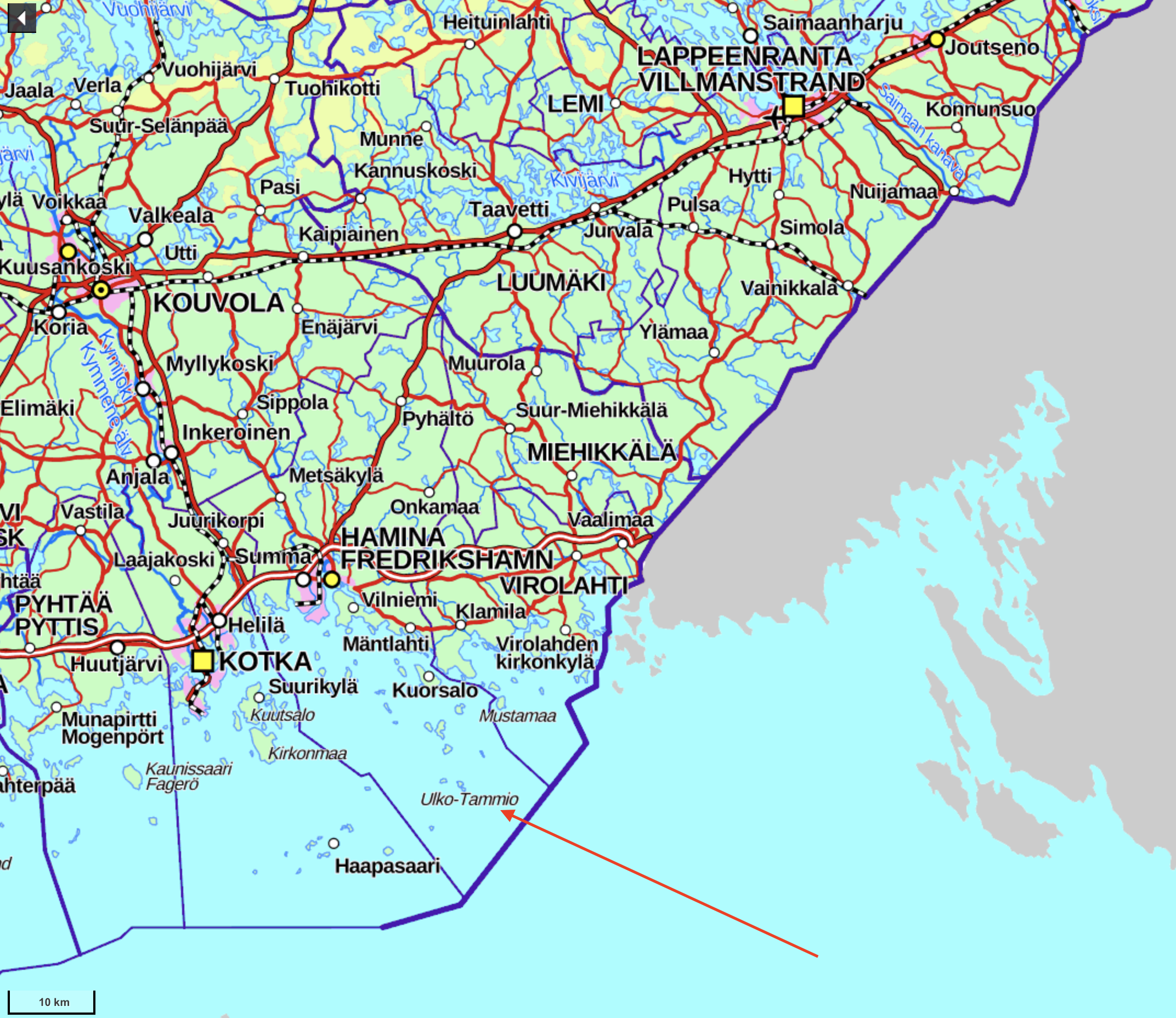
Ulko-Tammio is an island about 1400x700 m large at the widest; I couldn't find its exact area but it's almost certainly below 0.5 sq. km. Its shape is approximately of the Russian letter Ч, only mirrored. It is one of the bigger islands belonging to a quite sparse archipelago strip stretching from Haapasaari (15 km from Ulko-Tammio) to the northeast to the mainland at Virolahti. It is one of the closest islands to the sea border between Finland and Russia (8 km from that border), and certainly the closest such island available for a casual visit. Someri island on the Russian side 19 km away can be easily seen from Ulko-Tammio.
Until the World War II Ulko-Tammio was only ever used as a fishermen camp and a pasture for people from other islands, especially an island named simply Tammio. In fact Ulko-Tammio was declared a protected nature area as early as the 1920s. It was not a part of the original Peter the Great's Naval Fortress system of fortifications dating from the World War I, and didn't have any military presence, even though some other islands in the area did.
Everything however changed in 1940, when the USSR won the Winter War and annexed, among other territories, many islands in the eastern Gulf of Finland. Ulko-Tammio suddenly became a border island. Finland, fully and correctly expecting an even greater war to erupt in coming years, was in a hurry to fortify its new eastern border. On the mainland it built a relatively well known defensive line, the Salpalinja (Finn. Lock Line), along the entire 1200 km long border (although it used existing lakes and impassable bogs as much as possible, and farther to the north in roadless areas it was much sparser than in the Southeast Finland). On the sea, in turn, it built a few coastal batteries at short notice. One of the most crucial ones was at Ulko-Tammio.
In truth fortification of the island began only on 15.6.1941, mere weeks before the Continuation War, as it is called in Finland. Throughout the entire war construction continued and the garrison kept being strengthened, reaching 370 men at the end of the war (more precisely not just men but some Lotta Svärd women too). The nature of fortifications however never was as formidable as on the principal coastal fortress islands, such as Örö or Isosaari. Gun positions were built of wood and crushed rock, with few concrete constructions. Barracks and other buildings were wooden and quite hastily built. The biggest guns were 152 mm Canet-model ones; at most there were 4 Canet guns and 6 anti-air guns.
The island participated in only one major battle, the Battle of Someri. Someri, a small and mostly bare island, annexed by the USSR in the Winter War, was reconquered by the Finns in 1941. Since islands held by Finland were (along with minefields) a major factor of Soviet Baltic fleet being trapped near Leningrad, the Soviets were eager to retake them, and on 8.7.1942 attempted a landing on Someri. It was repelled splendindly (Soviet losses outnumbered Finnish 17-20 to 1), in no small part due to artillery support from Ulko-Tammio. Someri was right at the edge of its firing range of 19 km; apparently originally the firing range for this model (actually a quite old one, developed in the 1890s) was 15 km, and the Soviets weren't aware Finnish guns were upgraded.
Ulko-Tammio itself wasn't ever a major target and underwent only a few bombings inflicting minor losses. Of course, in the end the war was still lost. As one of the ceasefire conditions in September 1944, the USSR demanded immediate and complete dismantling of all coastal artillery in the east of the Gulf of Finland, including of course Ulko-Tammio.
So that was done. In 1945 guns from Ulko-Tammio were moved to Utö and Sommarö (near Vaasa). Other installations such as a modern German-built radar were removed too. Some buildings were abandoned, some sold for civilian use, but, having never been meant to really last, rotted away and fell apart with time. The island was once again uninhabited and reclaimed back by nature.
In 1982 the uninhabited outlying islands of Kotka, Hamina and Virolahti were decreed to belong to the Eastern Gulf of Finland National Park (Itäisen Suomenlahden kansallispuisto). Its overall area is only 6.7 sq. km, and no individual islands are bigger than 1 sq. km. The marine national park is mostly accessible only by own boat or boat taxi, and even that can be difficult in some cases; most islands don't have good natural or man-made harbors. Ulko-Tammio is the only really accesible island, with a scheduled boat going there. It is also the most notable island of the national park overall.
Even so getting there is not easy. For some reason boats to Ulko-Tammio depart only on weekends in July, so for example in all of 2020 there are only five departures to Ulko-Tammio. Traditionally these boats departed from the town of Hamina, the closest coastal town to the Russian border and in itself quite a curious place. This year however they depart from the bigger Kotka for some reason. They also used to stop at Tammio. It is closer to the mainland and bigger than Ulko-Tammio (Ulko-Tammio in fact means "Outer Tammio"), and doesn't belong to the national park, but instead holds a former fishermen village that is used now only for summer residences. At least in 2020 boats to Tammio and Ulko-Tammio are now distinct. Supposedly due to the coronavirus, so that the boats don't get too crowded, although in practice they're really crowded anyway; Yle, Finnish state news, actually had a story about that the next day after I visited, saying the visitor numbers at Ulko-Tammio are off the charts now. The island and the whole national park were relatively obscure (about 17,000 visitors last year), but this summer domestic travel is really peaking due to the coronavirus again. I generally consider this a good thing, it actually annoys me that most Finnish people don't really know their own country well and don't appreciate it as much as they should.
Ulko-Tammio has quite reasonable outdoor facilities (camping sites, toilets, firewood, grilling places, and even a wilderness hut) and in principle you could try to stay there overnight. If you're brave enough, because the boat would come next time only in a week! But for me it wasn't in my plans of course :)
Since I want to visit all Finnish national parks, a visit to Ulko-Tammio was in my plans for this year, and one of the July weeks I was able to finally do this and claim the 30th (of 40) national park. If you want to do such a trip, in 2020 you only have opportunities on 25.7 or 26.7! Tickets can be bought online here (website in Finnish only), an adult ticket costs 37€. I don't know if you can buy it on board at all, better to buy beforehand and show the confirmation email on your phone or just say your name when boarding. The ship Vikla III departs from Sapokka harbor in Kotka (address Sapokankatu, Kotka; there is a large unrestricted parking lot and it is also easily reachable by foot from bus and train stations) at 10:00 in the morning and returns at 17:00. As usual, I emphasize that this information is up to date at the time I'm writing this post, and very possibly will be out of date next year; maybe the link will get broken or even some other company altogether will be doing these trips. Please do your own research if you want to do this or any other trip that depends on private boat companies.
Tammio is a tourist destination in its own right but I decided to skip this one for now, as I've already seen some island fishermen villages and it is probably less unique than Ulko-Tammio.
Official information about the national park in English is available here.
1. I decided to travel to Kotka by public transport this time. I'm actually not really a huge fan of travelling by car; it kind of seems just too easy, not like proper travel. But often there is no practical alternative, especially if you want to see some nature spots or countryside. This time however I needed to go just to Kotka itself, so I decided to go there by train and back by Onnibus bus. I hadn't travelled on a long distance train in over half a year, after all! And I had explored Kotka quite satisfactorily only two months ago on the Haapasaari trip so I didn't even need to see much in Kotka itself.
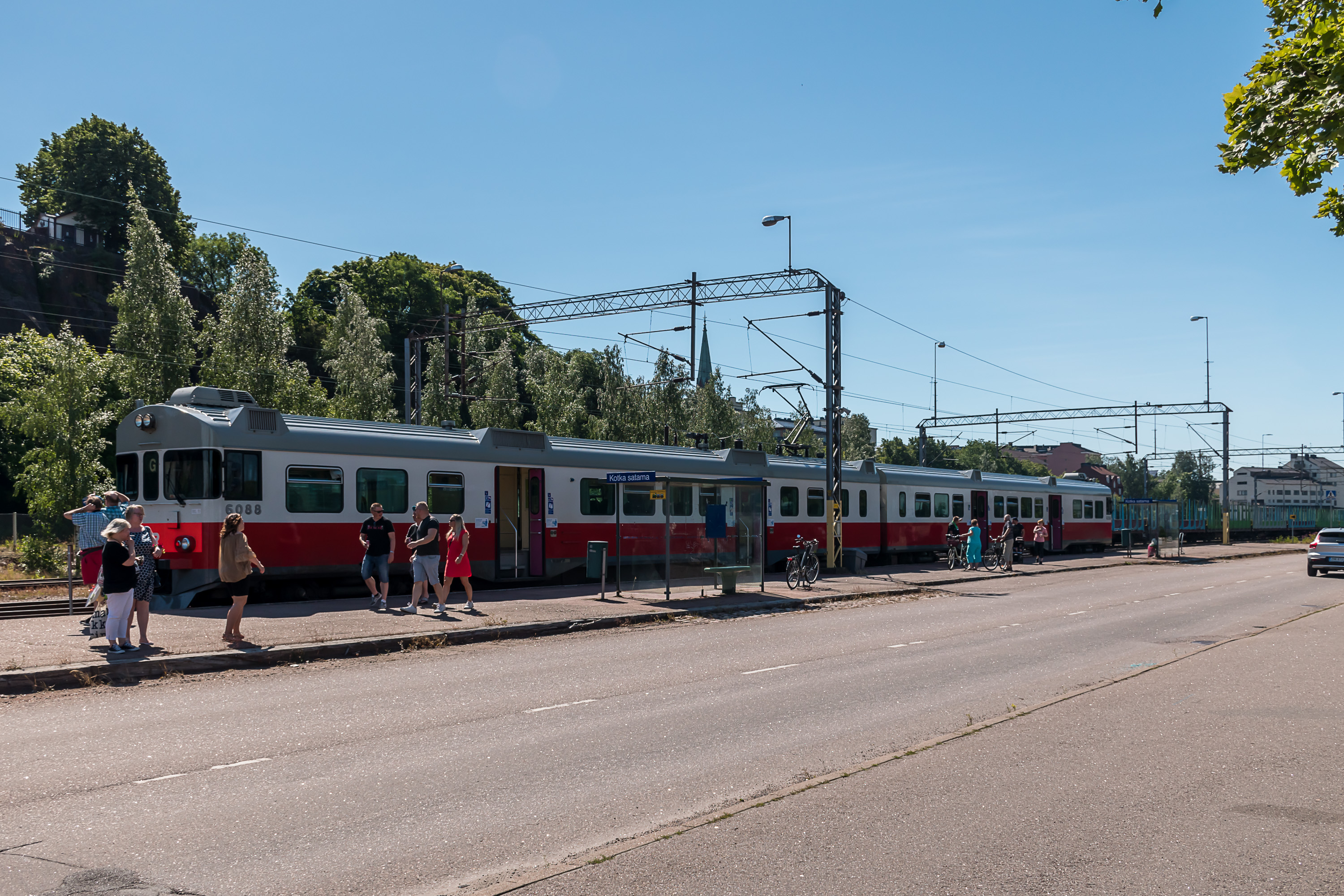
It is actually not really practical to travel from Helsinki to Kotka by train. Kotka is only 130 km away but it takes 3 hours and almost 30€ for a full-price ticket (compared to 1:45 and 10-15€ by bus). The reason is just that the railroad doesn't go there straight; you have to change from a long-distance train to a regional train at Kouvola. Such regional trains are typically diesel "trainbuses", but Kouvola-Kotka railroad is fully electrified (as it's a major cargo thoroughfare) and thus is unusually served by electric multiple unit trains, of the older Sm2 model. These trains, built in 1975-1981 in Finland, were originally common as commuter trains in Helsinki area, but are by now almost completely displaced by Sm4 and Sm5 in that role. They are only found on some odd early morning/late evening departures and also on Riihimäki-Lahti, Lahti-Kouvola, Kouvola-Kotka and Nokia-Toijala routes, and are the oldest kind of passenger rolling stock still in operation. This was the first time I got to travel on an Sm2; they are rather adorable. They are not low floor models unlike nearly all other current Finnish rolling stock and don't have electric sockets, but otherwise don't look all that different. Although that's to be expected, as all the interiors were renovated in the 2000s.
On the picture this train has just arrived to Kotka satama (Kotka Harbor) station, the terminus one. Trains have as many as five stops within Kotka, which these days is certainly a record in Finland outside Helsinki area. The main Kotka station is just a few hundred meters before the harbor one.
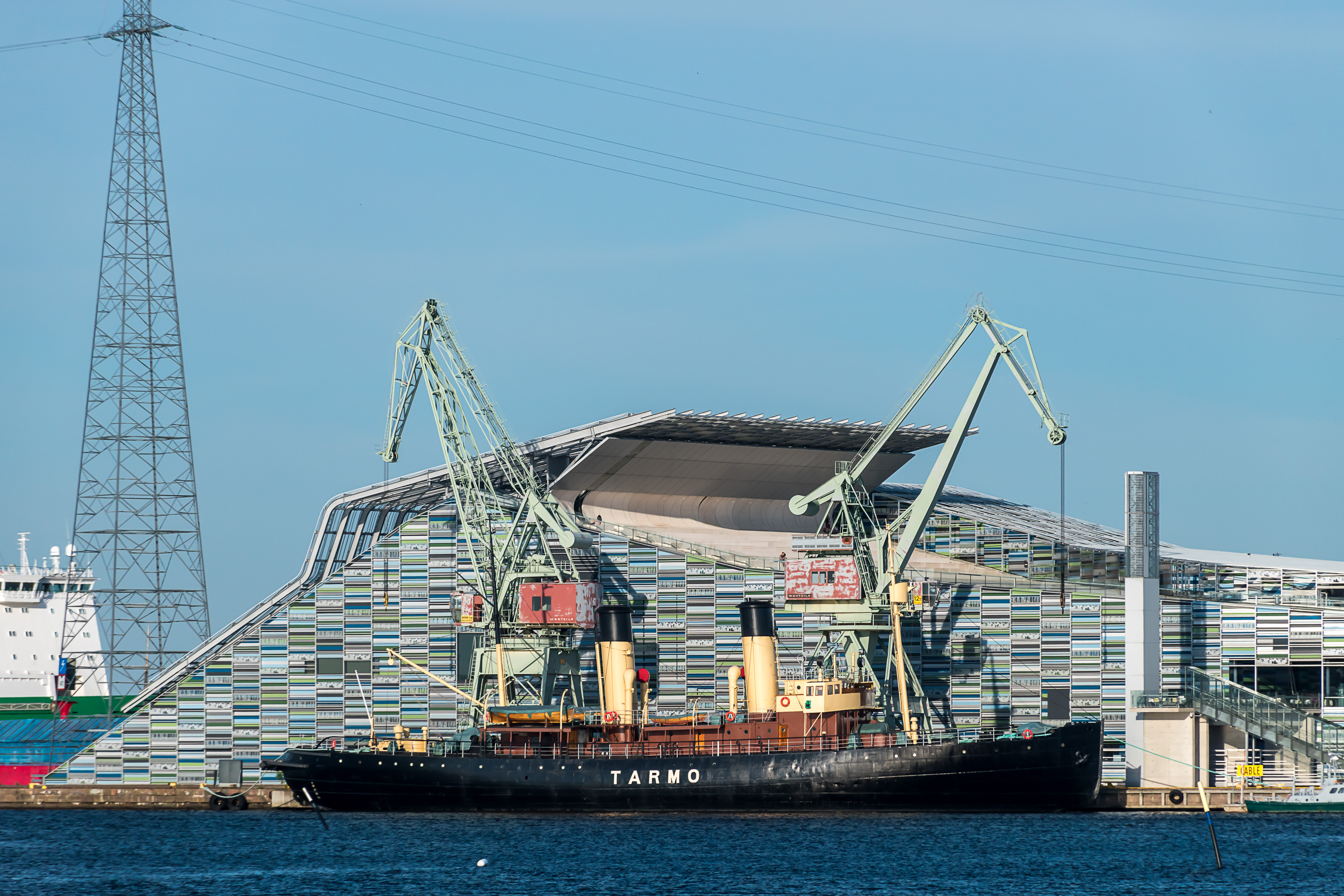
2. My plans for what I would be doing in this travel apart from Ulko-Tammio trip changed several times. In the end I went directly to Kotka to Vellamo marine museum, which is almost right next to the Kotka satama station. I had visited it 5 years before but apparently there was a new exhibition about the Ruotsinsalmi battle near Kotka. That one was alright but in the end I was far more excited by the opportunity to explore this Tarmo museum icebreaker from 1907; I had missed it the previous time. They let you see pretty much all of it, including steam engines and boilers. I ended up spending over three hours at the museum alone.
Afterwards I had a short walk around an industrial area at Hovinsaari north of the Kotka center (the picture is taken from near a cargo harbor there) and slept at a small hotel there. The Ulko-Tammio trip was planned for the next day; this was a two-day weekend trip.
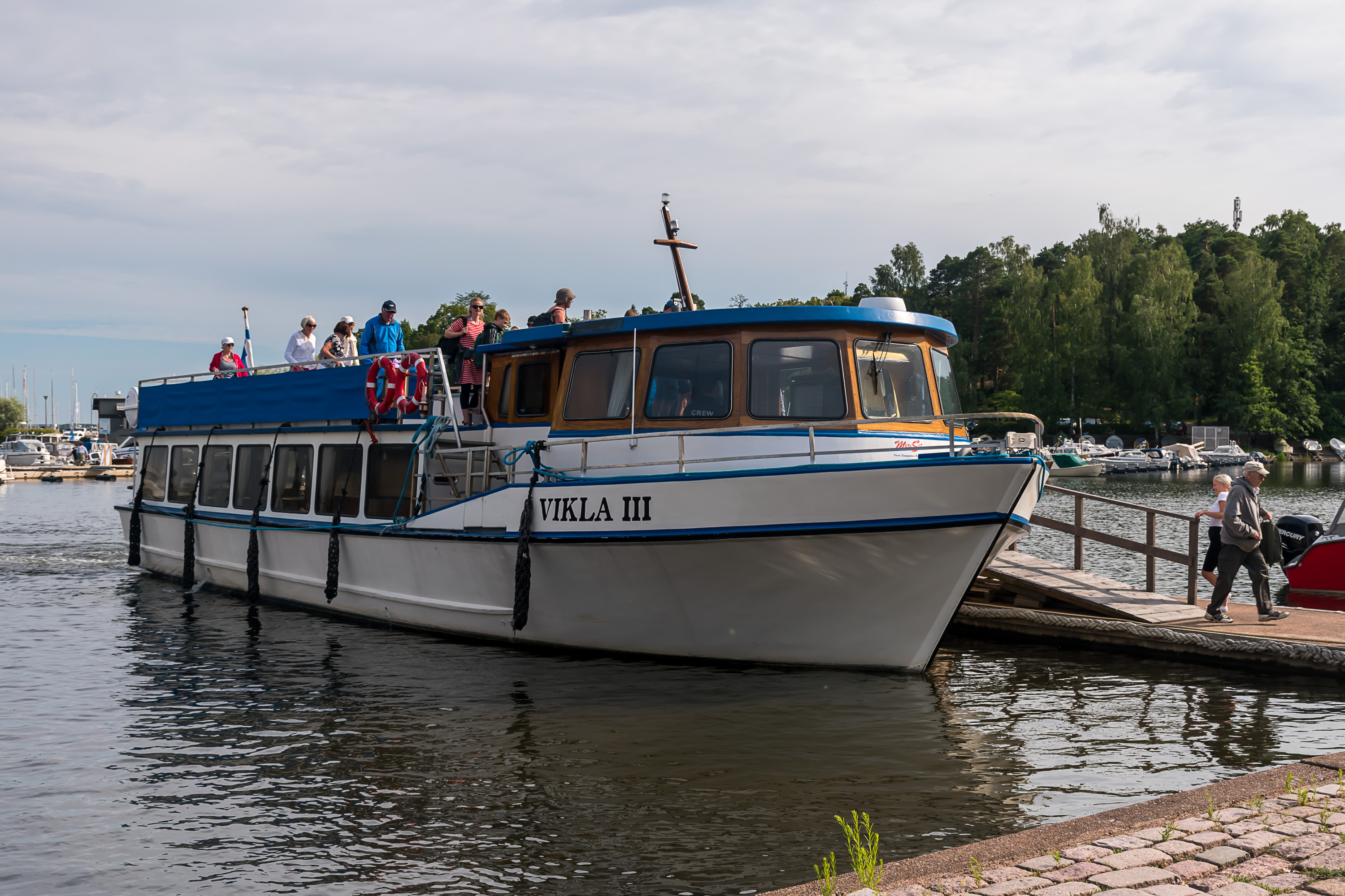
3. And here it is, Vikla III ship of MeriSet company. Rated for 130 passengers, with a restaurant (more like a bar) operating there. Nice but overall pretty ordinary. This picture is actually from when we returned, that's why everyone is leaving :)
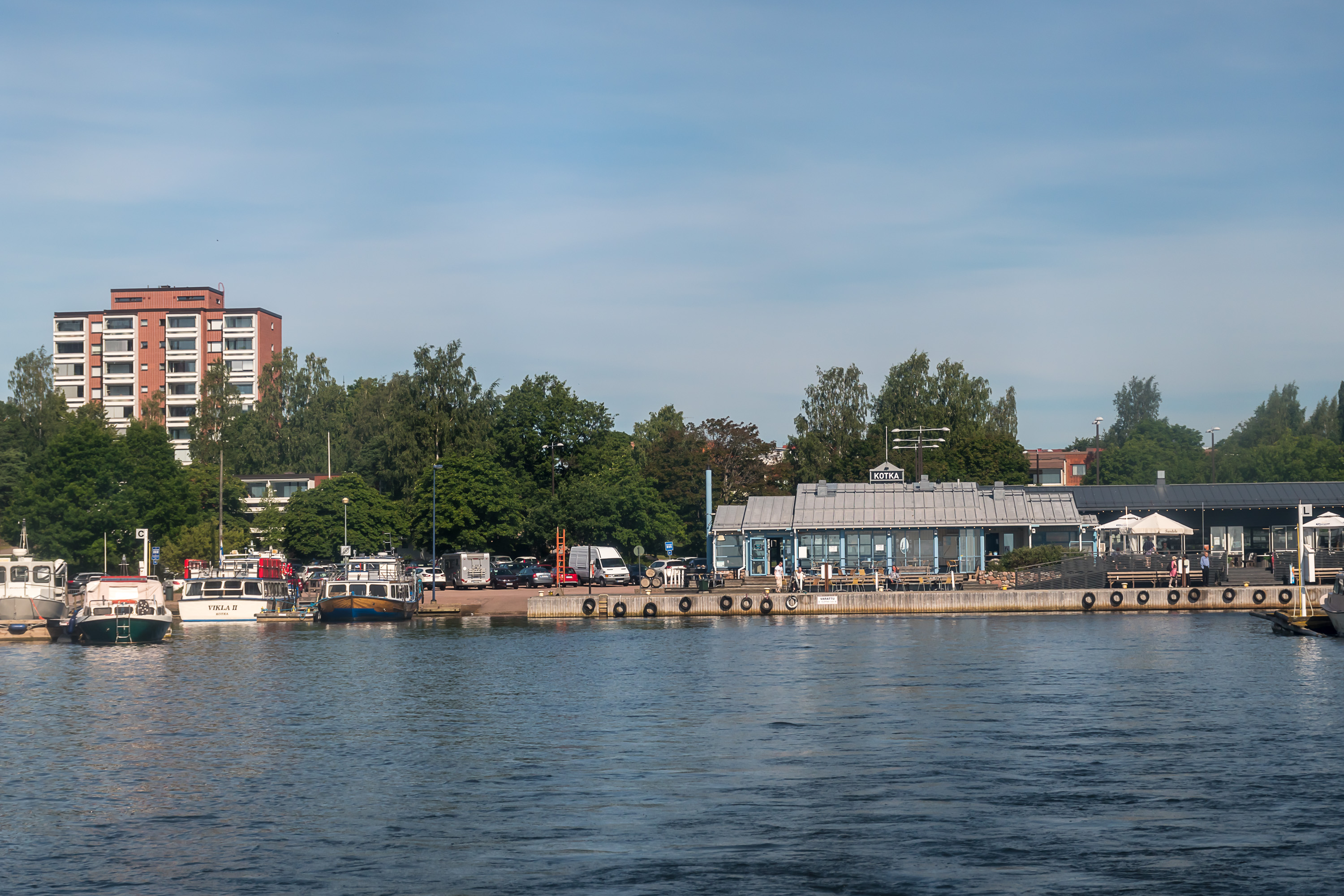
4. Leaving Kotka.
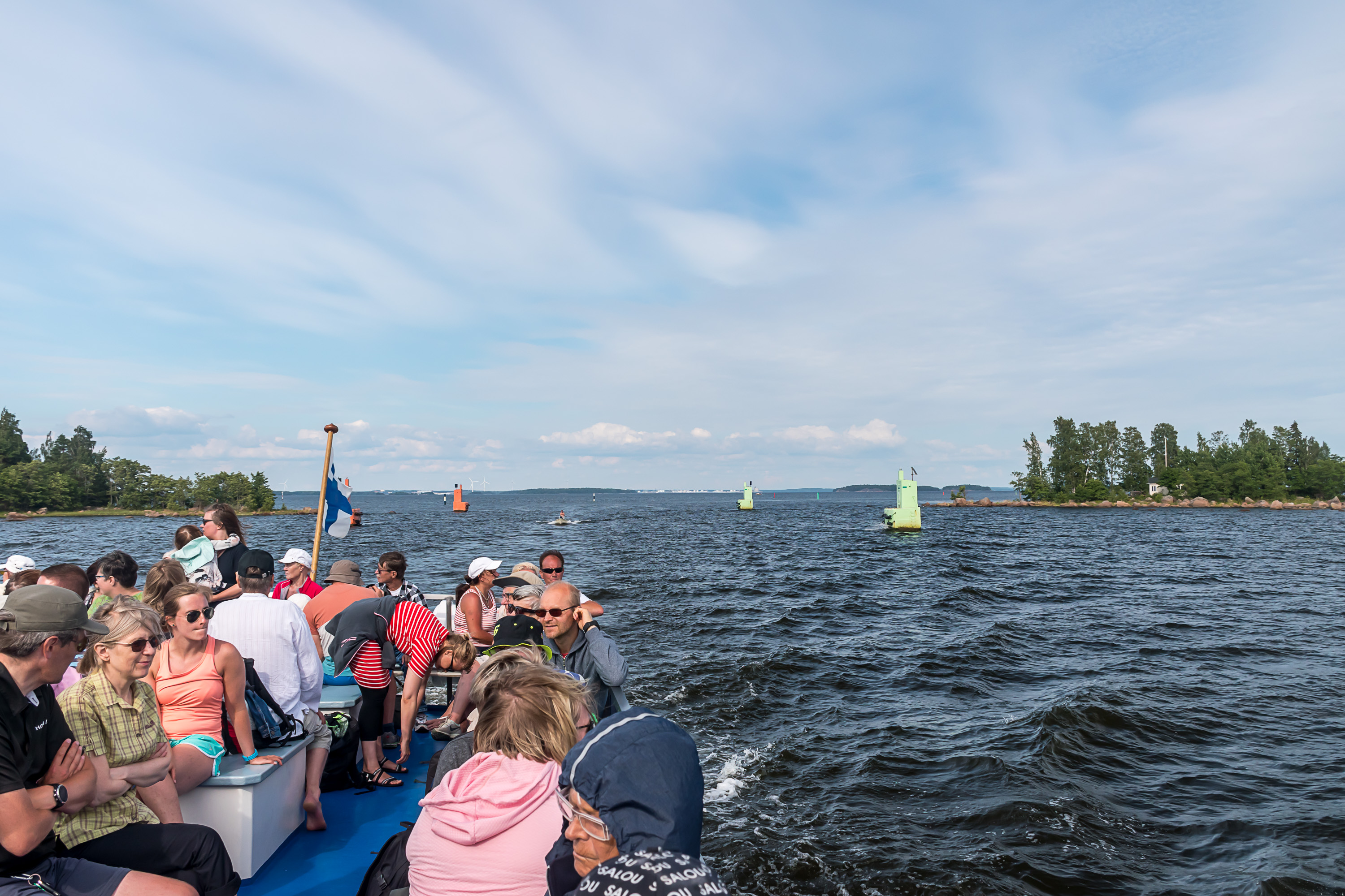
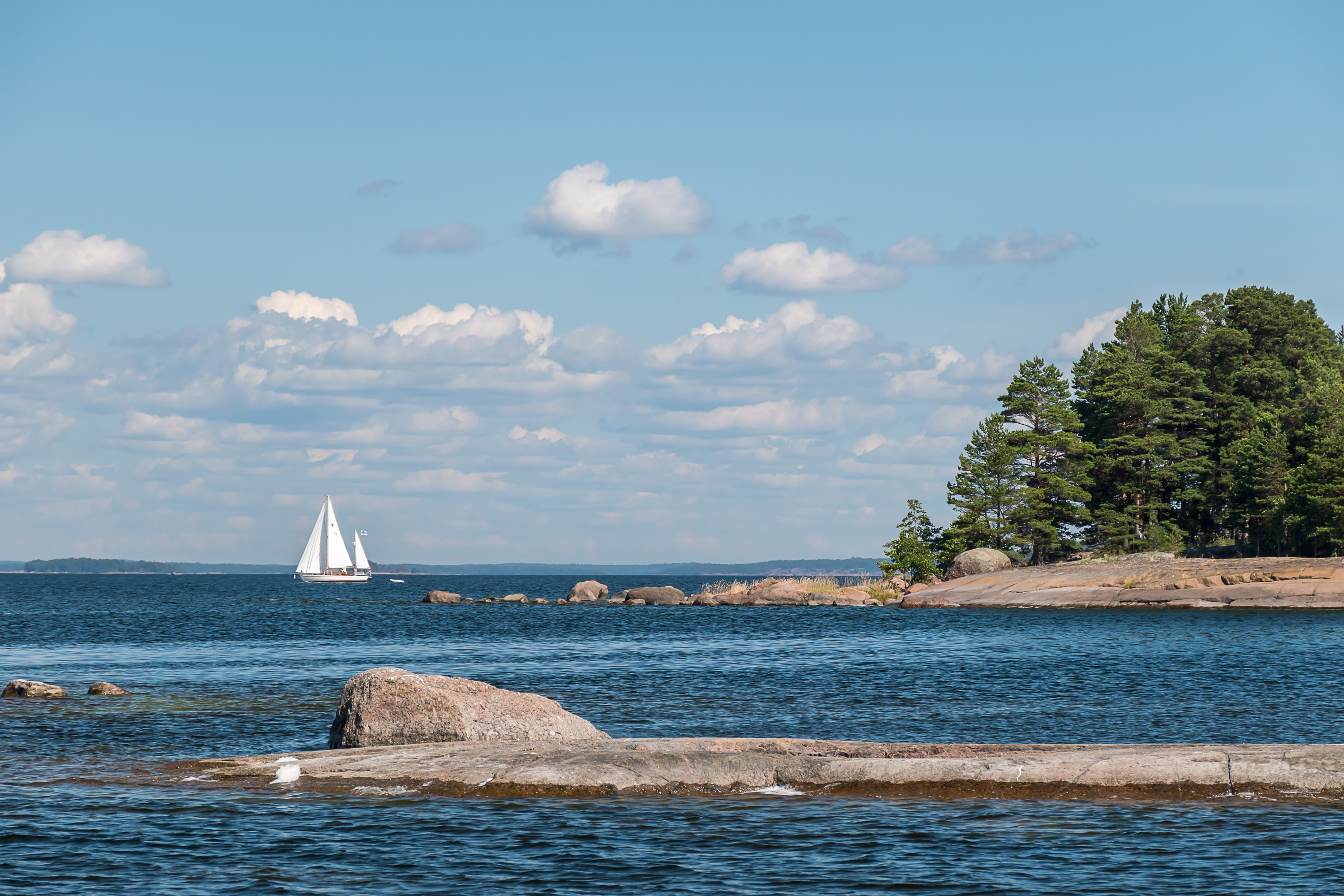
5. The trip from Sapokka harbor in Kotka to Ulko-Tammio lasts a bit over two hours and is mostly rather uneventful. Although there are announcements on the way about what to look at, mostly the views are just of an ordinary archipelago. The most notable place is probably Ruotsinsalmi, the actual strait after which the titular battle of 1790, the greatest naval battle on the Baltic Sea in history, took place. Between Russia and Sweden of course; Sweden decisively won, which helped them to turn a losing war into a draw (although their King Gustav III, who initiated the war, still ended up assassinated afterwards). Of course it wasn't all in this narrow strait, currently fitted with oddly huge beacons; it just was a major choke point. The picture is also from the way back from Ulko-Tammio and the huge port of Hamina is seen far in the background, but we never get too close to it.
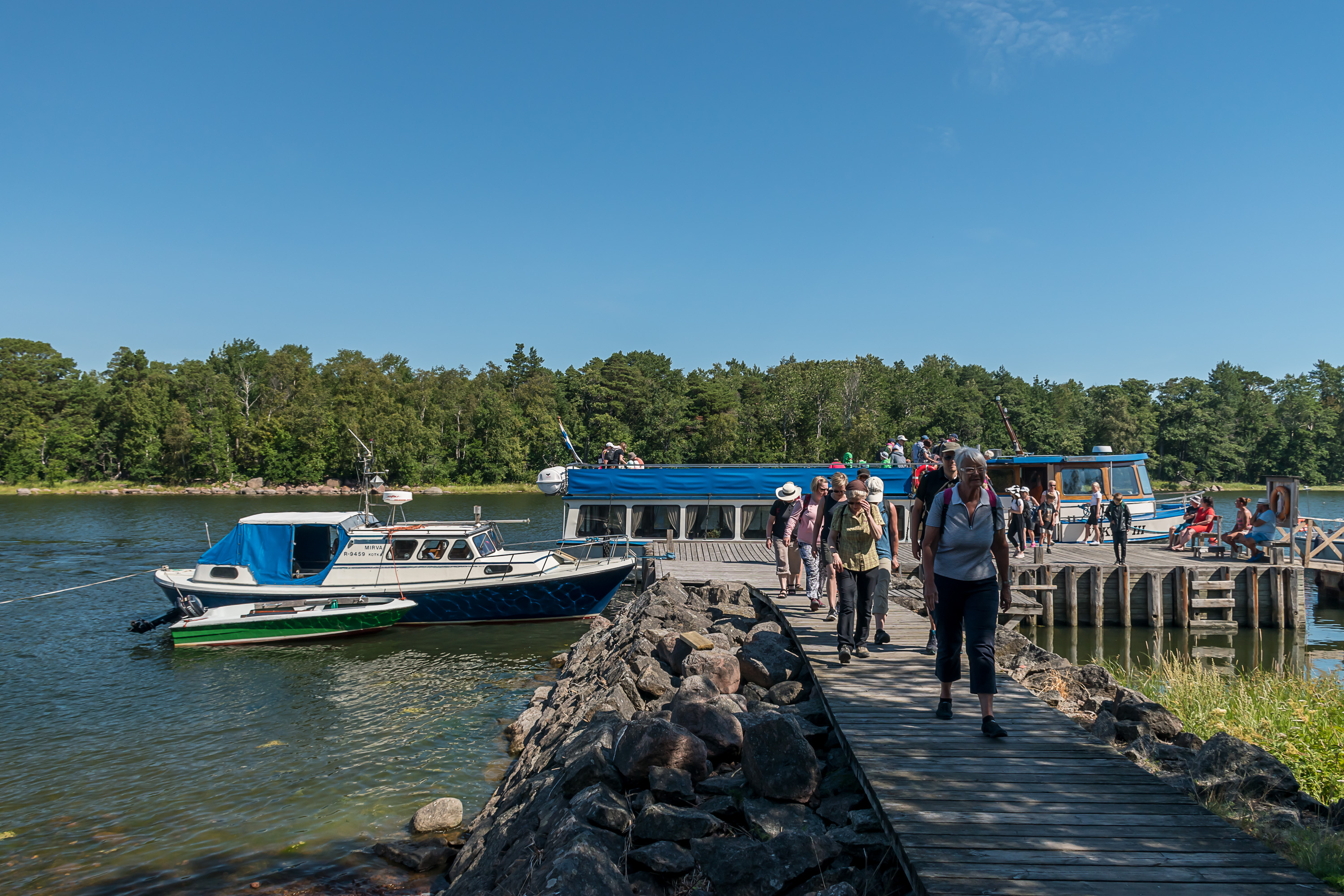
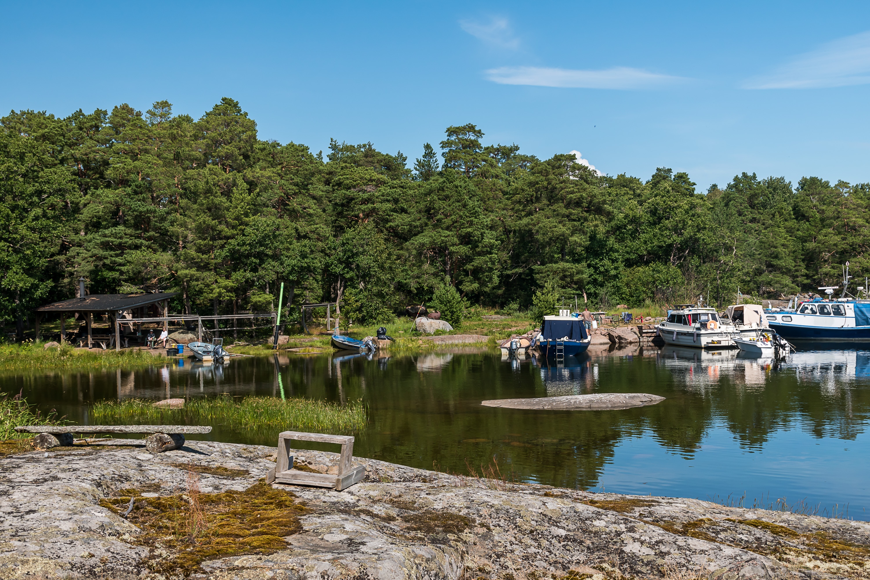
6. And so we arrive!
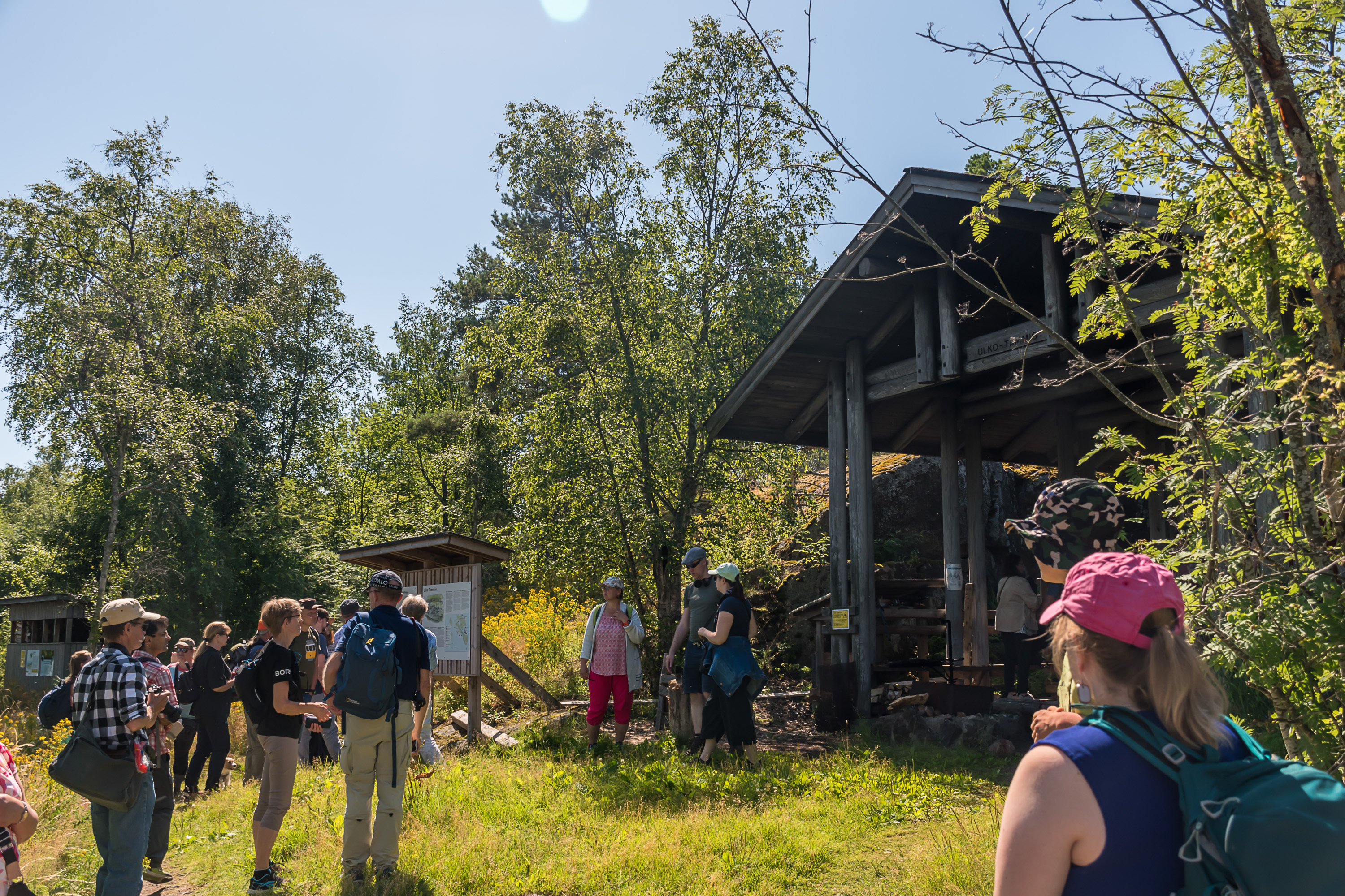
7. Greeting us next to the pier are information boards, a rather huge grilling place, and a guide woman. She meets passengers of Vikla III at the pier and gives a guided tour of the island (in Finnish of course), an hour long. The tours are free and the guide is an employee of Metsähallitus, Forest Administration, the organization that manages national parks. This is a quite unusual arrangement; I haven't seen anything like that in any other national park. Of course other national parks are generally reachable by car at any time and the woman, as I understand, lives here in summer anyway and presumably also does some maintenance etc.
I tried to follow the tour for a short while, but gave up quickly. While it would have been interesting to have another guided tour in Finnish and the guide certainly was very knowledgeable about the island, the tour group was huge (at least 40 people) and it was just not that fun to be out in the nature around so many people at once, so that there wasn't even a good opportunity to take pictures. So I ended up exploring alone, the way I normally do.
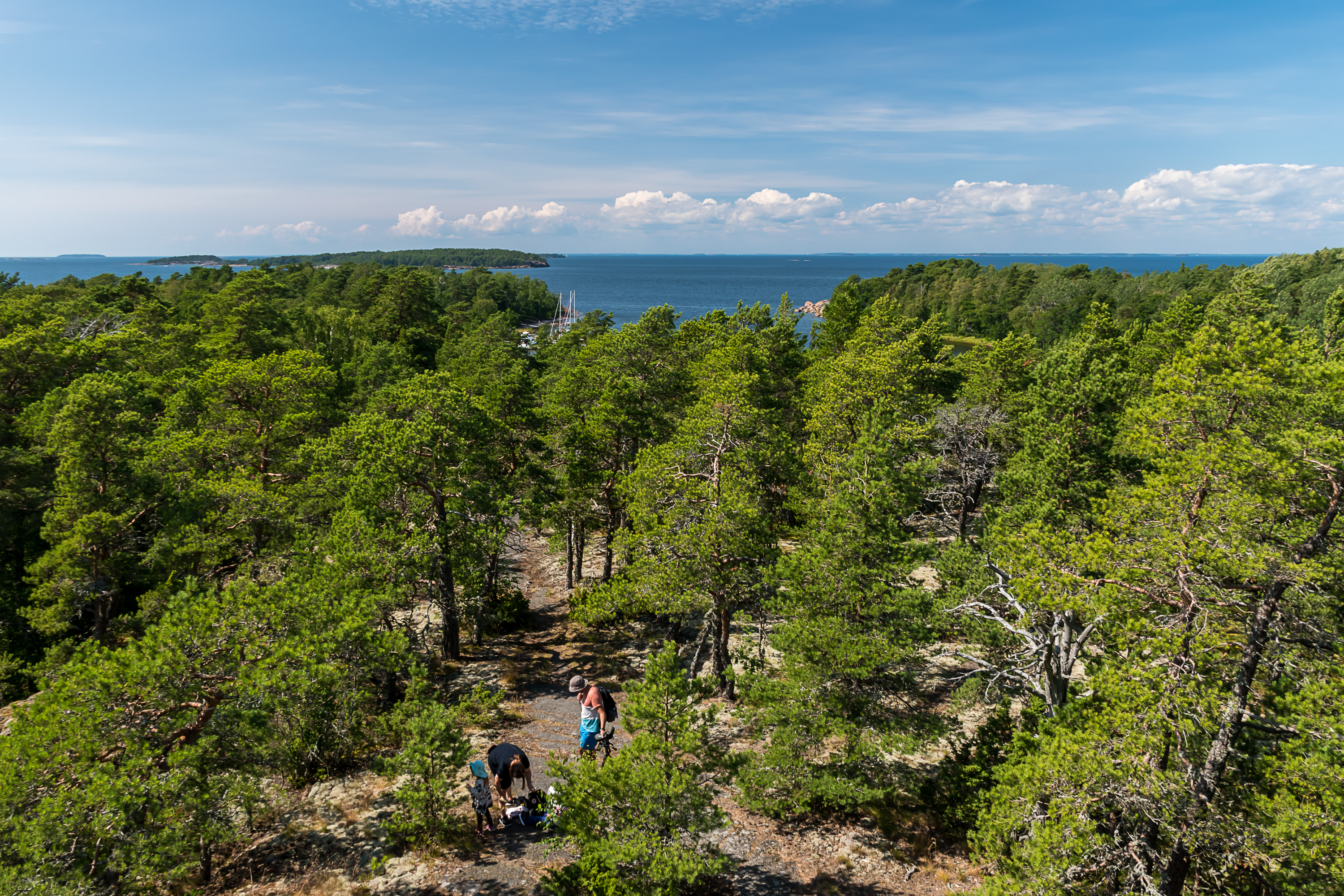
8. Most people as usual don't really go far. The island has a small trail network going to the important places (harbors, observation tower, camping spots etc.) with some signs, and also a 3 km long circular nature trail marked with sticks in the ground with their top painted white. It's still easy to get a bit lost; use e. g. OpenStreetMap, it has a fairly complete map of the island with trails. The smaller northern part of the island is mostly trailless. It is of course allowed to move around the island freely also outside of trails, provided you don't damage nature unnecessarily (rule number one, don't step on dry fragile lichens).
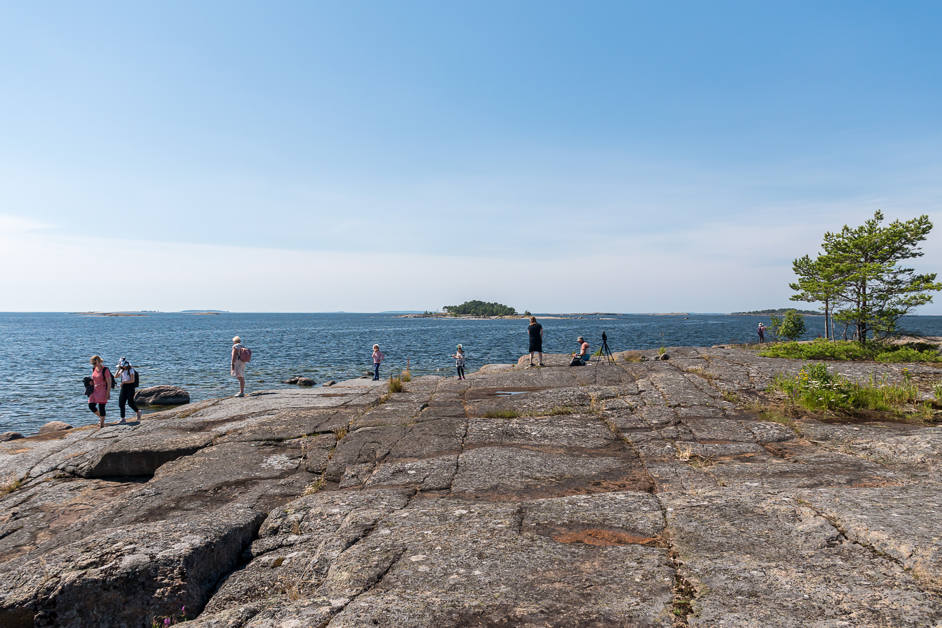
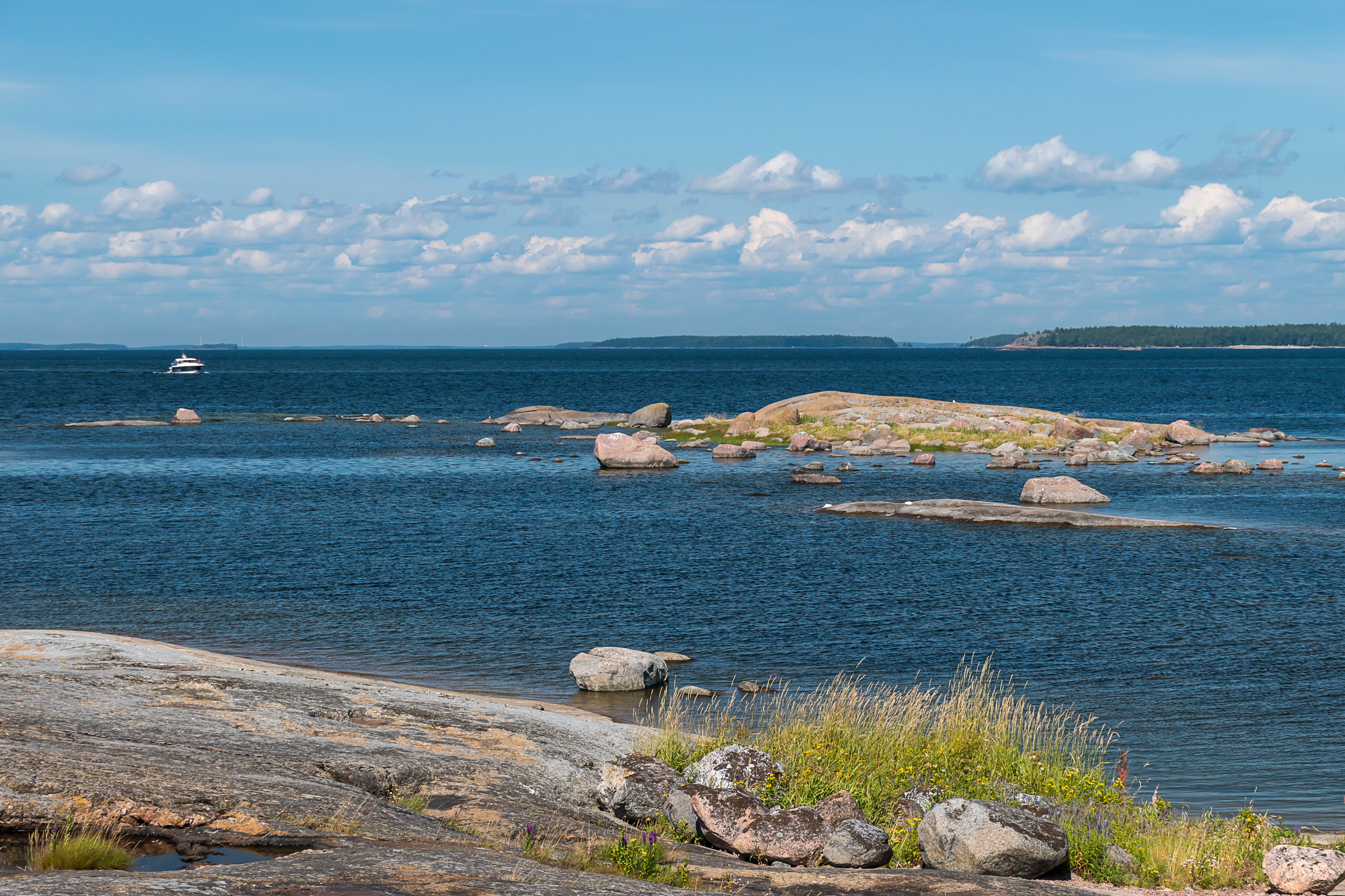
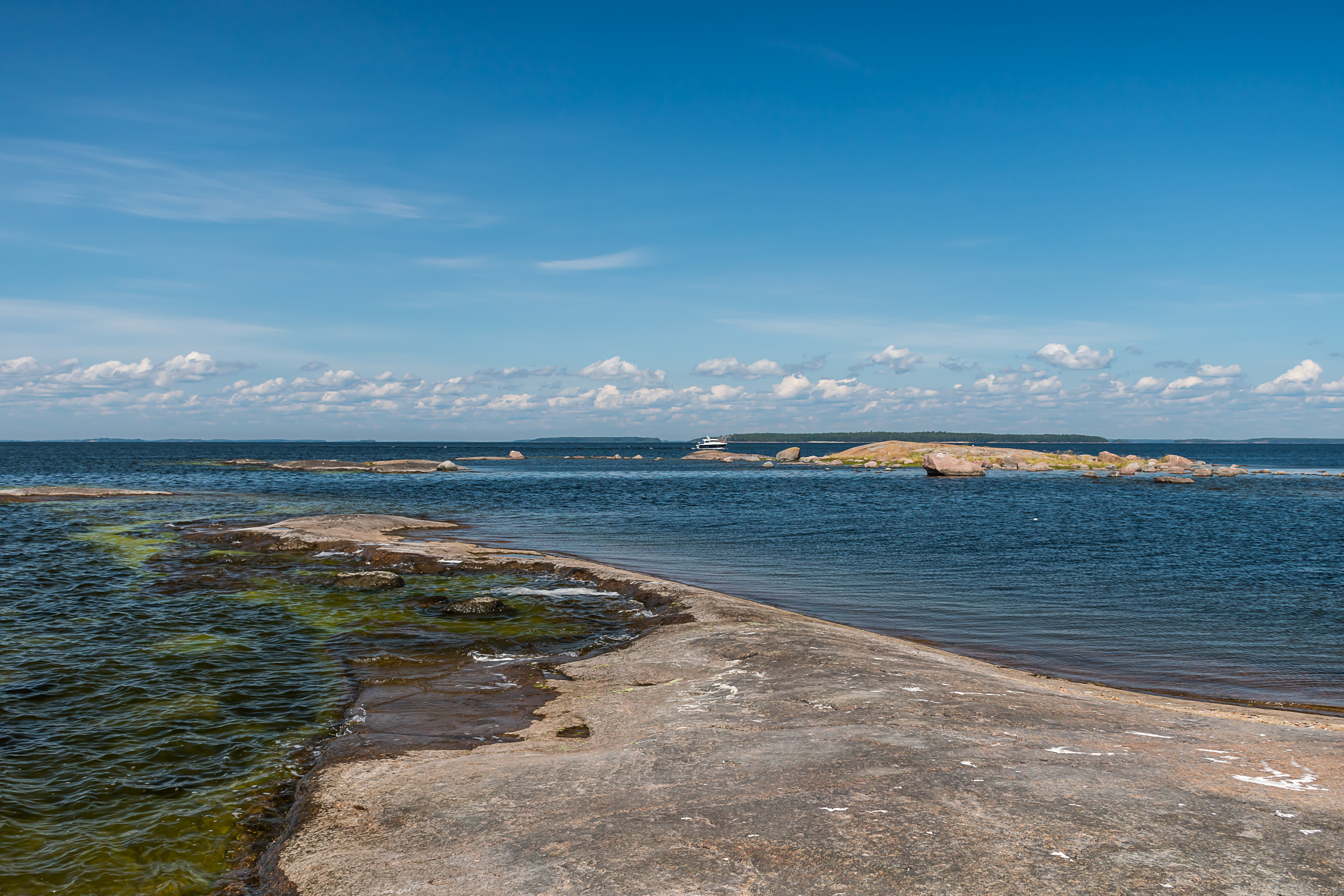
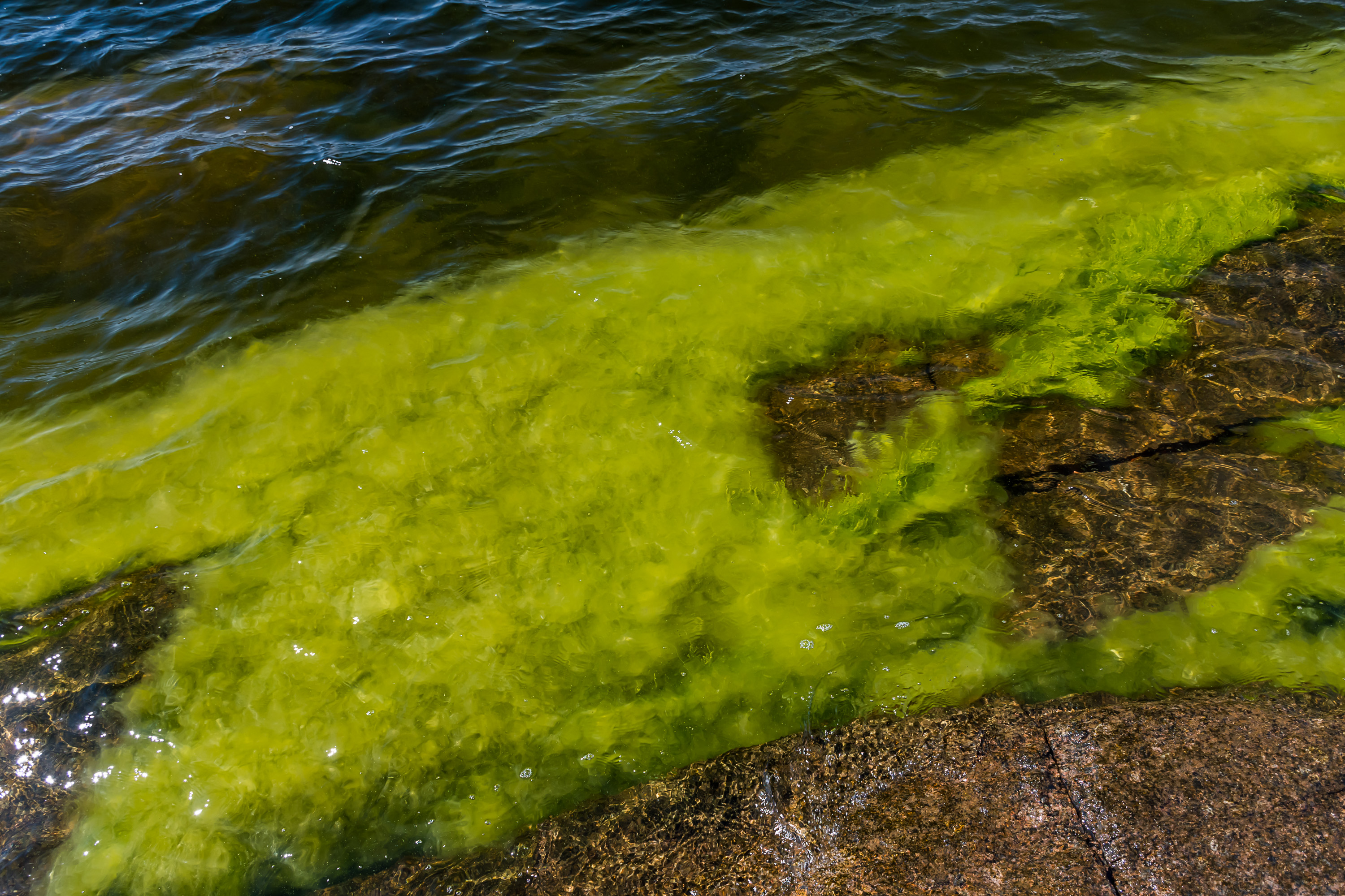
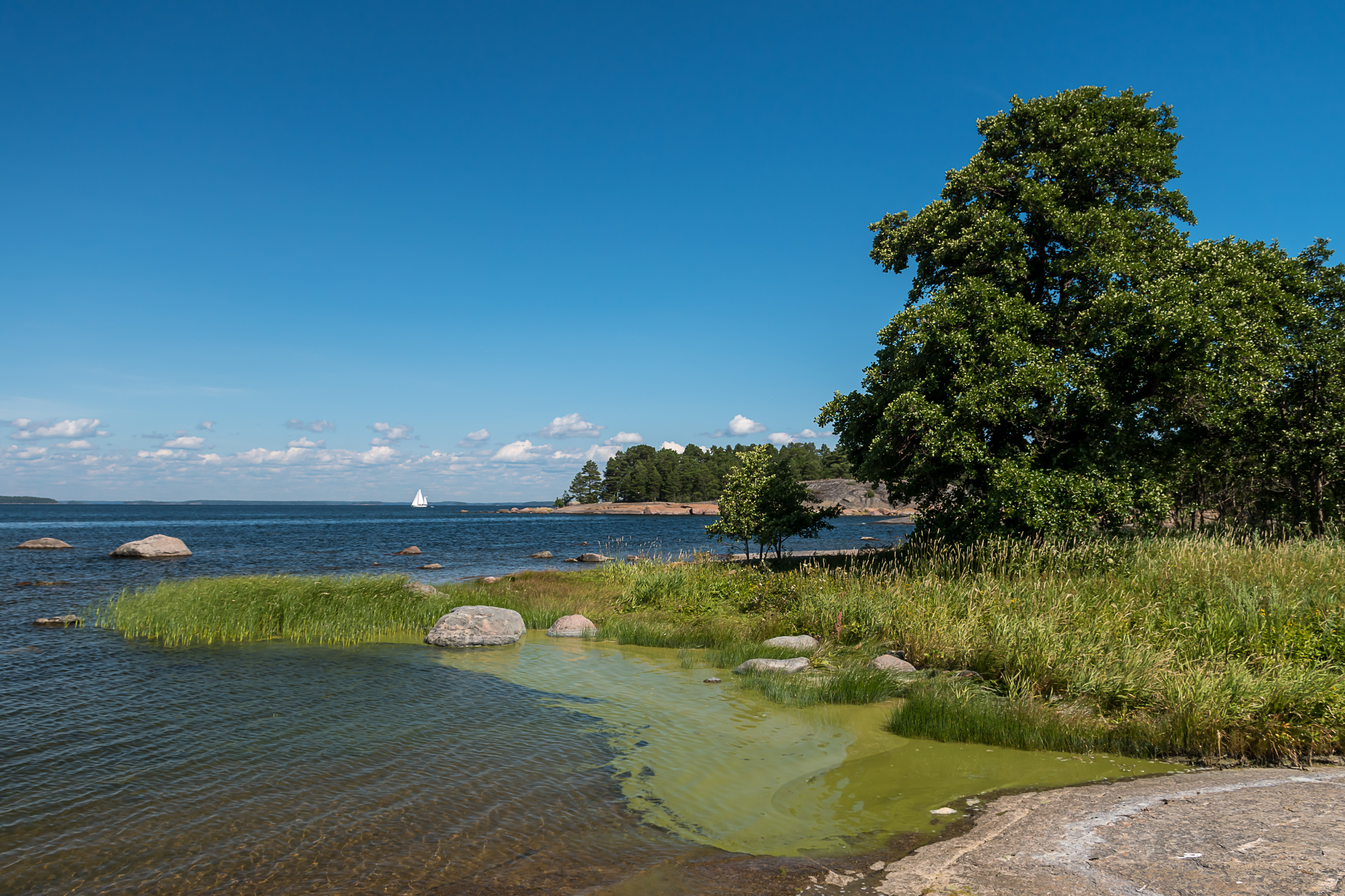
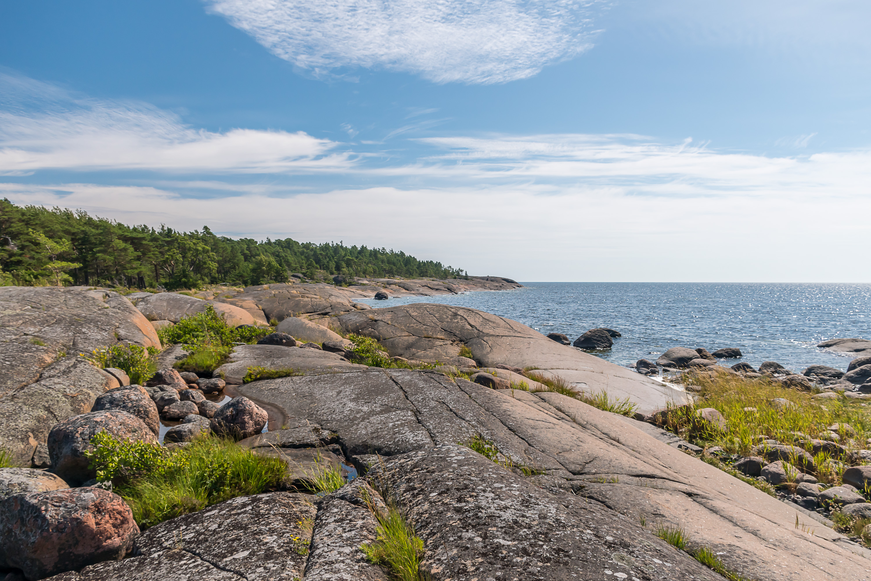
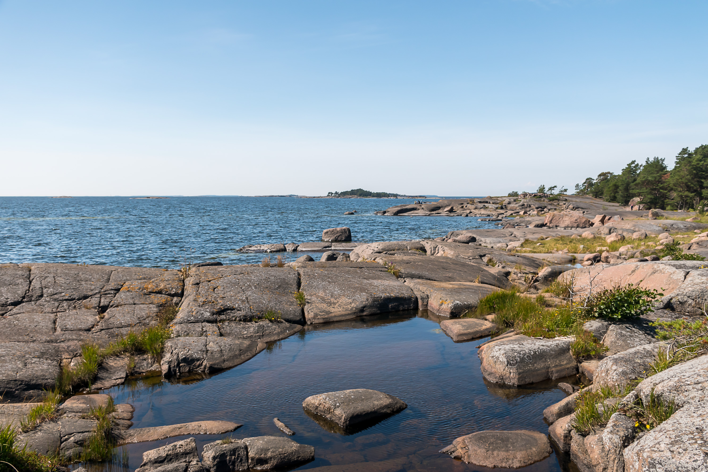
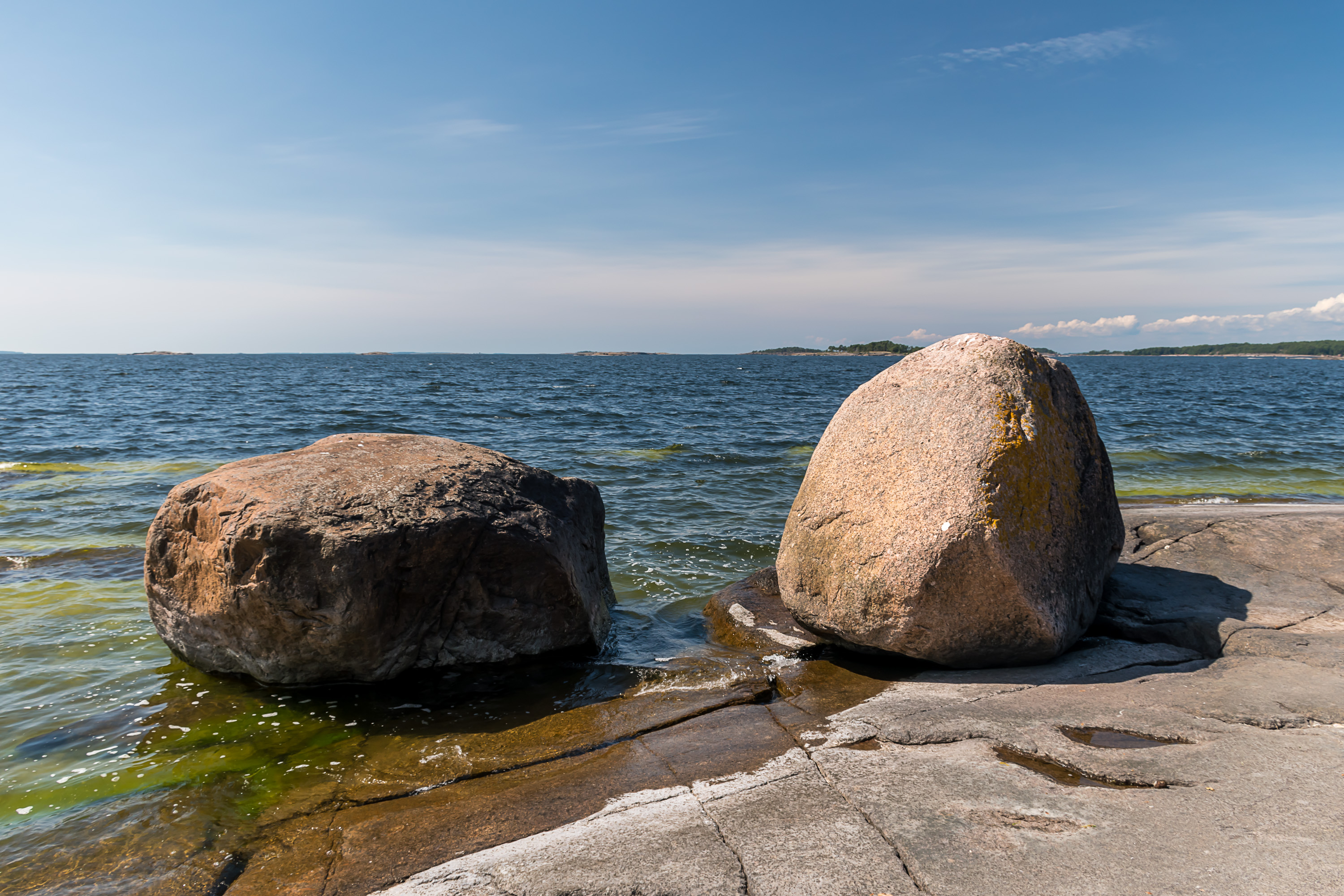
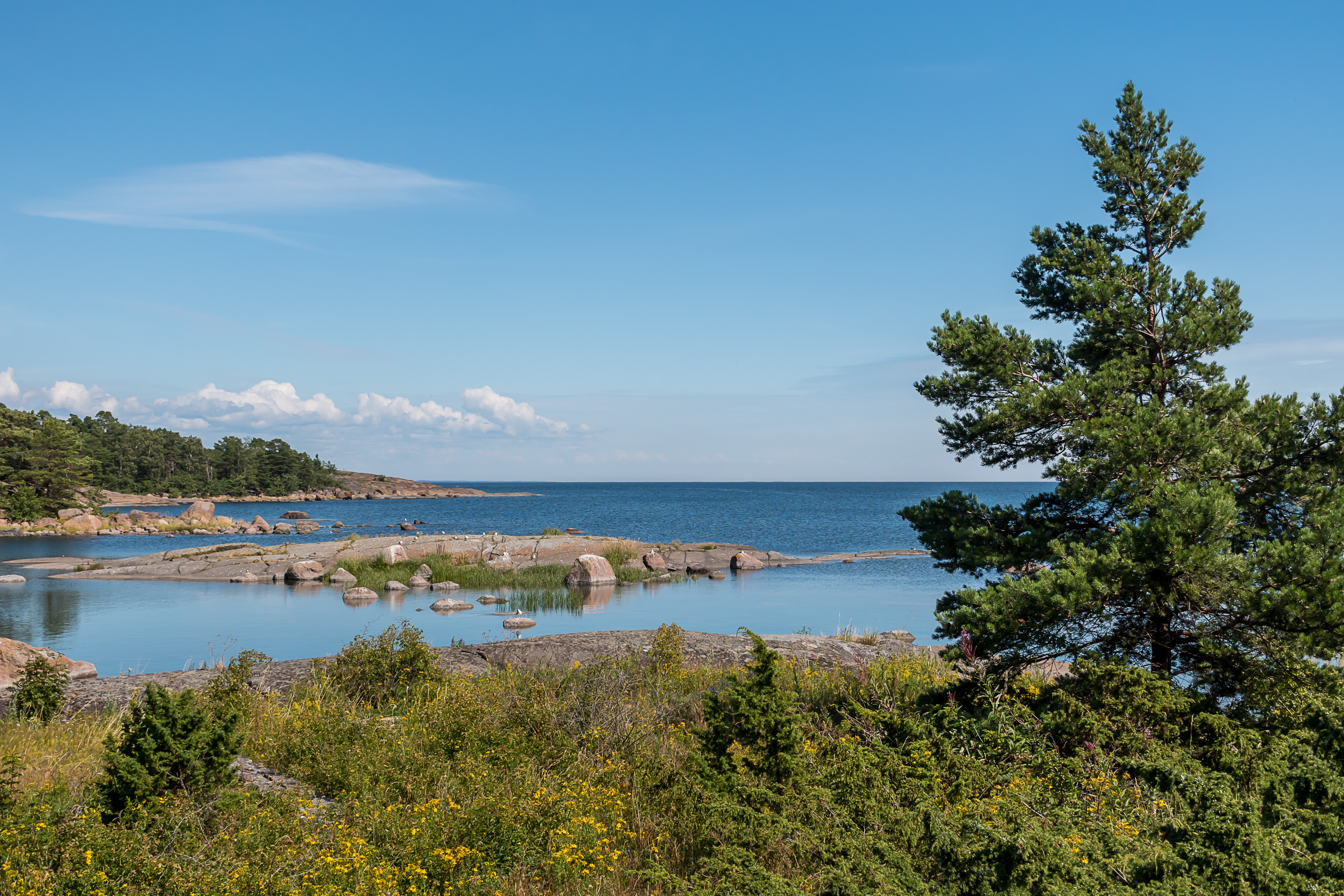
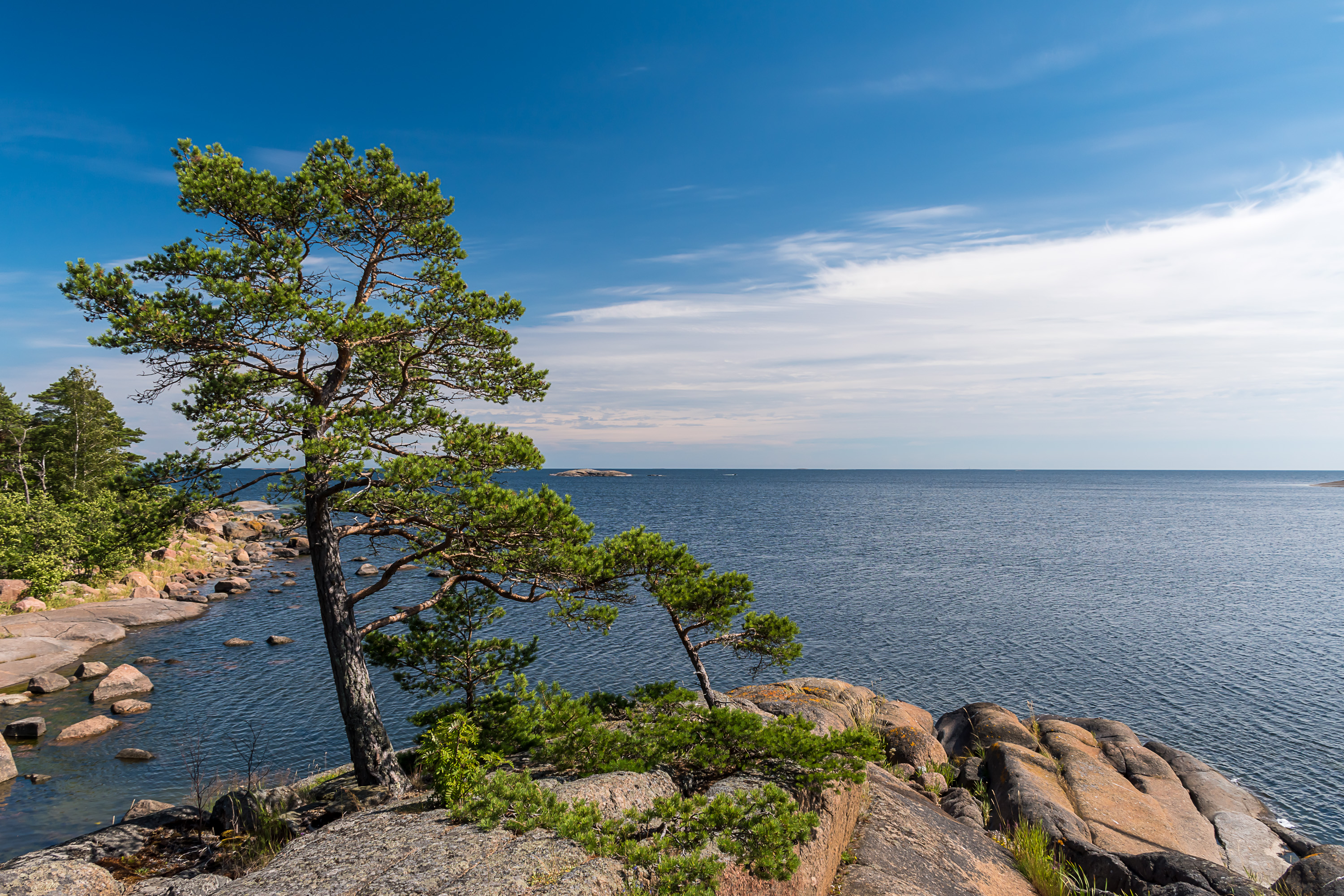
9. Ulko-Tammio shores are shallow but very rocky, with extensive bare rock landscapes on the longest southern shore especially.
10.
11.
12.
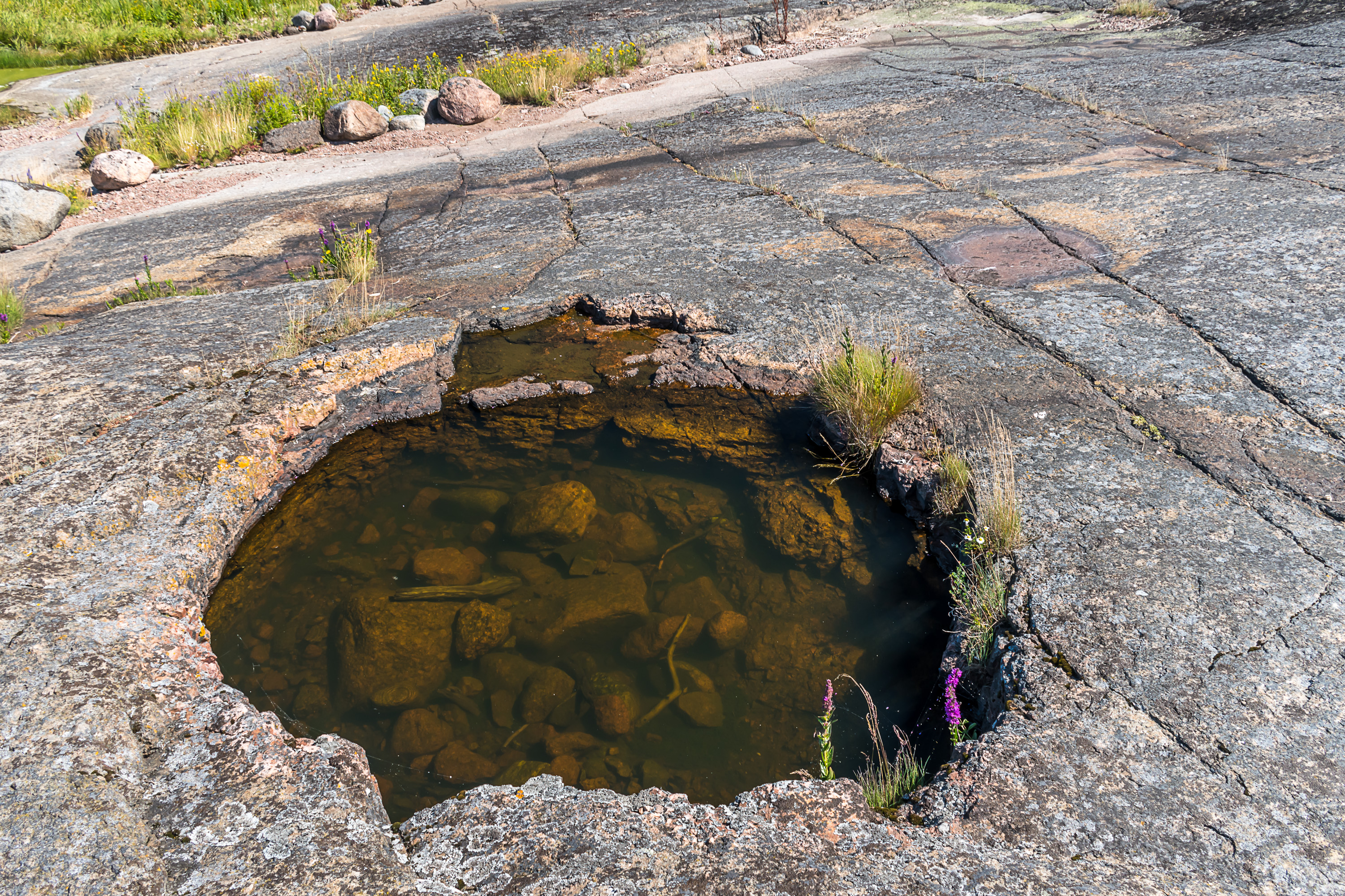
13. Interesting hole, can it be a bomb crater from the war?
14. The mainland can be seen in the north so the island doesn't feel quite as remote as Utö.
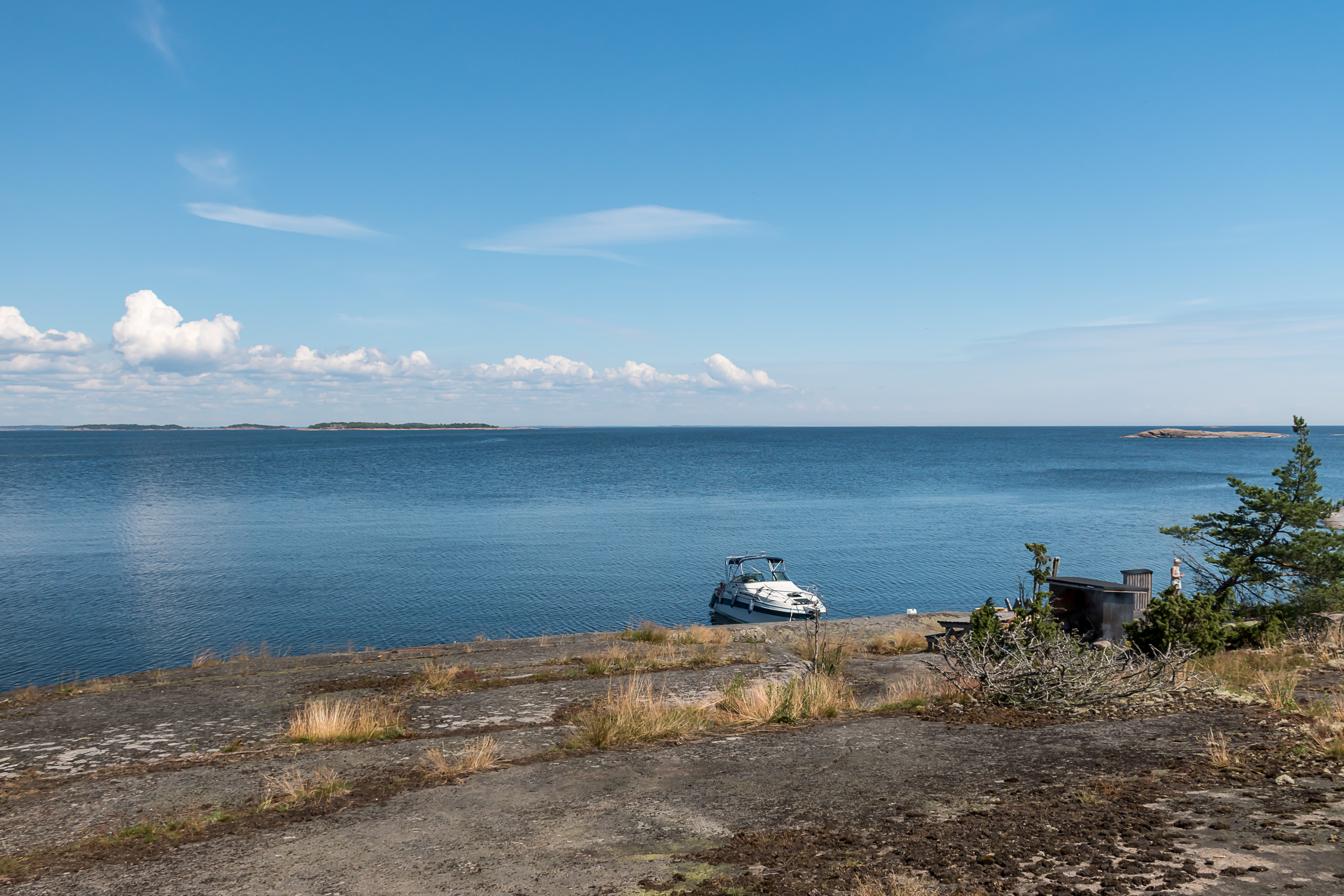
15. West harbor entrance.

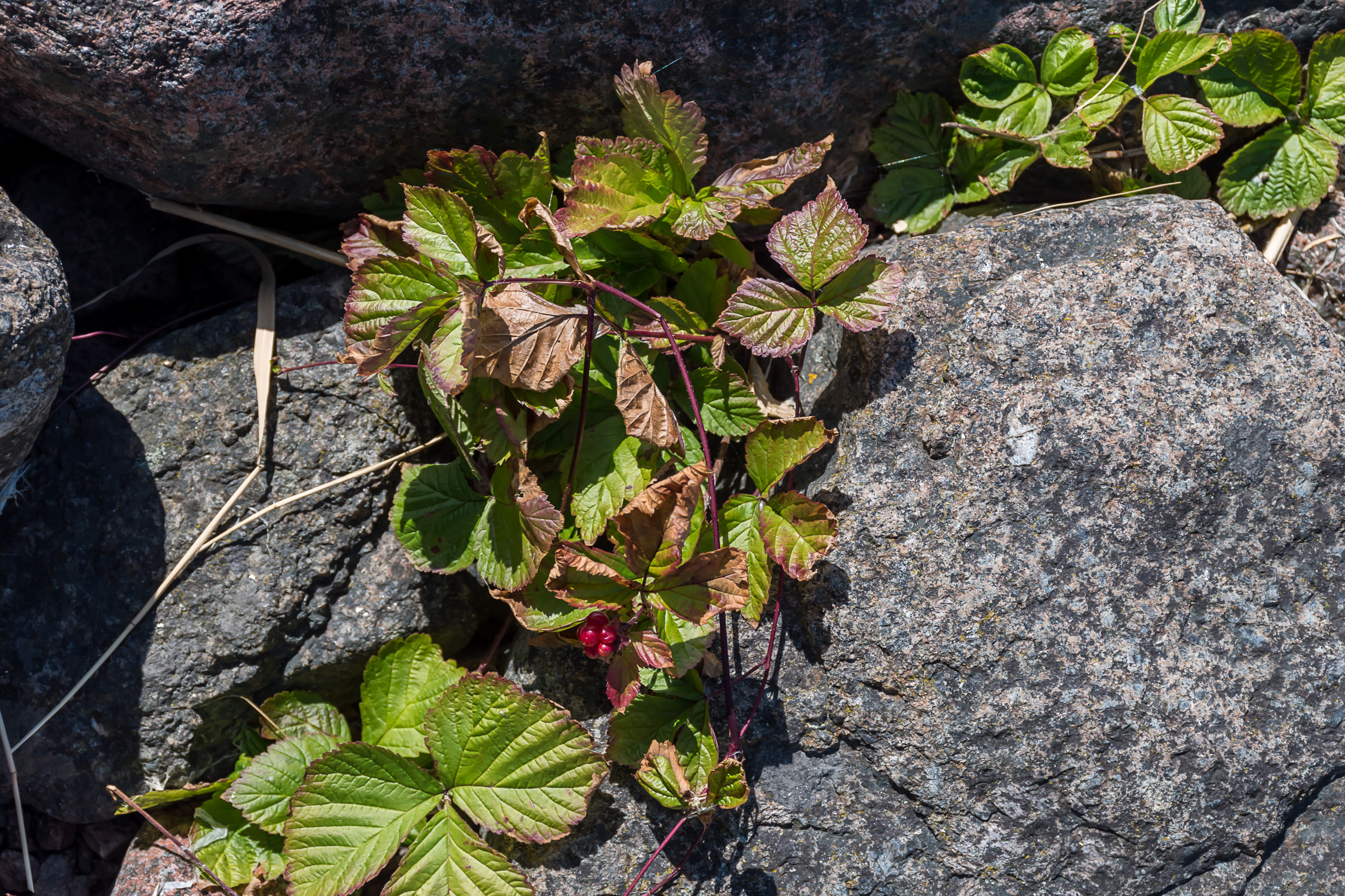
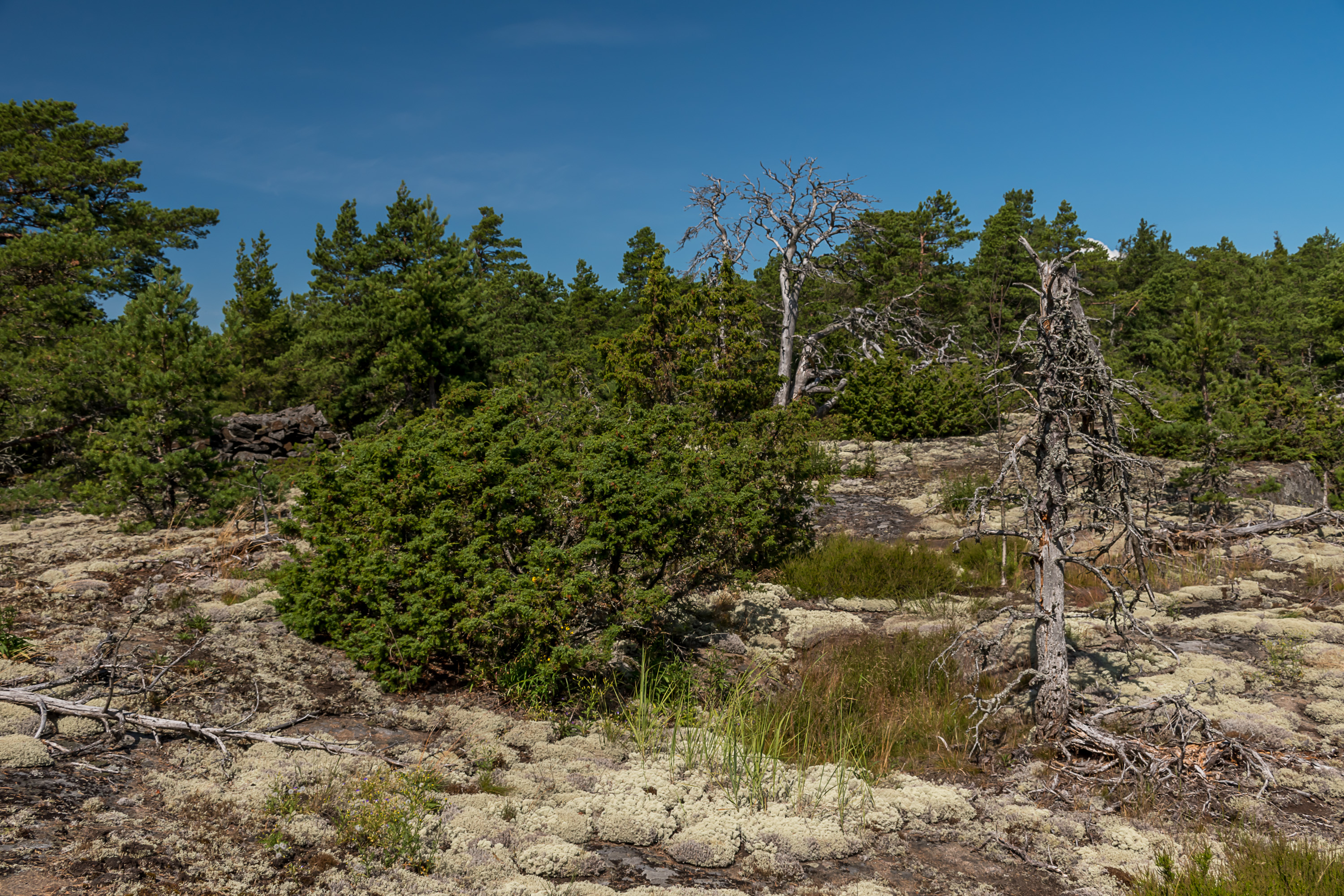
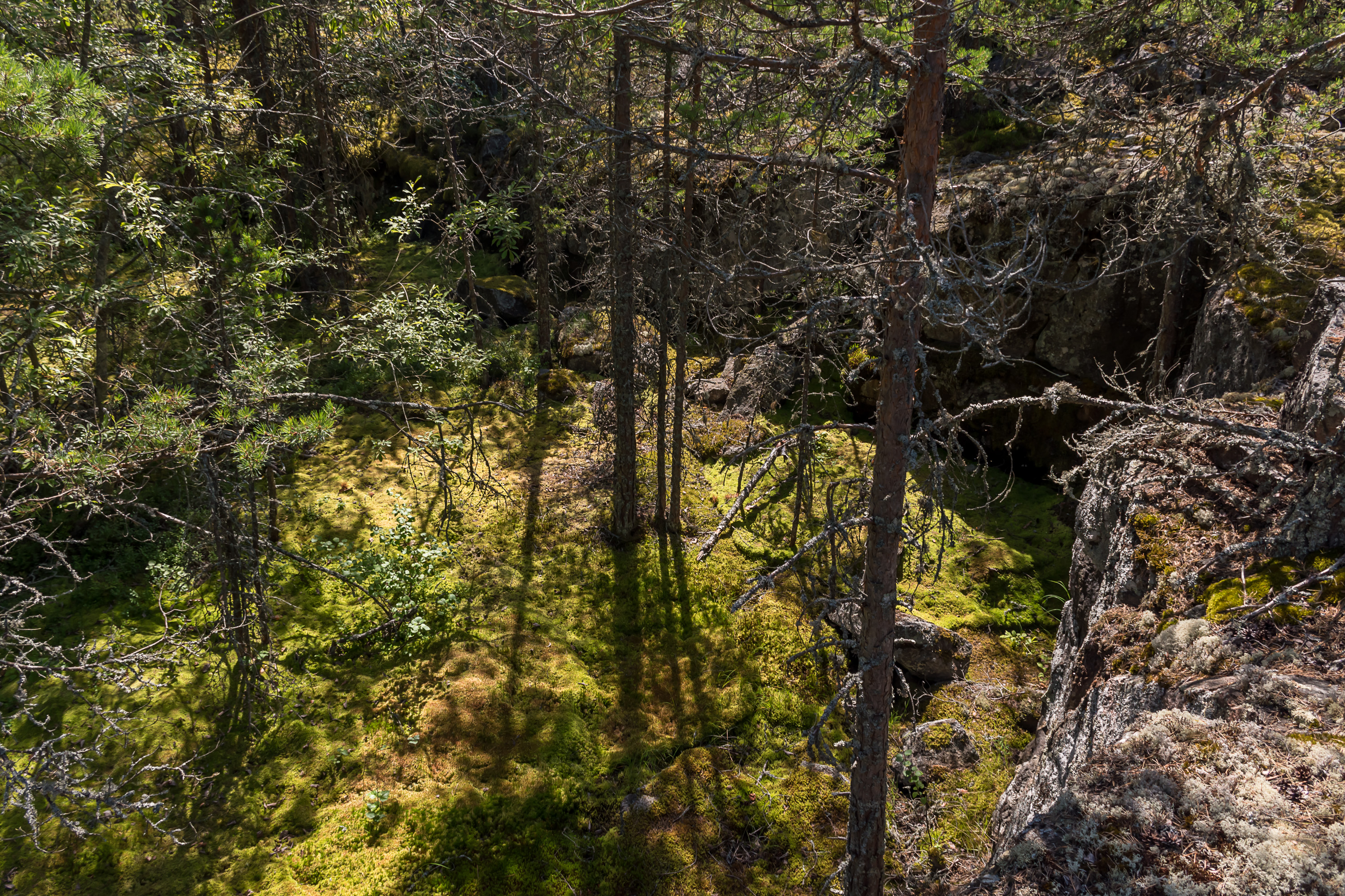
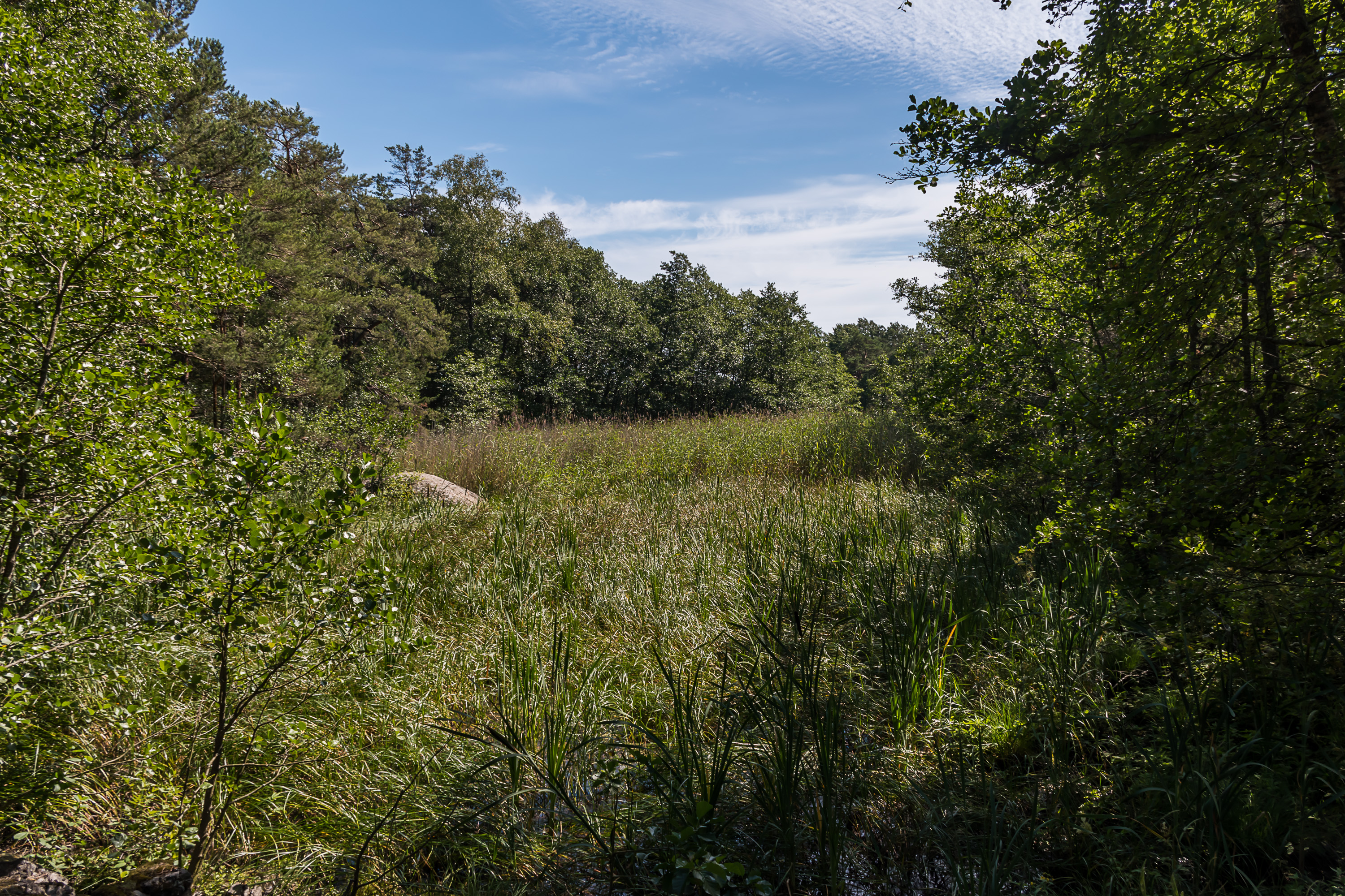
16. Apart from the shores, the island is nearly completely covered by forest, mostly of the expected kind with pines growing almost on the bare rock. But there are also lush deciduous groves and even a few tiny mires, like this one. No lakes or streams though.
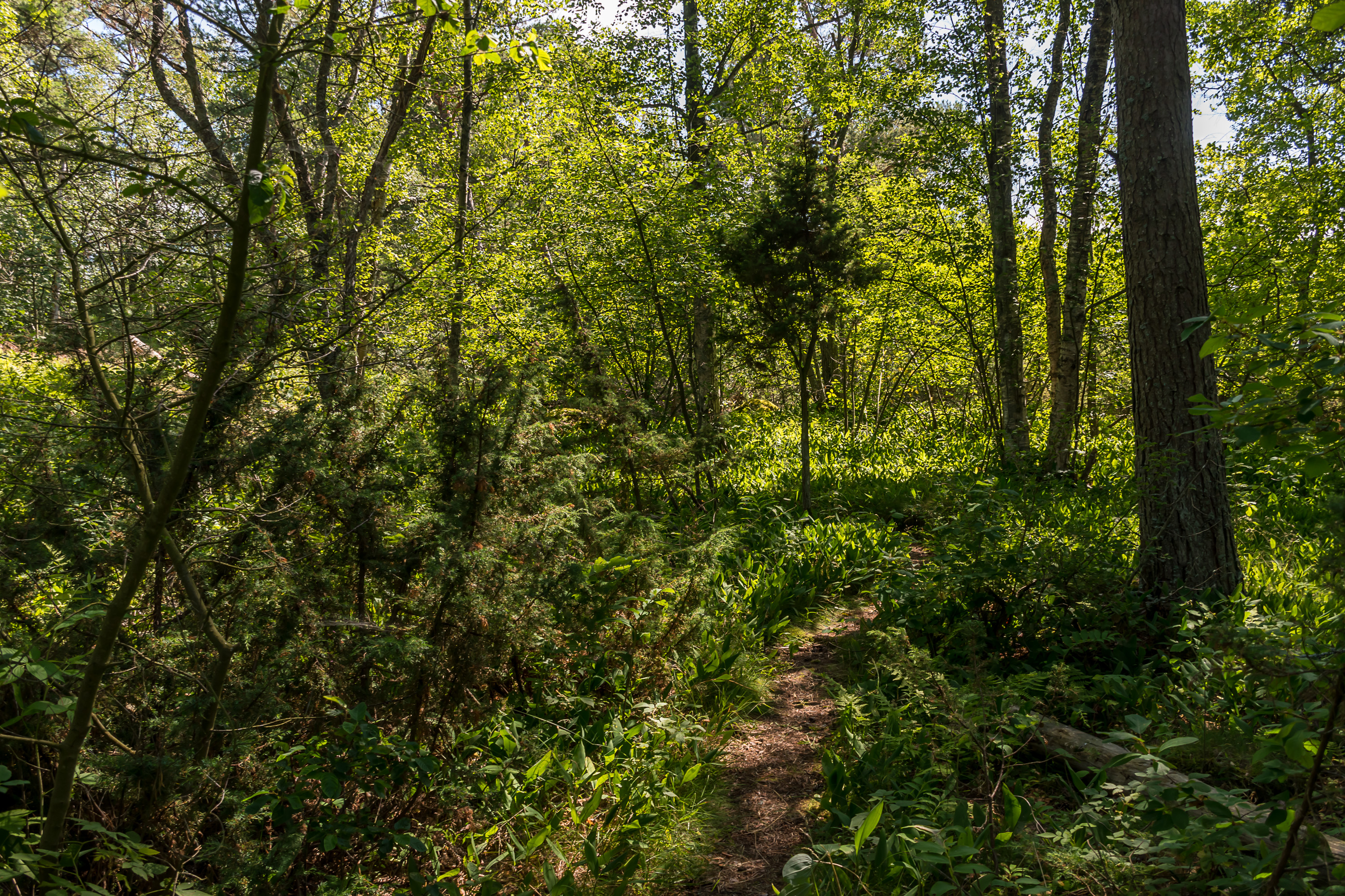
17. This is one of such groves.

18. Solomon's seal is unusually numerous on the island (one of the few things I learned from the guide before leaving the group).
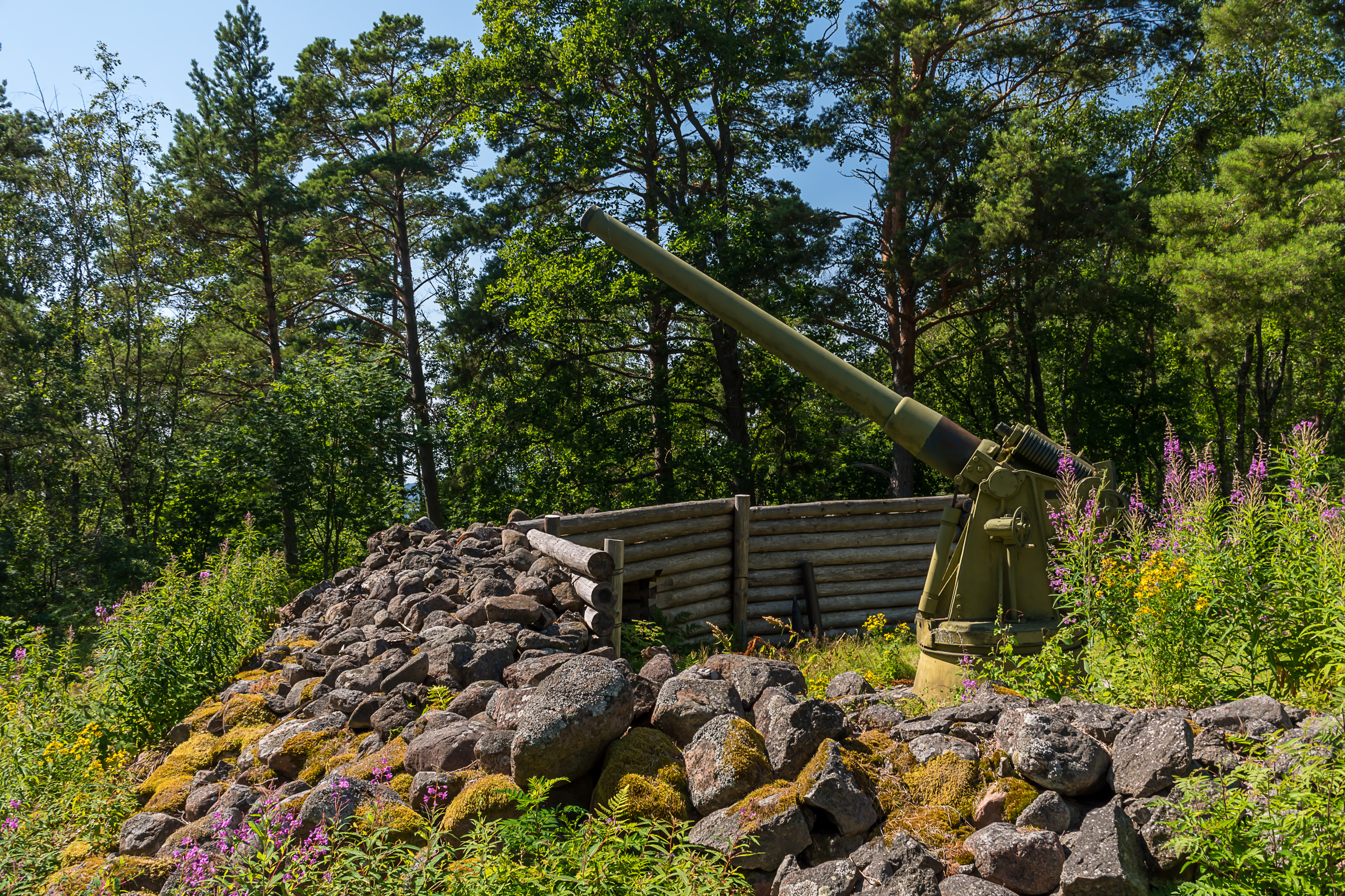
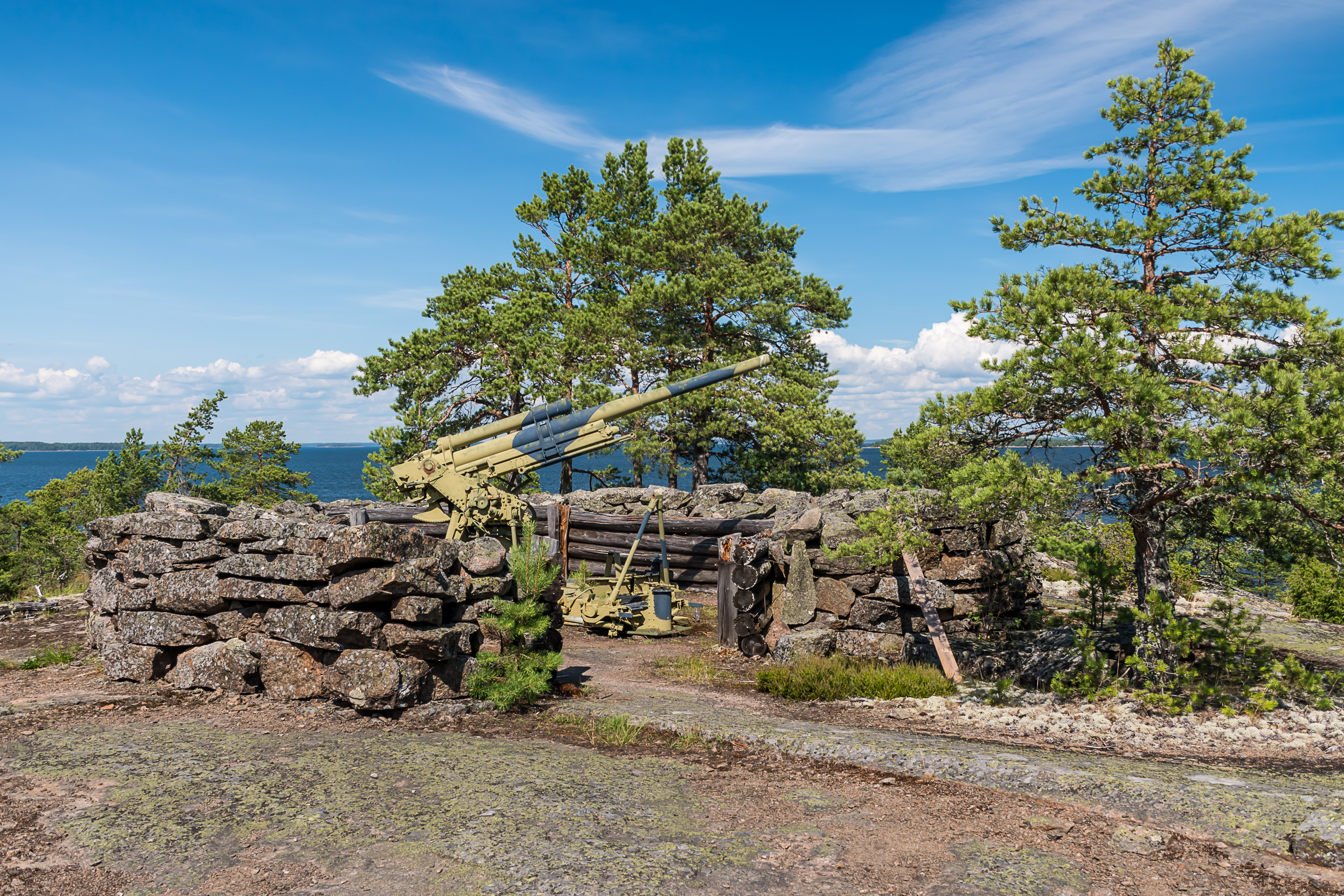
19. Ulko-Tammio originally had three batteries and quite a few guns. Nowadays only two guns are restored to their original appearance and position. One of them is this 152 mm Canet gun (152/45 C), close to the harbor. Designed by Gustave Canet, a Frenchman, these had been produced in fairly great numbers in Russia in St. Petersburg and Perm in 1897-1916, and, like with the mighty 305 mm Obukhov guns, many of them (about 100) ended up in Finnish hands after Finland proclaimed independence, and were used there far longer than anyone could have expected (up to the 1990s at Hästö-Busö near Ekenäs). This is in fact one of the original guns that were moved onto Ulko-Tammio in 1941, and participated in the Battle of Someri; it of course was moved elsewhere after the war but brought back for the national park.
20. There are small dugouts (I saw one but supposedly there are three) near the gun, meant for ammunition storage. These are pretty much the only dugouts on the island; it had almost no concrete shelters, characteristic for such major fortresses as Örö.
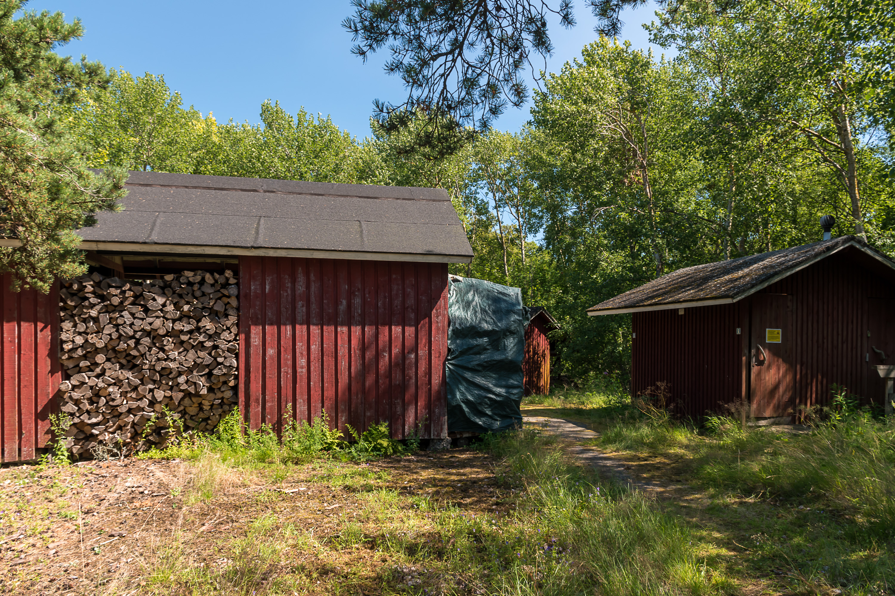
21. Toilets and wood storage for campers.
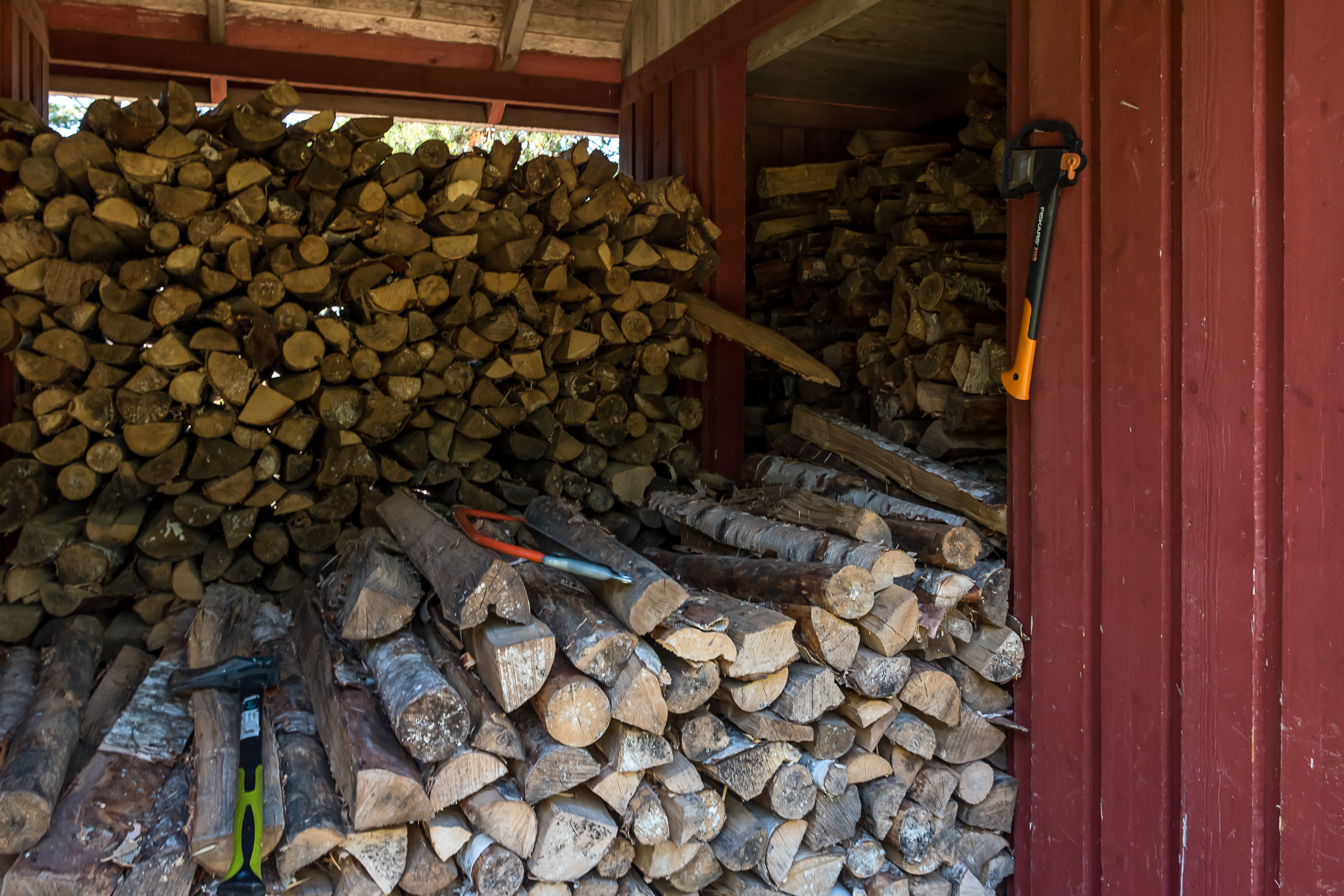
22. Equipped with a proper Finnish Fiskars axe, of course! (Fiskars tools are still actually manufactured in Finland, at least some of them, which by now is very rare for mass market consumer goods.)
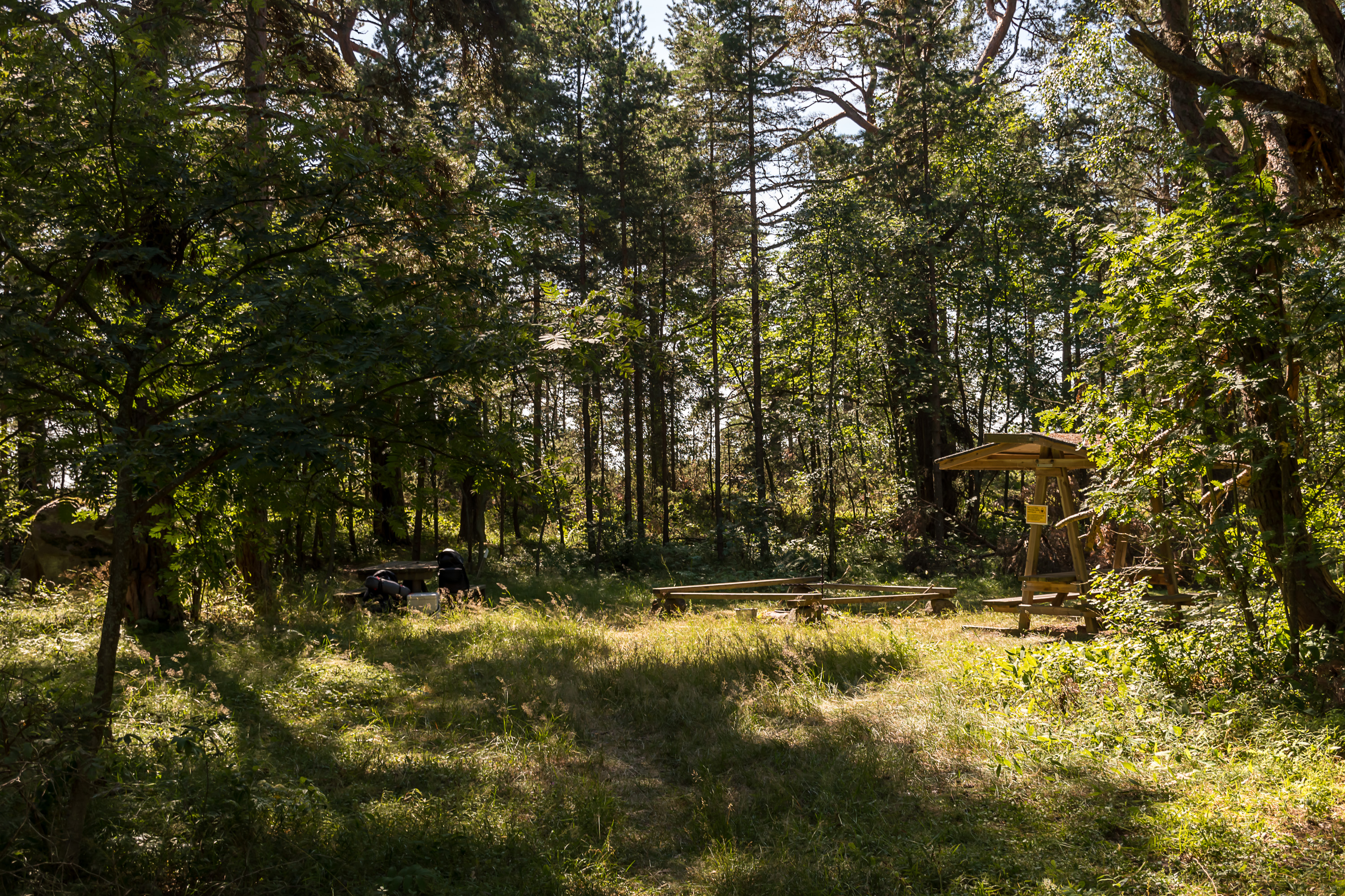
23. One of the designated camping spots.
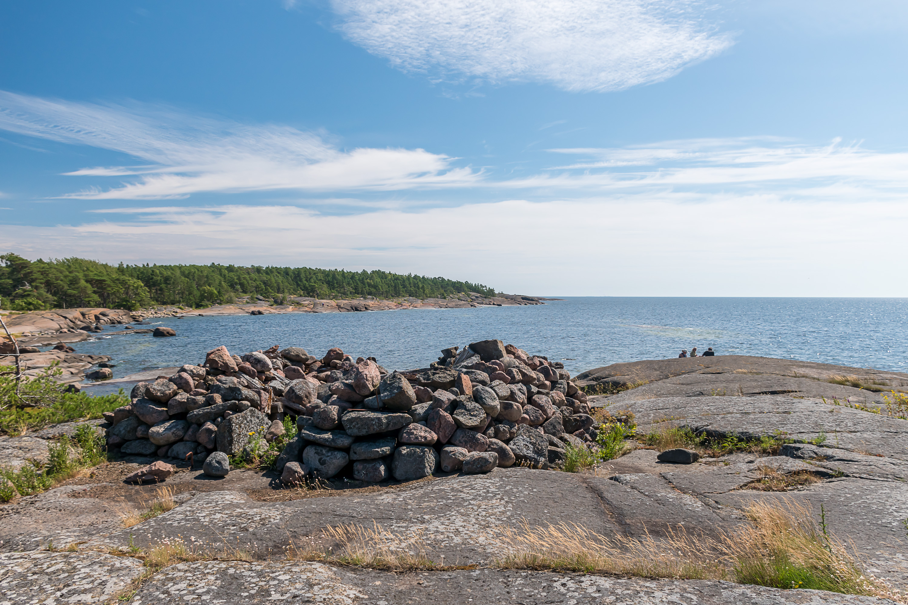
24. Most former gun positions now look like just piles of stone.
25. The beautiful southern coast, open to winds of the Gulf of Finland.
26.
27.
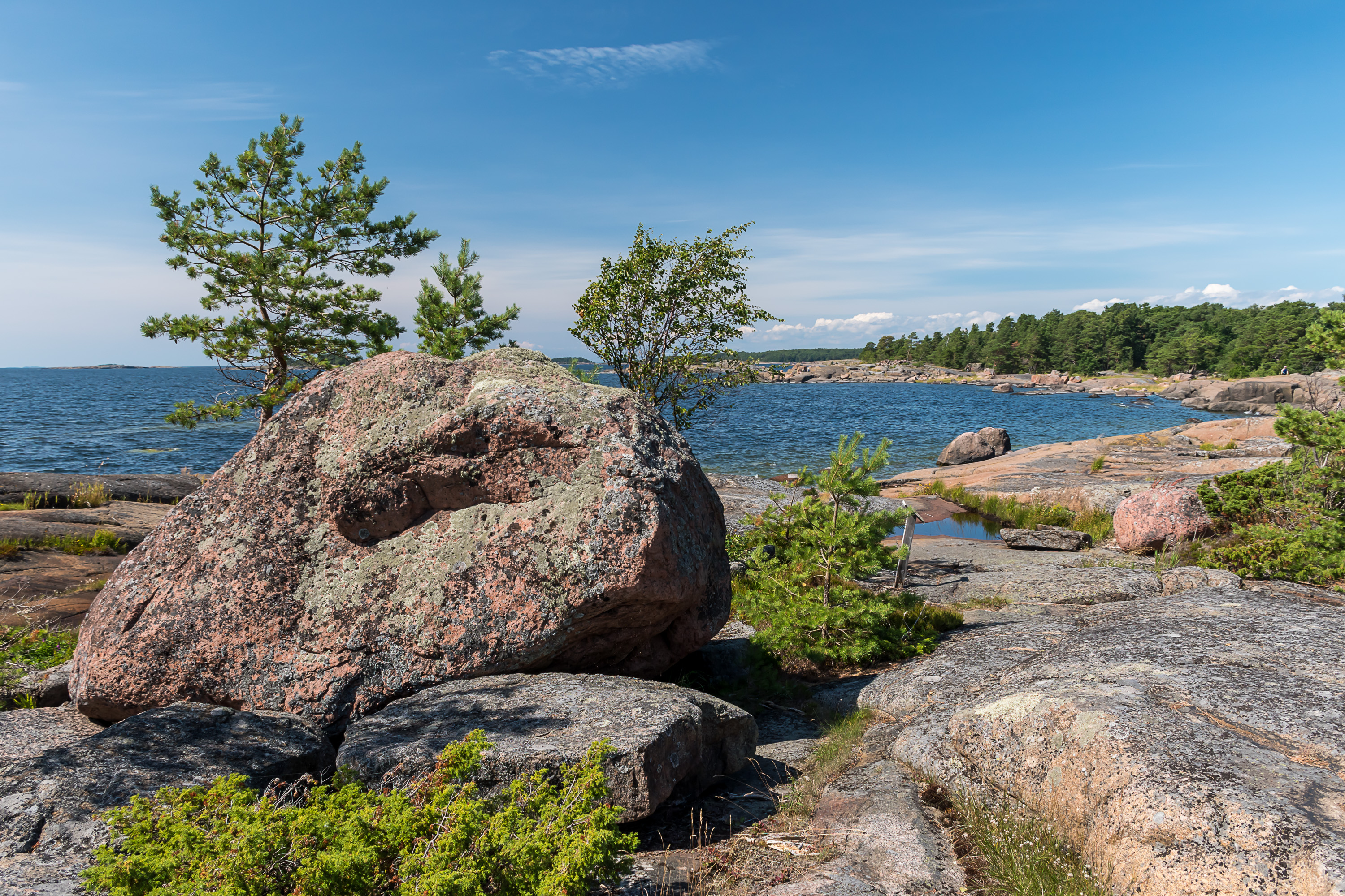
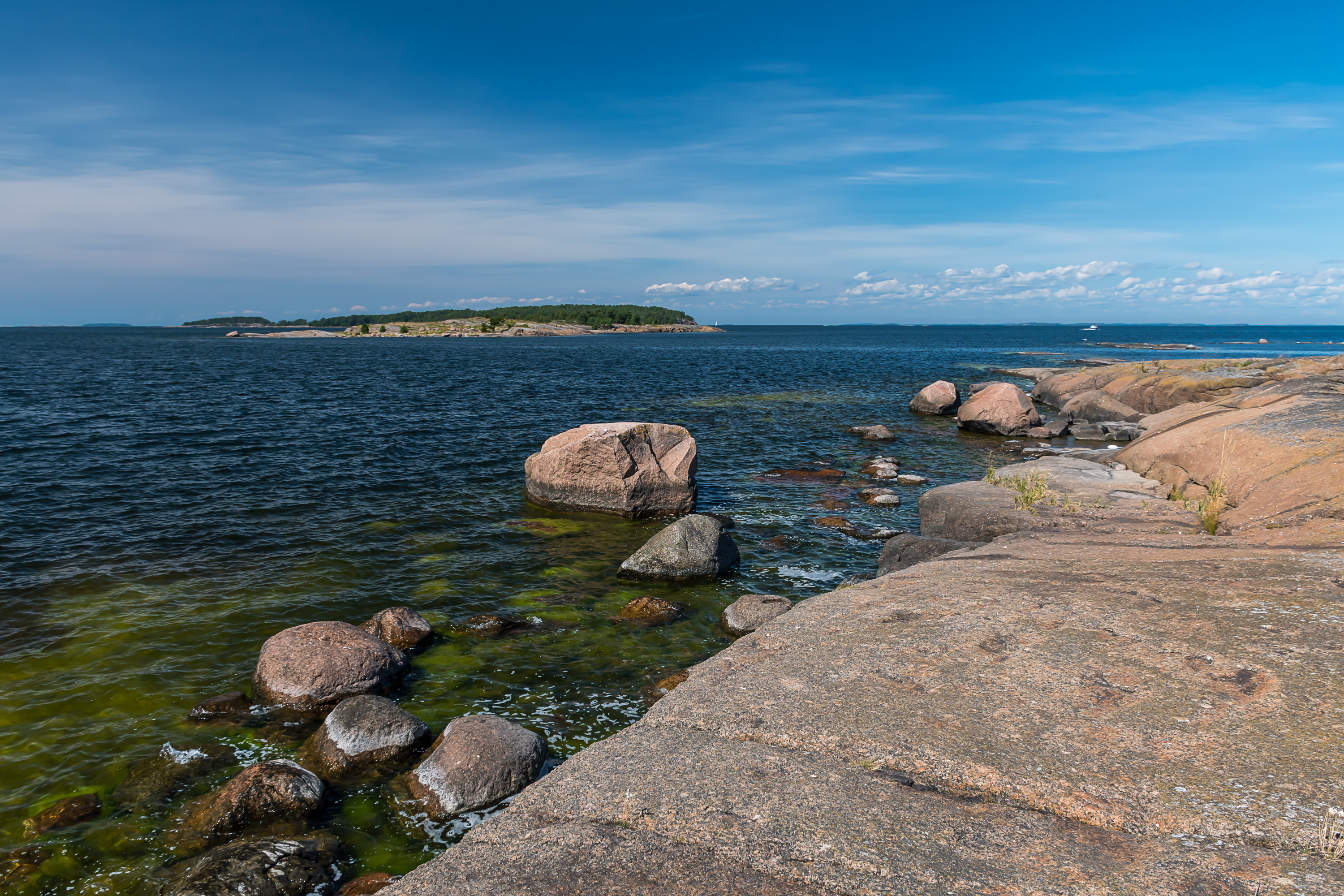
28. The bedrock of Ulko-Tammio is red rapakivi granite. This is perhaps one of the best known characteristically Finnish kinds of stone, especially for us Russians, as it was widely used in construction and decoration in St. Petersburg. Tha name means "crumbling stone", as it apparently actually crumbles easier than other granites. However the bedrock is actually composed of rapakivi only in Southeast Finland, in Åland and at a few small areas in Southwest Finland. Finland in general has quite many kinds of bedrock, although they mostly don't look all that different of course. It is quite easy to see exposed bedrock virtually anywhere in the country; 3% of Finland's land area is bare rock and further 11% is rock covered with <1 m of soil.
Nonetheless various granites are of course by far the most common kind of Finnish bedrock (over 50% by area), and granite is considered the national stone of Finland. Rapakivi is actually the youngest granite, "only" 1.6 billion years old, while the oldest kind of rock in Finland is gneiss of Pudasjärvi in North Finland, at 3.5 billion years. The second most common kind of bedrock is migmatite, at about 30% of the land area.
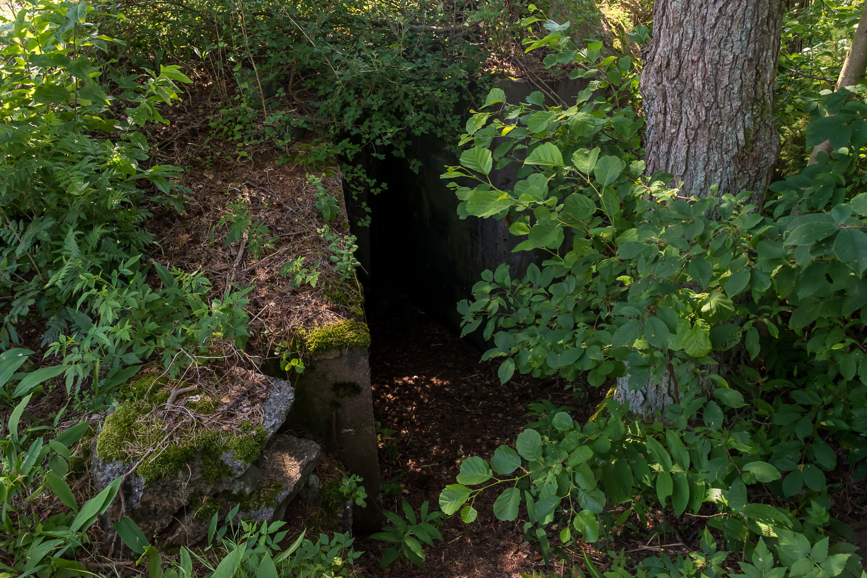
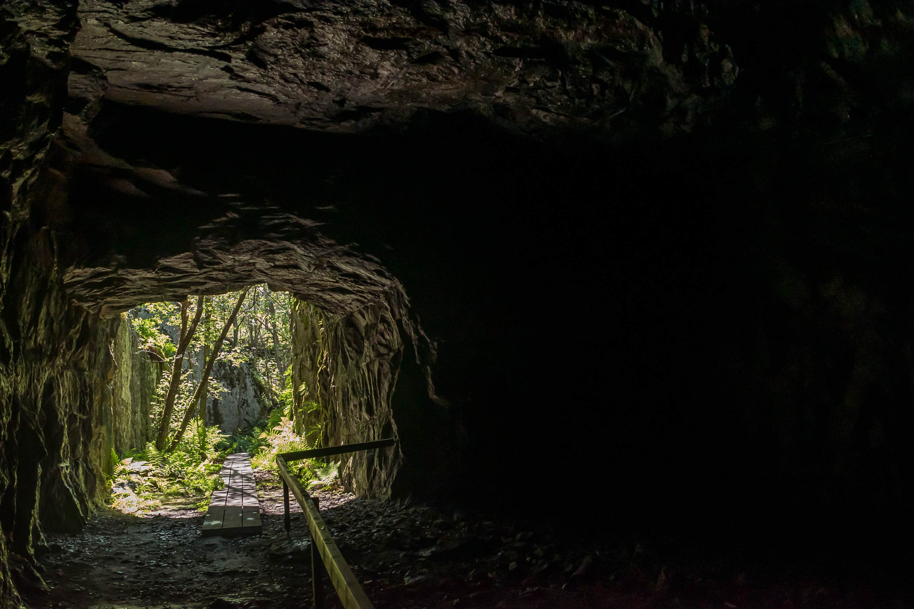
29.
30.
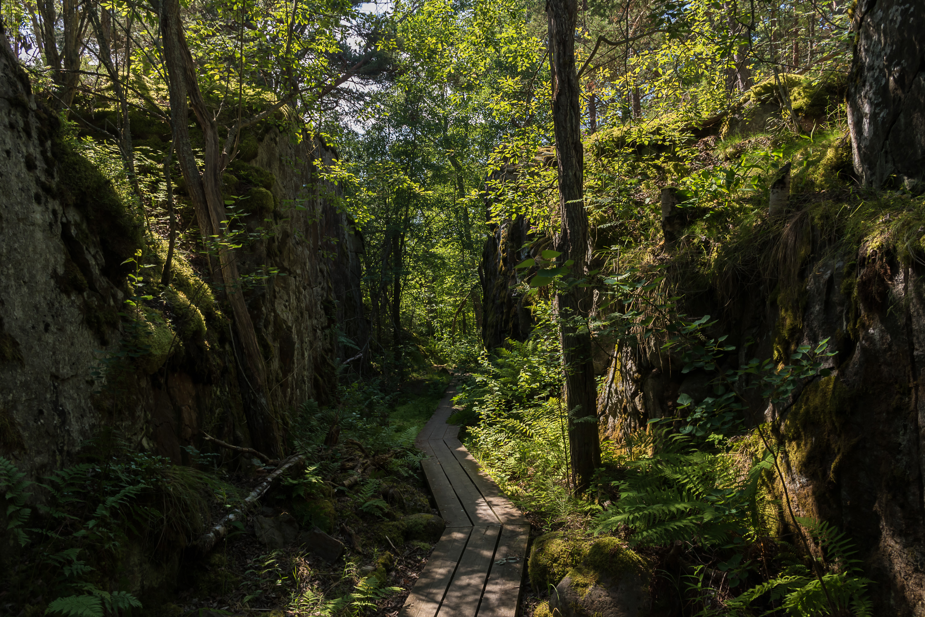
31. The island has a few overgrown quarries, presumably originally used to excavate rock for gun positions.
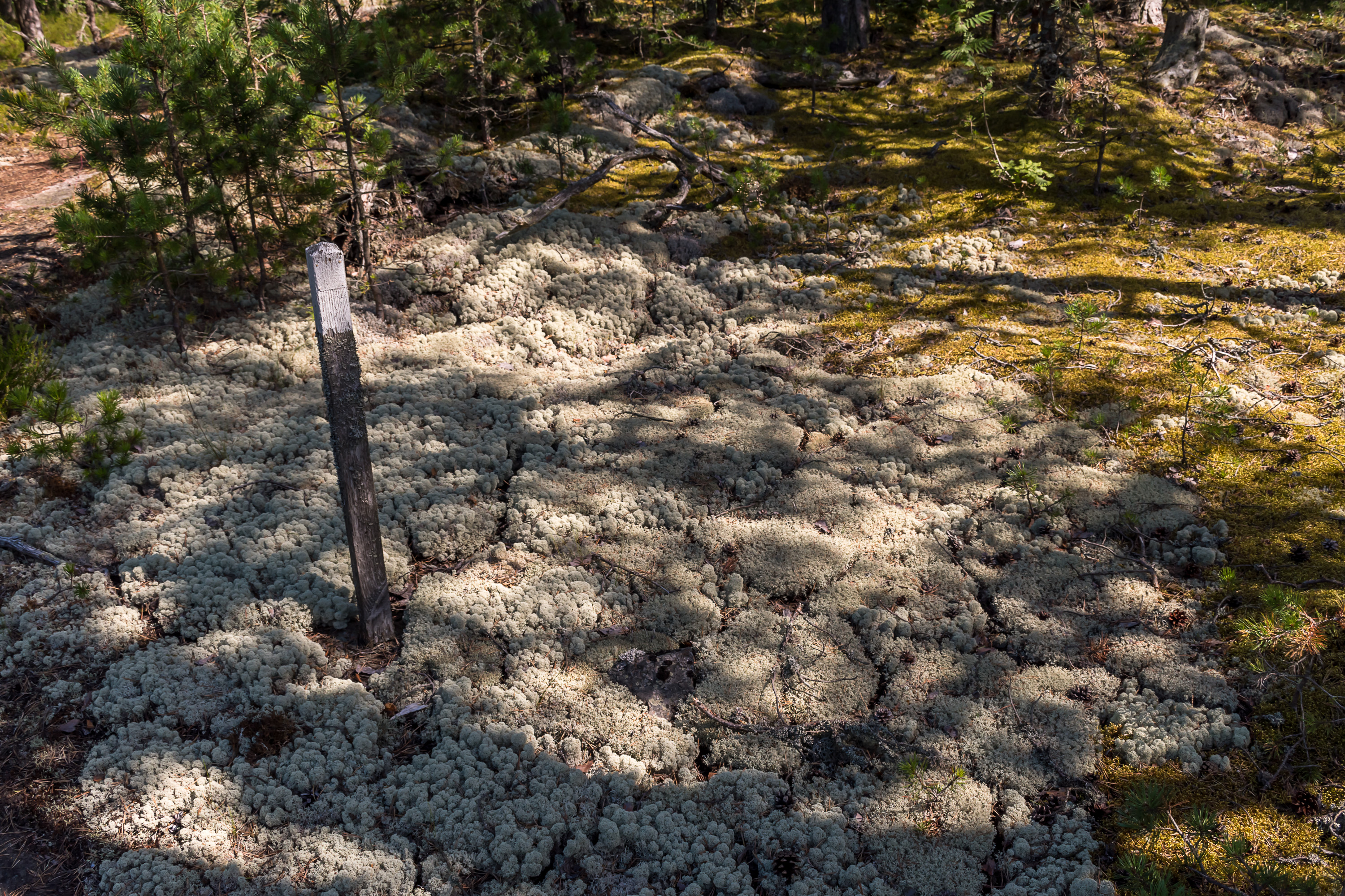
32. Reindeer lichen cracking from dryness. Following the official nature trail is annoying at places; trail markers are spaced at considerable distance and are not all that well visible, so especially in rocky areas following the trail is somewhat difficult.

33. The mushroom season is starting, and blueberry and cloudberry seasons are already in full force.
34.

35. Like other islands, Ulko-Tammio is notable for its birdlife (the mascot of the national park is a black guillemot bird). Many Arctic birds rest here during their migrations in the spring and autumn. Underwater life is also supposedly rather rich; low salinity of the eastern Gulf of Finland means that marine and freshwater species meet there. But of course I had no way to see that for myself.
36.
37.
38. The eastern harbor.
39. Bottom of the bay.
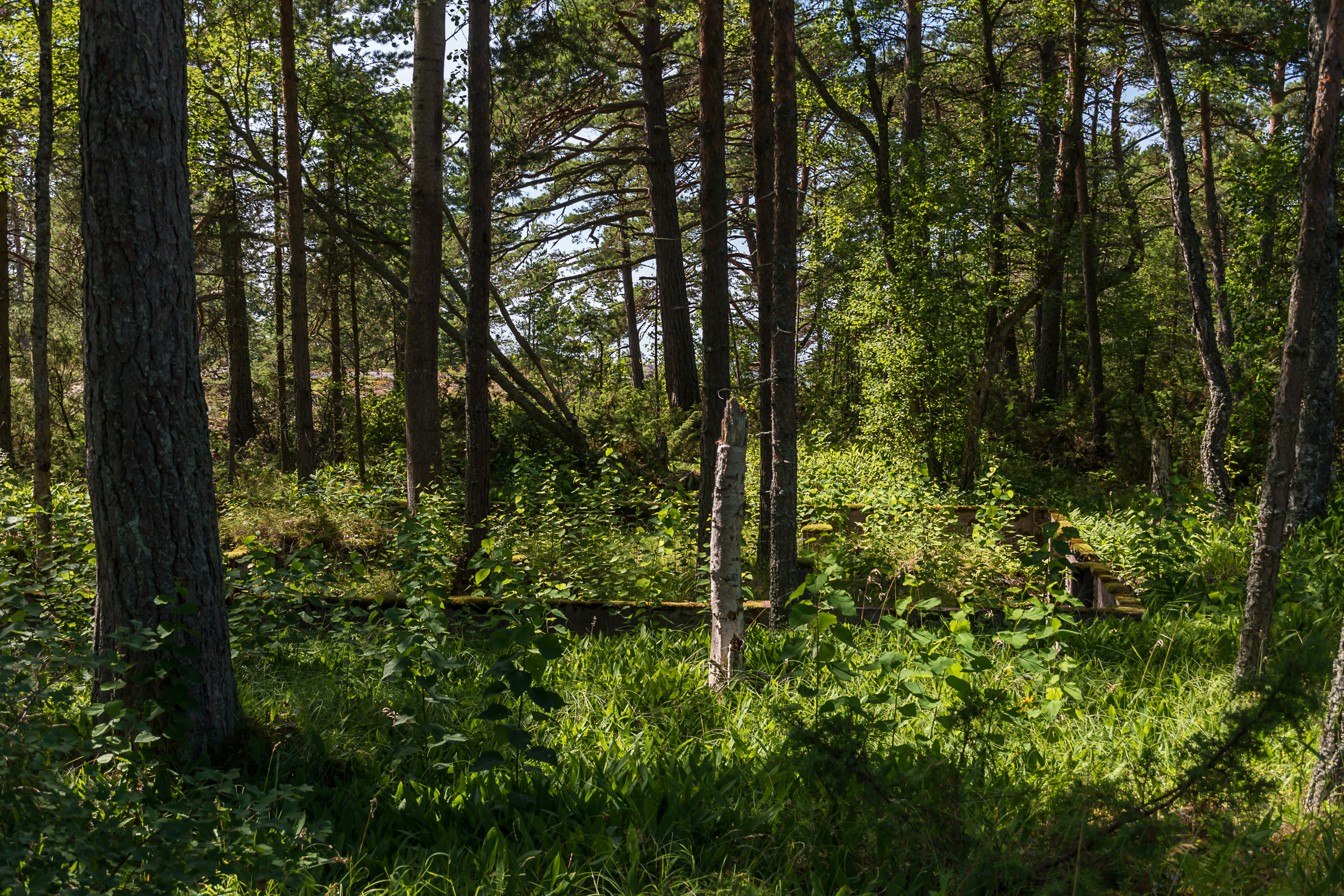
40. Basements of buildings from 1941-1944 can be found at places, but no more than that.
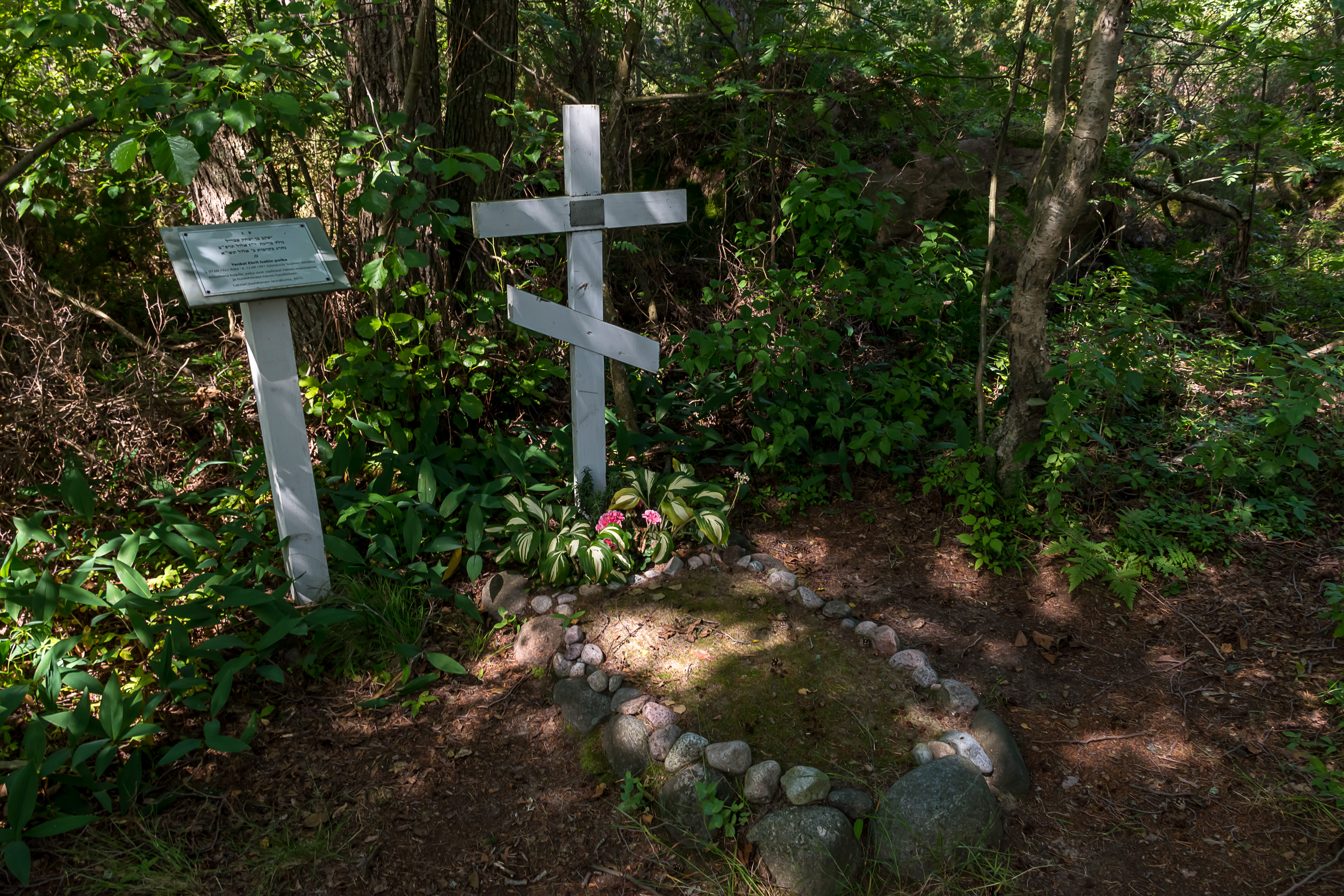
41. Grave of a Soviet soldier. His body was washed onto the shore on 12.9.1941, from some sunk Soviet ship presumably. He had documents with him, stating that his name was Yankel Ebril, born in Riga in 1922. Despite an obviously Jewish name, he was buried under an Orthodox cross for some reason. His history was researched more thoroughly only in 2010; turned out he was actually of Jewish faith (duh!) so an extra sign was put nearby. His story is actually pretty sad; since he was a Jew and from Latvia, which was occupied by Nazi Germany in the war, all his relatives there were killed in the end of 1941 in death camps. No one related to him survives now.

42. Not far from the grave is a memorial plaque for the Battle of Someri. The plaque reads in Finnish: In 187 hectometers from this place, at compass point 24-30, on the island of Someri a minor Finnish squad on 8-9.7.1942 won the battle against a much more powerful enemy, but suffered its own losses also. This plaque was set as a duty to the coming warrior generations by the brothers in arms from Someri on the 30th anniversary of the battle.
43.
44. The other museum gun can be found at the north side of the island. It is a 76 mm anti-air gun of the 76 It K/31 model, designed in 1931. This is also one of the actual guns that were used on the island; this anti-air battery was in fact installed pretty much in the last days of the war already. The gun, manufactured in 1937, continued to serve in other places afterwards all the way until 1992.
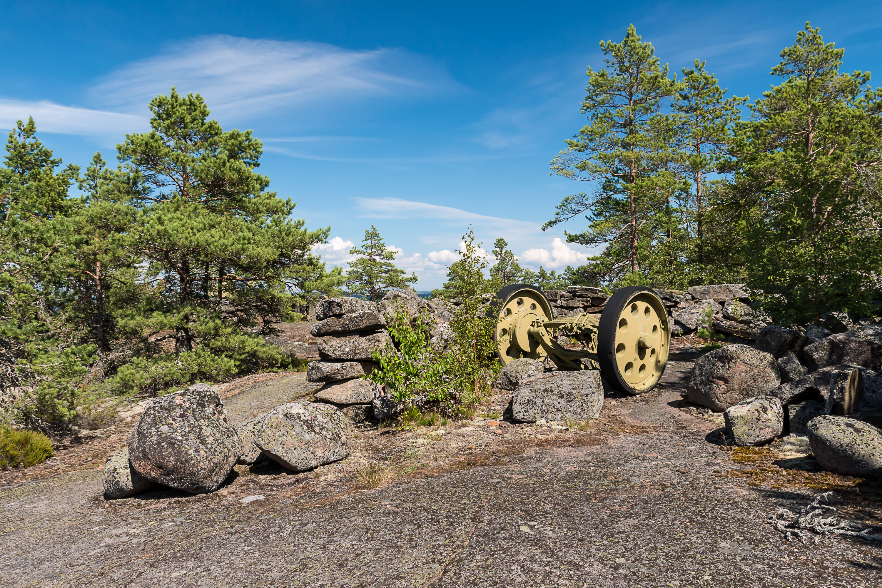
45. Detachable cart for transporting the gun.

46. The highest points of the island (at 15-18 m high) originally had two lookout towers. In place of one of those now is another lookout tower used by the border guard and locked for others.

47. The border guard also has two surprisingly nice houses close to the lookout tower. I don't think there's any permanent personnel stationed here though.
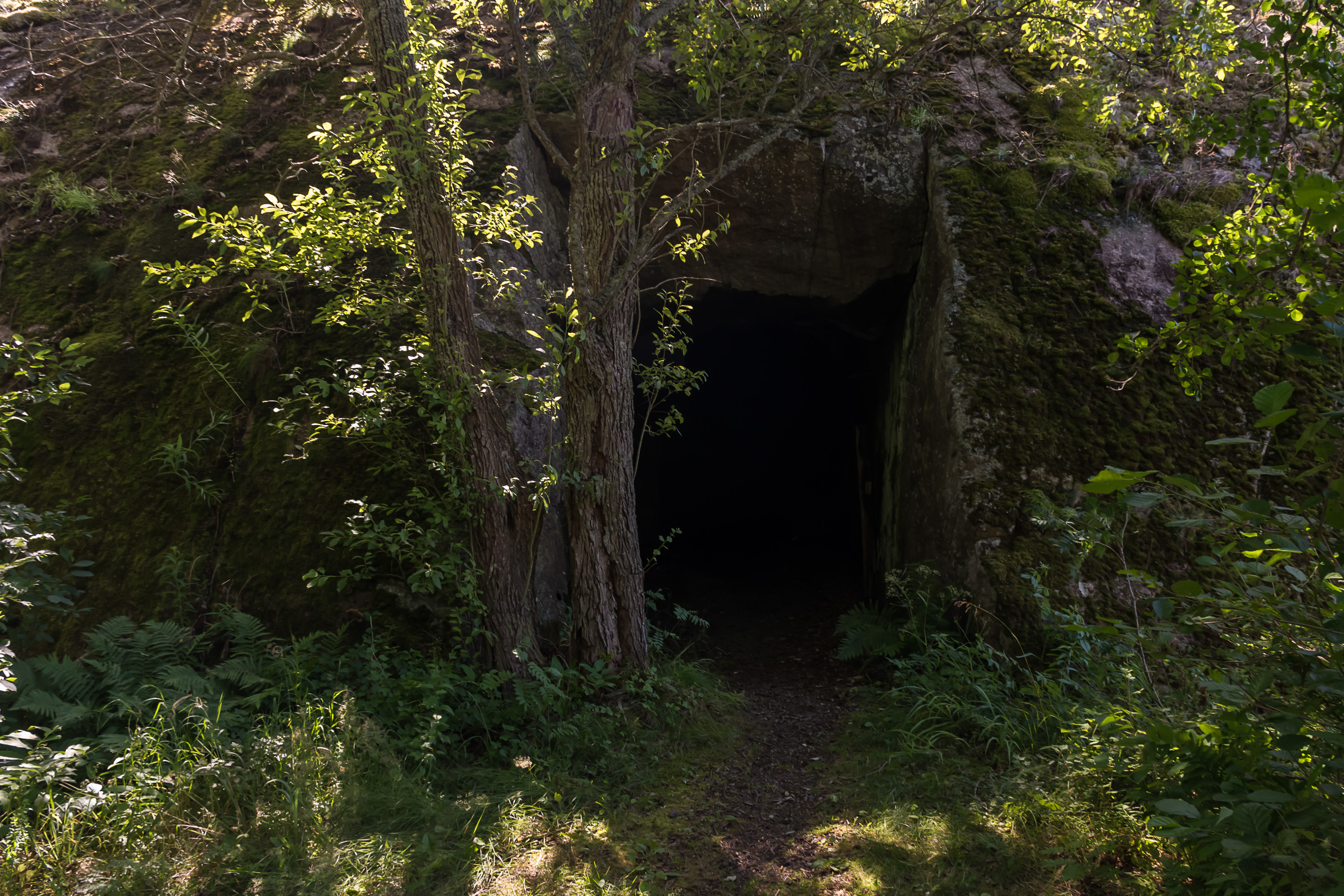
48. The other hill that had a tower (and a radar) also has a bigger oddity, a tunnel going through it. It is less than 100 meters long, but has a zigzag inside so it is rather dark (but still possible to walk using a phone flashlight). The tunnel was meant as a storage area, a shelter and a command station. It was not entirely finished by the end of the war. Even so it is probably the most curious man-made sight of the island.
49. Inside. The tunnel was used for a fire extinguishing experiment in the 1970s; it was filled with flammable material, and set on fire. The idea was to try to extinguish fire with some new substance, but instead the fire got out of control. People were injured and the fire burned inside the tunnel for days. I didn't really notice any fire traces, but I wasn't aware of this fact at the time, and I didn't have a strong light with me.
50. The trail out of the tunnel also follows a man-made "canyon" briefly.
51. In place of the other former lookout tower, above the tunnel, is now a small public observation tower. For some reason I forgot to take a picture of the tower itself, but certainly didn't forget to climb it.
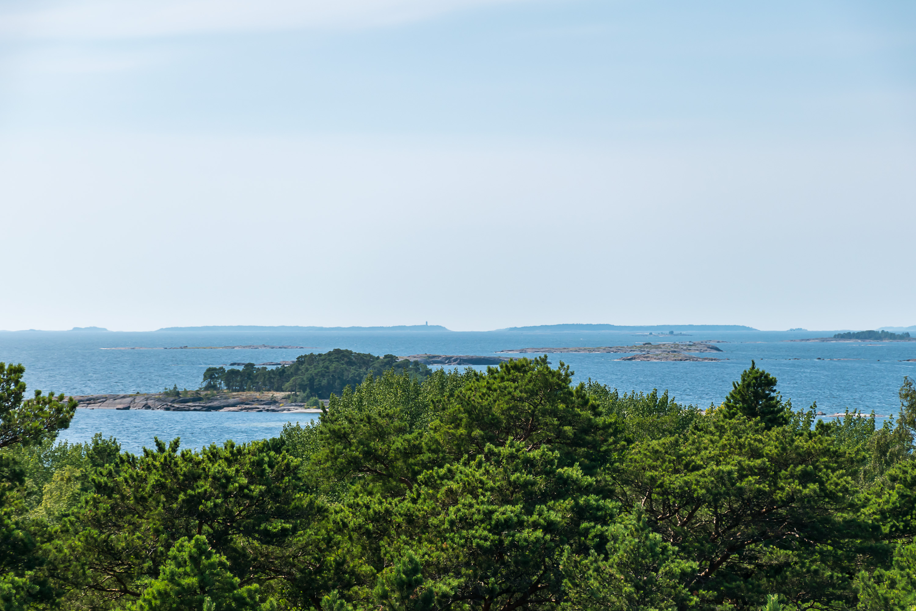
52. The island of Haapasaari, 15 km to the southwest, can be seen from the tower or from the shore, recognizable by its "lighthouse" (daymark). Someri with its modern lighthouse is also visible but I didn't recognize it at the time and didn't take a picture.
53. Other Russian islands can probably be seen from here too. Since 2017 most Russian outlying islands in that area also belong to a protected area, Eastern Gulf of Finland Strict Nature Reserve (заповедник "Восток Финского залива"). The huge Hogland (Suursaari) can just barely be seen in the haze on the horizon, but not on any of the pictures.
54. Island warden's hut, not open to the public.

55. The wilderness hut, which is the only surviving war era building, I somehow missed. Here it is peeking through the trees across a small bay. You can google images for "ulko-tammion autiotupa" if you're curious what it looks like outside and inside. The former small barrack has now sleeping places for six, and ordinary cooking facilities including both a wood and a gas stove. Drinking water is available from a well.
Such huts (autiotupa), open for free use for everyone, are very common in Lapland, but in South Finland they are extremely rare. In theory you could live there for a week like Robinson Crusoe or something. In practice, however, this might not be so fun with neighbors who you don't get to pick, and also it is considered bad etiquette to stay at the same hut for over two nights.
56. I didn't check out the hut afterwards because I was already hurrying back to the ship. Embarassingly enough I actually didn't understood properly the time it was departing back when they said it; it was 14:45 but I thought it was 15:35. You'd think time, of all things, I could have understood when spoken, and they even repeated it several times! Well, there are always ups and downs with learning Finnish, it has always been so for the last three years and the downs can be very frustrating. Anyway I started to get worried because I wasn't completely sure about the time still, and when I saw many people already returning to the ship, I decided to hurry up myself, and was on board at 14:30. So I didn't get stranded in the end.
57. Goodbye, Ulko-Tammio! In the end this island had fewer sights than places like Utö, nor is it so exotic, but still it's a beautiful place, and one more national park for me. So if you happen to be in Kotka in July, visiting Ulko-Tammio would certainly be a great idea for a weekend trip.