Let us continue with our Utö walk, starting with the most prominent feature of the island, the Utö lighthouse.

1. Finland has several dozen lighthouses, although some (newest) of them are quite unimpressive-looking automated structures which do not really look like proper lighthouses. There are plenty of classic-looking ones, though. Of these Bengtskär west of Hanko is probably the best known, Harmaja off Helsinki coast is seen by the greatest number of people, and Glosholm near Porvoo (destroyed in the war in 1940) inspired the shape of the Moomin house from Tove Jansson's books.
Lighthouses in these days of GPS are no longer particularly important for marine navigation, but most are still operated (since marine navigation is the kind of thing where you really want to have a plan B if something goes wrong). All Finnish lighthouses are automated (the latest ones were automated in the 1980s) and do not require any permanent personnel. All are located on islands (sometimes shallows), typically small outlying ones. Thus visiting most lighthouses is challenging. Only a few are accessible by road or public passenger ships; some others can be visited in summer by a scheduled boat, but most lighthouse islands can be reached only by own boat or on a special occasionally arranged tour. Many such tours are arranged by Suomen Majakkaseura, the Finnish Lighthouse Society, which also participates in maintenance and restoration of lighthouses on a volunteer basis, although most of their tours are meant only for the society members (it costs 20€/year to be a member). Almost all lighthouses can be actually climbed also only with a tour guide. The society's website has probably the most complete catalog of Finnish lighthouses and daymarks, although only in Finnish.
Utö is another well-known and relatively easy to reach lighthouse. It is the oldest lighthouse in Finland, originally built in 1753 (in a different, more traditional round shape). Its importance is fairly clear; as we mentioned in the previous part, the fairway through the Archipelago Sea to ports of Turku and Naantali starts here, and back in 1753 in the Swedish era Turku was the capital of Finland. The original lighthouse was destroyed in the Finnish War of 1808-1809 and rebuilt in a different shape in 1814. Even this second incarnation of the Utö lighthouse is the oldest existing in Finland.
The lighthouse was originally operating only in ice-free time. The first electric lamp and radio equipment it got in 1935. Unfortunately I didn't see the lighthouse in action this time.
2. The lighthouse appears to be normally locked. I could visit it the next day with a guide, Martin Öhman. I noticed an advertisement "daily guided island tours starting after breakfast from the hotel entrance, 1.5-2 hours long, payment 10€, cash only" at the hotel. Good thing I'm carrying around 20€ in cash for unexpected occasions! So I went to that tour the next day after breakfast, along with about 30 other interested tourists.
The tour was pretty great and I absolutely recommend it — if you know Finnish! Because, of course, tours are only held in Finnish. I've been living in Finland for over 2.5 years by this point and I haven't really been actively studying Finnish since the spring of 2019, and Finnish is of course known to be both a very difficult language in general and a surprisingly difficult language to actually practice even in Finland (as most Finns would rather prefer English to poor Finnish). Still I've been slowly getting better, and while I still cannot say more than a few words, I'm by now not that hopeless in understanding spoken Finnish, and so this was the first ever guided tour in Finnish that I dared to take. It was quite alright and I understood most of it fairly well (except whatever the guide was saying inside the lighthouse and the chapel; even a small echo in big spacey rooms makes understanding harder to a surprisingly large degree).
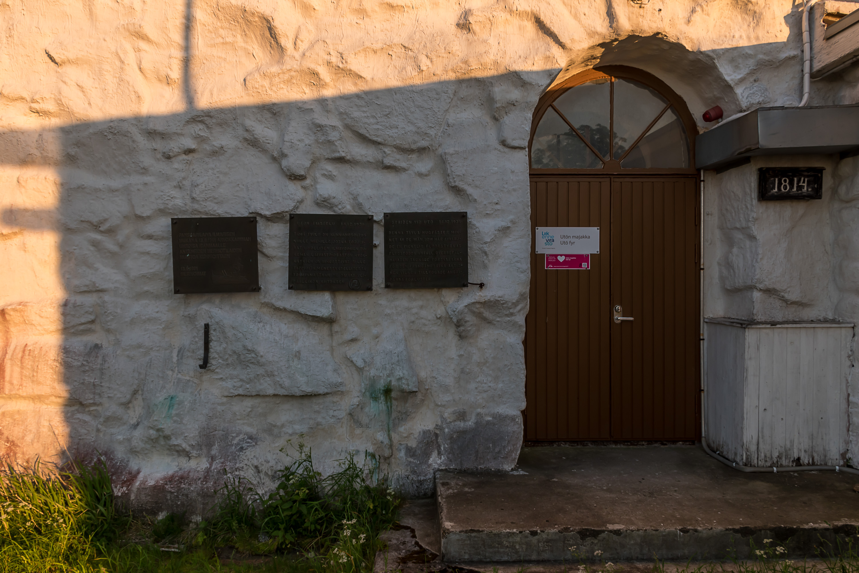
The left plaque here near the lighthouse doors is dedicated to the coastal defense ship Ilmarinen (after a Kalevala hero), the flagship of the Finnish fleet in the Second World War. Ilmarinen sunk on 13.9.1941 during a joint Finnish-German Operation Nordwind, meant to deceive the USSR about the plans for a German attack onto the Moonsund Archipelago in Estonia. A decoy group of ships departed to Saaremaa, the biggest island of that archipelago. However in the open sea, in 46 km south of Utö, Ilmarinen, heading the group, hit a mine of not entirely clear origin. The ship received catastrophic damage and sunk in only seven minutes, taking 271 men with it (2/3 of the crew). The operation had to be aborted. This remains the largest Finnish naval loss in history. I also mentioned the sinking of Ilmarinen in the post about Naantali, where there is also a memorial plaque in the place where last rites for those who died at the sea were held. Utö in turn is the closest piece of land to the sinking.
Other two plaques (in Finnish and Swedish) are dedicated to the Battle of Utö of 14.12.1939. This battle was the only actual battle of the Archipelago Sea coastal artillery in the Winter War. Two Soviet destroyers came within about 10 km of Utö, probably for reconnaissance and/or minelaying. Utö guns fired 31 shells towards destroyers, scoring some hits; one destroyer was reported sunk (although I could not quickly find a confirmation of the sinking from Russian sources). The destroyers returned fire, but all their shots missed, so the island had no losses or damages. The island did not participate in any fighting in the Continuation War of 1941-1944, except some anti-air defense (other islands had more battles).
3. The lighthouse has several floors. First two of them have more modern interiors and are not particularly interesting, so I'm not showing those. The first floor is now mostly empty, and originally was used to house electricity generators. Back in the day these generators were powering not just the lighthouse but the entire island too, but eventually however that started being not enough. In 1996 Utö was connected to the Finnish electricity network with a 90 km long underwater cable. All Archipelago Sea islands were being electrified in the 1980-1990s; they had been the last permanently inhabited parts of Finland without electricity.
The generators on the lighthouse were subsequently dismantled. In 2013 Utö's electricity cable got damaged and the whole island was left without electricity. This was a dangerous situation, since without any backup generators this meant for example water supply and cellphone tower also not working. Backup generators were delivered to the island on the next day, and the cable was subsequently repaired.
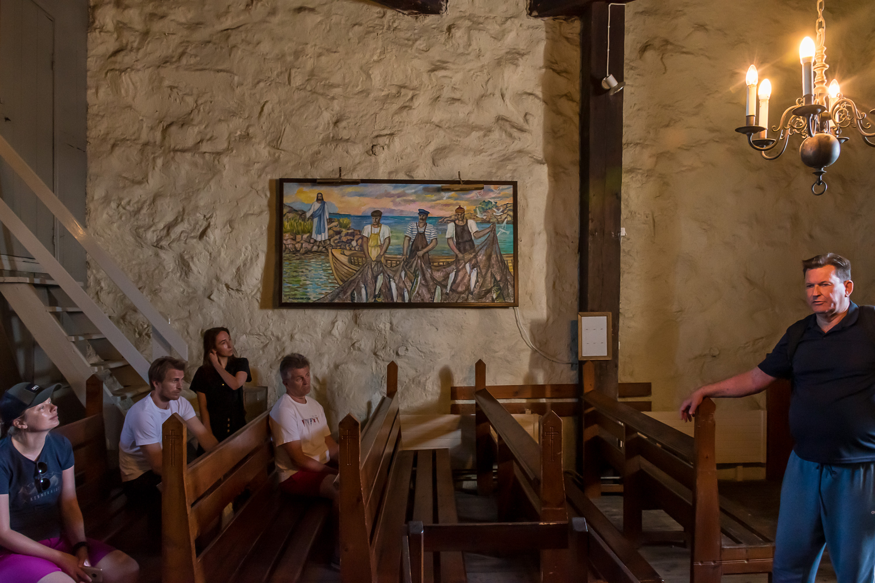
The second floor holds some old radio equipment. The third is some event room. This is the fourth floor, the lighthouse church. In truth it is more of a chapel; the island has never had an own parish, and a priest was visiting here only a few times a year; in other times some local layperson was carrying out some Sunday services. A separate chapel was built on the island in 1910, and is now the main chapel of the island. The lighthouse church was used by the garrison, and now has no regular services anymore; but it is sometimes used for weddings, and can be booked for that purpose.
This is really the only such church in Finland. Bengtskär lighthouse has a chapel, but it looks a lot more modest, and is technically not on the lighthouse tower itself but in the adjacent building. The church of Suomenlinna in Helsinki also operates as a lighthouse (there is a light on top of it), but that's a rather different case.
The actual lighthouse lamp is on the fifth floor, and tourists are normally not allowed there even with a guide, except once a year on the International Lighthouse Day in August. Interestingly enough, there is a hole in the ceiling of this church room, from which a large metal weight hangs, and can drop even lower through a small fenced off hole in the floor onto the third floor (not visible in my picture but visible e. g. here, in the middle above). The weight was a part of a clockwork mechanism through which the lighthouse lamp operated (rotated, presumably). The mechanism had to be rewound fairly often, multiple times a day. I don't think it's in use anymore now.
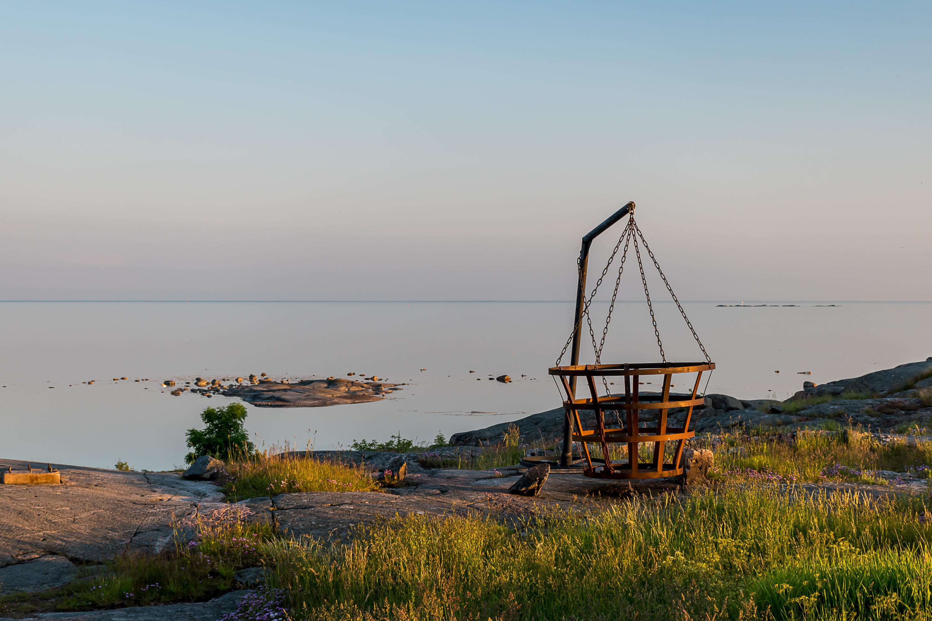
4. And this basket, outside near the lighthouse, is of the kind that was used very long ago, before lighthouses as such existed; some burnable stuff was just set alight in the basket.
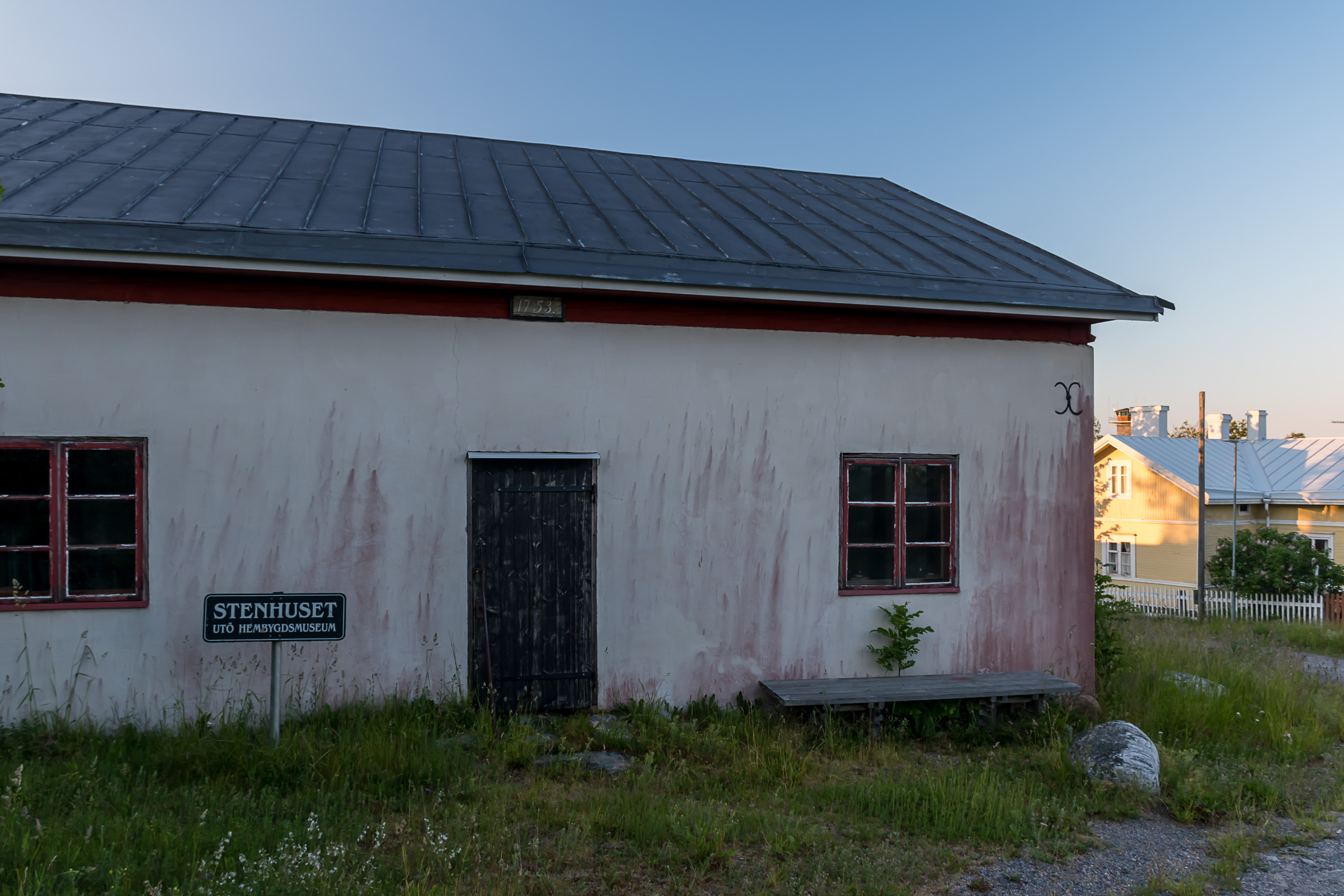
5. The "Stone House", Stenhuset, is the oldest building on Utö, dating from the construction of the original lighthouse in 1753, and originally it was used as the lighthouse keeper residence. Nowadays it serves as a small free museum. Unfortunately it is open only in July and for some reason even with a guide we weren't allowed to peek in.

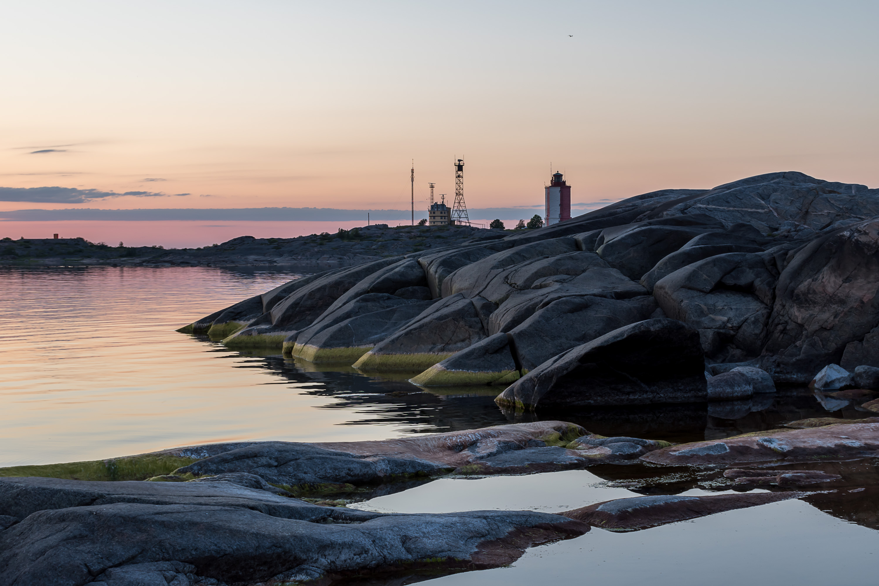
6. The other prominent structure next to the lighthouse is the pilot station. Its current building with prominent radar towers dates from the 1950s.
The pilot job has always been extremely important in Finland, since nearly all of its coast is broken with many skerries and shallows, and difficult for navigation. Official pilot stations in Sweden and Finland were first established in 1696, by the order of King Charles XI, although in practice some kind of pilot services had existed since the Middle Ages. Like lighthouses, pilot stations were mostly established on islands, and were a major reason why many islands, like Utö or Haapasaari, got permanent population in first place. Pilotage was more of an art than a craft, and was traditionally passed between generations within local families. Pilots have a duty to oversee ships reaching or leaving the destination port using a certain waterway; how they do that exactly varies depending on the experience of the ship's crew. A pilot can merely oversee them working and give some hints, or he can take over the control of the ship himself.
These days many pilot stations moved to the mainland, but the pilot's job is still no less important. Pilot services are mandatory on Finnish public waterways for ships over 70 m in length and/or carrying dangerous goods (e. g. oil). Apart from sea areas, Saimaa water system, which is connected to the sea with the Saimaa canal, is also open for large seagoing vessels, thus there are also pilot stations on Saimaa (there they are mandatory for ships >35 m long). Certain ships are exempt from the requirement, for example Finland's icebreakers and domestic ferries. Others can get a license for pilot-less operation on certain waterways; captains of ferries to Estonia and Sweden all have such licenses. Still about 35% of vessels in Finnish waters have to use pilotage, which in 2019 translated into 25123 pilot assignments. All pilot stations (25 in total) are operated by state-owned Finnpilot company. Pilotage is subject to a fee, and those are considerable, starting at about 600€ and usually many thousand euros per pilotage. Fees for Saimaa are about 4 times lower, however, which is probably a purposeful policy of keeping Saimaa navigation profitable for ships.
These days pilots generally don't come from dynasties; rather, it's a career path for experienced ship captains. There are no young pilots. The average age is almost 52 years. As of 2019 there were 151 pilots employed in Finland. The guide said that this is the only job in Finland that to this day has never been done by a woman. I looked it up later, however, and apparently he's wrong; there are two woman pilots now. But both of them work on Saimaa, where the nature of work is probably somewhat different; all sea pilots indeed have always been male.
A no less important job is a pilot boat operator. Pilots have to board ships at predetermined positions in the sea, and the characteristic small red-colored boats are used to deliver them there, where they have to climb a rope ladder on board (often a rather scary process in nastier weather, descending on that ladder even more so). In some cases where a ship is just leaving the harbor, a pilot can be brought on board by car, but boats are still more commonly used. Pilot boat operators number about the same as pilots.
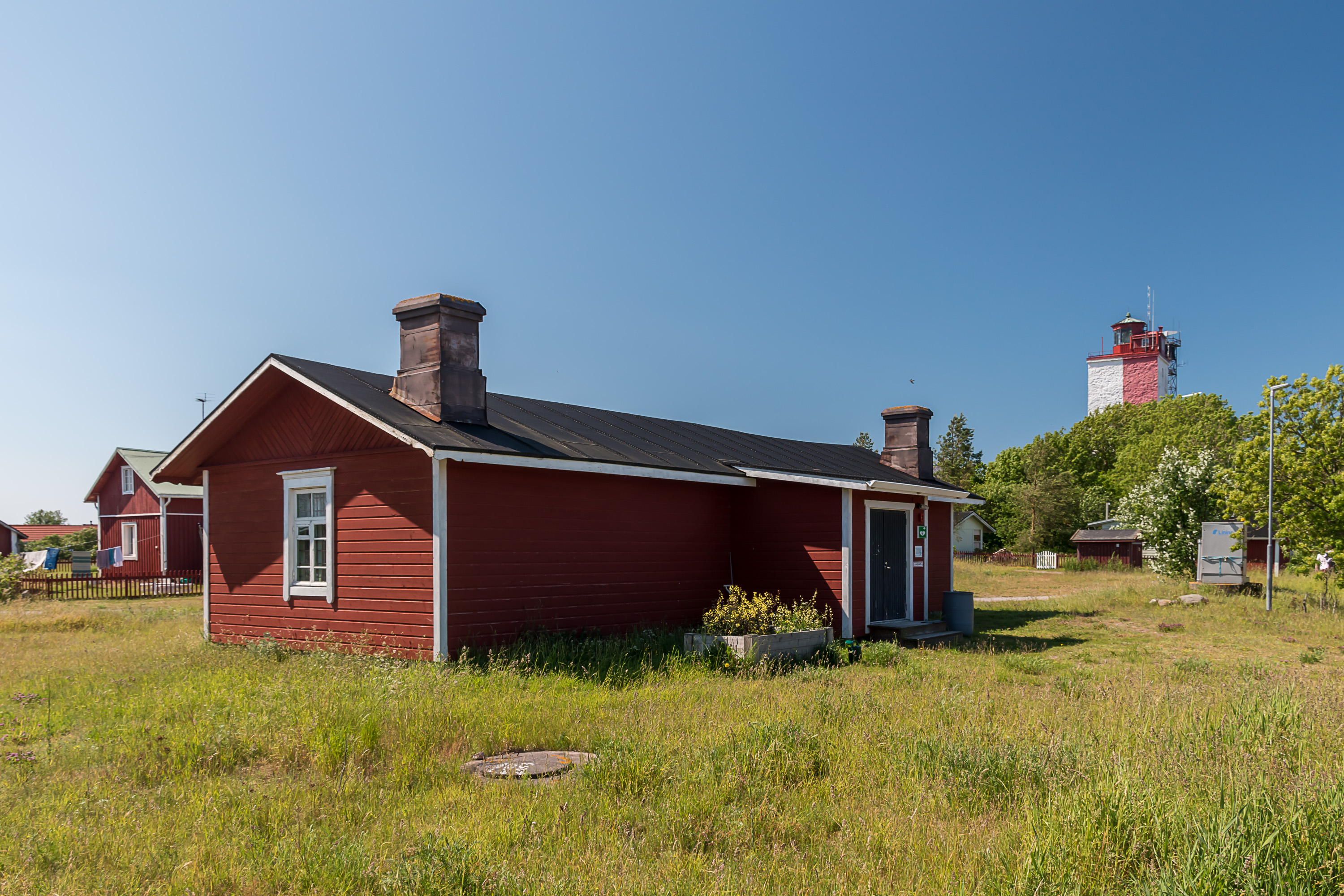
7. The rest house for the pilots. I don't know how many pilots exactly work on Utö, but I counted as many as four pilot boats.
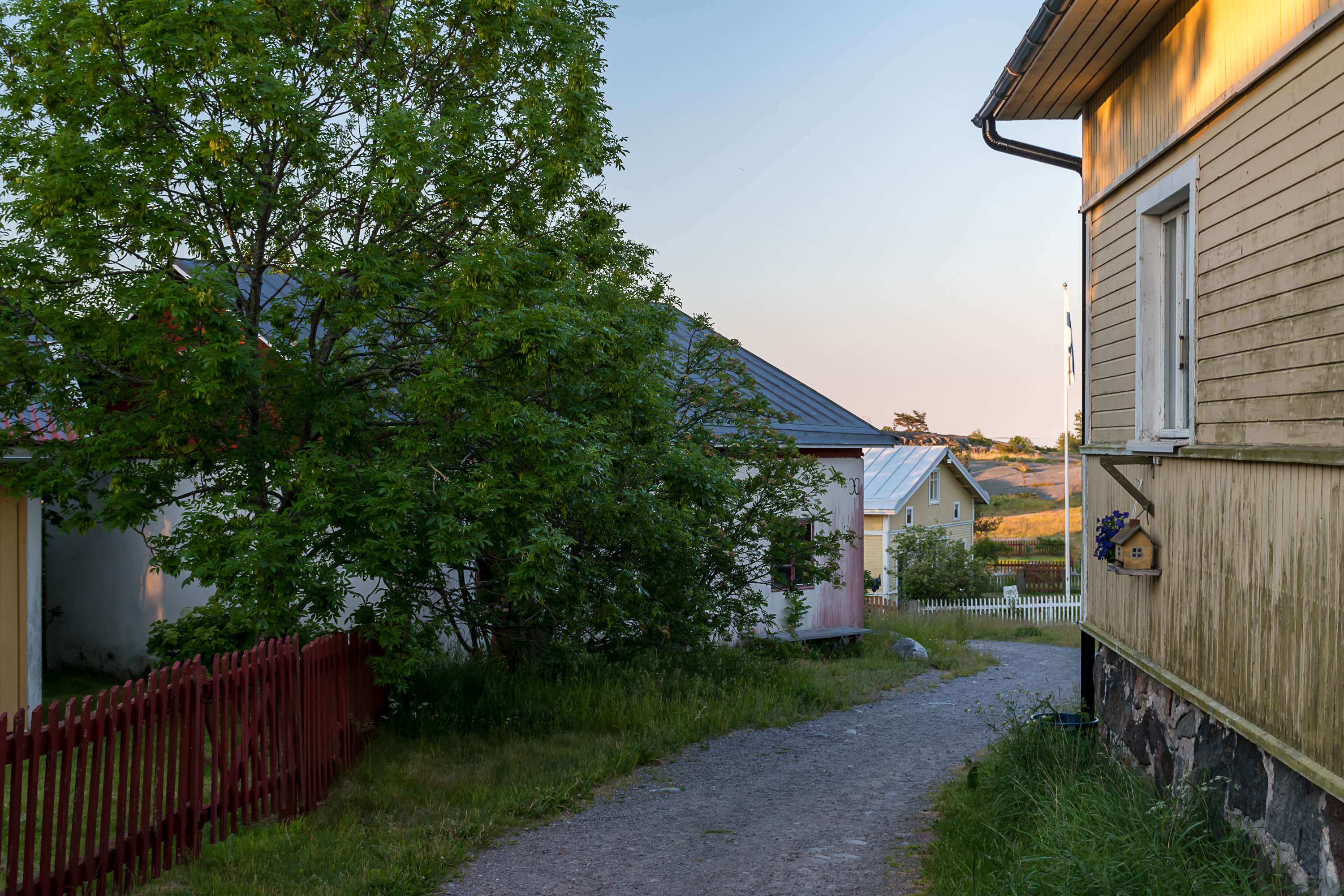
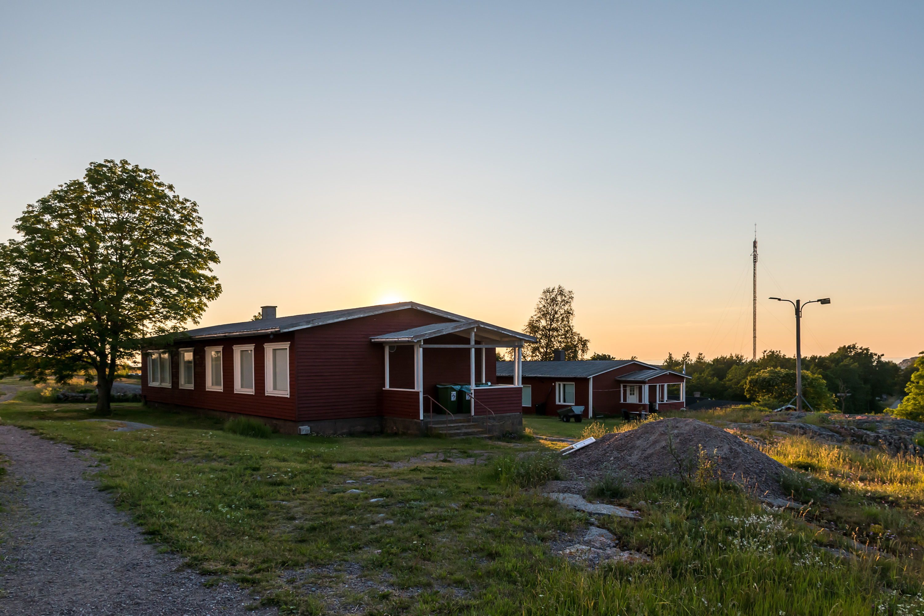
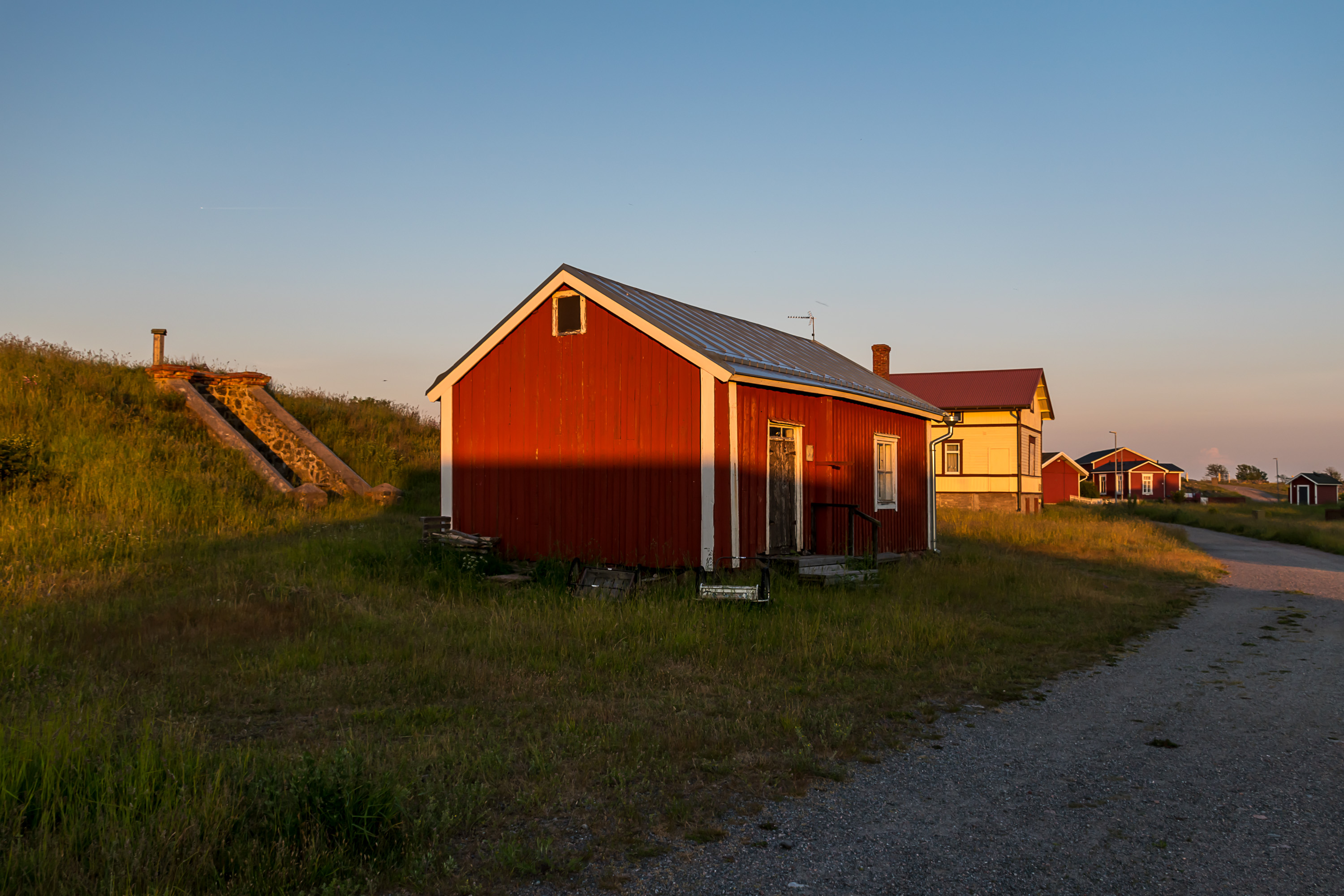
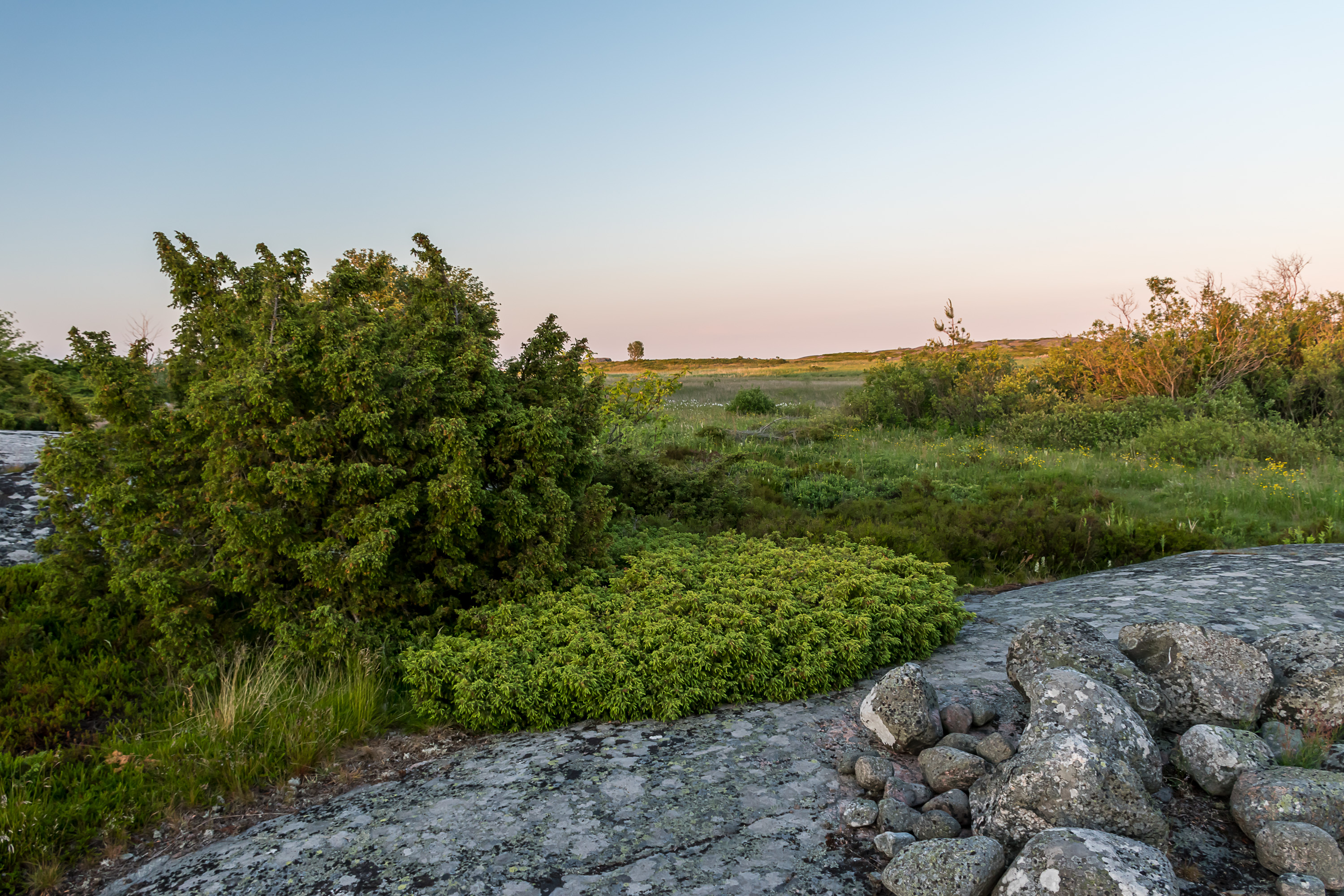
8. Going down from the lighthouse/pilots hill. Yellow-painted houses are all old pilot residences.
9. Memory plaques about the electrification of Utö, mentioned above.
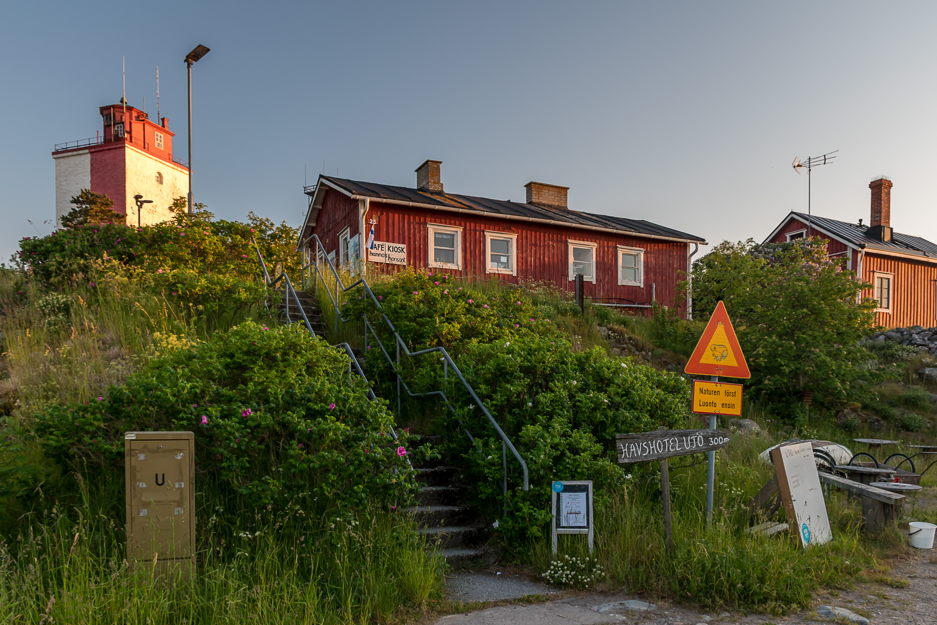
10. In the center of the village. The stairs go down from the pilot station to the harbor. The handmade sign says "nature first". There isn't all that much wildlife on Utö in truth; mostly just birds, also some mice and the like, and snakes. There are a few foxes and they are the biggest animals here. No hares, though.
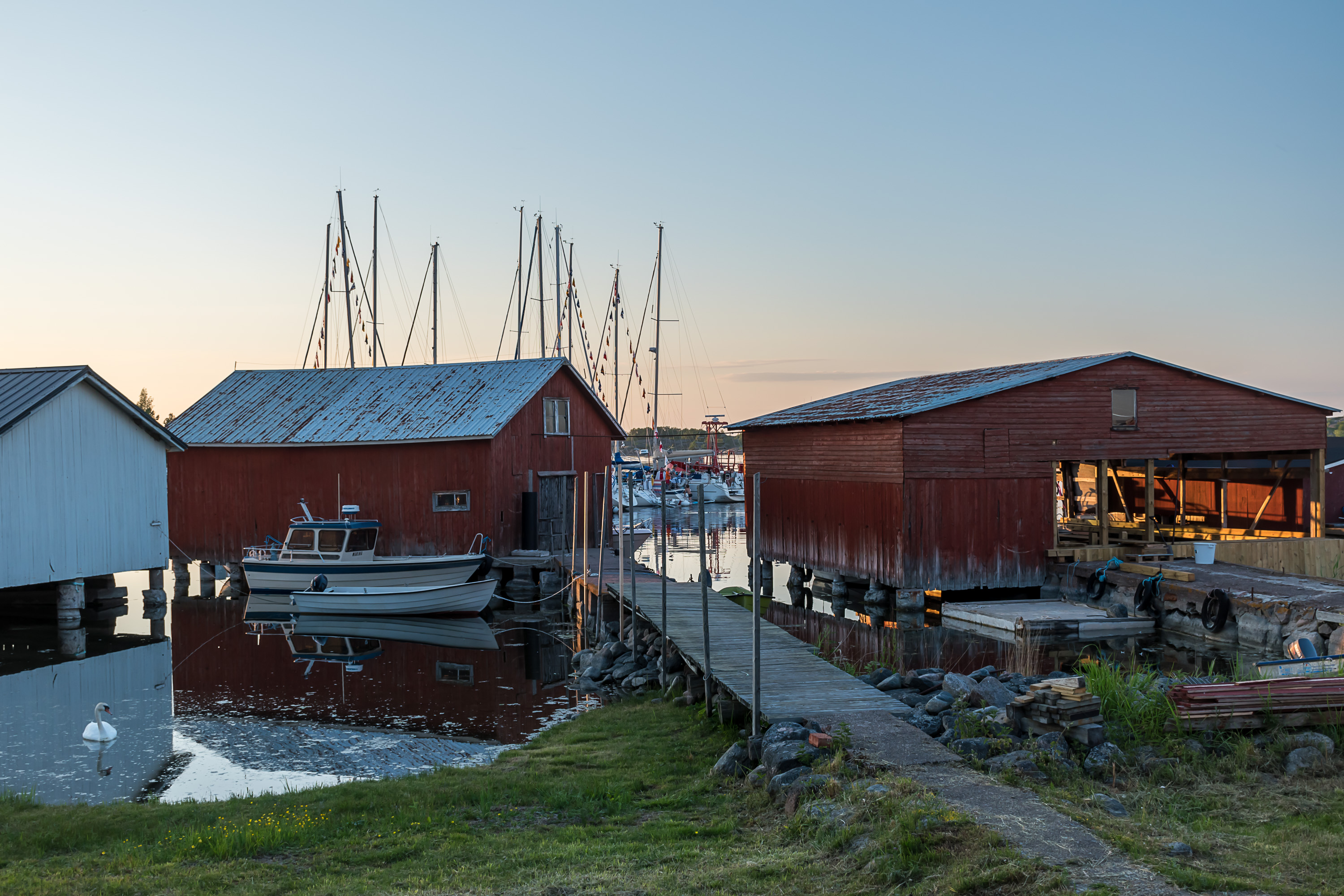
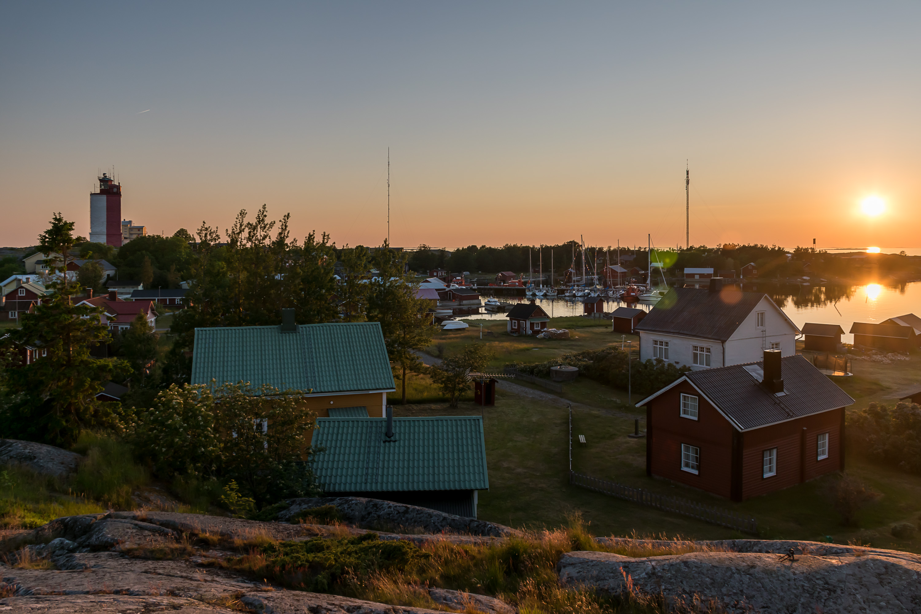
11. The village harbor.
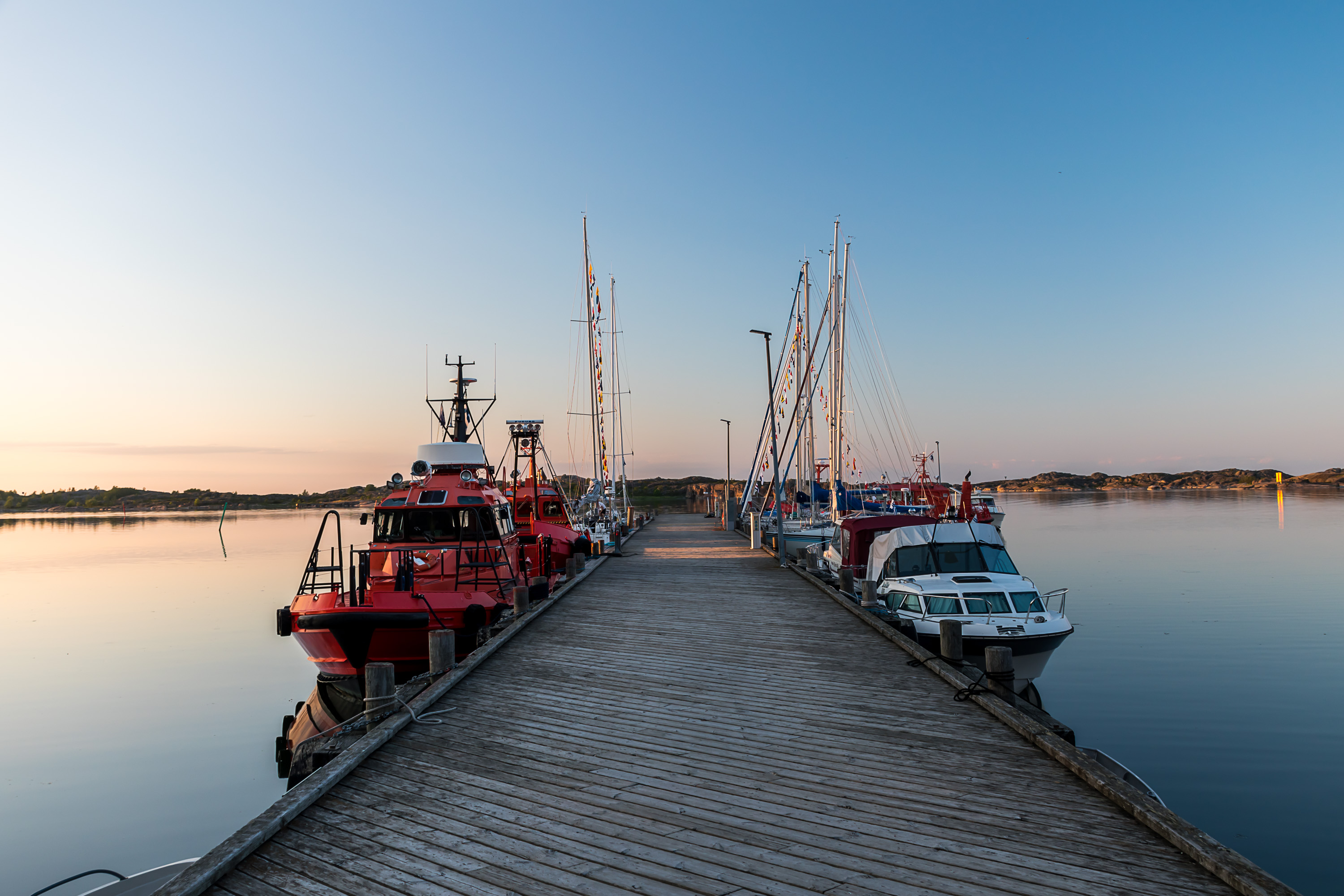
12. The pier, Stora bron (Swed. Large Bridge), built by Russians in the First World War, is used for guest boats as well as for pilot boats, to the left.

13.
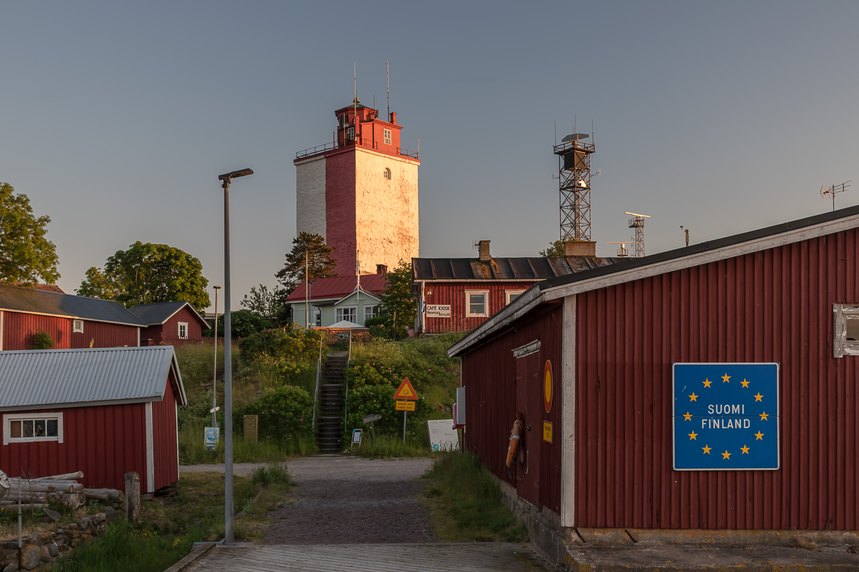
14. Suomi/Finland sign greets visitors at the harbor. However unlike Haapasaari there is no official border crossing point here. Visitors entering Finland by boat and requiring border formalities must do them in Mariehamn, Hanko, Helsinki, Haapasaari, Santio (at the very sea border with Russia) or Nuijamaa (at the Saimaa canal) before landing anywhere else.
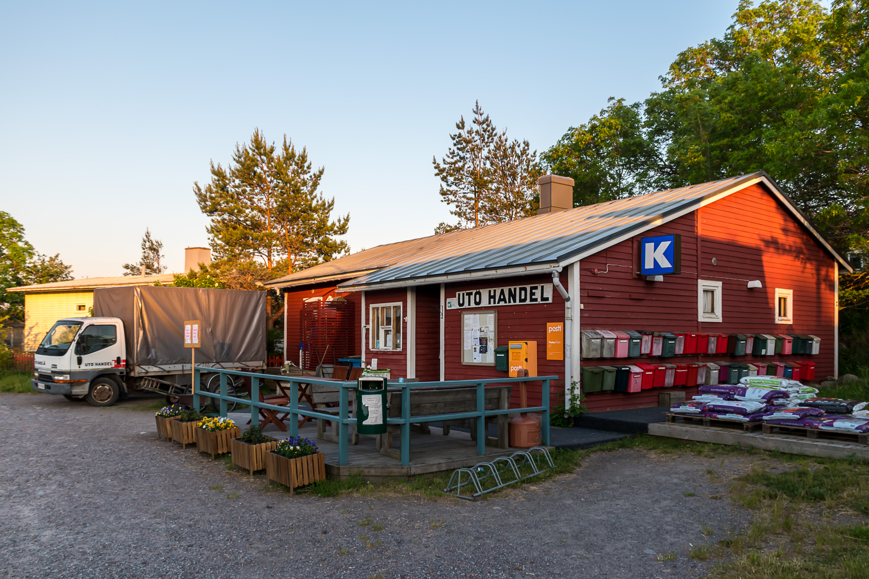
15. Utö Handel, the great little store of Utö, operating since 1933. It serves as an everyday meeting place for islanders, hence the tables. And also as the post office, and all the postboxes of the residents are also here. As the K sign hints, the store is formally owned by the Kesko group these days (same as K-Market/Supermarket/Citymarket stores).
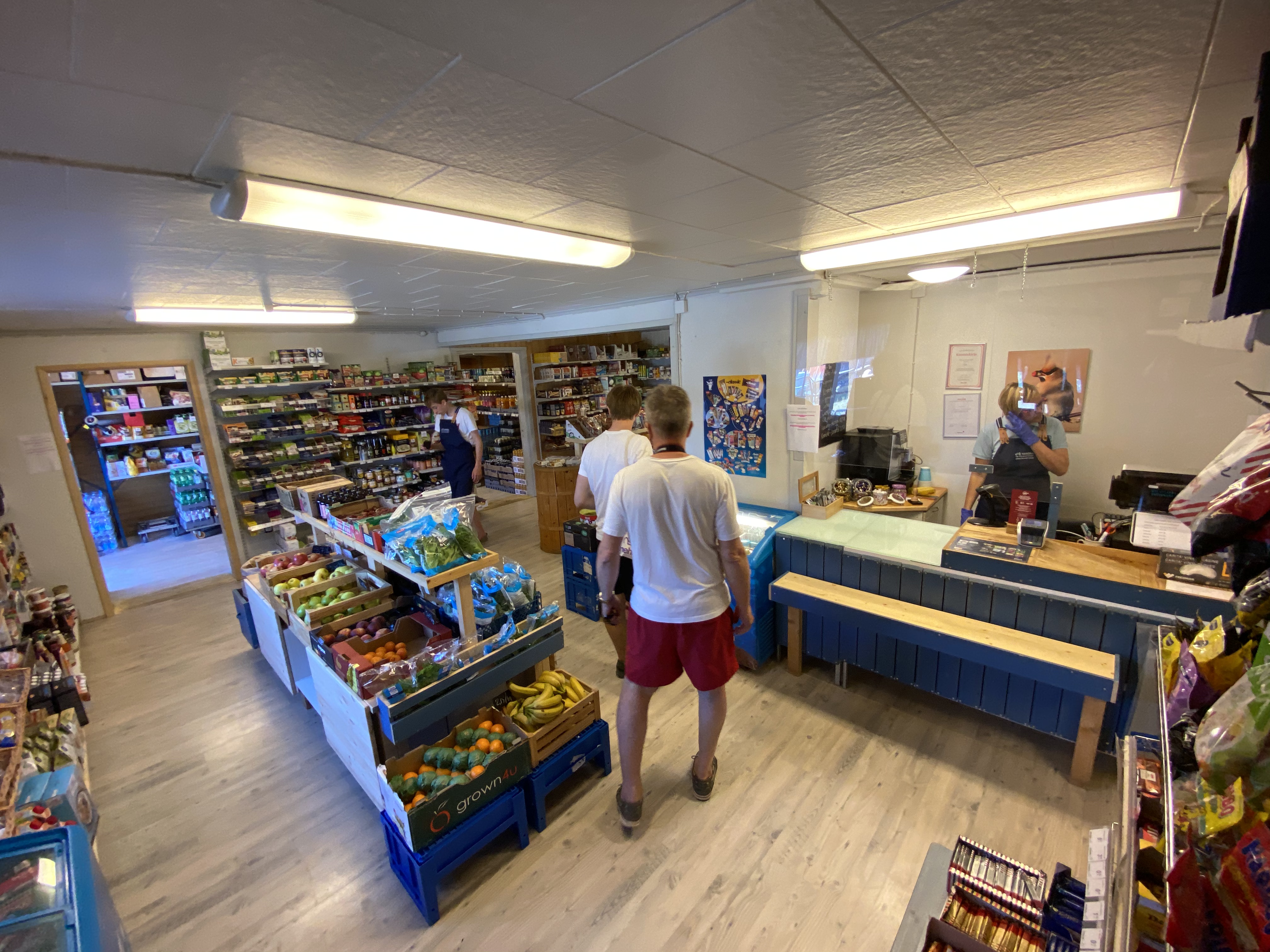
16. Phone picture from inside the store. Small but really cute and cozy. Opening hours of the store are rather limited, but in summer, when the tourists come, at least the shopkeeper gets some help from a summer worker or two. These summer workers are usually teens from the mainland. They usually work here not just one summer but several in a row, and of course many fall in love with the island, even though, according to an article about one such girl that I read, the locals might be not all that welcoming at first, some Swedish language knowledge is always required, and finding accomodation on the island can be very difficult even for such workers.
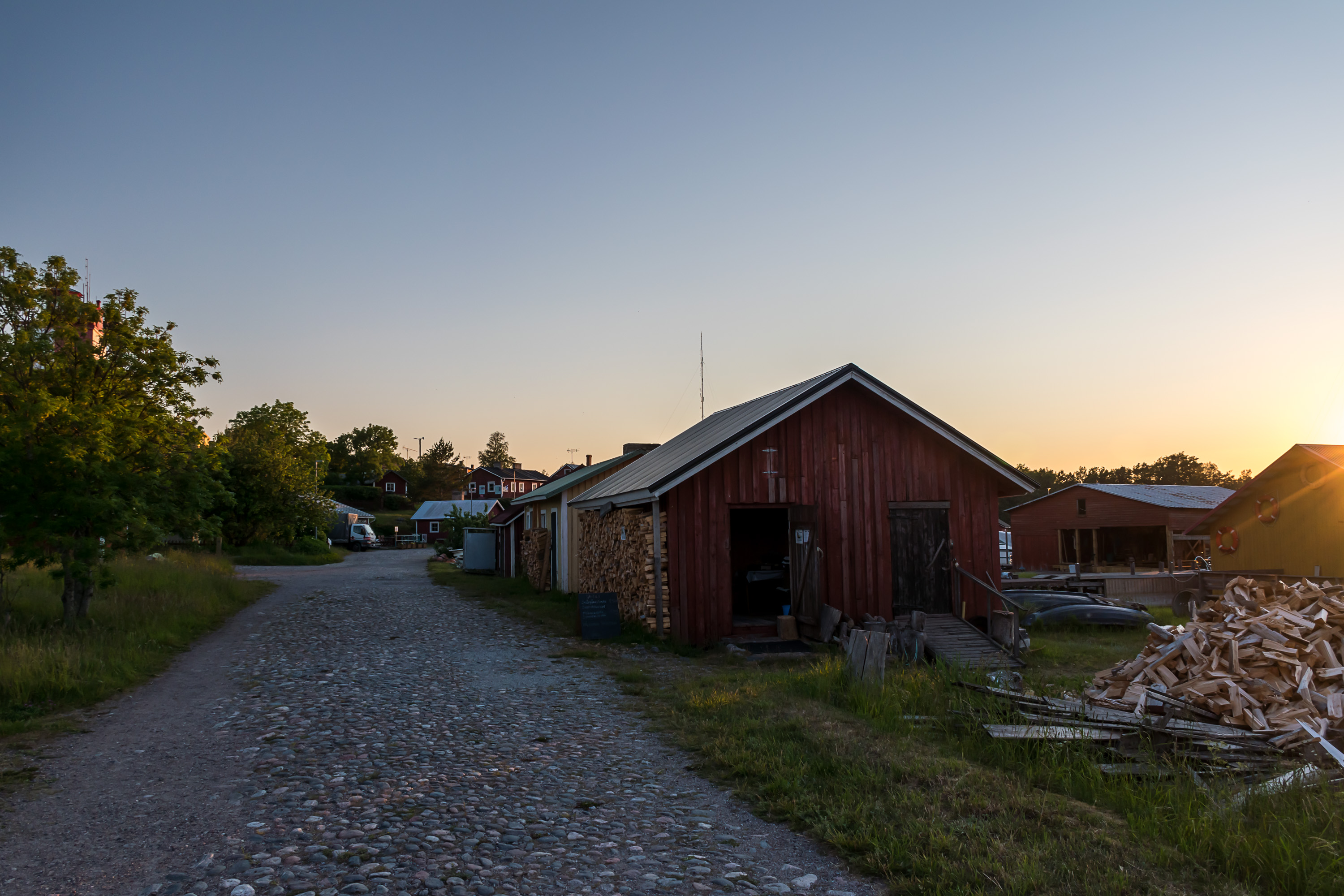
17. The "main street", also cobbled from Russian times. In the barn to the right they apparently also sell some local "archipelago bread".
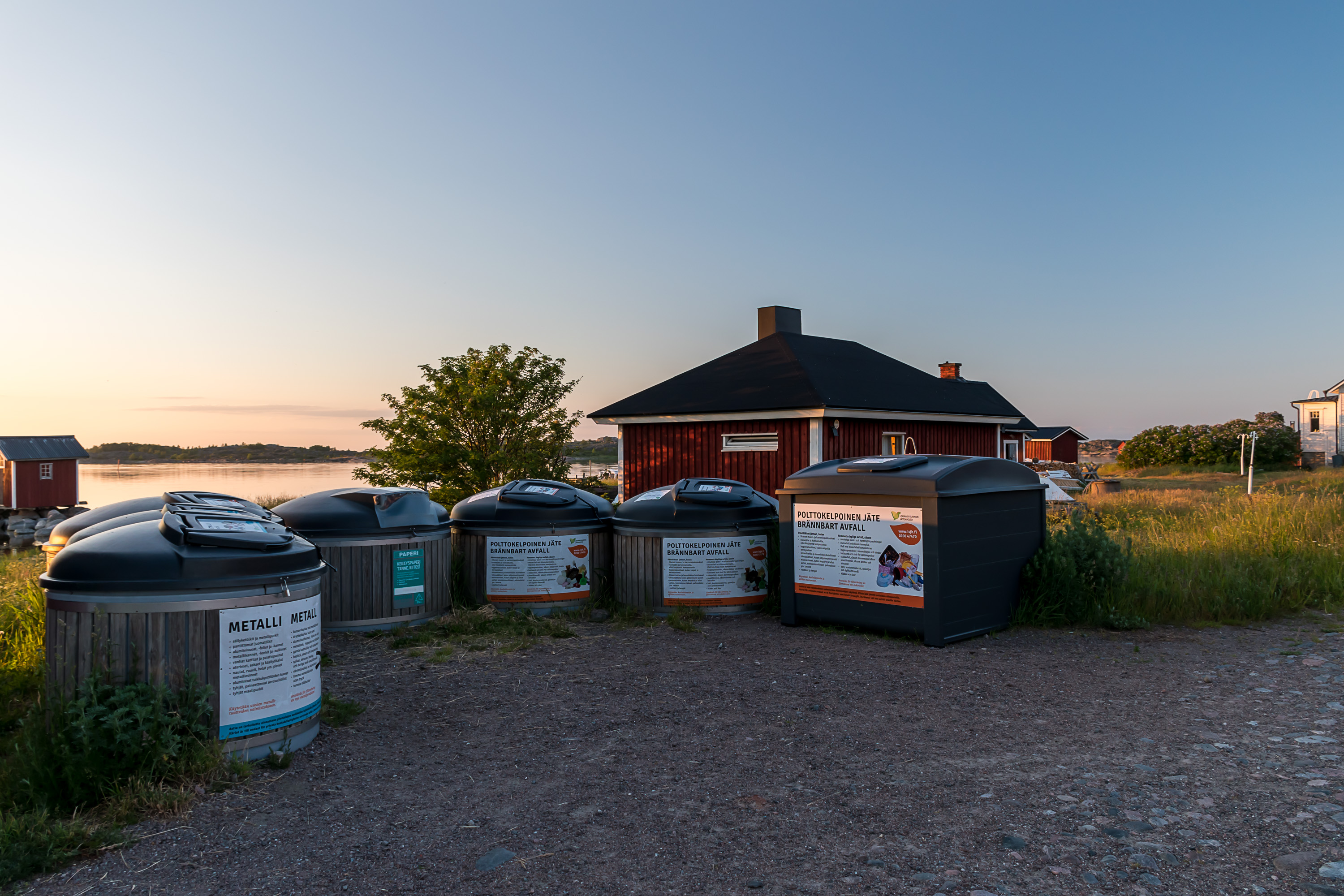
18. Since this is Finland, even such an island of course has proper waste sorting. This is the only complete recycling point. The trash gets moved to a very small recycling station in the east of the island (that I didn't see myself) which also accepts larger amounts of waste than fit here. Eventually it gets moved to the mainland for recycling/utilization. Very large amounts or waste or specific kinds of it (like gardening waste) need to be disposed of at the mainland manually.
19.
20. Red-painted buildings with such taller windows are all remaining from the Russian era (picture from the next day). The original garrison for the battery belonging to Peter the Great's Naval Fortress was stationed in these buildings. They all have now different uses of course. This one is used for smaller events, and also has a defibrillator for emergencies.
In general Utö doesn't have any kind of organized healthcare. Residents need to go to Korpo village (after a five-hour Baldur trip and then one more ferry and a bit of a drive) to the nearest health station, or all the way to Turku (like 75 km after a Baldur trip) to a hospital. Emergencies can be handled with a helicopter. In recent years the Finnish Red Cross association has trained some volunteers among Utö residents to handle some basic tasks.
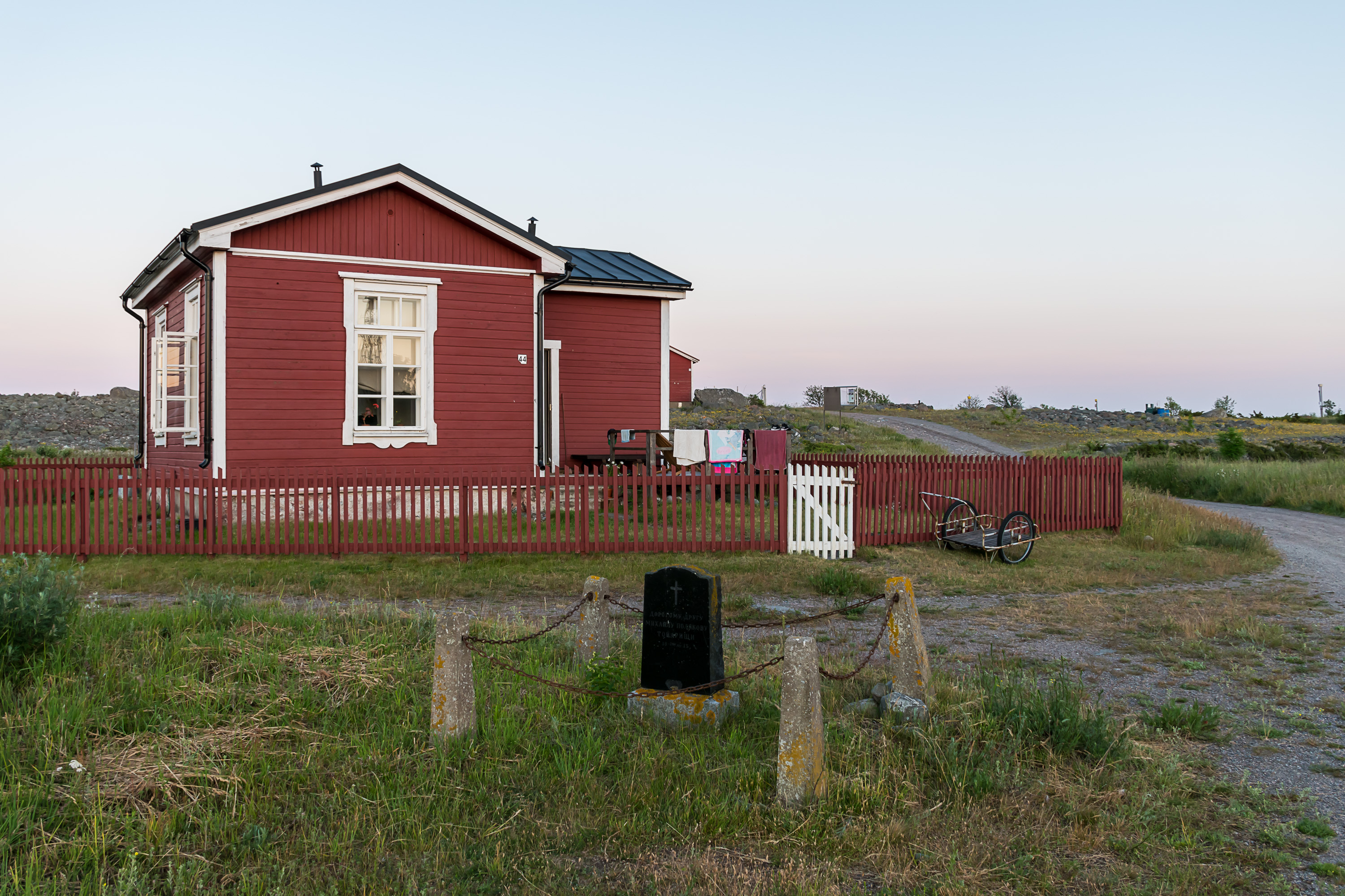
21. Another relic of the Russian era, the grave of Mikhail Polyakov (Михаил Поляков), a Russian telegraphist. He was the only casualty on Utö during the First World War; in 1915 the Germans attempted to bombard the island, but were surprised to find out that its guns were already operational, and were driven away quickly without any significant damage to either side. The telegraphist was the only one killed in the bombardment, by a random piece of shrapnel. He was buried right here by his telegraph station building (which is now used as a residential house).
22. On a small Fårberget hill overlooking the village.

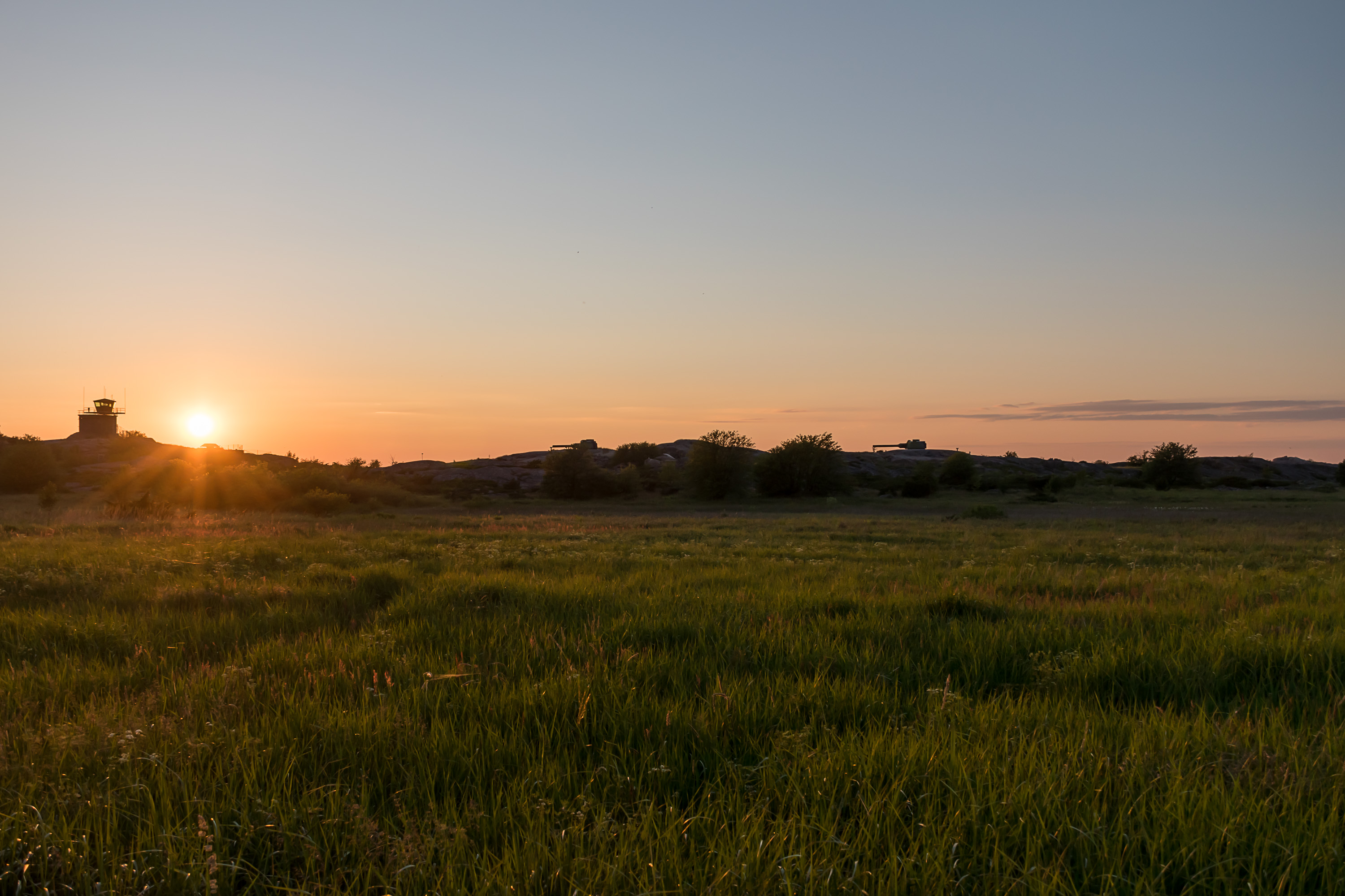
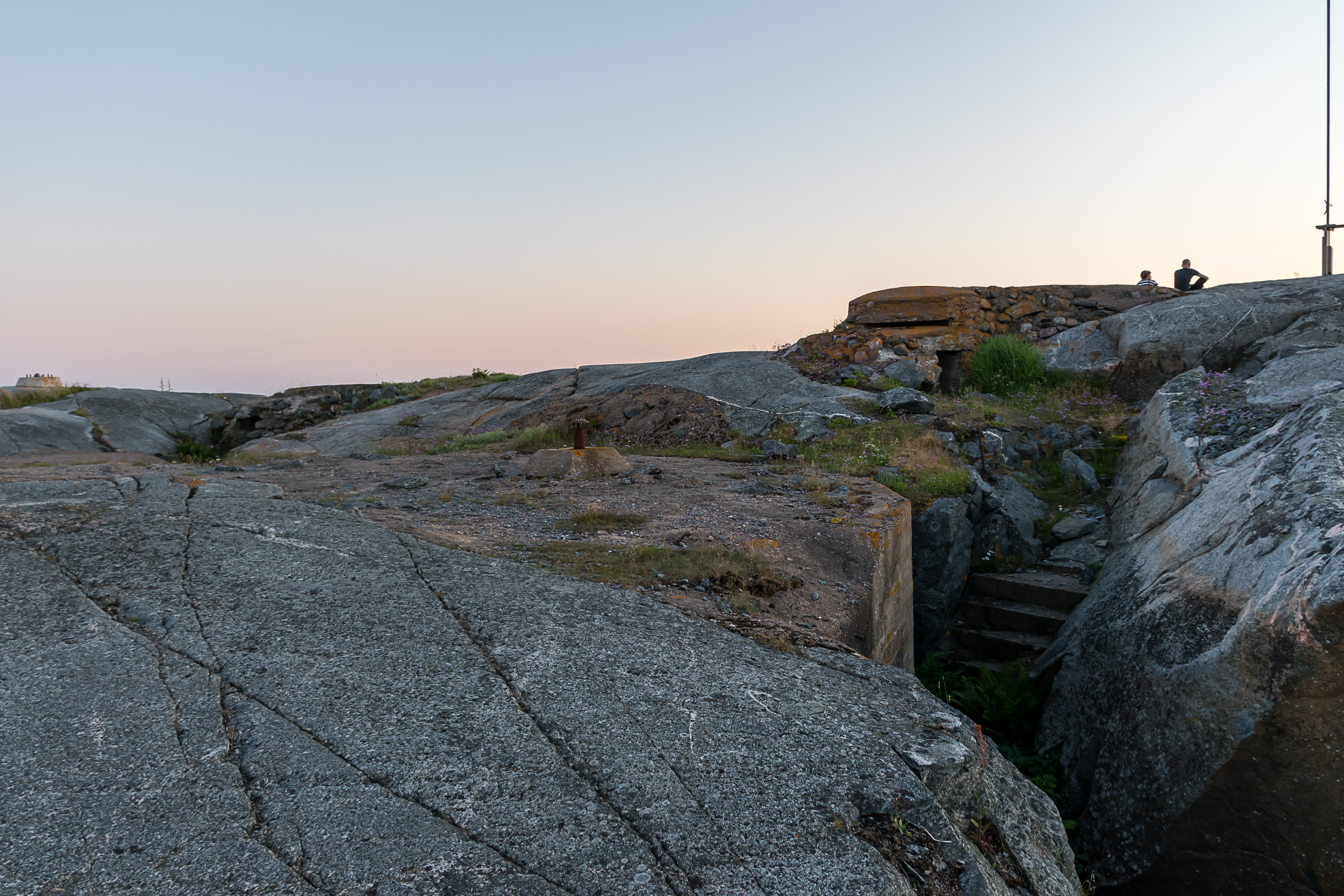
23. This hill is where the fire adjustment station for the island's guns is located. The station is still officially military property in use, although it is not fenced off properly.
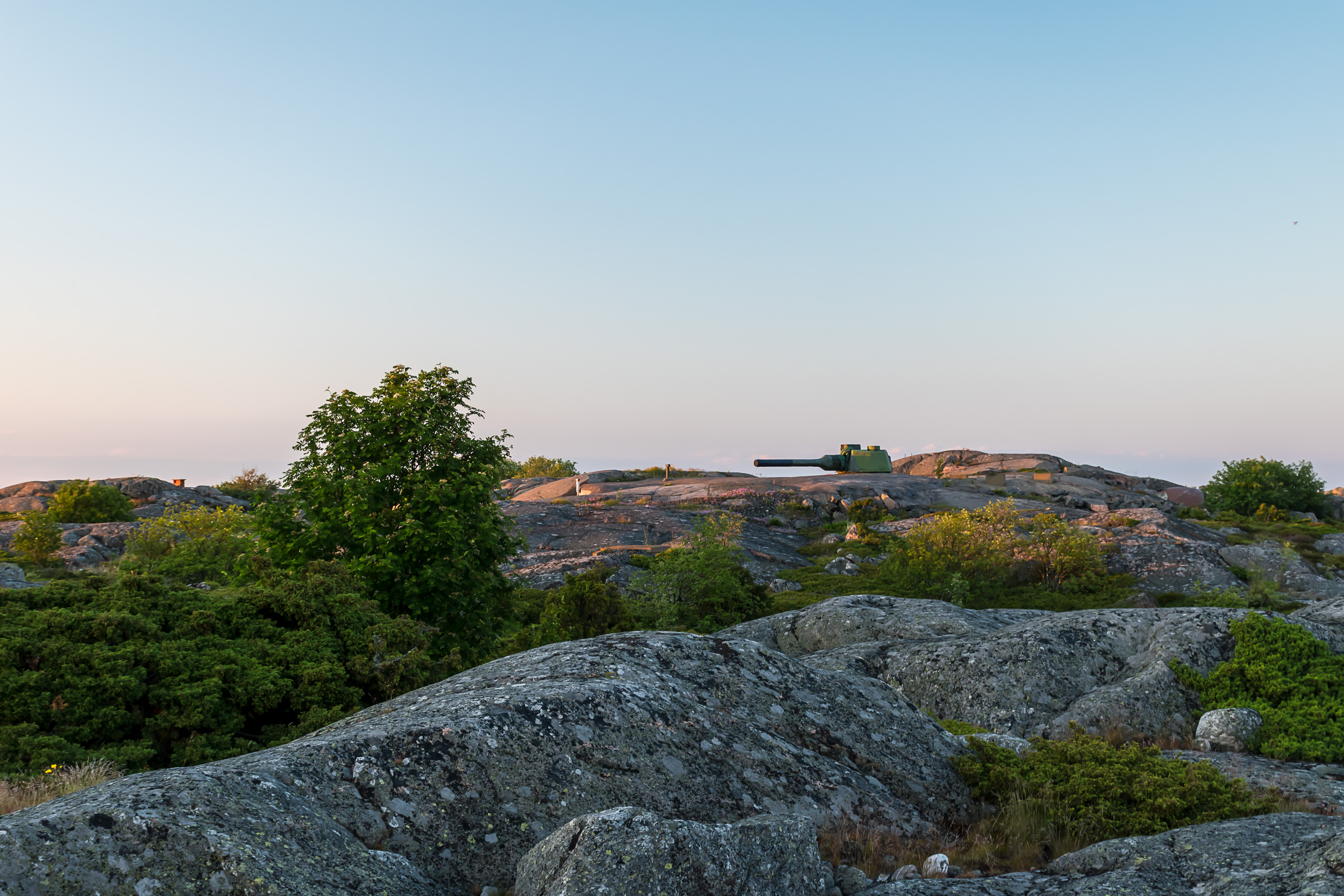
24. Two of the four remaining Utö's guns can be found nearby. These are 130 mm turrets of the 130 TK model, the latest (and probably the last) model of Finnish coastal artillery guns, designed and manufactured in the 1980s at the former Tampella factory in Tampere. This is actually the only ever model of Finnish coastal artillery guns to be fully designed and manufactured in Finland. But, as I told in the first part, by now these kinds of weapons are mostly obsolete (as missile munitions now rule the world, and also the potential adversary in the east is not as formidable now as it was in the Soviet era), so even these will probably be decommissioned in the 2020s. For now though these turrets are still operational, hiding among the rocks of Utö and seven other islands. They are now manned only for exercises, although, as the guide said, when the military comes here for exercises now, the exercises seem to be more about going to sauna than anything else.
Overall Utö hasn't really been such a major coastal artillery location as for example Örö or Isosaari (which I both visited this summer too and they too deserve a post someday). Especially in the first decades of the Finnish independence the fortifications and guns were nearly completely neglected. During the Winter War this policy reversed quite rapidly, and the island got temporarily a garrison so big that nearly all the civilian residents had to be evacuated for the duration of the war; their houses were used for housing the troops, and were painted in camouflage colors. Still Utö never had any really huge guns, such as 305 mm Obuhov ones.
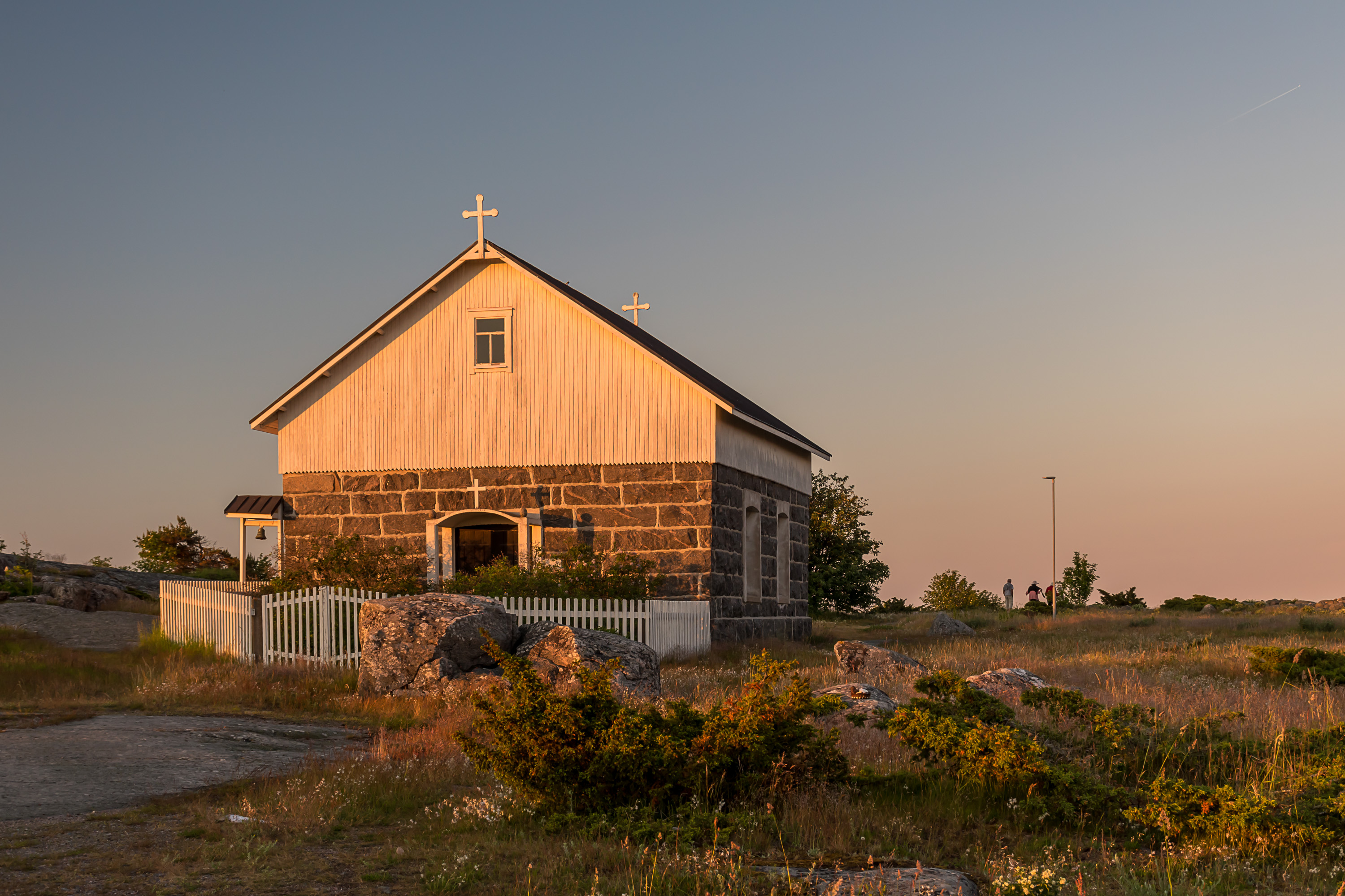
25. The chapel was built on the island in 1910. One of the reason why it was deemed necessary was that it had been simply too difficult to climb the stairs to the lighthouse church for aged people. Like some other buildings it was a volunteer project by the islanders, and it still actually belongs to the islanders rather than church. Nowadays there is only one official service per year, on Christmas, but the chapel can still be visited freely.
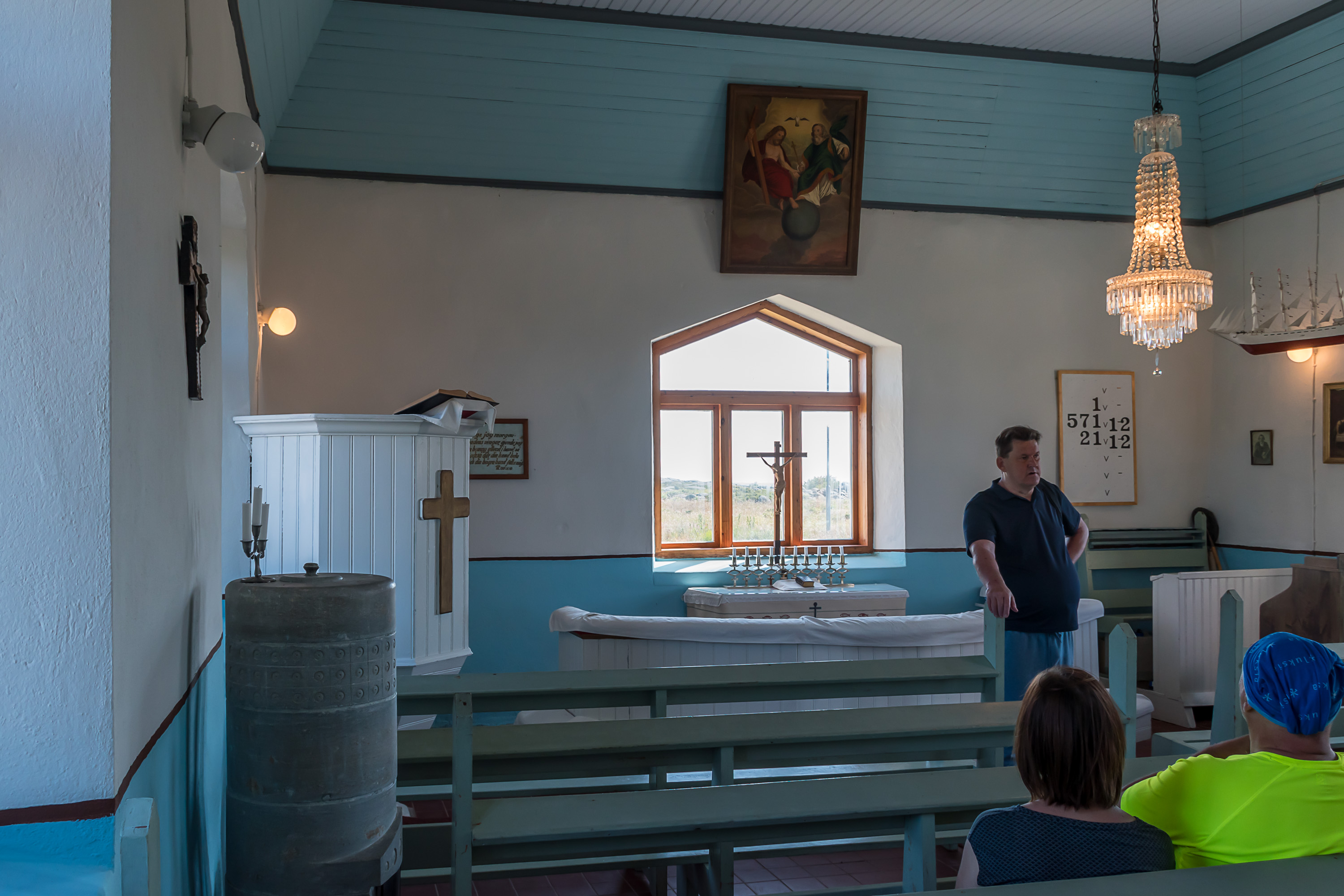
26. The chapel is not all that fancy inside, but one detail is actually more important than you could think. The ten candles near the crucifix at the window are dedicated to the ten casualties of the sinking of Park Victory, Utö's best known shipwreck.
Park Victory was one of the 534 Victory-class cargo ships, built in huge quantities and at great speed in the latest years of the Second World War in the US. Of course they were used for many years after the war too, but not Park Victory, which sank at Utö on 25.12.1947, on the Christmas Eve. The steamship, 139 m long, with its crew of 47 was on the way from Newport, Virginia to Helsinki with a shipment of coal. In the evening of 24.12, approaching Finnish waters and already having a pilot from Utö, Nestor Lindström, on board, it encountered a severe storm and attempted to anchor near Lillharu islet, about 5 km south off the coast of Utö. A major reason why Park Victory didn't want to proceed in a storm at night was that the minefields of the Gulf of Finland, dating from the war, still hadn't been entirely cleared, and the fairway towards Helsinki was narrow and dangerous. The storm however was bad enough that at night the anchor didn't hold, and the ship got repeatedly slammed against the shallow, seven times in a row; each time it managed to free itself, but with the final blow water rushed inside the engine room, and the boilers exploded soon afterwards. All crew managed to escape (with a great deal of hardship too, barely avoiding some deaths) to the little islet, but help from Utö (including boats from the garrison and a pilot boat) could reach them only in almost two hours due to communication delays and the severity of the storm. Most of the crew weren't dressed for the weather (it was also a snowstorm, with tens of centimeters of snow falling overnight) and ten people died before the help reached them.
The remaining 38 men were rescued and got first aid on the island, cared for in individual islander homes. Some people from the crew were black, and many Utö residents had never seen black people before and tried to scrub them with brushes, believing them to be dirty with soot. All rescued men recovered and eventually returned to the US. Utö people eventually got a letter of gratitude from the US government (which is also displayed in the chapel), and a load of sugar and coffee from the survivors; both still expensive things in the postwar years. The islanders sold sugar and coffee and ordered this candle stand for ten candles, each in honor of a Park Victory casualty. The US investigation ruled the sinking "an act of God"; no fault was found with the actions of the ship's captain, Allen Zepp, or any of the crew, the local pilot assisting them, or the islanders.
Park Victory remains to this day the largest known shipwreck within Finland's territorial waters (e. g. Ilmarinen or Estonia are outside of those). Lying close to Utö at the depth of 27-36 meters and originally fairly well preserved, it has been a prime destination for divers to explore, although by now the wreck decayed enough that this started to be quite dangerous. The ship eventually developed a fuel leak, and in 1994-2000 it was drained of the remaining 410 cubic meters of fuel oil, at a considerable expense to the Finnish state. Most of the original load of coal had to be lifted up in process, and that coal was gifted to the Jokioinen museum narrow-gauge railway, as a fuel for their steam engines.
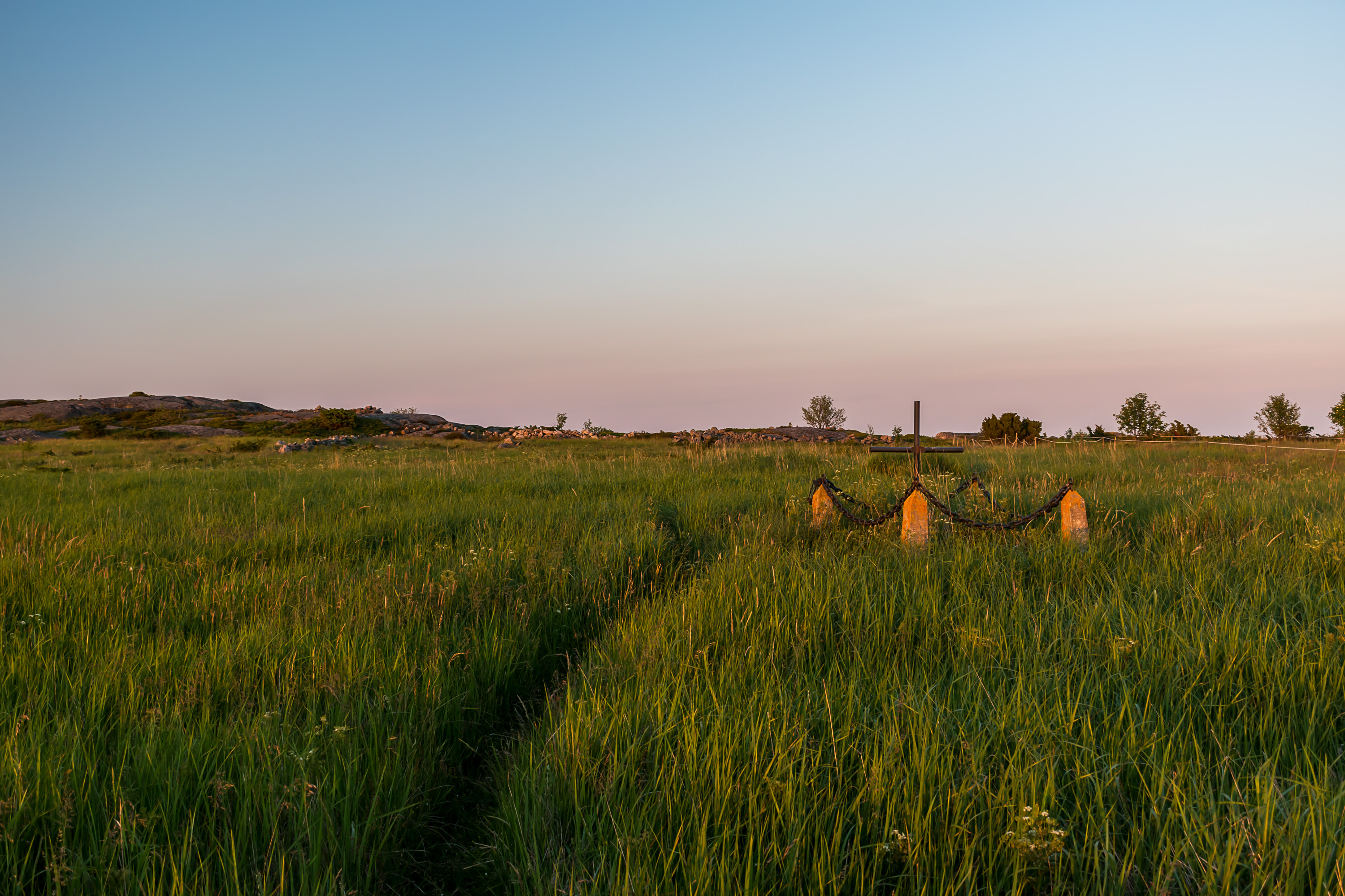
27. Behind the chapel some rather lush meadows open up, named Österäng, literally "Eastern Meadow". Among them you can spot another lone grave, this one of the German seaman Buchwald. His body was washed to the shore of Utö in December 1916. He was possibly killed in the same battle where the Russian telegraphist died, although that battle had taken place over a year before.
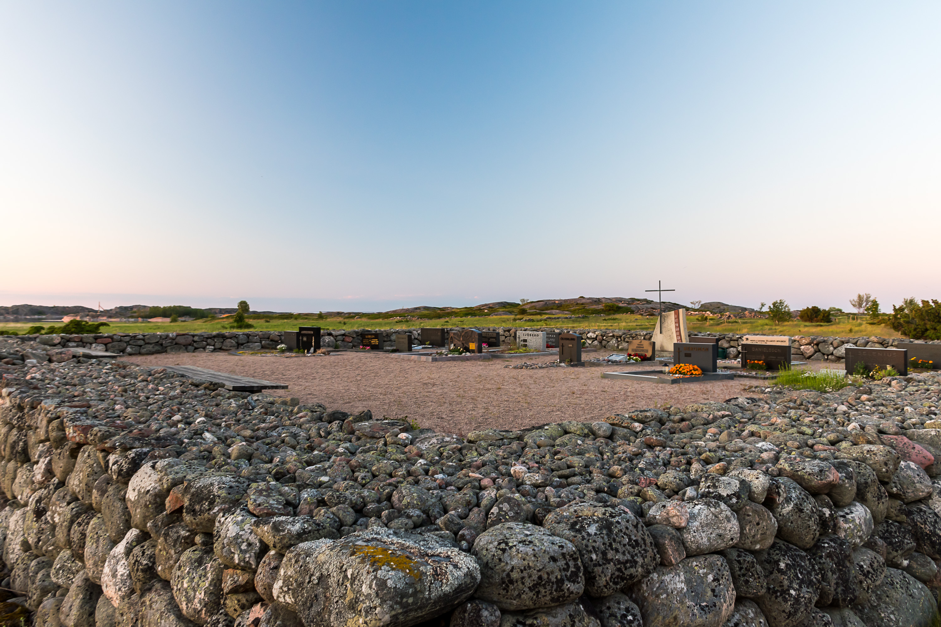
28. Utö's actual graveyard nearby is very small. It is also relatively new, built in 1962. The island's ground was simply not very suitable for a graveyard (the Russian and German lone graves notwithstanding), and for centuries dead were buried on the island of Jurmo (which we briefly saw from Baldur in the previous part). Travel to Jurmo itself could be a dangerous ordeal in winter, and while the body was buried, the last rites could be performed only in summer when a priest from Korpo visited Jurmo. All gravel for this graveyard had to be brought to the island from elsewhere.
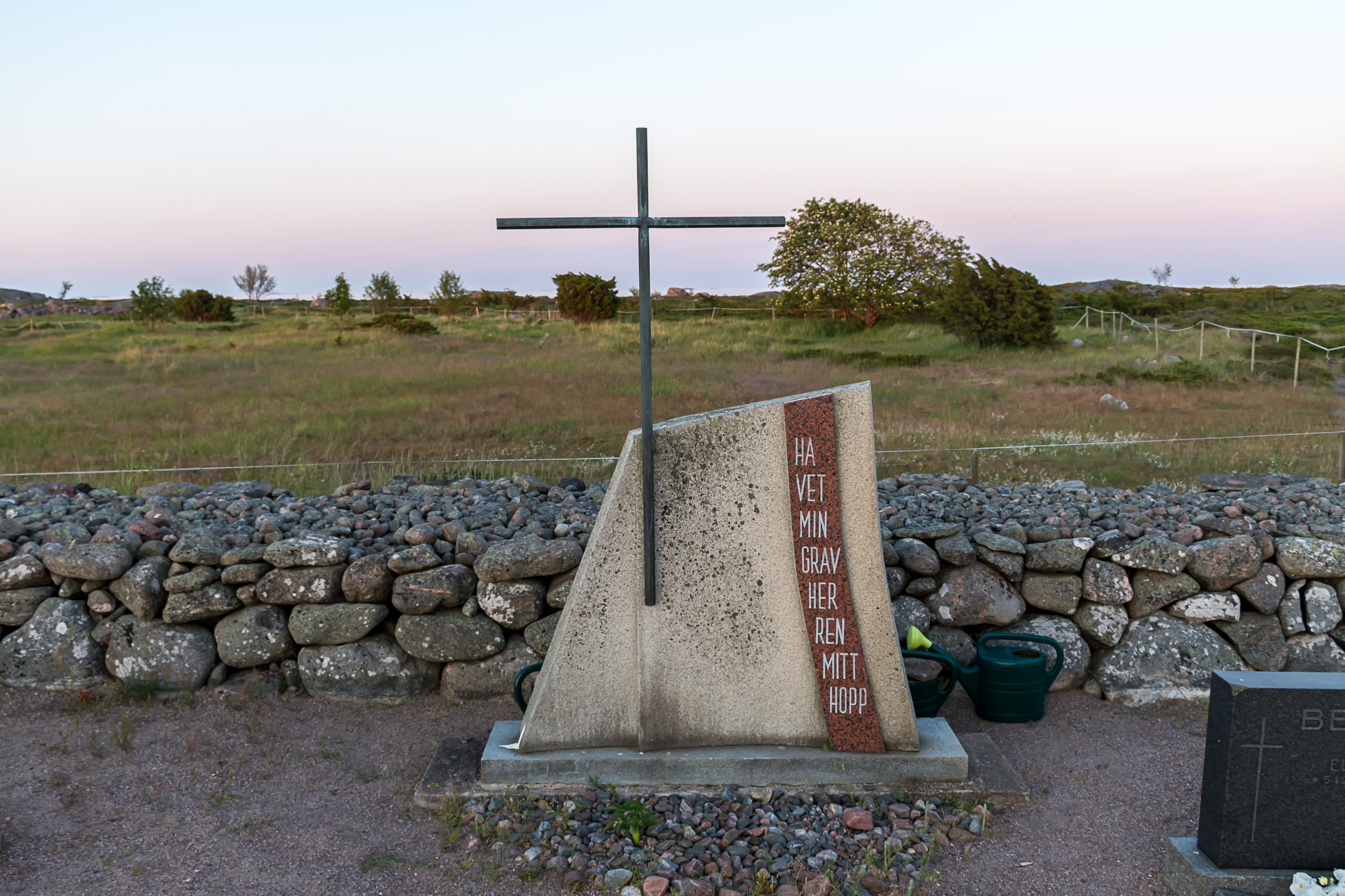
29. "The sea my grave, the Lord my hope."
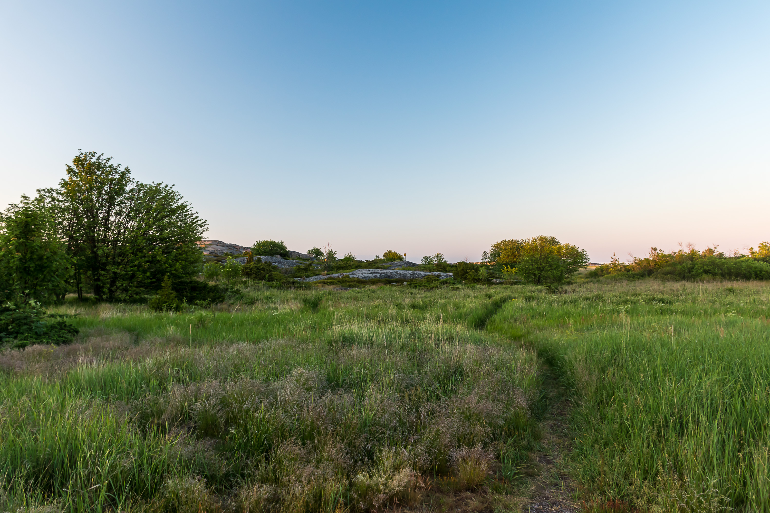
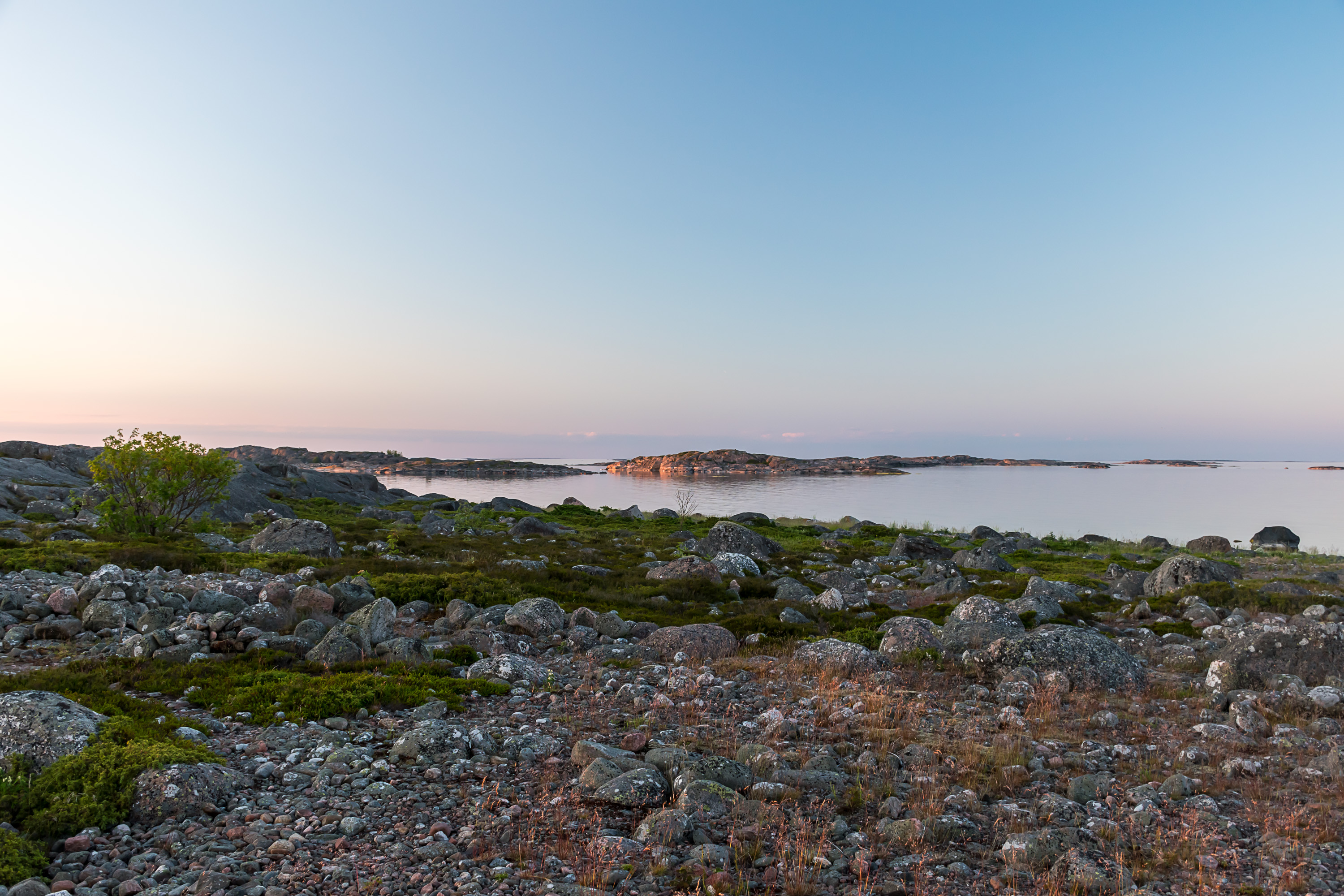
30. Österäng. The meadow had been used as a pasture for many years; the island used to have over 20 cows at most, but by now there is no cattle of any kind anymore. This place reminded me a bit of Vadsö in Varanger in North Norway.
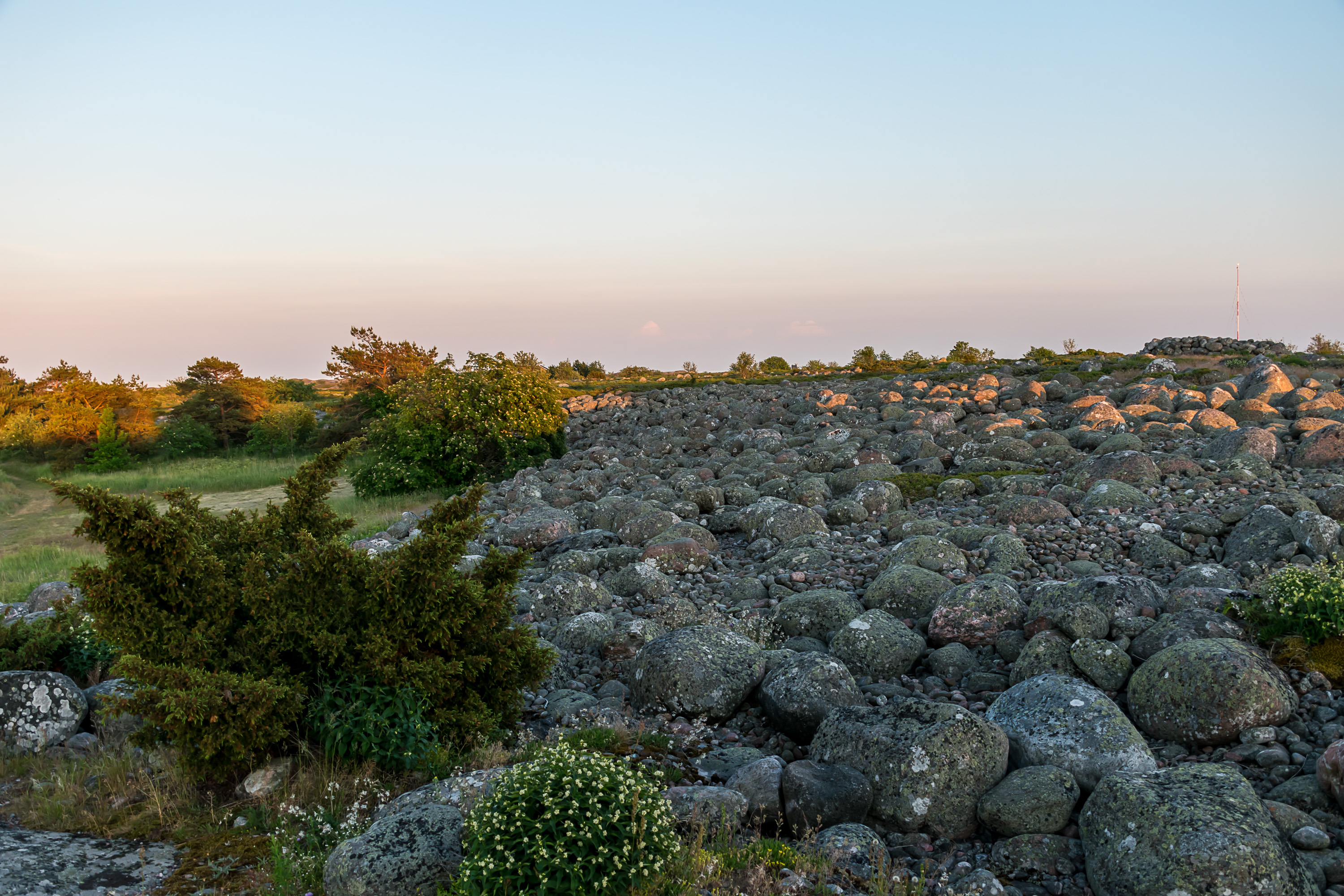
31. A stone field in Österäng is the very last part of the same Third Salpausselkä moraine ridge that forms the bulk of Jurmo.
32.
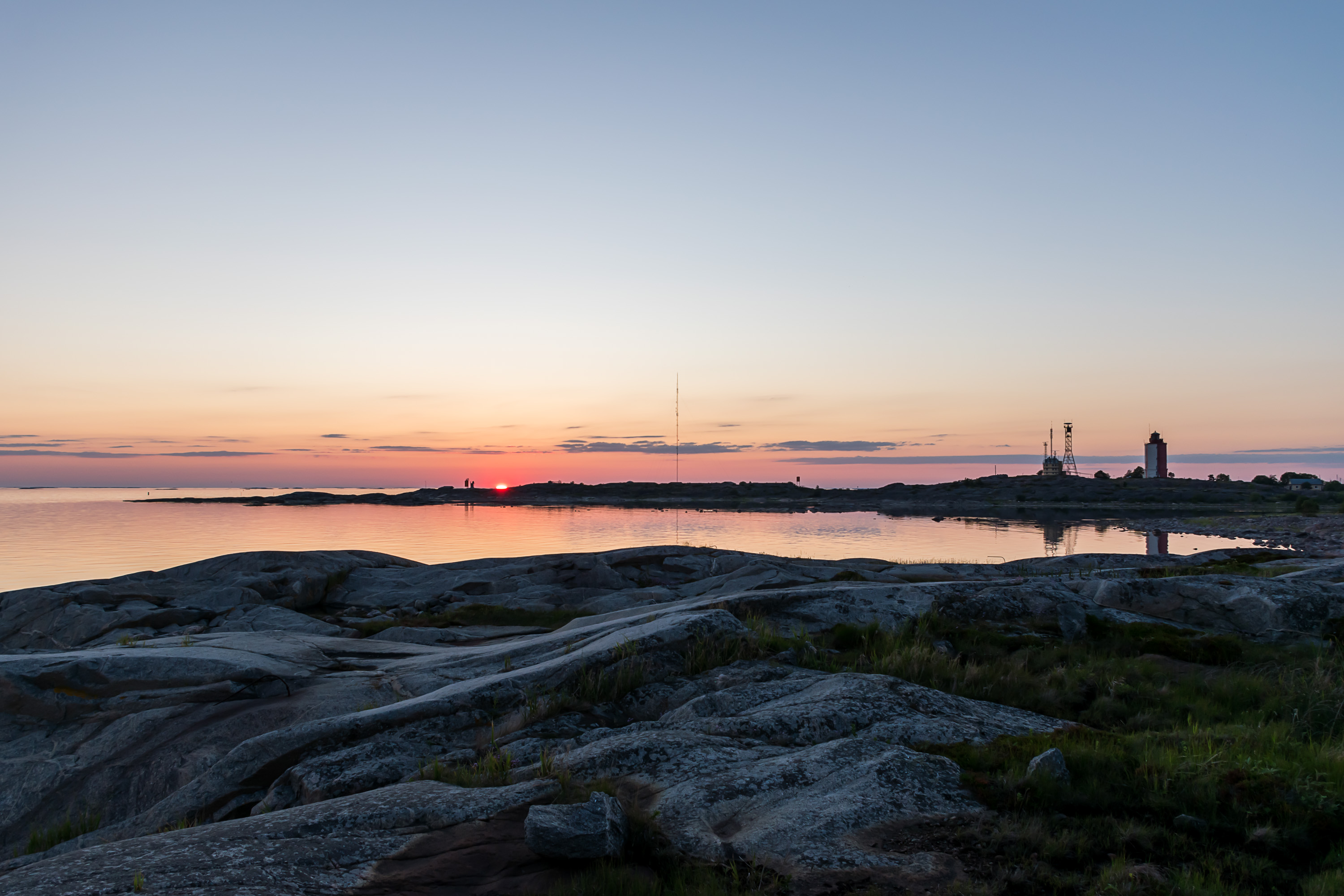
33. Looking carefully, you can spot the silhouette of the two 130 TK guns against the sunset.
34. The meadow is a very beautiful place, and like Jurmo stone fields it looks weirdly northern.
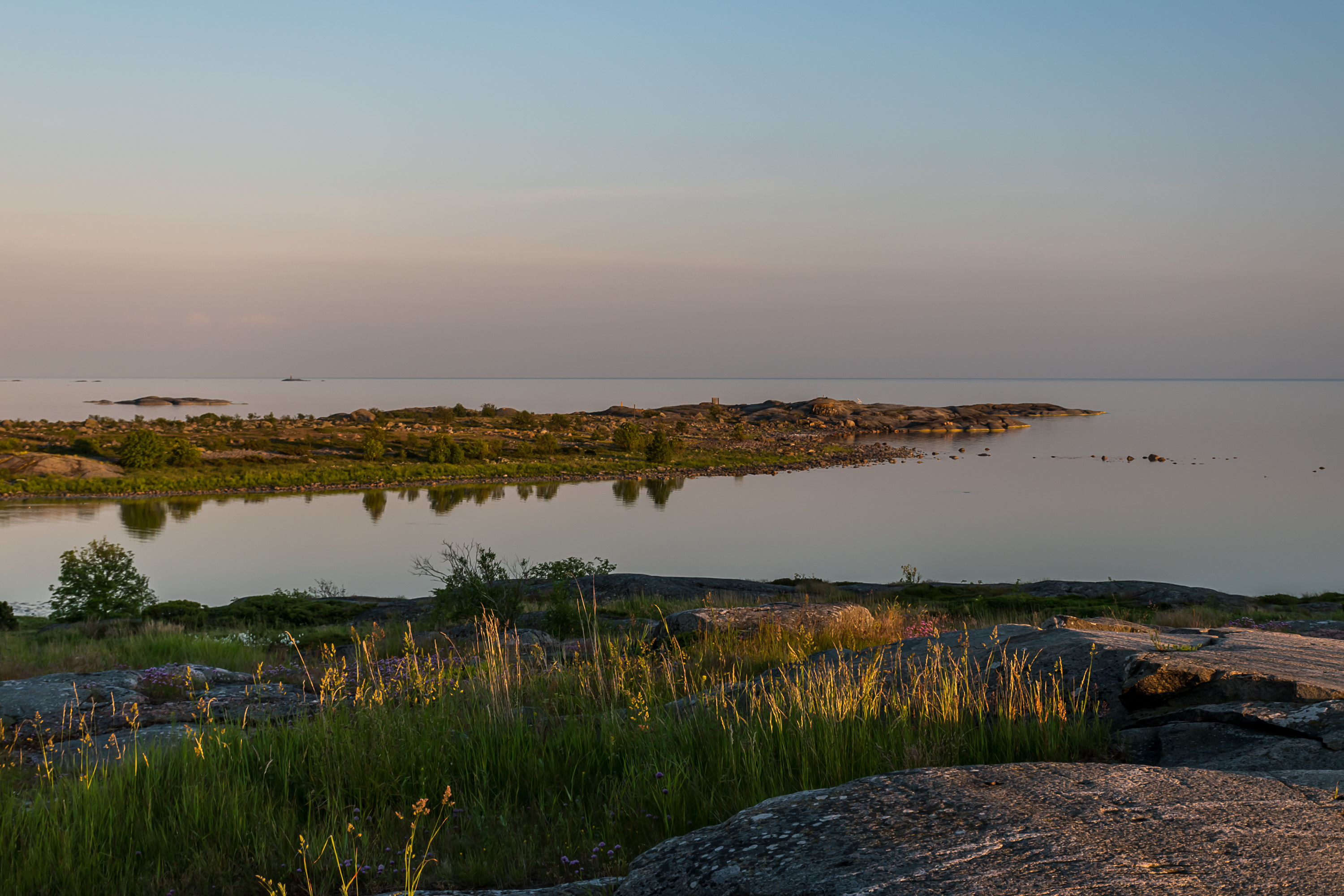
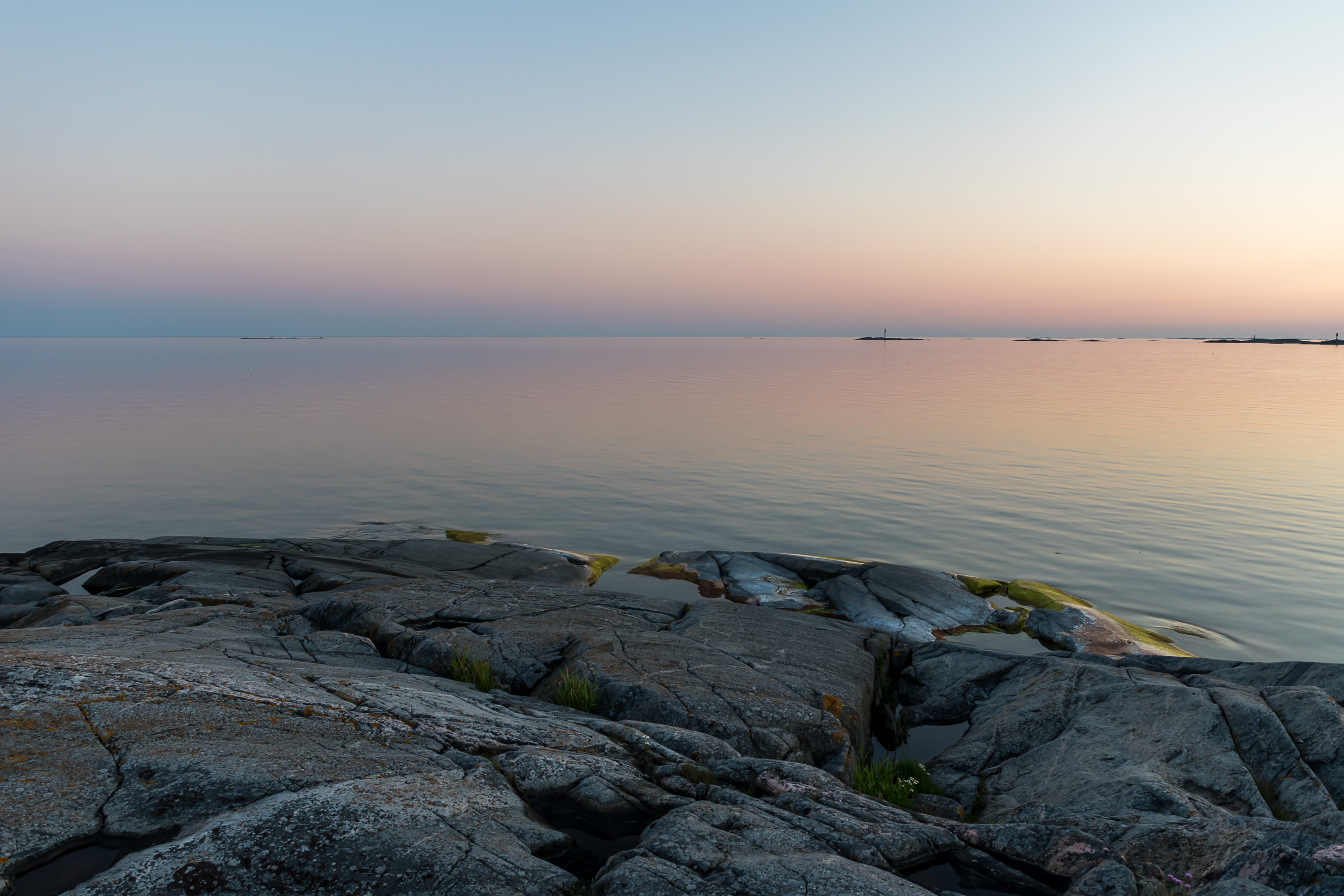
35. And the final place we'll see is Kesnäs peninsula, the southernmost part of Utö, seen here from the lighthouse hill.
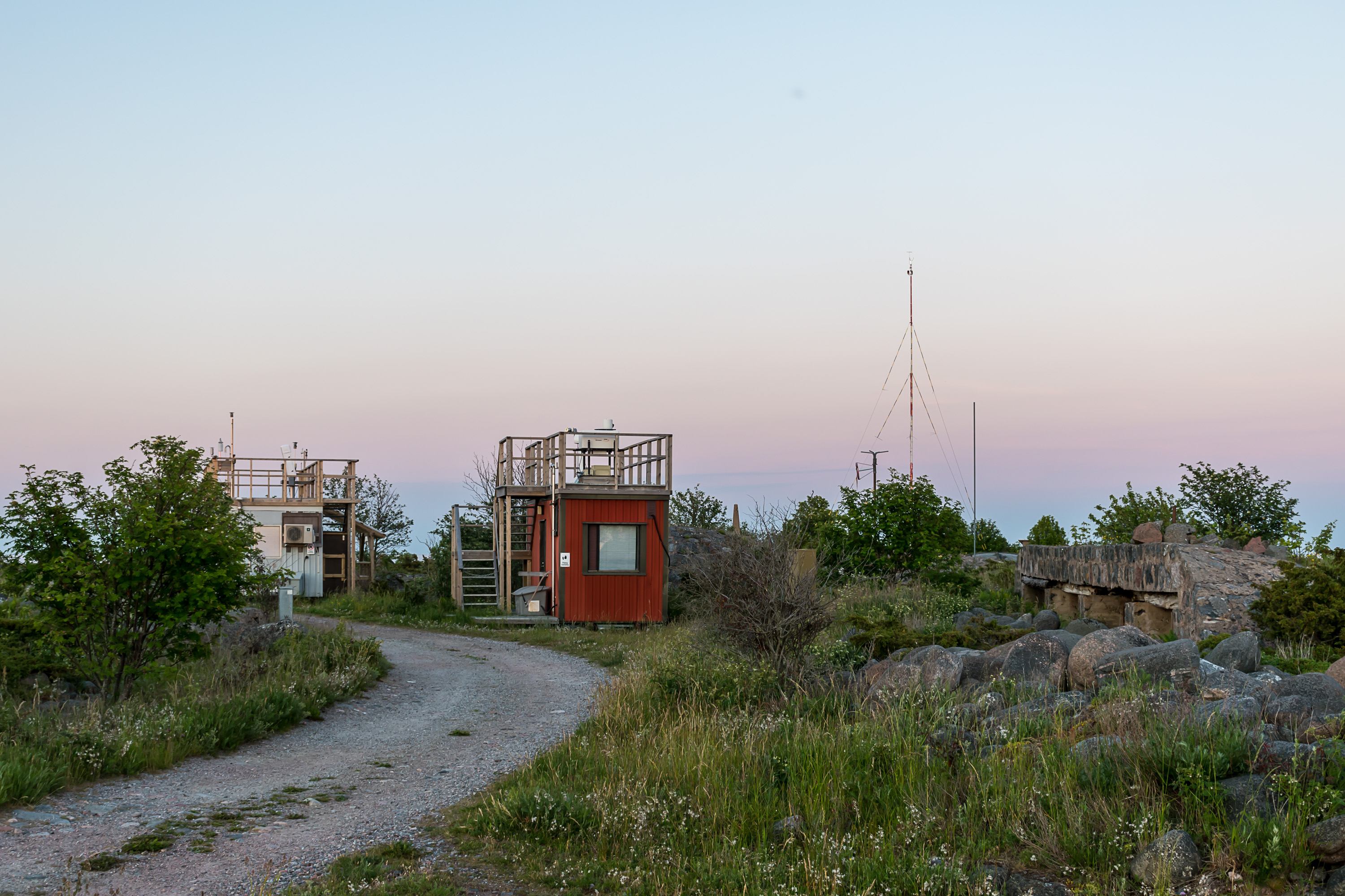
36. Kesnäs was also a military area until 2004, and a fence still remains but the gates are open and there are no forbidding signs, so don't be worried. An automated weather station can be seen nearby, quite an important one for overall Finnish meteorology, considering the island's extreme location.
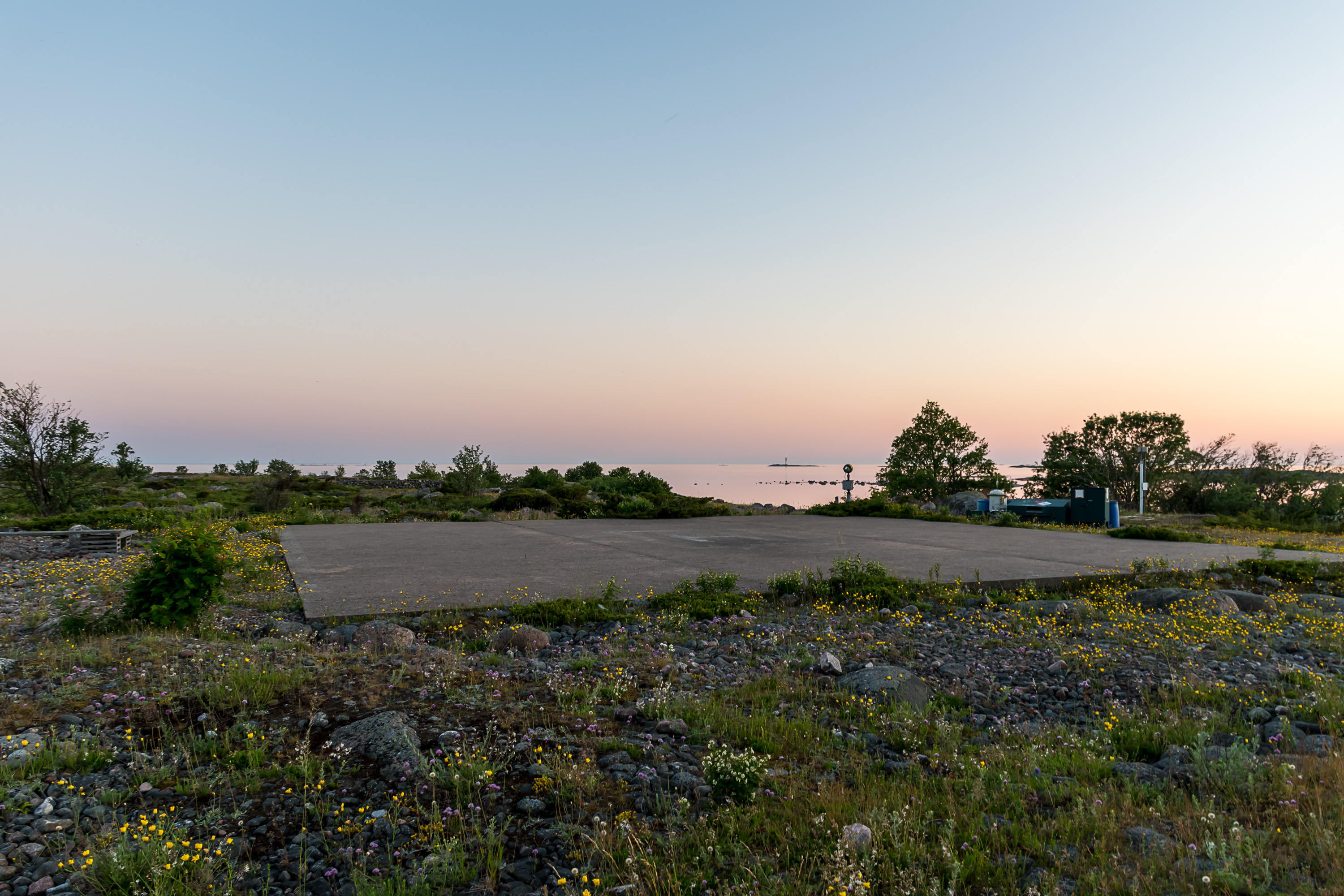
37. There is also a helicopter pad. It's extremely basic, just a concrete pad and that's all. And still it is very valuable for the times a helicopter needs to reach Utö, which as you understand are normally not happy times at all.
The most unhappy such time was the sinking of Estonia, the deadliest peacetime shipwreck of Europe, that claimed 852 lives on 28.9.1994. Estonia, a cruiseferry, the biggest Estonian ship at the time, was the pride of the newly independent country of Estonia, running on Tallinn-Stockholm route since 1993. At 1:15 at night, in a "normal" (by no means exceptional) autumn storm, Estonia's car deck doors separated and water immediately flowed inside. Such kind of accident was completely hopeless, and the ferry sank in a bit over half an hour at 1:50. The speed at which events unfolded and the heavy list that the ship took made launching lifeboats extremely difficult. Of 989 people on board (803 passengers, mostly Swedish, and 186 crew, mostly Estonian) only 137 survived, even though this was a busy part of the sea, and the first ship (another cruiseferry, Viking Line's Mariella) was at the scene at 2:12 already. However the rough sea made it very difficult for ships to pick up people, so most of those who were rescued were rescued by helicopters, and overall half of the people who managed to escape the ship still didn't make it out of the freezing cold sea.
The sinking took place in 41 km southwest of Utö, and thus Utö for a while became an impromptu rescue operations base; it was here where the rescue helicopters brought survivors and bodies. This must have been a thing that all islanders still remember, although I couldn't find any personal accounts.
The disaster was deemed to be due to the inherent deficiencies of the ship's construction. It of course led to many changes to safety standards in various regards, and to improvements on existing ferries. No major accidents with any of the cruiseferries, prowling the Baltic daily between Helsinki, Turku, Tallinn, Stockholm and other ports, have ever happened since. Estonia's wreck was protected and forbidden for unauthorized visits by a special Finnish law, as it is basically a huge grave. It is the only wreck to have ever been protected in such manner, which led to some conspiracy theories.
38. The landscape of Kesnäs. This is the most important bird nesting ground of the island, and signs ask visitors to avoid leaving the track.
39. The tip of Kesnäs has remains of some fortifications.
40. And this is it. The actual end of the world.
41.

42. At the time of my visit nothing suggested that this place can have such storms. The sea was calm as a mirror, and this Örö bådan islet seemed to be floating in the nothingness.

43. And yet a monument reminds that a drama took place here too, the sinking of Draken on 12.11.1929. Draken was a simple wooden schooner, 43 m long, which was mostly sailing under wind power, with a small engine only in an auxiliary function (yes, you'd be surprised how long sailing ships actually survived into the 20th century). It was built in Dragsfjärd on Kemiö island (the biggest island of the Archipelago Sea, closer to Hanko) and owned by a merchant from there.
Draken with its crew of 11 was carrying a load of timber from Oulu to Copenhagen, stopping at Uusikaupunki on its way. But you can guess what happened; yet another fatal autumn storm. The little ship didn't have a radio and didn't have any idea it was sailing right into it. By the time Draken reached Utö, the ship was filling with water, the auxiliary motor failed and the pumps were failing too. Draken wrecked against Örö bådan rocks, mere 150 m from Utö. The islanders gathered at Kesnäs but were unable to help in such weather, and so could only watch helplessly how the crew attempted to launch a boat and reach Utö's shore, with the sea claiming them one by one — one was swept over when the boat was lowered, another tried to swim and cracked his head against the rocks, two were swept from the boat at some point... In the end only 6 men of 11 managed to reach Utö.
The disaster got great coverage at the time, and lead to major reforms in maritime rescue area in Finland (which might be one of the reasons the Park Victory sinking 18 years later didn't end up even worse). Schooner's captain, Niilo Saarinen, who survived, got a presidential medal for his calm and reasonable leadership. The monument was put here on Kesnäs rocks in 1989.
There are many other shipwrecks near Utö. For example Rhein, a 136 m long German cargo ship, wrecked on Svartbådarna shallow southwest of Utö in 1958. That time at least the crew of 20 was rescued, and only the captain went down with the ship (and it was his last sailing before retiring, too). Swedish Torsholm, another cargo ship, wrecked at Utö itself in 1967, in the shallow bay between Kasnäs and western peninsula. The crew of 32 was unharmed. Torsholm's wreck had since been well visible for decades, until it fell apart in 2001.
A reasonably complete catalog of shipwrecks in Finnish waters, including of course Utö, can be found here — also all in Finnish, of course.
44. I stayed at this place until it started to get cold after sunset, and visited it one more time the next day too. It feels great to be at the end of the world.
45. And so this is all that I have to say about Utö for now. This is a place I want to visit again, even though I've already seen everything. But maybe in winter, to see these storms myself? Well, we'll see. But this is the best place in Finland I've visited in a long time, and coming from me it's a pretty big thing to say.