One of my favorite, if not the favorite, kind of places is small towns or villages in harsh remote places "at the edge of the world", mostly or entirely untouched by tourism and still retaining their original character.
From Norway for example I can remember such places as Vardø or Mehamn, but in Finland these are harder to find. Generally Finland doesn't have particularly harsh remote places. A few, however, do exist, and they can be found either in the heart of Lapland fells — or on the outermost islands of the Baltic Sea.
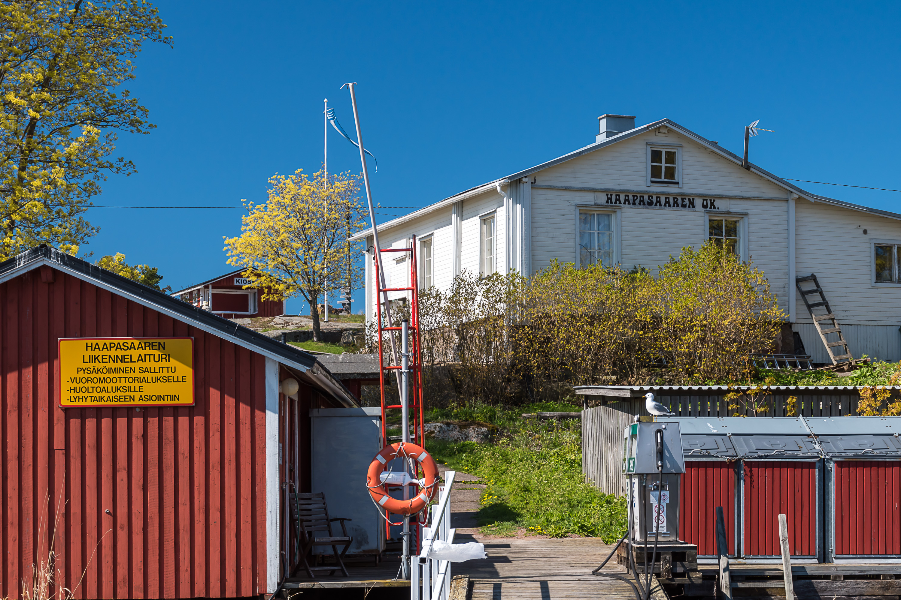
One of such islands is Haapasaari (Finn. Aspen Island), or in Swedish Aspö, in the Gulf of Finland, in its eastern part, about 22-23 km off the coast of the city of Kotka as crow flies. It is an island only about 1x0.5 km large, small enough that it doesn't have roads and cars, but still housing a unique village, with some year-round population. Originally a village of pilots, seamen and fishermen, these days it is mostly a summer cottage place — yet not entirely, as a few dozen people still live there permanently, and there is a grocery store, a church, and a regular boat service to the mainland, and all these operate year-round. The island also still has significance as a border guard post, as this is pretty much the first Finnish island of any note someone sailing from St. Petersburg to the west would encounter.
The interesting thing about Haapasaari is how almost entirely unknown it is, even in Finland. The information (in Finnish) is all there online if you care to find it (there is even a cute website, haapasaari.net), and it is actually very easy to get there — there is a regular boat service (yhteysalus, Finn. connecting ship), entirely free even, from a harbor not very far from Kotka center, and Kotka itself is a pretty significant city and not the worst tourist destination either; I would rate it as one of the most beautiful, if not the most beautiful, Finnish cities, for its coastline and wonderful parks; its closeness to the Russian border also makes it relatively popular with Russian tourists. Yet I couldn't find a single travel blog in Russian properly describing Haapasaari (a few yachters mention it in passing).
In truth the locals probably wouldn't want many tourists. There isn't any infrastructure for them (beyond a few information signs), no restaurants and no accomodation options. Even a single hotel, even if small and built to fit the surroundings, already would alter the local atmosphere significantly.
Haapasaari is the central island of a small outer archipelago, consisting mostly of tiny and nearly barren skerries, known to seafarers in the old times as "Perkele skerries". Haapasaari itself does have a forest, if a rather small one, and furthermore it has a bay nearly splitting the island in half (to Vestinpuoli and Uustinpuoli, "West and East Half"). The bay, named Kylänlahti, simply Village Bay, serves as a good harbor, and is almost certainly the reason why the island was settled in first place. The original settled island was a nearby slightly larger one, nowadays named Vanhankylänmaa (Finn. Old Village Land), where people came to in late Middle Ages probably; but by the 1600s or 1700s at the latest they moved to Haapasaari. The local graveyard still remains at Vanhankylänmaa. A small community developed on the island, and their most important livelihood was the art of piloting, which was something very necessary in the local archipelago (same as along most of Finnish coast, broken by innumerable bays and skerry guards). They also practiced seafaring, trading with Russians and especially Estonians from across the narrow sea, and survived off fishing and seal hunting. Estonians were called "sepra", from an Estonian word meaning "friend". Islanders practiced mostly barter trade with them, trading herring for grain; as herring has been plentiful in these waters, but agriculture on a small island was nearly impossible. This sort of trade ended only at the Second World War, and that's when professional fishing also became impossible to live off, and the mass exodus to the mainland started.
Haapasaari's history has been relatively calm. A church came in 1858, a lighhouse (or actually a daymark, as it never actually had any light) in 1862, a school in 1890 (closed in 1973), a grocery store in 1907, and a youth club in 1971. Pilot service also ended in 1966 (it moved to the mainland to Hamina), but the island remains an important military and border guard outpost. Haapasaari was mostly spared from war horrors, unlike the other major island in this sea area, Suursaari or Hogland as it is usually known this days, a massive island 11 km long with four rocky hills rising up to 175 m high; to the best of my knowledge there are no other places on the coast of the Gulf of Finland (neither in Finland nor in Russia nor in Estonia) having such high places anywhere remotely close to the sea, and Suursaari's prominent shape is easily seen from Haapasaari or even from Kotka coast (40 km away). Once a home for up to 1150 Finnish people in a few villages, Suursaari was ravaged in the Second World War, passing between Finland and USSR several times, and nowadays belongs to Russia, housing only some border guards and military installations, with no regular boat service and harsh restrictions on any visits, especially for non-Russians.
Haapasaari apparently was not remotely so strategically important, thus it was not a part of Soviet territorial demands, but still was touched by the war. It housed a sizable garrison in the Winter and Continuation War, and suffered some minor Soviet bombardments, which destroyed a few buildings. Artillery positions were built on the island in the Continuation War, and are still very noticeable in the landscape. Ultimately however Haapasaari saw no major fighting. These days I think the only real military presence there is a radar, put on top of the old daymark.
Haapasaari was an independent municipality between 1913 and 1974, having split from Kymi, a parish that had given birth to Kotka before and eventually got reabsorbed back by Kotka. Apart from Haapasaari proper the municipality also included the island of Rankki, much closer to Kotka and used for naval installations, and some small skerries; nonetheless its area was only 5 sq. km. About 350 people lived in Haapasaari in the 1910s, which probably was the height of its growth. The number kept steadily falling throughout the 20th century, and by the time of the municipality abolishment in 1974 the entire municipality consisted of only 66 people, the smallest one in the country.
These days the permanent population of the island is only about 10-20 people, yet it is very significant that a permanent population still exists (although I'm not entirely sure what they actually do there nowadays; likely nearly all are just retired people). There aren't many islands comparable to Haapasaari, having a single still alive fishing village. I could name Kaunissaari (Finn. Beautiful Island), also near Kotka, and Utö (Swed. Outer Island), a lighthouse island which is the outermost island of the Archipelago Sea. There are many other inhabited islands, but they have a road or ferry connection to the mainland road network, so they aren't isolated to such degree, and don't really feel that authentic; not having actual roads and cars is in my opinion a very distinct feature. There are also similar islands that were inhabited but now are just entirely summer cottage communities, with no regular boat service in winter. Such are for example Tammio off Hamina coast, or Tankar lighthouse island off Kokkola coast in the Bay of Bothnia. I visited Tankar in 2018 and it definitely feels a lot like Haapasaari, but a permanently-inhabited outer island was a first for me. Of course Haapasaari too does have a lot of people coming only in summer; the island's population may increase tenfold on summer weekends. Still these holidaymakers are also mostly people whose families previously had lived on the island for generations. Everyone knows everyone else.
I went to Haapasaari on my four-day expedition to Kymenlaakso region (Kouvola and Kotka areas) on the Ascension Day (helatorstai) of 2020. Most of Finnish holidays are religious, and I have a relatively vague idea what they actually mean, but it is quite convenient to have a Thursday (it's always Thursday) off several weeks after Easter; the remaining Friday you can take off or if possible just work remotely from wherever you happen to go. I was familiar with both Kouvola and Kotka before, but this time intended to explore them better, especially Kotka, and Haapasaari was pretty much the place I was most interested in.
As I mentioned before, Haapasaari is currently connected to Kotka with a regular boat service. This is a public service, similar to ferries on internal Finnish waters, and, like on those ferries, passage on these boats is completely free. Boats can actually take a few cars but this is not their primary purpose. Currently Kotka is connected by these boats to three more islands, apart from Haapasaari: Kuutsalo, Kirkonmaa and Kaunissaari. All of them also retain some small year-round populations.
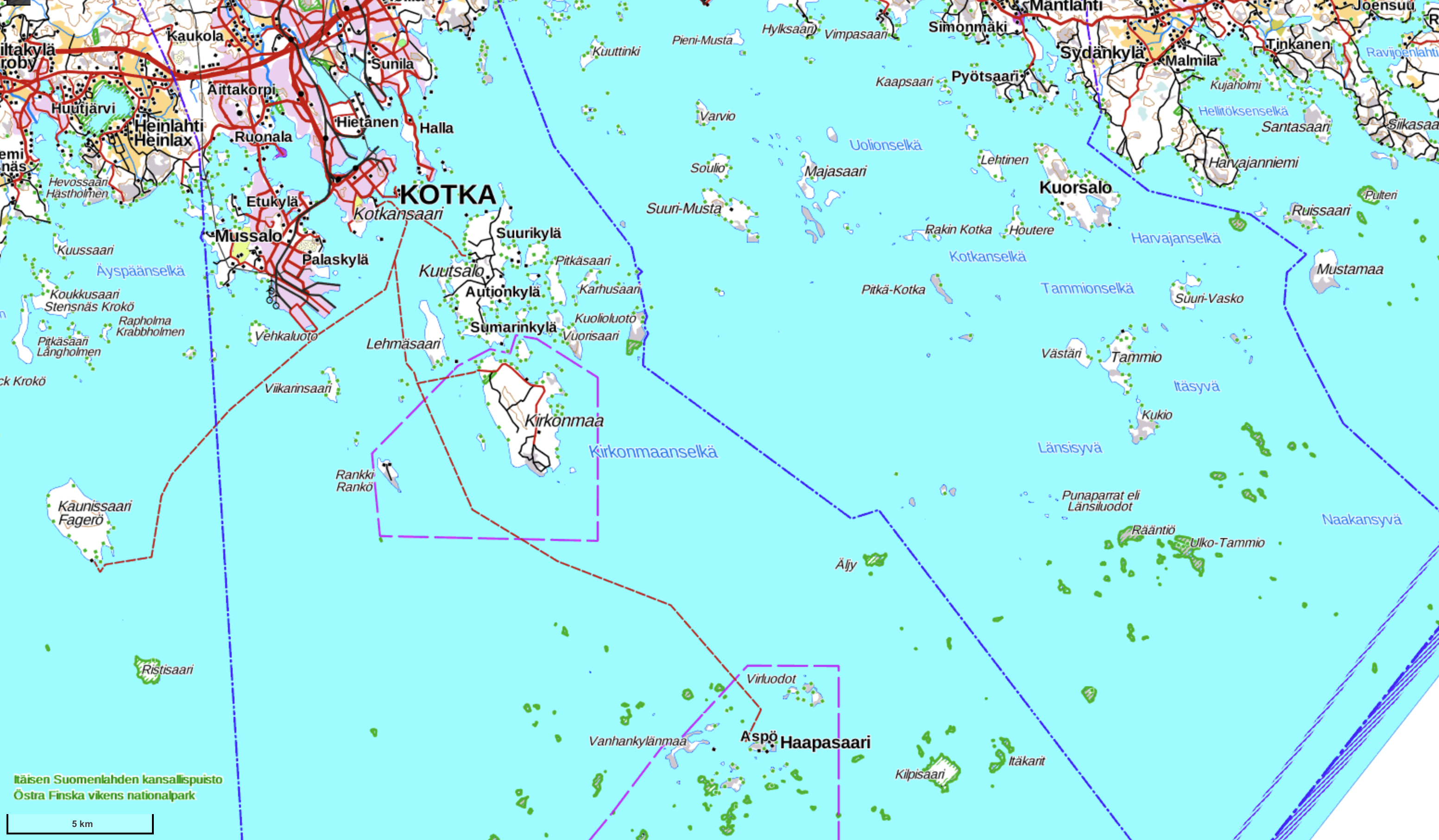
Of these Kuutsalo and Kirkonmaa are close to the mainland, largish and having driveable roads, so car capacity of the boats is mostly meant for these islands. These islands do not present as much interest. Both Haapasaari and Kaunissaari are further away and have only tracks suitable for quad bikes. Kaunissaari has a fishing village similar to Haapasaari, only without a lighthouse or border guard outpost. This island is much bigger than Haapasaari (3.3x1.7 km) and mostly occupied by a forest, and its coasts are sandy rather than rocky as on Haapasaari.
The downside of a boat service being a public state-supported one is that while it is possible to get to islands even in winter (I don't know if icebreaking assistance can be needed in such cases; Kotka area generally does get a fair amount of sea ice), timetables are not especially convenient and are certainly not made with tourists in mind. Most trips end with the boat going back to the mainland right away, and not returning on this day anymore. Haapasaari is the only island of the four with an option of actually staying there for a short while; in the current 2020 summer timetable, in effect from May to September, this is possible on Mondays, Thusdays and Saturdays. On these days a boat departs from Kotka at 9:00, arrives to Haapasaari via Kirkonmaa at 11:00, and makes the return trip at 13:00-15:00, allowing for two hours on the island, which is just about right amount of time to get acquainted with it and maybe have a quiet moment enjoying the sea views. Up-to-date timetables are available at FinFerries website. Some departures are not made every time and require reservation beforehand, but this 9:00-15:00 option is not one of these.
The only available option for an overnight stay on Haapasaari or any other of these islands is camping in an own tent. There are no specialized camping sites, but none of the islands are protected nature areas, and on all of them there is enough place to pitch tent away from the houses under the regular everyman's right.
In Kotka boats depart from a small harbor on the Kuusinen (Finn. Little Spruce) island. This is not at all an obvious location, and "Saaristolikenne" ("archipelago traffic") signs actually point to a wrong place, the Sapokka harbor close to Kotka center, far more prominent, with its famous park and Maretarium aquarium. The correct harbor is located at the end of a road named Juha Vainion katu that also begins at Sapokka and goes to Kuusinen on an embankment. The same harbor is used by fishing, fairway maintenance and border guard ships.
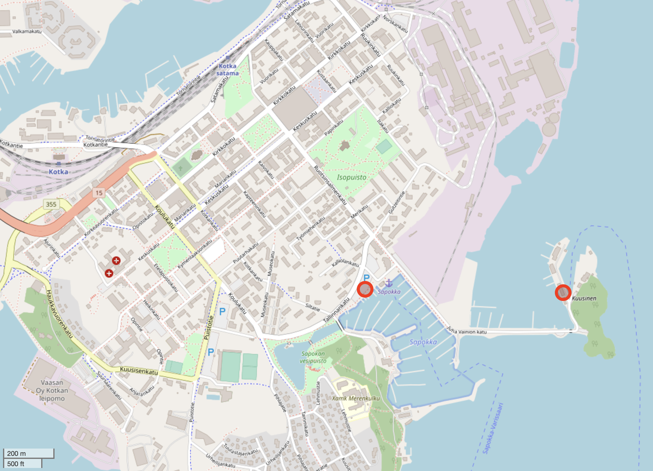
A word of caution for people arriving by car: there is some long-term free parking space at the harbor but it is very limited and likely to be completely full. Other nearby parking lots have short time limits, so the most reliable option is leaving your car at Sapokka harbor, where there is plenty of place (Sapokankatu street). From there the walk to Kuusinen harbor is about 1 km. This is not a big deal as such, you just need to make sure you're reserving enough time (15 min or so) for this walk, especially since the boat departure is rather early in the morning at 9. If you don't use a car, you probably would just walk in first place. Kotka center is small and easily walkable, and the city can be reached by bus or train without any difficulties.
So let us do such a journey, then.
One last word about Haapasaari: this is apparently pretty much the most tick-heavy place in all Finland. The little buggers are not uncommon in most of Finland, but mostly are harmless or carry Lyme disease, which can be pretty nasty, but the real killer is tick-borne encephalitis (TBE). TBE in Finland is very uncommon and there are only a few hotspots where it occurs. Most of these are on sea islands and archipelagoes for some reason. But even among the islands Haapasaari takes prize, with two out of hundred ticks carrying TBE, which is apparently like twice more often than anywhere else. To put this in perspective, this is still far less than in many areas of Russia, where on average 6% of ticks carry TBE, and up to 20% in Siberia and Far East; also the probability of getting the disease from a bite of an infected tick is still only a few percents. Nonetheless it is probably unwise to roll around in grass at Haapasaari, unless you're vaccinated against TBE.
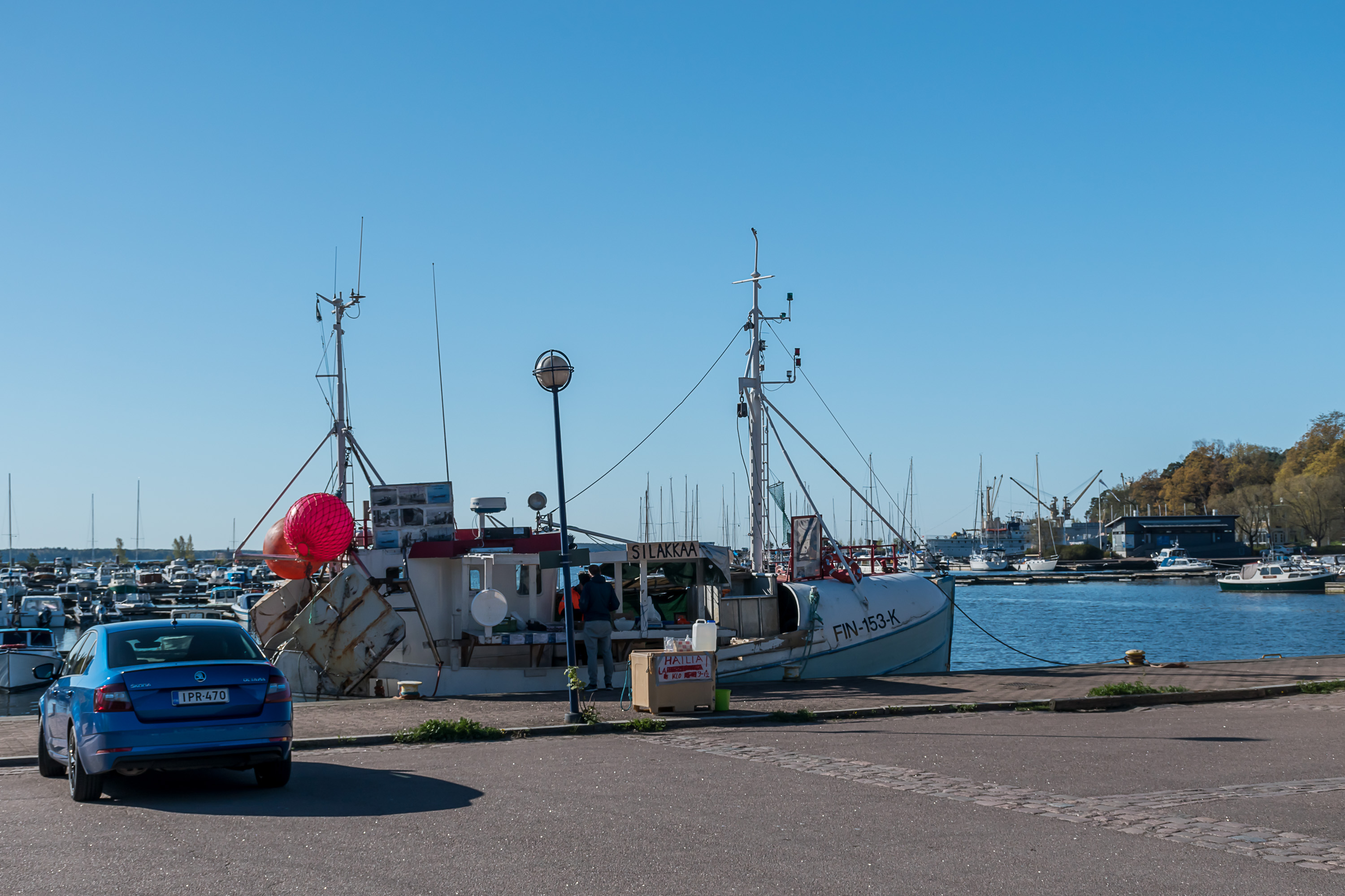
1. I got up at 7:30 in an AirBnB apartment I was staying in on this trip, in Karhuvuori area, on the western outskirts of Kotka; over 8 km to the center. Kotka is not the biggest city, at slightly over 50,000 population, but its built-up area is pretty large. I drove to center and left the car at Sapokka harbor. Someone was already selling herring right from a fishing boat, that's pretty cool!
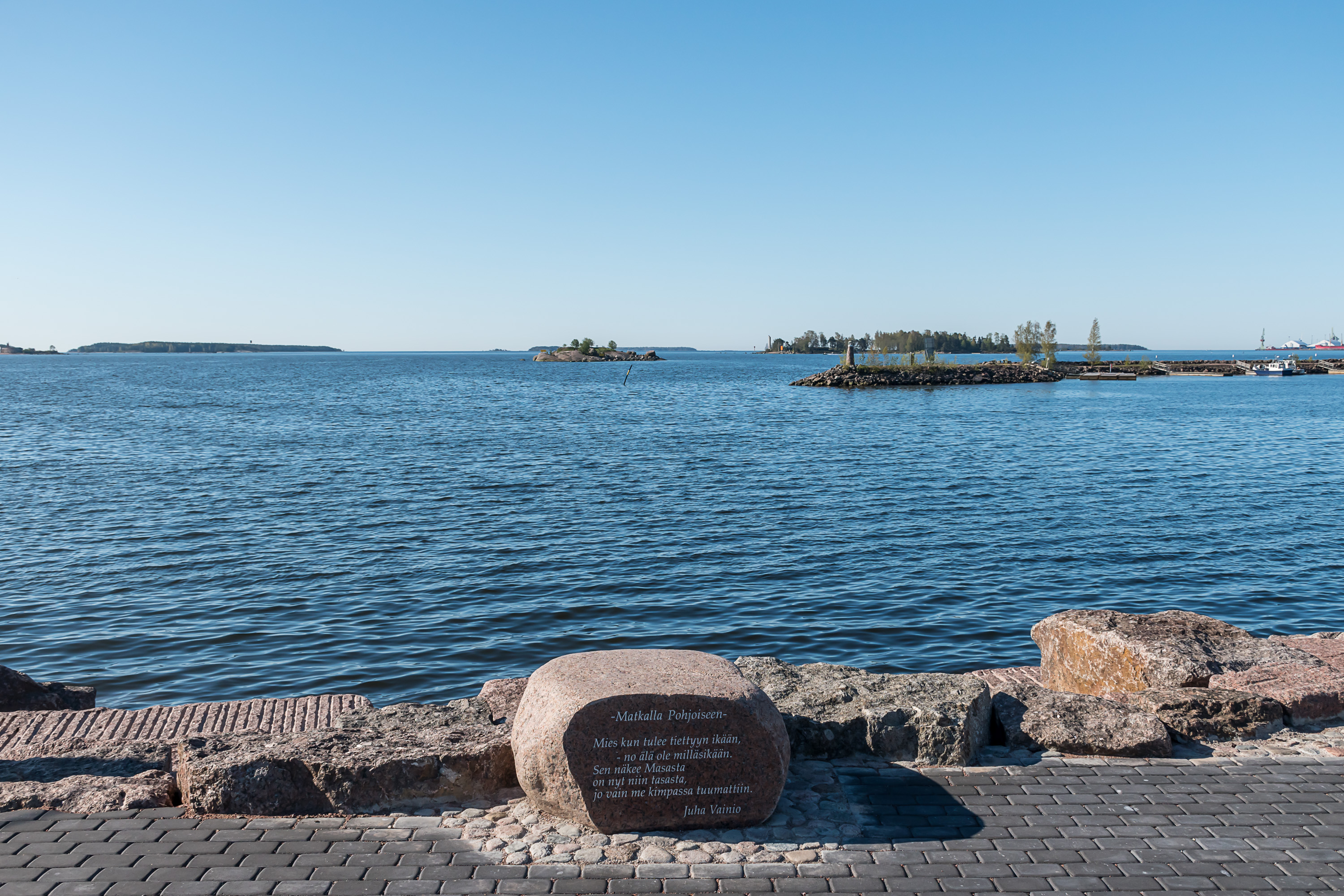
2. The road from Sapokka to Kuusinen is named Juha Vainion katu after, well, Juha Vainio (1938-1990), a prominent Finnish singer and a prolific lyricist, who was born in Kotka, loved the sea, and mentioned both in his songs frequently. Juha Vainion katu is lined with stones with quotes from this songs. This song, Matkalla pohjoiseen ("On the way to the north") describes, as far as I can tell from glancing at full lyrics, a guy driving to the north along the "terribly bendy Kaamanen road" to Nuorgam (the northernmost village of Finnish Lapland on the Norwegian border) to buy some erectile dysfunction medicine from another guy there. As you can see, at least some Juha Vainio's songs were decidedly of a not very serious nature.
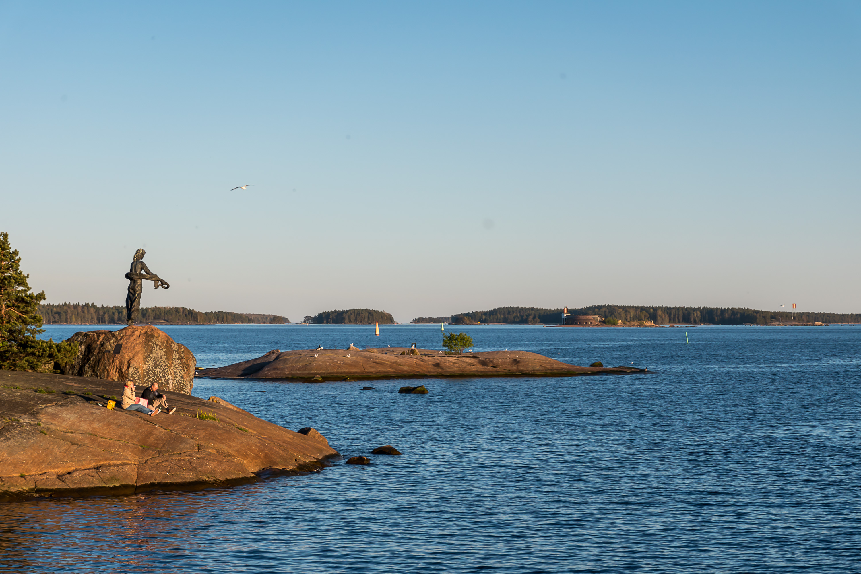
3. Kuusinen island, apart from the harbor, is mostly occupied by a small forest. People seem to quite enjoy spending time on the coastal rocks there in good weather. The monument seen is devoted to seamen who died in Ruotsinsalmi battles. These sea battles happened in Gustav III's War, the penultimate Russian-Swedish war of 1788-1790, where King Gustav III attempted a short victorious war, mostly for internal political reasons, to boost his own popularity by reconquering some of the previously lost Finnish land from Russia. He failed rather miserably and got assassinated soon after the war. Two battles happened in Ruotsinsalmi (Finn. Swedish Strait) or Svensksund how Swedes called it, a sea area separating modern Kotka from Kuutsalo island. Sweden lost the first battle, but actually won the second one decisively. This changed the tide of the war, allowing Sweden to make peace with Russia (which wasn't particularly interested in this war to begin with) at least without any further territorial losses.
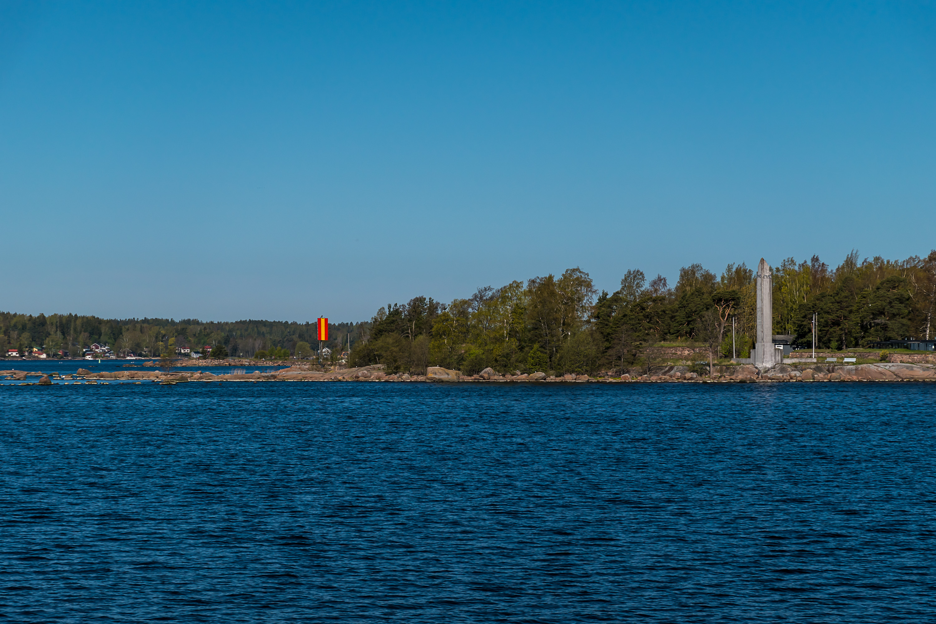
After the war Russia decided to fortify her border in Finland, which led to construction of numerous fortifications and canals in the modern Southeast Finland (which had belonged to Russia since 1743), overseen by the great General Alexander Suvorov, and also of a border fortress at Ruotsinsalmi. This is how Ruotsinsalmi, the precedessor of Kotka, was born. It consisted of three sea forts on islands, a big fortress overlooking the coastal King's Road, and a number of small redoubts. It was not an actual city yet, although it housed a Russian garrison similar in size to the population of the city of Turku at the time. In the end all these efforts were in vain, and all the freshly finished fortifications were barely used, as in the final Russian-Swedish war of 1808-1909 (Finnish War) Swedish forces, caught unprepared, retreated through Finland very quickly, and only began to offer some actual resistance by the time they were in Ostrobothnia, quite far in the north and from the pre-war border. Ruotsinsalmi, among with Svartholm fortress in the nearby Loviisa, was bombarded by the British fleet in the Crimean War of 1853-1856, and the sea forts were mostly reduced to rubble (although the inland big fortress, Kyminlinna, was spared and survives in decent shape to this day). The modern city of Kotka was established in 1879 in the place of Ruotsinsalmi as a place of industry, as this location in the mouth of the great Kymi River made it extremely convenient to build sawmills here, working on timber rafted here down the river from anywhere along its huge drainage basin.
A curious fact about the monument in the picture is that it was actually designed by a prominent Russian scupltor, Mikhail Anikushin, unveiled in 1998. One more monument in Finland was designed by him, and that was a monument to Lenin in the city of Turku.
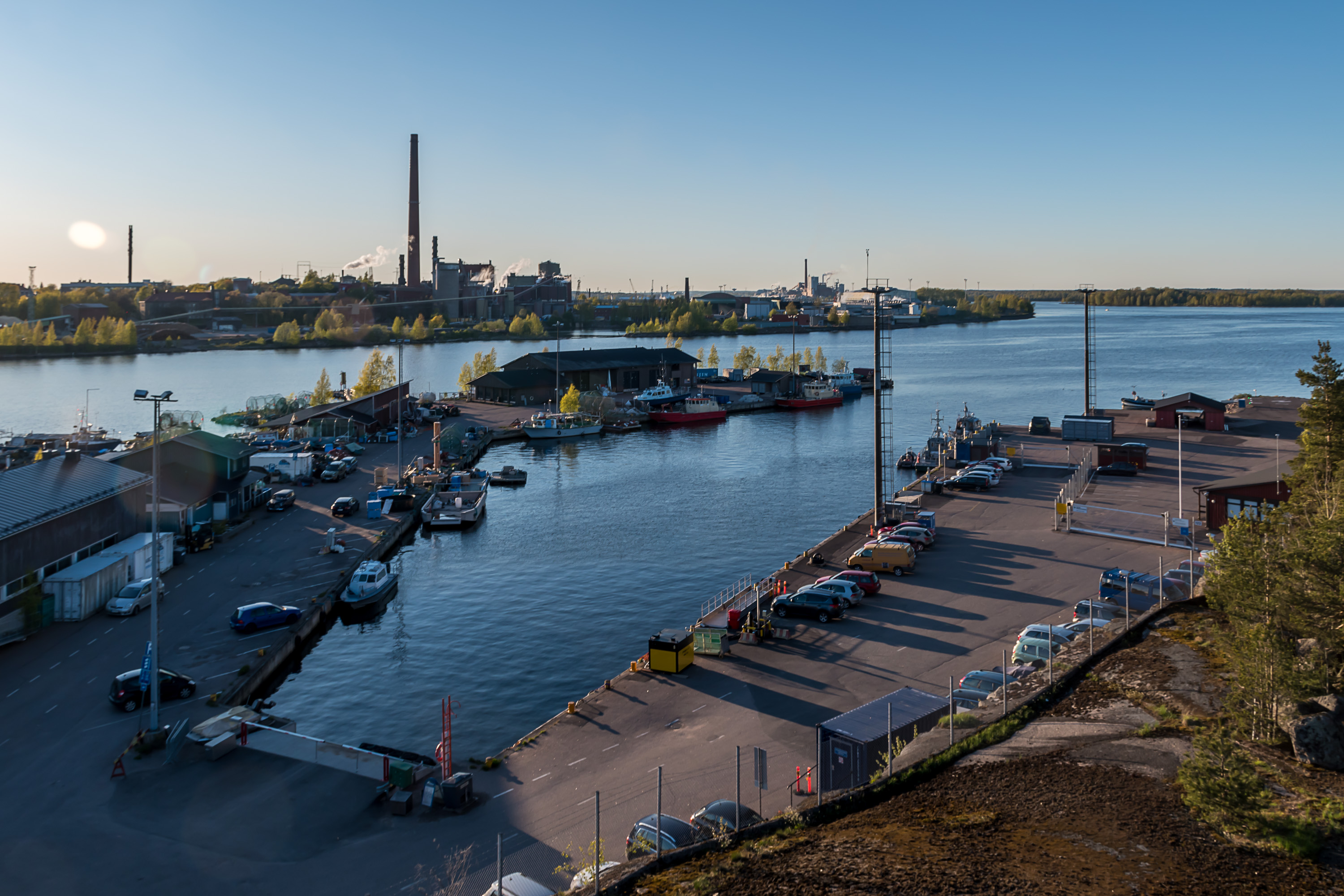
4. Kuusinen harbor, as seen from a small observation tower on top of a rocky hill nearby. The left half is used by fishing and fairway maintenance ships, the right one, fenced off, by border guards (two of their crafts are visible), and the middle is for archipelago boats. (This and the previous picture were actually taken the previous evening, hence different lighting.)

5. And here is our yhteysalus! It is named Otava, meaning "Big Dipper". This is a fairly new ship, built in 2014 at Uusikaupunki (in Turku region) shipyard, which specializes in small ferries, passenger vessels, border/coast guard boats and so on; in Finland it's pretty much the go-to place to build such ships. Otava normally has a crew of 2, and can take up to 130 passengers and 8 cars. It has a secondary function as an oil spill cleanup ship, in which case it requires a bigger crew. Otava has already made an early morning trip to the nearby Kuutsalo and is bringing a few people and a car from there.
The second passenger ship operating on these routes is Tekla I (Tekla is a Finnish female name). It is much older, built in 1983 in Savonlinna, and significantly smaller, taking up to 100 passengers and only 2 cars.
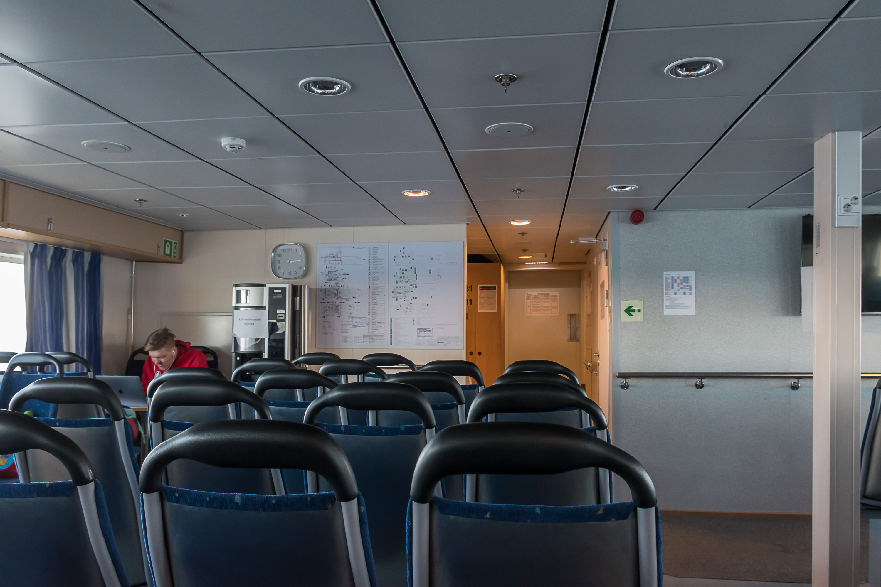
6. Otava passenger cabin. It is also possible to sit outside on one of the two decks. The weather was very warm with barely any wind, so it was fairly comfortable and I enjoyed most of the trip outside. I didn't see any other people who looked like obvious tourists. Most passengers were no younger than 50, although quite a few with grandkids.

7. The ship is not particularly fast, but Kotkansaari, the island on which Kotka center is located, quickly recedes behind. Although this is one of the most conspiciously maritime cities of Finland, its buildings do not face the sea directly. The low walls to the left there are the ruins of Fort Katariina, one of the three Russian forts of Ruotsinsalmi, and the only one easily accessible nowadays. A park has been built near it in recent years in place of an old oil harbor. Nearby is a forest and Varissaari island, and to the right Sapokka harbor is visible, and then some Kotka industry.
8. Varissaari (Finn. Crow Island) holds another ruined Russian fortification, Fort Elizabeth, that is not visible that well from the sea. Varissaari and also Kukouri with the third fort, Fort Slava, can be visited in summer by private boat service.

9. We also get some good views of Mussalo harbor, which is the biggest harbor of the Port of Kotka-Hamina, which is in turn the second biggest freight seaport of Finland (after the specialized Sköldvik harbor in Porvoo that only imports raw oil and exports oil products). This largely is due to closeness to Russia, as Kotka and Hamina still serve as transit ports for much of St. Petersburg-bound freight (even though Russia has taken big steps to increase its self-sufficiency in that regard, including expansions of Primorsk and Ust-Luga ports near St. Petersburg). Mussalo and other areas of the port of Kotka are even signposted in Russian on road signs, and the railroad to Kotka, although a dead-end one with little passenger traffic, is electrified and mostly converted to a double-track one, also due to having much more freight traffic that you'd think, mostly Russia-bound. Mussalo harbor serves bulk, liquid and container cargo.
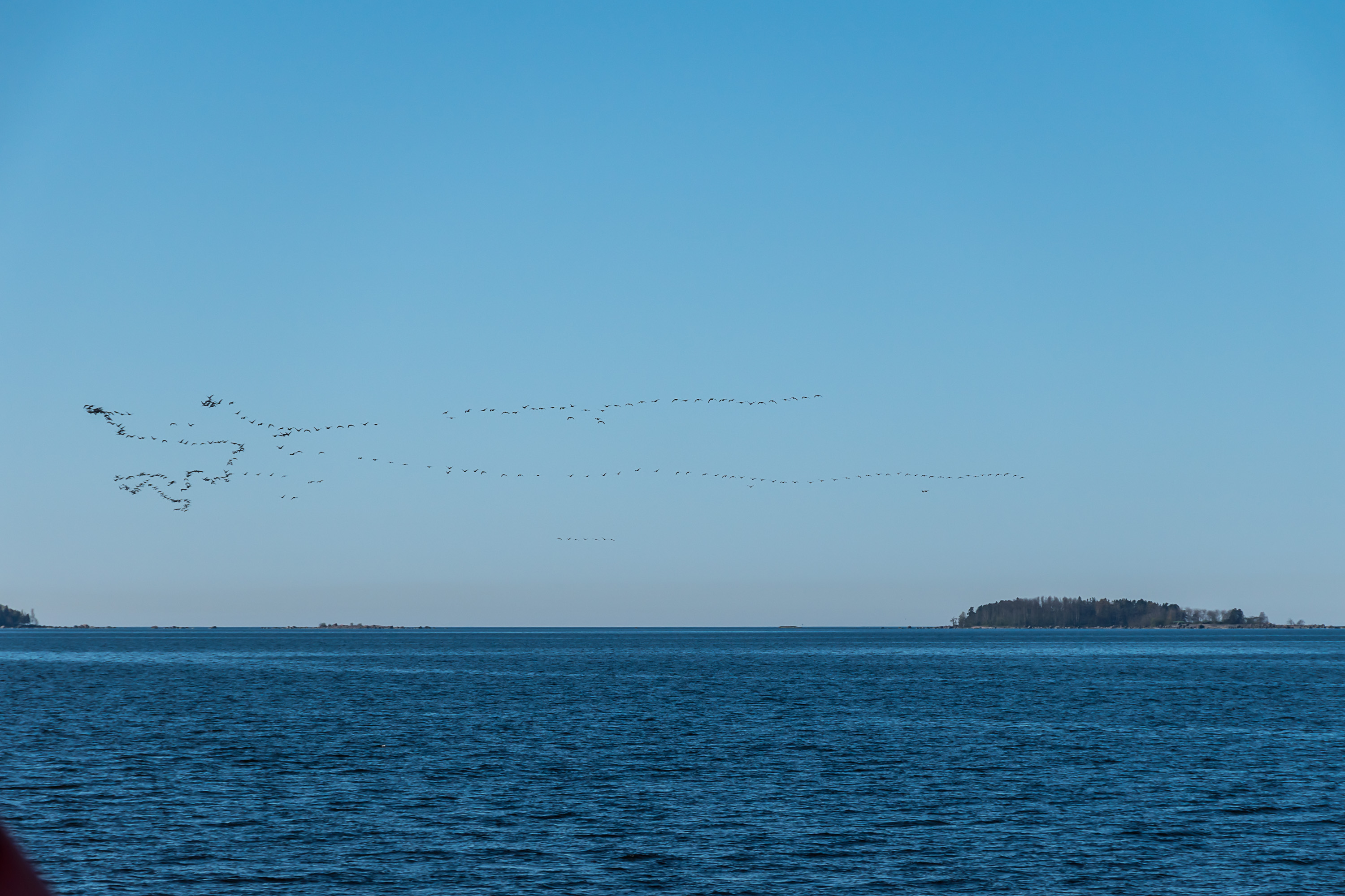
10. And we're heading into the open sea.
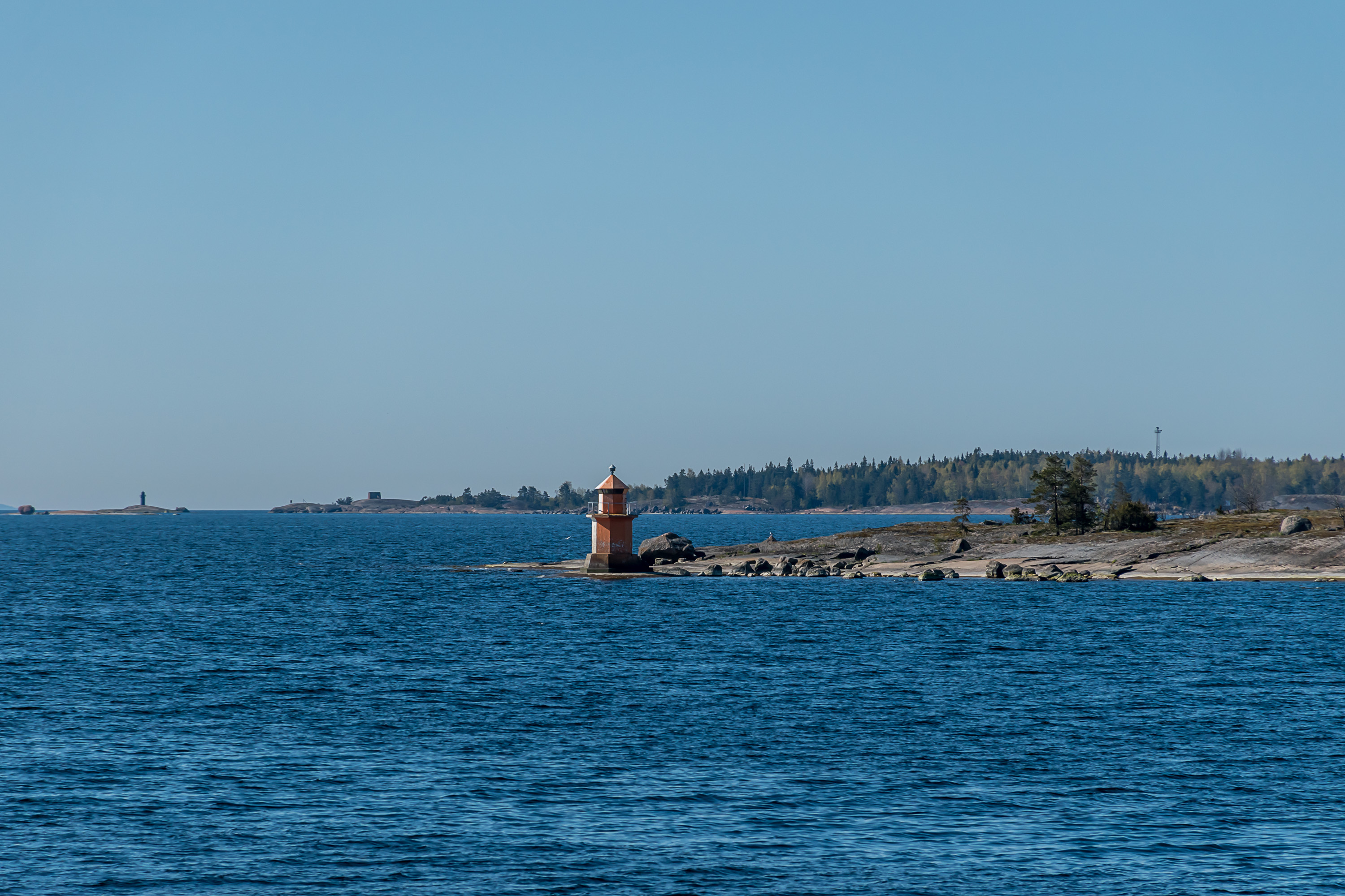
11. I really like these little lighthouses, which of course technically aren't lighthouses at all, but sector lights; they show white light when you're on the right course, and red/green when you're off course. Rankki island in the background.
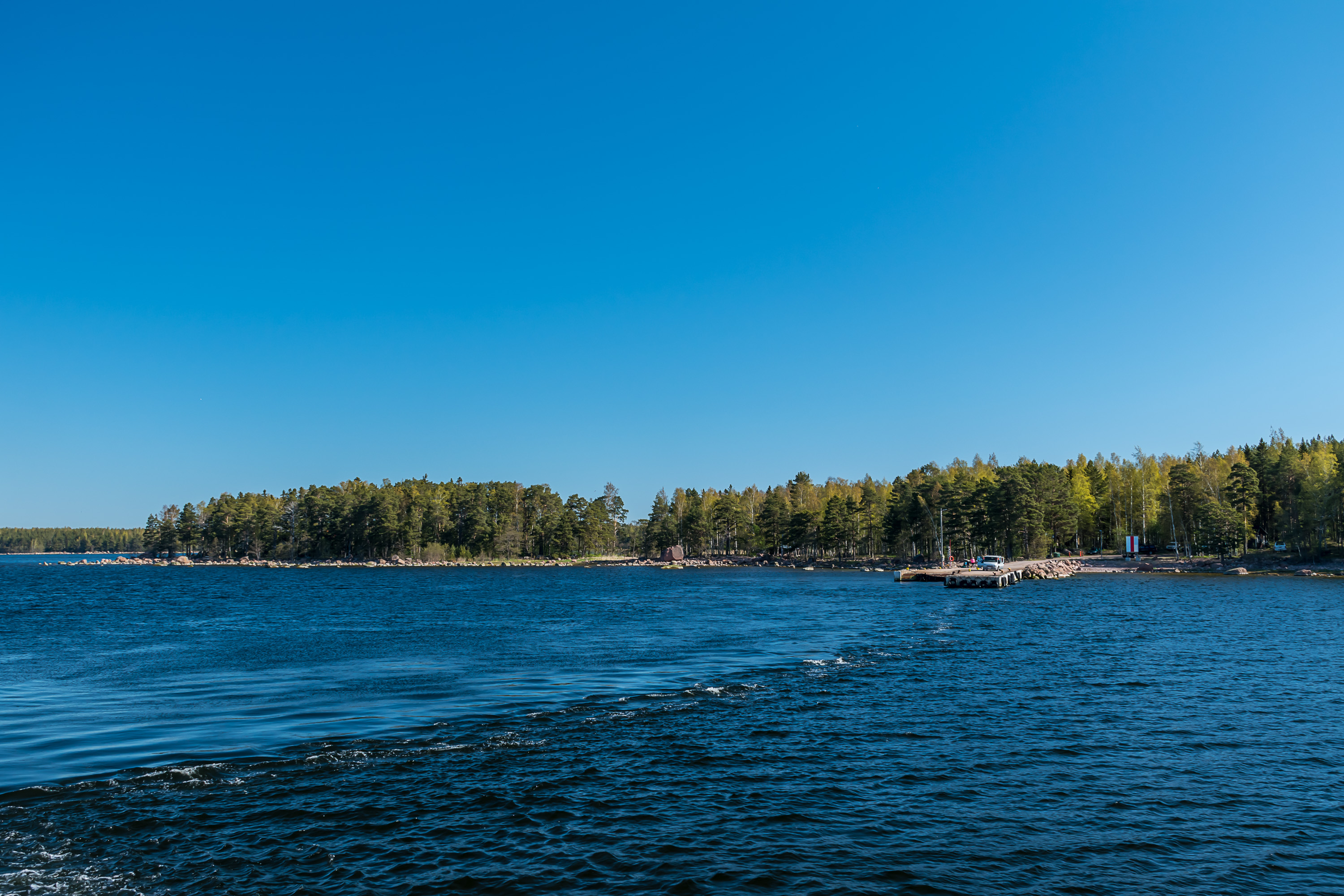
12. We make a brief stop at Kirkonmaa island. A van picks up some goods at the harbor.
13. An islet off Kirkonmaa has a lone small cross on it. Did someone die there? Some sailor? I couldn't find anything.
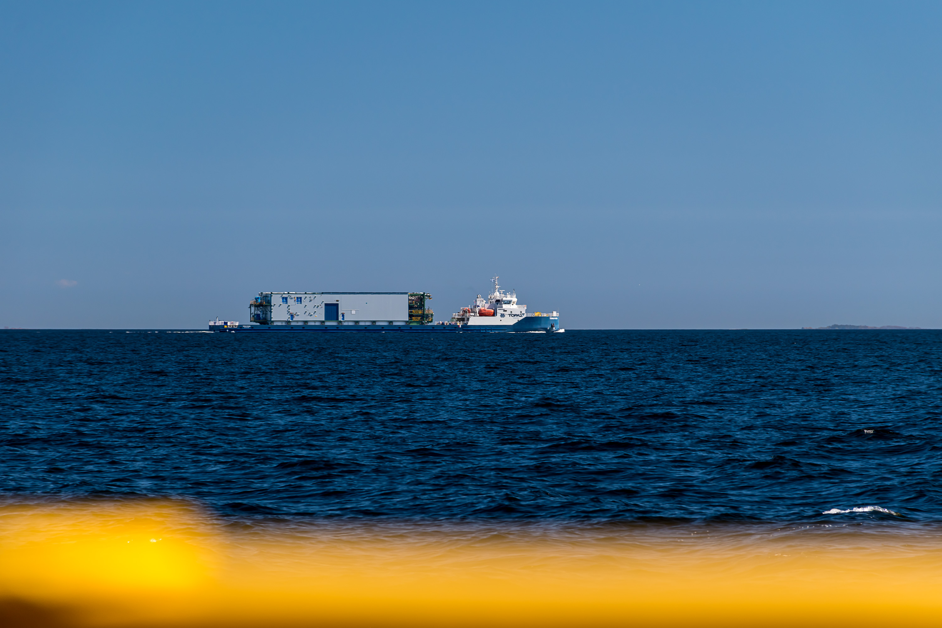
14. Going closer to the fairway in the middle of the Gulf of Finland, you're bound to see some ship heading to St. Petersburg or a few. This Topaz-Ruza for example is what is known a module carrier vessel (MCV), designed to transport huge prefabricated assemblies just on its deck. This is one of the 17 ships of VARD 9 21 class, commissioned by a Russian shipping company to transport such assemblies through internal Russian waterways (Volga-Baltic waterway and Volga river) into inland Caspian Sea, where on its eastern shore Kazakhstan is currently building infrastructure for a huge oil deposit. It must be really huge if so many ships are necessary merely to build the infrastructure.
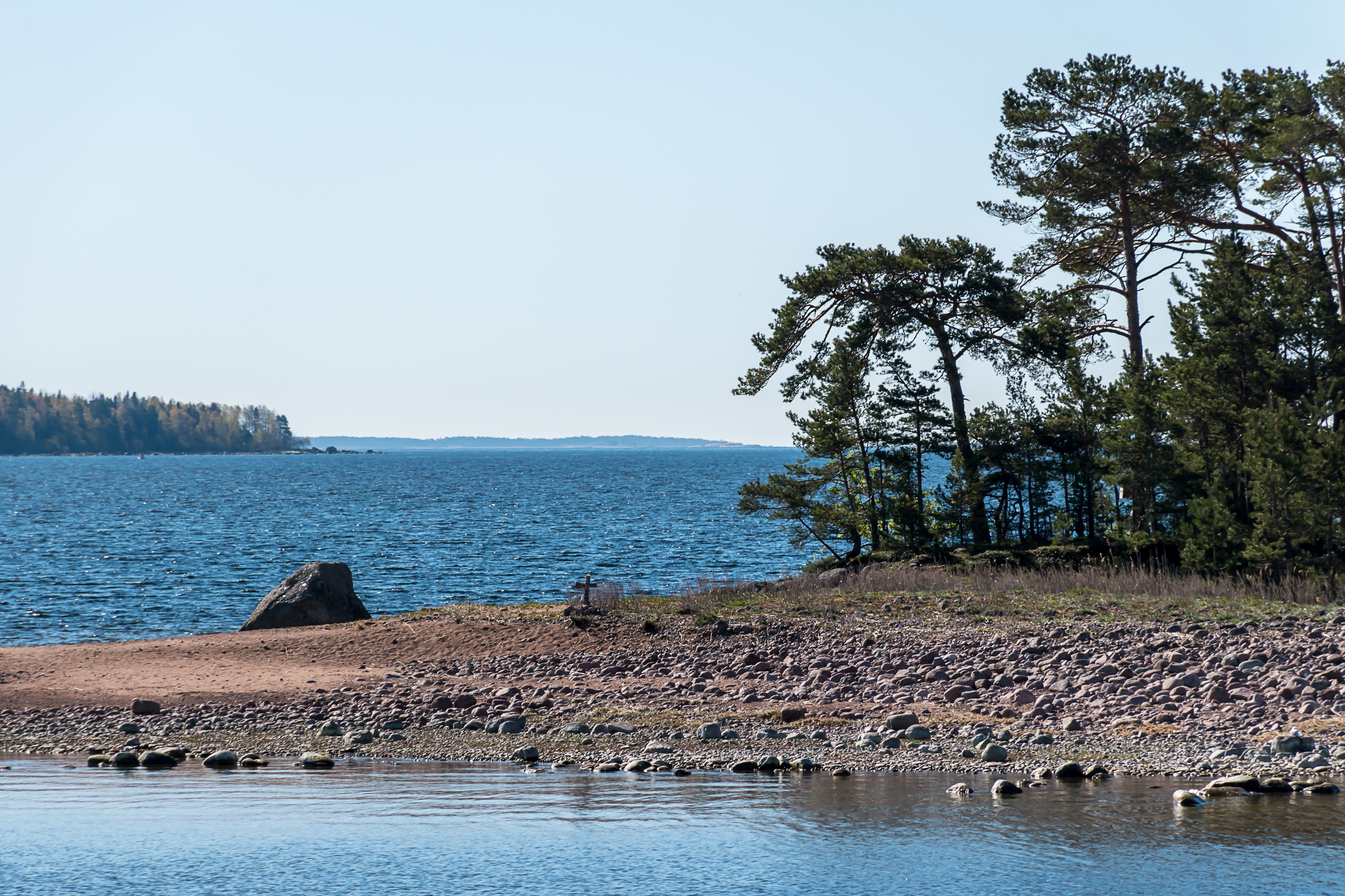
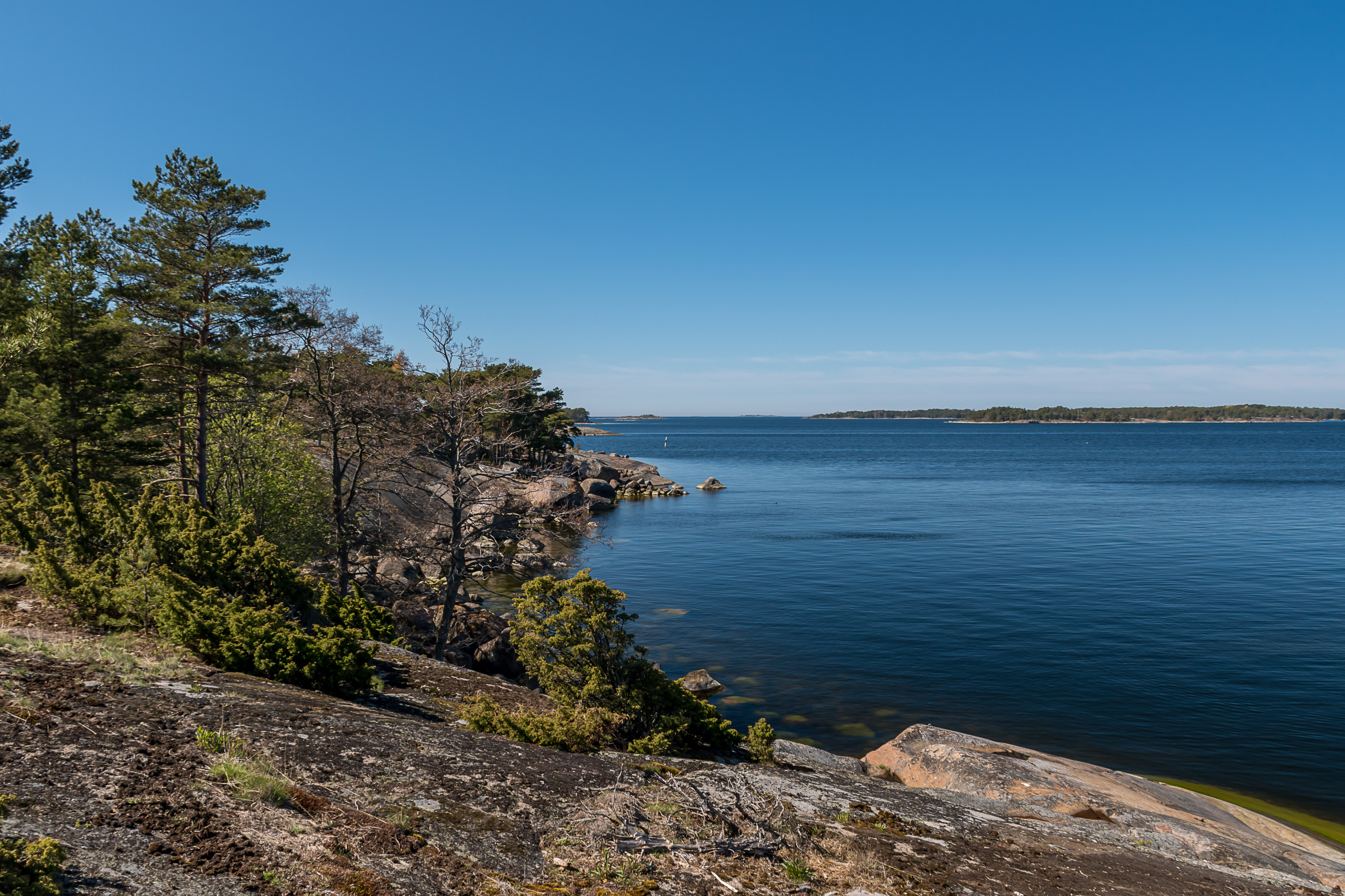
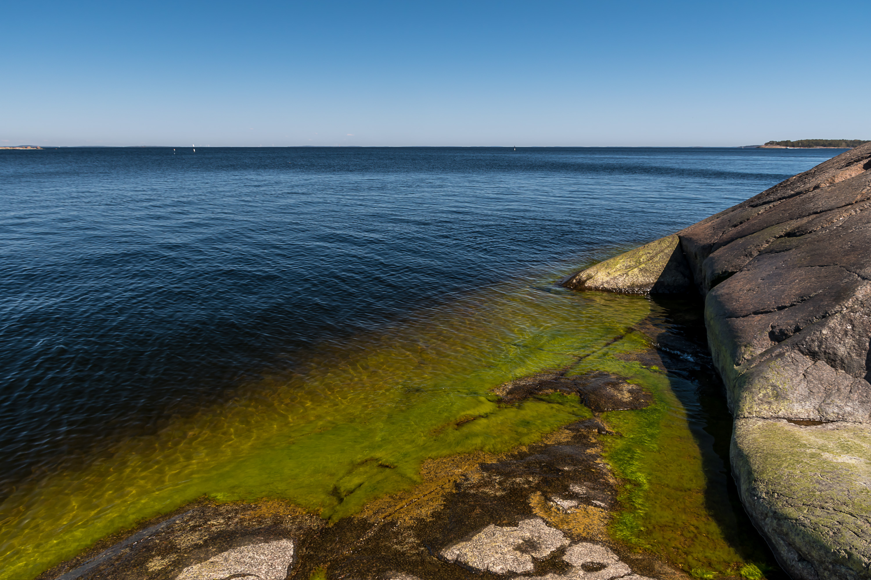
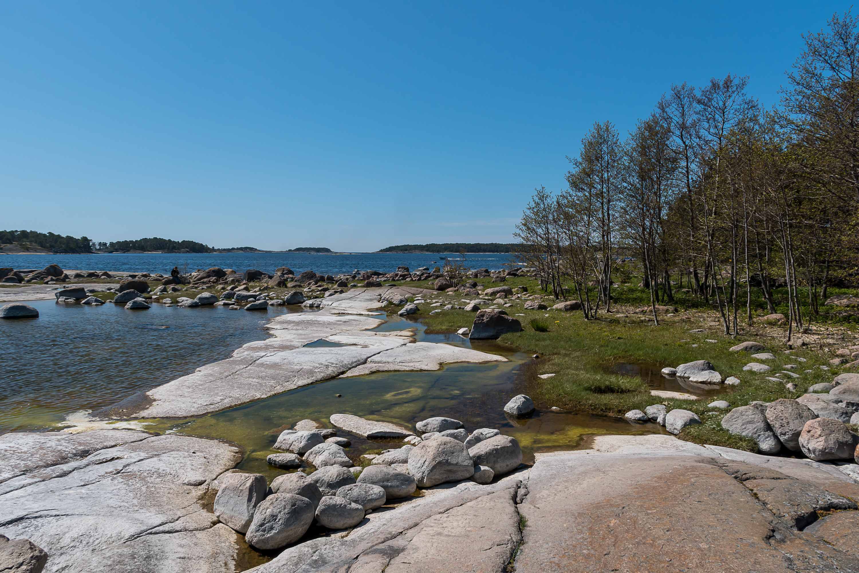
15. This shape on the horizon had puzzled me even on the previous day, seen from the coast of Kotka. I was pretty sure there could be no mountains big and distant enough to look like that on the Gulf of Finland. I decided it probably was some weird cloud. But on this trip to Haapasaari this shape not only stayed in exactly the same place, but I even could see towers on top of the hills.
This in fact is the aforementioned island of Suursaari, or Hogland as it's known now that it's a part of Russia. Its hills really make it completely unique for the Gulf of Finland. Many people, in Russia too, are sad that the Finnish city of Vyborg and Karelian Isthmus and Ladoga Karelia were ceded to USSR in the war, as they don't really look very good now. I don't disagree with that but personally I feel much stronger about much more obscure areas, namely outer Gulf of Finland islands and Petsamo area in the Arctic, that were also ceded to USSR. Mostly because they both have completely unique nature, not found anywhere else in Finland (and in case of Suursaari, not really anywhere in the Baltic Sea), but now within Russia they are poorly maintained and difficult to visit, especially for foreigners. A few days tour to Suursaari where you'd have to sleep in a tent costs currently about 150€ in Russia, and it also requires getting a permit to visit a "border zone". This is not too difficult for Russians (if somewhat bureaucratic) but nearly impossible for foreigners. The island doesn't have much of anything now either, apart from lighthouses and military installations; old Finnish villages are nearly completely gone.
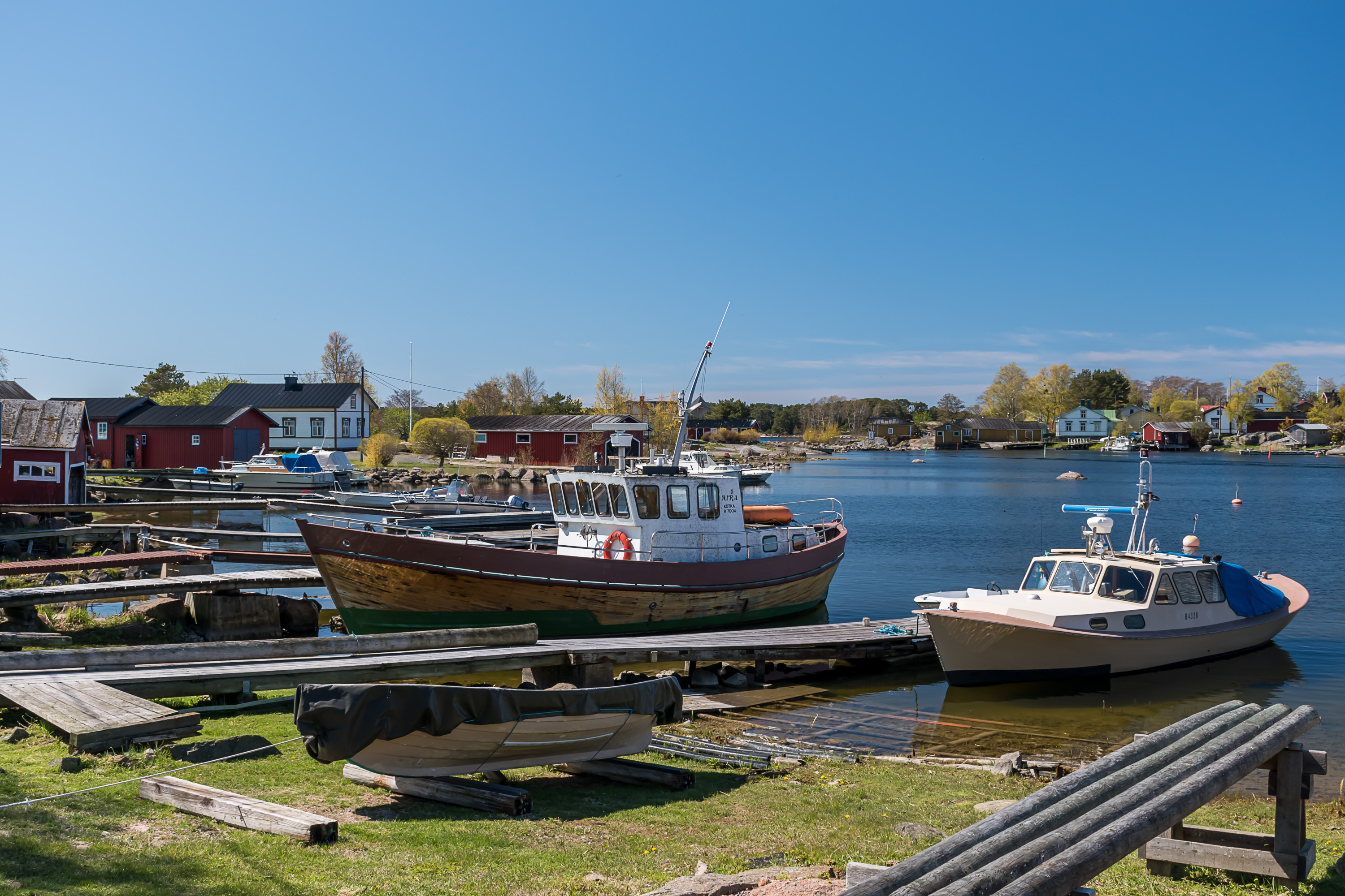
16. Two hours sea trip is long enough to begin to get a bit bored, but here it is! The Haapasaari coast!

17. The islanders leaving the ship.
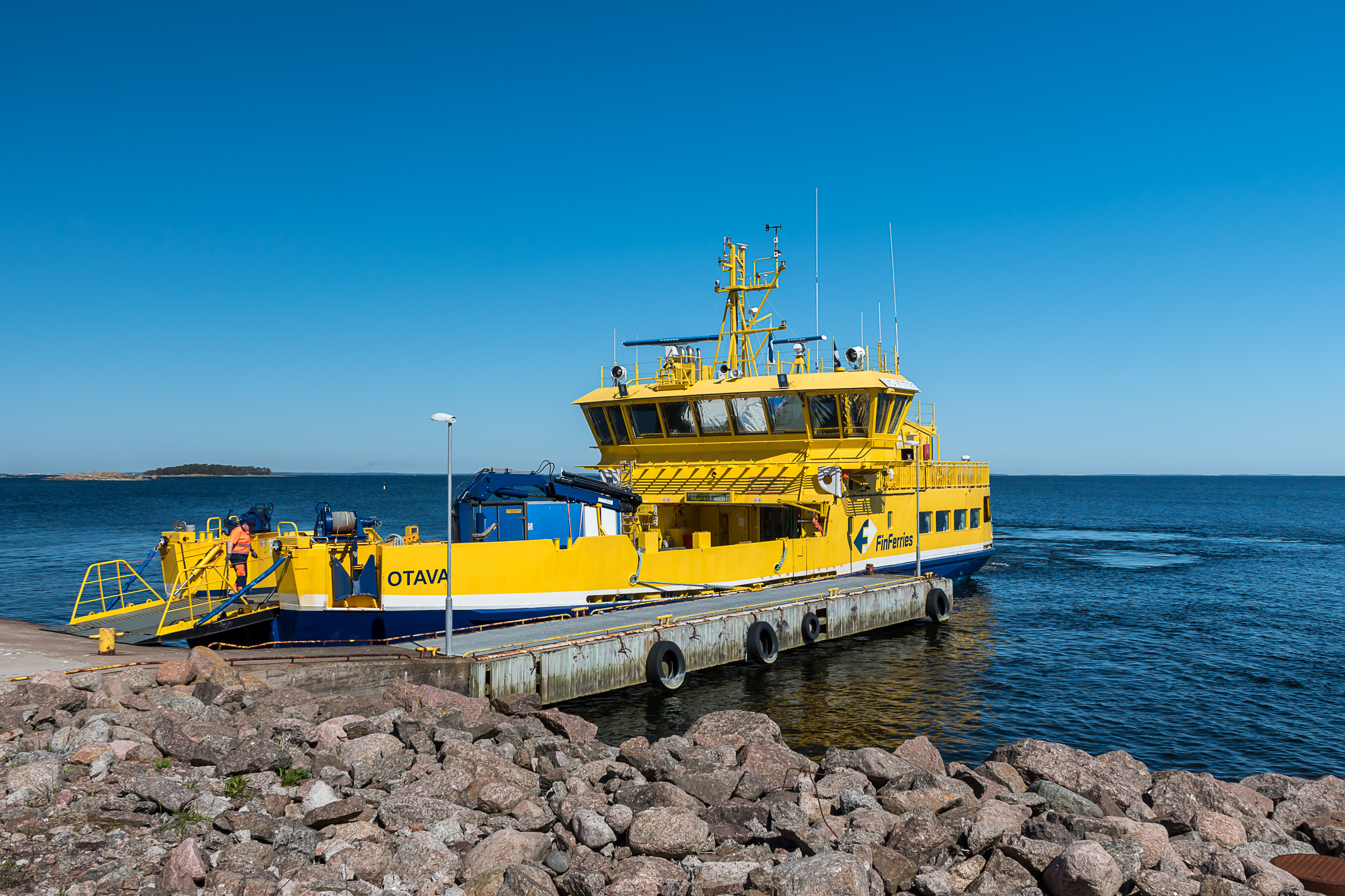
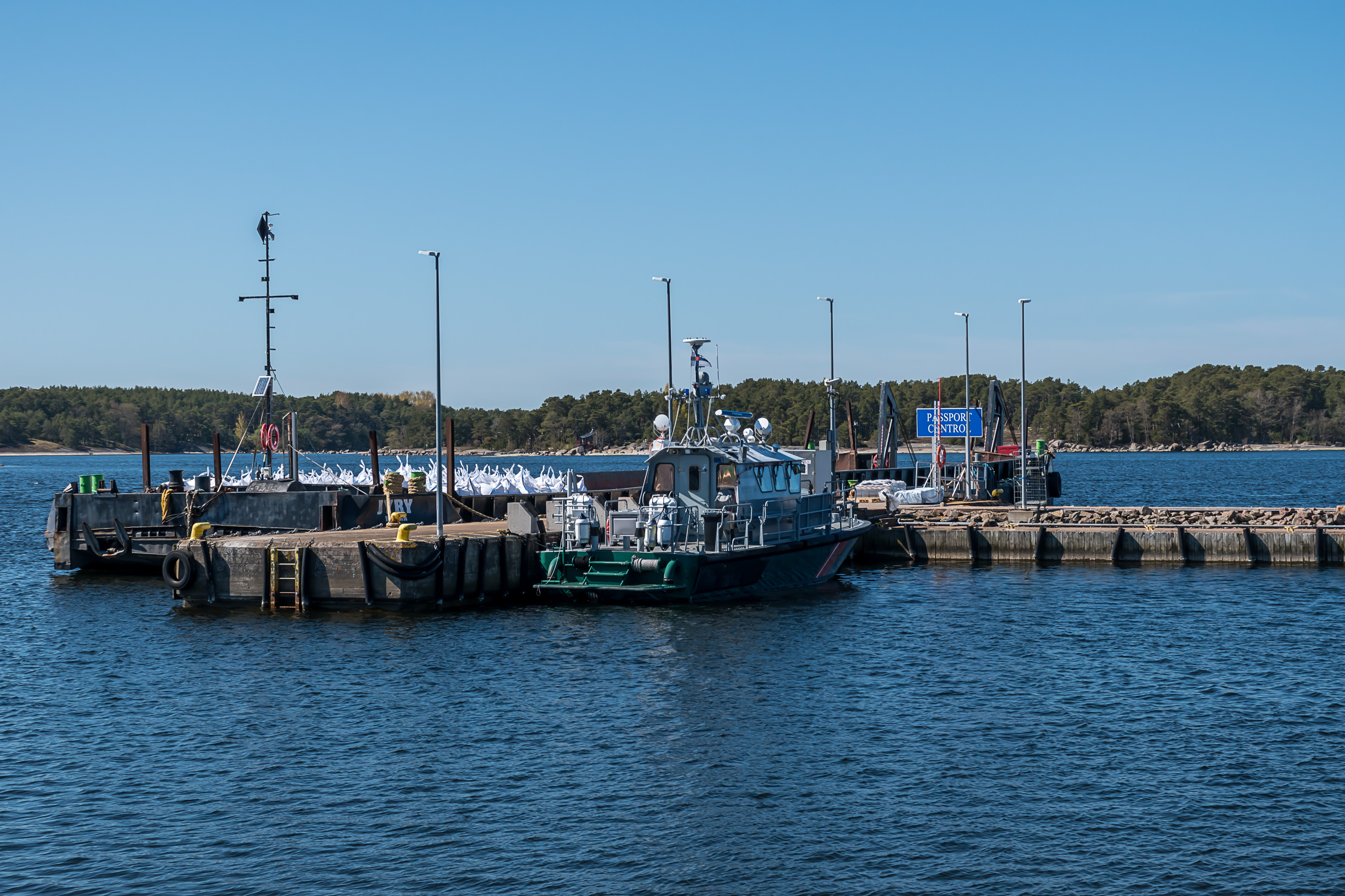
18. The empty Otava, staying at the harbor for two hours. Actually according to the announcement on the FinFerries website, on this and the previous day passenger ships were exceptionally using this harbor, facing the open sea in the north and actually a military one, because something happened at the normal one. Honestly I couldn't in the end tell which harbor is supposed to be the normal one.

19. This is indeed a military harbor and there are even signs saying it is off-limits, although no actual fences or guards or anything. Haapasaari has both military and border guard presence, and they are apparently distinct from each other. The military presence is limited to the harbor, the daymark and this weird place cut into the rock; I don't know what they actually do here.
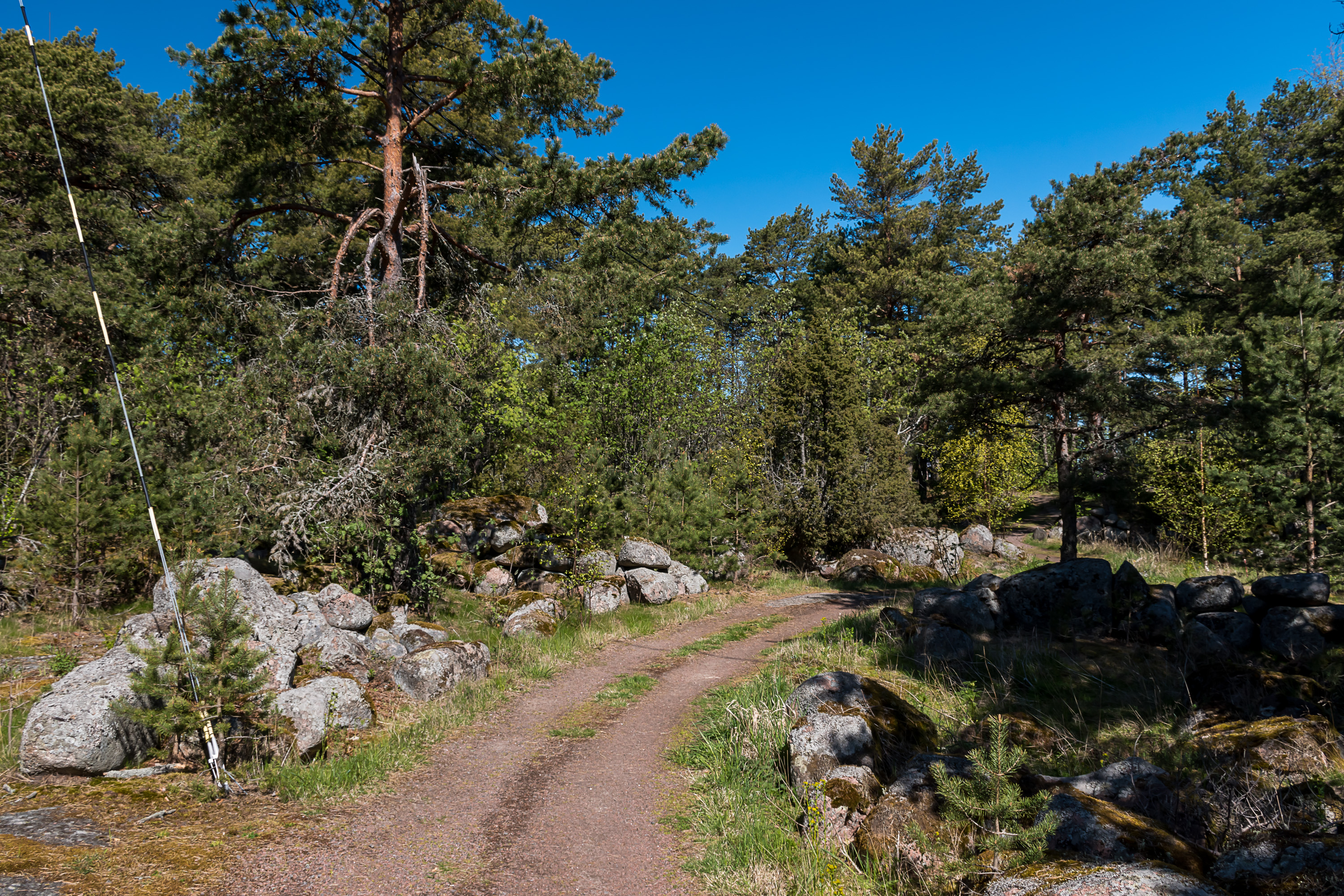
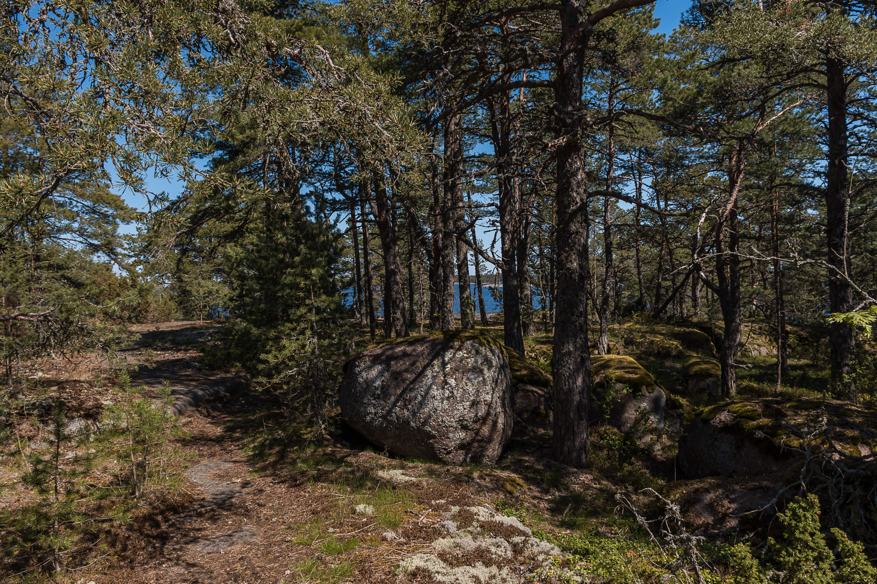
20. The few dozen people coming from Otava all followed this track, and so did I.
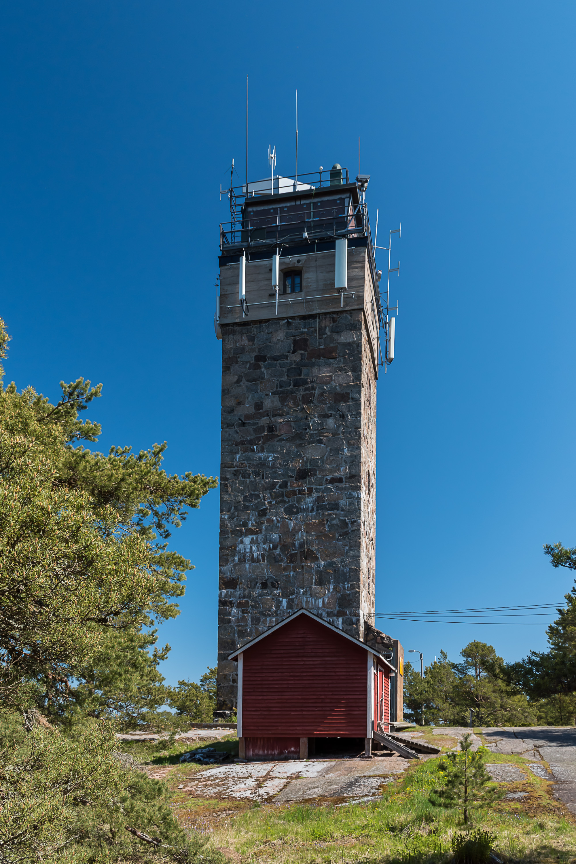
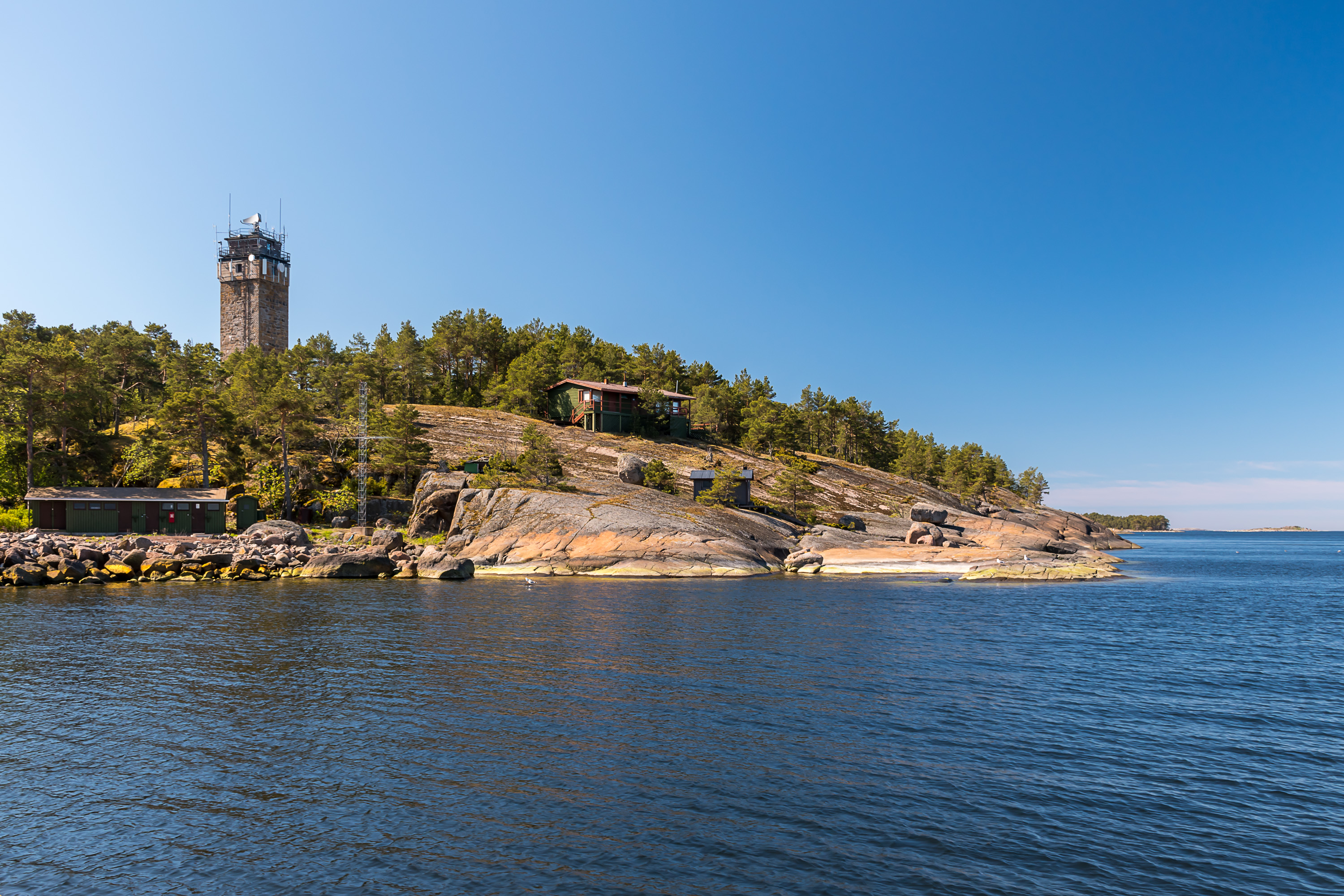
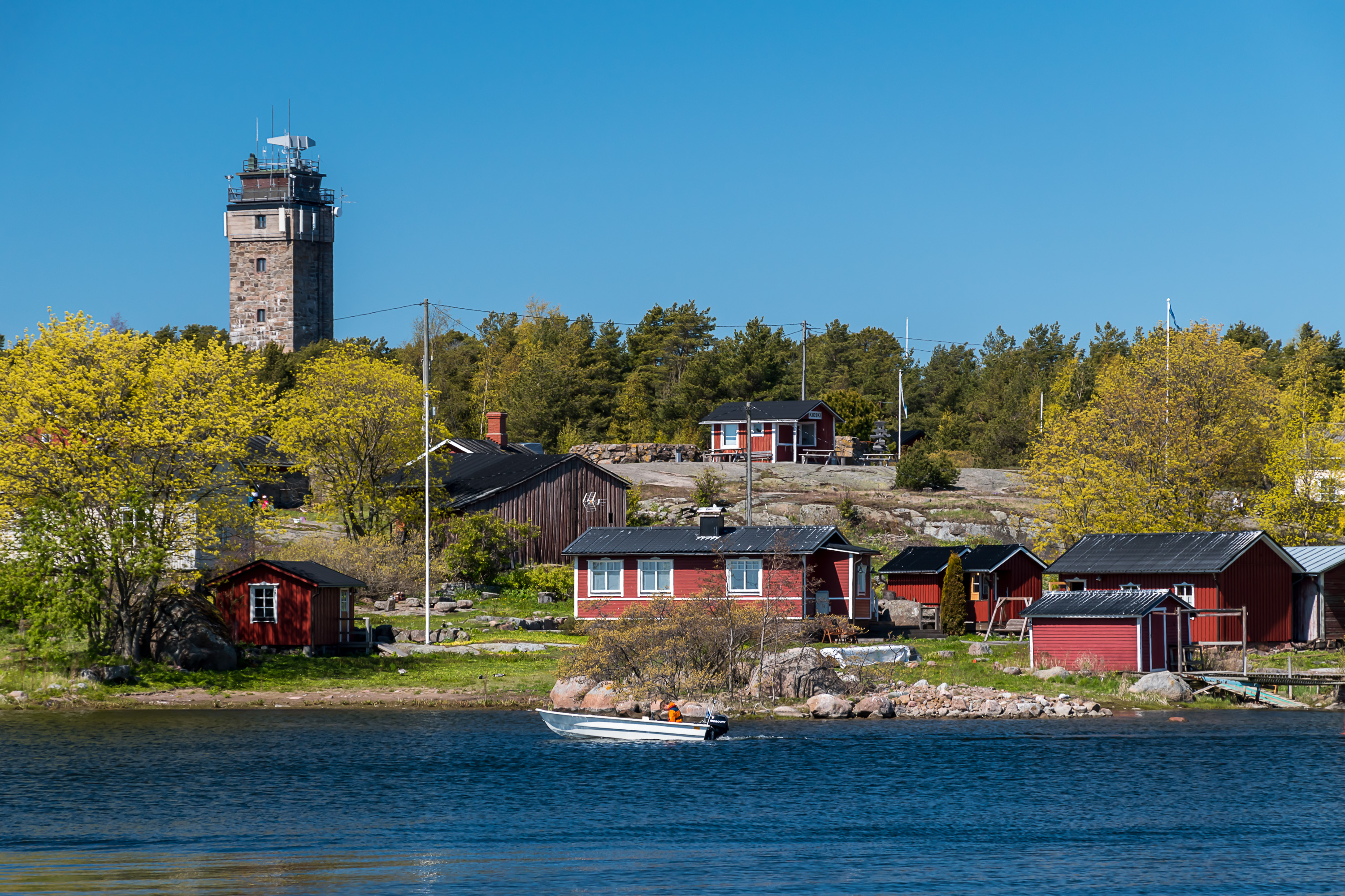
21. The daymark is the most obvious sight of Haapasaari. As I mentioned it was built in 1862, although there had been navigation signs preceding it too. The daymark is nicknamed Puokki, perhaps because one of the words for daymarks in Finnish is pooki (from Swedish båk).
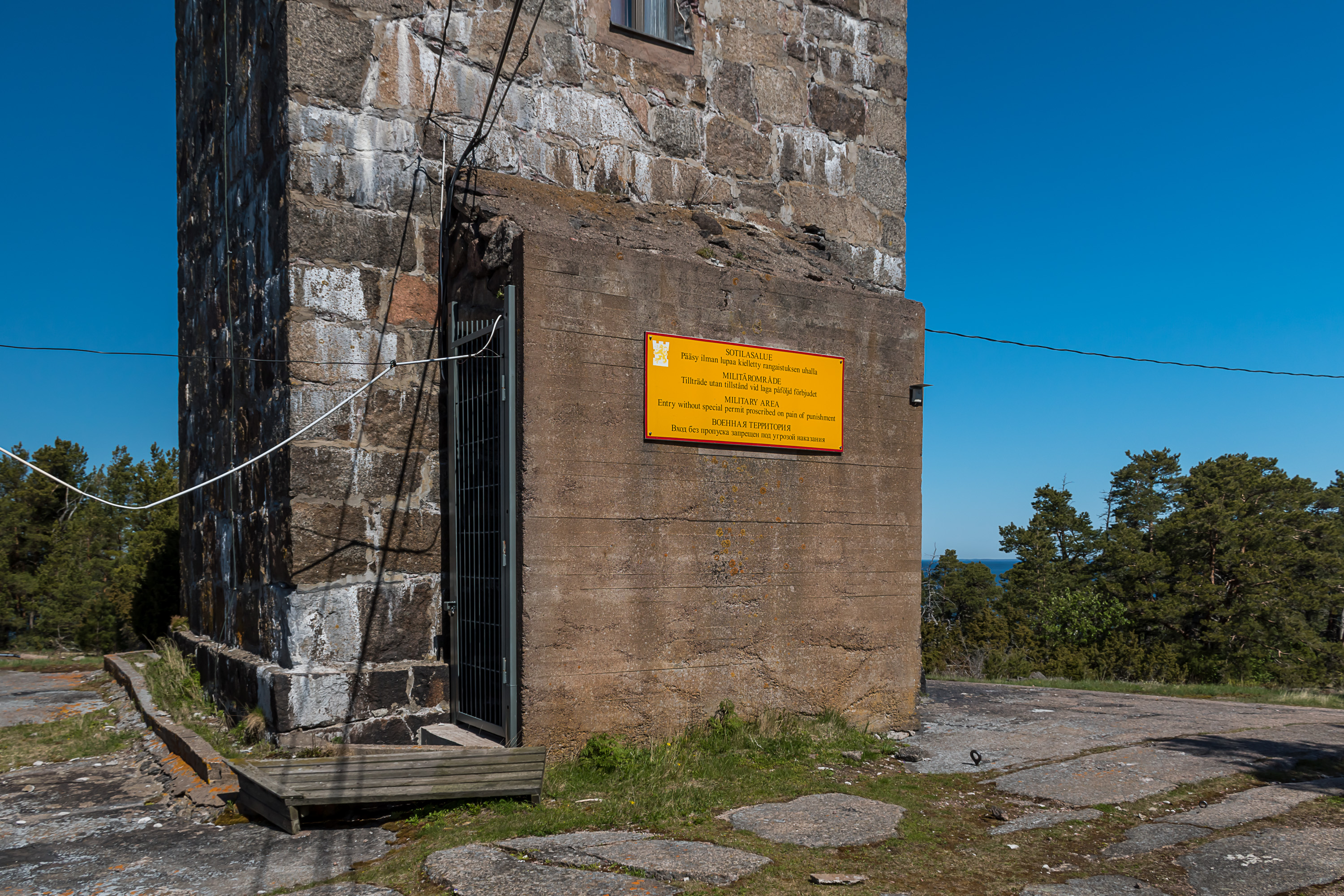
22. A sign tells you you shouldn't be hanging around here too much. Presumably because of that radar on top, although in truth visiting lighthouses and daymarks is usually forbidden or severely restricted in Finland anyway (to my disappointment).
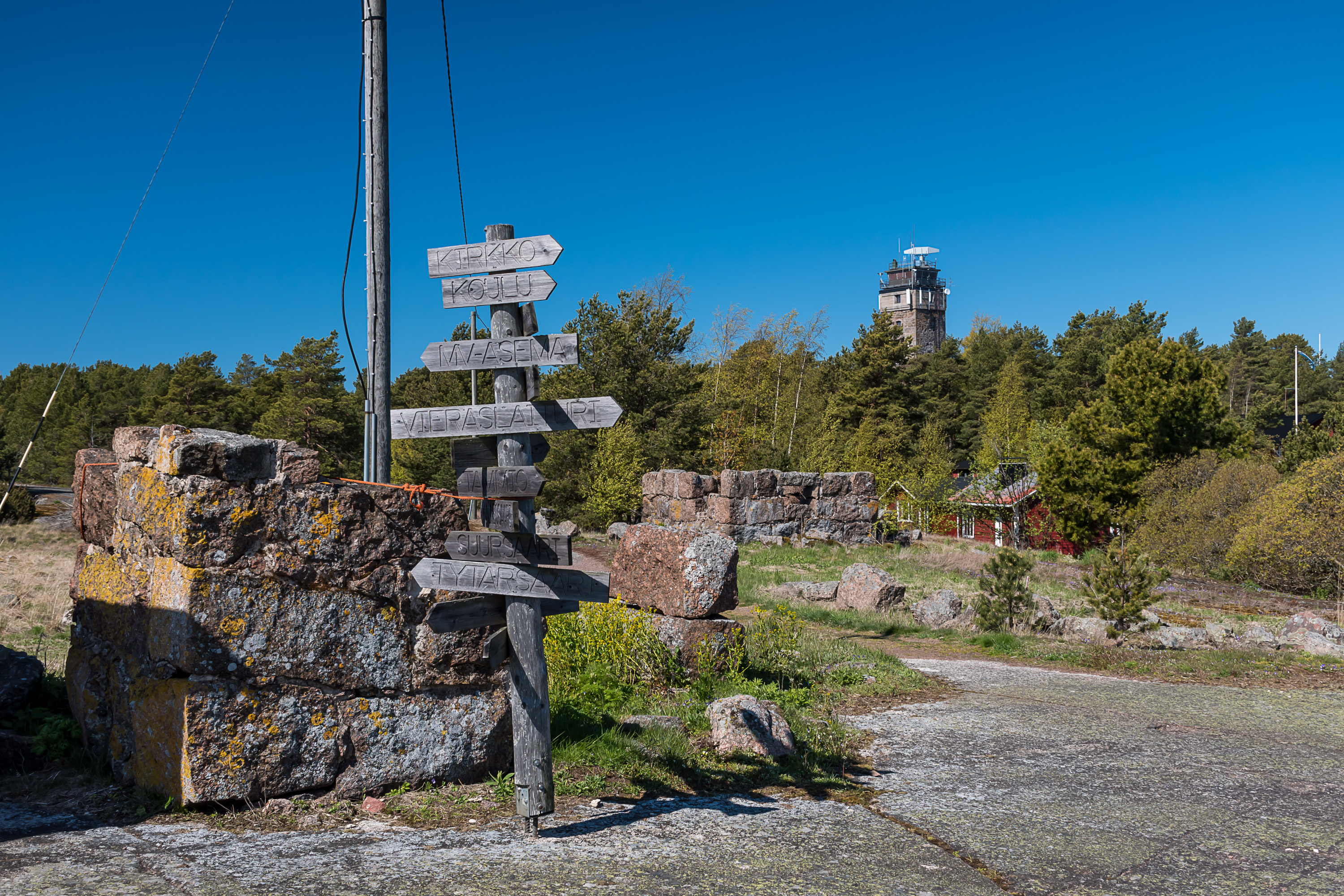
23. Meanwhile the track leads us to this crossroads, with signs showing local destinations like the former school and the church, but also directions to nearby islands such as Suursaari and Tytärsaari. I don't know where the small stone ruins come from, they certainly look too old for the 20th century.

24. Because the 20th century ruins are also quite prominent, forming a line on the stony part of the island. These obviously had some artillery in war times.
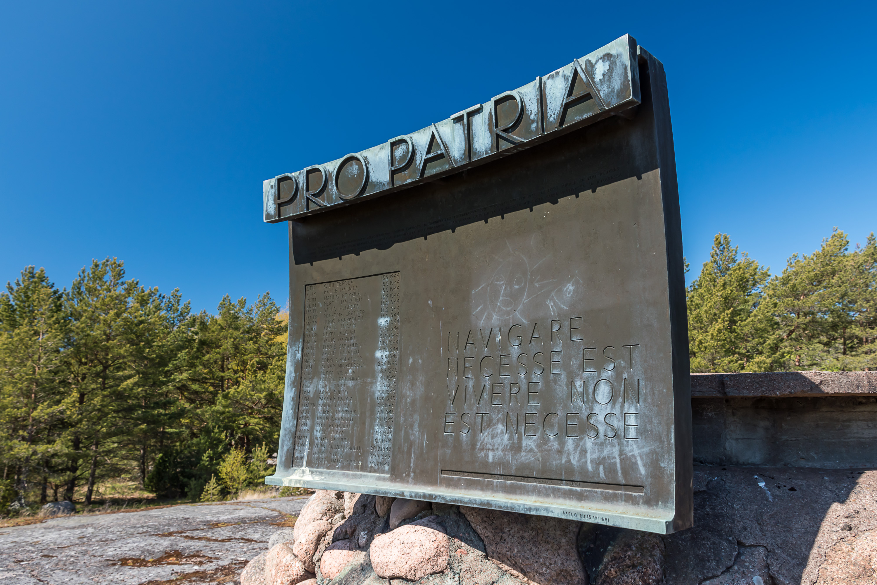
25. The one and only monument at Haapasaari is located at one of these artillery positions. It is meant to honor seamen who died in minesweeping operations after the war. As far as I'm aware this is just a general monument to all minesweepers, not to ones particularly related to Haapasaari (not that many people died in these operations in first place). The Latin words navigare necesse est, vivere non est necesse mean "it is necessary to sail, to live is not necessary", and are attributed to Pompey who supposedly said that when he commanded his men to bring a load of food from Africa to Rome in a severe storm (sailing on the same ship with them, of course).
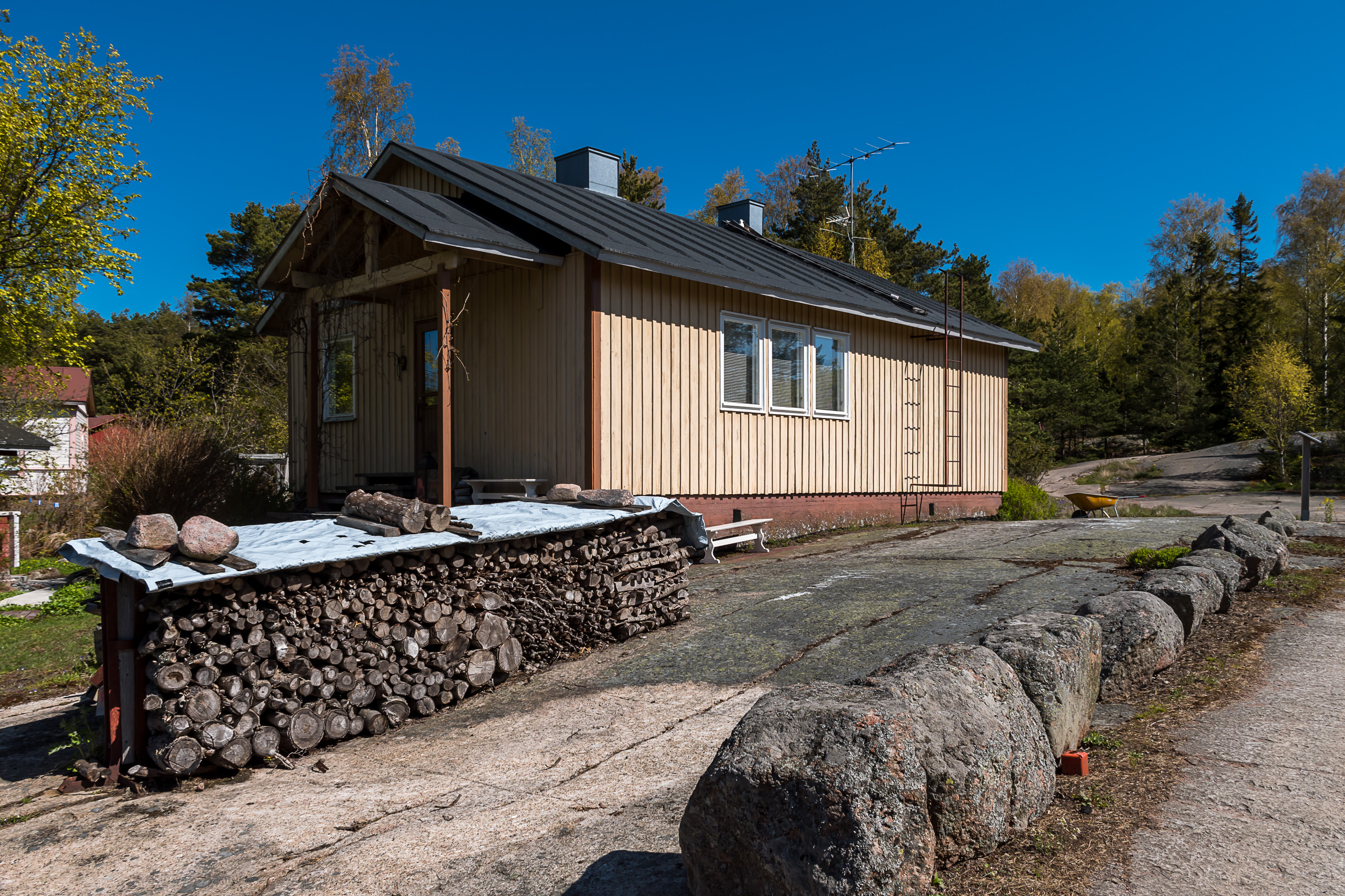
26. The island has electricity, apparently first brought here by a cable from the mainland in 1994. There are also water hoses here and there, just lying on the ground but giving the impression there might also be some semblance of centralized water supply.
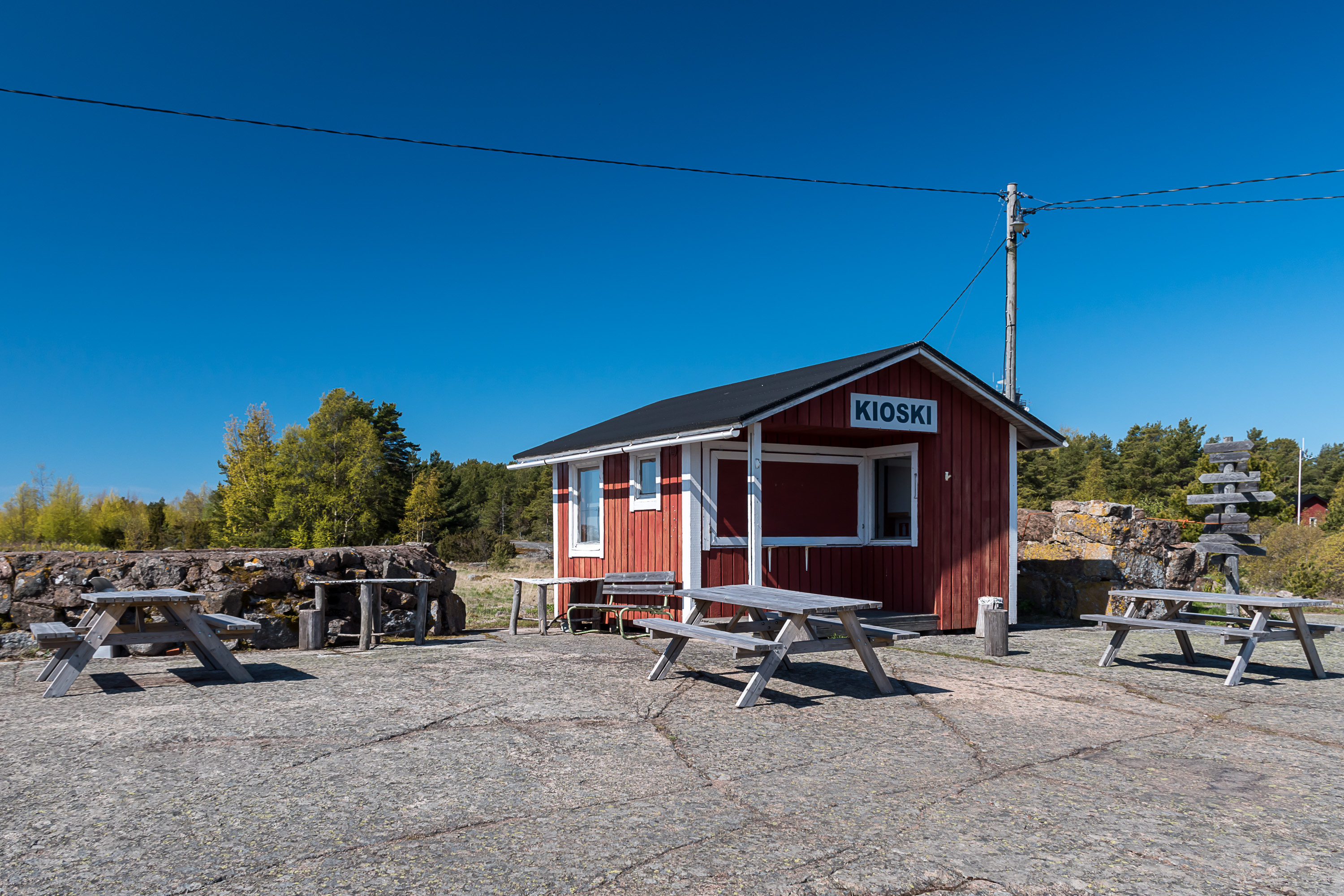
27. The "kioski" at the main crossroads, closed at the moment.
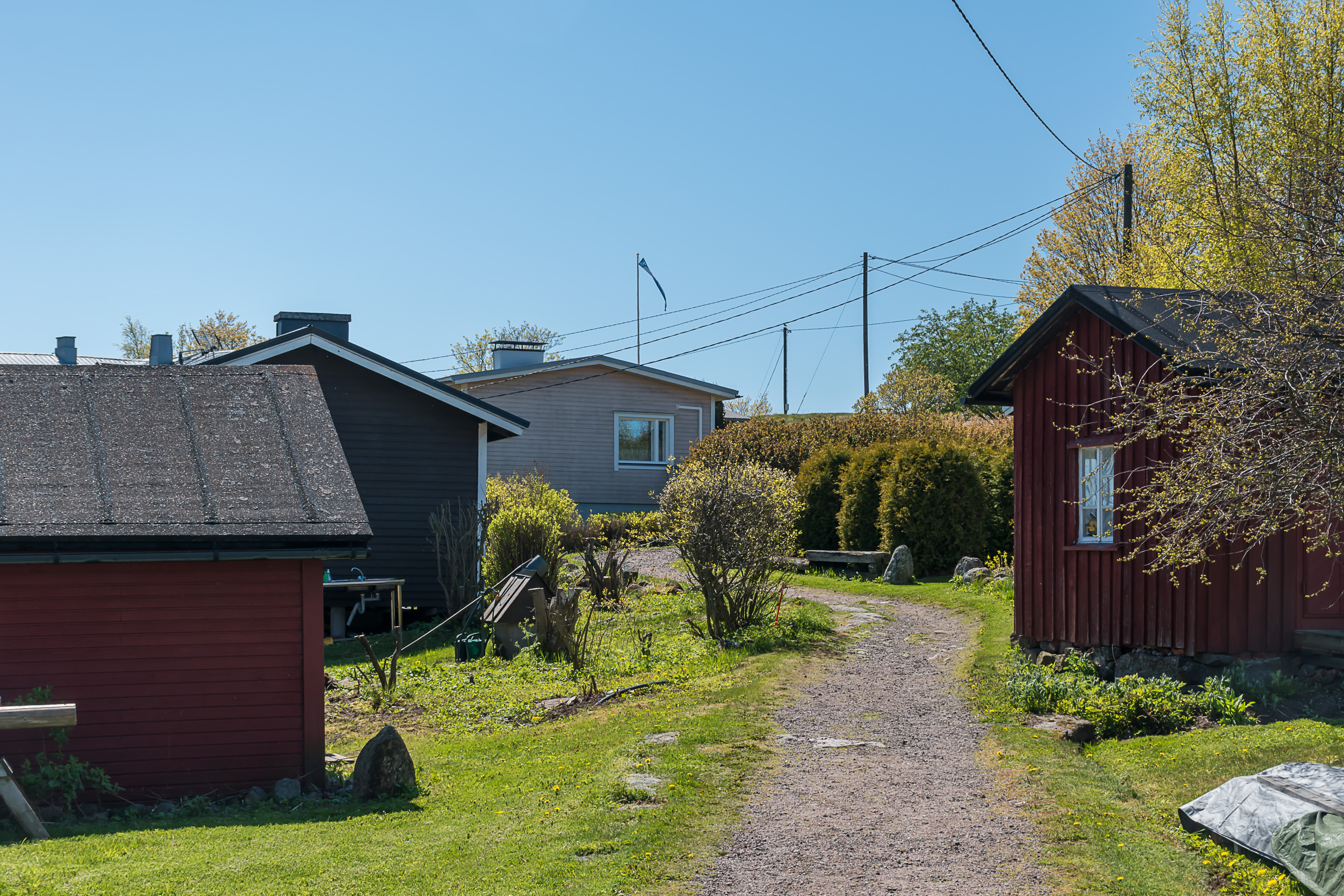
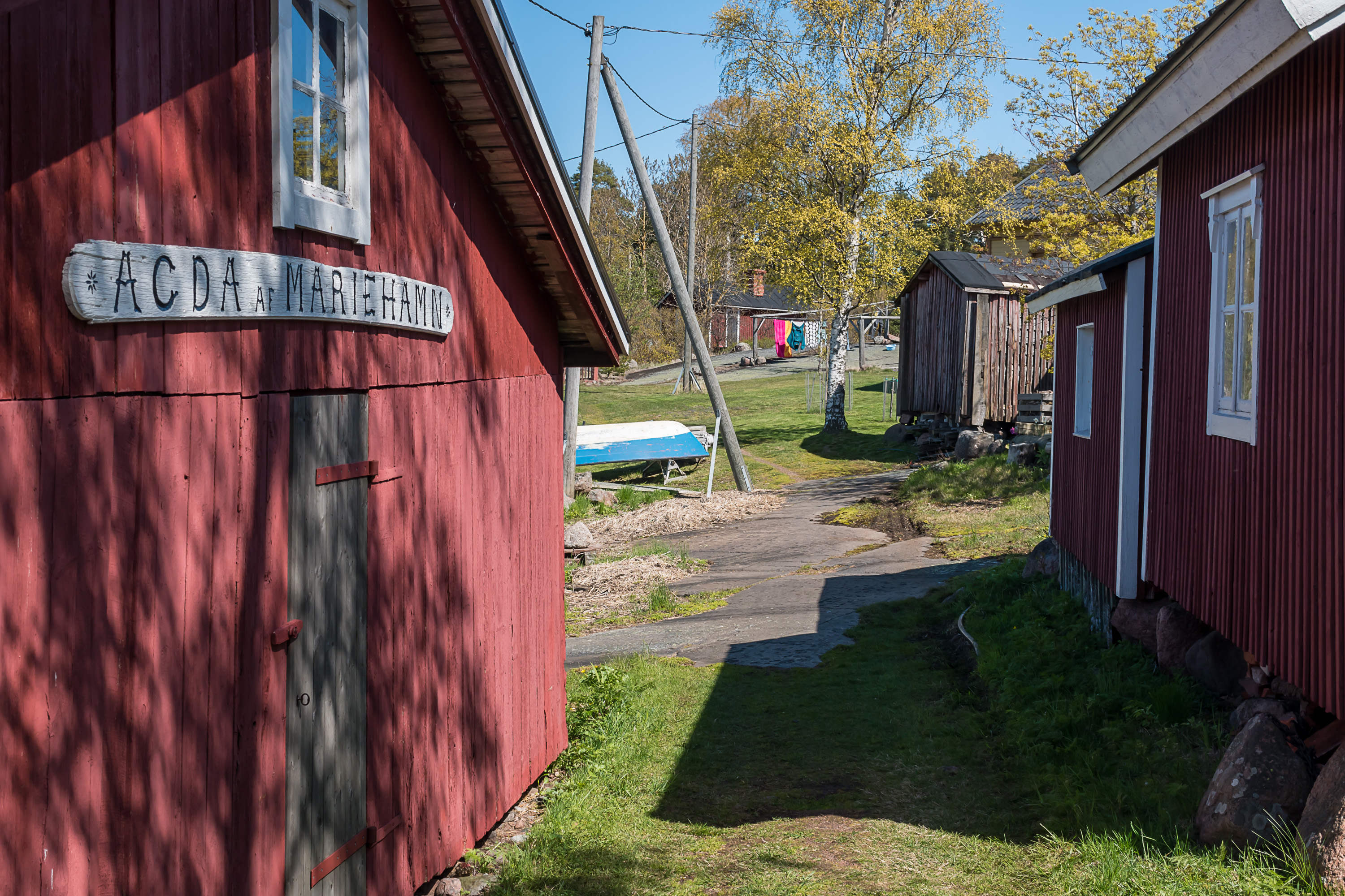
28. This is what the main "road" of the island looks like. There is a small network of such tracks, although they are not marked in any way and a few times I followed what appeared to be such a track and ended up at someone's front yard. After everyone who had arrived by Otava went to their homes I saw very little people, but some of the few passer-bys that I did see greeted me, which is in Finland a sure sign you have reached really obscure lands.
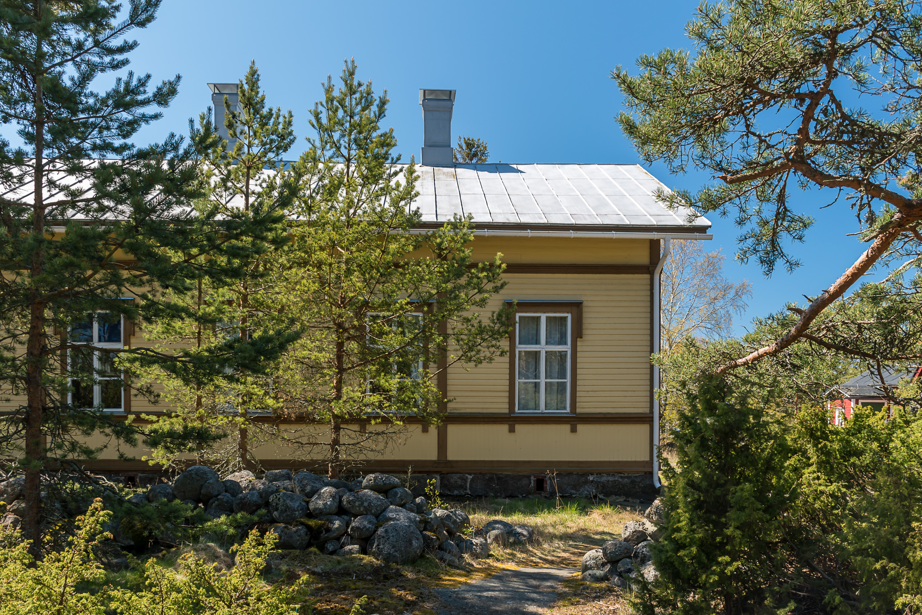
29. Going on the main "road" to the "west half", we soon see the former municipal administration building. It then served as a library and now is a private home.
30. At the west end of the island there is another small bay, which serves as a border guard harbor. Note the building in the middle. It's the only obviously modern building in all Haapasaari, but is still designed to more or less fit with the others.
31. Border guards headquarters is a building quite a bit older. Most Haapasaari buildings date from the 19th century, a few from the late 18th or early 20th.
32. The lone border guard boat.
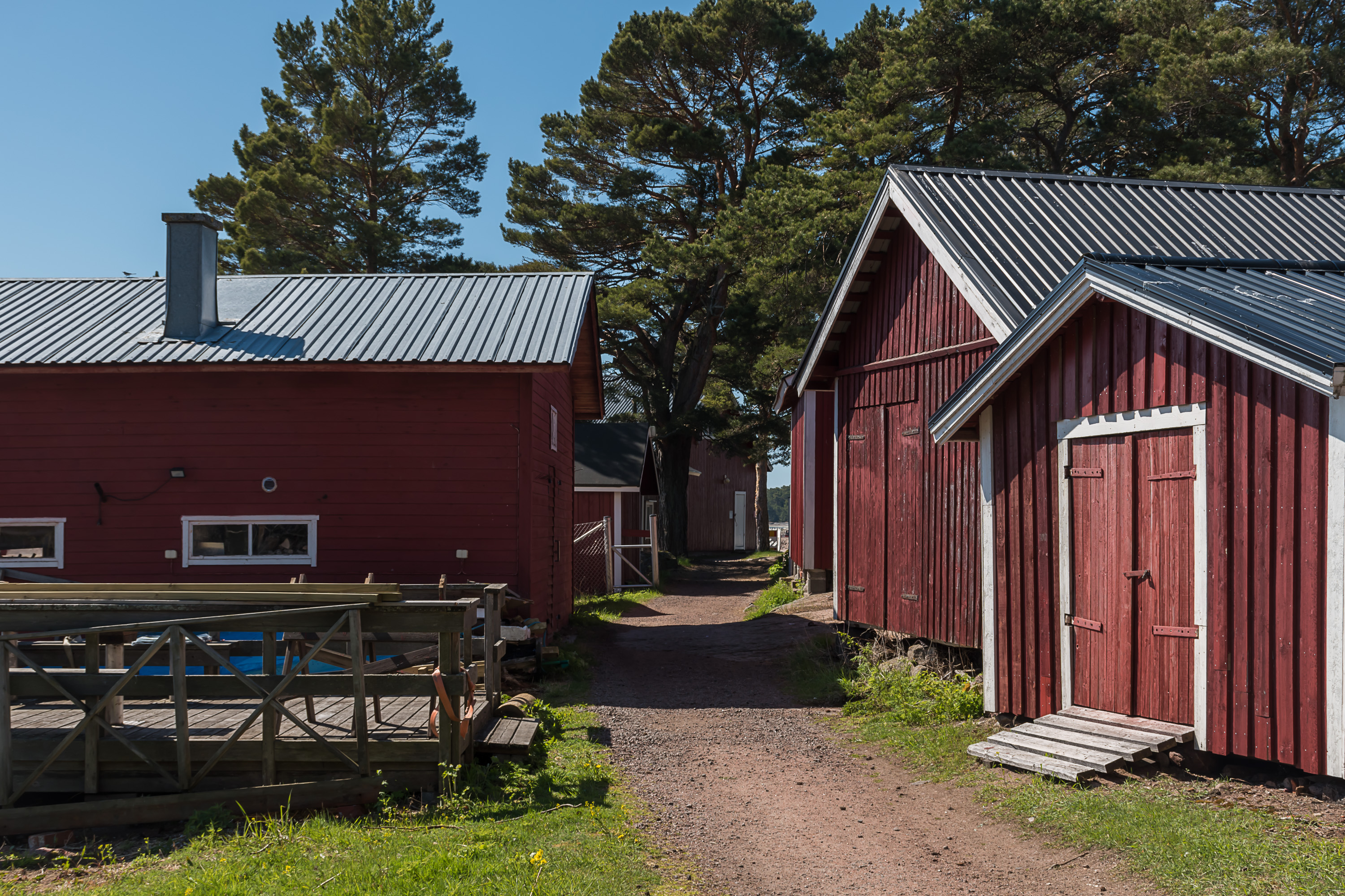
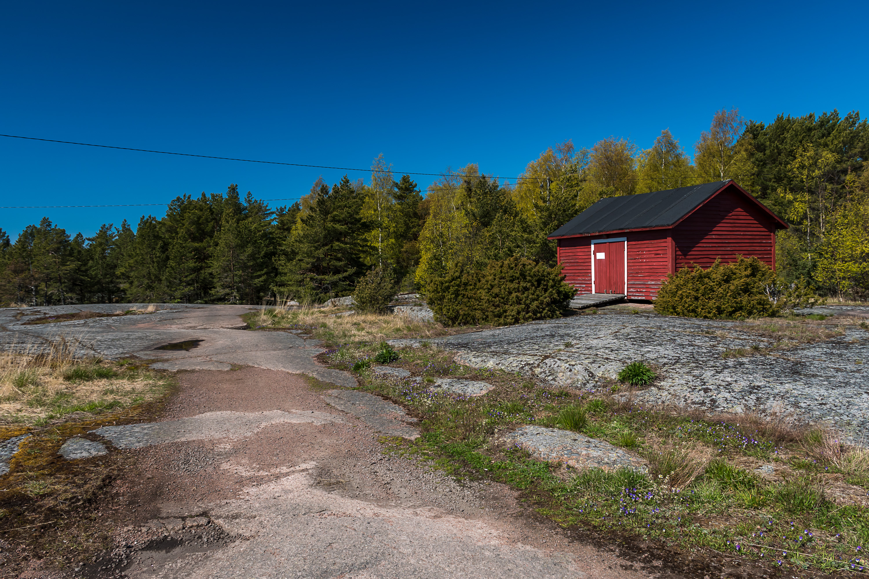
33. Private boat sheds.
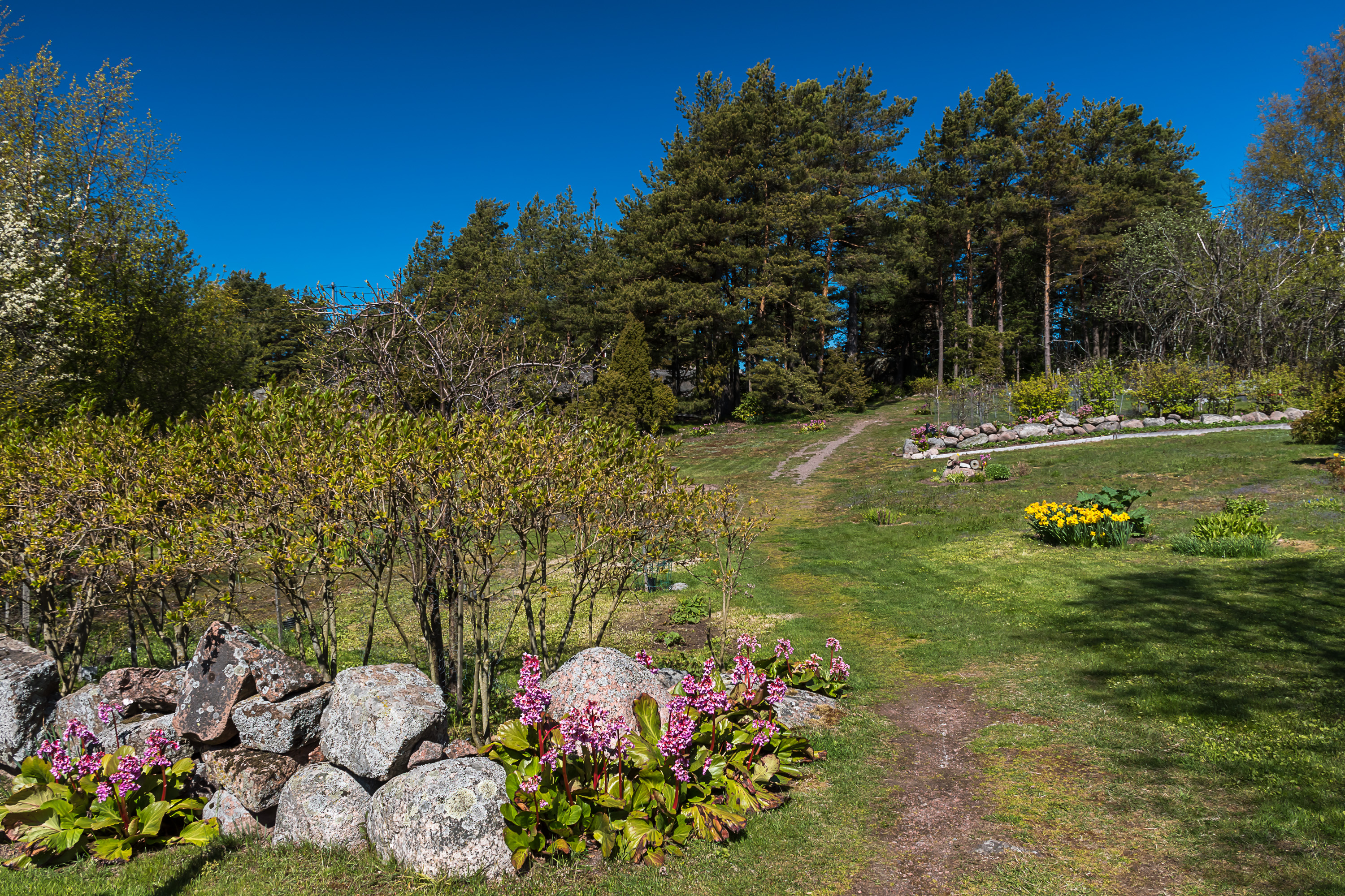
34. A small public "garden" by a track.
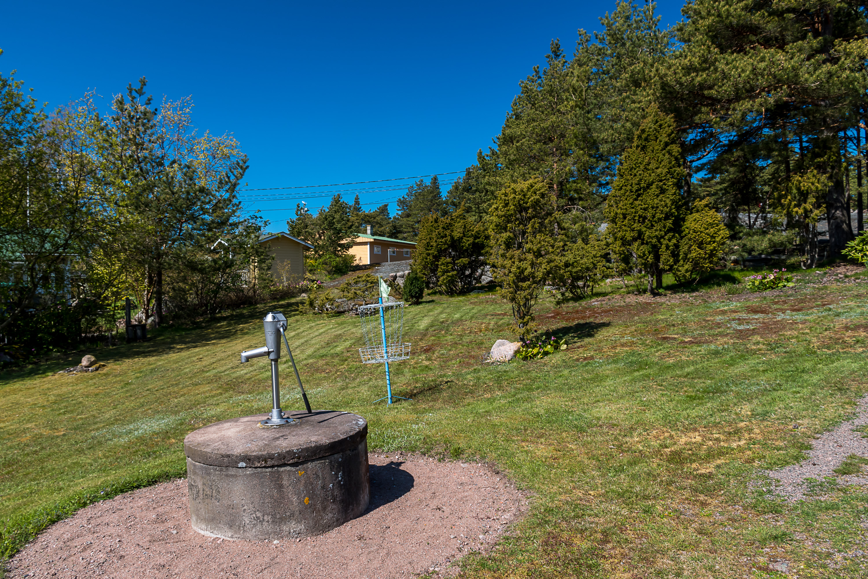
35. This garden has a well and a frisbee basket, because of course there must be a frisbee basket. (Frisbee golf seems to be oddly popular across Finland and I've always been mildly amused by that.)
36. The most beautiful coast of Haapasaari is the northern one, steep and rocky. I sat down here and ate some snacks I had with me (I hadn't had a proper breakfast). A startled hare ran into the woods nearby; I couldn't take a picture of it in time. This raised many questions for me. Can Haapasaari hold a hare population (obviously it would have an advantage of not having large predators), or is this just some lone lost hare who wandered here on sea ice and is trapped now? Hopefully not the latter option! (Well, on one hand, why would a hare run across 25 km of ice into the sea to reach this island? But still apparently some hare or hares did exactly that, even if they were the ancestors of the hare I saw.)

37. Many small islands around Haapasaari actually belong to the National Park of Eastern Gulf of Finland (Itäisen Suomenlahden kansallispuisto). This is one of the few maritime national parks of Finland, and as such it is difficult to visit without an own boat, as there is obviously no regular boat service to the small uninhabited skerries. As far as I know the only national park island with any scheduled (private) boat service is Ulko-Tammio off Hamina coast, even closer to Russian waters than Haapasaari is. Boats depart there only in July and this year I intend to go there to claim this national park for myself. Haapasaari has some information boards about the national park, but doesn't belong to it itself.
38.
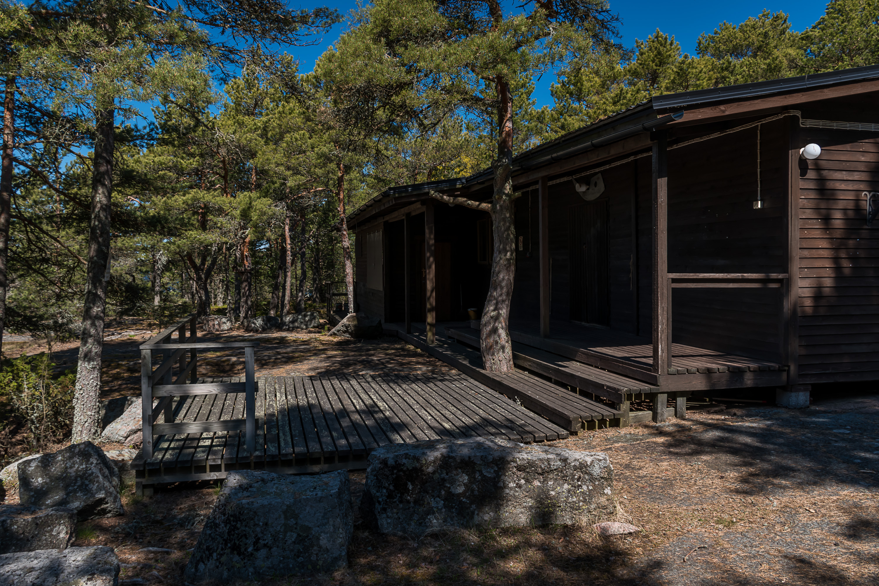
39. This is the village club of Haapasaari, Puikkarikuuri, which means something like "fishing net hook squad". It is a relatively recent buildiing, dating from 1977. I don't know what exactly they do here these days.
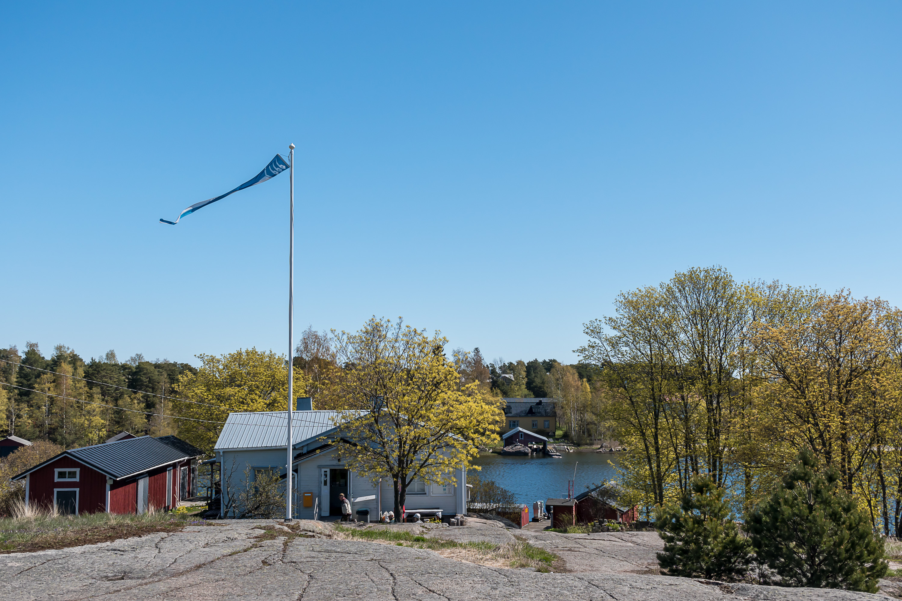
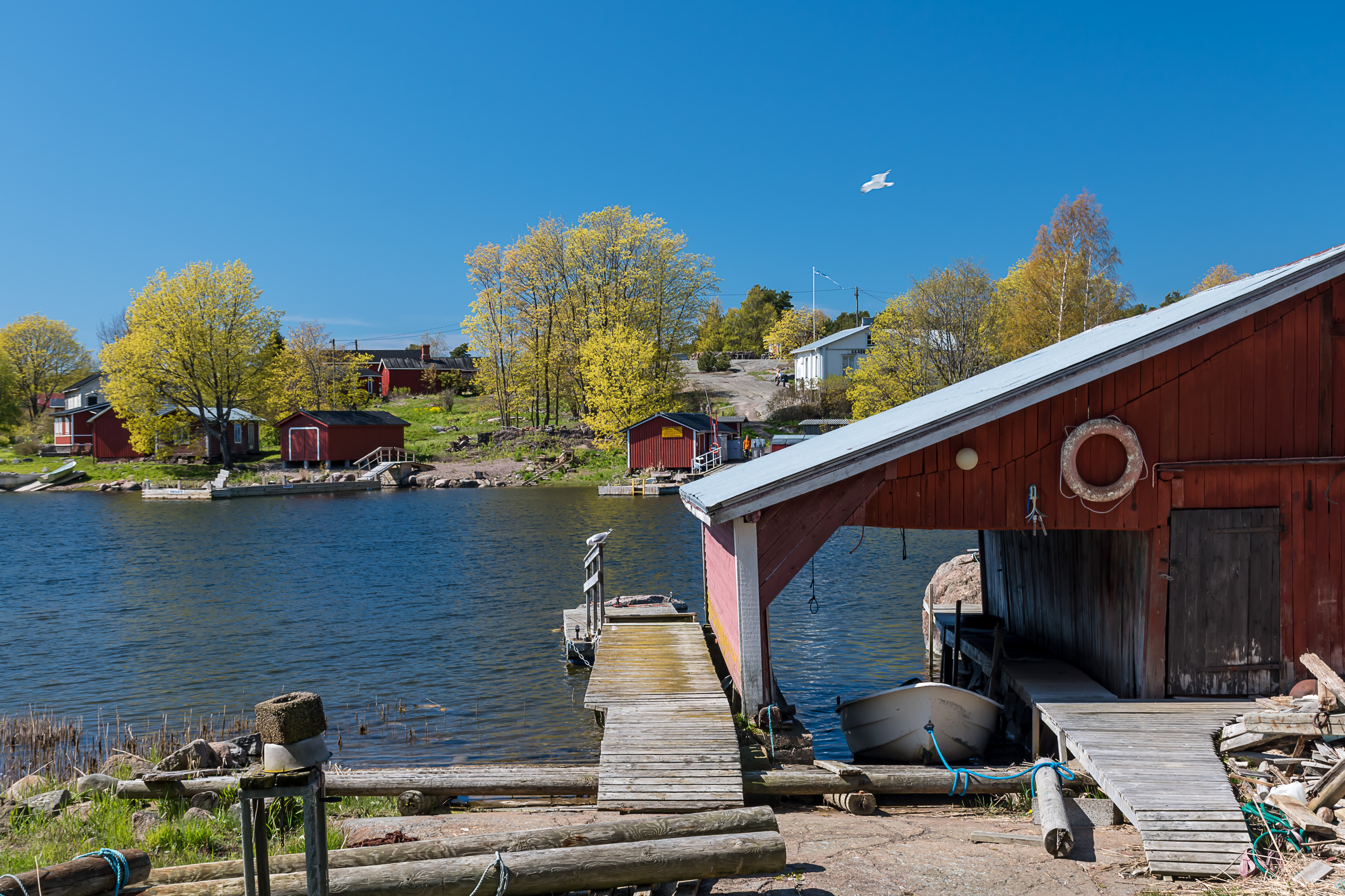
40. Going back to the center of the island, this is the grocery store of Haapasaari. The cooperative store has been operating since 1907, and is probably the pride of the islanders. It is open in winter too, if only for a few hours not every weekday. The benches near the store look like the main meeting place of the islanders, and quite a few people were hanging out there throughout my visit, although I didn't take a close picture as I normally don't just take pictures of random people.
Note also the pennon; the old municipal coat of arms of Haapasaari is still pictured in there. The coat of arms features three old-style hooks for fish nets, the kind called puikkari in Finnish. I saw quite a few of this pennons on the island; the islanders are proud of their heritage.
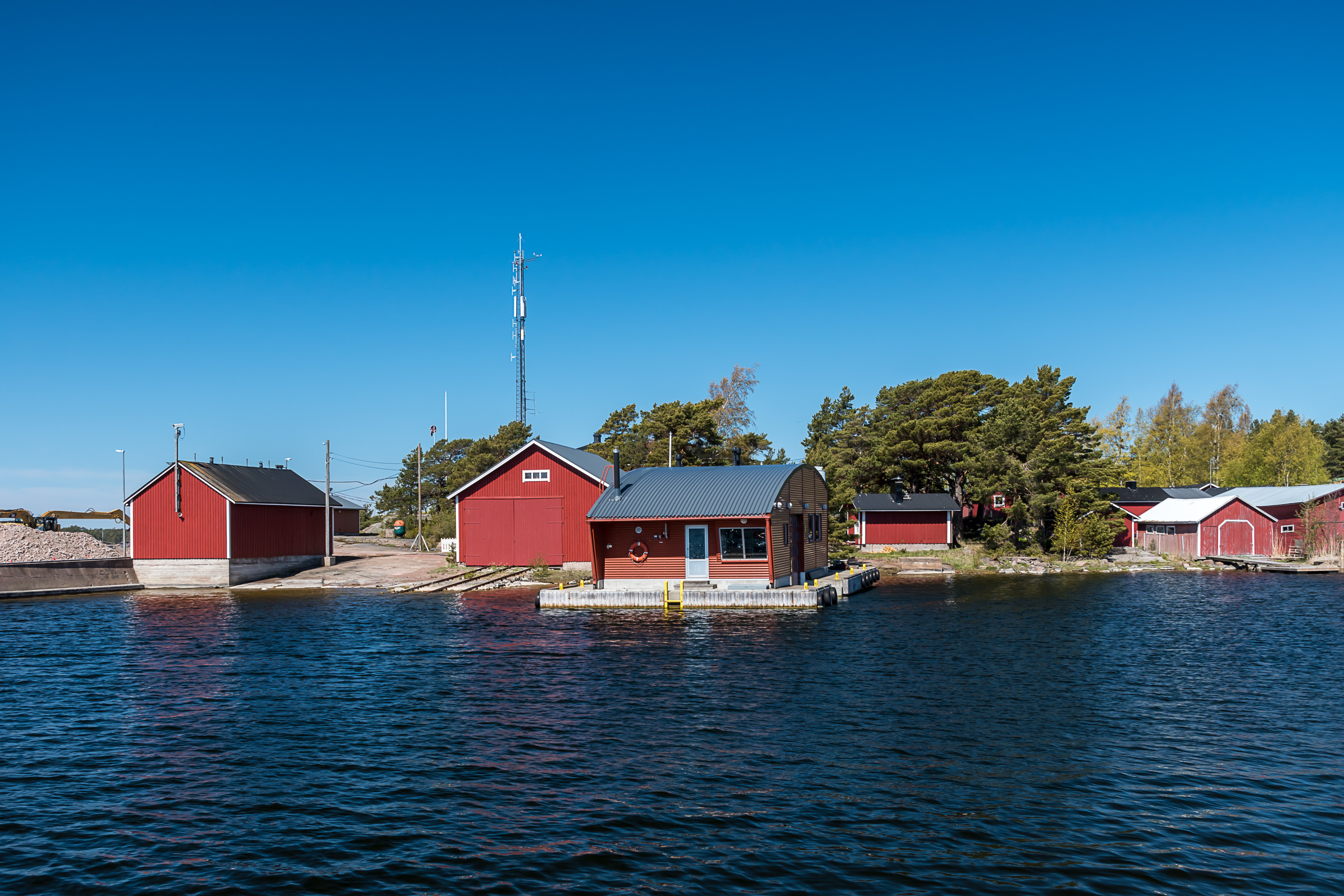
41. The store has its own harbor.
42. The ownership of the harbor is currently claimed by this seagull.
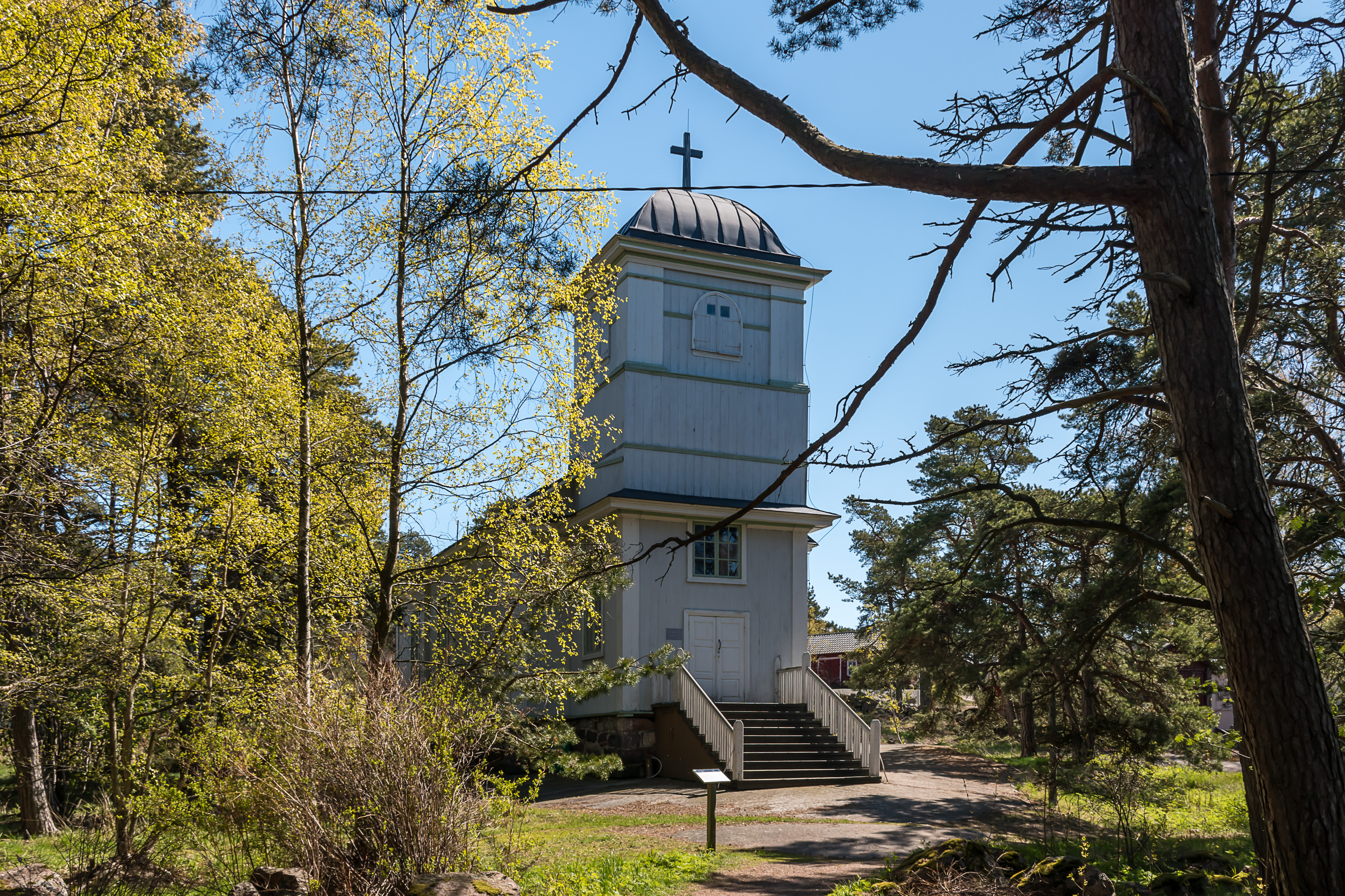
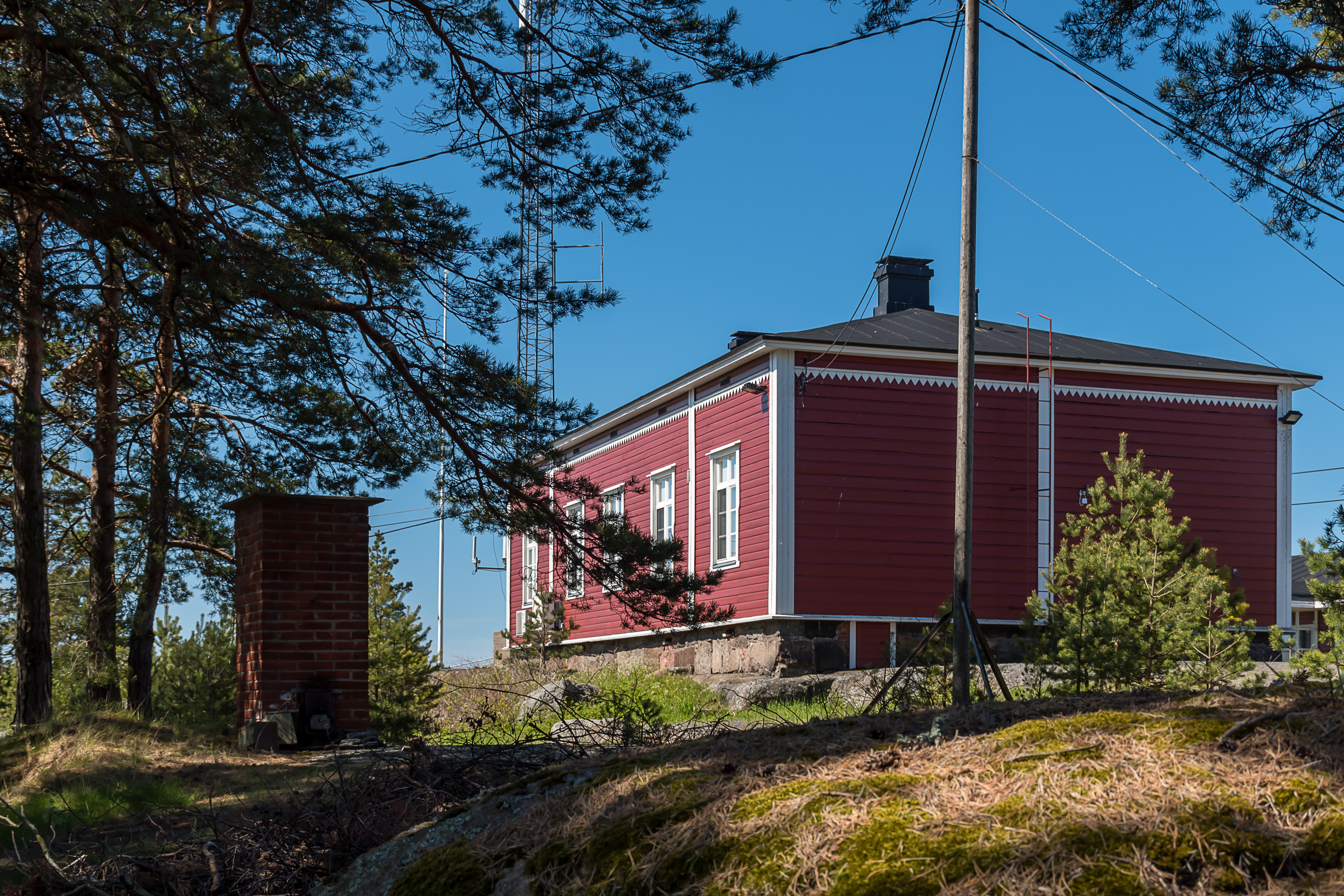
43. Going to the "eastern half", the first thing seen is the church, built in 1858 and still open in summer. It does have regular church services although it doesn't form an independent congregation anymore.
44. The "village bay".
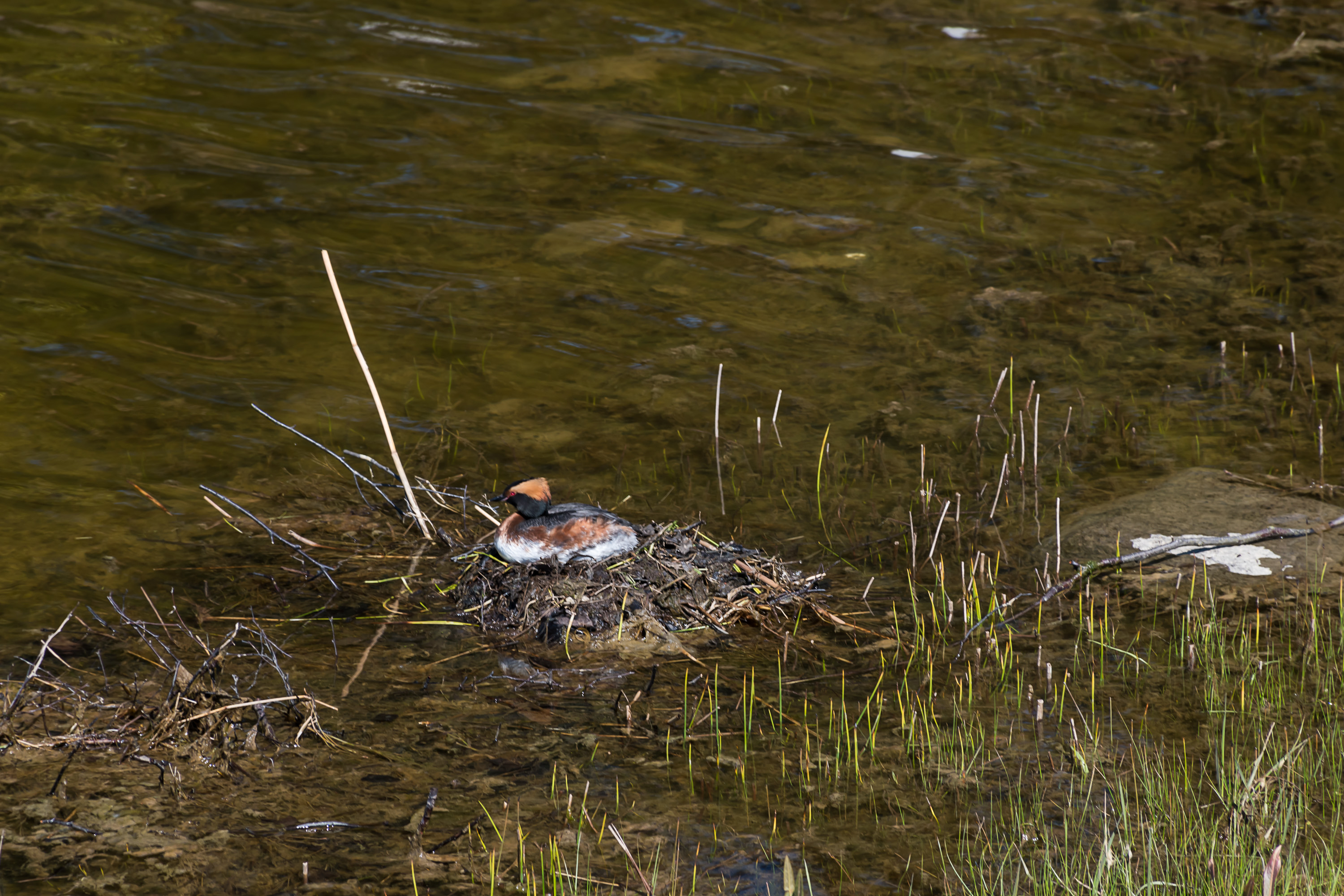
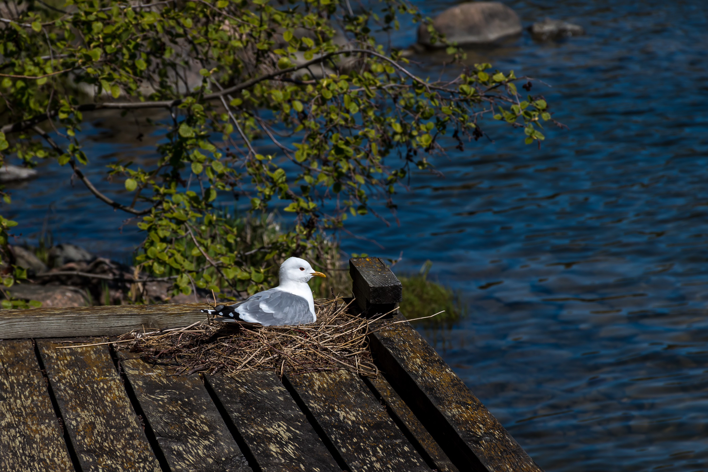
45. The bay is also home of some birds.
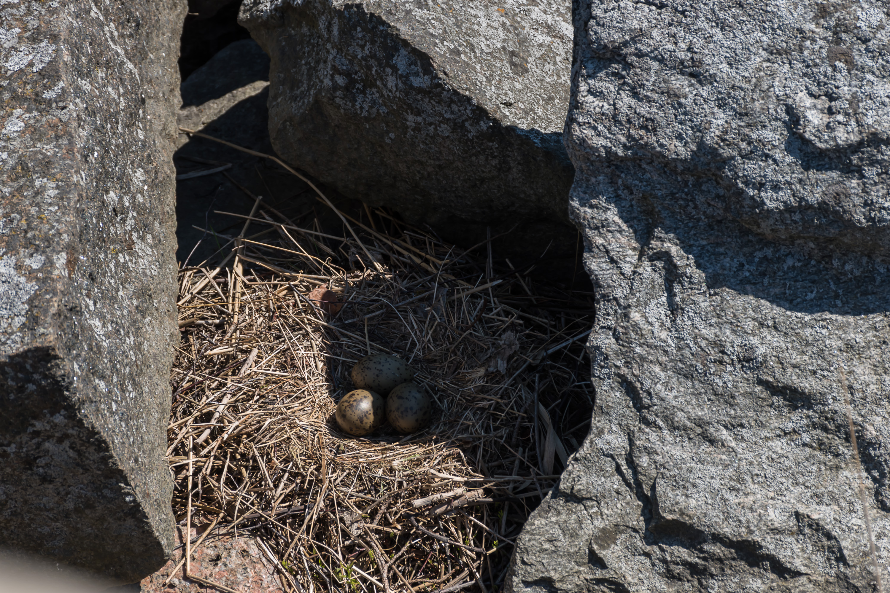
46. A seagull flew away from her nest very close to a pier when I tried to take a picture. (She returned promptly when I went away.)
47.
48.
49.
50.
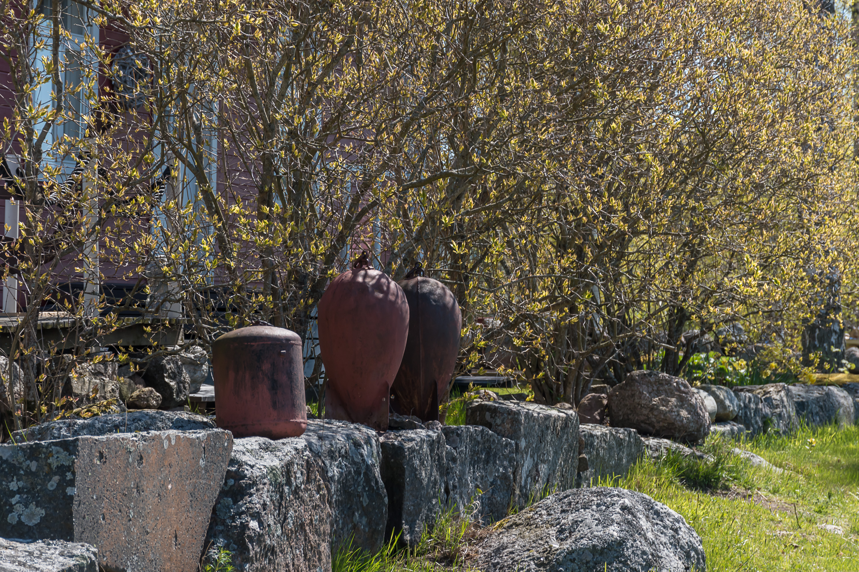
51. A few "fences" on the island were decorated with these objects. Are these old naval mines?
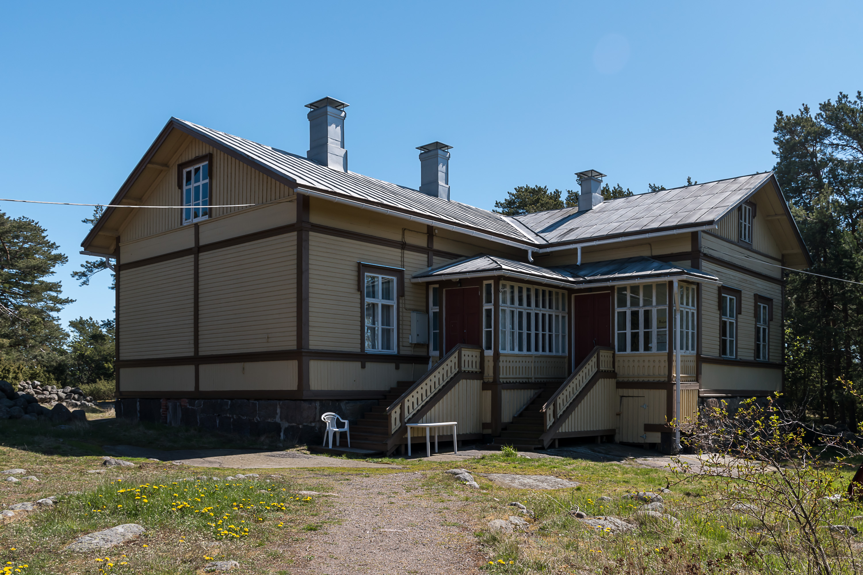
52. The old school now houses a library and a small museum, but is only open in summer. I was a bit disappointed.
53. Behind the school is the easternmost part of the island, the least populated one with only one house.
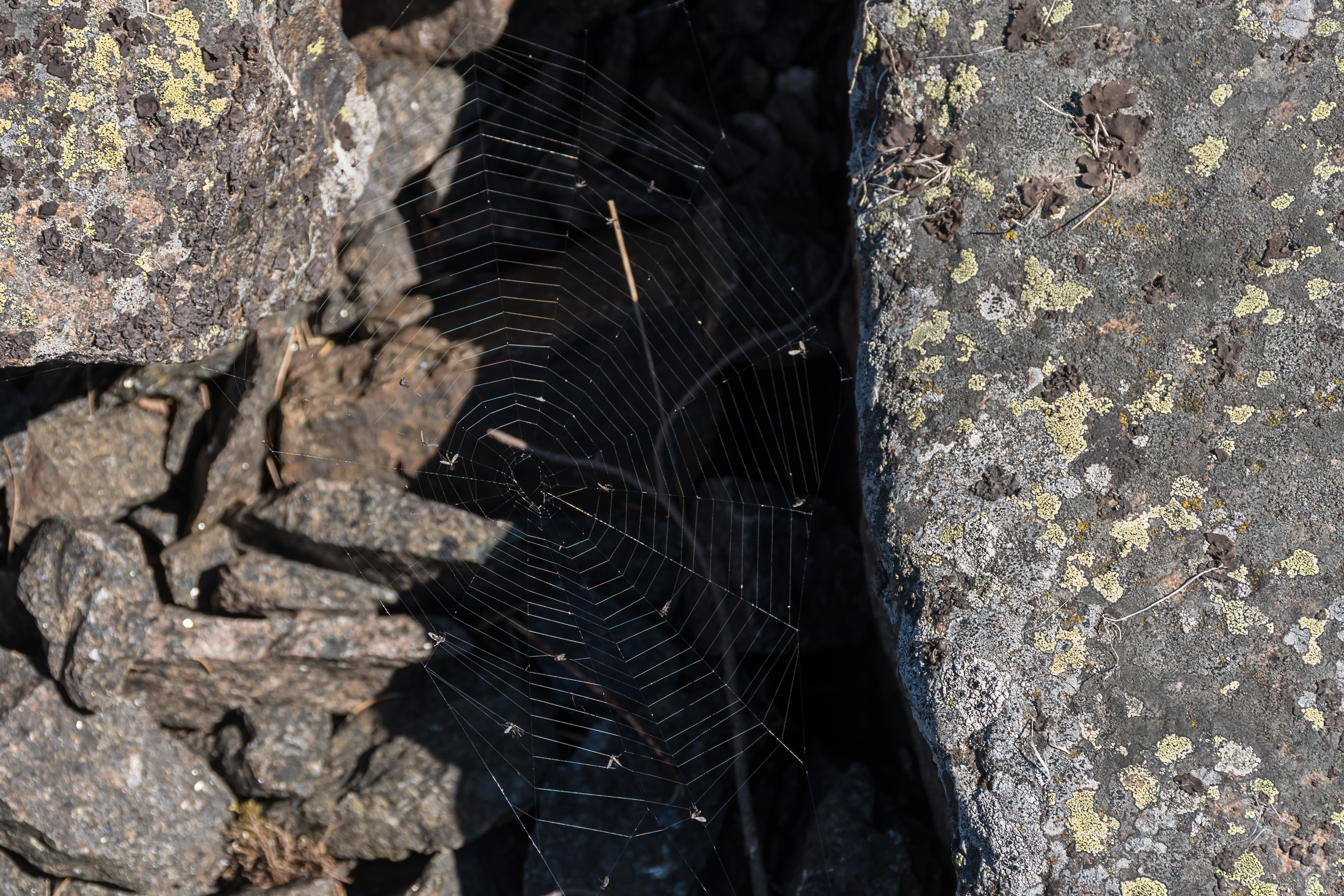
54. The topo map marks this location as "sacrifice stone" but I wasn't sure which of the boulders in this tiny forest is supposed to be the special one.
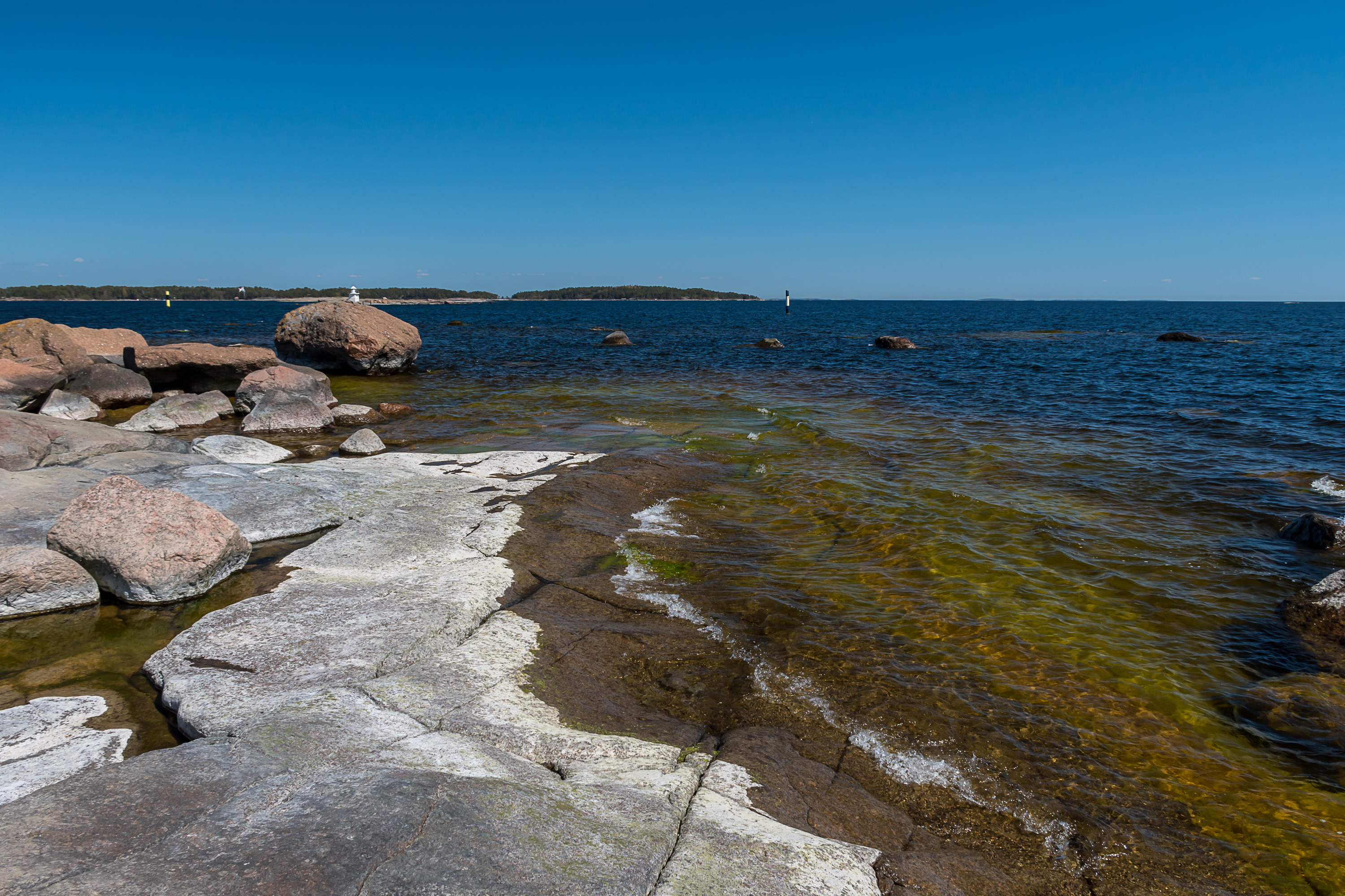
55. The eastern/southeastern coast is quite flat.
56.
57. A woman was sitting by a fire here and waved at me when I was walking past. However another woman soon joined her from a nearby house, so I suppose these aren't complete tourists like me either. (Well and of course you aren't supposed to light a fire on land not belonging to you without explicit permission.)
58. My favorite picture from the island.
59.

60. This white mark on a stone to the left might well be an old navigation aid. Such marks are called kummeli in Finnish; these are normally sea cairns, piles of stones specially brought into place and painted white, but often can be just paint marks on coastal rocks as well.

61. Kivikari sector light, the steeper northern coast again. The time was running out and I had to rush to the ship, but I really didn't want to leave the place...

62. But well I had to (or otherwise I would have to stay for like 30 hours here). Haapasaari is shrinking behind. We're returning to Kotka. I had some old travelogues about Kotka, which now I feel I should edit and expand, but that will be left for another day.