Over a month ago we were looking at Haapasaari, a still inhabited small Finnish island out there in the Gulf of Finland, about 25 km from the coast of the city of Kotka. We also mentioned that this is not the only island of its kind in Finland.
The best known and the most impressive such island is however very easy to identify. It is Utö (Swed. Outer Island) in the Archipelago Sea (Saaristomeri), the area of the Baltic west of Hanko and east of Åland Islands.
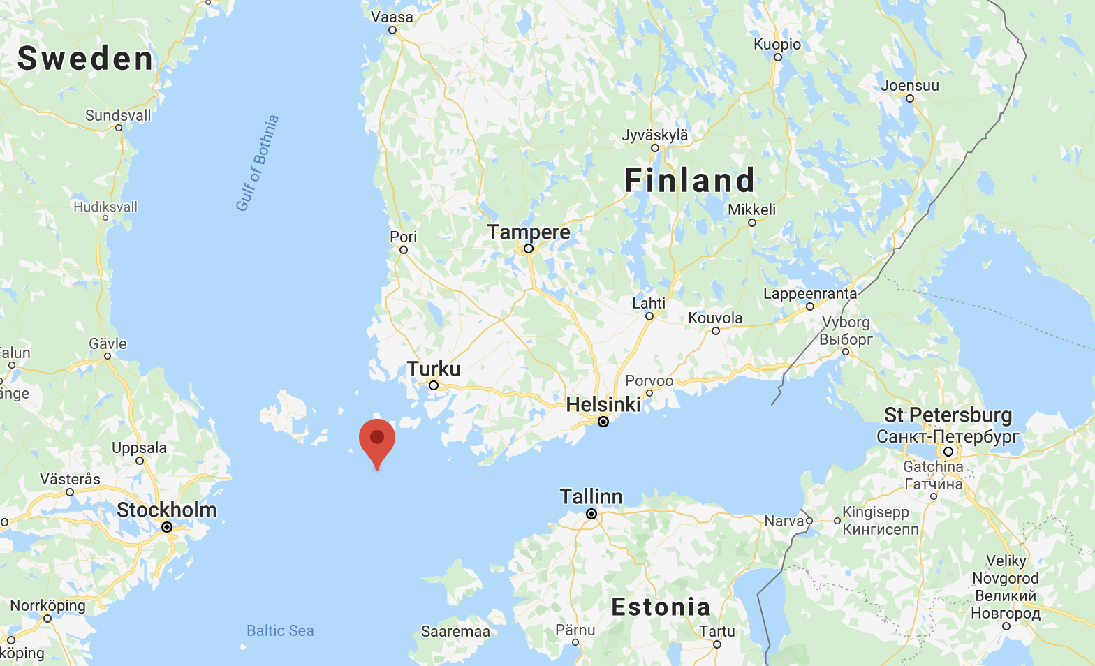
Utö, less than 1.5 km wide and 0.81 sq. km in area, with a permanent population of about 40, is incredibly far from anywhere and incredibly isolated. Well, of course there are much more isolated places in the world, but for Finland and really for the whole Baltic Sea it is an extreme outlier. Perhaps Estonian Ruhnu in the Gulf of Riga could compare, but even Ruhnu is over 10 times greater in area.
Utö is as close to the edge of the world as it gets in our narrow sea. The distance to all three of the nearest significant cities is 90 km, to Turku, Hanko and Mariehamn. The closest inhabited island (Jurmo) is in 13 km. The closest place with a road ferry connection is Kökar, an outlying island of Åland about 5-7 km wide, and 30 km away from Utö. The closest point of the mainland is probably about 80 km to the northeast. In these 80 km fits in the whole spectre of the Archipelago Sea islands, beginning from large ones up to 10 km wide, separated only by narrow straits and not really feeling any different from the mainland, but then the islands begin to get smaller and straits wider, and after Nagu and Korpo the outer archipelago (ulkosaaristo) area begins, dotted with thousands of tiny rocky islets, with islands of any size uncommon, and islands supporting a permanent population — rarer still and too small to have a real road network.
Utö is connected to the mainland Finland by a passenger ship named Baldur, making one trip a day most days of the week. Baldur stops at a few other small inhabited islands before Utö. The total travel time is 4-5 hours in one direction. As with other similar inhabited islands, the ship connection runs around the year and is completely free.
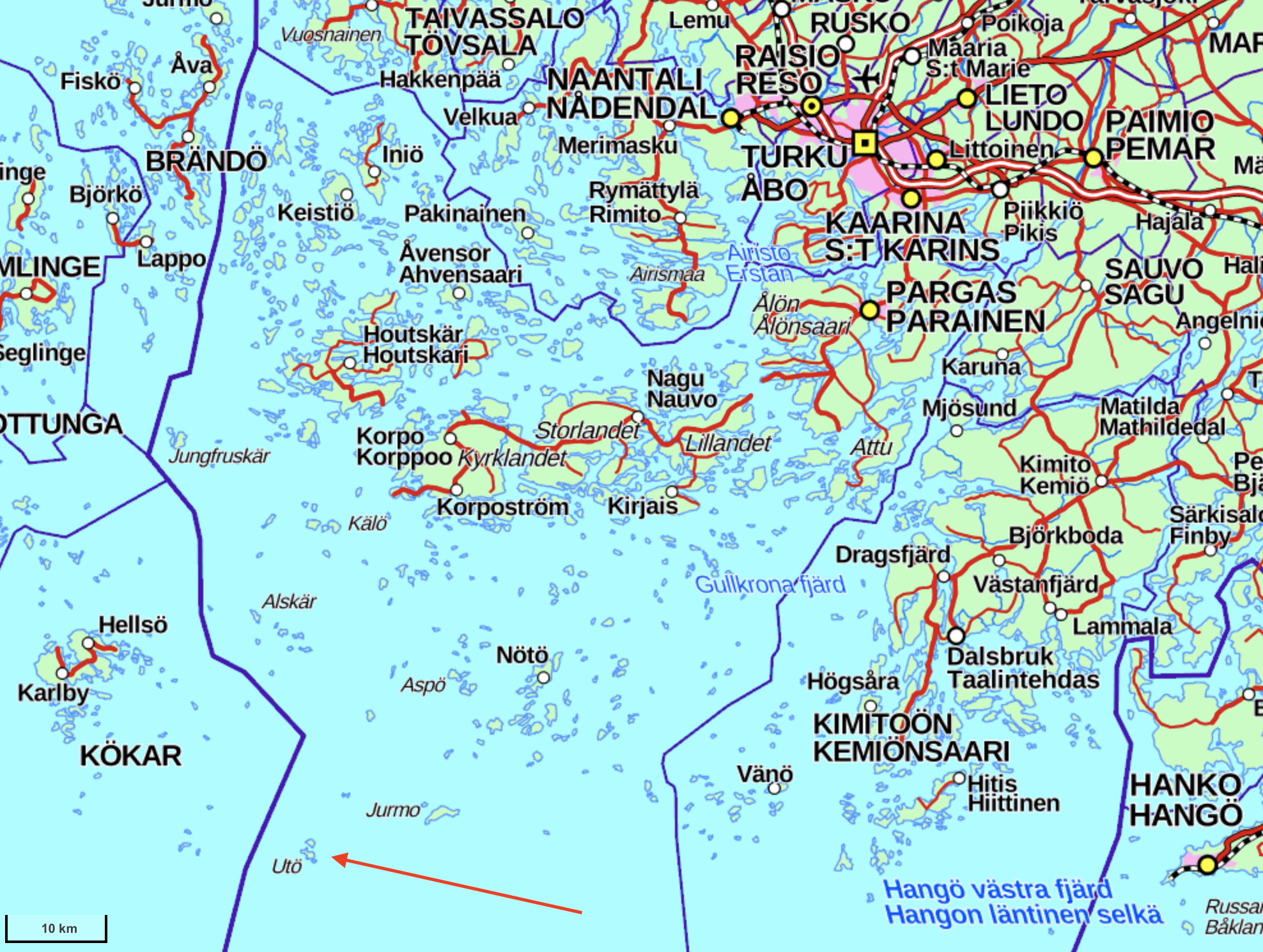
The ulkosaaristo culminates with Utö. South of Utö there isn't anything anymore. Not much is to the west either. And even to the north and to the west all you can see are small skerries; there is no mainland or large forested islands visible anywhere in any direction.
Utö is, and has always been the southernmost populated point of Finland, located at the same latitude as St. Petersburg's southernmost parts. It is not the southernmost land point of all Finland; that honors belongs to Bogskär, further 65 km southwest of Utö, almost at the latitude of Tallinn. Bogskär however is a lonely bare rock 50 m wide, with only an automated lighthouse. (The southernmost structure of all Finland is even farther, Suomen Leijona (Finn. The Lion of Finland) marker and radio beacon on a shallow, a very unimposing structure despite its name; it stands on the latitude of Stockholm.)
Utö has been inhabited since the 1500s, as a crucial place for a pilot station for ships entering the treacherous Archipelago Sea, with its infinite skerries and shallows and very non-obvious fairways. Even the waters around Utö itself are a small ship graveyard, much of it consisting of ships that tried and failed to find safety at the small island during storms. The pilot station is still functioning to this day and is a major reason why the island is still inhabited.
The first lighthouse of Finland was also built on Utö, in 1753. It was destroyed in the Finnish War of 1808-1809 but rebuilt soon enough in 1814 (although in a diffent shape). The characteristic stocky, painted with vertical white and red stripes, Utö lighthouse also still works to this day, although it is now automated like all Finnish lighthouses. It holds one of the few "lighthouse churches" of the country inside.
The third main purpose of the island was a coastal artillery battery, one of the outermost ones of the so-called Peter the Great's Naval Fortress, a huge chain of coastal fortifications and batteries built by Russia in the First World War, all the way from St. Petersburg outskirts along Finnish and Estonian coasts to outermost archipelagoes, to protect St. Petersburg from a possible naval assault. The Finnish installations of Peter the Great's Naval Fortress subsequently formed the backbone of Finnish coastal artillery defences throughout the 20th century, although of course the installations were being upgraded and new ones added. These days coastal artillery is considered a mostly obsolete kind of weaponry. Finland shut down all its remaining coastal artillery garrisons in 2005-2006, but a few installations are still preserved in working condition, among them the four 130 mm cannons of Utö; there are occasional training exercises still carried out. The cannons will probably be dismantled in the 2020s, when they will start to get physically obsolete.
The abolishing of the garrison fifteen years ago had a profound effect on Utö's livelihood. The island cannot offer many jobs (unlike many such islands it has never had any professional fishermen either), and quite a few that had existed were related to the garrison. Nonetheless it appears the island has more or less found itself, as an obscure but really unique and impressive tourist destination; a hotel and a restaurant operate now in the buildings of the garrison. These days an island might be a good place for a certain kind of people to live and do remote work from, although getting a long-term accomodation here is anything but easy either. The island is also extremely popular with birdwatchers.
The island has never had as great population as Haapasaari (that had 350 people at most; I couldn't find the relevant number for Utö but I believe it wouldn't be much greater than 100), and never was an independent municipality (originally belonging to the municipality of Korpo, these days to Pargas along with most of the Archipelago Sea). But neither had it ever had such a downturn as Haapasaari either. The island keeps not only a grocery store, but also a school, which is the smallest school of all Finland, with around 5-10 pupils at most. As far as I know there are no services that Utö had previously had but doesn't have anymore.
Of course on such a small island every person counts. A family with several kids moving to the island or away from it is a particularly major event. The vitality of the island community depends on it still having local jobs — and children. No one wants it to turn into retired people and summer residences land (the way Haapasaari more or less did). The school in particular has been under the threat of closure multiple times in this century, which would have been catastrophic for Utö and would likely lead to collapse of also the store and the overall community; in worst years the school literally had just a single pupil. Thankfully right now at least things are looking good and the school has around 10 pupils, more than in many years. There are several houses/apartments on the islands for rent, and the islanders pick candidates very strictly; families with children are absolutely preferred.
The island community is still very vulnerable. For many essential people there is no one to replace them, like the shopkeeper (although they get help in summer from interns) or the operator of the water supply station. In this corona spring the islanders were particularly scared of coronavirus landing on Utö and ending up in mass hospitalizations of such critical people. Or of coronavirus hitting the crew of Baldur ship, the island's only lifeline.
Thankfully it looks like this threat has been avoided, and as of June the island's hotel again accepts tourists. I decided myself to go to Utö for the Midsummer (juhannus), when there is traditionally a three-day holiday in Finland. For many this is the time to begin their summer vacations, and even those who aren't on a vacation yet often depart for some domestic trip on these days. So did I, choosing this time to spend two nights on Utö.
In the end honestly two nights on Utö might have been an overkill. The island can be explored in two hours, and even with a guided tour on top of that there just wasn't much for me to do. I spent some time on coastal rocks, reading and enjoying the outer archipelago landscape, but this is also difficult to do for long (due to the wind). If you are the sort of person for whom a meditative kind of trip with not doing much works well, then this is a great place for you, but if like me you're into exploring, then a one night stay on the island is more than enough.
Still this is absolutely an incredible place, of the kind you just won't see anywhere else in Finland.
Since the practical matters of an Utö trip are a fair bit more complicated than a trip to a random Finnish city, I'll be a bit more detailed than usual about those. Please notice that this information is up to date as of June 2020, and probably will not be updated (although things probably wouldn't change drastically either). If you're planning a trip later, some links might be broken, some information might not be valid anymore, and generally you should do some research yourself. Please also note that this is not an internationally known destination and information online is mostly available only in Finnish and Swedish, so Google Translate might be necessary.
Getting There
As mentioned before, the only way to get to Utö without an own boat is by a passenger ship called Baldur (or on the reserve ship called Kökar). Baldur was renamed after some repairs very recently, since June 2020, so you can see various references to it online under its old name, Eivor. There used to be a commercial boat connection directly from Turku to Utö in summer months, on a ship named Aspö. That connection does not exist anymore, Aspö now operates in Helsinki archipelago under the name Isosaari, and Baldur is the only option, but even getting to its departure harbor is a little involved.
Baldur is operated by a company called Meritie (Sea Road), and the timetables are available at their website, in Finnish and Swedish. Pärnäs (in Finnish Pärnäinen) is the mainland harbor from which Baldur departs. Note that Pyhäliikenne section in the end, with exceptional timetables for holidays. The current summer schedule is suitable for a Saturday-Sunday, perhaps for a Friday-Sunday trip (although on Friday the ship arrives to the island very late).
As mentioned the passage is free, and you are allowed to take any reasonable amount of baggage, which can be put on the shelves of the car deck. Taking a bike should be possible too, although Utö is small enough there is no real need for it.
Pärnäs harbor is located in the Turku inner archipelago near the village of Nagu. Getting to this harbor has its own challenges.
By car the trip from Helsinki to Pärnäs is about 220 km long. The address of the Pärnäs harbor is Saaristotie 5853, Parainen (Pargas). You'll need to drive nearly all the way to Turku, then in Kaarina (a Turku suburb) turn to Road 180, the Archipelago Road, going through the inner archipelago past Pargas and Nagu. The tricky part is that this trip already includes one road ferry crossing, Pargas-Nagu (Parainen-Nauvo), in one place too wide for the bridge. If you're not familiar with such ferries, using them is easy; they are also free and you need just to wait for it in the harbor (on the lane not marked as etuajo-oikeus, that is, not for priority vehicles), and drive on board as guided by the ferry personnel. This crossing takes less than 10 minutes and there's no need to leave you car (although you can if you want to take some pictures or something). The possibly problematic part is that this ferry is very popular and especially on Friday evenings and on holidays such as Midsummer there might be queues, even though ferries are fairly large, operate with 15 min intervals and at rush hours possibly even more often. Thus it is advised to reserve at least 45 minutes for this crossing; better be safe than sorry, as Baldur won't be waiting for you! Timetables are available here.
There is a very large parking lot at Pärnäs harbor, where you can leave your car freely for any period. Note however that it can also get completely full; in my case on Midsummer, it was. Leaving your car at the harbor outside the designated parking lot is not allowed. Instead of trying to somehow fit my car in (possibly making it difficult for others to drive out), what I did is left my car at a gravel road named Svedjentie, about 700 m before the harbor. Right upon turning to this road there is some space by the side of it enough for ten or so cars to park without obstructing anything.
Baldur can take a few cars (with prior reservation) and the roads of Utö are in principle driveable, but this is meant for service traffic such as construction trucks (and also for intermediate islands that are somewhat bigger than Utö). Going to the island with own car is pointless and also not allowed.
By bus there a bus connection from Turku, the "Archipelago buses" (routes 901-903). Schedules and prices are available through Matkahuolto website, as usual. Currently the one way price seems to me 13.70€. Usually connecting buses will wait for the Baldur and Baldur will wait for the buses (departures/arrivals to Pärnäs that have official bus connections are marked with yellow in the Baldur schedule). Turku is a major city and can be easily reached by train or bus.
Going to Pärnäs harbor by bike could take considerable effort. For example from Kupittaa railway station in eastern Turku it is almost 70 km by bike, from Turku center a bit more. You will also need to take the aforementioned Pargas-Nagu ferry in process, although of course there is no queue problem with bikes. It is possible to carry the bike by the "Archipelago bus" too for a small surcharge, but space is limited and place for a bike is not guaranteed; and, unless you're going to travel not only to Utö but in the inner archipelago too (which is a perfectly good idea of course), there's not really much point.
Accomodation and Food
The only hotel and hostel on Utö is Utö Havshotel (Swed. Utö Sea Hotel). Note that the website is not available in English (you'd think a hotel of all places would make an English version), but rooms are available also via Booking.com. The hotel part is rather expensive, so I used the hostel one, with a room for 40€ (+10€ breakfast)/night. The room would be private with two beds and two writing desks and not much else; common WC/showers/kitchen. Not the most comfortable place (gets hot and stuffy during the day in the sun also), but the price is pretty great for Finland and for such location. But for >1 night I wouldn't really recommend it.
There are options for AirBnB-like short to mid-length accomodation in a more comfortable place, including, at least: Utö Logi cottages, Villa Tyrsky row house apartment, Hannas Horisont B&B, Utö Rivitalot row house apartments (these seemly oddly overpriced), some place on AirBnB.
Although I've seen references to long-term housing rental on Utö, I could not find any specific information about it. Perhaps apartments are freed up rarely enough that this is just announced on case by case basis somewhere on Facebook or something.
Although the island is not officially a protected nature area or a part of the Archipelago Sea National Park (unlike many nearby islands, such as Jurmo), the only specific spot recommended for camping is here. Elsewhere you would probably be annoying people, and overall the small size and harsh nature of the island would make finding a suitable spot physically tricky.
The hotel is a very good place to eat, even if you don't live in it. It offers breakfasts, lunches and dinners suprisingly cheaply; you can get a huge dinner for barely more than a good McDonalds meal. Of course you can also have a drink there in the evening. There is sometimes live music.
The only other food place I saw is the Hannas Horisont cafe in the village close to the guest harbor.
The store, also close to the village harbor, obviously has a limited assortment but enough to not starve :) (If you want to try the Utö-brand beer from the story, be aware that it's brewed not on Utö but actually as far away as Estonia.) Cards are of course accepted. The only issue is that opening times are quite limited (especially on weekends) and it would be good to check them from the Facebook page.
With all that aside, let's look at Utö (and at the trip there). This will have a lot of pictures, so the post will be split in two. This one will be more about the Baldur trip, and most of Utö we'll actually cover in the second one.
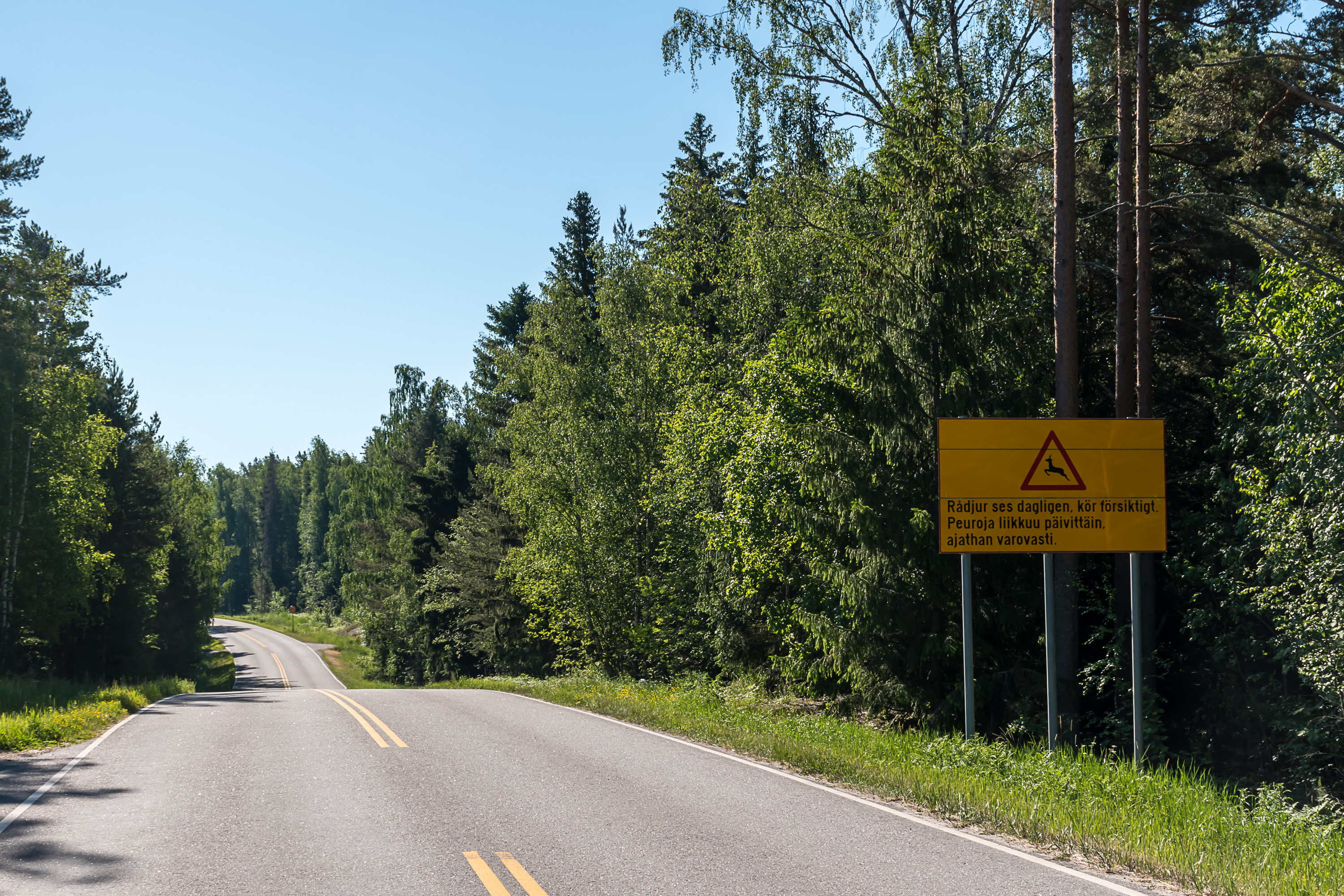
1. The journey starts at the Archipelago Road (Road 180) to Pärnäs harbor, on which we already passed the Pargas-Nagu ferry connection. The road is, unusually, strewn with "Deers move around daily, please drive carefully" signs. Archipelago Sea (and Åland Islands, of course) is the part of Finland with the warmest and mildest climate, and thus it has more deers among other things. Utö of course is an extreme example of it; on average it gets snow cover as late as on 23.1, and it lasts less than two months until 15.3. Archipelago Sea is also not especially prone to freezing, and around Utö it freezes only once in five years on average (probably even rarer this days; climate change has made harsh ice conditions on the Baltic rather uncommon). When it does freeze, it can present diffiiculties for Baldur; for example, sometimes passengers have to disembark right on the fast ice a short distance from the actual harbor.
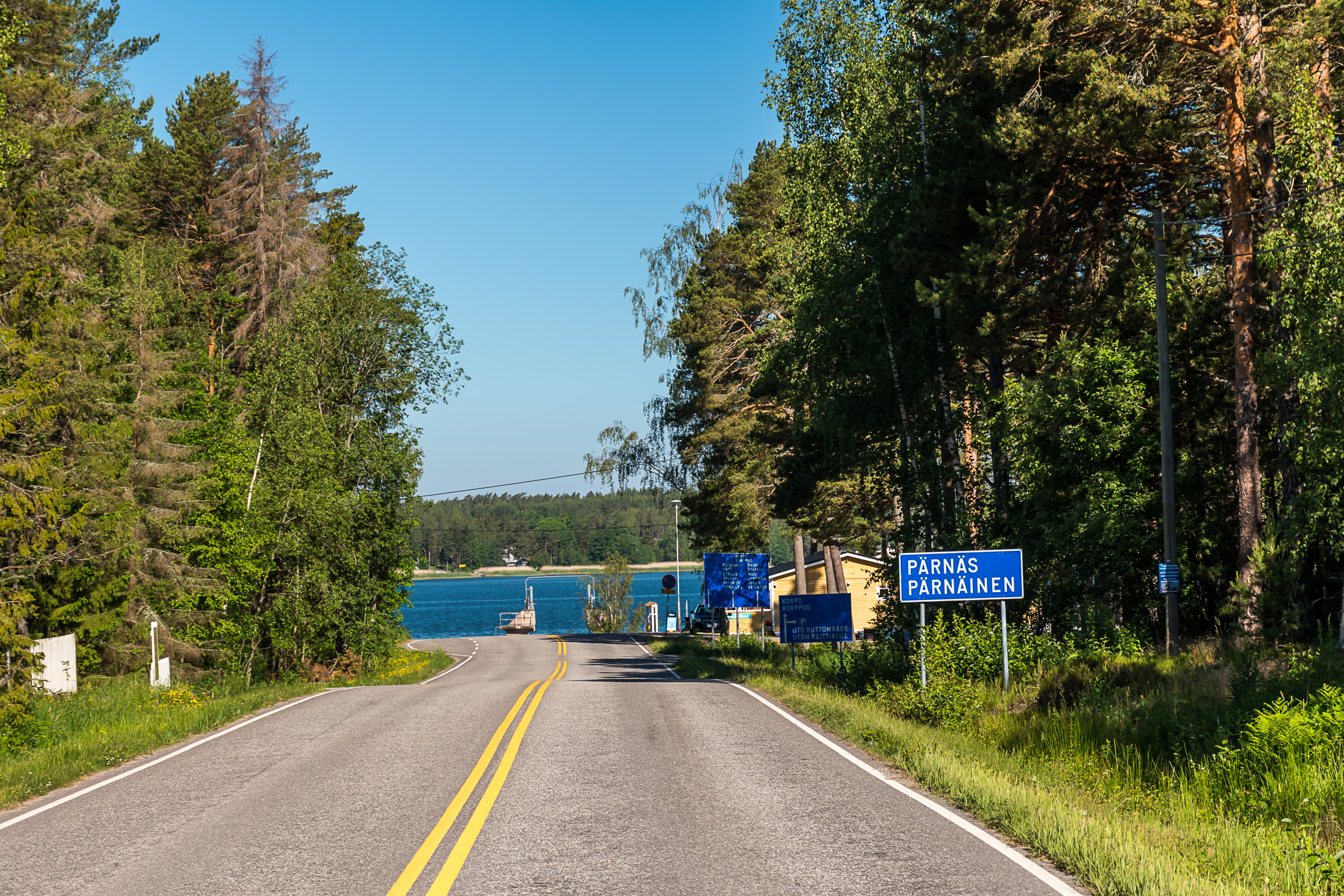
2. The road ends abruptly at the sea strait coast. This is the Pärnäs harbor, which, apart from Utö ship, is also used for another road ferry, Nagu-Korpo. The Archipelago Road ends at Korpo; this village is the closest "civilization" to Utö, and Utö residents have to go there for the services that the island itself misses, like a health station, or the higher grade elementary school (yläaste).
The parking lot for Utö travellers is to the right. I reached Pärnäs well in advance before the ship's departure (1.5 hours; since it was Midsummer, I was worried about possible traffic jams, especially at the Pargas-Nagu ferry, but in the end there weren't really any), but already found the parking lot completely full. As I said, I decided to park at the nearest available small side road in 700 m away. When I was returning from Utö two days later, I found out that only three other people chose the same option as me, and most others who arrived later simply parked at the "fire access road" driveways and in other places they weren't supposed to.
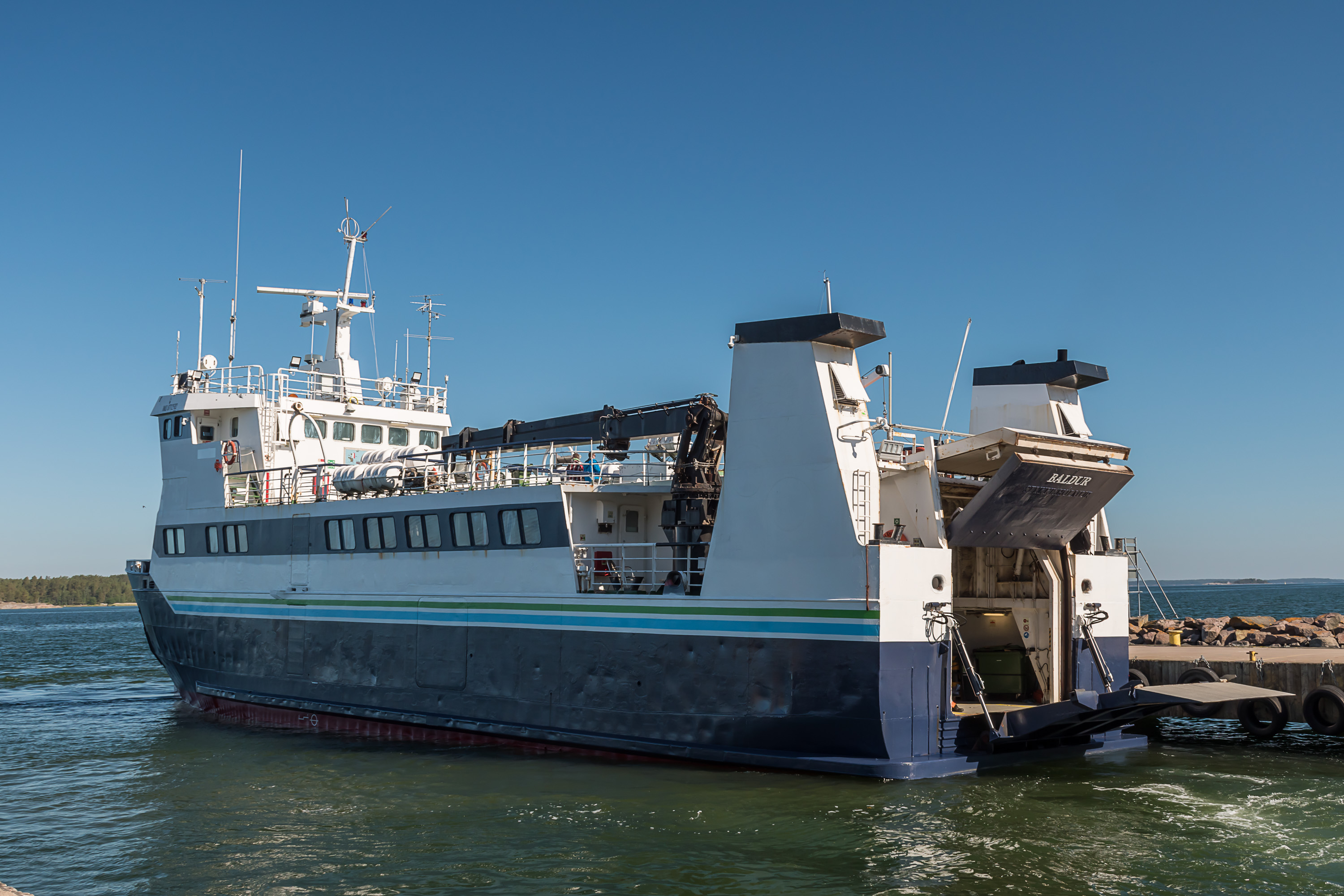
3. Baldur appeared quite early, and most of these 1.5 hours I was already able to sit on its upper deck. This is not the most graceful ship in the world, but it does its job.
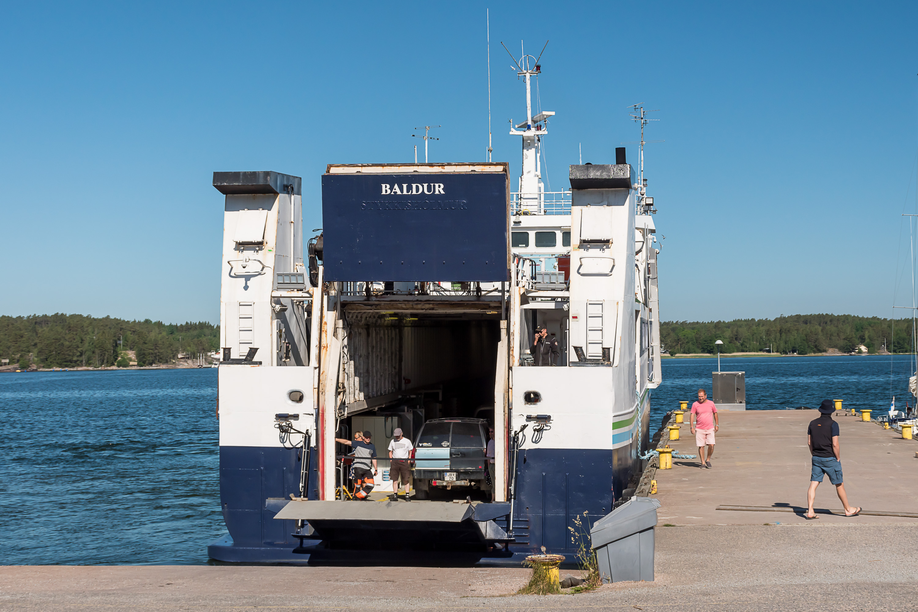
4. The painted-over Stykkishólmur sign is still visible at the stern. This is the original home harbor of the ship. Baldur was originally built in Iceland in 1990, and used to cross Breiðafjörður fjord from the town of Stykkishólmur to the Westfjords, the irregularly shaped northwest "arm" of Iceland. Apparently all ships on that route are traditionally called Baldur, as there is now another Baldur in operation there.
This Baldur was eventually bought in 2006 by Rosita, a small shipping company in Turku, which won the tender for Utö route and started operating Baldur on it, renaming it Eivor. In 2018 the ship and the line were sold to another shipping company, Saaristo Meritie (Finn. Archipelago Sea Road), which is operating it currently. The ship got its original name back only in June 2020 after some repairs.
Since travelling on Baldur is free, the state is of course paying all expenses instead to Saaristo Meritie according to their contract. As far as I was able to research, the state is paying about 1.6 million euro per year for the operation of the Utö line (according to this notification of change of contract period, which gives 9.5 million euro as a cost for the 6 years contract). Overall state expenses on "connecting ship" (yhteysalus) lines to similar remote islands with small permanent populations are 17.5 million euro per year, serving about 500 residents of various islands in total.
Baldur is rated for 195 passengers and 19 passenger cars. There are several passenger cabins inside it, and a restaurant with alcohol rights. I didn't really check out the restaurant neither on the way to Utö nor back, though. Passenger cabins have some sockets so you can e. g. use your laptop if you want to. (No Wi-Fi, but cellphone connection is mostly surprisingly good along the way, with only occasional spots of bad reception. Utö itself has a cell tower and underwata data cable so there the connection is perfect.)

5. The ship is a lifeline for the island, and can take a fair bit of cargo which is placed also here on the car deck, mostly on the sides of it. Post and wares for the island grocery store go in, and recyclable trash goes out regularly. For transporting perishable food to the store there are some fridges.
Any baggage can be also left here; just put it in a free shelf stand (look where other passengers are putting theirs, if you're unsure). Be aware that I've read somewhere that the car deck is locked while the ship is moving, so take anything necessary with you.

6. Since I was there so early, I could take a nice place on the top deck. The deck soon became quite crowded. Sitting there in the sun 1.5 hours waiting for departure and then five hours while the ship was actually moving wasn't all that great honestly, but of course I couldn't miss the views of the intermediate islands (and in between those I was reading an old book about the economical history of the USSR).

7. Nagu-Korpo ferries were running back and forth nearby while we were waiting for departure. Soon enough cars going from Nagu direction already couldn't all fit on one ferry.
8. And here we go.
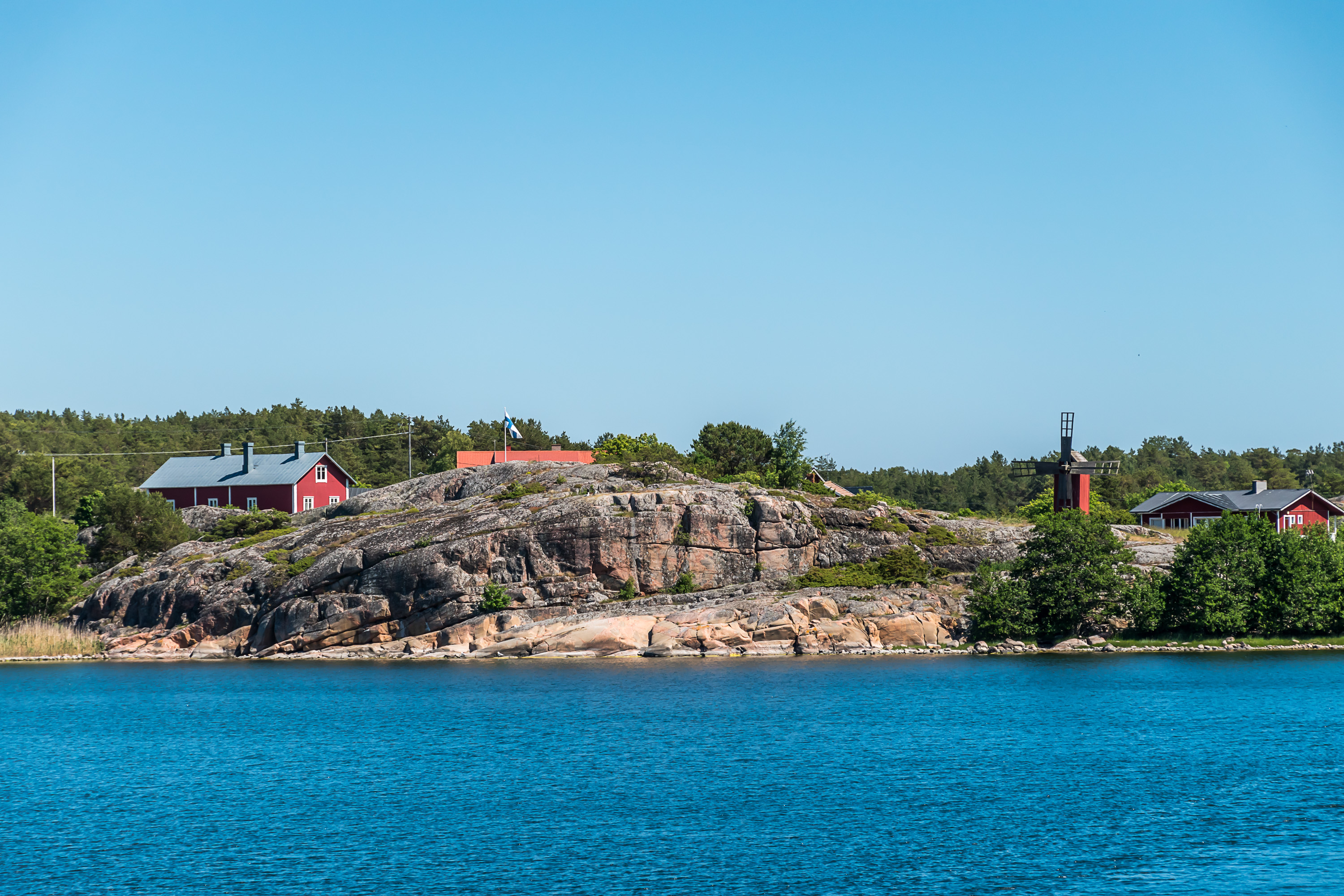
9. The first stop is Nötö (Swed. Hazel Island), a not so small island (3.9 sq. km) with 12 permanent residents. At its biggest it had over 200 residents, and now is mostly a summer island. There's a chapel and a store open only in summer. This island doesn't look particularly exotic.
(Before Nötö there is also Berghamn, but Baldur visits it only a few times per week and even then only by preliminary order. Berghamn has only about 6 residents.)
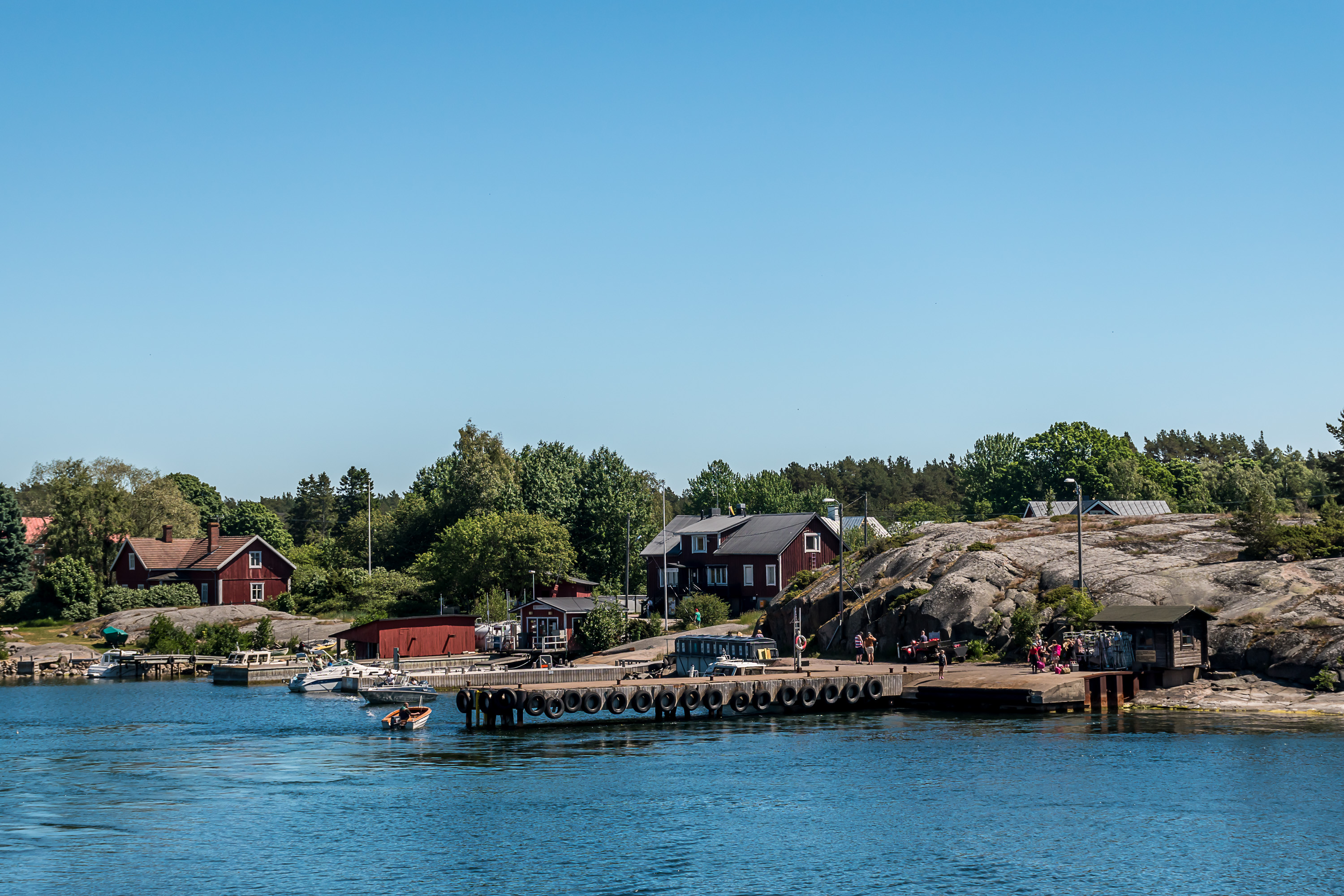
10. Nötö harbor.
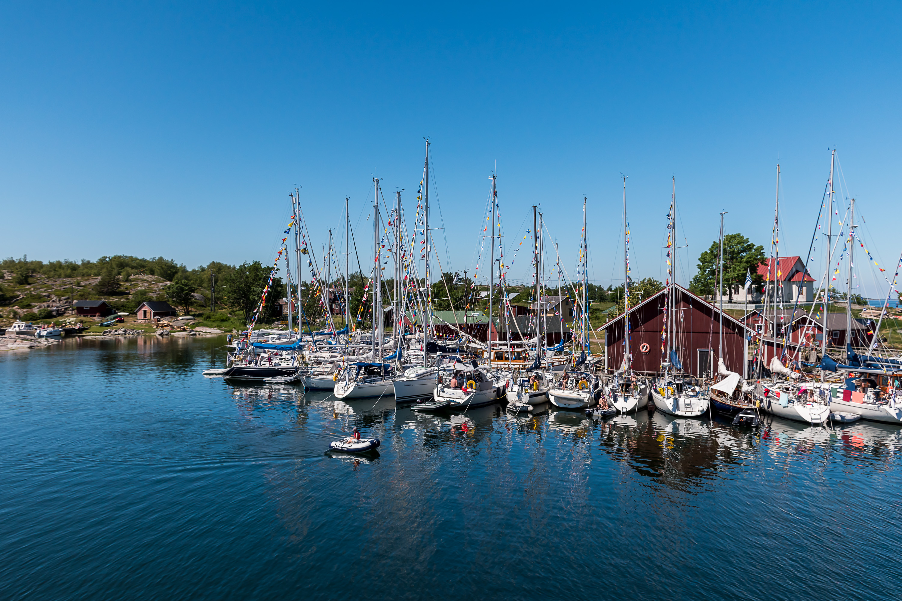
11. Aspö (Swed. Aspen Island), area 0.9 sq. km, population 10. This one had a great number of yachts adorned with little flags, I don't know why; maybe just because of Midsummer. This island is a lot rockier than Nötö and has fewer forest patches.

12. Aspö harbor. The only building of particular note on the island is a chapel, seen to the right.
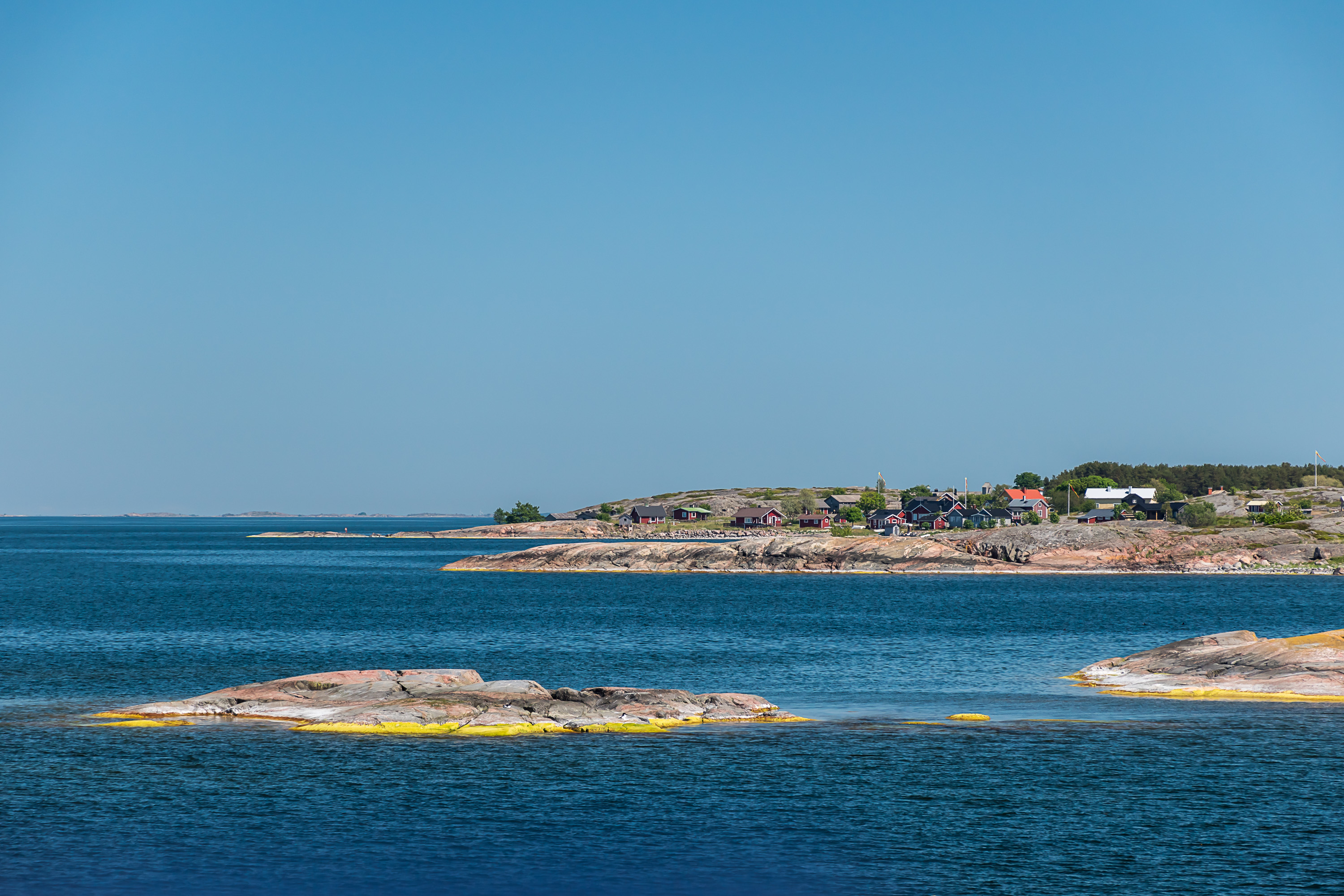
13. Jurmo (possibly originally from Finnish Juurimaa, "Root Land"), area 2.8 sq. km, population 11. This island is fairly unusual; although it has regular rocky parts, visible here, much of the long narrow island is just long flat gravel beaches. The island is truly a continuation of the Third Salpausselkä moraine ridge, just like for example Bromarv, 80 km east of here, is a continuation of the Second Salpausselkä. Due to its unusual nature the island partially belongs to the Archipelago Sea National Park. This island I definitely visit separately at some point, probably camping in a tent here (I'm not sure there are any other options).
An interesting fact about Jurmo is that this was the last place in Finland to undergo the Great Partition (isojako). The Great Partition was a land reform initiated in Sweden in the middle of the 18th century, the biggest one in the history of Sweden (or Finland). Before the reform, each village had its farmland collectively divided into many small strips, and they were allotted to each peasant family in such a way that everyone would get an equal fair share of good and bad land, but possibly all over the village. The Great Partition instead simply gave everyone some farmland, all in one place, and this was then really their own land from there onwards. Forest areas were similarly divided. This reform is the main reason why in Finland and Sweden there are so many single isolated farms somewhat away from villages; peasants just moved their houses for convenience to the middle of their land, which could be some distance away from the village center. The meaning of a village as a community form thus degraded, but agricultural output increased greatly.
The reform was, in principle, voluntary; but it was enough for just one peasant in the village to ask for the Great Partition, and the authorities would go forward with it. Some remote places (that probably never could rely too much on agriculture to begin with) managed to survive without the Great Partition quite long, well into the 20th century in fact, for example Kuusamo in North Finland did it in the 1960s (neither the Russian era nor the Finnish independence affected the Great Partition principles much). And so the very last place in the former Swedish Empire that underwent the Great Partition was Jurmo with its four homesteads, in the year 1990 — and all according to the principles laid out in the 18th century. If I'm not mistaken the only reason they finally did this was because they had to clarify land ownership, as parts of the island were being granted national park status.
The village on Jurmo is located a bit away from the harbor. It also has a chapel, a bird observatory, a cafe, a store and an information hut of the national park. Camping is allowed only in a specific place and the western part of the island is forbidden to enter during bird nesting season (April-July).
14. The gravel part of the island. The landscape, with stone fields and dwarf vegetation, oddly reminds me of Lapland fells — places as far away and as different from the outer archipelago as possible.
15. But most of the outer archipelago looks like that. It should be possible to see seals on such islands (seals are not even particularly rare in the Baltic in principle), but I've never seen them in the wild so far and not on this trip either.
16. And now we're finally approaching Utö itself.

17. The tiring trip is over! The small truck of the village store is already here to pick the fresh wares, which come to the island three times a week.
I immediately went to the hotel, along with a large fraction of other newcomers, got my room key, and spent there the next few hours, having a bit of a rest, also going to the hotel restaurant for dinner at some point. Since I was having an overnight stay (or rather two), I decided to begin actually exploring the island only at about nine in the evening, so that I would get nice evening lighting and it wouldn't have been so hot outside. The plan worked perfectly and I got some great pictures from the island.
One annoying part was that, apparently, the "live view" mode on my camera accidentally turned on while I was packing things in the morning, and so its sensor and display were on all the way on the drive from home to the harbor, where I finally discovered this. Thus the camera battery was already considerably discharged, and I neglected to take either a charger or a reserve battery either (normally one charge would have been more than enough for such a trip). Thus I had to be quite careful with taking pictures (usually I just take as much as possible just in case, although I delete a lot and most others never get seen by anyone either). In the end though the charge was enough to take pictures of pretty much everything of note on the island.
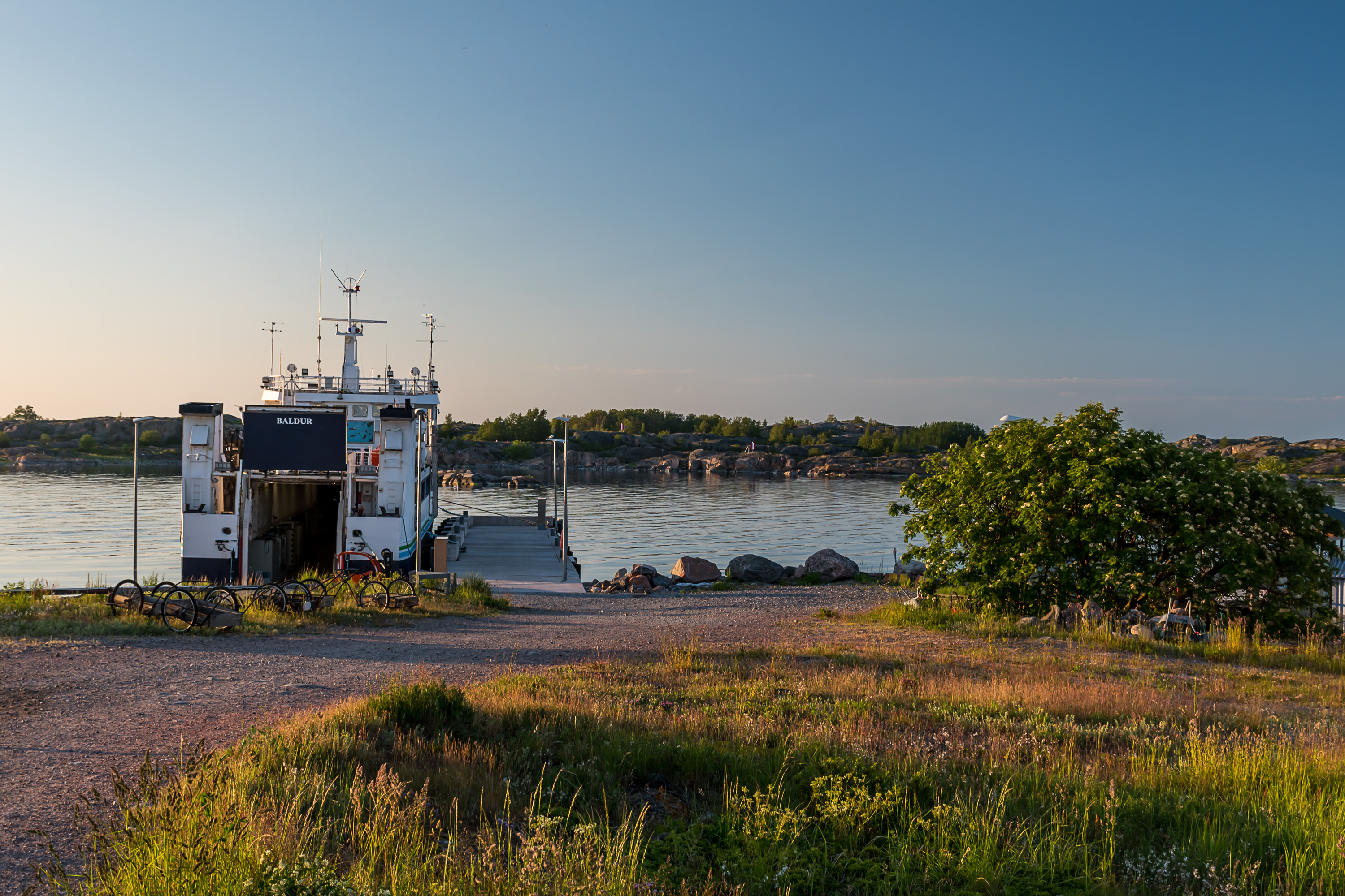
18. And so, let's begin from the same place in the evening. Baldur is still resting at the pier, and will be for two more nights; on the Midsummer day, on Saturday, it had no departures — the crew needs a holiday too! Presumably they have some overnight accomodation on the island.
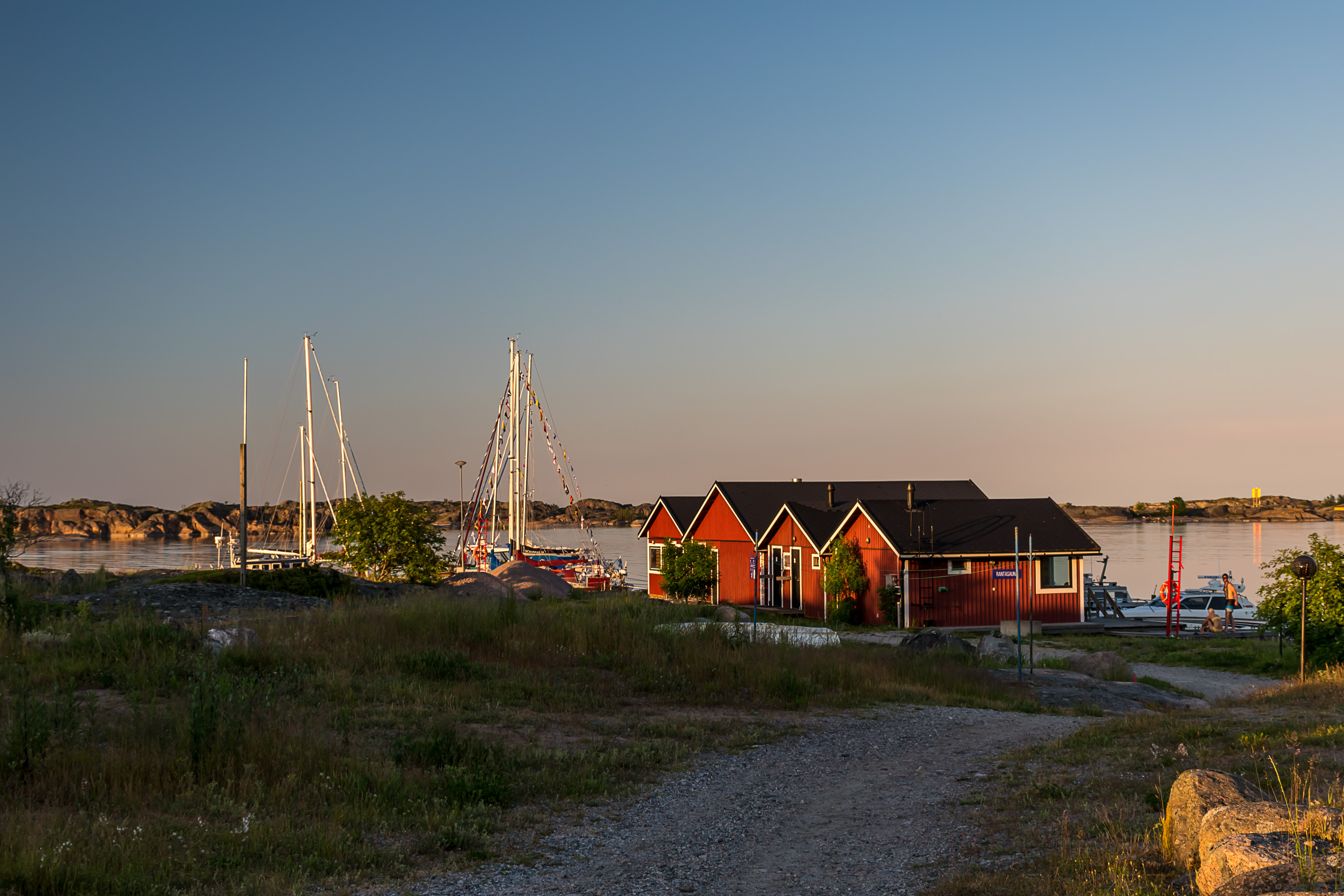
This pier, on the northern tip of the island, is used only by Baldur; the main harbor (used by islanders, guests and also pilot boats) is a few hundred meters away by the center of the village. This northern tip of the island originally was a separate small island, named Enskär (Swed. Juniper Skerry), but merged with the rest of Utö due to postglacial rebound. Most of Enskär was occupied by the military garrison, in the buildings of which the hotel now operates.
The islanders' carts are also stored near the Baldur harbor, carefully marked with names, apparently the most popular way to transport stuff here. There are some quad bikes with trailers but apparently the island overall is small enough (and roads reasonable enough) that it's simpler to just carry stuff in a cart.
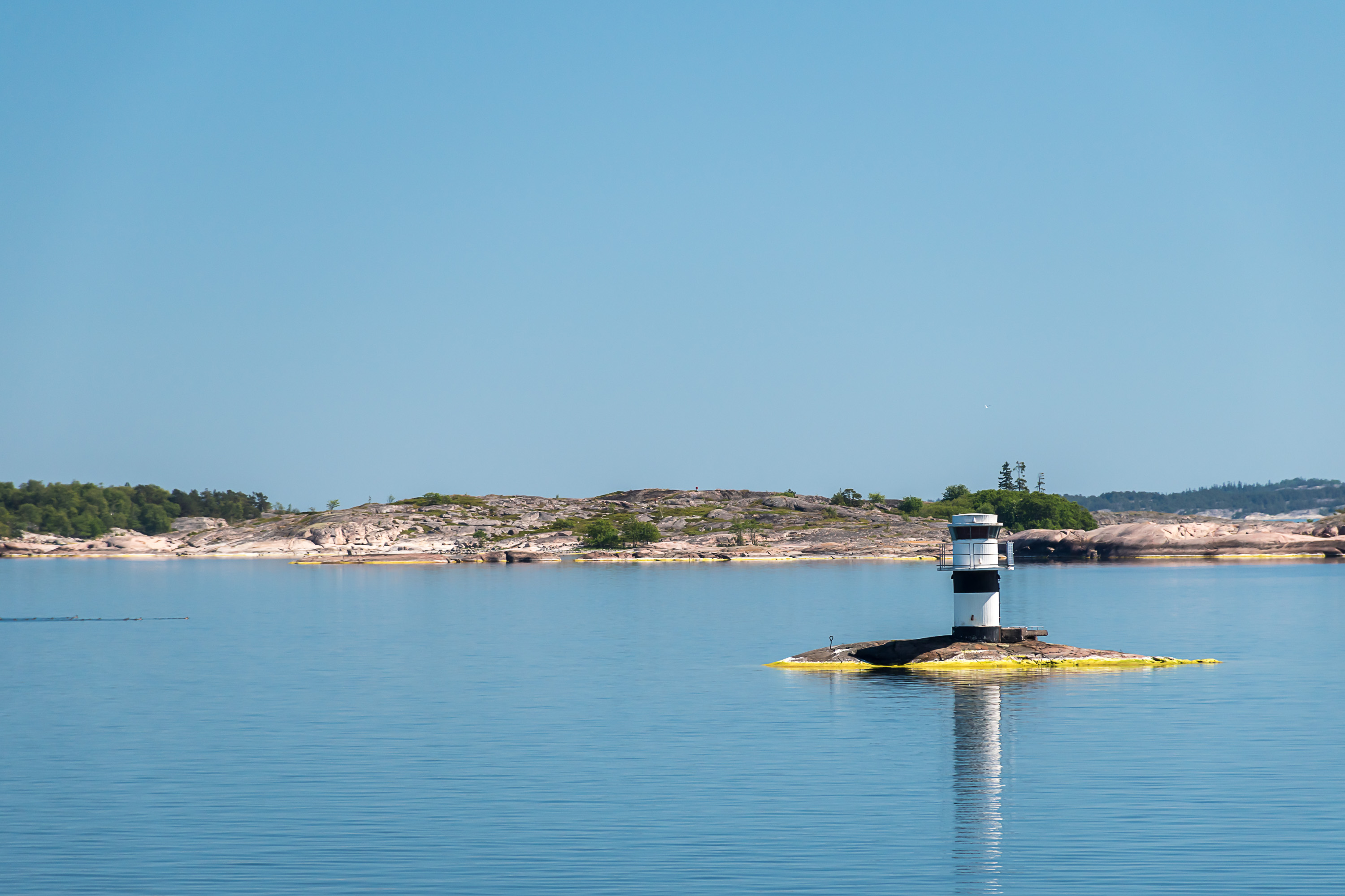
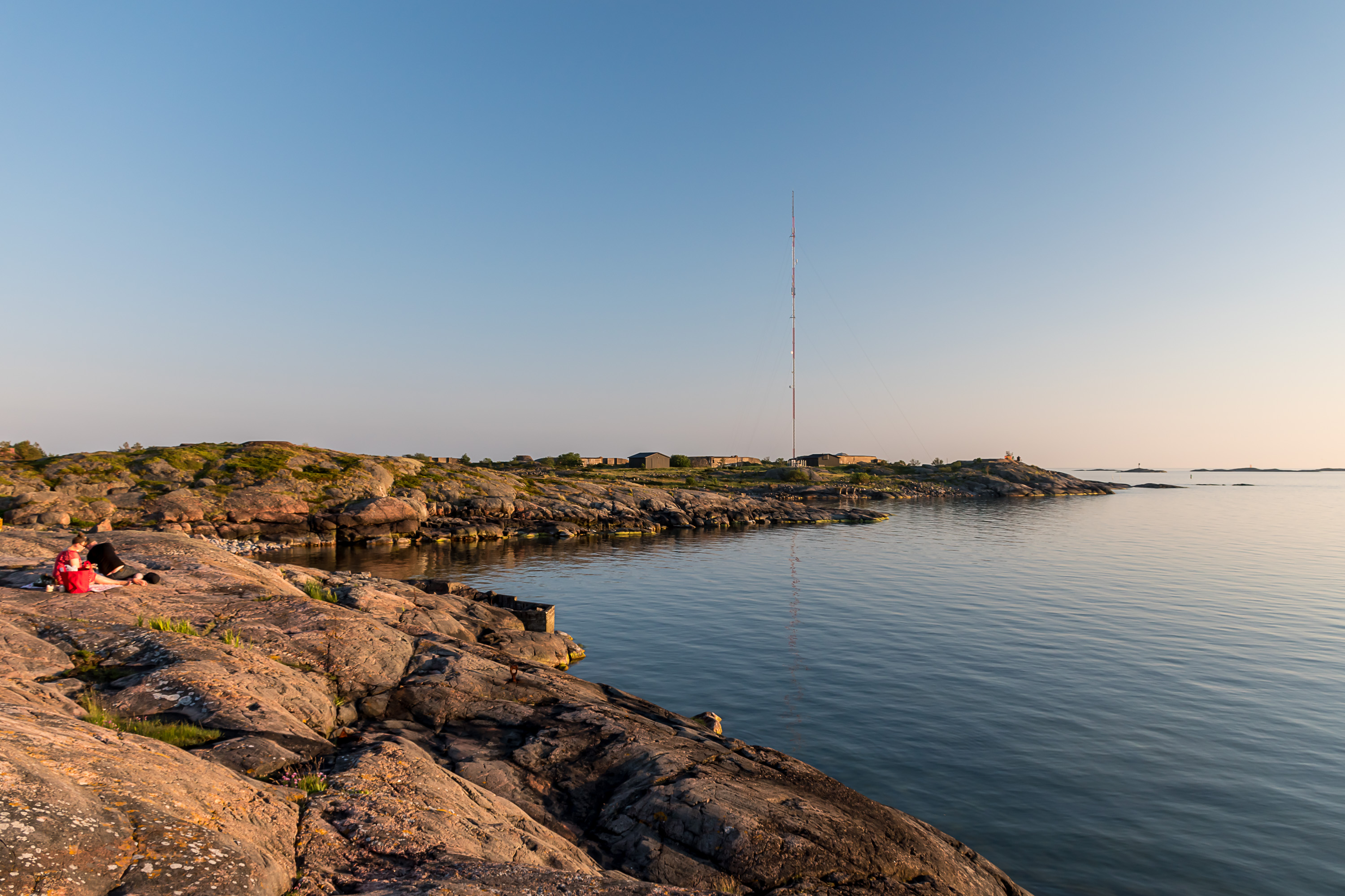
In the background is Ormskär (Swed. Snake Skerry), a largish (about 1 km wide) but still mostly quite barren uninhabited island. Ormskär and a few smaller skerries north of Utö shield its harbors from the sea.
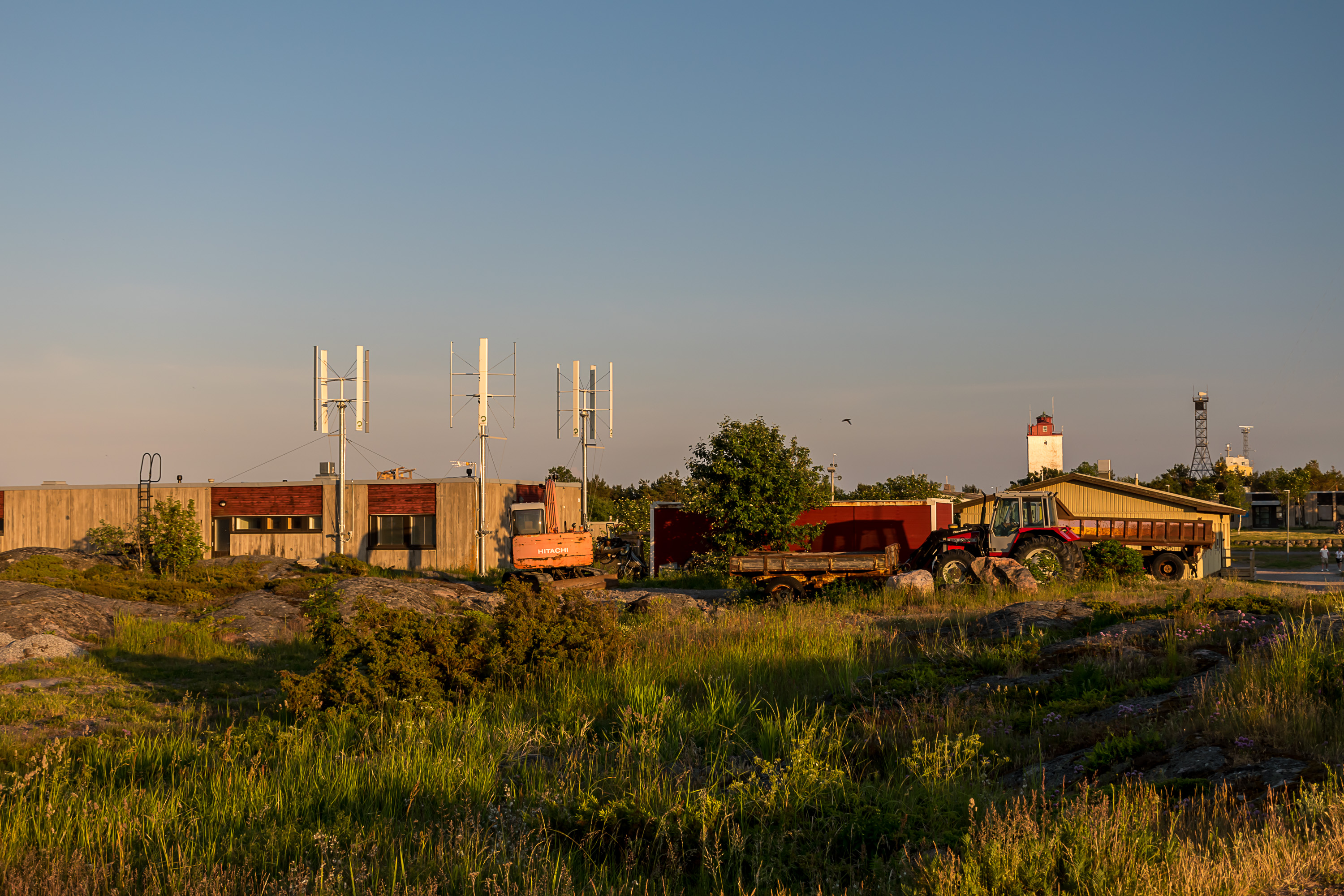
19. The former barracks environment also houses some service vehicles and not particularly pretty constructions. One of the former personnel rowhouses is visible; those are rented out now.
20. Enskär west coast is pretty nice though, a popular place for hotel residents to sit in the evening. In the background is the western part of Utö, still in military use and the only one still off-limits.

21. Immediately to the west of Utö a major fairway begins, the 15.3 m deep Naantali fairway, zigzagging through the archipelago and Airisto strait to reach the ports of Turku and Naantali. At 120 km long this is the longest official marine fairway of Finland, and I already wrote about its other end in Naantali some time before. This however was the only big ship I managed to see from Utö during my stay.
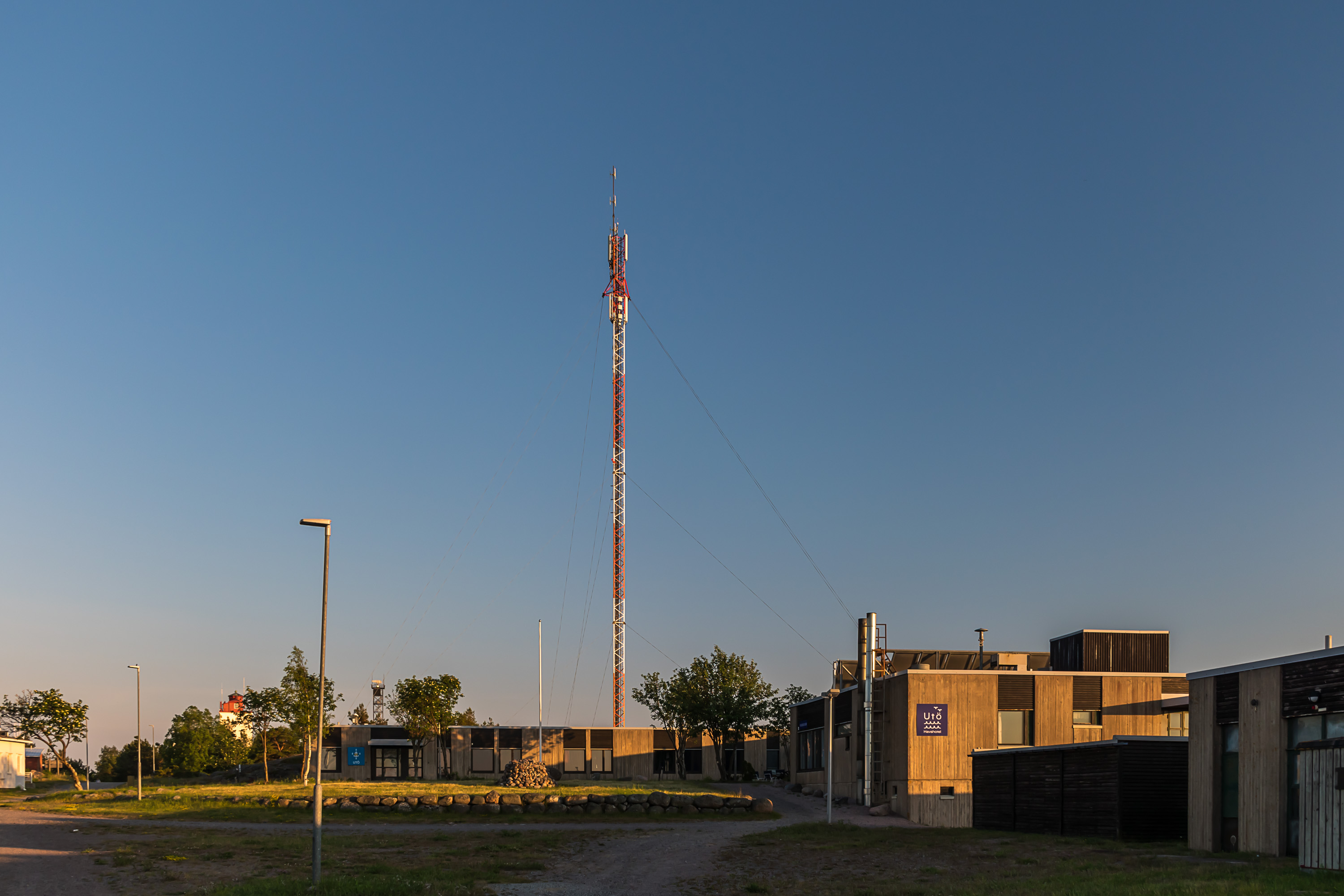
22. The main building of the hotel, and formerly of the barracks. Supposedly it also has the southernmost swimming pool in Finland, originally build as simply a water storage tank. Utö has a central water supply thanks to the former garrison; fresh water is made through sea water desalination. Thus water here is expensive but at least its supply is stable; before the desalination station was built, water had to be strictly rationed, especially since the groundwater was contaminated by the old landfill leaching. I didn't locate the actual desalination station.
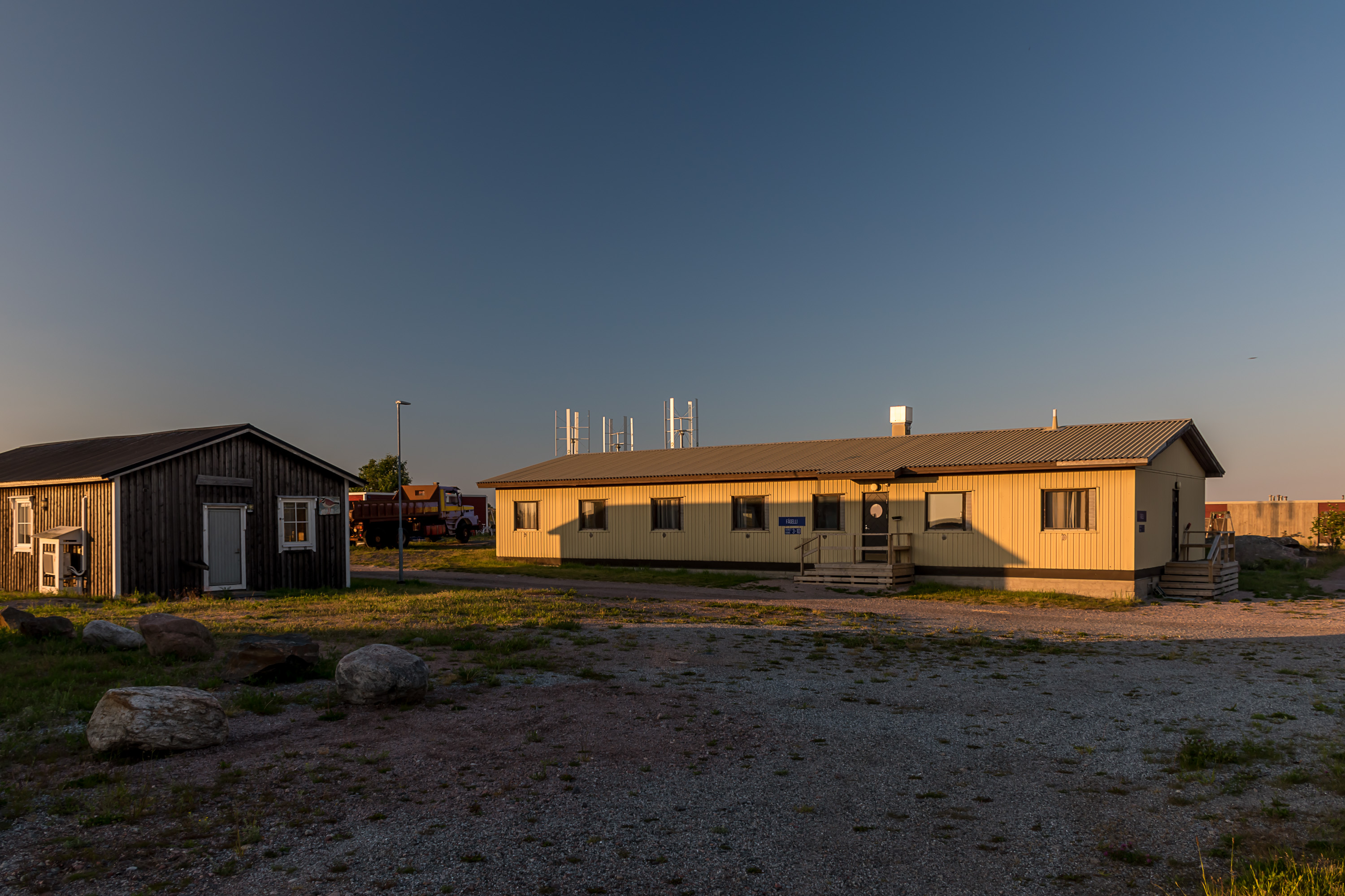
23. I was staying myself in the hostel part of the hotel in this building, named Fågelli.
24. The hotel's harbor and the saunas. Those I didn't try out; I'm not such a great sauna enthusiast and don't really go to public saunas.
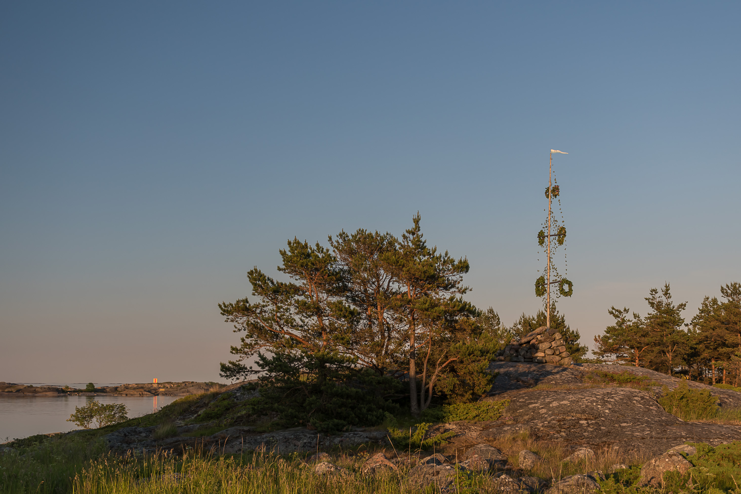
25. The Midsummer maypole (is it still called "maypole" if it's for Midsummer?) was also erected on a hillock nearby on that day.
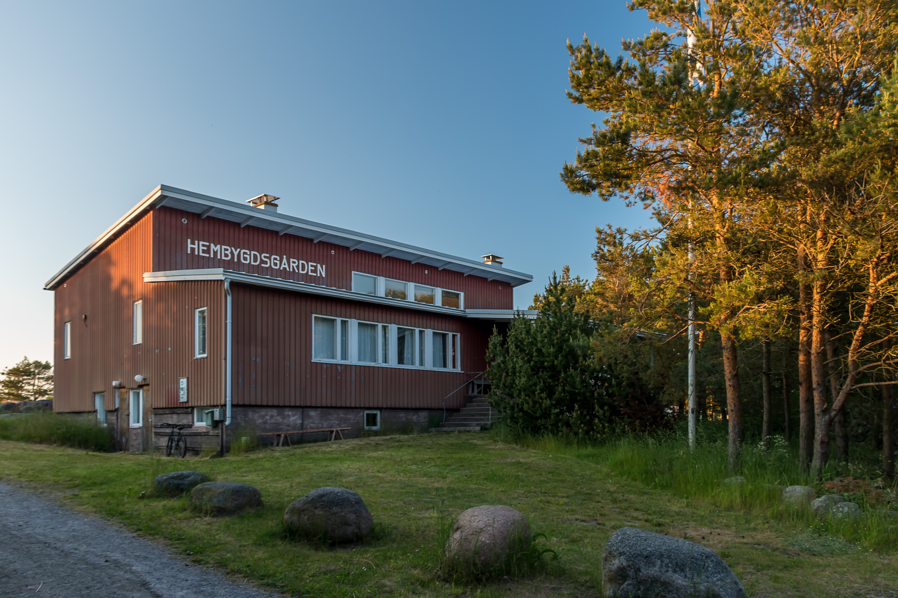
26. The hembygsgården, a local community center. It is used for some events, although, as the local guide told on the tour on the next day, not that often because it's difficult to heat; usually a smaller house in the village is used. One of the doors to the left says Gamla posten, "Old Post"; a post office indeed used to be located here. It was also the only available bank office on the island; Postipankki, the Postal Bank, used to offer their services at post offices. Nowadays postal services are available at the village store.
The building was built by volunteers among the islanders themselves. This is how many things have to be done on Utö; without helping each other life here would not be possible.
The name of the island and most signs here are in Swedish; as with most of the archipelago, the original population here has been Swedish-speaking. Nowadays however, with the former garrison, the pilot station, the hotel and other services, the population got mixed up sufficiently well that the island actually might have a Finnish majority. The school, notably, also switched to education in Finnish at some point. The people coming to their Utö houses only in summer however are largely the descendants of the original population, and thus mostly Swedish-speaking.
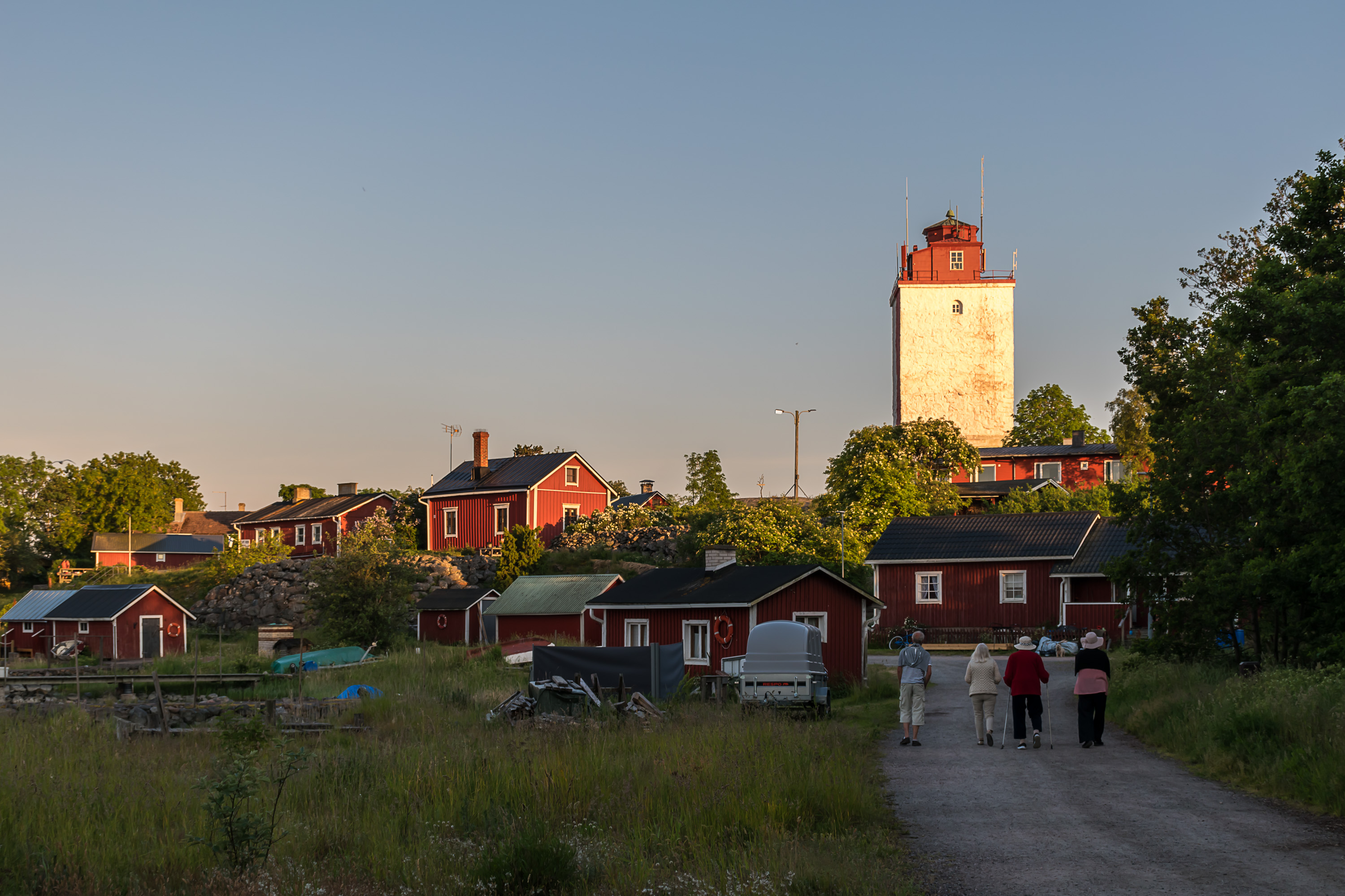
27. And now we're walking (behind some grannies) from Enskär peninsula to the center of the island, where its only village is also located.
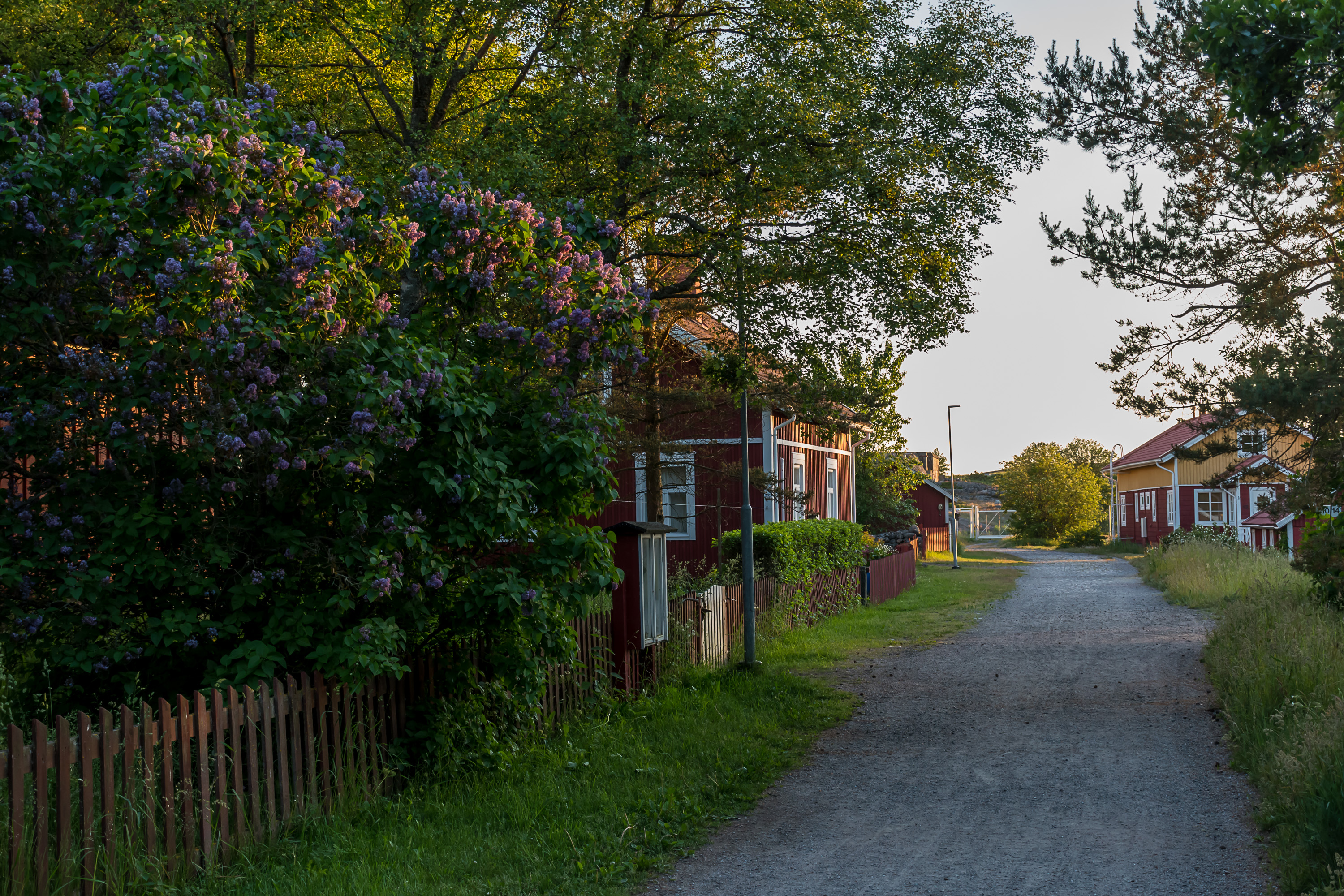
28. Utö streets. I think these are actually counted as public roads (unlike the narrow tracks of Haapasaari for example) and have proper names etc., but there are only a few of them.

29. The school is a bit away from the streets, so I could not really find it even, and this is a picture from the next day. Utö school, as I already told in the beginning, is the smallest school in Finland, and it has been under the threat of closure since the garrison was disbanded in 2005, when the population of Utö dropped by half and there was at the time just one pupil remaining in the school. At the moment situation is somewhat stable, but the municipality of Pargas (to which the school now belongs, distant as the actual town of Pargas may be from here) generally declared it may shut down the school if the number of pupils falls below three. The school's personnel now also consists of three people. School meals are provided by the hotel (and so are pretty good for a school meal!).
The school is fairly old. It has existed on the island since 1884; the original teachers were lighthouse keepers, and the school gots its modest building only in 1938. The need for schooling on Utö was quite practical; lighthouse keepers and pilots both had to be reasonably educated people.
The school provides only lower grade elementary education (ala-aste), so, the first six years. For the years 7-9 pupils need to go to Korpo village to their yläaste school. By that time however children are sufficiently grown up that their living can normally be arranged in Korpo in some manner (in a substitute family) without the entire family having to move. Korpo's Outer Archipelago School (Ulkosaariston koulu) has both Finnish and Swedish language education, but is not really all that big either, with 15 pupils.
Education in the Utö school has a strong focus on the nature and environment. The children are for example learning to fish, and visit nearby islands with their teachers.
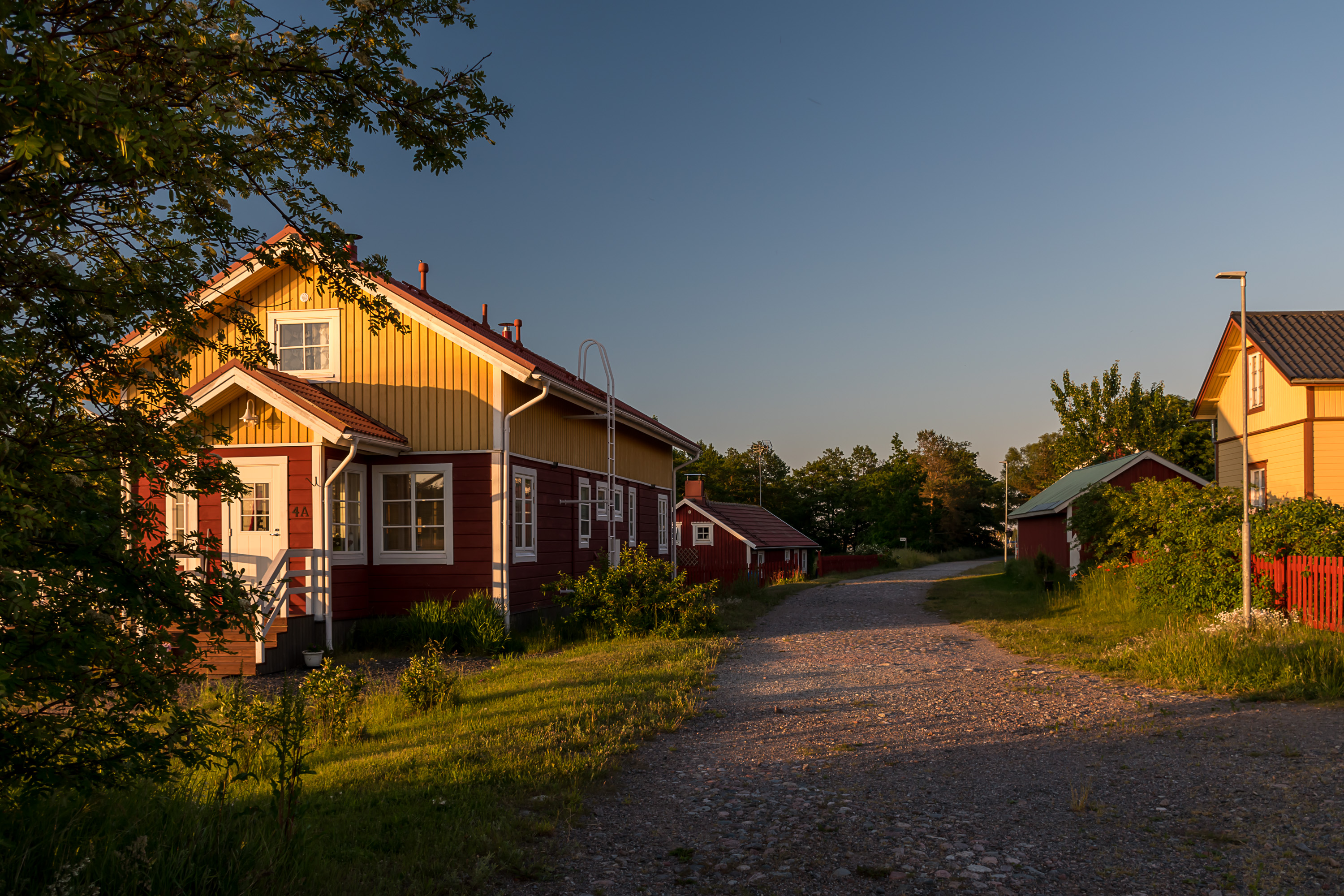
30. This to the left as far as I remember is the newest residential house in Utö not related to the garrison, built in the 1910s.
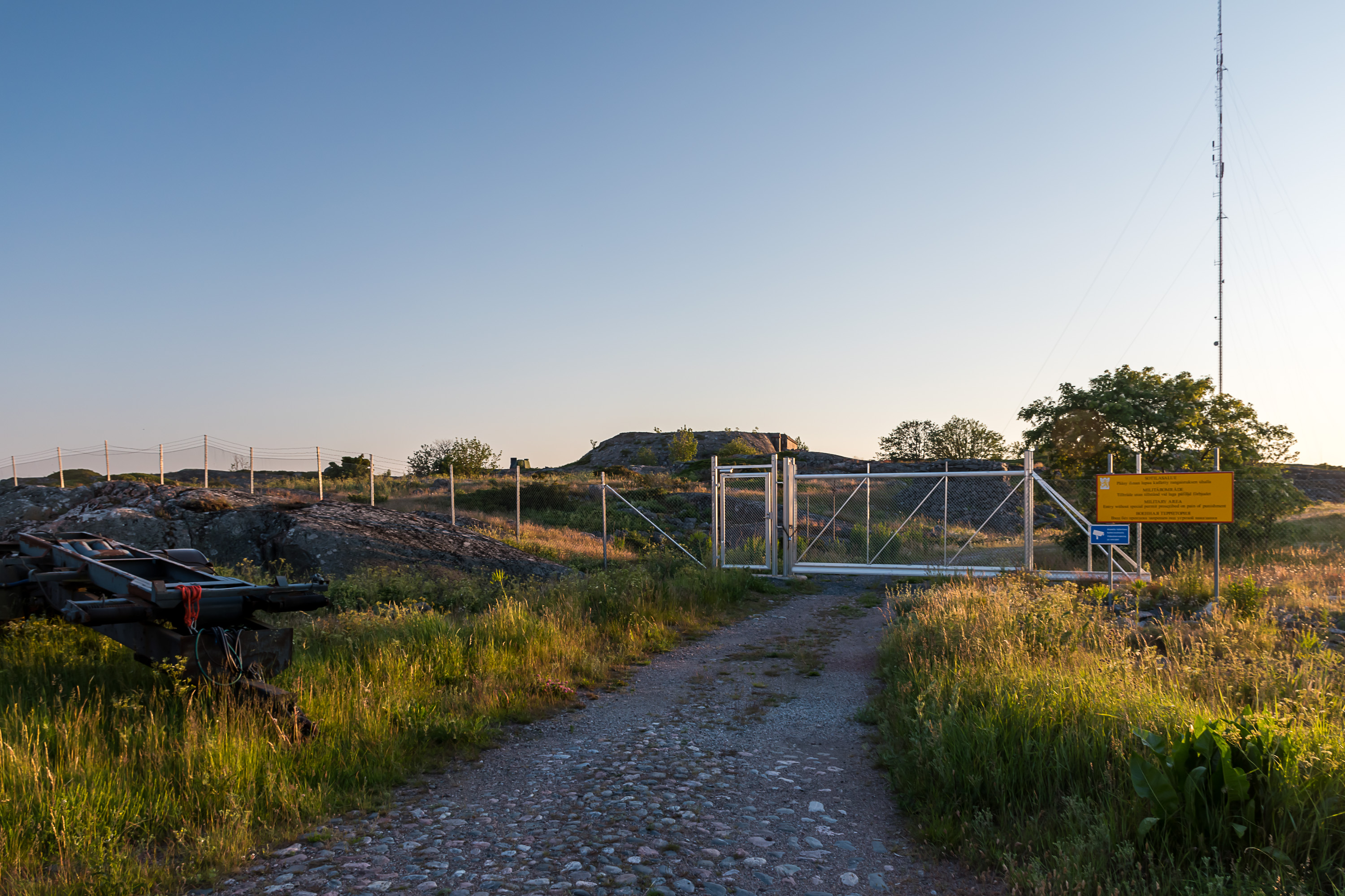
31. The off-limits area in the west of the island. Like other islands originally fortified by the Russians, Utö had some cobbled roads built by them. There also was a narrow-gauge railway to transport shells to guns, etc., also a standard feature. These fortress island railways were all dismantled without a trace, in Utö as long ago as the 1960s.
From there it is a short walk to the hill where the pilot station and the lighthouse are located. In the second part we'll explore the most interesting parts of Utö, including the lighthouse, the chapel and the southern peninsula, Kesnäs, the witness of many shipwrecks.