Over a month ago we had a look at the city of Kokkola, the regional center of Central Ostrobothnia (Keski-Pohjanmaa) in West Finland. The very reason for the city's existence is its seaport; Kokkola is located at the coast of the Bay of Bothnia (Perämeri, Finn. Rear Sea), the northernmost part of the Baltic Sea. More precisely, the city pretty much marks the exact place where Kvarken Strait blends into the Bay of Bothnia. Southwest of Kokkola the Kvarken coast is full of archipelagoes; immediately west of Kokkola begins the so-called Seven Bridges Archipelago (7 sillan saaristo) or Luoto Archipelago (Luodon saaristo), one of the major archipelagoes of the Kvarken. Northeast of Kokkola the coast of the Bay of Bothnia is less broken and has relatively few islands, while vast sand dune beaches on the coast become common.
We're going to see three places of the Kokkola coast and archipelago: Harrinniemi, Ohtakari and Tankar.
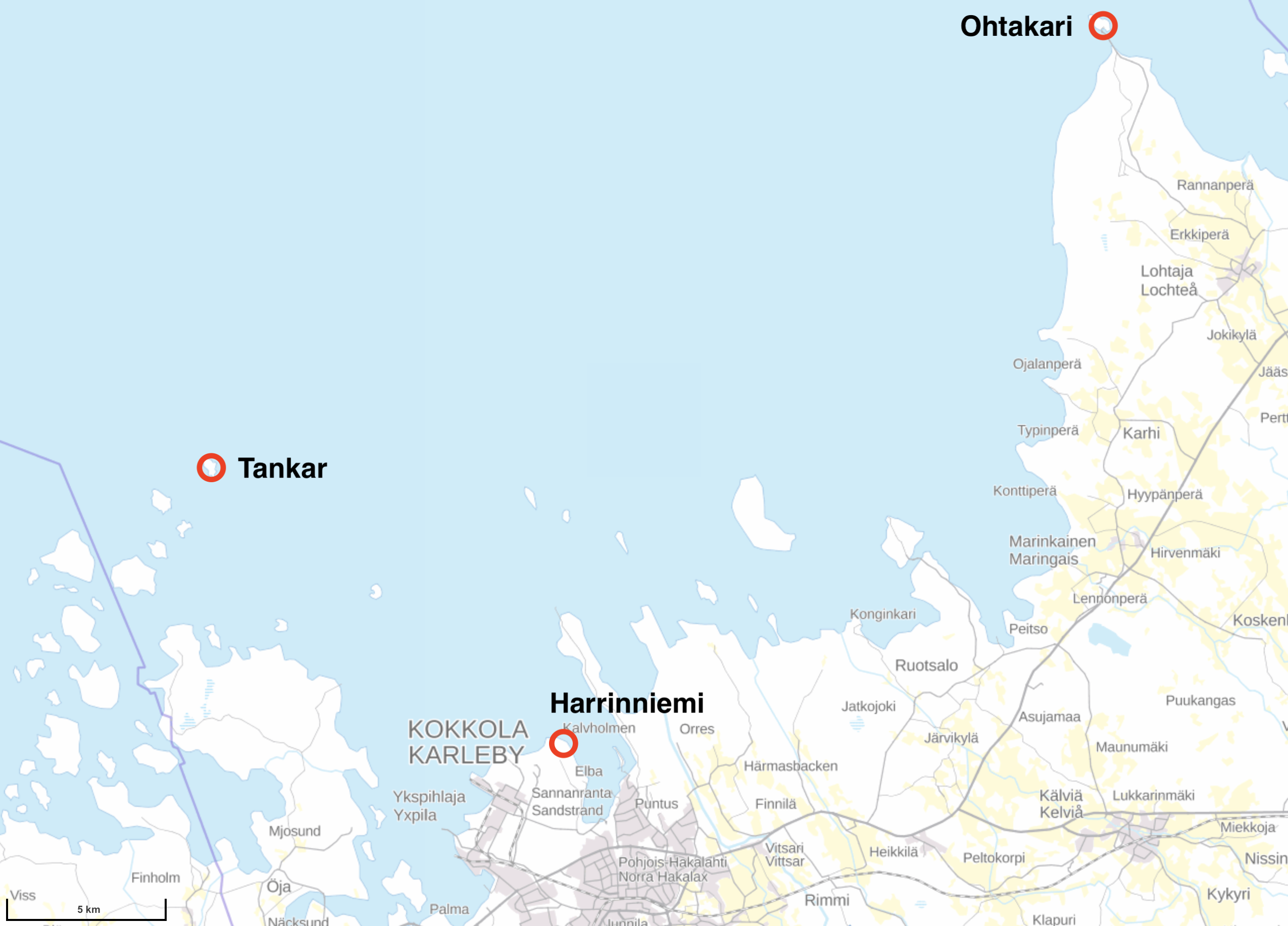
Harrinniemi (Harrbådan in Swedish) is a peninsula immediately northwest of the city; its point, with an abandoned lighthouse (more properly leading light), is about 3.5 km from the old/passenger harbor and 5-6 km from Kokkola center. A small nature trail goes to Harrinniemi mostly by the sea coast. The trail is 2 km long in one direction and begins at a place named Villa Elba. It's also possible to drive pretty much all the way to Harrinniemi. I explored the trail in February 2019.
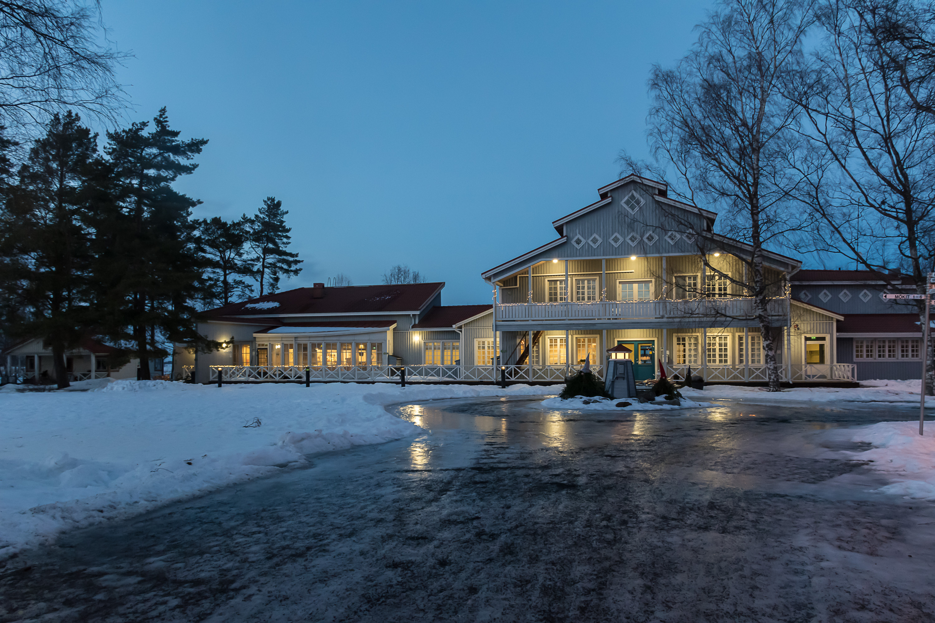
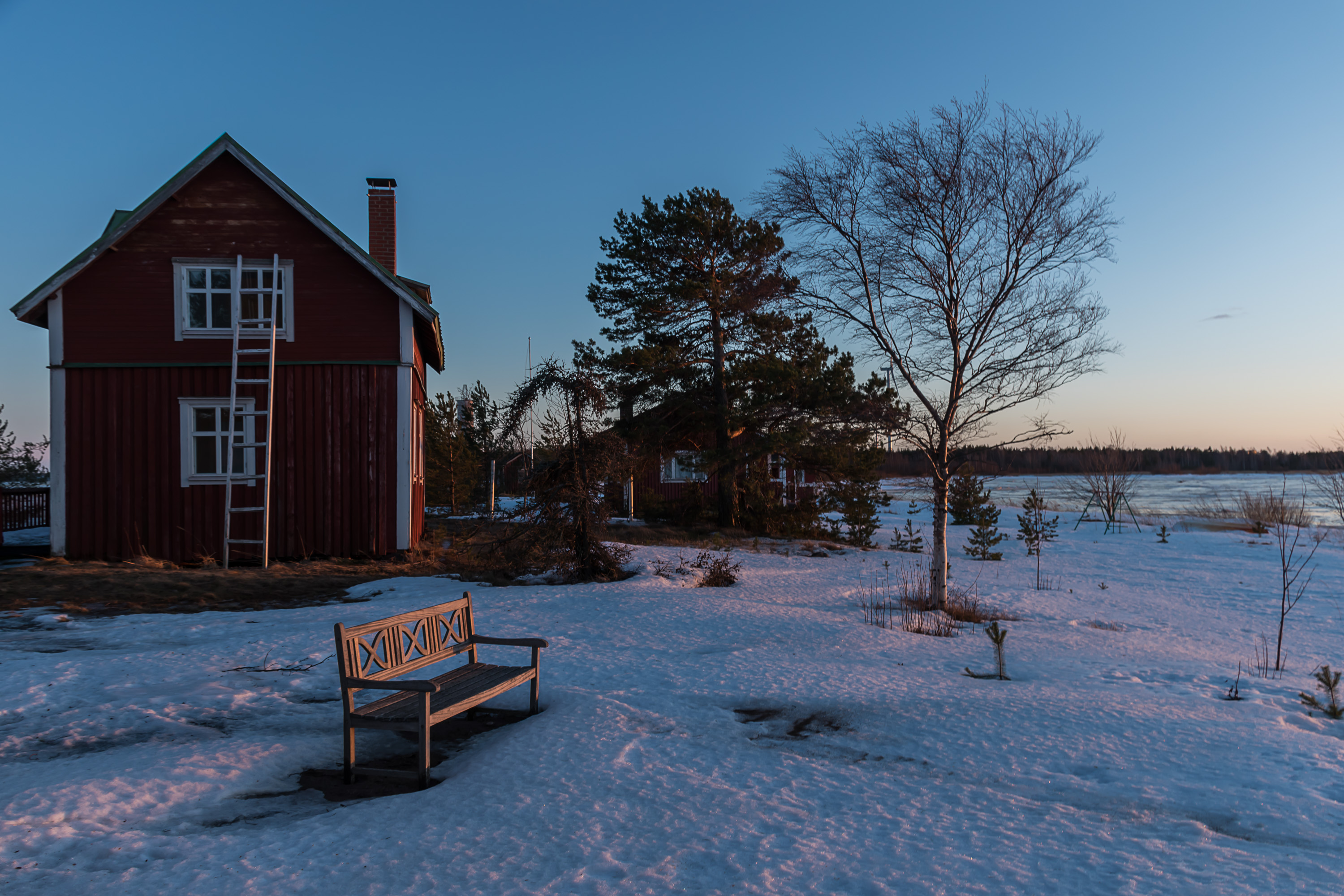
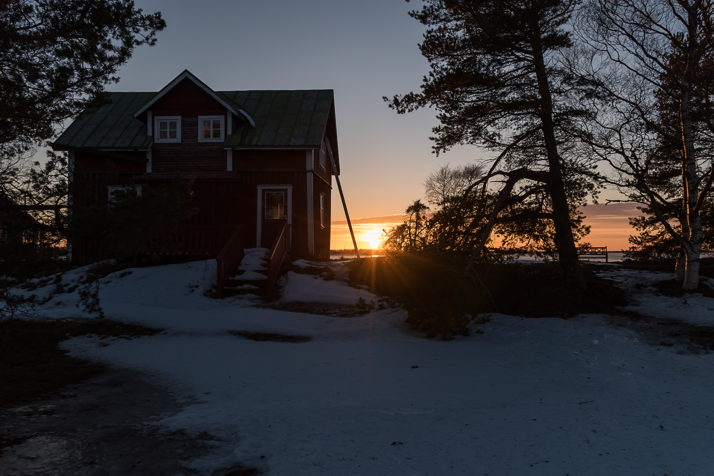
1. Villa Elba, a picture taken already after returning from the trail after sunset. The area between the old harbor and Villa Elba is called Santahaka (Finn. Sandy Pasture), and has a great number of summer residences which have been built there since the 1860s. The name Elba originally referred to a small island where a salt warehouse existed back in the day. Eventually the island joined the mainland due to sea level lowering, and a large villa was built there in the 1890s in place of the warehouse. It got its current appearance in the 1930s under the ownership of Ragnar Neunstedt, a local doctor who spent holidays there with his family. In 1956 his son (I think) sold the villa to the city of Kokkola, which opened a children summer camp there; since 1991 the villa has been owned by the Finnish Youth Center Associaiton (Suomen nuorisokeskusyhdistys) and is now used both as a school camp and as a hotel and restaurant for the general public.
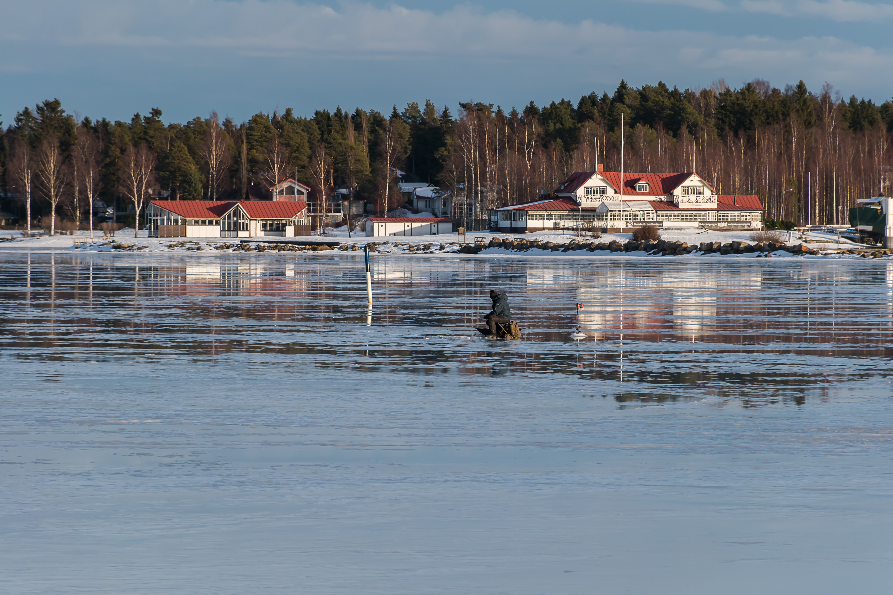
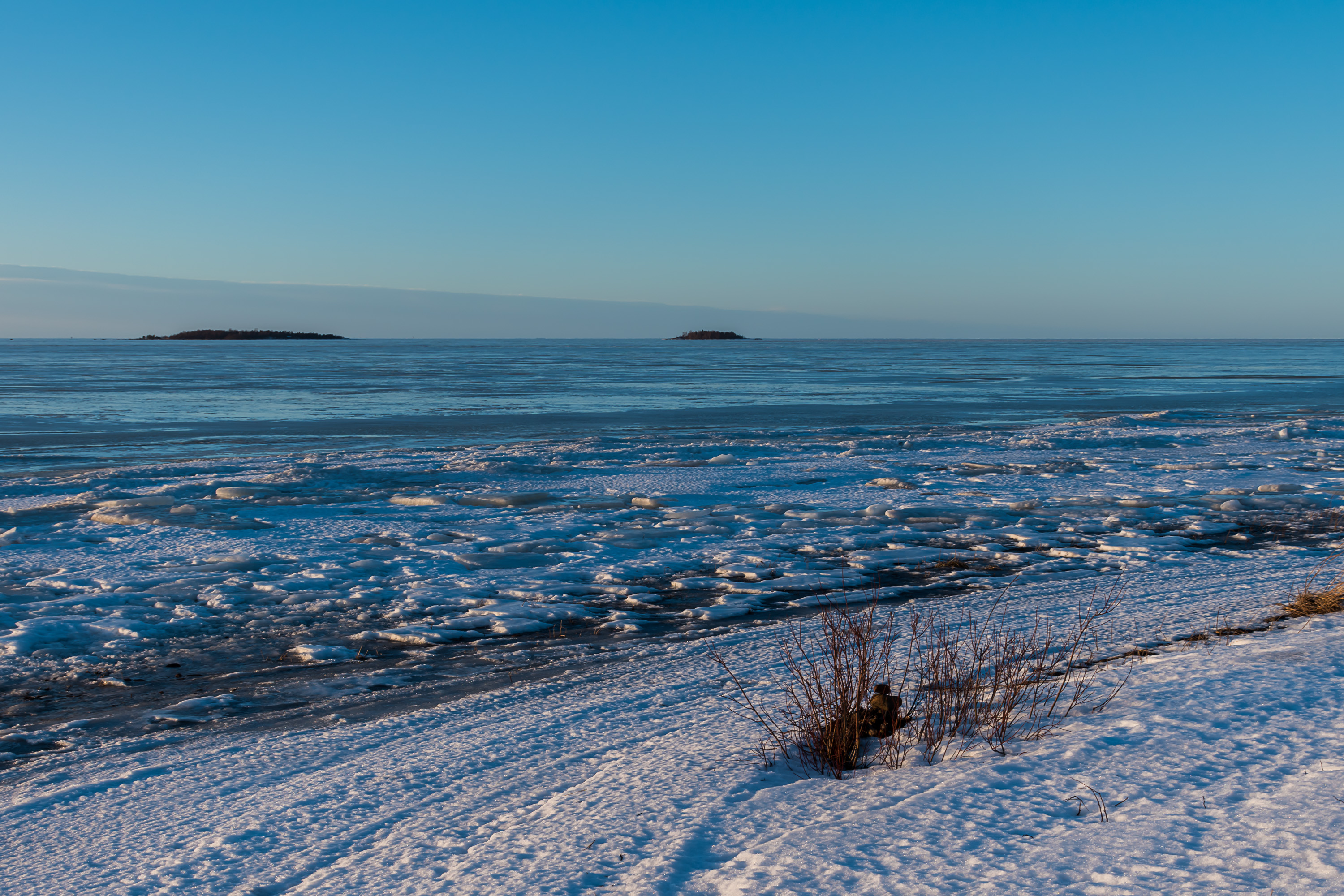
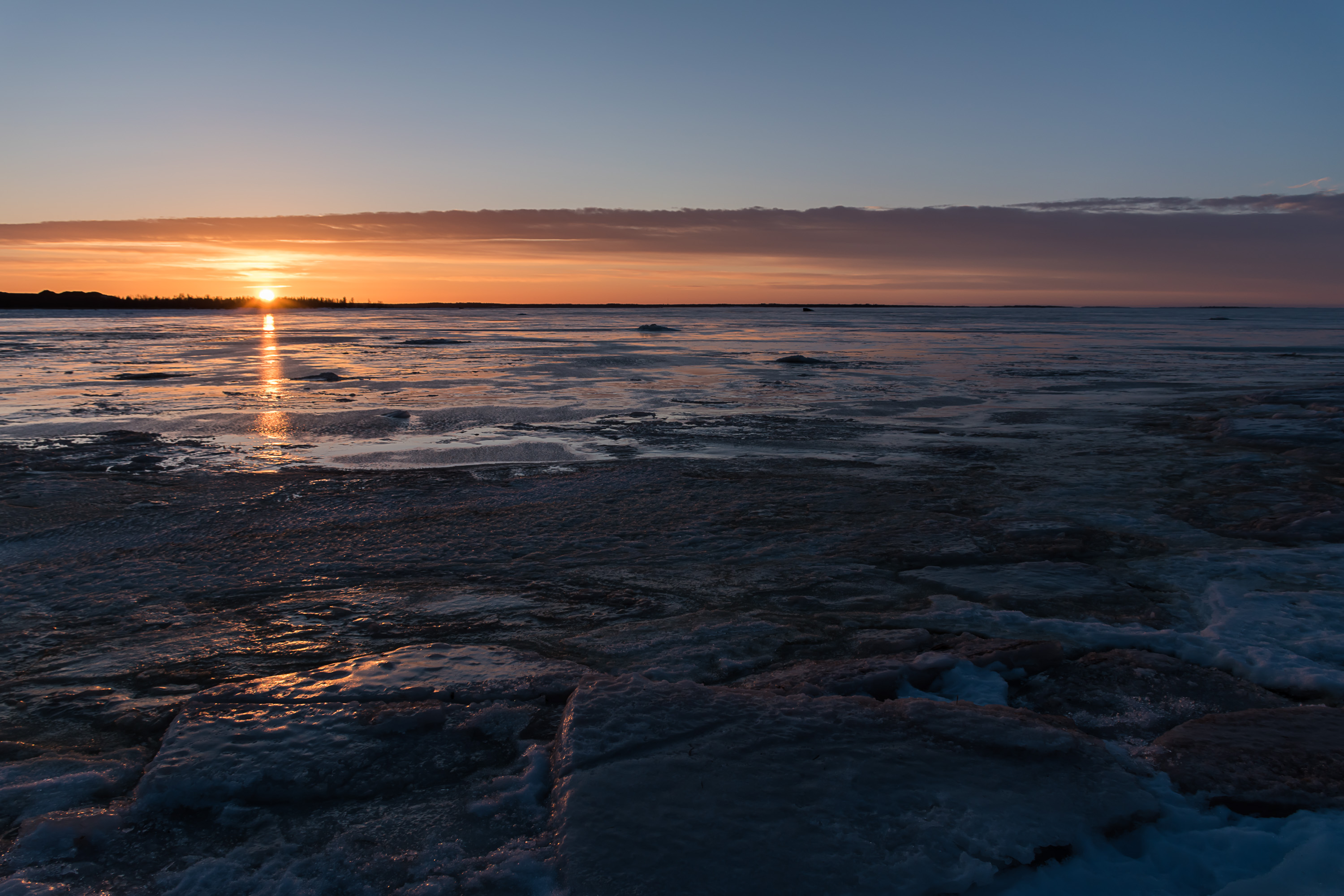
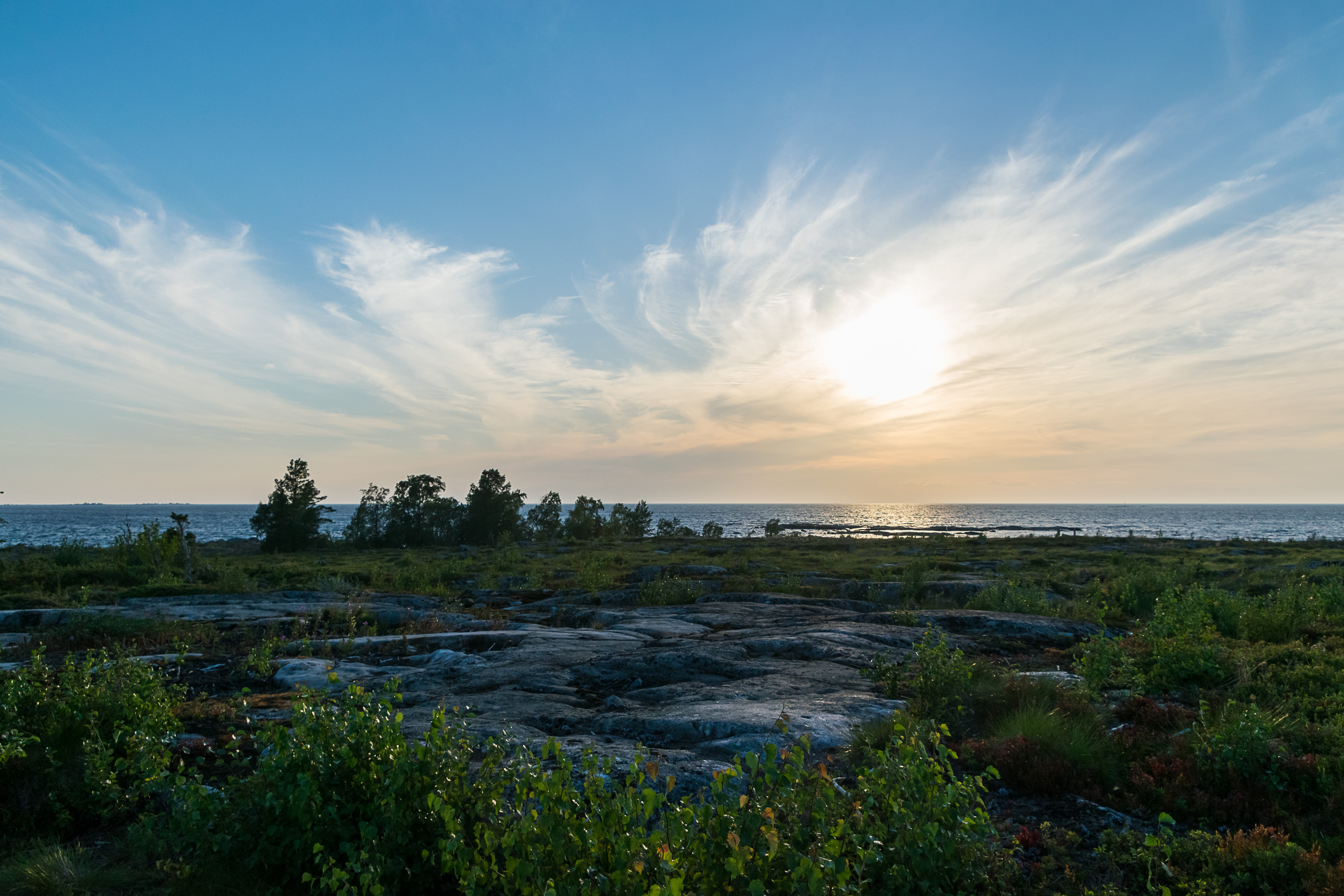
2. The Bay of Bothnia was frozen, of course. Baltic Sea, being essentially a shallow and brackish body of water, freezes quite readily. Ice situation on the Baltic can vary greatly between winters; in coldest winters almost the entire Baltic all the way to Poland or even Denmark can freeze. Such winters have become very rare due to the climate change. The last really cold winter was in 2010-2011. Winter of 2018-2019, pictured, was a warm one although not exceptionally so.
But the one part of the Baltic that reliably freezes even in the warmest winter is the Bay of Bothnia. In a good winter ice thickness can exceed a meter by February-March. The bay gets covered with ice completely or almost completely, although most of that ice is normally in form of drifting ice fields. The strip of ice frozen to the coast and unmoving (fast ice) may be many kilometers wide. Here we see of course fast ice, which thawed on top a tiny bit due to weather but is still very thick and solid.
Finland maintains a fleet of 8 icebreakers, which can be seen off season in Helsinki at their base at Katajanokka (of these 8 Fennica and Nordica double as offshore support vessels and normally have something to do in summer too). There are also ice restrictions updated daily in winter; only vessels satisfying the restrictions (having certain deadweight and ice class, meaning they are not troubled by light ice or for example ice pieces in the wake of an icebreaker) can request icebreaker assistance. Current ice situation updates and maps are published by Finnish Meteorological Service (Ilmatieteenlaitos).
Icebreakers are owned by Arctia Oy, a fully state-owned company. Icebreaking operations cost about 55-65 million euro per year. These are partially compensated by ship owners, not directly but rather through a fairway fee system. A ship above a certain size visiting a Finnish seaport must pay a fairway fee (to the customs), which is calculated based on ship purpose, net tonnage and ice class, and is capped at about 54,000 euro per ship. The fee does not depend on time of year or actual icebreaking needs, and has a yearly cap (it is not charged beyond a certain number of port calls of the same ship), except for cruise ships. Fairway dues are uncommon in the world and in Finland are unusually high, a lot higher than in Sweden for example; but then, Finland is the only country in the world that has zero non-freezing ports. Requiring ships to pay for icebreaking directly would have however immediately put especially Bay of Bothnia seaports at a massive competitive disadvantage, and maritime logistics is just as crucial for those lands and their industry as for the rest of Finland (90% of Finnish imports and exports go by sea). Thus fairway fees in their current shape are essentially a form of cross-subsidy.

3. The beginning of the trail. Close by Villa Elba the trail had these "gnomes" guarding it in places.

4. Much of the trail passes by the shallow sea coast on duckboards. Winter and especially spring is the time of year when duckboards over wet areas turn into a hindrance, as snow on them becomes compressed and slippery or at least easy to fall off.
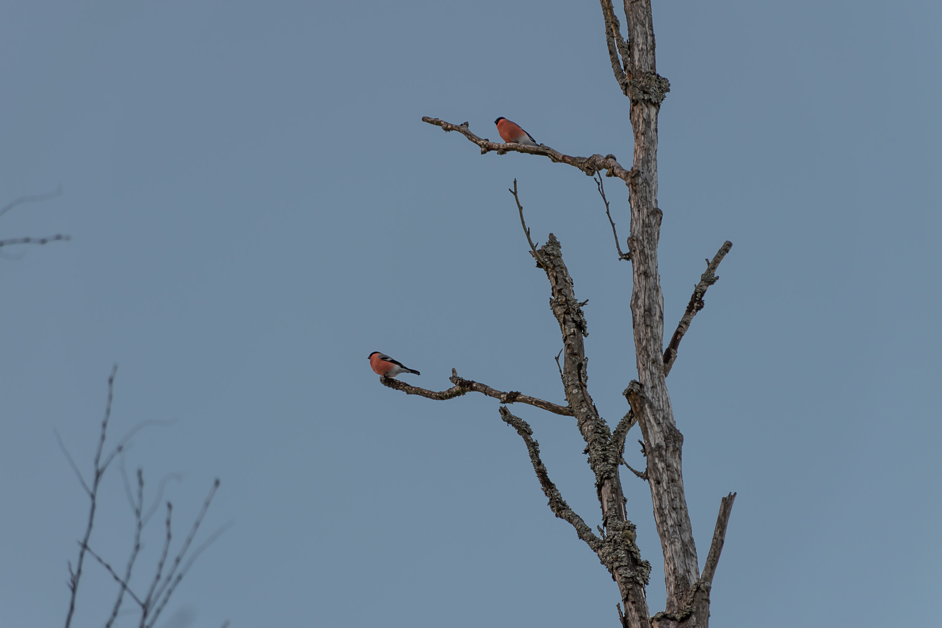
5. These are important birdwatching places (as shallow overgrown coasts tend to be), but I'm not a birdwatching enthusiast. I met a guy at one point who asked me if I had seen some particular bird. There are also two birdwatching towers in the area.
6. The open sea, with a strip of transparent/water-covered fast ice, and then a while wall of drifting ice far on the horizon. In winter the skiing tracks network, maintained by the local skiing association, stretches also over the sea. It is possible among other things to ski to the largish island of Poroluoto (Finn. Reindeer Skerry), some 9 km from Harrinniemi across the long peninsula of Trullevi.

7. Harrbådan leading light (linjaloisto) was built in 1953, but its light was extinguished already in 1979. Since it was meant to work in pair with another leading light, it was not a real lighthouse. The 30 m concrete tower itself can still be used as a navigation aid, although it's been abandoned and is crumbling down now. In 2016 it was sold by the city of Kokkola to a private party for mere 300€; they apparently planned to restore it and make some small cultural space there, but at least as of 2019 it didn't appear like anything changed much.

8.
9. Harrinniemi area has a few old summer residences. Not all of them appear to be still in use.
According to a local legend, this place is haunted by a ghost, the Maid of Harrinniemi. Either she accidentally drowned here, or drowned herself when her family died in a shipwreck, or was raped and killed by seamen, or something like that. According to the most likely version however the ghost is simply a rumor spread back in the day by summer house owners to stave off trespassers. I was not aware of the ghost at the time of my visit and didn't really notice anything unusual.
10.
11. The ice.
12. It is a bit difficult to believe this is the same day when I took the gloomy winter pictures of Kokkola center from the previous post. The sunset at the coast more than compensated for the overcast day in the city.
13.
14.

15.

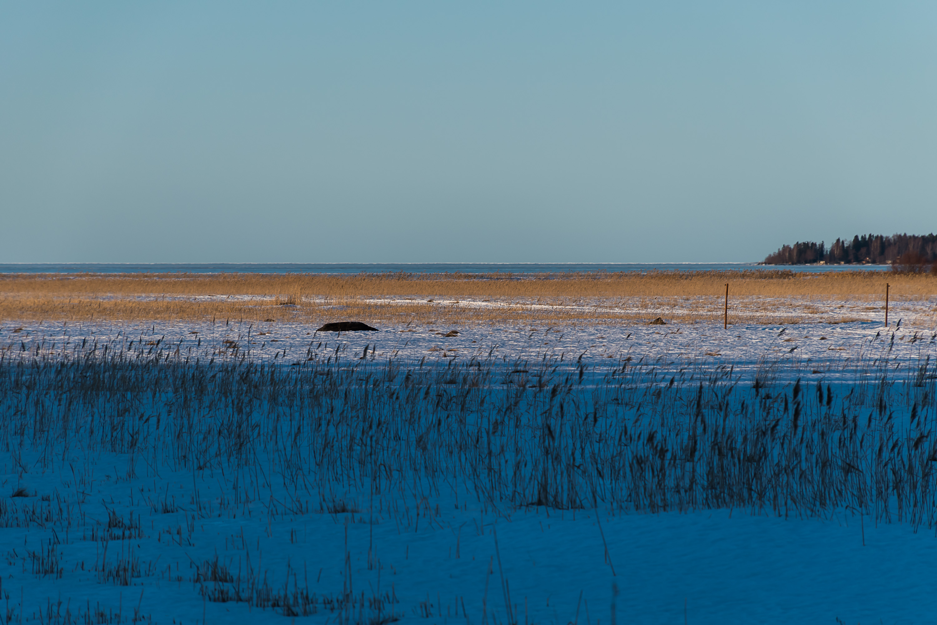
16. The sandy peninsula is exposed to the winds, and not much snow ever accumulates here.
17.

18. The walk back after sunset, and yes I did fall from these duckboards at least once.
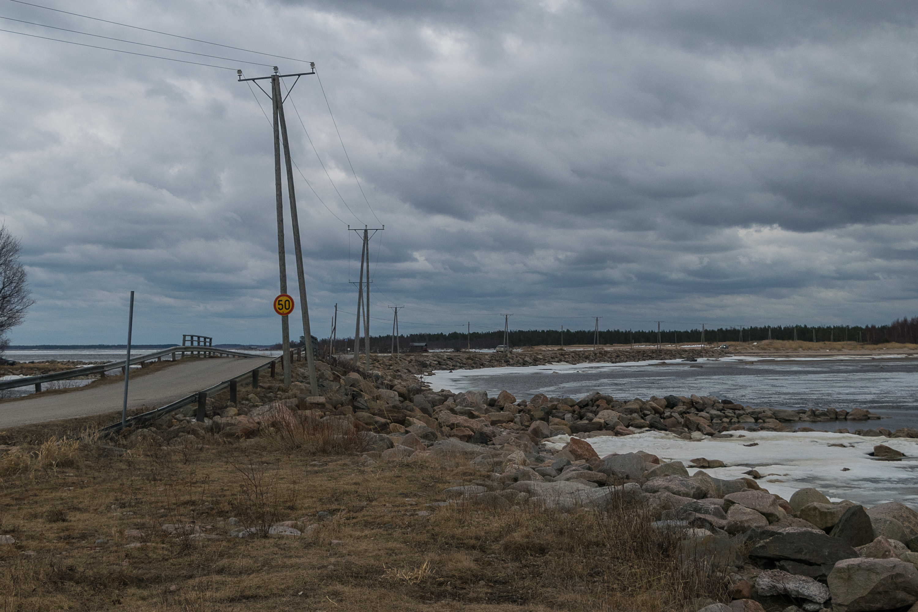
19. The next place to see is Ohtakari, a small lone island at the end of a prominent but smoothly curving peninsula some 30 km northeast of Kokkola. This area used to belong to the small Lohtaja rural municipality, which was merged with Kokkola (along with similarly small Kälviä and Ullava) in 2009. Ohtakari, about 10 km north of Lohtaja church village, is about 800x500 meters large. Being located very close to the mainland, it was joined to it in the 1970s with this road on top of an artificial embankment. The exposed location makes the road prone to flooding in stormy weather, as you can see for example in this video. The island is difficult to reach without a car.
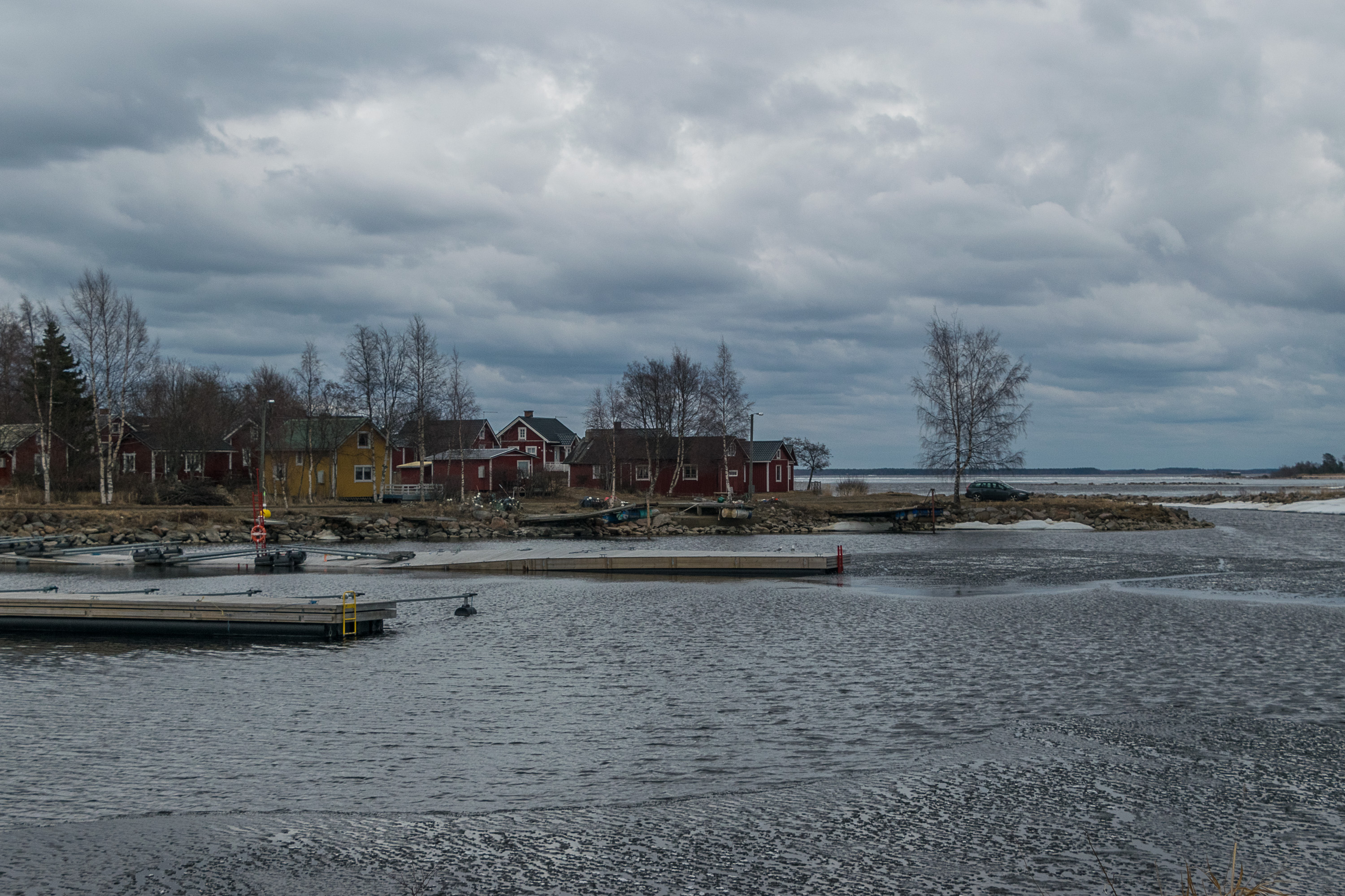
Ohtakari is an old fishermen and pilots island, not unlike in that for example to Haapasaari off Kotka coast. It has been used by fishermen since the 16th century; at some point local pilots also appeared there, and from the 1840s until 1961 an official pilot station was operating on the island. However since the island was quite close to the coast and easily accessible (unlike Haapasaari), there was no need to live here permanently; fishermen only lived in their cottages here during the fishing season, and pilots during their shifts.
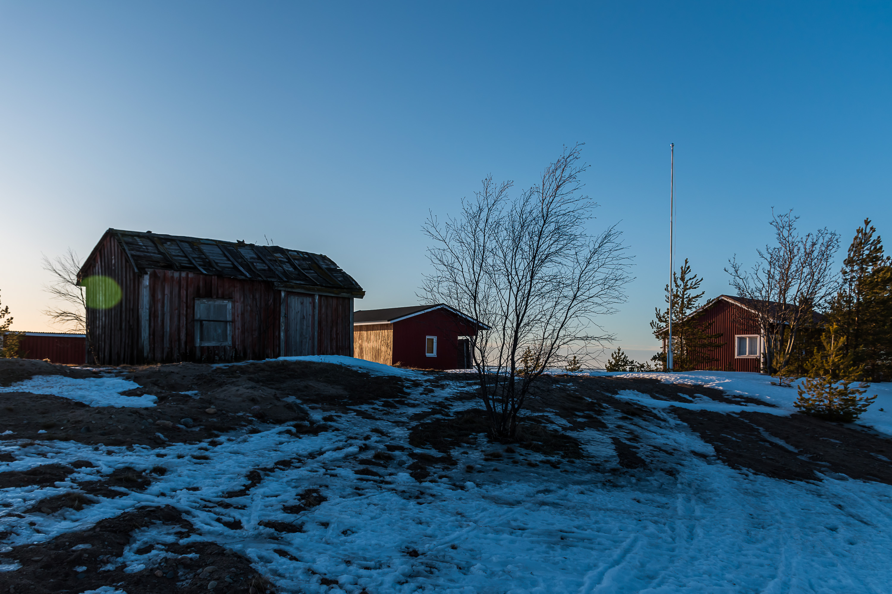
The pilot station was in 1961 shut down in favor of the far more outlying Tankar (to which we'll soon get too), but a small fishing harbor is still operating here to this day. Old fishermen houses (about 50) are now used as summer residences. There is a fishing museum, a restaurant and a church camp among other things. I only visited Ohtakari once and not for very long, so I don't have many pictures from here.
As someone who had lived in St. Petersburg for 6.5 years, I of course find the Ohtakari name vaguely familiar; the river Ohta is the biggest tributary of the great Neva, in the estuary of which St. Petersburg is located, and the city area near Ohta mouth is also named Ohta. The name Ohta is also Finnish in origin and predates St. Petersburg (in Finnish the river is known as Ohtajoki to this day). There is no full consensus on what it means; the most probable version is "bear" (a modern, though rare/poetic, Finnish word for bear is otso). There is a number of minor geographic names beginning with ohta- in modern Finland, mostly in the east (North Karelia, Kainuu, Koillismaa), but also a few around Central Ostrobothnia for some reason. (kari in Ohtakari means "skerry")

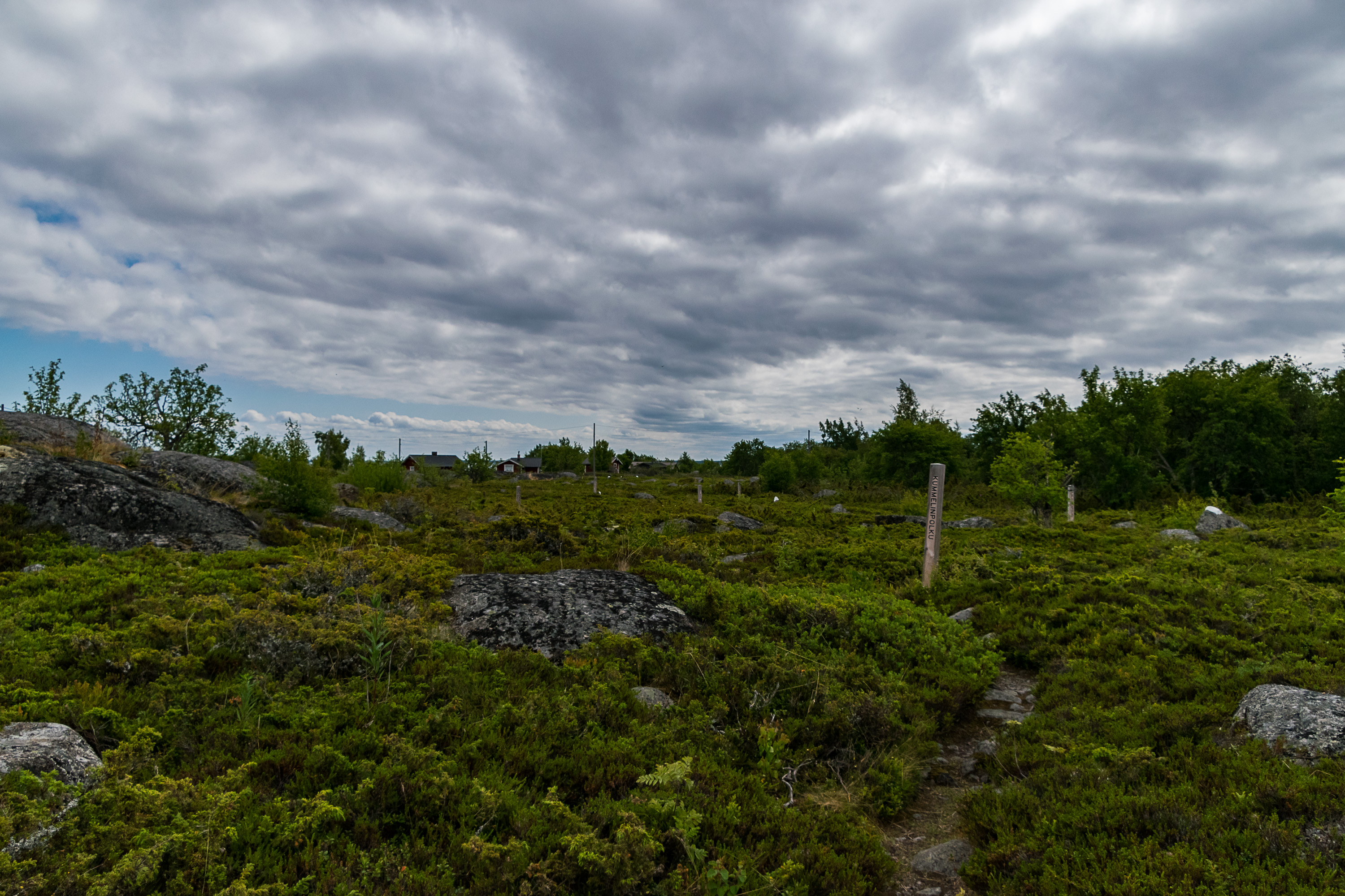
20. The peninsula at the end of which Ohtakari is located is also noteworthy; it's called Vattajanniemi or simply Vattaja, and is one of the great dune coasts of the Bay of Bothnia. Though perhaps less well known within Finland as Kalajoki or Hailuoto dunes farther to the north, Vattaja beach at 10-11 km long is also quite unusual for Finnish nature. There are nature trails there (a map is available here, although in Finnish only) which I never explored; a bit of Vattaja can be seen from the Ohtakari road, so I only have a picture from there.
Vattajanniemi area is however a military exercise area in active use. It is the place in Finland where basically the heaviest caliber range practices take place. While the area is not fenced off and as a whole is not off limits (apart from the actual military structures), it is upon the visitor to obey possible restriction signs and to avoid visiting it during ongoing exercises. Notifications of upcoming range practices are available on the Finnish Defense Forces website (in Finnish and English; the page lists all upcoming events in Finland, not just Vattajanniemi), and of course warning signs also would be set up at the entrances to the area. There is a local organization (Pro Vattaja) that demands removing the military presence in the area, but apparently without much success so far.
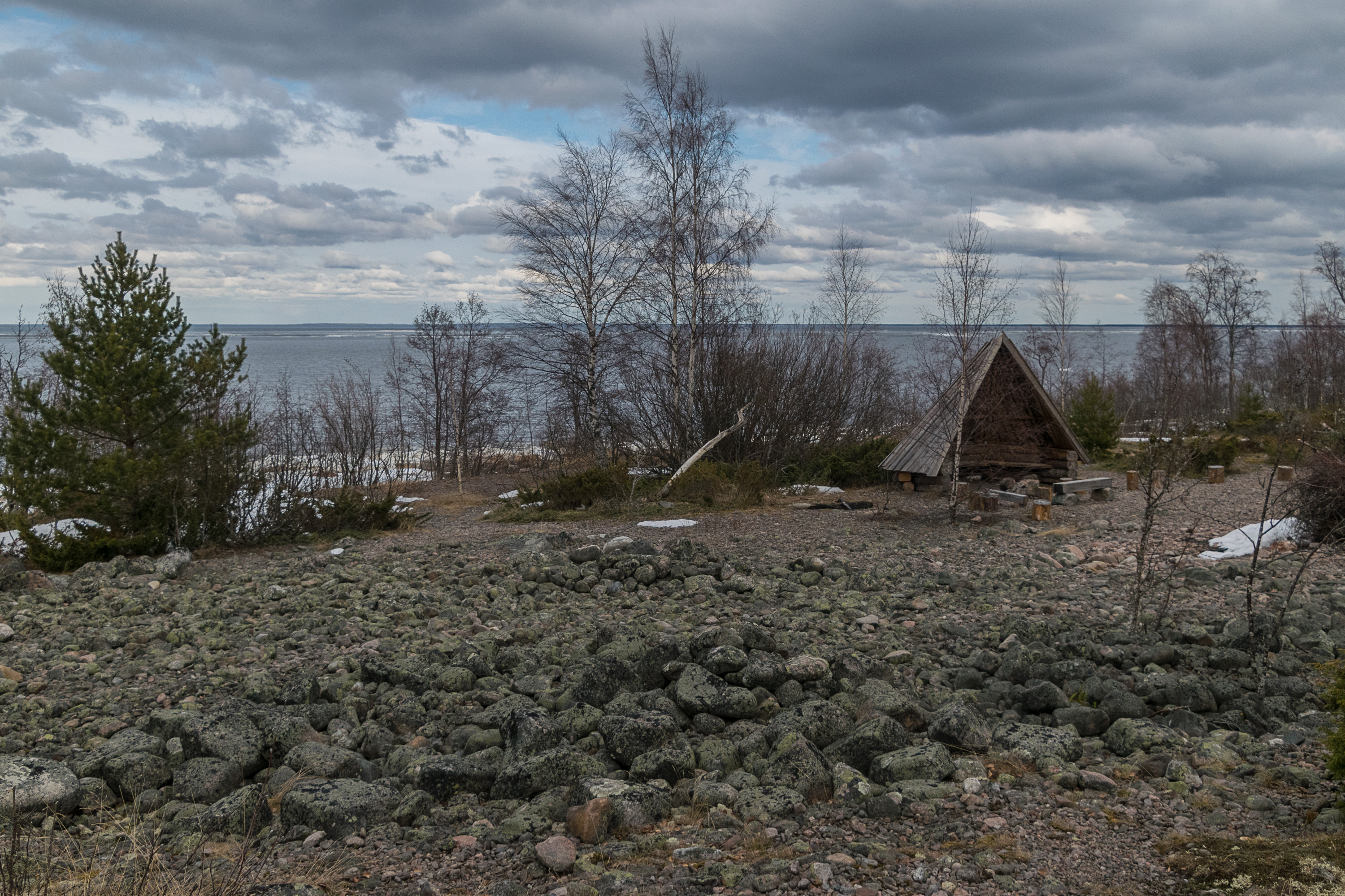
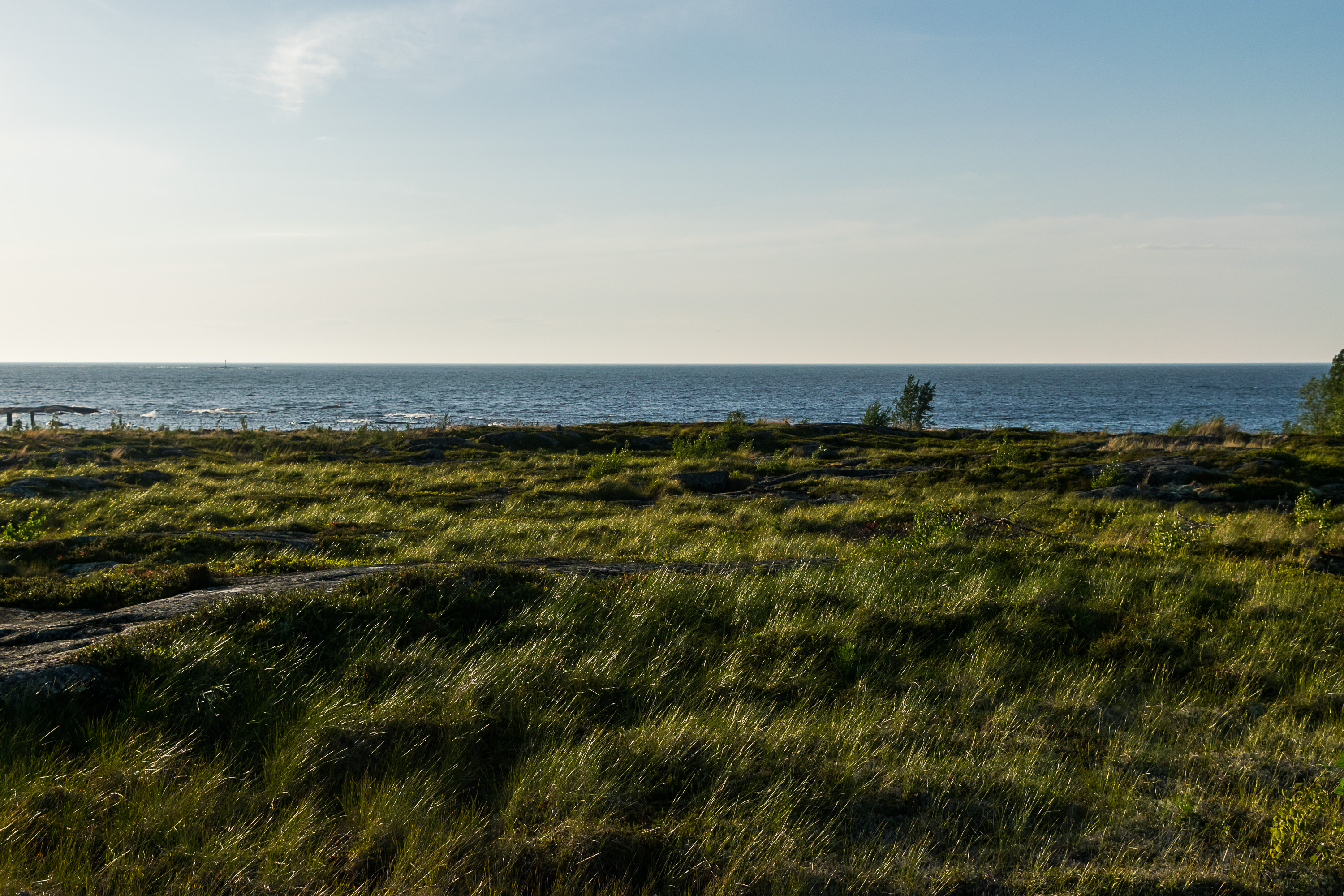
21. Vattajanniemi coast. There are a few birdwatching towers in the area.
22. The fishermen village.
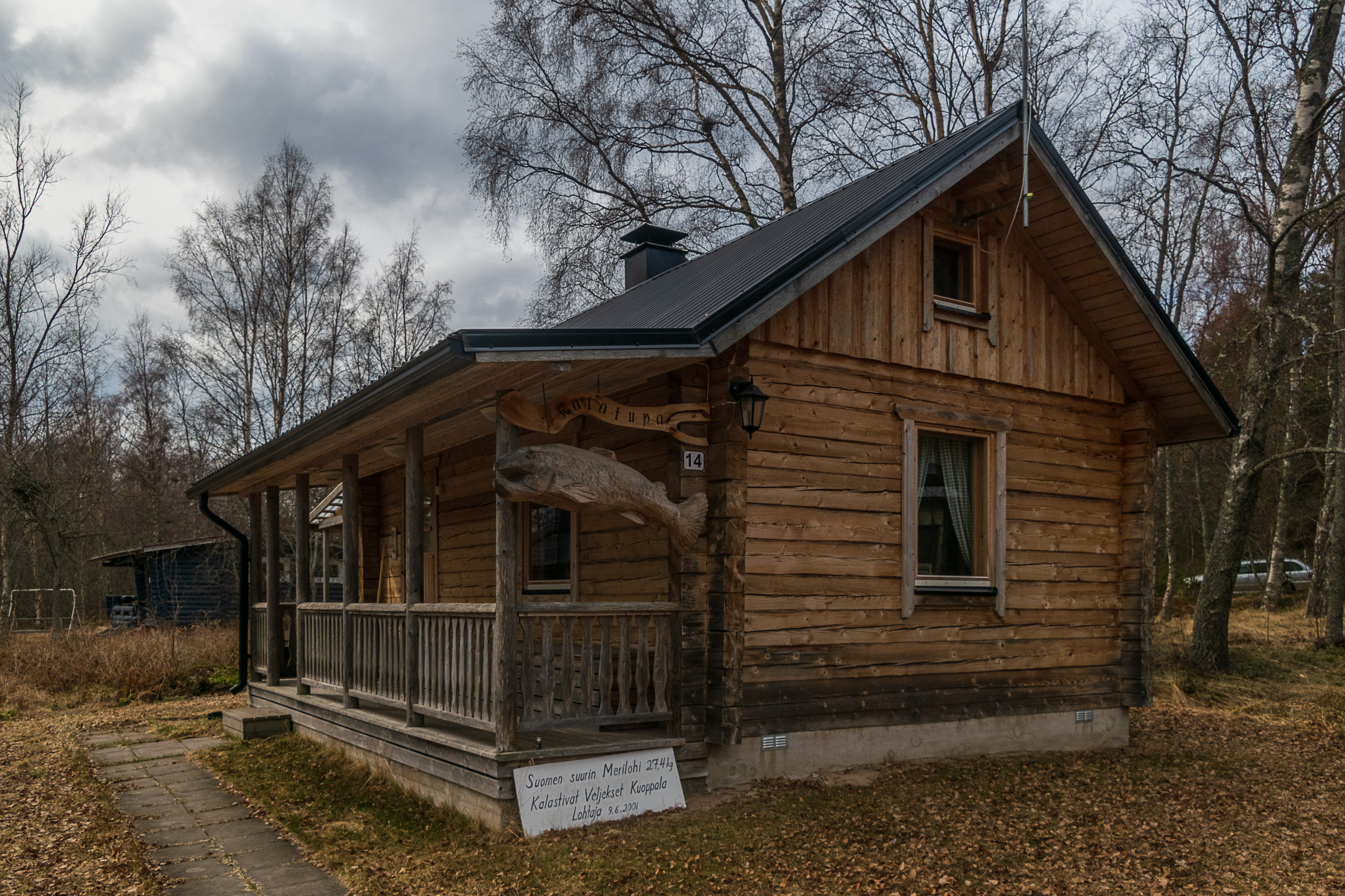
23. "The largest Atlantic salmon in Finland, 27.4 kg, caught by Kuoppala brothers. Lohtaja, 9.6.2001"
24. The island is relatively densely built up. Only the northernmost third is almost free of old huts.
25. As I occasionally noted before, the nature of exposed windswept islands in Finland at times looks oddly similar to the nature of the harsh tunturi-fells of Lapland, with low vegetation, relative lack of trees, and lots of just moss and lichen-covered rock and rock fields. The island used to be even more bare before, due to grazing sheep.
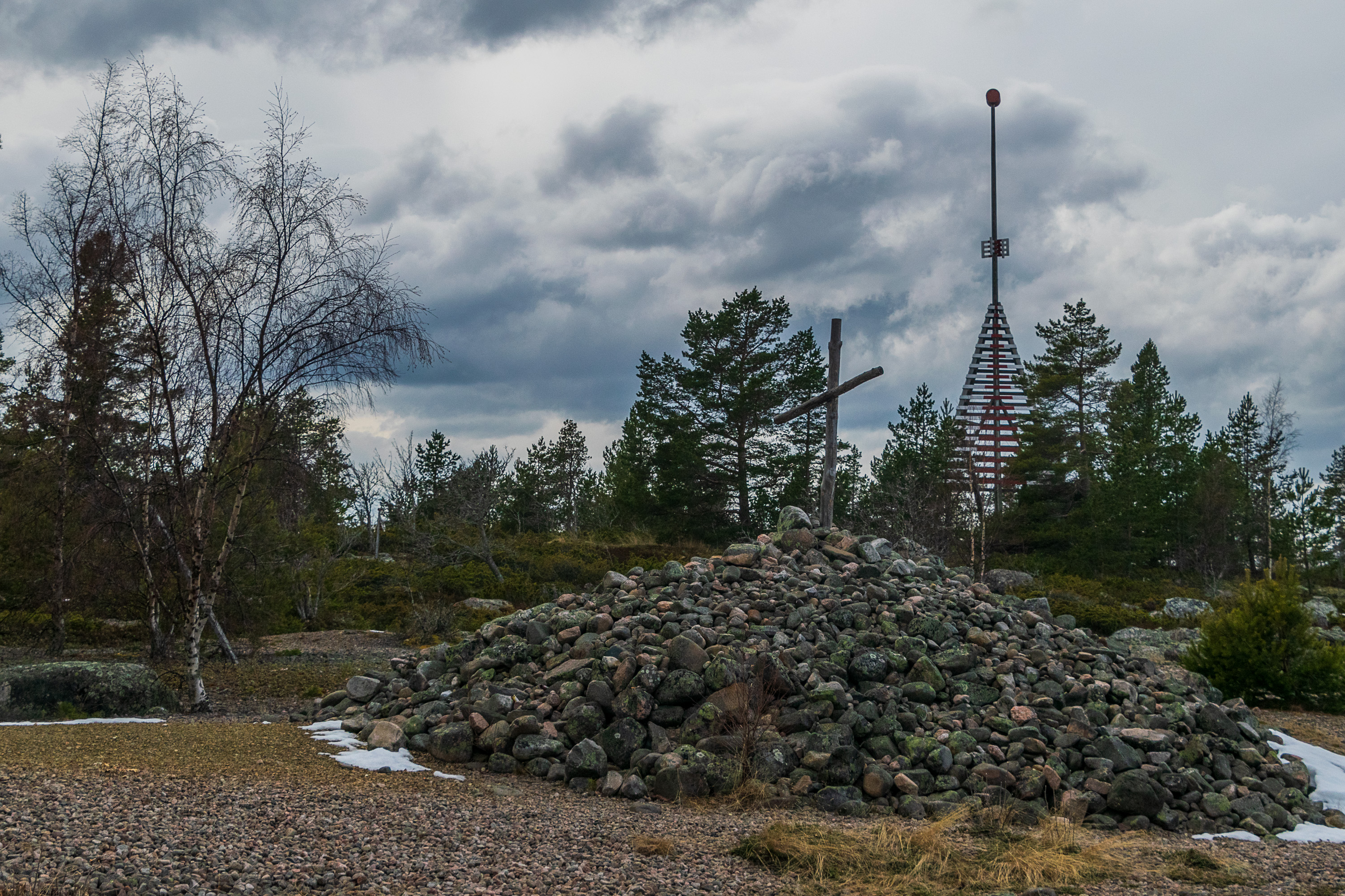
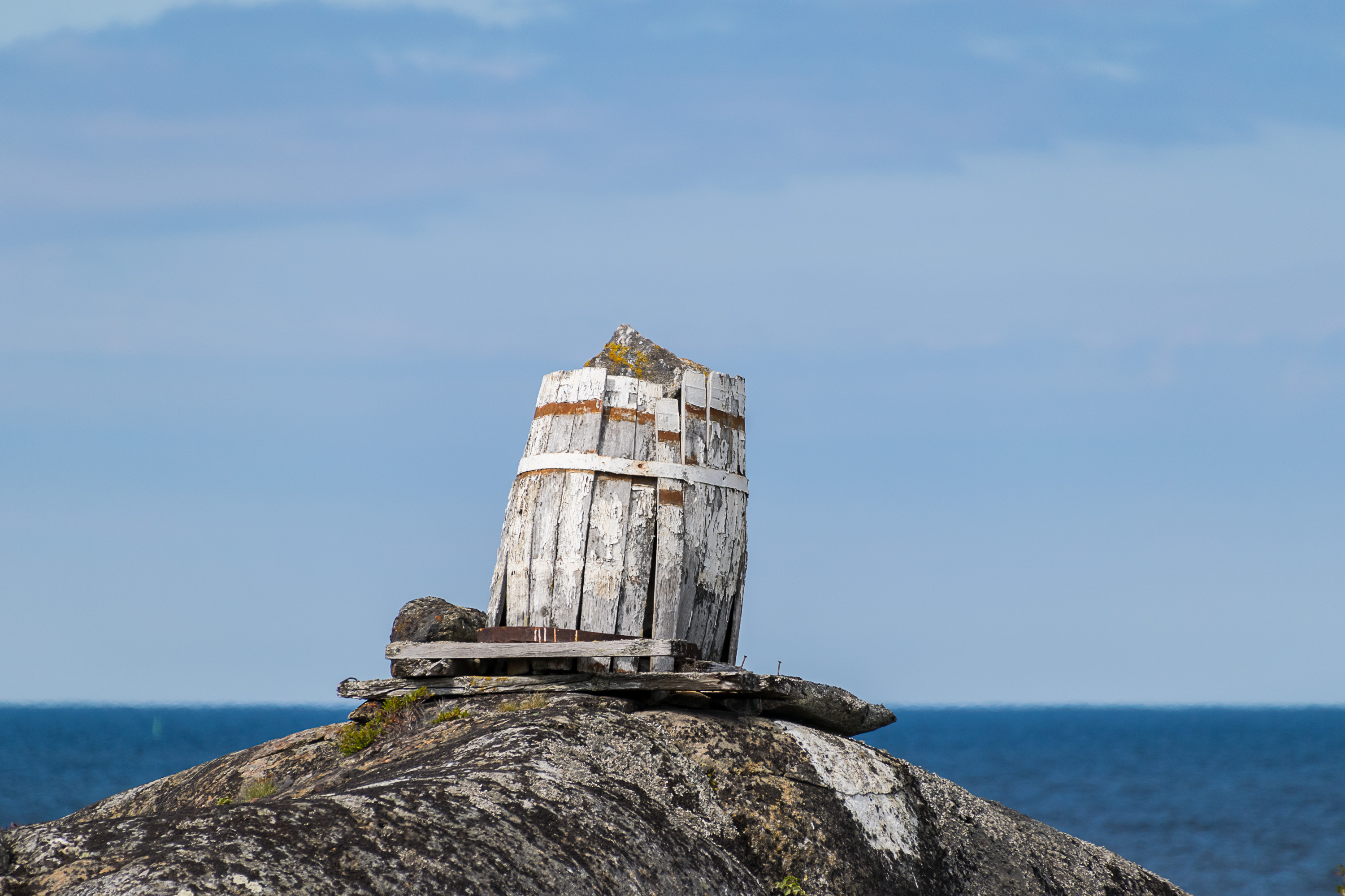
26. A daymark and some cairn with a cross. An older daymark, also used as an observation tower, I somehow missed.
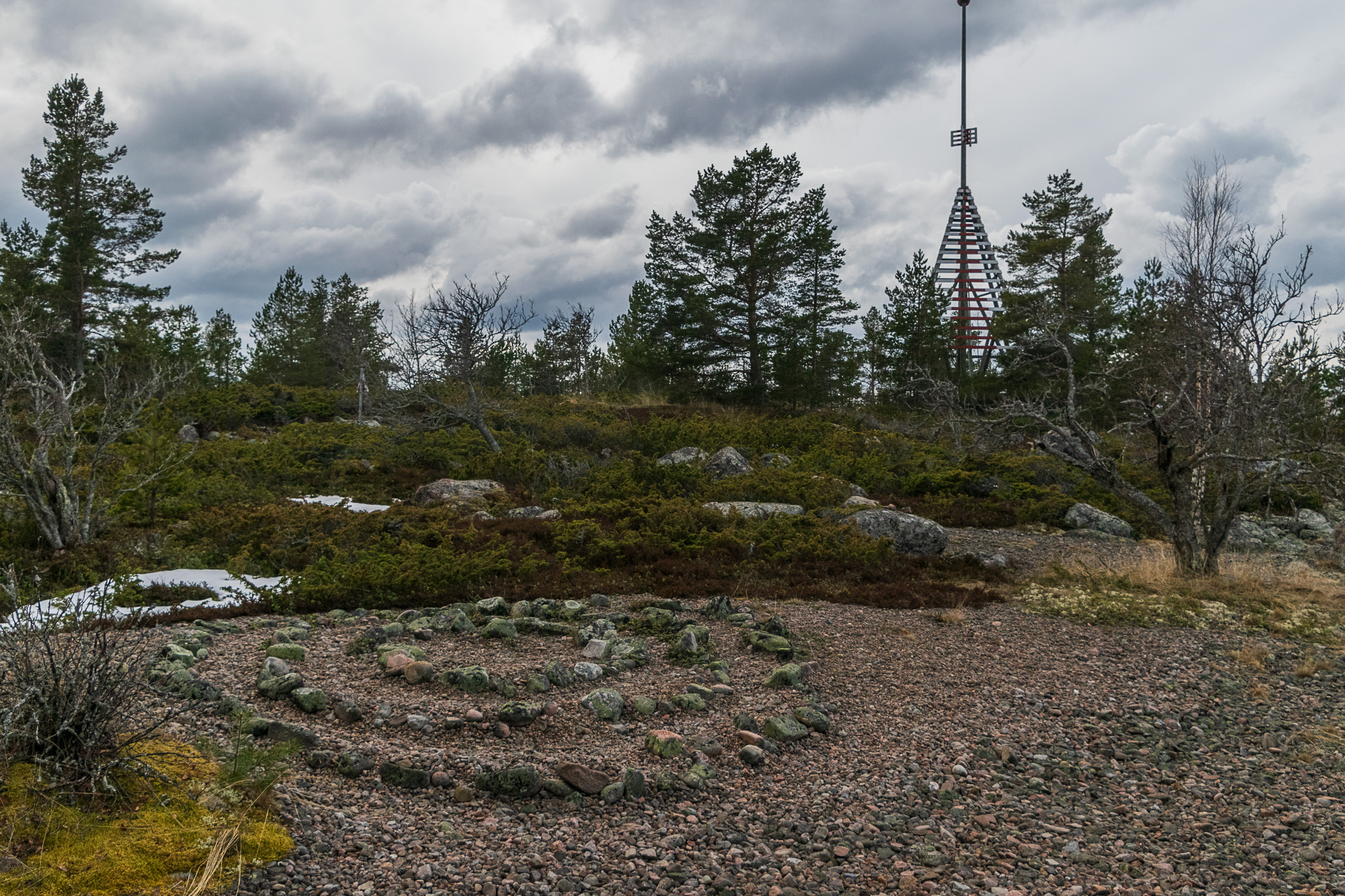
27. Possibly the oldest artifact of Ohtakari is the "giant's garden" (jatulintarha). These spiral "labyrinths" laid of stones are known around Scandinavia, on Kola Peninsula and at the White Sea, but Finland has the greatest number of them. The "gardens" were built on the Baltic coast, typically on islands, and it is uncommon (but certainly not unheard of) to find one in a place easily accessible by car. While they mostly date from historical times (Middle Ages, some are even newer although some are estimated to go all the way back to the Bronze Age), their purpose is unknown. Presumably they were built by local fishermen and had some ritualistic meaning for them. Spiral patterns of these labyrinths can be found on the walls of some medieval Finnish churches. The age of the Ohtakari "giant's garden" is not known.
The common name "giant's garden" originates from Kemi area farther in the north, but those could have various other names locally. The Ohtakari labyrinth in particular was known as "Laiska-Jaakon rinki", "Lazy Jaakko's Ring". Laiska-Jaakko, "Lazy Jaakko", is a Finnish nickname for Count Jakob De la Gardie (1583-1652), a Marshal of Sweden. De la Gardie was one of the Swedish commanders in the Russian-Swedish War of 1610-1617, known as Ingrian War (Inkerin sota in Finnish) in Finland and Sweden. Russia was living its Time of Troubles, when the ancient ruling House of Rurikid got extinguished, and various factions were fighting for the tsardom throne — including foreign ones. While the Time of Troubles was resolved when Mikhail, of the House of Romanov, was installed as the tsar in 1613, the Swedish invasion continued for years; in particular De la Gardie held the ancient city of Novgorod in the northwest for six years, with the Novgorodians actually accepting Swedish prince Charles Philip, son of Gustav II Adolf, as the lawful ruler of Russia. It is for this six year long occupation his Finnish troops called him Lazy Jaakko, although he was not literally sitting on his ass all that time; he had some other battles and sieges, although mostly not very successful ones. In the end the Peace of Stolbovo in 1617 returned Novgorod back to Russia, but in return it had to cede Ingrian area, basically all its Baltic coast. A century later the return of Ingria was the cornerstone of Peter the Great's ambitions — and he did recapture it, and in the middle of it he founded the majestic city of St. Petersburg.
But what relation this particular labyrinth has to De la Gardie, I do not know. The closest place somewhat related to him is the city of Jakobstad (Pietarsaari in Finnish) 55 km to the southwest, which was founded by De la Gardie's widow and named after him.
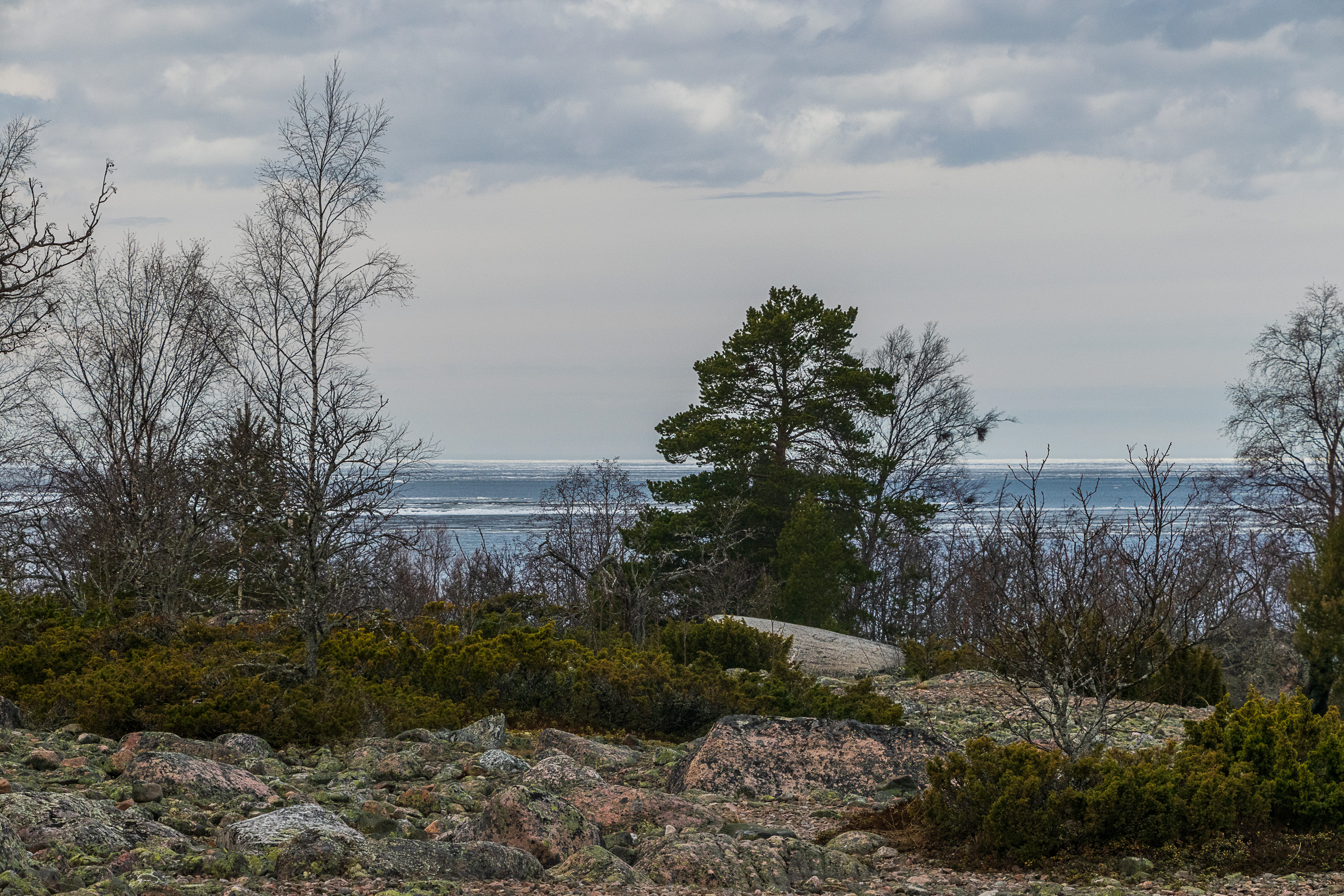
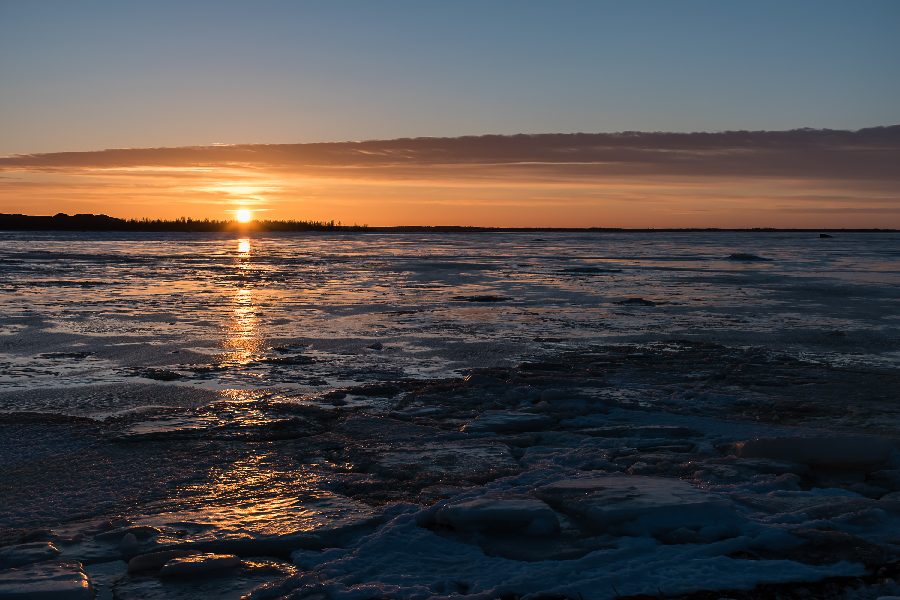
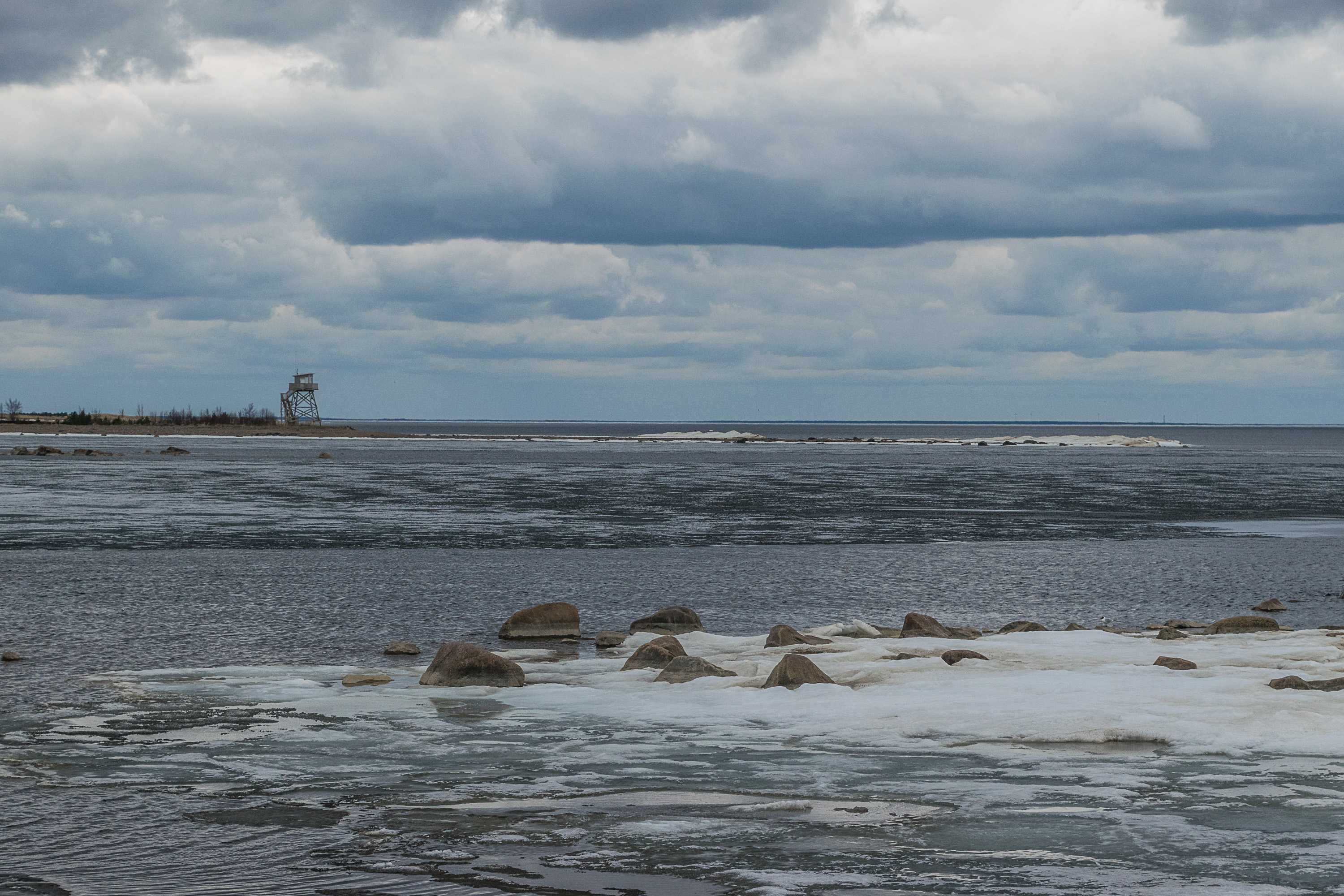
28. The pictures are taken on the 1st of May. The ice is melting rapidly, but vast drifting ice fields are still visible in the distance in the open Bay of Bothnia.

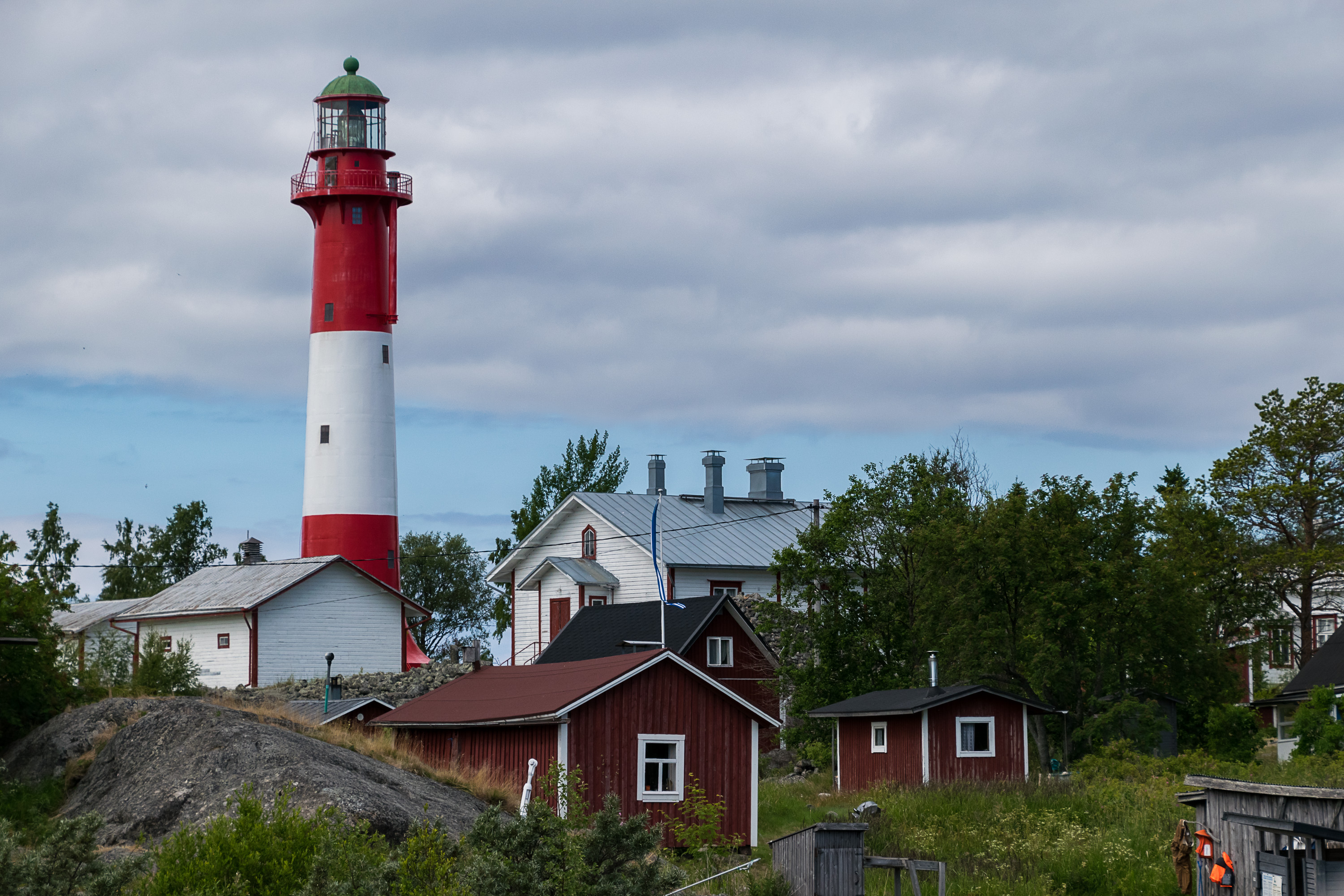
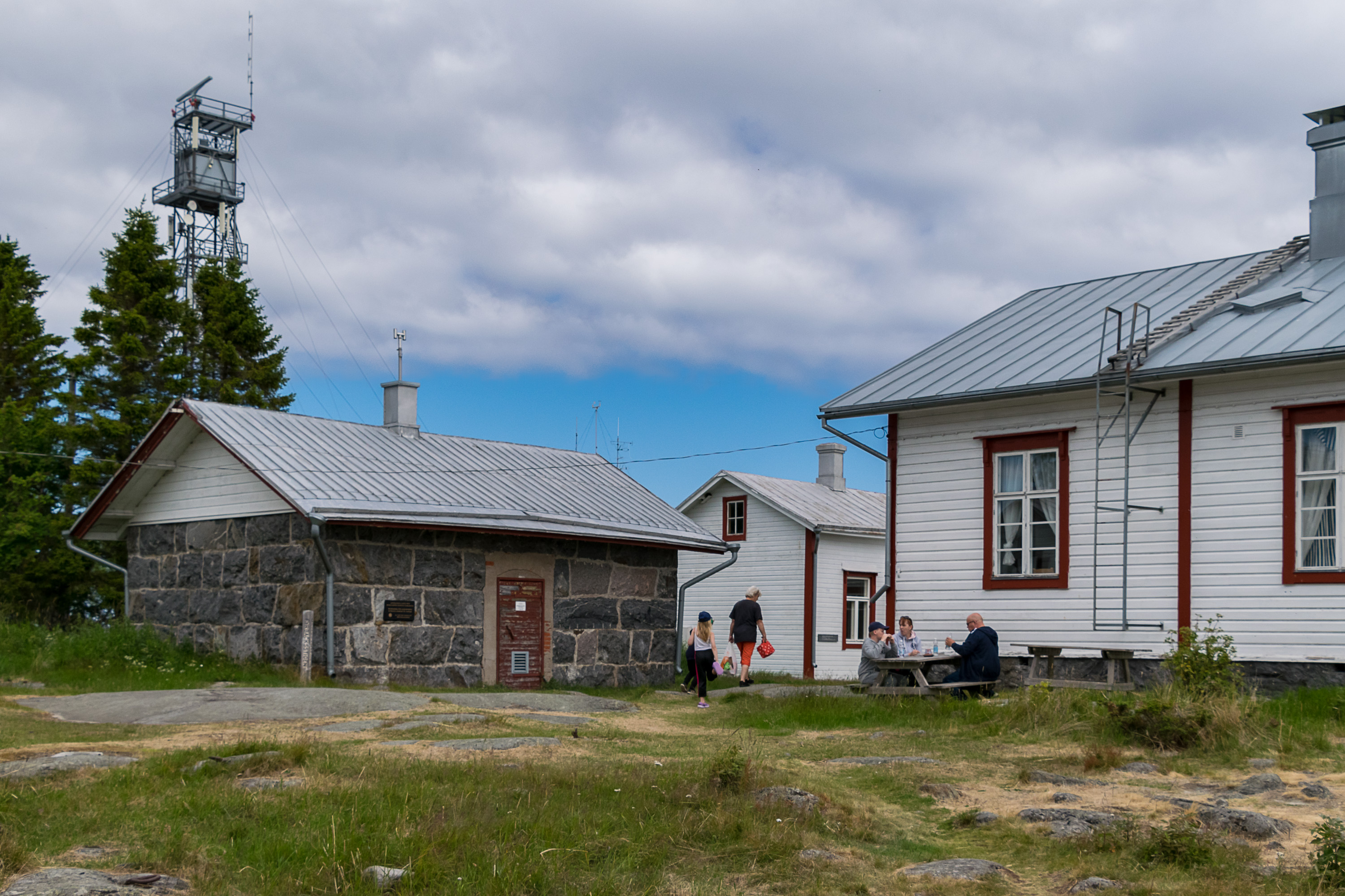
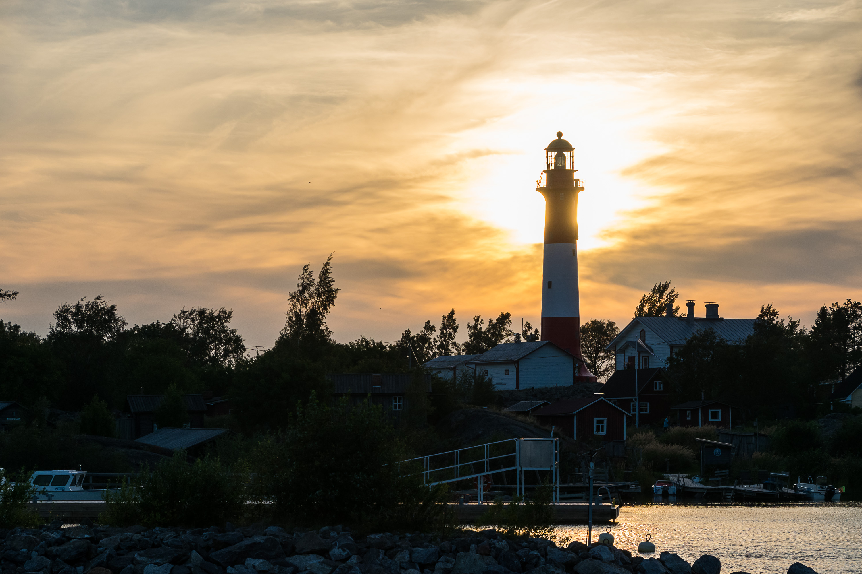
29. And finally, Tankar. It is another fairly small island (700x500 m), but it is basically the most outlying island in the Seven Bridges Archipelago near Kokkola, in 17 km northwest of it. The fairway to Kokkola begins from Tankar (like the fairway to Turku and Naantali begins from Utö), and correspondingly the island also has a lighthouse and a pilot station.
The island is relatively young, having risen from the sea only in the 13th century. Historically Tankar was originally used as a fishing and seal hunting outpost. Both occupations were however necessarily seasonal (due to a long ice season), and there's not much use in a lighthouse and a pilot station when the sea is frozen either, so I'm not sure the island ever had a truly year-round population (although at least it seems more likely than in case of Ohtakari). In summer at least fishermen and seal hunters used to live here for months with their families in their small huts, and sheep used to graze on the island which doesn't sustain trees well even now. A tiny wooden church for summer use was built on the island in 1754, and remains its oldest building today.
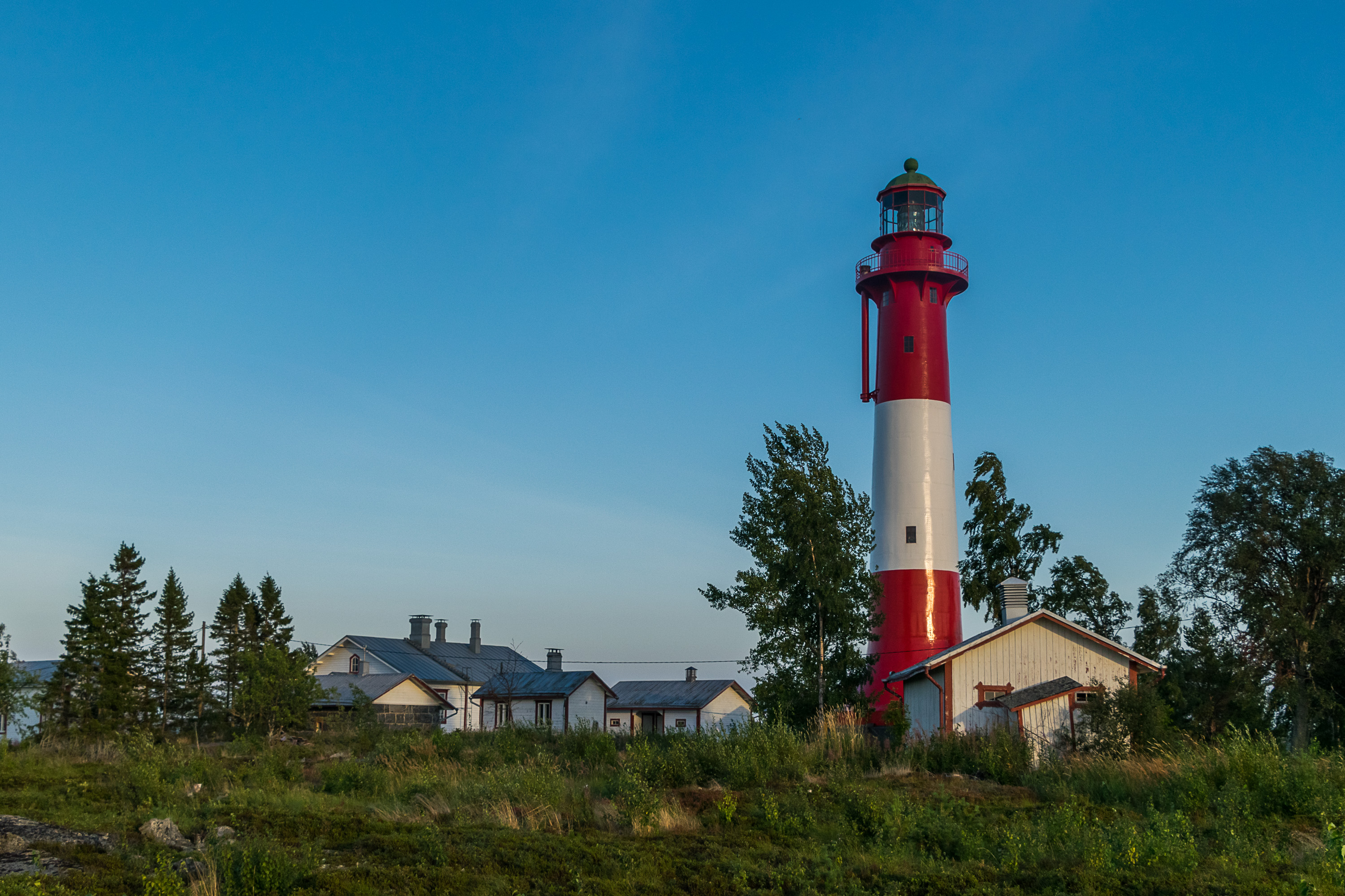
The navigational role of the island has also been important. The first daymark, a plain pile of stones (kummeli), appeared on it in the 18th century already. The original name of the island was Klippan, meaning simply "rock" in Swedish, but with the daymark built it turned into Tankokari, meaning "Pole Skerry" in Finnish, referring to a pole stuck in the middle of the daymark; Tankokari in turn got eventually corrupted into Tankar, perhaps due to Swedish-language influence. The island, like Kokkola itself, lies at the northern border of the area settled by Finnish Swedes, and had both Finnish and Swedish-speaking fishermen living on it. A better daymark was built in 1825, and a proper lighthouse, of a quite classic lighthouse shape, appeared in 1889, ordered from Osberg workshop in Helsinki; the design was ordered from Eiffel bureau in France, iron tower elements were manufactured in Germany, lenses in Paris, and the Osberg workshop assembled it all. The lighthouse crew originally consisted of four people: a ligthhouse master and three lighthouse keepers. The crew was reduced to two people when an electric cable from the mainland was installed in the 1960s, and the light was switched to an electric one. Soon afterwards the lighthouse got automated, like all other Finnish lighthouses nowadays are. Its importance has decreased nowadays, but the lighthouse is still operating, and all its parts are still original ones (excluding the lamp, but including the lenses).
Pilots have worked on Tankar also since the 18th century, and in 1848 the pilot station shifted under the state ownership, although pretty soon in 1855 all the pilots (so, three people) died in a storm, and the operations were suspended for some years. In 1912 half of the pilots at the time resigned in protest to the Russification of Finland and in particular of the pilot service. The pilot station is also operational on the island to this day.
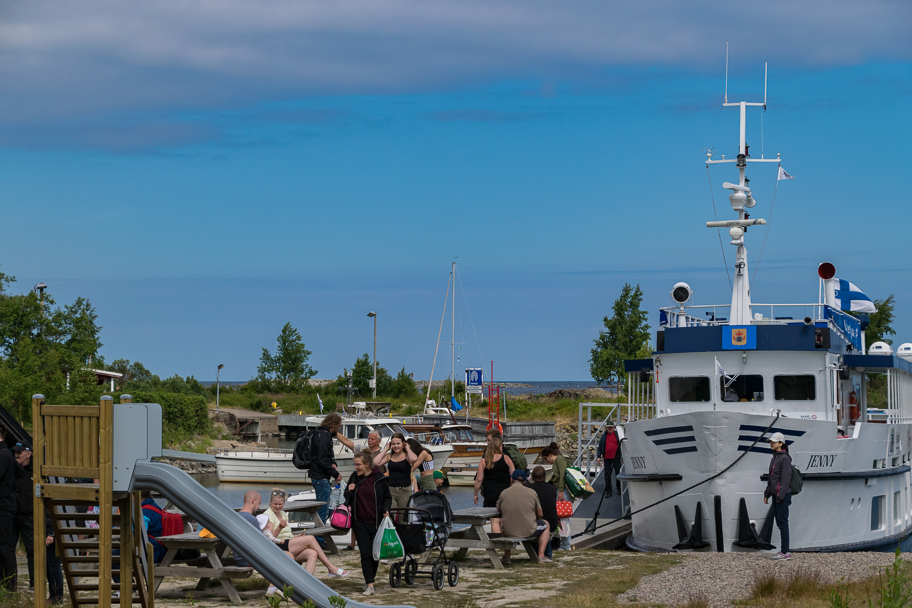
The island otherwise is mostly a tourist destination nowadays. About 20 fishermen huts on it are still used as summer residences, mostly by the descendants of the original fishermen and pilots. There is a restaurant, a tiny museum (open by special request) and overnight accomodation in former lighthouse crew buildings and elsewhere. A boat named Jenny operates between Kokkola passenger harbor and Tankar from mid-June to mid-September; tickets can be bought here as of 2021 (in Finnish only; or from a cafe at the harbor, but better do it in advance). Accomodation options are described here in English.
Apparently in some winters Tankar can be reached by an ice road around early March or so, but the season might be very short (like a week or so), and in some winters it never opens at all. The ice road, like nearly all Finnish ice roads with a handful of exceptions, is unofficial and can be driven only at your own risk (insurance also won't cover possible accidents). I also coundn't quickly find where the ice road begins (not from Kokkola for sure, as the Ykspihlaja fairway, kept open by icebreakers, would be in the way).
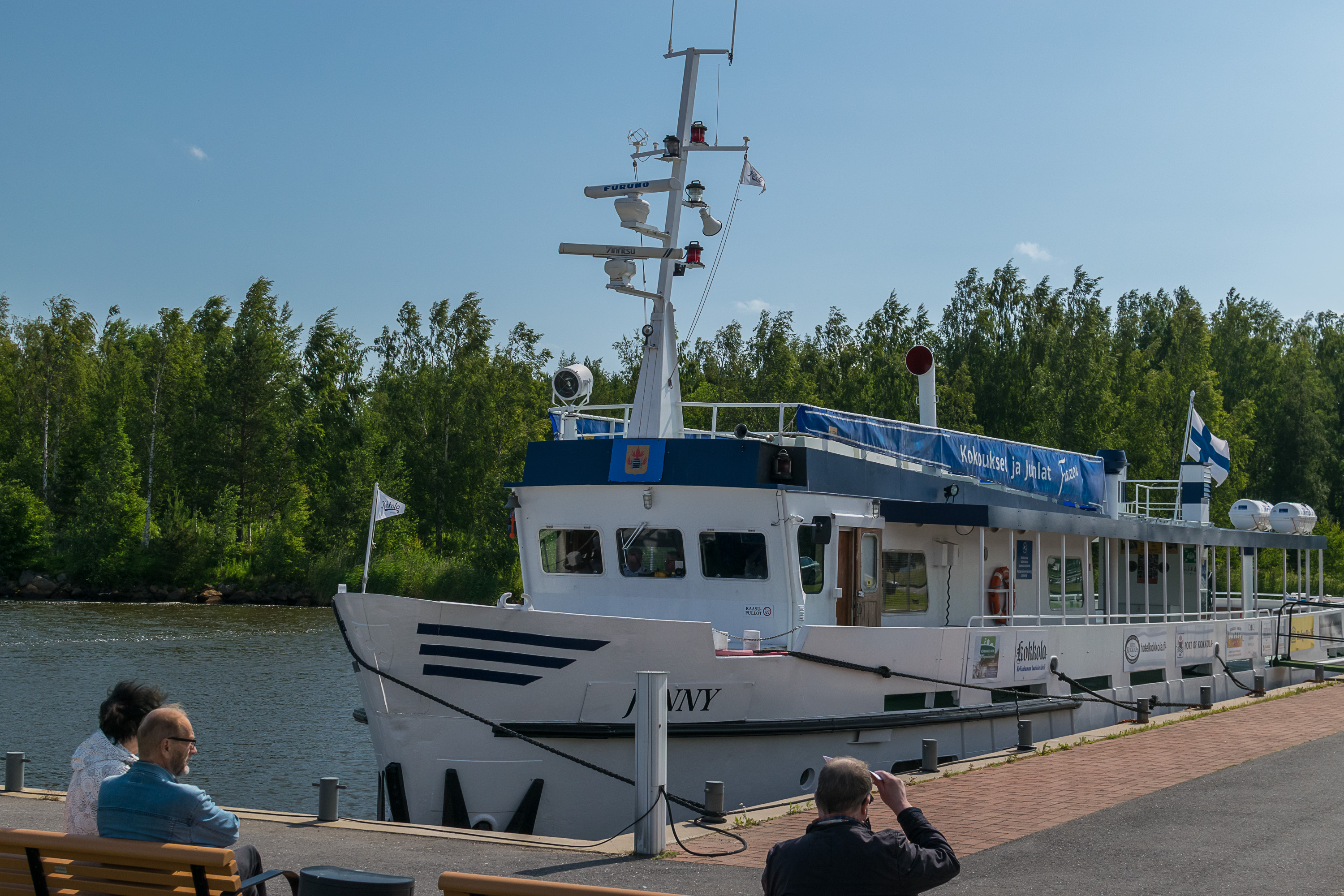
30. Jenny at the Kokkola passenger harbor. I showed this harbor area in the previous post; it is about 2.5 km north of the Kokkola center and railway station, by the local camping area and the mouth of Sunti bay. An adult return ticket in the upcoming 2021 season will cost 20€. The boat has a cafe/bar on board. I visited Tankar twice in the summer of 2018, first by myself, then next month with my parents who were visiting me in Finland, in Vaasa, for the first time.
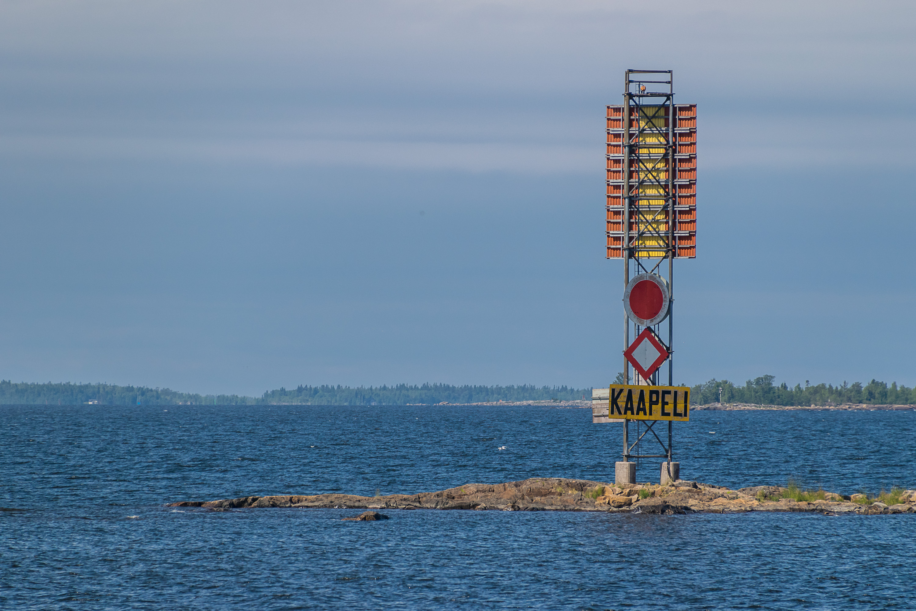
31. The trip to Tankar through the archipelago is quite beautiful. Harrbådan leading light at Harrinniemi can be seen from the sea to the west.

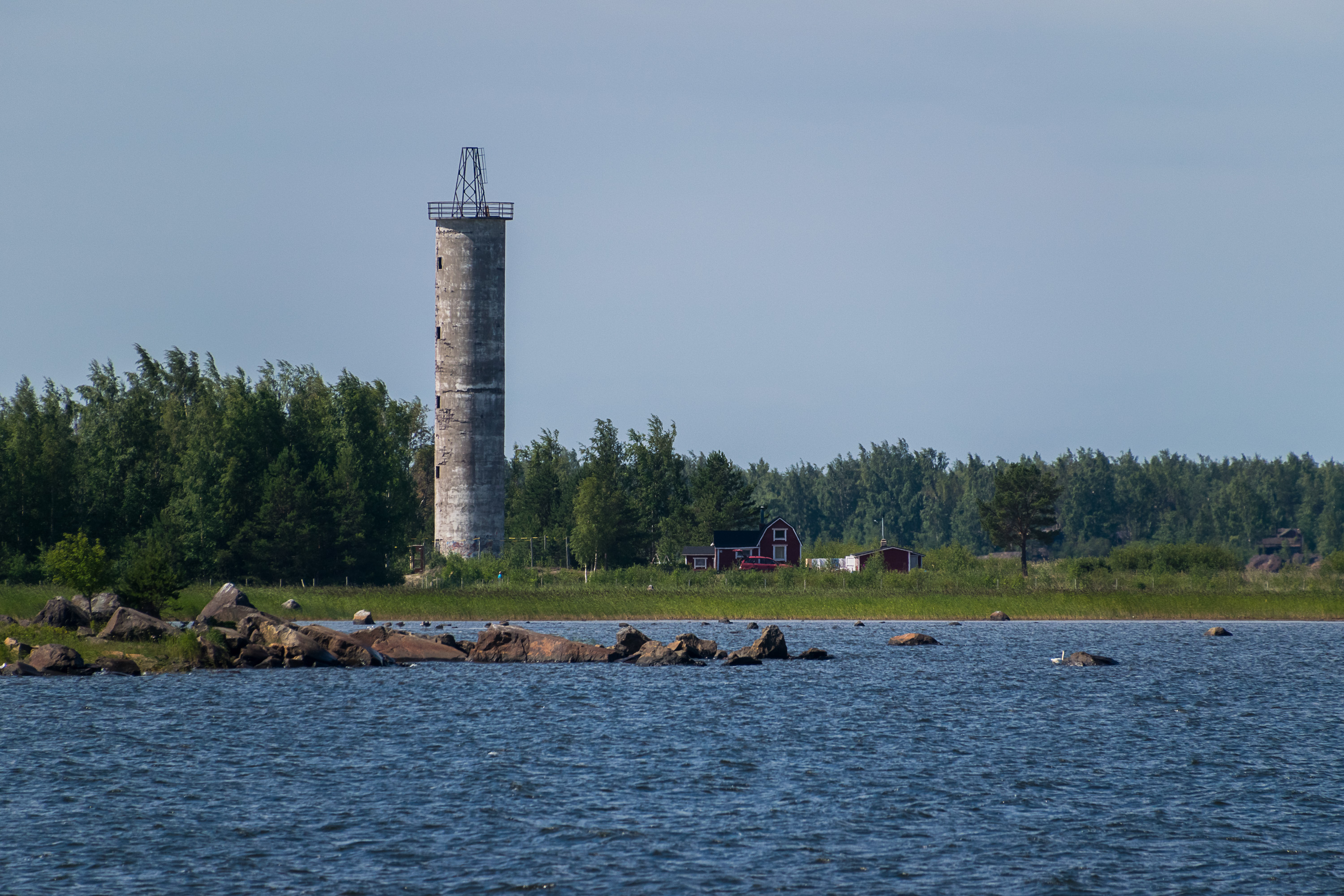
32. A rather similar and also abandoned former leading light can also be seen in the east, the Trullögrundet one on a small and nearly empty island.
33.
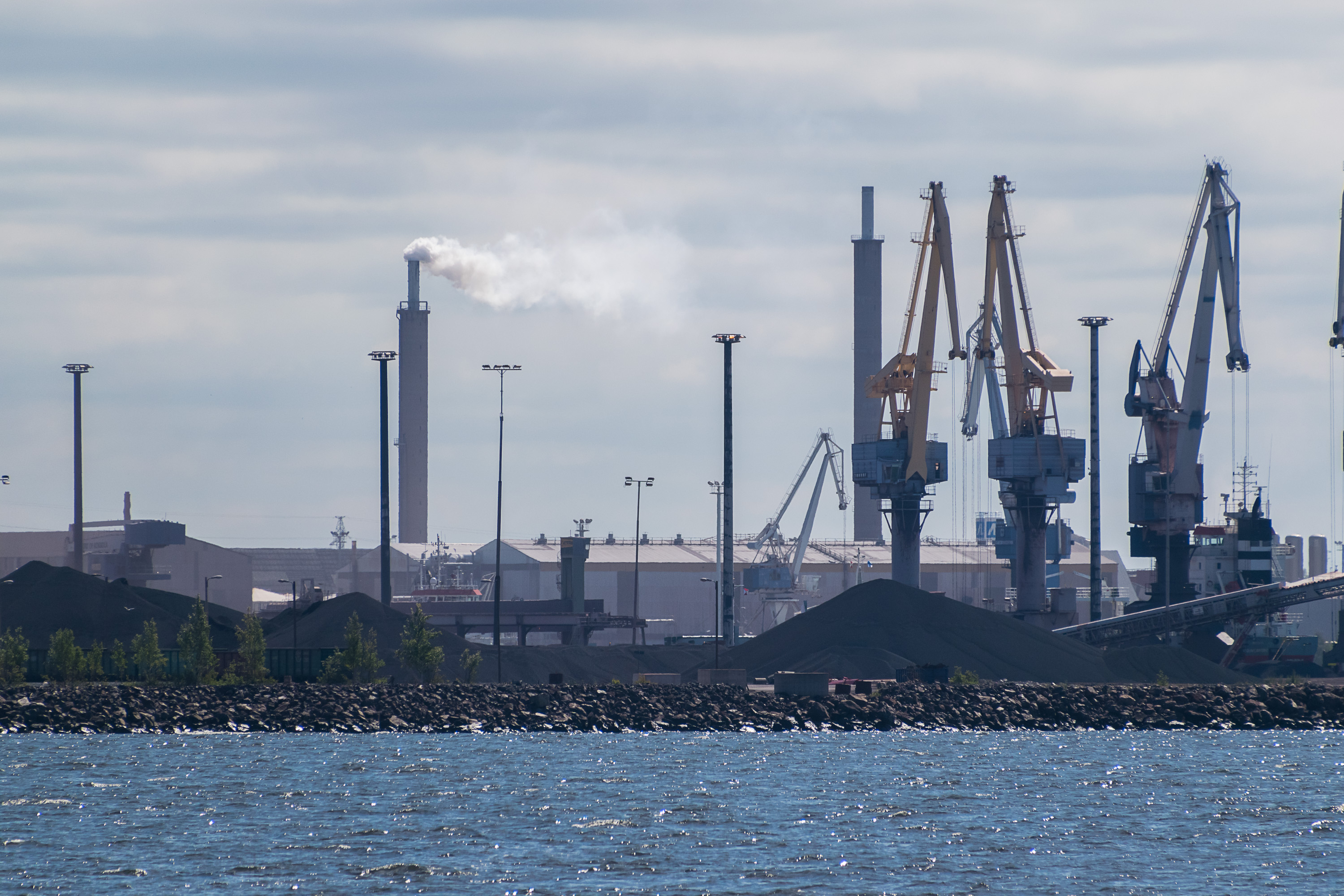
34. It takes a while to reach Tankar, as the fairway is not straight, and the boat has to make a large zigzag coming rather close to Ykspihlaja, the large cargo harbor of Kokkola. Unfortunately it appears I don't have good views of it. One notable feature it has is an all-weather terminal (AWT), not visible here; basically a huge (122 m long) hangar under which a cargo ship can sail entirely, and then be loaded/unloaded safe from the elements. This is the biggest such terminal in Europe and the only one in the Nordic countries, which sounds like quite an achievement. I'm not sure in which situations exactly such a terminal would be necessary.
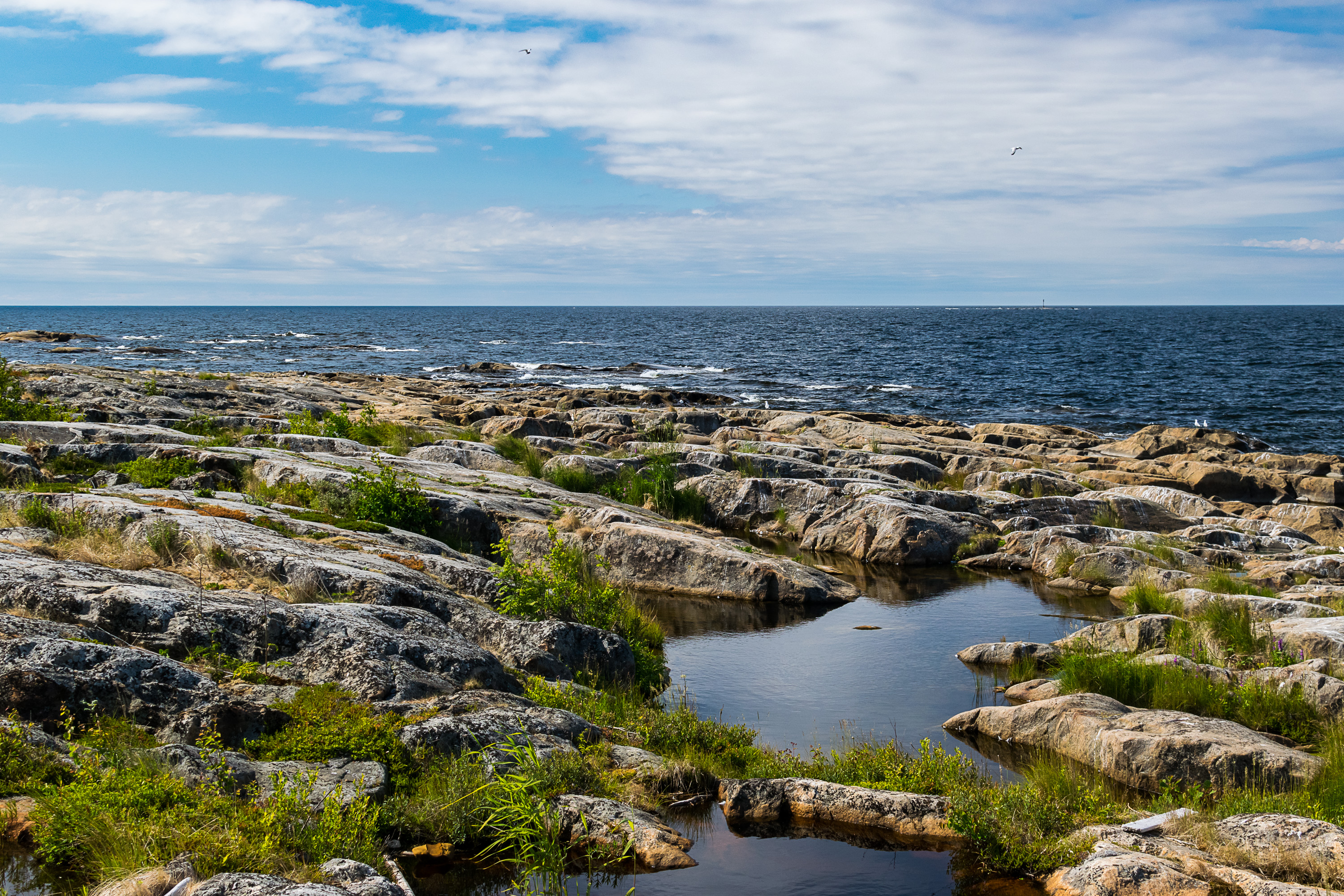
In 2020 a relatively rare kind of a transport infrastructure project was finished; the deepening of the Kokkola fairway from 13 m to 14 m. The old depth was getting insufficient; in practice the same kind of cargo ships will continue to load at the Kokkola harbor, but to full capacity now, while earlier the biggest ships had to sail partially empty to avoid their draught getting too large. The project was carried out in 2018-2020 and cost 63 million euro, of which 35 million were paid by the Finnish state and the rest by the port of Kokkola, which legally is a company fully owned by the city of Kokkola. (It doesn't bring all that much revenue to the city directly, but pays a lot of taxes, creates a lot of jobs, and most importantly allows the operation of the rest of the local industrial cluster.)
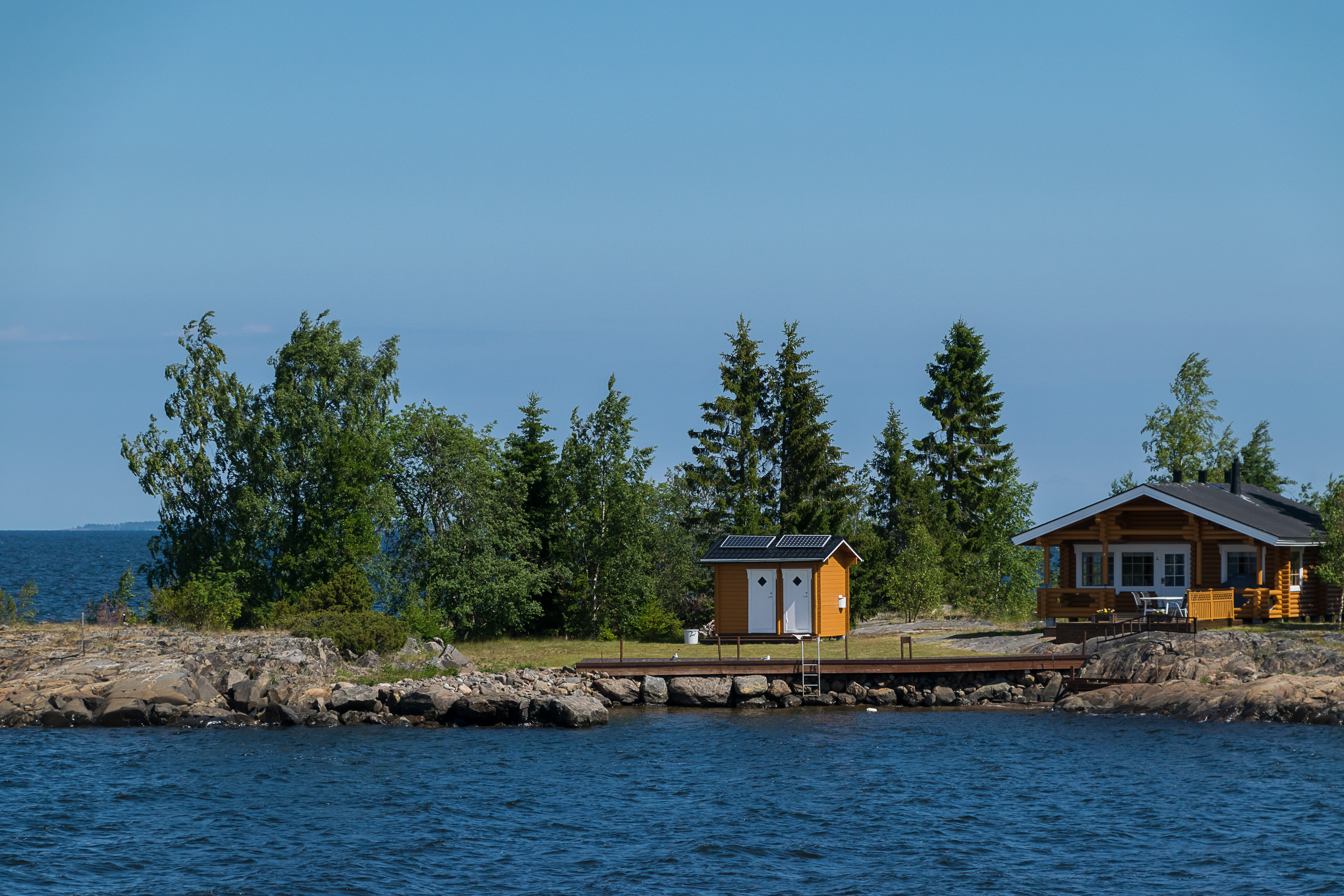
35. The fairway passes by some small islands, some of which have summer houses that look absolutely idyllic.

36. Approaching Tankar.
37. Here we come!

38. Tankar lacks roads entirely and only has some narrow tracks, which however mostly have actual names signposted on small wooden poles.
39. Tankar landscape.
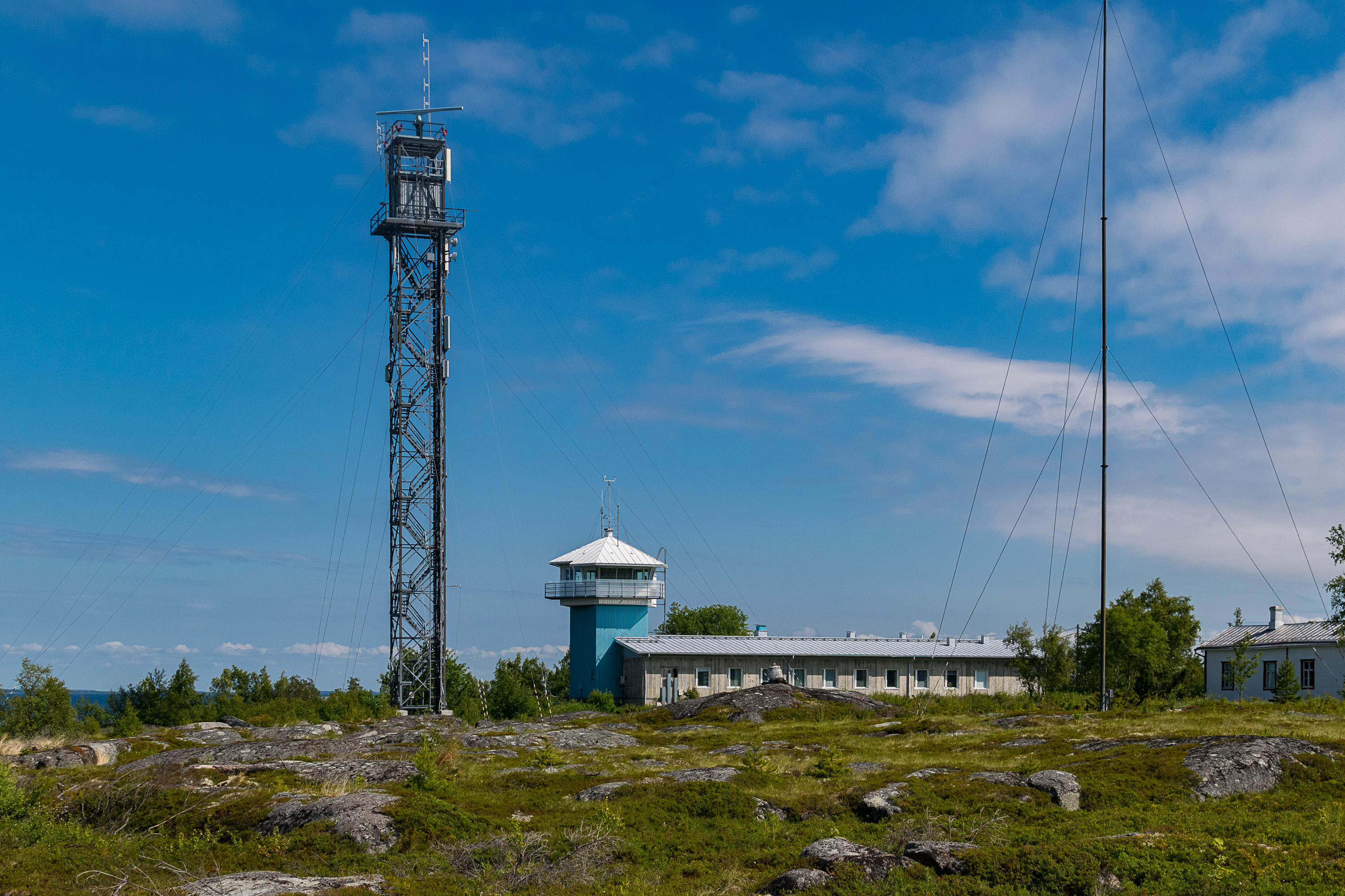
40. The pilot station, built in its current shape in the 1970s, is probably the most modern part of the island.

41. A pilot boat.
42. The restaurant.
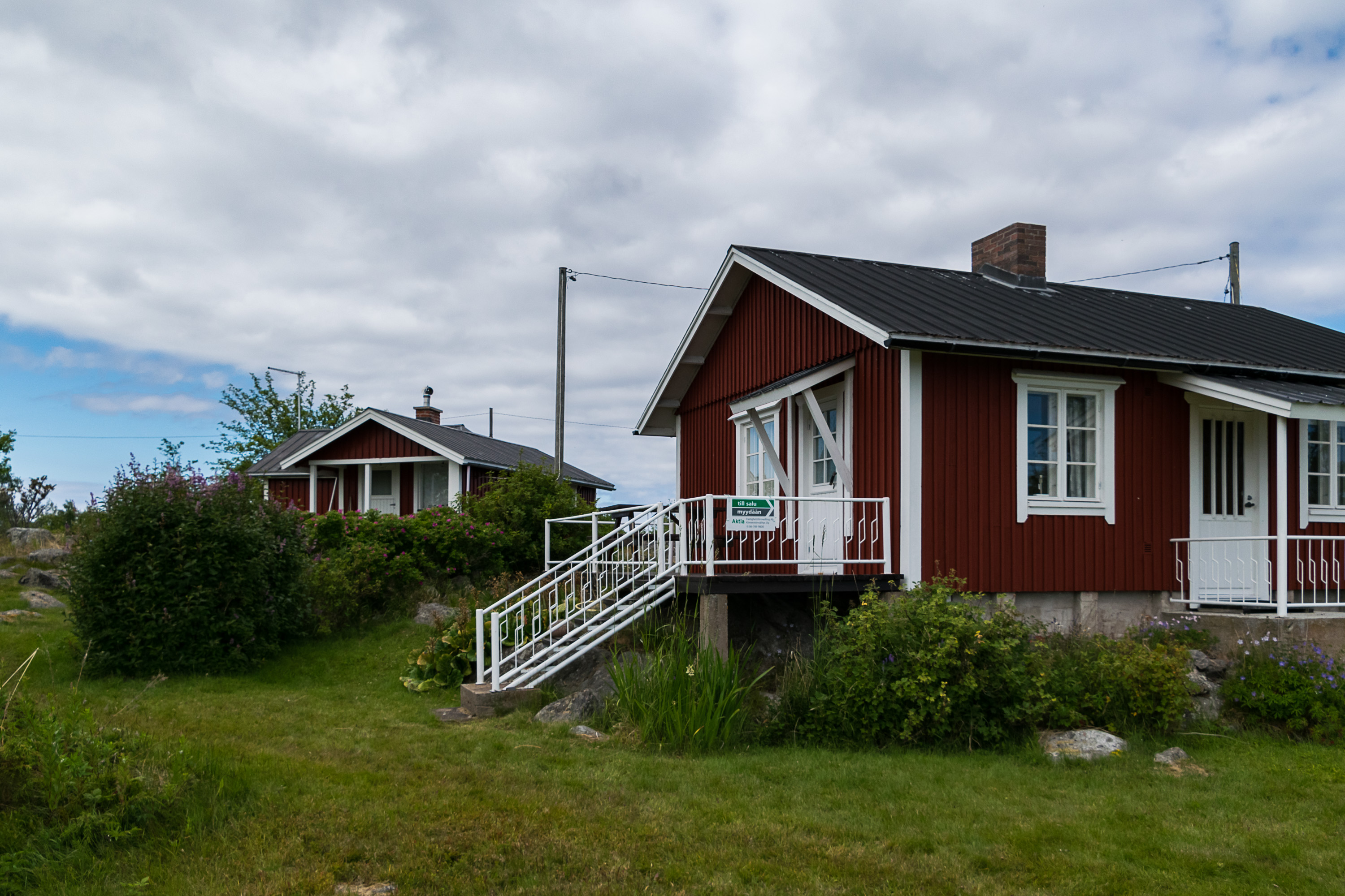
43. Some of the larger cottages. One of them was for sale, as a small sign tells us, but I don't remember if I remembered to look it up online and check the price afterwards.
44. The "square" in front of the lighthouse; houses around belonged to lighthouse keepers and now are rented out as accommodation. A tour of the lighthouse itself is available for 5€, but since it is of course in Finnish and my Finnish at the time was still at a beginner level, I didn't bother to join.

45. A swallow nest under the roof of a house.
46. Heather thicket. Poles with track names are visible.
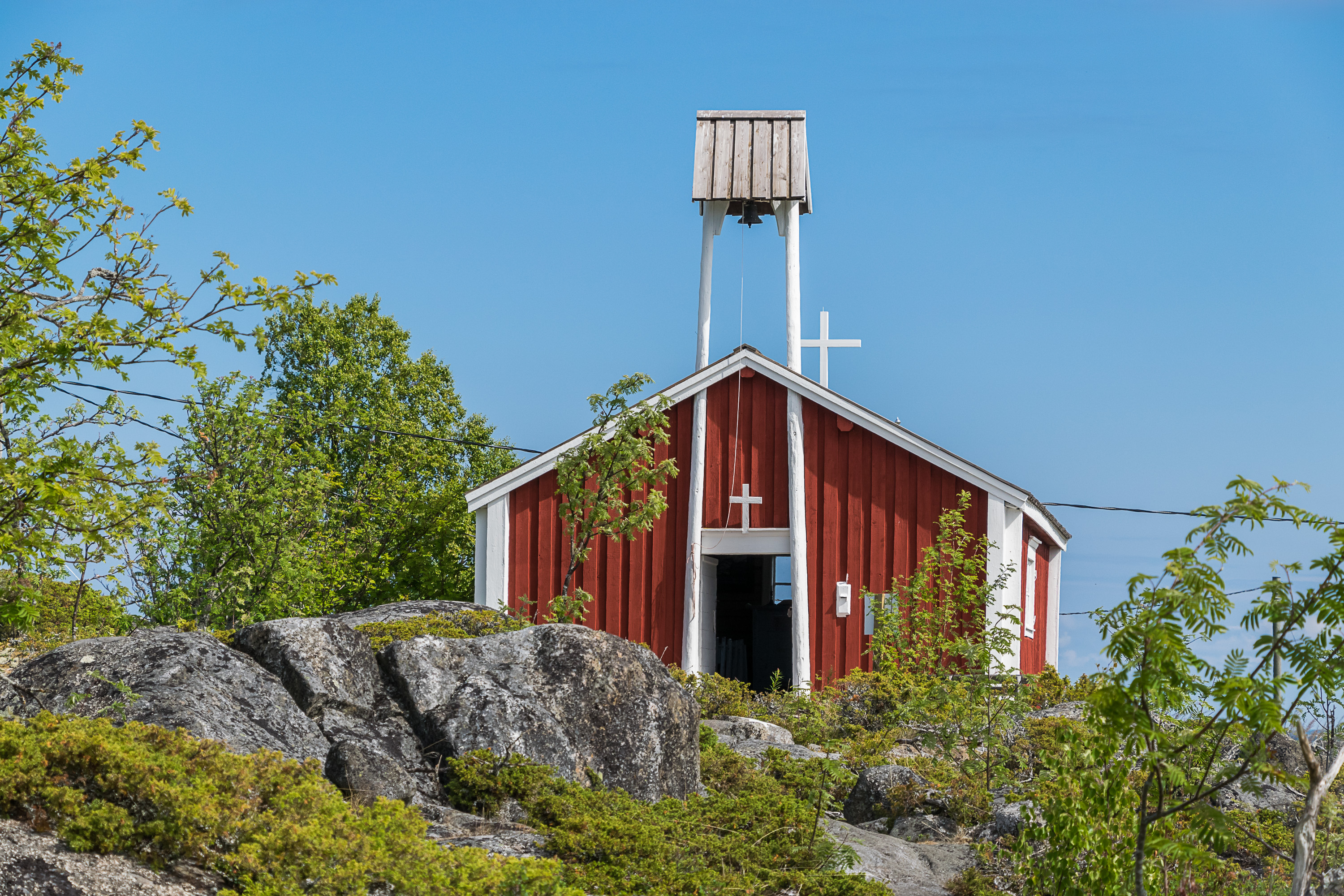
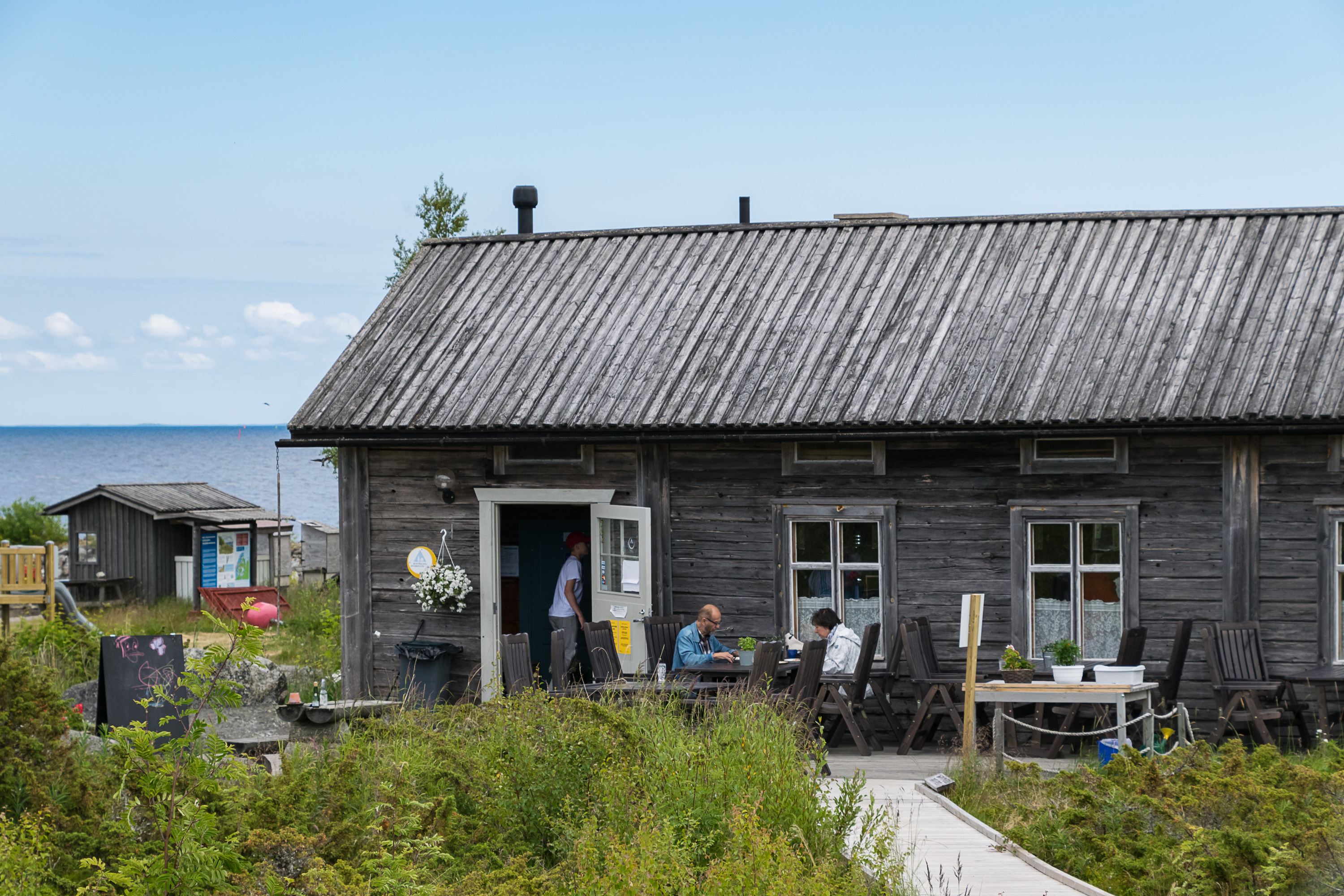
47. The tiny old church that I mentioned before, built in 1754 by local fishermen themselves. A priest came to the island in summer same as fishermen did, and the church was basically the center of the small village society. Nowadays the church is used for weddings and other events.
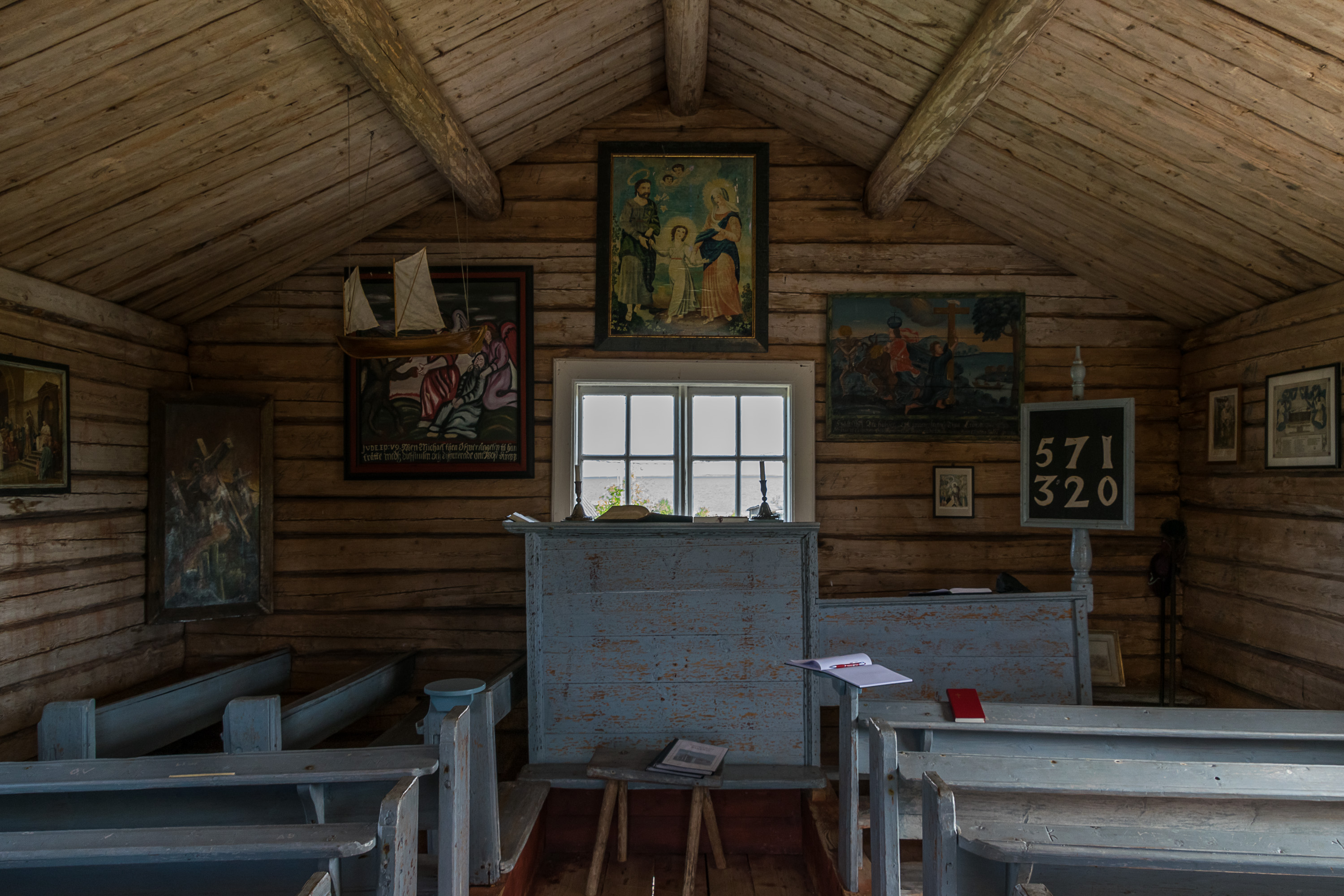
48. The interior is quite basic. The picture to the right of the window dates from 1764, and the picture to the left of the window (behind the ship model) is a copy of an even older picture from 1697; the original of that one was moved to the old Kaarlela church in Kokkola.

49.
50. Remains of an old navigation sign?
51.
52. The northern side of the island, facing the open sea, is rocky and bare.
53. And the views there are gorgeous, like at all outer archipelago islands.

54.
55.
56. The sun is getting low, but we're not staying overnight, and rather will go back to Kokkola on the Jenny.
57. Goodnight.