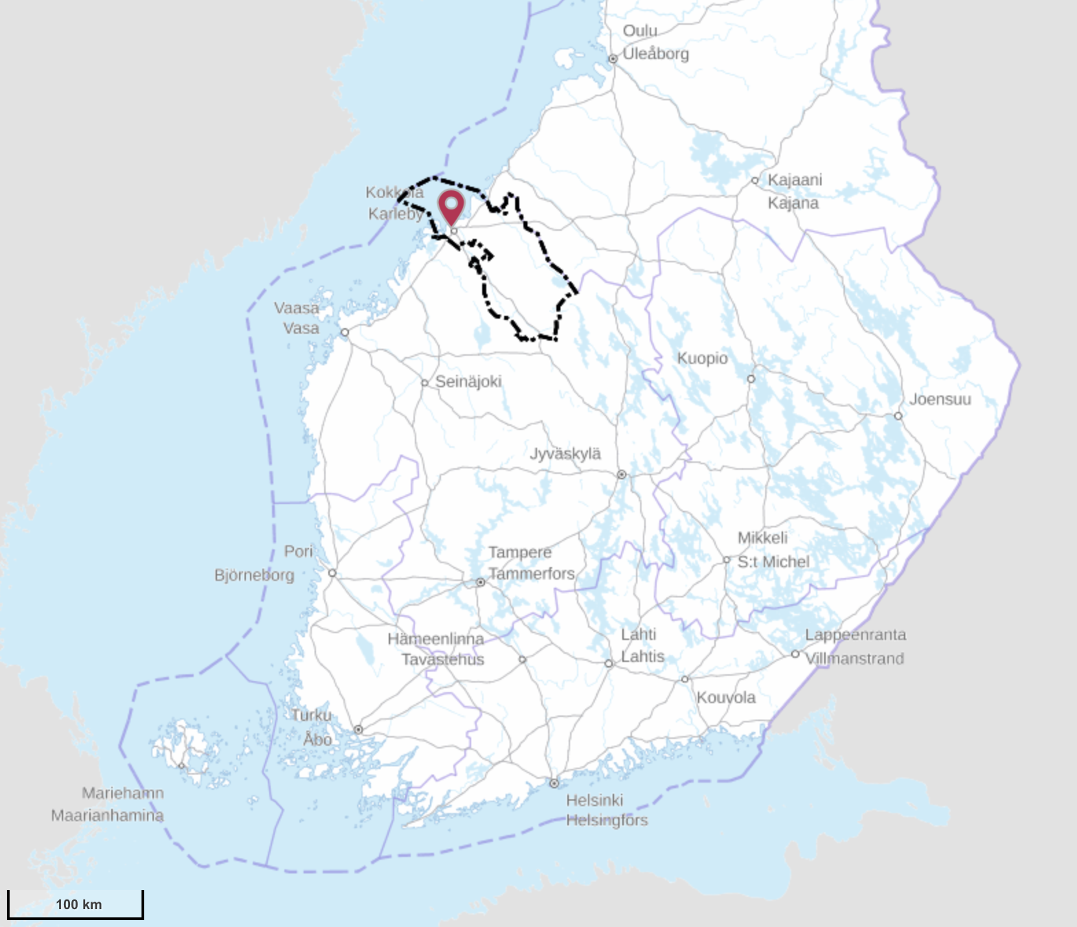
Of the modern regions (maakunta) of Finland Central Ostrobothnia (Keski-Pohjanmaa) at the western, Bothnian sea coast is both the most obscure of all Ostrobothnias (there are four in total), and quite possibly of all 19 Finland regions altogether. By land area, 5129 sq. km (excluding sea areas), it is smaller than for example Suomussalmi alone; population, about 68,000, is comparable to a single mid-sized city like Vaasa. In fact it is the smallest Continental Finland region both by area and by population; only Åland is even smaller.
In truth the modern Central Ostrobothnia is somewhat smaller than the historical definition; for example, cities of Jakobstad and Nykarleby in Coastal Ostrobothnia, and a fair bit of rural North Ostrobothnia are considered to be culturally Central Ostrobothnian. Cultural boundaries however can be a somewhat vague thing, and generally Central Ostrobothnia is not associated with a strong cultural identity, the way especially Coastal Ostrobothia (the main Finnish-Swedish region, with rural area essentially completely Swedish-speaking) and South Ostrobothnia (deeply rural, conservative, proud, enterprising, shrewd, obstinate folks; generally "Texas of Finland" vibes) are. And administratively Central Ostrobothnia never formed its own county, belonging to Vaasa/Ostrobothnia/West Finland county as long as counties existed. Even today Vaasa is the closest bigger city and probably the go-to place for shopping and other stuff that cannot be done within the region itself.
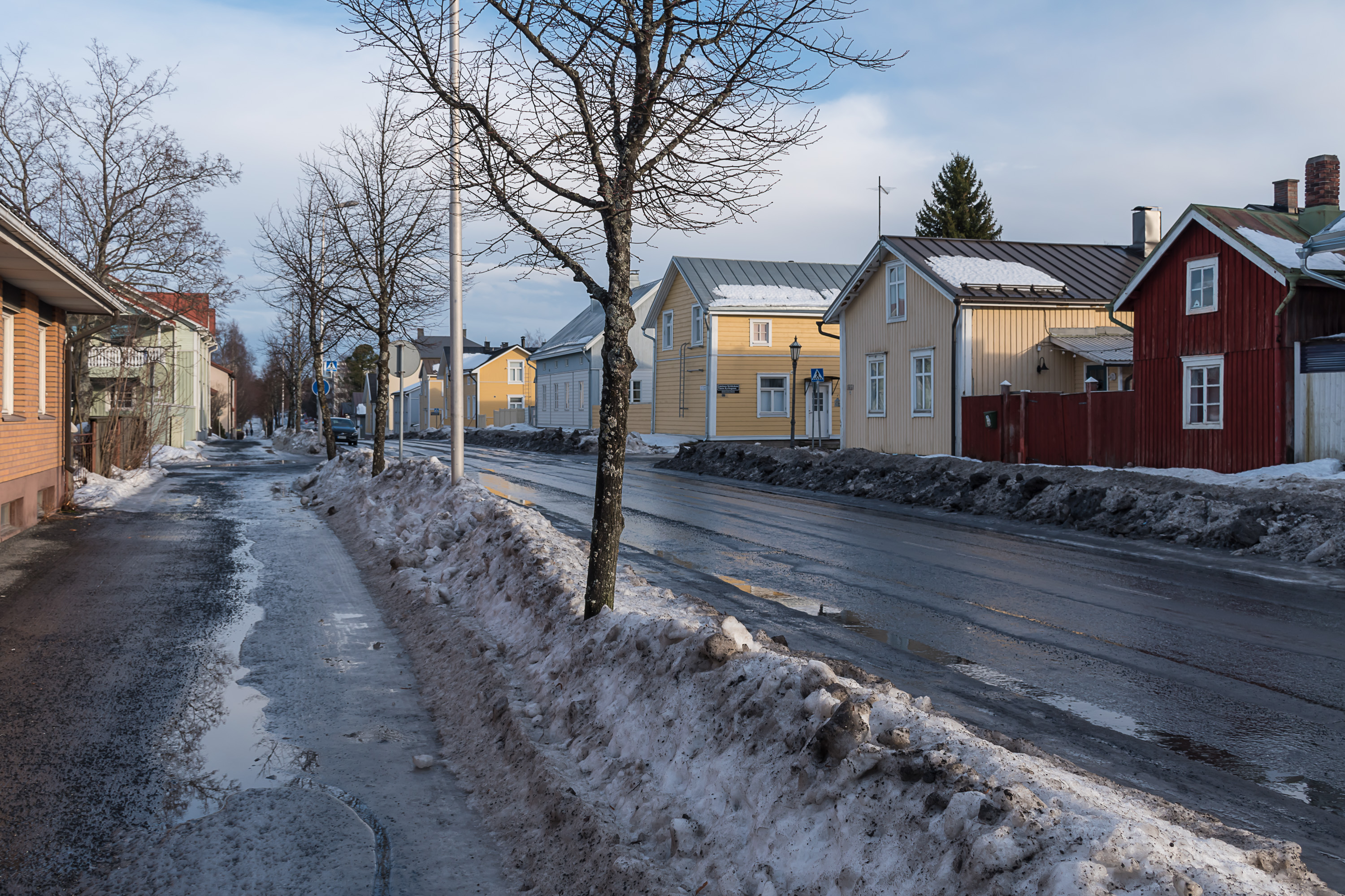
Central Ostrobothnia, like a few other Finnish regions, is very much a one-city region, and this city is Kokkola, an old port city at the Bothnian coast. The municipality of Kokkola is inhabited by about 48,000 people, of which 36,700 live in Kokkola proper, and the rest is rural population; Kokkola merged with various nearby rural municipalities, which makes it the only coastal Central Ostrobothnian municipality nowadays. The rest are all inland rural fairly unremarkable places: Kannus, Toholampi, Lestijärvi, Halsua, Perho, Veteli and Kaustinen. Of these Kannus technically also has the city title, but is quite tiny and not really distinct from its neighbors.
Geographically Central Ostrobothia is a strip of land 40-50 km wide, stretching about 100 km from the coast inland to the southeast. Like all Ostrobothnias the region is quite flat, with rivers flowing from the southeast to the northwest into the Bay of Bothnia (Perhonjoki and Lestijoki most notably), and their valleys used for agriculture; although there are already very noticeably fewer fields here than in South Ostrobothnia with its famous "seas of barns". The coast also marks the transition between Kvarken (Merenkurkku, Finn. Sea Throat), the "throat" of the Gulf of Bothnia, with its huge archipelagoes, to the Bay of Bothnia (Perämeri, Finn. Rear Sea), the northernmost part of the Baltic, with relatively few islands and shores often sandy instead of rocky as is the norm in Finland. The most inland part of Central Ostrobothnia reaches Suomenselkä, a woody and boggy thinly populated watershed area, the most wilderness-like place of West Finland. Salamajärvi National Park, of which I wrote someday already, is located there partially on Central Ostrobothnia side. This is overall the only major nature conservation area in the region.
There is not much more to tell about the whole Central Ostrobothnia, and in this and the next post we'll take a look at Kokkola, the city itself and the coast and archipelago nature around it. I used to live in Vaasa for 1.5 years, only 120 km away from Kokkola, and I visited the city several times, although of course now I wish I did it more. In particular I don't have pictures of Kokkola center in good weather/time of year; only winter and spring ones. Also I wish I had explored the Ykspihlaja area and the archipelago west of Kokkola (Öja). But we'll have to make do.
The city of Kokkola has just celebrated its 400th anniversary. It was established in 1620 by King Gustav II Adolf to practice the trade on the Bothnian coast and, ultimately, to increase the crown incomes for the wars that Sweden waged in the 17th century, which briefly made it a European superpower. Kokkola became the 13th oldest Finnish city (including Vyborg and Käkisalmi, lost in the 20th century).
All the names for the city can be a big confusing. The Swedish name for Kokkola is Karleby, not related to all the Swedish kings named Charles (Karl), but from the Swedish word karl, meaning simply a man or a peasant. Karleby had been the parish name even before the city was founded, since the Middle Ages; in Finnish the old parish was called Kaarlela, and the Kaarlela church, now a bit away from the center of Kokkola, remains the oldest building in Central Ostrobothnia. Gustav II Adolf actually founded two cities in the area in 1620, Gamlakarleby (Old Karleby) and Nykarleby (New Karleby). Gamlakarleby was Kokkola, presumably named so because there already had been the Karleby parish at this place. Nykarleby, some 45 km southwest of Karleby is these days a Coastal Ostrobothnian town; it has remained fairly small to this day and has few sights. The Gamlakarleby name can still be used interchangeably with Karleby. Finally, the Finnish name for the city, Kokkola is unrelated to all of the above; it means either "Bonfire Place" or, more likely, kokko is used here in the archaic sense of "eagle", in which case Kokkola would mean "Eagle Place" referring to the white-tailed eagles in the sea archipelago.
Back then in Middle Ages the Kaarlela church was almost at the sea coast, and if we go further towards the 9th century or so then these lands were still completely covered by sea. Like in Vaasa area, the postglacial rebound is happening here very quickly, and the land rises from the sea at a rate of almost a centimeter per year. The sea bay at the end of which Kaarlela church was located has by now became very long and shallow, passing through the modern center of the city, resembling a small river but there is virtually no flow in it. This bay is called simply Sunti, which comes from the Swedish word sund, meanting a strait. The seaport, originally at Sunti shores, then at its "mouth", had to be eventually moved to a location outside of the city proper, to Ykspihlaja (Finn. One Rowan) area 4-5 km west of the Kokkola center. There it remains to this day.
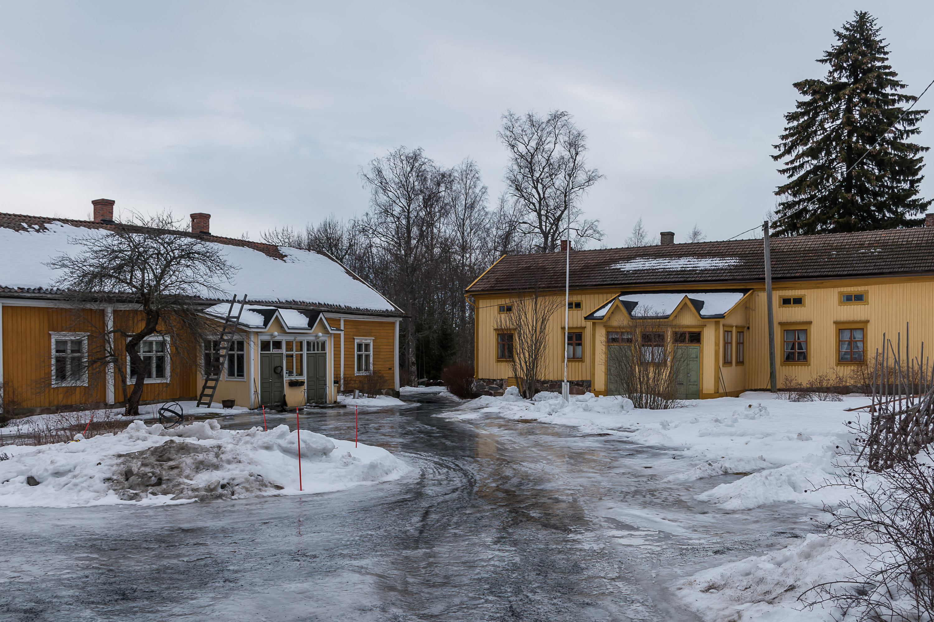
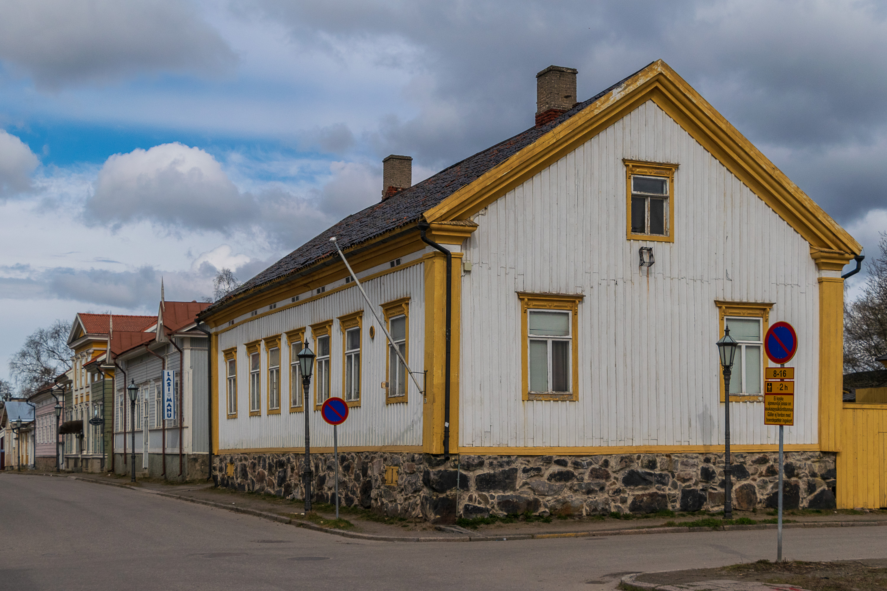
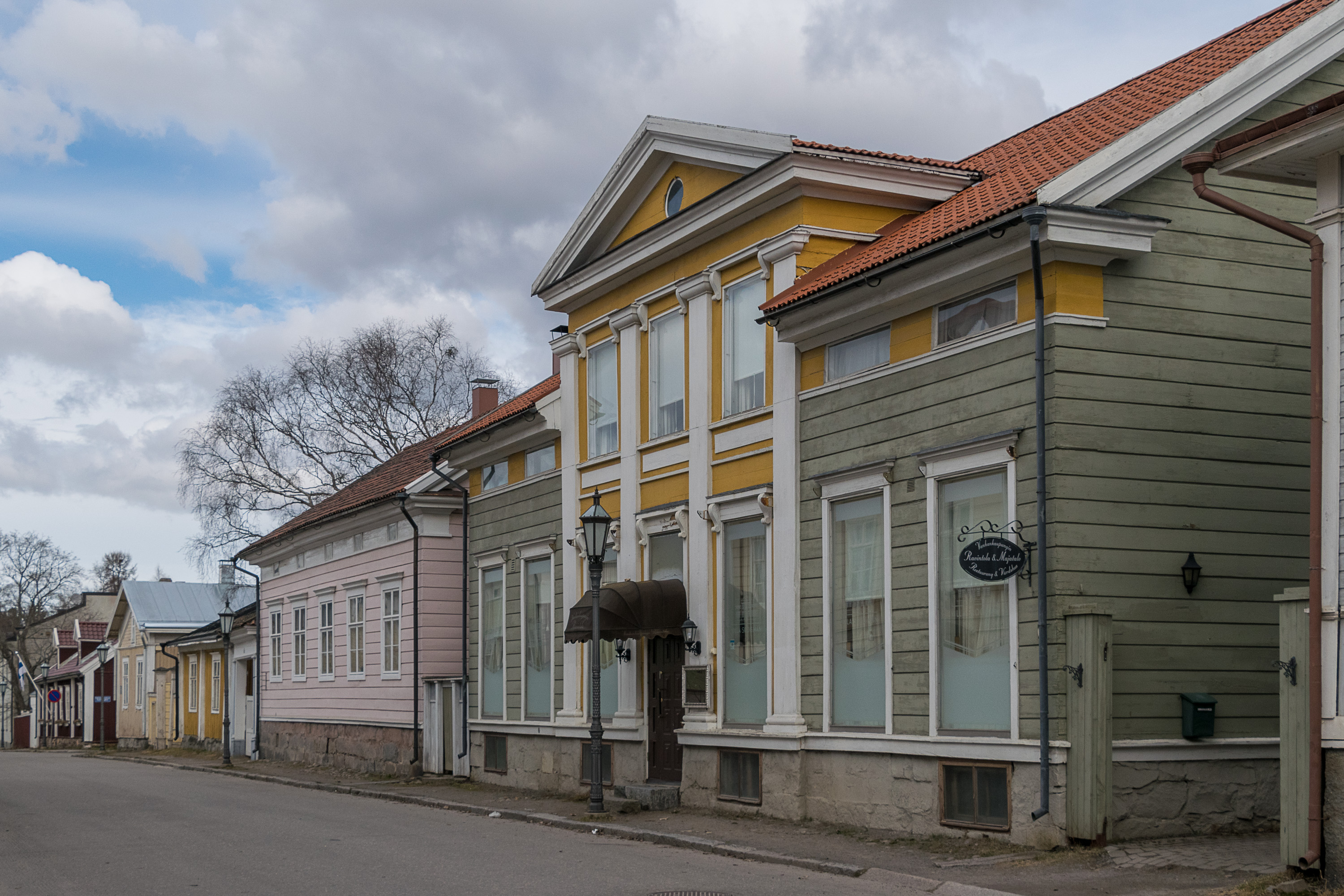
Like nearly all Finnish cities, Kokkola remained small before the 20th century, with its population barely reaching 2600 by the year 1900. Like in all Ostrobothnia, Kokkola particularly suffered from the Russian occupattion in the Great Northern War of 1700-1721 (the Greater Wrath years, isoviha), but recovered relatively quickly. The Kokkola city plan, a classic Finnish square grid one, dates from the year 1665 when the then tiny Kokkola burned down. The old worker quarters, Neristan (Swed. Lower Town), with its wooden detached houses, are mostly preserved since the 19th century, making Kokkola one of the Finnish wooden towns, if a less prominent one than Porvoo or Rauma. The more prosperous Upper Town had some fancier stone buildings, but is overall preserved pretty poorly.
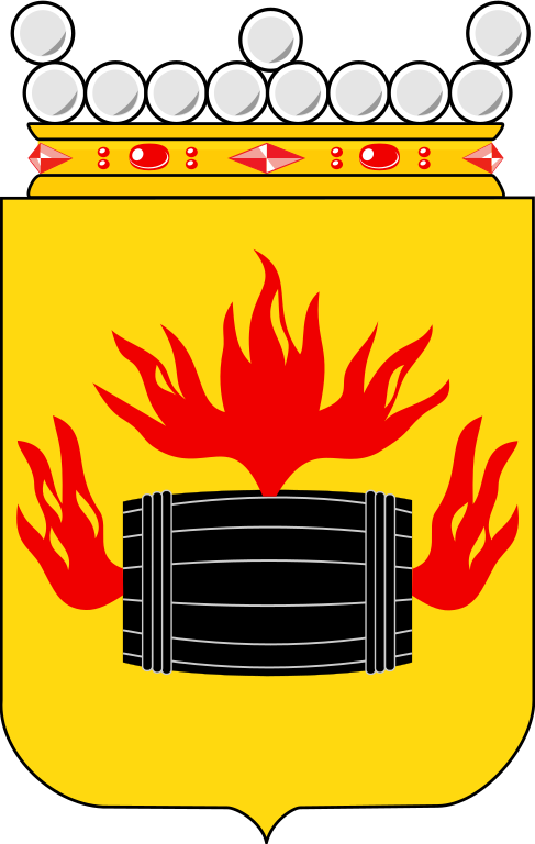
Kokkola was at its most prosperous in the first half of the 19th century, when its harbor was for a time the busiest one in Finland. It was a major shipbuilding and tar export center. Even the coat of arms of Kokkola shows a burning tar barrel; while the best known tar export town was Oulu in North Ostrobothnia, Kokkola (along with Vaasa and a few others) were really not much less prominent. The tar to be exported was manufactured in Central Finland and shipped from there by river. Both these industries declined in the 20th century; tar, used as waterproofing substance, was not as useful when wooden shipbuilding ended, and Kokkola itself never really managed to make a transition to iron shipbuilding either.
Nonetheless the city survived. In 1885 it got a railway station, on the Ostrobothnian Line (Pohjanmaan rata, Tampere-Seinäjoki-Kokkola-Oulu). Notably, it is really the only coastal city in Finland (except a few northernmost ones: Oulu, Kemi and Tornio) which has a major railroad passing through it, rather than having a dead-end branch line. In the 20th century Kokkola slowly became a major industrial city. The first major modern factory of Kokkola became a superphosphate fertilizer factory of Rikkihappo Oy in 1945. That was also when the city also began to grow in earnest (the initial push for that happened at around the same time, due to resettlement of Karelian refugees after the war).
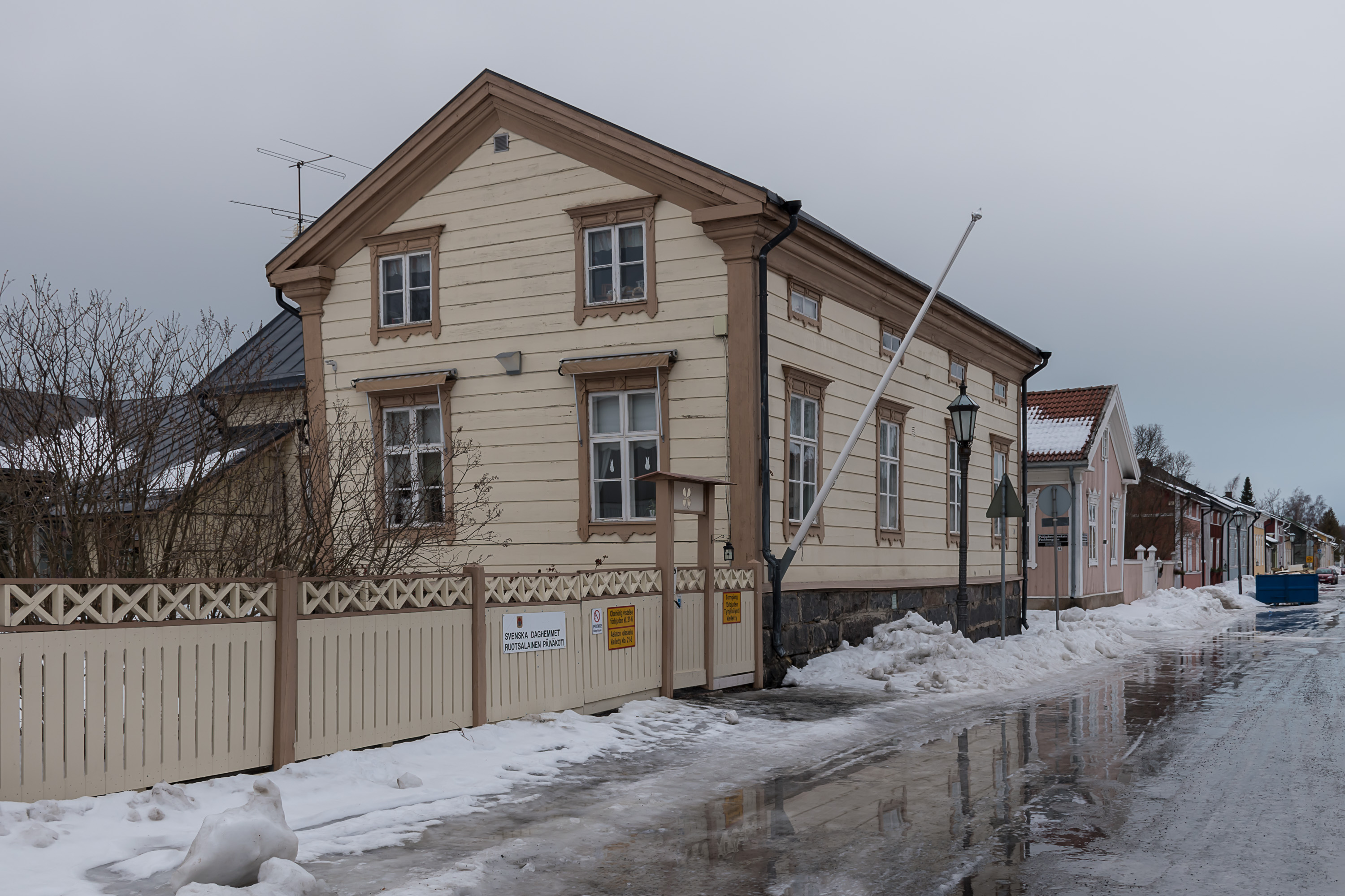
In the 20th century Kokkola also turned from a Swedish-speaking city to a Finnish-speaking one. This happened in most older Finnish cities (including Helsinki itself), but Kokkola in particular is the place where the 200 km long Finnish-Swedish strip on the western coast ends nowadays. In Kokkola the Swedish-speaking population currently stands at 13%, which is still a lot more than usual; but going farther north it drops to near zero pretty much immediately.
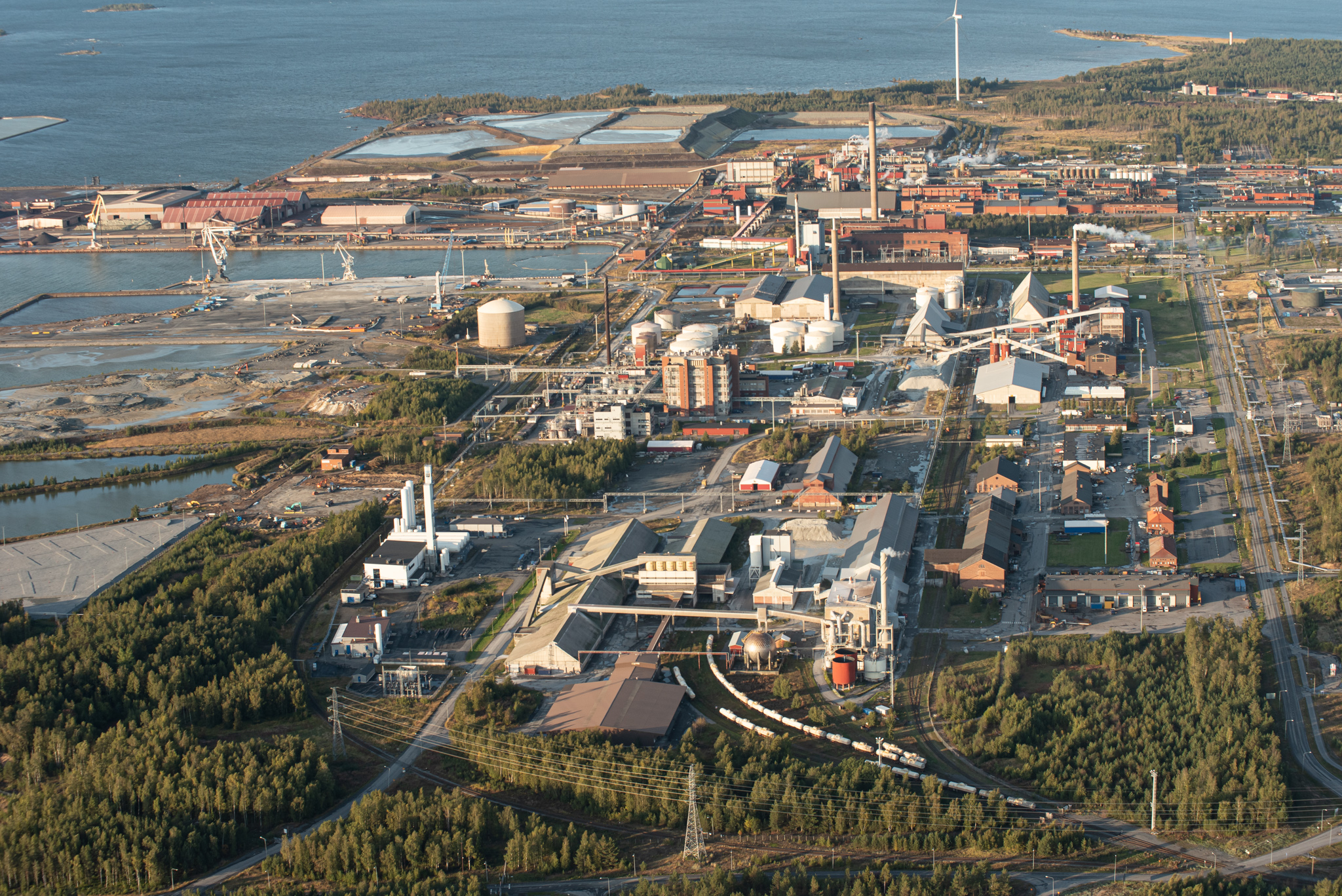
Modern Kokkola is a major metallurgy and chemical industry center. Metallurgy mostly works on imported raw materials. The major factories in Kokkola are:
- Zinc smelter. The largest industrial employer in Kokkola and the 2nd largest zinc smelter in Europe, currently owned by Boliden (Sweden). Ore comes from a variety of sources, including Boliden's own mines in Sweden and Ireland
- Cobalt smelter, the biggest in the world. Currently owned by Unicore (Belgium). Cobalt ore comes from Kongo, and tales of child labor in Kongo cobalt mines are widely known. Unicore claims that mines that it uses are certified and verified not to use child labor
- Sulfuric acid factory, owned by Boliden
- Potassium sulfate and superphosphate (fertilizer) factories, owned by Yara (Norway)
- Smaller factories and industrial facilities: Cabb chemicals factory, Neste fuel storage facility, Nordkalk limestone powder factory, Woikoski industrial gases factory, two power plants (working on peat and forestry byproducts), etc.
No less notable is the Kokkola seaport, which is the biggest bulk cargo harbor in Finland. 6.6 million tons passed through Kokkola in 2019. Apart from exports and imports for the local factories, the harbor is also used for exports from elsewhere in Finland (for example, ore concentrate from Pyhäsalmi mine, which in truth is exhausted and is in the process of shutting down), and most notably, from Russia.
The Kostomuksha (Kostamus in Finnish or Koštamuš in Karelian) iron ore deposit in Russian Karelia was discovered in 1946, and in the 1970s the construction of the ore refinery and a smallish city nearby started. One of the most massive monument to Soviet-Finnish cooperation in those years, the refinery and the city were mostly built by Finnish companies; to this day Finnish apartment blocks and city planning style in Kostomuksha makes it look very distinct from other Russian cities. Kostomuksha is located in only 35 km from the Finnish border, and from the get go it was planned to use Finnish railroads and Kokkola harbor for exporting ore concentrate worldwide. The city and the refinery both have existed since the 1980s, and in 1983 the ore transit through Finland started. Finland in turn had of course to build a rail connection on their side, the Kontiomäki-Vartius railroad to the Russian border (100 km long). Previously the concentrate was also delivered to the Raahe steel mill (in North Ostrobothnia, not too far from Kokkola), but nowadays it is only exported. The location of Kostomuksha is such that Kokkola is closer than any practical harbor alternatives within Russia, and thus Kokkola option is quite competitive.
The Kostomuksha transit traffic is quite massive by Finnish standards, both for the harbor (where it represents roughly a half of its cargo throughput) and for the Finnish railroads. 3-4 freight trains of 60 cars arrive to Kokkola daily. Among other things, in 2007-2017 the Finnish state undertook a massive renovation of Seinäjoki-Kokkola-Oulu railroad (costing 770 million euro), where the railroad was in practice rebuilt from scratch; at Kokkola-Ylivieska, the busiest section, a second track was added; and station tracks were lengthened to allow for 60 car long Russian trains; before that, trains had had to be split into 45 car ones at Oulu, which obviously was highly impractical. The transit arrangement still remains highly profitable for Finland, even though working with modern Russia does represent certain political risks.
Personally I think it would be great of course if Finland had such big mines and refineries itself. It does have ore deposits and some mines, but these days establishing new ones is extremely politically difficult due to the ubiquitous nature conservation concerns. Finland doesn't have a mining tax unlike most countries, and the claims of "foreign mining companies ruining our nature and not even paying for it" are pretty common. Nature conservation of course is not a bad idea (and as we all know I'm a great fan of Finnish nature), but there is such a thing as too much of a good thing.
But Kokkola actually seems now to have its own mine incoming; Keliber (KEski-Pohjanmaan LItium ja BERyllium), a company currently funded by Finnish investors, is preparing to establish a few major lithium mines in Central Ostrobothnia, a refinery in Kaustinen, and a smelter in Kokkola. The first mine would be in a former peat production area away from lakes, so ecologically it should be fine and there has been no major resistance to the project. The project however met delays simply because lithium prices have greatly dropped in the last few years. Nonetheless they are expected to pick up in the 2020s, as electric cars become more common; lithium is a crucial accumulator raw material. If Keliber plans are realized, the Kokkola mine, currently hoped to start operation in 2024, might become the greatest lithium mine in Europe and produce some 5% of all world lithium overall.
Despite all that, unlike many other Finnish cities Kokkola doesn't really feel particularly industrialized at all. All this heavy industry, harbor and railroad infrastructure is highly concentrated in Ykspihlaja area, which is located in such an inconspicious way that a casual tourist in Kokkola will never learn about their existence at all. In this post we'll explore Kokkola center and the nearby areas, and in the next one, the nearby coastal nature: Harriniemi peninsula and the islands of Tankar and Ohtakari. As I said before, I never went to Ykspihlaja so there will be only one or two industrial views from afar, from the boat going to Tankar.
Kokkola can be most easily visited by train; all trains between Helsinki and Oulu/Rovaniemi stop at Kokkola, a total of about 8 per day. It takes about 4 hours and currently costs 51€ to travel in one direction. Night trains to Lapland also make a stop here, although at an inconvenient hour of night. There is an airport (at a considerable distance from the city, officially called Kokkola-Pietarsaari (Jakobstad) airport), but due to corona situation there are only a few flights from Helsinki per week, and the future of this connection remains uncertain. By car it is about 500 km from Helsinki to Kokkola via Tampere, Seinäjoki, Lapua (Roads 3, 19, 8), and about 650 km from St. Petersburg to Kokkola via Vyborg, Lappeenranta, Mikkeli, Jyväskylä (Road 13 within Finland).
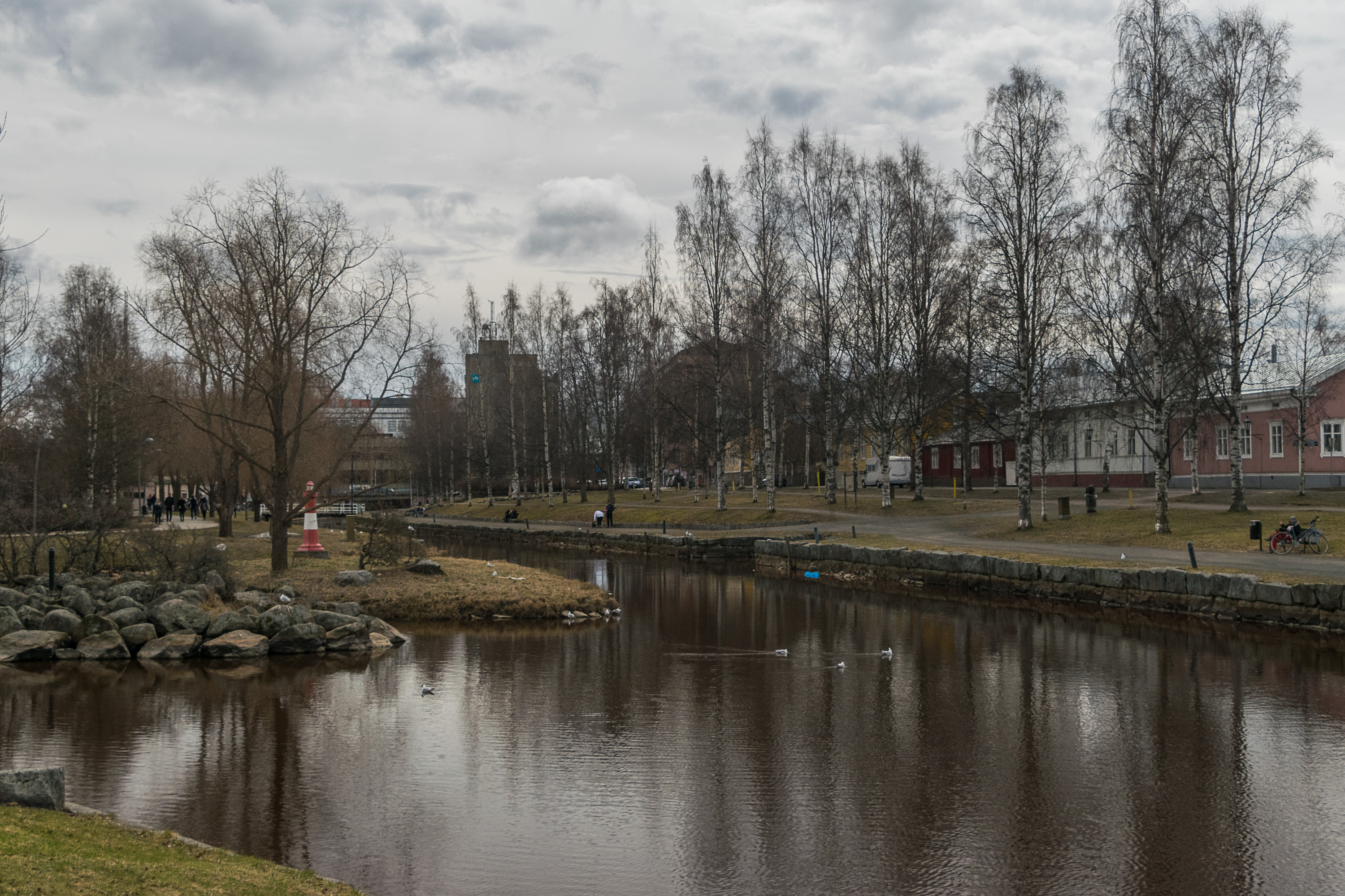
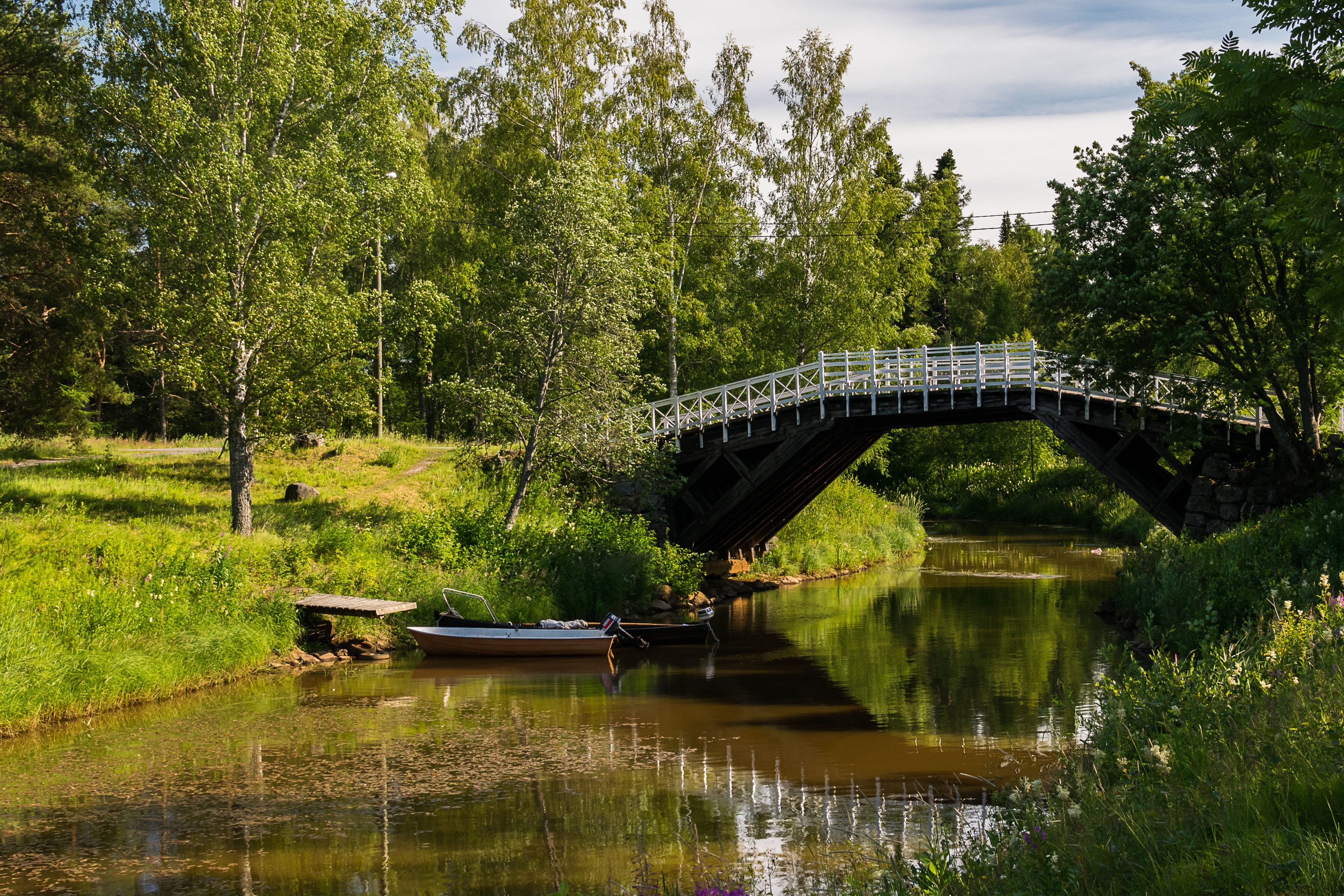
1. Let us begin from the center, from the small park by the Sunti strait. It does not look like the clearest body of water in existence, but imagine what it looked and smelled like when city sewers ended up in it in the old times :) Sunti was navigable to this point until the early 20th century or so (although regular dredging was still necessary), and boats used to line its sides. To the right are the wooden quarters of Neristan, and in the background buildings of Kokkola center.
The park is named, at least officially, Energy Park (Energiapuisto), because it was built in the modern shape in 2007 by Kokkolan Energia, the local energy company, for its 100th anniversary as a gift to the city.
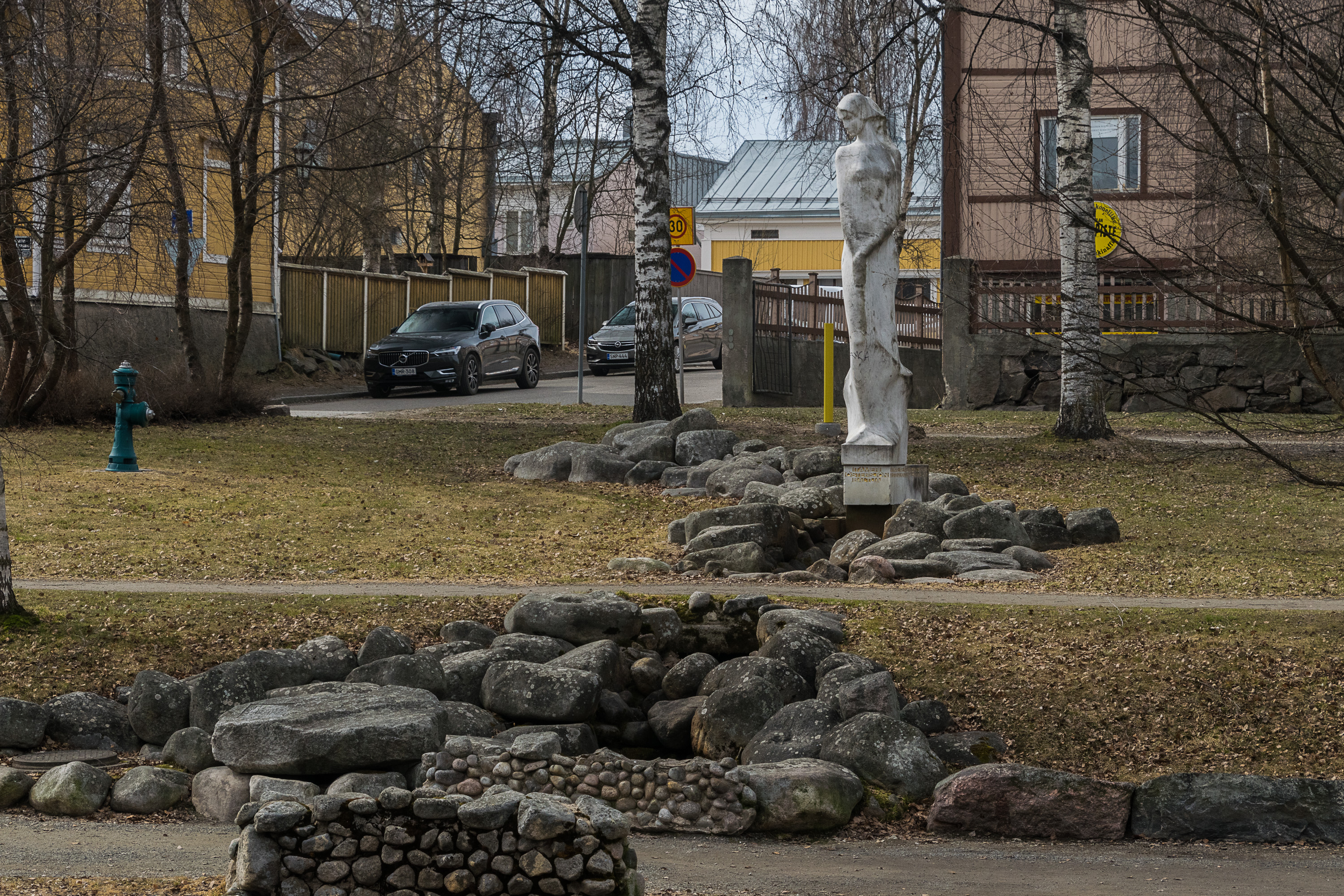
2. Baltija (Baltic) statue was gifted to Kokkola by its sister city of Marijampolė in Lithuania in 1980. Lithuania was back then still Soviet, so could this be also inspired by Kostomuksha exports through Kokkola? In summer there is a small fountain springing from below the statue and draining into Sunti.
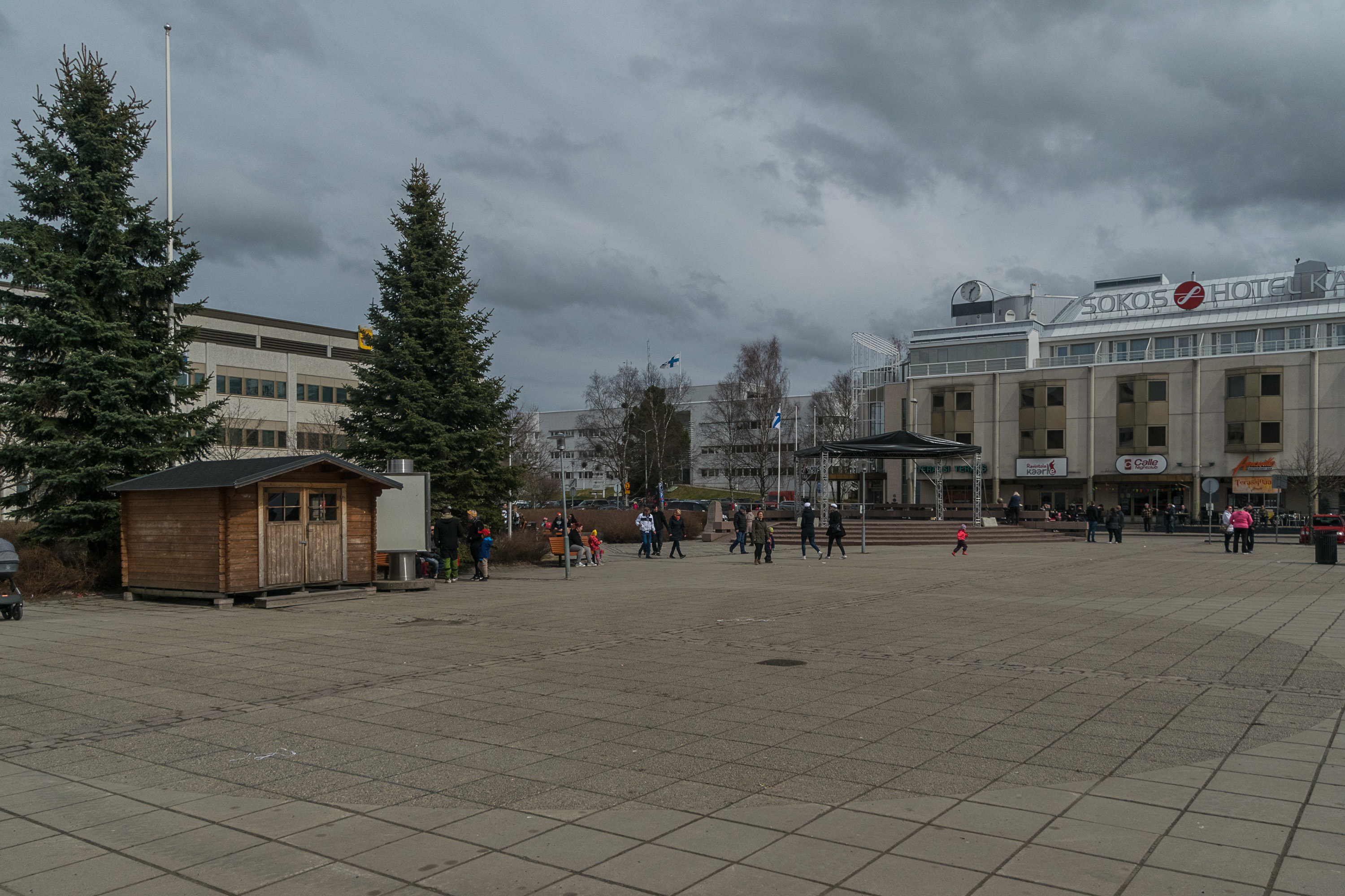
3. The central square is pretty boring. The modern city hall is visible to the left.
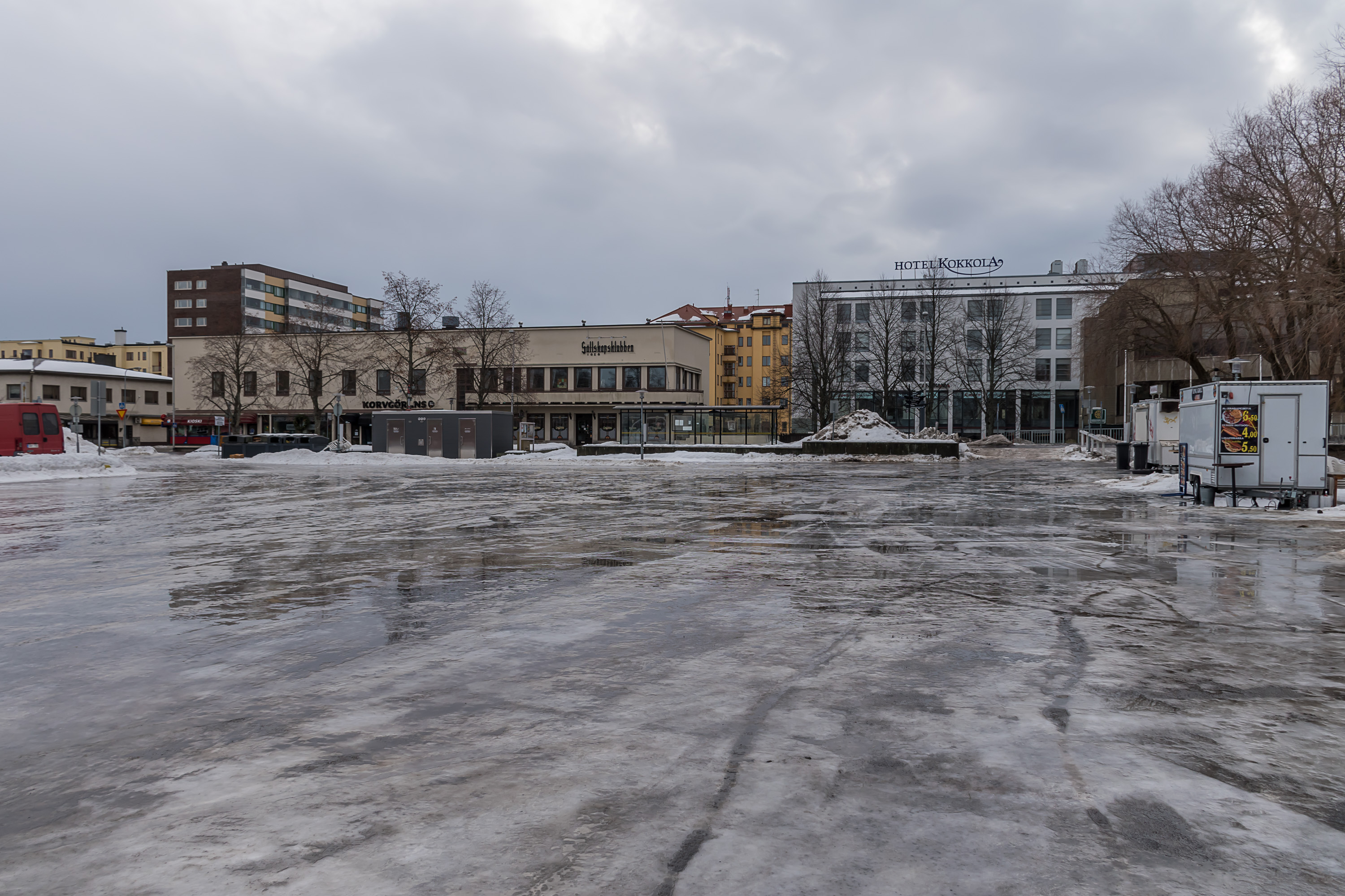
4. But in winter it can be more fun! It just turns into a skating rink! The most complete walk I ever had in Kokkola I did in February 2019, when the weather was quite dreadful, with most sidewalks and minor roads turning to sheer, partially melted ice (and gravel spread on top of didn't always help — and in some areas like this square there wasn't any). So Kokkola might look rather depressing in some pictures, although it really isn't.
5. Kokkola center.
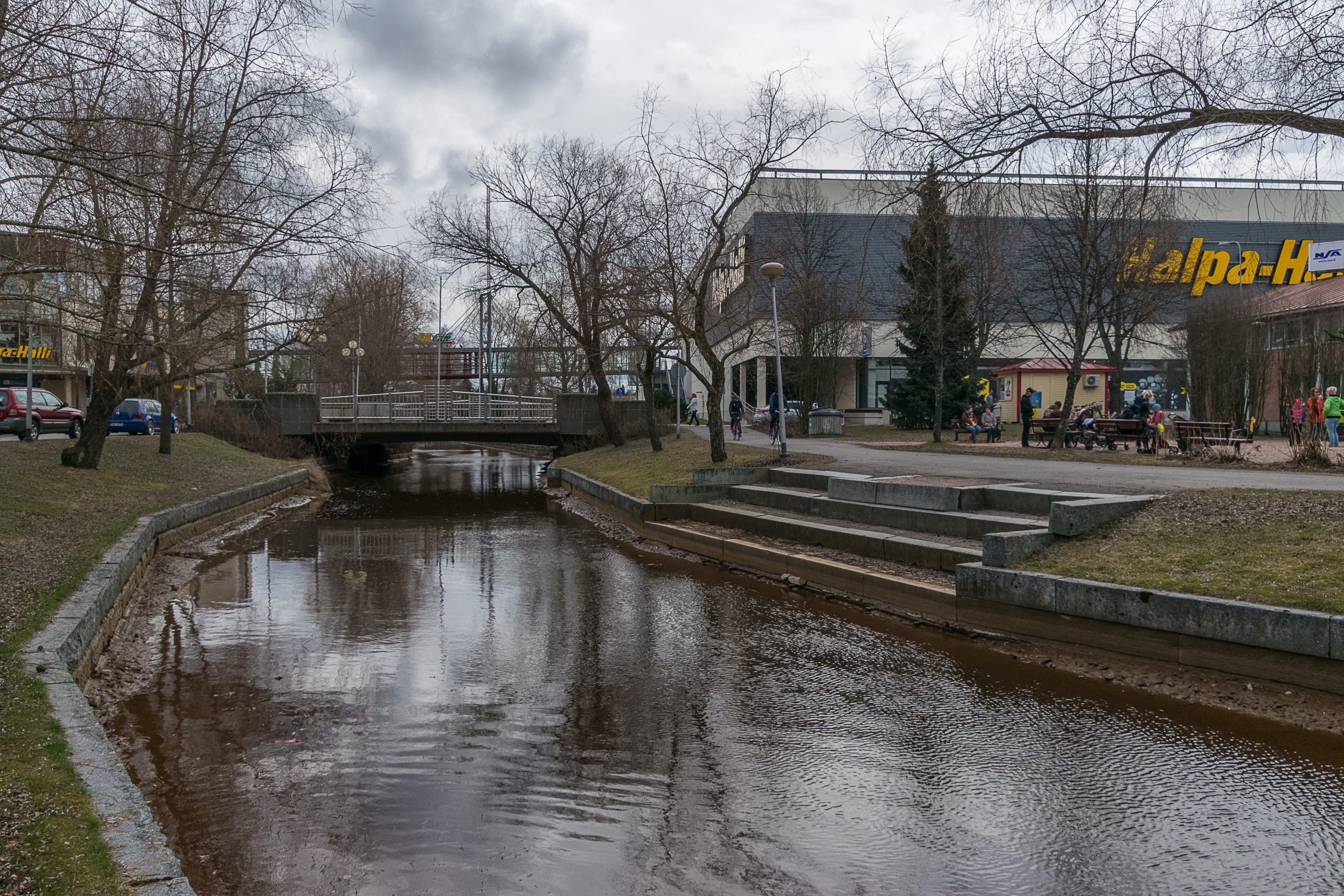
6. HalpaHalli (Finn. Cheap Hall) store is a sure indication that you're not in Helsinki or somewhere nearby; this supermarket chain doesn't operate in Helsinki. Specifically it operates almost exclusively in West Finland, and Kokkola is in fact its hometown. The chain is owned by a religious man, Esko Ylinen (1947-), and so it does not sell any alcohol (even beer), cigarettes or even postal stamps with LGBT-themed Tom of Finland pictures.
HalpaHalli's owner is specifically a Baptist, but generally the coastal West Finland areas between about Jakobstad and Oulu or perhaps a bit wider are known as the "Finnish Bible Belt" first and foremost due to Laestadians. Laestadianism is a Lutheran revival movement popular mostly in certain parts of the Nordic countries, started by Lars Levi Laestadius (1800-1861), a Swedish priest in Lapland. Laestadians emphasize supporting each other in this faith, and for example confessions of sin are expected to be made openly at their congregations. Things like alcohol, premarital sex, television and others are of course sinful. Laestadians tend to have very big families, to the degree that Larsmo, the deeply Laestadian municipality west of Kokkola, is the only municipality in all Finland that still shows its population naturally increasing at a good rate, even with internal/external migration subtracted. Of course, for some such conservativeness means outright emotional abuse; a person might be unwilling to live by Laestadian rules, but still feeling bound to their existing family and social circle. Laestadianism is also associated with some sexual abuse cases. Laestadians are also known to own quite a few businesses in Finland, and some people might even unironically use the word "lestamafia". Even Juha Sipilä (1961-), a Prime Minister of Finland in 2015-2019, actually was/is a Laestadian, although apparently he belongs to a smaller less conservative movement within Laestadianism. He still had five children though.
It is difficult to say precisely how many Laestadians there are, because in Finland at least they aren't a separate church or sect, just a movement within the regular Finnish Lutheran church. In significant cities such as Kokkola their share probably is nowhere as large as in rural areas.
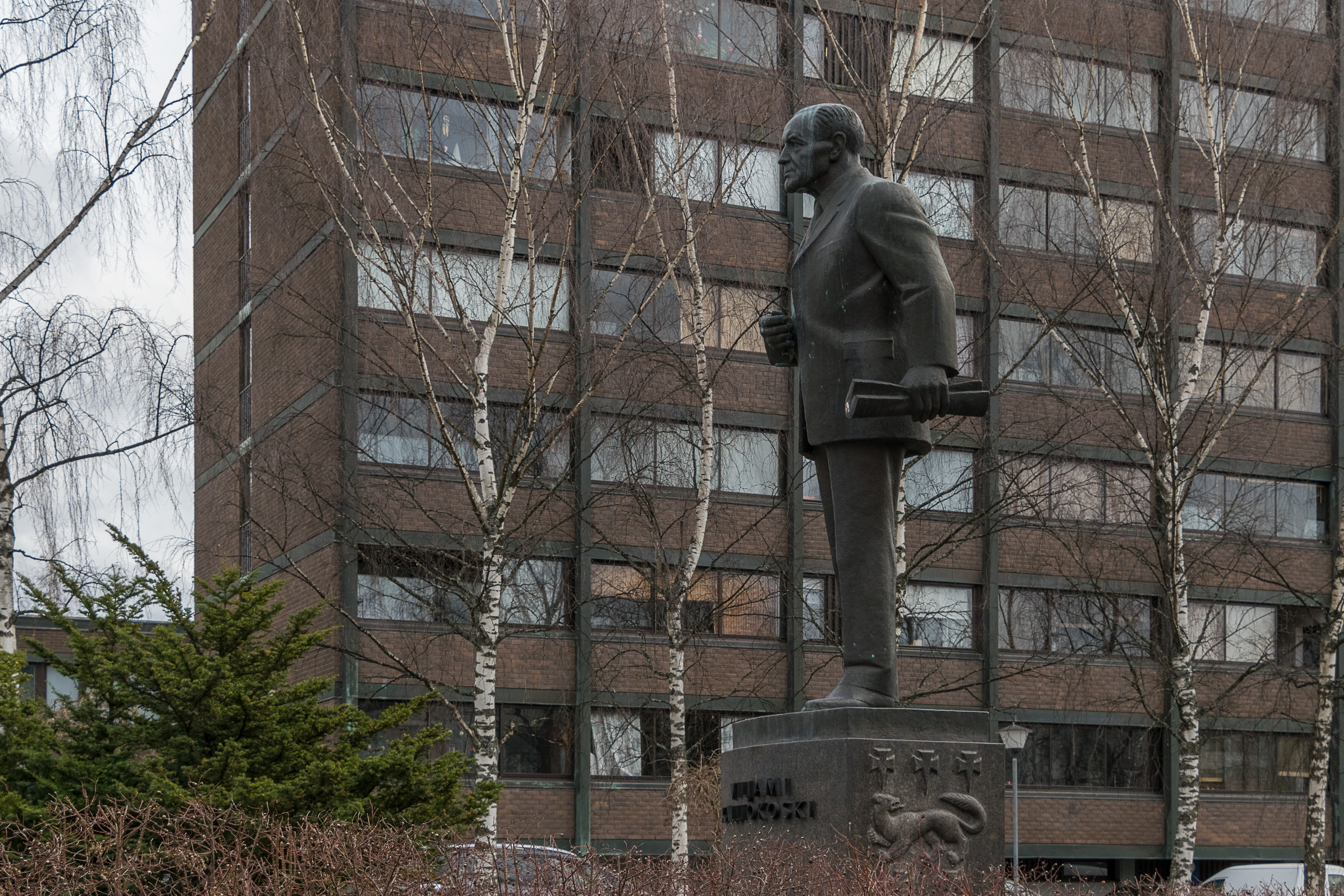
7. Nearby is a statue of Viljami Kalliokoski (1894-1978), one of the most prominent Kokkola politicians ever, who's been a MP for 37 years and a Minister of Agriculture for 8 years. Perhaps more locally importantly, he was the initiator and the first chairman of the Central Ostrobothnian Regional Council (Keski-Pohjanmaan maakuntaliitto), pretty much the first organization that attempted to represent Central Ostrobothnia specifically, and one of the first regional councils in the country overall. Regions in Finland were an unofficial division until 1994; counties existed instead, which were generally bigger than regions (especially in later years) and less based on actual geographical/cultural differences. Regions were introduced in 1994 and counties phased out by 2009. Regions however are not however a tier of authority as such. There are several sets of organizations tasked with regional affairs, but none of them are elected bodies with legislative power.
On the pedestal of Kalliokoski the coat of arms of Central Ostrobothnia is visible, with a pine marten. Historically the coat of arms animal of Ostrobothnias has been a stoat, but the very oldest images actually show a pine marten instead, so in 1950 when the coat of arms of Central Ostrobothnia was developed, the pine marten was taken back in use.

8. Central Ostrobothnian Regional Council building.
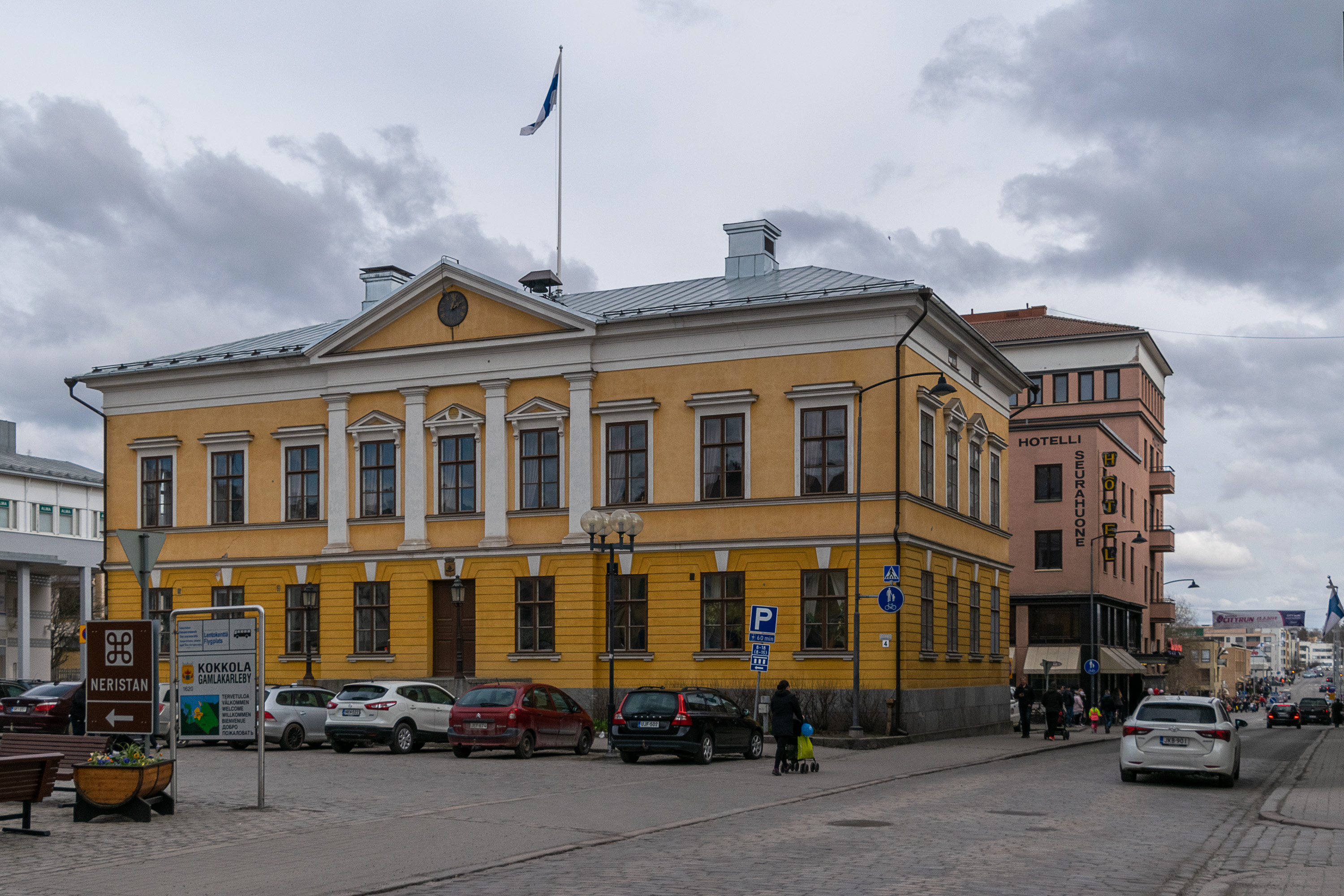
9. Kokkola old town hall, finished in 1842, designed by the local industrialist Anders Donner (1796-1857) and approved by Carl Ludvig Engel (1778-1840), the architect of Helsinki center. It was already the 4th town hall of the city. Nowadays it is little used and has suffered some damage from age, although repairable. Note also the flowerbed to the left, made in the shape of a tar barrel cut in two.
10. The square where the town hall is located is called Mannerheiminaukio, Mannerheim Square, and the monument is called the Freedom Statue, in the honor of the White Guards in the Finnish Civil War of 1918; it dates from 1920 and is designed by John Munsterhjelm (1879-1925).
Like the rest of Coastal, South and Central Ostrobothnia Kokkola was a strongly White-leaning area in the Civil War; Ostrobothnia was overall a White citadel and even the official White government was temporarily operating in Ostrobothnia in the city of Vaasa. Russian garrisons were still remaining in Finland at the outbreak of the fighting; they were present because of the World War I, and when the October Revolution happened in Russia, and Finland declared independence in December 1917, they were kind of left to their own devices. Russian garrisons in Ostrobothnias were disarmed in the first days of the Civil War, and on 29-30.1.1918 a clash of Russian troops in Kokkola (about 700) with the White Guards (about 250) took place. Four people died on either side, and the Russians eventually decided to surrender, after which the Whites also quickly quashed the local Reds.
Russians were interned in a camp at the nearby town of Nykarleby, in a few buildings such as the seminary. About 2000 Russian soldiers were kept there, of which 140 died. Already in February some soldiers were being sent to Russia and eventually the camp was emptied by May-June. Still about 40 Russians were shot; most of them in two episodes. 16 were shot as the leaders of a hunger strike, which apparently proclaimed that they were going to just walk out towards Russia regardless of being shot at. This execution was approved by the White headquarters, and presumably Mannerheim, the White commander-in-chief, was aware of it. 14 people were shot later simply by drunk White staff officers. About 100 Russians died from diseases; although the prisoners were fed well, living conditions were very cramped and unsanitary. The prisoners felt betrayed by Mannerheim, who personally promised them that they would be kept safe and given safe passage to Russia. The only ones who were indeed treated well were Russian officers, which were kept in individual house arrest instead of a camp, and even were paid their salaries. Well, Mannerheim had been himself a Russian officer before 1917, too.
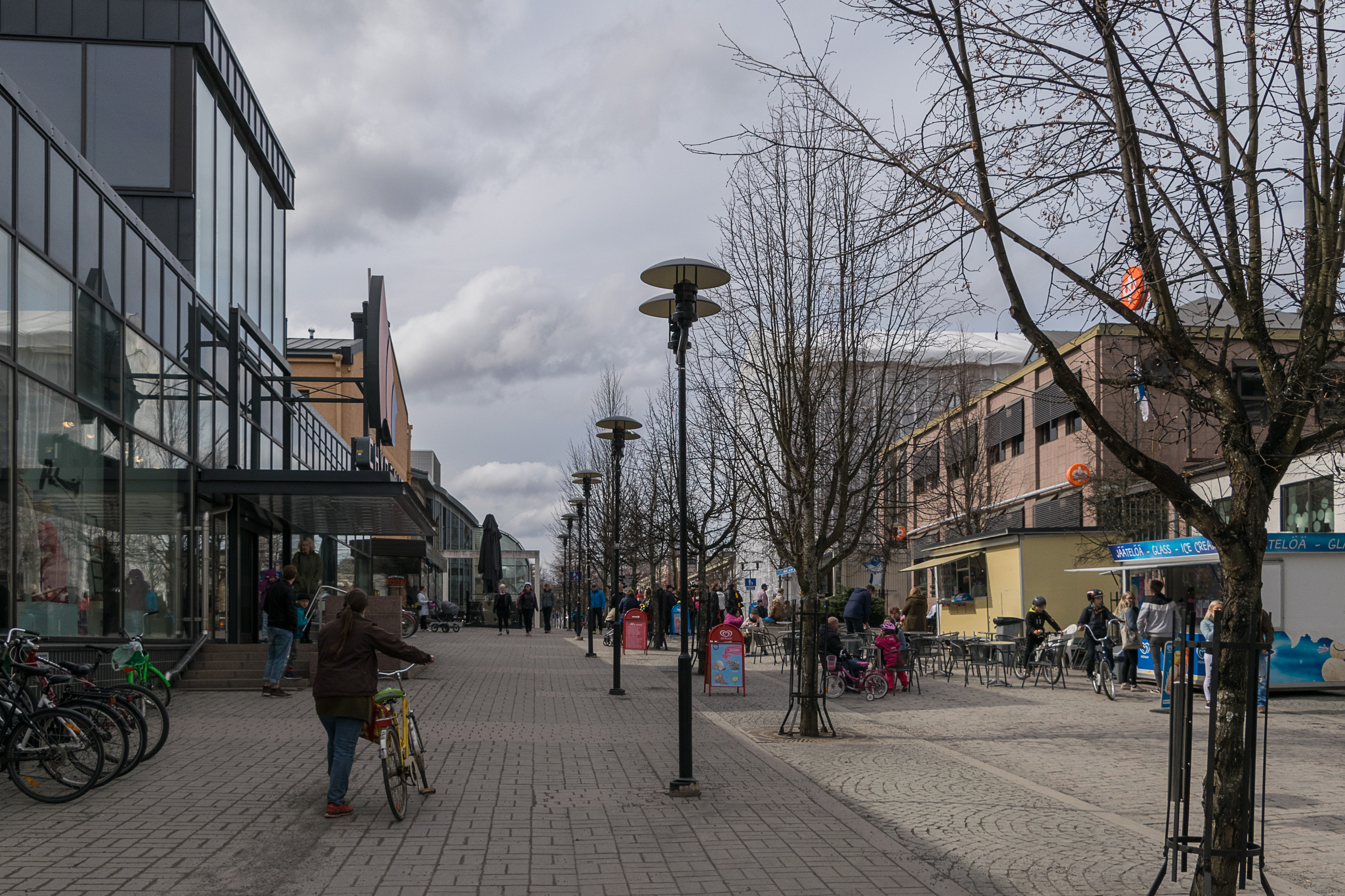
11. A small central pedestrian street. Actually called Tehtaankatu, Factory Street. The factory in question is a tobacco factory that originally operated right here in the modern center since 1763. It existed until the end of the 20th century, althogh presumably in some other place by this point, and also mostly overshadowed by the tobacco factory in nearby Jakobstad. There used to be quite a few tobacco factories in Finland overall, but by the 2000s all domestic production has ended. Although the prevalence of the smoking habit has greatly decreased in Finland over time too; only about 14% of its working-age population smoke daily nowadays.

12. The most famous historical Kokkolan is probably Anders Chydenius (1729-1803), the father of economic liberalism in Sweden and Finland. Born in Sotkamo in Kainuu in a chaplain family, he lived in Kokkola for most of his life; he graduated from the Turku Academy (the first Finnish university) and became a priest in Nedervetil (not far from Kokkola) where he among other things inoculated the local peasants against smallpox and experimented with new animal and plant breeds. Having become locally known, in 1765 he was elected to the Riksdag of the Estates (Swedish Parliament), from the clergy estate.
Sweden at the time lived its Age of Liberty. King Charles XII was killed childless in the Great Northern War in 1718, prompting a succession crisis. The Riksdag of the Estates put on the throne his sister Ulrica Eleonora, and in exchange she signed the constitution, or more exactly the Instrument of Government (regeringsform) of 1719, which essentially made the monarch a figurehead and put the power into the Riksdag hands. Of course the representation in Riksdag was extremely uneven (peasants, the fourth and by far the biggest estate, had the least voice — of course, it's still notable that they had some at least), but still that was pretty much constitutional monarchy. Two parties emerged; the Hats and the Caps.
The Hats, the war hawks, led Sweden into two disastrous wars and in 1765 were replaced by the more peaceful and economy-minded Caps, who immediately realized that the Hats had driven Sweden deep into debt. Chydenius was one of the most instrumental figures among the Caps; in the same year he published The National Gain (Den nationnale winsten), a pamphlet about the benefits of free trade. He expressed much the same ideas as Adam Smith in The Wealth of Nations, only 11 years prior to Smith. In truth however not many of his ideas were actually implemented then. One important idea was, though: staple rights for Finnish Bothnian cities, including Vaasa, Kokkola, Oulu and also Pori. Before that only Turku, Vyborg and Helsinki had these rights (also Hamina when Vyborg was lost to Russia, and Loviisa when Hamina was also lost). These rights meant the city could conduct foreign trade directly; cities without these rights were only allowed to trade with Stockholm or Turku (where all wealth effectively remained). Gaining of staple rights greatly boosted the growth of Kokkola and the other cities, and is one the primary reasons why Chydenius is remembered here. By the end of the 18th century granting of staple rights became a lot more widespread.
An even bigger achievement of Chydenius was the first Freedom of the Press Act (Tryckfrihetsförordning) of 1766, which forbade all censorship and introduced the principle of public access to official records. In that Sweden became one of the pioneers in the world. The main principles of this act are still in force today, and by tradition it still remains one of the three "additional" laws to the main constitutional law, the Instrument of Government.
Chydenius had more weird radical ideas, like equality or freedom of religion, and was soon pushed out of the Caps party. In 1772 King Gustav III made a successful coup and introduced its own Instrument of Government, which reverted some of the excesses of the Age of Liberty. Sweden reverted to an absolutist monarchy for a while. Gustav III's constitution was still relatively liberal for the time; Gustav III, like Catherine II of Russia at the time, fancied himself to be an "enlightened despot"; the important thing to him was that he had the last word. Although in Sweden the constitutional monarchy was reinstalled for good in 1809 when it lost the last war with Russia, Finland kept the constitution of 1772 during its Russian autonomy years, and even formally proclaimed independence based on this constitution (which was then replaced in 1919). As for Chydenius, he'd been a rector of Kokkola since, but still participated in the Riksdag a few more times, and even eventually introduced a law allowing limited freedom of religion (on the condition, of course, that Gustav III approved of it).
Anders Chydenius remains one of the most prominent Finns in history (his portrait was on a 1000 Finnish markka bill, before it was replaces with euro). And notably, that was in the Swedish era of the Finnish history. It is sometimes claimed (mostly in Russia) that the Swedish era was a period of oppression for the Finns, where they were basically enslaved to their Swedish masters. That is not true; Finland legally was just a part of Sweden and the Finns were legally just regular Swedish citizens, and in principle nothing prevented them from becoming for example prominent statesmen as Chydenius did. It's just that in practice such occasions were not very common (but by no means very rare), as Finland simply was a remote borderland of mostly peasantry, and social elevators weren't really a thing yet. And of course things like promotion of the local language and culture in the 18th century simply didn't exist yet; and finally, Finland being a traditional battlefield between Sweden and Russia was certainly not a nice state of events for the Finns. Still, major Finnish figures in the Swedish history do exist, and Chydenius is one of them.
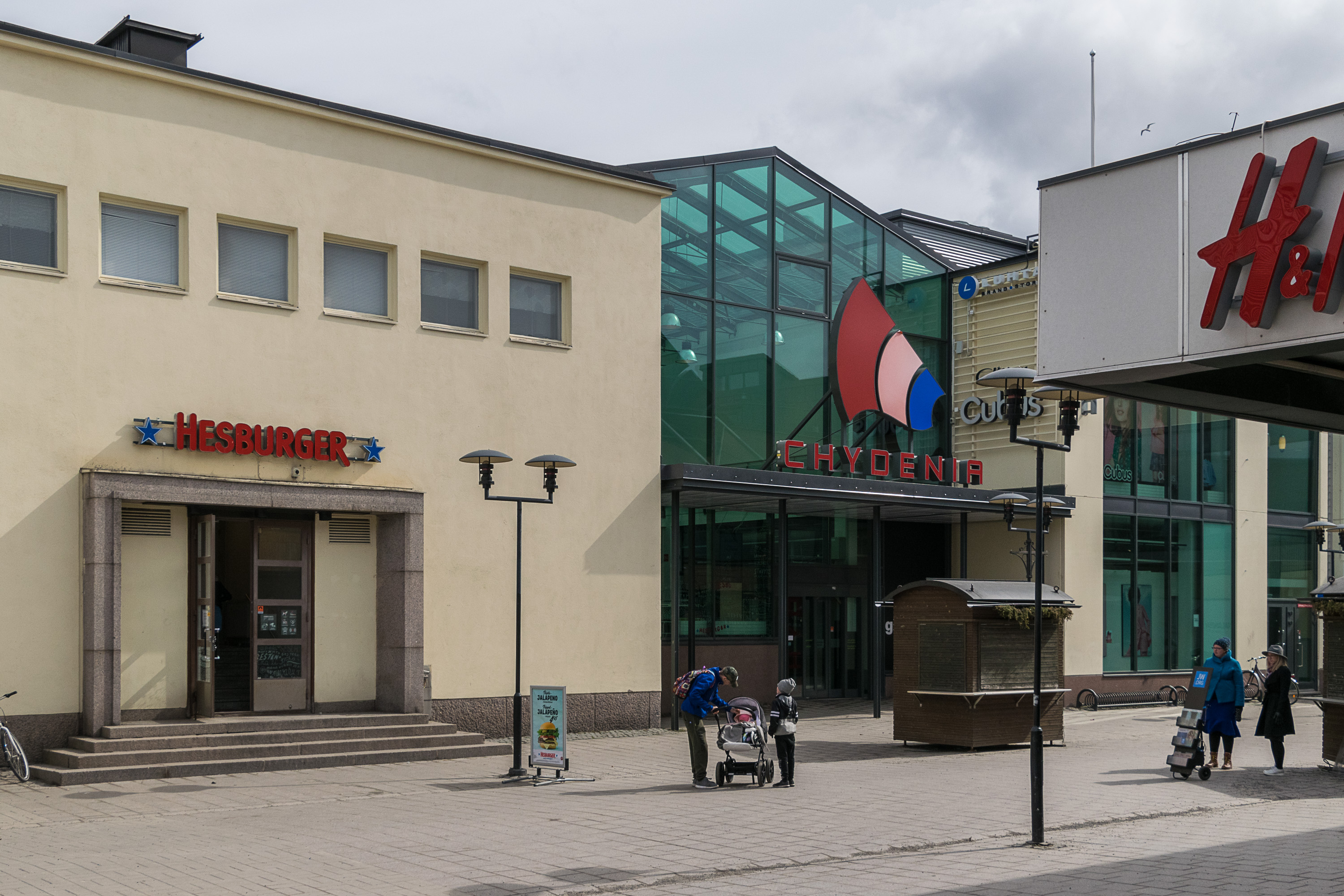
13. The shopping center in the center is called Chydenia, obviously after Chydenius.
Also the so-called Kokkola University Consortium (Kokkolan yliopistokeskus) is called Chydenius. A university consortium in Finland is an institution that provides university-level education and carries out research in major cities which lack their own university. Kokkola University Consortium for example provides master-level studies in a few fields, being effectively a joint branch of universities of Jyväskylä, Vaasa and Oulu. There are currently six university consortiums in Finland; overall in nearly every Finnish regional center (except Hämeenlinna, Kouvola/Kotka and Mariehamn) there is either a university or a university consortium.
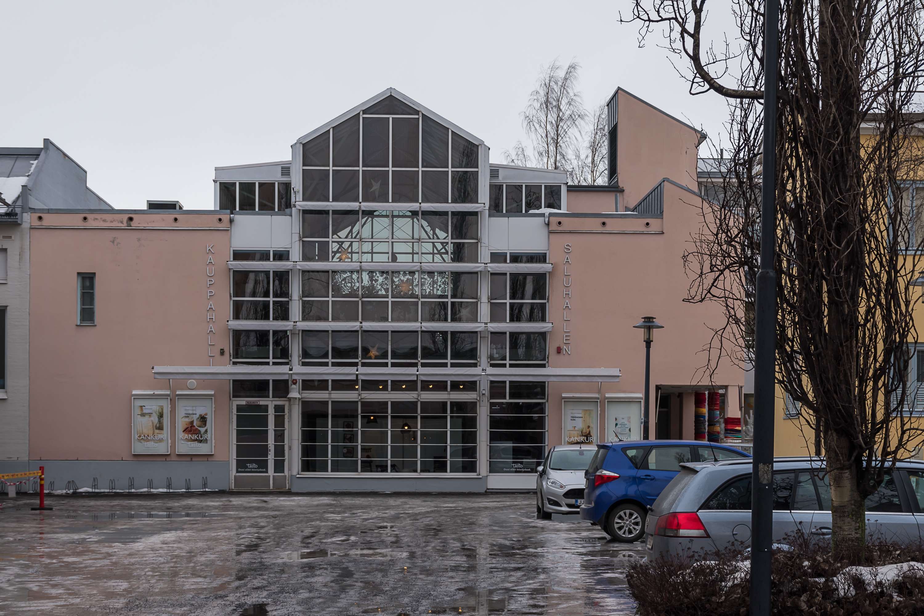
14. Another shopping center. They are really unassuming here.
15. Coastal Street (Rantakatu), probably the nicest looking one in the center.
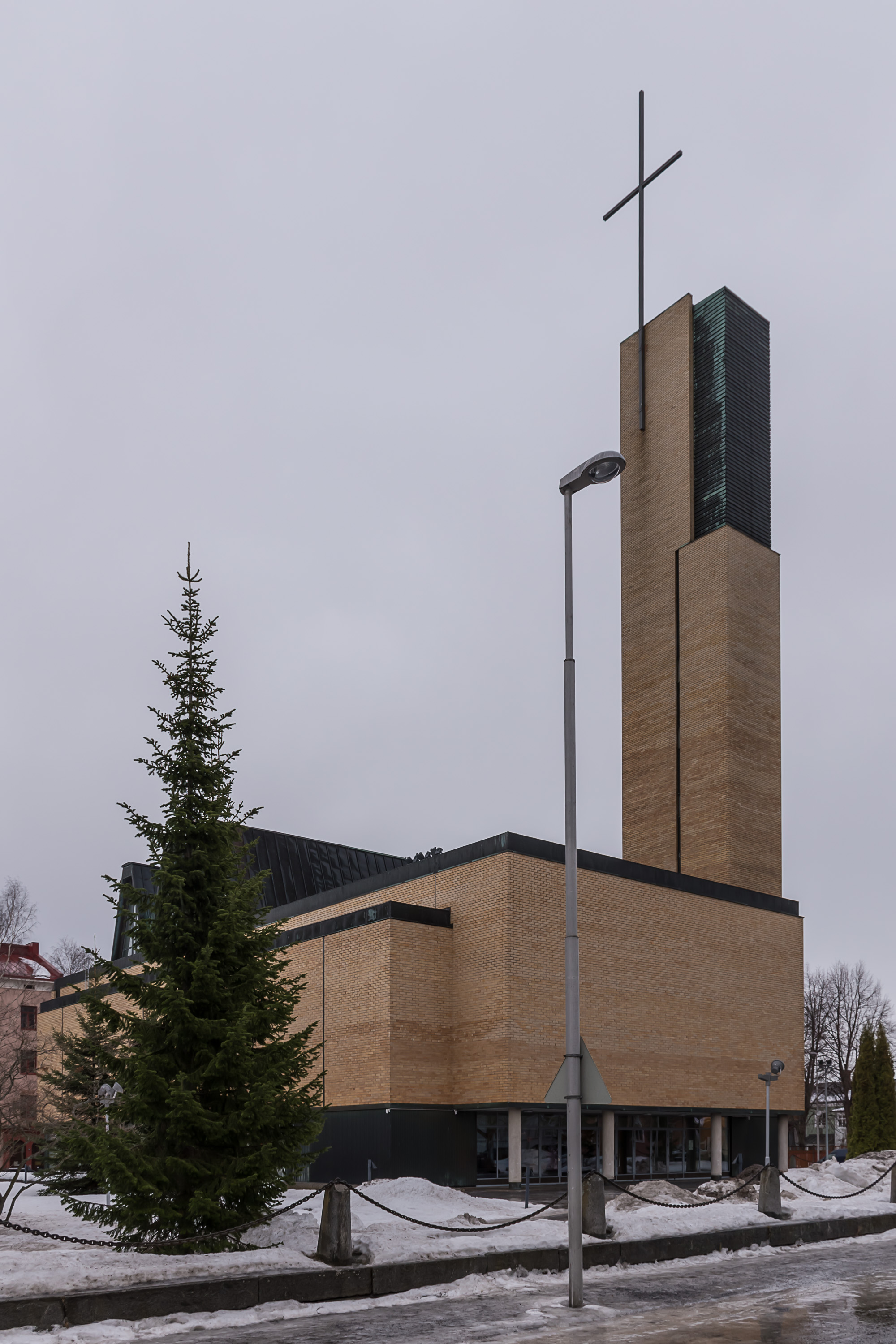
16. The modern Kokkola church was built in 1960 by Aarne Nuortila. It was even given a name, De profundis — Syvyydestä (Out of the Deep, after Psalm 130). This is the third church in this place; the first one existed in 1655-1876, the second in 1877-1958. Both old churches were wooden ones and the second one burned down in 1958; it looked nicer.

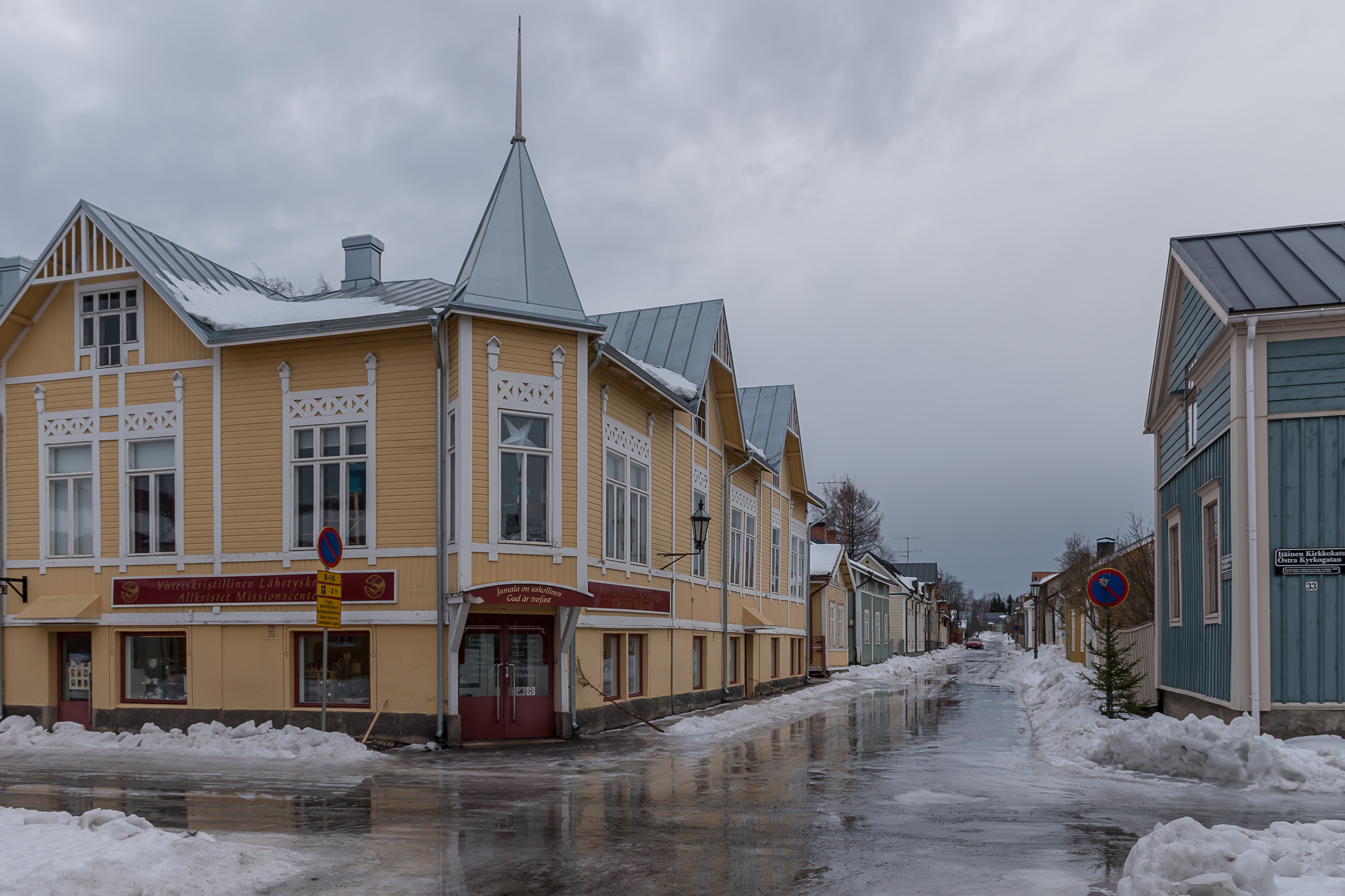
17. The main museum of Central Ostrobothnia is called K. H. Renlund Museum (K. H. Renlundin museo). The main building is known as Roos House (Roosin talo); Andreas Roos (1785-1842), one of the richest local shipbuilders, built this house for his family and business in 1813. At this point it was only the third stone building in the town. The building operated as a school and as a bank at various points, and has been a museum in the city ownership since 1963. Karl Herman Renlund (1850-1908) after whom the museum is named was in turn a local hardware trader, who among other things is notable for originally financing Karl Fazer (1866-1932), the founder of Fazer bakery and confectionery, which is nowadays one of the most famous Finnish brands. Renlund owned a large art collection which now forms the main exhibition of the museum.
Unfortunately I somehow never visited this museum itself, so I cannot tell much about it. I think there is also an exhibition about Kokkola history, but I'm not sure.

18. Close by, another part of the museum is the Pedagogio. It is the red building to the right; somehow I don't have a better picture of it. The Pedagogio is very old for a wooden building, dating from 1695-1696. This is the oldest known non-clerical wooden building in all Finland (the oldest known clerical wooden building is the church of Vörå of 1626), and also the oldest building of Kokkola after the old Kaarlela church (to which we'll get soon). Pedagogio was a school; the word "pedagogio" used to mean elementary school in 17-18th century Sweden. King Gustav II Adolf decreed in the early 17th century that schools are to be split into three stages: pedagogio, trivial school and gymnasium.
As of the end of the 17th century there was one university (in Turku, founded in 1640), one gymnasium (in Vyborg), 7 trivial schools and 21 pedagogios in Finland. For peasants, by far the most numerous estate, attending even a pedagogio was quite rare; the most common pupils were sons of priests. Nonetheless literacy was not uncommon (it was required by the church from everyone after all) and by the early 19th century half of all Finns already could read (although usually not write). By the middle of the 19th century "people's schools" (kansakoulu) began to be established, and in the school reform of 1866 replaced the old schools entirely (although compulsory school education was introduced only in 1921, oddly late — Finland, then already independent, was one of the last European countries to implement compulsory education). The Kokkola pedagogio building was in school use until 1867; after it was a poorhouse, a library and now is a small school museum.

19. The nature museum, another part of the K. H. Renlund Museum, burned down in January 2019 and was in the process of being dismantled a month later when this picture was taken. Most of the museum collections were rescued.
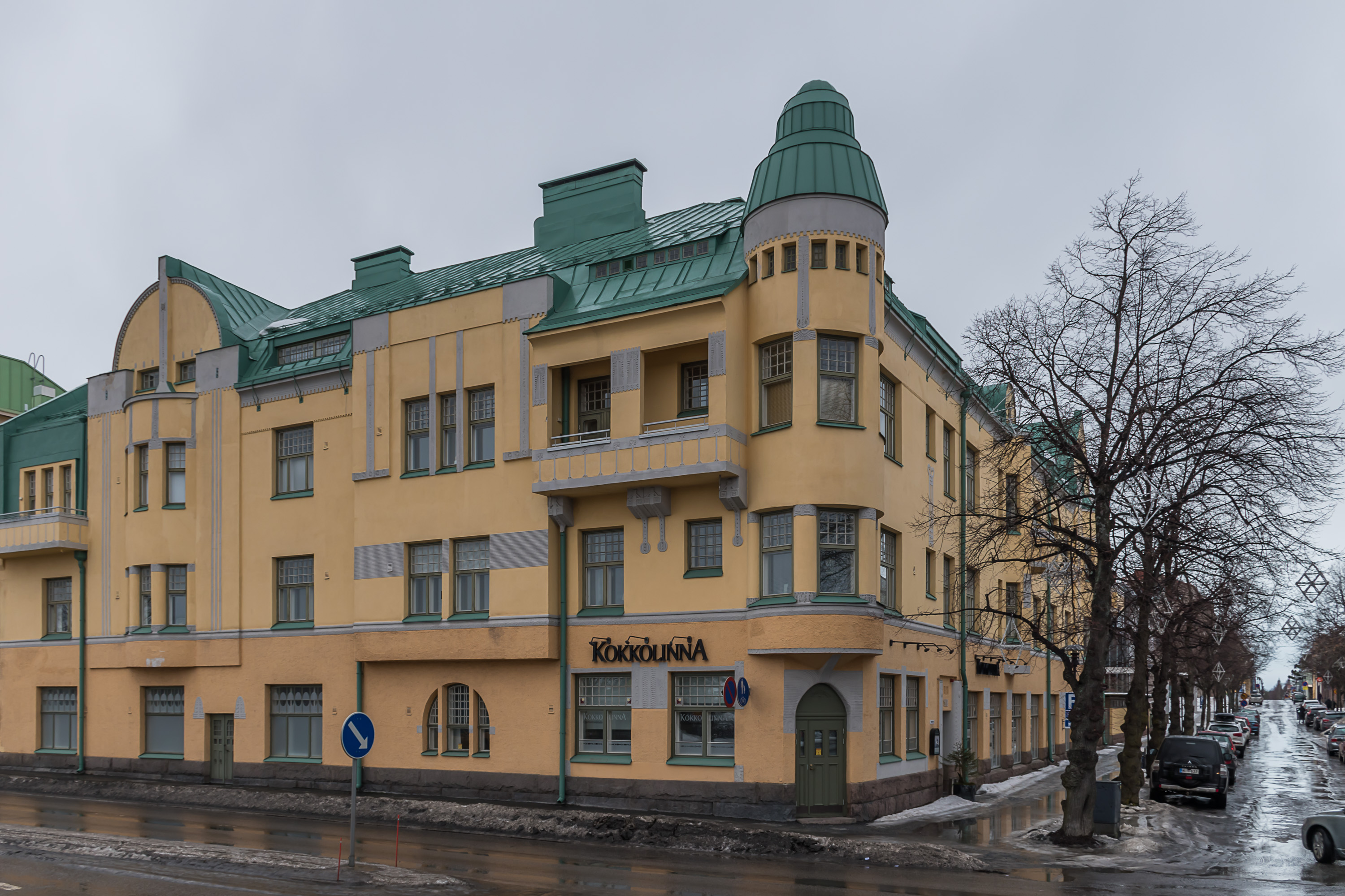
20. Kokkola has almost no buildings in National Romantic style, which I, an ignoramus in architecture overall, personally consider the most beautiful architecture style that ever came from Finland. Kokkolinna, the "Kokko Castle", is virtually the only stone-built National Romantic building in the city. Although there are quite a few Jugend buildings, and that is only a slightly later style.
21. Streets east of the center. Kokkola, being a not especially big city, has nearly no classic lähiö mass production commieblock-style residential areas; the only one is Koivuhaka a bit south of Ykspihlaja that I never visited.
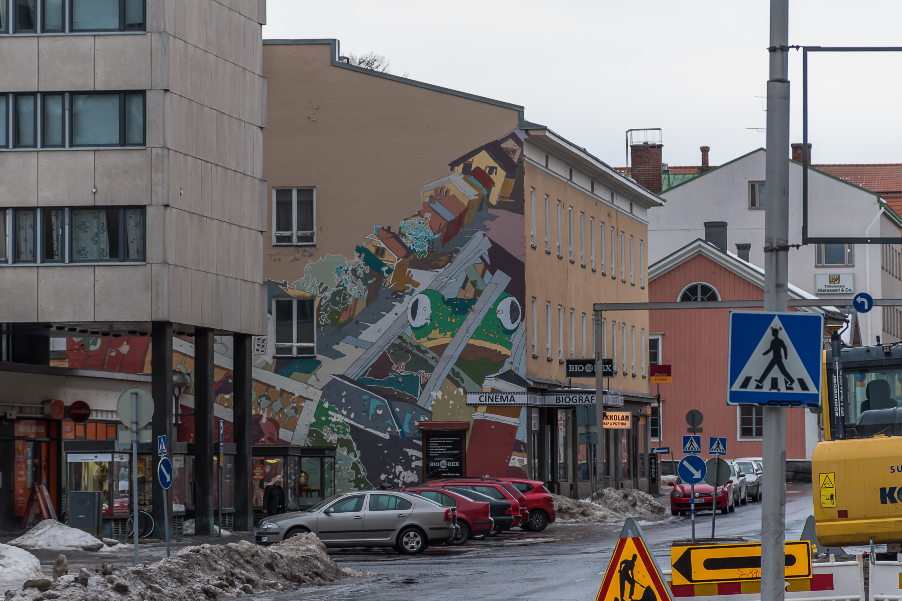
22. Kokkola has a small cinema, which despite being named Bio Rex is an independent one and not related to the nationwide Bio Rex chain. (Bio is a Swedish word for a cinema, oddly enough.)
23. Central Ostrobothnian District Court (Keski-Pohjanmaan käräjäoikeus).

24. J. V. Snellman monument. Johan Vilhelm Snellman (1806-1881) was a prominent Finnish statesman and one of the fathers of the Fennoman ideology, effectively of the Finnish national awakening. Snellman was actually born in Stockholm but spent most of his childhood here in Kokkola, and apparently as a child liked to read outdoors just like that. The inscription says (in Finnish and Swedish): "young soul being open". The monument was designed by Pekka Jylhä (1955-), a prominent modern sculptor, and installed in 2006.
25. A school building being repaired.
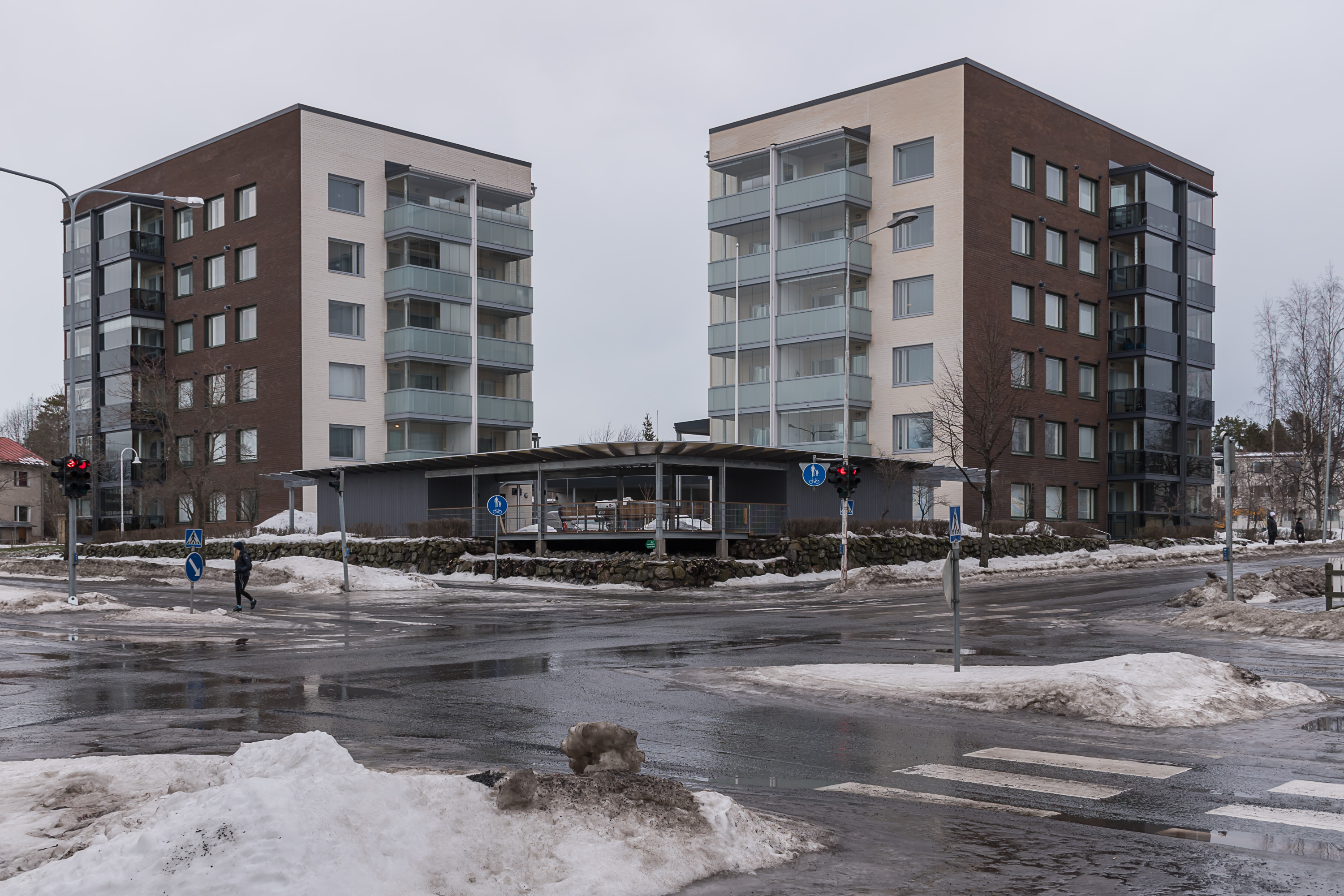
26. Modern residential buildings in Kokkola exist but are not super common. Cities of that size have been remaining at nearly constant population for the last few decades. It is expected that they will begin slowly shrinking in coming years. Of course even a shrinking city will still have some new buildings.
27. The Crown Bailiff House (kruununvoudintalo), another very old building, to the left here. It is claimed that it was built in 1667, which I don't think is true; it would make it older than the Pedagogio, and Pedagogio is commonly claimed to be the oldest non-clerical wooden building in all Finland. I could not find much about the history of this house, and the crown bailiff (kruununvouti) position in fact existed relatively late, in 1898-1945 (a crown bailiff was the local police chief, chief prosecutor and tax collector), but of course the house might well had been called something else before those dates. The house doesn't appear to be protected by the Finnish Heritage Agency (Museovirasto). Well, anyway it is obviously very old; most likely the house has existed here in 1667, but this particular building is not the original one. The building is now used as a cafe and as conference and event space.

28. Now let's go towards the railway station. The bus station is almost right across the street from it. Kokkola has five local buses; all of them run about once an hour and only on weekdays, so service is quite basic.
Kokkola is located on the National Road 8, running along almost the entire Bothnian coast from Turku to Oulu, and thus has good bus connections along this road, to Vaasa, Oulu and other cities. National Road 13 runs southeast to Jyväskylä, and there are some buses going there too. National Road 28 runs east to Kajaani; rarely would anyone need to go between Kokkola and Kajaani and buses in that direction don't go very far. Connections with at least the biggest Central Ostrobothnian towns such as Kannus and Kaustinen are also reasonably good.

29. The old school, later a lyceum operated near the railway station from 1898 (as a private school until 1918), and was the first Finnish-language school in Kokkola. The lyceum proper moved elsewhere in 1954. Currently the building is used by the worker institute (työväenopisto, known in some cities as the citizen institute, kansalaisopisto), which in Finland means a municipal adult education center.

30. And this is the railway station, as seen from the street. The old building by Knut Nylander (1839-1886), the chief railroad station architect at the time, is still in use; it looks similar to most railway station buildings at the Ostrobothnian Railroad.

31. The platforms. The station still uses relatively unsafe railroad pedestrian crossings instead of an underpass.
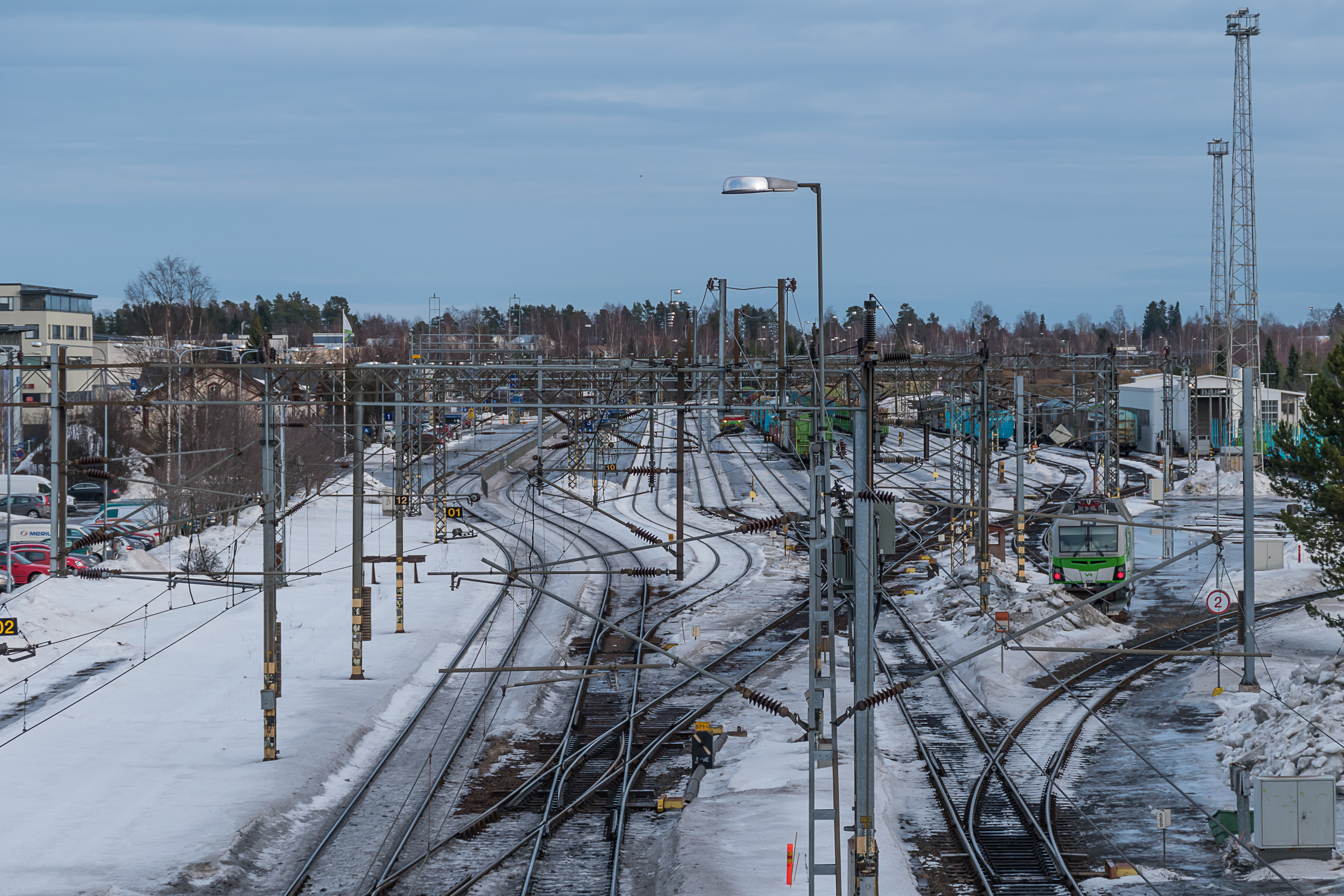
32. The station is a large one by Finnish standards. Since a short railroad to Ykspihlaja industry and seaport branches from it, it is also a junction station.
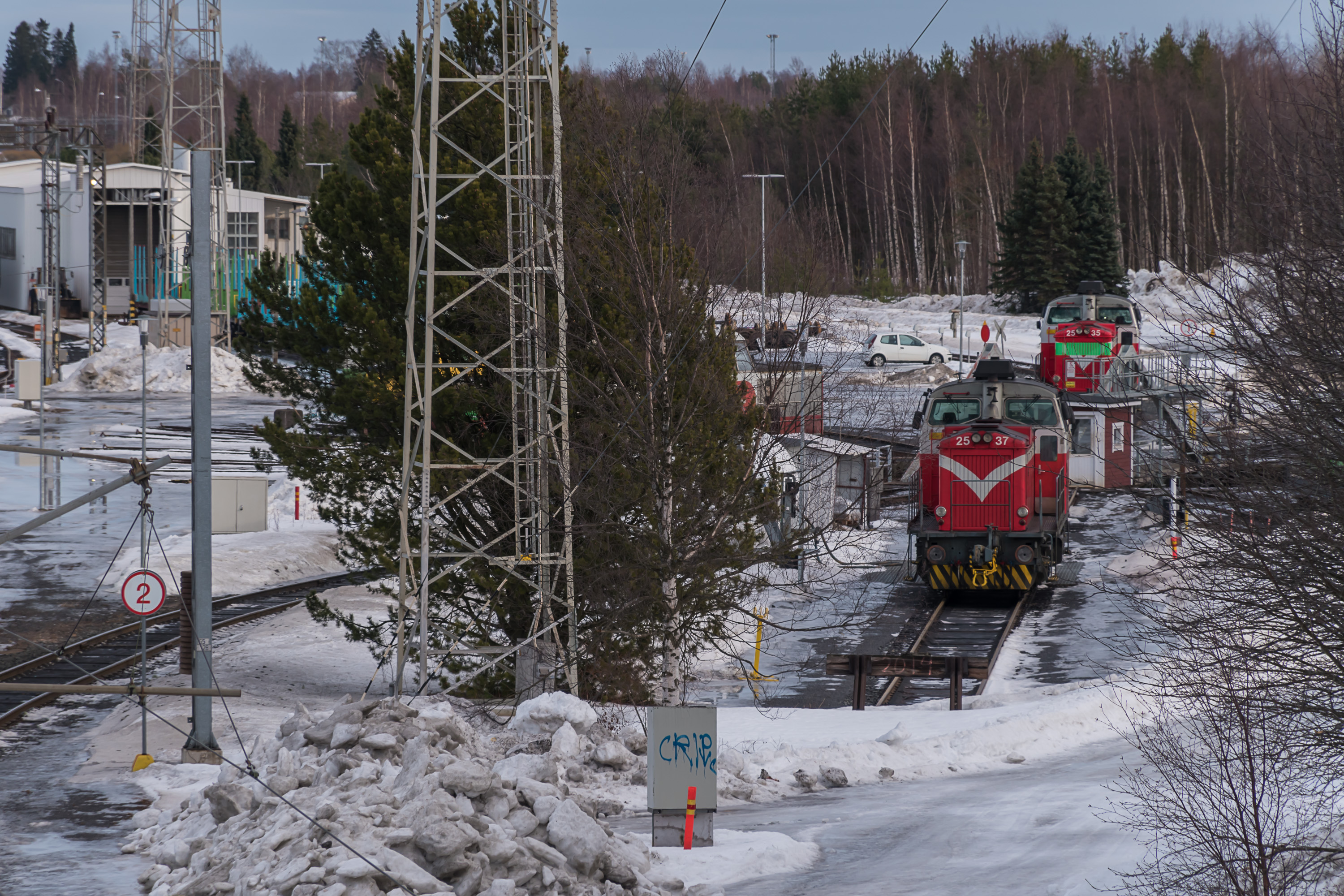
33. Locomotive refueling and service point.
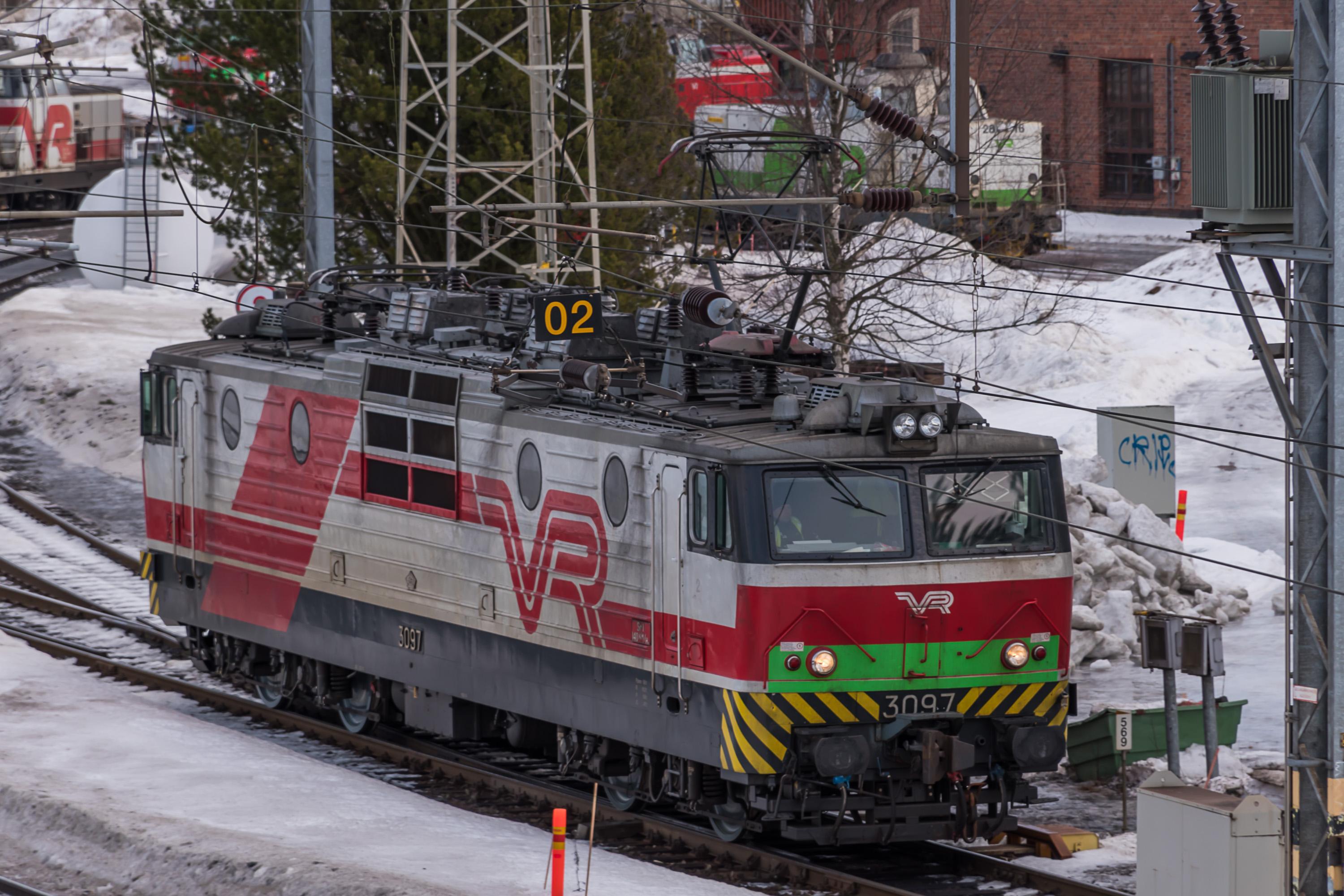
34. The oldest of the only three electric locomotive models in use in Finland, Sr1. These were in fact ordered from the USSR (later Russia) in 1973-1996; a total of 106 Sr1's were built at Novocherkassk factory in South Russia. Despite age these are still ubiquitous at nearly all electrified Finnish railroads and proved very reliable.
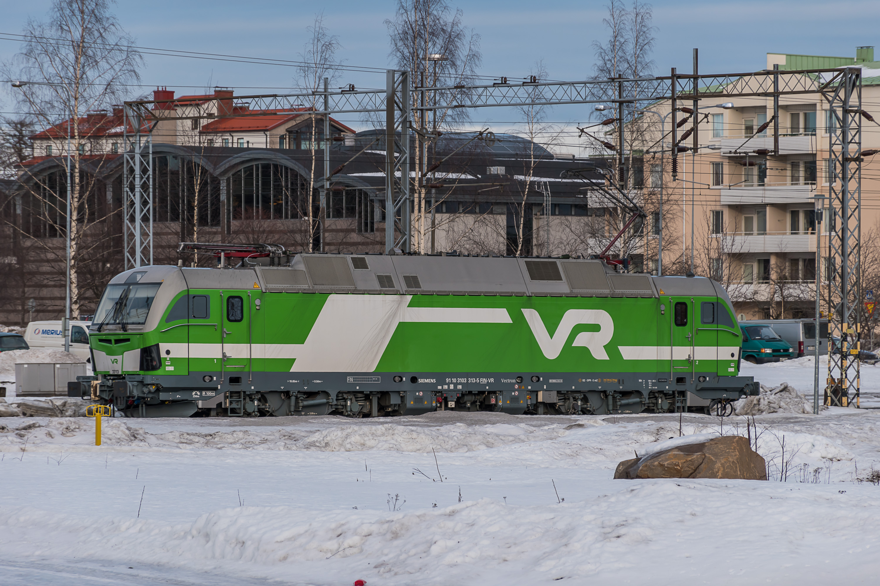
35. Still since 2017 their replacements, Sr3 locomotives, elsewhere in the world known as Siemens Vectron, have started to appear. A total of 80 Sr3's have been ordered; so far less than half have arrived. It is expected that in the 2020s Sr1's will be replaced by Sr3's. The latter are not without their own teething troubles, but a Sr3 is twice as powerful as a Sr1.
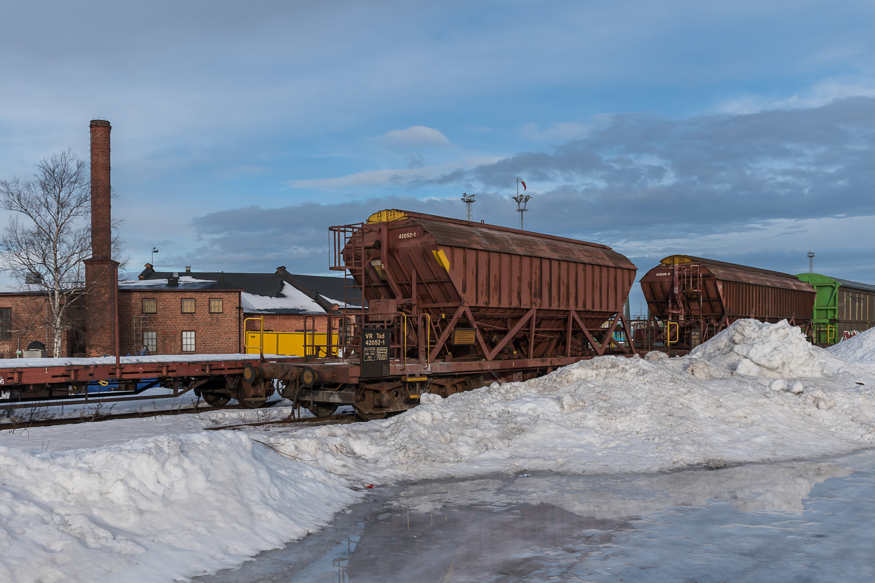
36. The station is also used for freight car storage.
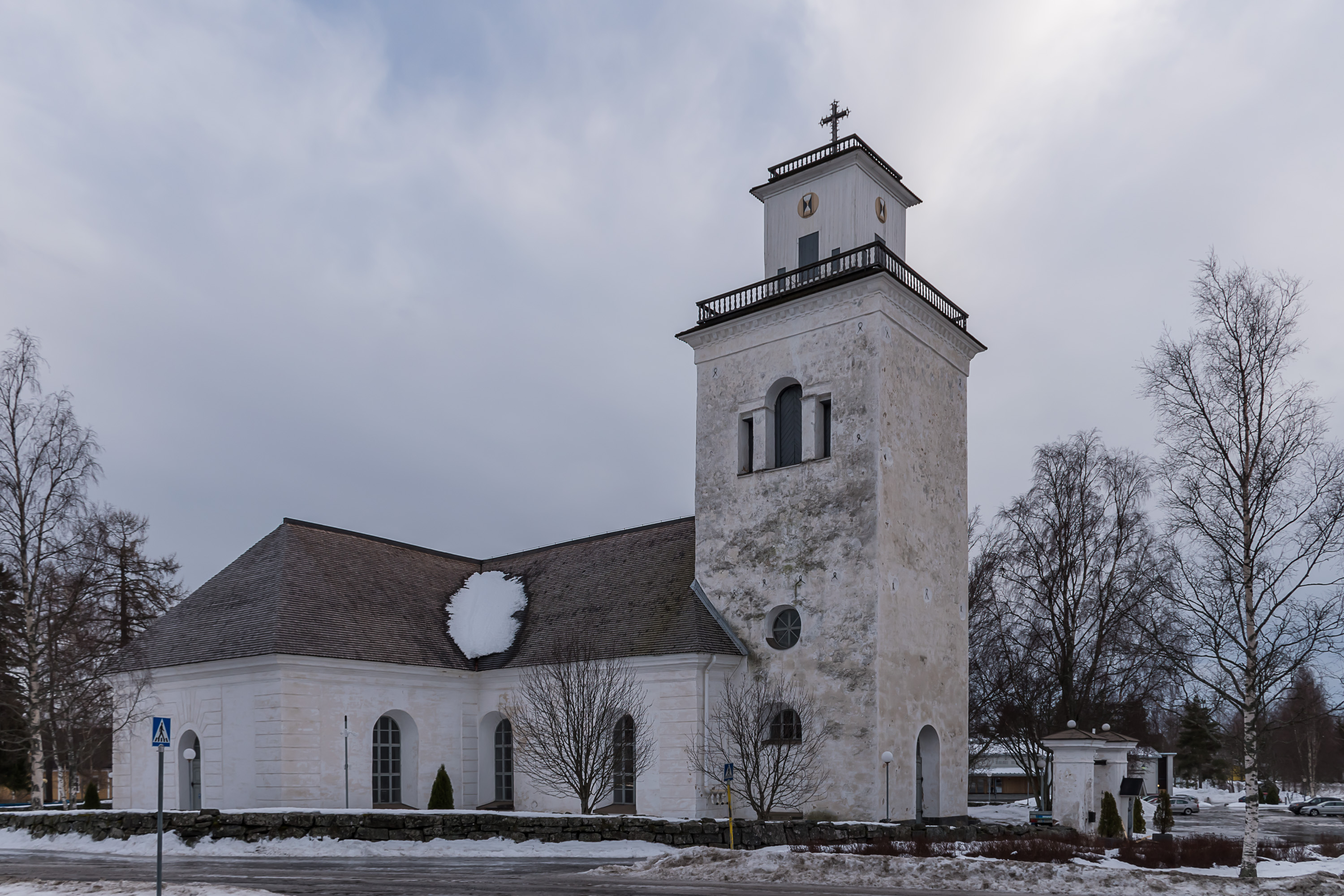
37. South of the railroad there are big stores such as Prisma, detached house areas and National Road 8 bypassing the city, generally not too much to see. But there is also the Kaarlela church. It dates from about 1500-1530, thus, it predates the city of Kokkola itself and comes from late Middle Ages. Back in the day the sea almost reached these places; nowadays it is 3.5 km from here to the sea as crow flies.
Kaarlela church is one of the five medieval Ostrobothnian stone churches still preserved in mostly original shape. In Vaasa for example the church built in approximately the same years was destroyed in the great Vaasa fire of 1852, and only ruins of it stand in what is now called Old Vaasa.
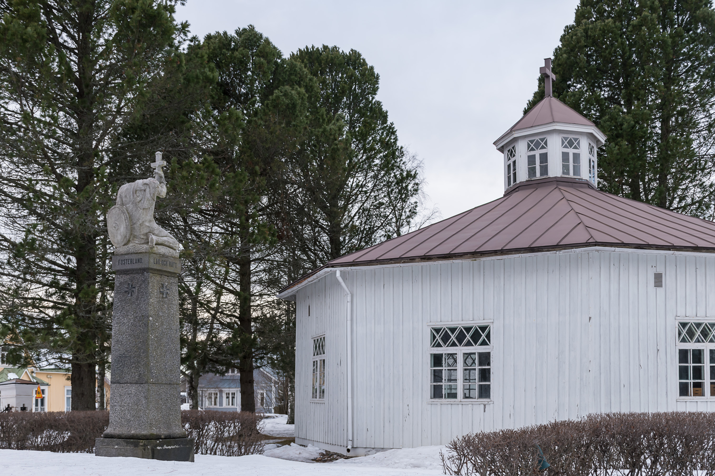
38. A graveyard chapel from 1871 across the church. Nearby is a war cemetery. One more notable building nearby is a wooden priest house from the 1770s, apparently designed by Chydenius himself. At the time however I either didn't see it or didn't realize its significance.
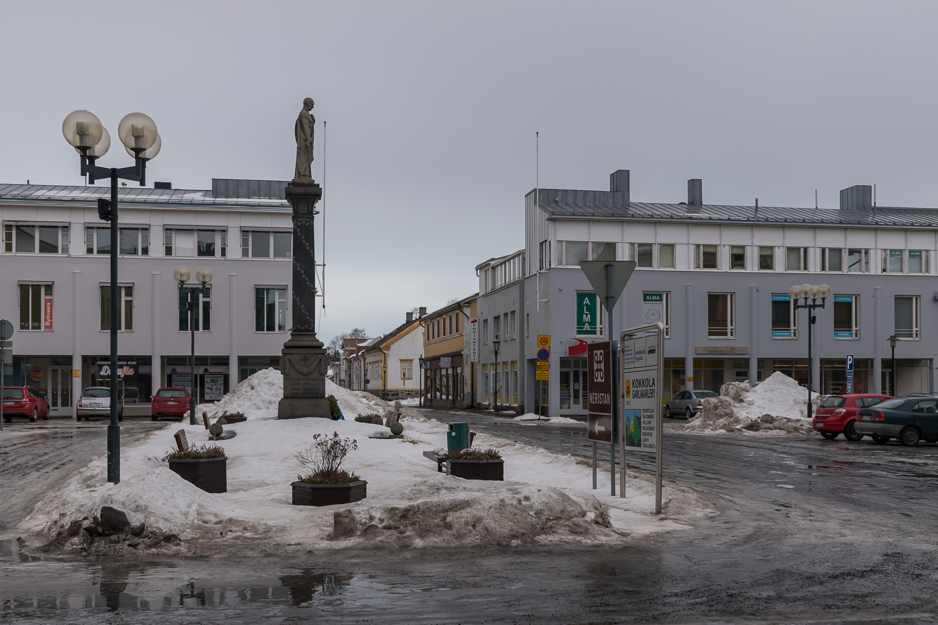
39. And now back to the center, let's have a walk about Neristan, the Kokkola "old town".
40. Neristan proper is only approximately 360x320 meters large, split neatly into 120x80 m blocks, divided by narrow streets (pictured is a larger street at its edge) This neat grid city plan (ruutukaava) in Finnish is a dead giveaway that you are in an older (but not medieval-old) central part of the Finnish city; in the 20th century city planning became more, for the lack of a better word, organic. This particular plan dates from 1665, designed by Johan Persson Gädda after a city fire. The grid plan is usually still preserved even when most of the buildings are replaced by newer ones, as is the case in the formerly more prosperous Oppistan, the modern Kokkola center. Neristan, as I said before, was the workers and seamen area, and thus was under no pressure to modernize. Most of its houses date from the 19th century.
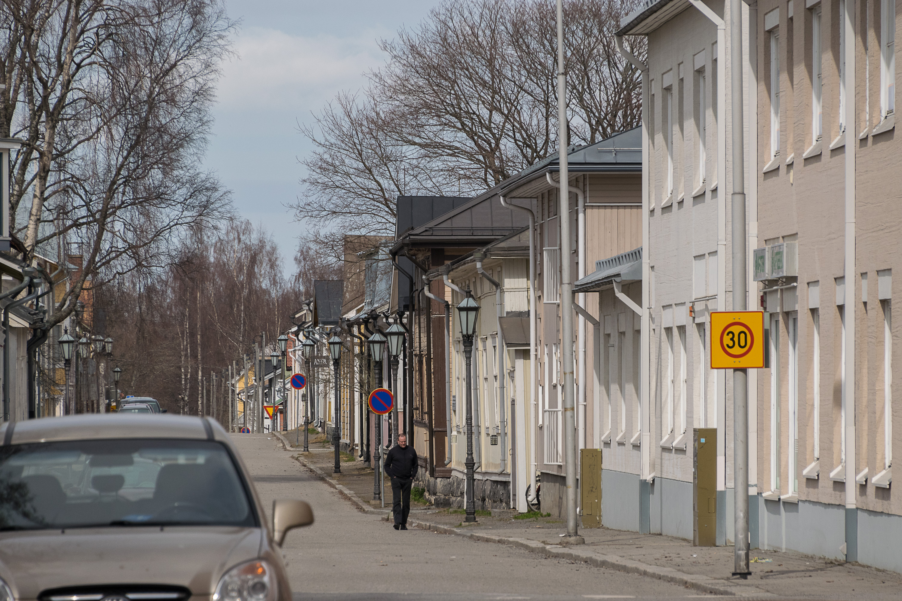
41. Neristan is valuable in its entirety, but few of its houses are individually significant, and it's mostly just residential houses; it has rather few small shops and cafes, for example. So it doesn't really feel all that lively and interesting. That's probably the reason Kokkola is not as famous as the main two Finnish "wooden towns", Porvoo and Rauma (which do have plenty of cafes and other things, and also somewhat more interesting architecture and medieval chaotic city plans instead of grids). Similar old wooden house areas as in Kokkola in principle exist elsewhere, for example in the nearby Jakobstad. My favorite wooden towns are in small cities, where the wooden town actually is still the real commercial center, not just a particular preserved area nearby. Such are for example Kristinestad, Uusikaupunki and Nurmes.
42. And yes, these streets in particular can turn into skating rinks in winter. Road salt is not used on them, only gravel in places.
43.

44.

45.
46. Swedish-language kindergarten.

47.
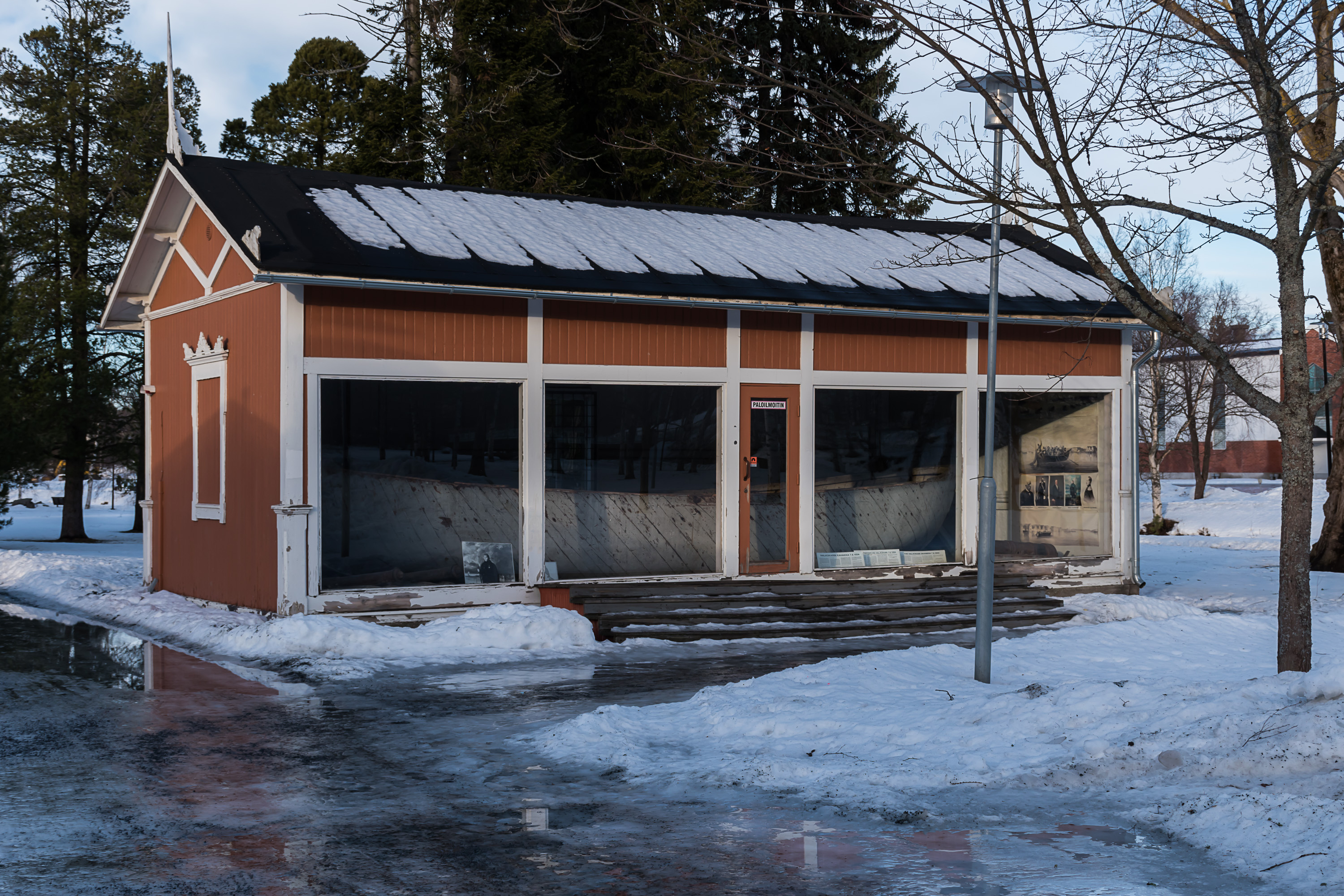
48. The English Park (Englanninpuisto), between Neristan and Sunti north of the Energy Park, is named after the English launch boat, which is dutifully preserves here in a special pavillion. It is the witness of a small colorful page of Kokkola history, the skirmish of Halkokari. Halkokari (Finn. Firewood Skerry) is an old harbor area north of the center, near the mouth of Sunti; nowadays used only as a small marina.
In 1853-1856 the Crimean War was ongoing between Russia and Turkey, the latter allied with Britain and France both. This war Russia ultimately lost. In Finland the war is known as the Åland War (Oolannin sota; using the word Åland in Finnish pronunciation instead of the modern Finnish name for the archipelago, Ahvenanmaa), because from Finnish point of view the war was mostly about British and French navies bombarding coastal military and civil installations in Finland (including Åland Islands where a major fortress, Bomarsund, was destroyed and never subsequently rebuilt), in order to make the Russian navy in the Baltic Sea inoperable. As usual, no one gave any particular thought about Finland itself in all these events. In May 1854 British ships were attacking the coastal cities at the Bay of Bothnia, destroying ships and buildings and stores in the harbors (to deprive the Russian navy of possible bases), after a warning to the civilians to leave everything and go away; real gentlemen those British were, you see. They destroyed harbors of Oulu and Raahe, and then it was Kokkola's turn; Vulture and Odin steam frigates approached it on 7.6.1854.
The people of Kokkola however were already prepared, having heard of the neighbors' fate. Men of the city, about a hundred volunteers, led by the local industrialist Anders Donner which I already mentioned, and armed mostly with seal guns (actually reasonably good weapons), were prepared to defend the city. They were not amused also by the fact that much of the Kokkola trade before the war was with Britain, and many local ships and crews were currently interned at British ports; and all that because of some stupid Crimea that no one in Finland even heard of! Of course the civilian militia was not alone; they managed to get two Russian infantry companies from Vaasa and some light artillery from Närpes, commanded personally by General Major von Wendt (1800-1874), a Finnish-German officer responsible for the defense of the Bothnian coast. Russian forces in Ostrobothnia were very weak (that's why the Brits could strike with such impudence to begin with) but that was enough to defend Kokkola.
The British might have had better luck if they could bring their frigates into firing range, but they couldn't; the Kokkola harbor fairway is difficult and treacherous. They had to use 9 launch boats, armed with cannons, with a total of 180 men. One launch came under an armistice flag to negotiate; the British demanded to be allowed to burn down the ships in the harbor and various stores, including tar ones. Mayor Roos and Trade Councillor (a honorific title) Donner refused, citing the Russian Emperor's orders not to aid the enemy. The negotiators departed and the attack itself came.
The defenders used a rather simple trick; they built a fake wall at the harbor, camouflaged as a wall of some depot, and hid behind it; then dropped it and started shooting when the boats came close. A seal hunter, Matts Kankkonen, shot the commander of the first boat right between his eyes, mumbling "I've got that cigar-smoker". The British, who hadn't expected any resistance at all (like in Oulu and Raahe), returned fire, but their aim from small boats was terrible. After an hour of shootout the British retreated. One boat ran aground and its crew was taken prisoner. The next day British ships decided to leave. 3 British officers and 15 seamen were killed; 3 officers and 31 seamen were taken prisoner (and shipped to Helsinki and then St. Petersburg). The defenders had only a few wounded. There was a great celebration in Kokkola, and everyone got really drunk. There weren't that many battles in history when Finns and Russians fought on the same side, let alone with such enthusiasm!
People of Kokkola, especially Donner and Kankkonen, received warm thanks from Emperor Nicholas I and were generously rewarded. Donner and Kankkonen got portraits painted by Wladimir Swertschkoff (1821-1888), a Russian-Finnish painter. Those portraits are located in the Presidential Palace in Helsinki to this day, and President Koivisto (in office 1982-1994) later said that Kankkonen's portrait was his favorite work of art there. And the captured boat remains on display to this day too, here in place of an old tar depot. It is sometimes claimed that this is the only ship of the British Royal Navy ever captured by enemy and not returned. Of course the Royal Navy participated in so many wars and battles that it is impossible for this claim to be true. It is also said that the railroad was a few decades later routed straight through Kokkola (which, as we noted, was very unusual for Finnish coastal cities) because Emperor Alexander II specifically remembered the Halkokari skirmish and the bravery of the locals.
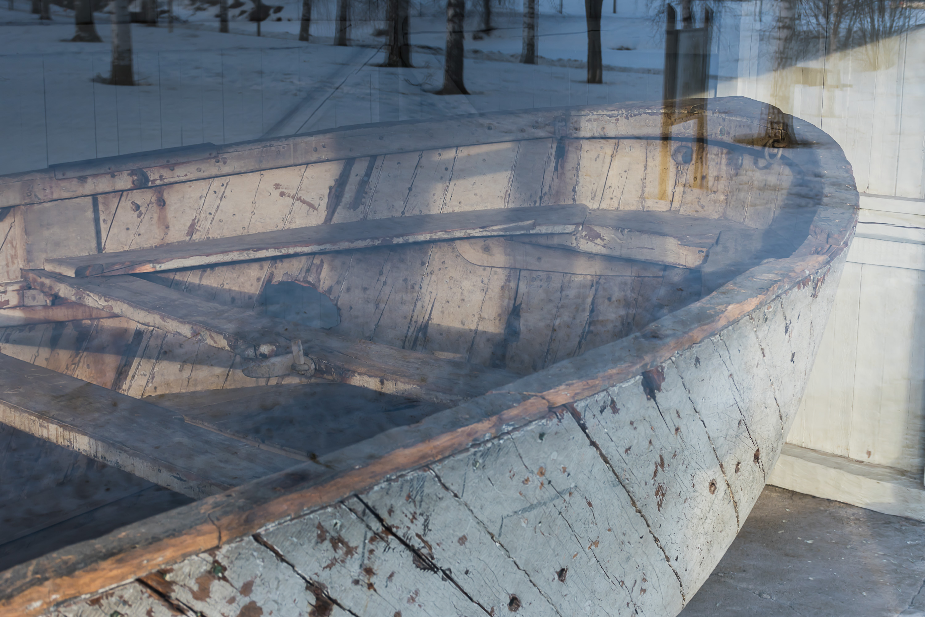
49. Boat close-up.
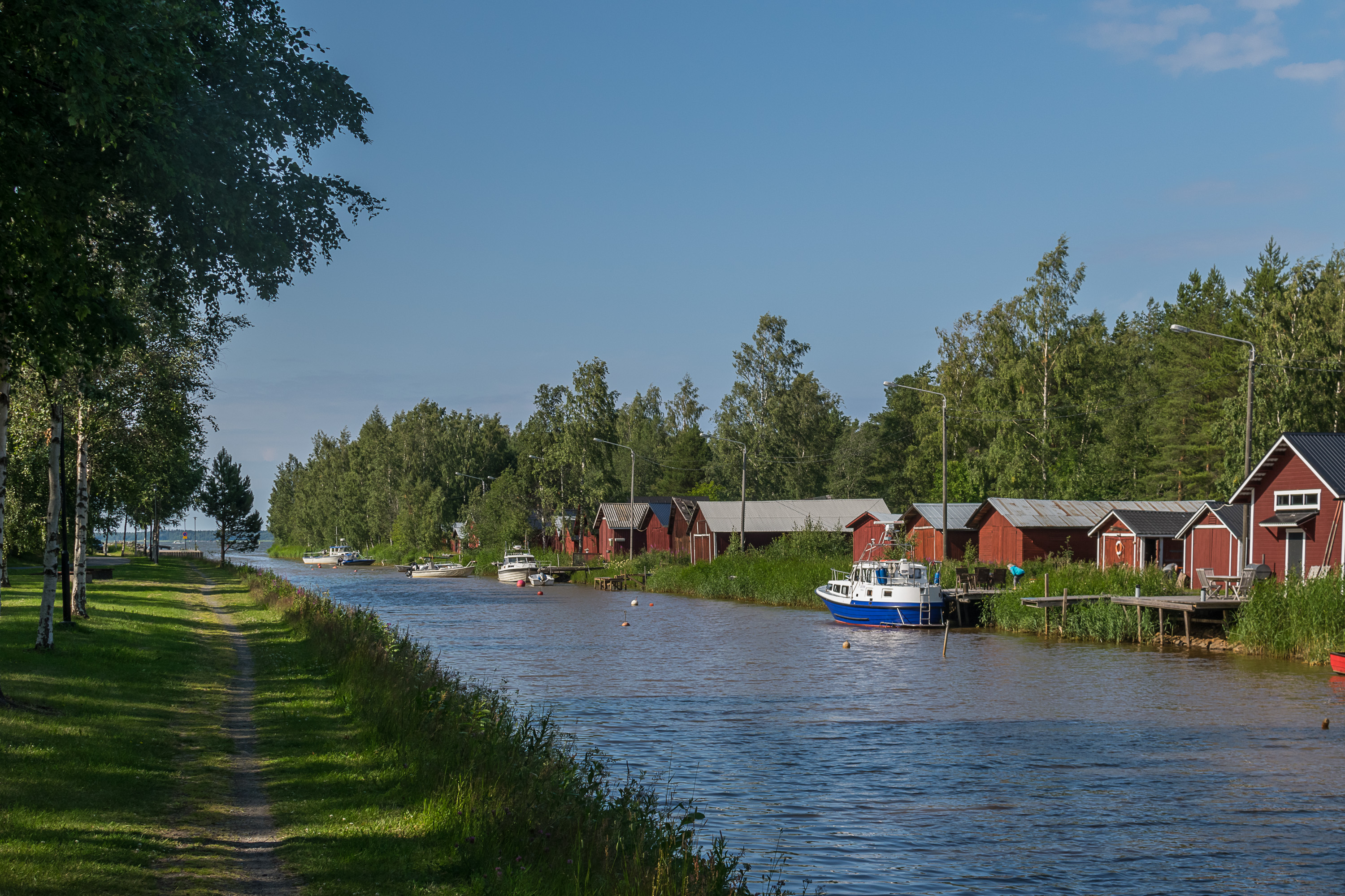
50. And finally let's walk towards the sea, along Sunti. This is the only part of the city for which I have summer pictures.

51. Sunti is currently somewhat navigable for about 600 meters (below the bridge on the previous picture), and here its banks are still strewn with boat barns.

52. These are actually also pretty old and at least some of them have all historical owners listed.
53. And the mouth of Sunti is already visible.
54.

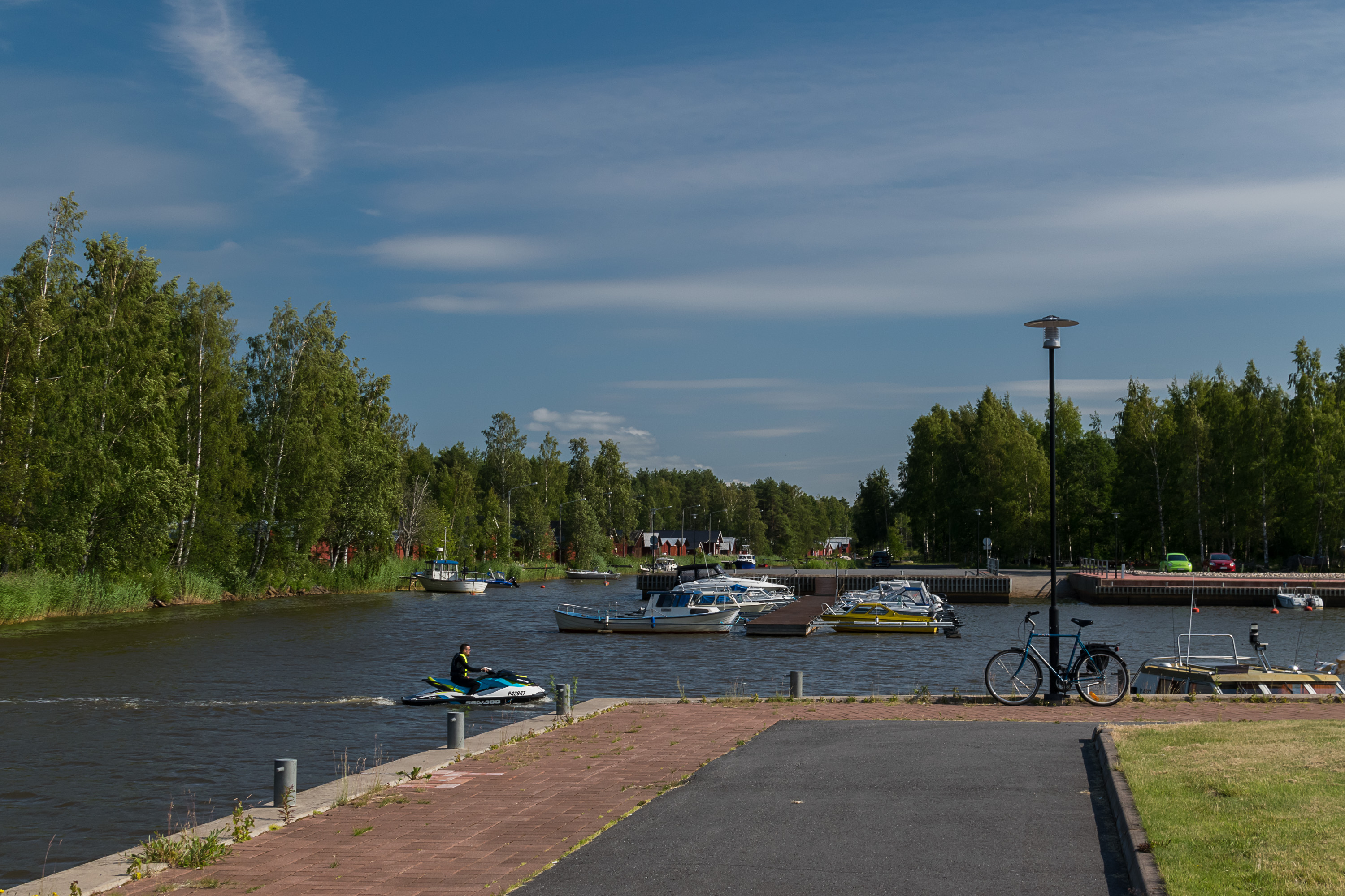
55. Kokkola Passenger Harbor. This is the place where the main harbor used to be before being moved to Ykspihlaja. The only regular traffic here is boats to islands of Tankar and Köpmanholmen in summer season. Behind the building is a beach.
56. Sea Park (Meripuisto). There is a camping close by.
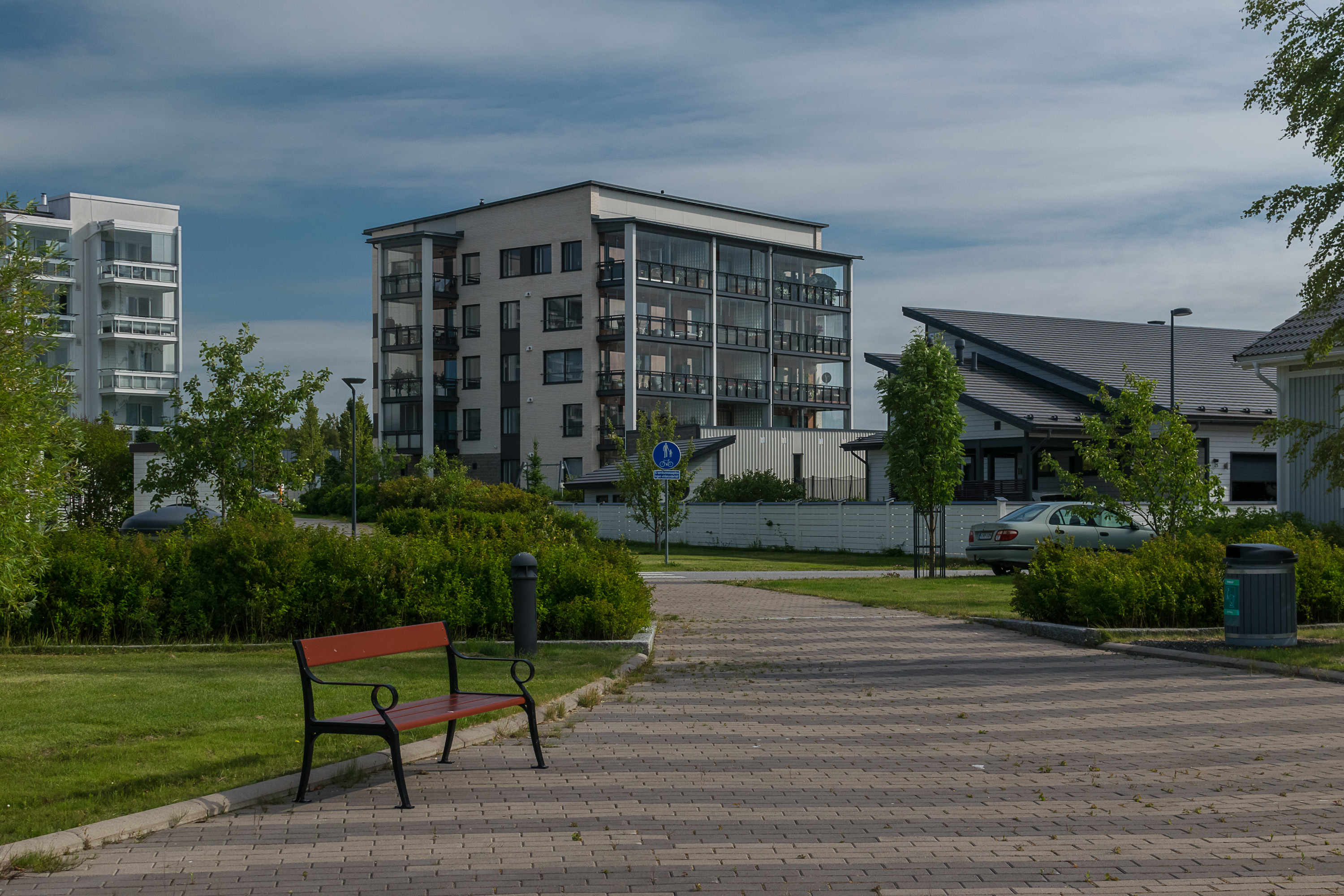
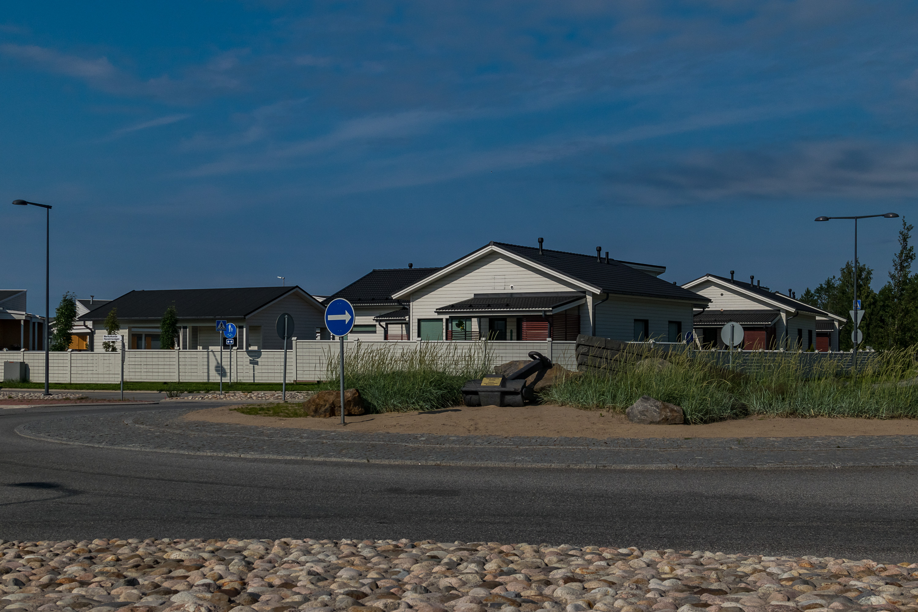
57. There are some houses right on the sea coast, mostly detached houses east of the harbor and Sunti mouth, in Halkokari area. A monument to the Halkokari skirmish can be found there, but apparently I never checked it out. This is Meritulli (Finn. Sea Toll), a new residential area built at the coast for the Housing Fair (Asuntomessut) of 2011. Housing fairs, taking place around August yearly, are fairly popular in Finland. For these fairs a small residential area in some city is built from scratch, typically with mostly detached houses and just a smattering of rowhouses and/or apartment buildings. Houses are built to individual projects, either by individuals or by companies which sell the house afterwards. During the fair visitors are allowed to come and explore the houses, which are fully furnished. Of course especially detached houses tend to be on the large and luxurious side. I visited one such housing fair in Pori in 2018.
58. A roundabout at Meritulli.
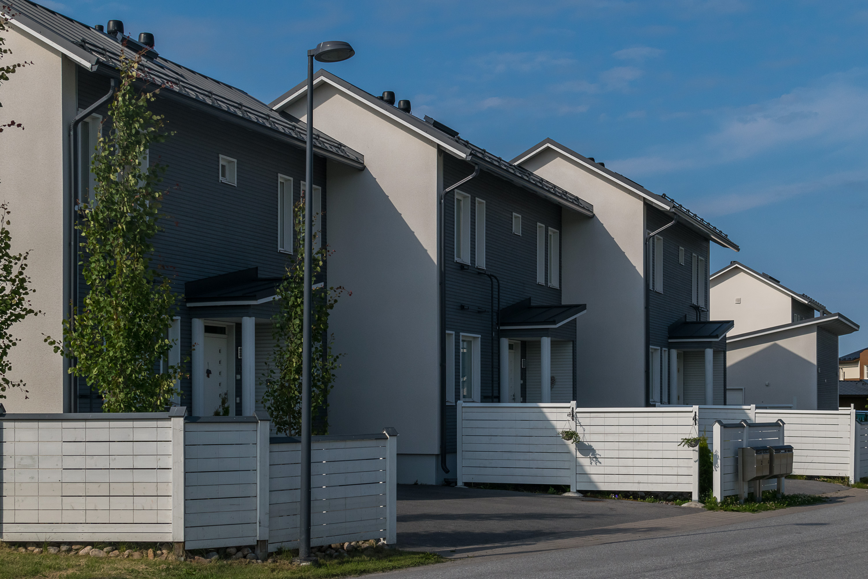
59. Rowhouses.
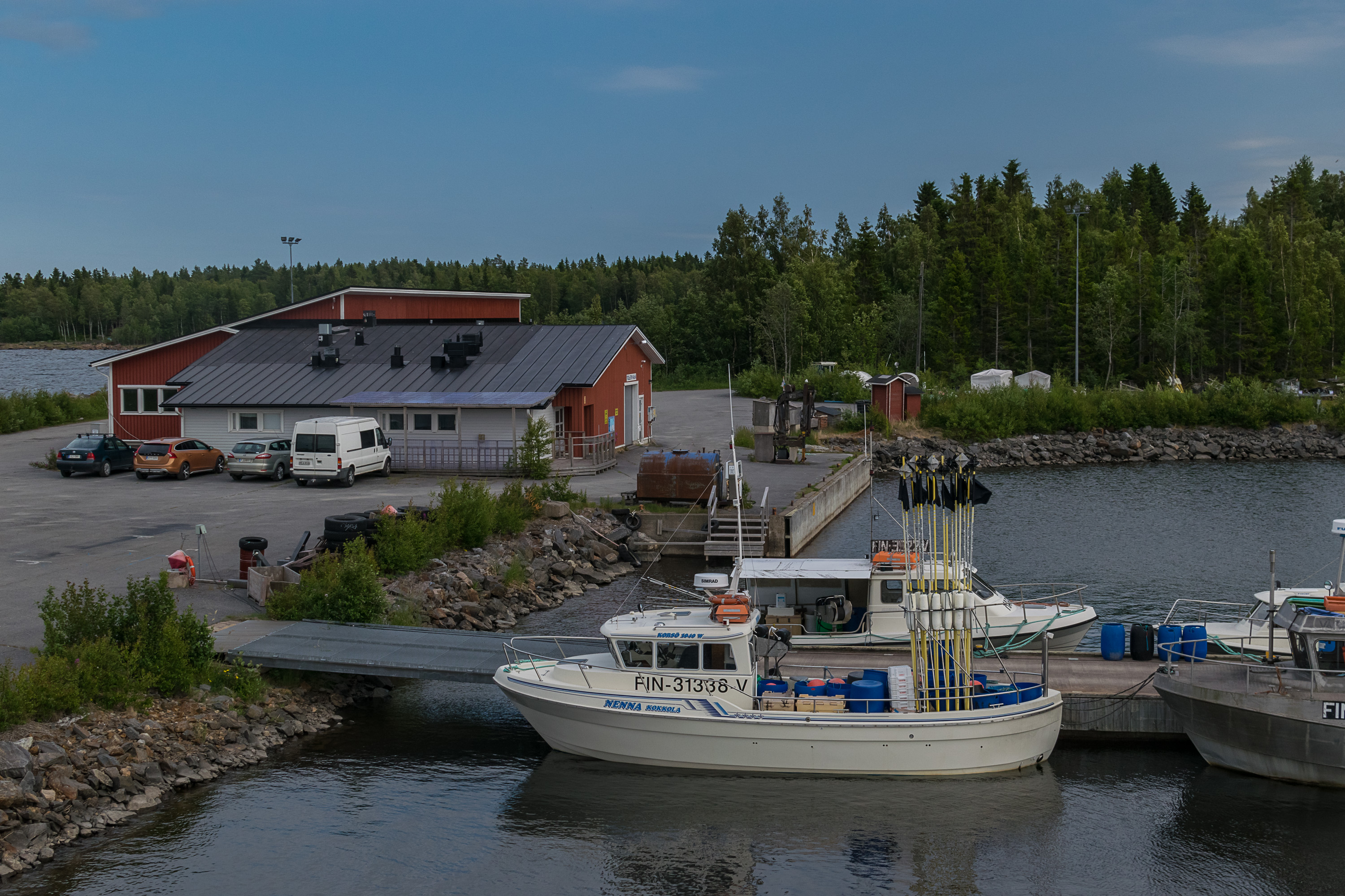
60. Fishing harbor at Trullevi peninsula near the city. There won't be any magnificent coast and sea views in this post, because we'll explore the coast in the following post, but I can already tell you the Bay of Bothnia is one of my favorite parts of the Baltic for a reason :)