Salamajärvi means "Lightning Lake" in Finnish, and you've got to admit that's a really cool name. It refers to one of the 40 Finnish national parks, located at the border of Central Finland and Central Ostrobothnia regions. Salamajärvi lies in Suomenselkä (Finn. Finnish Ridge), the watershed of the Gulf of Finland and the Gulf of Bothnia, a forested, hilly, boggy, sparsely populated area, which is noticeably different in its vegetation and climate than the surroundings (Finnish Wikipedia page claims that it's sometimes referred to as the "finger of Lapland"). The national park is relatively far from any major cities (Jyväskylä and Seinäjoki would probably be the closest ones), and it's almost exactly 200 km by road from me. I visited it twice so far, in May 2018 and January 2019, and here I'll be showing the late spring and the winter pictures interspersed.
Salamajärvi is particularly known as one of the location where the Finnish forest reindeers live. Those animals, known as metsäpeura in Finnish, are a distinct subspecies of the regular reindeer; they are somewhat bigger, darker in color, prefer forests to tundra and fells, and are wild animals. All the regular reindeers which are so common in Lapland are domesticated; in Nordic countries some wild tundra reindeers survive only in the mountains of West Norway. Russia and Canada have much bigger wilderness areas, and thus there vast herds of wild tundra reindeers still exist. Wild tundra reindeers were hunted to extinction in Finland, and the metsäpeuroja nearly were as well. A tiny population still survived in Kainuu region (and in the adjacent Viena Karelia in Russia), and over the last decades they've been reintroduced in some areas of West Finland, particularly Suomenselkä and particularly Salamajärvi. It's been quite successful and apparently they're thriving there, but the absolute numbers remain not that high, and these reindeers are rather shy unlike the domesticated Lapland ones, which generally just don't give a shit. So I've never seen one so far. But anyone a metsäpeura is on the national park logo, seen above. You can also try looking for some on a live video feed from WWF though! They don't show up there all that often either, but sometimes they do. That feed is not from Salamajärvi though, but rather from Lauhanvuori area, in another national park.
There are quite a few day hike options and shelters available in Salamajärvi. There is also a multi-day hiking trail passing through it, which appropriately enough is named Peuran polku, "Deer Trail". The trail proper (one-way) is 77 km long, and its circular variant (Hirvaan kierros, "Reindeer stag ring") is 58 km long. It allows you to see more of the same Suomenselkä terrain. I haven't tried that one yet, of course.
You can read more about Salamajärvi at the official nationalparks.fi website.
And so let us just look at the beautiful Finnish woods and mires. There will be a lot of pictures in this post.

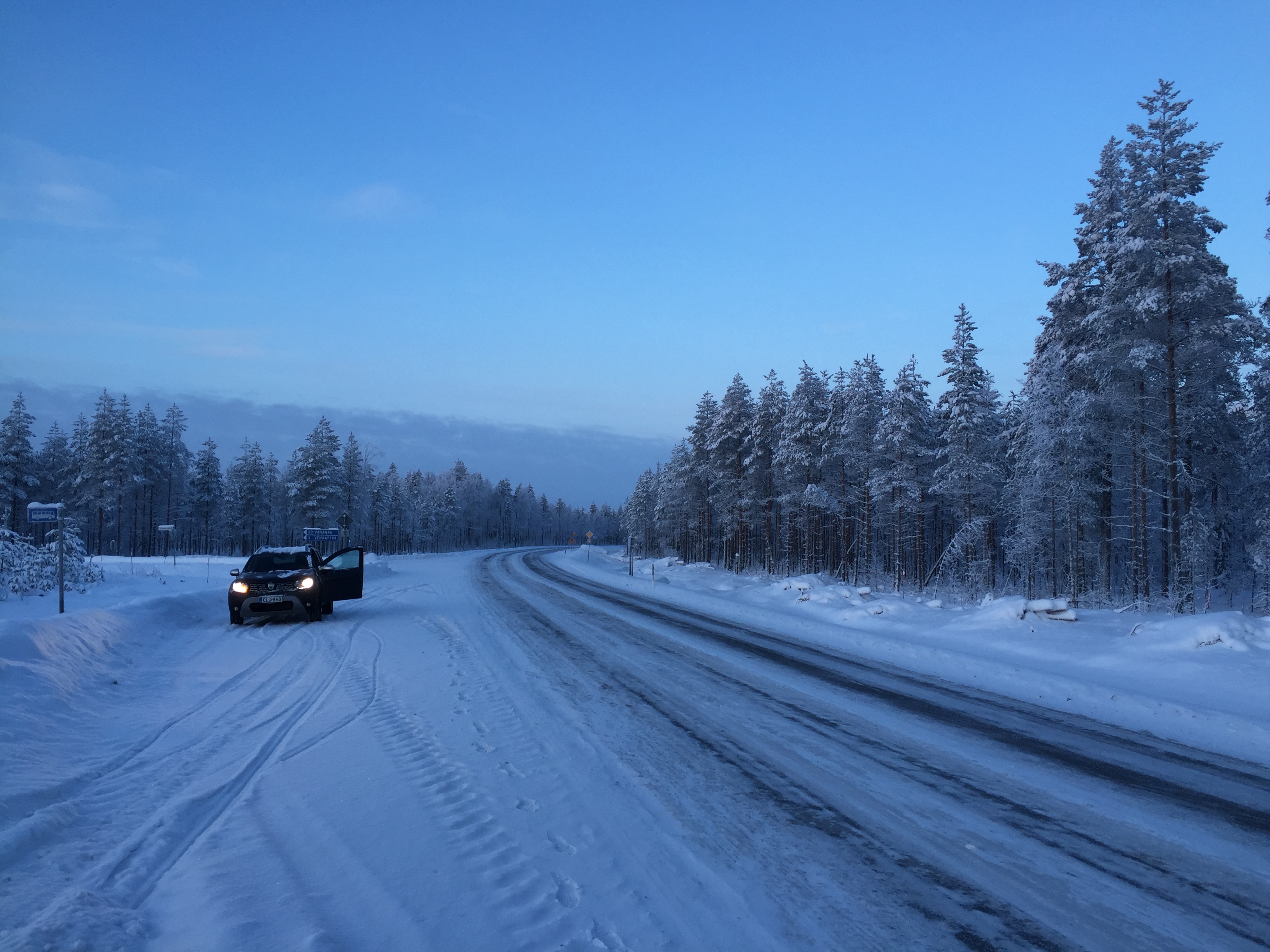
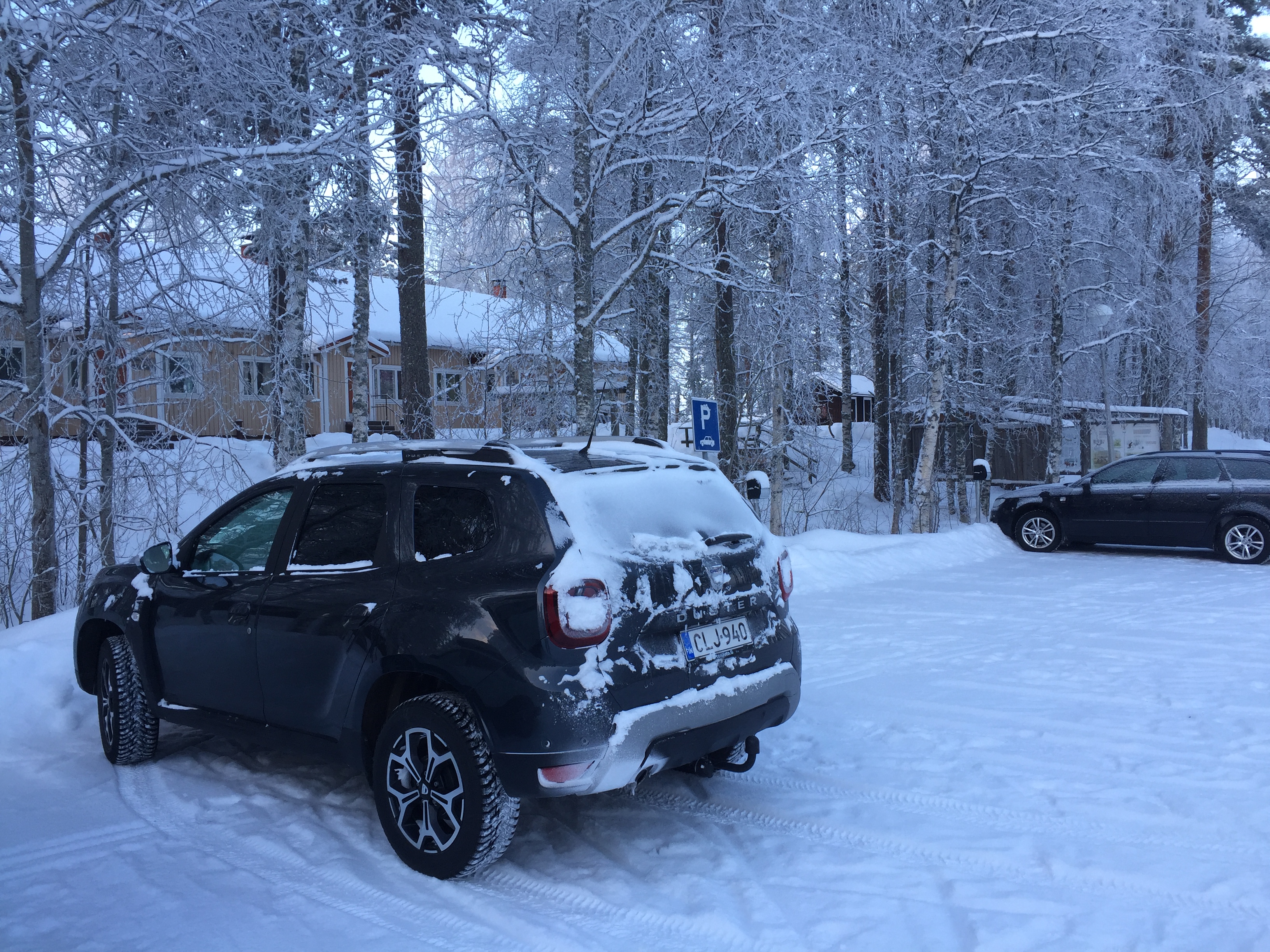
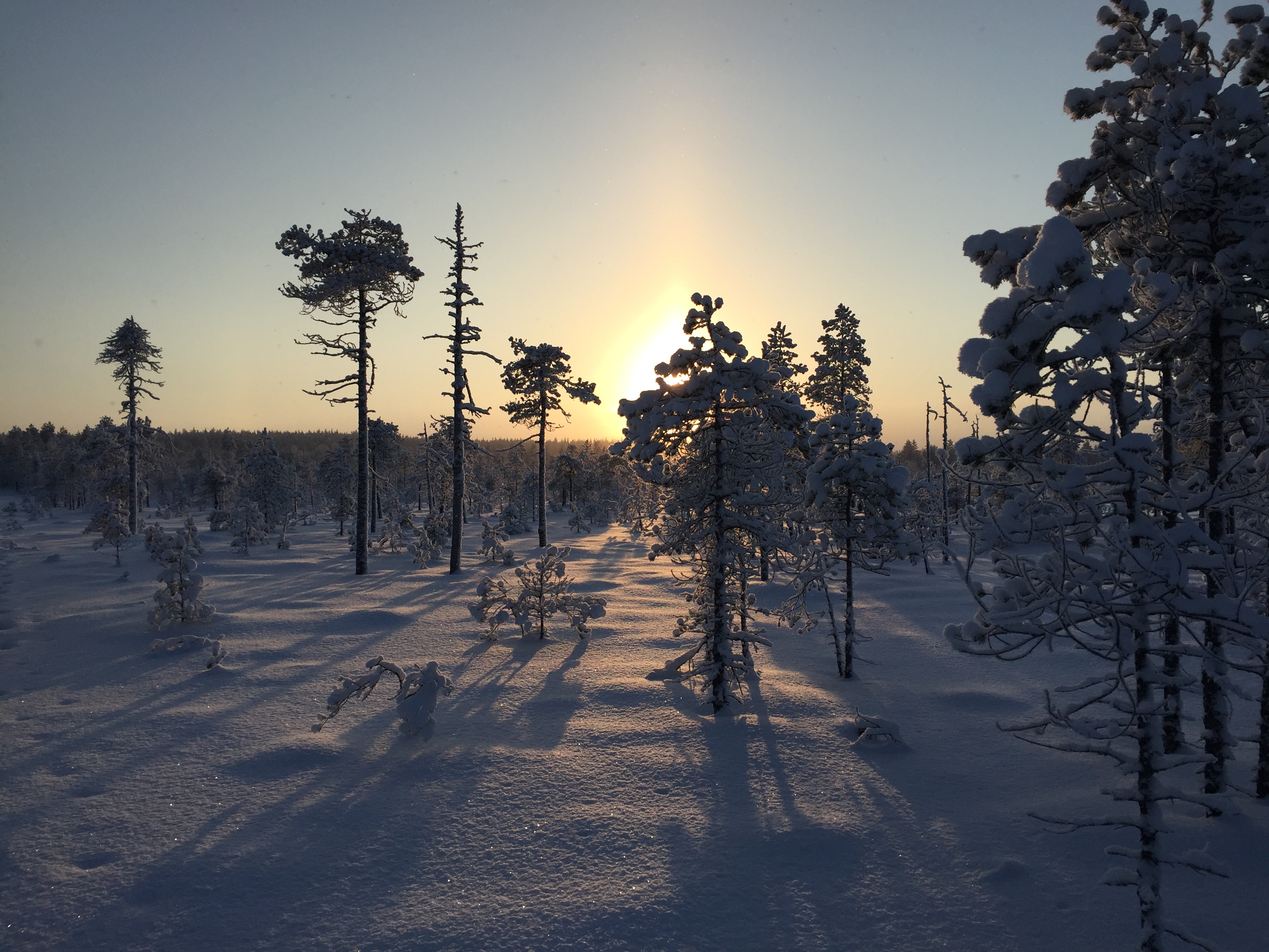
1. Driving to Salamajärvi in winter. It was a crispy cold sunny day, and while it was -9º in Vaasa where I live on the sea coast, by the time I got to Salamajärvi 200 km inland my car was showing it was -18º outside.
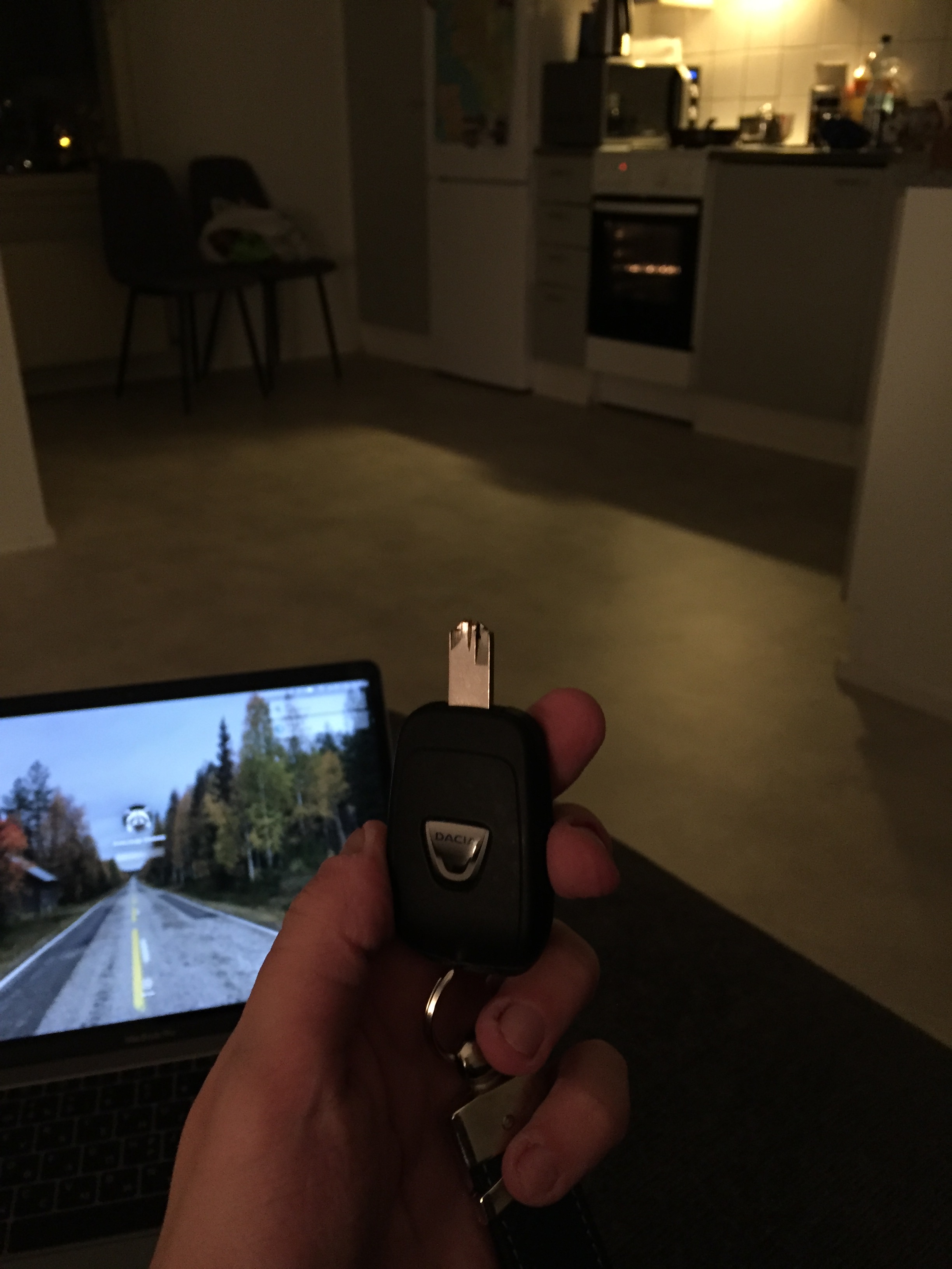
2. The car didn't like that weather, or rather, the car was fine, but my car keys didn't. The gas tank cap on my car has to be unlocked with the car key, and it tends to freeze and get stuck a bit in winter. Well, this time it froze worse than usual, and I didn't realize that until my key just snapped. (I'm not a smart person.) It was at a gas station where I stopped to refuel before my trip. Very luckily I had the spare key right there with me (I carry it around in my small day hike backpack, on the reasoning that I can in theory lose the main one somewhere in the mountains or something like that). It would have got more interesting if I didn't have the spare key with me, and it would have got a lot more interesting if that also happened not in Vaasa but at a random gas station in the middle of nowhere. In the end I was able to thaw up the cap with hot coffee from my thermos. I'm not sure if that was a good idea, and anyway it of course froze afterwards even worse, but eventually a few days later I thawed it again in the undeground parking at the city square, and bought some lock-thawing liquid for the future occasions. Well, the important thing is that I was able to continue.
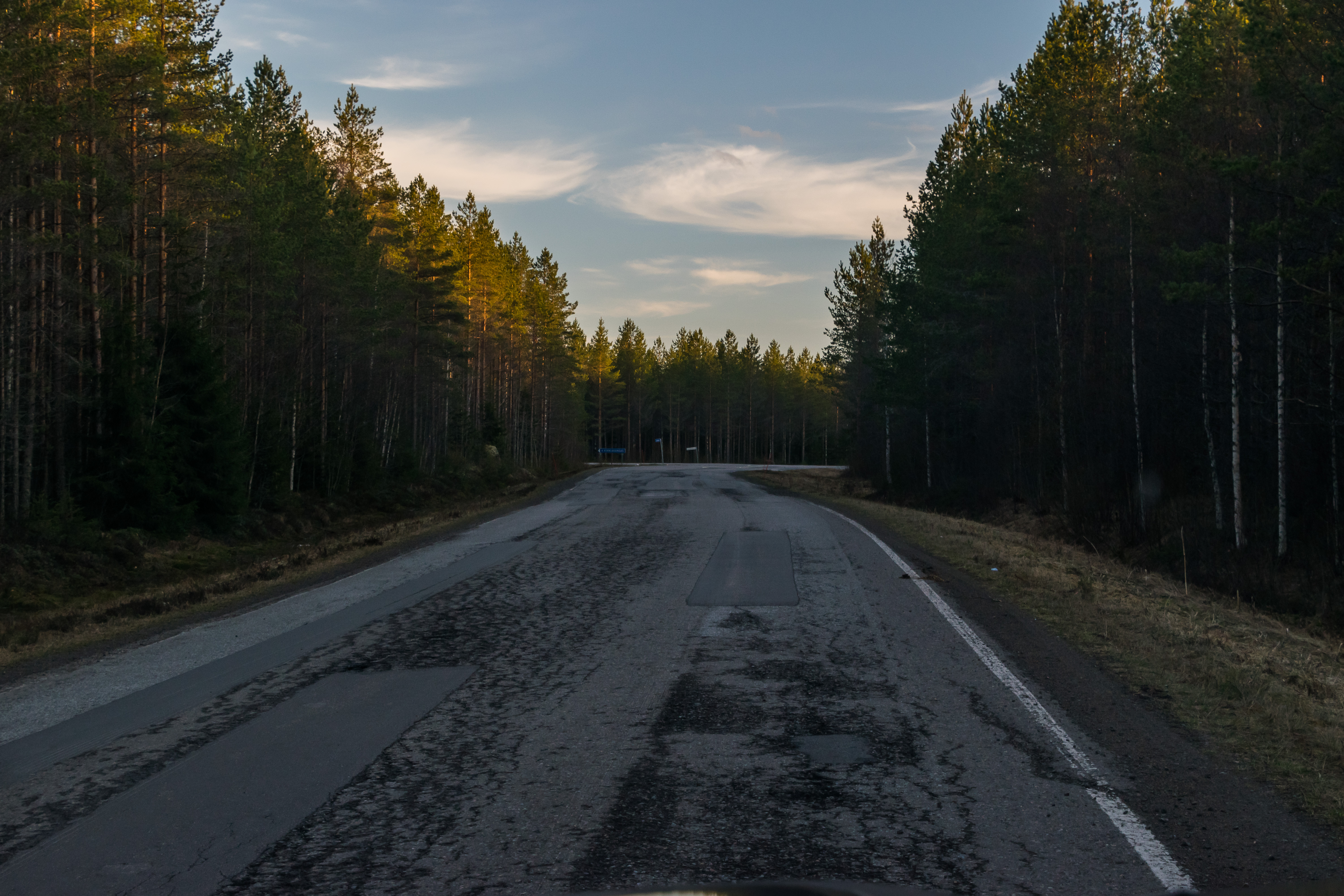
3. Finnish National Road 16, somewhere between Alajärvi and Kyyjärvi towns.
4. From the bigger national roads you turn off onto this smaller one in Möttönen village. As you can see it is in a rather poor condition by Finnish standards, although still perfectly driveable at the regular speed limit of course. 10 km by this road and the last 10 km by forest gravel roads.
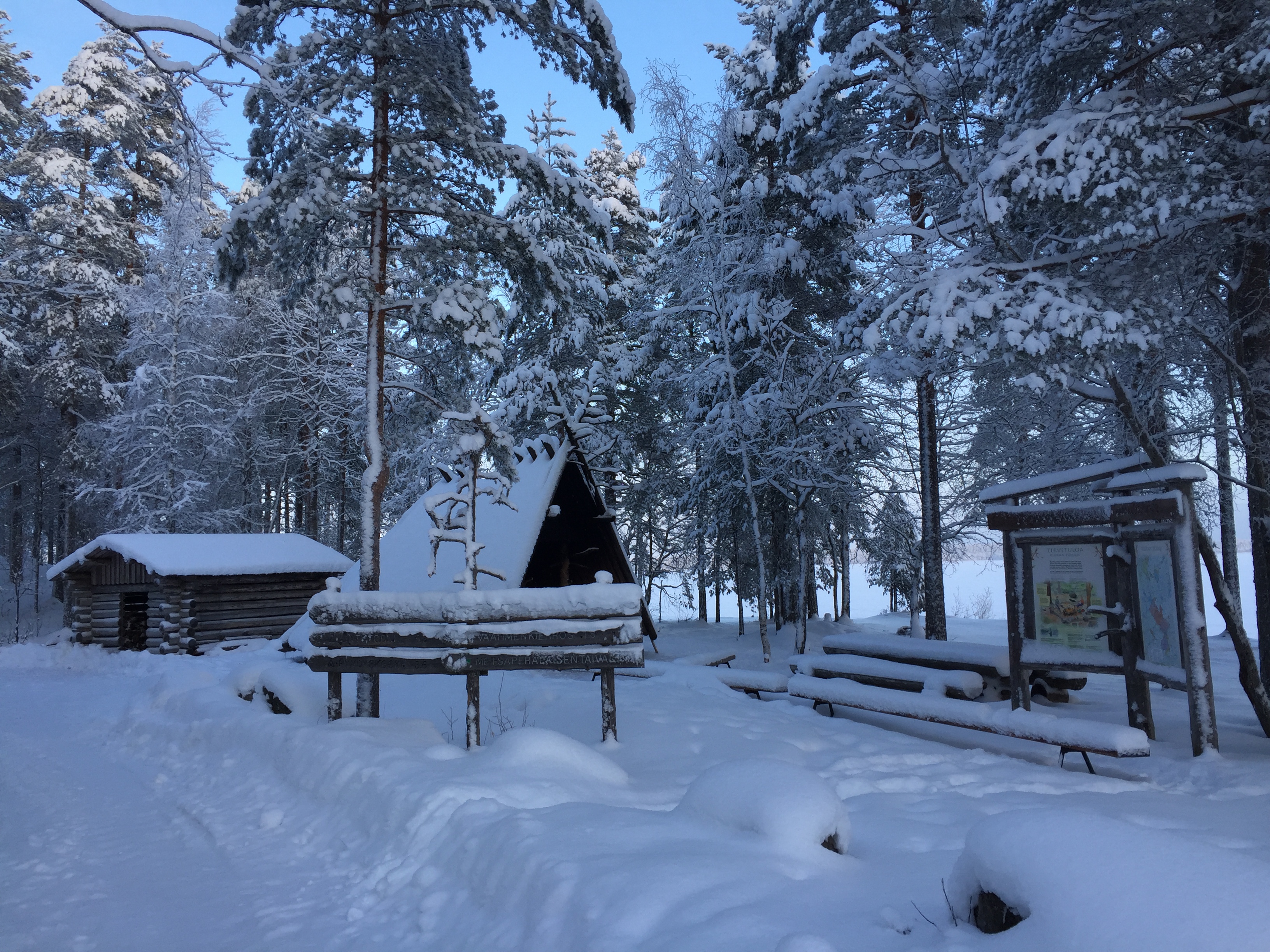
5. And here it is, the national park at last.
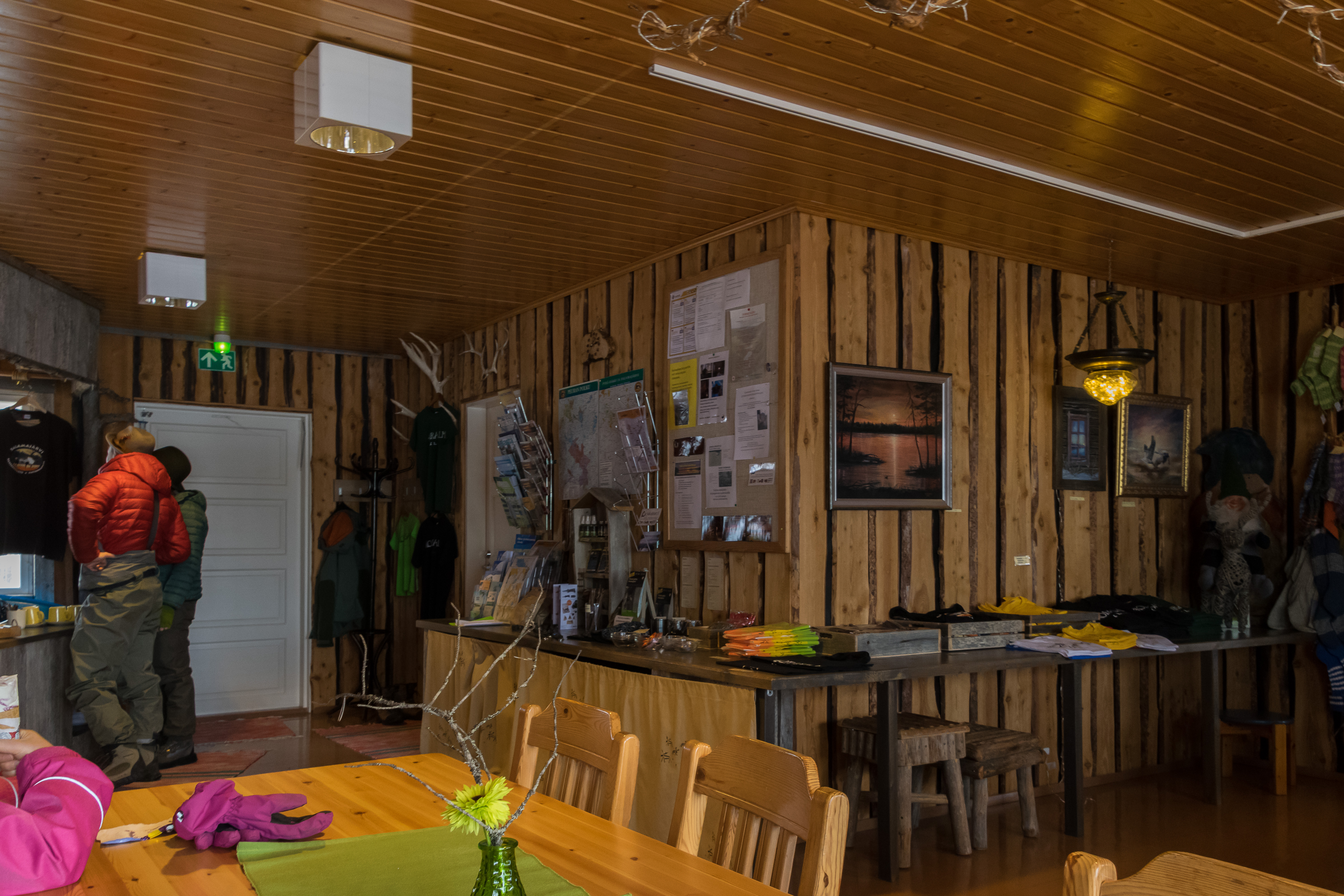
6. The building visible in the previous picture is the Koirasalmi luontotupa (nature hut). It is closed in winter. I had visited it in May though. It resembled a visitor center in some of the bigger national parks like Koli or Pallas-Yllästunturi, just a small one. It was possible to get maps and other supplies there, and I got some coffee also. On the January trip I had to do without coffee, with the luontotupa closed and my own supply mostly spent thawing the gas cap.
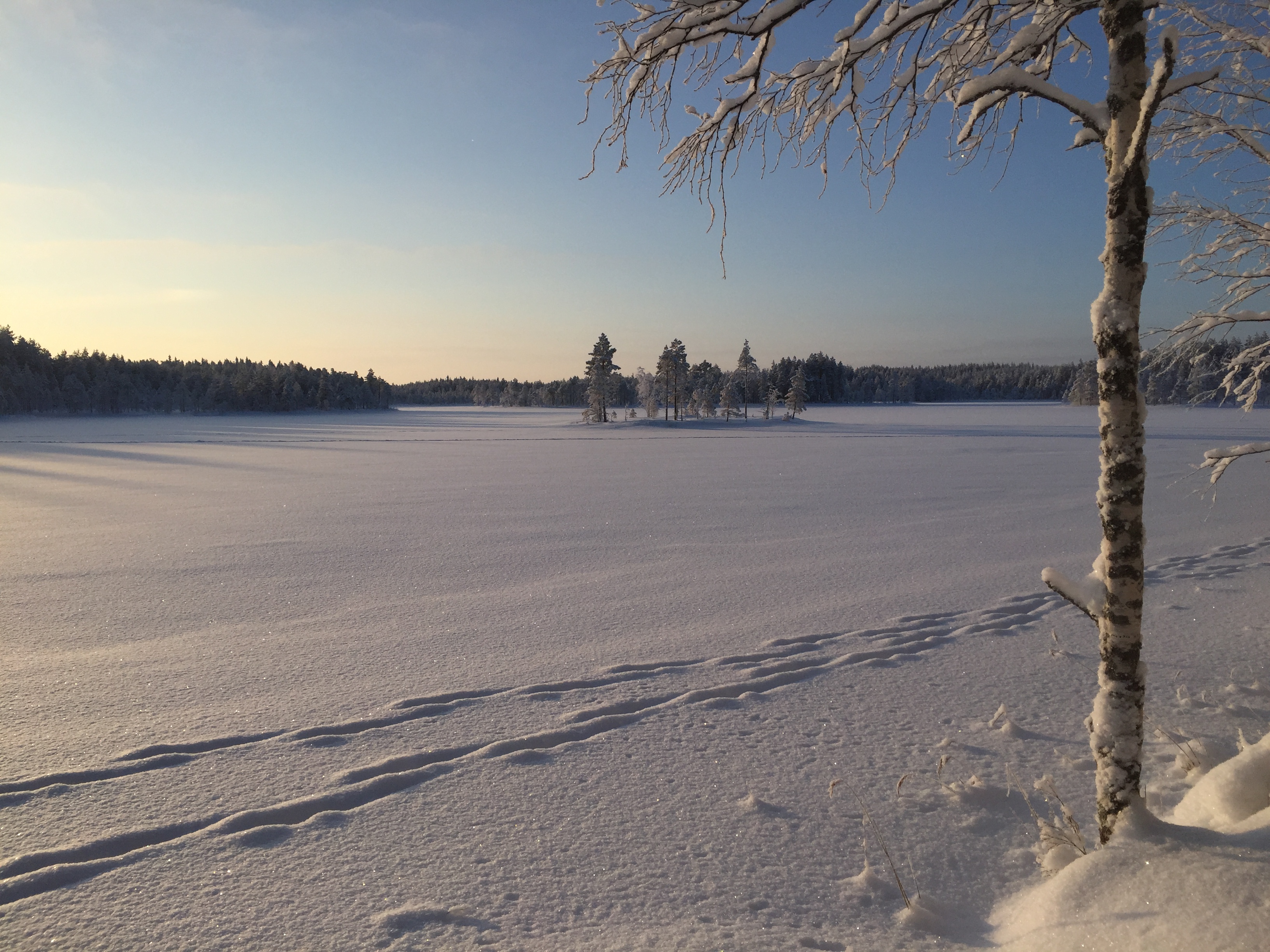
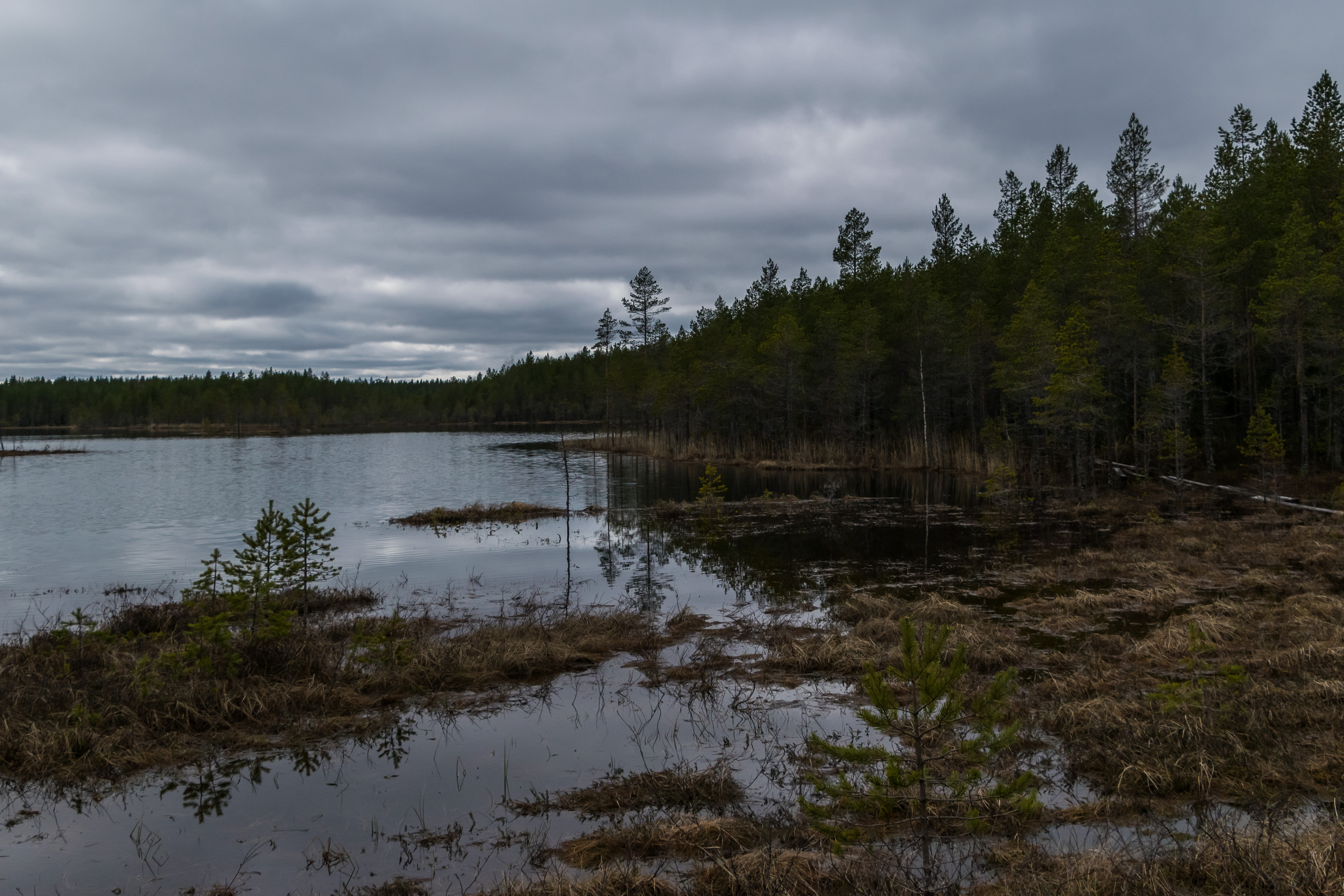
7. Koirasalmi, the name of the nature hut and this parking area, means "Dog Strait", and it is located by the beautiful Koirajärvi, the Dog Lake. Curiously the namesake Salamajärvi lake is actually in a more remote part of the national park, and I have never seen it yet. Perhaps they just thought that it was a cooler name than Koirajärvi.

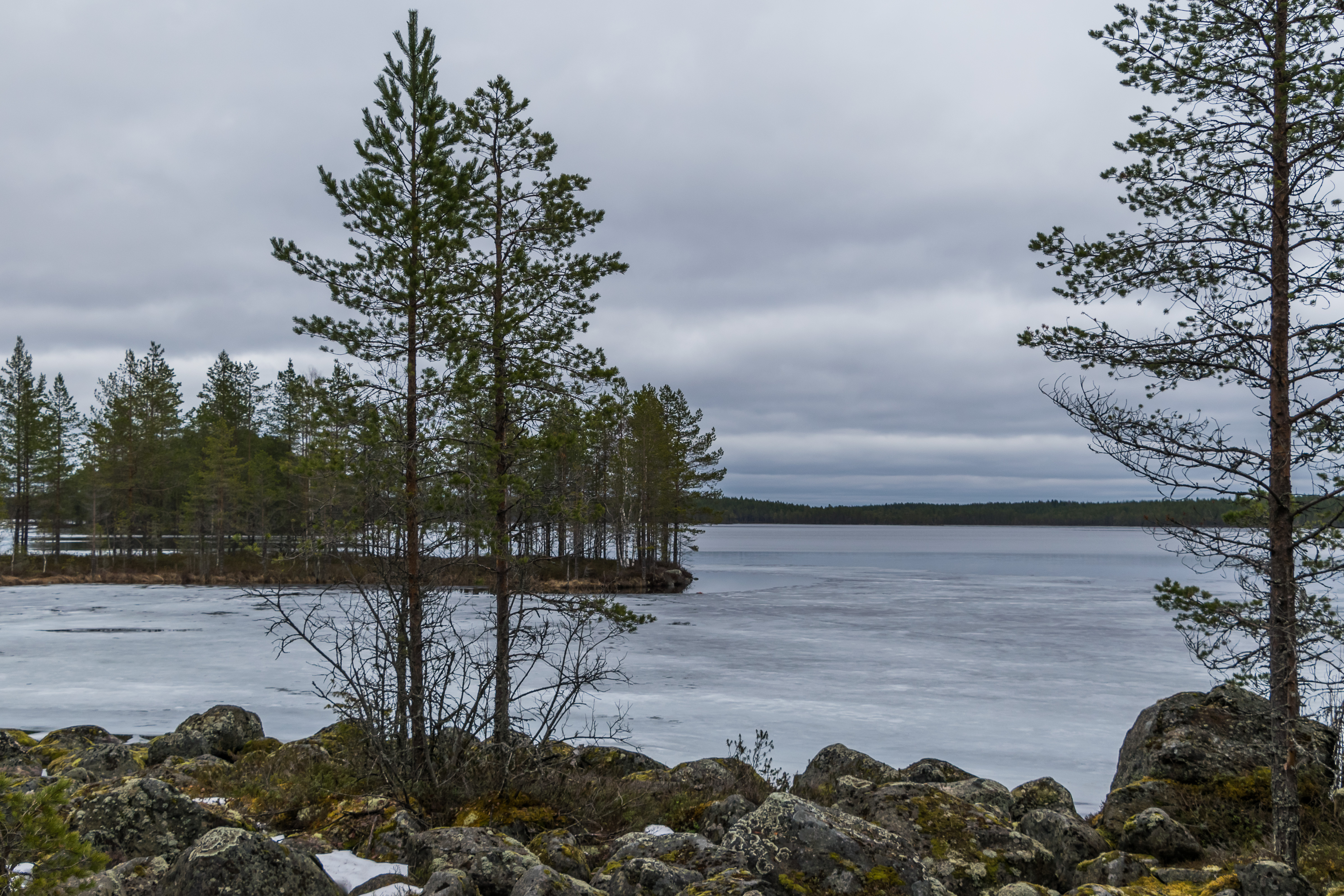
8. Koirajärvi in May, approximately the same view. It was pretty early in May, and lake ice hasn't finished thawing yet.

9.
10.
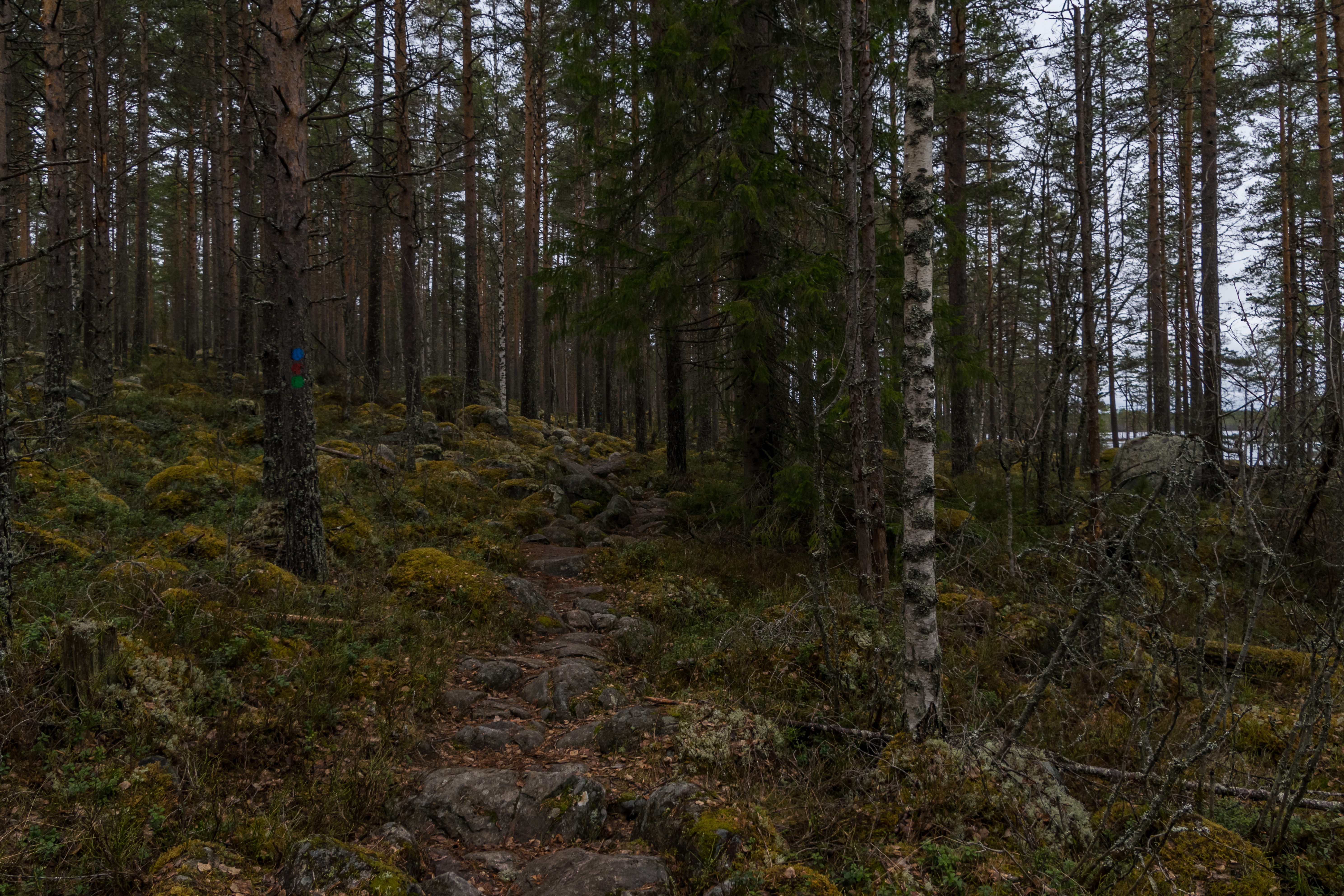
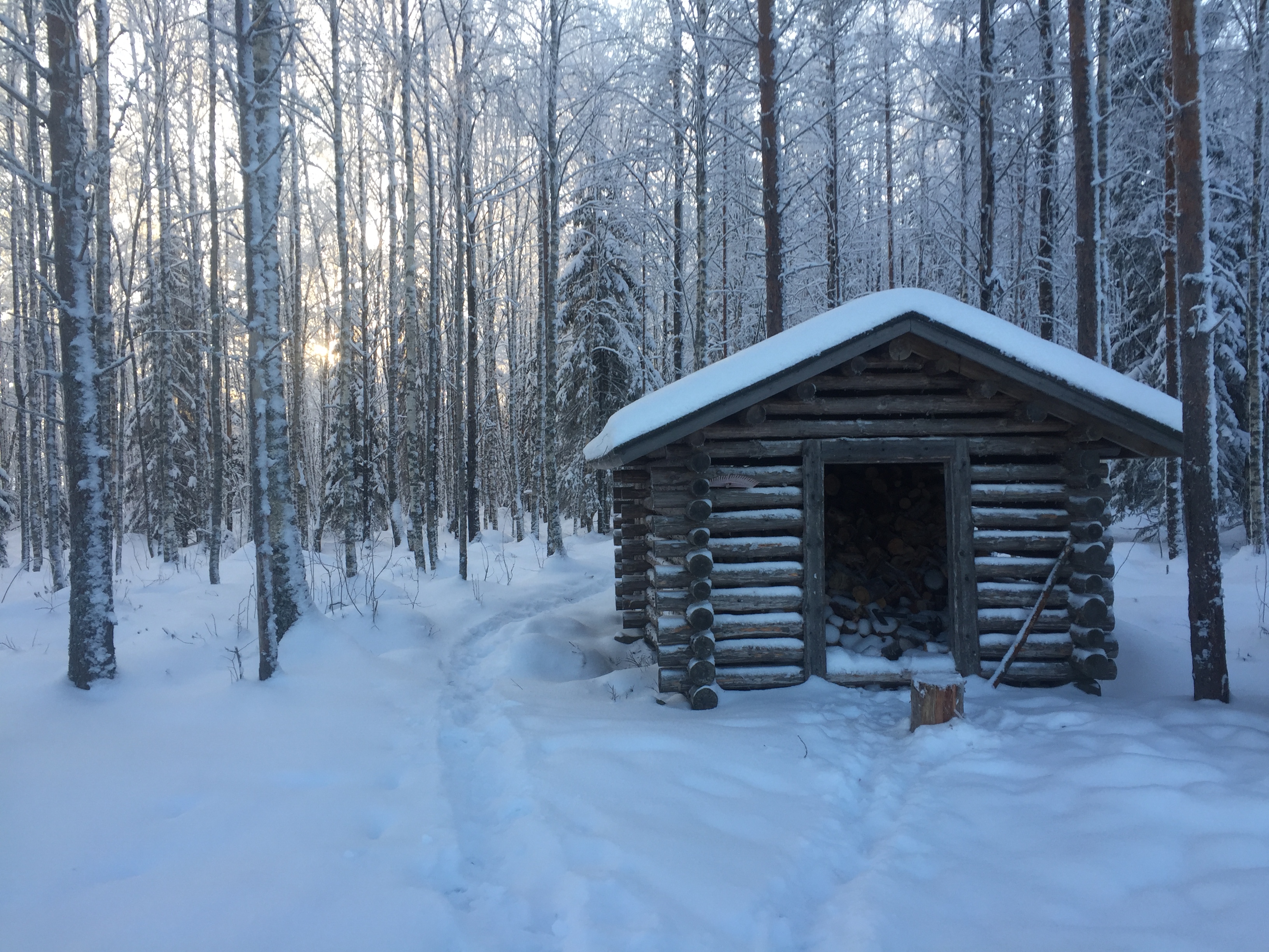
11. Laavu shelter at the beginning of the circular trails. In May I walked the biggest circular trail, Vaatimen kierros, which means "Reindeer Doe Circle", which is actually a pretty cool name; it is 18 km long. I intended to do the same in January; turned out, although there were some cars and other people in the vicinity of Koirasalmi, no one had actually tried to hike the trails in many days, and they were almost completely snowed in! The trail was still clearly visible, but I had to wade though 15-20 cm deep snow, which was much more exhausting than regular hiking. I cut it short to 12 km; luckily the trail network allows such an option. On the brighter side, I basically felt no cold at all due to physical exertion.
I encountered two women on snowshoes near the beginning of the trail. Snowshoes might have been more sensible for the trail (I also saw some parallel ski tracks from time to time, also covered by snow), and I had thought about getting them before, but, well, so far I haven't and probably won't this winter. Still probably should someday. They're not extremely expensive and I don't think you need any particular skills to use them, while I'm pretty poor at skiing. But the women weren't really walking the trail either, they got off it onto the lake ice in some 500 m and the rest of the trail was undisturbed.
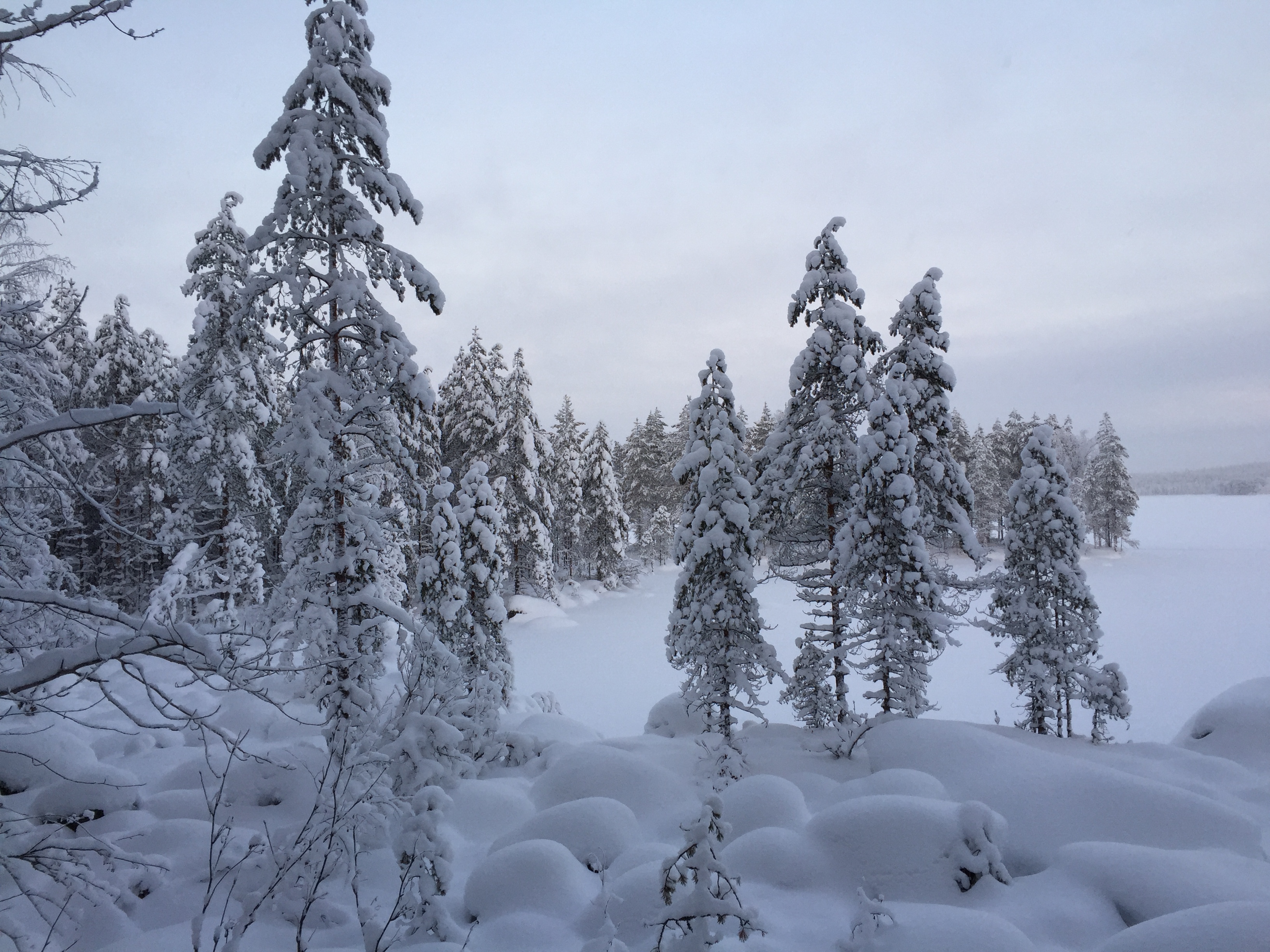
12. This is how it would normally look.

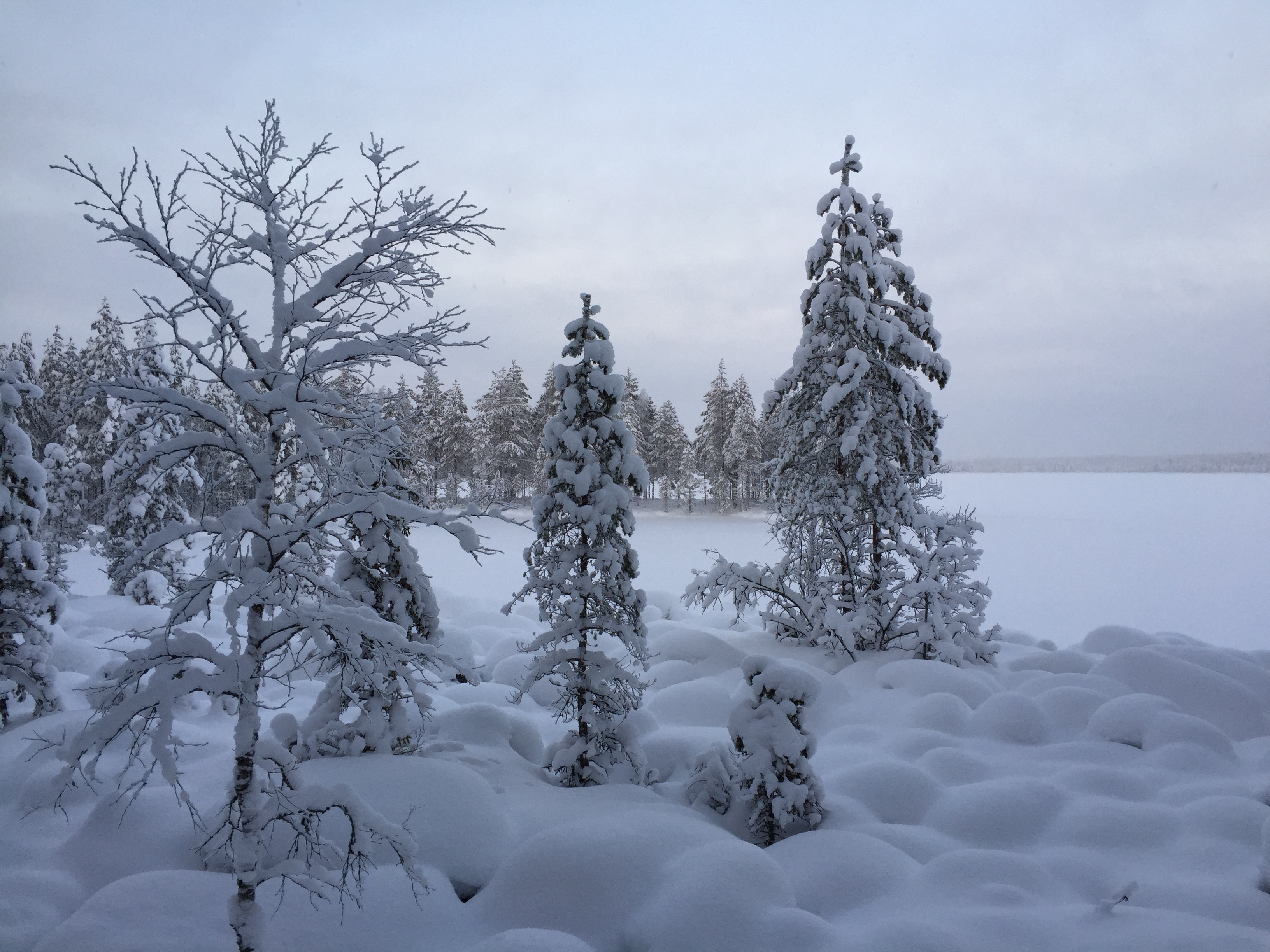
13. Along the Koirajärvi shore.
14.
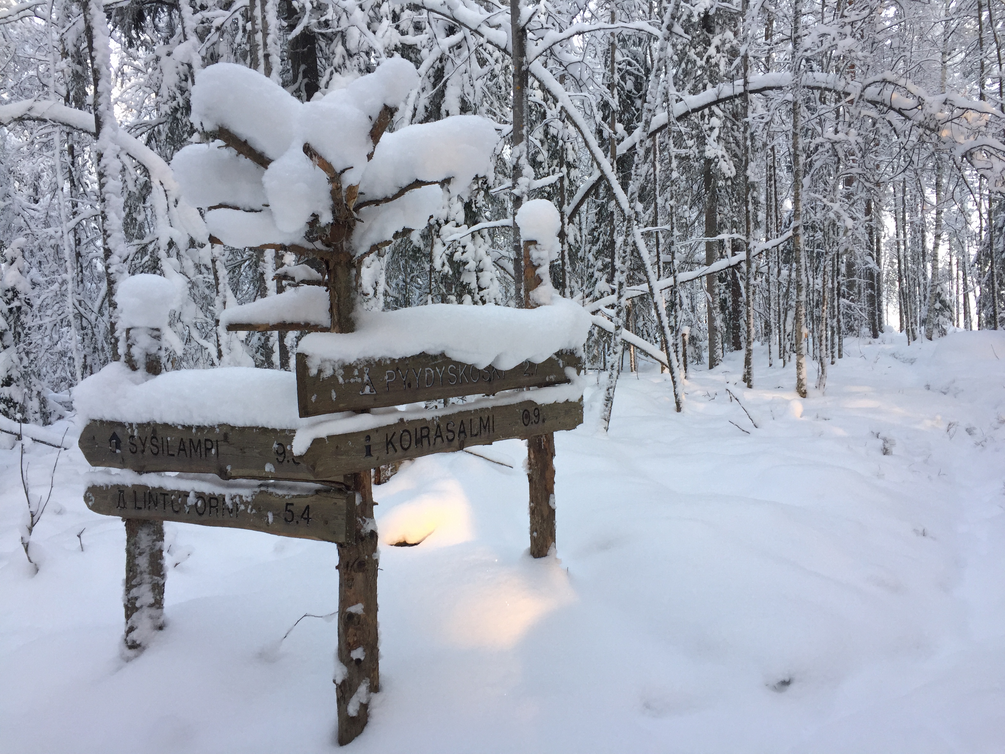
15. Going left here, although neither to Sysilampi nor to the lintutorni (birdwatching tower).
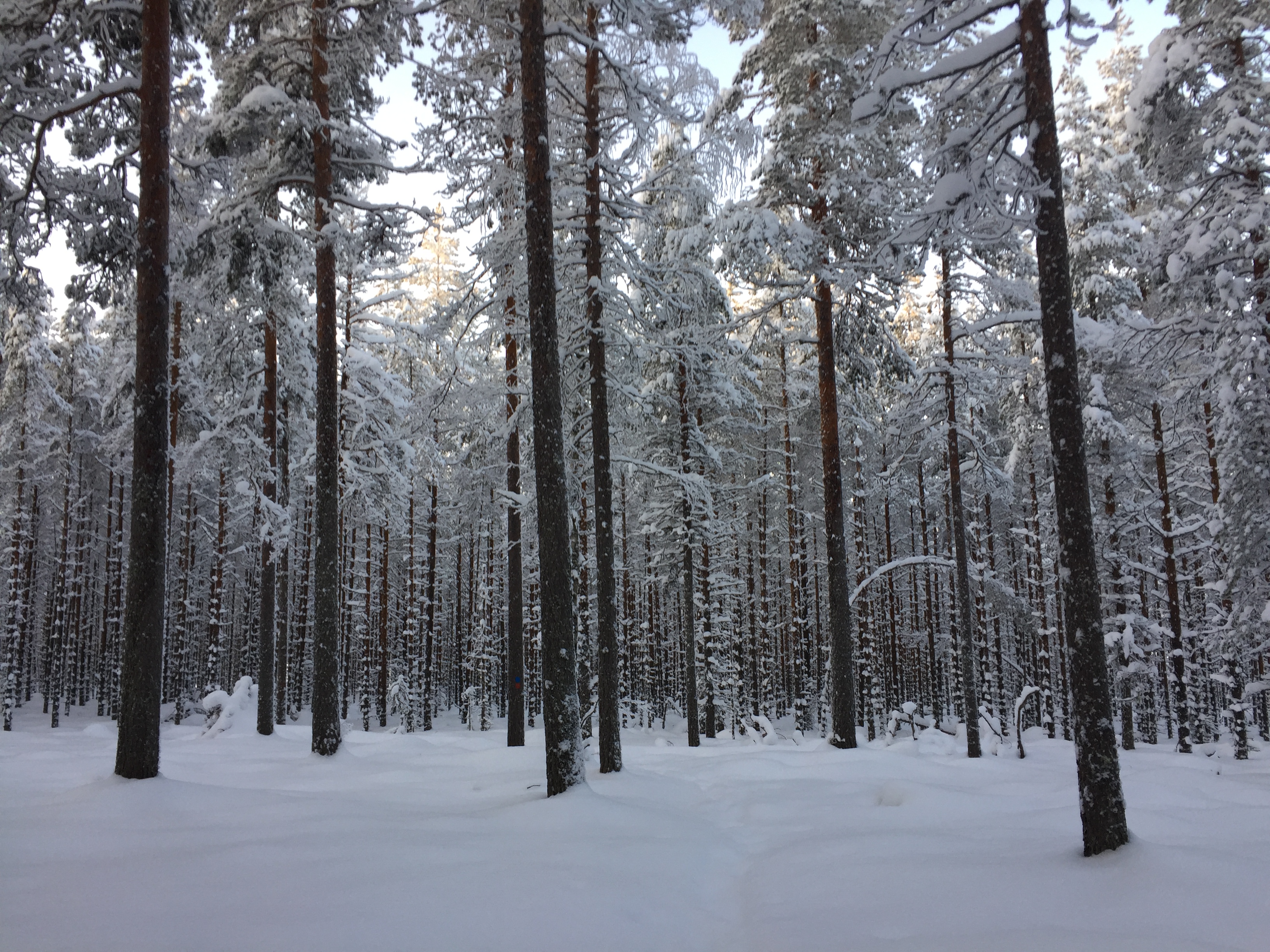
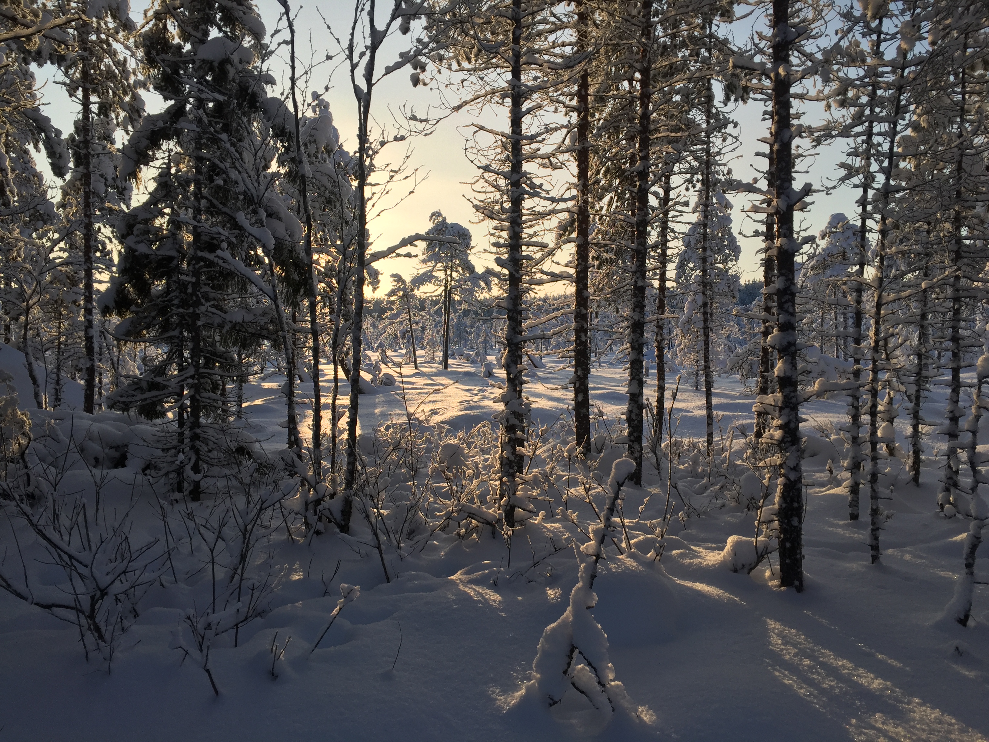
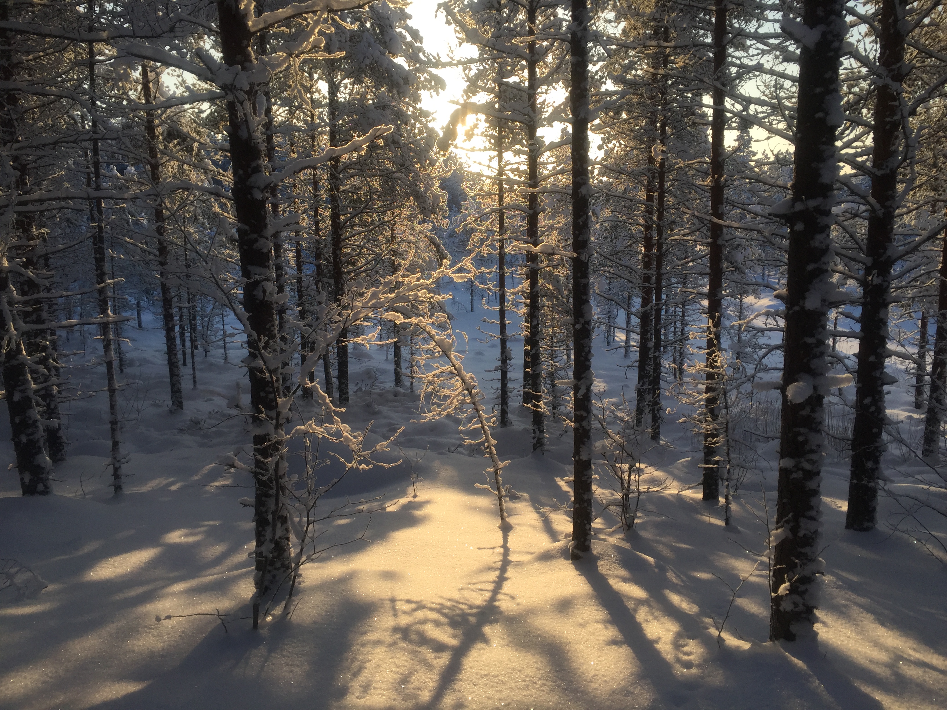
16. Winter woods.
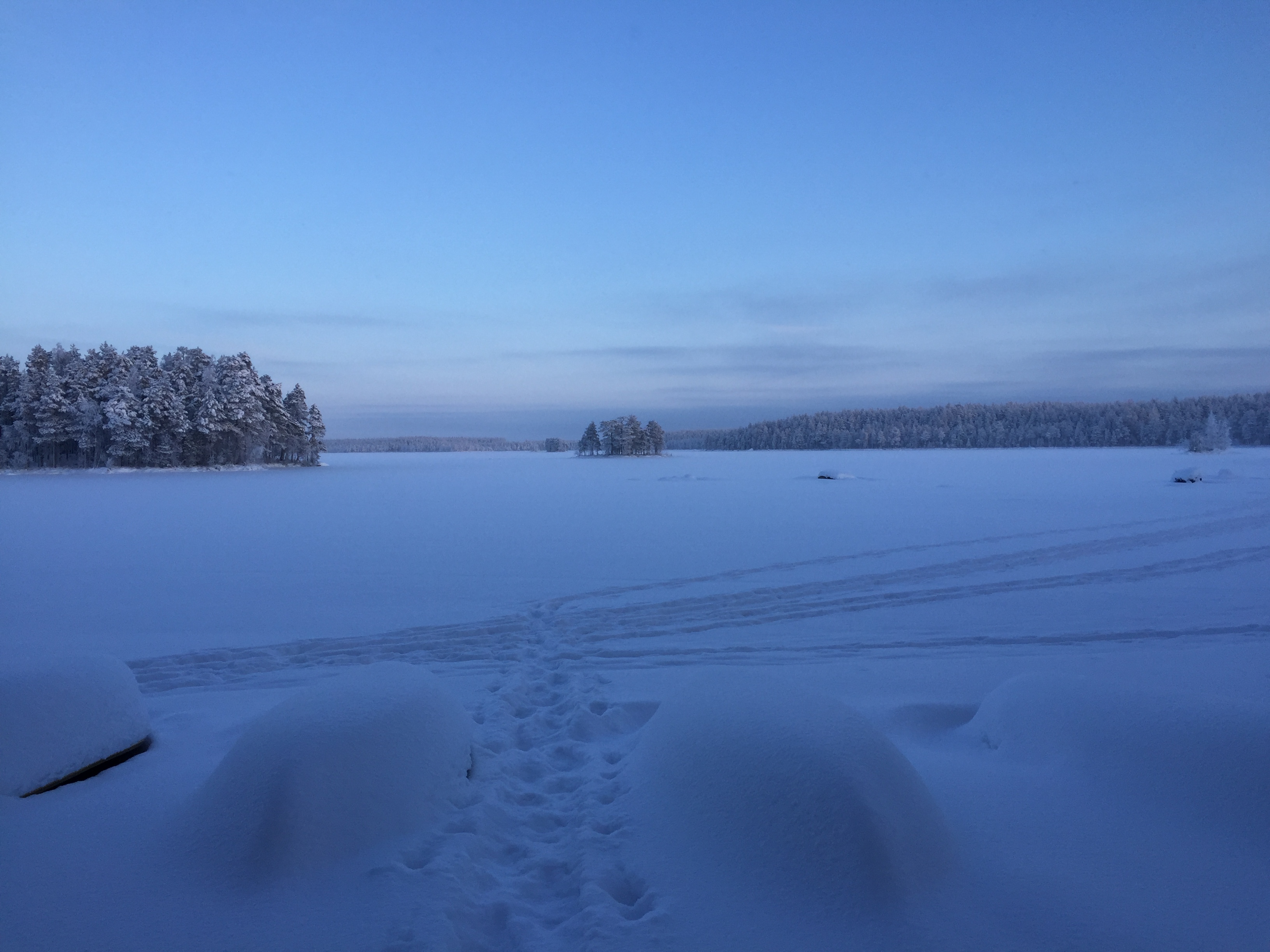
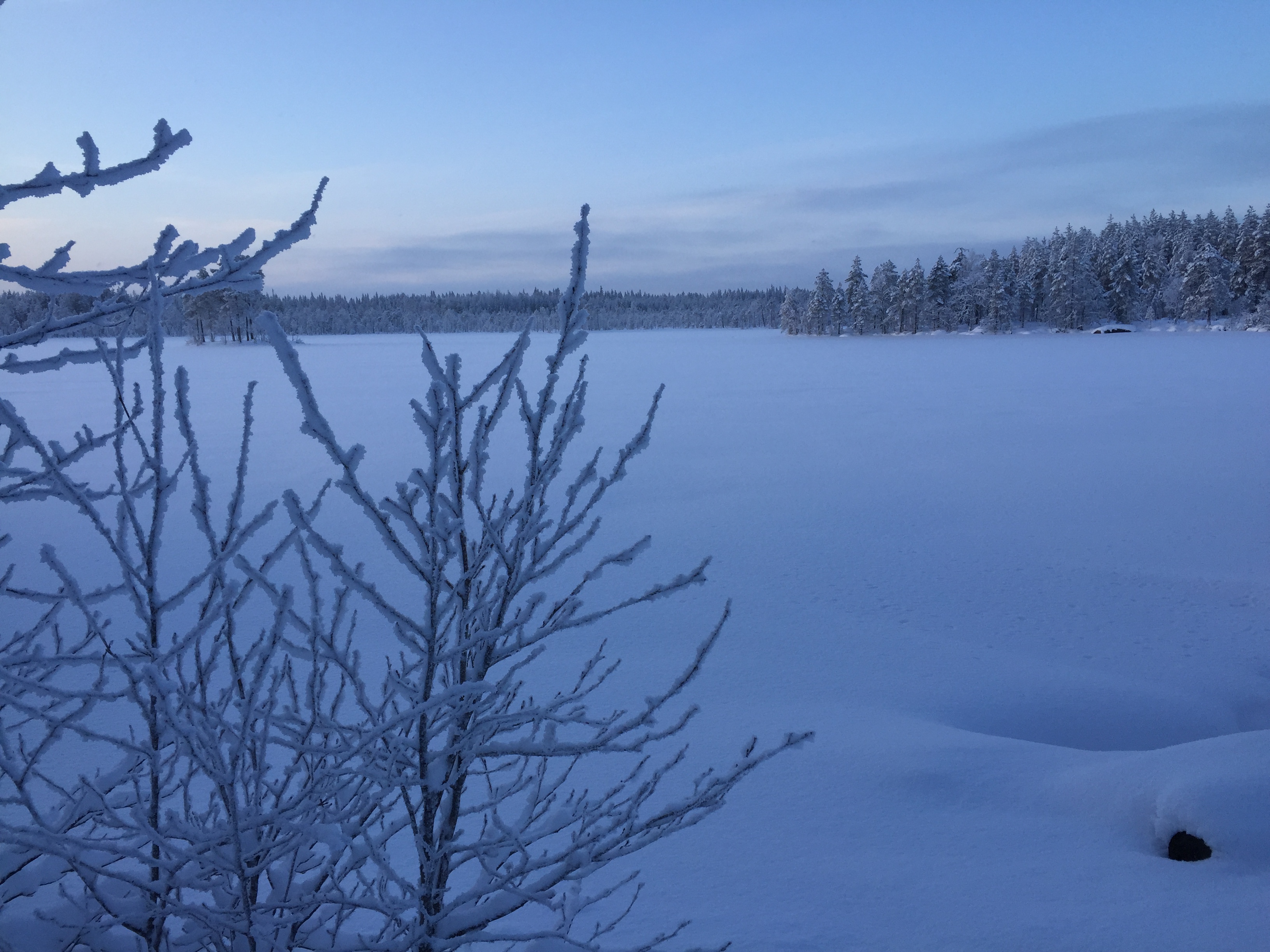
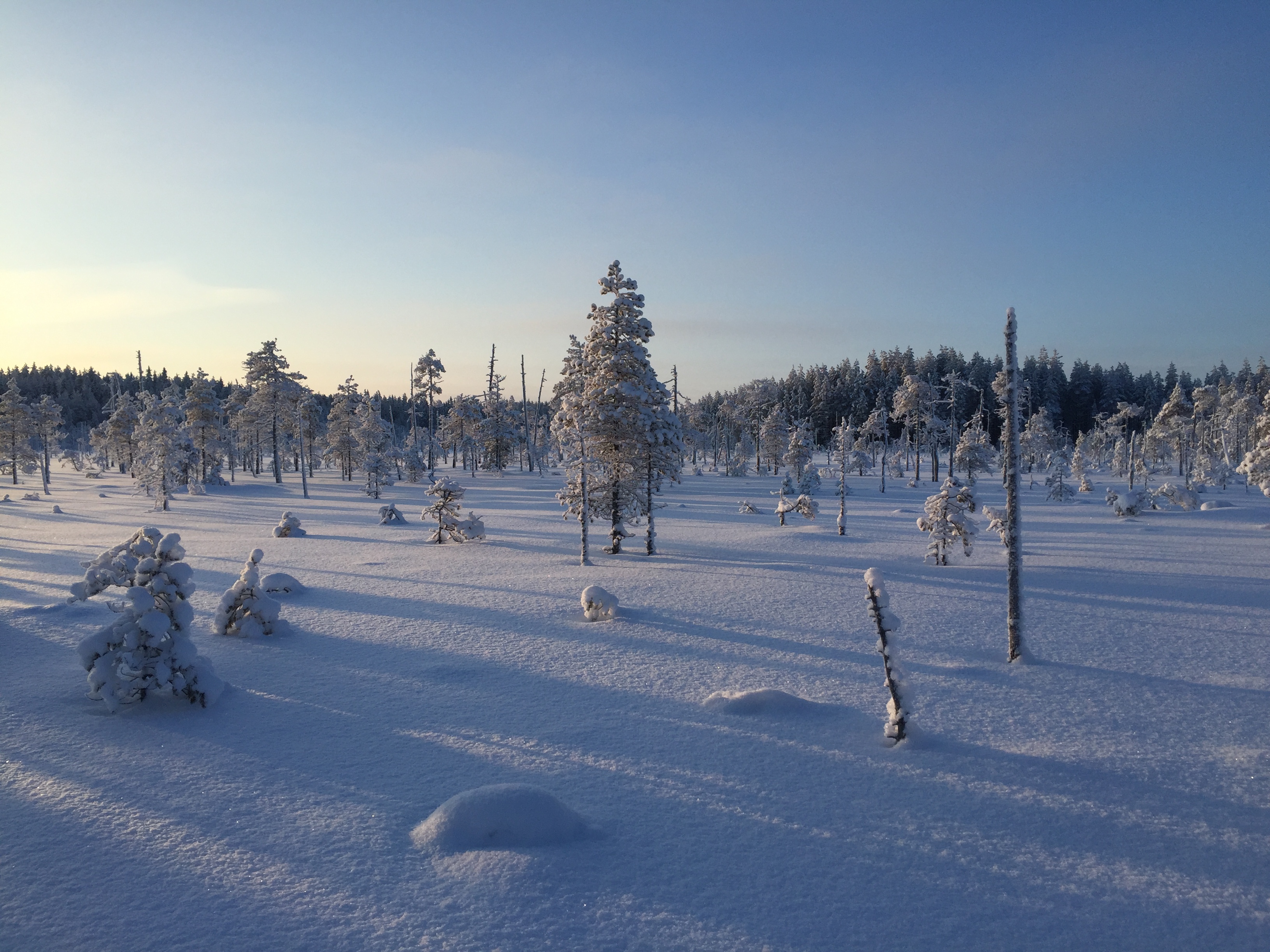
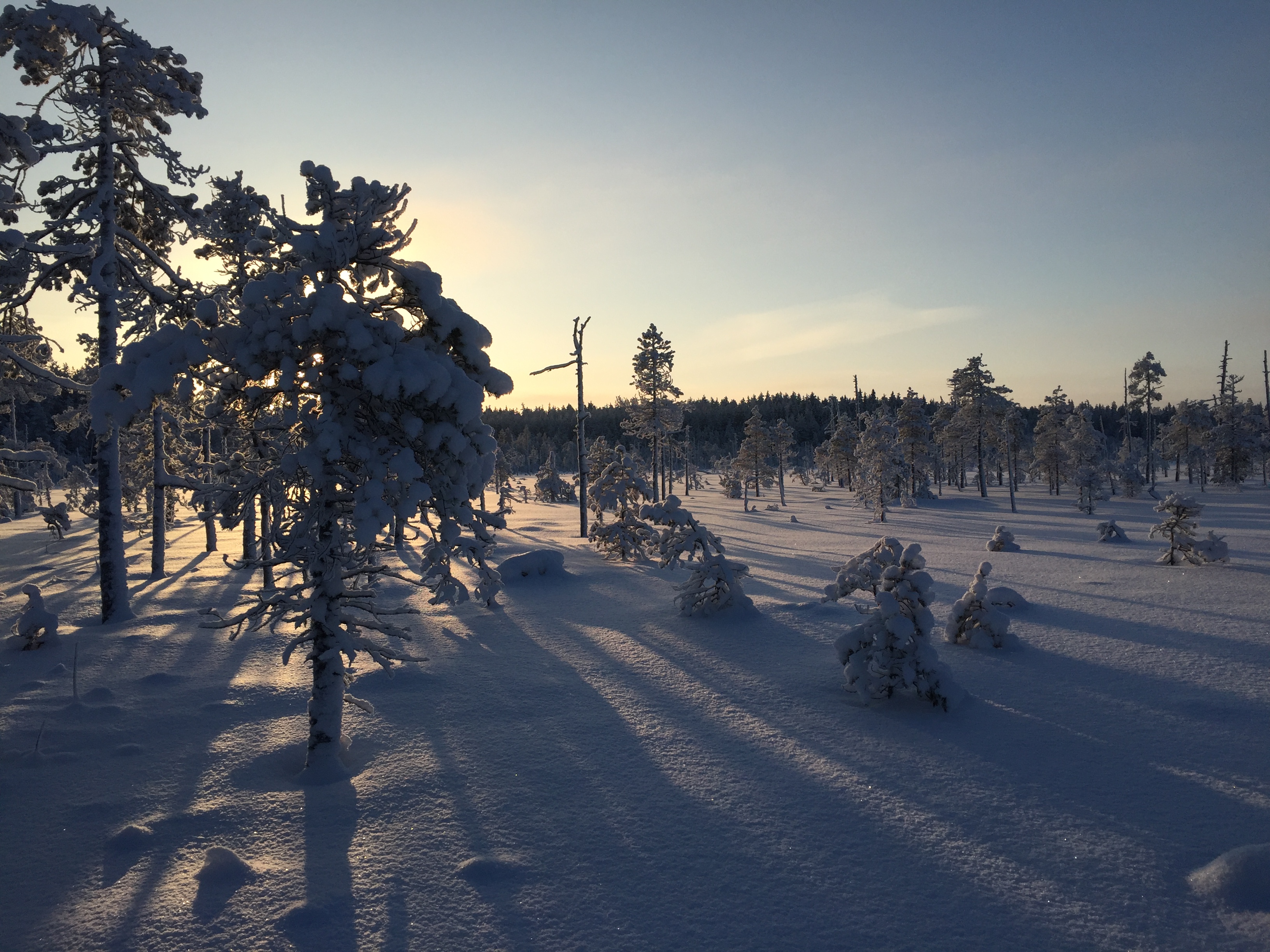
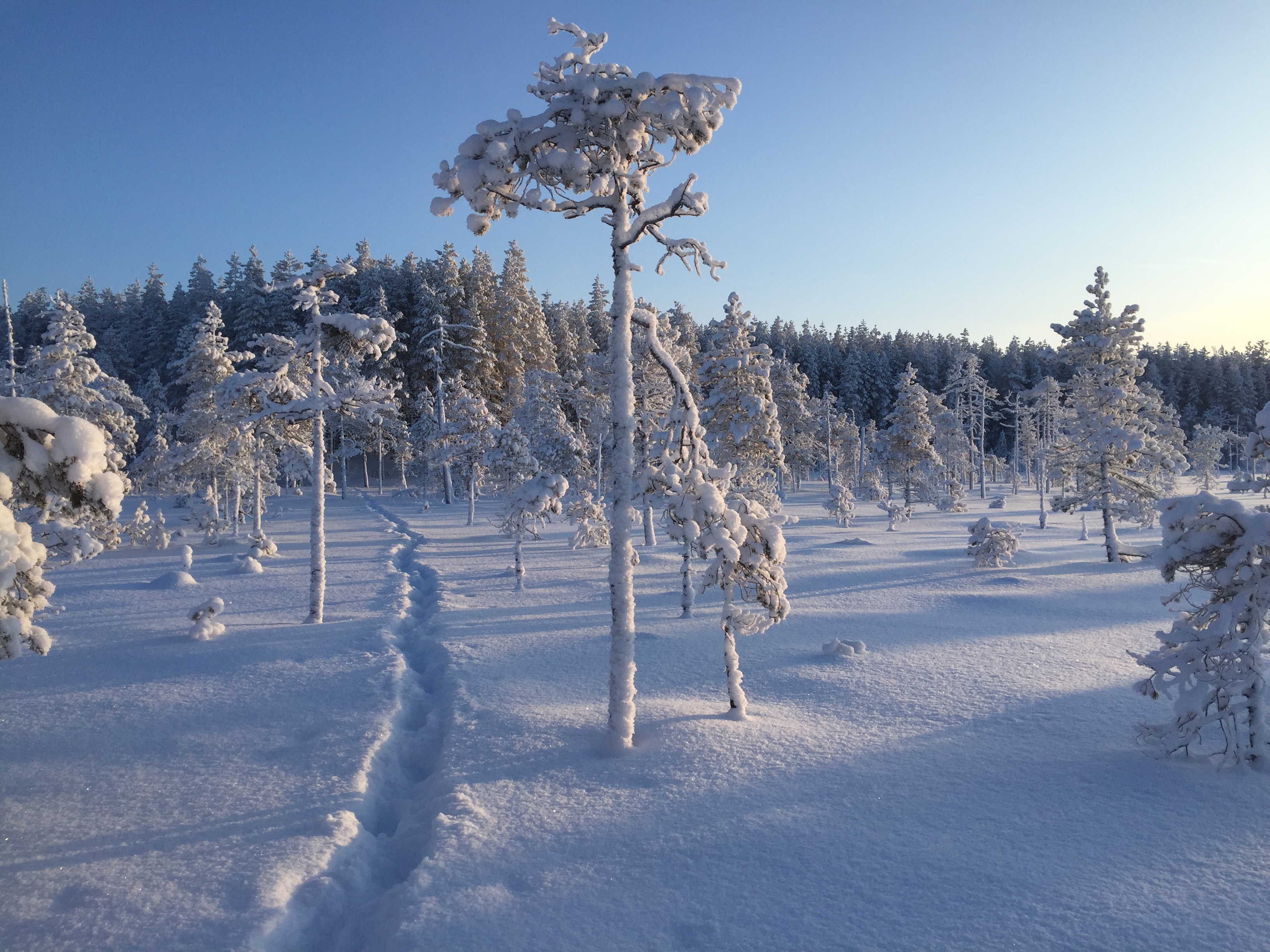
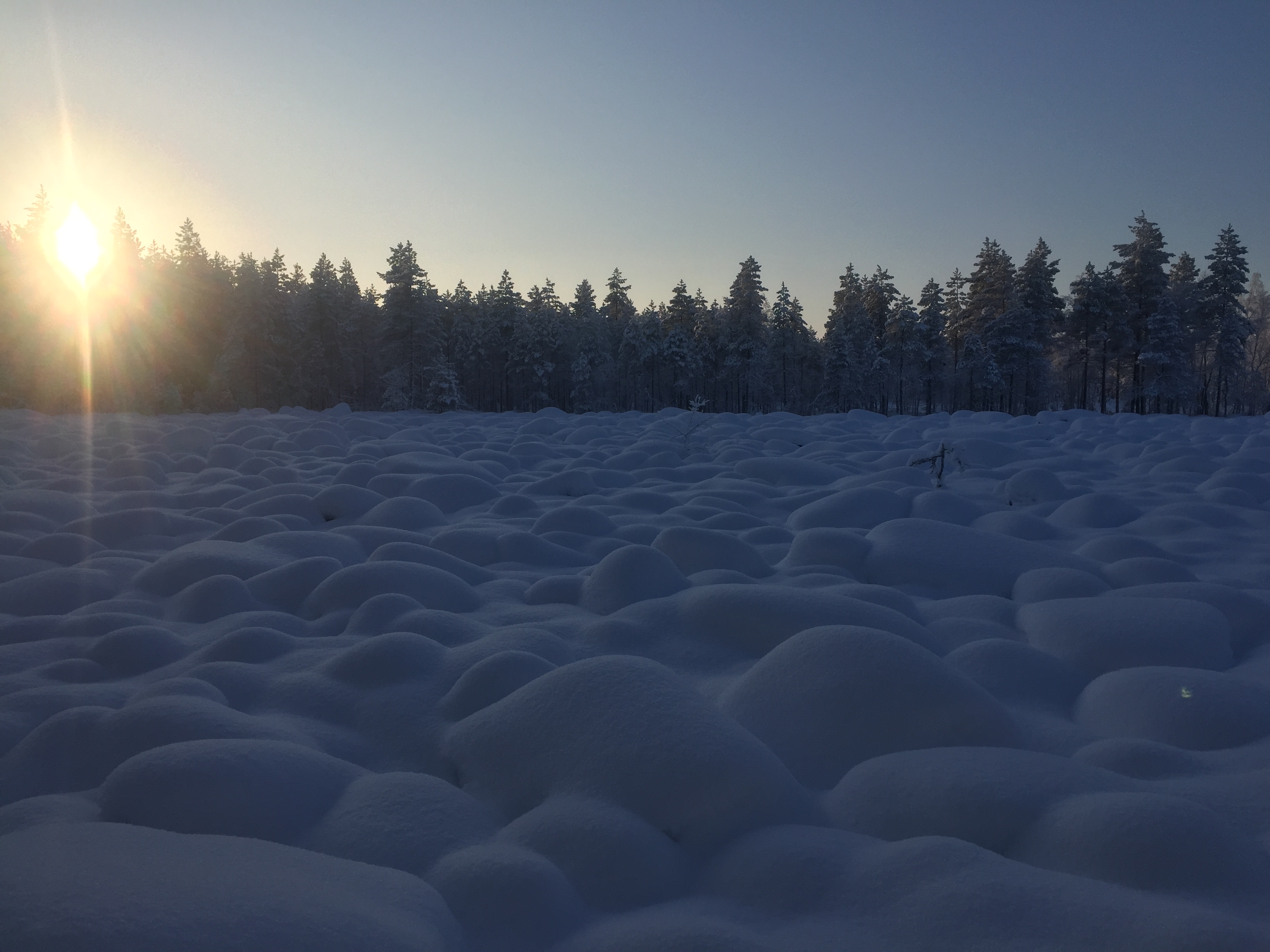
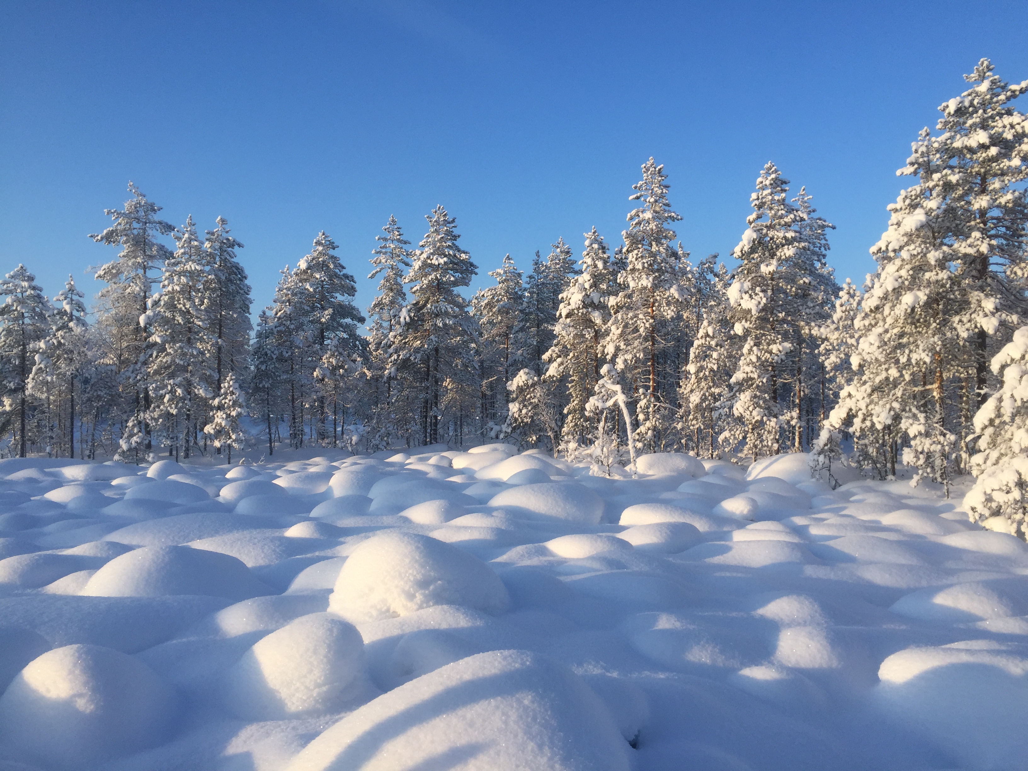
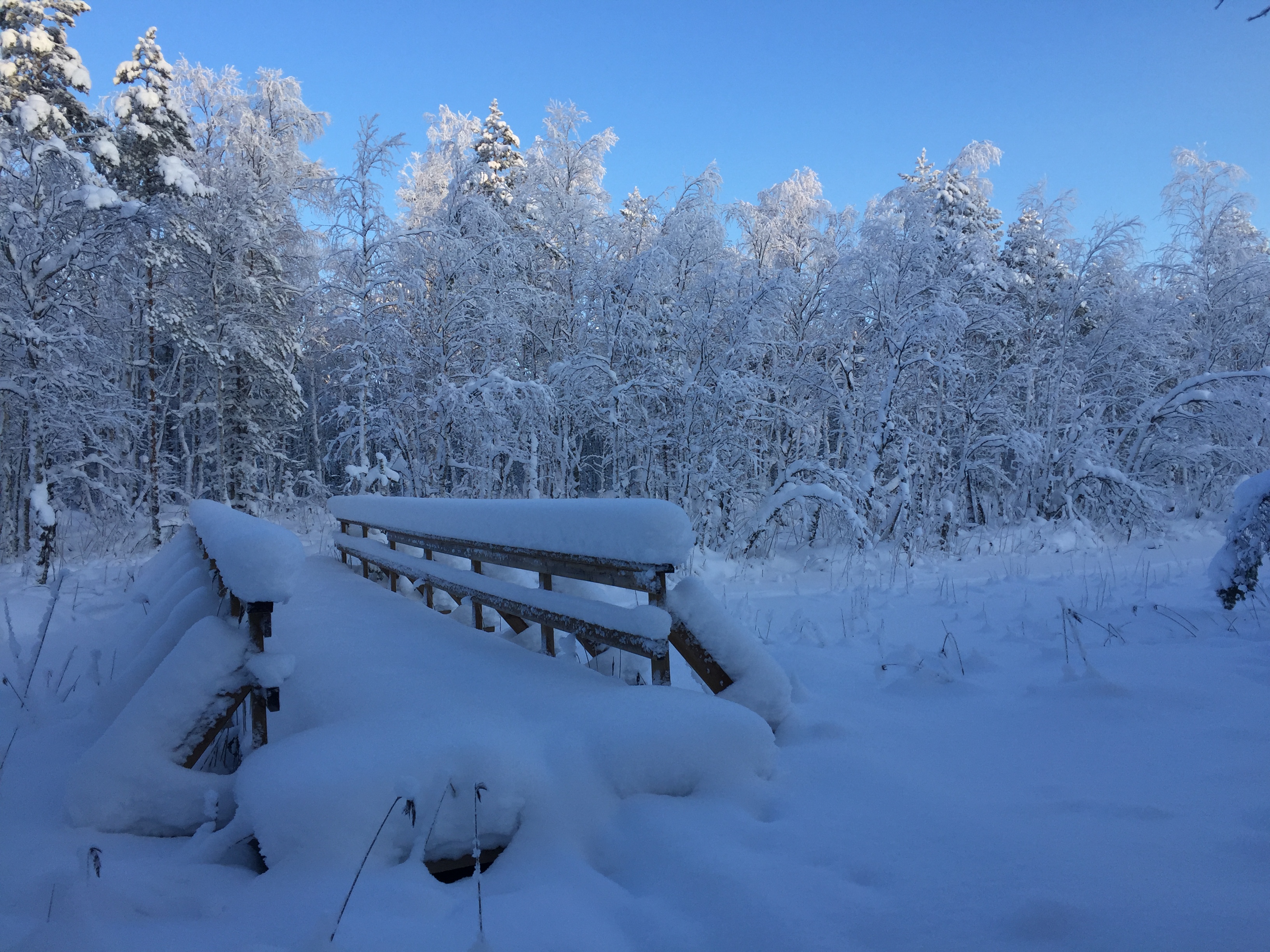
17. The trail passes through several rather big mires. With snow and winter sun those were incredibly beautiful! Pretty much the highlight of the entire national park.
18.
19. I still haven't got a new camera instead of the destroyed one (hopefully finally will get one next week!), and was taking all these pictures with my regular phone (which is an iPhone 6). This was however one of those occasions when the landscape and lighting are so great that even phone pictures turn out incredibly beautiful.

20.
21. This is the trail I was leaving behind me.

22. And this is the trail in front of me, or what passed for it.
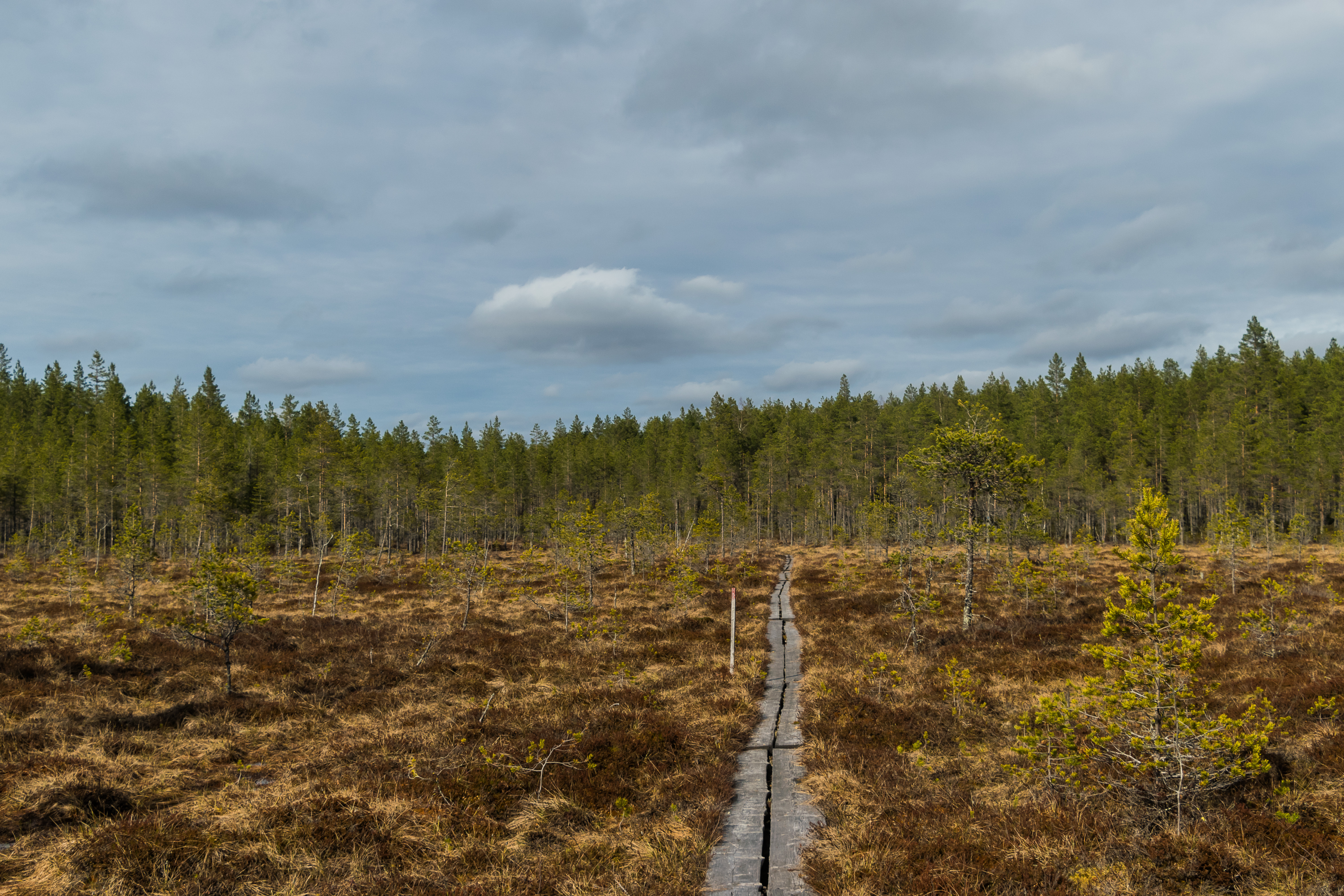
23. The trail goes through mires over duckboards. These are of course crucial in snowless period, but in winter they make walking even more difficult, as it's easy to fall through knee deep snow off the side of duckboards.
24.
25.

26. Same place as in previous picture.
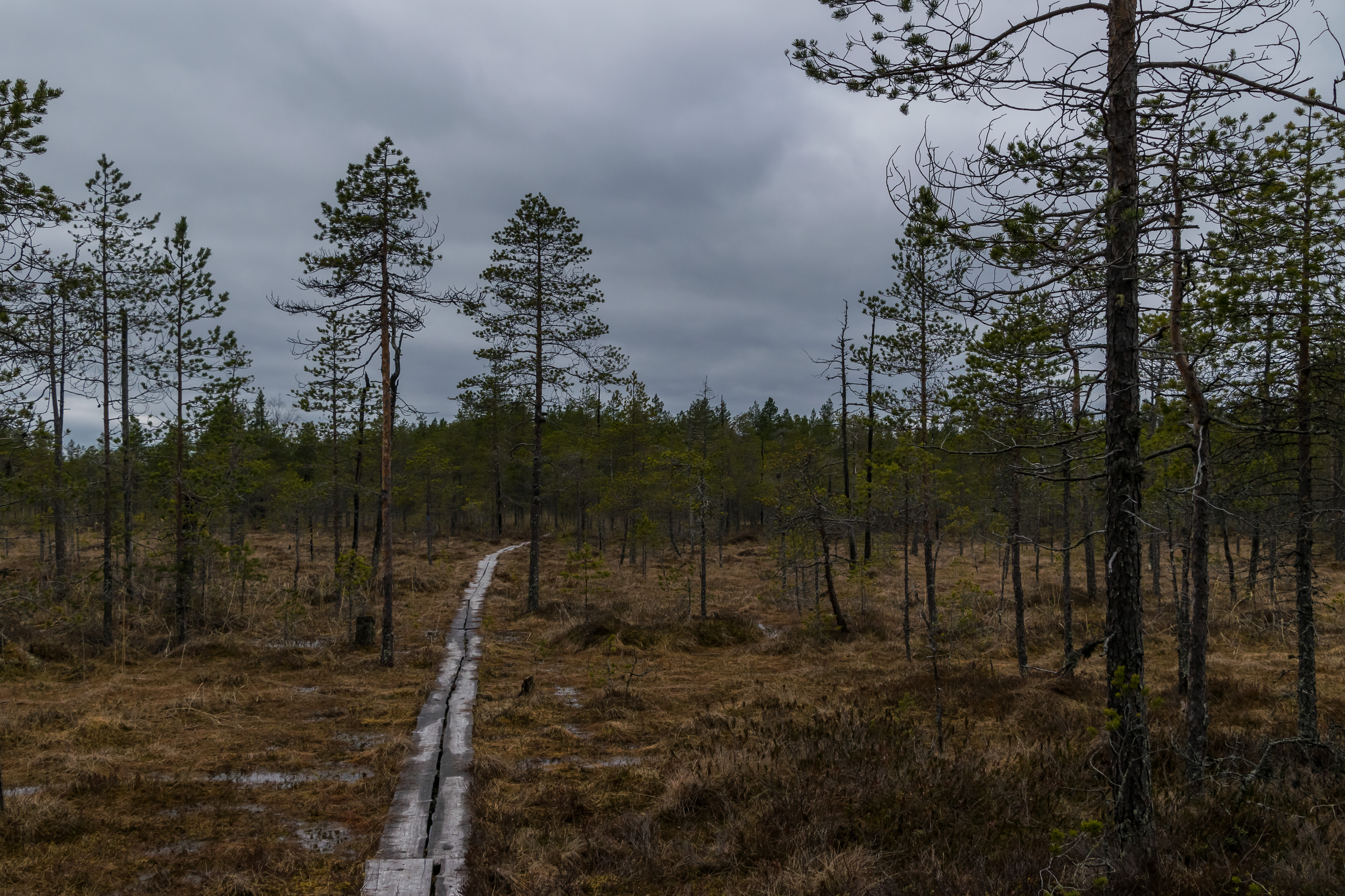
27. The weather in May had unfortunately been less beautiful than in January.

28. And also the woods were flooded in May. Some streams flowing through, normally just two or three meters wide (with small bridges over them), had risen high enough to flood the duckboards. So passing that part of the trail got unexpectedly challenging, and I had to just bite the bullet and ford the flooded spots through knee-deep cold water.
29.
30. Another notable natural feature that you can see on this trail is areas named pirunpelto — "devil's field". These are fields of boulders of moderate size. Pirunpeltoja are unrelated in origin to the vast boulder areas in the fells of the north (rakka). While rakka is created by freezing water splitting cracks in rocky mountain faces, a pirunpelto is actually an ancient rocky sea coast.
31.
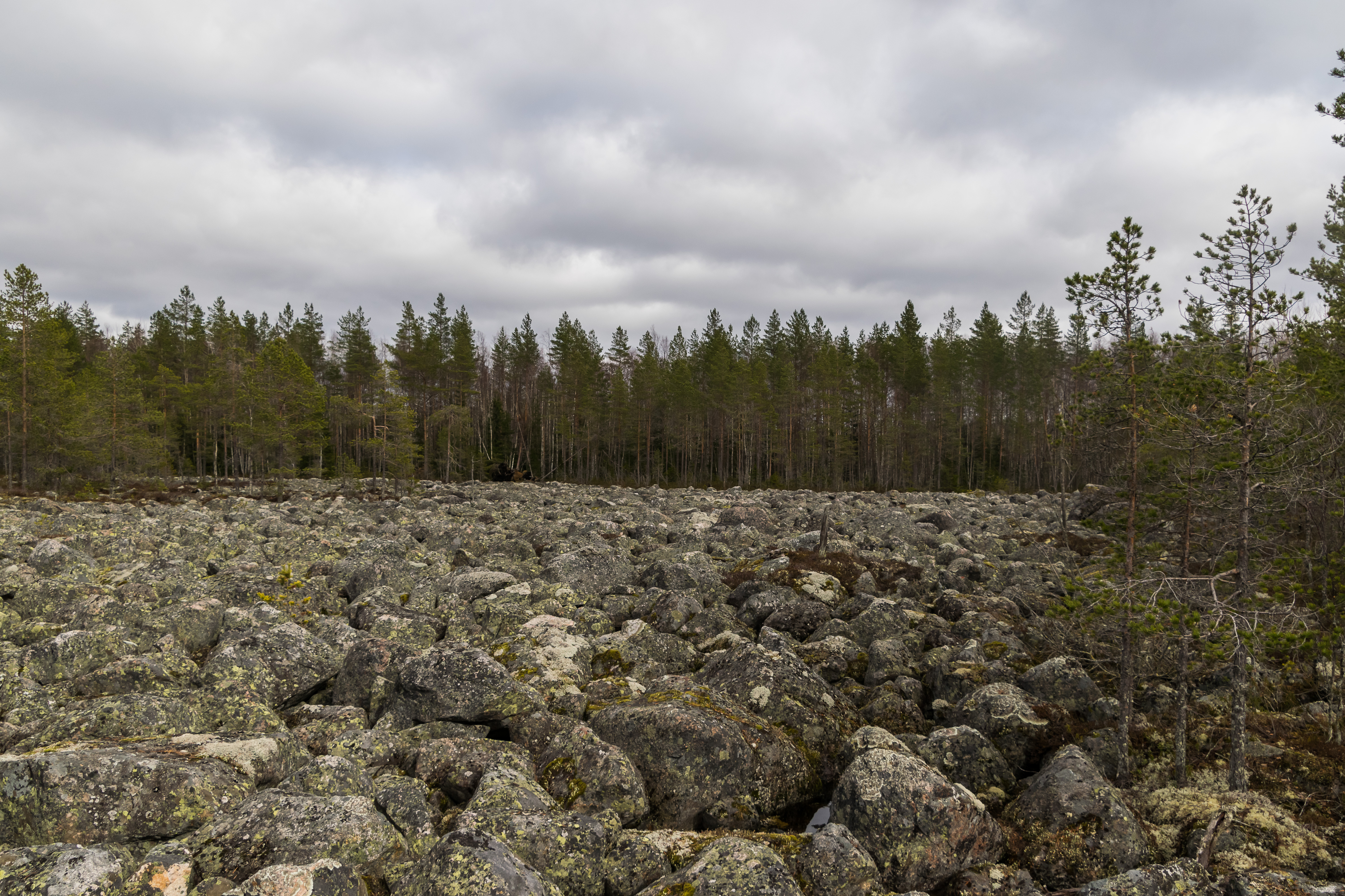
32. The same pirunpelto snow-free.
33. Finally reaching the first laavu, at Heikinjärvi lake. I had a quick beer there but didn't stay long, without motion I began to get cold rather quickly.
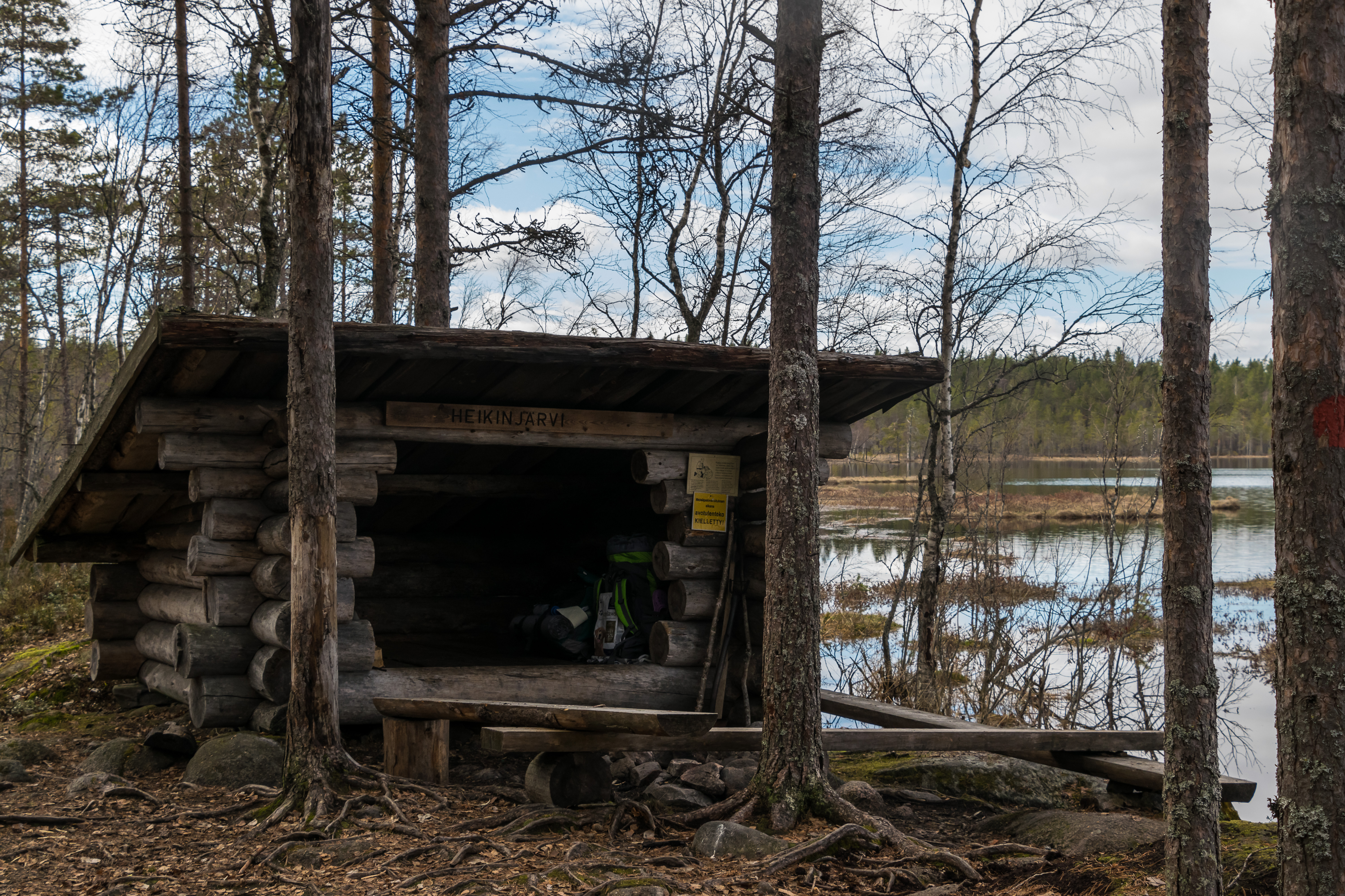
34. The laavu itself.

35. I considered turning back (which would probably be easier on a trail already walked once) but decided to continue on.
36. Heikinjärvi Lake.

37.
38. Bridge over one of the aforementioned creeks.
39. In January, I turned back towards Koirasalmi from the second laavu (Pyydyskoski); in May I continued on the Vaatimen kierros trail proper.
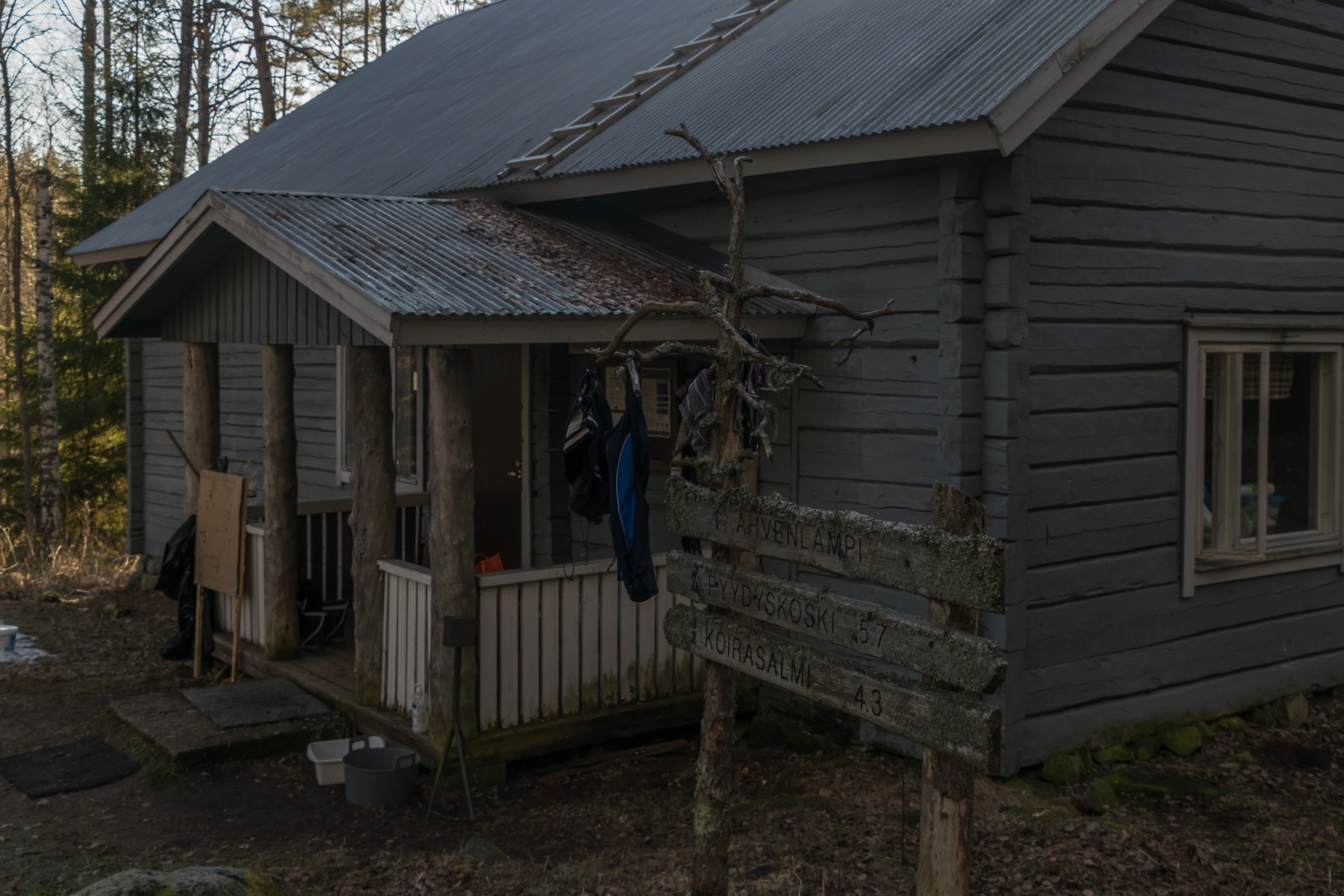
40. Apart from laavu shelters, there's also a rental cottage on the trail, named Ahvenlampi. It can be rented in summer as a regular mökki-cottage (and is rather expensive but then it's also really big). It is possible to drive to it directly, you don't have to hike all the way.
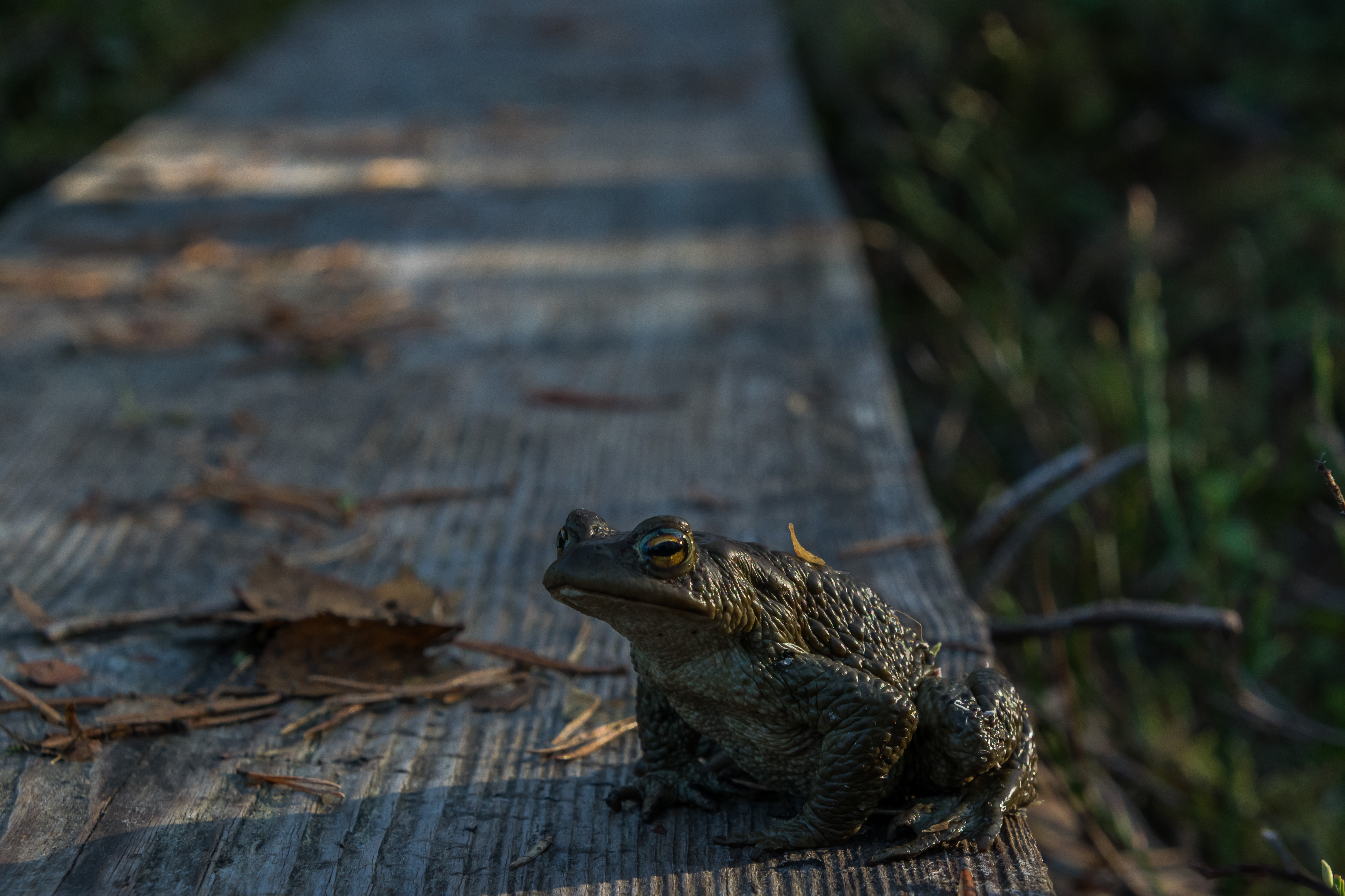
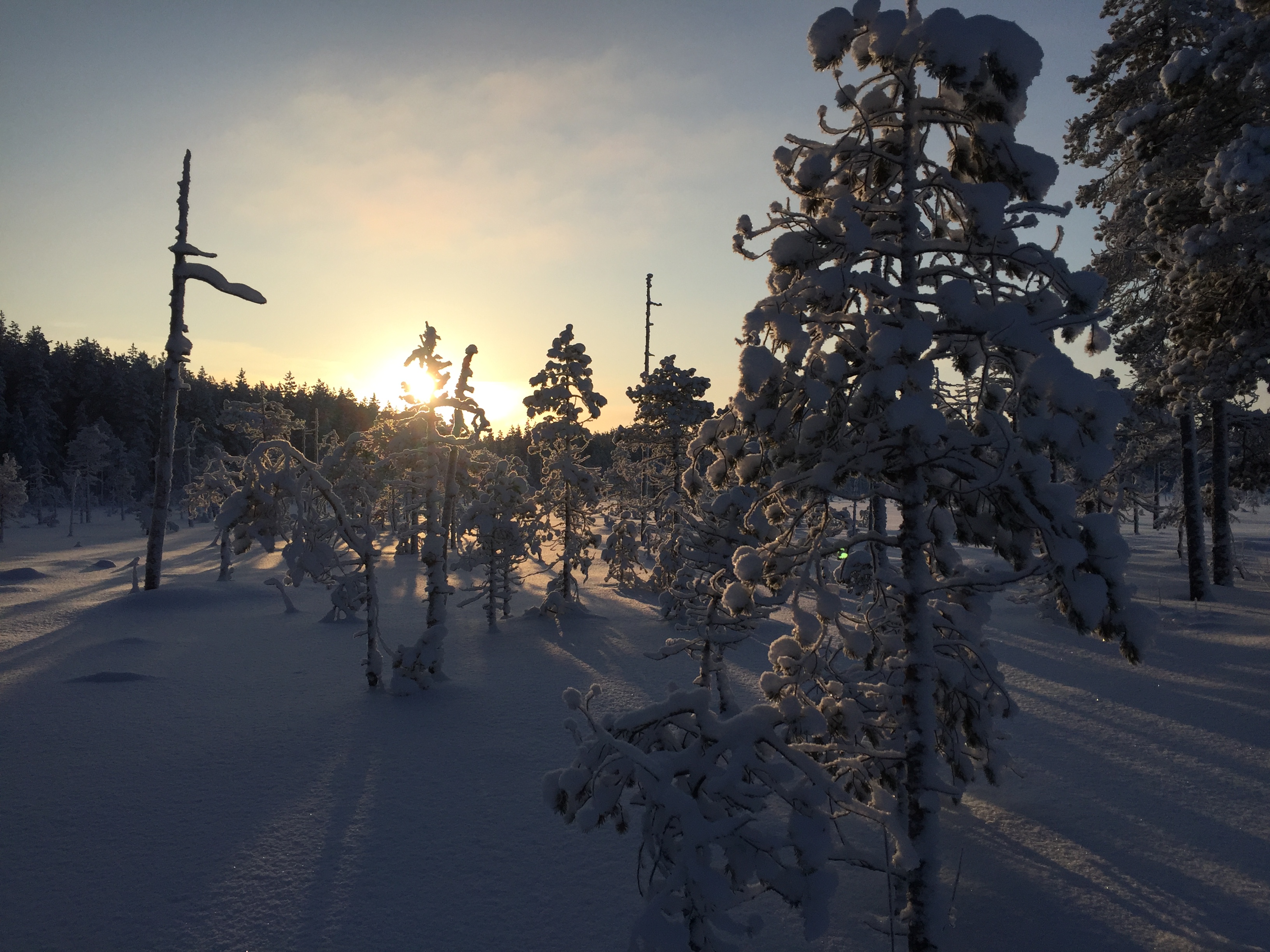
41. In January I saw basically no wildlife; May was not much better but at least there were those guys.

42. It's getting closer to the sunset already.
43. Another fine mire.

44.

45. Back along Koirajärvi.
46. And the sun has set around that time. It was of course only 15:30 or so; I had to wake up pretty early to even be able to hike there in the daylight.
47.

48. Back to the car at last. I look cool with white hair!
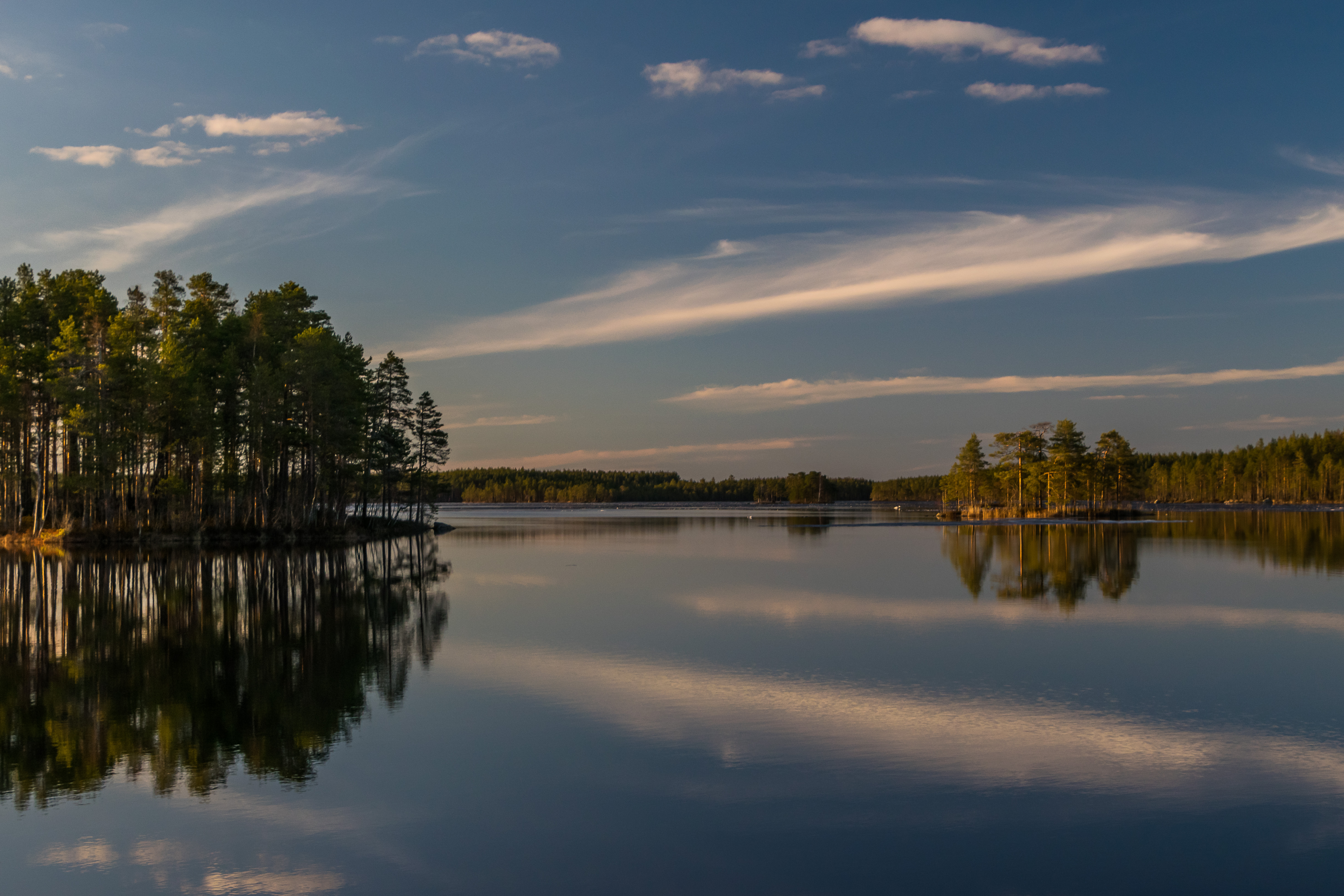
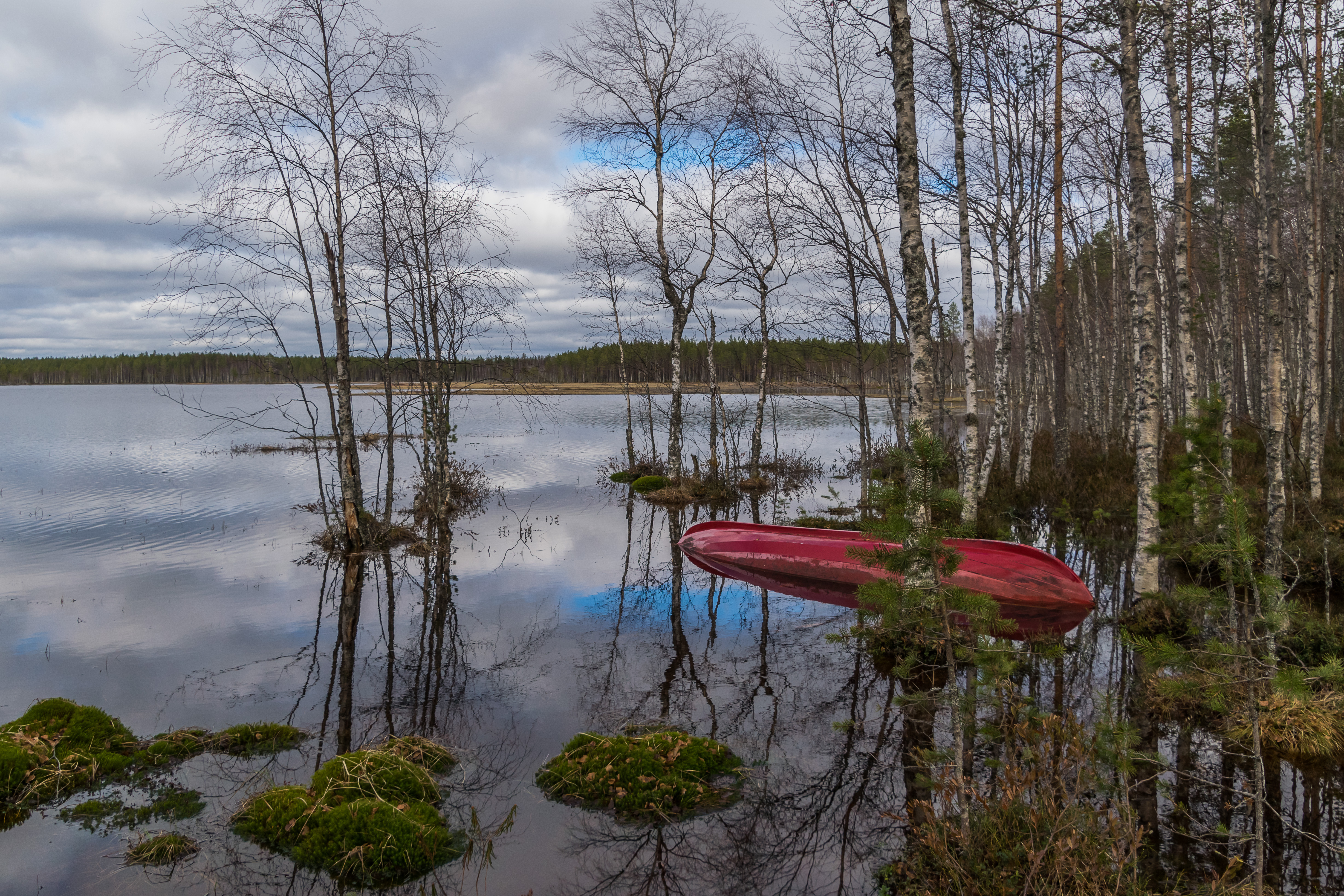
49. Sunset Koirajärvi in May.