Suomussalmi (Finn. Fishscale Strait) is a rural municipality in Eastern Finland, in the region of Kainuu. Kainuu is a remote, thinly populated area of thick wilderness-like forests, and Suomussalmi in particular is probably the most remote and wilderness-like part of Kainuu. It is a vast place by area, 5858 sq. km large, making it the 9th biggest municipality in Finland. The population however is modest, about 7700 people, making the population density only 1.45 people per square kilometer.
Suomussalmi is most famous as the site of some major battles of the Winter War of 1939-1940: the Battle of Suomussalmi, where a Soviet division occupied Suomussalmi village but was eventually driven away, and the Battle of the Raate Road, where another Soviet division attempting to aid the first one was surrounded and nearly annihilated on a small forest road. Of these battles and their monuments I just wrote in the previous post. But is there something else to see in Suomussalmi? Yes, of course! Mostly it is nature, but there are a few interesting man-made sights as well, and many of them are related to the land just beyond the border, White Karelia.
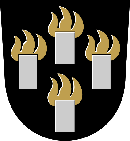
These lands were remote borderlands throughout all their existence. The headwaters of the rivers flowing into the Bay of Bothnia (Oulujoki and Iijoki) meet headwaters of the rivers flowing into the White Sea in Russian Karelia, and there is much evidence of prehistoric habitation in the area. Most obvious are Värikallio rock paintings from the Stone Age, but there were also archeological findings from the Viking era for example. Nonetheless in historical times these lands were settled again fairly late. The Treaty of Nöteborg in 1323, which formalized the border between Sweden and Russia (then Novgorod) for the first time, in principle left these lands to Russia, but the border here in the north was poorly defined anyway, and Sweden encouraged Finnish peasants to settle in these areas to get a better claim on them. Much of Eastern Finland was settled in this manner during the rule of King Gustav I Vasa (ruled in 1523-1560), but first settlers in Suomussalmi arrived only during the rule of King Charles IX (ruled in 1599-1611). The modern coat of arms of Suomussalmi shows four "smokes", the first four houses of the Suomussalmi village (originally named Kianta) as recorded in 1604. The peasants were Savonians from the south, practicing slash-and-burn agriculture as was the norm in Eastern Finland all the way until the 20th century. The Treaty of Teusina in 1595 also formally confirmed that these lands belong to Sweden.
Life in Suomussalmi has never been particularly easy. This is a remote area, and the climate is harsh; the Arctic Circle lies less than 200 km to the north, and the inland location makes winters much colder than for example in the city of Oulu, which is at the same latitude on the coast of the Bay of Bothnia, and is a pretty cold place by Finnish standards already. Before modern times crop failures and epidemics took their toll regularly. Suomussalmi became a little bit livelier when the ironworks of Ämmä (Ämmän ruukki) was founded, operating in 1841-1878 on the great Ämmäkoski (Finn. Hag Rapids) of Emäjoki (Finn. Mother River) and using the local lake ore. It brought some prosperity to the area, even though it was remote enough that much transportation had to be done by reindeer sled.
Like most of Kainuu, Suomussalmi also became in the 19th century one of the most important tar production areas in Finland. Tar, useful first and foremost for wooden shipbuilding, was at the time a Finnish export as valuable as oil is elsewhere nowadays. Finland had the kind of pine woods that were well suited for tar distillation, and especially in the northern regions these woods were plentiful, unlike Central European countries which had mostly destroyed their forests. Tar was transported by boat down the Oulujoki, the great tar river (of which Emäjoki is headwaters), to the port city of Oulu. Although by the 20th century large ships began to be built of iron instead of wood, tar still remained an important product for considerable time, and its production eventually declined only by the World War II years not for the lack of demand but simply because it became more profitable to sell timber than tar. Forest industry is probably still the most important one overall in modern Suomussalmi, but the biggest private employer is an electronics factory of the American company Kemet, manufacturing capacitors (it's somewhat surprising that some routine electronics components are still being manufactured in a western country instead of Asia, let alone in Suomussalmi of all places, but here we are). There is also for example one of the two factories of Tulikivi company, manufacturing stoves and fireplaces of Finnish natural stone.
To the east, beyond the border, lies White Karelia (White Sea Karelia, Belomorsk Karelia, Беломорская Карелия), the northern part of Eastern (Russian) Karelia, as thinly populated as Suomussalmi and Kainuu. In Finland it is called Vienan Karjala or simply Viena, after Northern Dvina river, the mouth of which at the White Sea was viewed as the easternmost point of the region (although it is now lying outside the Russian region of Karelia). This land has intrigued the Finns since the 19th century if not earlier. Karelians are essentially a branch of the Finnish people; the three original Finnish tribes were the Finns (suomi), the Tavasts (häme) and the Karelians (karjala). Unlike the first two however Karelians, who originated at the Karelian Isthmus and spread north from there, have been split between the west and the east for about a millenium. Western Karelians have lived in Finland first in the Swedish era, then in the Russian autonomy and now in the independence era; although much of their land was annexed by the USSR in the war, there are still regions of South Karelia and North Karelia within Finland, with centers at the cities of Lappeenranta and Joensuu. Like other Finnish subethnicities, Western Karelians have over time considerably intermixed with others, and outside Finland they aren't generally called Karelians. Eastern Karelians were subject to Novgorod and then and now Moscow; they are of Orthodox Christian faith rather than Lutheran faith of the west, and their language (which in truth has a few quite different dialects) has somewhat diverged from Finnish. Whether it is really a distinct language is more of a political question; in Finland it had been considered a dialect of Finnish until relatively recently.
Nonetheless, Karelians are the people by far closest culturally to the Finns, and White Karelians especially so. White Karelian (also known as Karelian proper) language is the closest living relative to Finnish, completely mutually understandable. And this is also the most remote and relatively untouched by civilization part of Karelia, and it had historically had close relations to Finland, for example as numerous korobeiniki, Karelian wandering traders, were making tours around Finland every year. Finally, the Orthodox church had historically been nowhere as forceful as Catholic/Lutheran one in stomping out old pagan beliefs. So it's no wonder the Finns started to view White Karelia as a sort of idealized Finland, untouched by civilization, where people still lived like in old times. Most famously, Elias Lönnrot (1802-1884), a rural doctor working in Kainuu, made a number of trips to White Karelia writing down local runes, a form of Finnish folk poetry. From them he compiled Kalevala, which has since been considered the Finnish national epic, despite being, well, Karelian in origins. Of course the beliefs and the tales on which Kalevala is based are very old, with roots in ancient Finnish prehistory, and they were common for various Finnish peoples. Kalevala is not the only such work; there is also Kanteletar, also by Lönnrot, a more authentic runes collection without an overarching plot, this one actually mostly gathered in Finnish Karelia. In the 20th century Suomen kansan vanhat runot (Old runes of the Finnish people), a collection of about 100,000 runes in 33 tomes, was compiled, and it contains most of rune poetry ever recorded.
Rune-singing was of course not the only White Karelian tradition that the Finns were interested in. Many famous painters and writers travelled there before the Finnish independence and got inspiration from those lands. And it's also no wonder that when Finland declared independence quite a few people considered the fact that White Karelia was now in a different, now completely alien Soviet country, unfair. Thus Karelia and especially White Karelia was the prime candidate for the Great Finland (Suur-Suomi) building, something that was attempted by armed volunteers in 1918-1922, and then in 1941-1944 when Finland was trying to take revenge on the USSR for the Winter War, and to get (with Nazi Germany help) in turn more "rightfully Finnish land", a process that included ethnic cleasings for Russian alien civilian population in Russian Karelia. To be fair, such nationalistic views were never universal or even all that much widespead within Finland, even in those years. In any case, after the fall of the USSR the border mostly opened again, and cooperation and tourism between the two sides of the border finally became properly possible. And much in Suomussalmi does remind of the closeness of the great Viena. Ironically despite being a Russian, I've travelled much more in Finland than in Russia, and I've never been to White Karelia myself.
So let's have a look at various places of Suomussalmi, including the municipal center, Hossa national park and Karelian villages of Kuivajärvi and Hietajärvi. I made a map of locations of the various places shown here, but it was ugly and I didn't put it in.
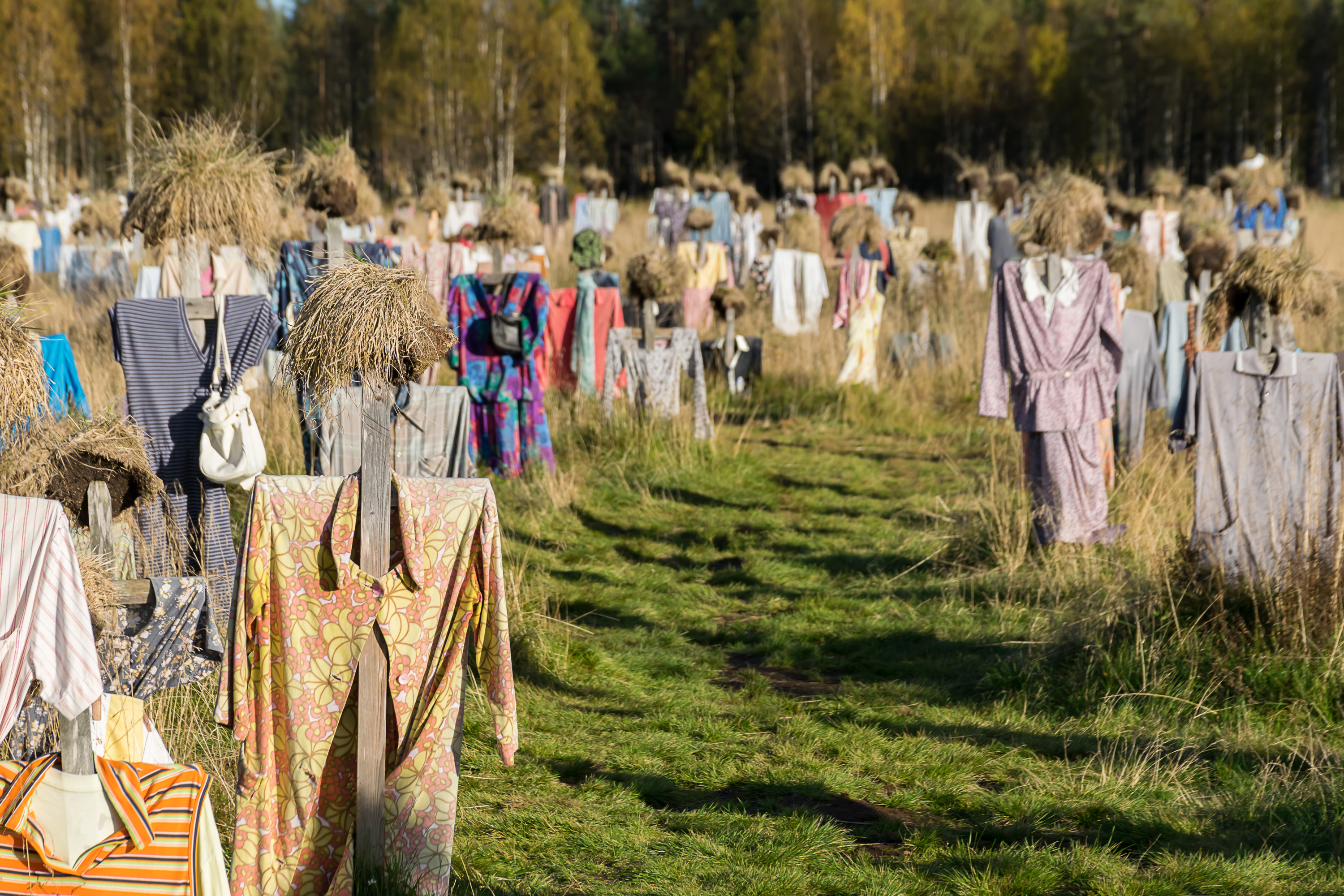
1. The most visited spot in Suomussalmi is, I'd bet, the Quiet Folks (Hiljanen kansa), a work of art originally from 1994 by Reijo Kela (1952-), a local dancer and performance artist. The work is simply located right by the National Road 5, the main road in the area going to Hyrynsalmi and Kajaani (and all the way to Helsinki) in the south, and to Kuusamo in the north; it is difficult to miss for the tourists travelling north to Kuusamo or Eastern Lapland, locations definitely more touristy than Suomussalmi itself. There are a few hundred such scarecrows-figures standing closely in a field (I don't think I have a wider shot unfortunately), their clothes flowing in the wind. Rather creepy and definitely memorable.
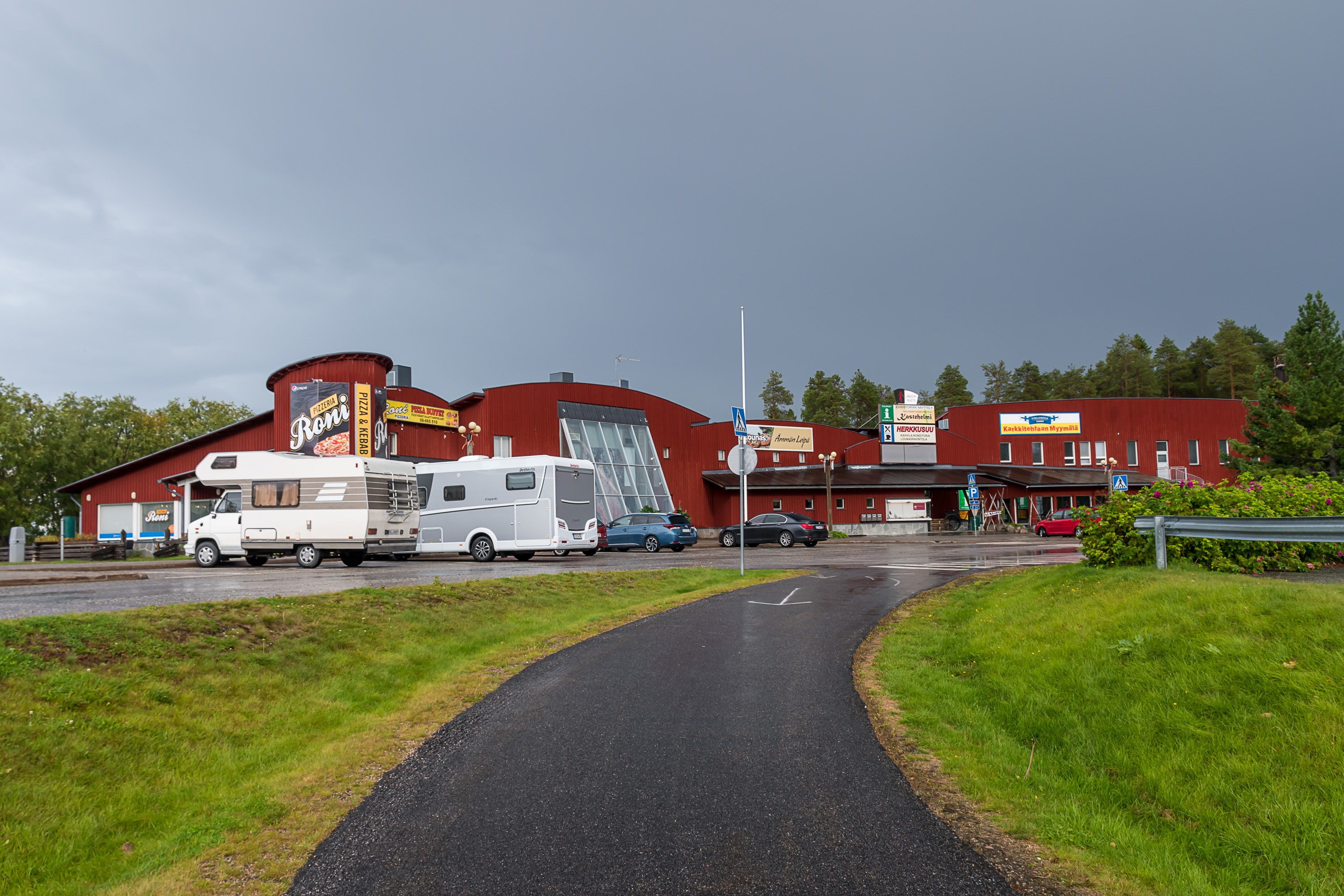
2. And the municipal center of Suomussalmi, a small town also known as Ämmänsaari (Finn. Hag Island), most people see only as a few gas stations and stores by the side of the National Road 5, which passes between the town center and the Kiantajärvi lake. The older municipal center is the so-called Suomussalmi church village (Suomussalmen kirkonkylä), across the lake not very far from Ämmänsaari. However it was destroyed in the war (see the Raate Road post) and subsequently lost prominence compared to the slightly more conveniently located Ämmänsaari.
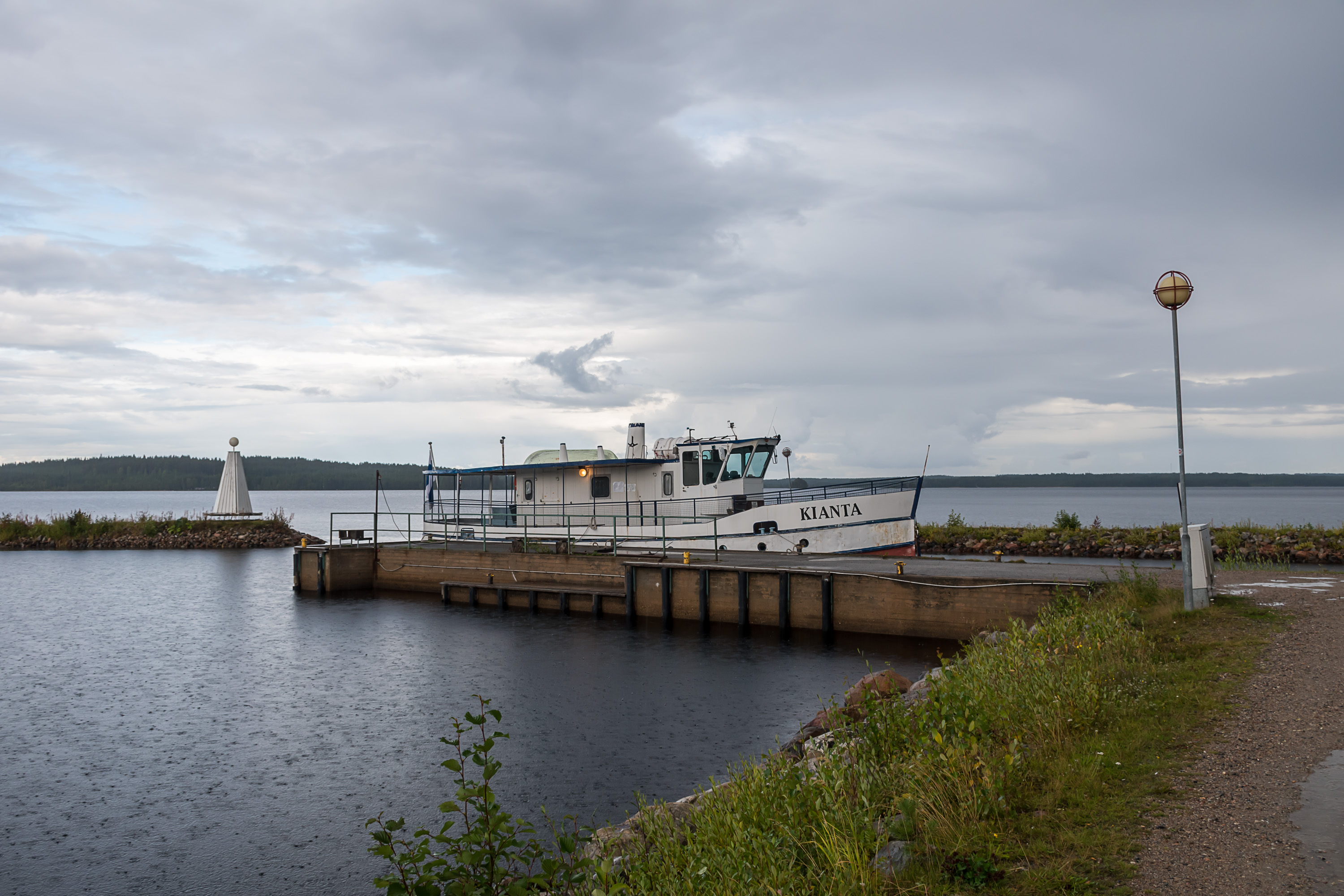
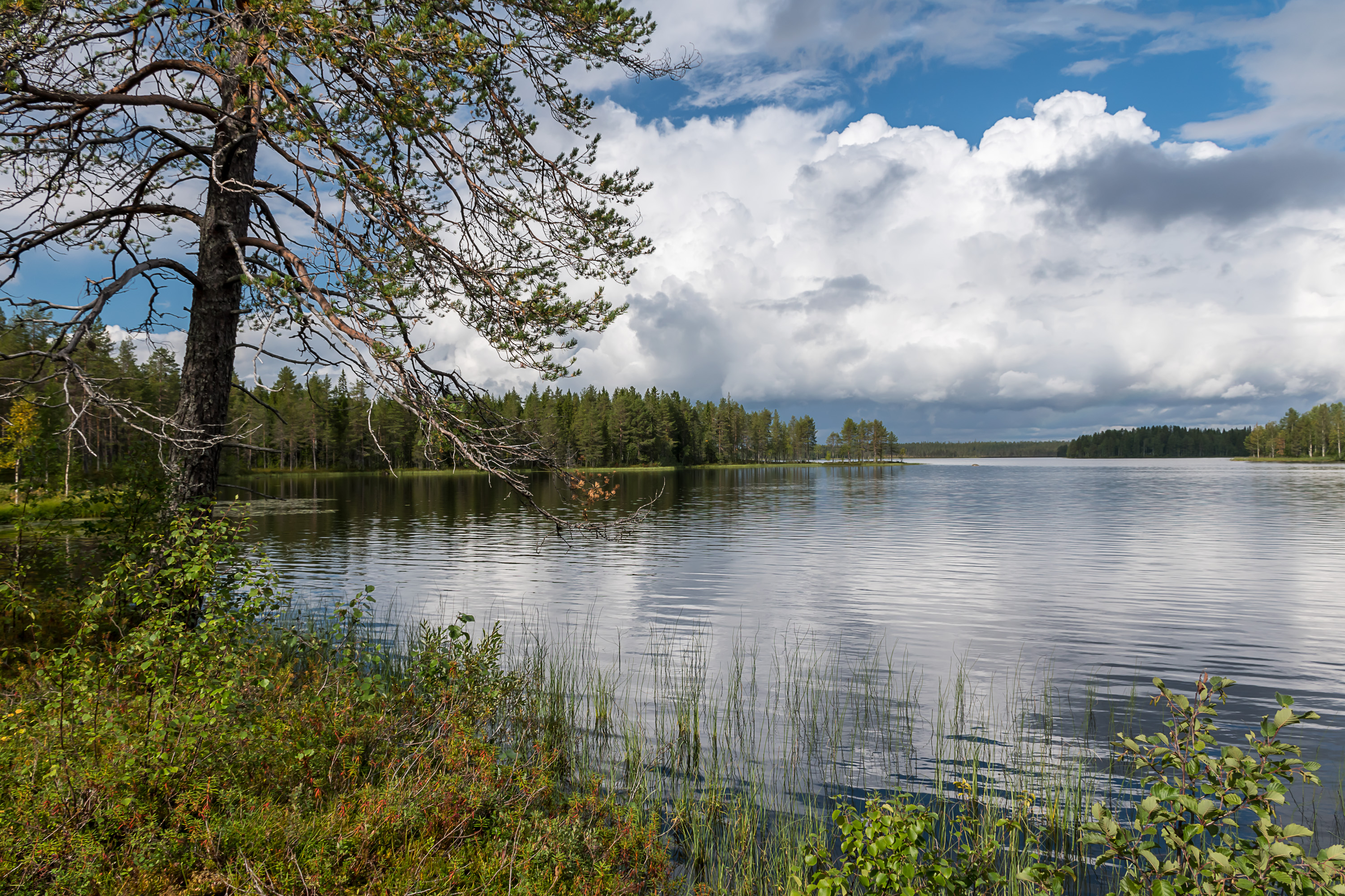
3. Kiantajärvi in Ämmänsaari. The small Kianta ship is used for lake tours in summer, going to the former place of Turjanlinna, a home of the most famous local writer Ilmari Kianto (1874-1970). There is also a boat harbor here. Kiantajärvi is a large lake, 191 sq. km by area and up to 45 km long, with a typical for Finland irregular shape, basically a collection of long narrow straits. It is the 23rd biggest lake of Finland. However its outflow, Emäjoki, is locked by a hydro power plant dam and the lake is only used for recreational boating these days. Another major lake in the area is Vuokkijärvi, stretched for 30 km from Ämmänsaari towards the Russian border. The state border here approximately matches the watershed between Baltic and White Sea catchment basins, named Maanselkä (Finn. Land Ridge), thus unlike Kuusamo or Finnish North Karelia there are no significant rivers flowing to Russian direction. The watershed within Suomussalmi is not really a mountain or even a hill ridge; Suomussalmi, again unlike Kuusamo, overall lacks any prominent hills.
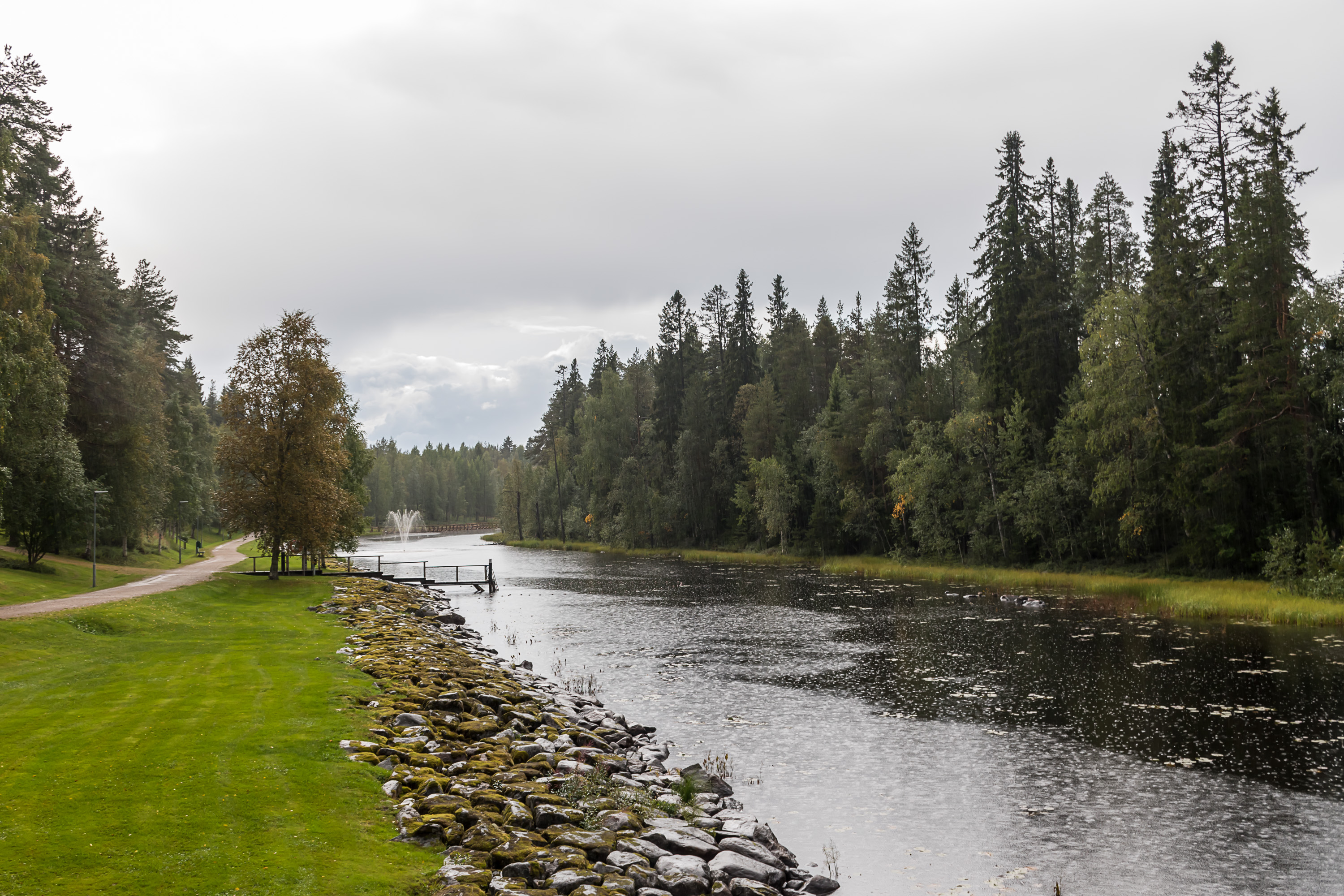
4. Emäjoki river flows from Kiantajärvi as two forks, merging a short distance downstream and forming an island about 2x0.7 km large, the namesake Ämmänsaari. Banks of the western, quiter fork (Jalonkoski) serve as a local park. Downstream it is completely blocked off now, with all water going through the other fork.

5. Ämmänsaari central square.
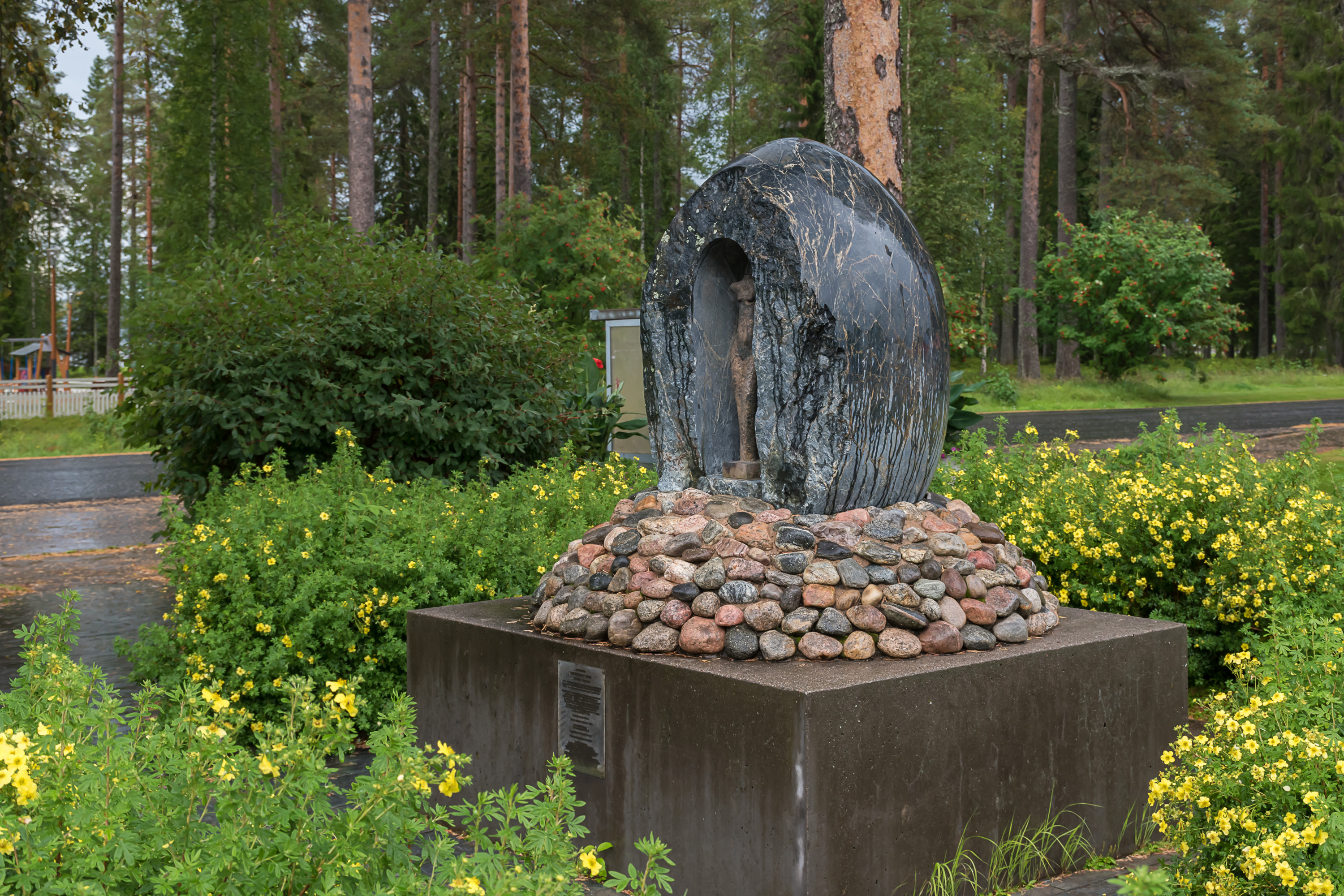
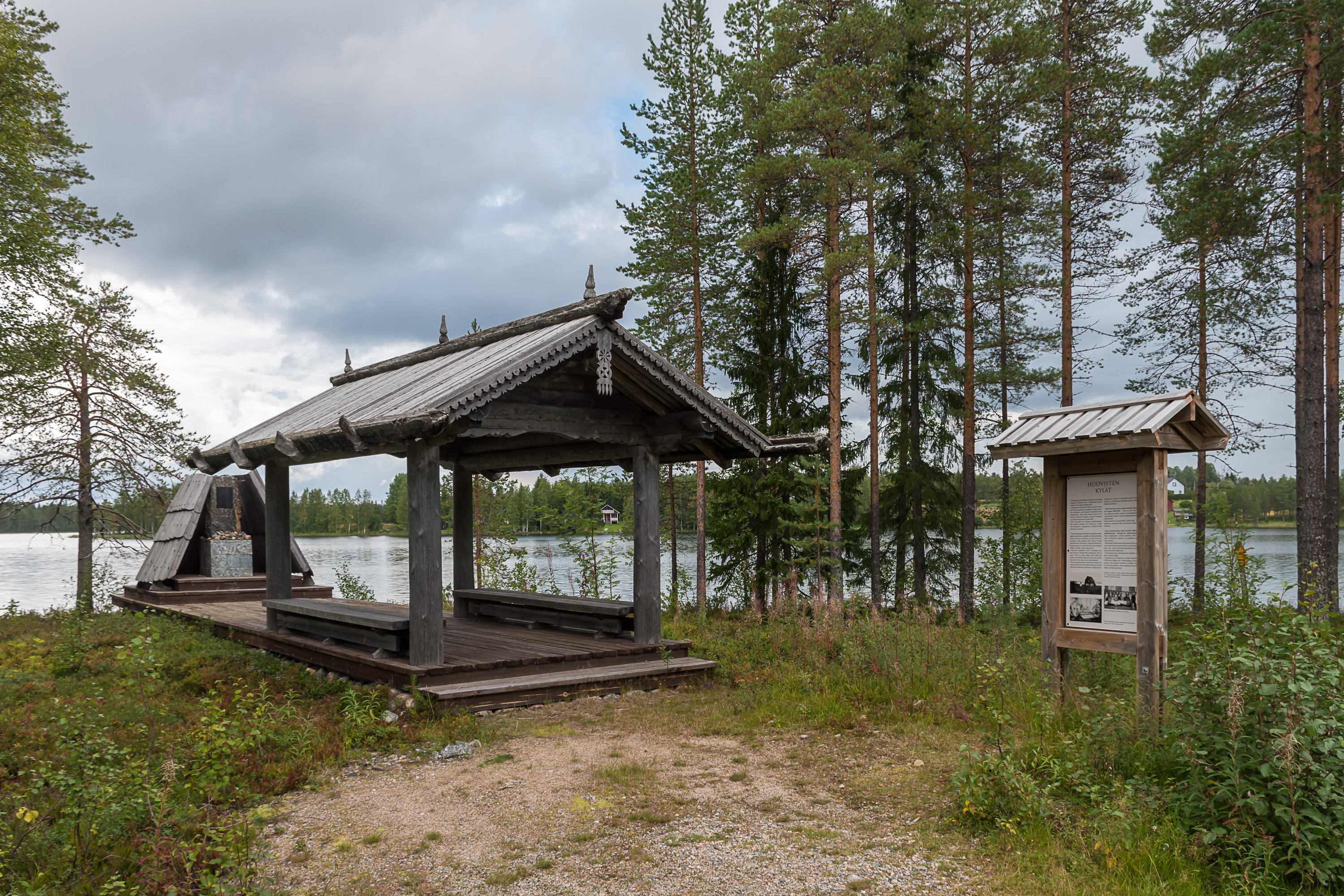
6. There is a monument (rather oddly shaped) to Suava Nykänen Trohkima's son, a rune singer from Akonlahti (Russ. Бабья Губа, Babya Guba) of White Karelia, right by Suomussalmi border. The sign claims he was the first good rune singer that Lönnrot met in White Karelia in his 1832 expedition. I couldn't really google anything of note about him otherwise. The expedition of 1832 was Lönnrot's third one (the first one was in 1828, and the first edition of Kalevala was published in 1835), so it's not like this was the very first rune singer Lönnrot met. Some Akonlahti villagers were able to move to Finland during the Continuation War of 1941-1944, and their descendants put up this monument in 1999.
The village of Akonlahti was abandoned in 1958, when its inhabitants were forcibly moved to Uhtua/Kalevala, the biggest local village. On the Finnish side of the border across Akonlahti was Rimpi, one of the only three White Karelian villages actually within Finland. Like the other two it was burned down in the Winter War by retreating Finns, along with its traditional Karelian houses, and was rebuilt in a much more boring style afterwards. While the other two villages still exist, Rimpi pretty much got extinct by the 1980s, although nowadays there are two houses in the area still marked on the map as permanently inhabited.
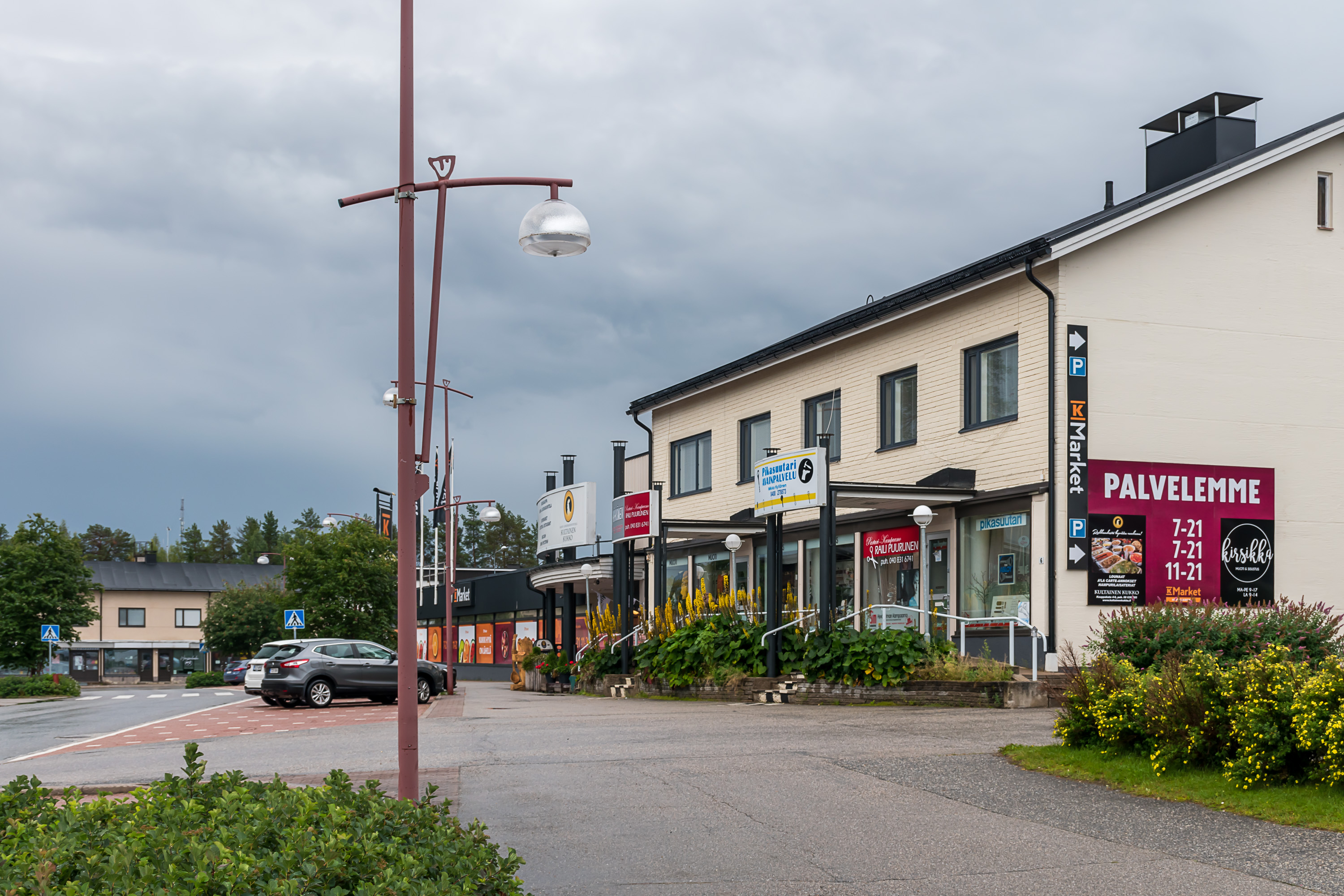
7. Ämmänsaari center mostly looks uninspiring, but let's still have a brief look.
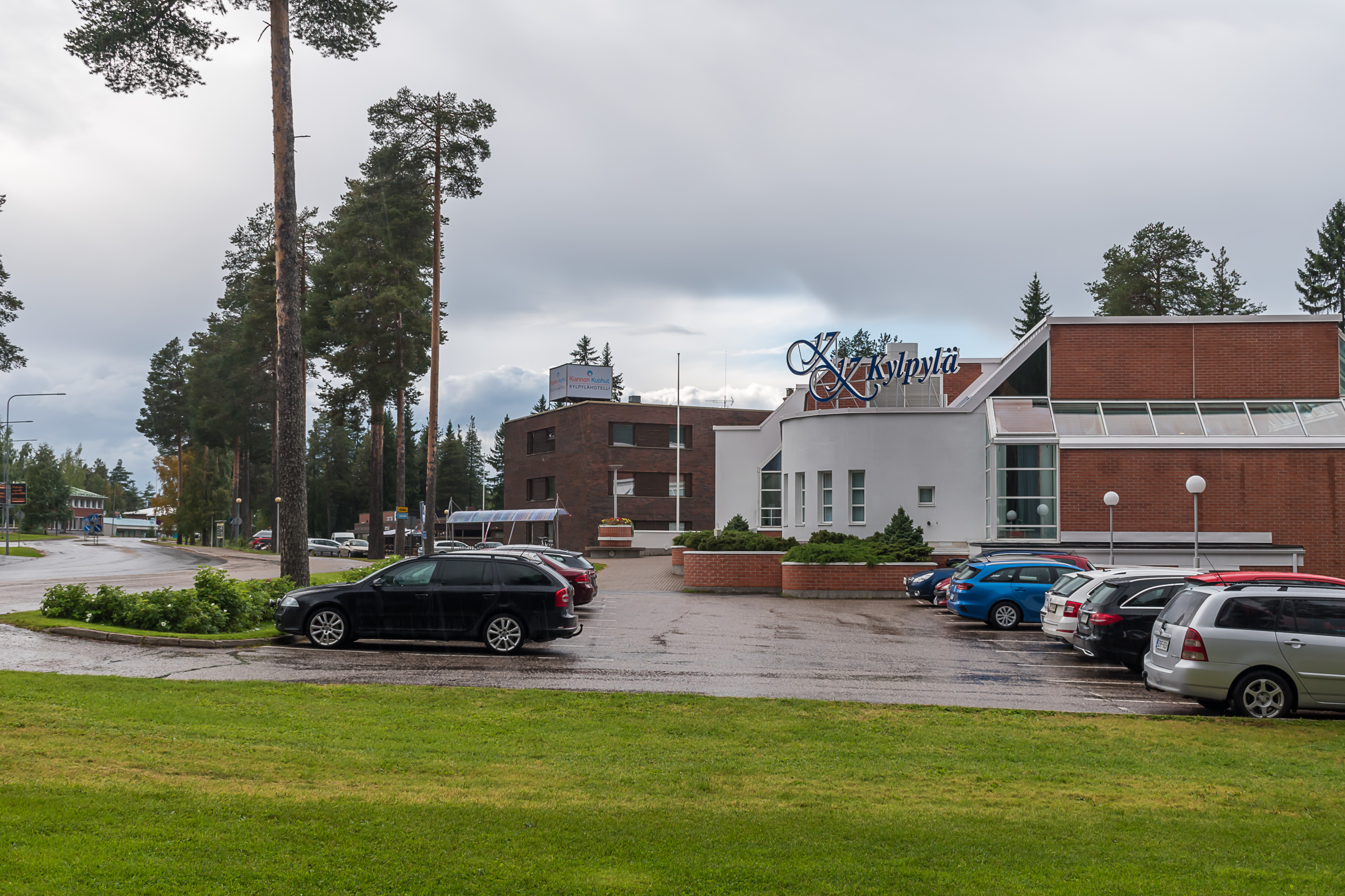
8. It does have a spa hotel.
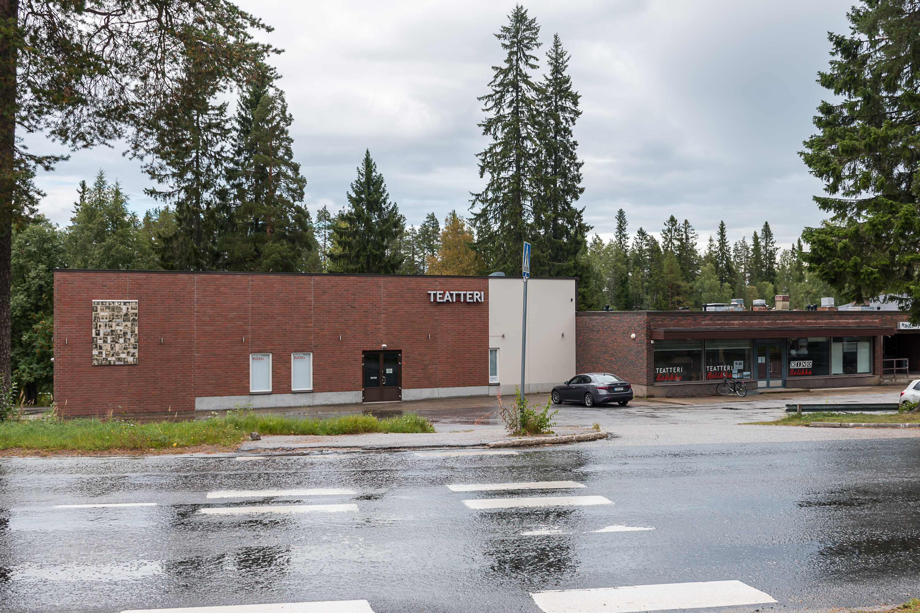
9. And a theater of some sort.
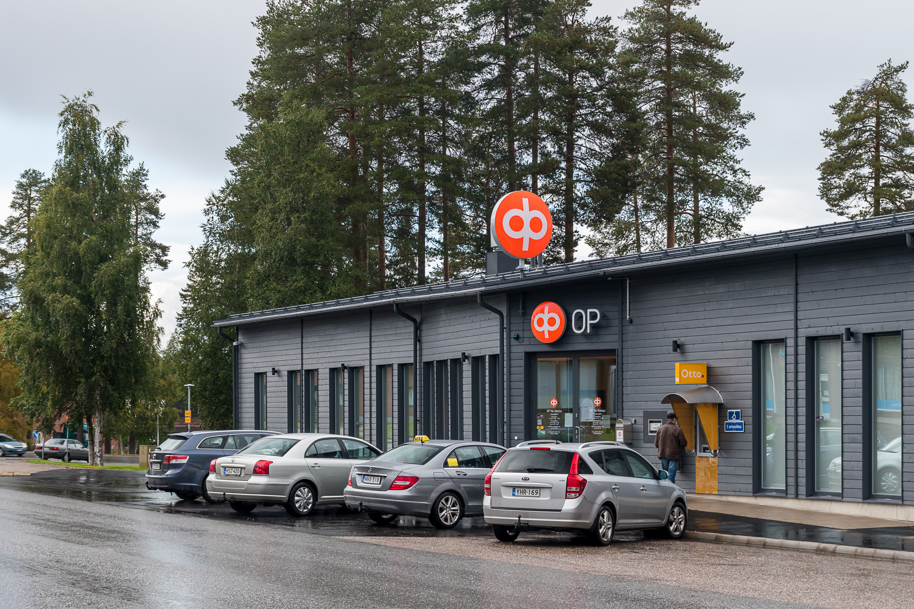
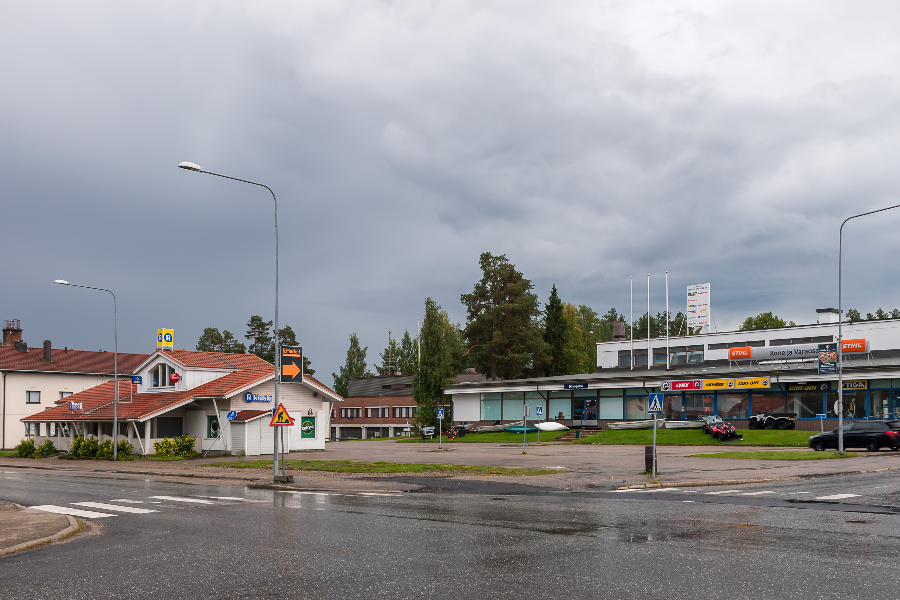
10. And a few businesses have newish-looking buildings.
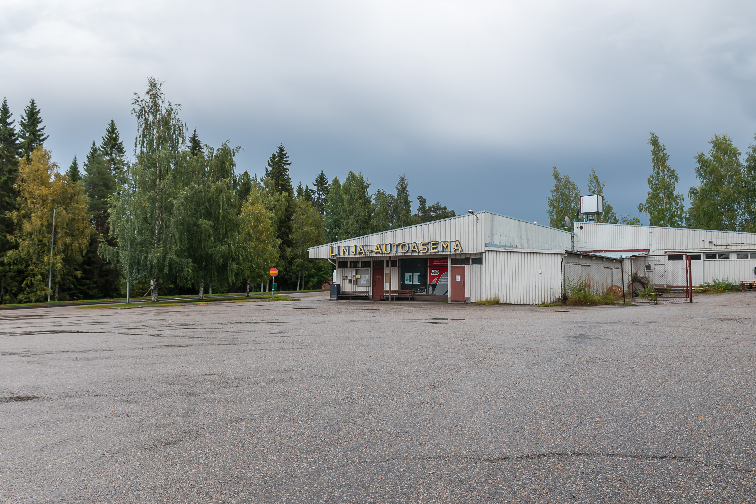
11. The bus station is as uninspiring as it gets though. Ämmänsaari has a regular bus connection to Kajaani, the regional center. There are a few buses to other destinations (Oulu, Kuusamo, Kuhmo and the church village).
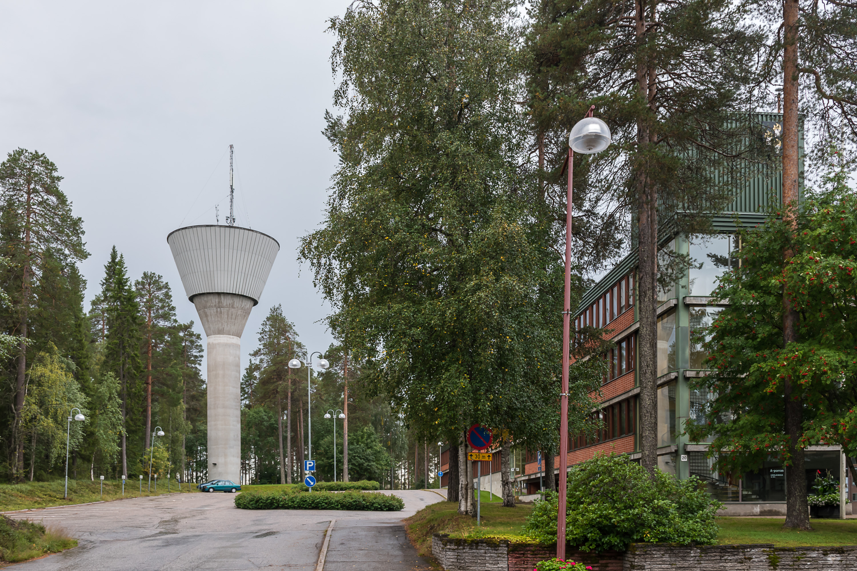
12. The municipal administration and the water tower.
13. Interesting lamp post shape on the central street. My guess is that the shape (stick figure) refers to the Värikallio rock paintings, which we're going to see a bit later.
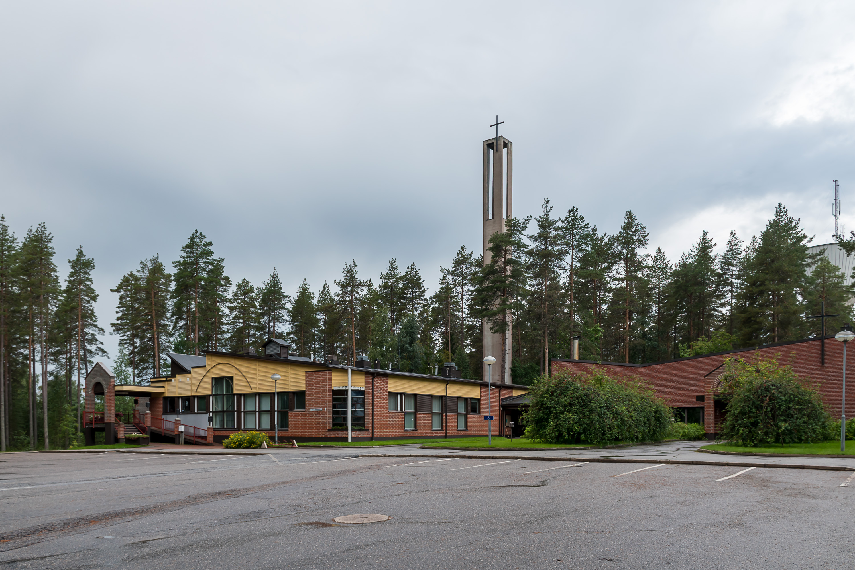
14. Ämmänsaari got its own church in 1967 so people wouldn't have to go to the church village. The church looks as ugly as most 1960s churches.
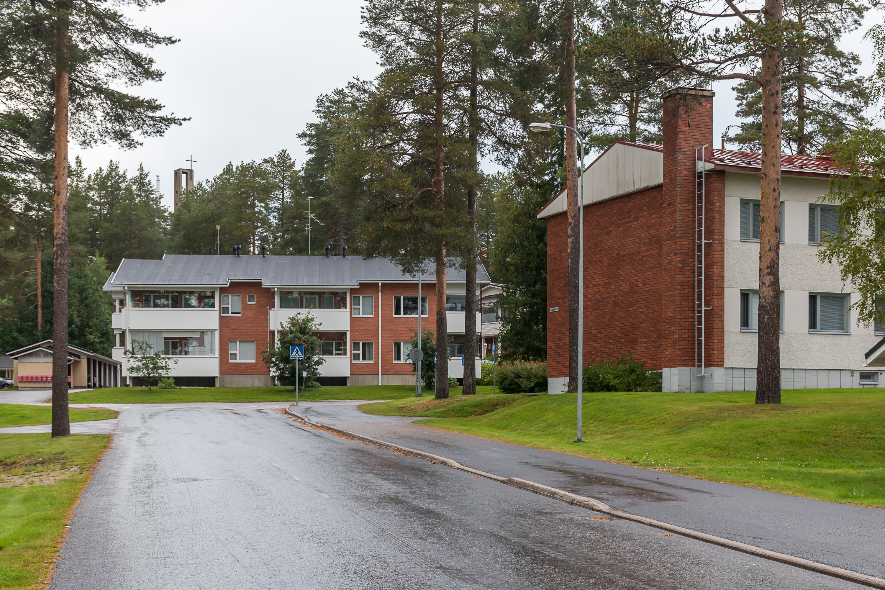
15. Residential buildings.
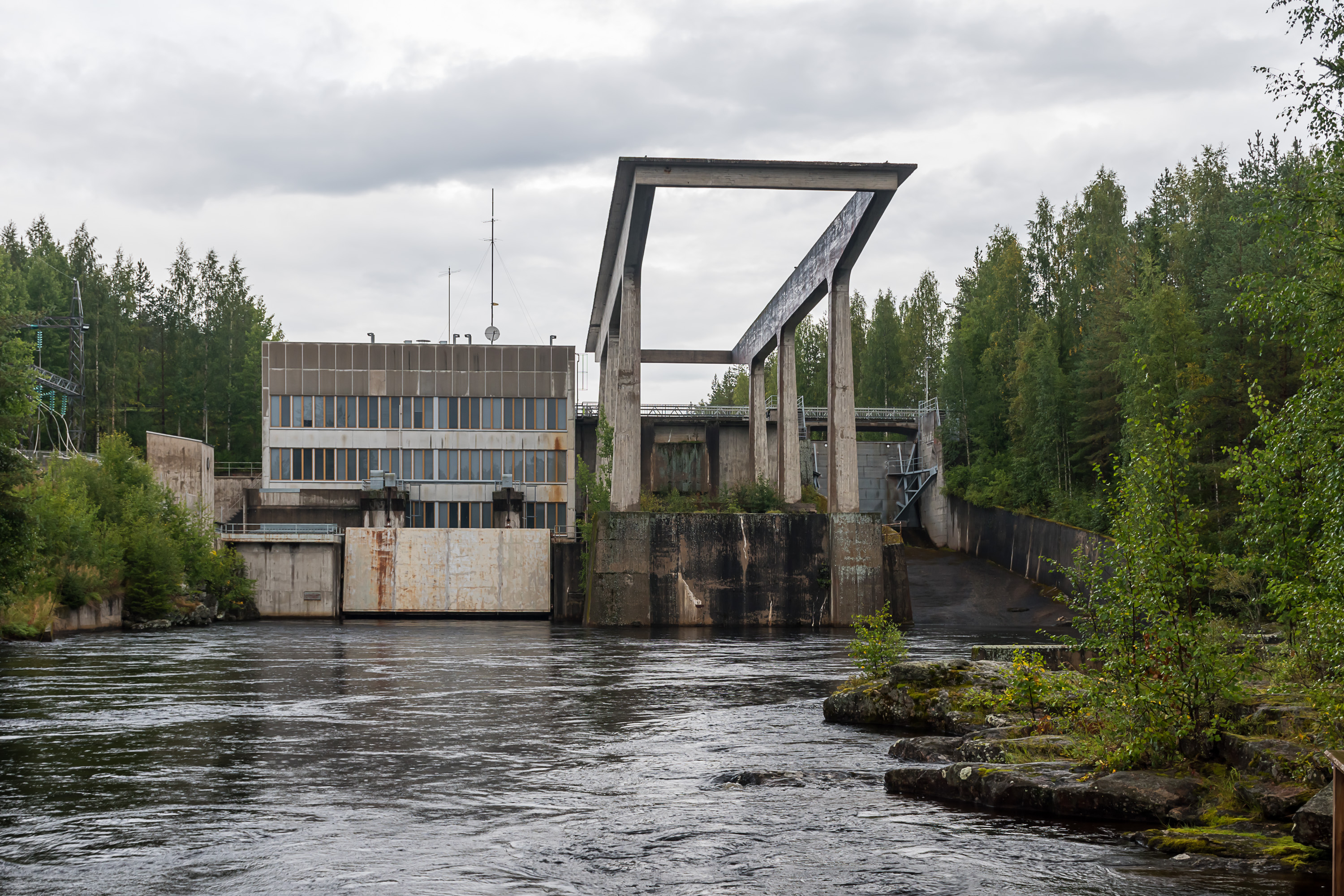
16. Ämmä hydro power plant is located at the place of Ämmäkoski rapids and the old ironworks (of which no buildings or other traces are preserved at all) at the eastern Emäjoki fork. Getting a nice hydro power dam picture from downstream is often quite challenging, but here you can actually get a great view.
The plant was built in 1959 and designed by Aarne Ervi (1910-1977), one of the most notable postwar architects who also for example designed much of the Tapiola area in Espoo, the first real mass apartment block housing project in Finland. The power output is modest 16 MW. The power plant was built by Oulujoki company, same as most hydro power plants in Oulujoki and Emäjoki valleys. Nowadays it belongs to Fortum, the biggest Finnish energy company, partially owned by the Finnish state. Oulujoki drainage basin overall has a great number of mostly mid-sized hydro power plants, with their combined power output approaching 700 MW if I calculated correctly.
Ämmä power plant is not to be confused with Ämmäkoski power plant, which is located at different Ämmäkoski, in the center of the city of Kajaani.
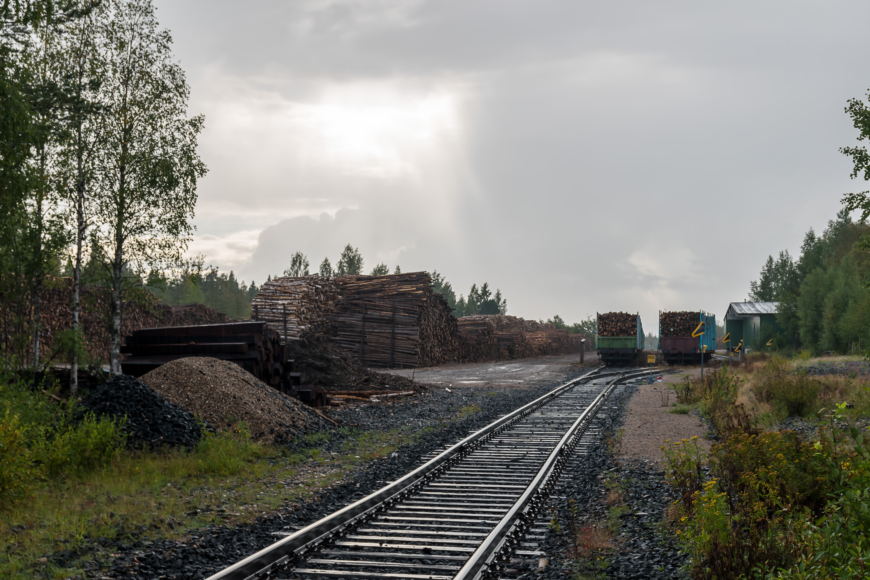
17. Ämmänsaari railway station. The railroad from Kontiomäki (a junction station near Kajaani) to Ämmänsaari, 92 km long, was built in 1955. In 1961 it also got a long spur line to Taivalkoski, a fairly similar town in the eponymous municipality farther north from Suomussalmi, but that one was abandoned in 2004. The remaining part is however still relatively actively used for timber loading, timber being virtually the only kind of bulk cargo transported internally (not imported or exported to Russia) on Finnish railroads in any volume. Passenger traffic existed only fairly briefly and was ended in 1966 already.
The railroad section is technically obsolete (it has very light rails allowing only 40 km/h speeds, and has no signaling, thus no more than one train is allowed on the entire section an any one time), and is basically crumbling apart from age now too. Options (including abandoning the whole section) were reviewed recently and in 2020 Finnish state granted 81 million euro for renovating the section, as part of a coronavirus-caused crisis stimulus package. In practice the railroad will be pretty much rebuilt from scratch, with signaling added etc. However it will also be a big shortened, and timber loading will happen at Pesiökylä, about 15 km west of Ämmänsaari, as Ämmänsaari station is simply getting too small and cannot be easily expanded, due to residential houses close by. Thus Pesiökylä-Ämmänsaari section and the station pictured will be dismantled in a few years. Needless to say, restarting of passenger services is not on the table.
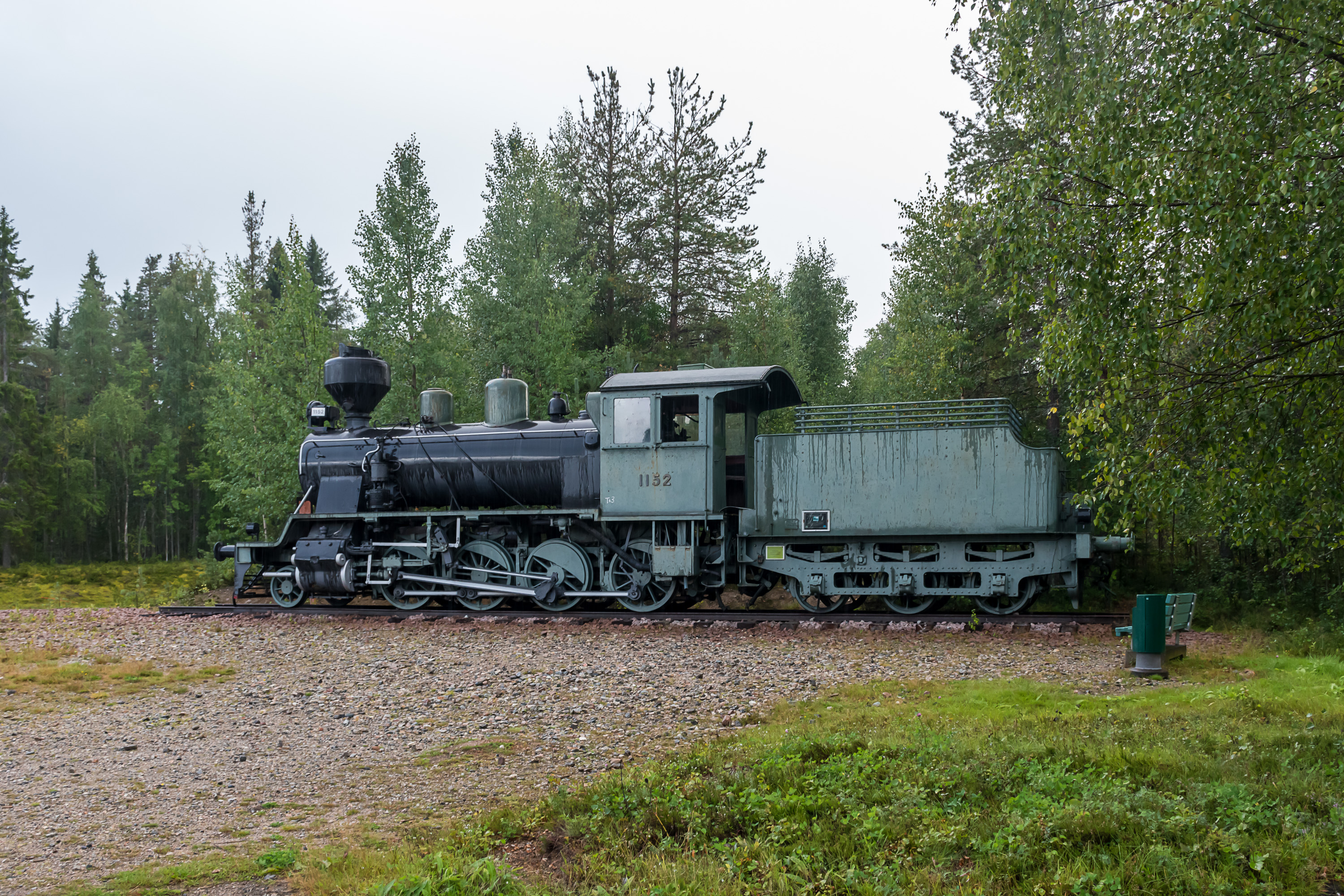
18. A museum steam engine nearby, with paint faded. This is a Tk3, the most common steam engine model in Finland to be preserved. It had originally been a monument at Pesiökylä station, and was moved here to a (somewhat) more prominent place only in 2013.

19. This is really a land of forests, even by Finnish standards. Forest plots for sale displayed at a real estate company.
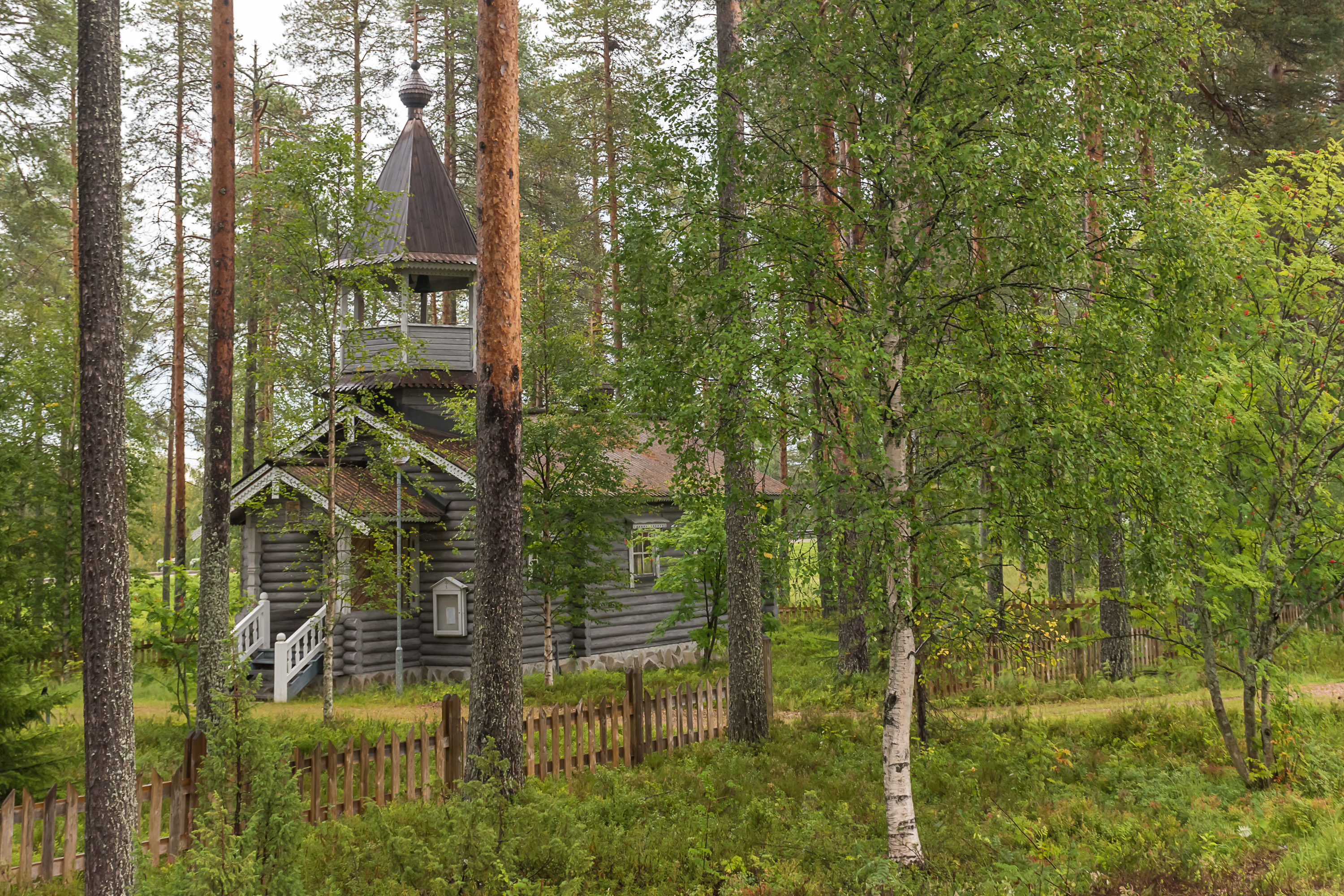
20. And one more bit of White Karelia in Ämmänsaari, an orthodox chapel (tsasouna). Built in 1979 by Hannu Pyykkönen, a local architect, inspired by old chapels of the so-called Border Karelia (Raja-Karjala), basically the northeastern Ladoga Karelia. Border Karelia is a part of the Finnish territories lost in the war, and a significant part of its population was Karelian and Orthodox (Olonets Karelian, not White Karelian though). That population was resettled around Finland, like the rest of Karelian evacuees, and largely assimilated since.
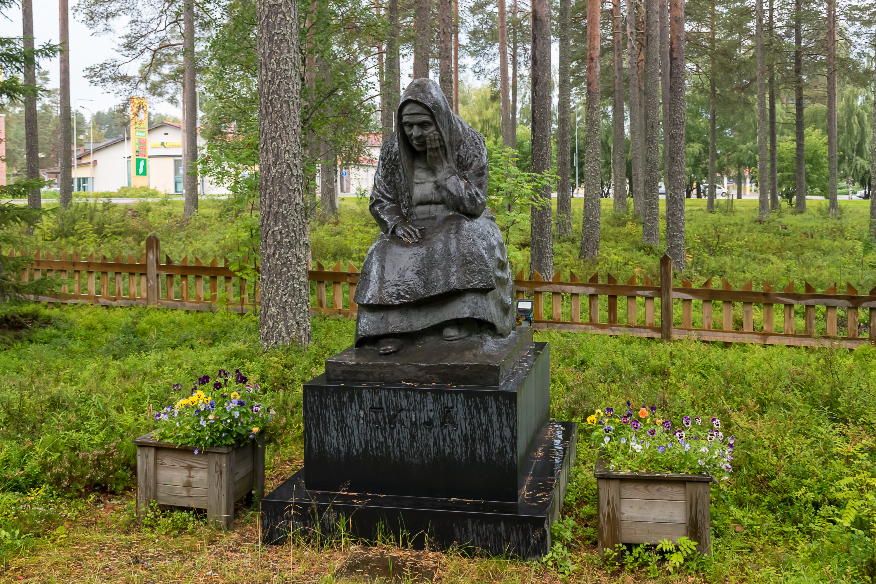
21. The statue of an old woman nearby was put up in 1987. This is a White Karelian lament-singer; laments, sung at weddings, funerals and other events, is another Karelian tradition that does not exist among the Finns; it might have come from Russians. There are attempts to preserve the tradition both in Russia and in Finland.

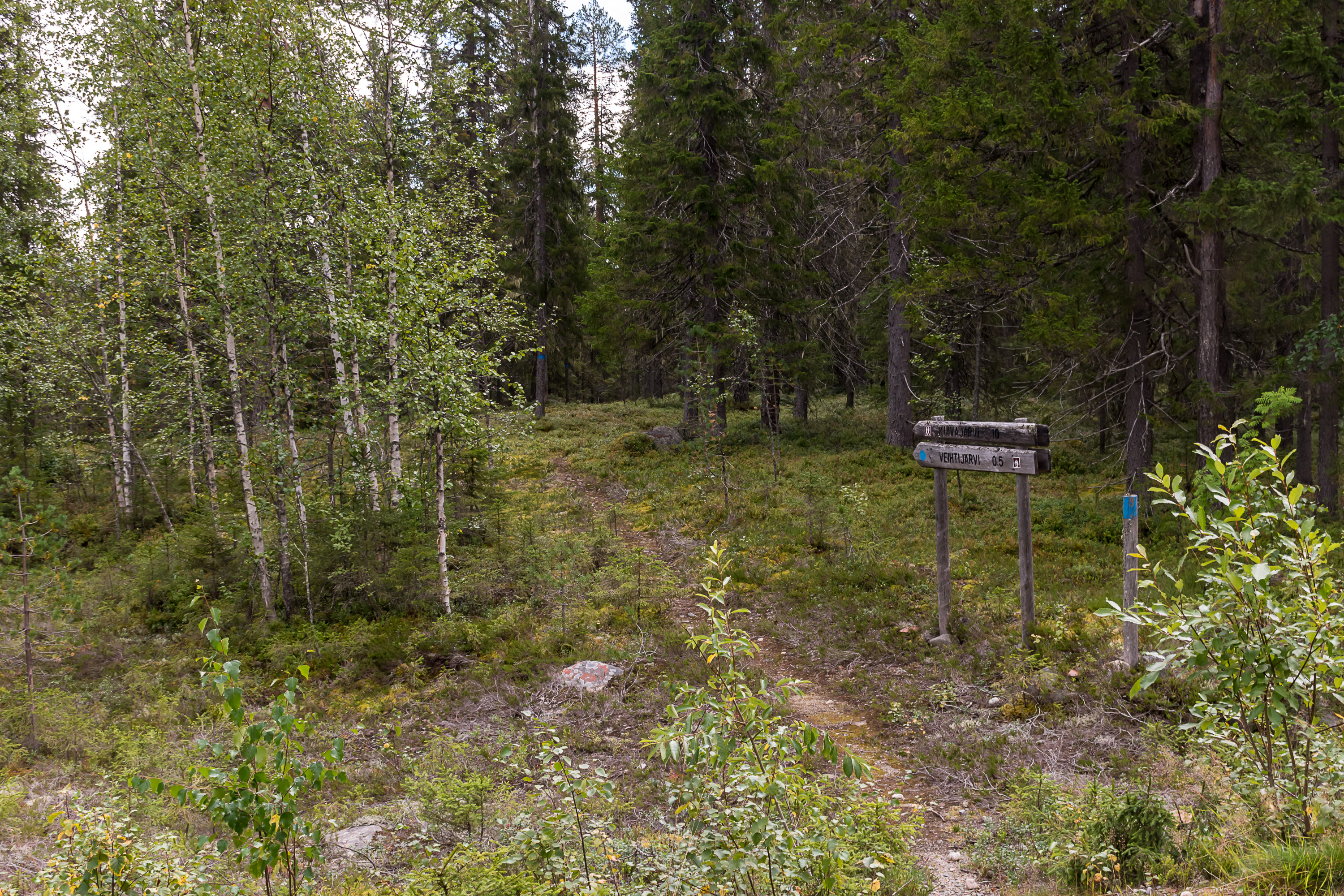
22. And now let's go visit some real Karelian villages. In truth there's not all that much exciting to see there. The village of Kuivajärvi (Finn. Dry Lake) is located in 20 km down a gravel road branching from Suomussalmi-Kuhmo road, quite a bit to the south of Ämmänsaari and of for example the Raate road. Kuivajärvi is only about 3 km away from the Russian border. There is no public transportation here.
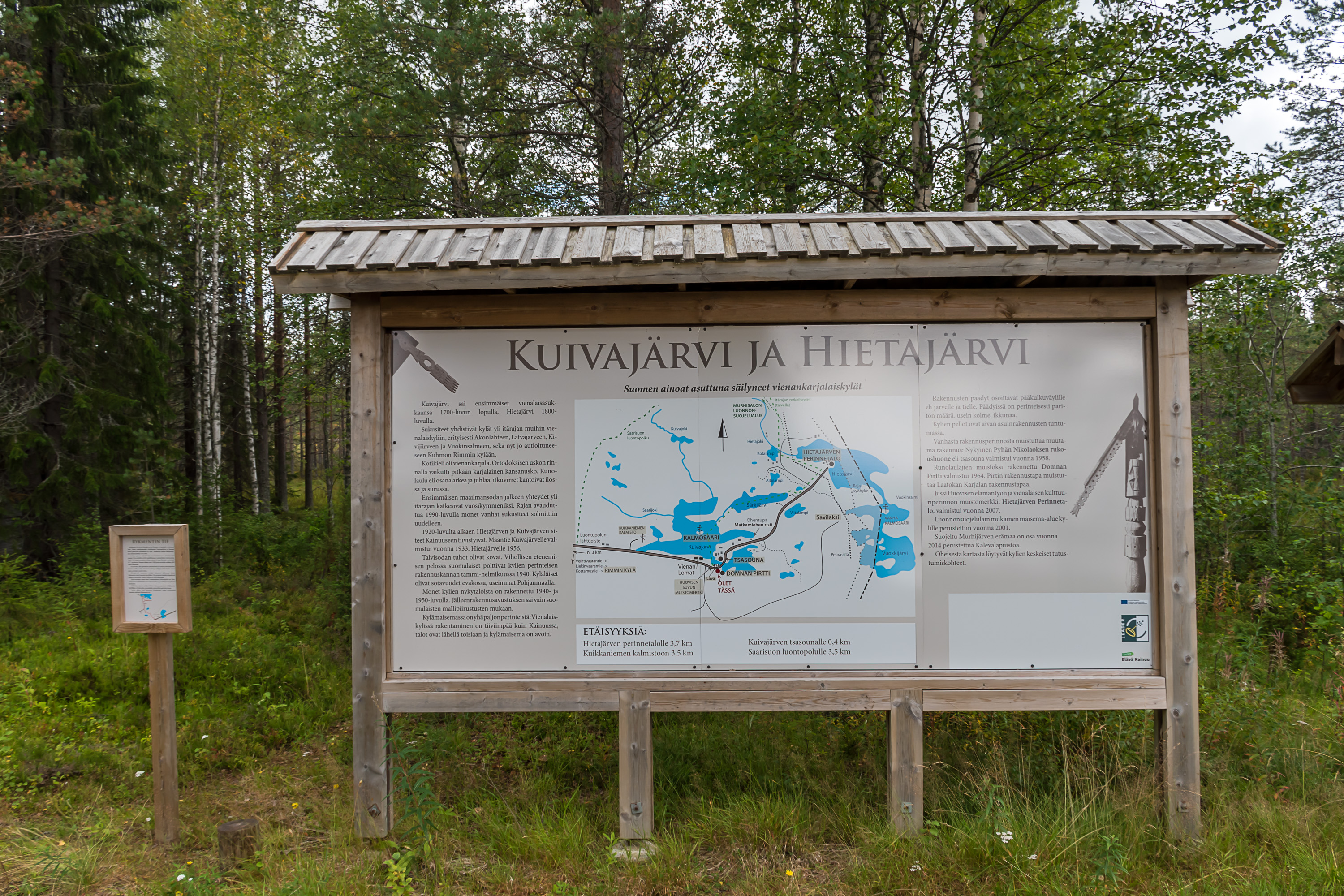
23. For those few tourists who reach these places there are even information signs (I think there was information in English somewhere too). They tell us that these villages were settled in late 1700s-early 1800s, when the borders were in principle defined but in practice no one cared much. Before Finnish independence Kuivajärvi and the nearby Hietajärvi were closely related to the much more numerous Karelian villages on the Russian side; there were many intermarriages etc. Then the border closed and Kuivajärvi and Hietajärvi had not much choice but to drift towards Finland. Nonetheless both villages are still populated mostly by Karelian people. Less then ten houses in two villages together are marked as permanently inhabited (and a similar number is now used as summer residences), but the villages aren't really going extinct either.

24.
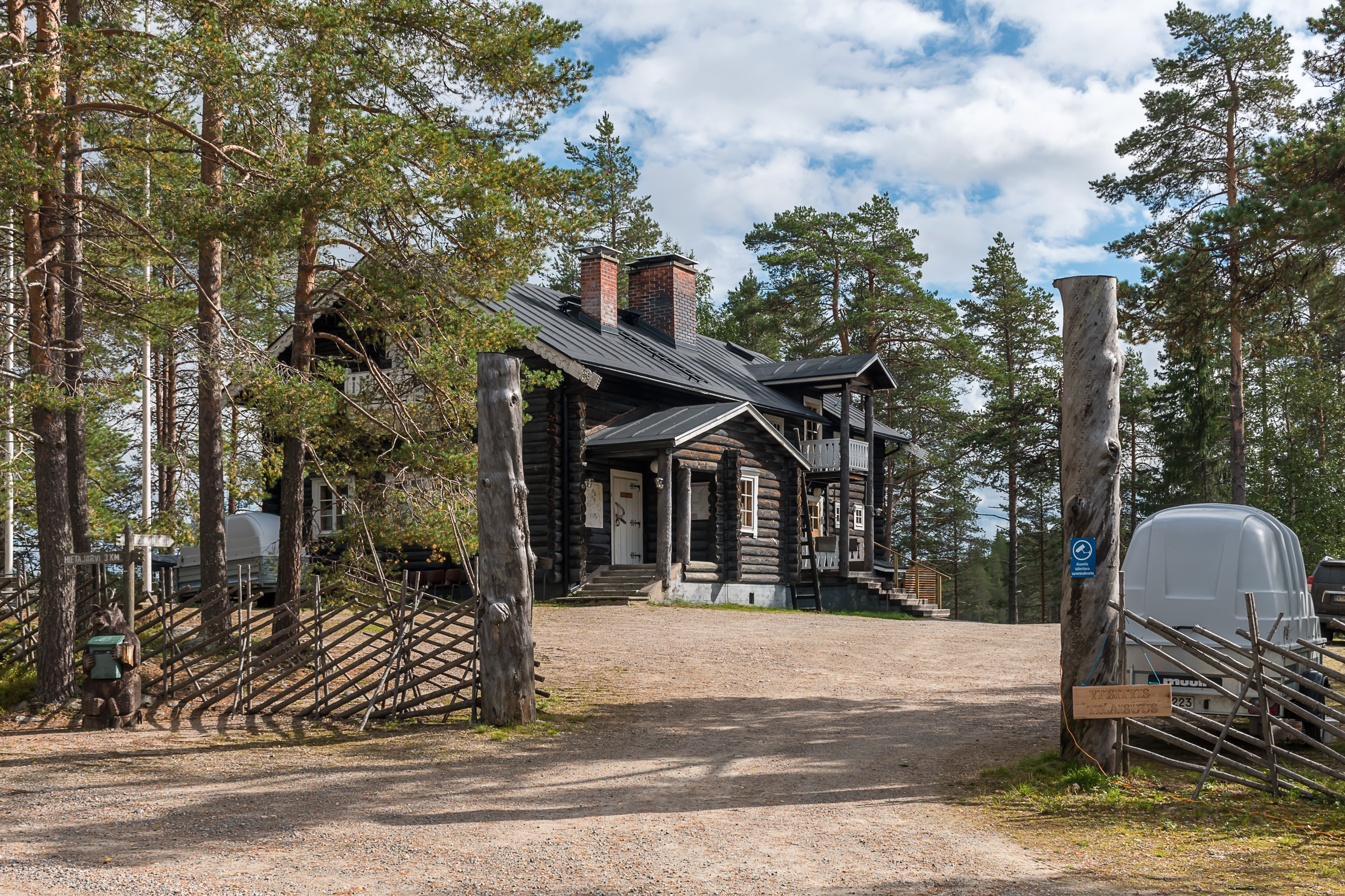
25. As I mentioned before, the villages were burned down in the war, and the original Karelian houses were destroyed. After the war the villages were rebuilt with generic Finnish houses. Nonetheless a few (three, I think) buildings in Karelian style were eventually built by the villagers again. This is Domnan pirtti, Domna's Cabin, built in 1964 and named after Domna Huovinen (1878-1963), a locally famous lament-singer. She was born on the Russian side in Vuokinsalmi, another village that does not exist anymore, but married some Hilippä Huovinen from Kuivajärvi and moved with him here. Huovinens have overall been the biggest local dynasty. Domnan pirtti is currently privately owned and rented out as accomodation for up to ten people, and as an event/conference place for up to 50 people.
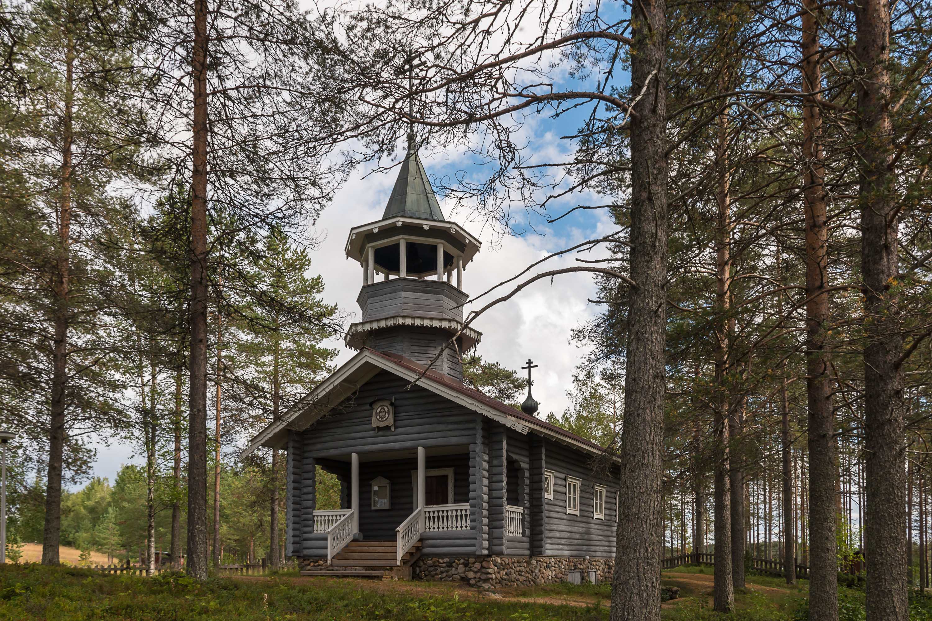
26. The St. Nicholas chapel (Pyhän Nikolaoksen tsasouna), close by Domnan pirtti, is the third Orthodox chapel to be built in the village, in 1957. It is normally locked up unfortunately. The chapel is modelled after the chapel of Ägläjärvi of Korpiselkä, also in Border Karelia in the lost territories (and thus looks rather similar to the also Border Karelia-inspired chapel of Ämmänsaari). The chapel of Ägläjärvi and the whole village was destroyed in the war and the place was never resettled by the Soviets. The altar screen was painted by Martta Neiglick-Platonov (1889-1964), one of the extremely few Orthodox icon painters in Finland at the time. (Platonov is her husband's last name; she herself was Finnish and lived in Helsinki.)
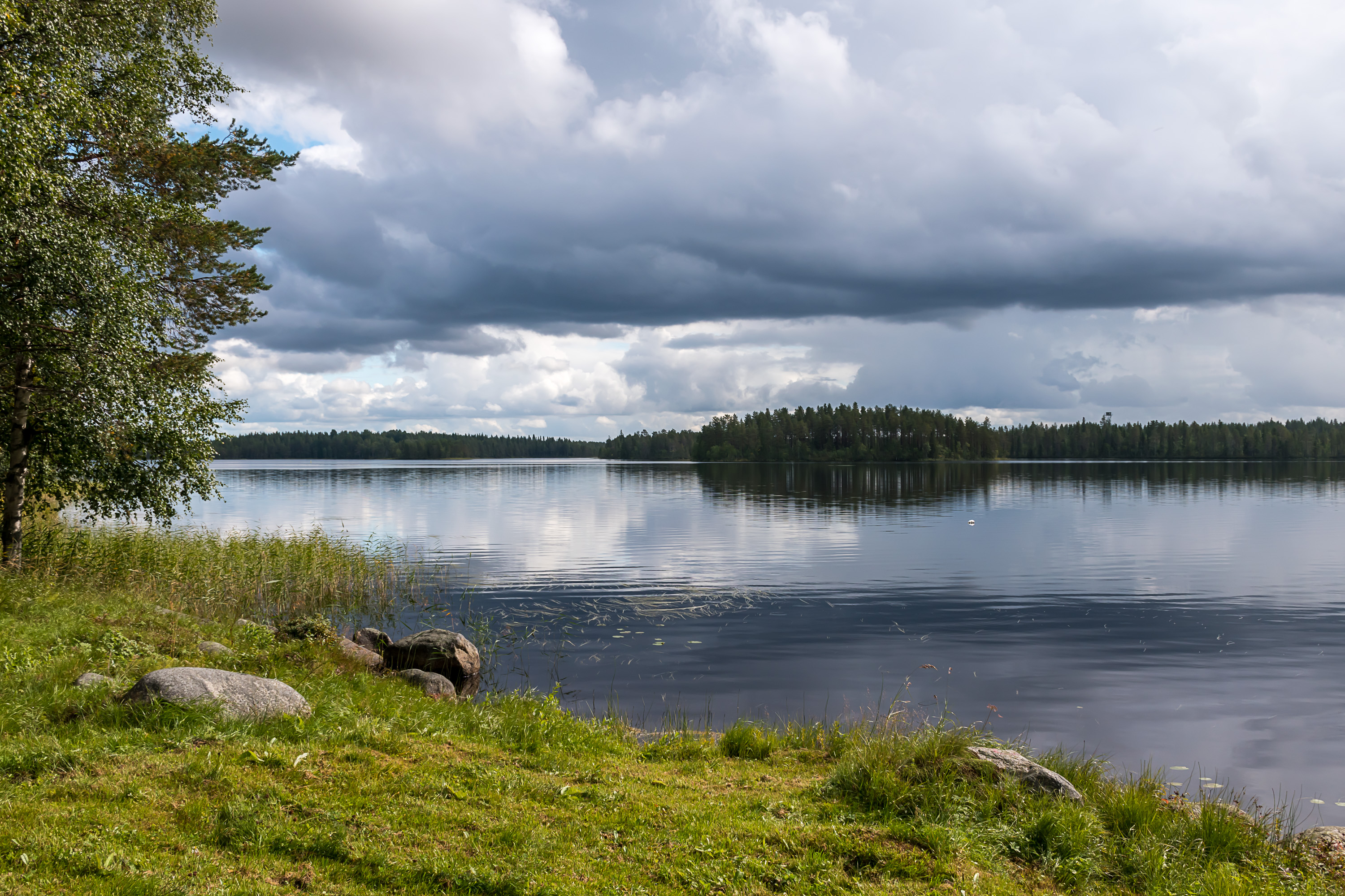
27. The village's namesake Kuivajärvi isn't a very big lake. A smallish forested island can be seen to the right. It happened to be in shade when I was taking this picture, which is rather appropriate because it is Kalmosaari, the Graveyard Island, the local graveyard. It is actually the new graveyard island; the old one, closer to Hietajärvi, originally used both by these villages and by Vuokinsalmi village on the Russian side, was located in another lake right on the border, and, upon closing the border in the 1920s, could not be really used anymore. The new island is in truth now disused too, the newest graveyard is just on the lake shore not very far from here.
The Karelian tradition of having permanent graveyards on lake islands is, as I understand, distinct from the Finnish tradition of having such islands in remote villages for burying people temporarily, in times of year when the roads to the local church and the proper graveyard were impassable.
28. A monument on the shore of the lake, dedicated to the Huovinen family. There have been rune singers among Huovinens too.

29. Hietajärvi (Finn. Sandy Lake), the other village, is even smaller and even closer to the border. From the end of the road to the state border is only 700 m as the crow flies. The border passes through the namesake lake, with the restricted zone on the lake being only about 200 m wide.
The signs say that although the new houses are unremarkable, they are still spaced rather tightly and there is little space around, which is a Karelian village trait and distinct from Finnish villages. Honestly I probably wouldn't have noticed that myself, but I suppose in this picture it should be more or less visible.
30. One of the houses is not like the others; this is the traditional house of Jussi Huovinen, the last rune singer of Finland. The house was built relatively recently, in 2006, in the shape of his childhood home. As I understand the house has been more of a museum one, not for actual living. I guess it should be possible to have a look if you knock and ask nicely.
Jussi Huovinen died in 2017, at the age of 93.
31. Hietajärvi, the border lake. You can see a border guard tower beyond the lake, although it's still a Finnish one. I'm not sure if any Russian territory is actually visible in this picture; Russia should be somewhere to the left.
Beyond the border the Russian lands that used to be full of Kalevala villages are mostly empty now. The population from most villages was resettled in the Soviet times, just like from Akonlahti and Vuokinsalmi. The good news is that there are now large protected nature areas on the Russian side, far larger than anything in Suomussalmi: Kalevala National Park (744 sq. km) in the north, and Kostomuksha Strict Nature Reserve (476 sq. km) in the south. The nature in Russian Karelia is overall wilder and better preserved than in Finland, although it's also kind of why it's not really as appreciated as in Finland.
Kostomuksha Strict Nature Reserve, along with various smaller protected nature areas of mostly Kuhmo (south of Suomussalmi) but also Suomussalmi itself, were declared in 1989 the Friendship Park (Ystävyyden puisto), and some Finnish-Russian nature preservation-related cooperation is ongoing here. One of the major points is preserving the wild forest reindeer population on both sides of the border.
32. There is actually a reindeer fence on the municipal border of Kuhmo and Suomussalmi, seen there crossing a small forest road. Kuhmo has a wild forest reindeer population, which had spread there from the Russian side in the 1950s, even though wild forest reindeer were for a while extinct within Finland itself. From there over the years some reindeer were moved elsewhere, to Suomenselkä areas in West Finland. All populations are quite stable and growing by now. I even saw wild forest reindeer myself twice, both times in West Finland in areas west and south of Lappajärvi lake.
Suomussalmi on the other hand actually belongs to the reindeer husbandry area. These are some of the southernmost lands in Finland where semi-domesticated reindeer, living in the wild, are herded on the commercial basis. I actually don't remember ever seeing reindeer in Suomussalmi, so they must not be very numerous here (in Lapland you can see plenty reindeer along roads just driving around), but still they're definitely present here somewhere. And thus, the reindeer fence: so that the wild reindeer of Kuhmo wouldn't intermix and interbreed with the domesticated reindeer of Suomussalmi.
33. Signs for the Eastern Border hiking route (Itärajan retkeilyreitti) can be seen by these small roads, a fairly rarely visited 160 km hiking trail along basically the entire Suomussalmi, passing by Kuivajärvi and the Raate road, and ending at the Hossa National Park.
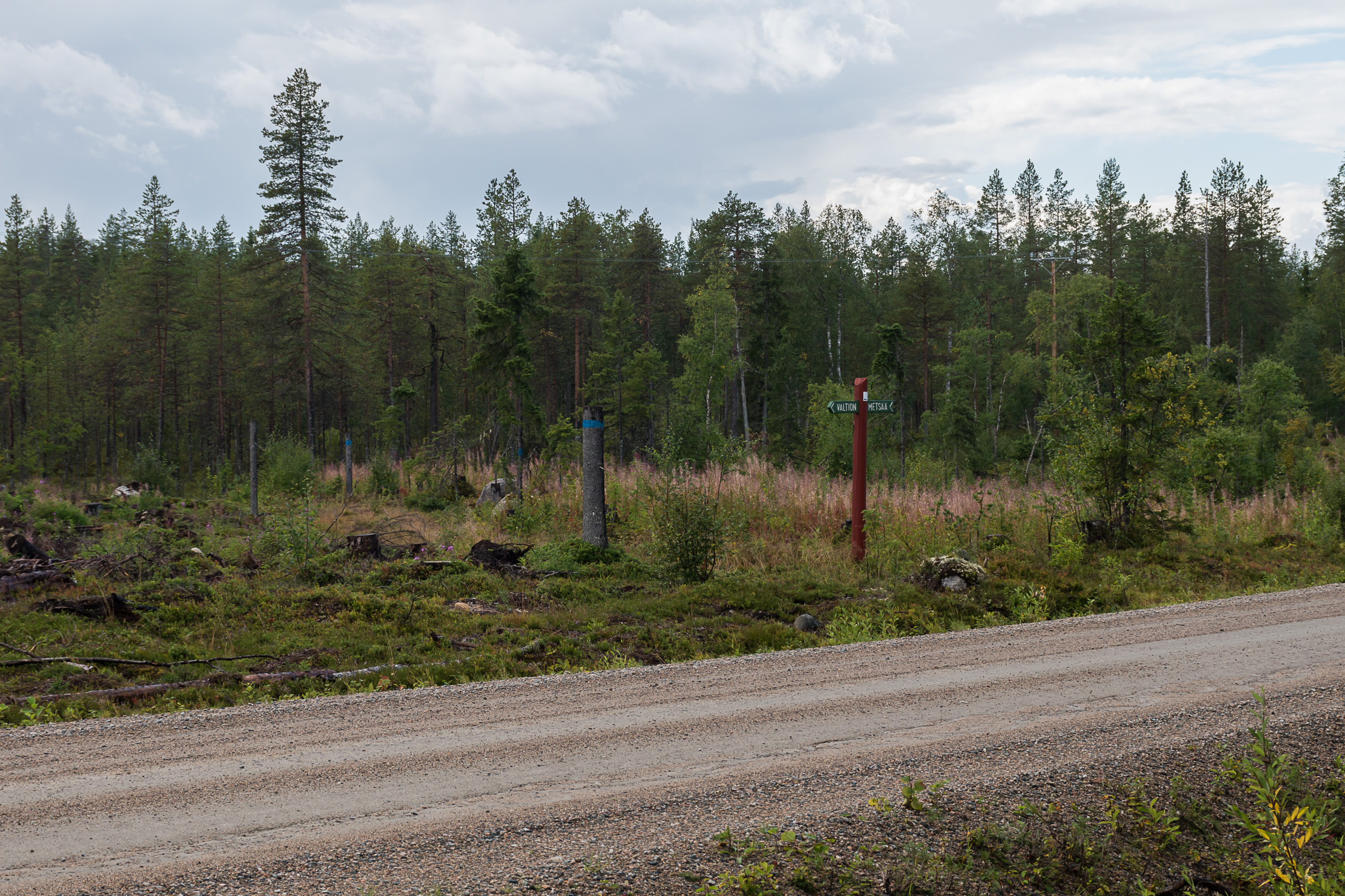
34. The trail passes by several protected nature areas, but also through a lot of regular commercial woods and wood cuttings. Here in the north much of the forest belongs to the state; Valtion metsää signs make sure to tell us about that, although I have no idea why; it's not like there is any practical difference at all to any visitors. The state forests get cut and sold every once in many decades, just as privately owned forests do.
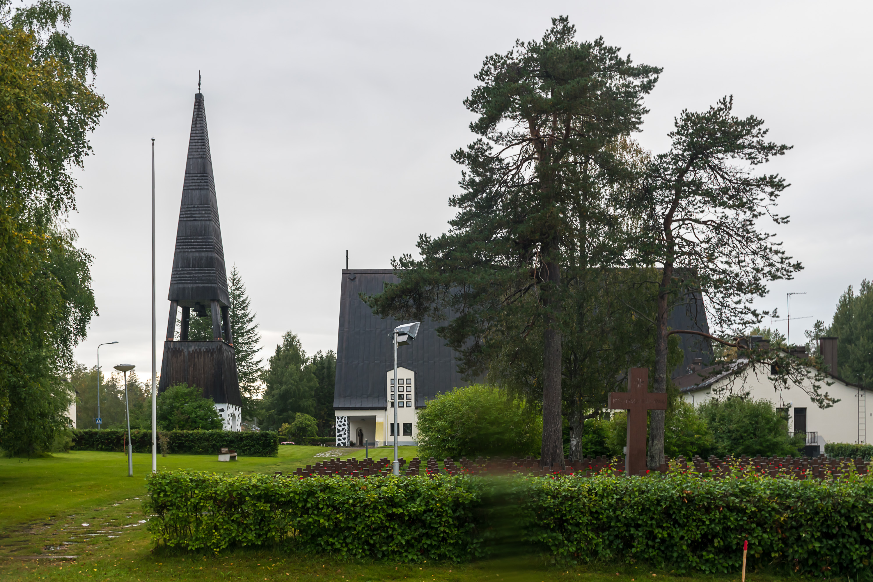
35. But now let's return to Ämmänsaari and go north from it. We're first passing by Suomussalmi church village, where there is little to see other than the church from 1950 and the large war cemetery.
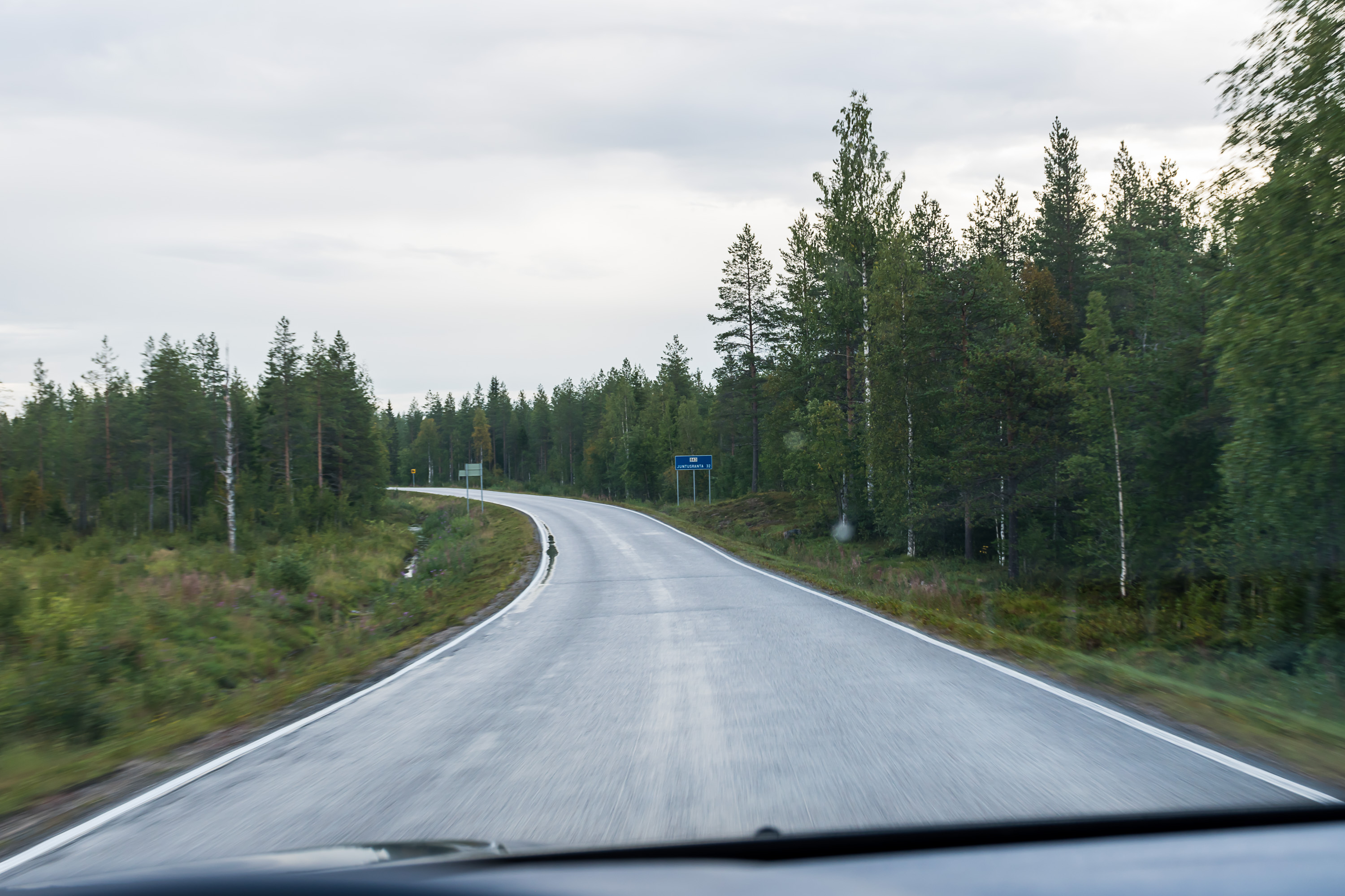
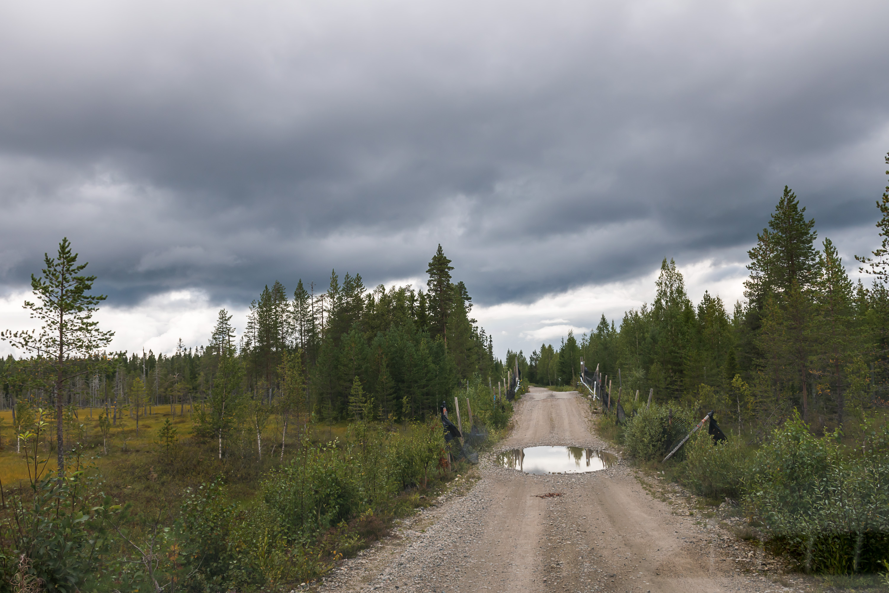
36. Regional roads in these lands are usually pretty much completely empty, and are a real pleasure to drive.

37. The village of Juntusranta, a rather significant one during the Winter War Suomussalmi battles, is a sad sight now. A store, a gas station, a primary school, everything has closed down. Well, it is a small village too, not nearly as small as Kuivajärvi and Hietajärvi but small enough there is no real population data. Of course, all of Suomussalmi is losing population fairly rapidly. In 1980 there were almost 13400 people in the municipality, now in 2020 only 7700 are left.
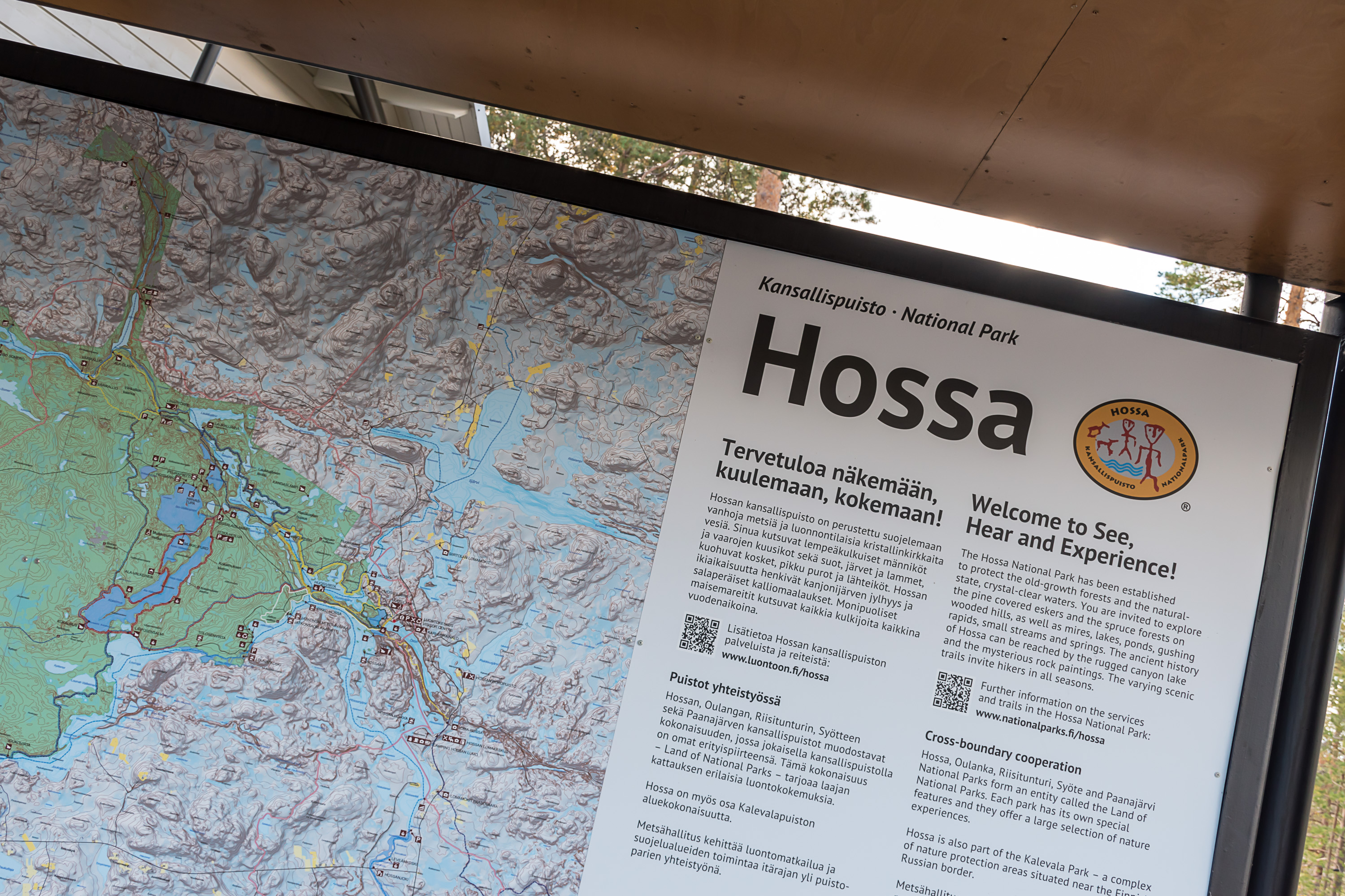
38. But now we're going to see the biggest nature spot of Suomussalmi, the Hossa National Park. It is located at the very north of Suomussalmi; parts of it stretch already to Kuusamo side.
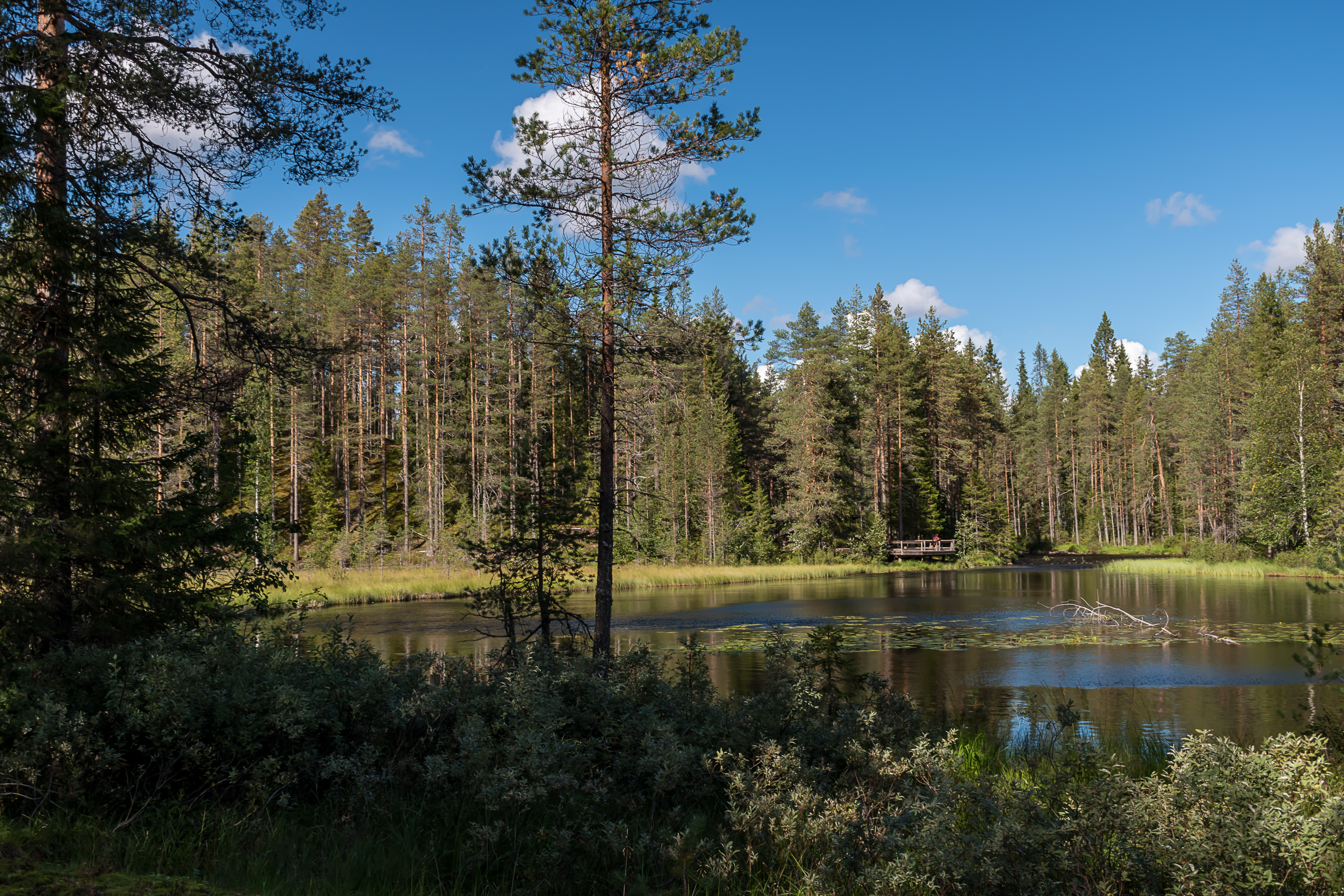
Hossa is, as of 2020, the newest national park in Finland, officially established in 2017 for the 100th year of the Finnish independence. Although it wasn't really a new site, before that it had been a national recreation area (basically national park hiking infrastructure without national park conservation status). By area it is 110 sq. km large, large enough for multi day hiking and also with biking and canoeing options. Its nature however is not as dramatic as some of what can be found farther north, even not too far away in Kuusamo (Oulanka National Park); just untouched woods, mires and a lake maze. There are however a few major sights, so let's go see two: Värikallio and Julma-Ölkky.
The official webpage of the national park in English can be seen here, and the brochure with a trail map here.
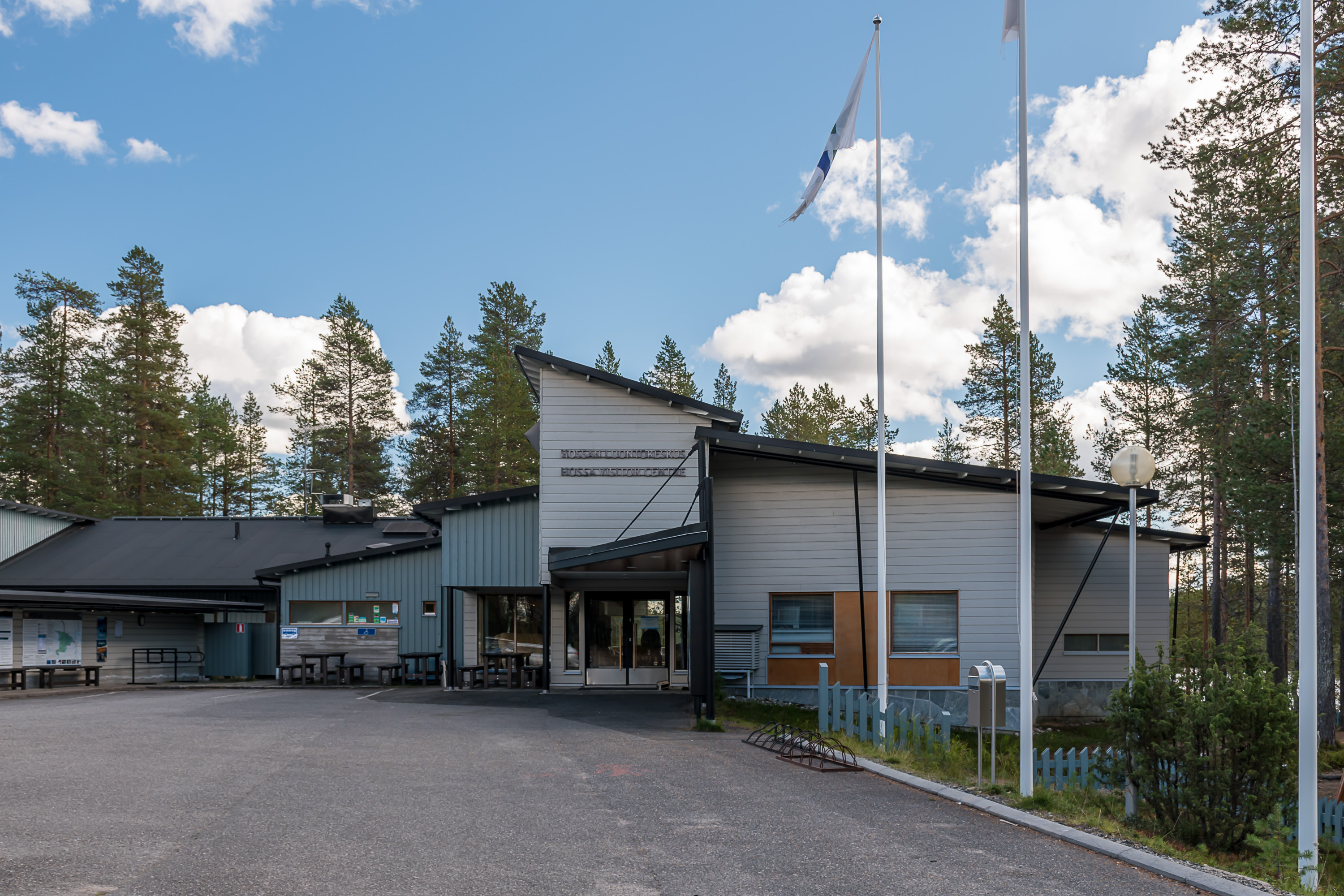
39. The national park visitor center. Nothing interesting really, not even a small exhibition as is typical for such places. From the center small roads go and branch out, first paved, then gravel ones (some of them rather poor) and go to the trailhead parking lots.
Hossa is not very easily accessible without a car, but at least the situation is better than for many smaller national parks. The first place to reach would be Kuusamo, which has buses (even direct ones from Helsinki) and a small airport with flights to Helsinki. Then the options are:
- There is one bus per day between Kuusamo and Juntusranta on school days (weekdays outside school holidays), which stops at Hossa Holiday Village (Hossa lomakeskus) close by the national park
- There are 1-2 buses per day between Kuusamo and Peranka also on school days. From the village of Peranka there is a 9 km connecting trail to the western edge of the national park, and 38 km to the visitor center in total. It is thus possible to through-hike the national park from Peranka to Hossa Holiday Village, mostly along waterways
- Finally at least in 2020 in summer (late June to early September) there were two buses daily from Monday to Saturday with a Ruka-Kuusamo-Hossa route (Ruka being a skiing resort north of Kuusamo), and also two on Kuusamo-Hossa route. That of course would be the most convenient option
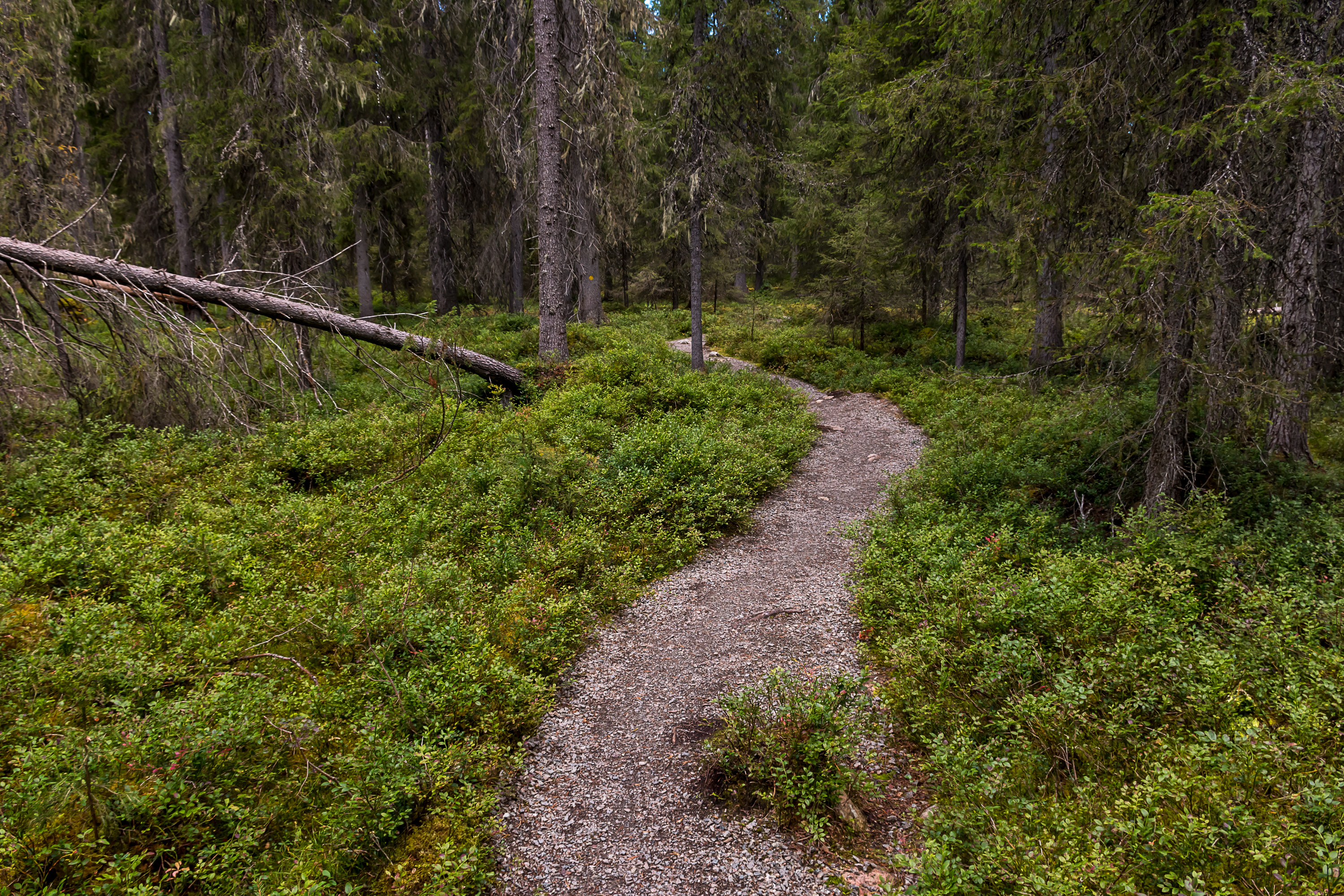
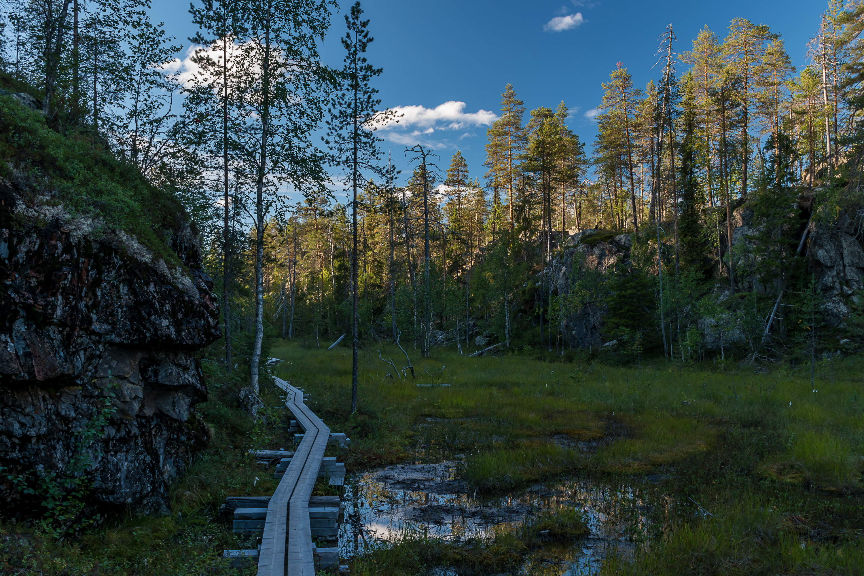
40. Let's start with Värikallio Bend (Värikallion kaarros) trail, a circular one 8 km long. It goes to the rock paintings of Värikallio, which literally means "Colored Rock".
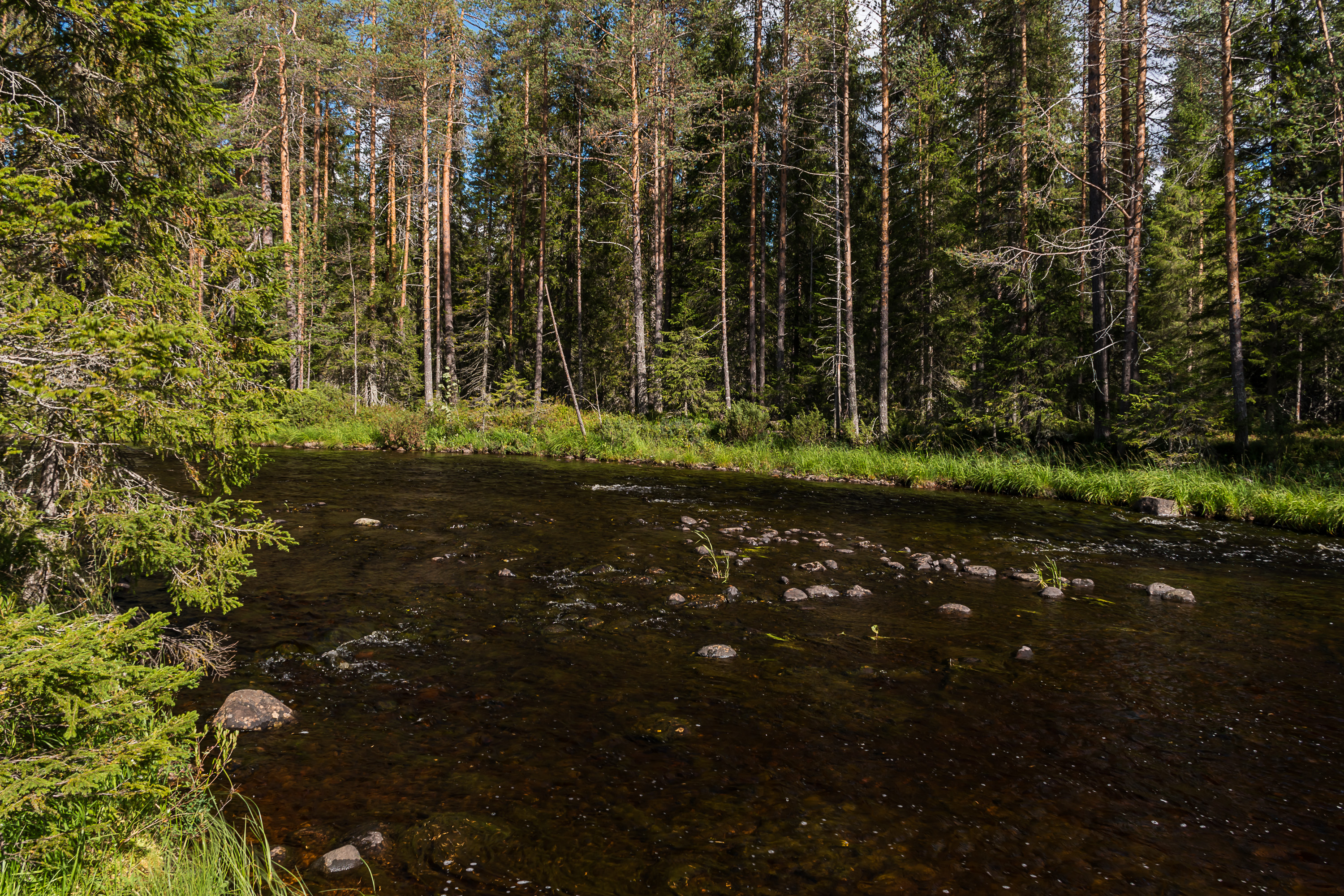
41. The first half of the trail follows a small river named Somerjoki.
42. Starting at a place named, for some reason, Lihapyörre, "Meat Whirlpool".
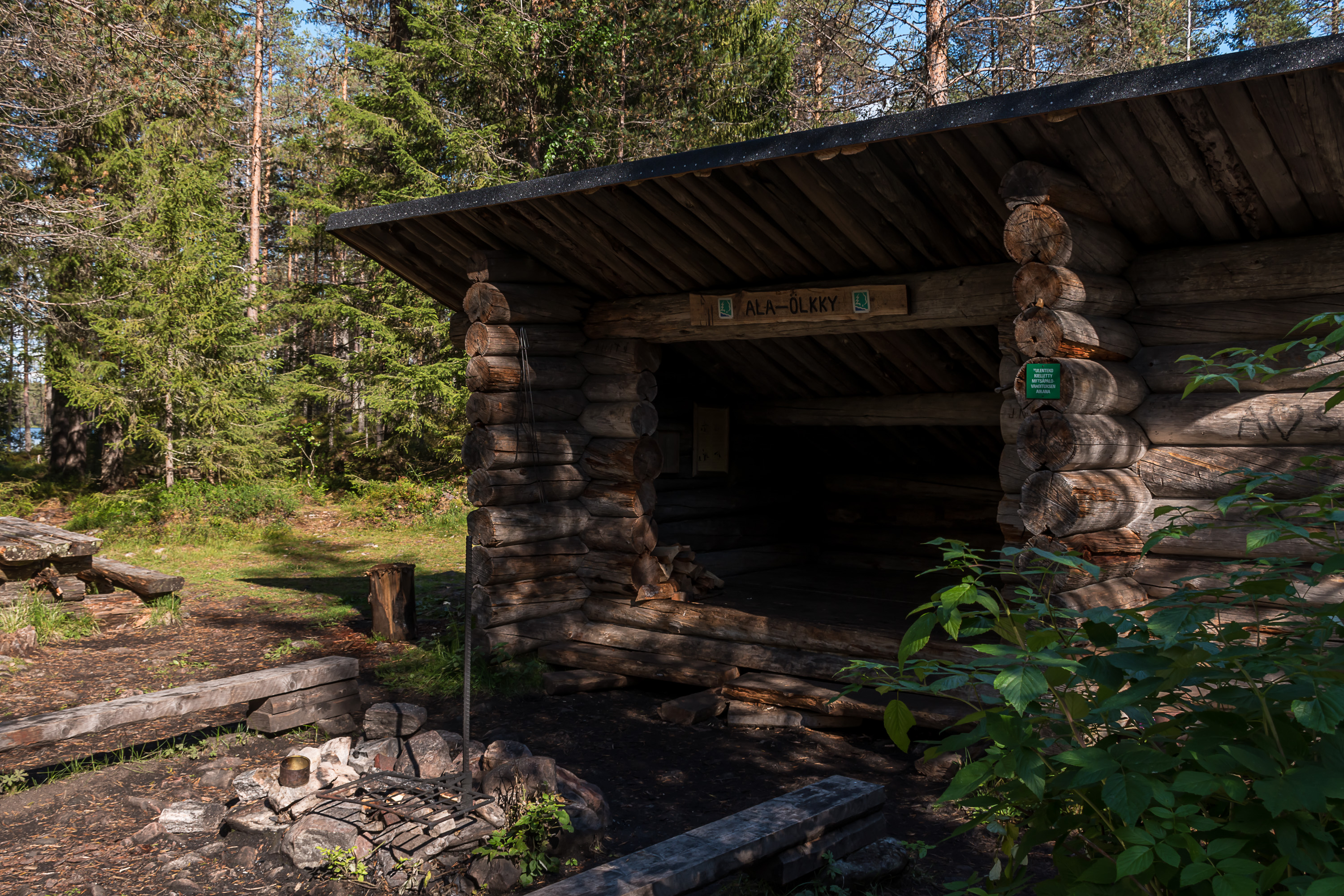
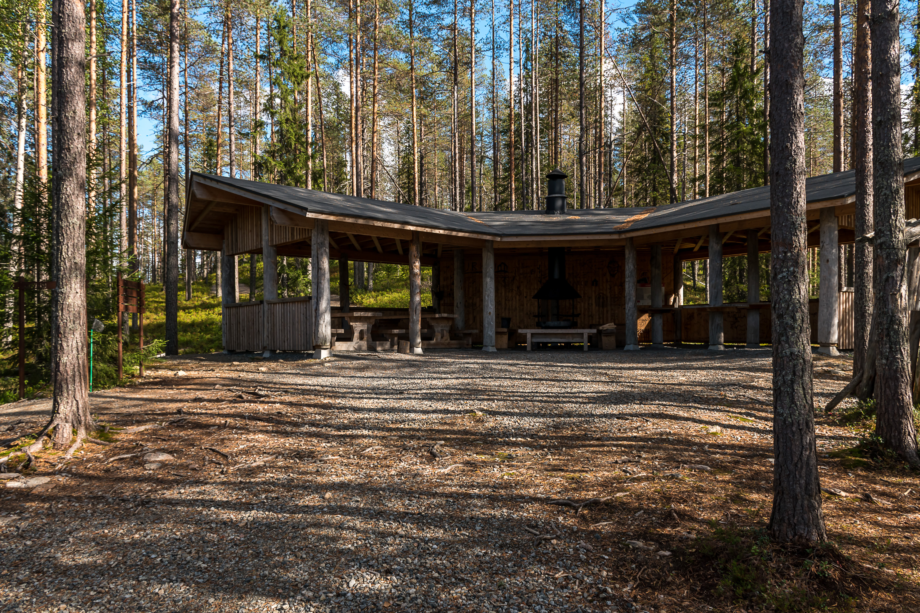
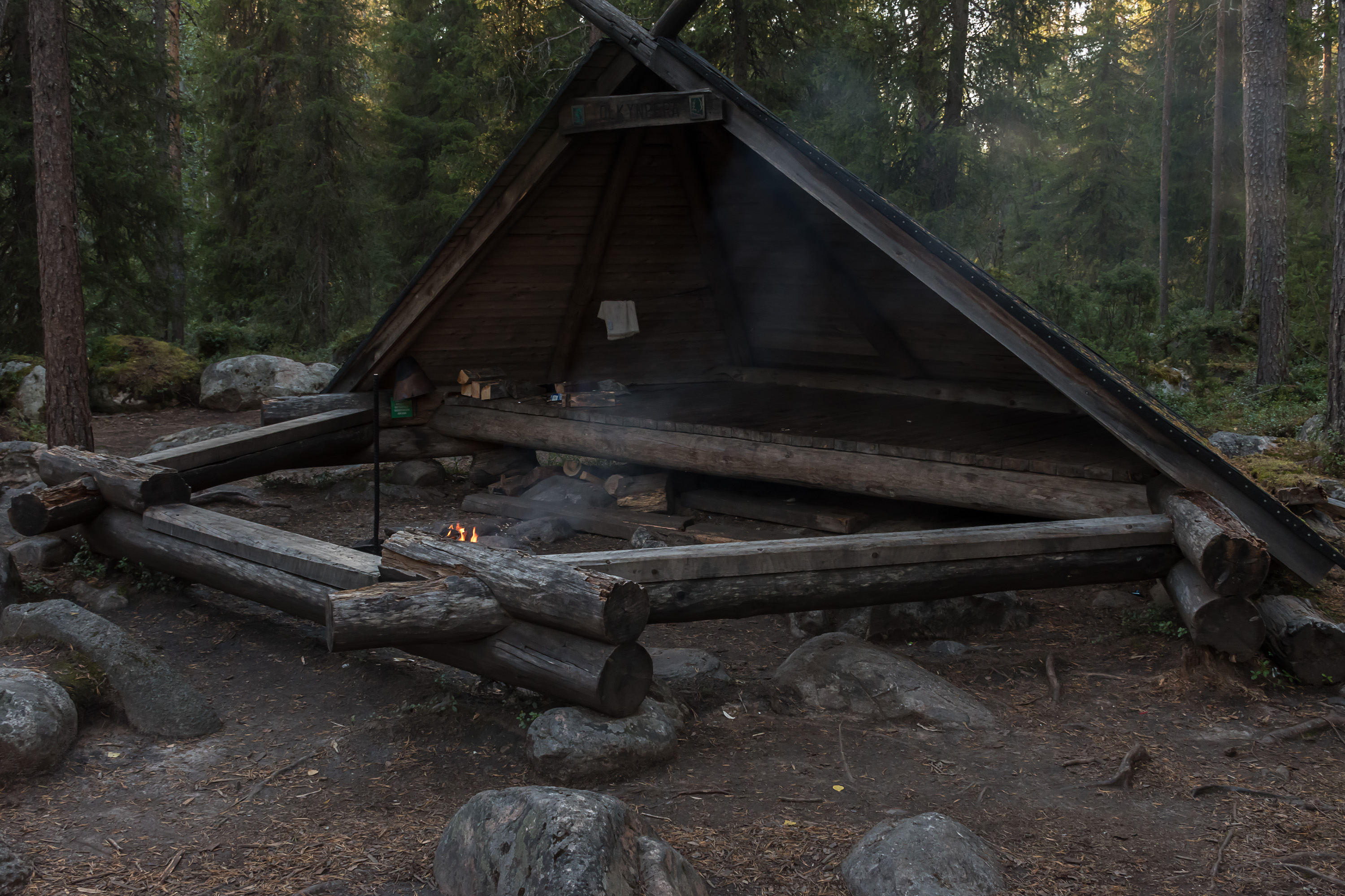
43. Laavu lean-to on the way.
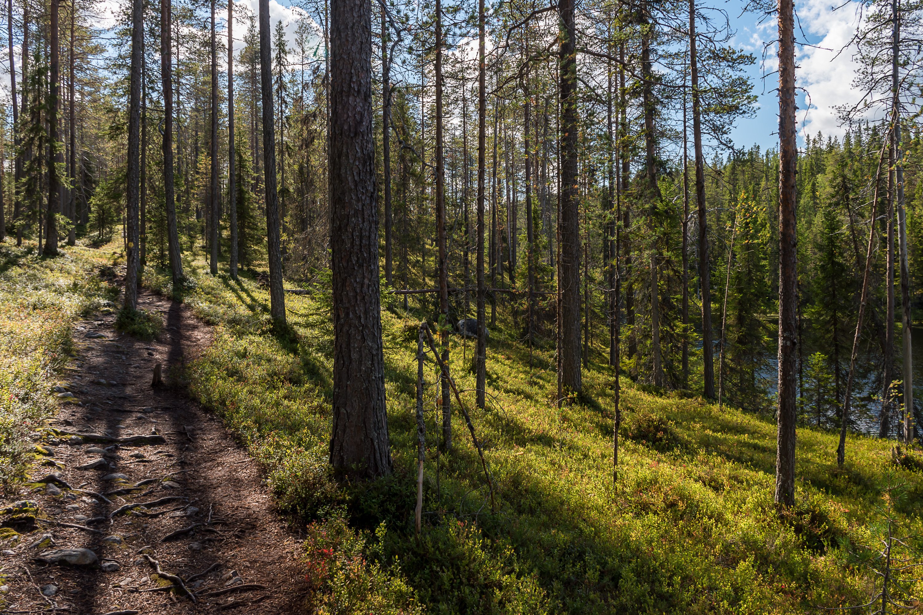
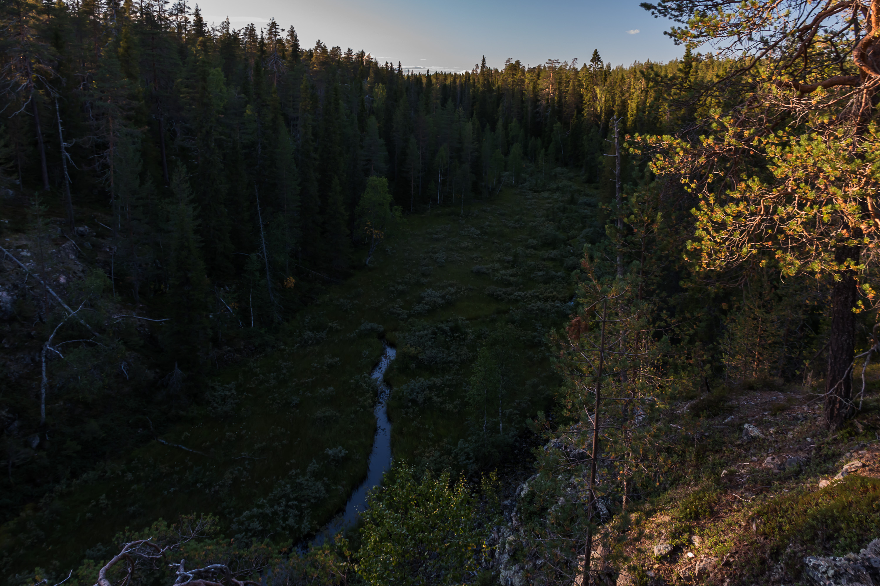
44. The trail climbs some steep ridges along Somerjoki but there rarely is a clear view.
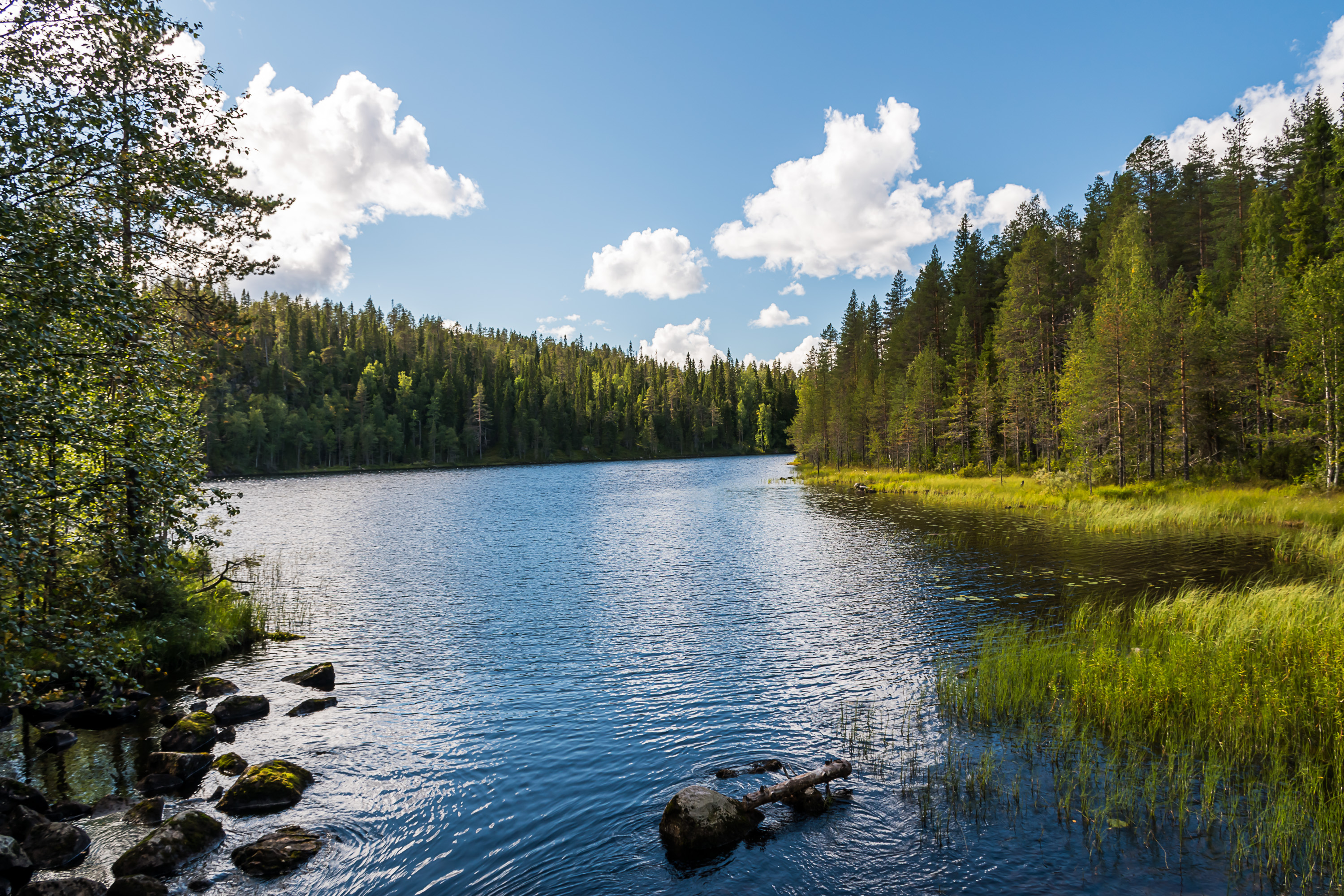
45. This is the lake we need, named Somer. It is long and narrow, but we don't need to follow it for long.
46. There is a pretty huge rest spot on the shore of Somer. From there it is only a few hundred meters to the rock paintings.

47. The rock paintings are located on a vertical cliff by the lake. Rock paintings are found on lake shores, and very often the cliffs are such that the paintings would be visible only from a boat or from ice in winter. Since this is a prominent site, there was such platform constructed.

48. And here they are. Most distinct in the center, but some shapes are discernible all over the picture.
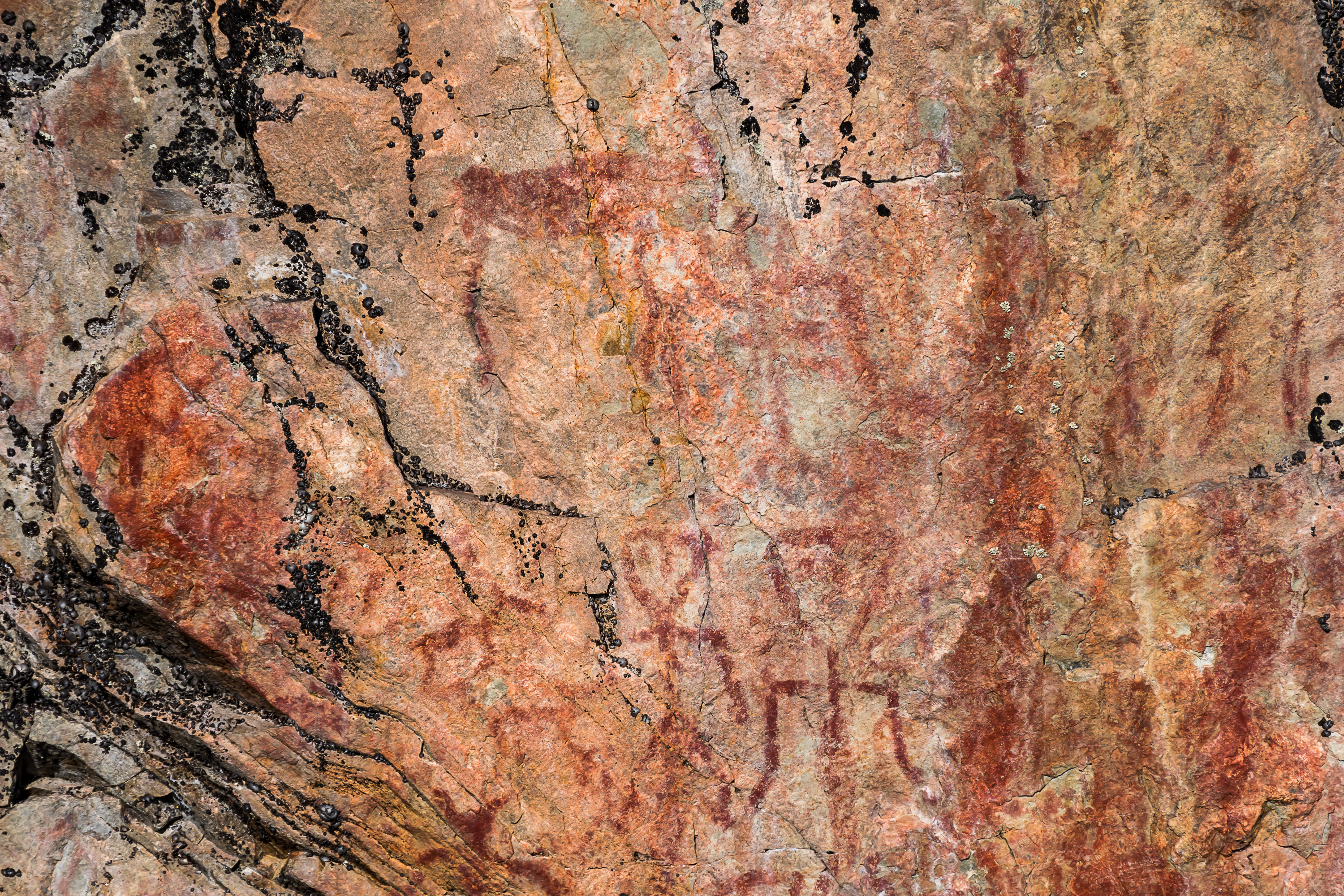
49. Magnified here in the middle. Stick figures with triangular heads and animal (elk) shapes are clearly visible.
Värikallio, discovered in 1977, is the 3rd biggest known rock painting site in Finland (after Saraakallio in Laukaa in Central Finland, and Astuvansalmi near the city of Mikkeli in South Savo). It contains at least 61 distinct figures. Apart from humans and elks some are interpreted as bears and lizards or beavers; all of those are much rarer in rock paintings than humans or elks.
The age of Värikallio paintings is unknown. Overall Finnish various rock paintings were dated between 5000 BC and 1500 BC, thus in Stone and Bronze Ages. There really are very few possible ways to estimate the age of such paintings. It is usually done based on their height above the lake, in areas where the lake surface is known to very slowly decrease with time due to postglacial rebound phenomenon. The surface of Somer lake has however been more or less constant, and the paintings are at the same height as they presumably were thousands of years ago: right above the water. Using radiocarbon dating could in theory be possible for organic materials (fat, blood) used as paint thickeners, but so far this hasn't been done successfully anywhere in Finland.
About 100 rock paintings are known in Finland, most of them in the southeast but also in the east (like here) and in the south. Most are small and contain only one or a few shapes. How many paintings have been destroyed by time, or lie yet undiscovered, is anyone's guess. It's rather miraculous that at least some ochre paintings by prehistoric people have survived time, elements, microorganisms, mosses/lichens and later human activity to be somewhat visible even today.
The meaning of rock paintings and the reason for painting them is of course an even bigger mystery, although there might be occasional tantalizing hints with repeating shapes (for example, in one rock painting there are unusual patterns that are similar to those on Sami shaman drums from millenia later). Not much archeological research has been done at Finnish rock painting sites either so far.
Finland has more rock paintings than any other Nordic country or than neighboring Russian regions. On the other hand, there are no known prehistoric rock drawings (petroglyphs, engraved into rocks rather than just painted) in Finland, except possibly one now destroyed site near Rovaniemi; even though numerous such drawings are known in Sweden, Norway and Russian Karelia.
50. The trail circles back from Värikallio to Lihapyörre through mostly unremarkable terrain, except a small deviation where you can also look at Värikallio rock from across the lake, from another rock some 30 m above water surface.
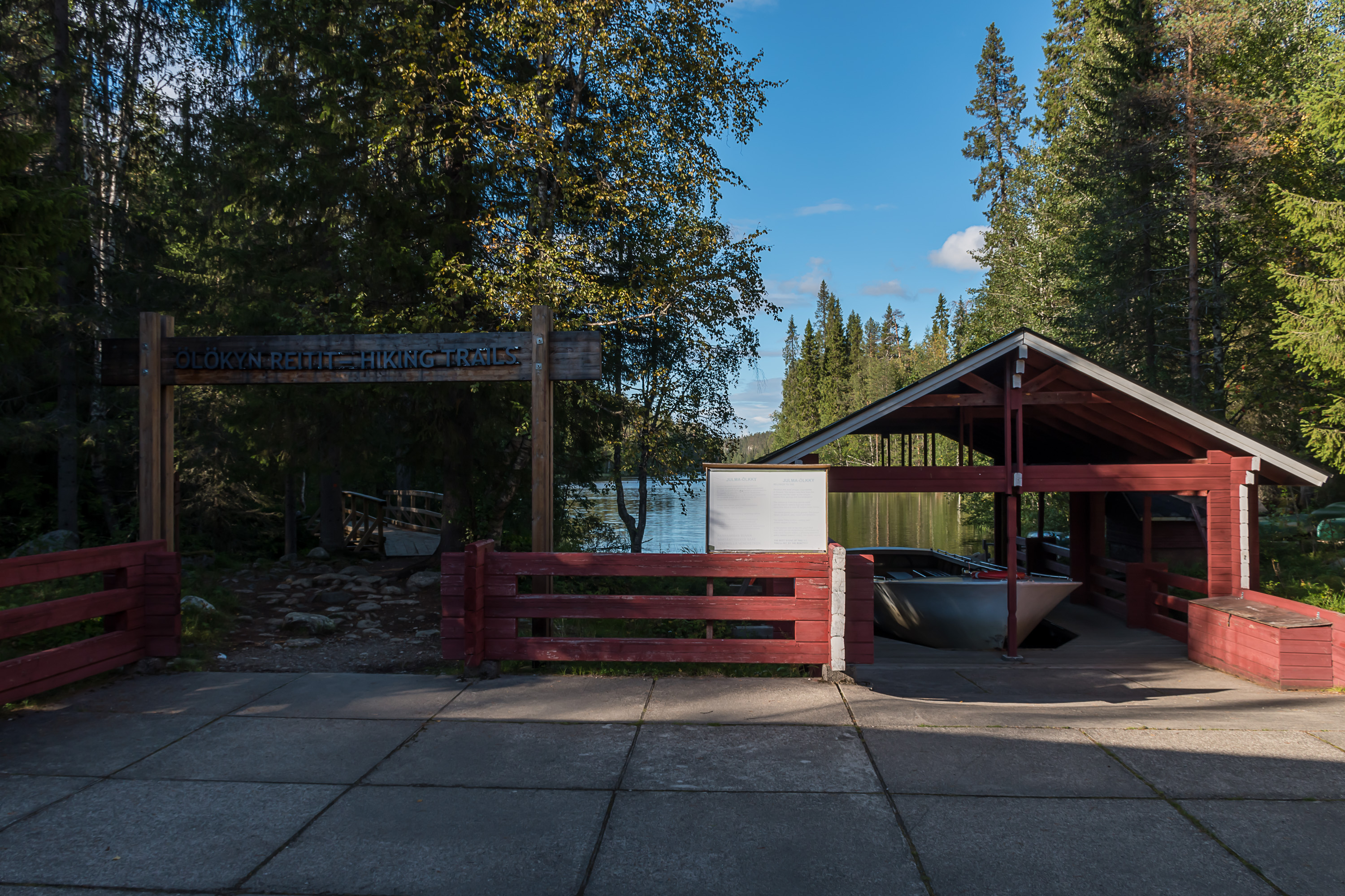
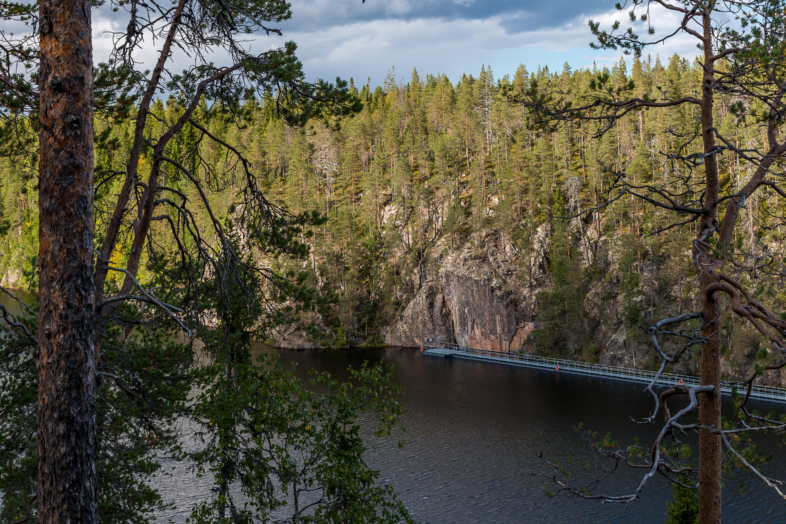
51. The canyon lake of Julma-Ölkky (Cruel Ölkky) is another major sight of Hossa. It is technically already on the Kuusamo side of the national park, but there's no reason not to have a look at it still. It is reached by a completely different road, a rather annoying poor gravel road 8 km long.
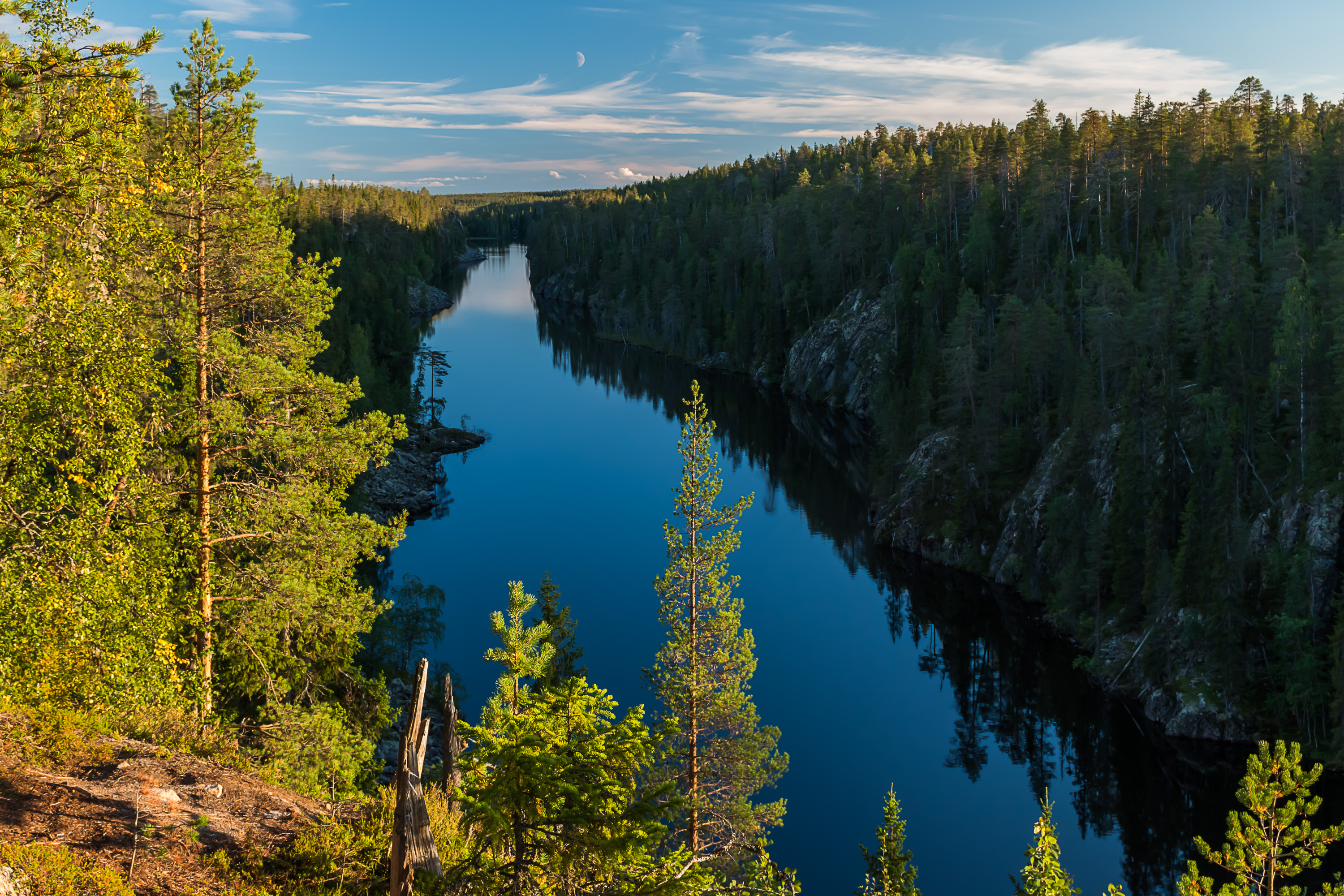
From mid-June to September it is possible to have a boat tour at the bottom of Julma-Ölkky, which costs 17€ per adult, is quite effortless and allows you to have the best views. Julma-Ölkky also has its own rock painting site, not as big as Värikallio, that can only be seen from a boat. It is possible also to rent a boat. But as usual we're not looking for easy adventures, and we'll rather hike the 10 km circle around the lake, the Ölkky Grunt trail (Ölökyn ähkäsy). The lake is actually not very far from Värikallio (Julma-Ölkky and Somer waters join just a kilometer downstream), so you could in theory combine trails, but you'd have to walk some 23-24 km or so, and especially around Julma-Ölkky terrain is rather steep at places.
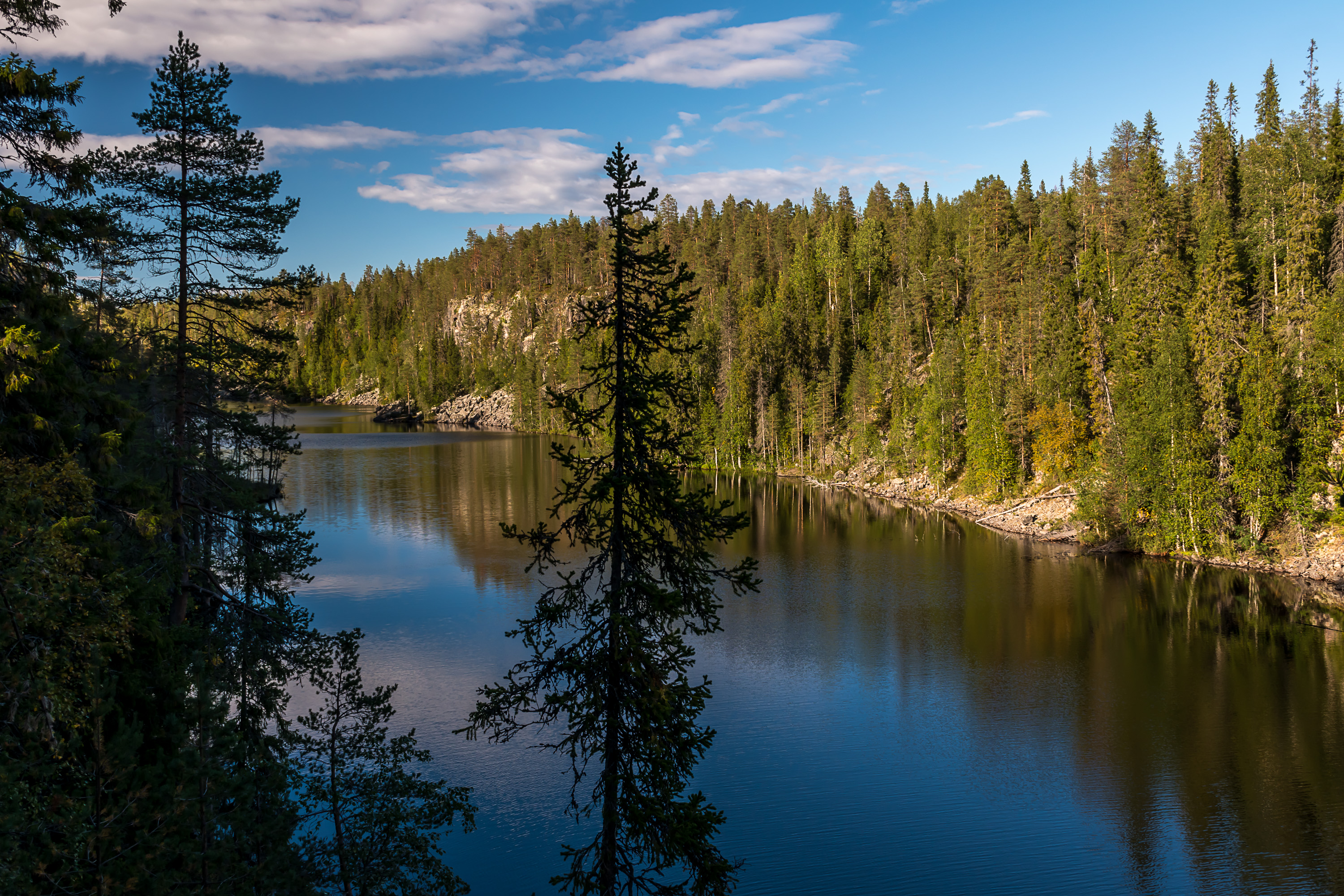
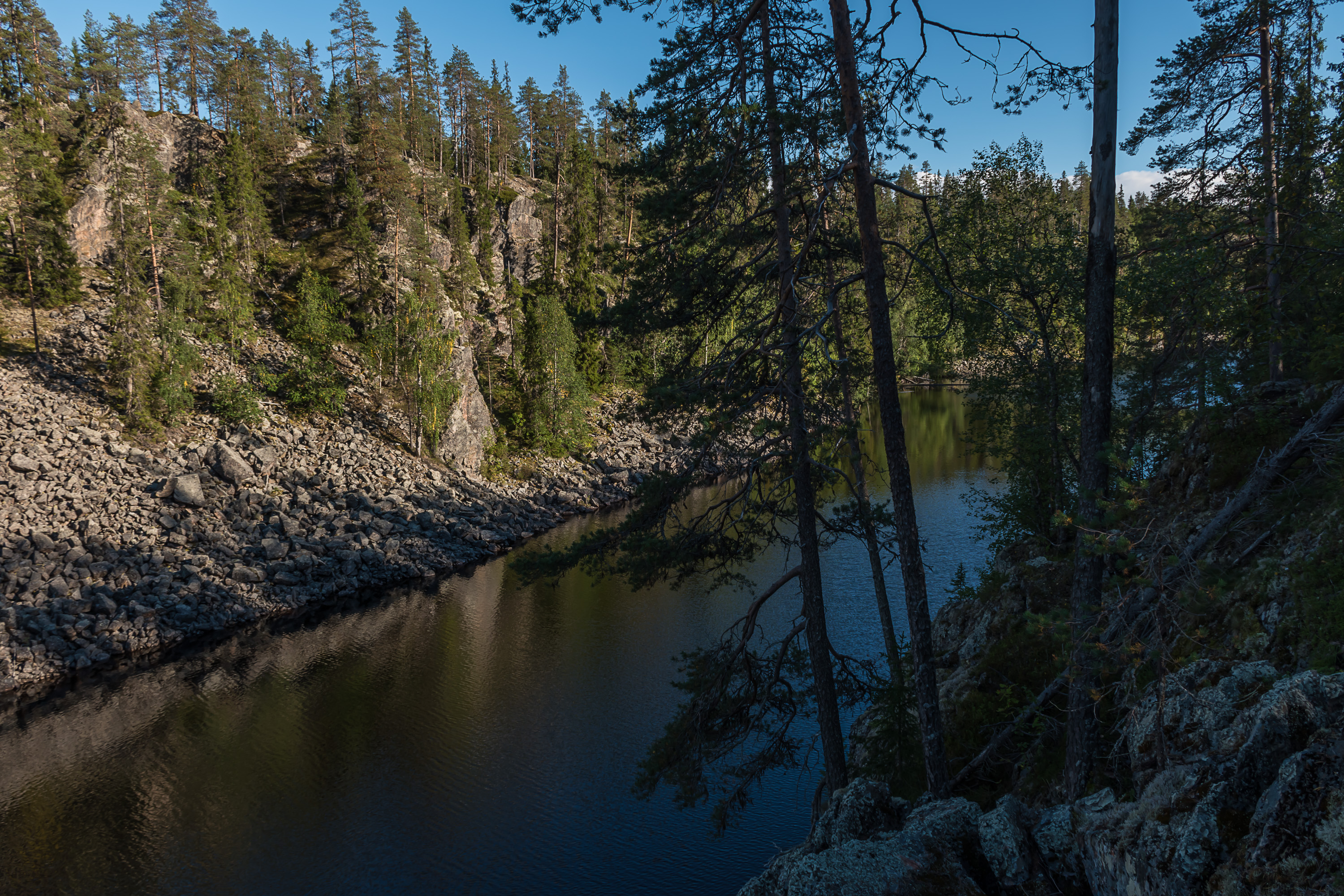
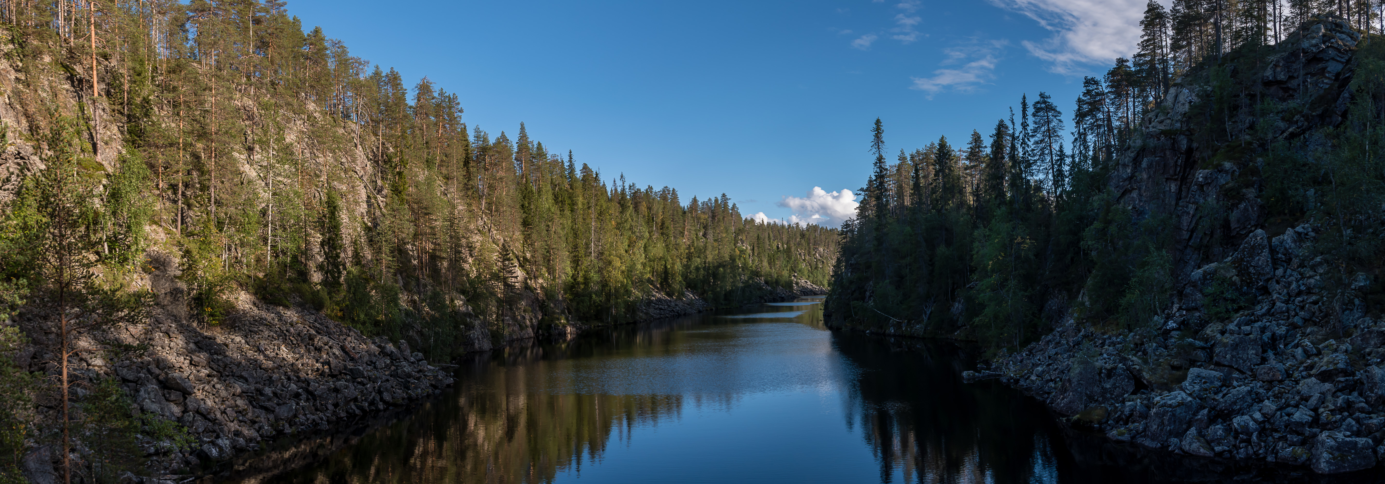
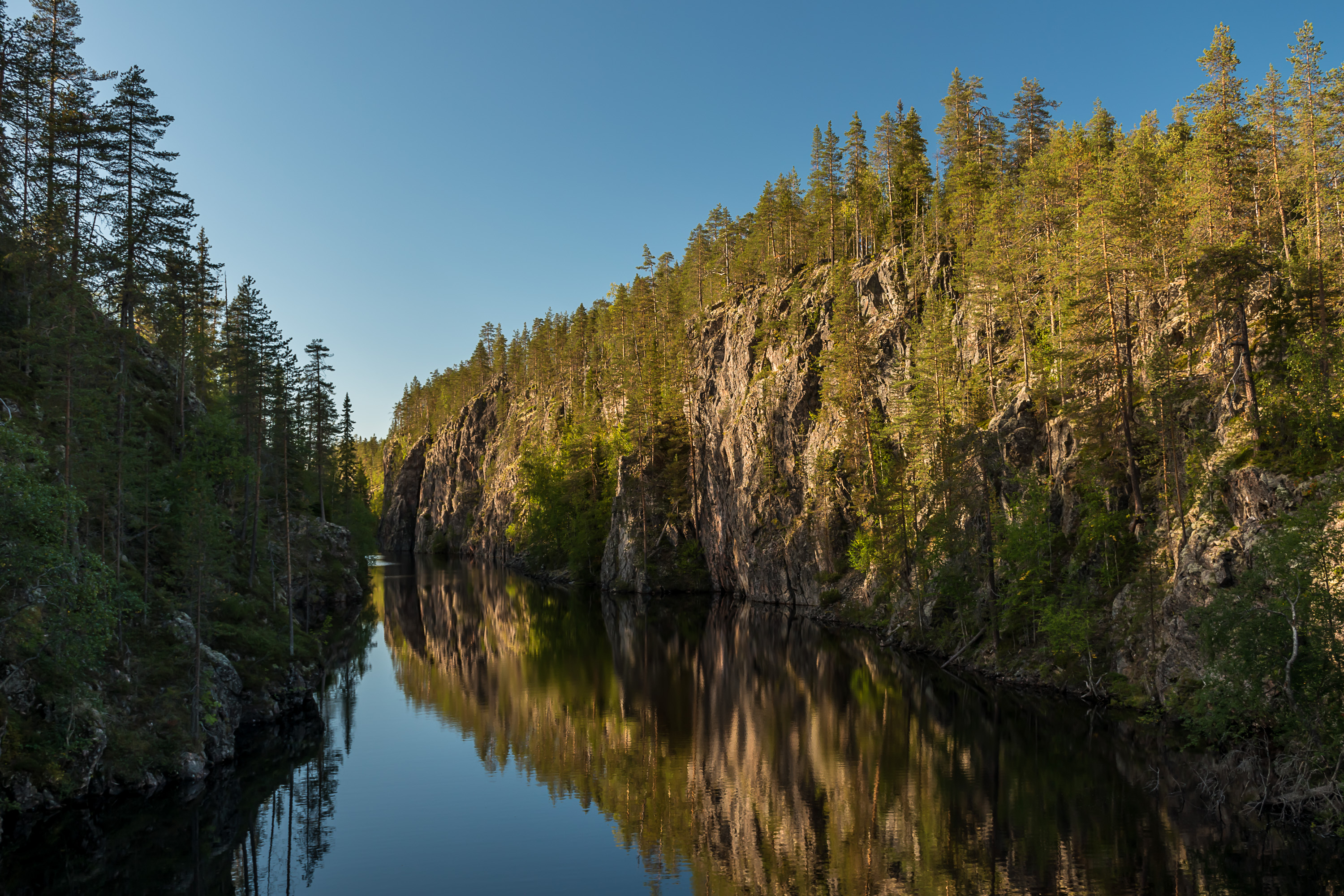
52. Julma-Ölkky is indeed a canyon. The lake proper is over 3 km long and as narrow as 10 m in some places, but the entire canyon is at least 5 km long and has a small side branch. Eastern and Northern Finland in general is surprisingly rich with beautiful canyons, although not many are really epic. I don't know if Julma-Ölkky qualifies as epic, but it certainly is a great natural sight. The walls of the canyon, nearly vertical in places, are up to 50 m high. The deepest point of the lake is 42 m deep, so in truth the canyon is even higher.
The lake surface, at 244 m above sea level, is the highest point of the so-called Hyrynsalmi water route (Hyrynsalmen reitti) that subsequently also includes water bodies we already saw today, Kiantajärvi lake and Emäjoki river in Ämmänsaari.
53.
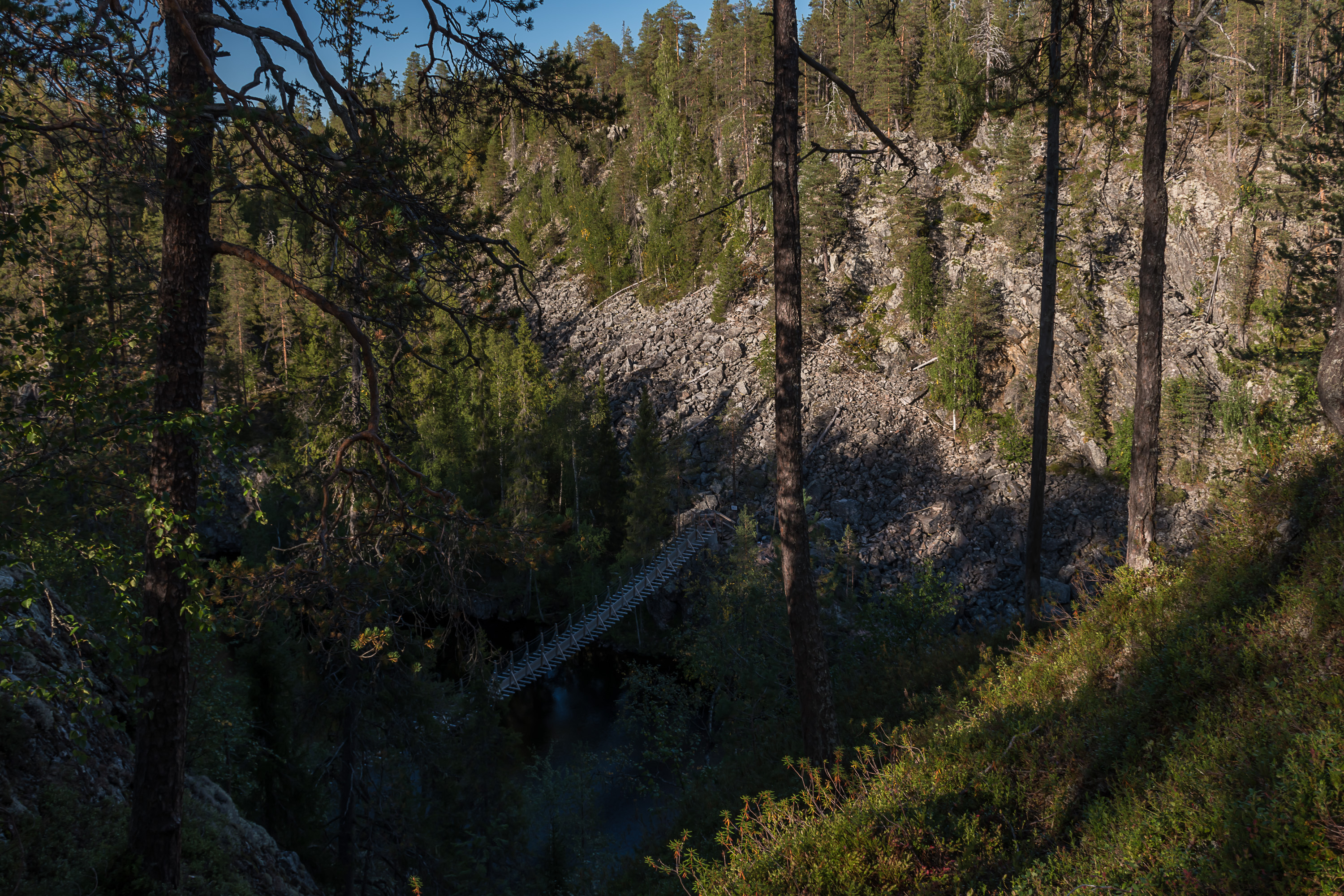
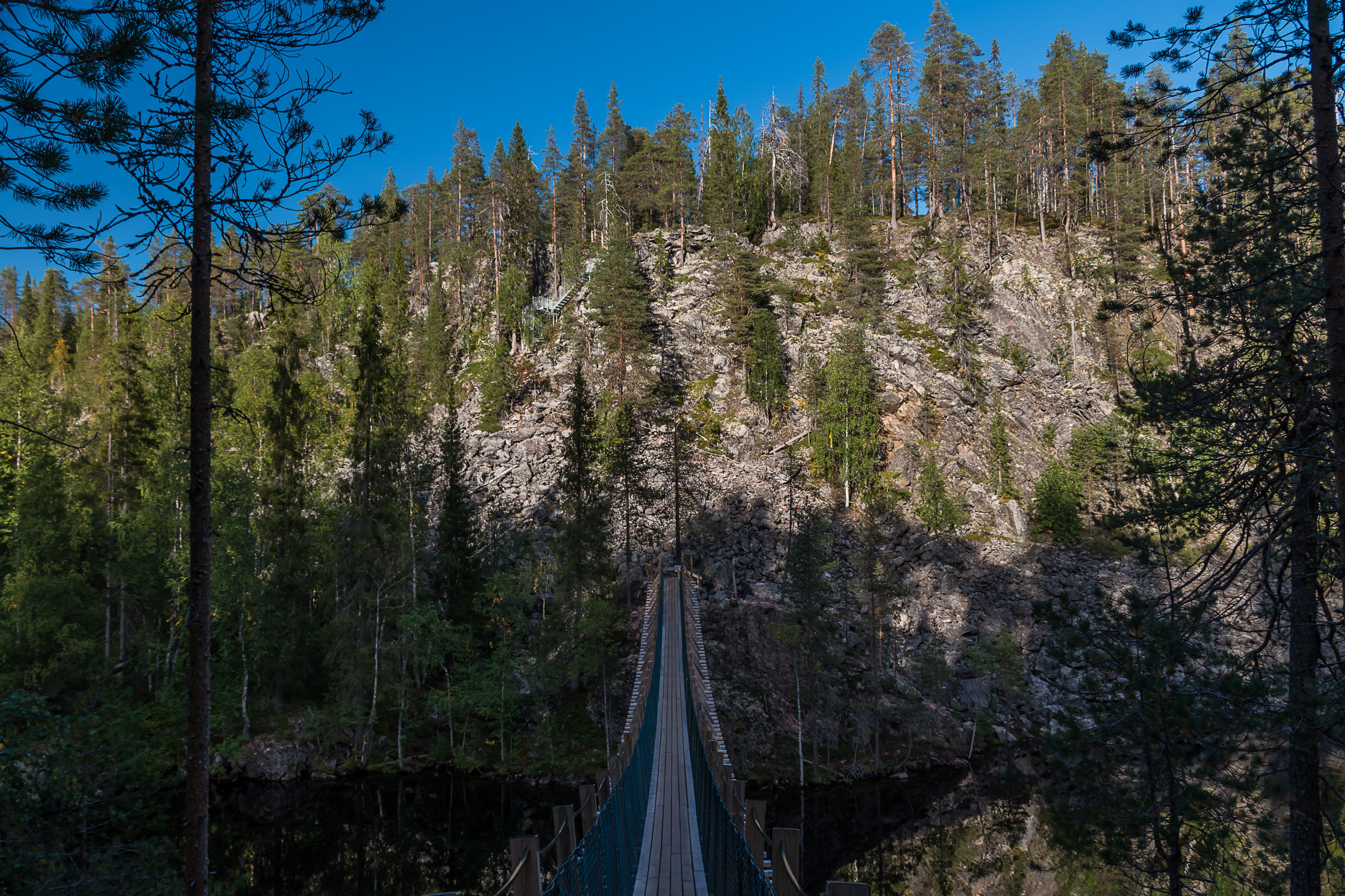
54. Halfway through the canyon there is a hanging bridge. It's possible to cross here and thus to cut the hike to 5 km instead of 10 km. Personally I would recommend do the full one though.
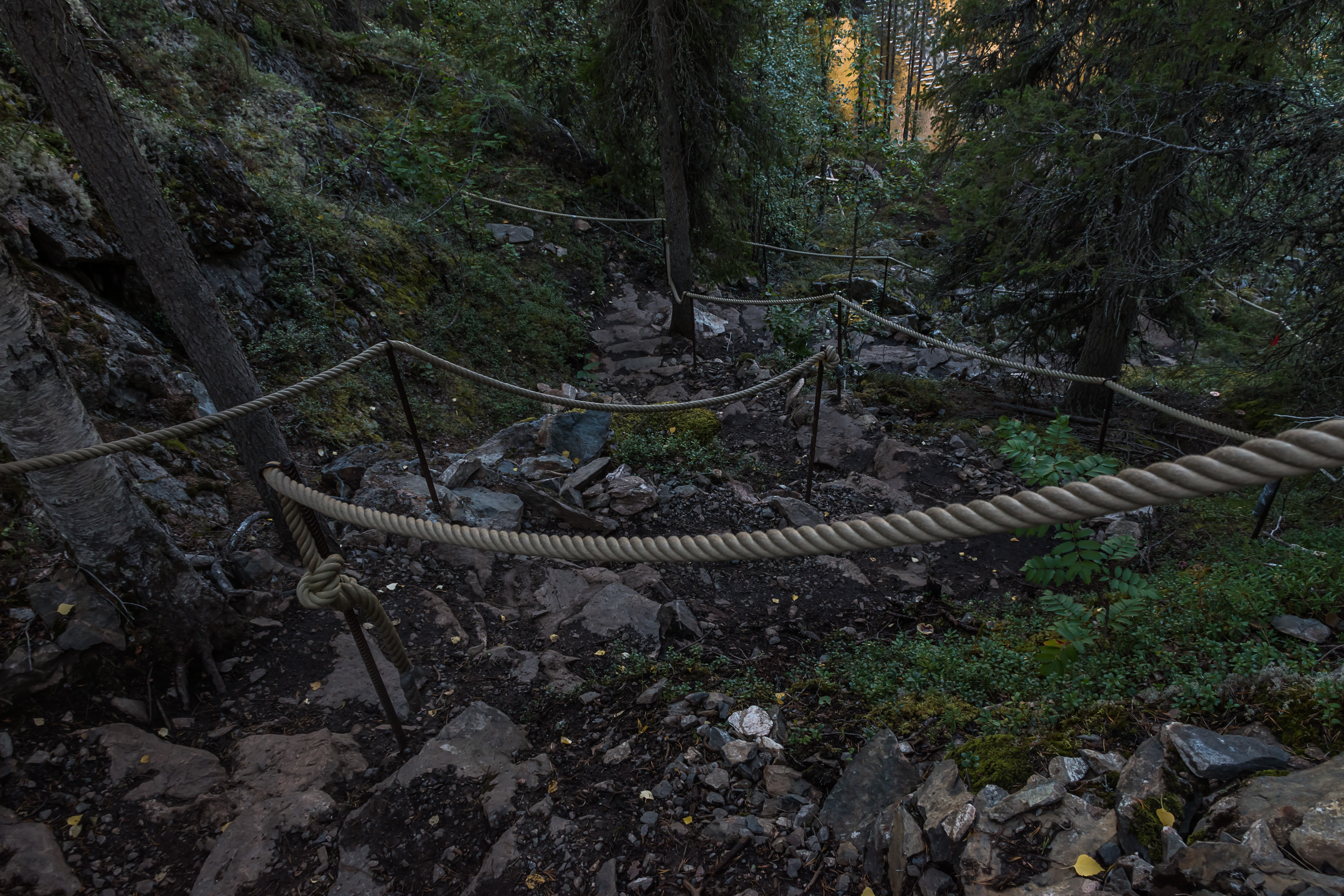
55. But we still need to enjoy the view from the bridge, don't we. The descents towards the bridge are quite steep, so there are ropes to hold on to.
56. A view to the south.
57. And to the north. As usual, going in sunny weather in the evening makes for very nice lighting.
58.

59. Back to the around-hike. The best topside view is probably from here.
60. In the end you descend into the canyon again. The walls become rather low but are still well discernible, and the lake turns into a bog.
61. Laavu at the end of the canyon. I think someone was around, just went away briefly.
62. The walk back along the eastern side of the canyon is less eventful, because for a kilometer or two you have to go away from the canyon edge to circle through the woods around its side branch, with a bog and a small stream at the bottom, named Vasapuro (Finn. Fawn Stream).
63. And then back towards the beginning on the edge again, in the evening sun. And that, I think, is all that I have to show of Suomussalmi for the time being.