The name of the small Raate road (Raatteen tie), a 20 km long small gravel road going to the Finnish border in Suomussalmi (Finn. Fishscale Strait) municipality in the gloomy forests of Kainuu region, is well known to anyone at least passingly familiar with the history of the Soviet-Finnish Winter War of 1939-1940. One of the most devastating, if not the most devastating Soviet losses, happened here. Soviet forces, more than twice as strong as Finnish ones and much better armed in theory (they had a lot of tanks and artillery, while the Finns had no tanks and barely any artillery), were driven back beyond the border, suffering losses several times worse than Finns, with every 1 of 3 their men killed or missing in action.
Although the Mannerheim line on the Karelian Isthmus is relatively well known, and also where the Soviet breakthrough finally happened in February 1940, 2.5 months into the war, the USSR in fact had started war against Finland on 30.11.1939 elsewhere too, along much of its border. Suomussalmi and Raate road area was rather far in the north and mostly resembled wilderness on both sides of the border, more so on the Soviet one. Suomussalmi village it itself was a fairly insignificant place, but the aim of the offensive here was to quickly advance west, all the way to the city of Oulu on the Bay of Bothnia, and thus cut Finland in two in its narrowest place (about 200 km from the eastern border to the sea). The USSR believed that these lands were poorly defended and Finland would not be able to move a lot of forces here quickly when attacked. As a matter of fact, this assumption was perfectly correct, and this still didn't help the USSR a single bit.
Let's quickly go through what actually happened. This is a brief overview of course with some simplifications. I'm not an expert on the subject overall. Winter War and Continuation War already seem to be the best known parts of Finnish history (in Russia at least), while normally I'm much more interested not in courses of battles as such, but rather in questions like "why a war happened at all", "how a country and its economy functioned during the war" or "what the post-war resettlement and reconstruction looked like".
The Raate road's only significance was that it was the only road for at least tens of kilometers around leading right to the border and over it. Raate was and is nothing more than a small farm 3.5 km from the actual border. The road was built in 1915-1919 as relief work, and was somewhat improved and officially became a public road in 1923-1924. Notably, the road extended to the Soviet side, to the village of Voknavolok (Вокнаволок, Finn. and Karealian Vuokkiniemi). East Finland and Russian Karelia had historically (since the Middle Ages) had rather close relations, with thousands of Karelian wandering traders, the korobeiniki (коробейники) or in Finnish laukunkantajat, named after the massive boxes they carried on their backs, going from their villages to Finland by waterways and long-forgotten trails, to earn some living by trade. This activity continued to some extent even after Finnish independence and the formal closure of the border. Indeed, the Raate road was at its busiest in the 1920s, and the border there completely closed only in 1928.
Raate road went to Suomussalmi, the central village of the parish (formerly called Kianta), and it was in turn connected to the rest of the Finnish road network, as primitive as it was back in the day. In particular, a road ran north towards Kuusamo, another ran southwest towards Hyrynsalmi, and from either you could turn to roads to the west, to Puolanka and farther to Oulu. Suomussalmi was however located on a peninsula of a large lake named Kiantajärvi, and going either north or south required a ferry crossing, as bridges there are of considerable size and at the time hadn't been built yet. In winter of course the lake froze and was normally passable by ice road.
On the Soviet side the situation was rather different. The road from the Finnish side to Voknavolok ended there. This village connected to the village of Uhtua (Ухта, Ukhta, nowadays Kalevala, Калевала), the local regional center, only by a long and complicated waterway through Kuittijärvi lake chain. Uhtua had in turn a road connection to Kem (Кемь, Finn. Vienan Kemi to distinguish from the Finnish city of Kemi), which had a railway station.
The Finns were not stupid and mobilized their army and did some preparations in the last months before the war, as they were well aware the negotiations with the USSR might end up ugly in the end (even though the possibility was not taken very seriously by the country leadership and population). They recognized also that the Raate road might be problematic even despite roadless conditions on the Soviet side, and built some field fortifications on the west bank of Purasjoki river, which the Raate road crossed. The Finns had also some forces quartered at Suomussalmi and Kuusamo, the next village of any size to the north (120 km away), and had some plans of a counterattack into Soviet territory, which in reality in the end could not be realized.
The Soviets however also did their preparations: in the months before the war they built dirt roads from Uhtua to the Finnish border. One went to Voknavolok, but another led to an unexpected direction, to a really tiny village named Lonkka, close to the village of Juntusranta on the Finnish side. That route was nothing more than an old korobeiniki trail never previously developed as a road, so on that direction Finland had just a small border guard station (named Karttimo). The new roads were usable, but only barely so, and supplying troops using them still was very problematic, which was a major factor in the subsequent loss.
The following four maps of the phases of fighting at Suomussalmi are taken from the page https://www.talvisota.fi/en/battles/north-finland-group/the-battle-of-suomussalmi-1939/, originally made for Sotatoimet – Suomen sotien 1939−45 kulku kartoin book (Ari Raunio, Karttakeskus, 2013), a collection of maps of the Finnish battles in 1939-1945, and further modified for that website. Hopefully borrowing them here is alright; I'm not much of a map artist, it would be very difficult to follow the subject without maps, and my work is non-commercial in character.
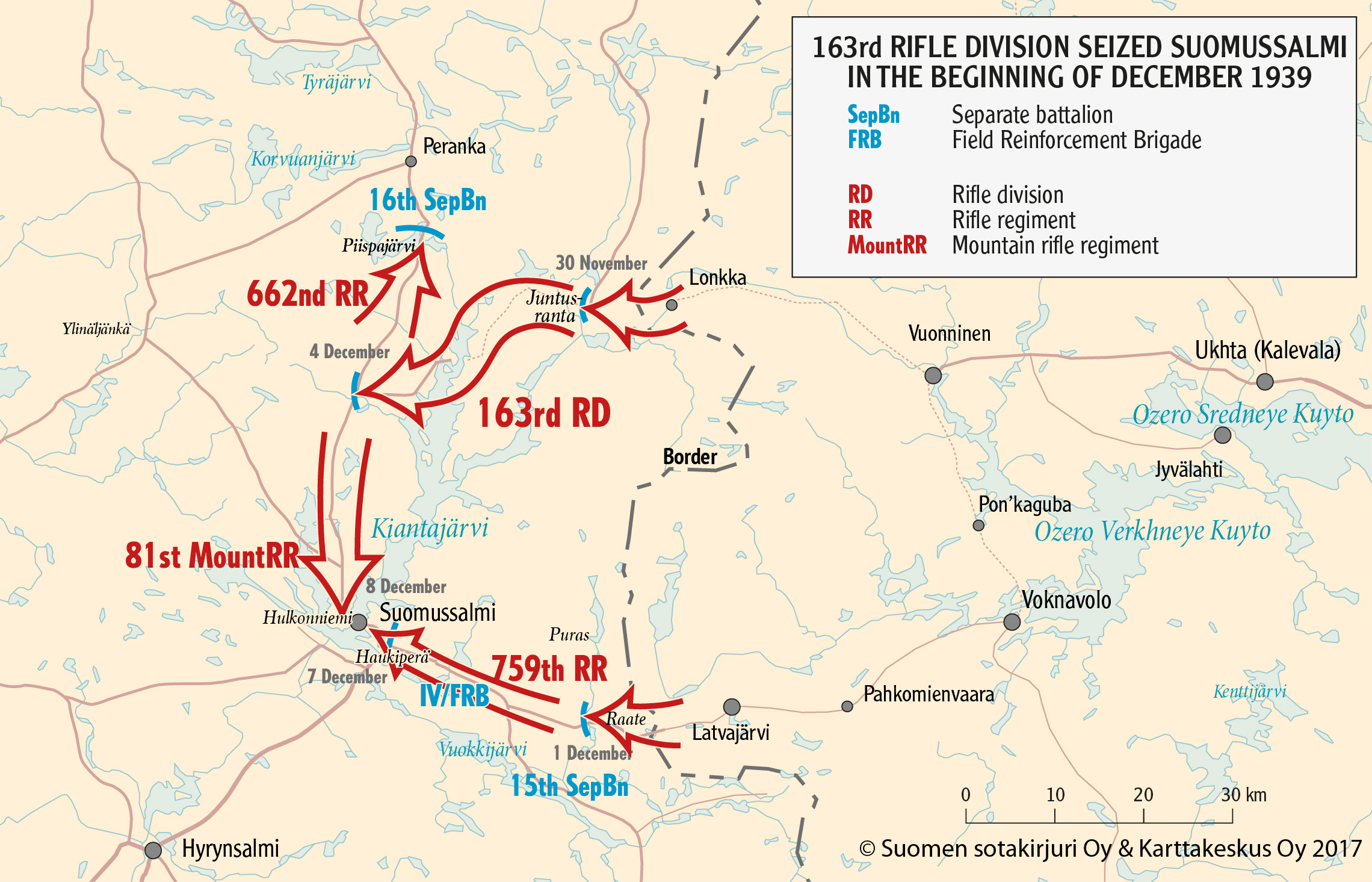
163rd infantry division, about 13,000 people strong, was assigned to the Suomussalmi offensive. It had some tanks and a fair bit of light artillery. It was meant to attack both via Raate and via Juntustanta, taking Suomussalmi in pincers from both directions. The offensive was started immediately on the morning of 30.11, at the outbreak of the war; the border guards at Karttimo literally heard the first shots at the same time as they were listening on the radio about the severing of diplomatic relations with the USSR. This direction, via Lonkka, Karttimo border guard station and Juntusranta was the main one, and most of the division was concentrated there, outnumbering the border guards 100 to 1. The border guards of course retreated immediately. Juntusranta was reached and taken in a few hours. There was not a proper road from Juntusranta farther on, but in a few days Soviets managed to bypass the Kiantajärvi lake and reached the Suomussalmi-Kuusamo road, overwhelming fierce but minor Finnish resistance. Going south from there they reached the village of Suomussalmi relatively easily by 8.12, and found it abandoned and burned to ground by the Finns. The south offensive pincer, at Raate road, initially met some resistance at the Purasjoki defense line, but the Finns retreated from it in a few days and the southern group reached Suomussalmi almost simultaneously with the northern one.
The Finns used scorched earth policy, burning down their own villages as they retreated. Suomussalmi in particular was nearly burned to ground. The fate of the civil population was problematic; they hadn't been evacuated before the start of the war, as they had in the Karelian Isthmus borderlands for example. Evacuation started immediately at the outbreak of the war, but in some places like Juntusranta just couldn't be executed fast enough. About 300 people in the end were left on the territory occupied by the Soviets. (Overall, this happened in the Winter War only to about 2400 civilians, mostly in Suojärvi in Ladoga Karelia; evacuation overall was very efficient.) They were initially left undisturbed (although some authorities of the Finnish People Republic, the puppet regime of Kuusinen intended for Finland by the Soviets, were actually established), but eventually most of them were interned into work camps in Soviet Karelia for forestry work. 276 people from Suomussalmi had such fate; 14 of them died there, 3 escaped, 5 decided at the end of the war to stay in the USSR on their own will, and 254 were returned but rather late after the end of the war, in June 1940.
Notably, some civilians were charged with aiding the enemy by the Finnish authorities. 6 Suomussalmi residents were court-martialed and shot for espionage during the war, and 27 people got prison sentences afterwards. Ilmari Kianto (1874-1970), a famous writer living in his Turjanlinna mansion on the shore of Kiantajärvi lake near Suomussalmi, left a note in Russian for the advancing Red Army in his house, asking to spare it; he mentioned that a nearby island, where he also had a few buildings, was also "empty". Turjanlinna, which at one point ended up right at the front line, was however in the end burned by the Finnish troops, and his note was discovered by them. The reference to the "empty" island was interpreted as the island being empty of Finnish troops, and that in turn was interpreted as giving information to the enemy. Kianto received a half a year sentence for attempted treason in a house of correction. Being a famous writer, he was pardoned by President Kallio before finishing his sentence; other people in such situations probably weren't.
For the Soviets the luck pretty much ended at Suomussalmi occupation. The burned abandoned village did not offer much shelter, and resupplying from Soviet Karelia was very difficult due to poor roads; meanwhile, the Finnish command immediately realized that a much bigger force was attacking at Suomussalmi than they had anticipated, and moved more troops to this part of the front. The 163rd division had to immediately continue their advance, but failed at that. For going southwest, to Hyrynsalmi and Puolanka, they had to cross Haukiperä (Finn. Pike Bottom), a long narrow bay of Kiantajärvi lake, where a ferry operated in summer. But the Finns had a great defensive position on the opposite shore, and despite initially making a small beachhead, the Soviets failed to advance across the frozen lake, being repulsed with significant losses. A smaller force tried to advance north, up the Kuusamo road, but encountered Finnish forces at Piispajärvi lake crossing and was also stopped by them, making several attack attempts.
At that point the Soviets were in a rather grim situation. The troops, poorly equipped for winter conditions to begin with, began suffering from frostbites and malnutrition (due, again, to poorly working supply lines), and their morale was getting quite low. They were still outnumbering the Finns somewhat and had far more artillery and tanks (the Finns lacked them completely), but that wasn't helping them much.
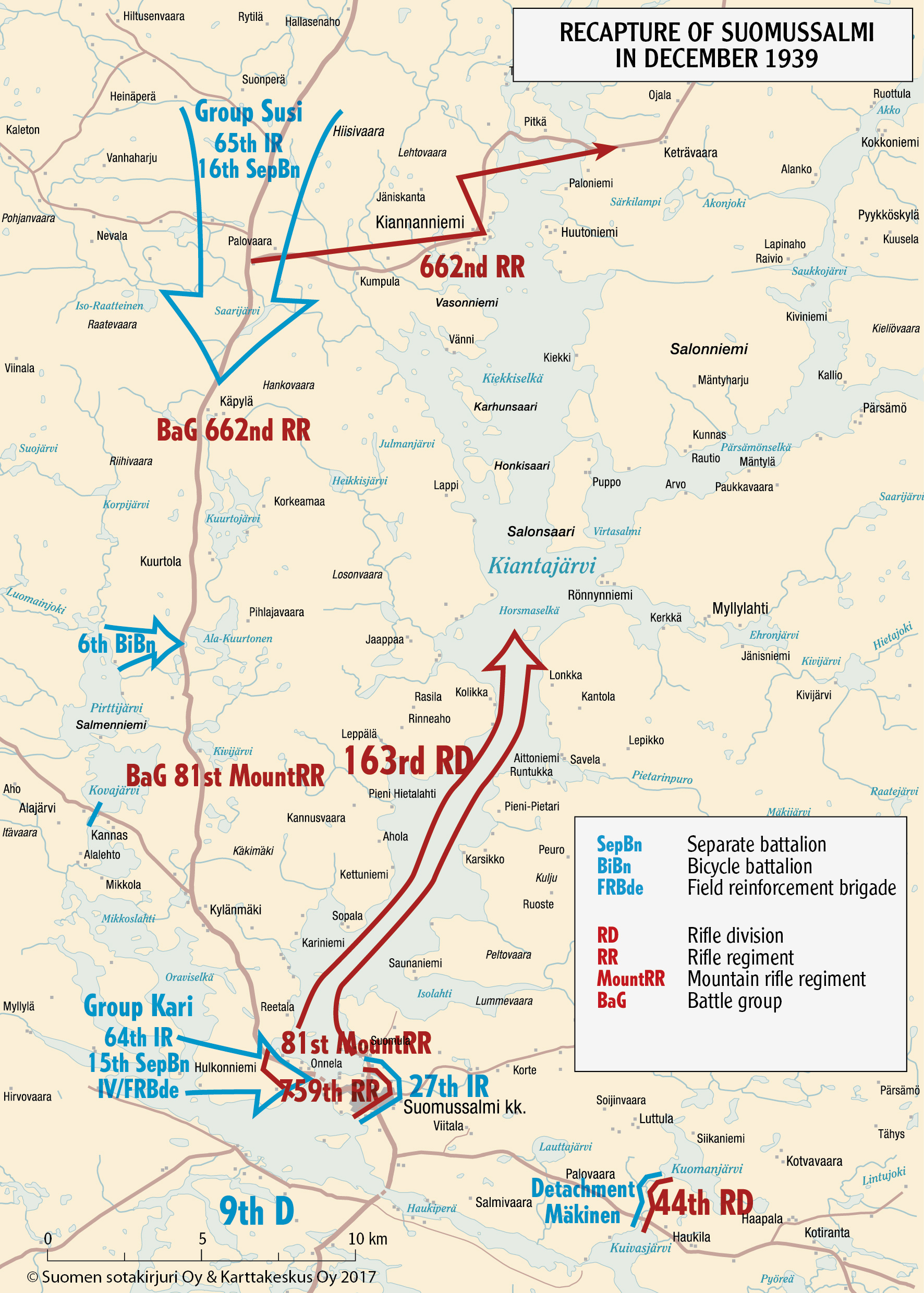
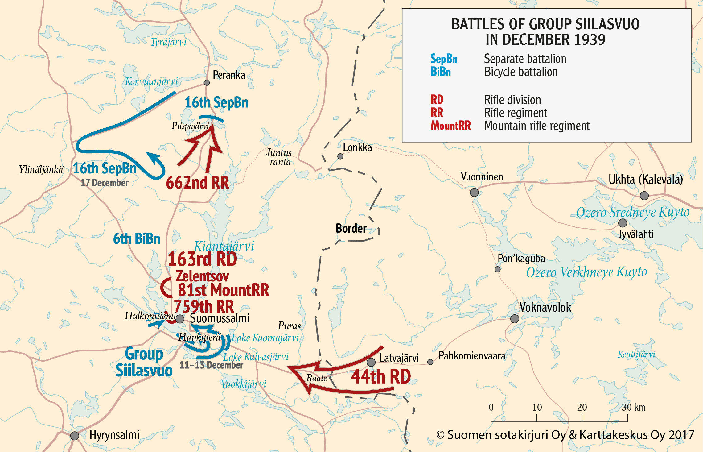
The Finns counterattacked, and although despite fighting fiercely they failed to retake Suomussalmi as they had intended, they successfully cut off the Raate road; the Suomussalmi-Kuusamo road was also cut in two, mostly breaking the supply line via Juntusranta. Thus most of the 163rd division ended up completely surrounded and cut off from supplies in Suomussalmi by 15.12; some forces still remained near Piispajärvi. They asked the Soviet command for help, and got it: the 44th infantry division, formed mostly from Ukrainians, was moved to Kem and began advancing down the Raate road.
The help never came though; the 44th division was also stopped on the Raate road by the Finns. Despite many attacks, Finnish forces held tight on their positions, and the division soon began to suffer from the same issues as the 163rd had: cold and supply issues. The situation was getting completely desperate for the 163rd, and the Finnish attacks were continuing all the way until Christmas. On 29.12, the 163rd started retreating. With all roads blocked, they did it on the ice of Kiantajärvi lake towards Juntusranta. The retreat was carried out mostly peacefully. However nearly all materiel of the division was lost, and human losses numbered about 3,000 (half of that wounded, half killed and MIA), through all December fighting.
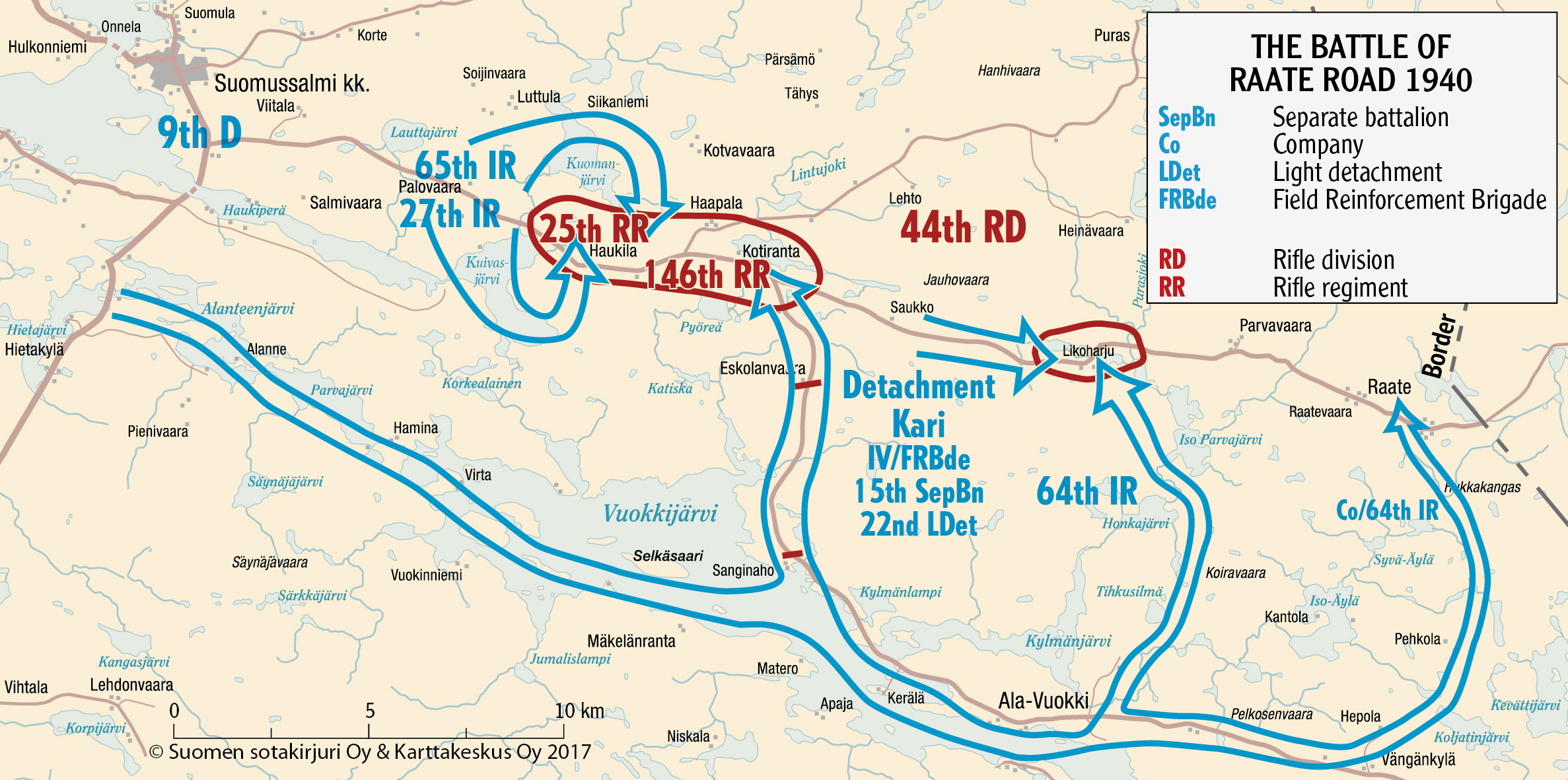
The Battle of the Raate Road proper, the most famous part of the fighting in Suomussalmi area, was what happened with the 44th division, which had come to help the 163th, but in the end suffered a worse fate. That battle is probably the closest one in the entire war that comes to the popular culture Winter War stereotypes, you know, "when the trees start speaking Finnish" memes and stuff. Conceptually the battle was quite simple: the Finns cut off the Raate road closer to border and thus encircled the 44th division there; then divided it further with light swift strikes, the so-called "motti" tactics. Soviet equipment ended up worse than useless, stuck on a narrow forest road; even the tanks were useless in the heavy snowdrifts of the forest around. Meanwhile Finnish infantry on skis, knowing the terrain and local conditions well, attacked right through the forests. The frost was getting quite dreadful, to -30º and lower; the battle took place over the period of 1.1 to 7.1.1940. Sydäntalvi, the Finns call these times, the heart of winter.
Initially the Soviet forces had merely to deal with the roadblocks made by Finns and with their repeated attacks. By 4.1 the 44th division started retreating, but on 5.1 the road was actually occupied by the Finnish forces east of them, and the retreat turned into a panicked rout, with men trying to escape on foot towards the border through the woods, leaving all their equipment on the road. By the end of the day of 6.1 the 44th division broke down completely, and by 7.1 the Finns finished securing the road and capturing prisoners.
The 44th division lost over 5,300 men, of which 1,100 killed, 1,800 wounded and half MIA; the Finns got a large number of prisoners of war, and a great deal of equipment. Total Soviet losses near Suomussalmi, in both divisions, numbered 13,000, of which 2,300 killed. Total Finnish losses (also killed, wounded and MIA together) were about 2,700. This all is according to the estimates of Oleg Kiselev, a Russian historian who specializes in Soviet-Finnish wars and whose expertise I trust (that is, he doesn't have a pro-Soviet propagandistic bias as too many Russian "historians" these days do).
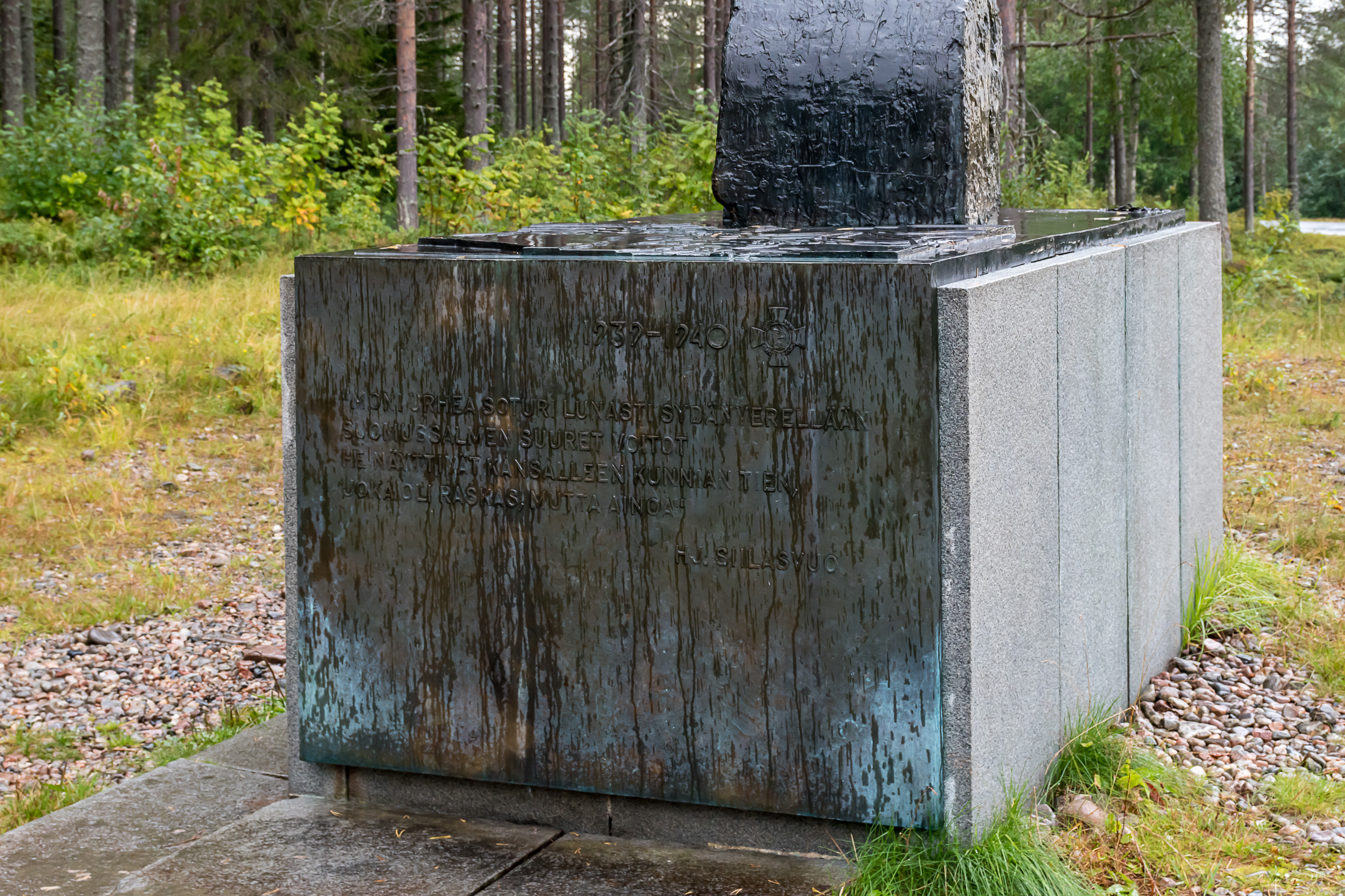
Colonel Hjalmar Siilasvuo (1892-1947), one of the old jaegers (Finnish men who received military training in Germany during the World War I in secret, and subsequently formed the backbone of the military of newly independent Finland), commanded the Finnish 9th division, which carried out most of the fighting at Suomussalmi. The division was formed of local men, from Oulu to Suomussalmi, and they were pretty much literally defending their homeland. After Suomussalmi Siilasvuo went on to fight in Kuhmo, an area in the same region but considerably to the south of Suomussalmi, but couldn't quite repeat his success there. He was promoted to major general after the end of the war in April, and fought in the Continuation War of 1941-1944 and Lapland War of 1944-1945, having some considerable wins especially in the latter. Kombrig Alexei Vinogradov (1899-1940), commander of the Soviet 44th division, managed to escape the icy hell of the Raate road, to be immediately court-martialed and executed in front of his troops on 11.1.1940.
No more major fighting happened in Suomussalmi area until the end of the Winter War, although in the north the Soviets stayed in Juntusranta until the end of the war. The victory was a great boost for the Finnish morale, and many in Finland began even hoping that the war could in fact be won. Of course, it still was hopeless in the end. Were all these deaths for nothing? Well, in the same sense the whole war can be said to be for nothing yes, and personally I consider the Winter War a bad strategic mistake for the USSR (that is, if we already put aside the question of morality of fighting what undeniably was a war of aggression), turning a neutral (if not overly friendly) neighbor into a fierce enemy, willing to ally with the Nazis themselves for revenge. But the fighting by the Finns for their homeland in Suomussalmi was certainly not in vain; if Finland could really be cut in two from Suomussalmi to Oulu, the peace terms in the end would certainly have been much more dire for Finland.
I visited Suomussalmi and the Raate road in August 2020, as part of my three weeks long vacation in East and North Finland (and a little bit of North Norway) this year, where I finally got to visit quite a few places I had always wanted to. This is one of the very few Winter War battlefields that ultimately still remained on the Finnish side of the border (the USSR never demanded any territorial changes there) and so there are now a few museums and many monuments in the area. Let's go through them now.

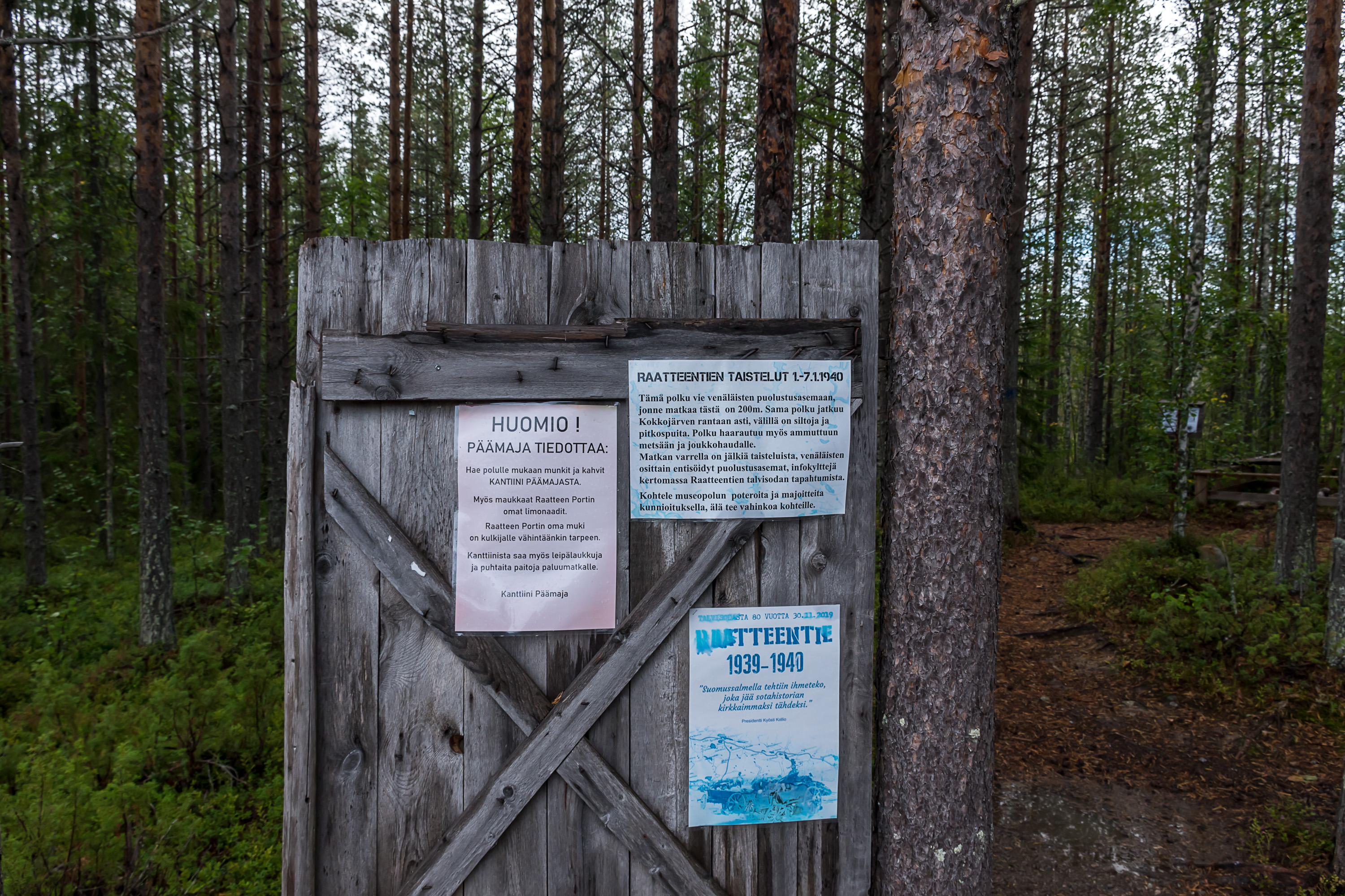
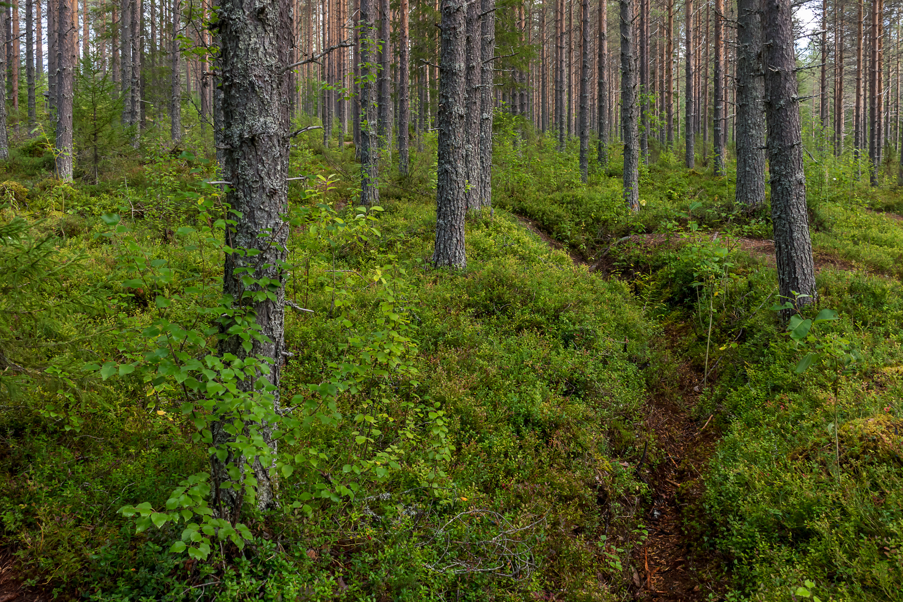
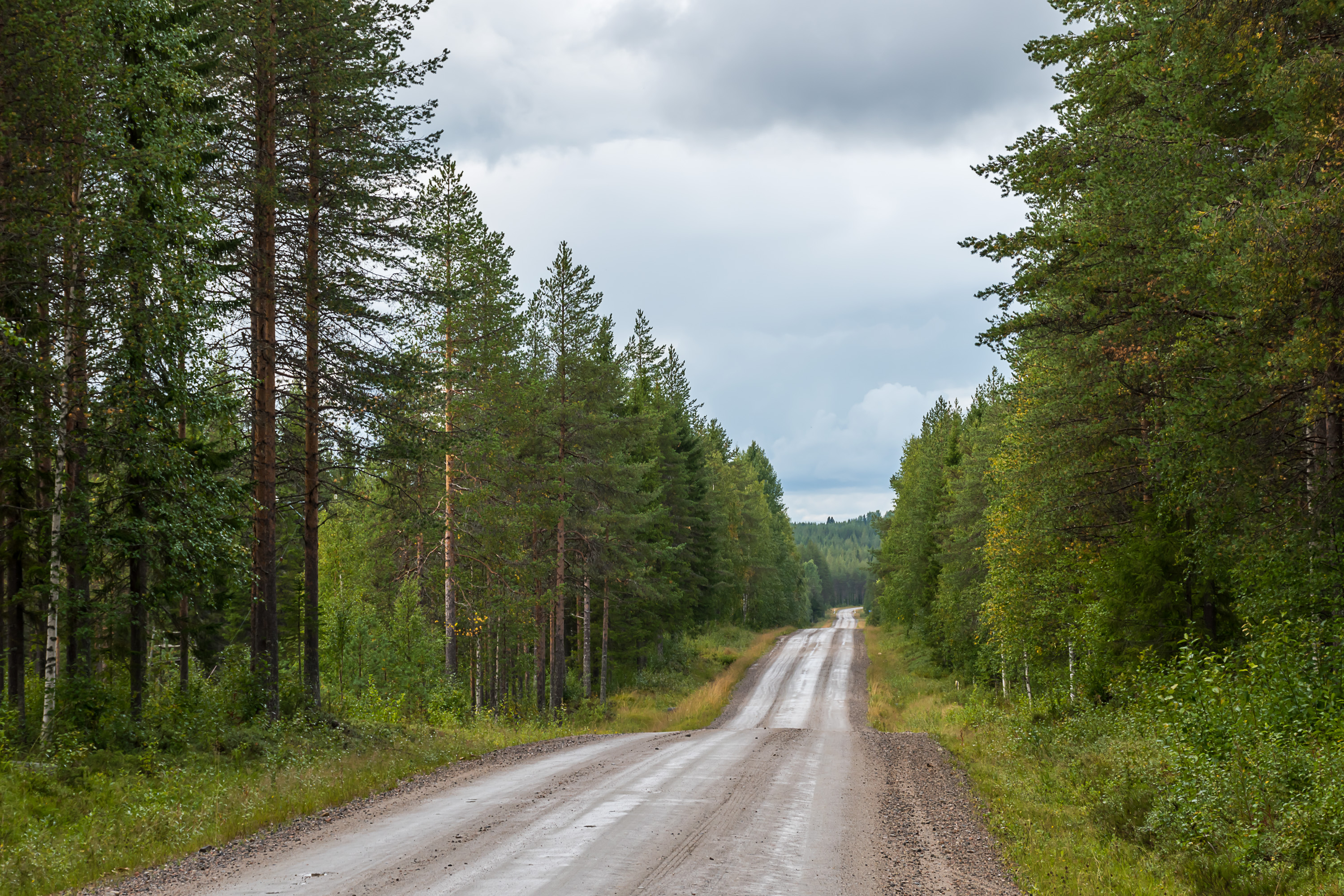
1. The Raate road (Raatteentie), formally also Road 9125, was declared a museum road in 1982. It still preserves the original alignment and the gravel covering (there hardly was ever a need to improve this road). 18 km is the distance to the barrier at the end of the road; to border itself it is closer to 20 km.

2. The modern museum road is however just the eastern half of the original Raate road. The western half was eventually improved, and became a part of the Regional Road 912 Kuhmo-Suomussalmi. The most severe fighting in fact took place on this western half.
These places are difficult to explore without a car. There's only one bus per day on school days (that is, weekdays outside summer and other holidays) between Kuhmo and Suomussalmi that stops here at the crossroads to the museum road. Kuhmo and Suomussalmi have reasonably regular bus connections to the regional center, the city of Kajaani, which in turn has a railway station.

3. By far the biggest monument here is the one at the beginning of the museum road. It is the Winter War Memorial (Talvisodan monumentti), not just about the Battle of the Raate Road. Built in 2003, it is about 3 ha large by area. It is sometimes claimed that every one of the 17,000 boulders stands for a man fallen in the war. In fact the number of actual losses was much higher even, about 26,000 on the Finnish side, and about 127,000 on the Soviet side (some Russian historians claim these estimates are wrong, but so far I haven't seen any convincing arguments for that). The boulders are just to give some approximate scale.

4.

5. However every one of 105 the bells on the central memorial, Avara syli (Finn. Open Embrace), does indeed stand for one day of the Winter War.
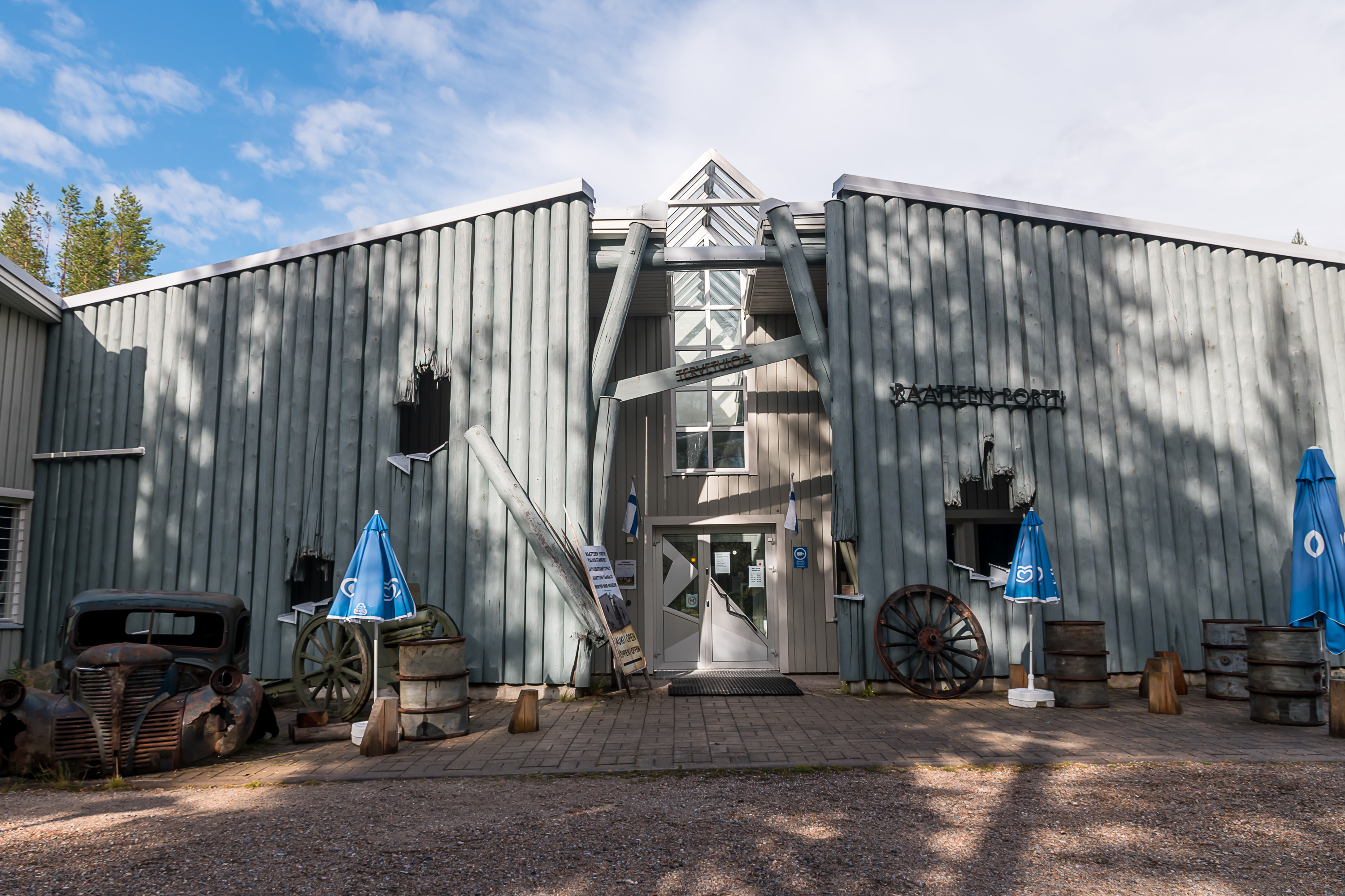
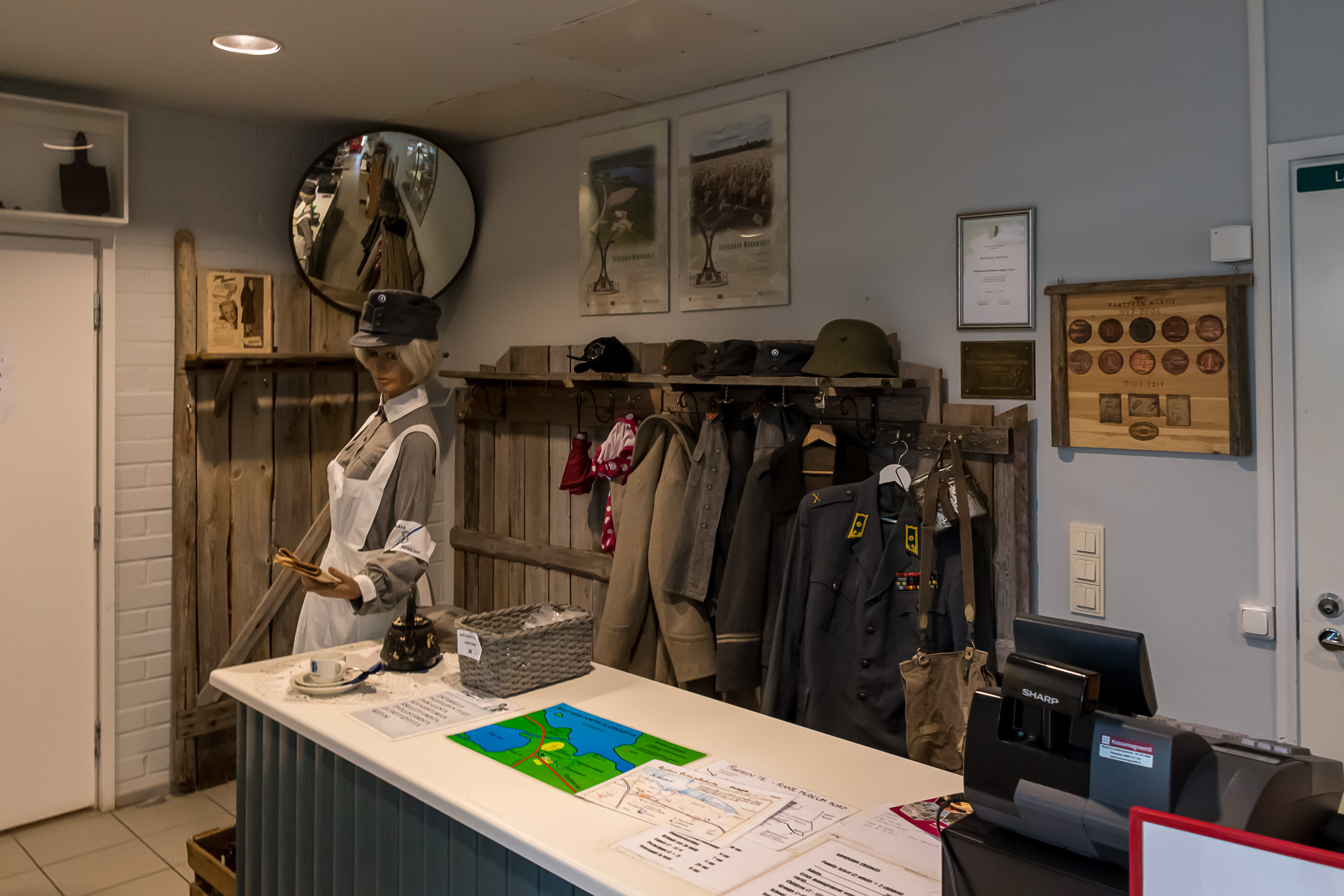
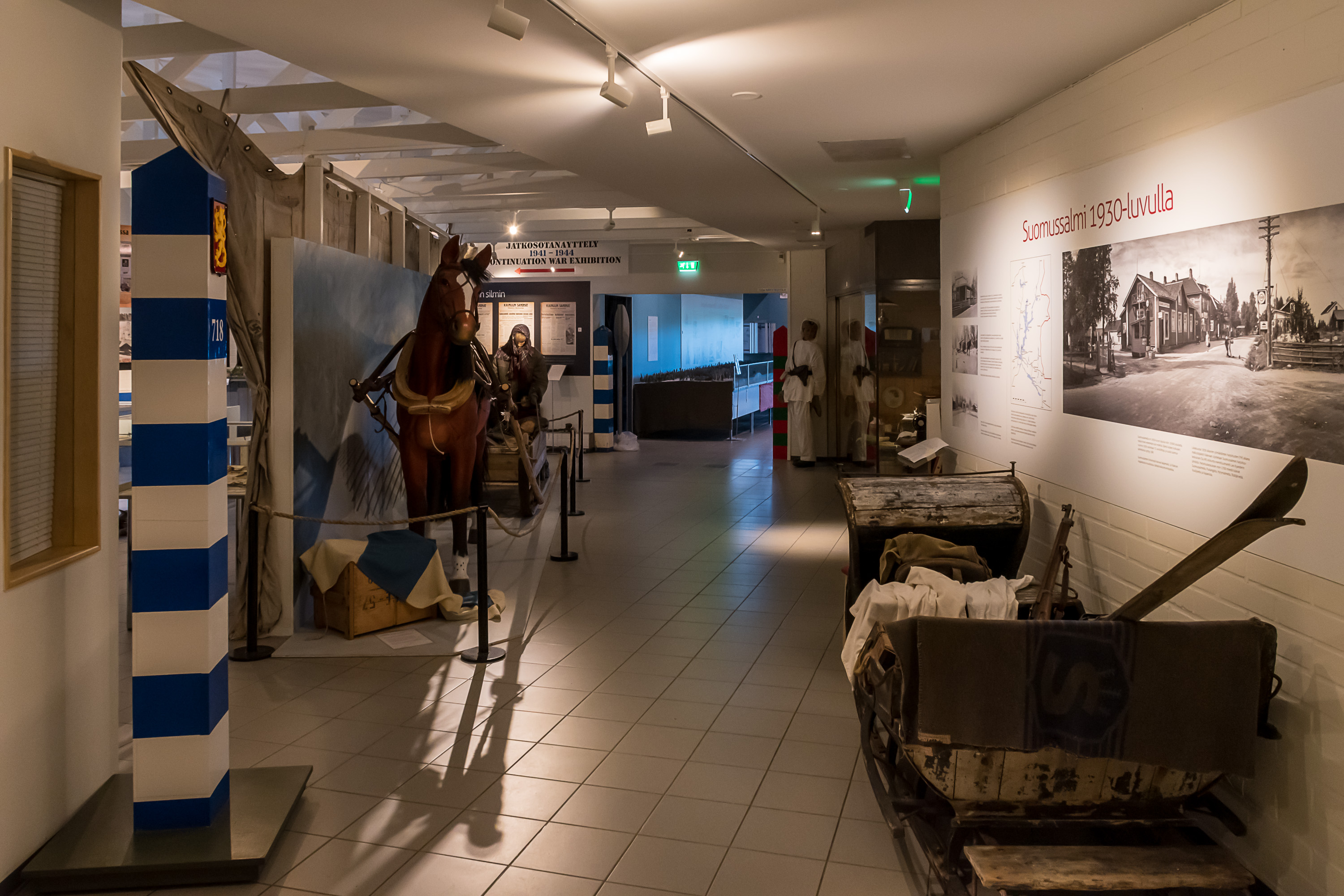
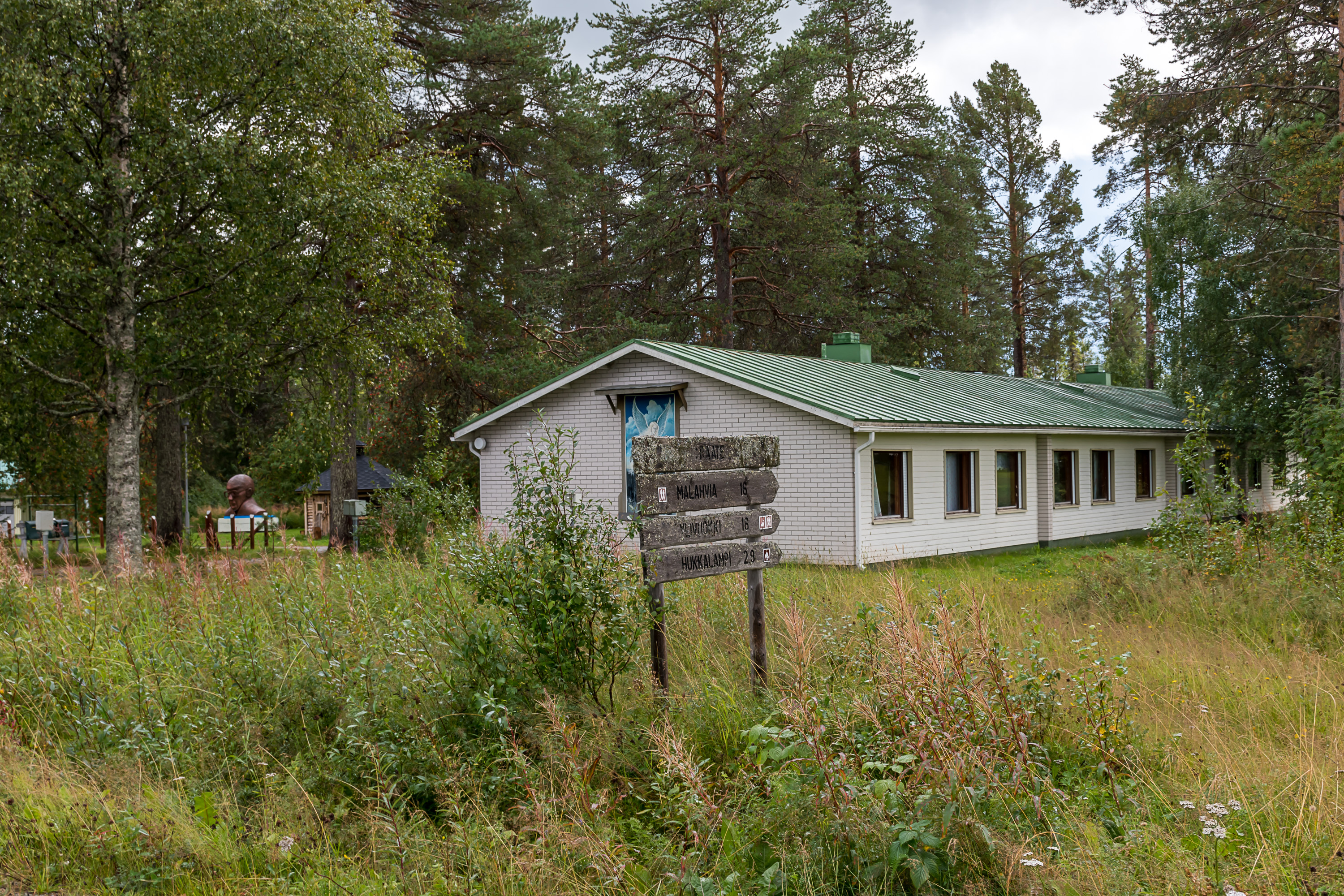
6. Right nearby is the museum of the Winter War, Raatteen Portti (Finn. Raate Gates), with its faux shell holes. Unlike many Finnish museums, this one operates on a purely commercial basis and doesn't for example accept Museum cards (a free pass to the vast majority of Finnish museums for 69€/year, a great deal at least for me personally), but still is very much worth visiting I would say. An adult ticket costs the normal 10€. The museum is open from May to October. Museum website: https://www.raatteenportti.fi/en/
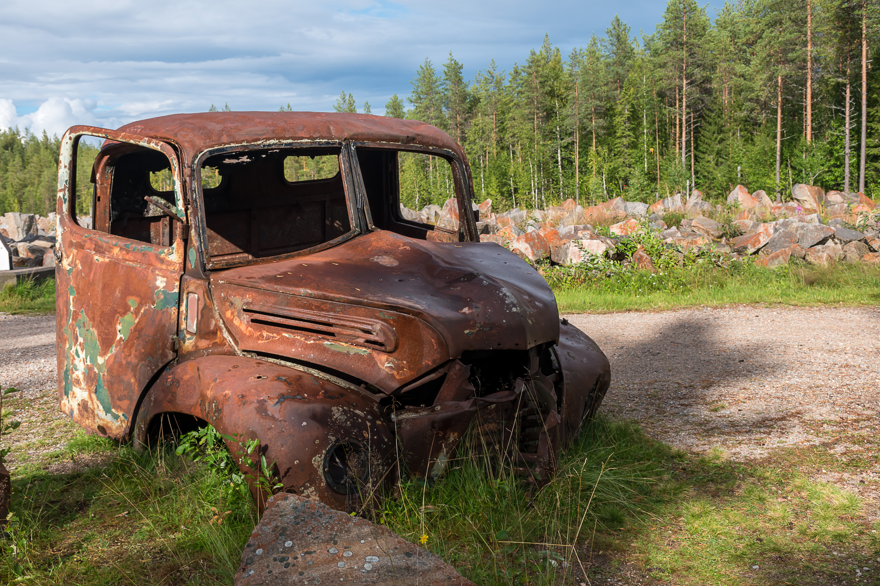
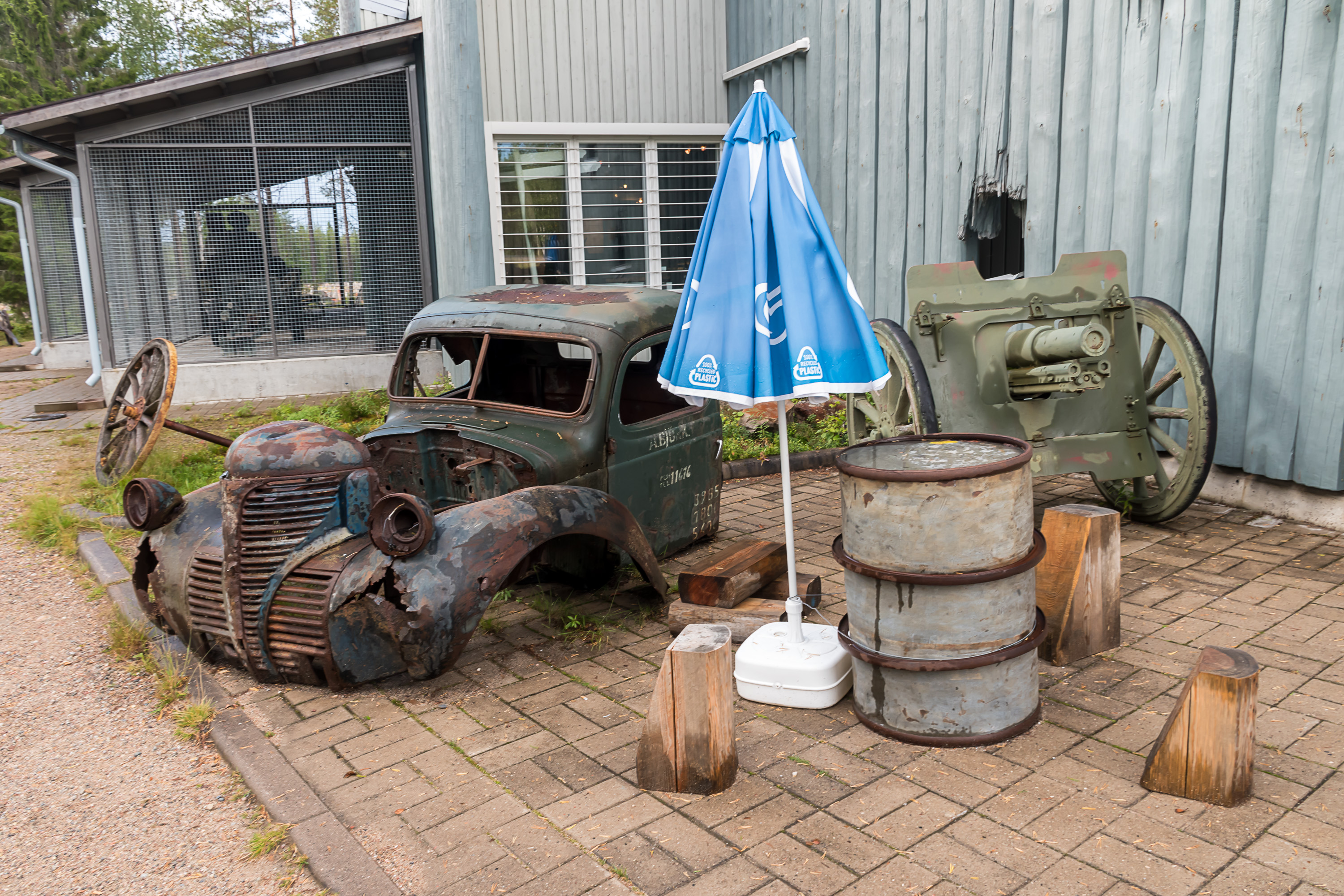
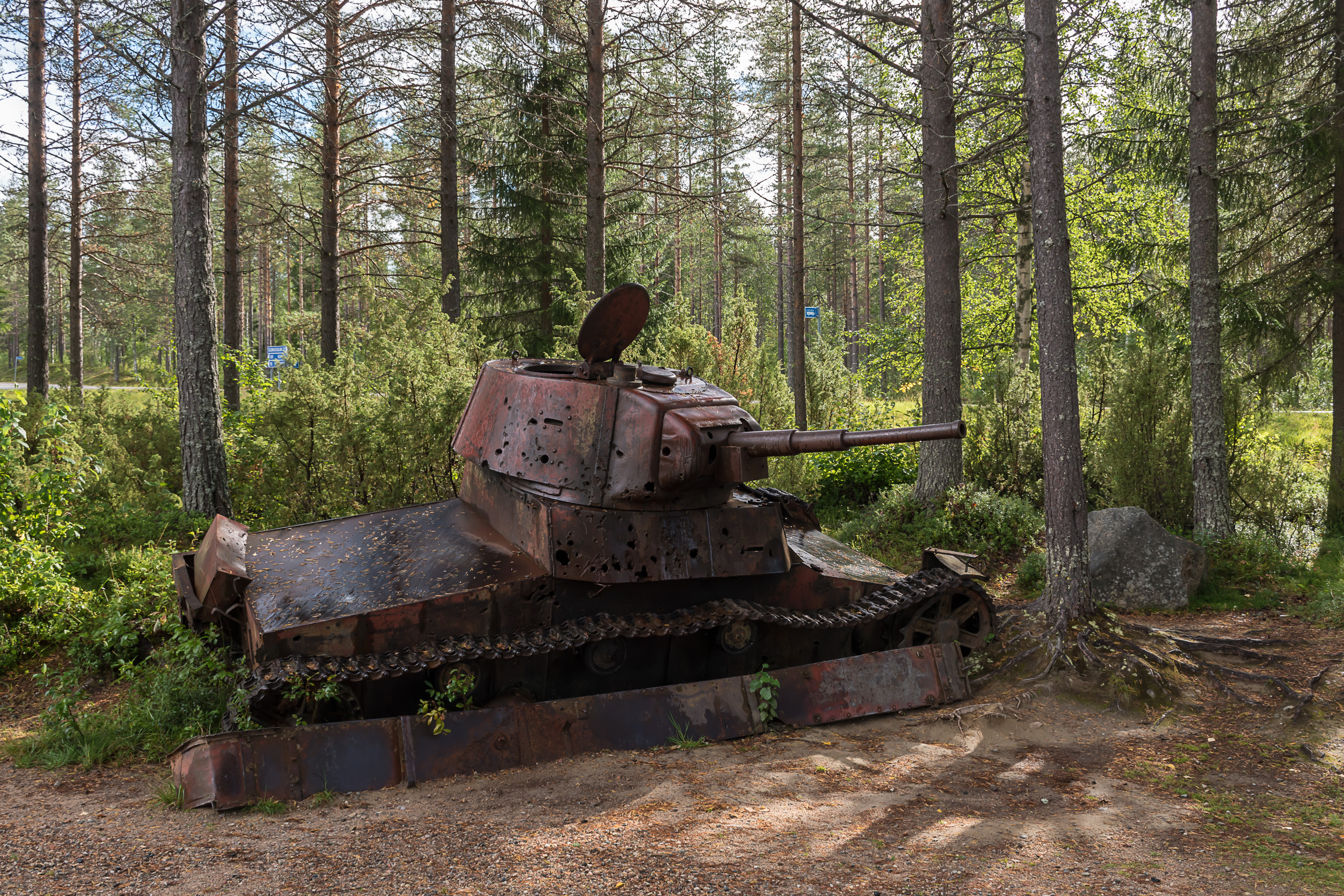
7. There is also some mostly destroyed equipment strewn near the museum.
8.
9.

10. There is also a tank in a restored state. Both tank are T-26's, I believe.
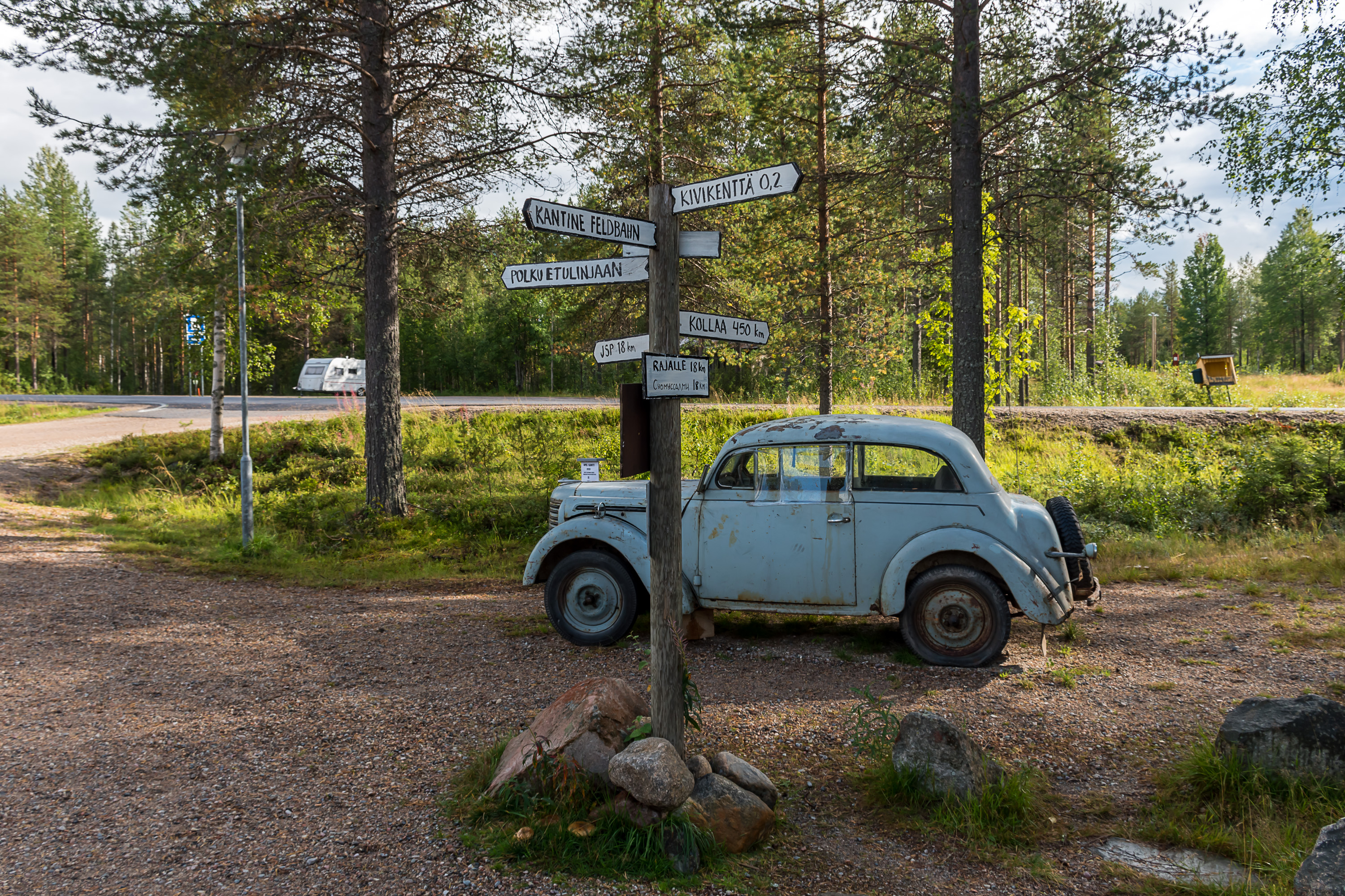
11. The signs by a decently preserved '38 Opel Kadett point to the "canteen", stone field (the memorial), border, a "trail to the front line", and in 450 km, Kollaa. The Battle of Kollaa is another famous one of the Winter War; it happened in Ladoga Karelia, in Suojärvi, part of the lost territories. It lasted pretty much through the entire war, until the very last day, and Soviet troops were simply never able to break through Finnish defenses and cross the Kollaanjoki river in three months. This is also where Simo Häyhä (1905-2002), a Finnish sniper who somehow became a worldwide-known figure recently thanks to the Internet, fought; in truth his achievements were certainly overstated by Finnish propaganda, and in Finland itself he's relatively obscure and certainly not celebrated as some great hero. The saying Kollaa kestää — "Kollaa will hold" — has on the other hand really stayed a part of the Finnish culture to these days.
12. Well, let's go in.
13.
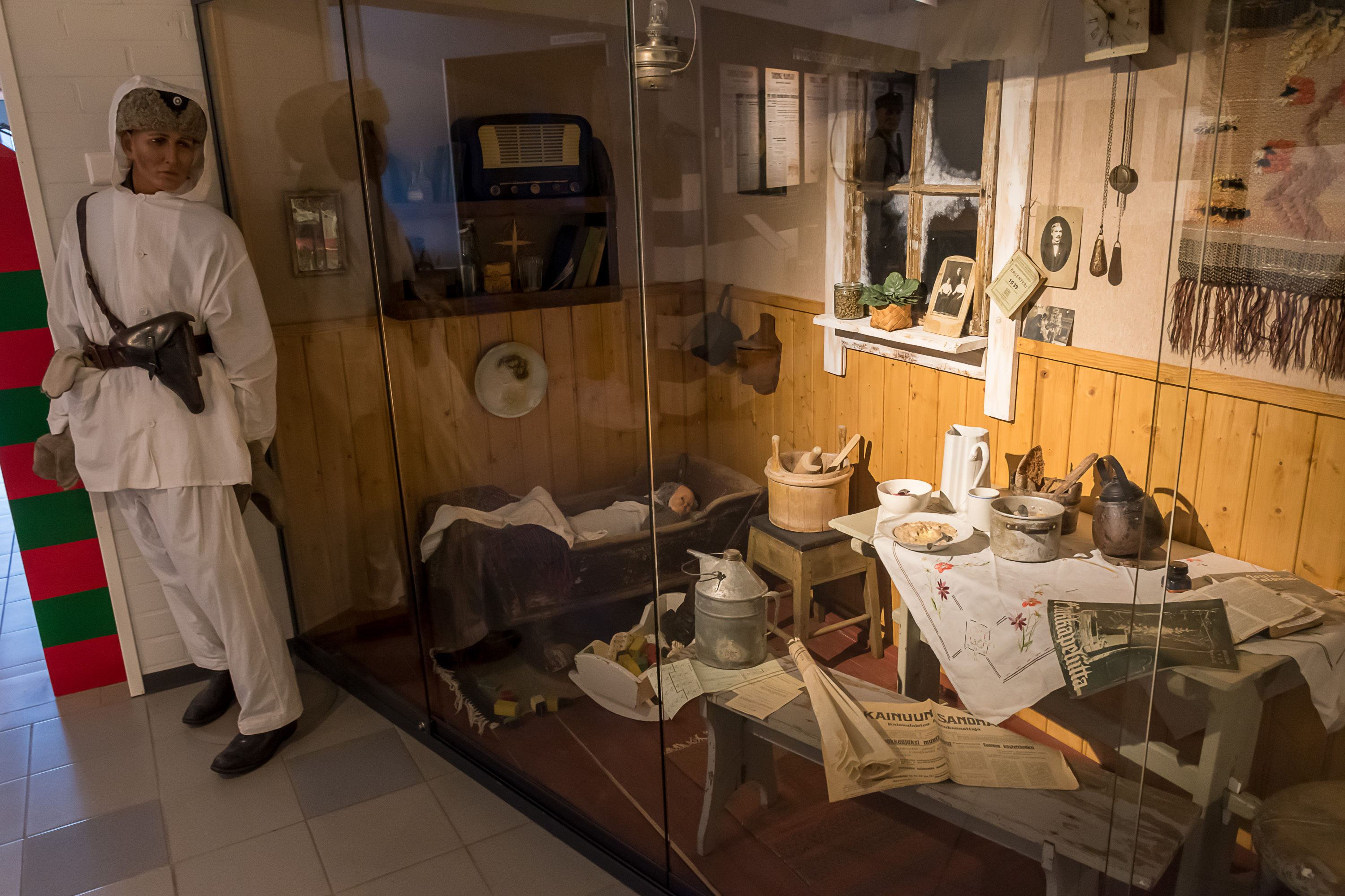
14. Life in Suomussalmi in war times.
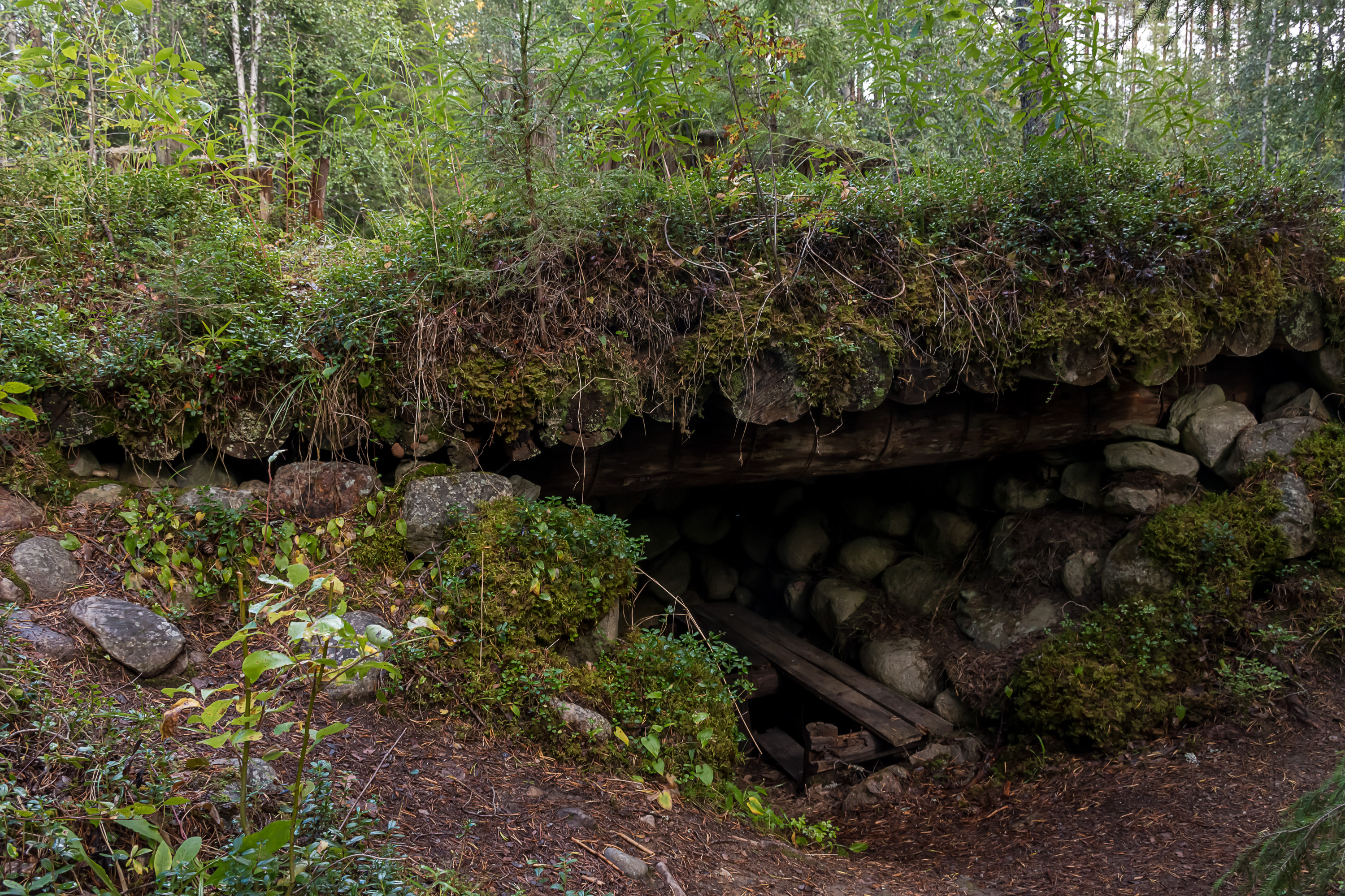
15.
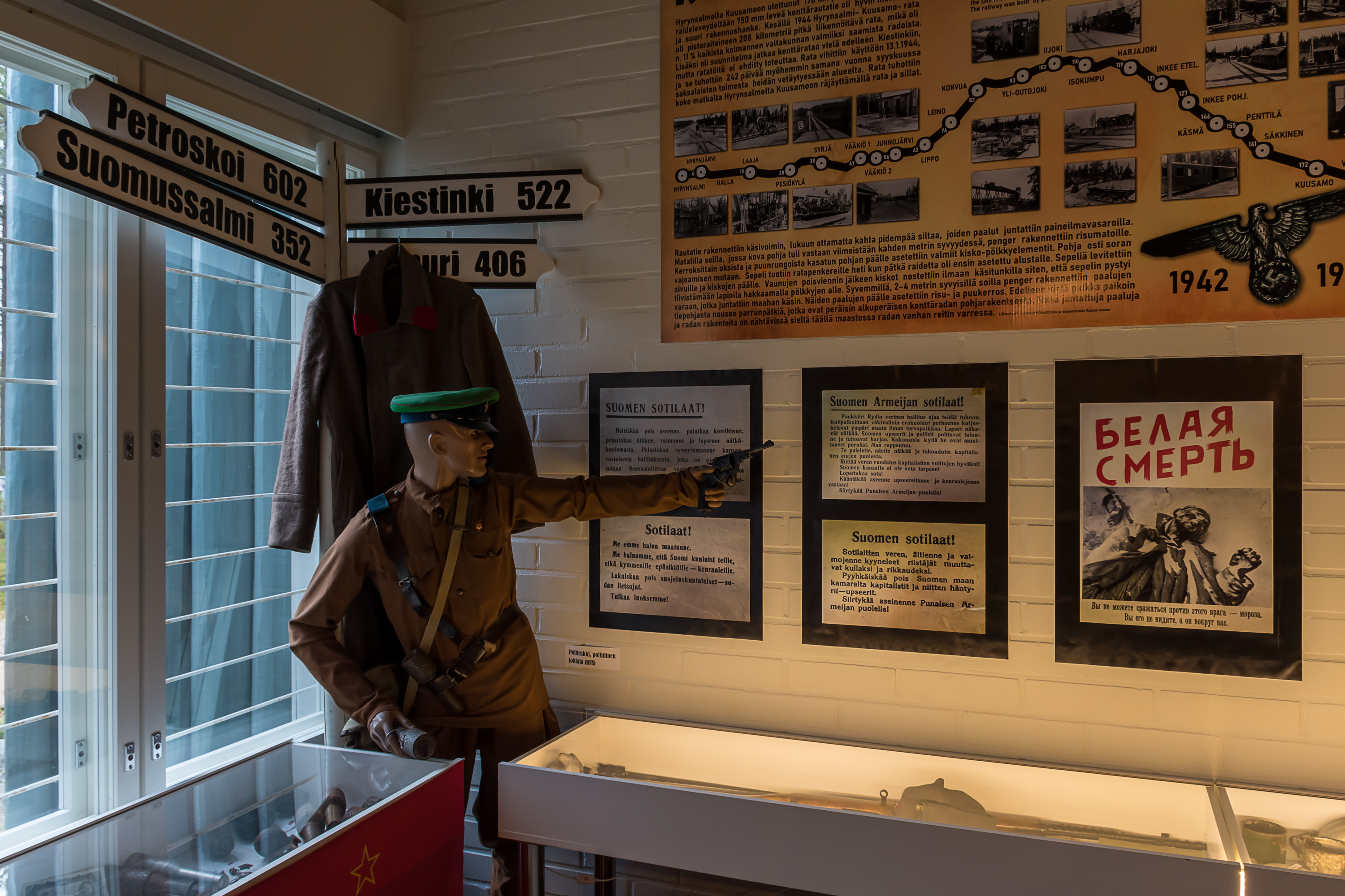
16. Personal belongings of Soviet troops.
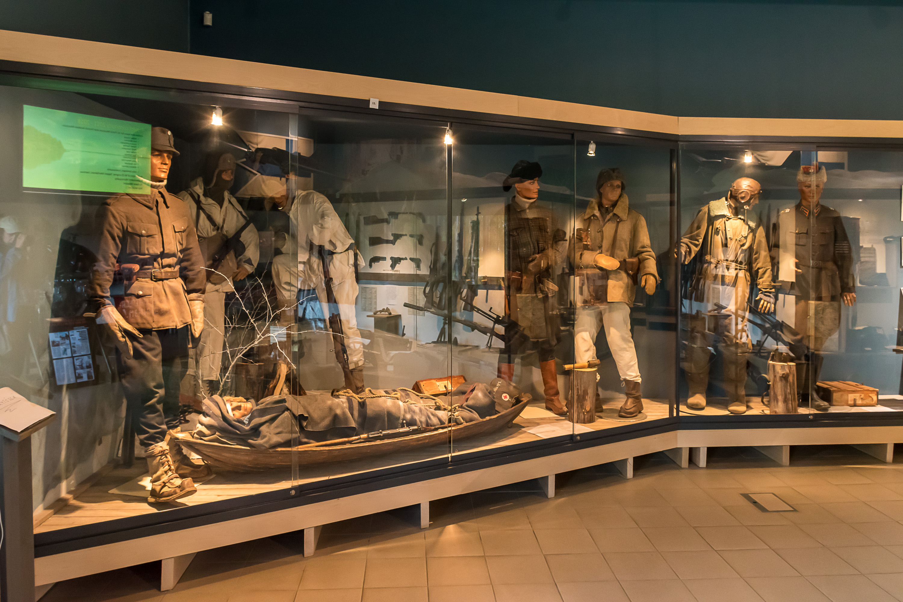
17. Finnish troops.
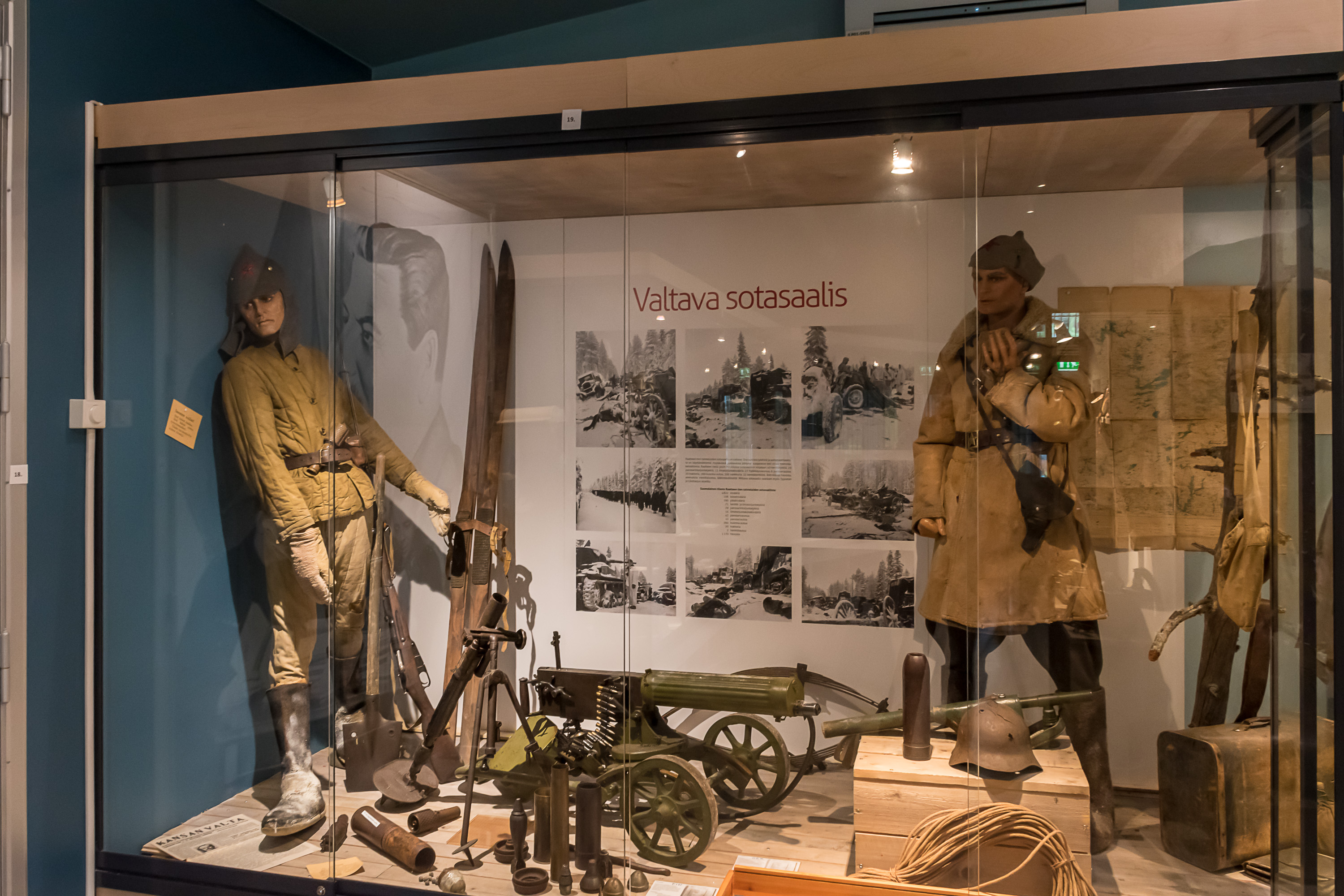
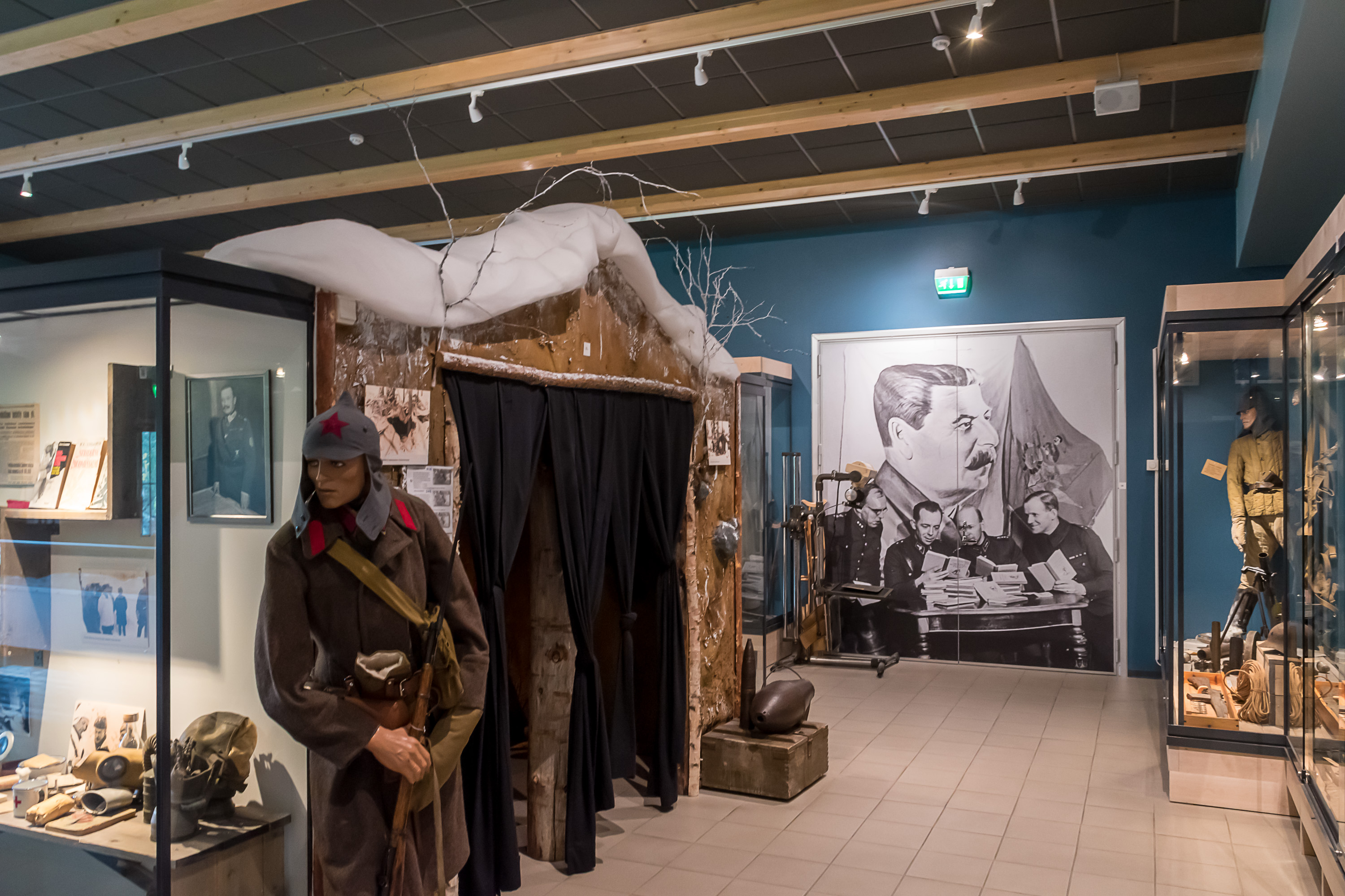
18. Soviet troops.
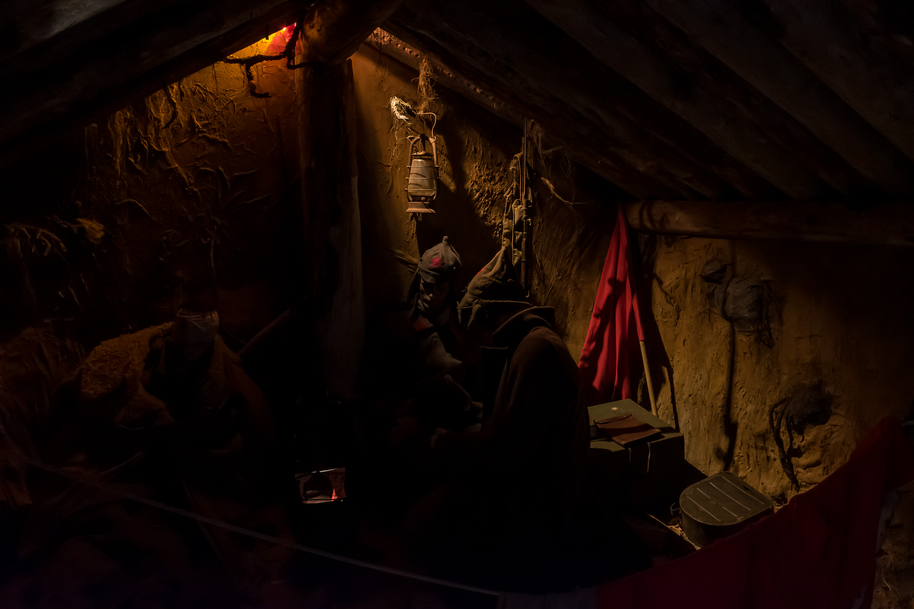
19. Same in a dugout.
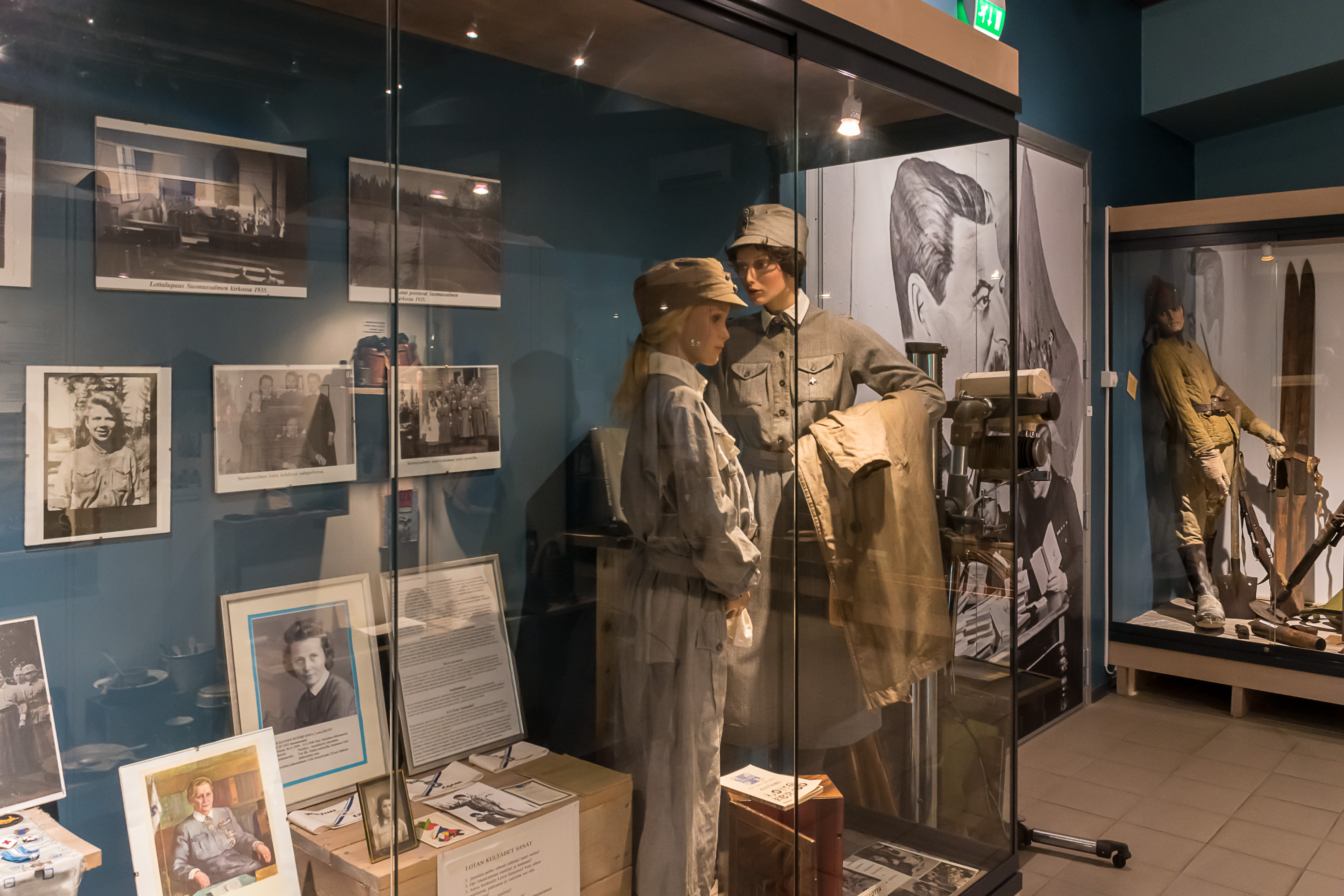
20. Finnish "lottas".
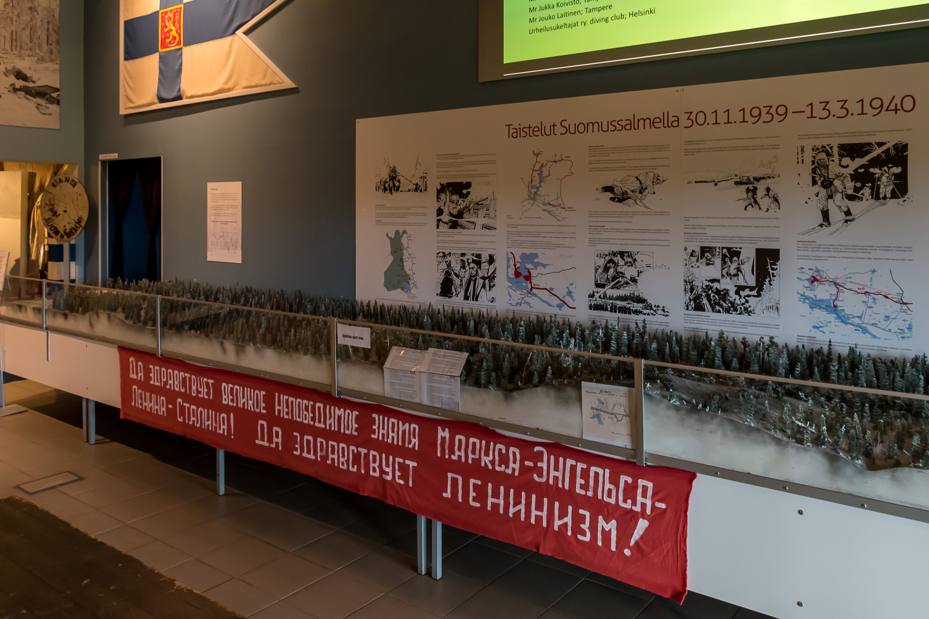
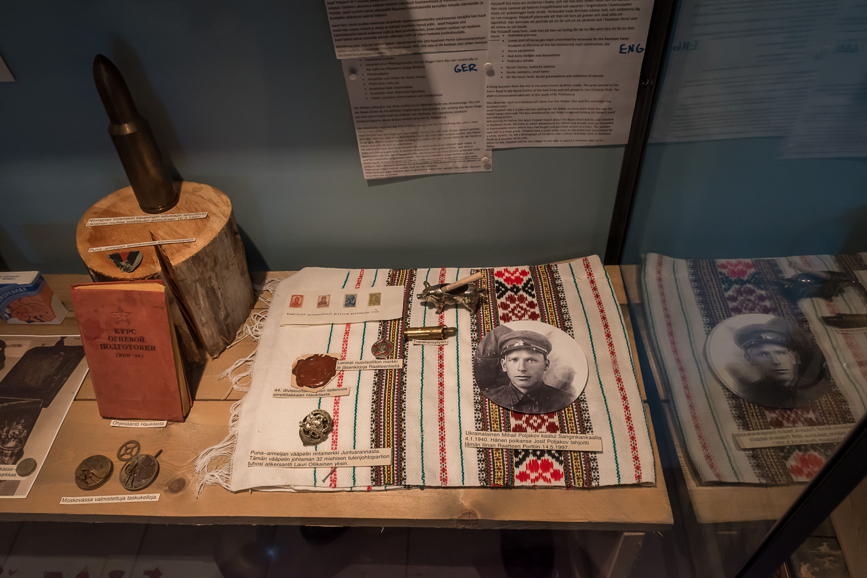
21. A model of the aftermath of the Battle of the Raate Road. The Soviet banner underneath reads: "Long live the great unconquerable banner of Marx-Engels-Lenin-Stalin! Long live the leninism!"
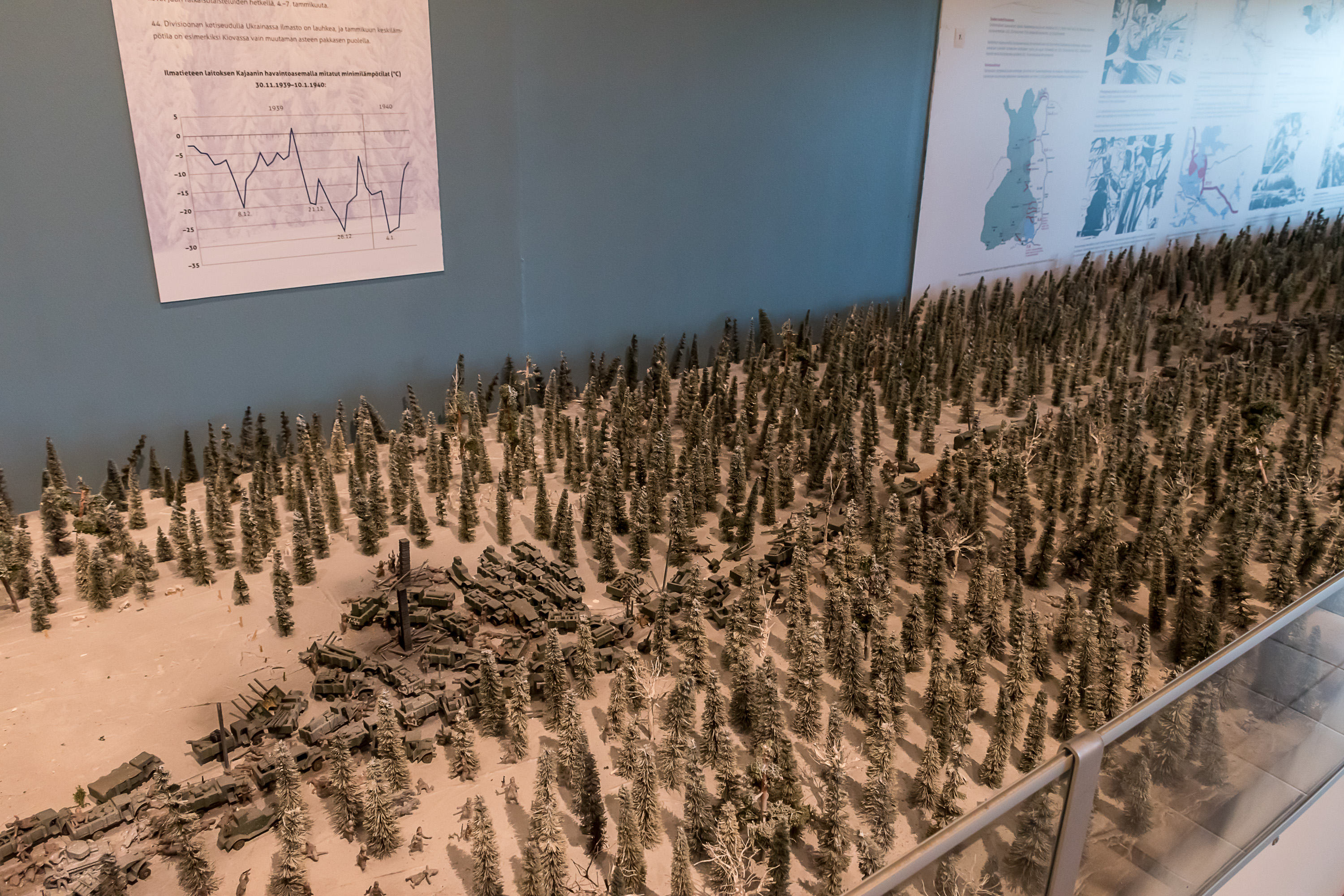
22. The model closer by.
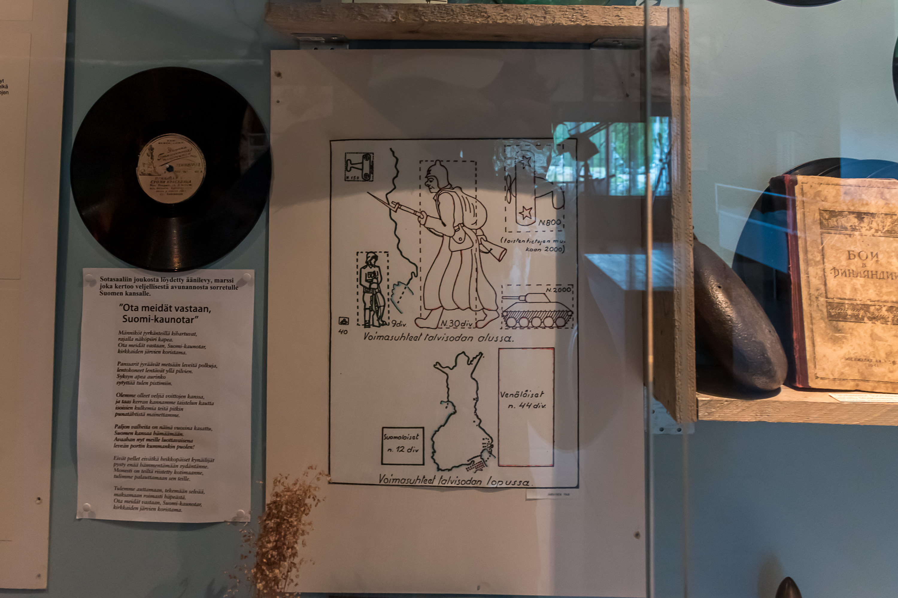
23. A graphic representation of the sizes of Finnish and Soviet forces involved, in the beginning of the war on top (various kinds of troops), and in the end of the war at the bottom (the number of divisions). To the left is a record of the infamous Soviet propaganda song, Принимай нас, Суоми-красавица (Russ. Take us in, Beauty Finland), describing how the grateful people of a beautiful northern country, oppressed by its rulers, gladly welcome the victorious Red Army bringing them freedom. Of course, such propaganda was disconnecting with the reality so badly it is almost comical, although this seems to be true of much of war propaganda, including for example pamphlets made by the Finns for Soviet troops. This song however was in Russian, meant for own troops. It is also curious that the song is explicitly set in the autumn, despite the actual war being, well, the Winter War; they wrote it beforehand.
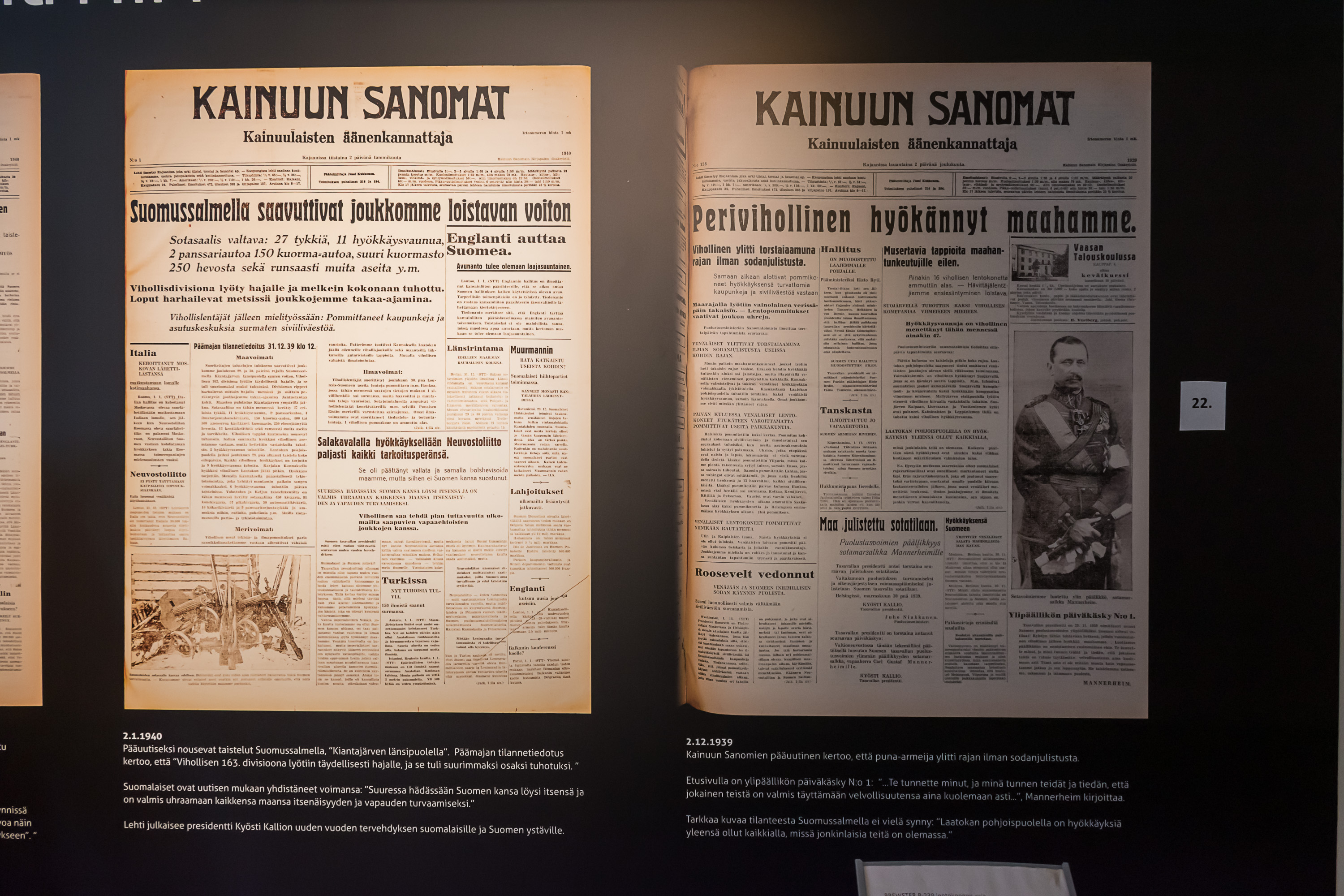
24. The regional newspaper, Kainuun Sanomat. To the right, 2.12.1939: "The archenemy has attacked our country"; also the daily order no. 1, with Marshal Mannerheim being appointed the commander in chief. To the left, 2.1.1940: "At Suomussalmi our troops achieved a glorious victory", referring to the Soviet 163th division being finally driven back for good from the burned Suomussalmi village.
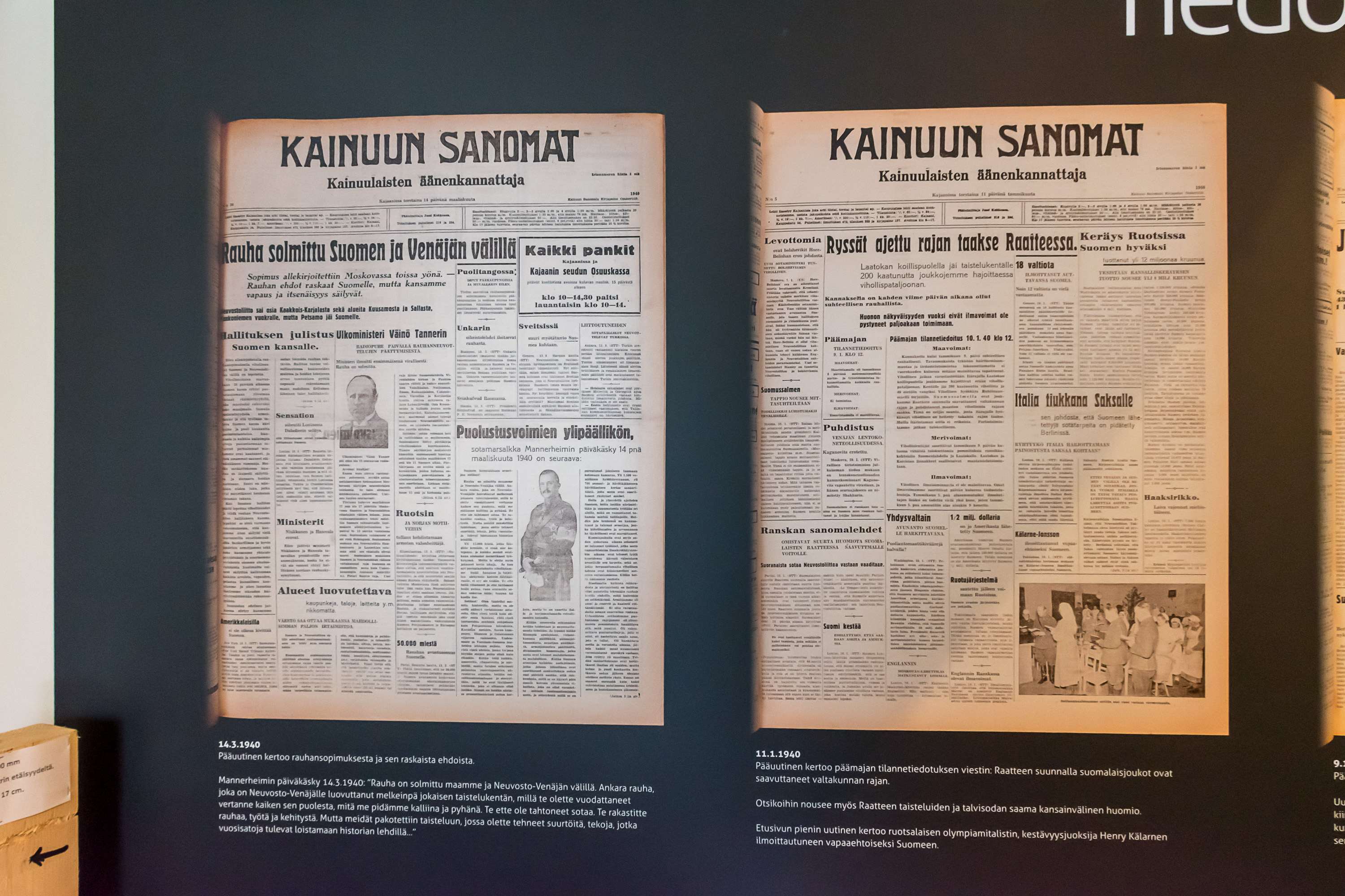
25. To the right, 11.1.1940: "The ryssä driven back over the border at Raate", ryssä being an offensive word for Russians. To the left, 14.3.1940: "Peace signed between Finland and Russia".
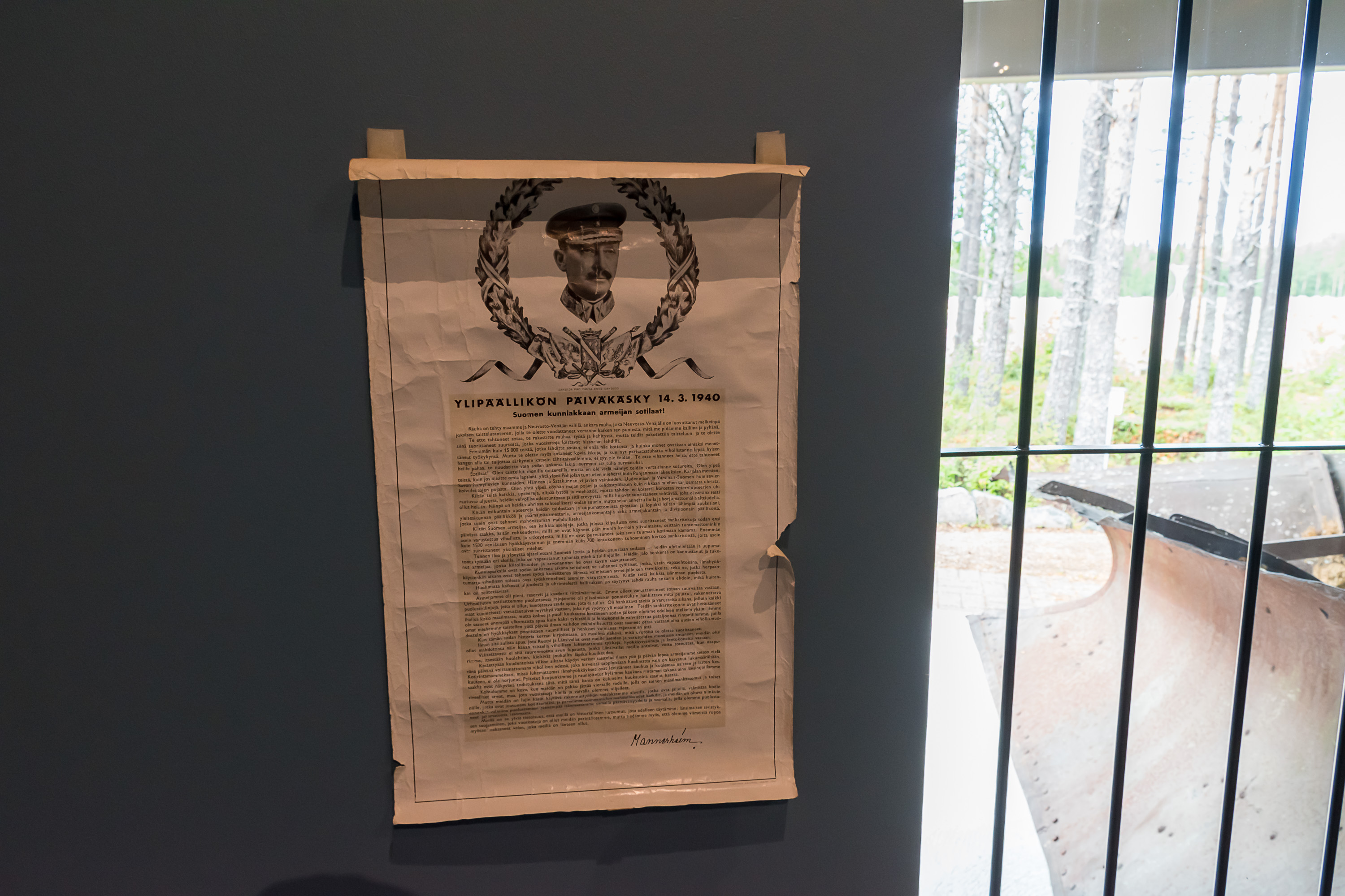
26. The daily order of Marshal Mannerheim proclaiming the end of the war. It is difficult to read with tearing up a bit at the parts where he thanks at length all the troops. At the same time, it is undoubtedly a war propaganda piece too; he overstates the enemy casualties and the damage inflicted by the USSR to Finnish civilians (bombings of Finnish cities; these did happen, cities all over Finland were bombed and around 1000 civilians died, but that still was a far cry from the kind of complete destruction wreaked for example to Dresden and Tokyo by the allies in the World War II). Mannerheim explains the reasons for losing the war, placing much of the blame on the western countries (not pointing to anyone in particular though) which provided little help and/or refused to allow help from other countries pass through their territory. This is largely true; Finland did hope for help, but it was too little, too late in reality. Mannerheim's concluding words sound rather dark, and already contain a hint of what was to come: Finland has been a shield for the western civilization, but now its debt to the West has been paid in full.
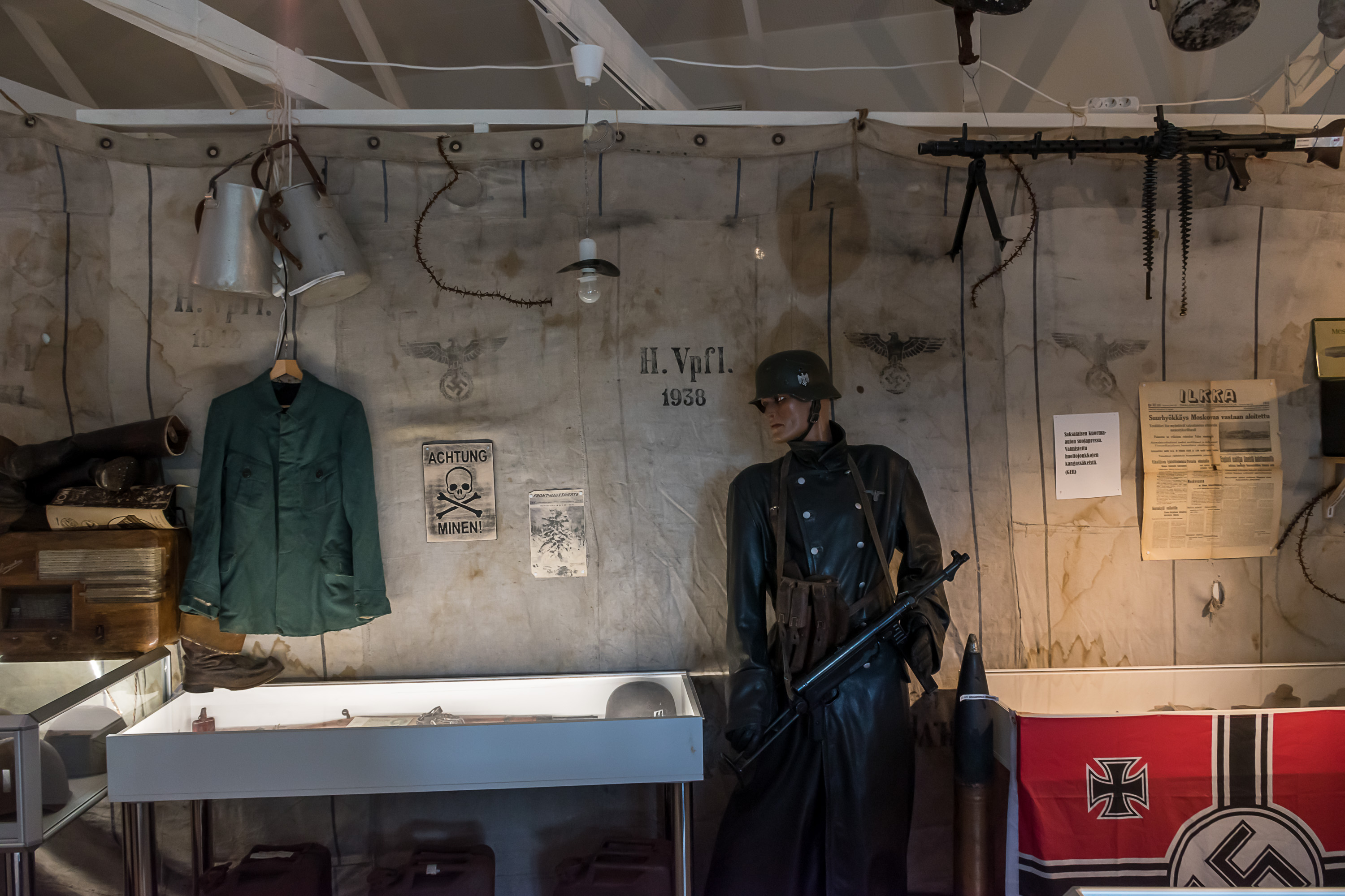
27. And so there are also some expositions about the Continuation War of 1941-1944. In this war Suomussalmi didn't have a major role, as the fighting in these areas in that war was happening on the Soviet Karelia side of the border, where Finnish troops advanced nearly to Uhtua but were never able to take it.
28.
29. Let's now explore from the museum to the east, towards the border along the museum road. Immediately next to the museum are some history/nature trails, which I didn't explore deeply. The sign to the left says: "The Headquarters announces: take donuts and coffee with you from the canteen..."
30. A monument to the Karelian volunteers in the Kinship Wars (Heimosodat) of 1918-1922, when Finnish volunteers made a number of expeditions to Soviet Karelia, trying to inspire Karelians to rebel against the Soviet Russia and join Finland too. These in the end were not successful; some Karelians were able to escape to Finland though. Being undeniably an act of aggression from Finland, these clashes, although fairly small in scale, didn't really help the building up of Finnish-Soviet relationships. The inscription says: "To the memory of White Karelia kinship soldiers. Honor to the volunteers who, based on their convictions, bravely followed the flag of freedom. The Raate road was a major thoroughfare for White Karelia kinship troops and refugees".
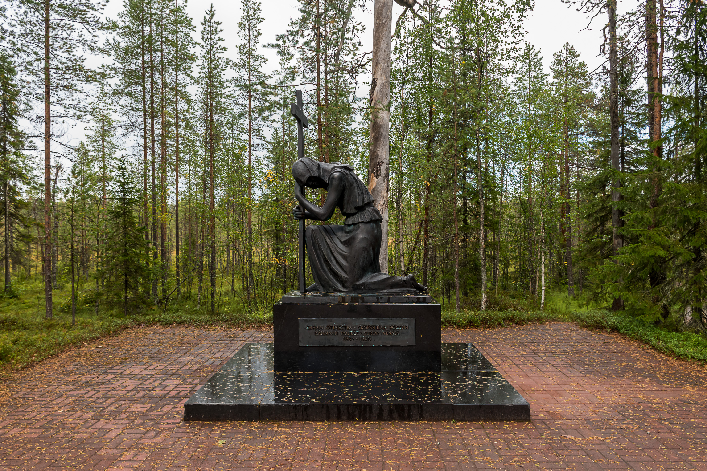
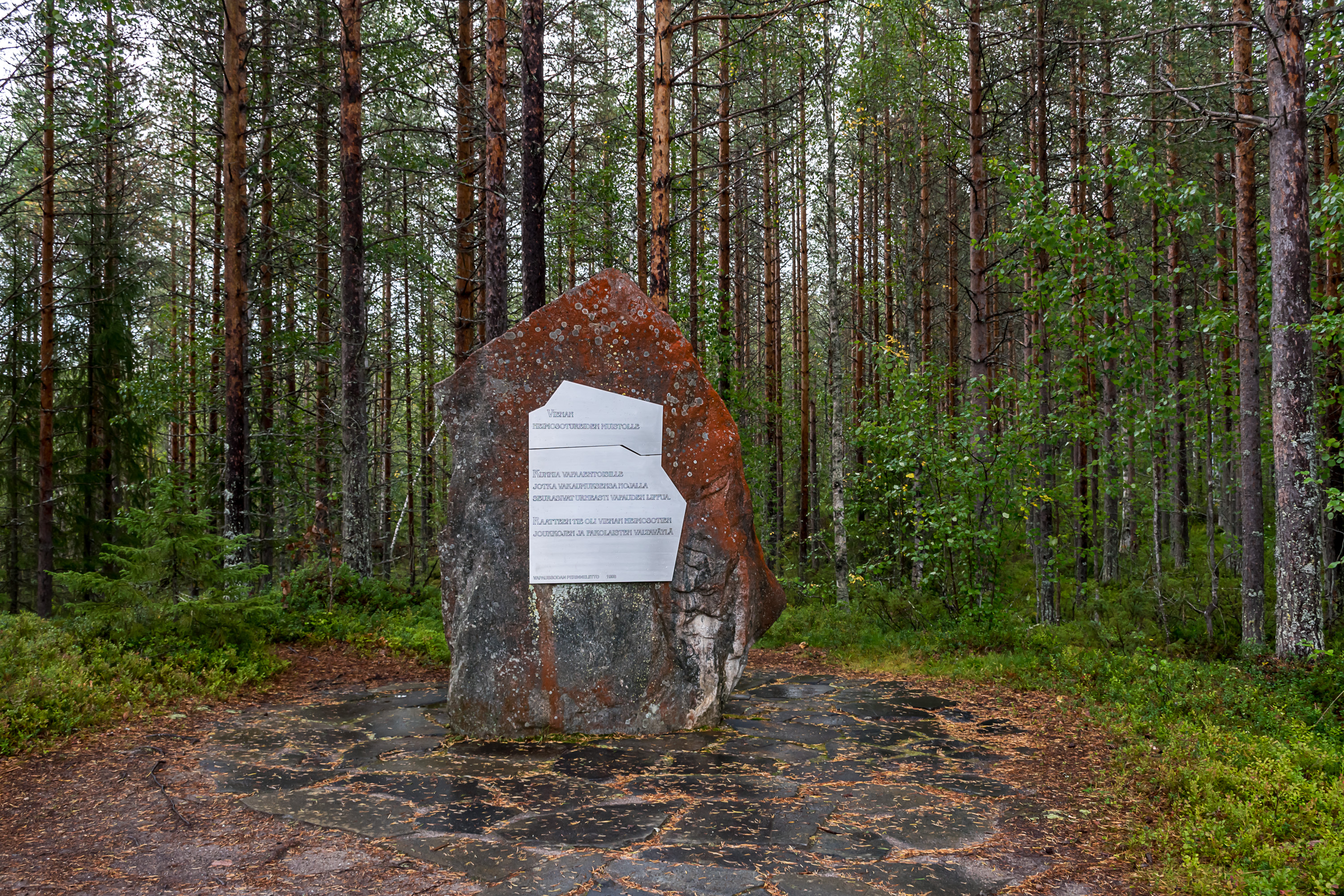
31. About a kilometer east of the museum and memorial, there is a Russian monument by the Raate road. It was put up in 1994. The inscription says: "To the sons of the fatherland, the grieving Russia".
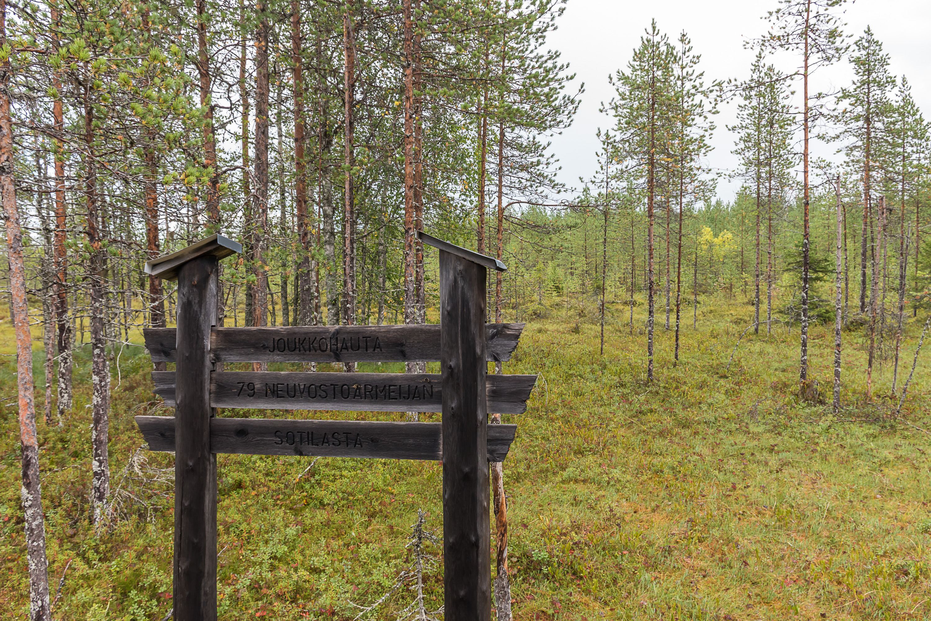
32. Right behind the monument is an ordinary-looking mire with a sign: "Mass grave of 79 Soviet army troops". This is in truth the only marked mass grave; there are probably many more, even in the Suomussalmi church village itself.
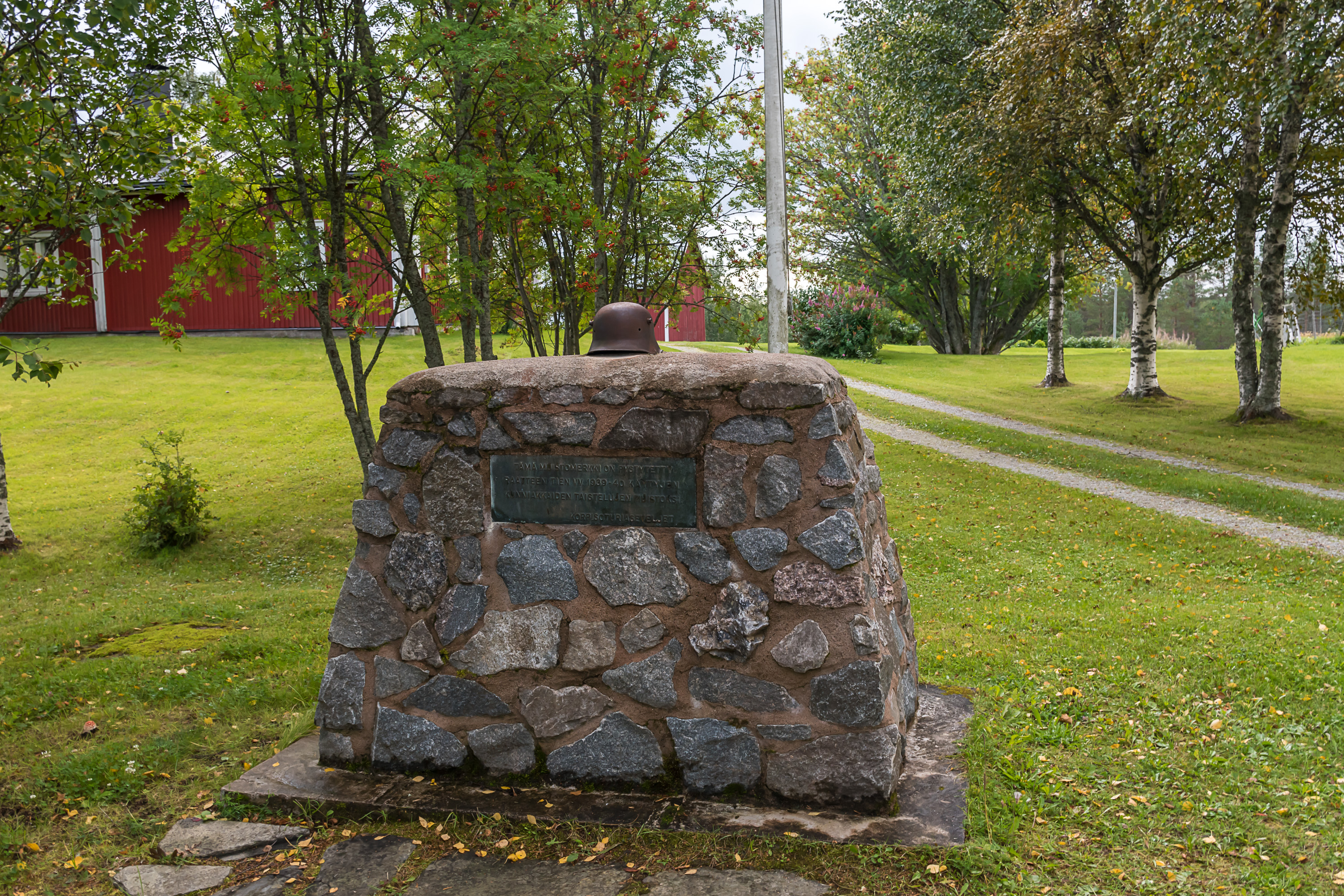
33. About 8 km down the road, by the Harjula farm, there is a rather simple monument: "This monument has been put up to honor the memory of the glorious battles on the Raate road in 1939-1940". I'm guessing this is one of the oldest monuments in the area.
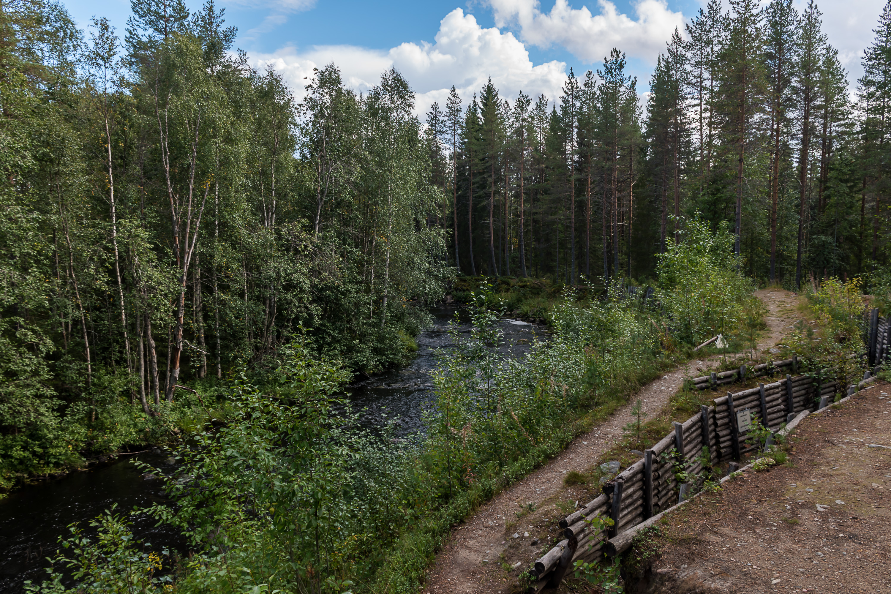
34. And then we get to Purasjoki river and its small defense line. The fortifications are partially restored.
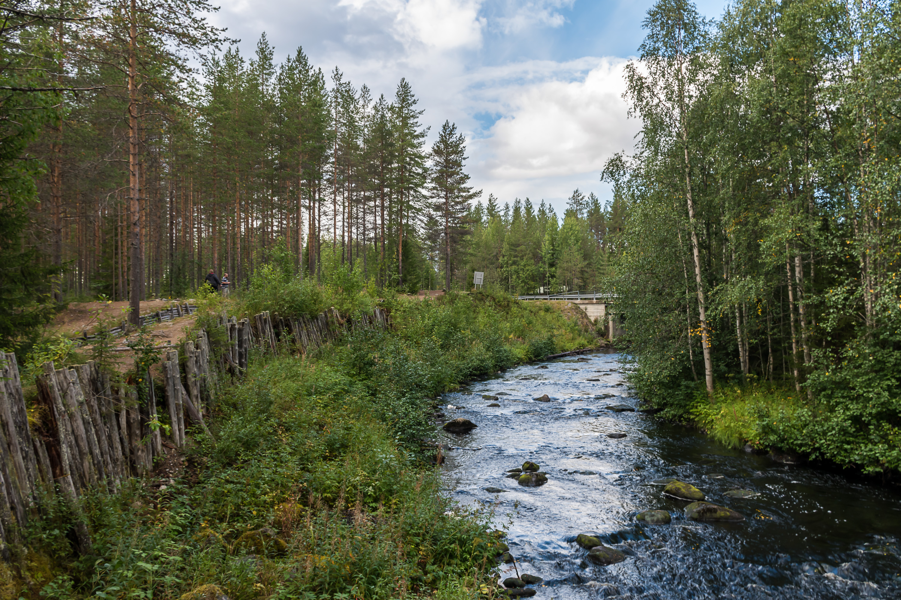
35. The west bank of the river is protected against tanks crossing it. River itself looks quite easy to cross even without a bridge.

36. Trenches.
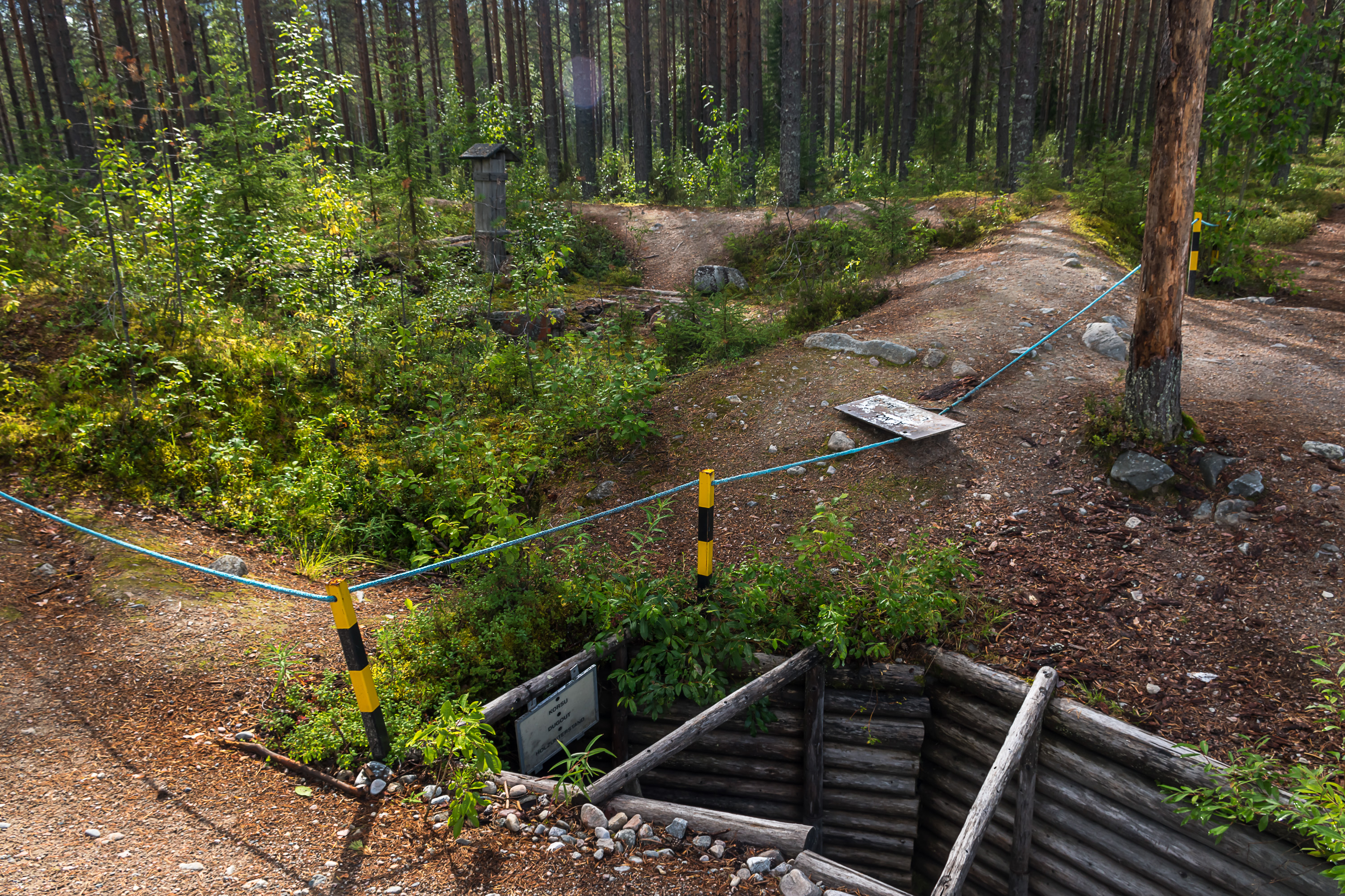
37. A dugout. Those are not restored, or maybe one of them is, I don't exactly remember.
38.
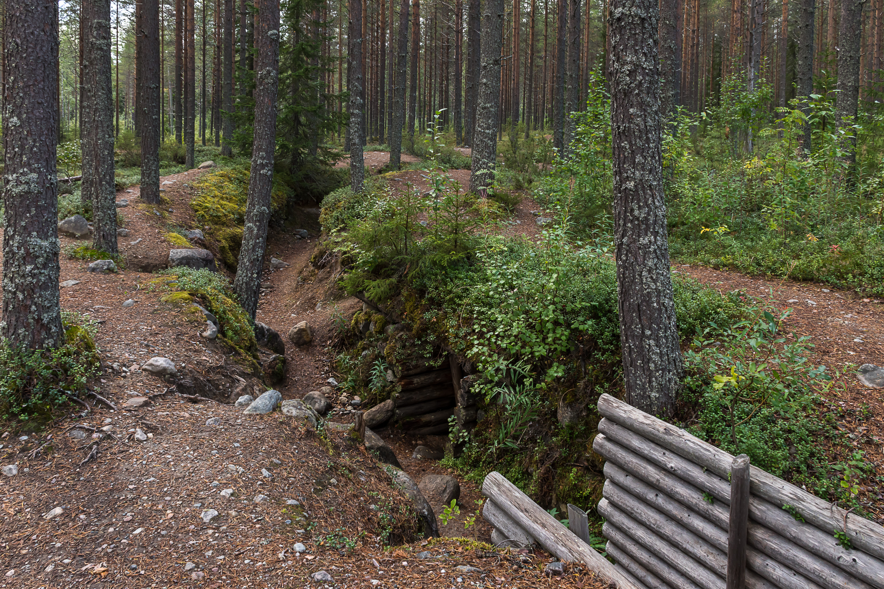
39. Restored part of a trench ending.
40. Trenches that weren't restored.
41. The road continues on towards the border.
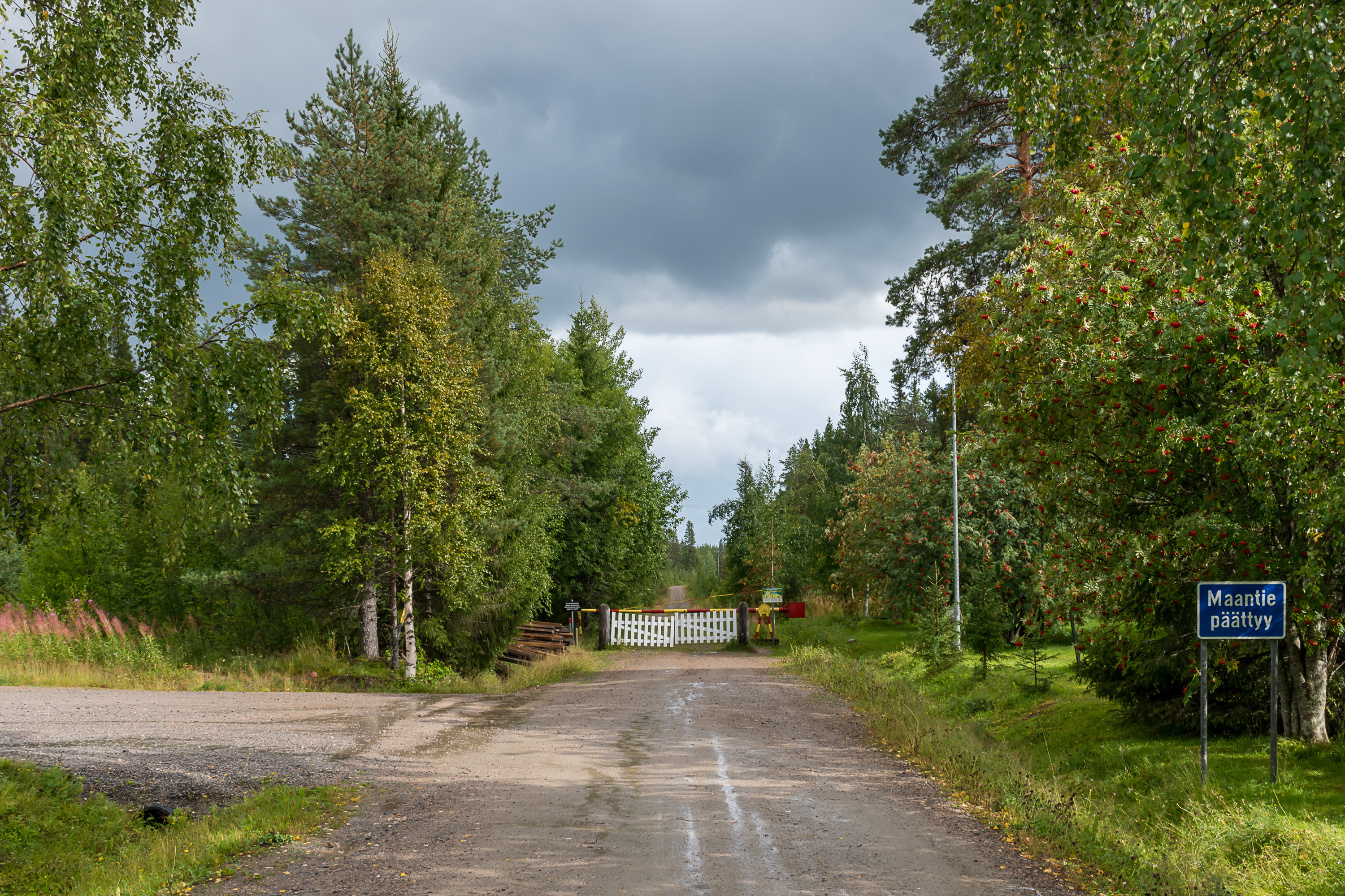
42. And ends here 18 km from the museum, with a helpful sign "road ends".
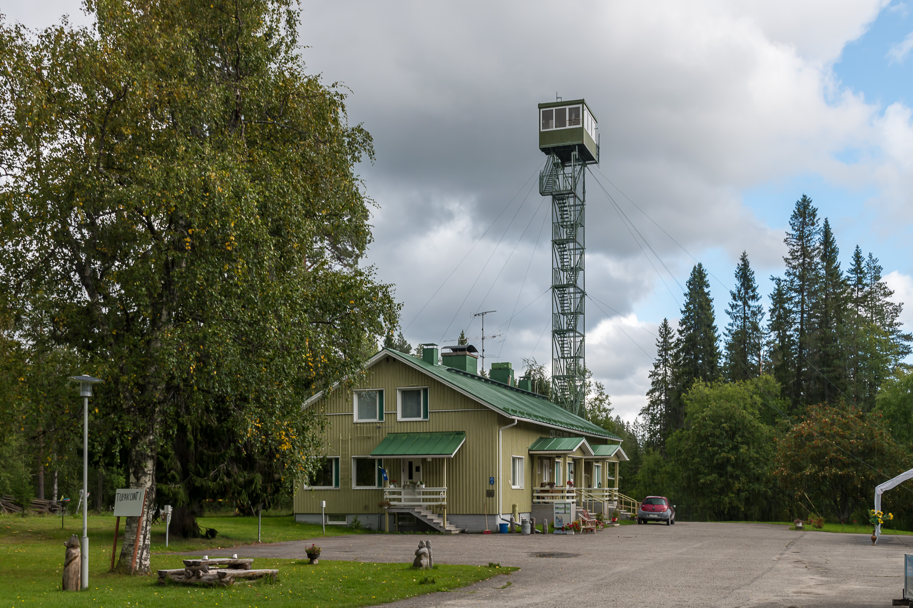
43. This is the former border guard outpost at Raate. The outpost has been shut down in the 1980s. The building now houses a summer cafe. It is possible to climb the lookout tower but they ask like 10€ for it, so I decided, nah. (You probably wouldn't be able to see anything but endless woods in all directions anyway.)
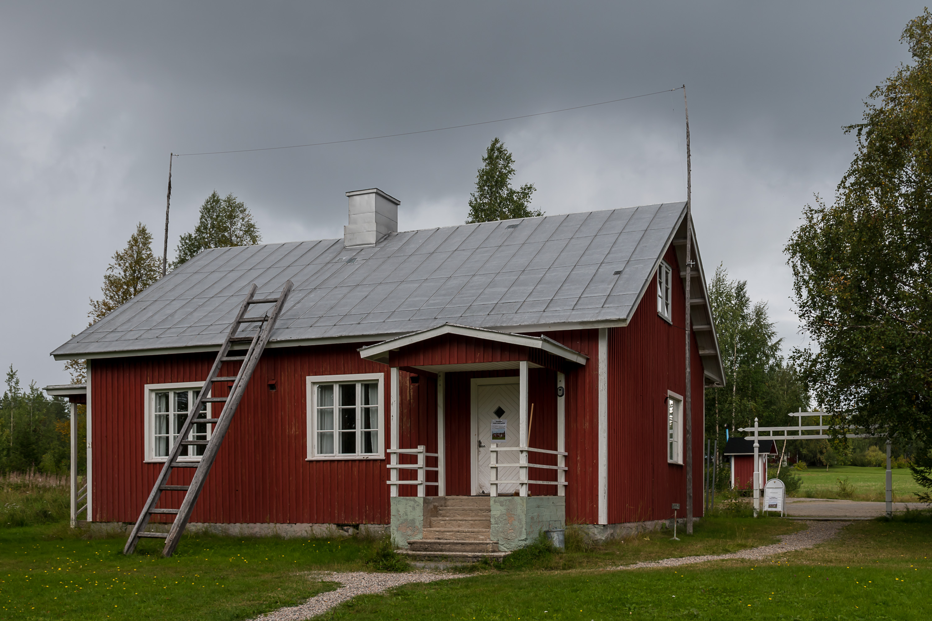
44. In the second, older building, restored to its appearance from 1939, a border guard museum operates in summer. It is free to visit but unfortunately I just missed its opening season by a few days.
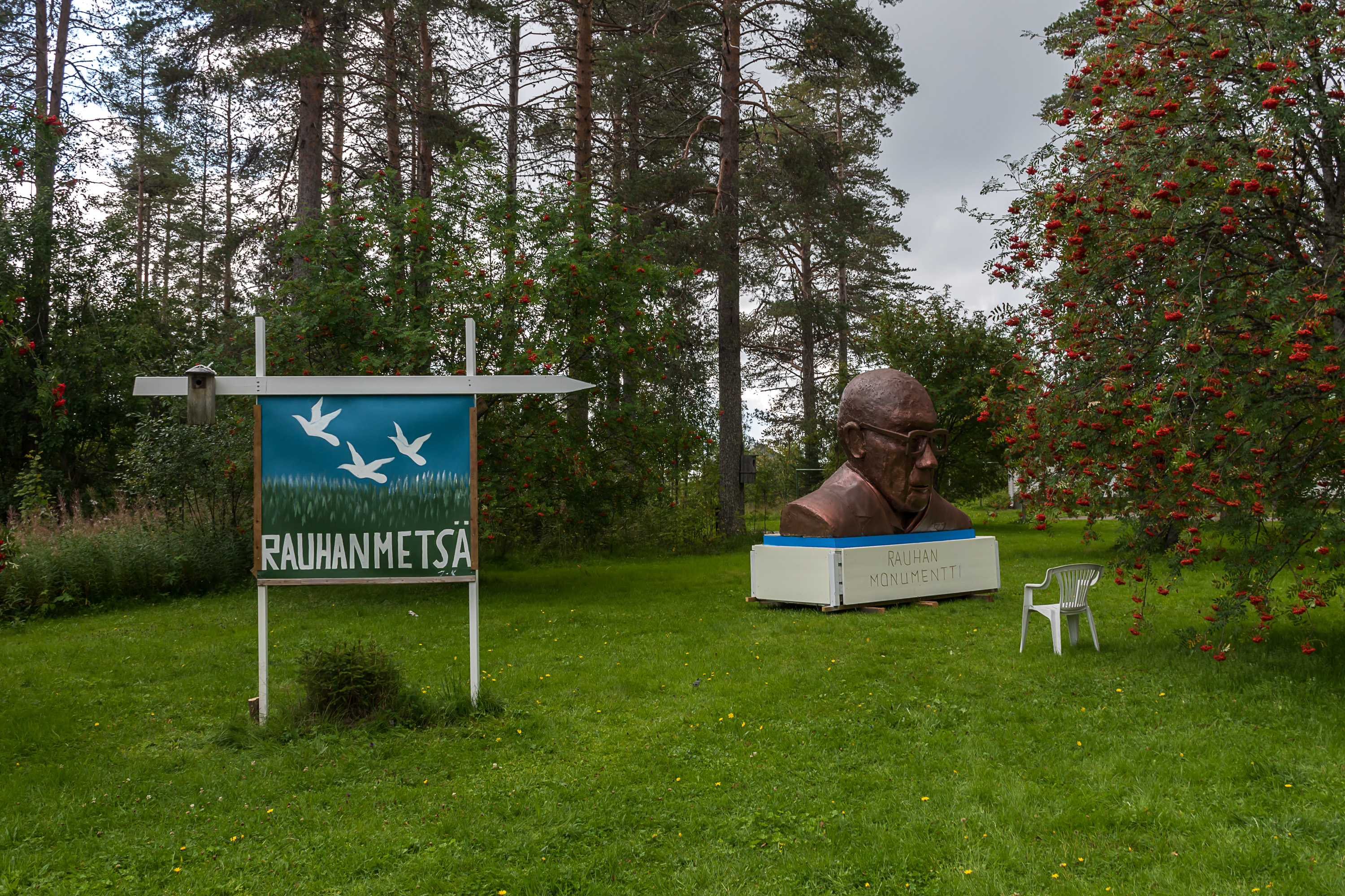
45. "Peace forest". No idea what this is about. Is that President Kekkonen?
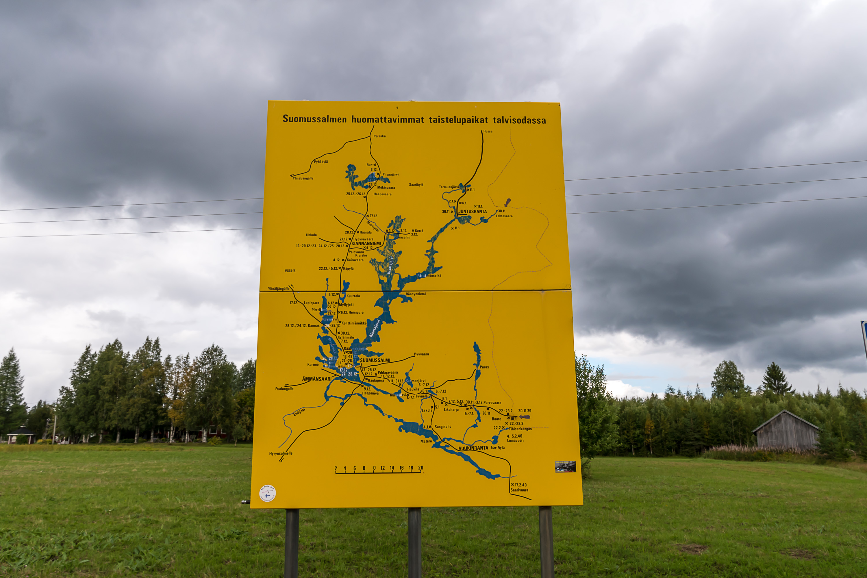
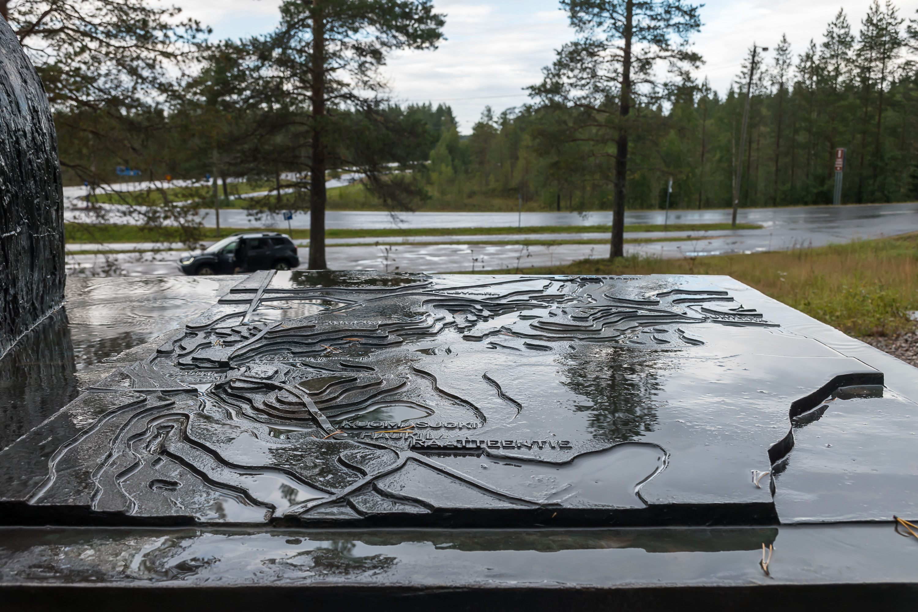
46. A detailed map of all battle sites in Suomussalmi at the museum/cafe parking lot.
47. The Eastern Border hiking trail (Itärajan retkeilyreitti) passes through Raate. It is a long-distance hiking trail, about 160 km long, passing through rather wilderness-like areas of Suomussalmi close by the Russian border (of course it still doesn't stray into the restricted border strip). It begins from the Suomussalmi-Kuhmo municipal border close to the Vartius border crossing point (or alternately a little farther away, from Vartius itself) and ends at Hossa National Park on Suomussalmi-Kuusamo municipal border. This is a very obscure hiking route, visited by very few people. It's still been one of the relatively few long-distance hiking trails maintained by the Finnish Forest Administration (Metsähallitus), but in 2019 they announced that the trail will not be maintained anymore "in the current shape" at least. Well, you can already see from the signs that they are not particularly new :) The descriptions of the trail are available only in Finnish at the official Luontoon.fi website and at the site of the local enthusiasts.

48. The sign to the left says that the wooden gate is the original one from the war period too. The signs and the barriers make it look like the restricted border area begins from here. Actually it doesn't if you look at the map; the restricted area proper begins about 500 m farther down the disused road, and then it's 850 m through the restricted area to the Russian border.
The road does still continue on the Russian side to Voknavolok, although it is not clear how driveable it is, where the restricted border zone ends on the Russian side, or whether the few tiny villages between the border and Voknavolok are completely abandoned by now. Voknavolok is definitely inhabited and connected to the city of Kostomuksha with a gravel road, if a rather poor one.
49. In any case we cannot go east, so let's briefly check the monuments along the western half of the former Raate road, the one that is now paved and improved and near the Raatteen Portti museum and crossroads turns south towards Kuhmo. This is a monument to the fallen Ukrainians (as you remember the 44th division was an Ukrainian one) near Haukila farm, where the worst part of the Battle of the Raate Road happened. The monument was put up in 2009. It says: "Ukraine prays for the fallen souls", and quotes the Bible: "They shall beat their swords into plowshares, and nation shall not lift up sword against nation".
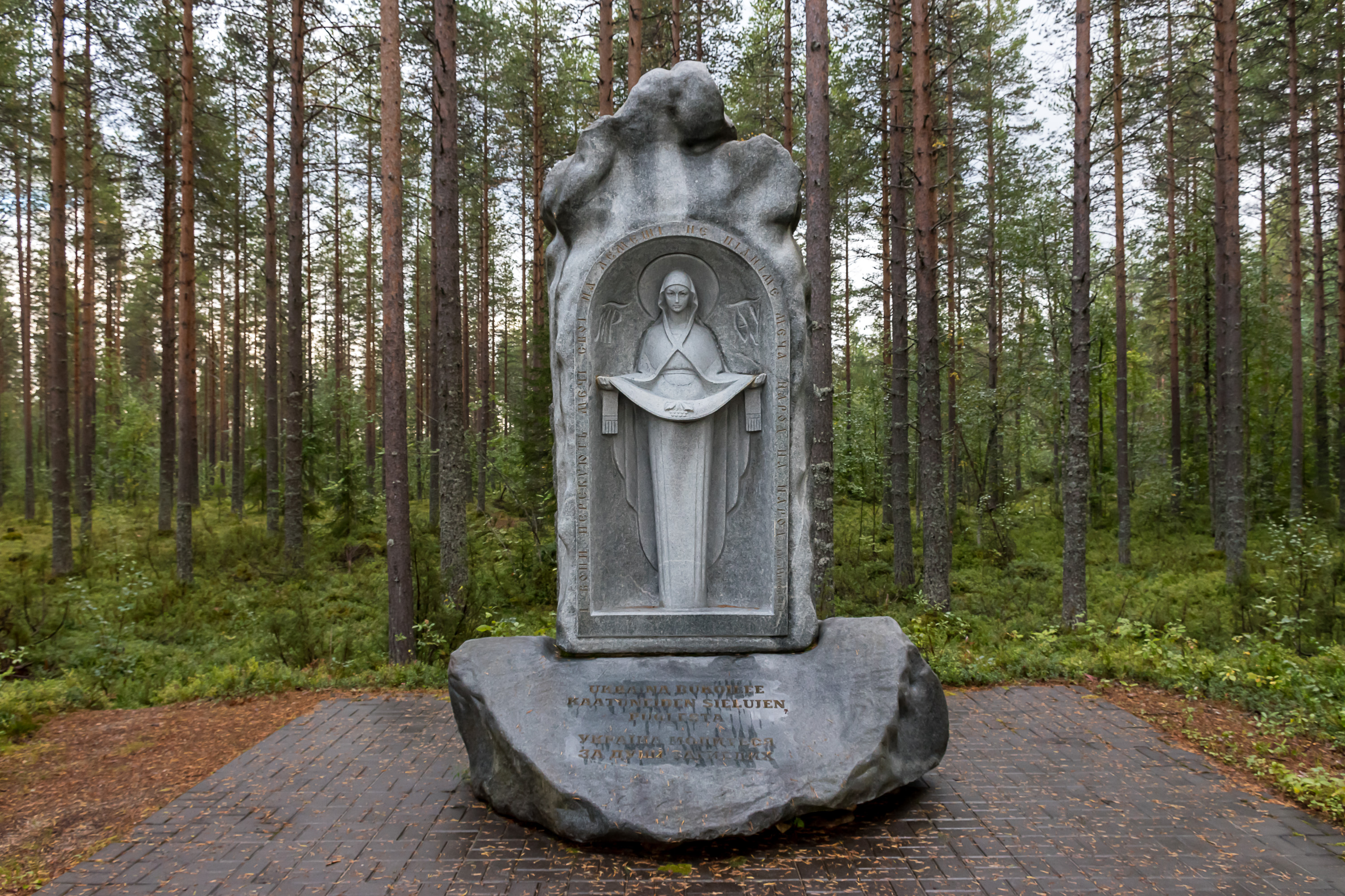
Both Russian and Ukrainian monuments were put up by these countries, and designed by their sculptors. The USSR apparently was not interested in putting up Winter War monuments in Finland (or really even in Russia for that matter), so both of these date from after the fall of the Soviet Union already.
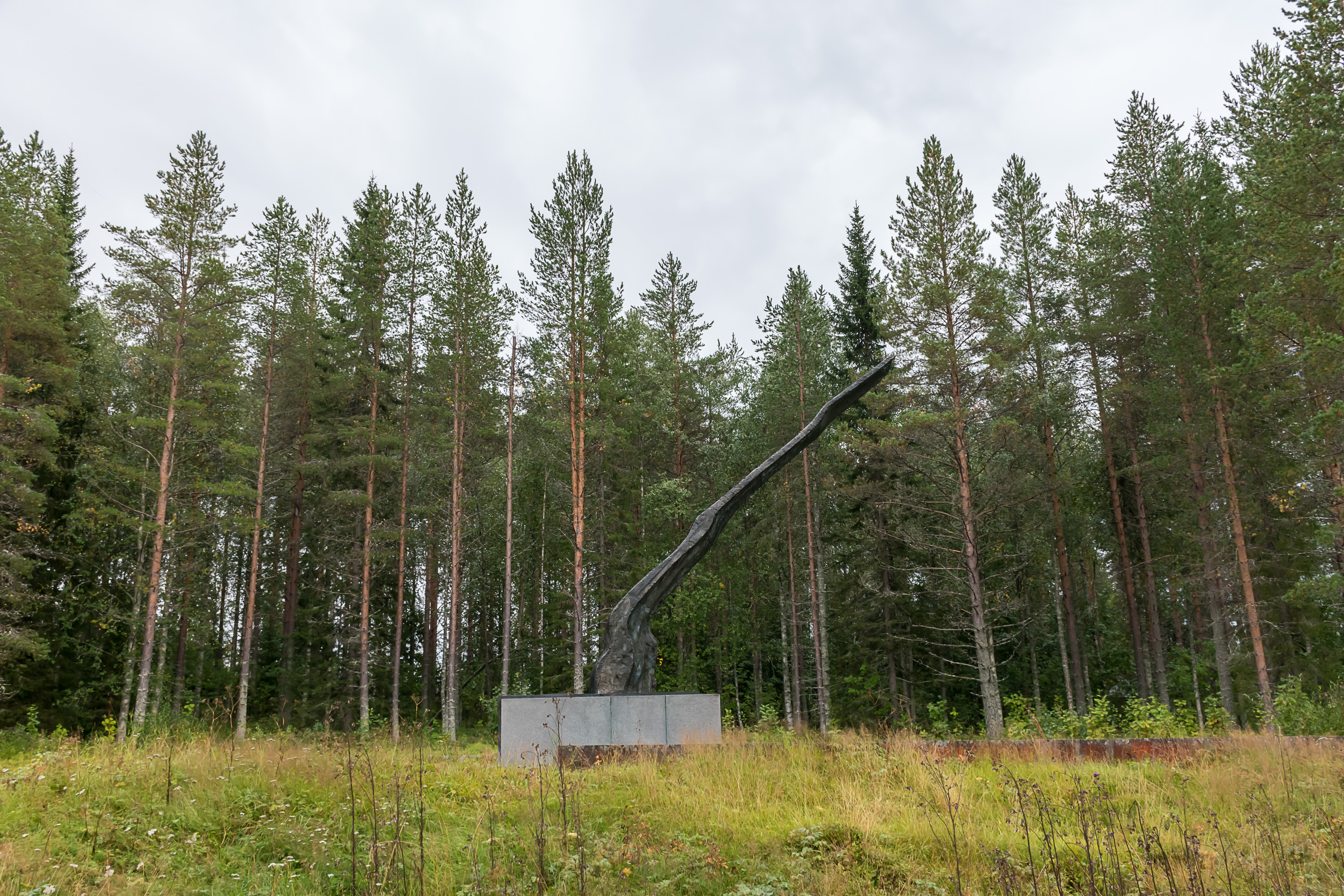
50. The "Flame monument" (Liekkipatsas) at the crossroads of modern Kuhmo and Juntusranta roads near Suomussalmi is the main monument of Suomussalmi battles. It was designed by none other than the great Alvar Aalto (1898-1976), one of the most famed Finnish architects ever, and unveiled in 1959. Honestly I cannot really explain what its shape means, but it is quite big at least, 9 m high.
51. "Many brave solders shed their heart's blood for the great victories at Suomussalmi. They showed to their people the road of honor, which was strenuous, but the only possible one." — Colonel Siilasvuo, the Finnish commander at Suomussalmi.
52. The monument also includes a map.

53. And this little monument beyond the bridge over Haukiperä bay is easy to miss, but is quite important nonetheless: "Here ended in the time of the Winter War 9.12.1939 the enemy's advance". Haukiperä beachhead, quickly lost, was the farthest point anywhere where the USSR could advance within the modern post-war borders of Finland.
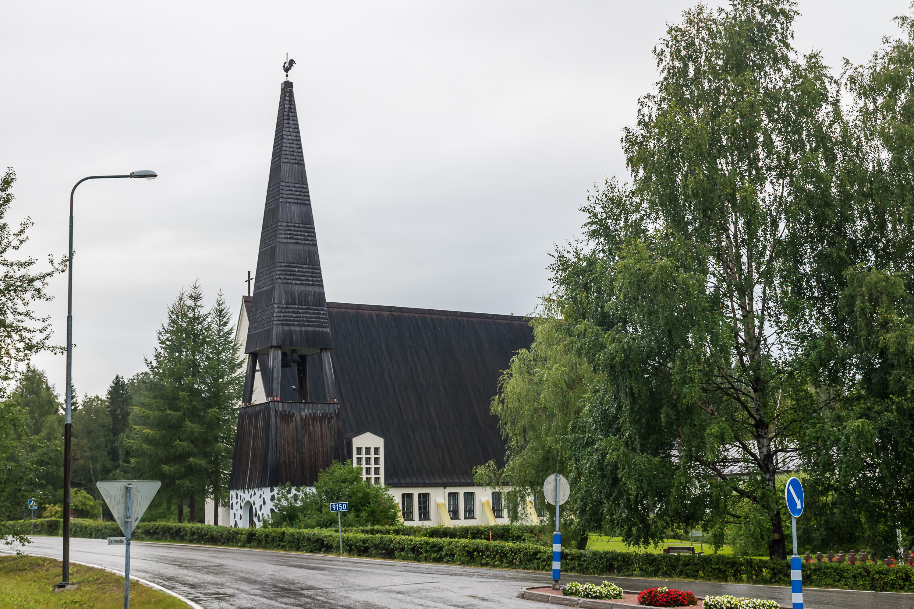
54. The village of Suomussalmi was rebuilt after the war, but it lost importance by now. The modern municipal center moved to the other side of Kiantajärvi lake, to Ämmänsaari village. Ämmänsaari nowadays has a railroad connection (no passenger service since 1982, but still in active use for timber transport; the whole region is a major commercial forestry area), and the modern National Road 5 was rerouted through it too. These days Ämmänsaari is simply called Suomussalmi, and the old Suomussalmi is known as Suomussalmi church village (Suomussalmen kirkonkylä). The population of the new Suomussalmi (Ämmänsaari) is about 4100, and of the old Suomussalmi (Suomussalmi church village) is about 900.
Pictured is the Suomussalmi church, rebuilt in the church village in 1950. Graves of the local fallen soldiers are also visible to the right. There isn't really anything else to see in the church village, and neither can Ämmänsaari be called a particularly exciting place. I might eventually still write a post about Ämmänsaari and the remaining (non-Winter War related) Suomussalmi sights. These are for example the Hossa National Park and the Karelian villages of Kuivajärvi and Hietajärvi, which have historically been the only places on the Finnish side of the border where White Karelians lived and live to these days. Unfortunately these churches were also burned down by the Finnish troops during the Winter War, so the only "true" Karelian houses there are a few later replicas. The destruction of these villages is, I would say, the worst cultural loss of the battles of Suomussalmi.
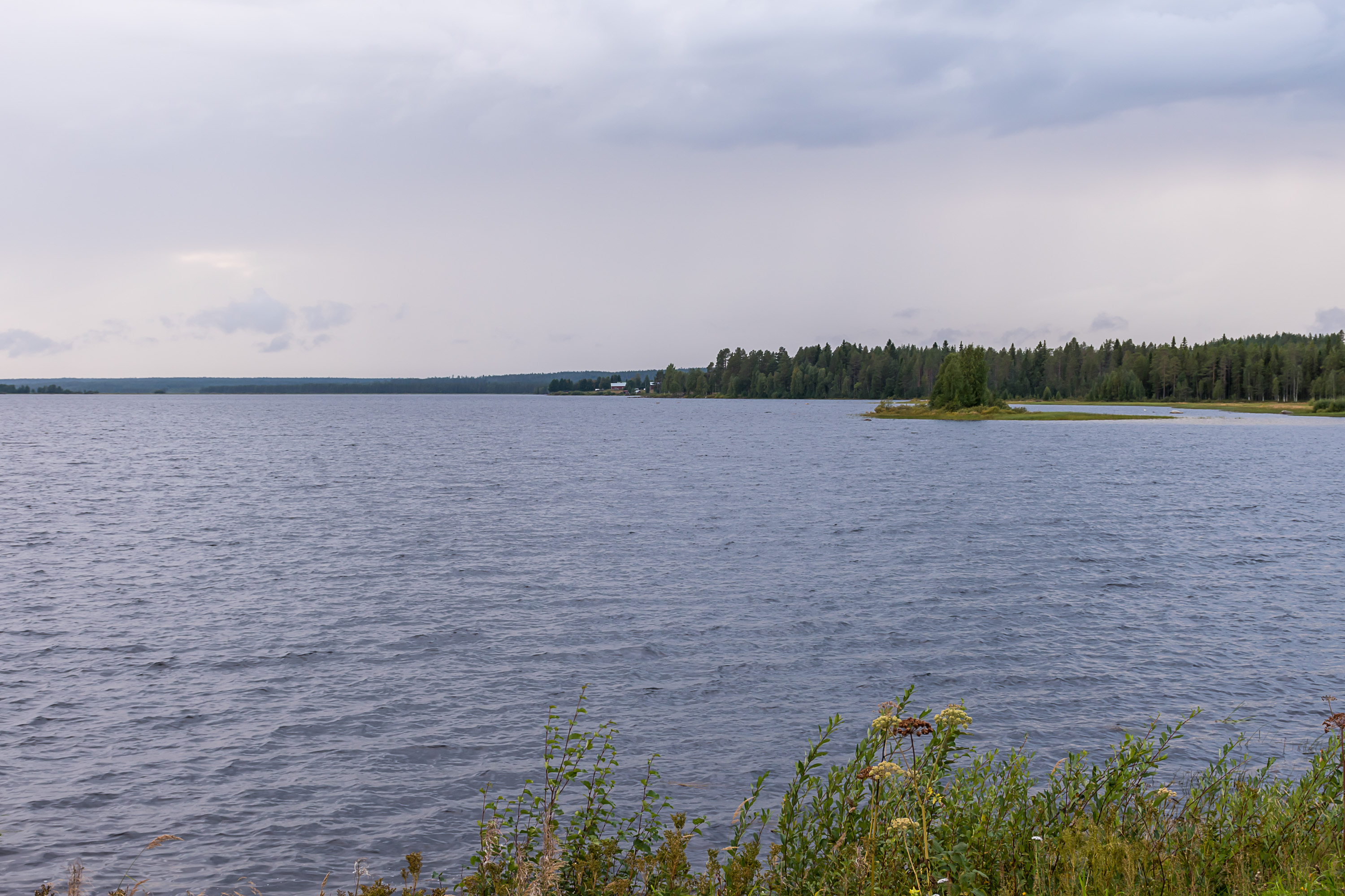
55. But it is what it is. And the lake Kiantajärvi rolls its waves blissfully unaware of the tragedies that happened on its shores over 80 years ago.