I want to do something productive, which is difficult in these corona times, but I feel lazy, because these are corona times, so let's have a post a bit lighter on information and history. Two weeks ago I went, among other places, to a place called Bromarv, in modern Raseborg Municipality in western Uusimaa, in Finland of course.
Bromarv is a small, I almost wish to say, archipelago area, because its nature and relative remoteness certainly remind me of some South and West Finland archipelagoes, but actually it is located not on an archipelago, but on a long, weirdly shaped peninsula, 30 km long, wide in some places but narrowing to very small isthmuses in others, the narrowest being within Bromarv village itself, where the peninsula is just 150 m wide. Of course there are some islands, but not very significant; to the south is a sparse archipelago with no permanent settlement, and to the north is the Särkisalo archipelago which is an its own area with no particular relations to Bromarv.

The unusual shape, as with quite a few other formations in South Finland, is explained by terminal moraines of the Ice Age. The ice sheet covered nearly all Finland at its greatest extent, and the leading edge of the expanding glacier was moving a huge wave of loose stone in front of it. At the place where the ice sheet finally stopped this loose stone formed a very long but shallow and not especially high ridge (tens of meters), stretching from west to east along South Finland. This ridge is called Salpausselkä, "Lock Ridge", because in many places it serves as a watershed. To people it served as a transport route since the Middle Ages if not earlier, being a lot easier to traverse than the regular Finnish forested, rocky and boggy terrain; for example, the Upper Vyborg Road (Vyborg-Hämeenlinna) was built along Salpausselkä. The ridge is still used for that purpose to this day; for example on the map above you can notice a road and railroad going to the town Hanko past Ekenäs/Tammisaari. They are in fact also going along Salpausselkä, and Hanko is where this ridge ends at the sea coast.
However the last Ice Age did not just end all at once, and in fact there were several periods when the ice sheet was starting to melt, then beginning to expand again. This is why there is also the Second and the Third Salpausselkä (Toinen, Kolmas Salpausselkä) in Finland, and also an unimaginatively named Inner Finland Moraine Formation (Sisä-Suomen reunamuodostuma) quite a bit farther inland. All of them are a lot smaller than the main Salpausselkä, and roughly parallel to it. And so in the map you can notice the road from Tenhola village to Bromarv is almost exactly parallel to the Hanko road and railroad below; this is because the road follows the Second Salpausselkä, which thus joined a few largish islands into one peninsula chain tens of thousands years ago.
The first permanent inhabitants of the Bromarv peninsula, as far as is known, were Swedish colonists in the 13th century. The entire Uusimaa area had a major influx of Swedish population back then (Uusimaa is in fact the Finnish translation of Swedish Nyland, "New Land"), but, unlike another similar Swedish-majority area, Coastal Ostrobothnia on the west coast of the country, Uusimaa Swedish-speaking population by now is much more diluted with the Finnish-speaking one, because Helsinki, the modern Finnish capital, is located in Uusimaa, and subsequently Helsinki and its surroundings have become overwhelmingly the major internal migration destination in the country.
Bromarv, however, is one of the pockets of Uusimaa that remain overwhelmingly Swedish-speaking, presumably due to its relative remoteness; I'm pretty sure it is the part of Uusimaa that is the most distant from Helsinki by road (140 km; of course that's not counting outer archipelagoes with no road links). The distance by road to the nearest city of any size (Ekenäs) is 33 km. The name "Bromarv" is Swedish and there is no Finnish place name for this area. Unofficially it is spelled "Bromarf" on some buildings there; apparently the locals like it more this way. I couldn't find where the name comes from, probably from some early resident.
Not much has happened in Bromarv history; a lively seafaring community, it eventually turned into an agricultural one and by the end of the 19th century it also became a site from some rich people summer villas thanks to its beauty, but not such a major one as for example Hanko. For example Leo Mechelin, a major politician in the late pre-independence years of Finland and Nokia co-founder (Mechelininkatu street in Helsinki center is named after him), had a villa there.
One event that was pretty significant is the sea Battle of Gangut of 1714. "Gangut" is the Russification of the Swedish Hangöudd name for the large Hanko peninsula, south of Bromarv. In actuality however the battle took place much close to the coast of Bromarv than Hanko peninsula, and in Finland the battle is accordingly known as the battle of Riilahti, or in Swedish Rilax. Rilax manor on the Bromarv coast, a few kilometers southwest of the actual Bromarv village, has existed at least since 1437. Among its historical owners was Alex Oxenstierna, one of the greatest Swedish statemen of the Gustav II Adolf era. Currently the manor has been owned by Aminoff dynasty since 1725. As you could guess from the name, this Finnish-Swedish noble dynasty has Russian roots, and was founded by Fyodor Aminov, the voivode of Ivangorod, who surrendered the city to the Swedes and switched to their service during the Russian Time of Troubles in 1611.
The Battle of Gangut/Riilahti/Rilax however didn't have much to do with Rilax manor, other than taking place near its coastline. The battle was a part of the Great Norhern War, a daring Russian bid for power in the Baltic, which eventually led to the fall of the Swedish Empire as a major power. In Russian historiography the battle is considered particularly notable as it was pretty much literally the first Russian naval victory in history. The battle itself in truth doesn't sound as a particularly great achievement; Russian galley fleet defeated a Swedish squadron, outnumbering the Swedes by 15 to 1, and it probably would be pretty difficult to lose with these odds (although Swedish ships were individually significantly bigger and more powerful). The significance of the battle, apart from the symbolic one, was more strategical; it allowed the breakthrough of the Russian fleet out of the Gulf of Finland (where it had been locked east of Hanko peninsula) into the Archipelago Sea and the rest of the Baltic.
Bromarv existed as an independent parish and then municipality until 1977. Back then its territory also included a major part of Hanko peninsula, which was where most of the development in Bromarv actually took place (for example an explosive factory has been operating in that area since 1893). In 1977 the Hanko peninsula territory was joined to the city of Hanko, and Bromarv proper became a part of Tenhola municipality. Subsequently Tenhola was joined to the city of Ekenäs in 1993, and in 2009 the municipalities of Ekenäs, Karis and Pohja united into a single municipality known as the city of Raseborg. Bromarv thus underwent three municipal mergers in its history, and by now its significance is quite diluted.
Currently, according to the Finnish statistical bureau, the population of Bromarv postal code area is 459. The average age is 53.
Bromarv is a nice summer destination, having some hotels and beaches. It unfortunately lacks hiking trails and major nature sites; otherwise I probably would have visited it earlier. Bromarv can be reached by car (from Helsinki via Kirkkonummi, Karis, Ekenäs, Tenhola, by roads 51, 25 and 52) or by bus; there is a daily direct bus from Helsinki and three buses (four on school days) from Ekenäs. Ekenäs in turn has a passenger railway station.
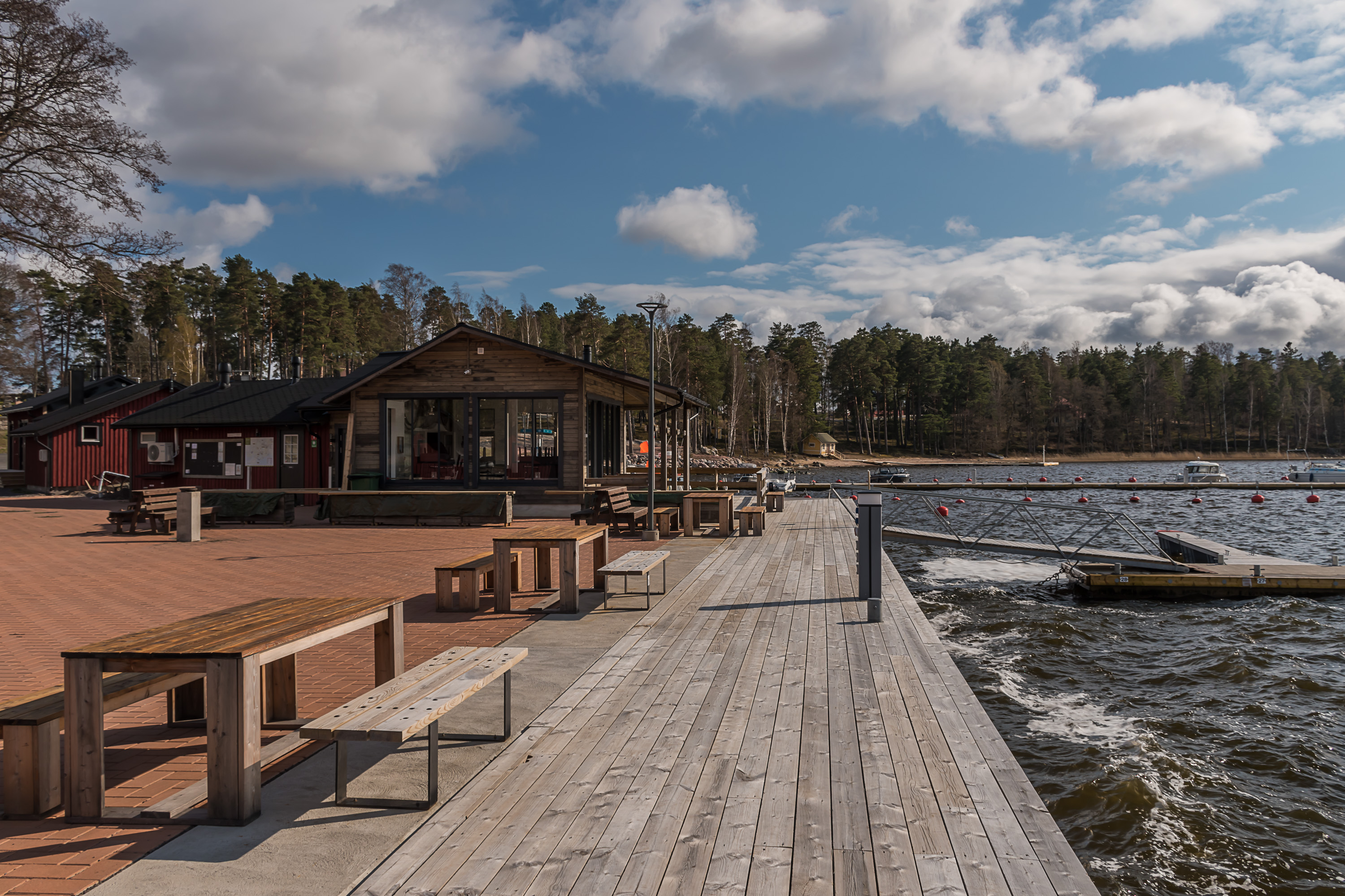
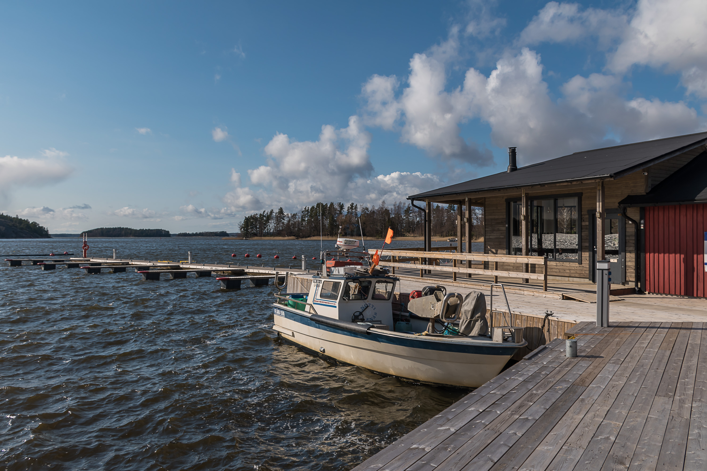
1. Let's start with the Bromarv church village, which can really be explored in some 15 minutes or so. Most places in Finland can be said to begin from their central square or maybe a railway station, but Bromarv really begins from its guest harbor.
2.

3.
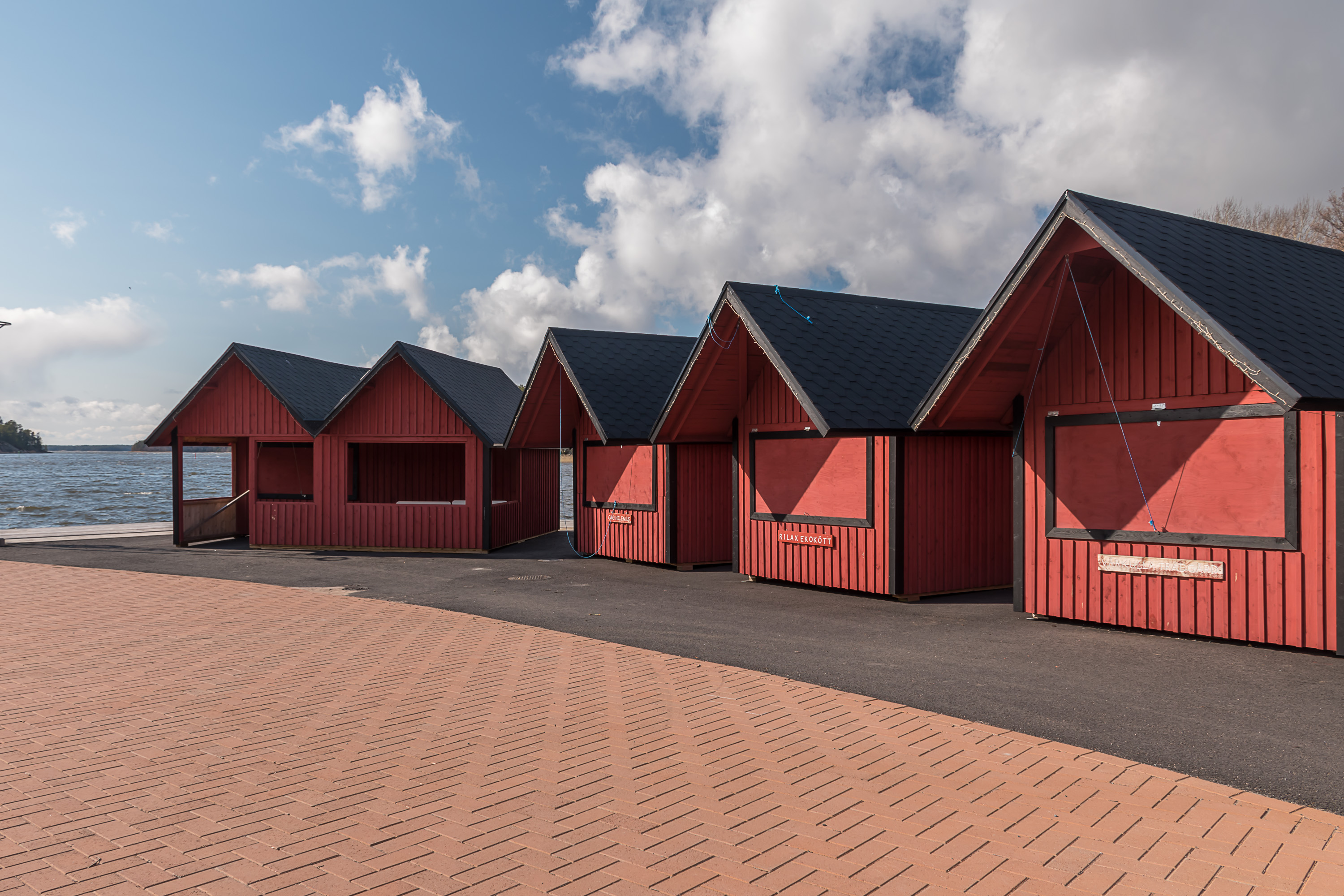
4. Bromarv tori (central marketplace) is actually also located in its harbor, but nothing was yet open at the time.
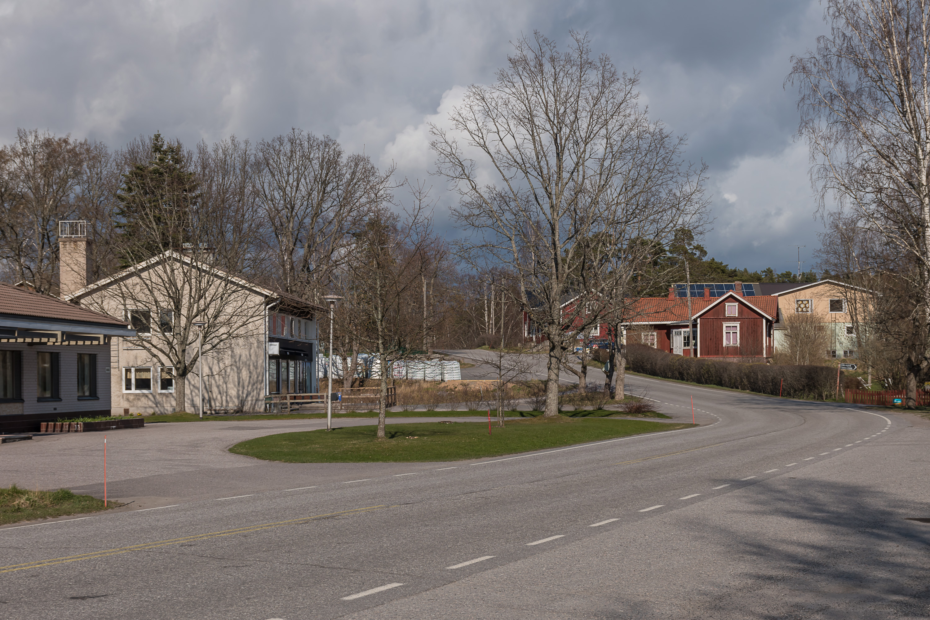
5. The central and pretty much the only road of Bromarv.
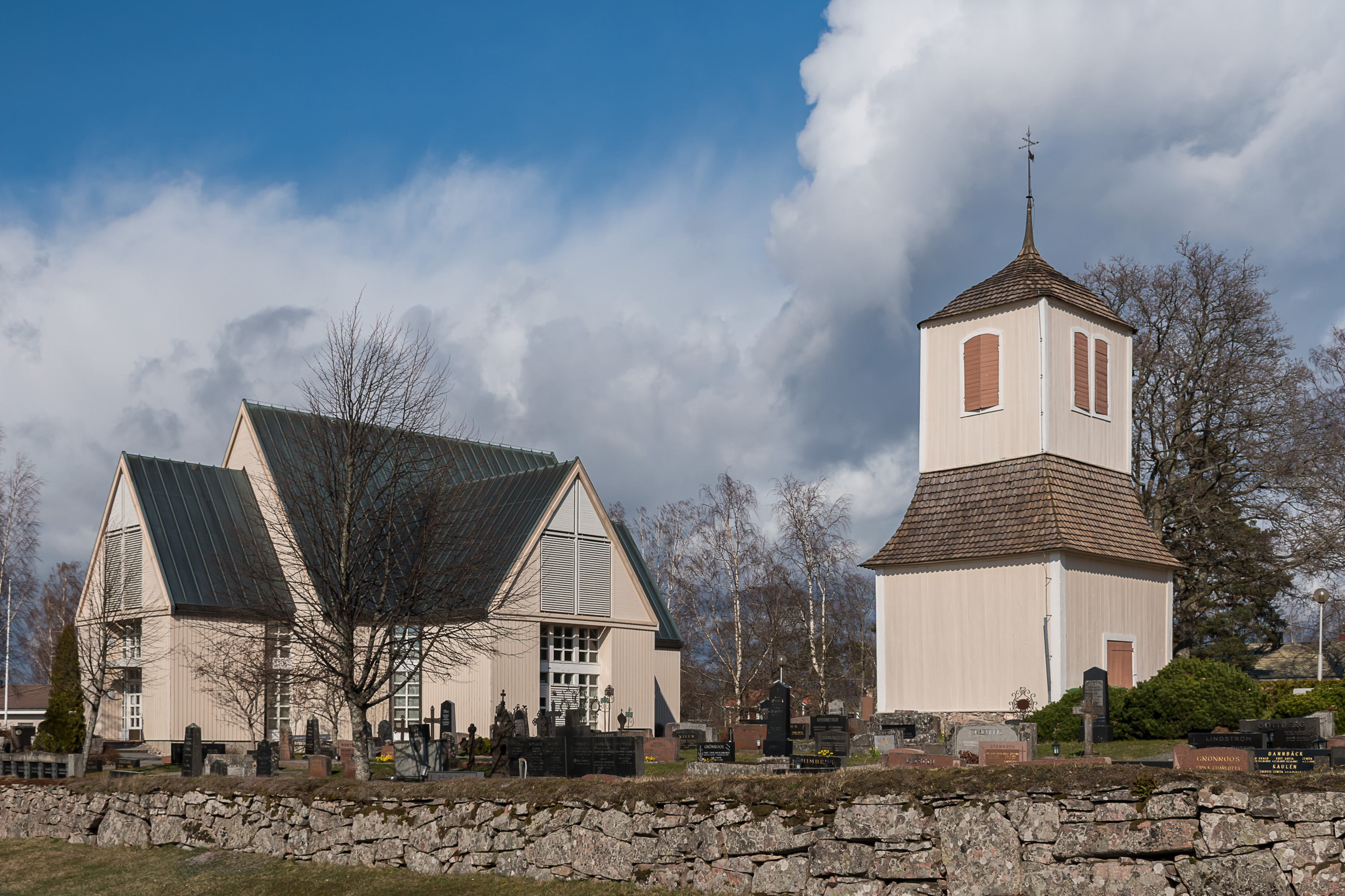
6. The church is located just across the road from the harbor. It is not obvious from its look that it was actually built in 1981, as the original church from 1753 burned nown in 1979 for an unknown reason. The new church was built to closely, but not entirely resemble the old one. The standalone belltower however was spared by the fire and remains from the original church.

7. A graveyard near the church.

8. Tenhola-Bromarv road (Road 1081) has stone kilometer markers still remaining.

9. An old granary which now has a "handcraft" sign.
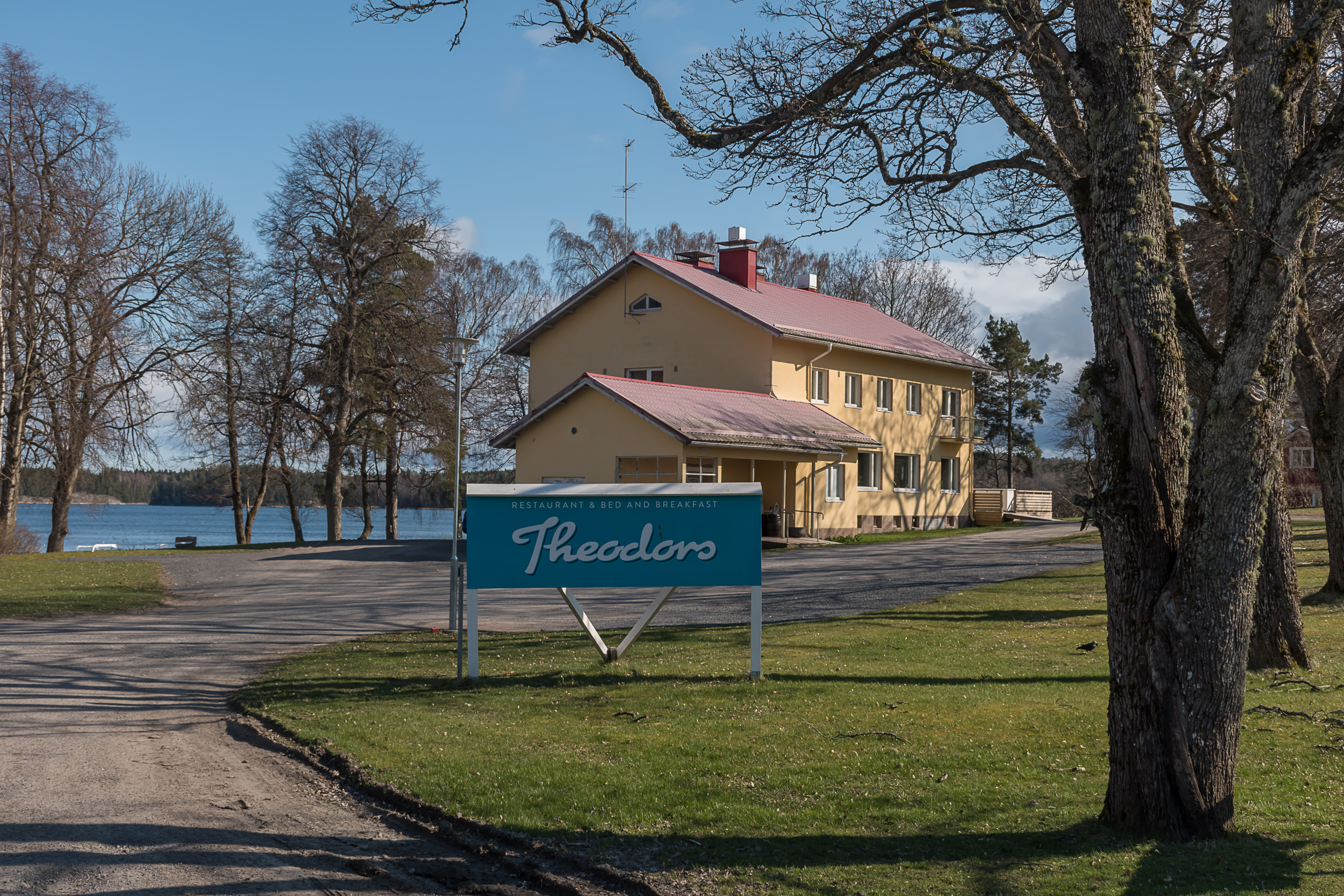
10. I think this building was marked as a health station on the map, but it seems to be only a restaurant/guesthouse now.
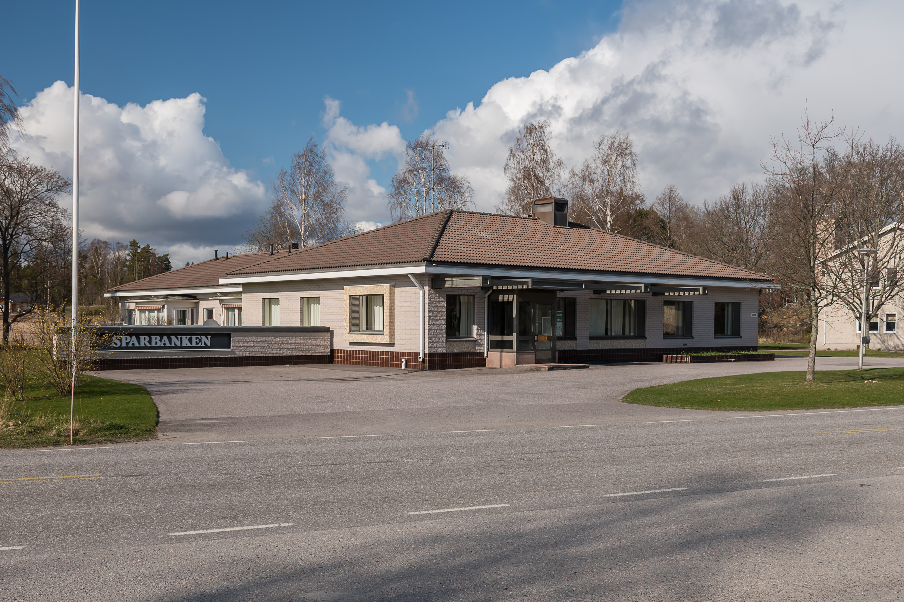
11. A closed bank office. It seems that a lot of bank offices in smaller towns and villages have closed in quite recent years.
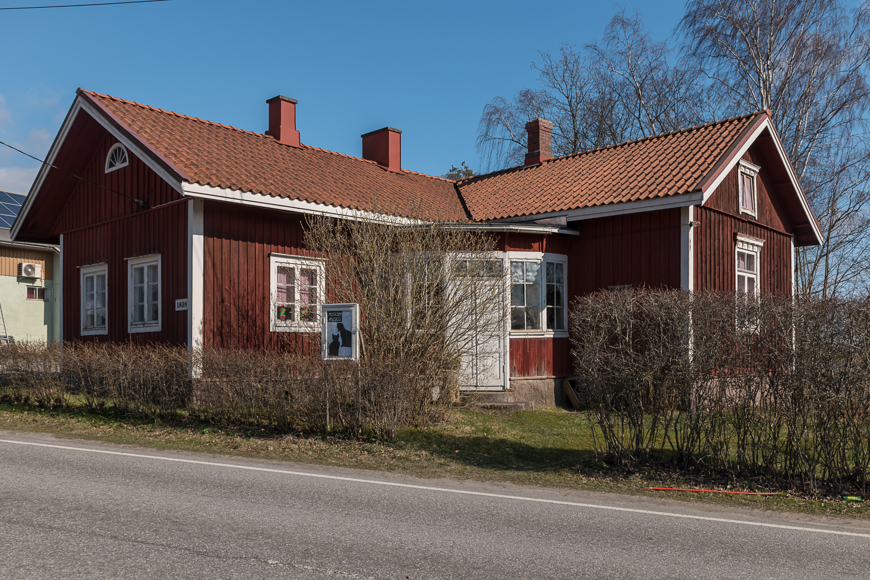
12. A local museum, apparently open only by appointment (probably not in these corona restriction times anyway).

13. A grocery store, of the M-Market chain, which is fairly rare and mostly found in small towns and villages (but not the smallest villages, for those there is the Tarmo chain).
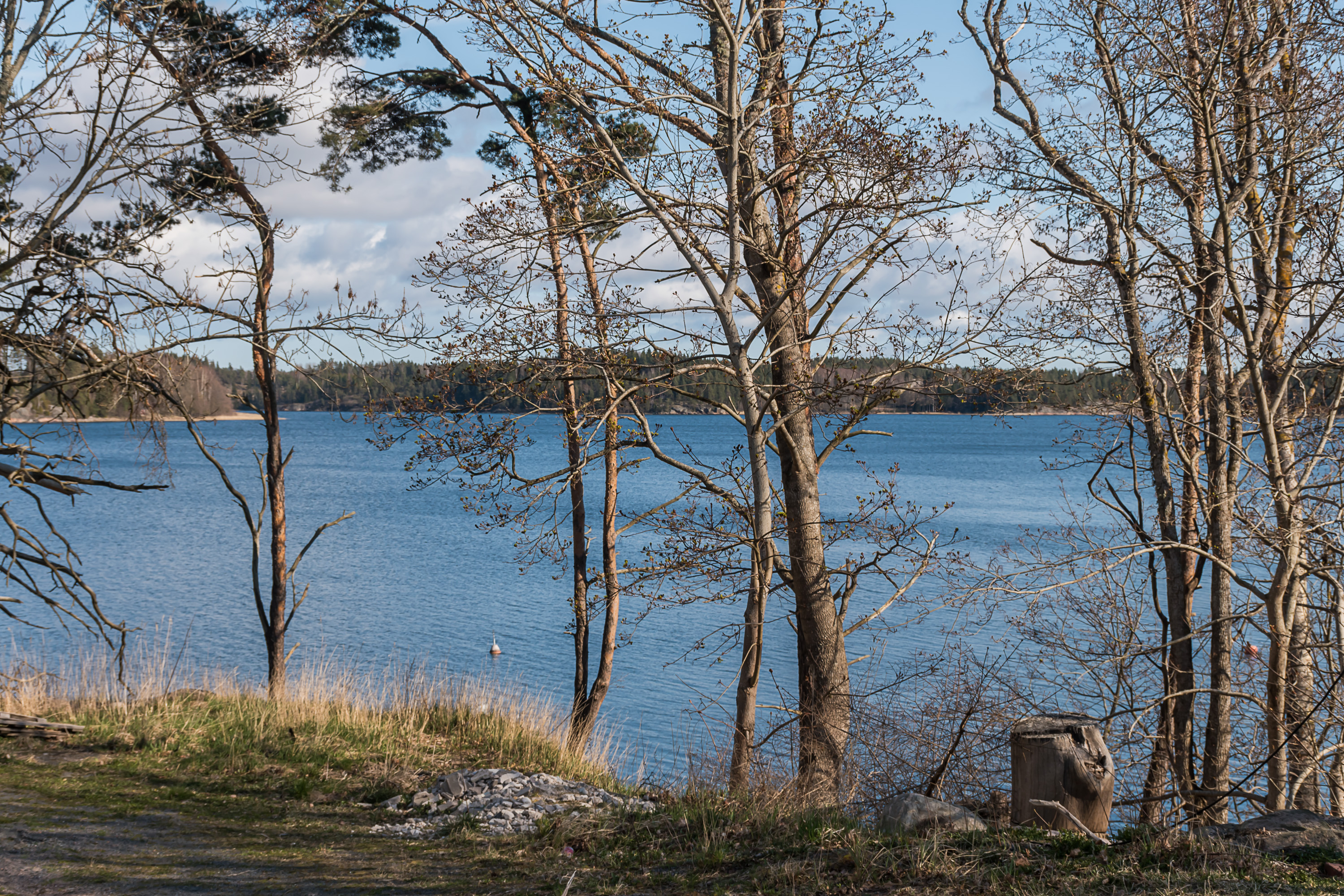
14. The sea on the other side of Bromarv, near the store.
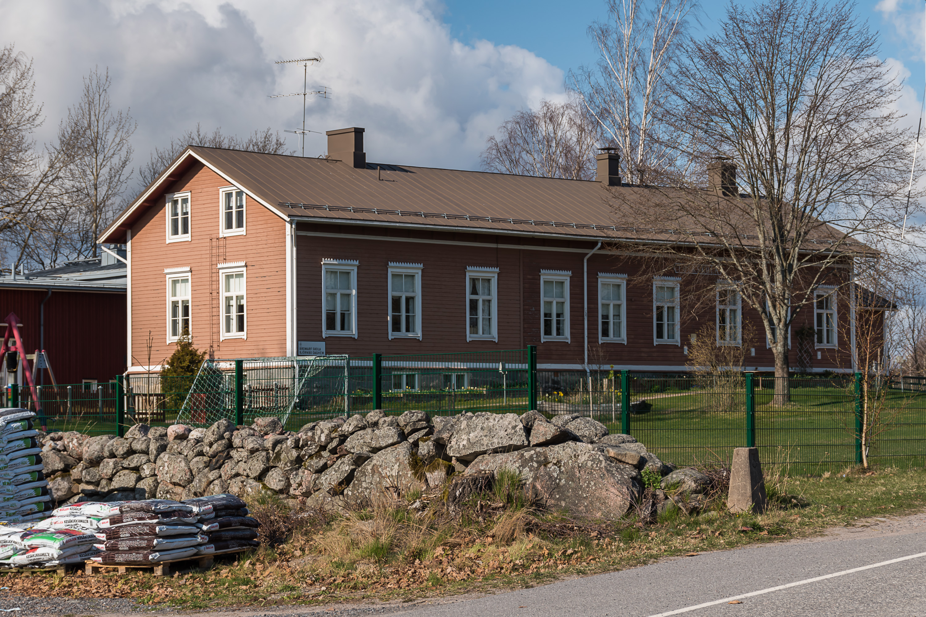
15. A school.
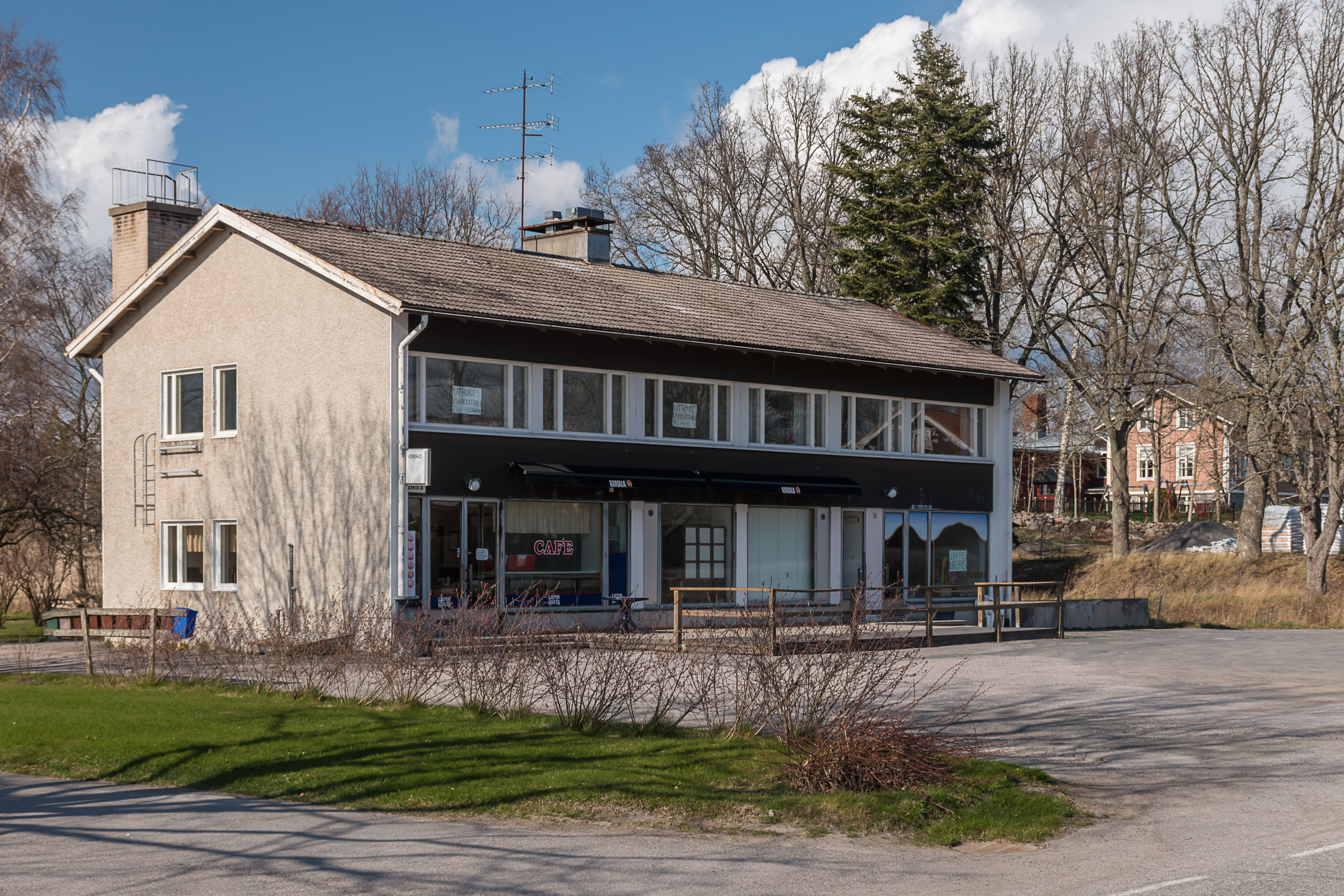
16. Some bar and a flea market.
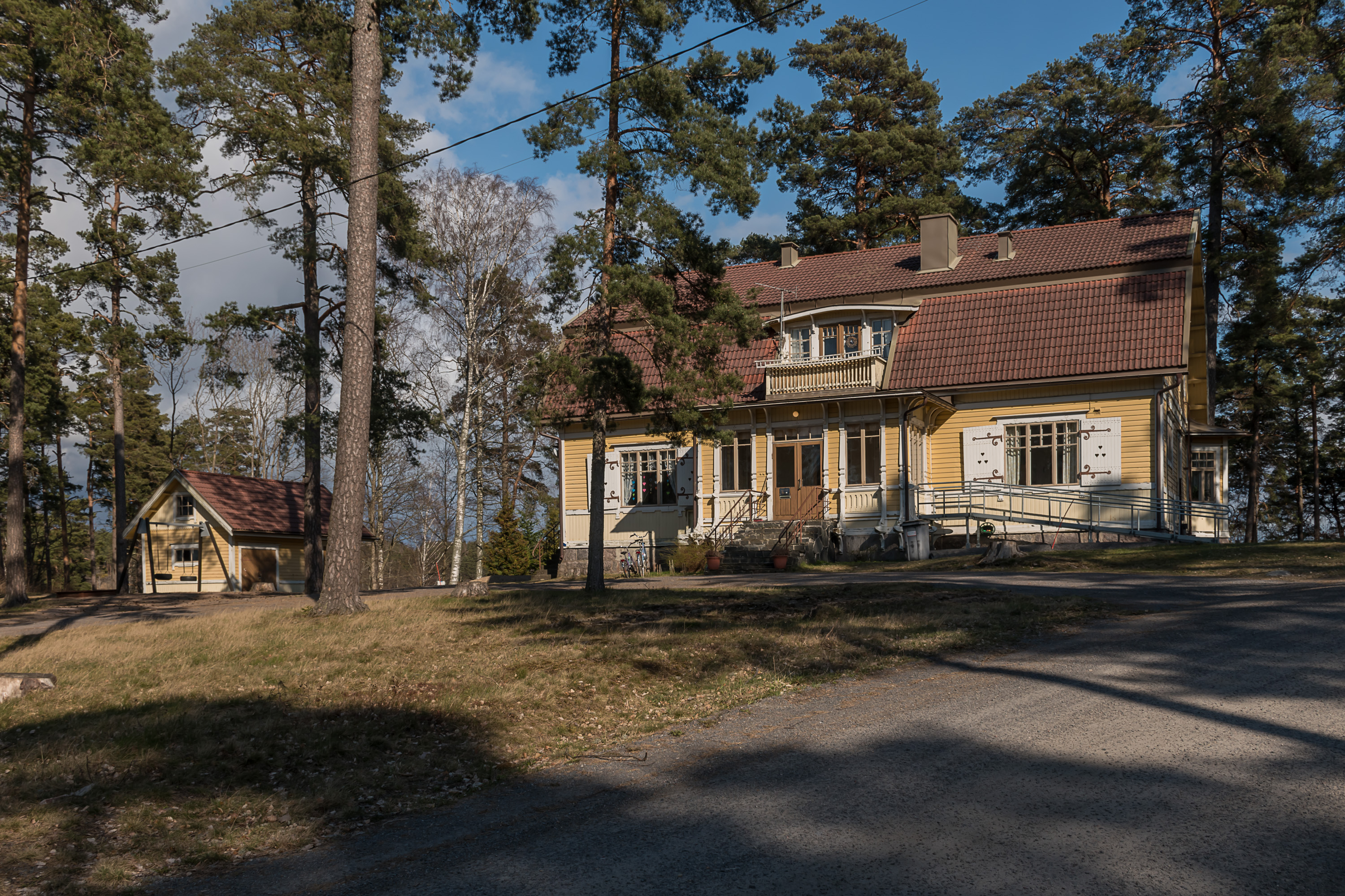
17. This fancy manor building actually houses the local library. I don't know anything about the building history.
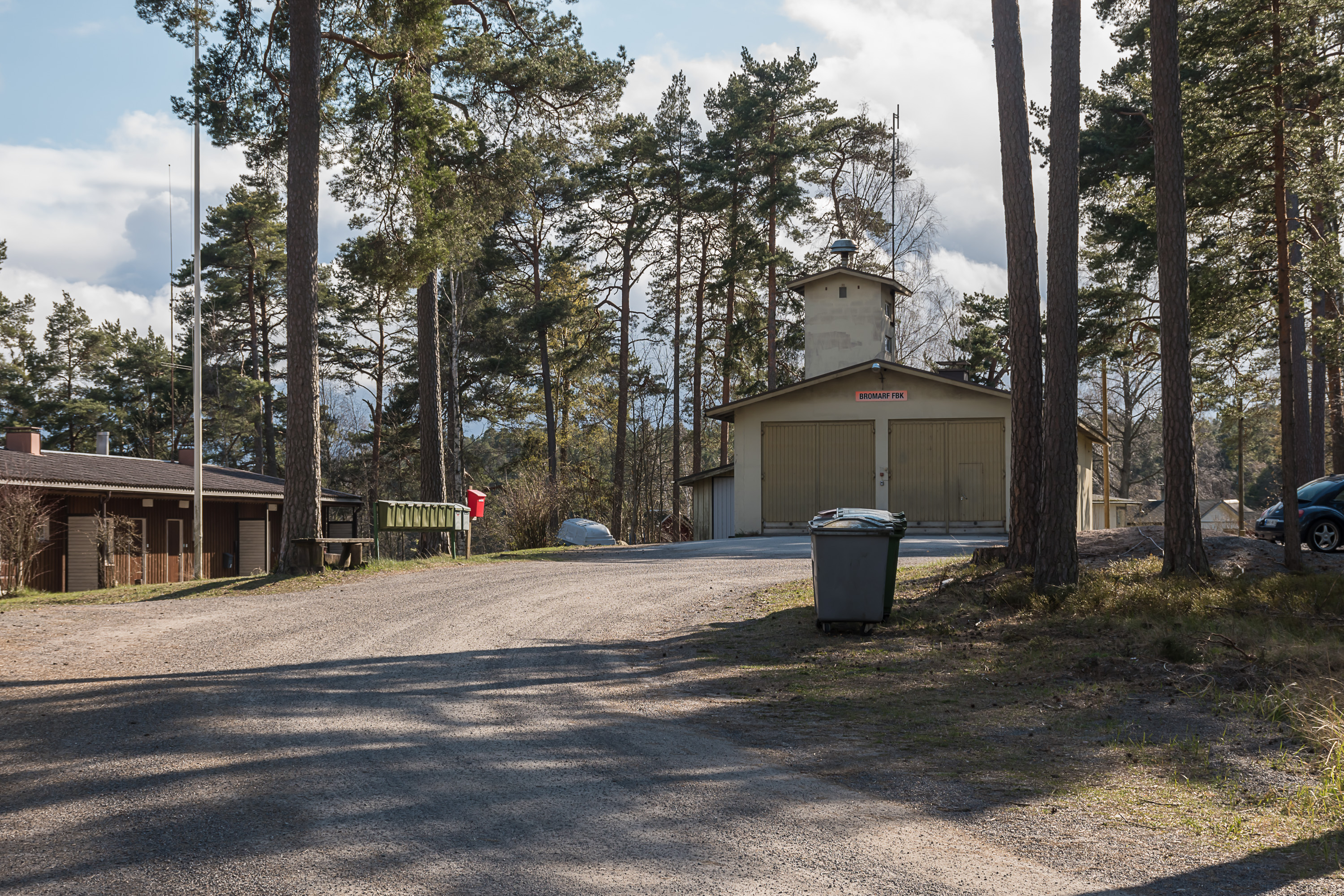
18. Fire department. This is actually a volunteer fire brigade (in Swedish FBK, frivilliga brandkår). It is common for small places in Finland to have only volunteer fire brigades.
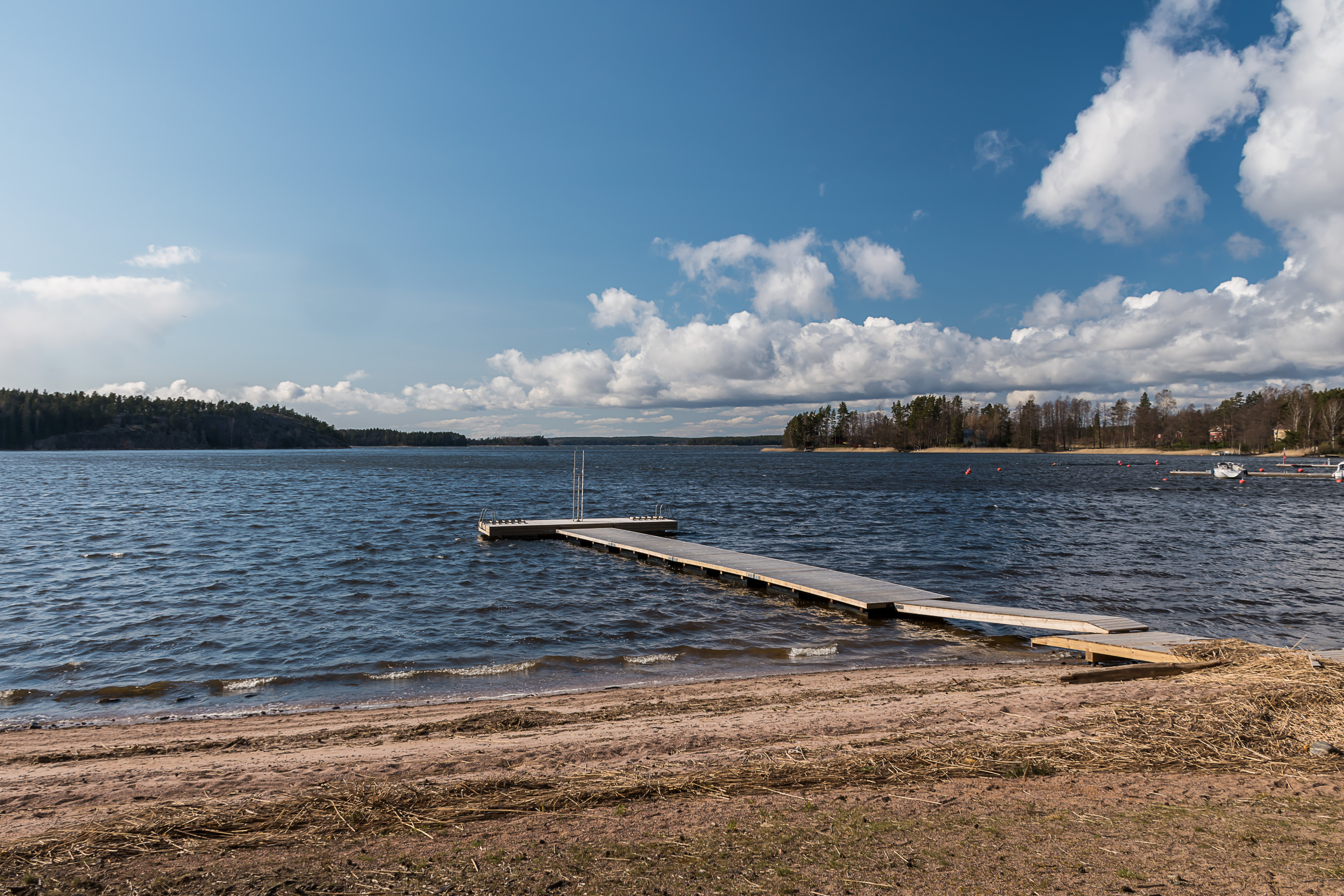
19. The small village beach.
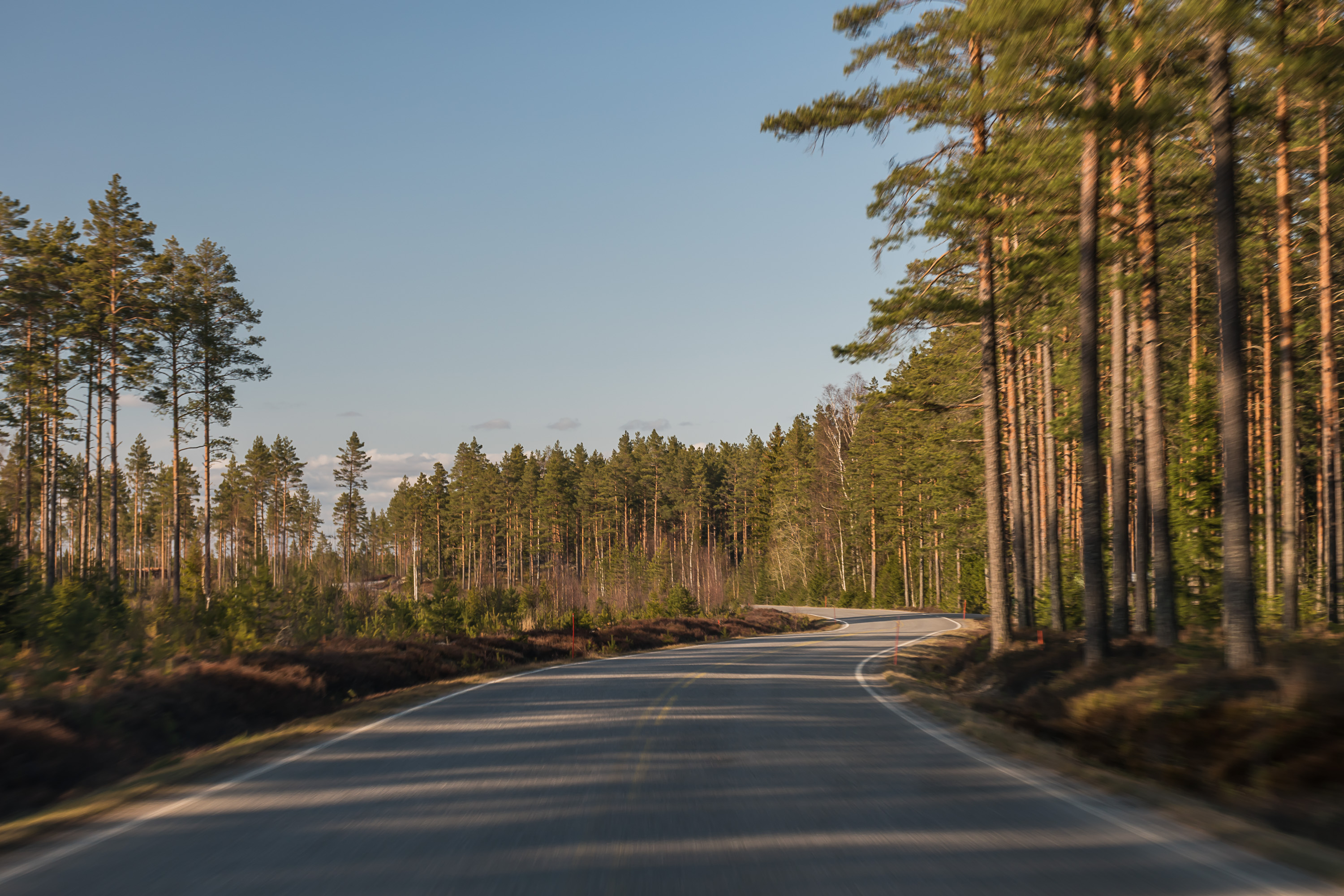
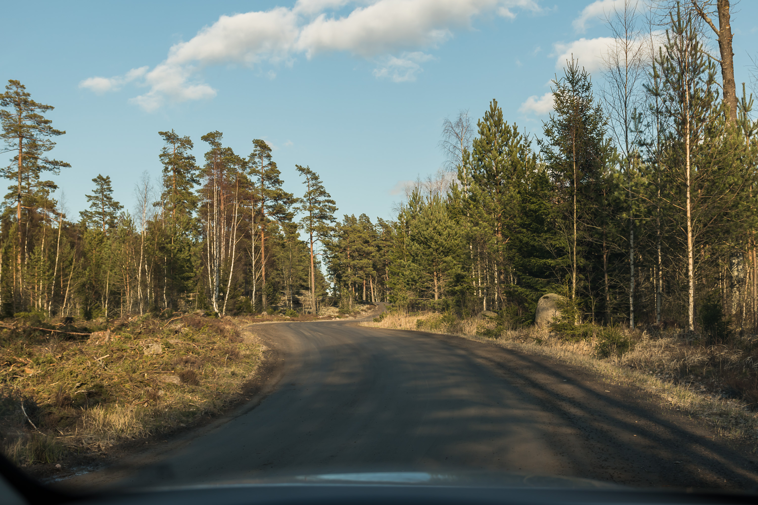
20. Now let's check out a few places outside the church village. The road to Bromarv was unusually fun, hilly and bendy but just the right amount that you can still drive it at allowed 80 km/h without feeling sick, and several times along the way you get to drive along the sea. I don't have pictures of that part; this is the road continuing after the church village, in the wide part of the peninsula, less winding and completely empty.
This "outer" part of Bromarv gave me strong Replot vibes; Replot archipelago was the most significant nature area near the city of Vaasa, where I lived my first 1.5 years in Finland, and it also was not so small and its roads looked exactly the same. I kind of miss that place; it had nice Swedish-speaking villages and a few nature trails that were pretty good by Finnish standards, and I lived only 15 km away from the arhipelago so I could easily visit it in any time of day and of year. In Espoo where I live now I can't really find such a go-to nature place as that archipelago (of course there are plenty of nature places, but none of them feel the same, and none of them are as close either).
21. Most of roads in Bromarv are actually gravel roads.
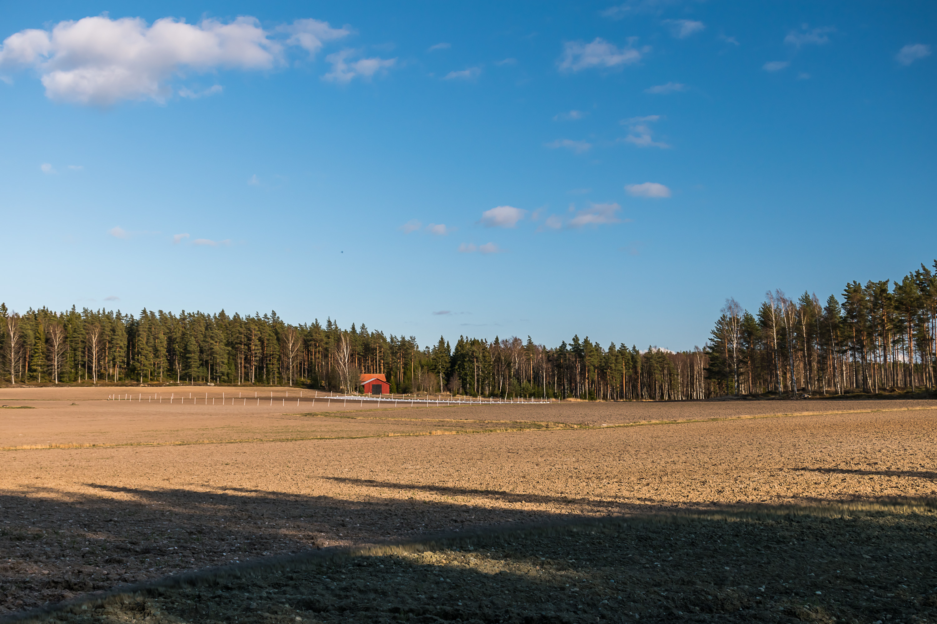
22. Here and there there are some fields.
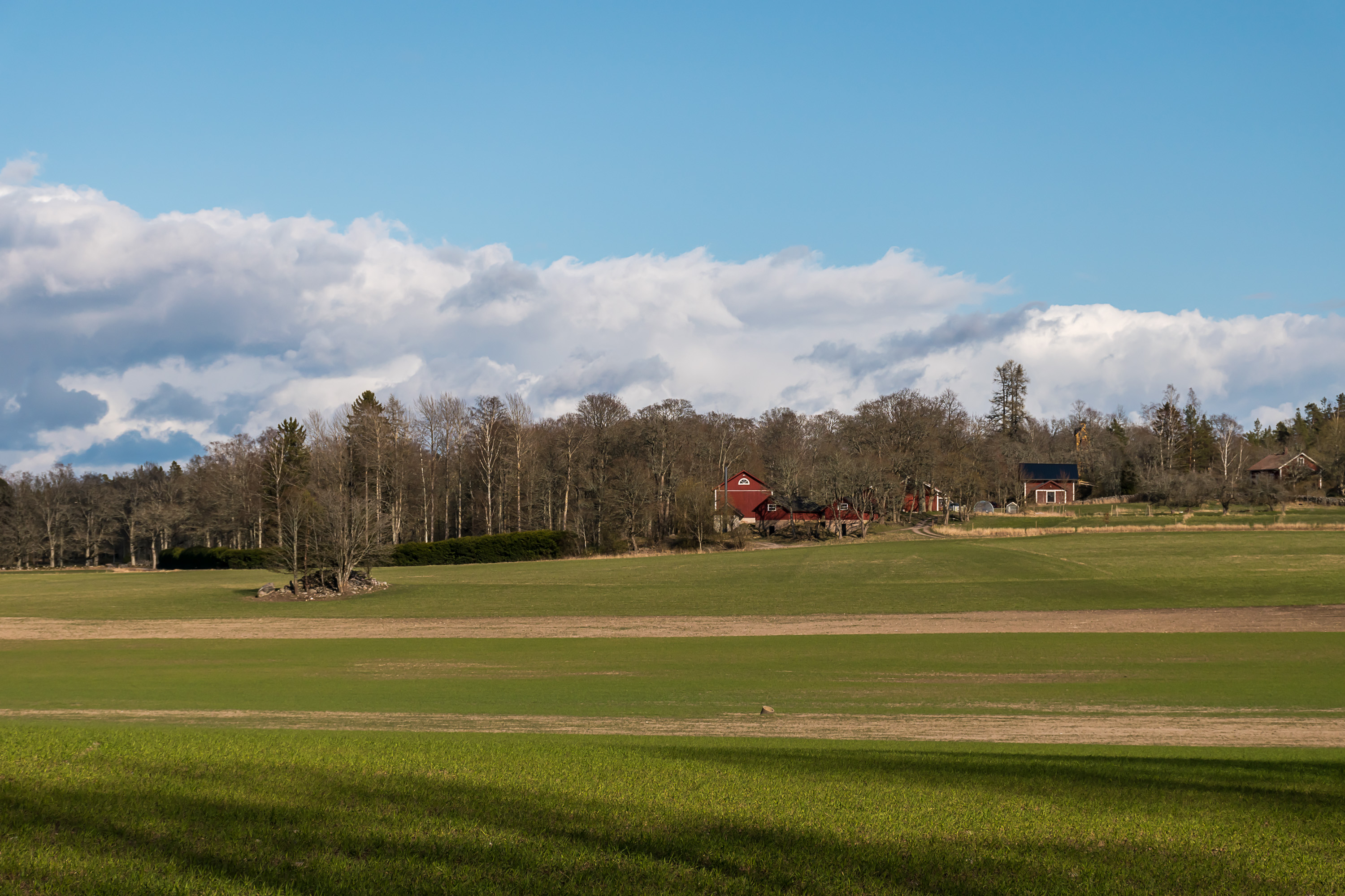
23. Agricultural buildings of the Rilax manor that I mentioned above, some 3 km southwest of Bromarv. The main manor building is not visible. There is actually a monument to the Battle of Gangut right on the Bromarv coast, put there in Tsarist Russia era. However it is only possible to get there through the rather vast manor private territory, right by its main building in fact. This might be still perfectly legal (especially on foot), although I'm not terribly sure, but somehow I didn't really want to bother to check. Such a location makes this monument really obscure, there aren't even many pictures of it online.
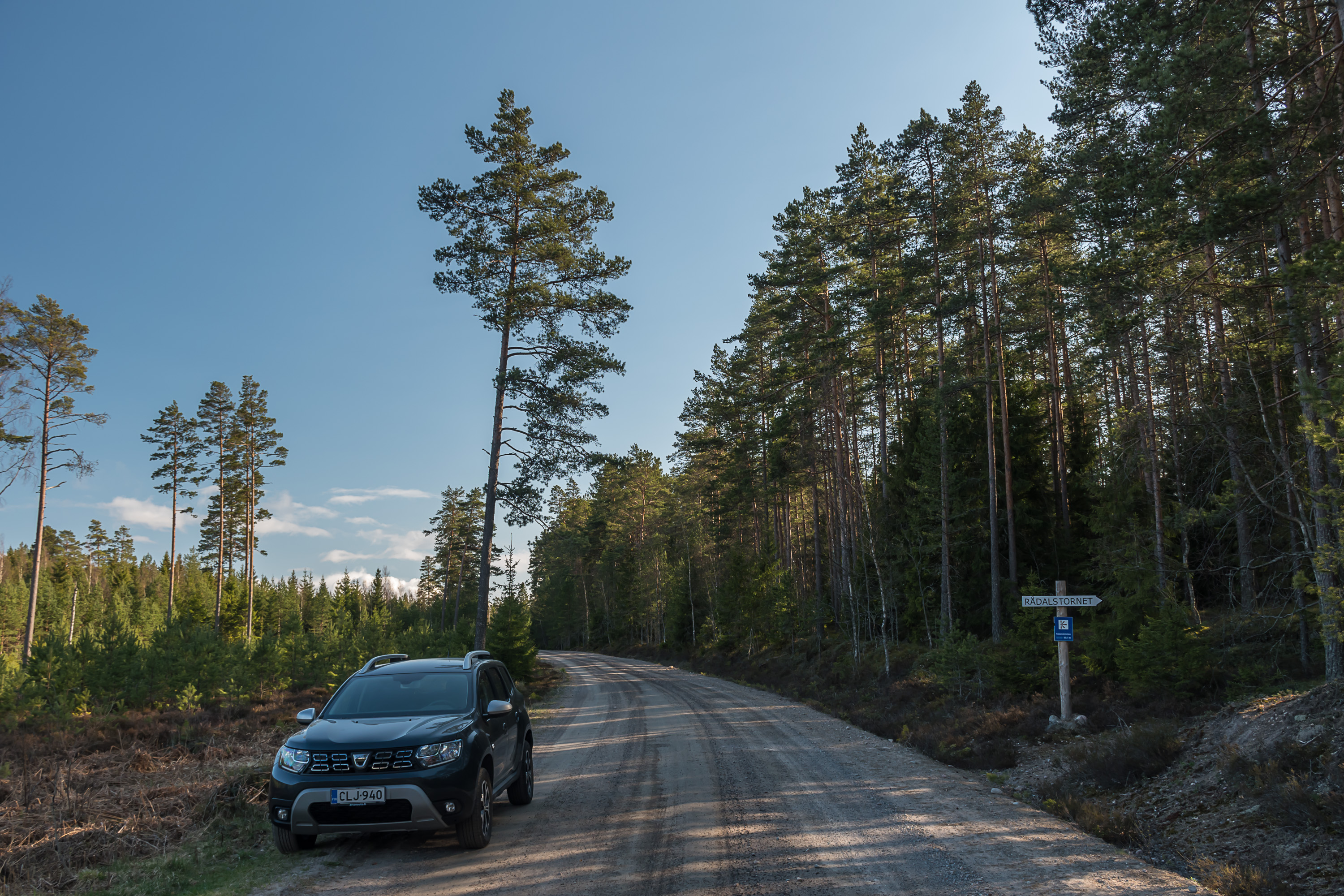
24. One minor sight not far from the Rilax manor is an observation tower on top of the Rådalsklinten hill. I found it on a tourist information map in the center of Bromarv (and checked that the topo map also has it) and decided to check it out.
Finland has a great many observation (and birdwatching) towers, of varying level of fanciness, and views from there can sometimes be quite cool. Obscure observation towers such as this one, even if still present on the map, could be tricky in reality. They might be unmaintained and damaged/rotted by time, or closed altogether due to damage, or not exist anymore due to a fire or something else, or the trees around them might be already tall enough that you can't really see anything. Still, why not see for myself! Getting to the tower involves driving some kilometers past Rilax manor on private gravel roads (it is always allowed to drive on private roads unless signs explicitly specify otherwise). There is no parking lot so I had to awkwardly turn around in the middle of the road and leave the car at the shoulder. The sign for the tower was very clearly visible though. Apparently I was the only visitor at the time.

25. A short (300 m), well-marked with white paint on trees trail leads to the tower from the road. Rådalsklinten is by no means a big mountain; it is about 55 m high, and the climb from the road is just about 25 m.

26. Sparse forest on the rocky hilltop. The forest and the hill greatly reminded me of Åland Islands; the highest point of Åland (at 129 m) has a very similar looking forest on the top, and even the name is similar (Orrdalsklint).
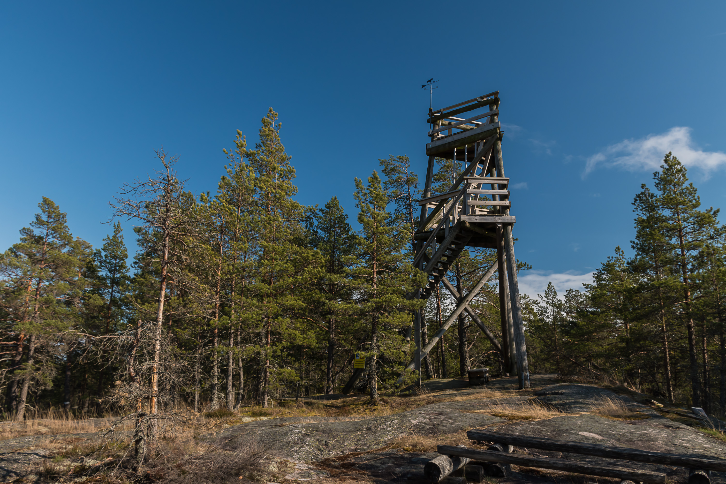
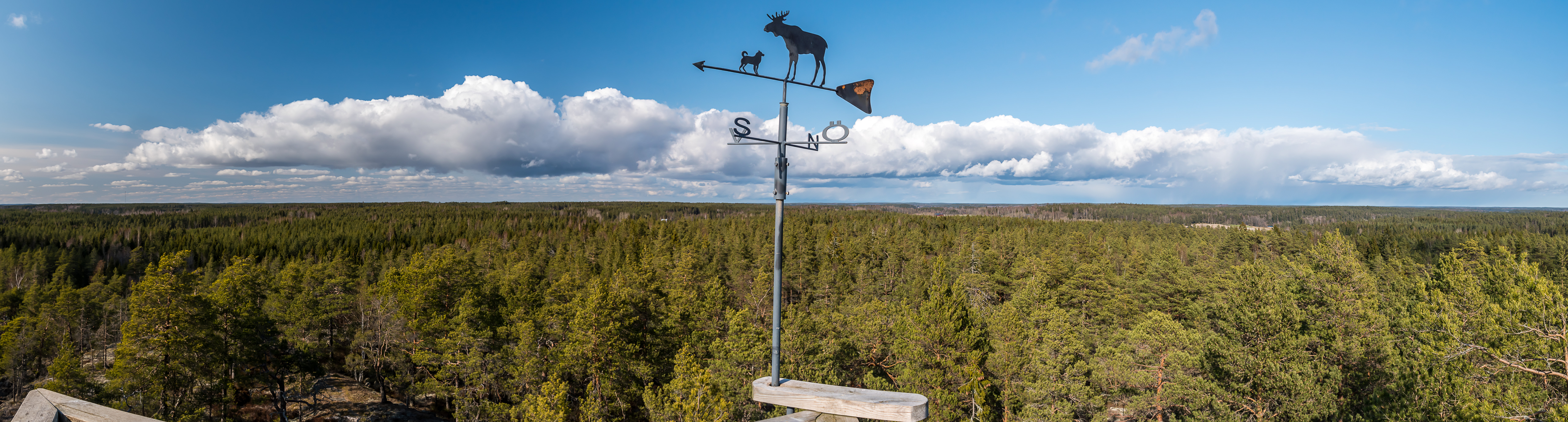
27. Well there it is, in perfect condition too.
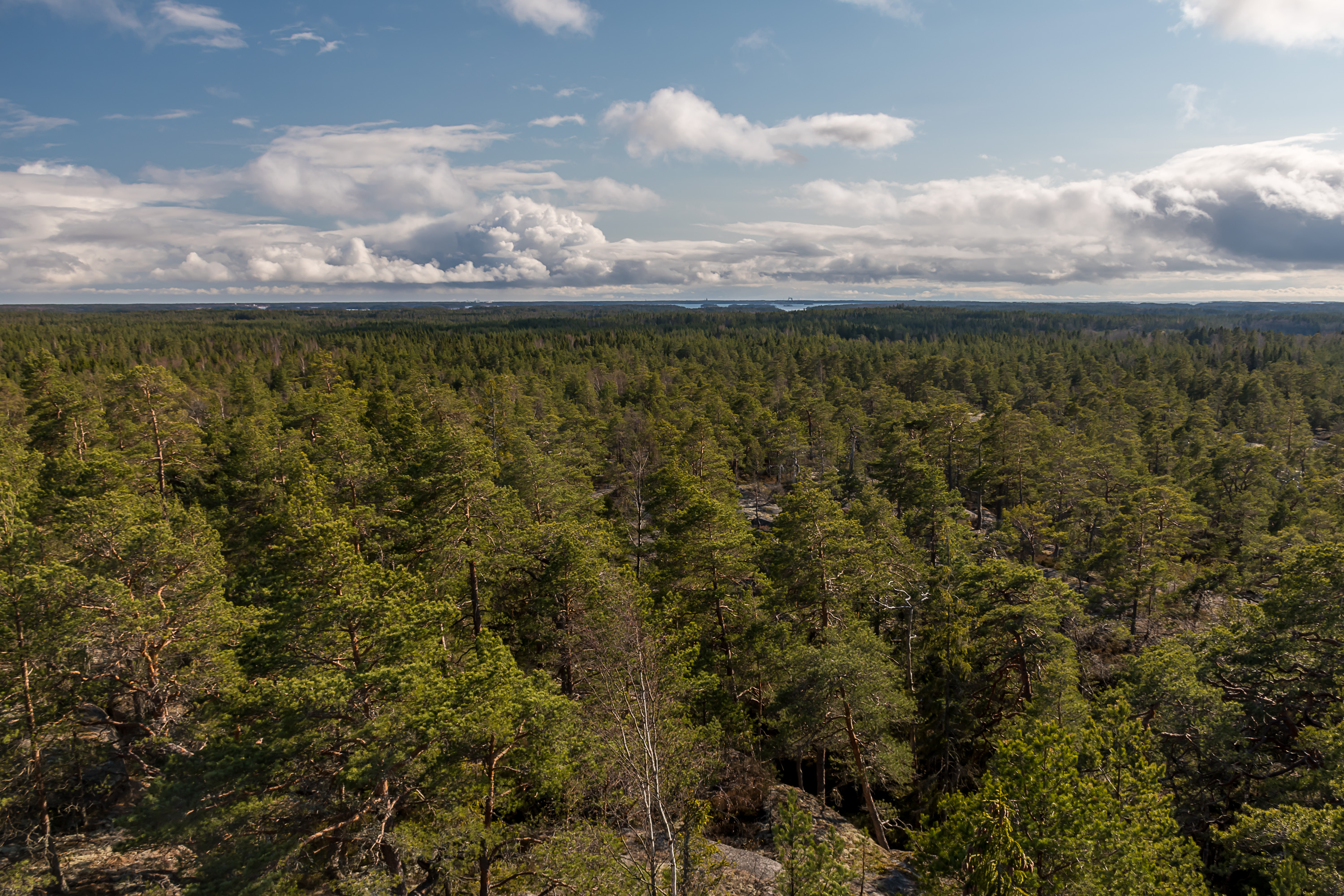
28. I was expecting some cool sea views from this tower, because there is so much sea around Bromarv right? The tower is in less than 1 km from the sea itself. To my surprise pretty much the only thing you can see from the top is an endless-looking forest, not dissimilar from pretty much any other place in Finland. I was more amused than disappointed. The only bit of the sea was visible on the horizon in the south.
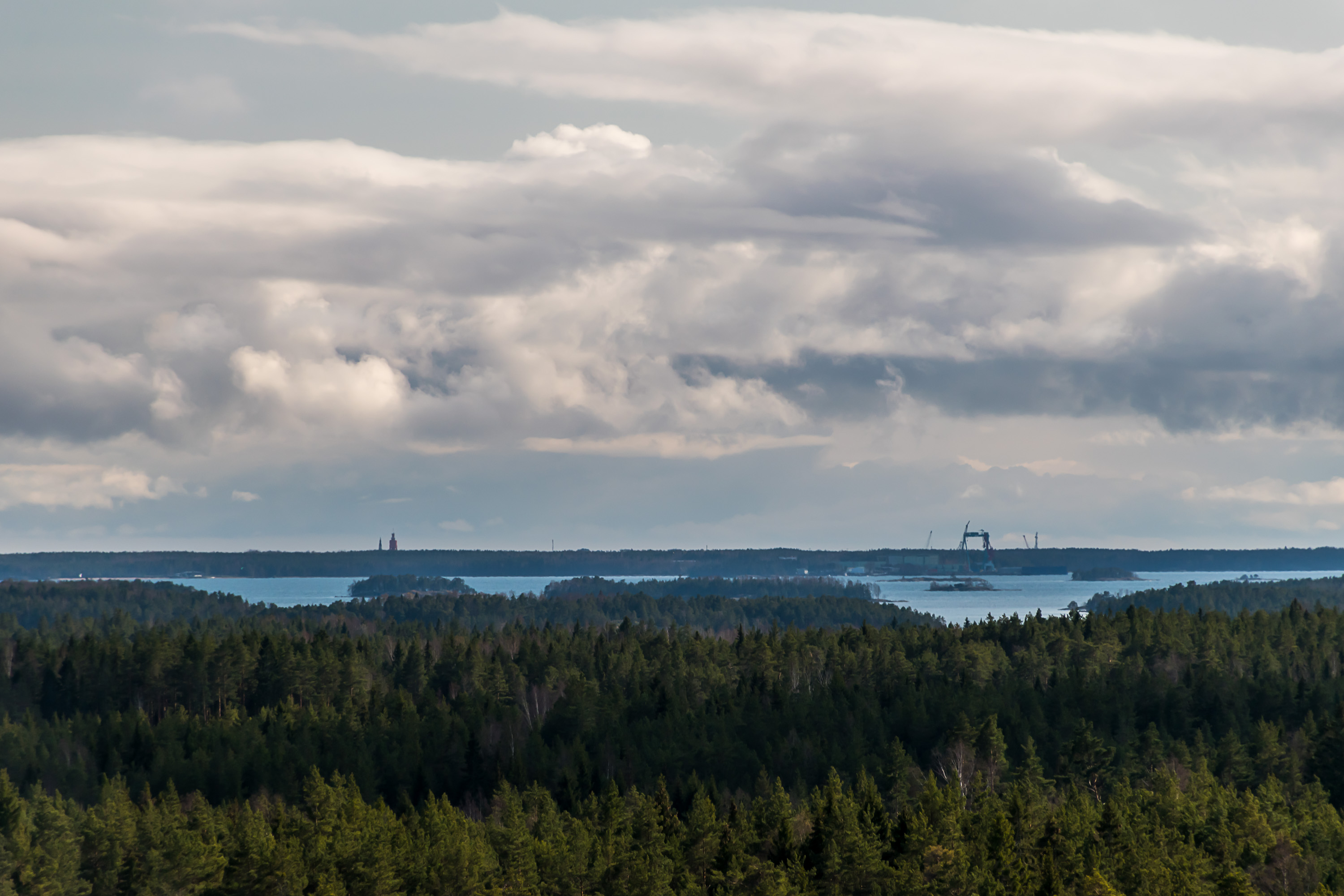
29. A strip of land and some structures are visible on the horizon beyond the sea too. The sea in question is in fact the sea area between Bromarv and Hanko, and the two towers on the left are the church spire and the water tower in the city Hanko. To the right is probably the Hanko harbor.
30.
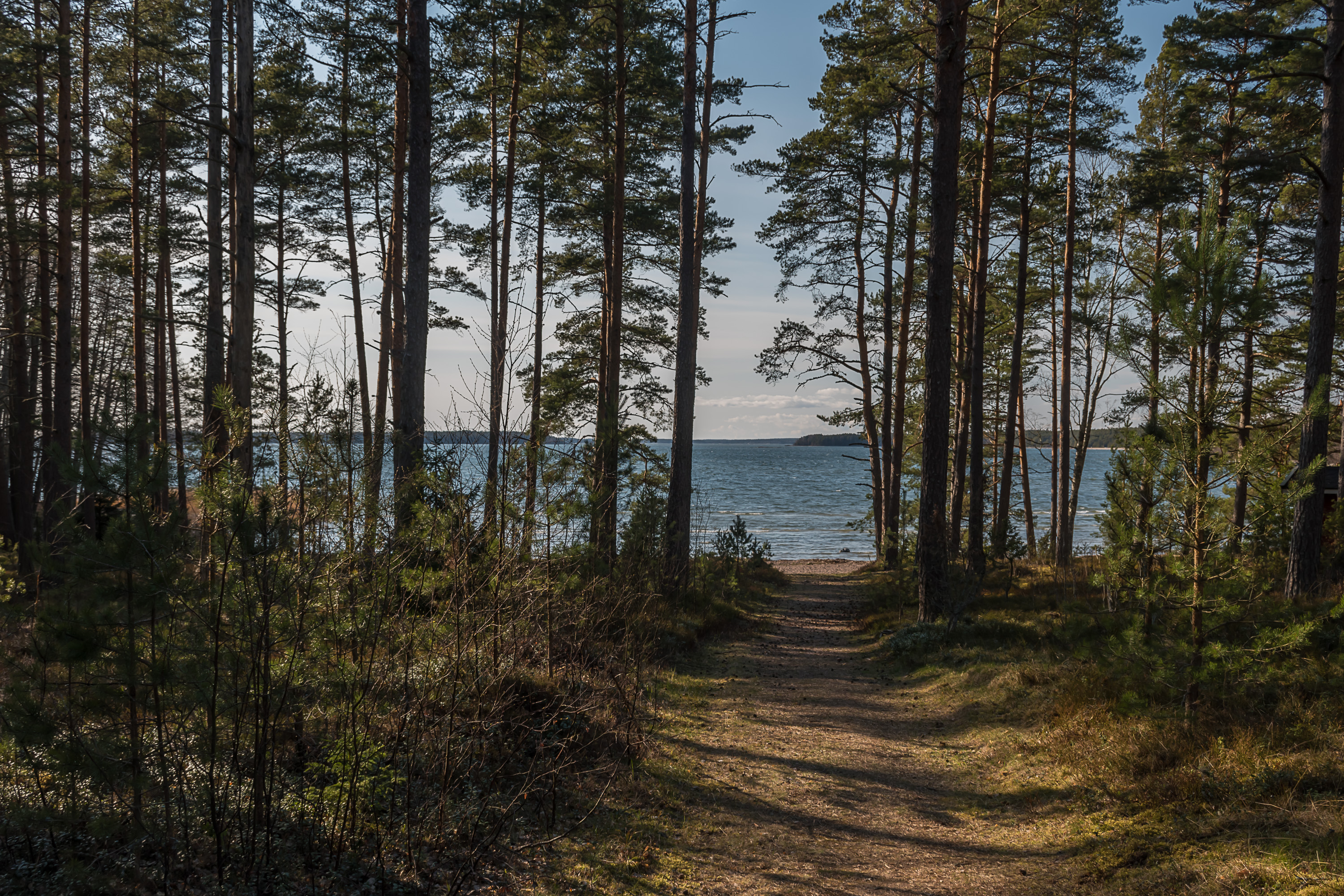
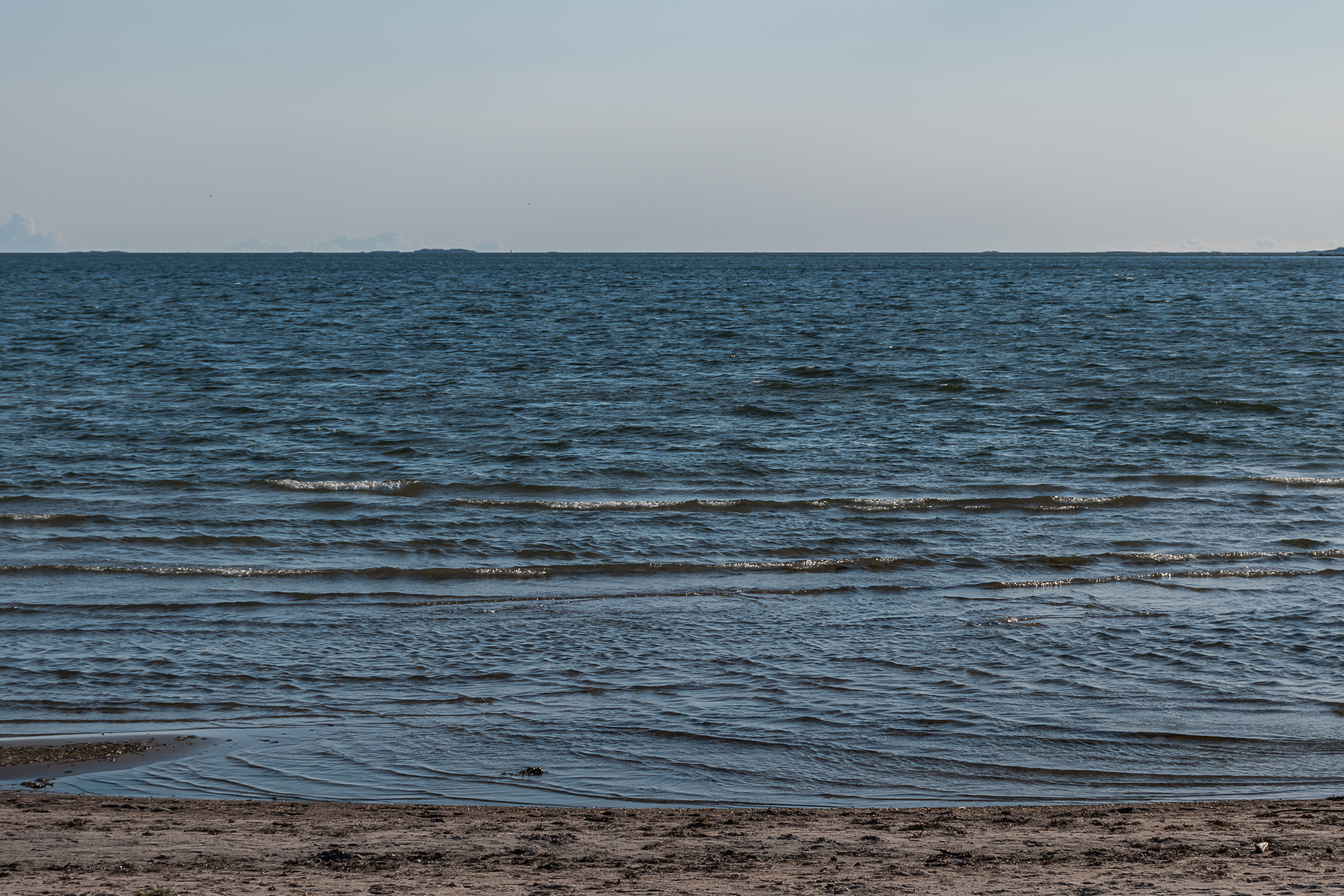
31. The final place I checked out is a pair of beaches on the west coast of Bromarv, facing the mostly open sea. This is the Sandviken (Swed. Sand Bay) beach. It was completely empty, apart from a lone fisherman a little bit away from the sandy part on the rocks.
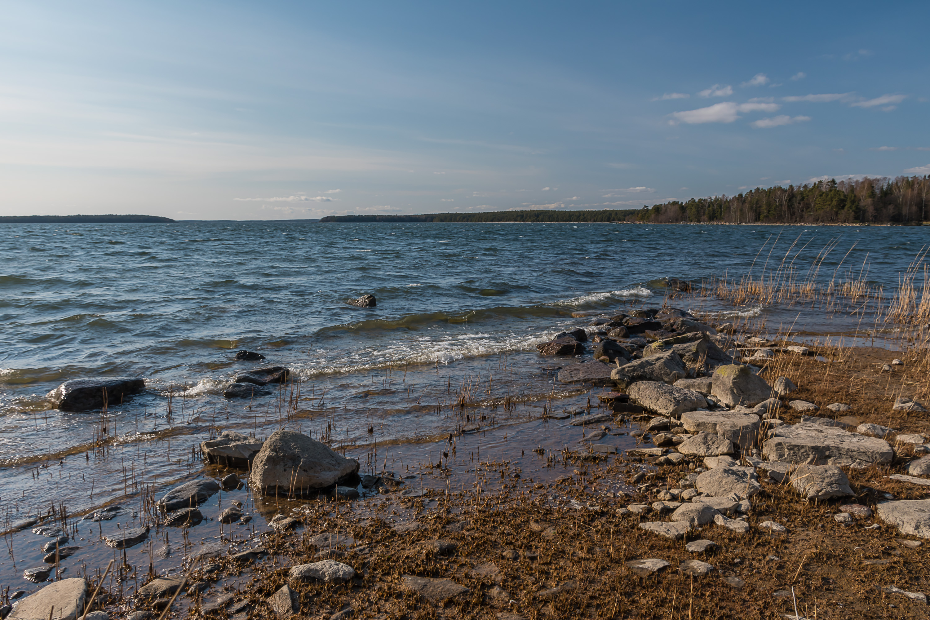
32. Bolax fjärden bay west of Bromarv is wide and has only a few minor islands. This is considered the easternmost part of the vast Turku archipelago. To the north of Bolax fjärden is the island of Kemiö or Kimito, the second biggest sea island of Finland (at 524 sq. km area and 7500 population) after the central island of Åland, and 2.5 times bigger than the third biggest island (the lone Hailuoto in the Bay of Bothnia). The strip of land faintly visible on the horizon in the gap between the Bromarv coast and the nearby island to the left is Kemiö coast.
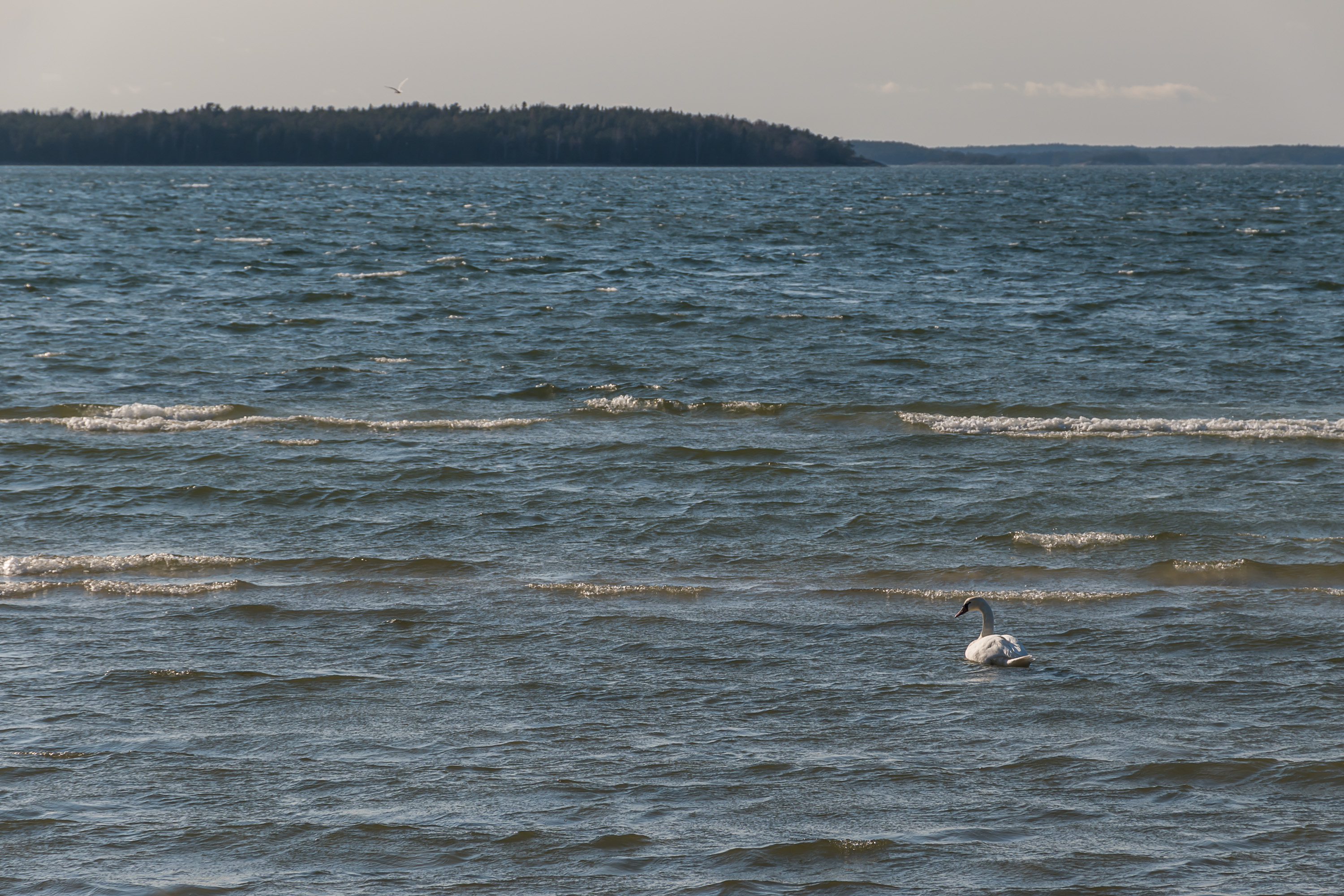
33. A lone swan off Sandviken coast.
34. Bright pine forest on sandy ground near the other beach I checked out, the Padva one. Padva is the most distant part of the entire Bromarv peninsula, curving to the north. For some reason I didn't drive to the end of Padva, which is in a few more kilometers after this beach.
35. The sea of Bolax fjärden looks a lot more open and emptier at Padva.

36.
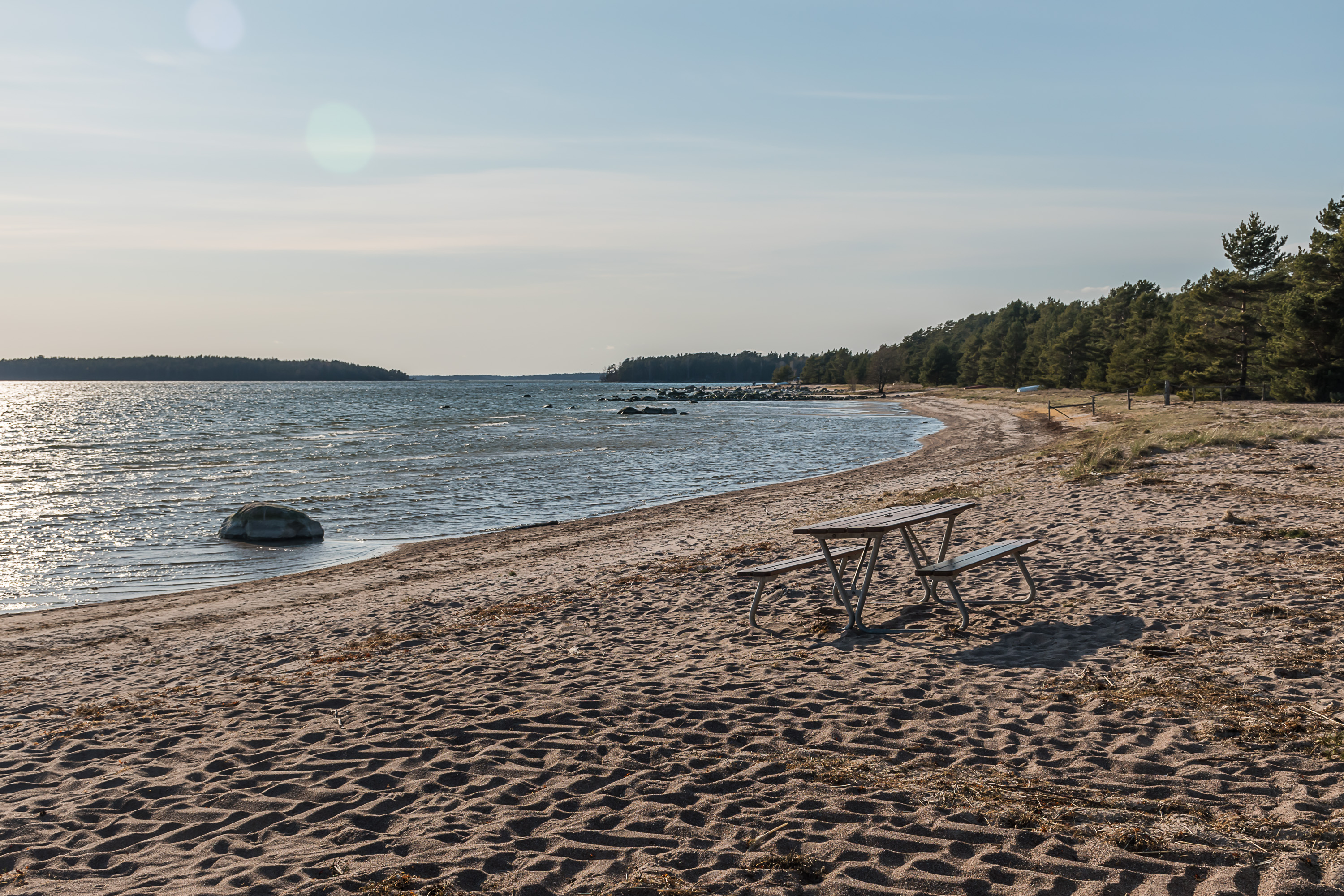
37. The beach itself. This one had a few more people, although no one dared to swim of course (the sea was at +5 or so). However near a motorhome at the parking lot someone was drying out their wetsuit.
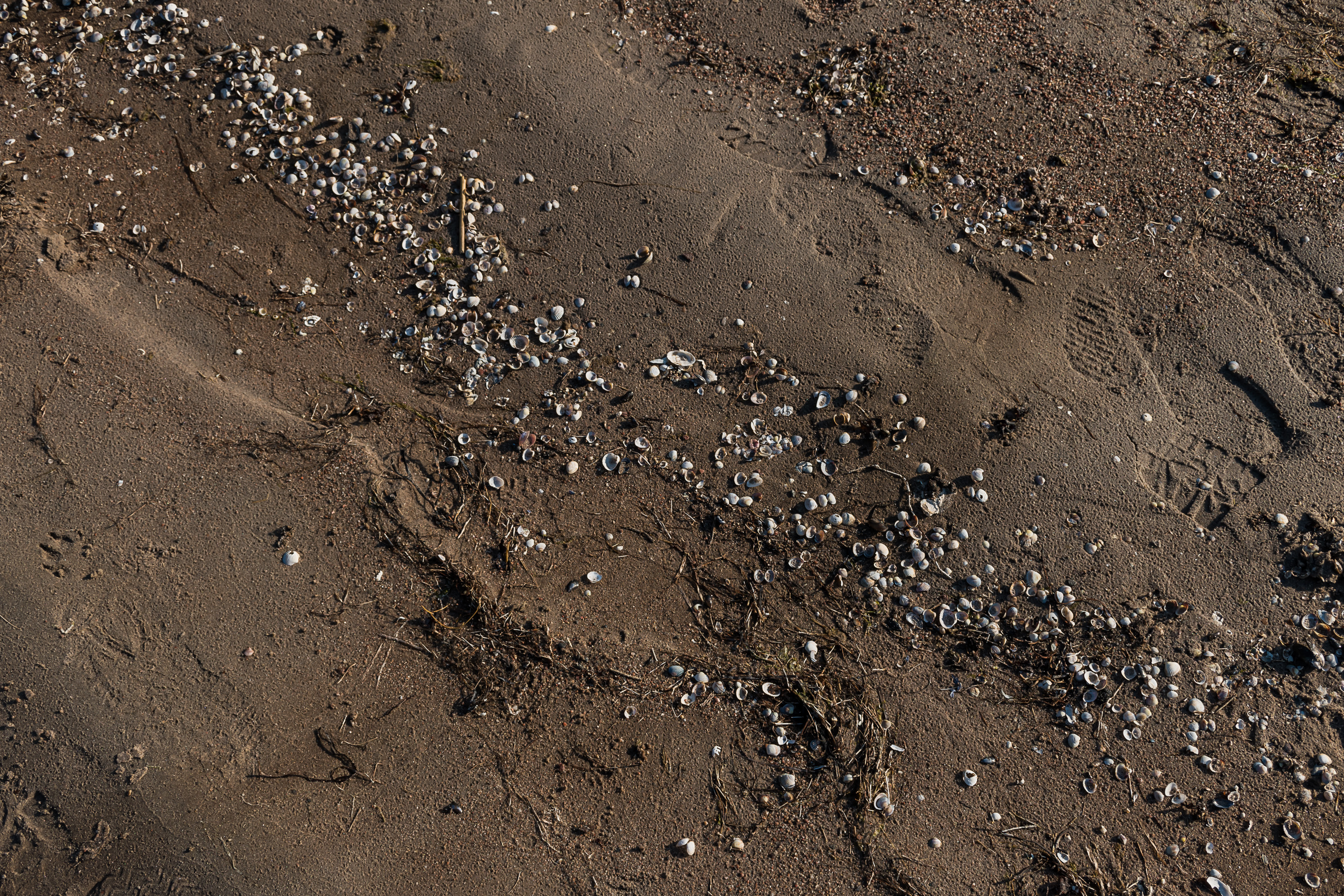
38. And thousands of tiny seashells on the beach will be the final picture for today.