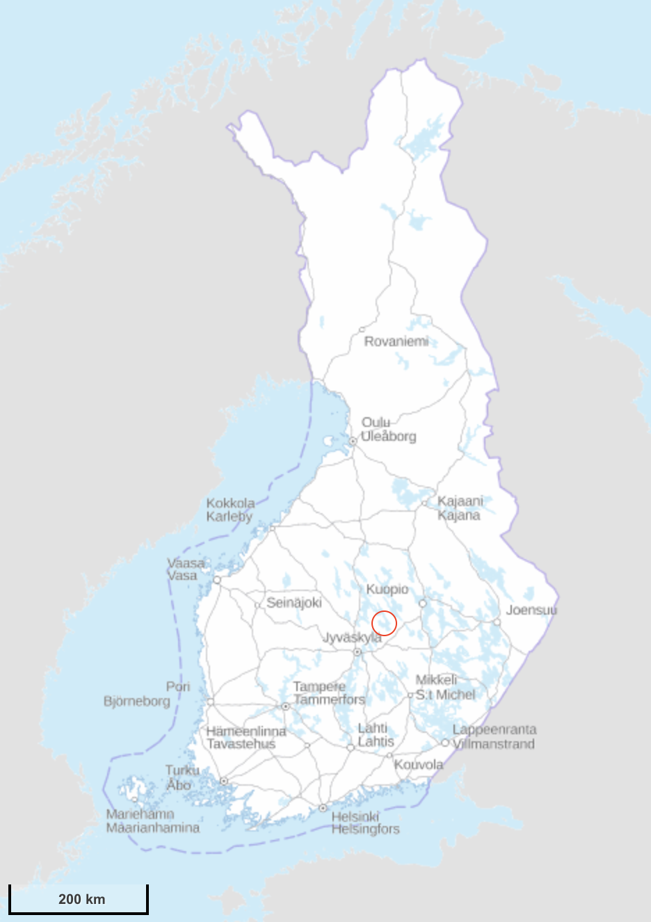
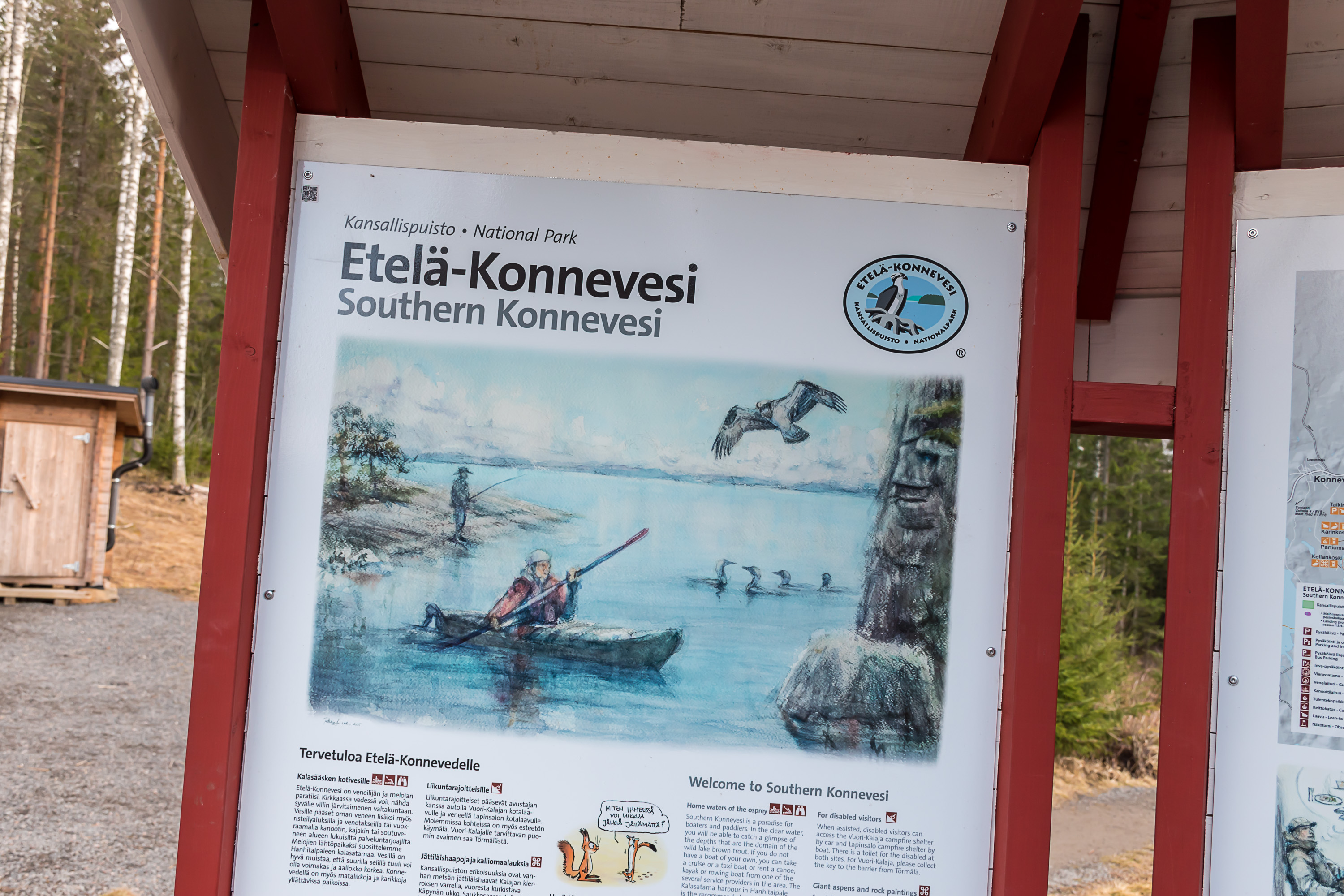
One kind of places that I want to visit all in Finland are national parks, that is, state-owned protected nature areas having marked trails and facilities for day trips or longer hikes, often including nature spots of special beauty and/or rare or well-preserved nature or otherwise remarkable in their ecology. There are currently 40 national parks in Finland, and as of previous year I visited 27 of then. The 28th came in early May 2020, the Southern Konnevesi National Park (Etelä-Konneveden kansallispuisto) in Rautalampi Municipality in Northern Savo region, deep in the heart of upper Finnish lakelands.
The overall trip was quite a bit longer; the 1st of May (vappu) is a holiday in Finland, and since it fell on Friday this year, I had an opportunity to do a three-day trip which I was really eager to do after the annoyingly mild winter and corona spring. I went to the city of Mikkeli, the center of Southern Savo region, that I had only previously seen once in 2015 and rather briefly at that; 230 km northeast of Helsinki. I stayed at an AirBnB apartment there and could explore the city and some surrounding villages and nature fairly well, but for the last destination I chose to drive 125 km farther north, into Northern Savo region already, because there was a national park I had been missing before, and this was a good opportunity to check it out; the drive there from Helsinki directly would be about 320 km, which is too far for a day trip. (In my practice a day trip by car should be within a 150-200 km distance; this might be stretched a bit of course but not really too much.) Annika who was staying in her student apartment in Jyväskylä at the time joined me in the town of Pieksämäki, where she went by train, and then we went on to Southern Konnevesi together.
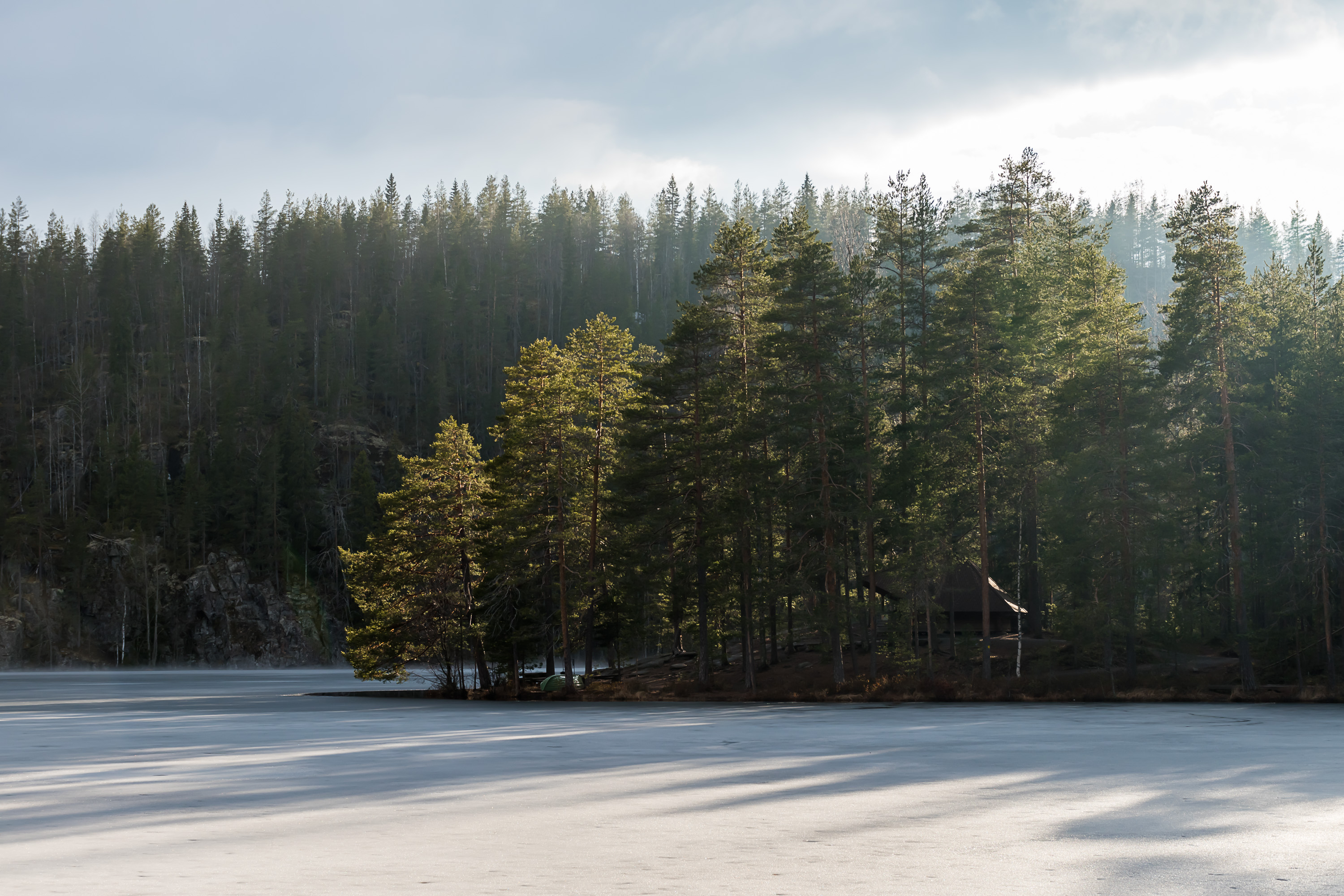
In Southern Konnevesi we walked in the end about 17.5 km, pretty much the longest possible route. Although it had seemed in the morning the weather was going to be overcast and drizzling all day, in fact by the time we got to the trail the drizzle mostly disappeared and it started to get somewhat foggy. Lake landscapes looked very beautiful in the fog, and this allowed me to take good pictures, a few of them I would even say are the best in 2020 so far. (I usually travel to see places, whenever I can, and go in whatever weather and time of year and day I can. The pictures thus rarely look really good, because weather and time of year and day are by far the most important things about landscape photography. Many of my best pictures I took near Vaasa when I lived in that city, simply because there I often went for walks in nearby nature in various conditions.)
Konnevesi is the 23rd biggest lake in Finland, at 189 sq. km area. It is one of the uppermost major lakes of the water system of Kymijoki, the middle one of three major water systems of lower Finland. The waters of Konnevesi flow through Liesvesi, Vanginvesi, Kynsivesi, Leivonvesi, Kuusvesi, Saraavesi and Leppävesi lakes, in that order, into the great Päijänne lake, 120 km long, which then drains into the Gulf of Finland through Kymijoki river. For recreational boating Konnevesi is connected to Keitele lake via Neituri canal. I already wrote about the Keitele lake and the canal connecting it to Päijänne rather recently, in my post about the town of Suolahti. Konnevesi is shaped like an inverted mushroom, with the stem being the narrow and mostly island-free Northern Konnevesi (Pohjois-Konnevesi), and the cap being the rather vast and more rich with islands Southern Konnevesi (Etelä-Konnevesi).
The meaning of the name Konnevesi is not precisely known. The -vesi part means "water"; this is a very common suffix for lake names of Central and Eastern Finland; but it is not certain what konne means. For example one theory is that it comes from a Sami language word meaning a wild reindeer. Wild reindeer back in the day were common throughout entire Finland, but were hunted to extinction; some populations have been relatively recently reintroduced in certain parts of the country, but most reindeer found today are the semi-domesticated ones herded in Lapland and other parts of North Finland.
The chain of lakes from Päijänne to Konnevesi and upwards beyond it is known as Rautalampi waterway (Rautalammin reitti). Neituri canal shortcut aside, it remains to this days one of relatively few major waterways of the Lakeland kept it its pristine state, unspoiled by dams. It takes its name from the very old parish of Rautalampi (Finn. Iron Pond), which has existed since 1561, created by order of King Gustav I Vasa himself, to take control of the borderland wildernesses of that area. Originally it covered a vast territory corresponding to 27 modern municipalities (there are at the moment 310 municipalities in Finland in total). Rautalampi subdivided a lot with time, and modern Rautalampi is a very minor rural municipality of 3100 people, which is demographics-wise on the road to dying out, like many other Finnish rural municipalities especially in East Finland (Northern Savo region is a part of East Finland).
The national park formally covers territory in two municipalities, Rautalampi and another one in Central Finland region, literally named Konnevesi; however the Konnevesi part has only minor islands in it, and the actual trails are all on the Rautalampi side. Unlike other lake-centered Finnish national parks (most notably Linnansaari and Kolovesi), the main part of Southern Konnevesi is located on lake shores and not on islands, and thus it can visited anytime without needing to have an own boat or relying on local boat services. Obviously it is also possible to visit by boat, which would allow you to see more views and to land on the islands (although on the smaller ones it is not allowed in late spring and most of the summer, as they are bird nesting places). Alas I'm not rich enough to have a boat, and I also cannot swim so it's probably not a great idea for me to have even a canoe or something (canoeing is also particularly recommended in the area).
The national park was founded rather recently, only in 2014, although by that time there already existed some locally known trails in the area. Now the trails and facilities (including a few campfire places and laavu lean-to shelters) are maintained by Metsähallitus, Finnish Forest Administration, just like in other national parks. It is allowed to freely visit the national park anytime (although in winter you'd probably need snowshoes; for skis the terrain is too uneven) and to walk anywhere, off-trail too if you feel like it. It is also allowed to camp although it has no dedicated camping spots as such, and camping next to some lean-to or a campfire places is probably your best bet and also the officially recommended option. But in general everyman's rights (for nature access) in Southern Konnevesi aren't limited. The national park area is officially only 15 sq. km large. About 35,300 people visited it in 2019, which makes it one of the more popular of relatively obscure national parks of lower Finland. The national park symbol is osprey, a large bird of prey, about 20 pairs of which are known to nest in the area.
The beauty of this national park is that it is relatively big, and you can easily spend an entire day hiking there; and that it includes many very beautiful landscapes, including both open lake views with coastal rocks, and lookout points on high hills. I would compare it to Repovesi (Finn. Fox Waters), closer to Kouvola in Southeast Finland (this one might be better familiar for my Russian readers, as it is not so far from the Russian border too); Repovesi also has pretty long trails and varying landscapes with many beautiful views. Southern Konnevesi, however, just somehow feels much wilder. Even though there are still many hundreds of kilometers to the real wilderness, to Lapland, this land still definitely reminds a lot more of inland Finland how it was supposed to be, before stupid people settled it and ruined everything.
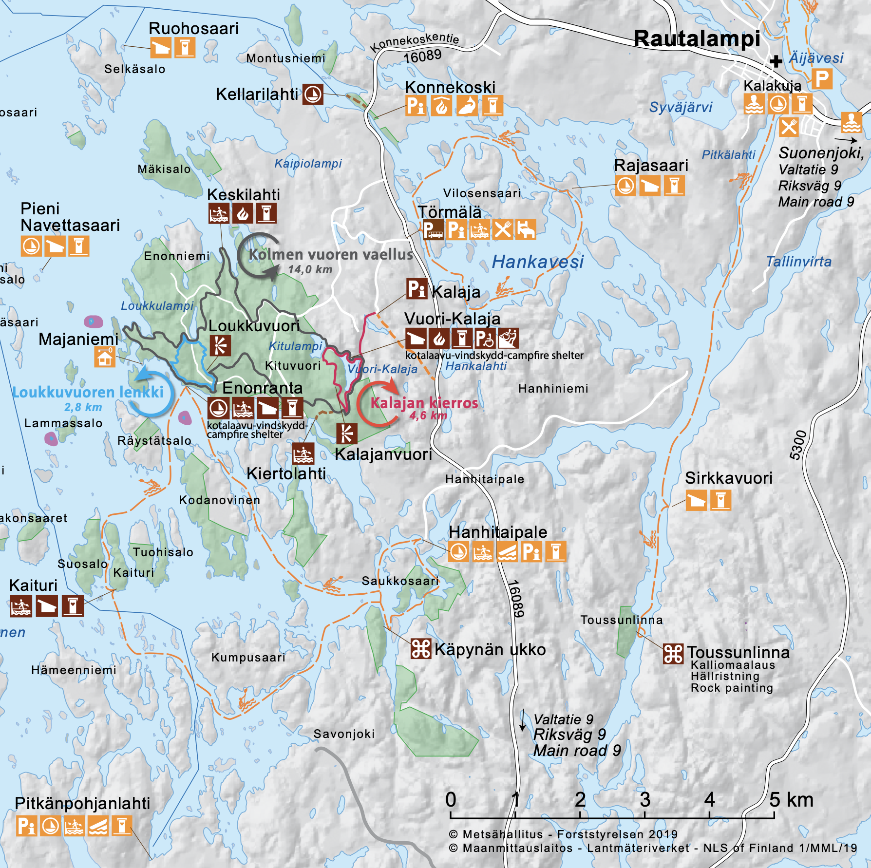
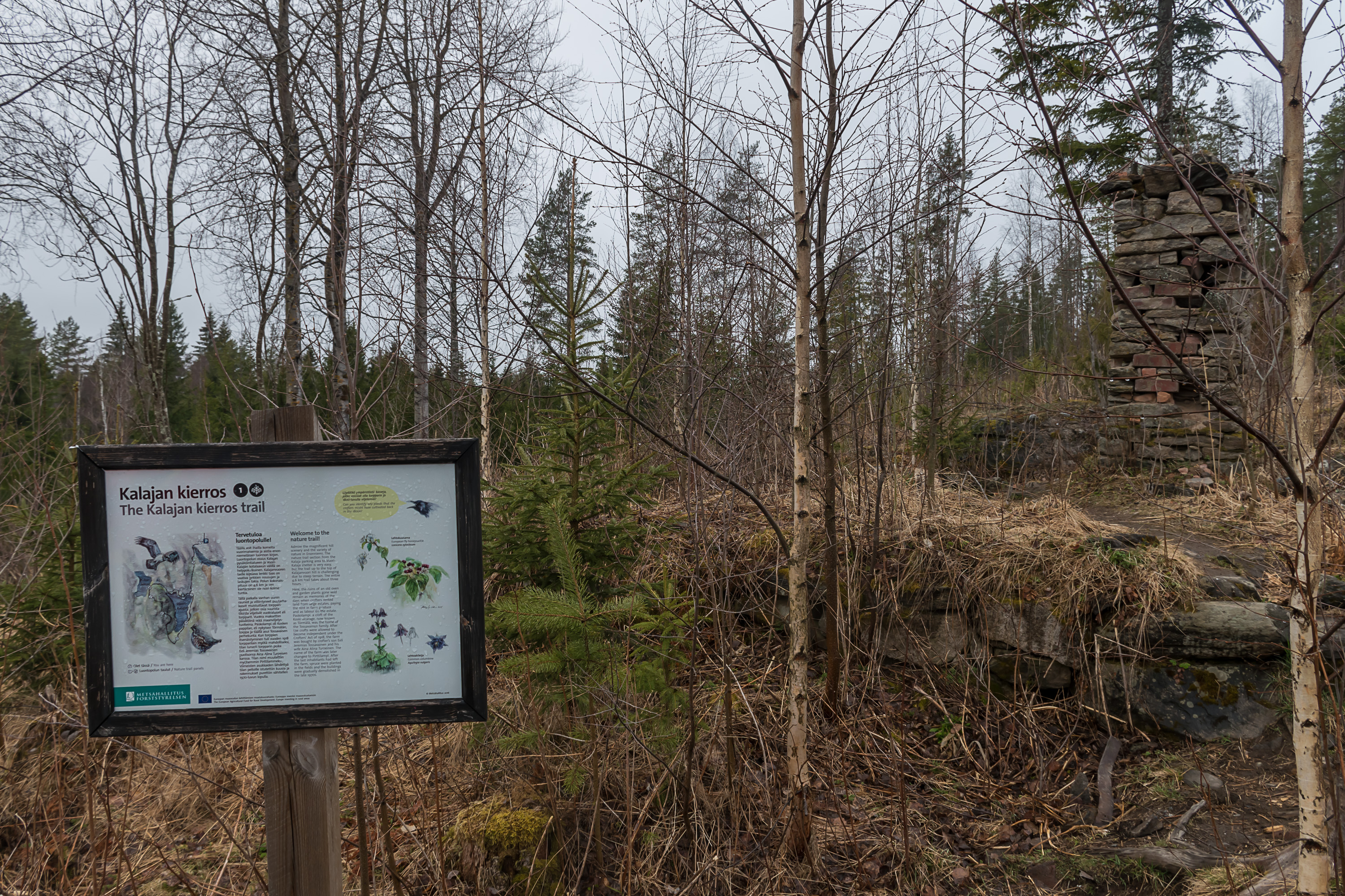
The official web page of Southern Konnevesi in English has an extensive description of it and its trails. The trail we walked was Kolmen Vuoren Vaellus (Finn. Three Mountains Hike), 16 km long (14 km the circular trail itself + 1+1 km access trail from the parking area and back), which indeed goes by the three big hills in the area. In practice it's closer to 17.5 km if you want to make detours to lookout points on two of the hills, which is absolutely worth it. "A very challenging, rocky trail, with large differences in altitude", says the official description which is naturally why I was so interested in it. In the end of course it was nowhere as physically demanding as climbing a moderately-sized mountain in Norway can be, but as far as Finnish trails go this is a more difficult one indeed, so at least good hiking boots and enough time (and water, etc.) is a must. Personally I would also greatly recommend a hiking stick; my phone says I climbed around 400-450 meters that day, and with such climbs and descents a hiking stick really makes a difference at least for me. The hike took us 7 hours, with two not very long breaks.
The trails start from a parking area, named Kalaja, at the address Törmälän metsätie 136, Rautalampi. The 1.5 km long narrow gravel forest road (Törmälän metsätie) to the parking area is not plowed in winter. This was a concern for us, as at the time some snow could still be found in these parts of Finland at least in some darker places; I had summer tires already so a big spot of snow or ice on the road could be dangerous to try to force. However there were no such spots and we passed to the parking area without any issue. The alternative would be leaving the car at a parking area at the beginning of this forest road (Konnekoskentie 552, Rautalampi), next to some Törmälä course center, whatever that is; that place is reachable by a public road (if still a gravel one) and has proper winter maintenance, but, obviously it would add 3 km (1.5 there and 1.5 back) to the length of the already long hike.
Some sights of the national park (Konnekoski rapids, Toussunlinna rock paintings, Käpynän-Ukko human face-shaped rock) are not part of any trails; the rapids you can see or stop by when driving towards Kalaja on Konnekoskentie road, and the other two places can be only seen from a boat.
Going to Southern Konnevesi by public transport would be very challenging. The closest place reachable by bus would be the Rautalampi village, from which it is 11 km to the Kalaja parking area. Should you want to go by bike, you could go by train to Suonenjoki station and then bike 31 km from it to Kalaja parking area.
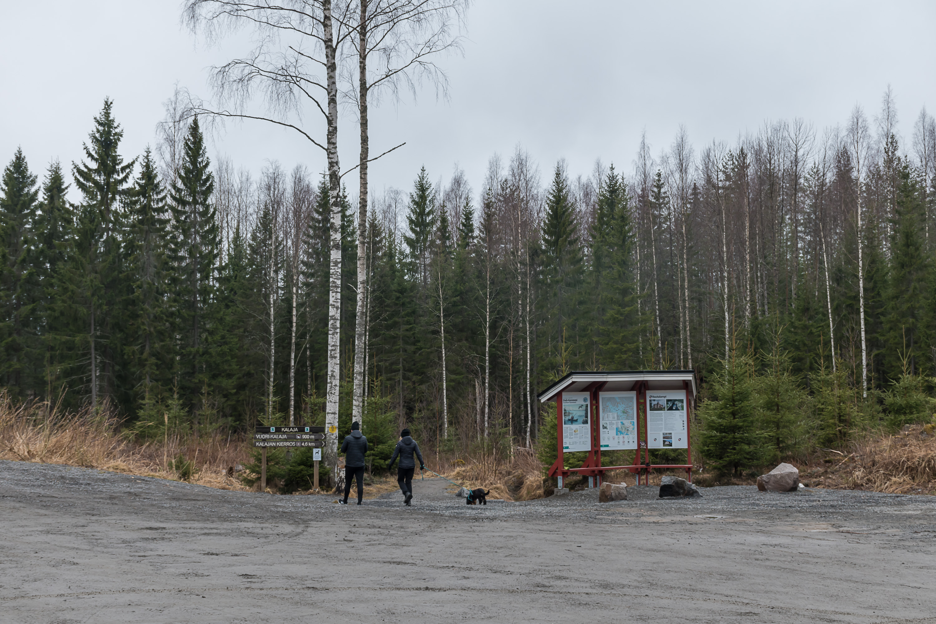
1. The beginning of the trail from the Kalaja parking area. There were maybe about 20 cars present, which is about what I'd expect for such a relatively remote place on a May weekend but not the best (as I thought) weather.
2. The first part of the trail, to the Vuori-Kalaja shelter, is the easiest one, with a wide flat track mostly covered with gravel. The trail goes by a small lake named Paskolampi, which literally means "Shit Pond" (and I assure you there are many places in Finland named like that), and a sign tells you about the remains of a crofter (torppari) house there.
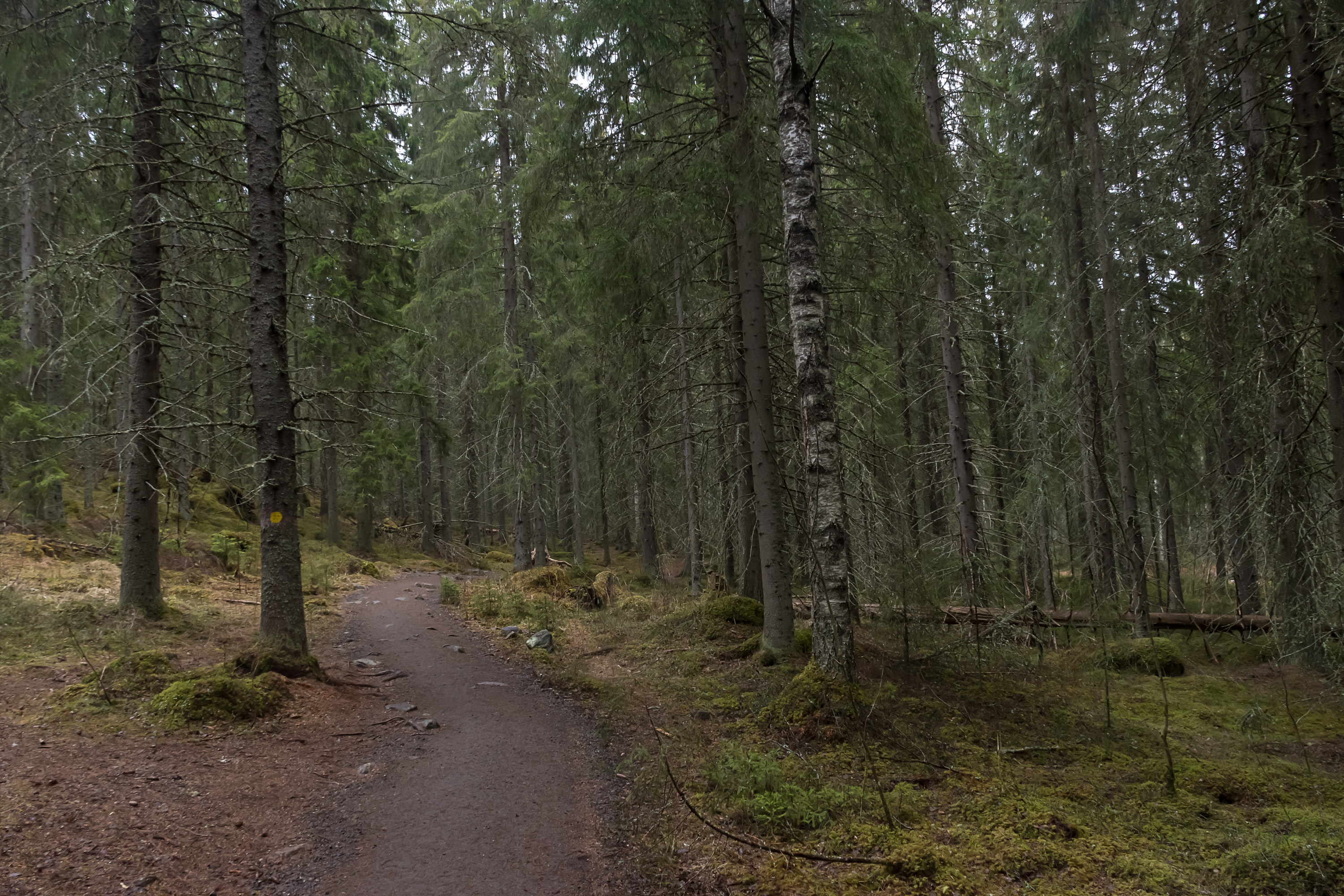
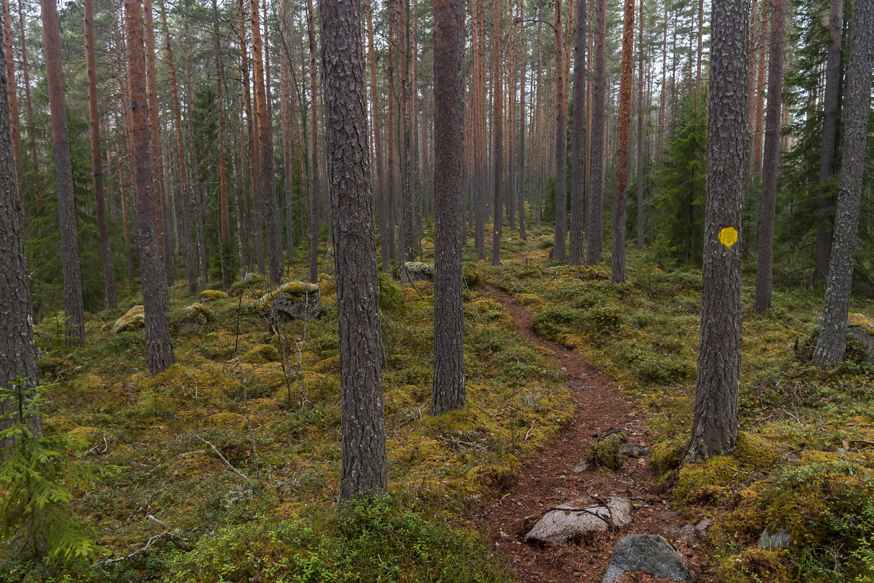
3. The trail to Vuori-Kalaja. All trails in this natural park are marked with the same yellow round blaze.
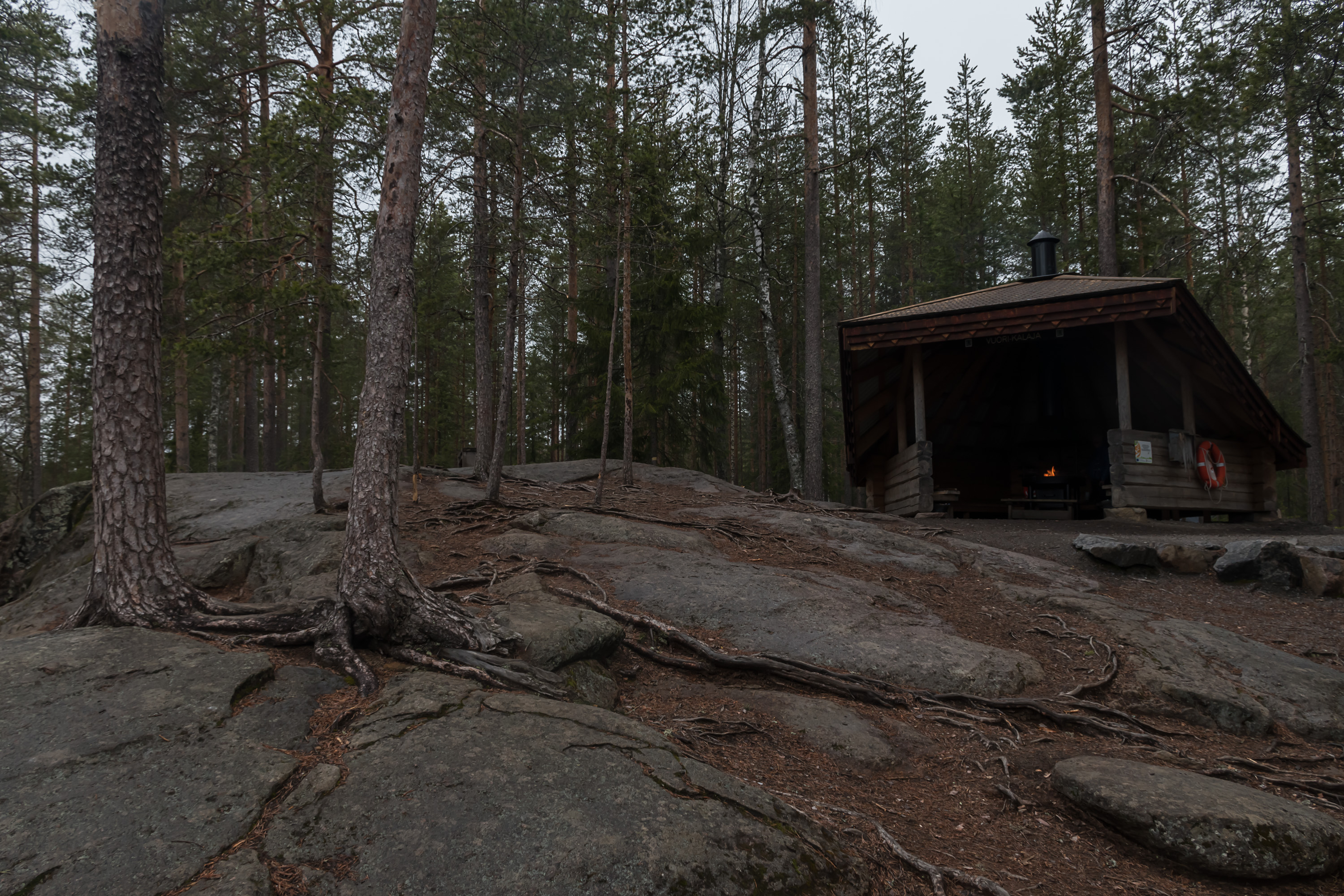
4. Vuori-Kalaja is a laavu lean-to shelter and a campfire place on the shore of a small (about 600x250 m) lake named Vuori-Kalaja (Finn. Mountain Kalaja; I don't know what "kalaja" would mean, although "kala" means "fish" and "-ja" usually means a profession, but "fisherman" would be "kalastaja" and not "kalaja"). It is actually even reachable for disabled people, as there is another road to the national park with a much closer (and smaller) parking area, which is meant only for disabled people.
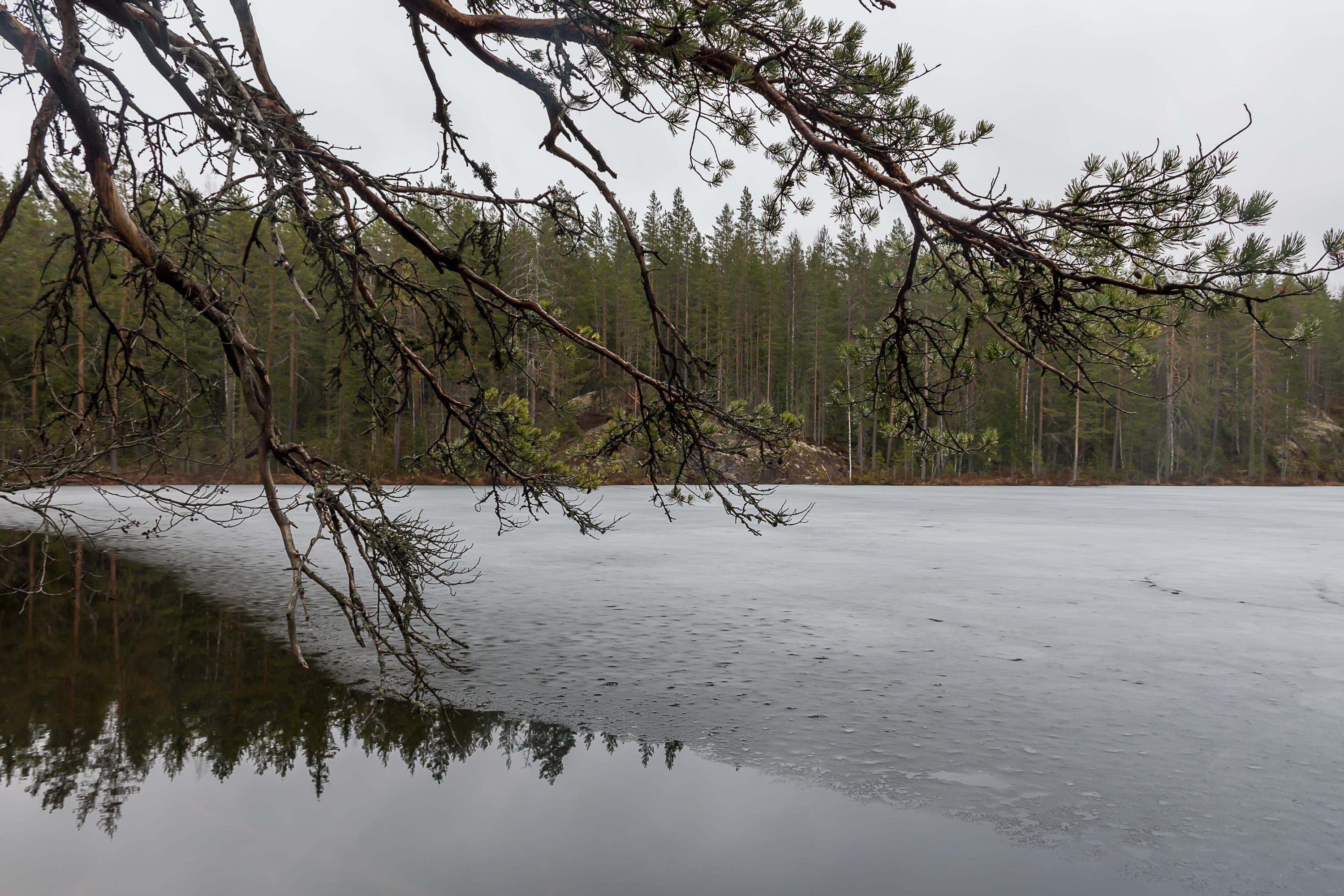
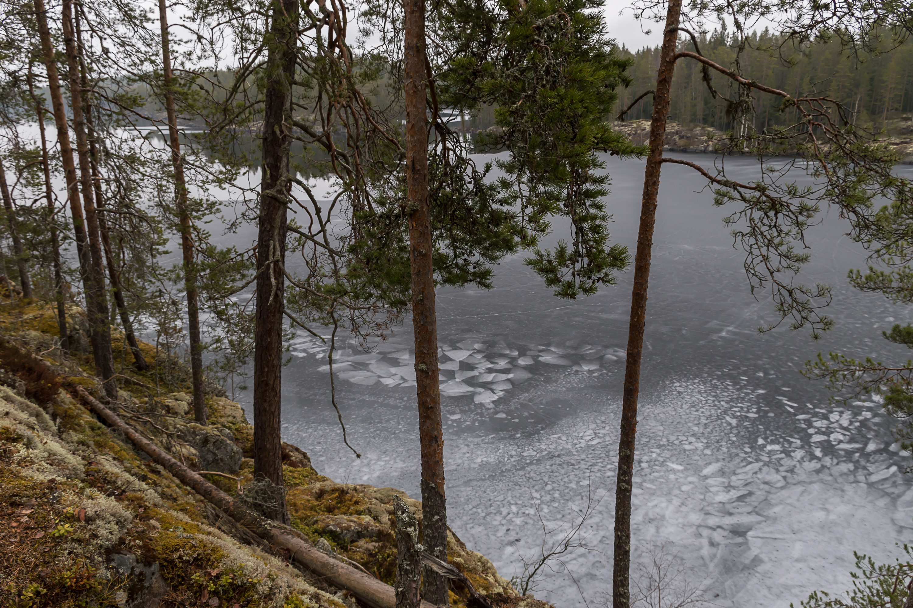
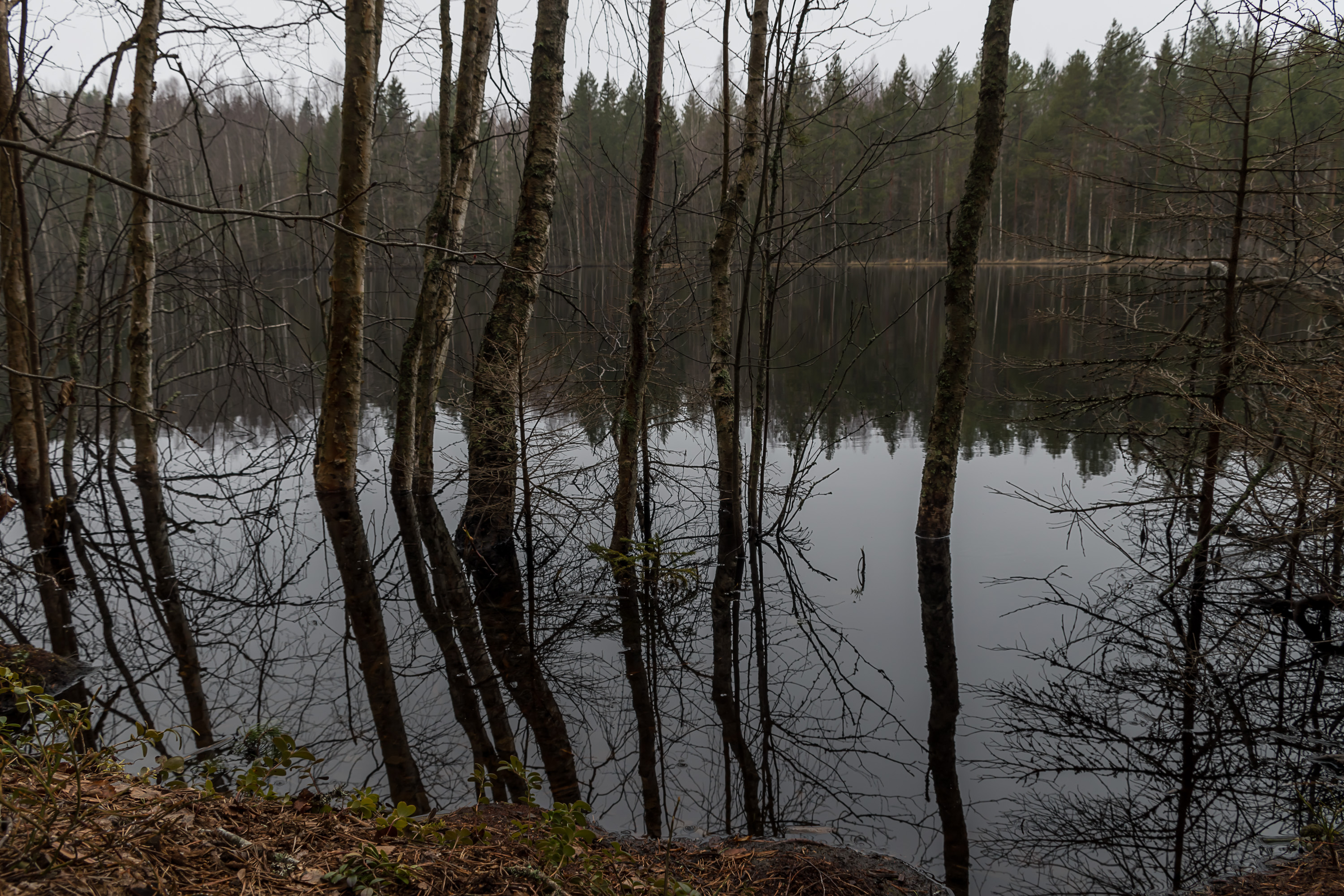
5. And this is the Vuori-Kalaja lake. Lakes were partially still under rotten ice in this area, regardless of their size.
6. The lake is named Vuori-Kalaja because it is next to the Kalajanvuori hill, rising steeply over its west shore, but going up that hill remained for the end of the hike.
7. The trail initially goes also along another lake, Kitulampi, which shares name with the nearby Kituvuori hill, and means something like "pond of languishing".
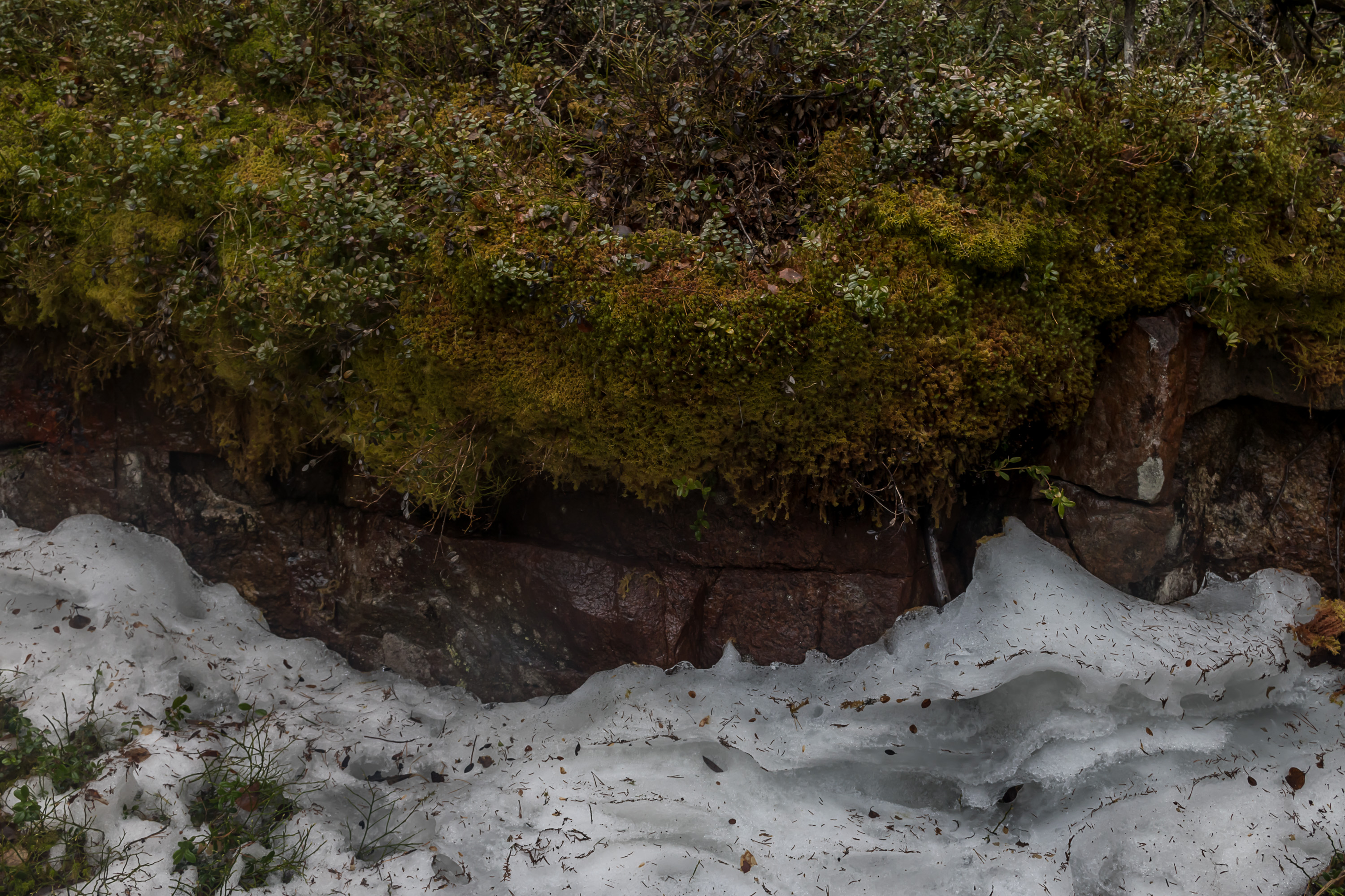
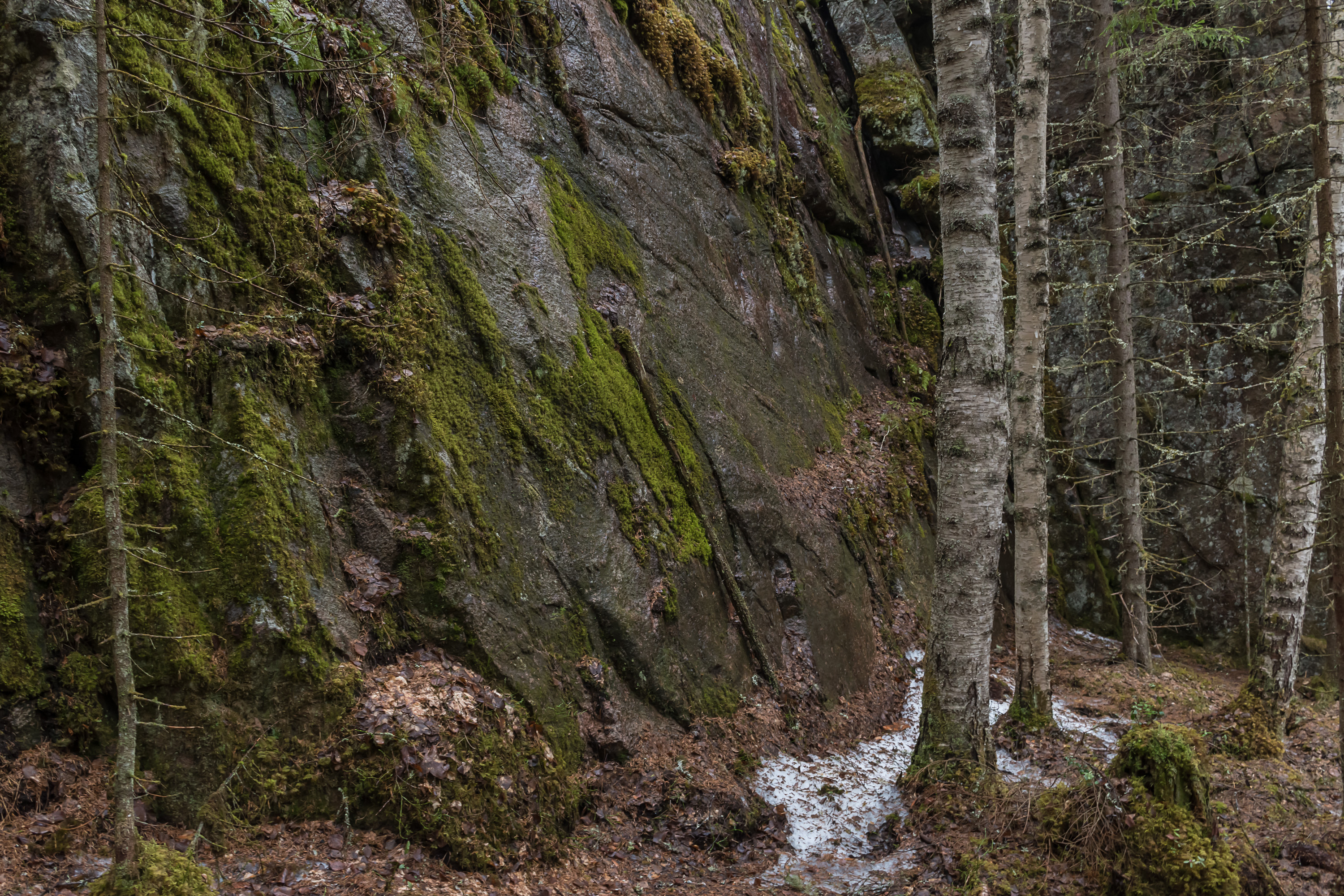
8. Some snow was also still present in the national park, mostly in the darker places on the northern side of hills. However it, with a few very small exceptions, didn't cover the actual trails, which was very good, as walking a trail covered with compressed ice-like melting spring snow is very annoying, especially in a place like this with many small but steep climbs and descents.

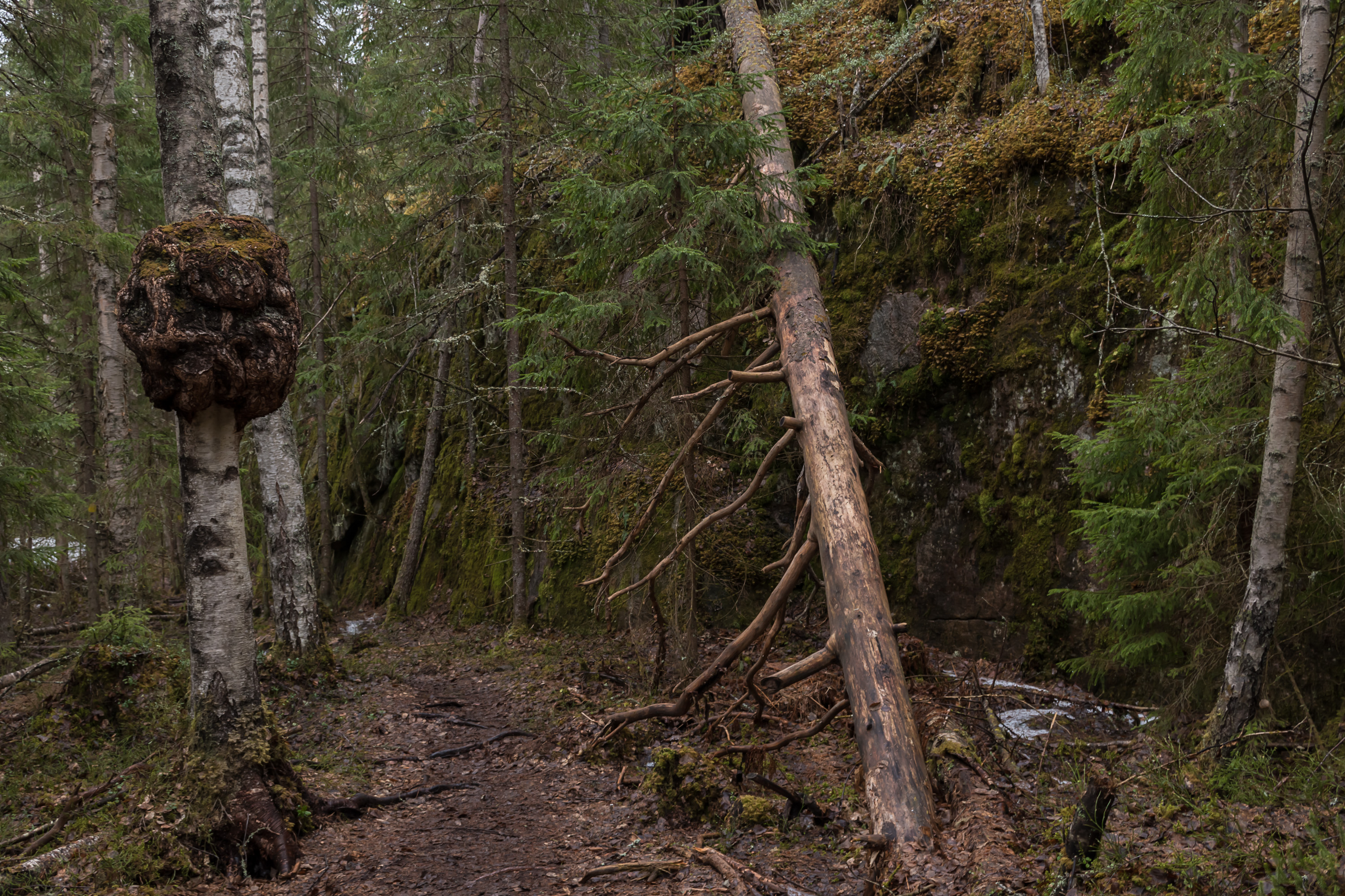
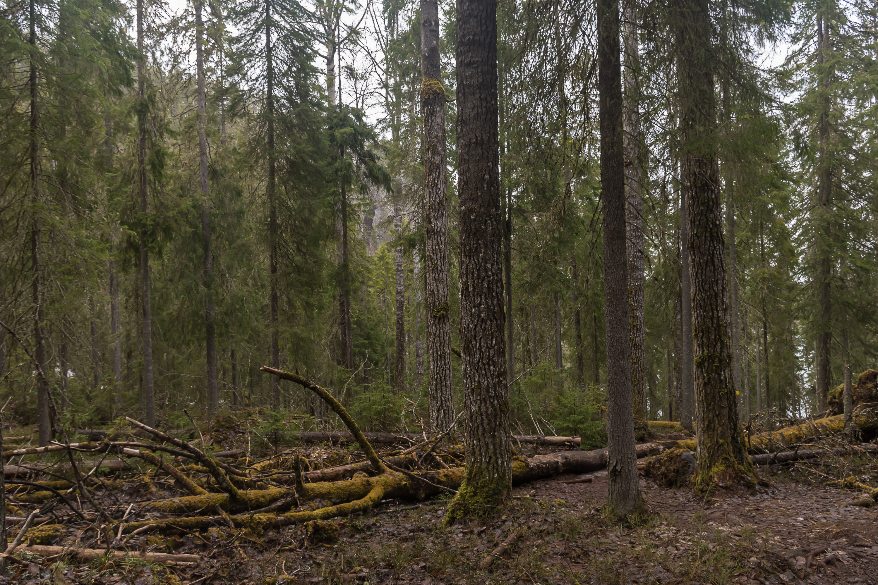
9. A few gravel roads cross the national park and the trail even actually follows one of them for some distance. Those remind you that the area's status as a national park is fairly recent and the roads were maintained for forestry needs. But any actual cuttings at Southern Konnevesi took place quite many decades ago (in the 1960s if I remember correctly), and the forest there now is fairly old (if not exactly primeval). A major storm named Asta in 2010 damaged the forest fairly extensively; trees that it fell are all remaining now to rot whenever they are, in natural conditions.
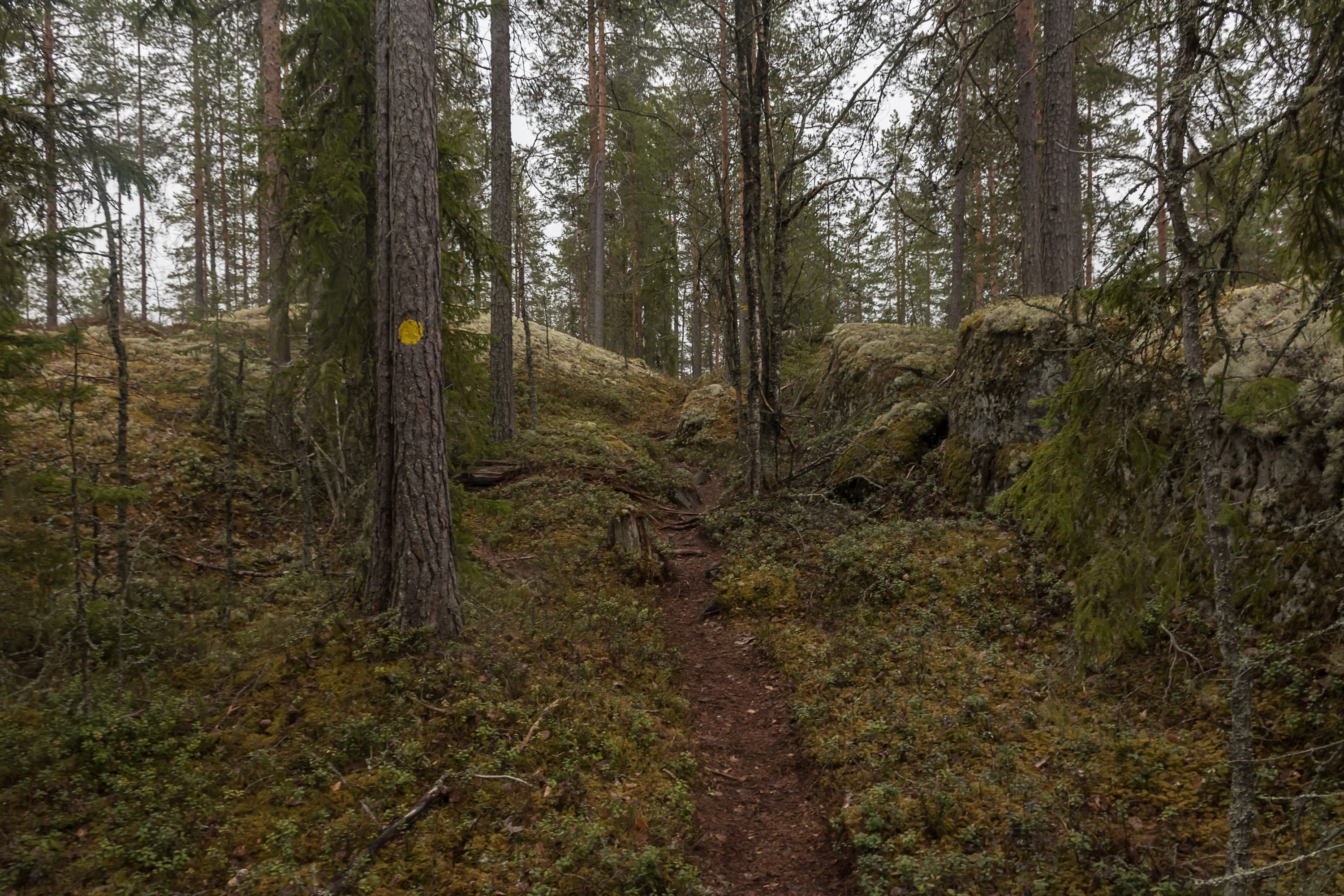
10. But then we're leaving the road and walking on a trail again.
11.
12.
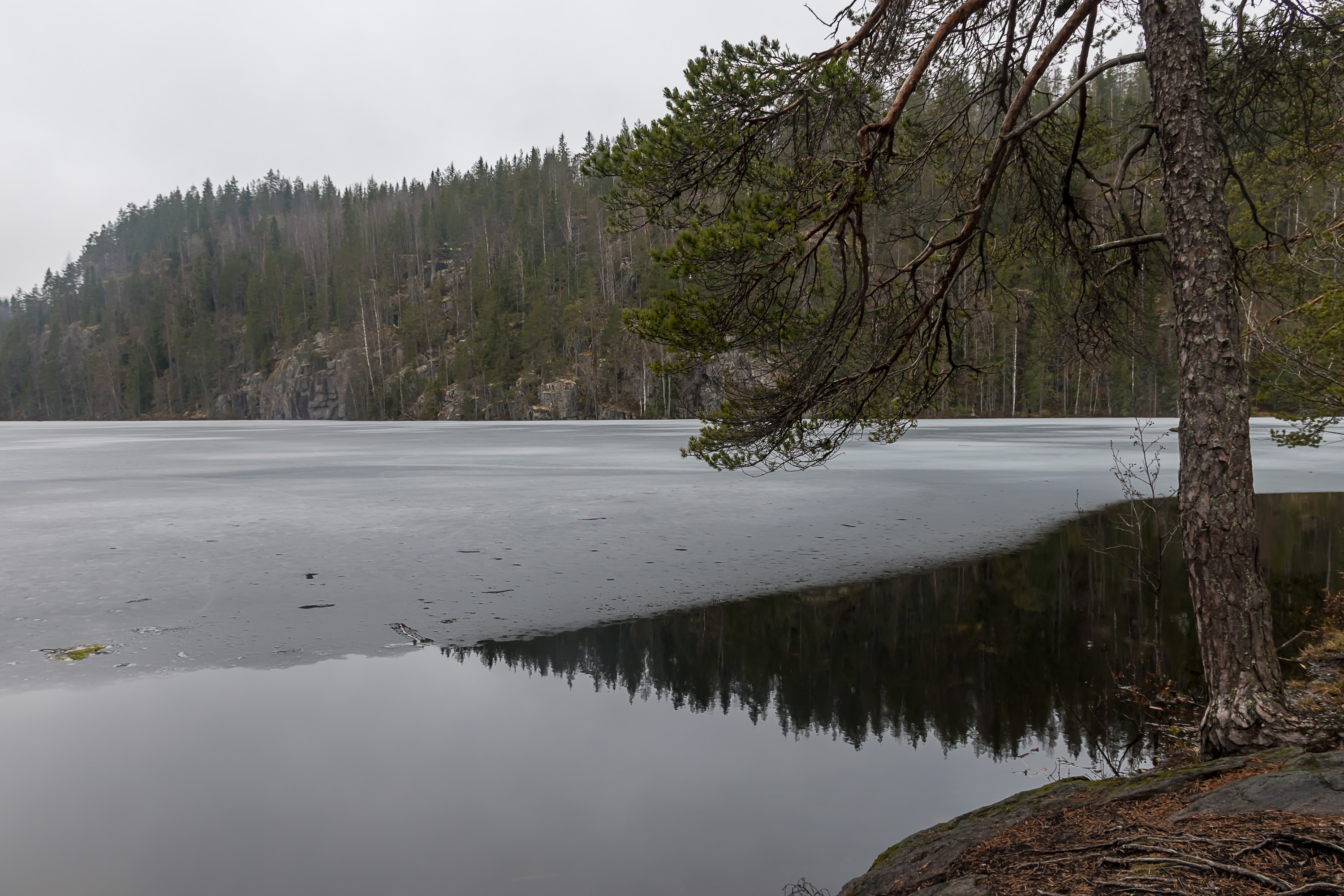
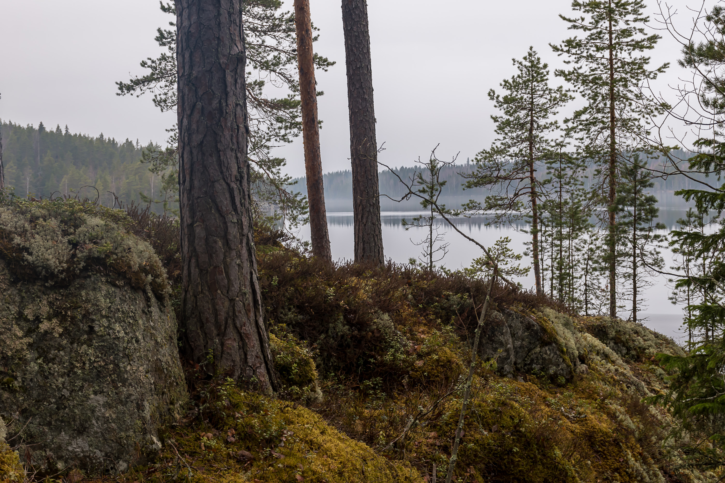
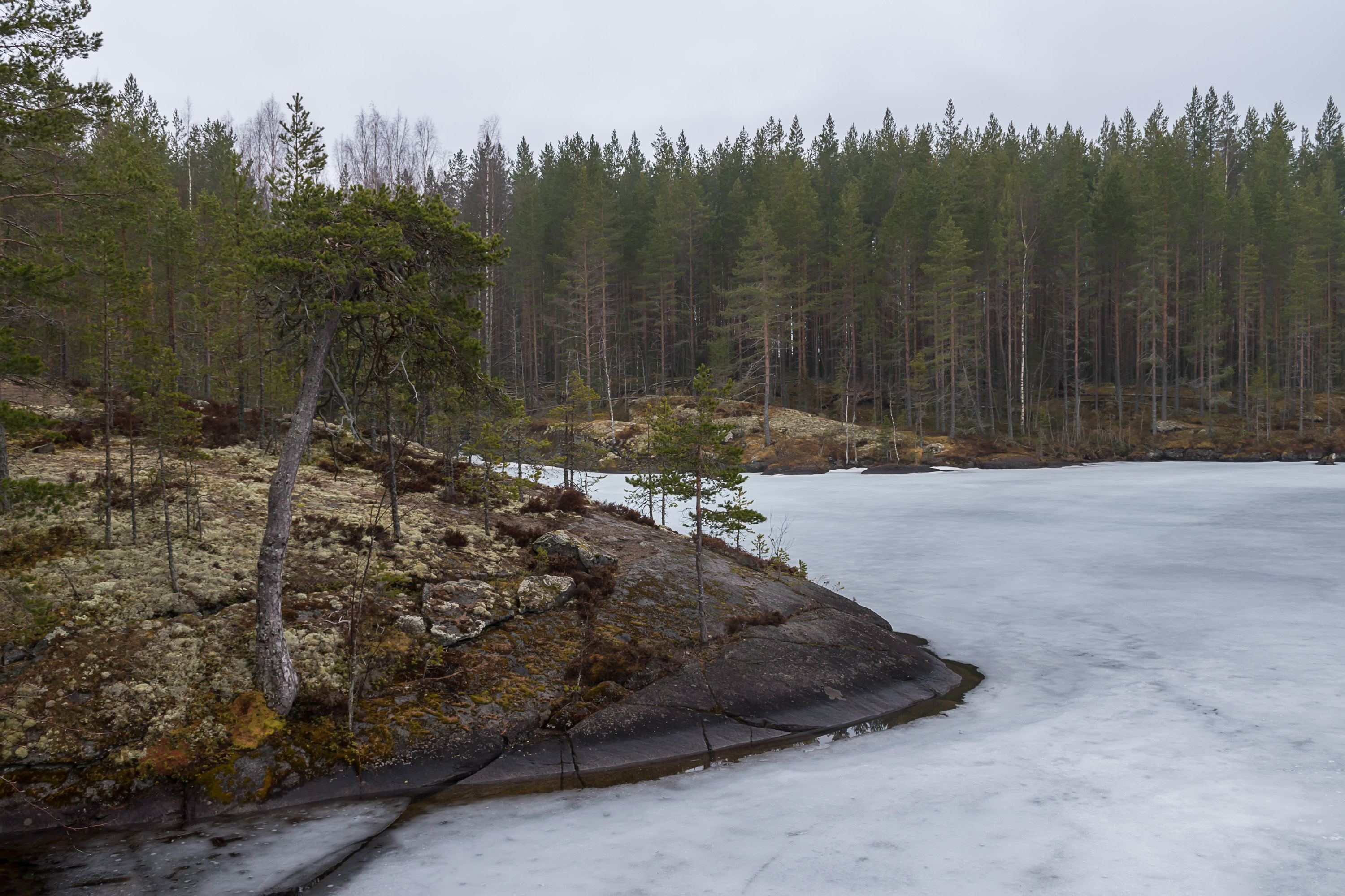
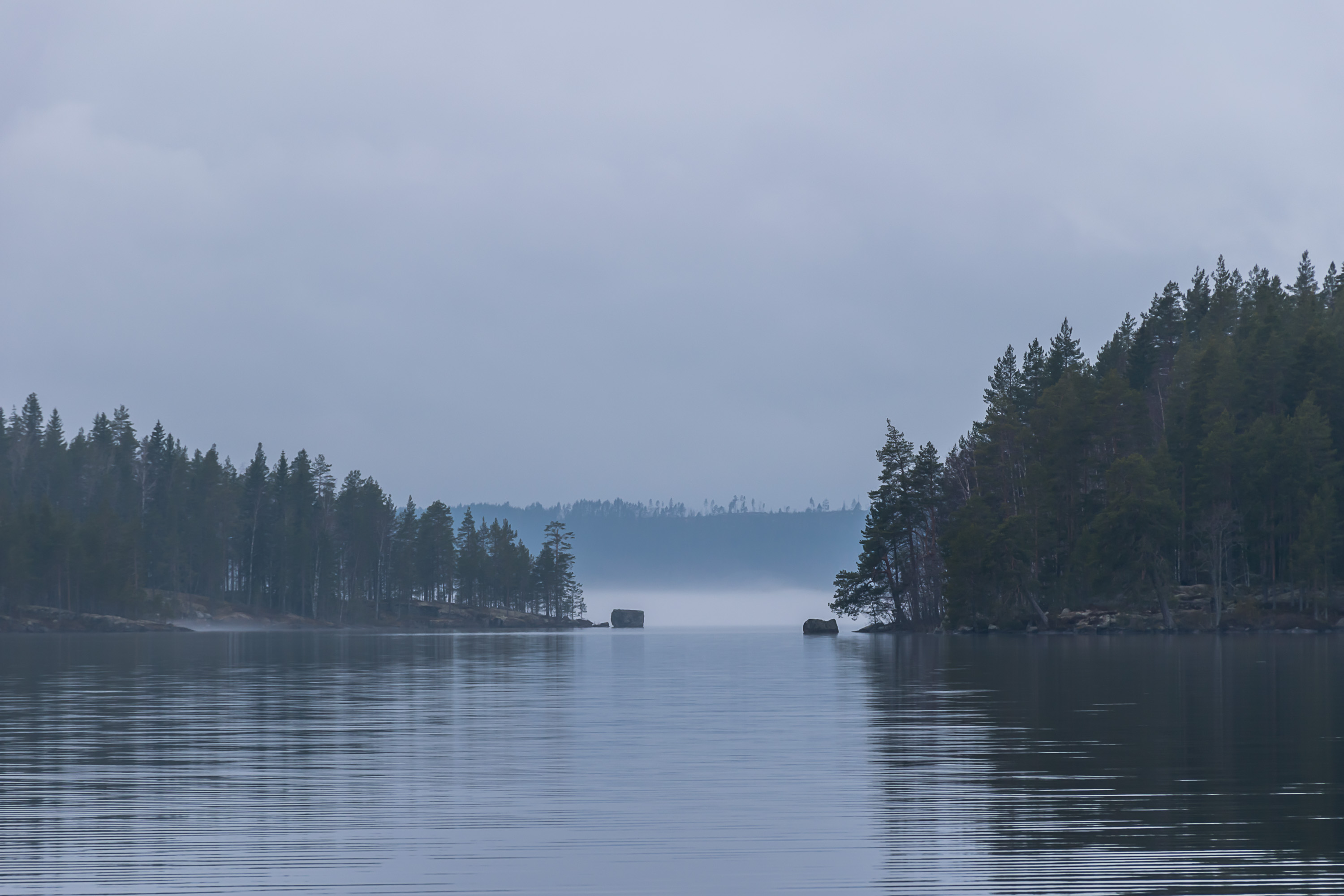
13. And then we reach the coast of the actual Konnevesi, and this is where the good parts start.
14. The ice in this small bay has melted and re-frozen in a curious manner.
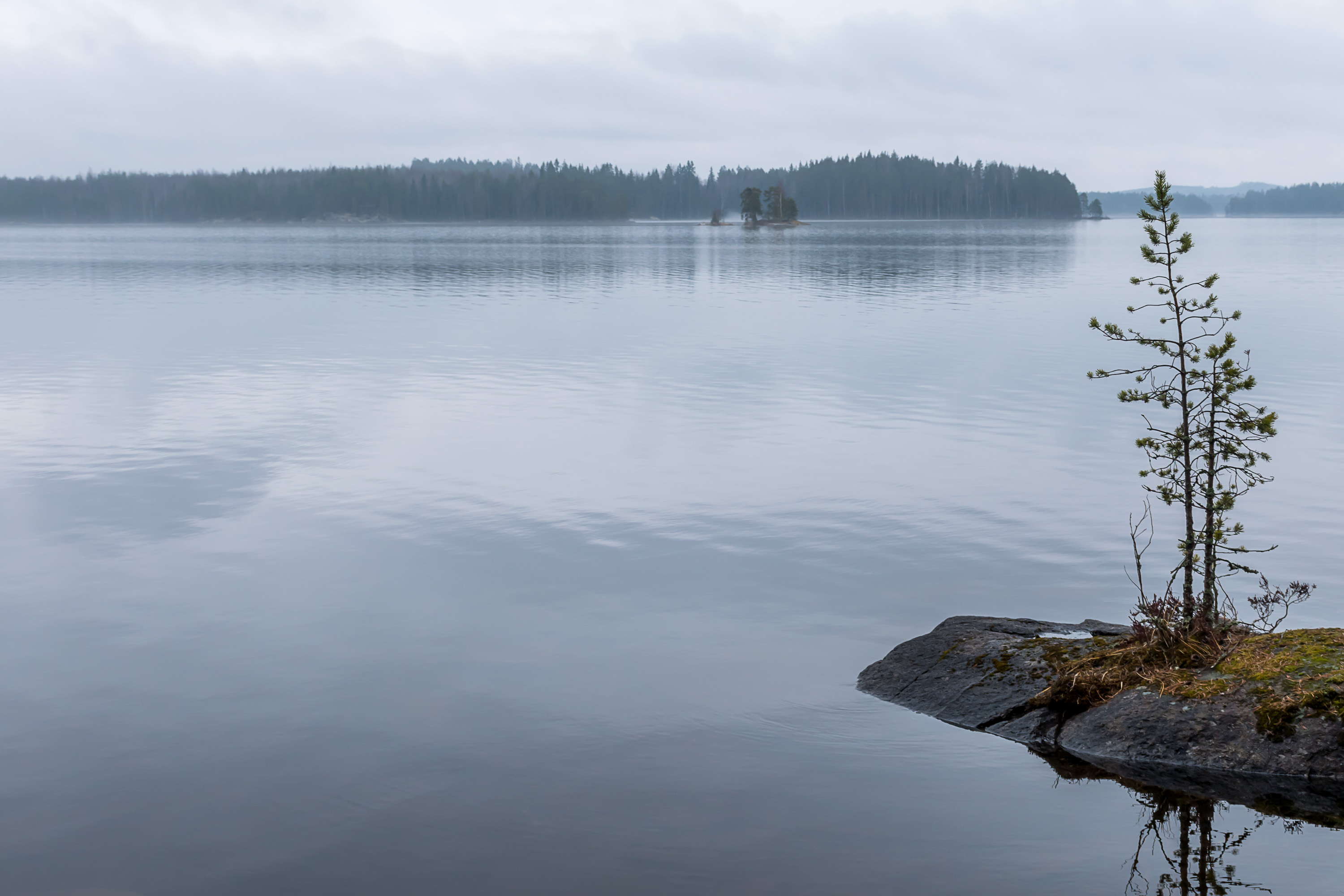
15.

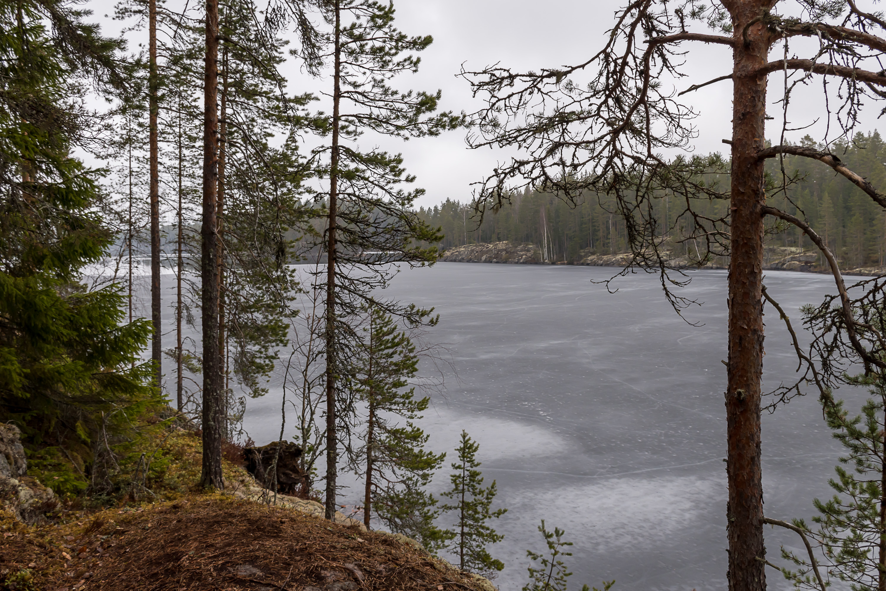
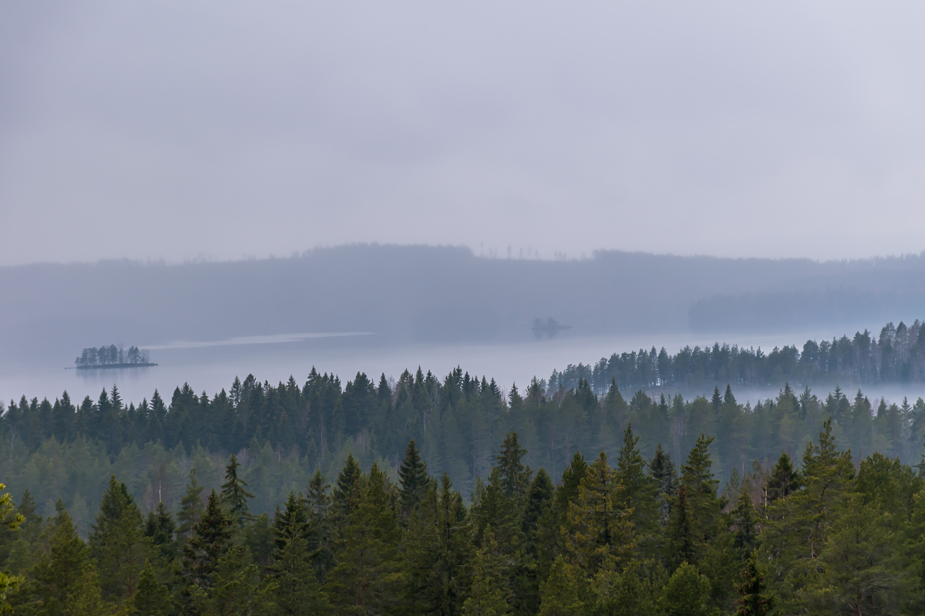
16. When I saw light fog over the lake expanse I thought "okay this gonna be good".

17.

18. Keskilahti (Finn. Central Bay) campfire spot.

19. Afterwards we're leaving the lake shore temporarily and climb Loukkuvuori (Finn. Trap Mountain) the first time. Here we actually reach a higher point than it would be the second time, but there aren't any good views from this point.

20. How can that tree even grow there?
21. Loukkulampi (Finn. Trap Pond) tiny lake at the foot of Loukkuvuori.
22.
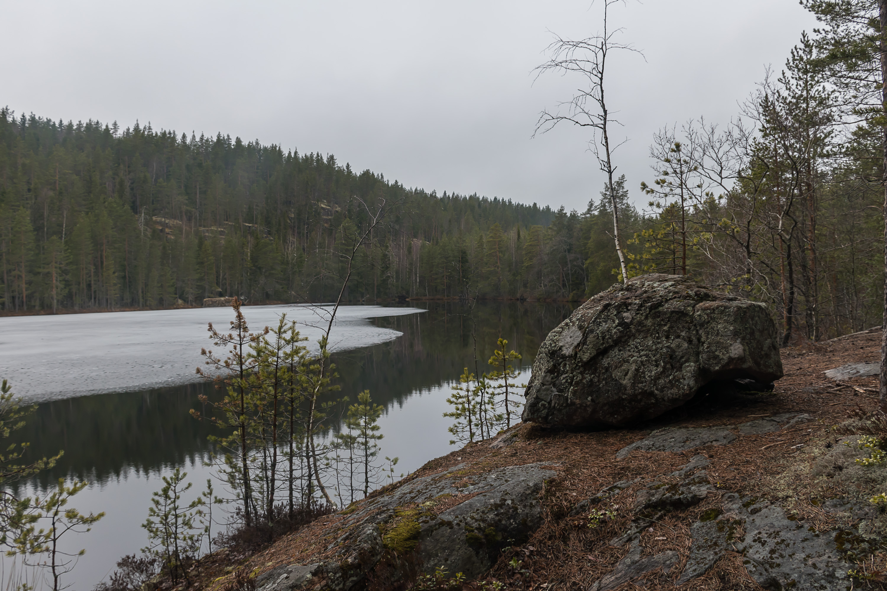
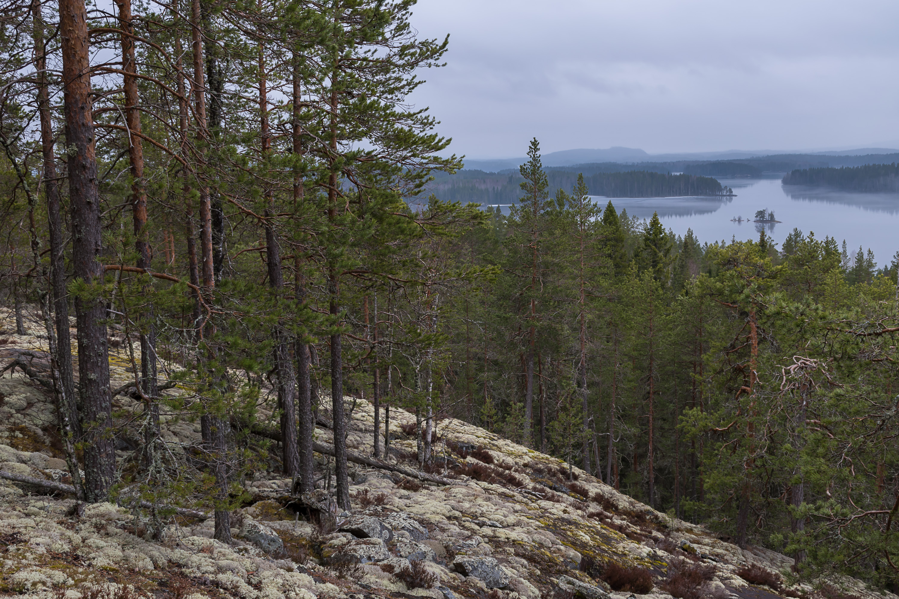
23. Then we reach the lake shore the second time, at the Enonniemi peninsula, and this times views are even better, and the trail section along the shore is much longer.

24.
25. Konnevesi coasts are full of smooth rocky outcroppings, the kind we call "ram's forehead" in Russia; those are of course ubiquitous in Finland in general too.
26.
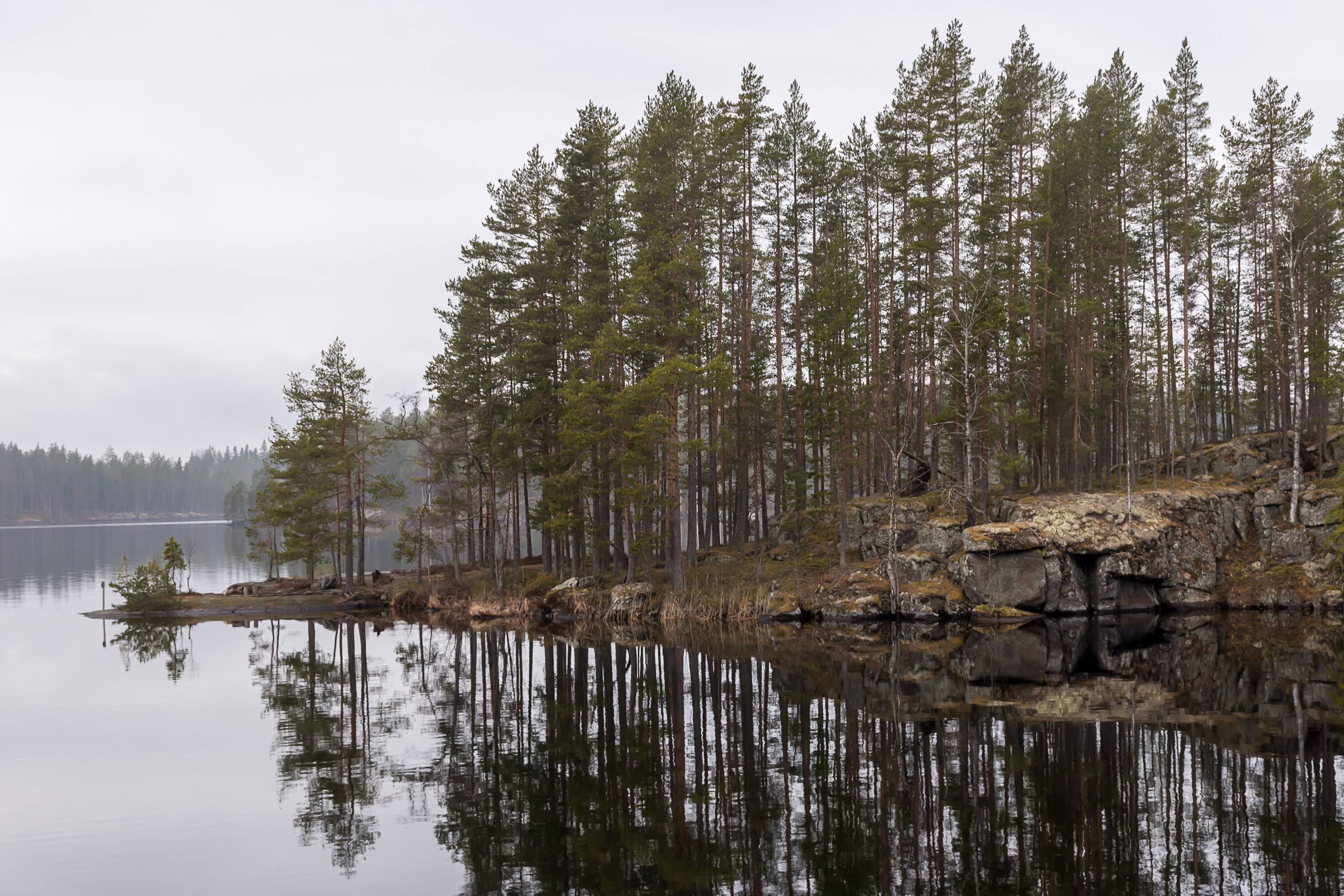
27. Some islands can be visible close by the shore too.

28. Large laavu shelter named Enonranta on the coast.

29. This place is also equipped with a small boat pier, so it is possible to visit the national park by boat, starting the hike from this location, and one of the (Loukkuvuoren Lenkki (Finn. Trap Mountain Walk), 2.8 km) has this pier as a starting point. Of course the large amount of rotten ice still remaining on the lake meant the boating season wasn't open yes.
30.
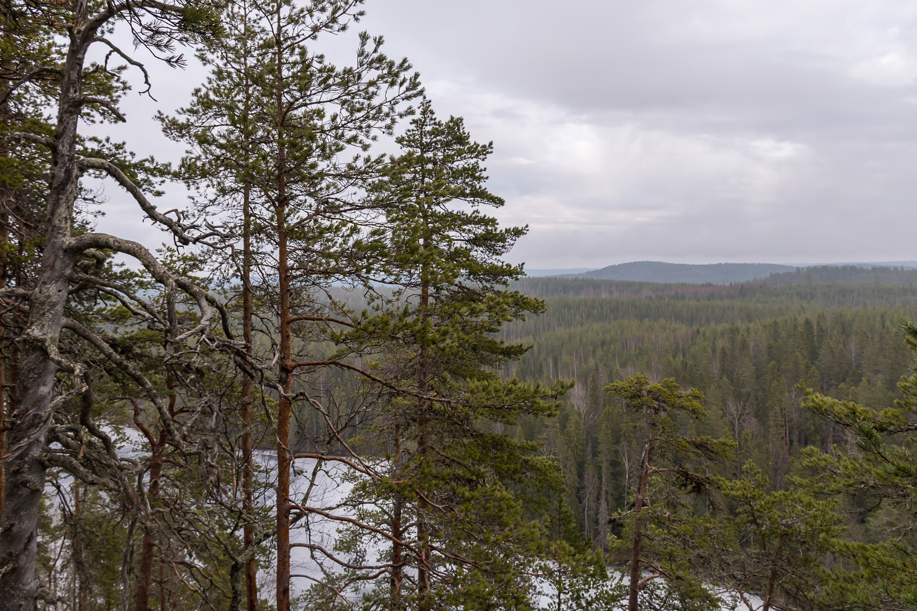
31. Some forest cutting can be visible beyond the lake, presumably in a place which does not belong to the national park area already.
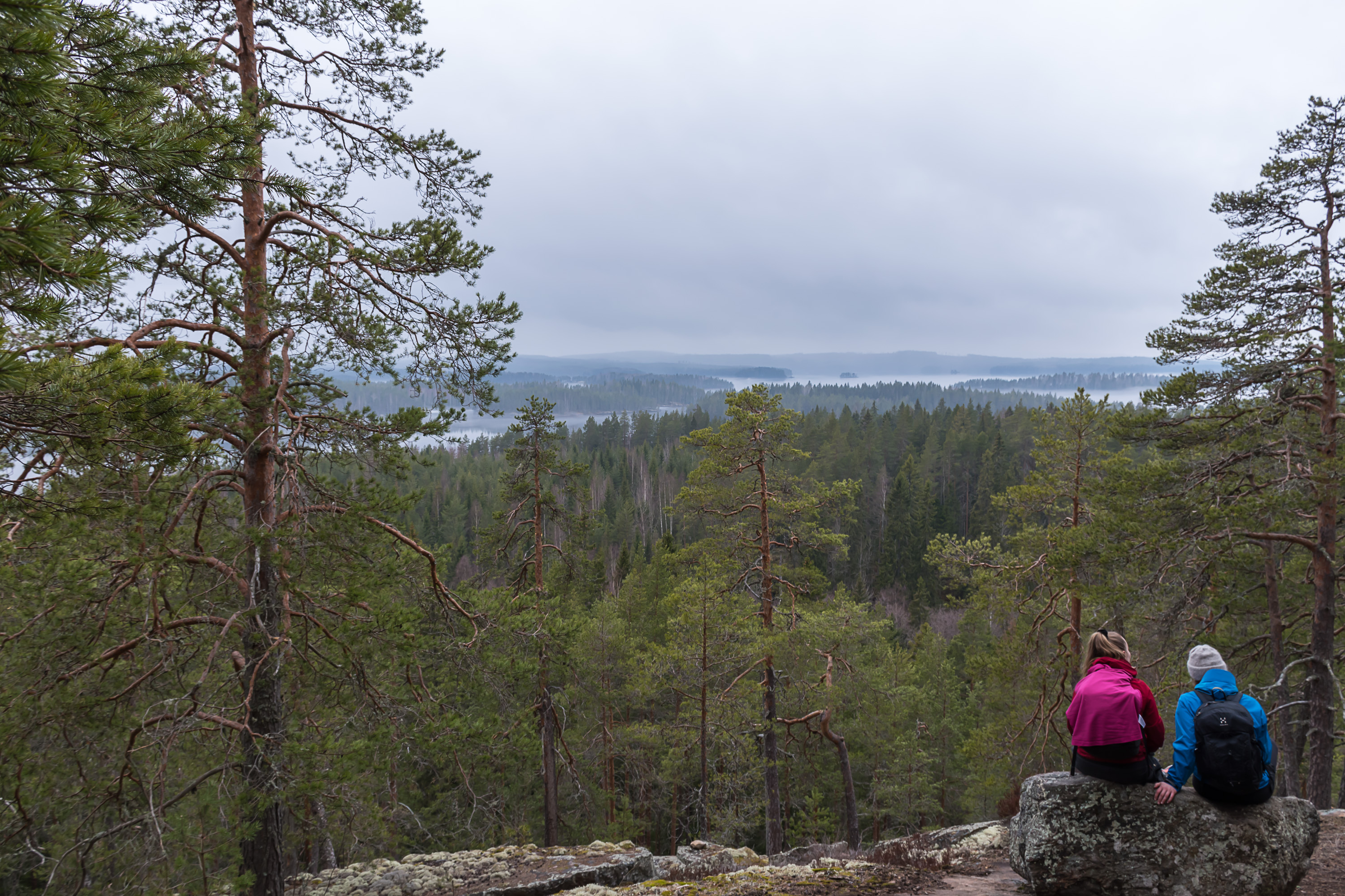
32. Then the trail goes away from the coast for good, but it's not the last time you can see the lake. The trail goes close by a lookout point on the slopes of Loukkuvuori hill. The actual lookout point is not on the long Kolmen Vuoren Vaellus trail, but the detour is only 200 m in one direction and by that point you've basically climbed nearly all the way anyway, so there's no reason not to have a look, and it's well worth it.
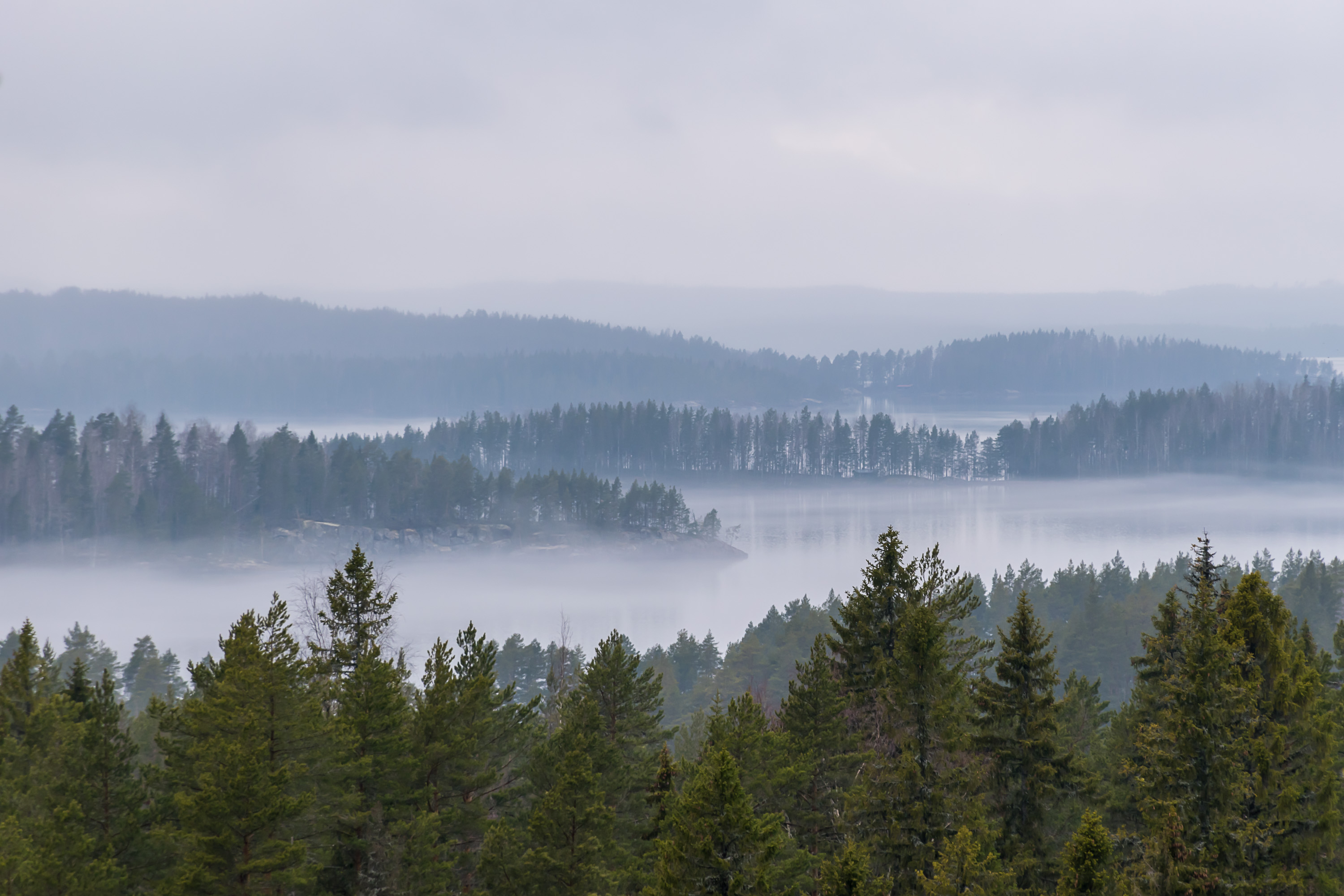
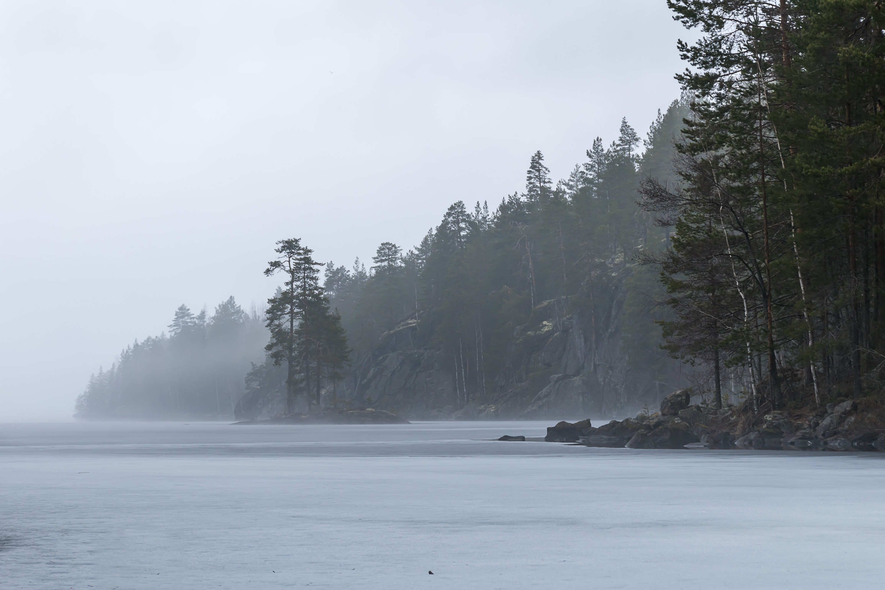
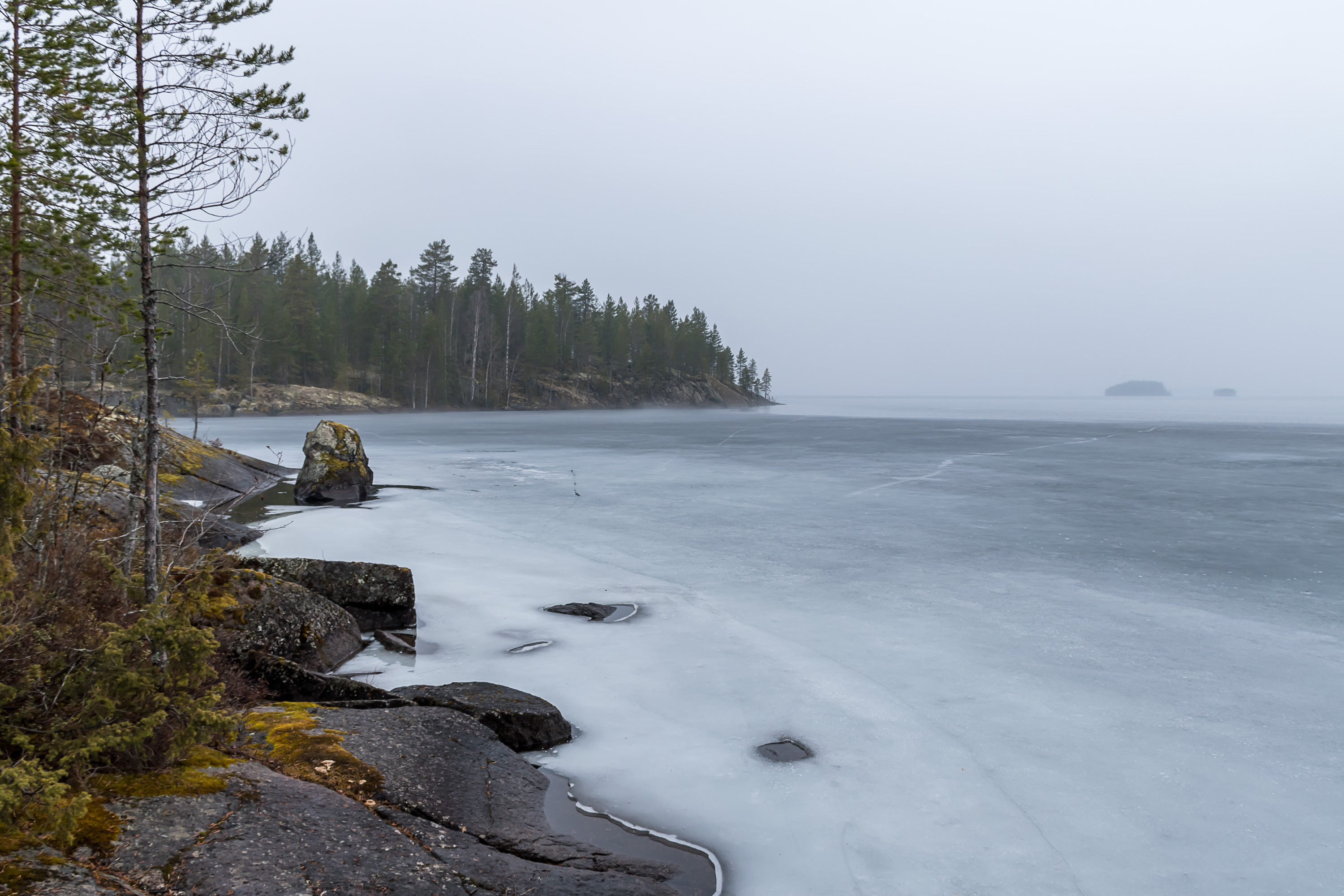
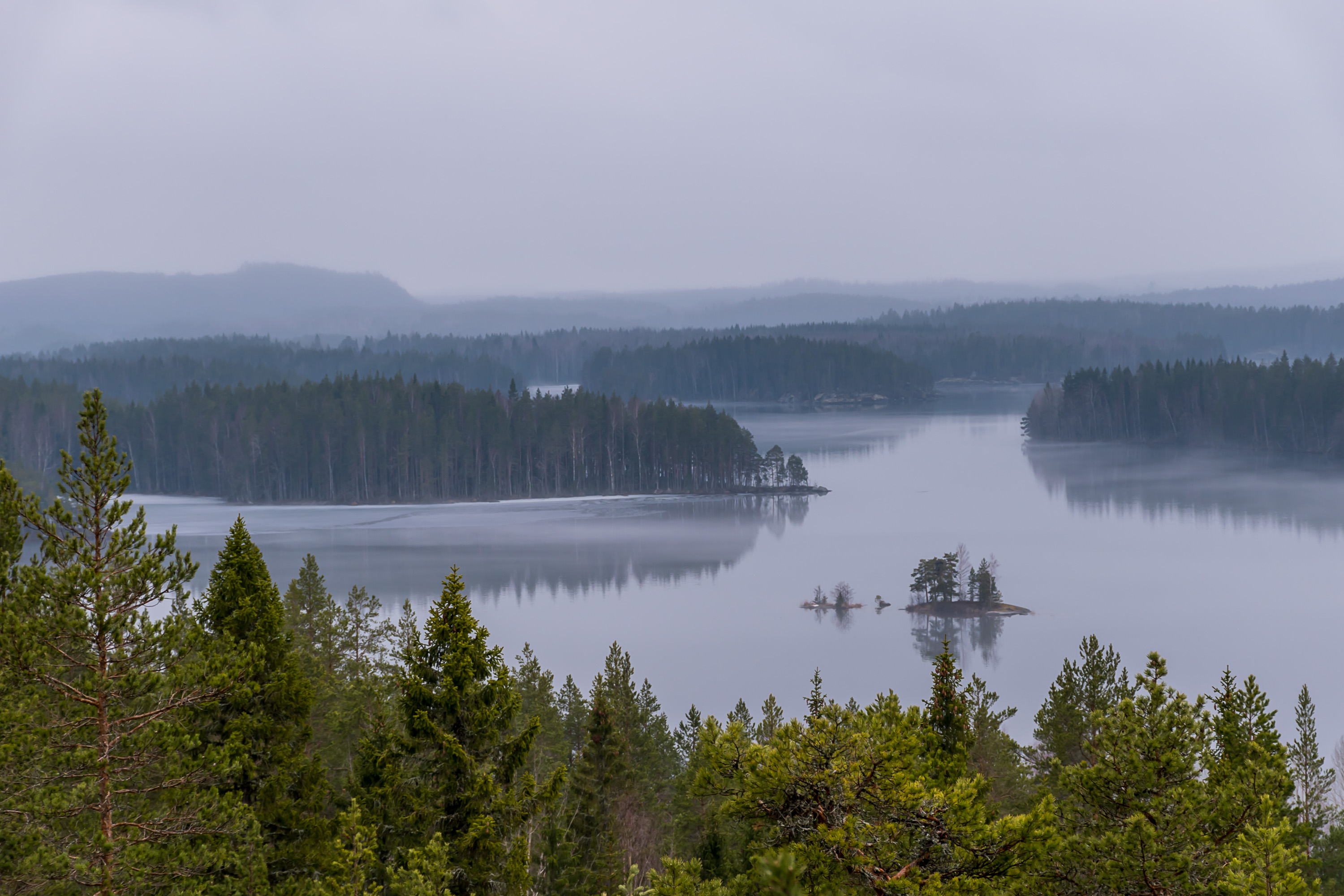
33. This view from Loukkuvuori onto the lake and its islands and shores was my best picture from that trip, and really the best picture in quite some time.
34.
35. The conspicuous forest cutting is visible from here too.
36.

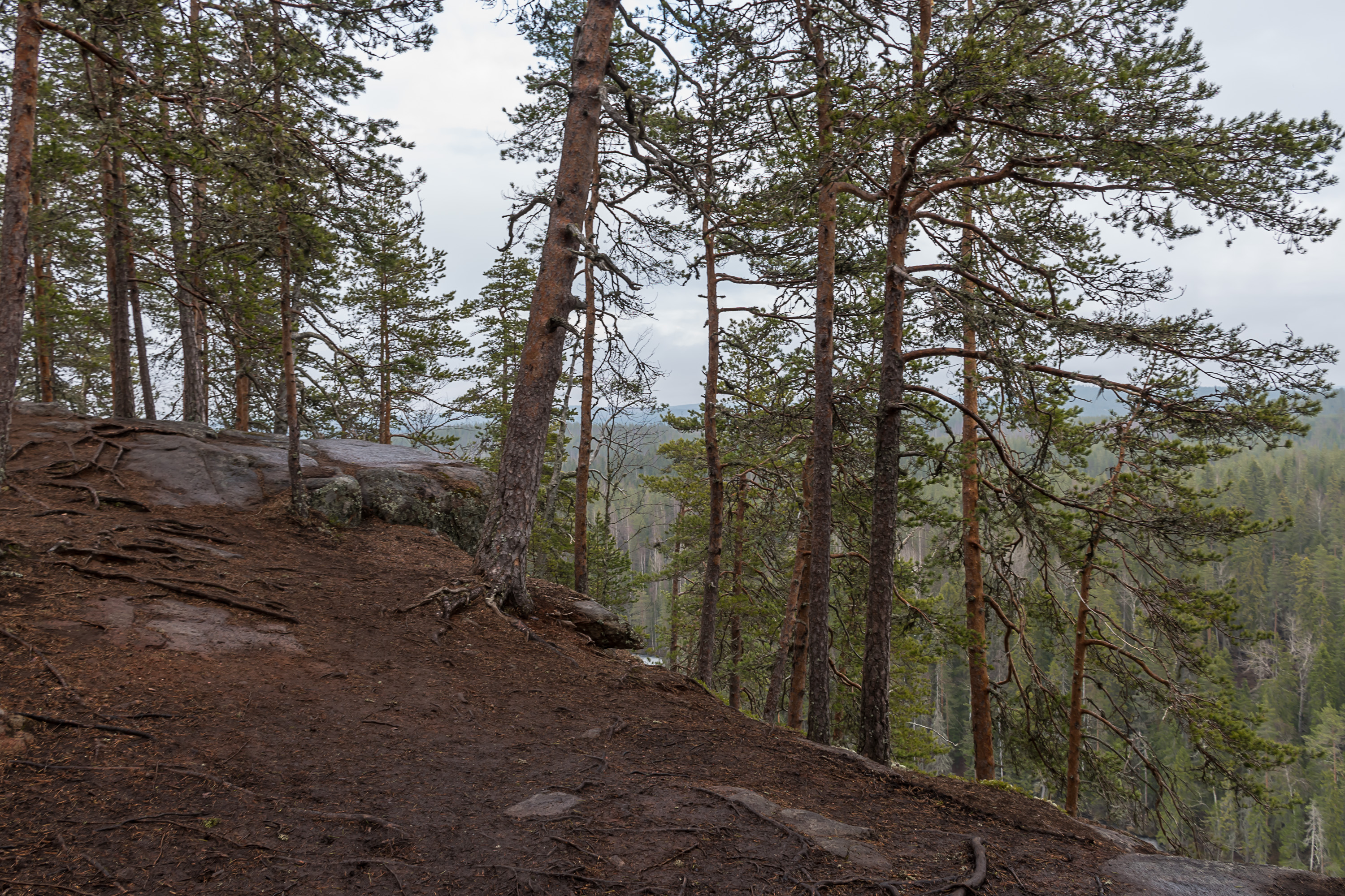
37. Crossing one more forest road. We're getting closer to the end, and the signs already point to Vuori-Kalaja, that laavu at the small lake where we would make a full circle.
38. But first there's a somewhat longer detour to another hill, Kalajanvuori, which is overlooking the Vuori-Kalaja lake and is actually the biggest hill in the area, 211 m above sea level and 77 m above Vuori-Kalaja. Before the national park was established, this was the only well-known natural sight in the area. A shorter trail from parking area (Kalajan Kierros (Finn. Kalaja Round), 4.6 km) visits just the top of this hill so you can do that trail if you don't feel like walking 17.5 km. The information signs about the local nature and history are present only along this Kajalan Kierros trail, not the long route. However I would very strongly recommend the long option, just Kalajanvuori in my opinion wouldn't warrant a long trip all the way to this national park.

39. The view from the edge of Kalajanvuori is in the eastern direction, so you cannot see the big Konnevesi here, but rather can enjoy the 77 m drop over Vuori-Kalaja.
40.
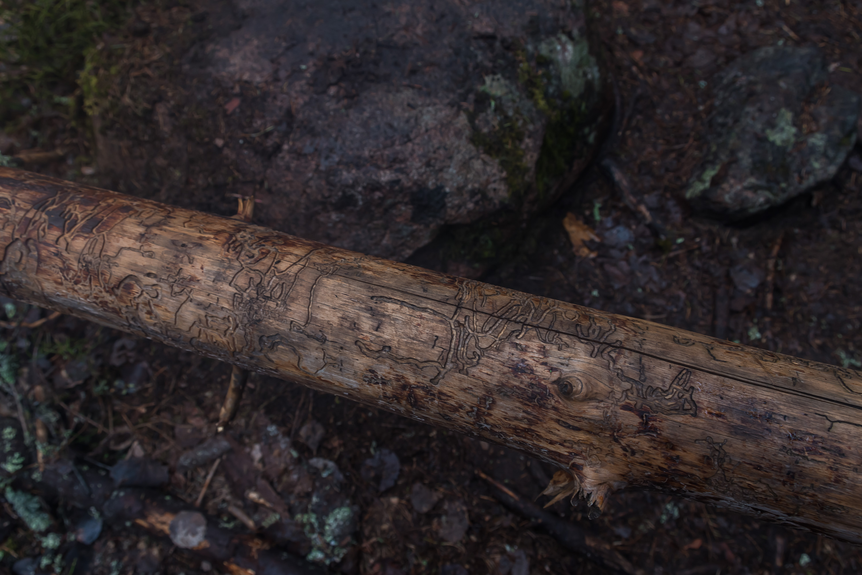
41. A fallen tree where you can see the pattern of damage under the bark caused by bugs.
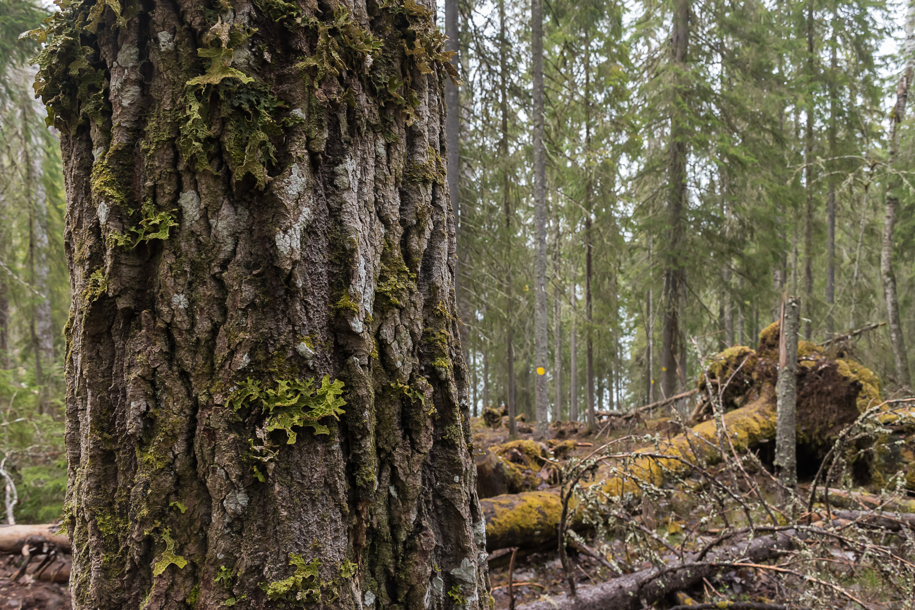
42. The national park is also known for its old aspens, and at least one aspen grove can be found near Kalajanvuori.
43. Aspen trunk.

44. Kalajanvuori seen from the bottom.
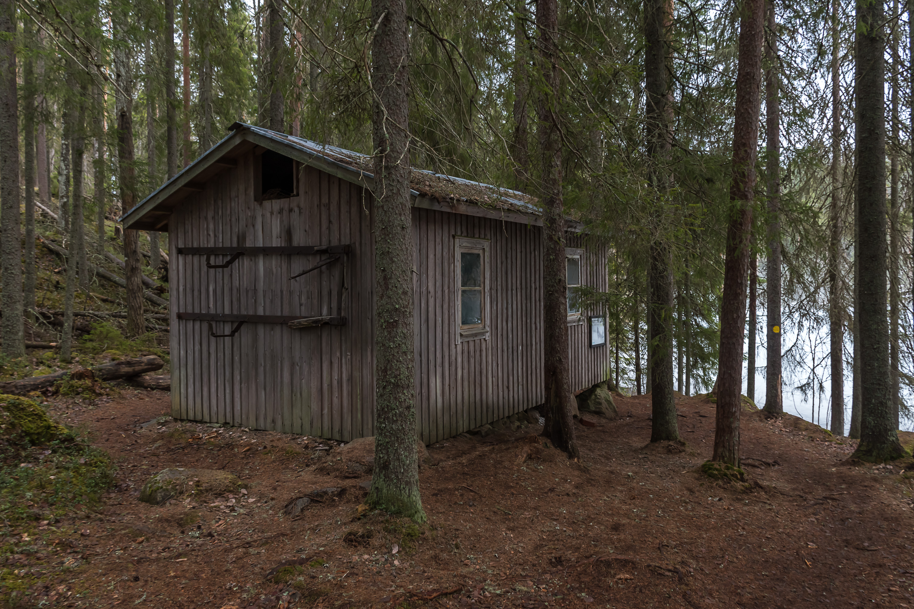
45. A hut of an old resident, a Karelian evacuee, preserved. I'm not sure if this was a house for permanent living or just a hut for sleeping while doing forestry work.
46. Just as we were approaching the Vuori-Kalaja shelter, the sun briefly peeked out.
47. And after Vuori-Kalaja there was only the easy short trail back to the car remaining, and after that a rather long drive to Jyväskylä. 28th national park, check!