Suolahti (Finn. Marsh Bay) is a minor industrial town of about 4200 people in Central Finland (Keski-Suomi) region of Finland, which, despite its name, is technically not in the actual center of Finland, but more in the center of its southern half. It is located about 35 km north of Jyväskylä, the center and overwhelmingly the largest city of the region. Suolahti was an independent municipality until 2007, when it was merged with the nearby town of Äänekoski (Finn. Loud Rapids), just 7 km west of Suolahti and about twice bigger than it. Within its current municipal borders the city of Äänekoski is about 1150 sq. km large and has a population of about 19,000, including, apart from Äänekoski and Suolahti, a number of villages and farms.
Suolahti is not an old population center (here in inland Finland old population centers are generally few and far between) and existed as a town only since the 1930s. Its history is mostly unremarkable. Currently the biggest local business is Valtra, a tractor plant. It has existed since 1951, originally as a subsidiary of Valmet, a huge Finnish state-owned post-war industrial conglomerate (Valmet means Valtion Metallitehtaat, "State Metal Works", and Valtra is of course an abbrevation of "Valmet" and "tractor"). The production has been moved to Suolahti in 1968. Valtra is actually a pretty big business, one of the leading Western tractor manufacturers, with half a billion euro in revenue. Apart from Suolahti factory they have had one in Brazil since 1960; it was one of the biggest Finnish industrial investments abroad at the time. Valtra has been owned by AGCO corporation (USA) since 2004, but still operates under the older brand, and employs over 900 people at Suolahti. Presumably many if not most of them live outside Suolahti itself; the actual factory is indeed a bit in the middle of nowhere a few kilometers away from the town.
The reason I'm writing about Suolahti is however not tractors, but railroads and canals.
Most of Central Finland is a part of the great Finnish lakeland, and Jyväskylä sits in the northern end of Päijänne, the second biggest lake of Finland, stretching about 125 km from north to south but relatively narrow, about 20 km wide on average. Northeast of Jyväskylä there is however another major lake, named Keitele. Keitele is about twice smaller than Päijänne, approximately Y-shaped, 40-50 km at the longest. It is in turn the 9th biggest lake of Finland, but is much more obscure than Päijänne, even for most Finns themselves; probably because there are virtually no population centers on its shores, with Äänekoski, Suolahti and Viitasaari being pretty much the only towns of any note, and even they are all really small.
Keitele waters flow into Päijänne through a few smaller lakes, but until quite recently that waterway was unusable for shipping or log floating because of numerous rapids. In truth Päijänne water system has never been really important for shipping, as it lacks connection to the sea; Päijänne drains through the river of Kymijoki, by far the biggest Finnish river flowing into the Gulf of Finland, but Kymijoki has been similarly blocked with rapids, and now also with numerous hydroelectric dams. Neither there are any canals that connect Päijänne with Saimaa, the biggest Finnish water system in the Eastern Finland which is connected to the sea through the Saimaa Canal. While some passenger and cargo steamboats operated at Päijänne back in the day, railroads and eventually highways made lake transport mostly irrelevant after the war already. (Recreational boating, on the other hand, is still huge on Päijänne, like on any Finnish body of water of any size.)
Another matter entirely is, however, log floating. Päijänne and Kymijoki coasts are full of cellulose, paper and other wood processing industry. Such factories exist, or had existed before, at least in Jyväskylä, Jämsä, Lahti, Heinola, Kuusankoski, Inkeroinen. All these factories traditionally worked on timber transported to them directly by waterways. And it is for that reason also why it was considered quite desirable to join Päijänne with Keitele, to be able to easily use timber logged in sparsely populated woods around Keitele area.
The canal between Keitele and Päijänne, however, has lingered at a planning stage for decades. Due to lack of a canal, timber was transported between Keitele and Päijänne by railroad, an arrangement that came to be known as "iron canal". A railroad was built from Jyväskylä to Suolahti in 1898 already for its lake harbor; the station at the time was located right on the coast of Keitele, and it probably was why the town of Suolahti started to grow around it. Eventually the railroad was prolonged to Äänekoski (replacing the private Suolahti-Äänekoski narrow-gauge line), and then to Haapajärvi pretty far away, and in 1952 Suolahti got a new station beside the old harbor one. The old station was used for the "iron canal" in 1964-1993. Logs were floated on Keitele to Suolahti, then lifted out of water by cranes and loaded into trains, which then went to Jyväskylä, and there logs were similarly unloaded back into Päijänne lake at Keljo harbor on the outskirts of the city. Since 1983 railroad also started transporting private recreational boats on the "iron canal" trains, for a fee of course.
The real canal construction in the end was greenlighted only in 1988, and the most surprising part about it is that it actually was to be built by the Soviet Union. USSR engaged in considerable amount of bilateral trade with Finland, which basically meant barter trade. It was highly beneficial for both countries; Finland sold mostly its industrial production, and USSR paid back mostly with oil but also occasional construction projects such as Loviisa nuclear power plant. Keitele-Päijänne canal was another such construction project, but it came to be in the final days of the Soviet Union and in practice was built in 1990-1993, so mostly already by post-Soviet Russia by Zarubezhtransstroi (Зарубежтрансстрой, Russ. Foreign Transport Construction) company. It probably was the last bilateral trade exchange between the two countries; Russia was still subsequently left with a considerable debt to Finland which it eventually repaid.
The canal is in practice just a chain of lakes 45 km long, connected with a total of five locks bypassing existing rapids and dams, the longest lock at 700 m in length. The canal begins near Suolahti and ends at Vaajakoski in the eastern outskirts of Jyväskylä. Allowed ship dimensions are rather modest; maximum depth is 2.4 m and height clearance above water is 3.5 m, limited by a minor road bridge in Vuontee village. Upon its construction it immediately began to be used for log floating, replacing the "iron canal", but all log floating in the canal and in Kymijoki water system in general was ended in 2002; transporting timber by truck or train is simply more practical now. The canal remains now pretty much just for recreational use.
The old railway station in Suolahti, in turn, now houses a small rail museum. It is a rather obscure museum and I, despite having some interest in railroads, had no idea of its existence until I visited Suolahti. It is a summer-only museum, but some (although not all) museum rolling stock and old rail infrastructure is located outdoors and can be explored any time freely.
In this post we'll have a short look at Suolahti itself, then at the museum station, and then at some parts of the Keitele-Päijänne canal.
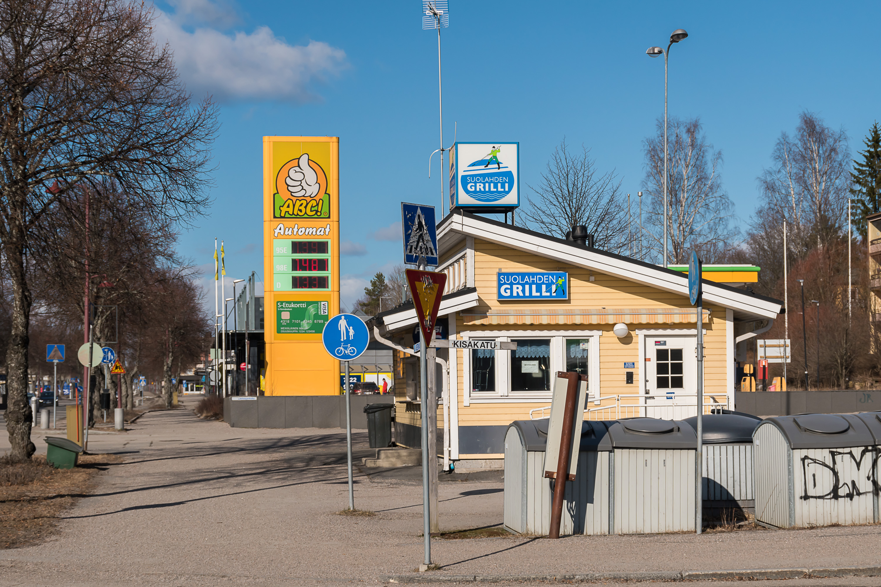
1. So here's Suolahti center, looking mildly depressing, with the gas station, the closed grilli food place and dumpsters. This is the central square/marketplace, but it is really quite small.
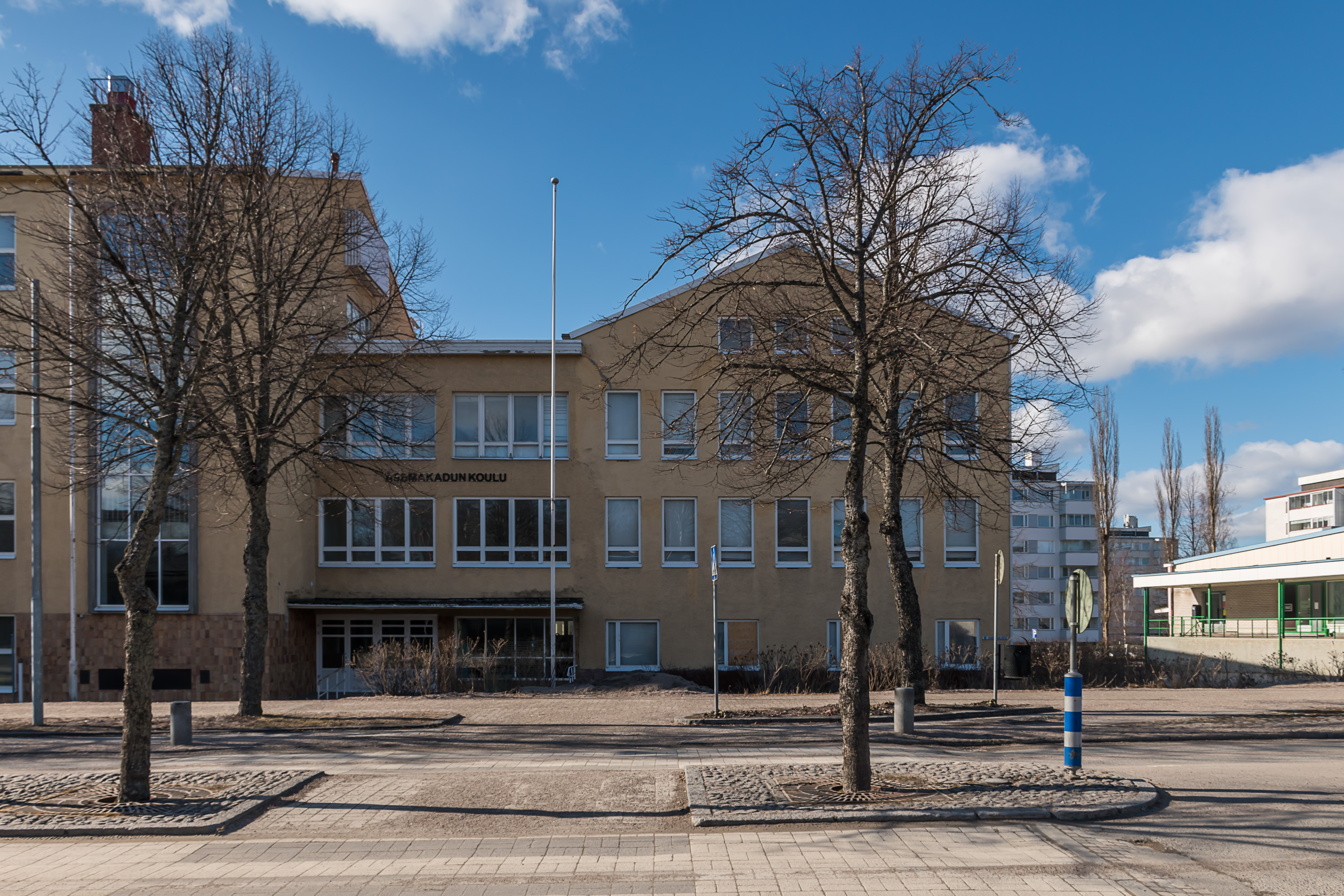
2. Most of the stores and offices are located along a single central street. So is the local school, painted in this characteristic sickly pale yellowish color of older Finnish schools.
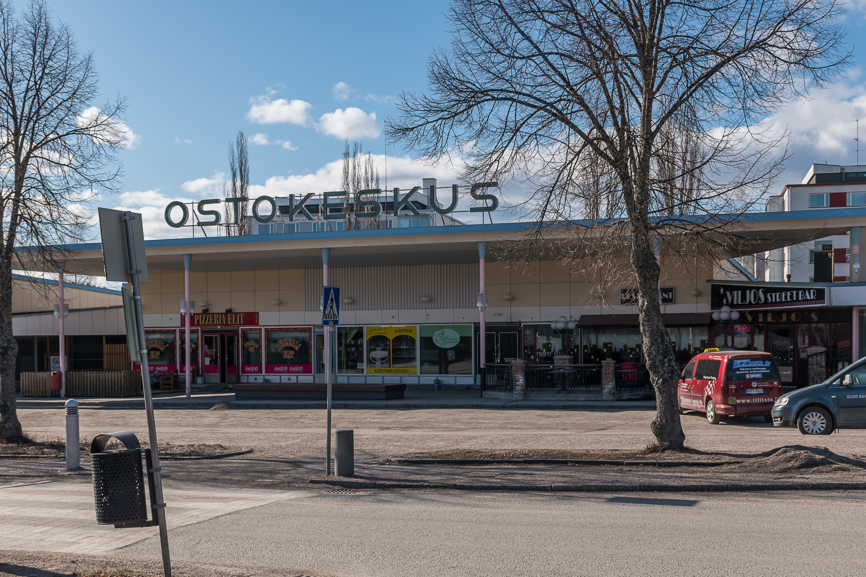
3. A local shopping center, with, notably, a night club.

4. Funeral services and a bar is always a good neighborship.

5. A local bakery.
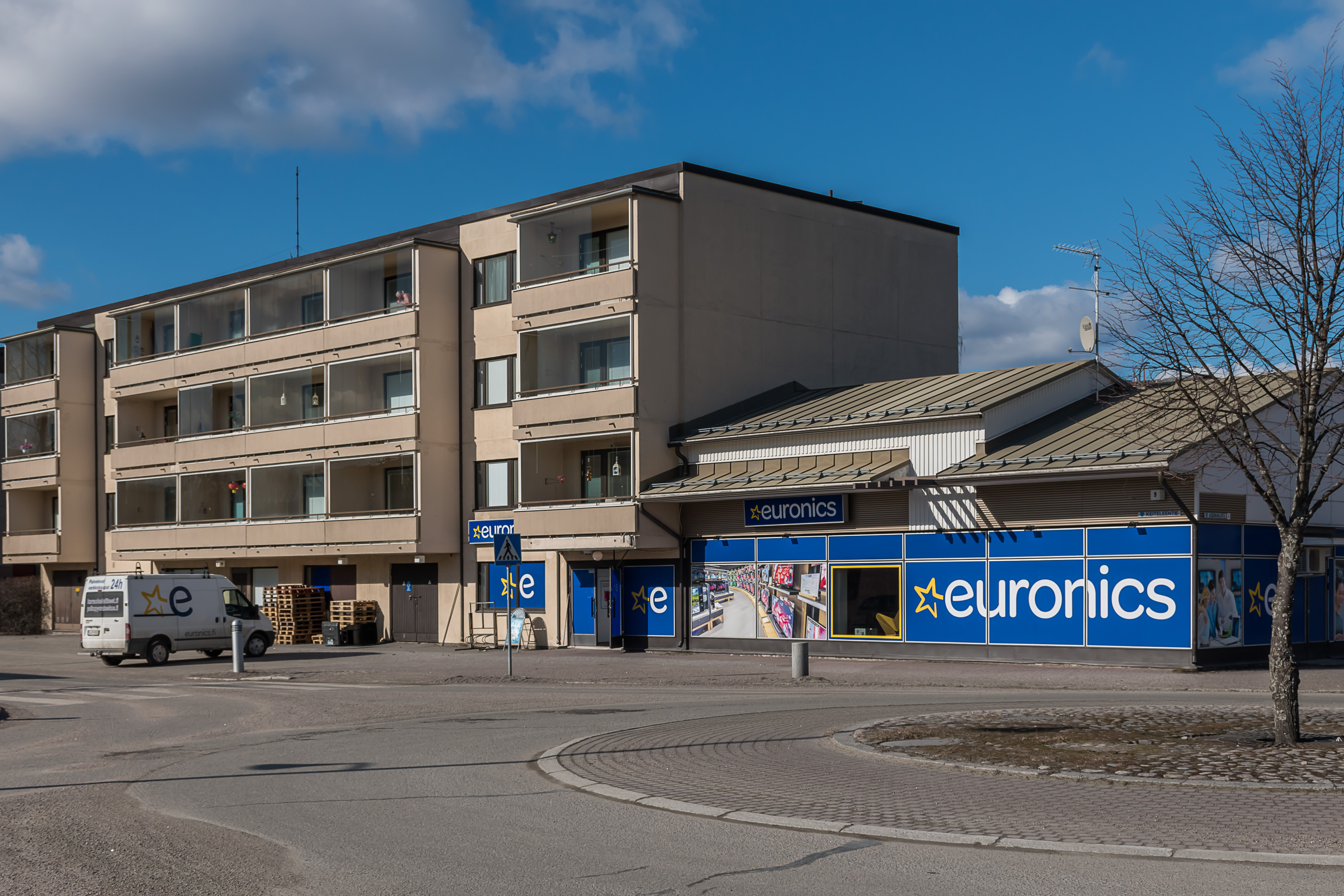
6. A home appliance store of the Euronics chain.
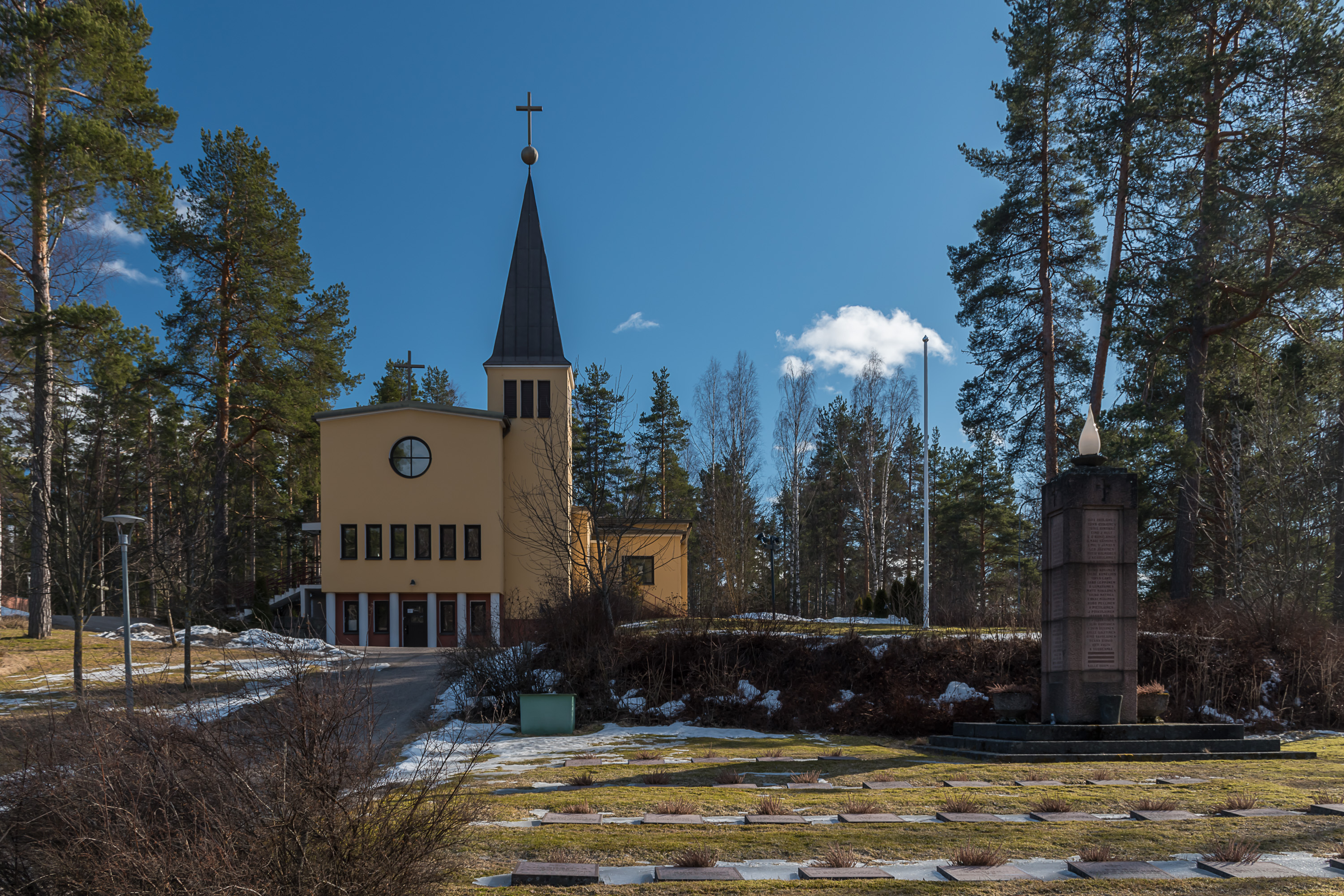
7. Suolahti church (and the traditional war cemetery). The functionalist-style church, built in 1940, looks rather distinctive (while there are many functionalist churches in Finland, some even built by famous Alvar Aalto, somehow this one doesn't look much like the other ones).
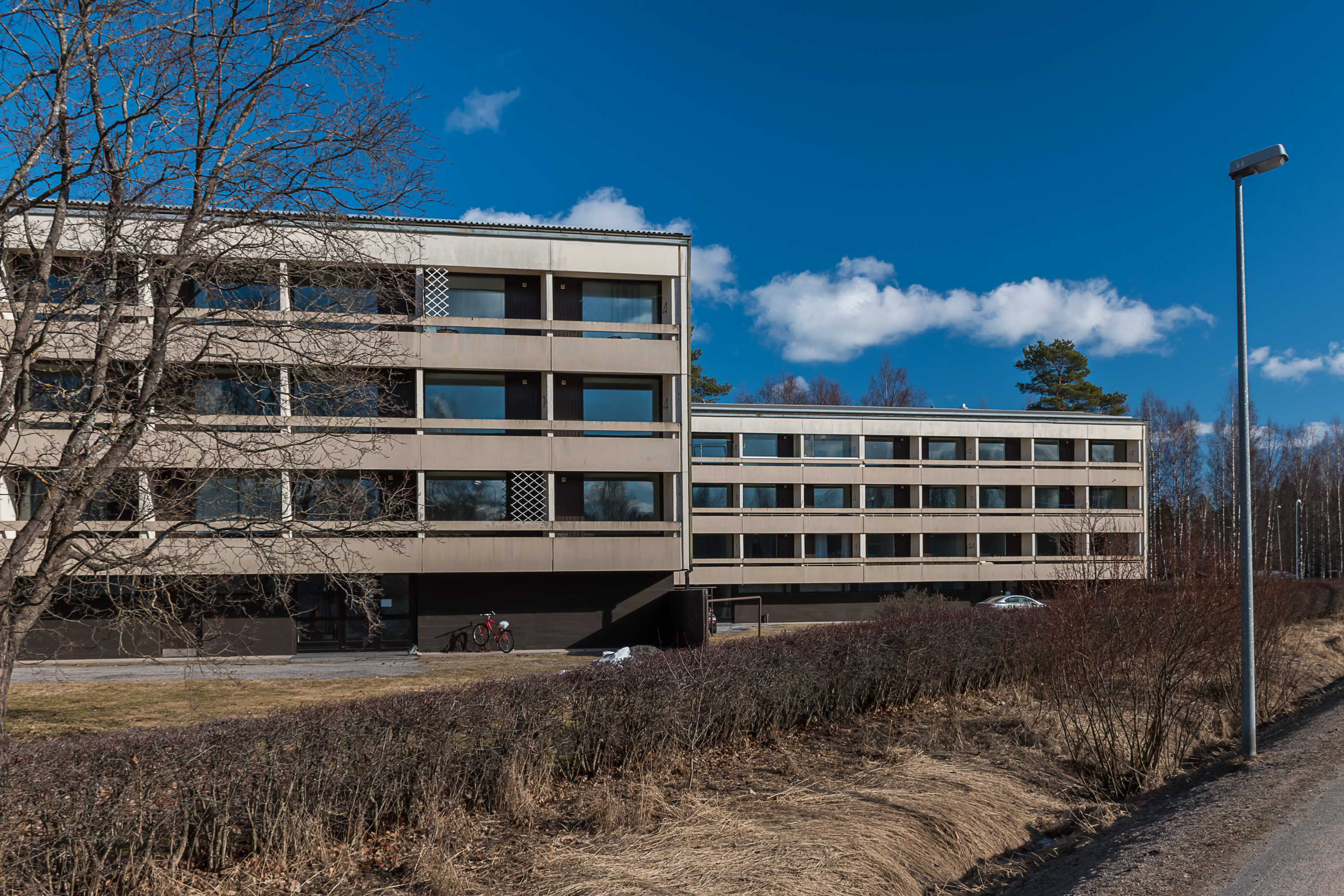
8. Residential buildings. Suolahti appears to be unusually dense for its size; most Finnish towns that small would have barely any bigger residential buildings, and most people would live in detached or row houses. There are of course detached and row houses in Suolahti too, but they don't appear to be that overwhelming.
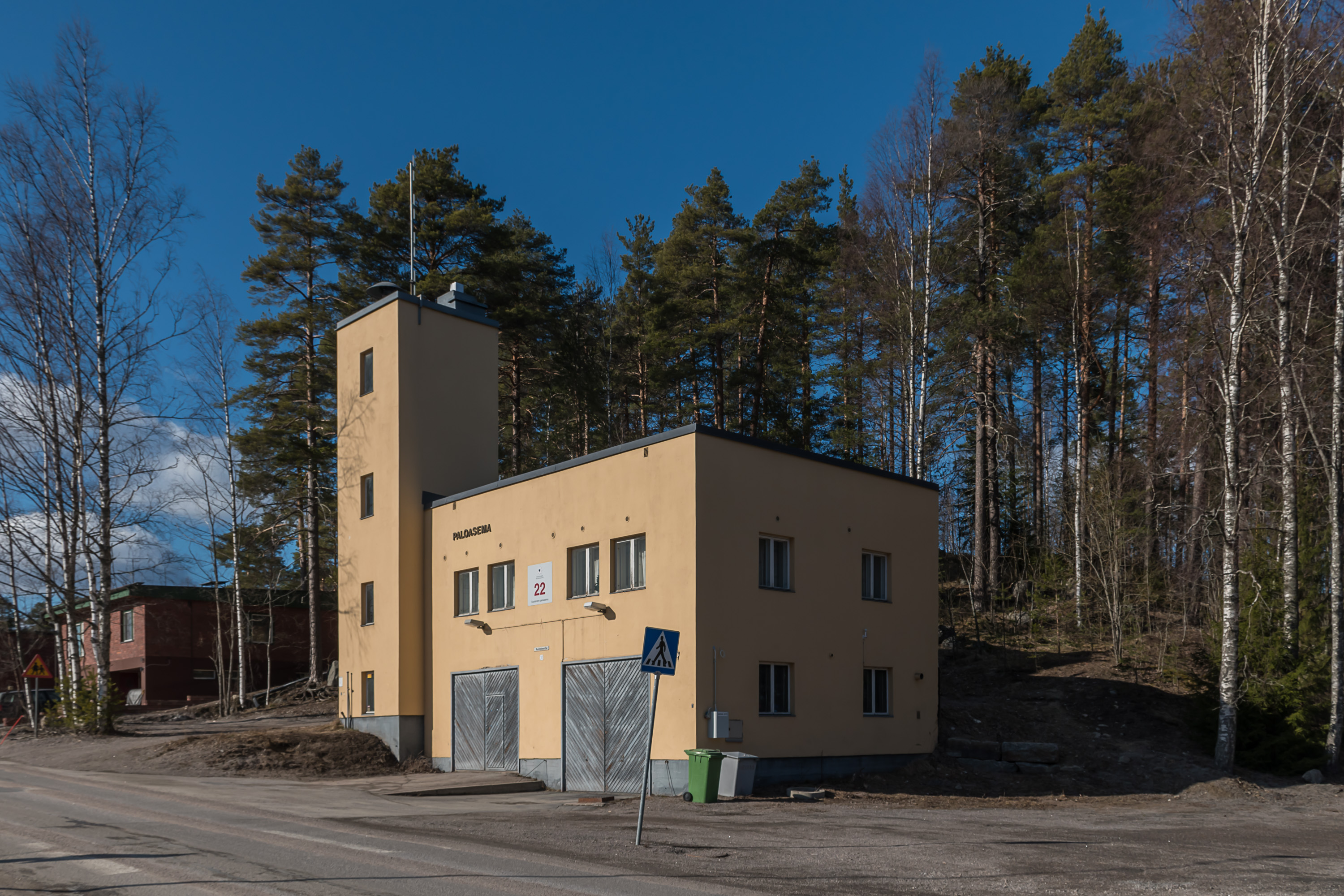
9. A tiny fire station.
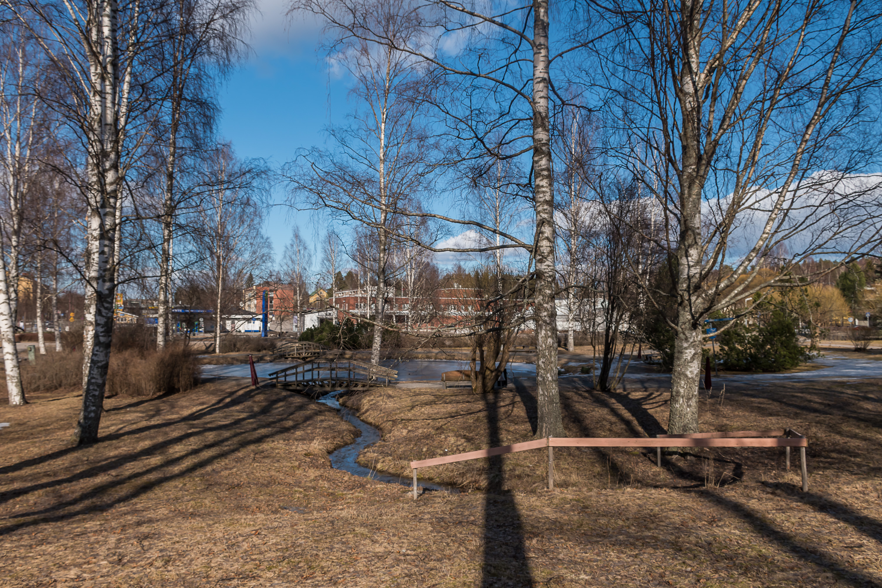
10. A nice small local park, with a brook flowing through it and a small pond.
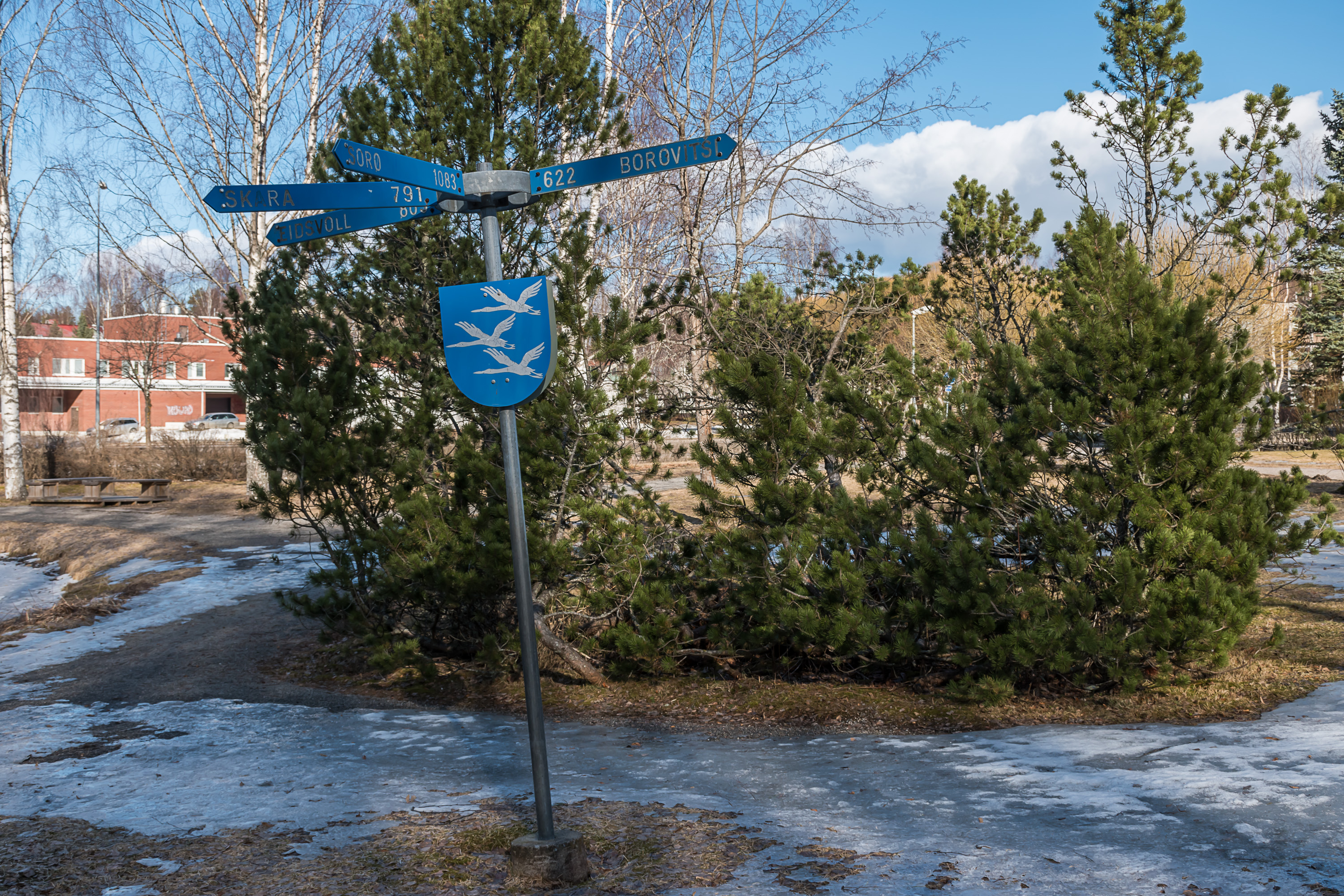
11. Suolahti has a few sister cities; those are called "friendship cities" (ystävyyskaupungit) in Finnish, so that is why this park with pointers to those cities is called "Friendship Park" (Ystävyydenpuisto). One of them, Borovichi, is a mid-sized city in Novgorod region in Northwestern Russia. Others are minor obscure towns from other Nordic countries.
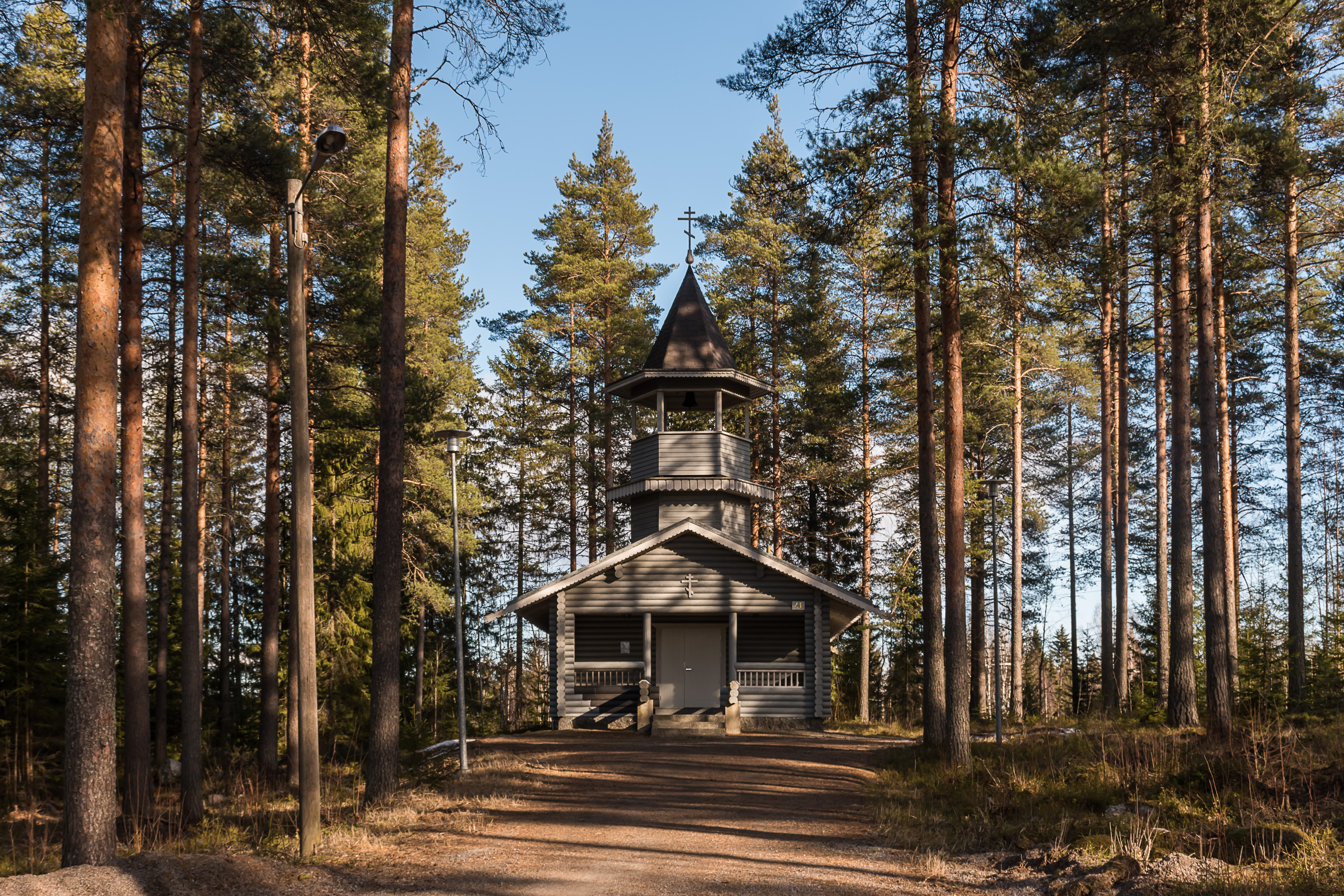
12. Curiously Suolahti also has a small but rather nice looking Orthodox chapel, despite it being a very small town and also not in those parts of the country that have relatively many Orthodox believers (those would be Savonia and Finnish Karelia).
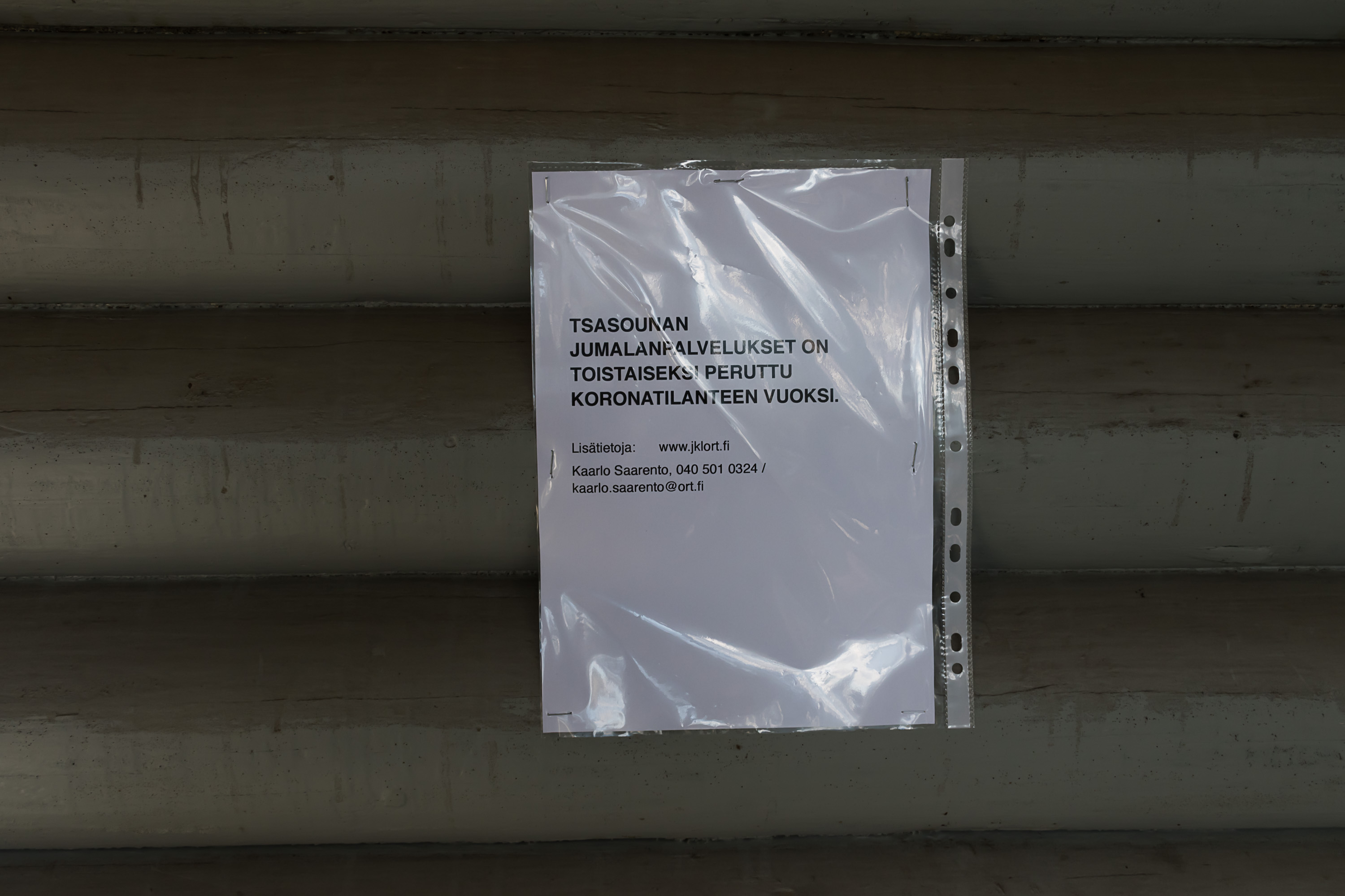
13. The pictures in this post are mostly taken during the corona epidemic times, and the chapel was closed due to corona like many other places are. Orthodox chapels have a special word for them in Finnish, tsasouna, from Russian часовня (Lutheran chapels are called kappeli).
14. Suolahti roads. This particular road could use some repair, but then it's a rather minor one of course (you can see from the four-digit number), and I cannot say local roads are in particularly bad shape in general.
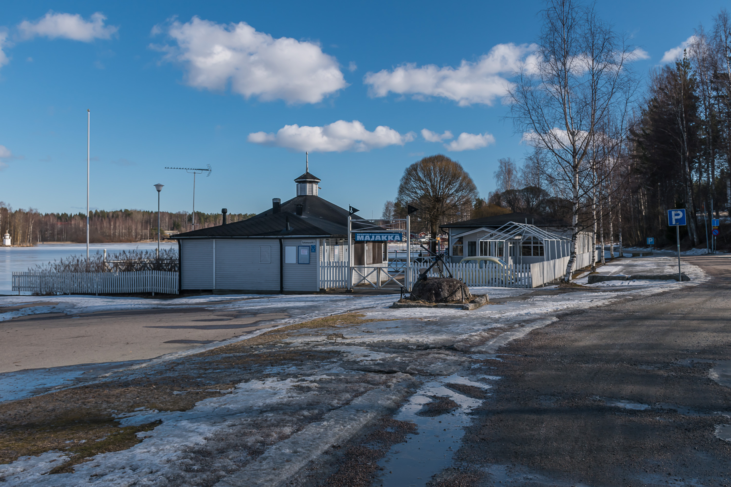
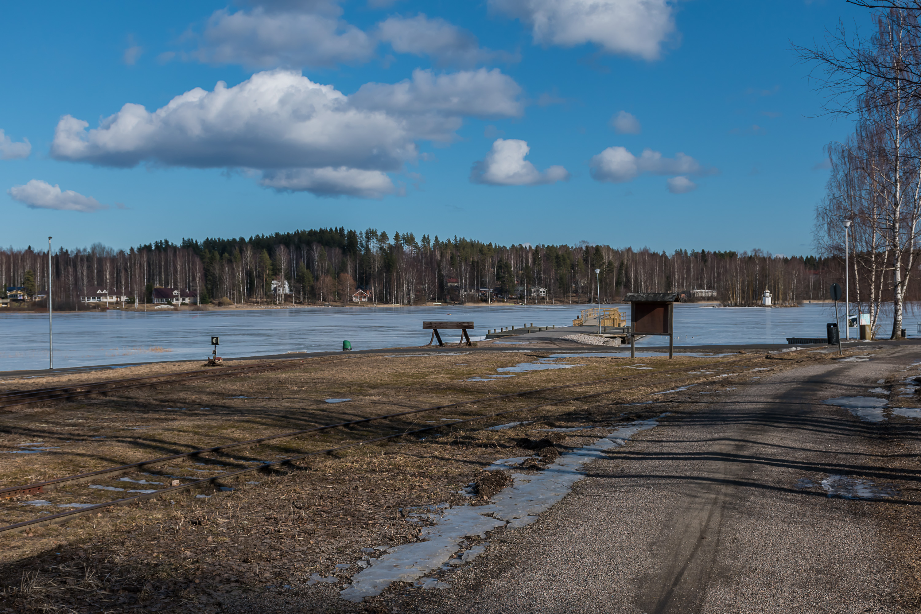
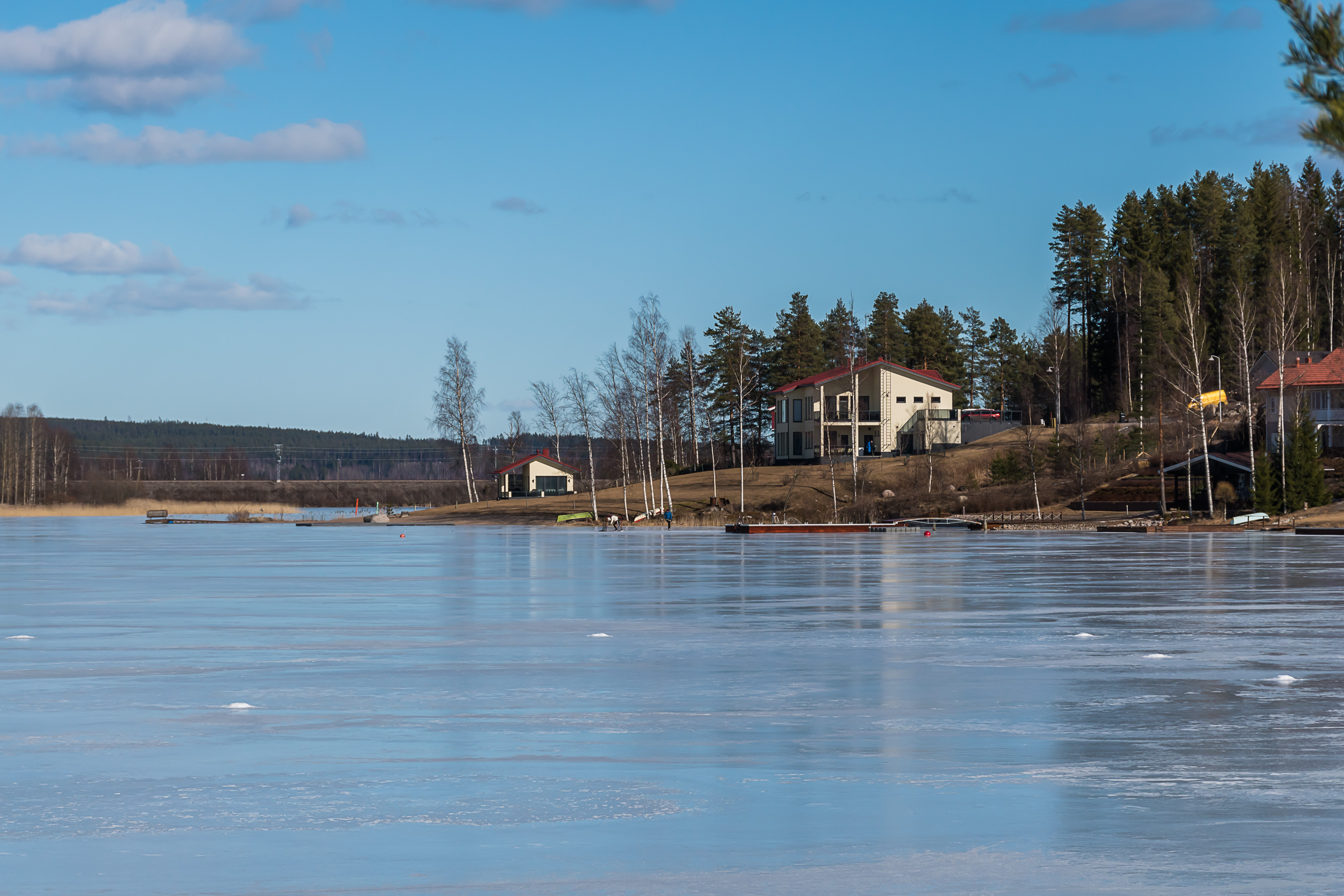
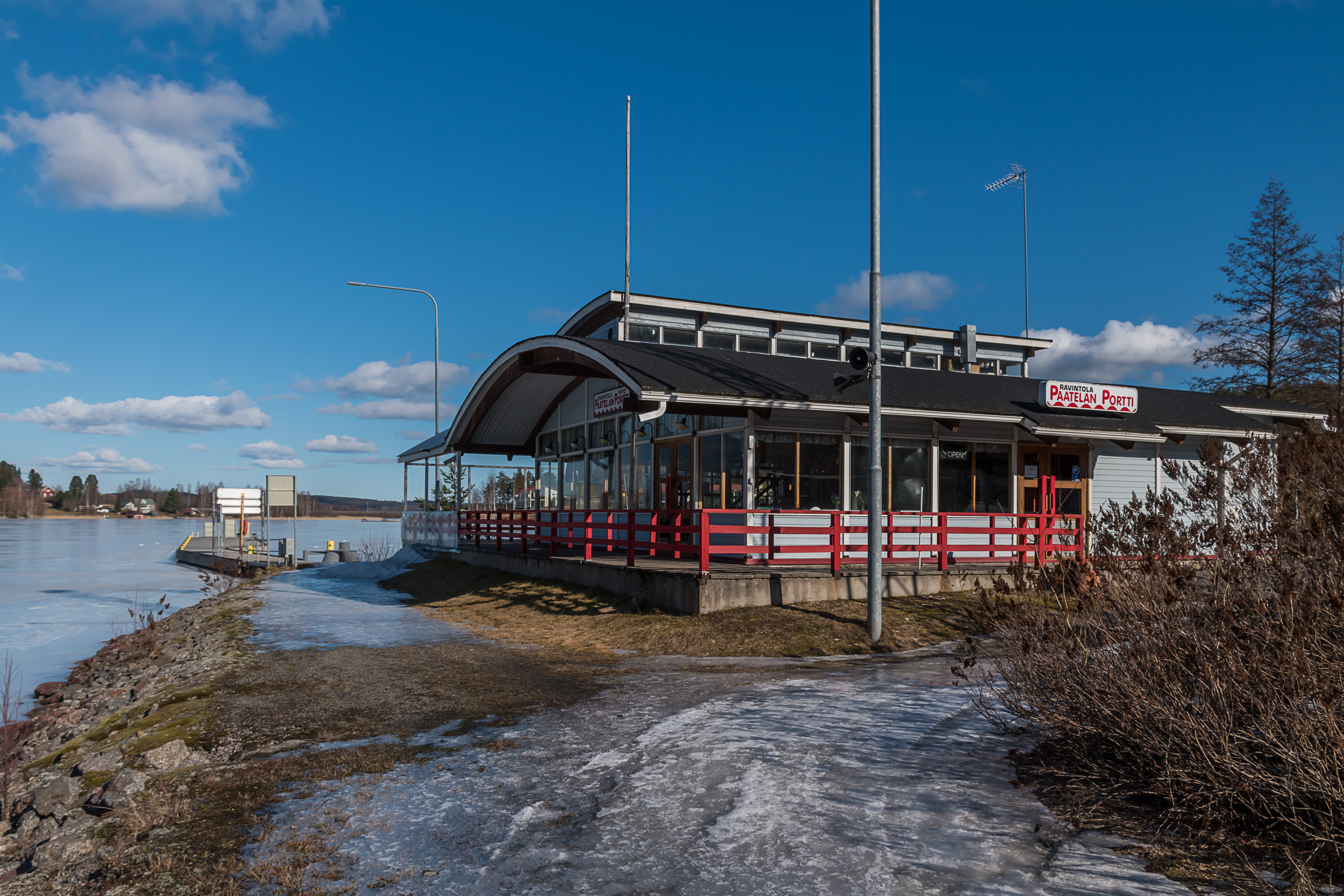
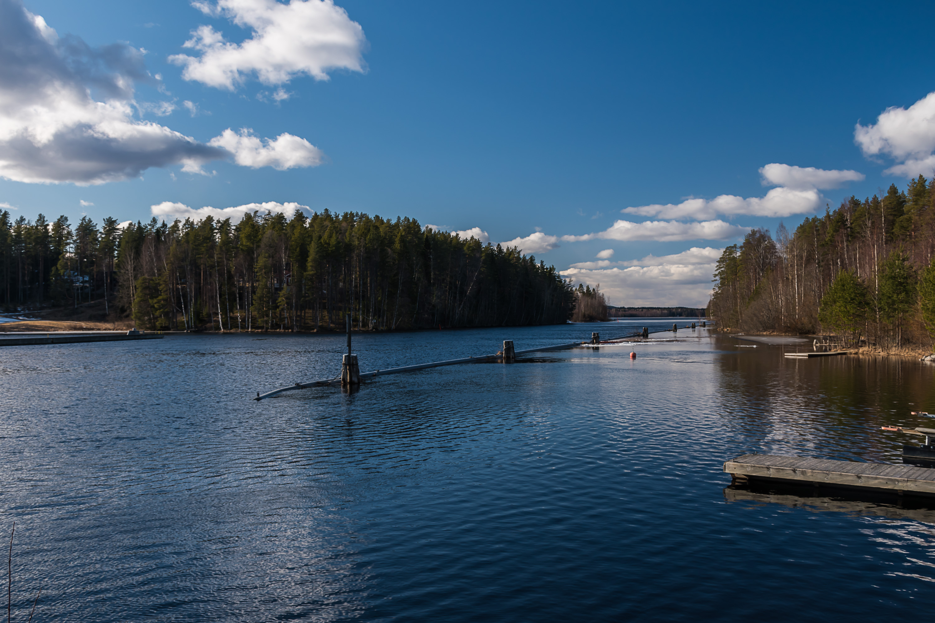
15. Keitele shore and a restaurant there.
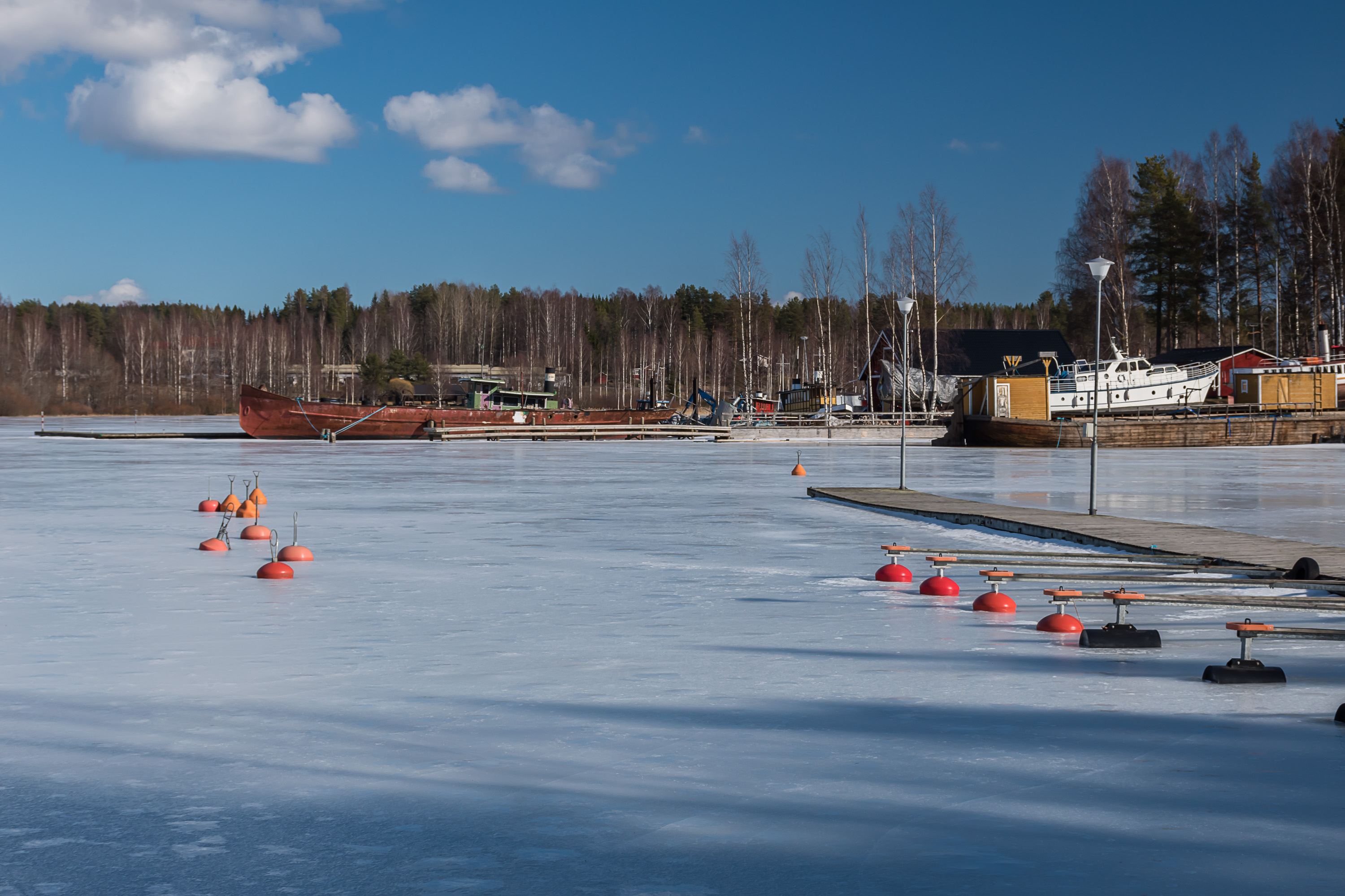
16. Lake harbor. Some older steamship is visible, but I don't know exactly which one that is. There is in fact an old small shipyard in Suolahti, which nowadays is working on restoring old steamships. A few years ago they apparently started to restore Ylä-Keitele (Finn. Upper Keitele), which was the biggest steamship on Keitele, built originally in the same place here in Suolahti in 1907. However I couldn't find any information on how that project has proceeded.
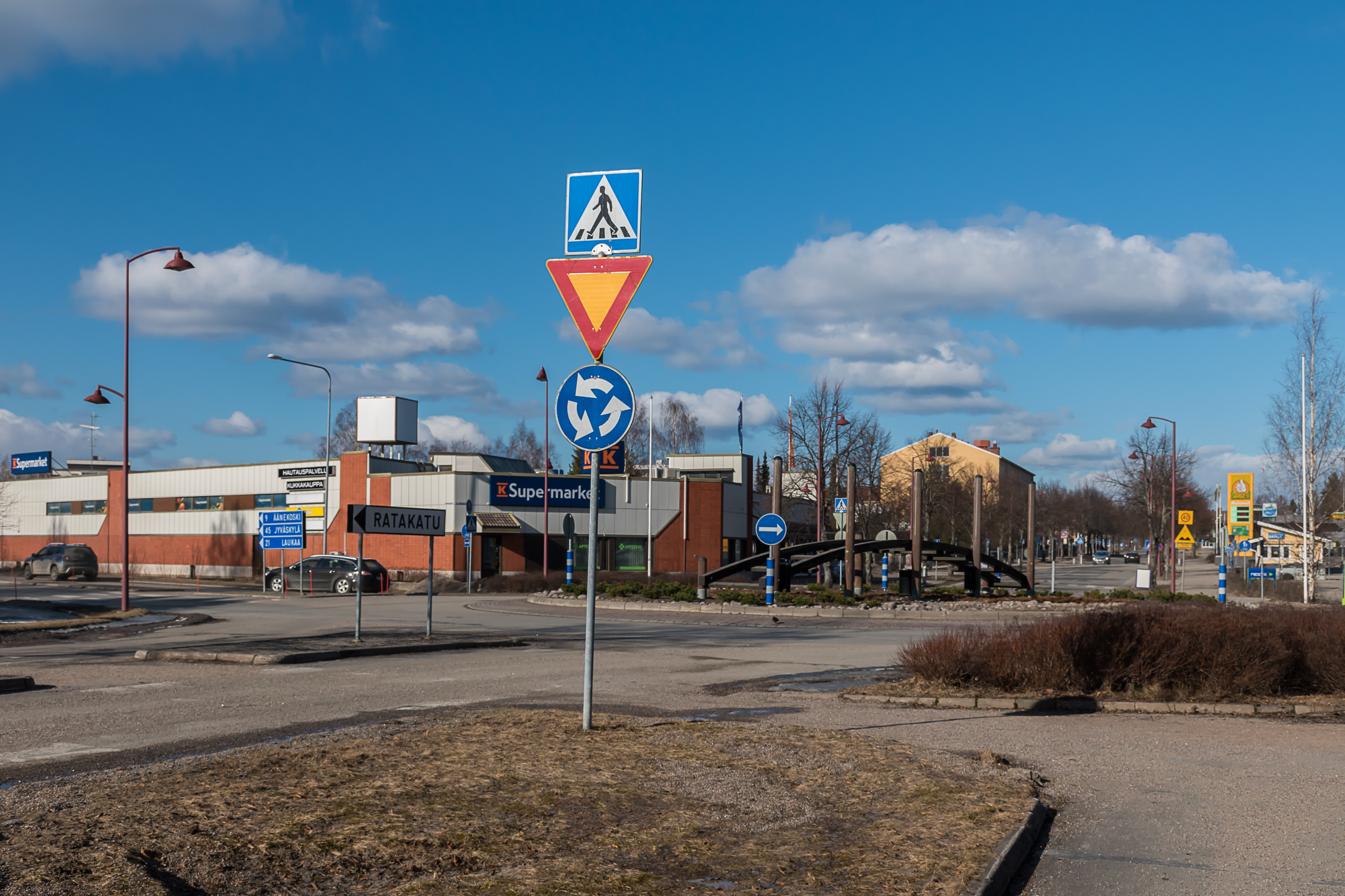
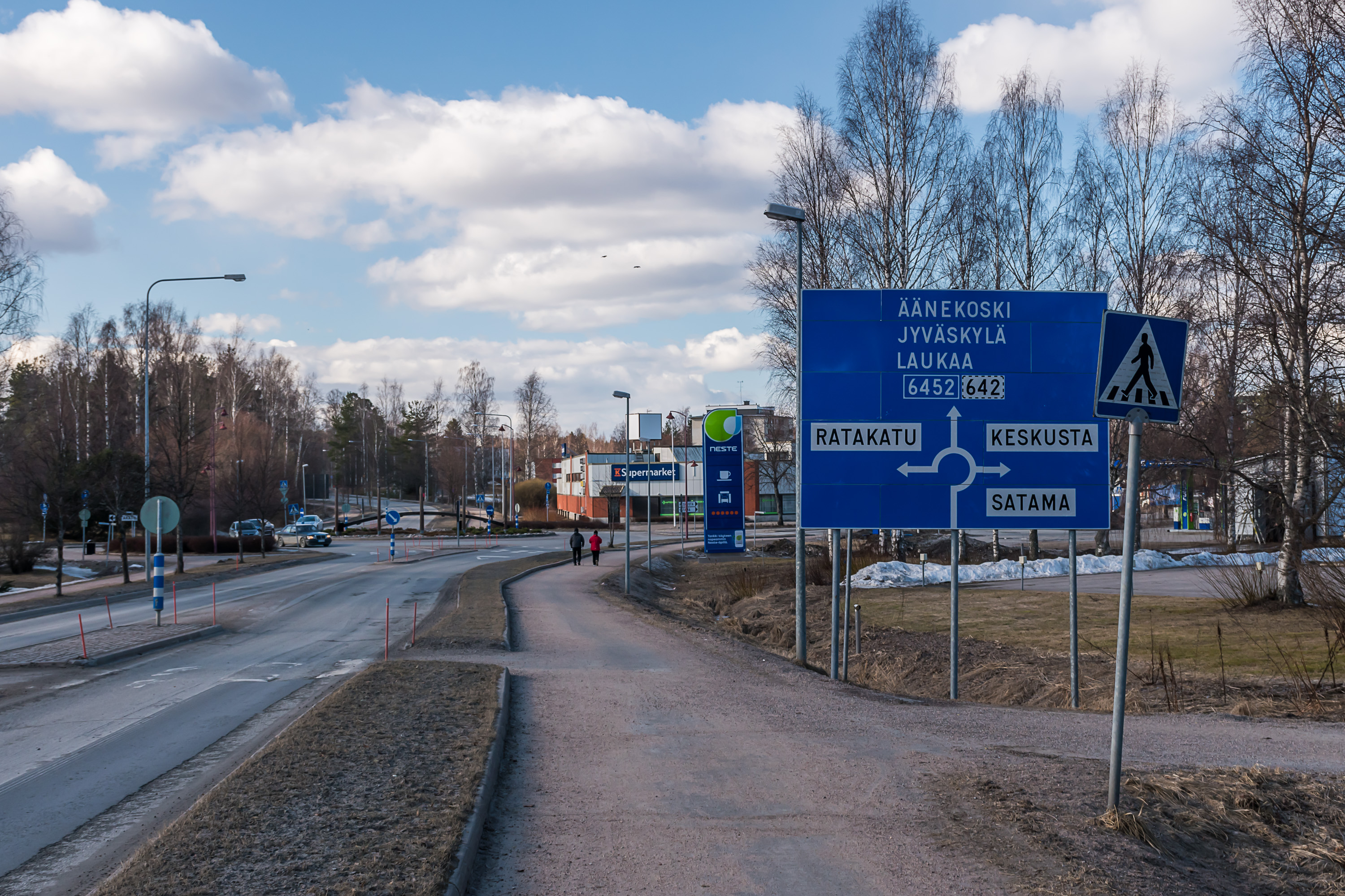
17. Now let's go look at the old (and the new) railway station. The roundabout in the middle of Suolahti has a stylized railroad tracks sculpture in the middle.

18. This is the beautiful old station on the Keitele coast. The station building houses a restaurant, and the train shed to the left holds some rolling stock. The museum here (Keitele-Museo, website in Finnish only) has operated since 1988, and technically has been the first private railroad operator allowed on Finnish railroads; it arrranges museum train rides on old Dm7 trainbuses. Among its other more treasured belongings, kept indoors and thus not shown in this post, are a Tk3 steam engine and some shunting diesel engines. In truth none of these are remotely unique; Dm7's in working condition also exist in Haapamäki and Hyvinkää museums for example and Tk3 was the most produced steam engine in Finland back in the day.
19. Tracks end on the lake shore.
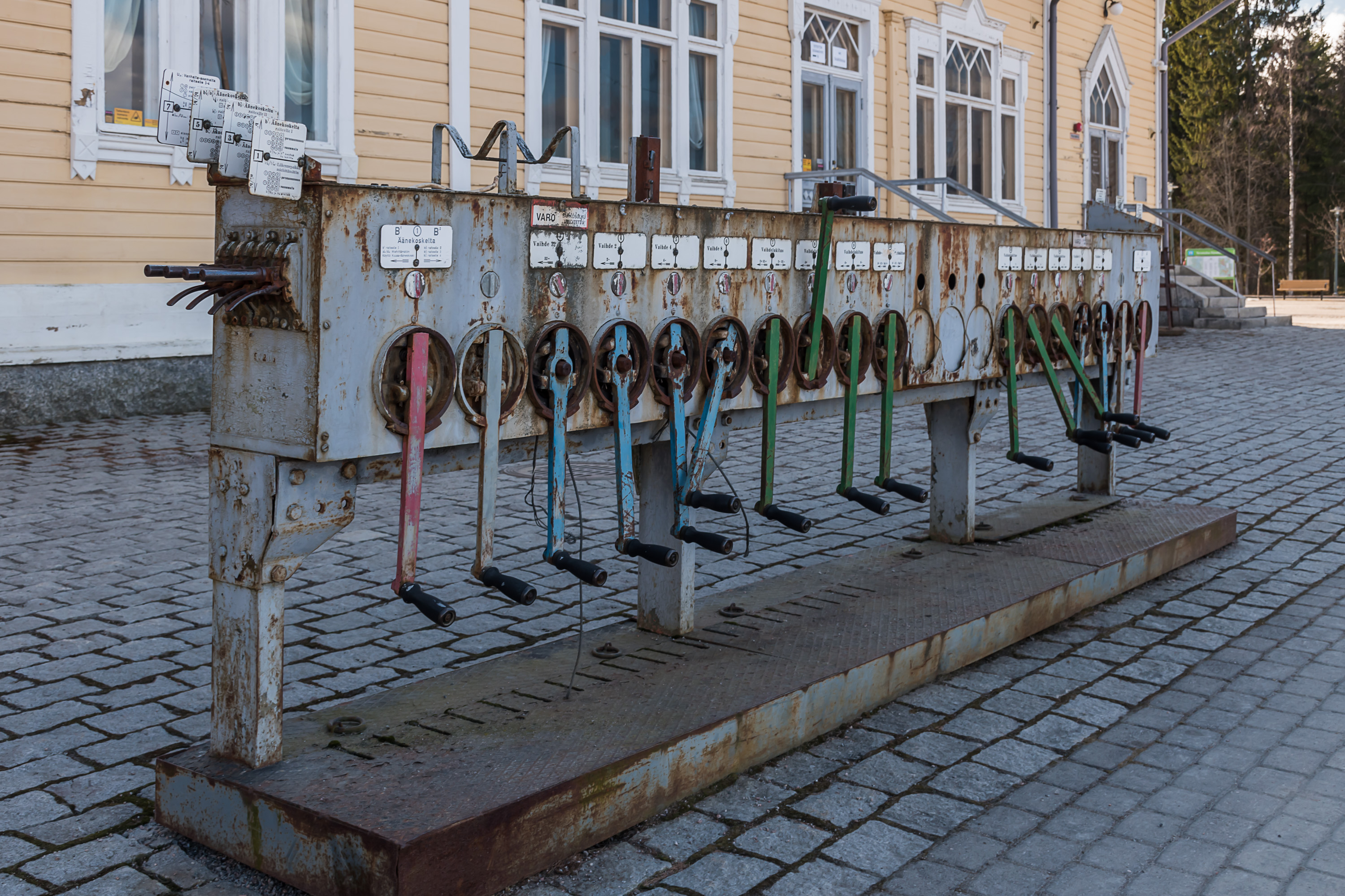
20. The station has a mechanical switch remote control device. Such devices were pretty archaic (dating from 1920-1930s) but still were in use on Finland railway network until 2005, and apparently still are in use on a few freight yards. The last track where they were used was Iisalmi-Kajaani-Kontiomäki, and these devices are still preserved at least at some of the stations there. Nowadays switches all over the country are generally controlled remotely from a few bigger train dispatching centers at the biggest stations.

21. Details of the device.

22. Another archaic feature of the station is a pair of semaphores. These are however not at any authentic locations, they were moved here from elsewhere. Last semaphores on the Finnish rail network were retired in 2003.
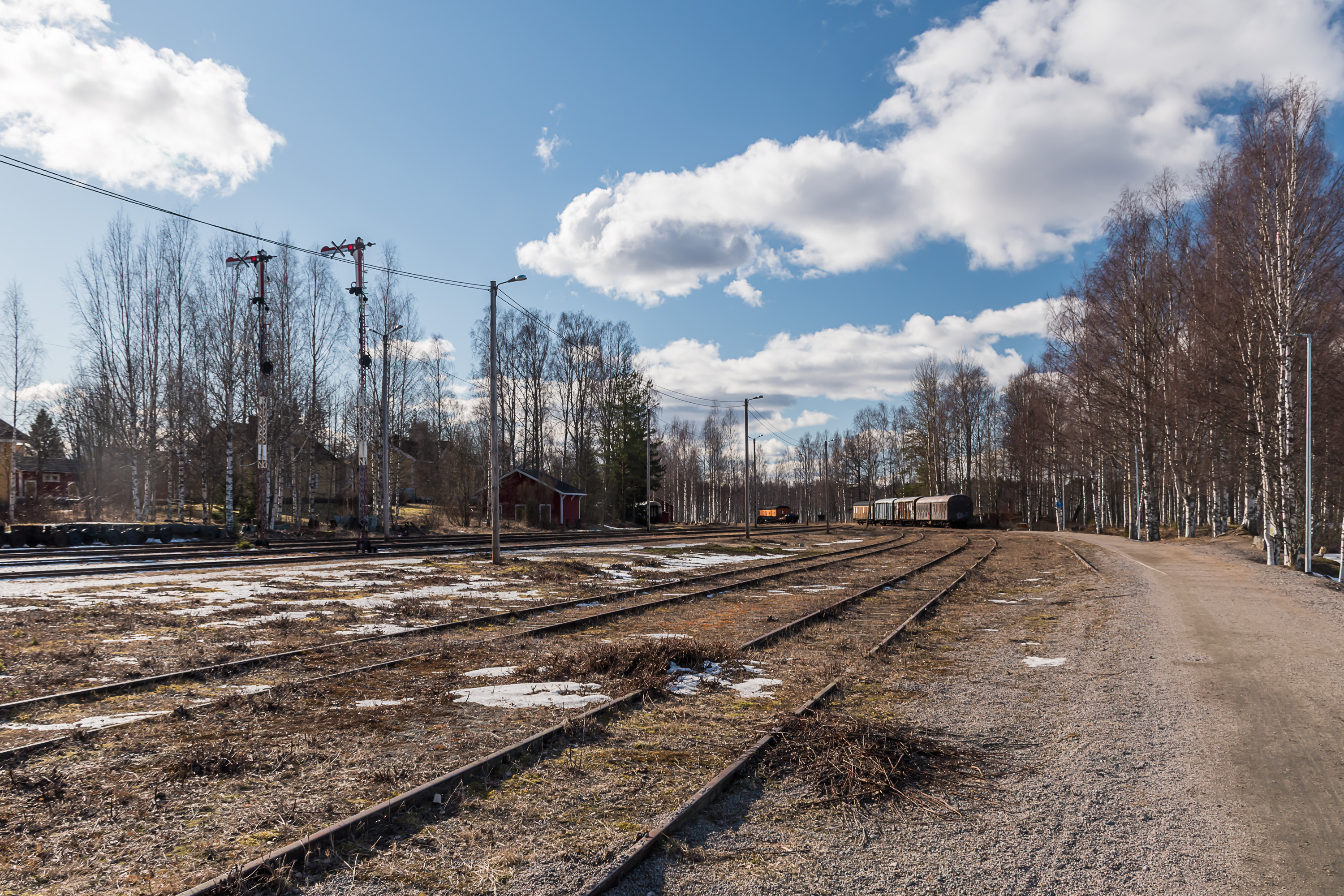
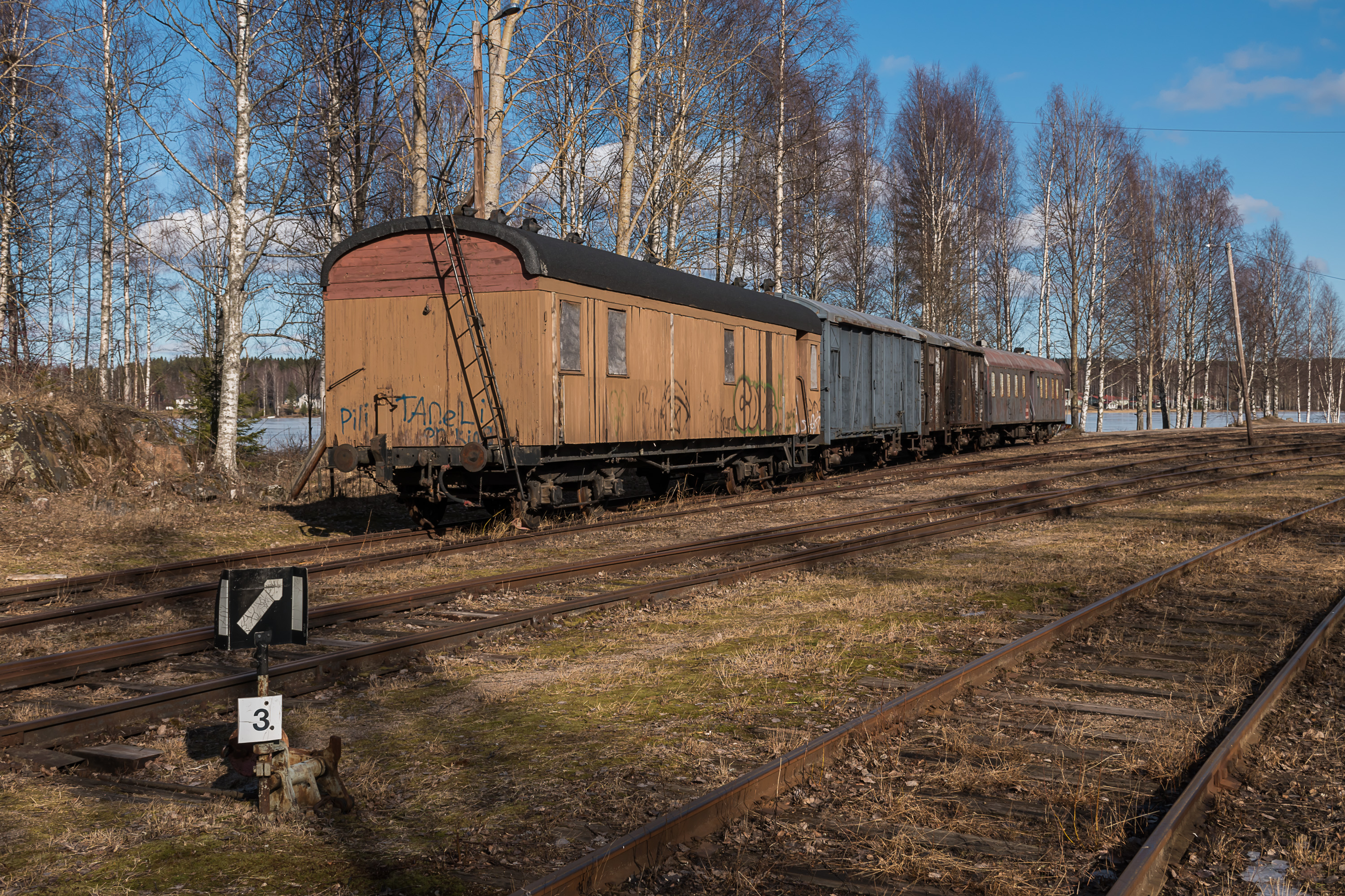
23. The rail yard looks nearly abandoned.
24. A few railcars can be found on the tracks. Of these one in the foreground is probably the most interesting; it's a prisoner transport car. Finland does in fact still employ prisoner transport cars, which is perhaps a bit surprising; the country is not that huge and it would seem like these days transport by road would be a lot easier logistically. Nonetheless one prisoner car is going between Helsinki and Oulu (using eastern Savonian track, so, via Kouvola, Mikkeli, Kuopio, Kajaani) and back once a week, attached to a regular passenger train, and shuttling people between a number of prisons along its route. There were probably more prisoner cars in the older times. I don't know exactly how old is this car; Not-class prisoner cars were in use at least in the 1970s. Another of the kind is preserved in Hyvinkää museum. This car unfortunately got most of its rust damage and vandalism already here in Suolahti.

25. It is possible to peek inside the prisoner car.

26. Chafed paint.
27.
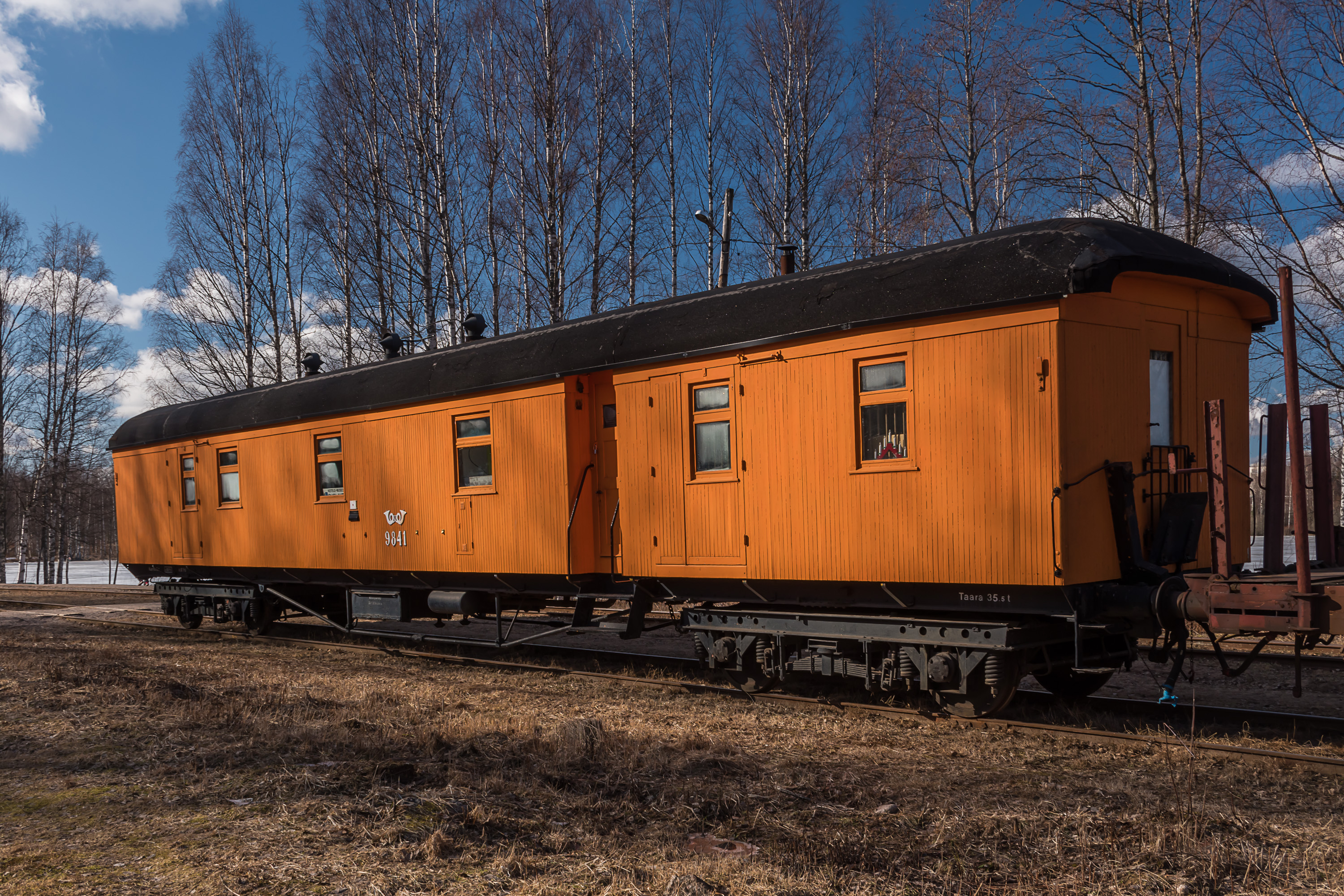
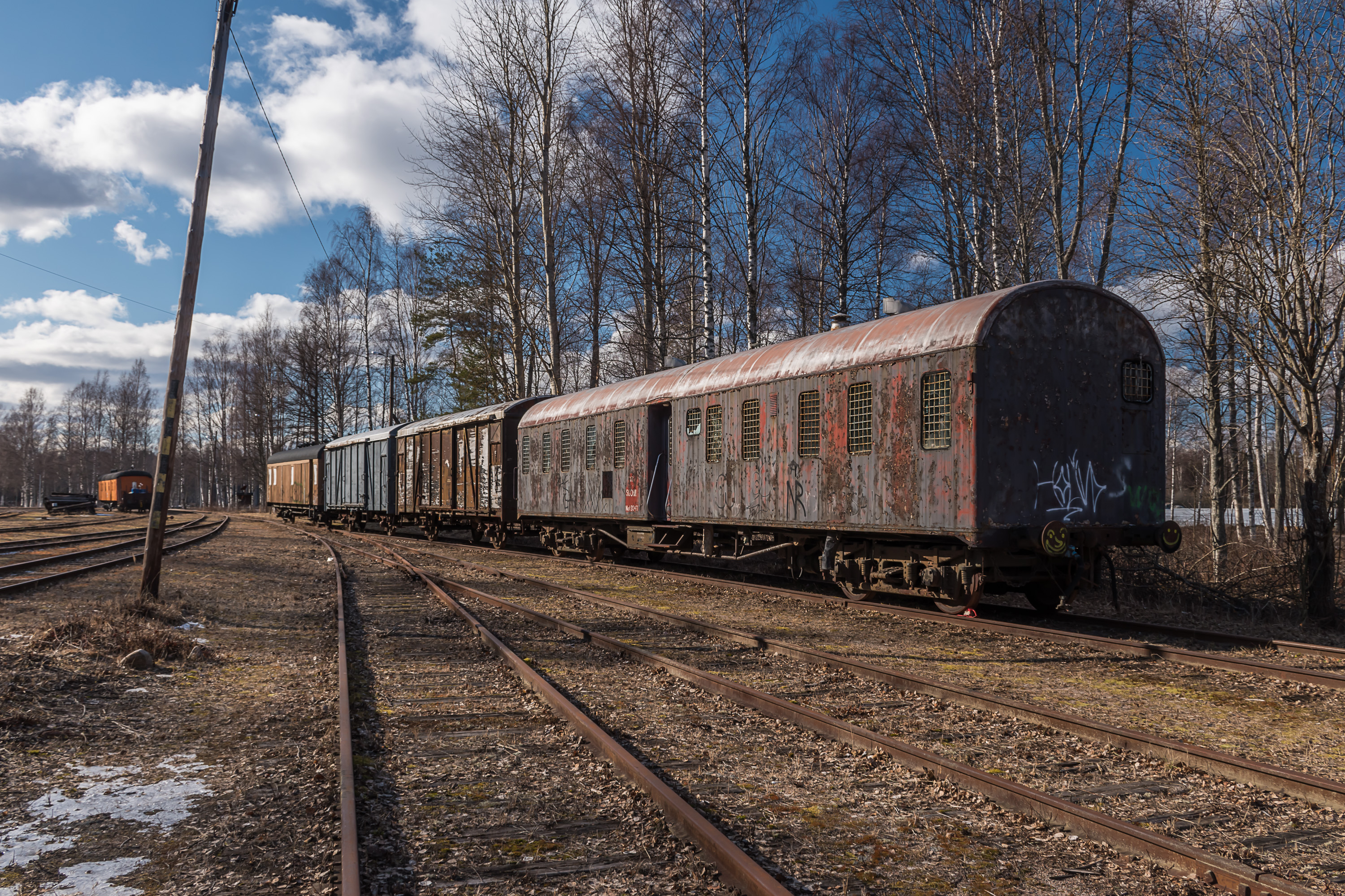
28. The Po-type postal car on the other hand looks to be in mint condition, despite probably being about the same age as the prisoner car. Postal cars were in use in Finland until 1995.
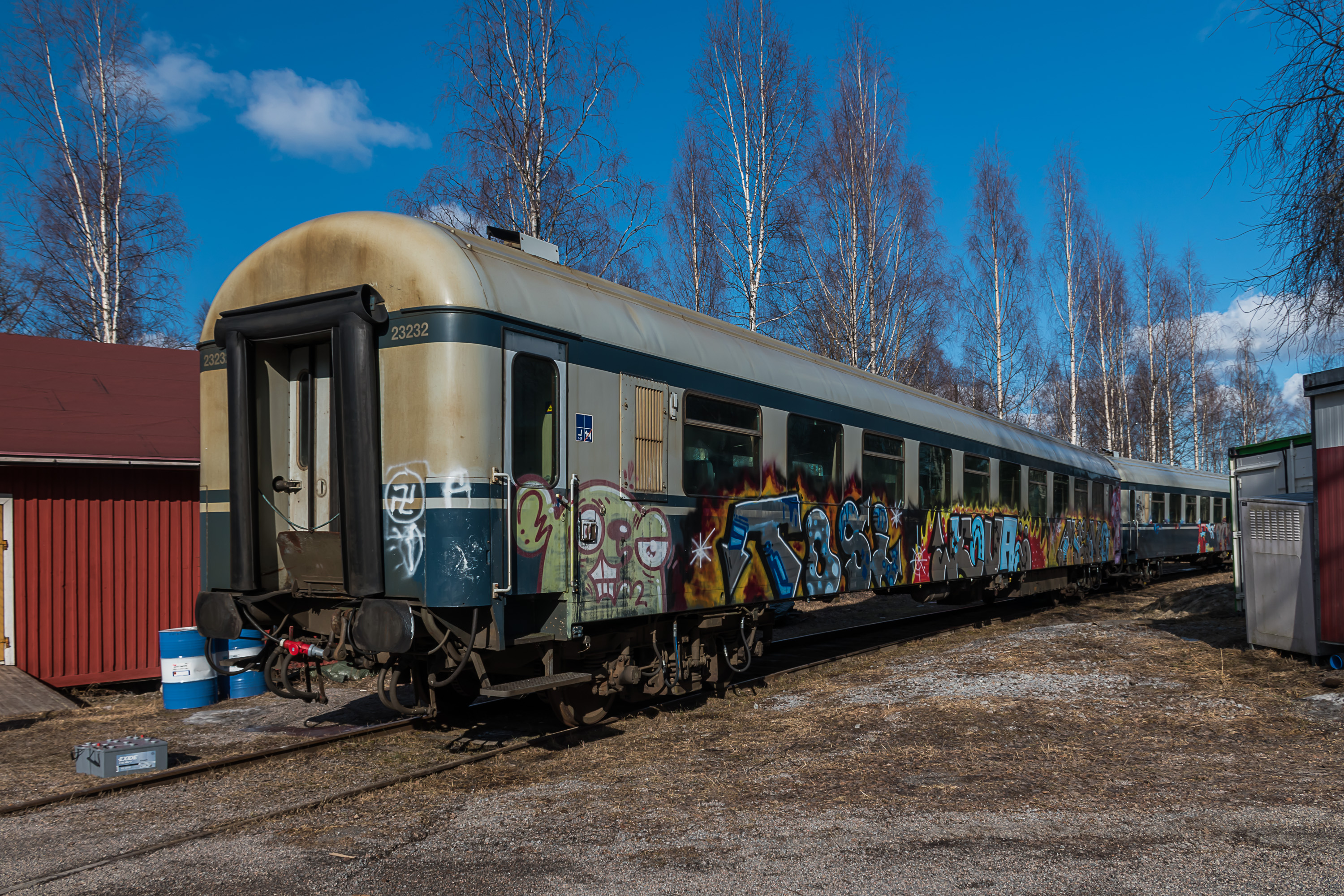
29. Two "blue cars" in unfortunately somewhat vandalized condition. "Blue cars" (siniset vaunut) is a semi-official name for Finnish all-metal passengers cars, actively used from the 1970s to the 2000s, when they were replaced by InterCity cars, Pendolino trains and Dm12 railbuses. There were dozens of various blue car models. A few of them are still in use to this day in night trains to Lapland.
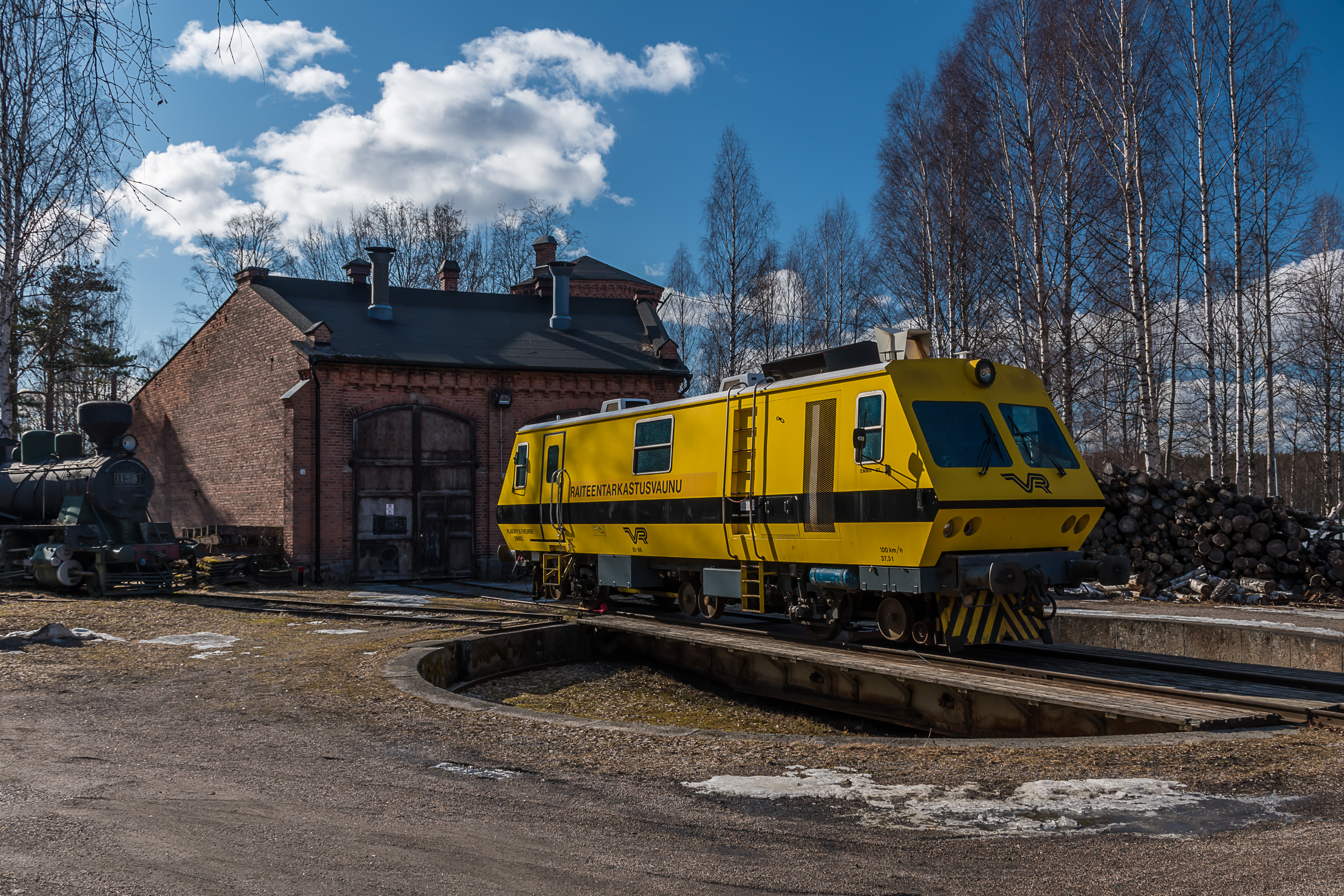
30. This might be the one truly unique piece of rolling stock in Suolahti, an older track geometry inspection car, Et 66 or "Emma", standing here on a turntable near the rather tiny depot. Built in Austria, it was in use between 1981 and 2003, when it was replaced by Ttr 1 51 or "New Emma". (Finland thus only has one track geometry car for all its rail network.) Despite being out of use for a long time, old Emma was preserved by the state railroads and was not scrapped, and when they finally did decide to scrape it, it was announced that if anyone wants it for museum purposes they can get it; so the museum at Suolahti did and Emma was brought here very recently, in January 2020.
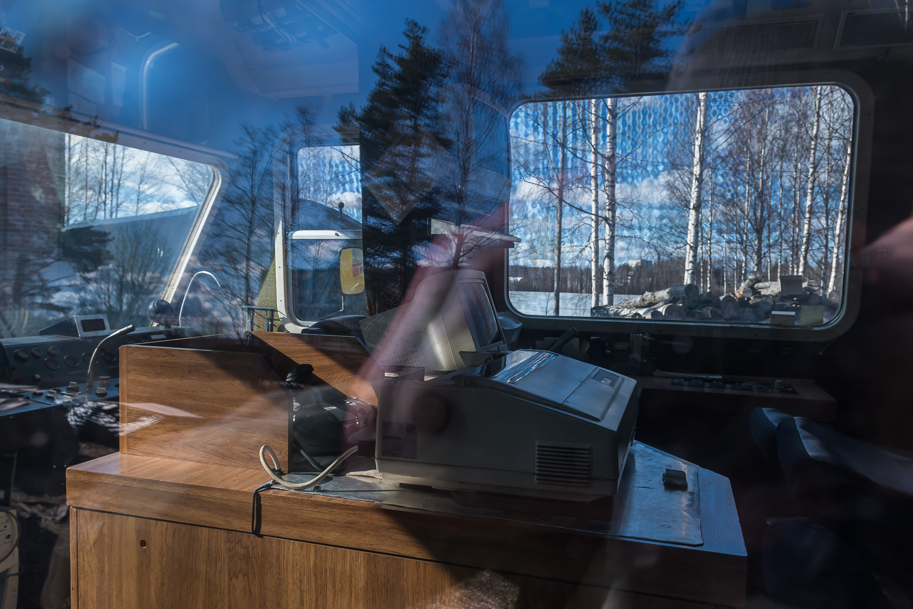
31. Cool archaic-looking computers and printers from the 1980s can be visible within Emma.
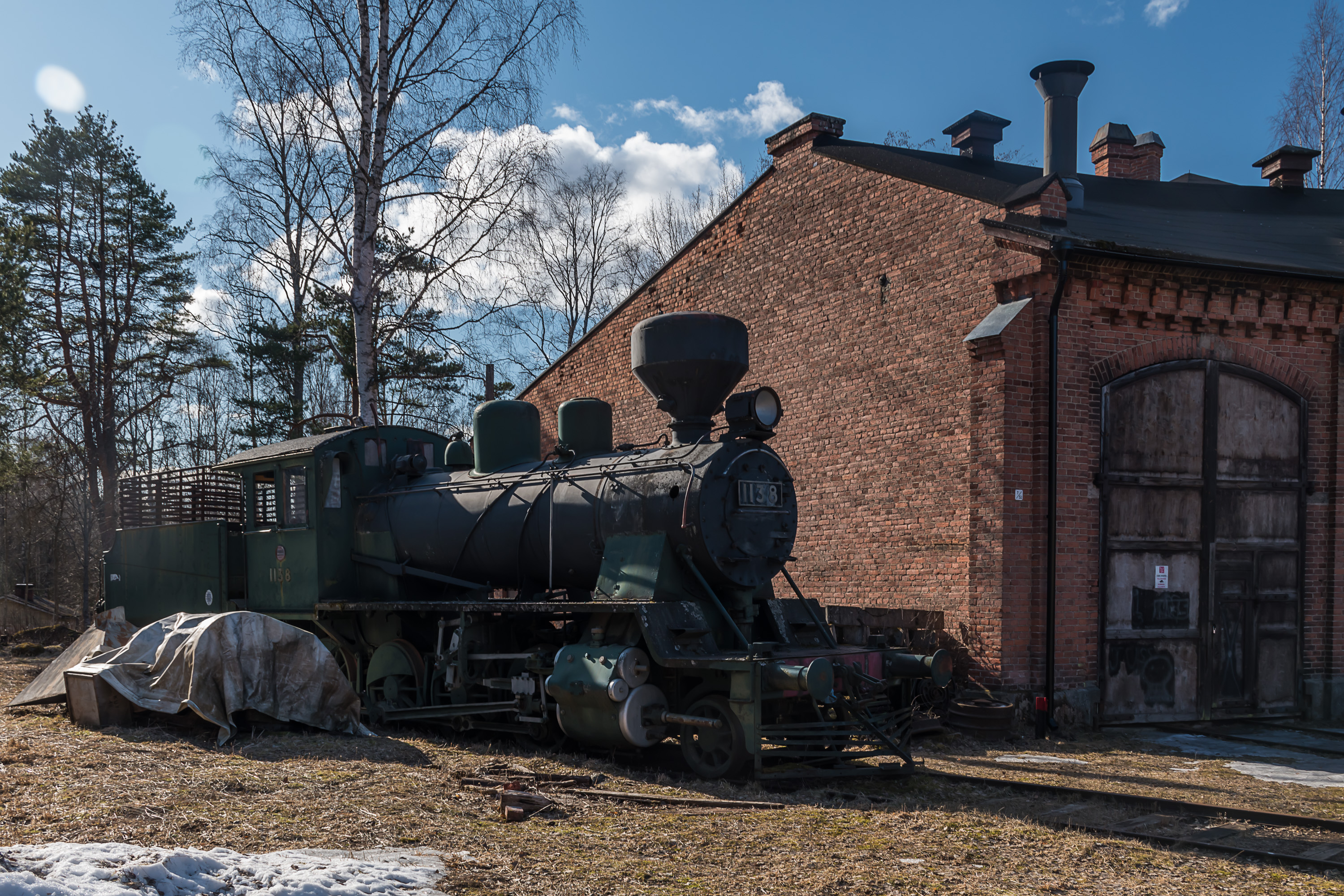
32. A Tk3 steam engine. It's a pretty generic one, used in mid-20th century mostly for lighter freight trains. A second identical steam engine is restored to working shape here in Suolahti but presumably kept indoors.
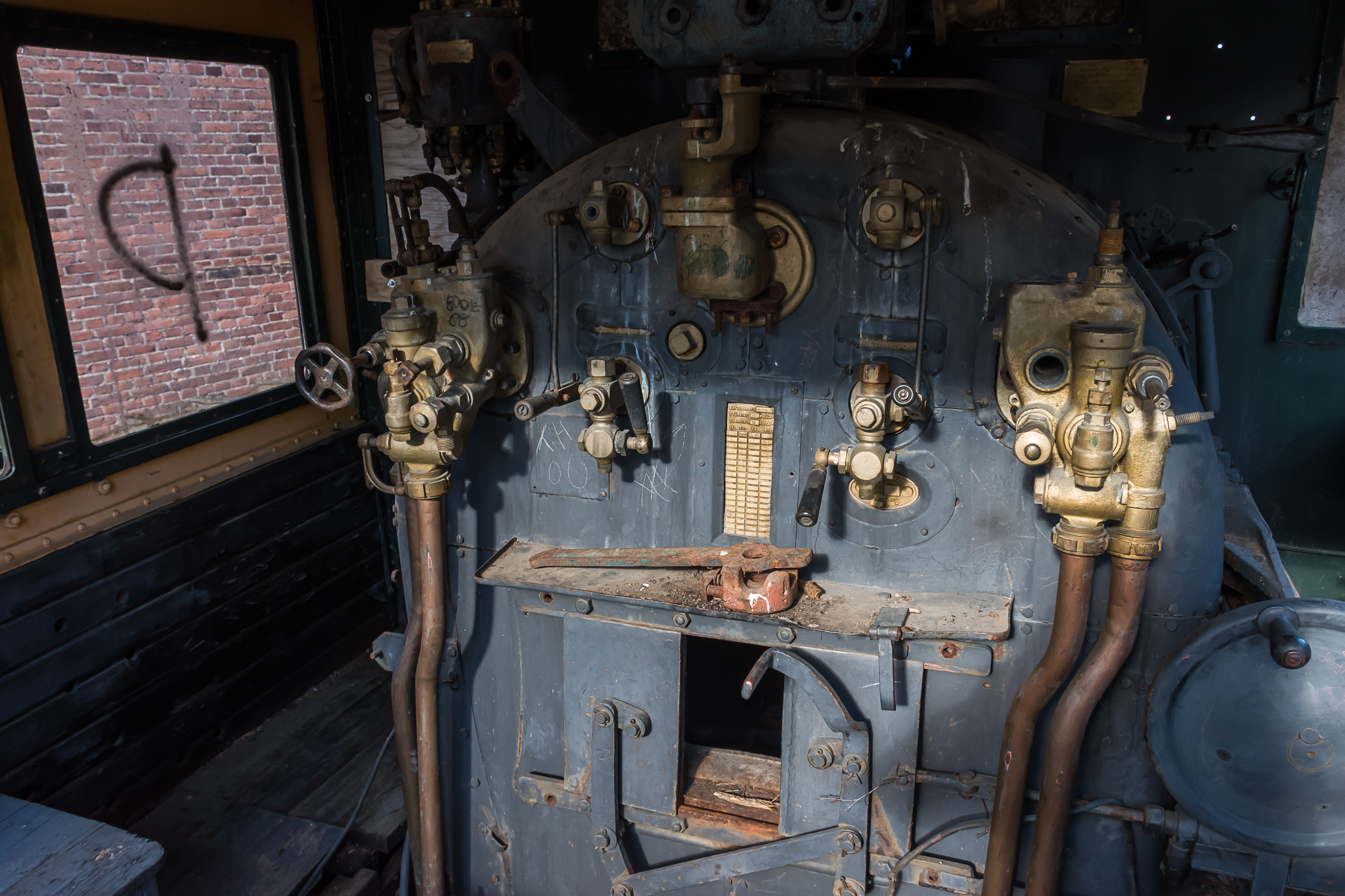
33. With this one however you can even get into cabin! (I have no idea if this is actually allowed, but the territory was not fenced off, had no forbidding signs, and there weren't any people present, so I assumed it was okay.)
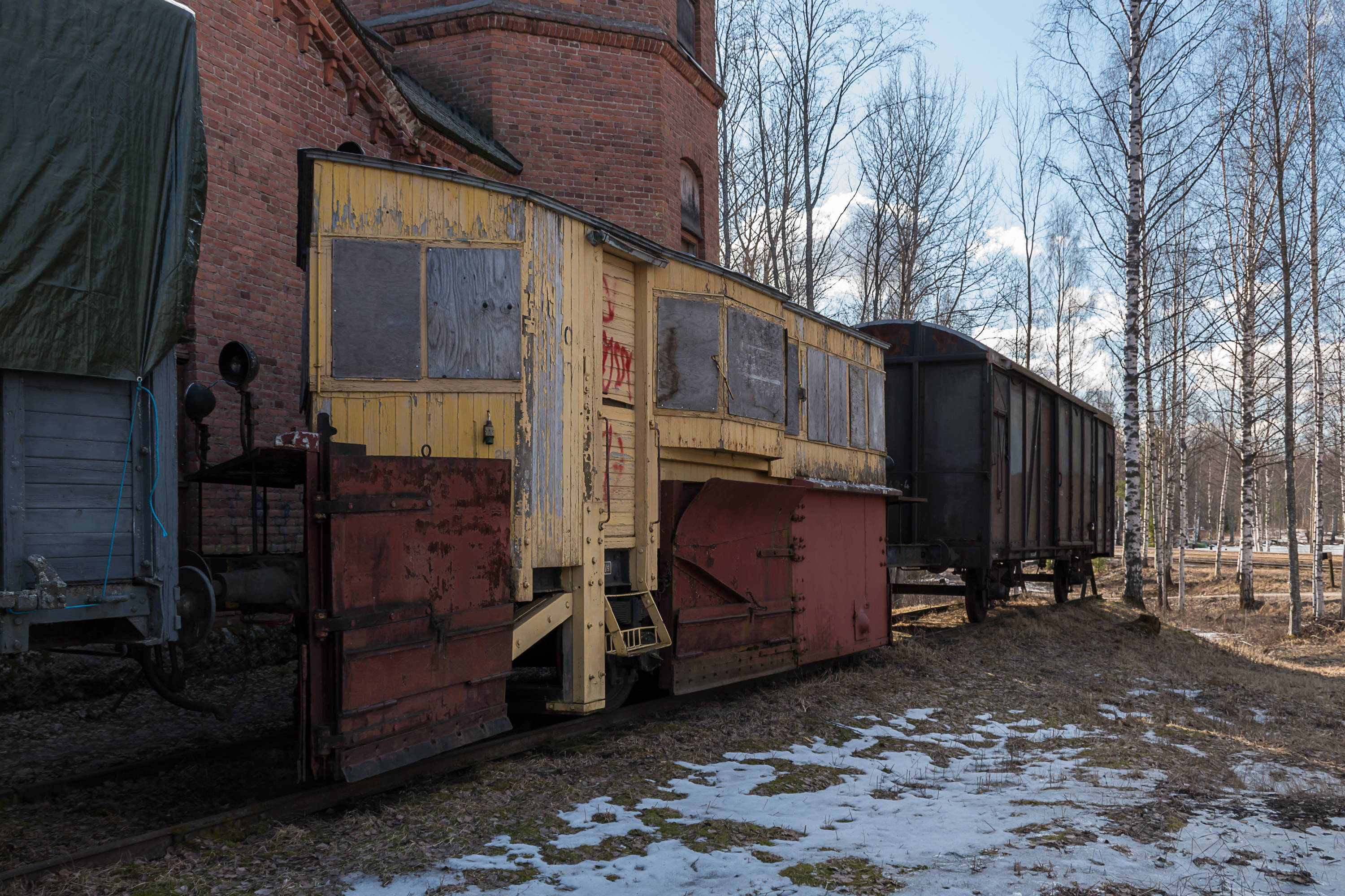
34. Among more prosaic pieces of rolling stock there is a snowplow.

35. "The Loaders" monument near the station area refers to the "iron canal" days.
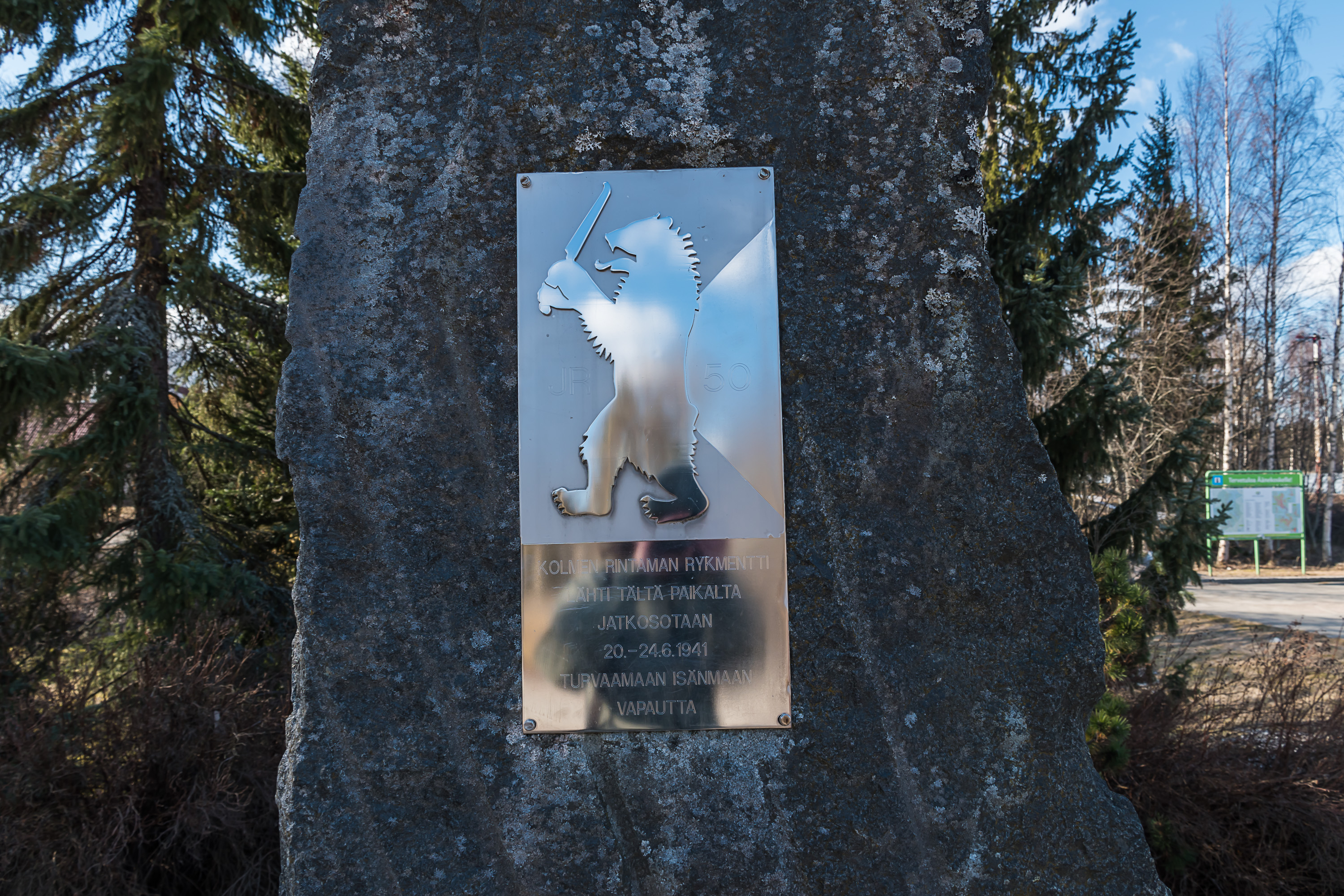
36. Another nearby monument. "The regiment of three battlefronts departed from this place to the Continuation War on 20-24.6.1941 to safeguard the freedom of the fatherland". The regiment in question is JP 50, the 50th Infantry Regiment, which consisted of men from Suolahti, Saarijärvi and Viitasaari, who were indeed sent to war from the Suolahti harbor station.

37. A street of railroad worker houses near the station.

38. And this, for comparison, is the current Suolahti railway station. It looks like it is mostly used for timber loading these days.
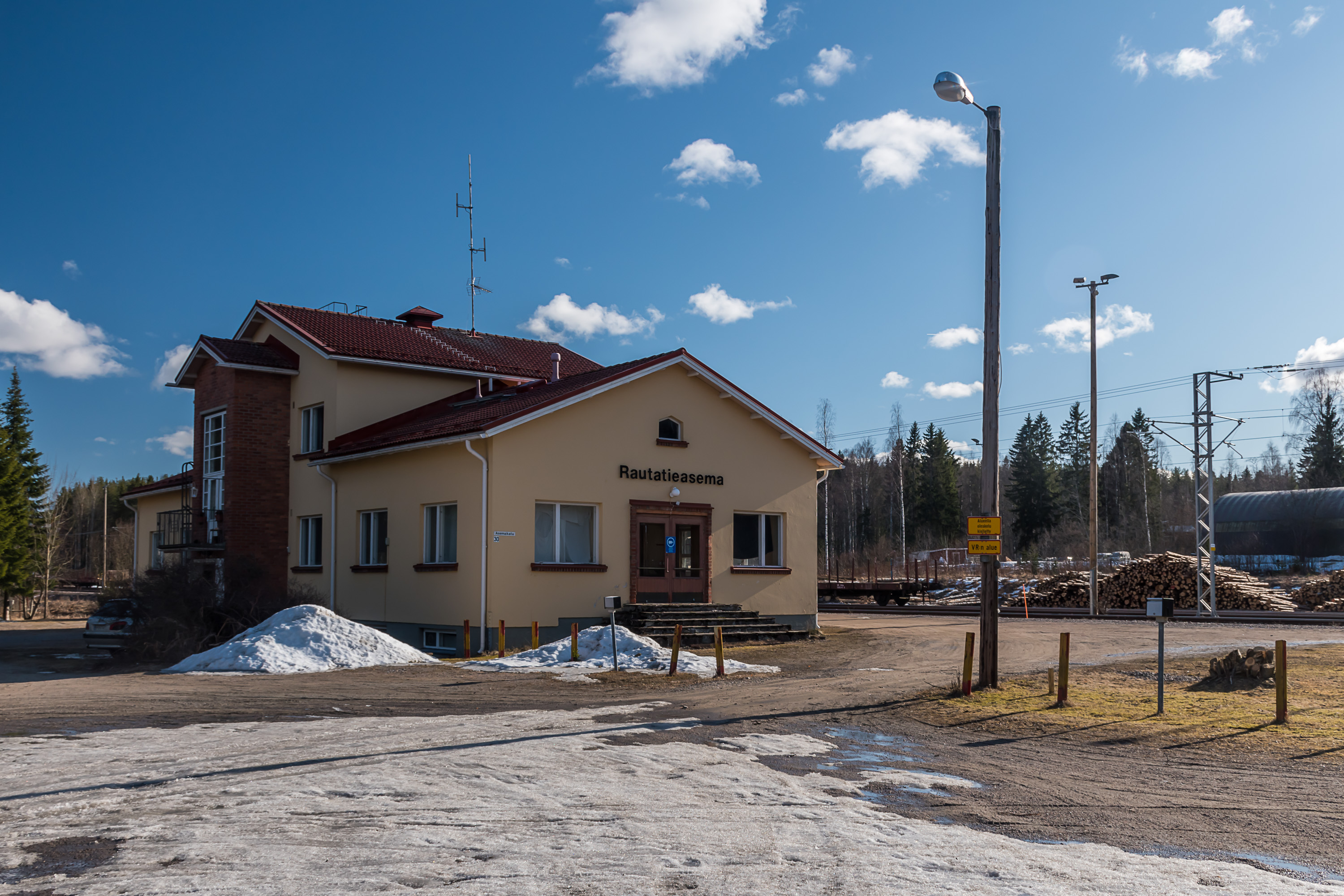
39. The station building is unremarkable. Unlike most small station buildings, this one appears to still be in use by the railroad, instead of being converted into a residential house.
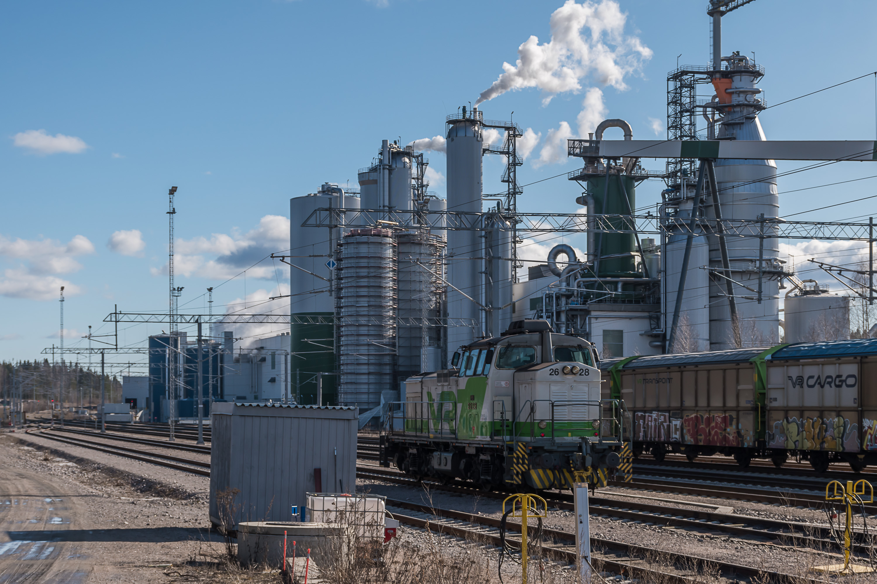
40. Jyväskylä-Suolehti-Äänekoski railroad section used to be one of the quieter railroads, but in 2017 a new bioproduct mill was launched in Äänekoski by Metsä corporation (in place of the older cellulose factory), an absolutely mammoth facility, consuming 6.5 million cubic meters of wood a year. It was the biggest forest industry investment in the history of Finland. Äänekoski transport links were improved in connection with this project, including improvement of Äänekoski bypass on Road 4 to motorway level, and electrification of the Jyväskylä-Äänekoski railroad stretch (47 km). The picture is taken at the Äänekoski station, with the bioproduct mill clearly visible.
The entire 211 km Jyväskylä-Äänekoski-Haapajärvi railroad has had no passenger traffic since 1986. With Jyväskylä-Äänekoski electrification project finished, there has been talk about resuming commuter train service on this section. So far this has not been greenlighted; it is not such a trivial task because proper platforms and other passenger infrastructure would have to be mostly rebuilt from scratch at this point. Äänekoski-Haapajärvi part meanwhile still remains very quiet, used only for timber transport. In particular timber that used to be floated through Keitele and Suolahti is now usually loaded at Keitelepohja station near the town of Viitasaari.
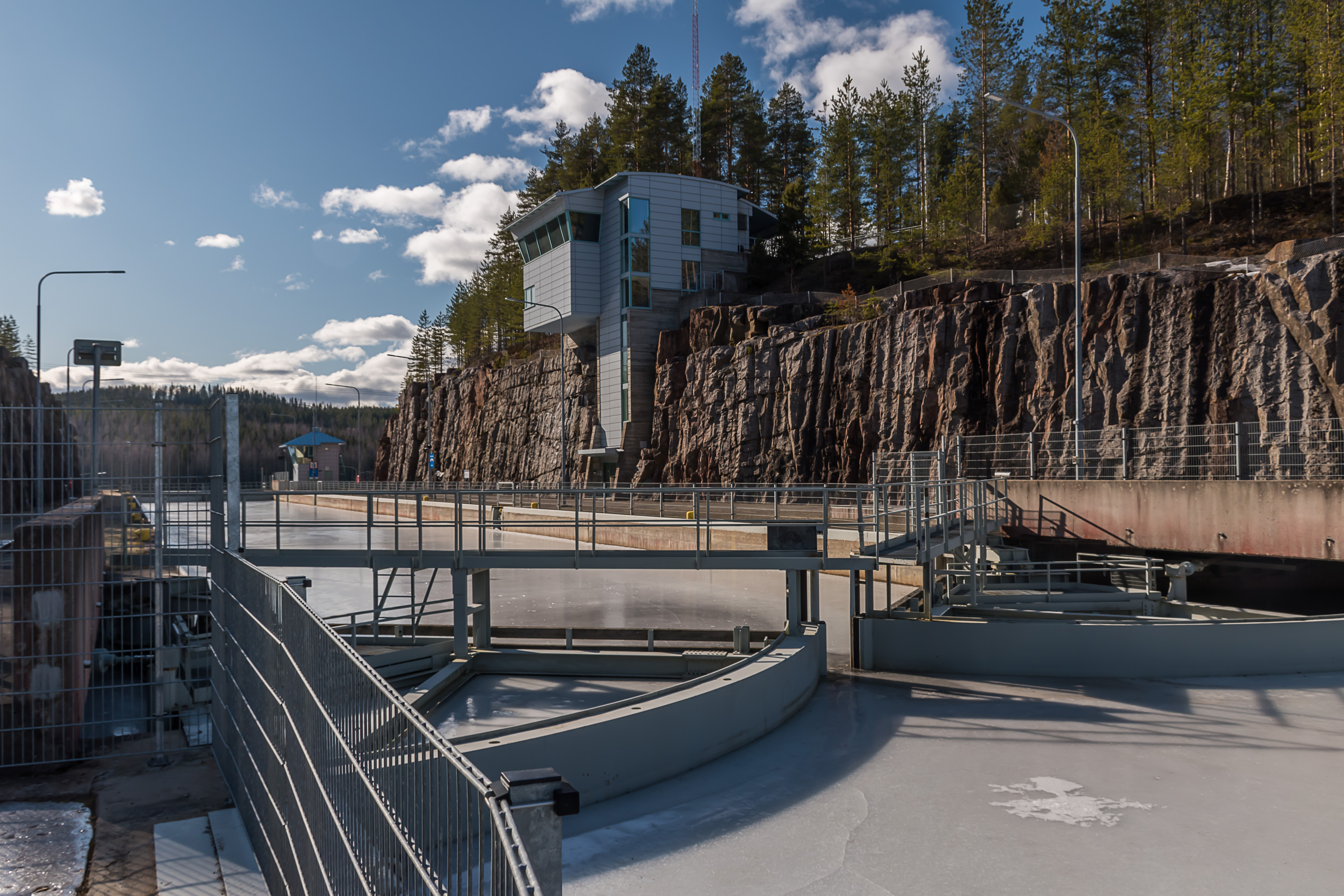
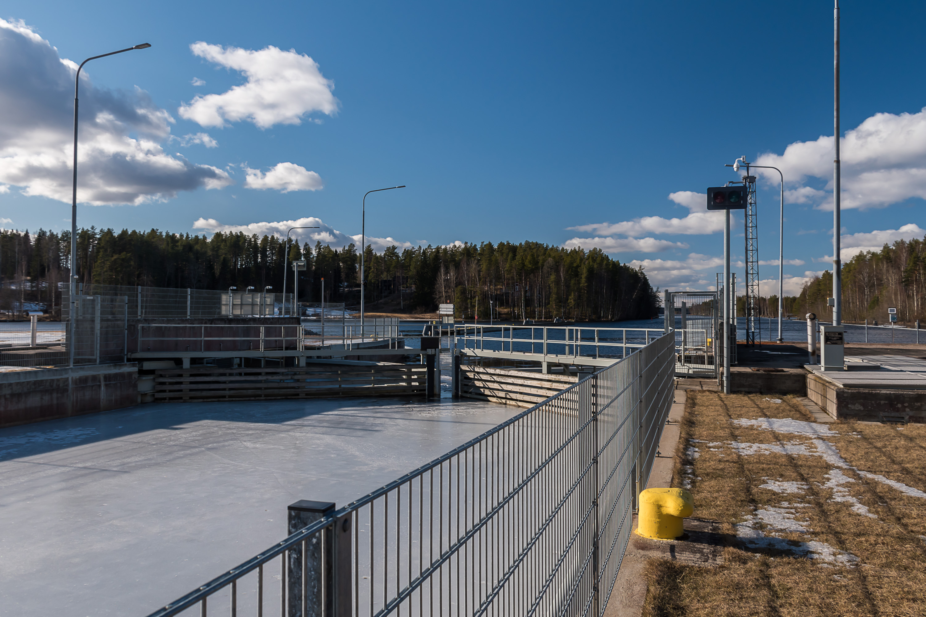
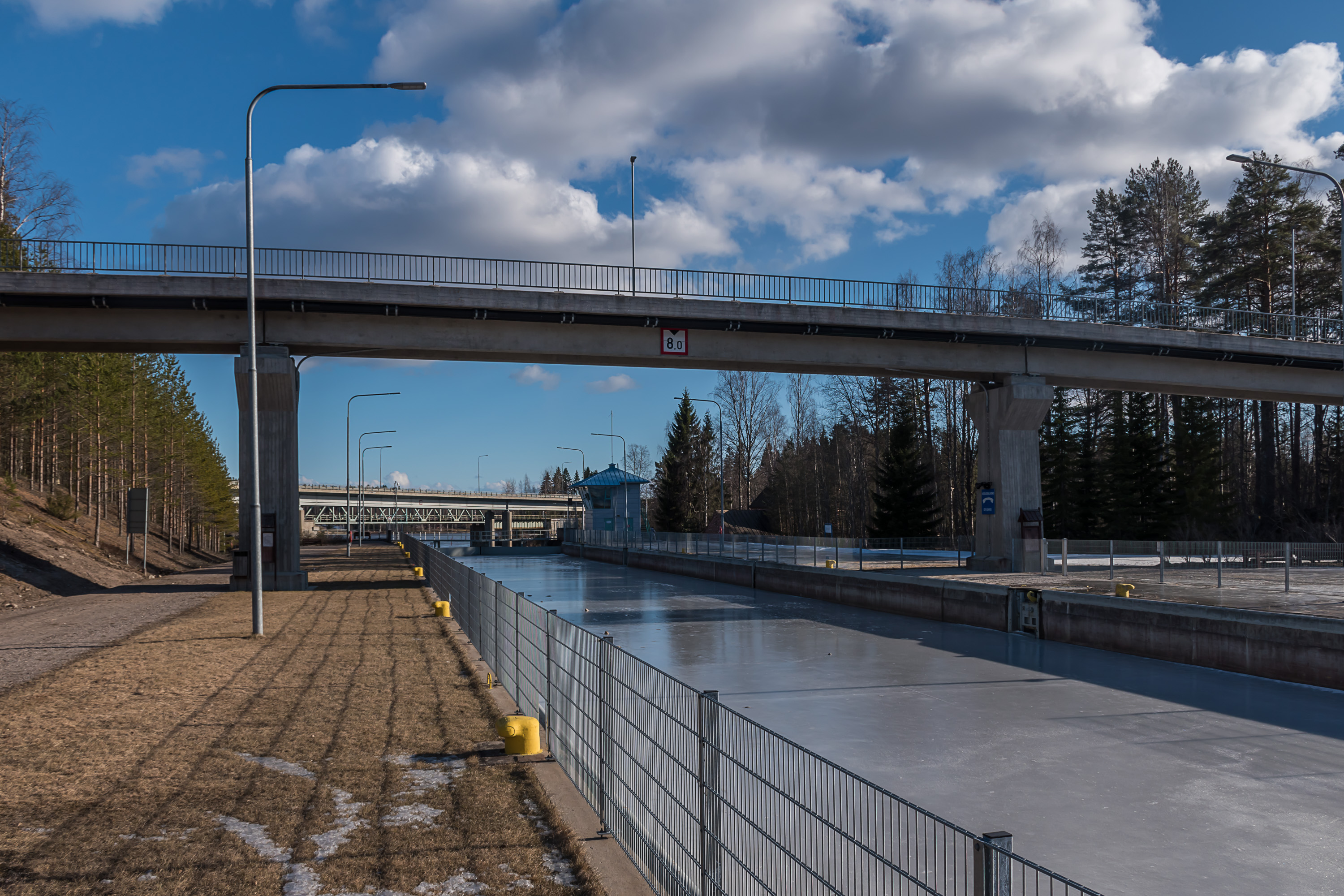
41. And now let's look at the canal. This is its highest lock, Paatela, connecting Keitele with Kuhnamo lake. For some reason most of the territory near this lock is fenced off. The pictures are taken in late March, and despite very warm and nice spring most lakes still were under ice. Of course in winter the canal and all boating on Päijänne and Keitele in general shut down.
The lock is built in a steep rock cutting, indicating that originally there wasn't any natural river at all in this place before. Natural Keitele outflow into Kuhnamo is through a short Häränvirta (Finn. Bull Stream) river in Äänekoski city center. That river has a hydroelectric dam on it and in general there would not be any space in that place for a lock; presumably this is while they had to blast it into rock here, about 4 km away from Häränvirta. This is also the highest lock of the five, with almost 8 m drop.
42. Keitele under ice near Paatela. If you look closely you can see two boys playing ice hockey right on the lake.
43. A summer restaurant near the lock.
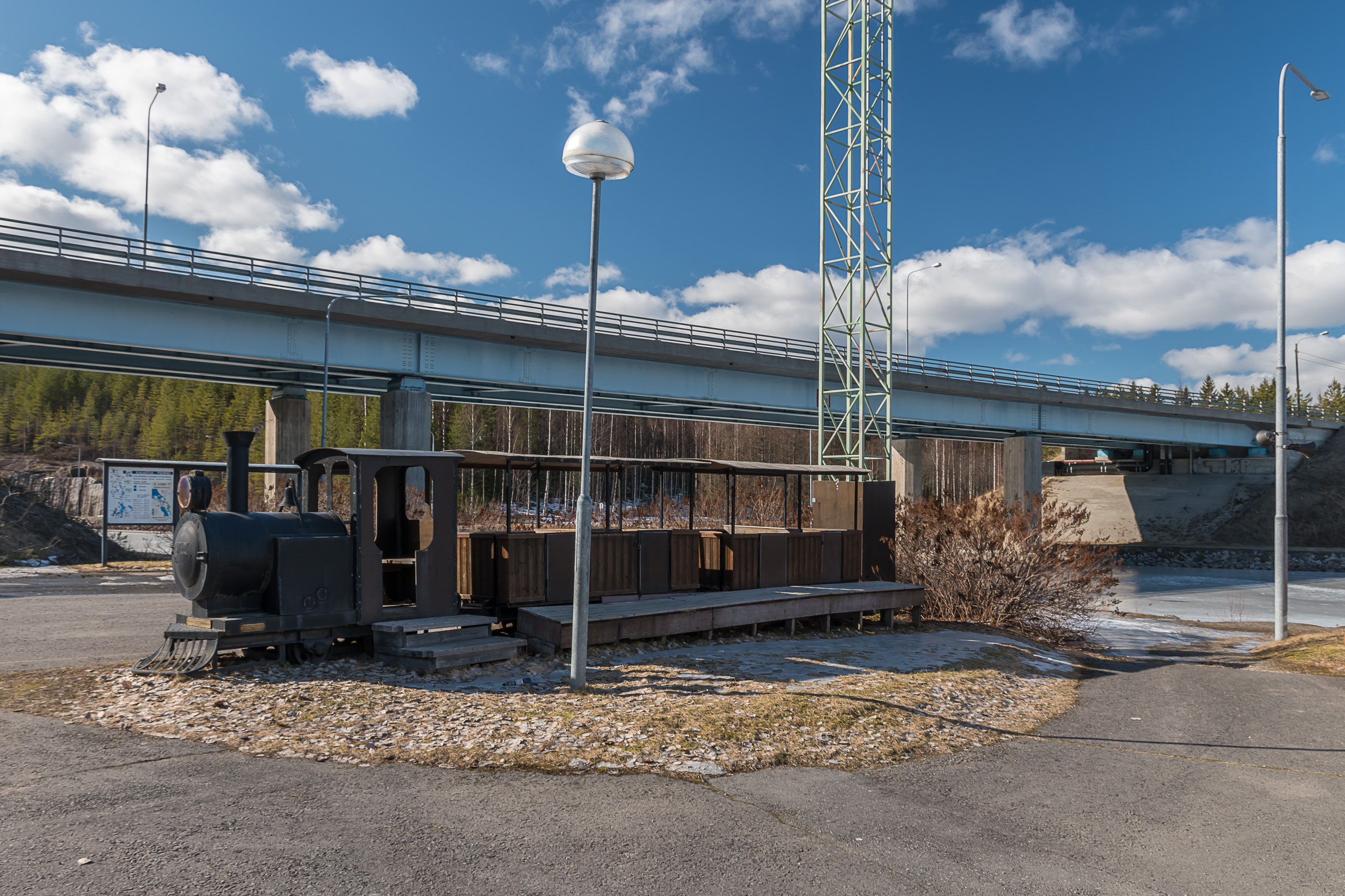
44. A curious sight at Paatela is also an old tourist train, apparently put there as a monument. This is indeed a real small train on tracks, with manufacturer plates and controls in the cabin indicating it used to be functional, but I couldn't really find out where it is originally from or what it is doing here. Barely readable letters on it say Toivakan Pony Train, apparently referring to Toivakka, a minor rural municipality southeast of Jyväskylä. But I couldn't find anything online about Toivakka ever having a tourist train, nor it is really a place I would expect to have one (with its 2400 population).
45. Kuusa lock is the middle on of the five, located in the eponymous village. It connects Vatianjärvi and Saraavesi, two smallish lakes.

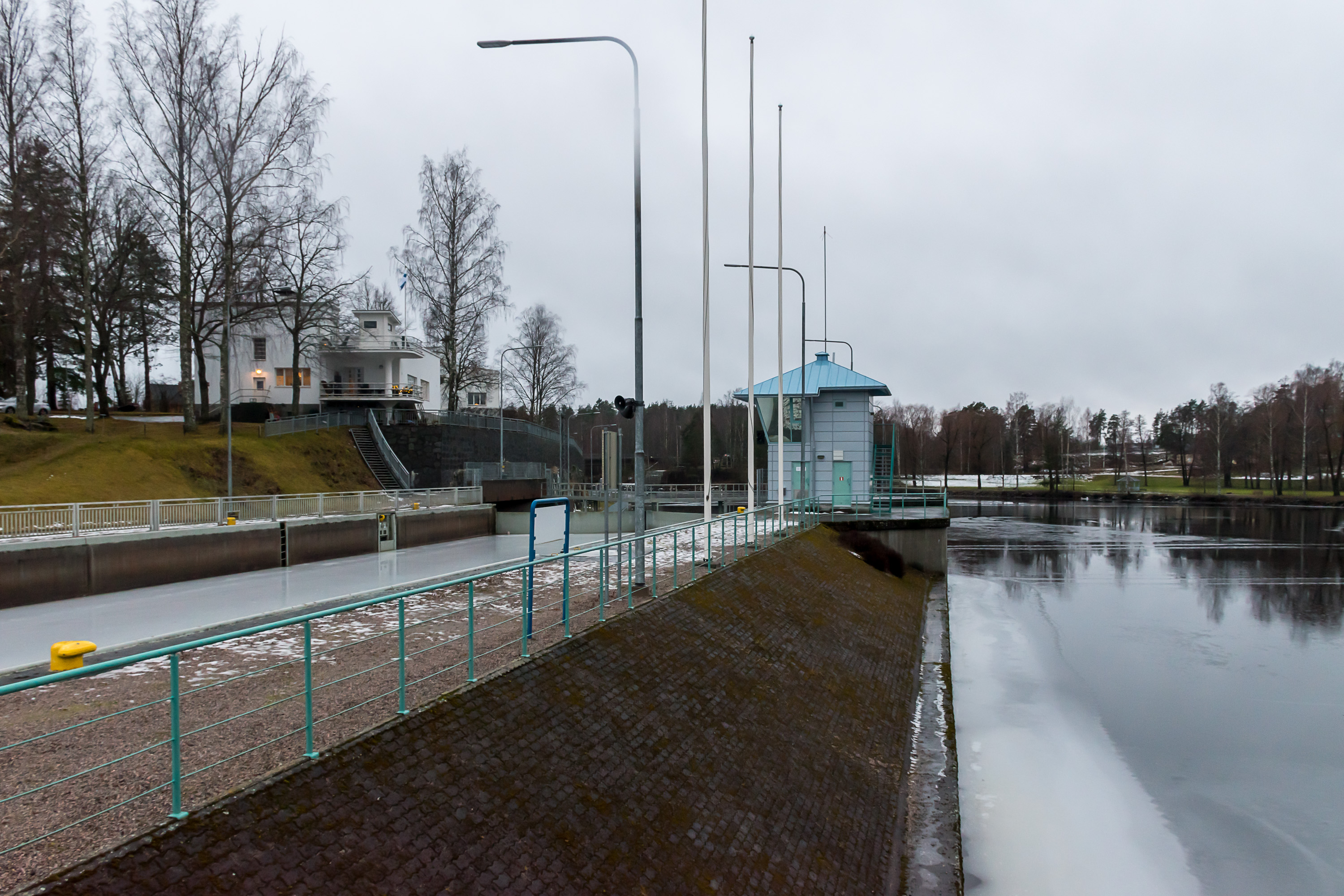
46. The architecture of all the locks of the canal is pretty similar. If you look closer at the personnel tower, you can see it's covered with rainscreen cladding, which really remains me of the 1990s-2000s Russian architecture (that was generally terrible; only things built in the 2010s started to look better). In truth these towers are mostly not used anymore. Paatela is the only lock that remains manned, others are self-service now.
47. The waterway in Kuusa.
48. Bridges at Kuusa.
49. Vaajakoski lock is the lowest lock of the canal in the former town of Vaajakoski (Finn. Wedge Rapids) that by now has merged with Jyväskylä both physically and administratively. Vaajakoski pictures are, unlike all others, from December.
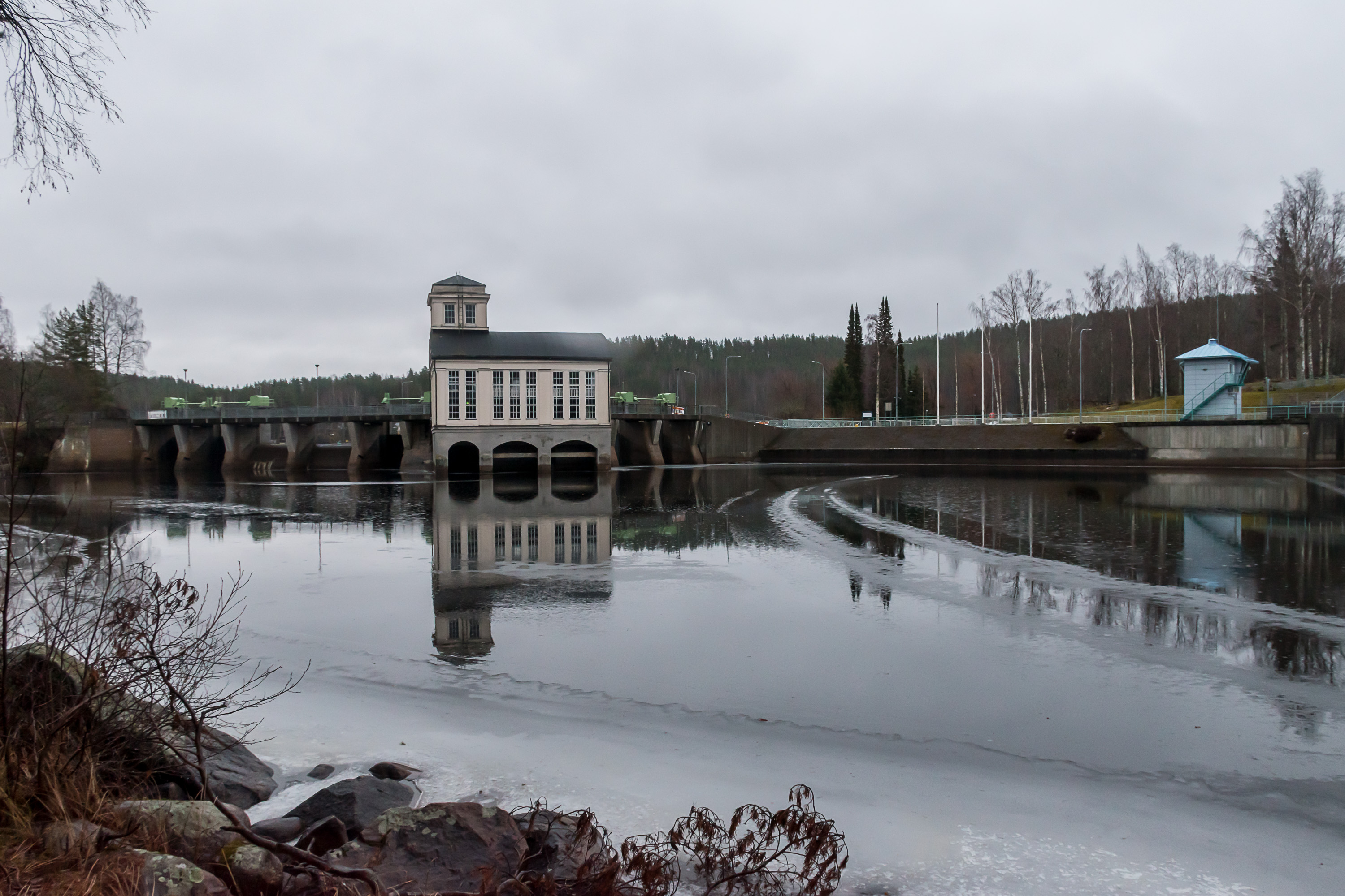
50. The short, less than 5 km long, river in Vaajakoski is named Vaajanvirta (Finn. Wedge Stream). The lake upstream of it is Leppävesi (Finn. Alder Waters), the biggest lake between Keitele and Päijänne, 63 sq. km large. Two hydro power stations exist at Vaajakoski. This is the older one, built in 1920 for the local industry needs. It was very small at only 368 kW power and was retired in 1942 already; its building is now rented out for concerts and events.
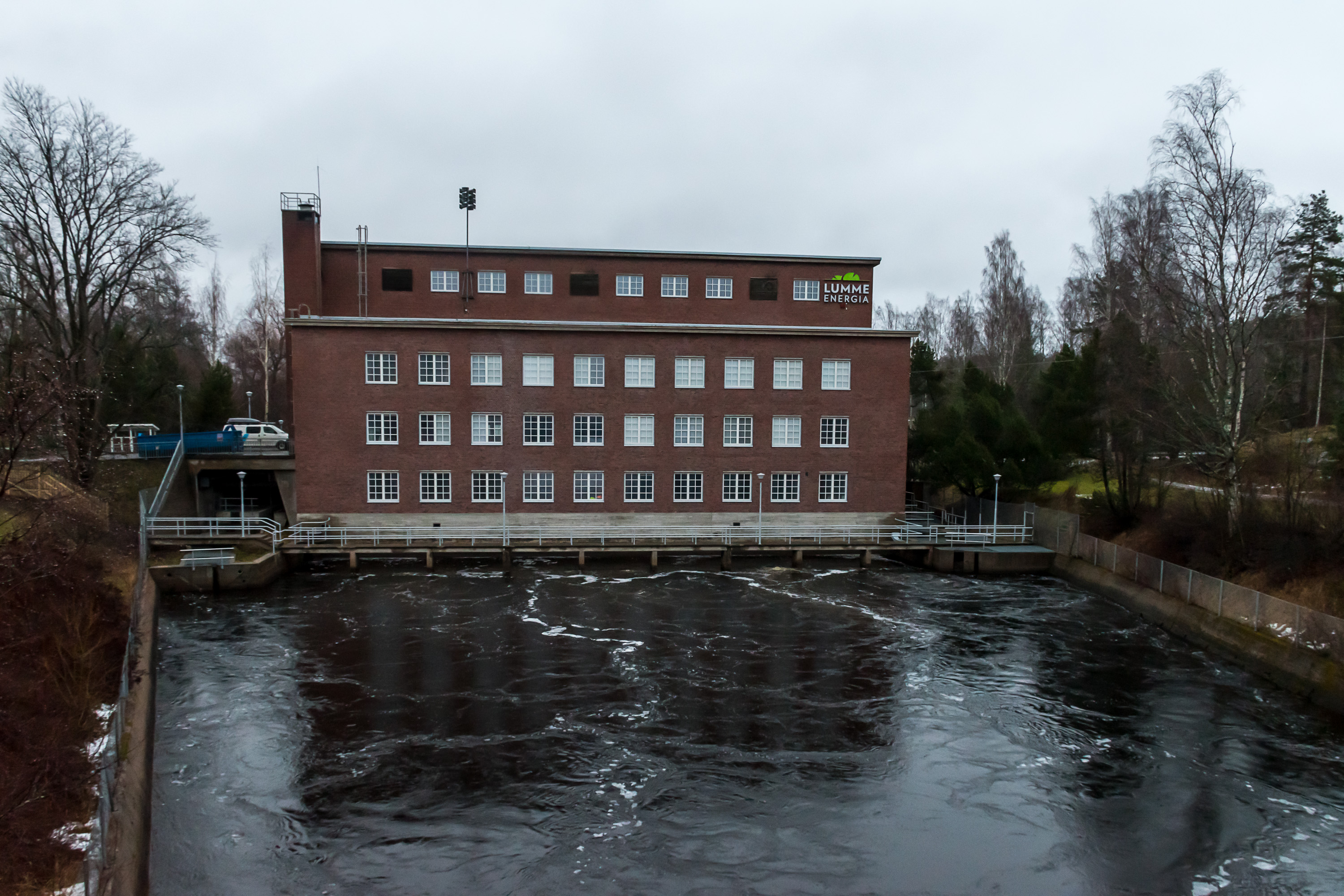
51. The newer Vaajakoski hydro power plant is a lot bigger but still has only 3.5 MW power; Vaajakoski rapids just aren't high enough (only 2.2 m) to have much hydro power.

52. It's possible to tell more about the canal surroundings and Vaajakoski in general, but that would be out ot scope for this post already. Just continuing with the overall transport infrastructure theme, I can note at least that Vaajakoski is also home to one of the worst bottlenecks of the Finnish road network, where four roads (National Roads 4, 9, 13 and 23) have to share a single two-lane road section through Vaajakoski (including a bridge over the canal), with several at-grade turns to local streets. Thankfully this road section is at least pretty short and usually does not present any actual difficulties. Local geography makes building a proper bypass challenging; nonetheless it is now in planning phase, with the existing motorway from Jyväskylä to be extended.
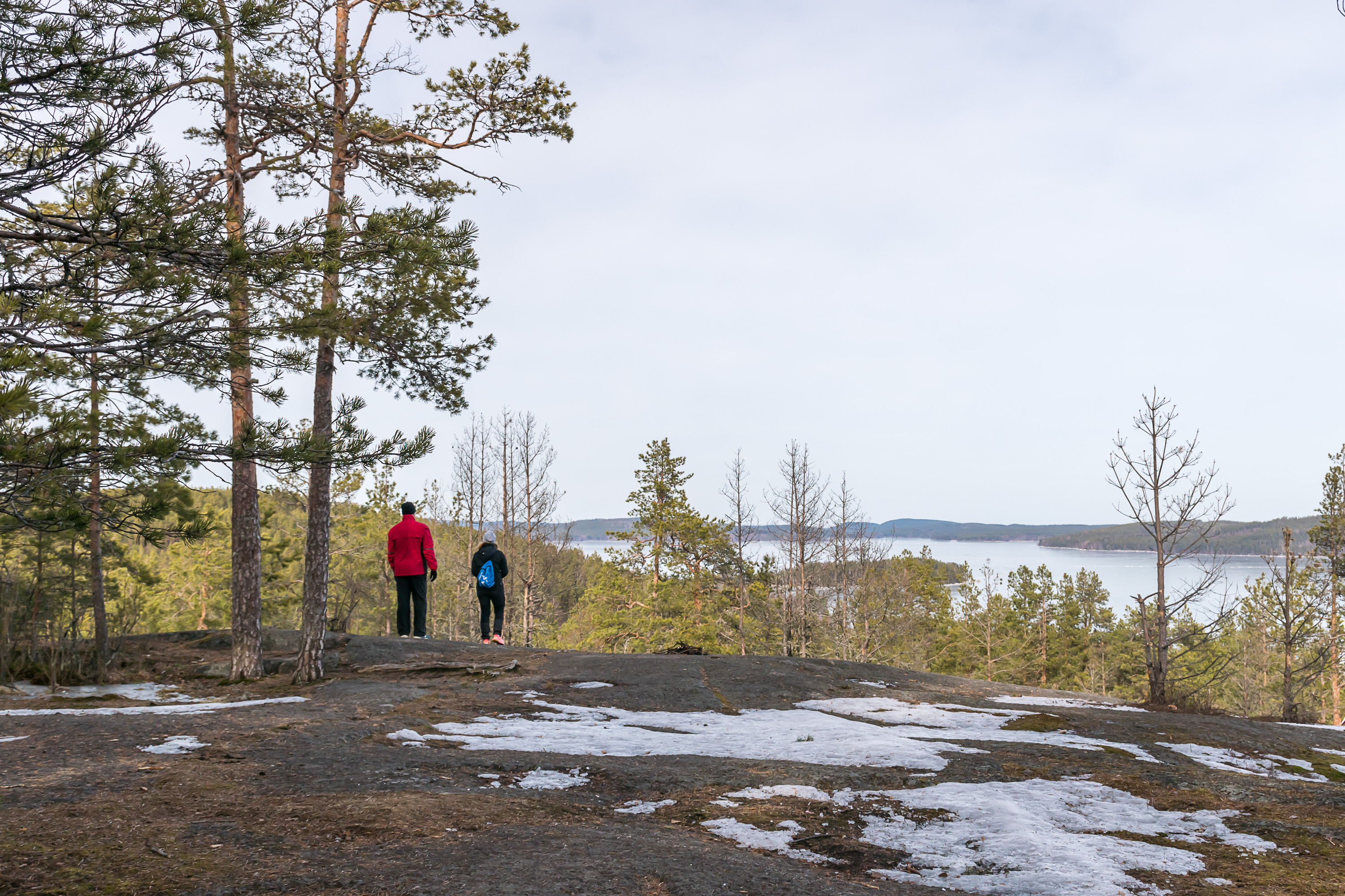
53. And then downstream of Vaajakoski the vast Päijänne lake begins. This is just a random view onto Päijänne, from Paljaspää hill (Finn. Bare Head) at Muuratsalo island, about 15 km south of Vaajakoski, and there our story ends for today.