Finland is not a mountainous country, but if we still try to make a list of its more notable mountains, then Aavasaksa should certainly be on it. This low (242 m) but prominent and easily accessible lone fell stands near the border of Finland and Sweden, by the great Torne River. The rather famous fell, chosen as one of the 29 national landscapes of Finland, in particular was almost visited by two Russian tsars, Alexander II and Alexander III.
The mountain by the important river and land route to the north has been well known through the ages. It stands about 80 km north of the town of Tornio, a port on the Bay of Bothnia. The area surrounding Tornio is known as Sea Lapland (Meri-Lappi); it is mostly flat, like the North Ostrobothnia region farther south, and is also the only area of Lapland where reindeer husbandry is never practiced. So Aavasaksa marks a sort of a border of the "proper" Lapland.
Aavasaksa is also the southernmost place in Finland where it is possible to see the midnight sun on Midsummer. It is located about 25 km south of the Arctic Circle, but the fact that it is a mountain allows you to see a little bit farther, which is supposedly just enough to catch a glimpse of the midnight sun.
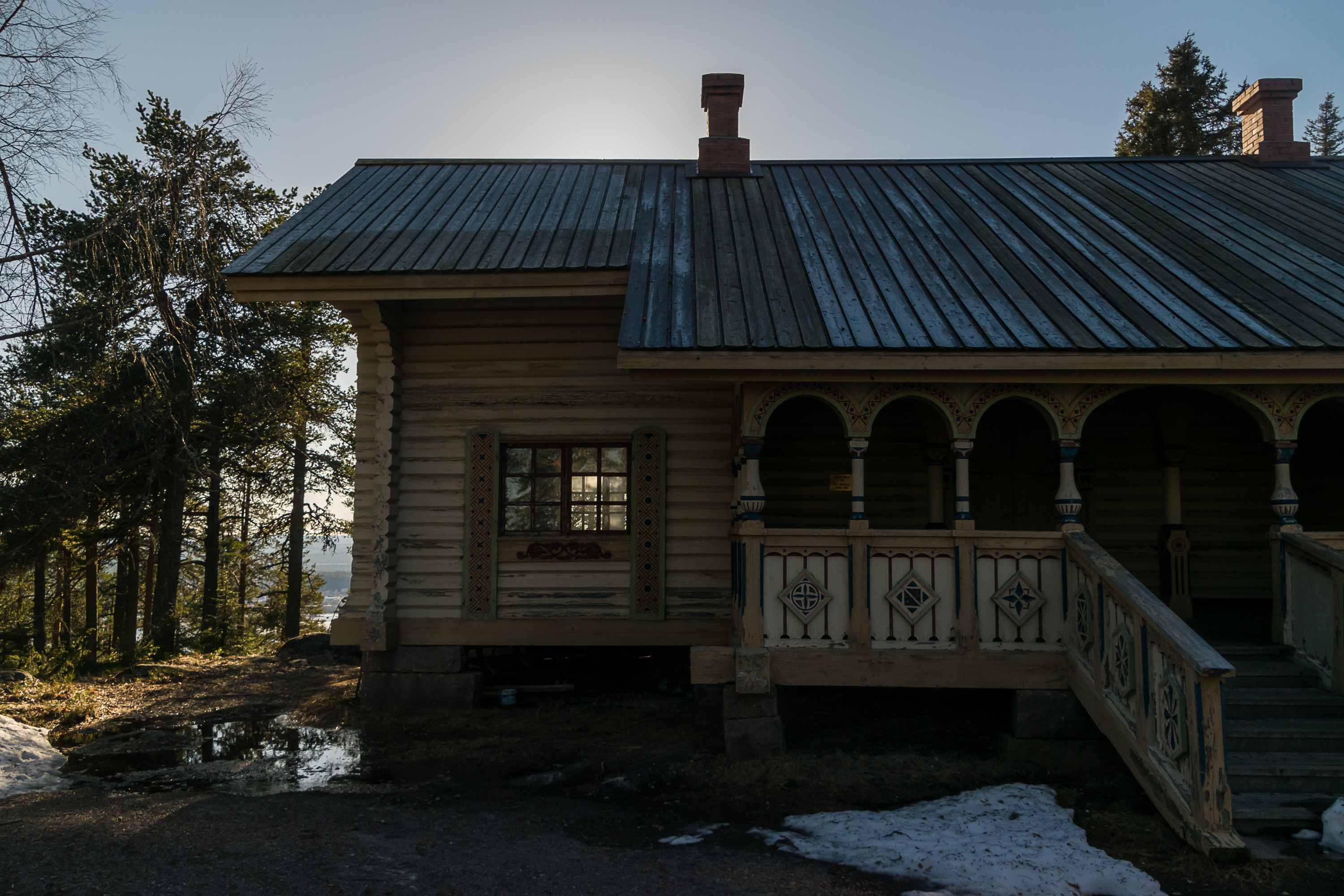
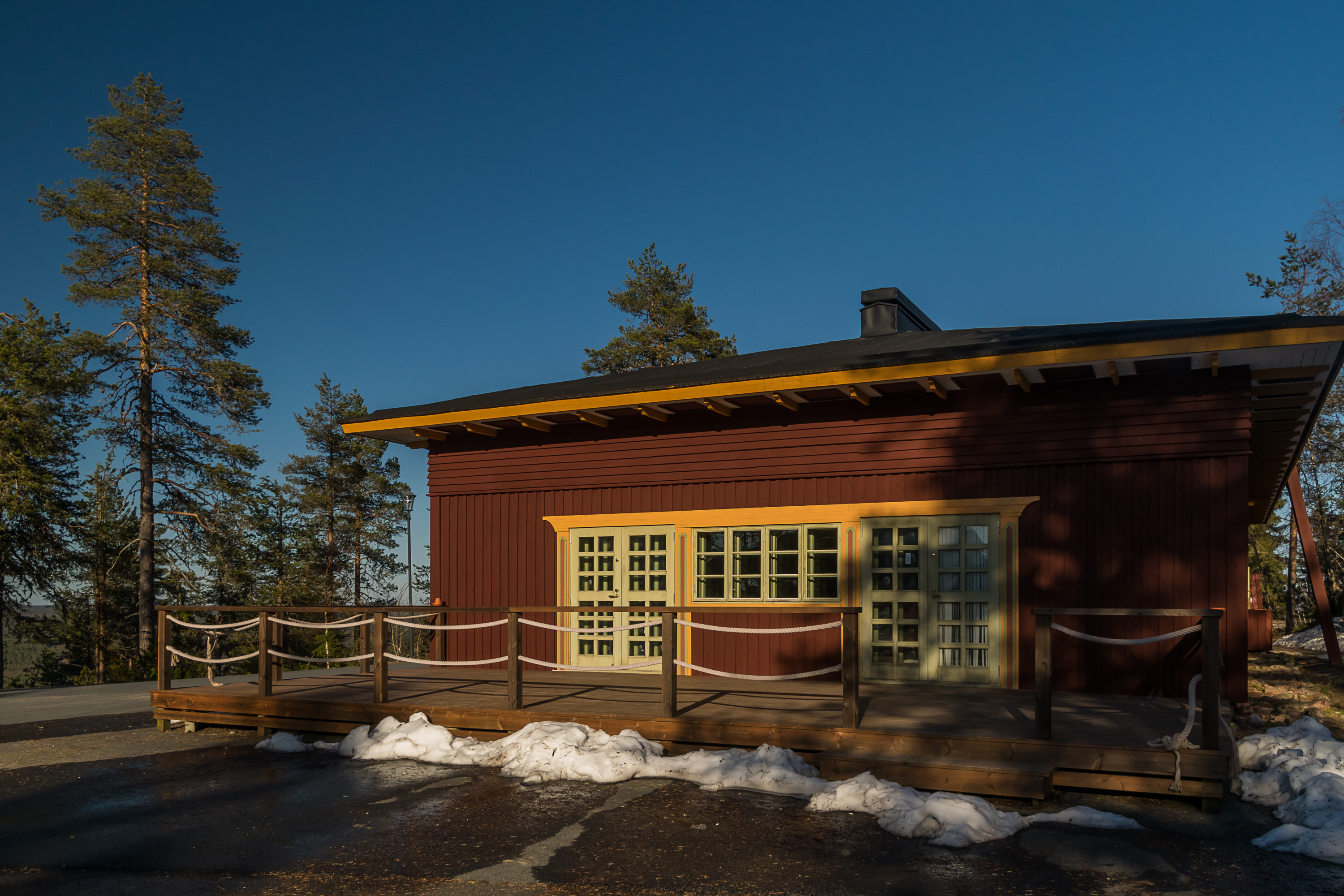
Aavasaksa area was declared a "crown park" (kruununpuisto) in 1877, and Alexander II, one of the greatest Russian tsars who was also extremely fond of Finland, intended to make a visit to Lapland in 1882. For that specific purpose, a small but beautiful Emperor Lodge buiding (Keisarinmaja, in the picture on top), meant to be used just for a single overnight stay, was designed and built for him on top of Aavasaksa by the architect Hugo E. Saurén. Unfortunately it came a little too late, as Alexander II got assassinated in 1881. Alexander III, his son and successor, intended to visit Lapland and this lodge, but ultimately never did either. The lodge nonetheless has been preserved and is currently open for public in summer, and this is the oldest existing tourist building in all Lapland. Over the years other tourist infrastructure appeared on Aavasaksa, including a 13 m observation tower (1969), road to the top, cafeteria, designated observation spots and a camping a bit lower on the mountain. While Aavasaksa was at some point one of the most accessible Lapland destinations, now that there is a good road network and airports all across the north of Finland and Scandinavia it is perhaps visited less often and more briefly.
Aavasaksa was also visited by scientists and explorers in past centuries. In the 18th century Pierre Louis Maupertuis, a French astronomer, visited these lands to make measurements of the shape of the Earth, and later Giuseppe Acerbi, an Italian explorer, climbed it on his way to the North Cape. Maupertius' experiment was repeated in a much greater scale in the 19th century by Vasili Struve, a German-Russian astronomer who constructed a huge chain of geodetic points all the way from Barents to Black Sea, using mostly various prominent terrain features for them. This allowed to measure Earth size and shape to a ridiculously high (for the 19th century at least) precision. Aavasaksa is one of the relatively few points of the Struve Arc that have memorial plaques.
The fell's name is a little weird, because it means something like "open Germany" or "vast Germany" in Finnish. The name supposedly exists since Middle Ages, when German Hanseatic League merchants made trips up the Torne River past the prominent hill to the village of Pello. But this is not certain; the name might have Sami origins also. In Finnish language the hill of such type would be called vaara(and the more precise name for this mountain itself is Aavasaksanvaara); this word means a hill that is prominent and usually rocky but still completely or almost completely forested over. Vaara-hills are extremely common in East and North Finland.
Some more pictures of Aavasaksa and its surroundings:
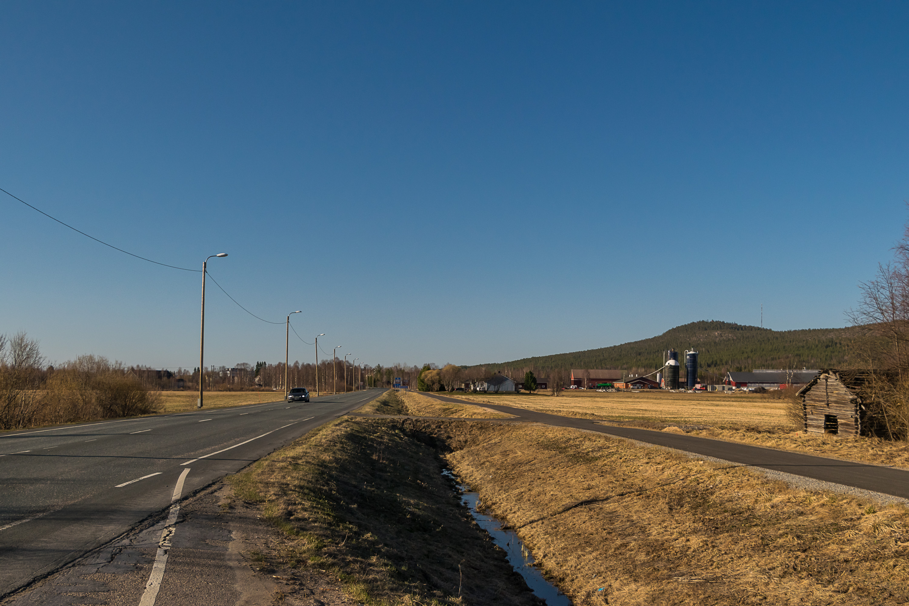
1. This is how you can see Aavasaksa (to the right) when driving to the north on the Finnish National Road 21 (Northern Lights Road). Perhaps you can even see the observaction tower on top if you open the full-size picture.
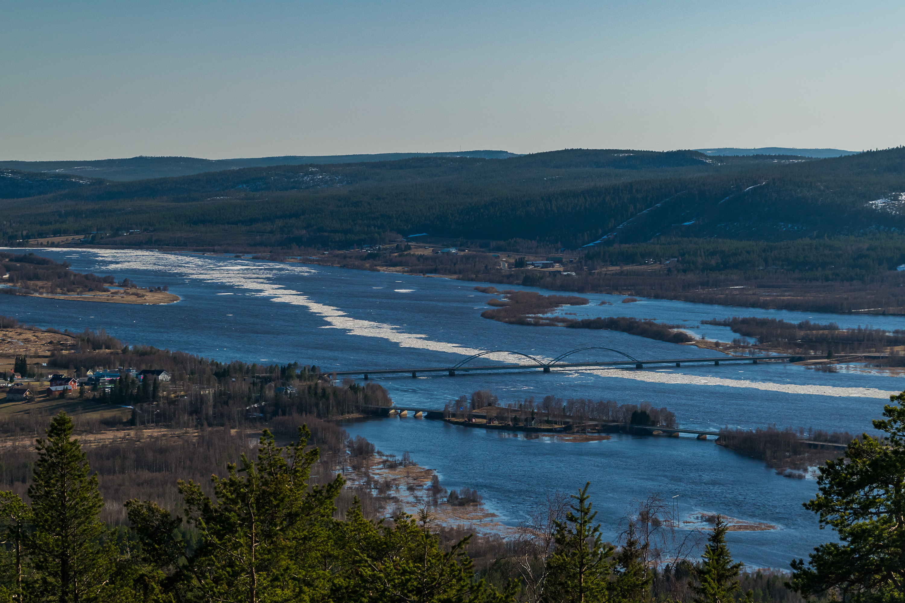
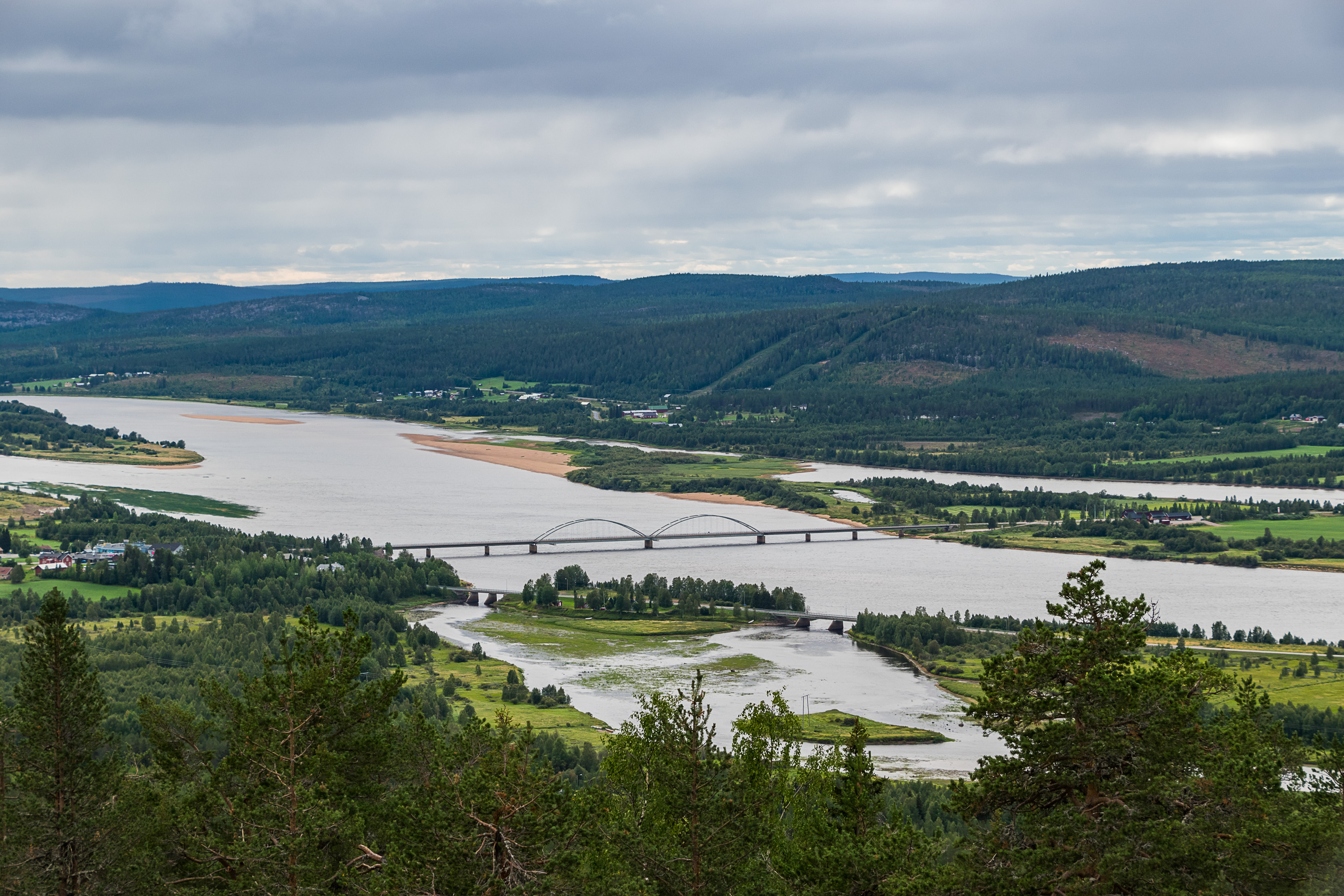
2/3. This is the view from the observation tower, in early May and in August (I happened to visit Aavasaksa twice in 2018). The river is Torne River (Tornionjoki/Torne älv), the border river of Finland and Sweden, and thus the bridge is a border bridge, and on the other side of the river is Sweden already. The village at the foot of Aavasaksa is also named Aavasaksa; about 5 km to the south are the twin towns of Ylitornio/Övertorneå (both meaning Upper Tornio in Finnish/Swedish) on both sides of the river.
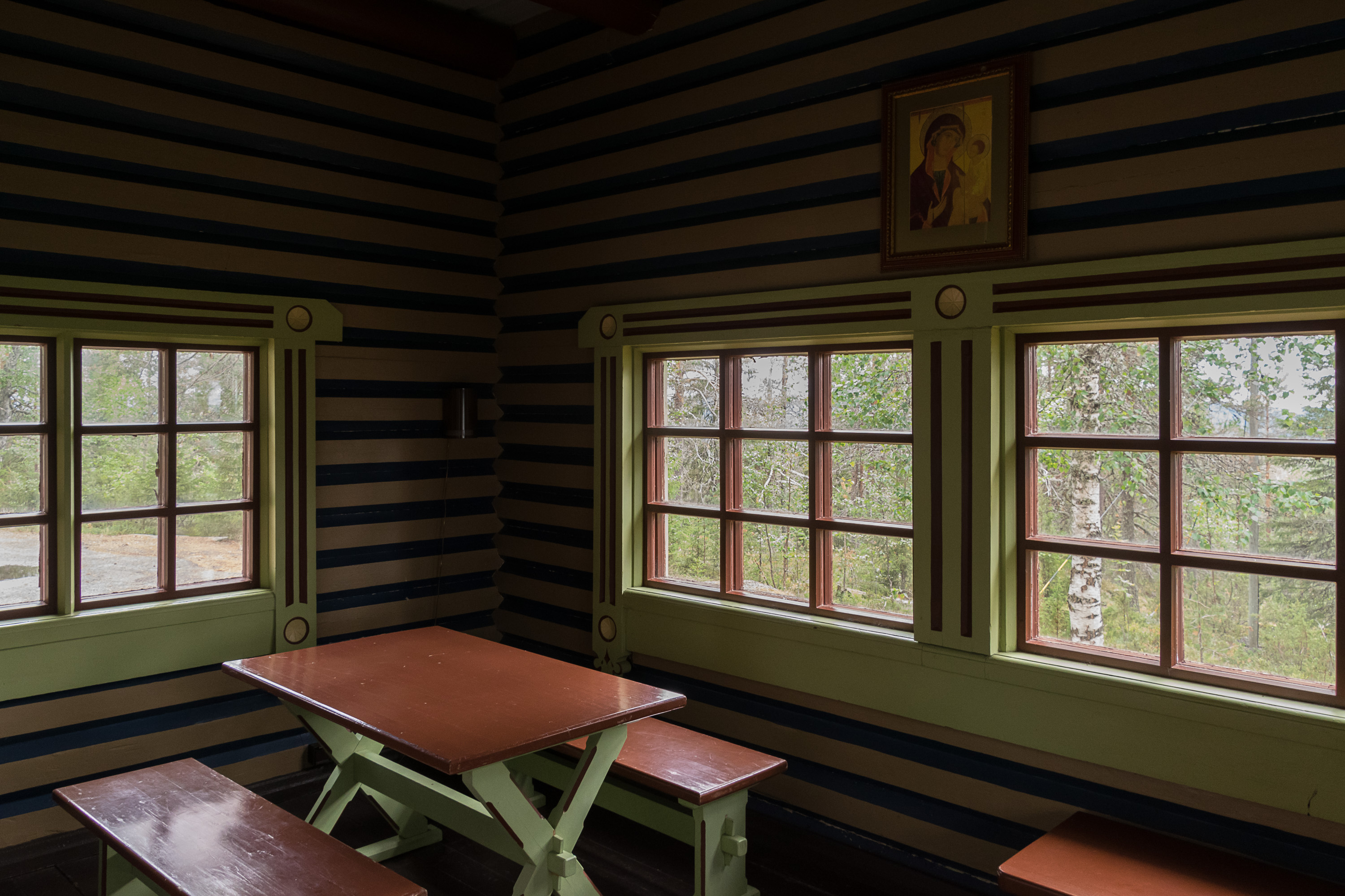
4. Emperor Lodge interior.

5. View from the side of Aavasaksa. On Midsummer you should be able to see midnight sun from here. At the foot of this side of the mountain is Tengeliö River.
6. Cafe/pavillon.
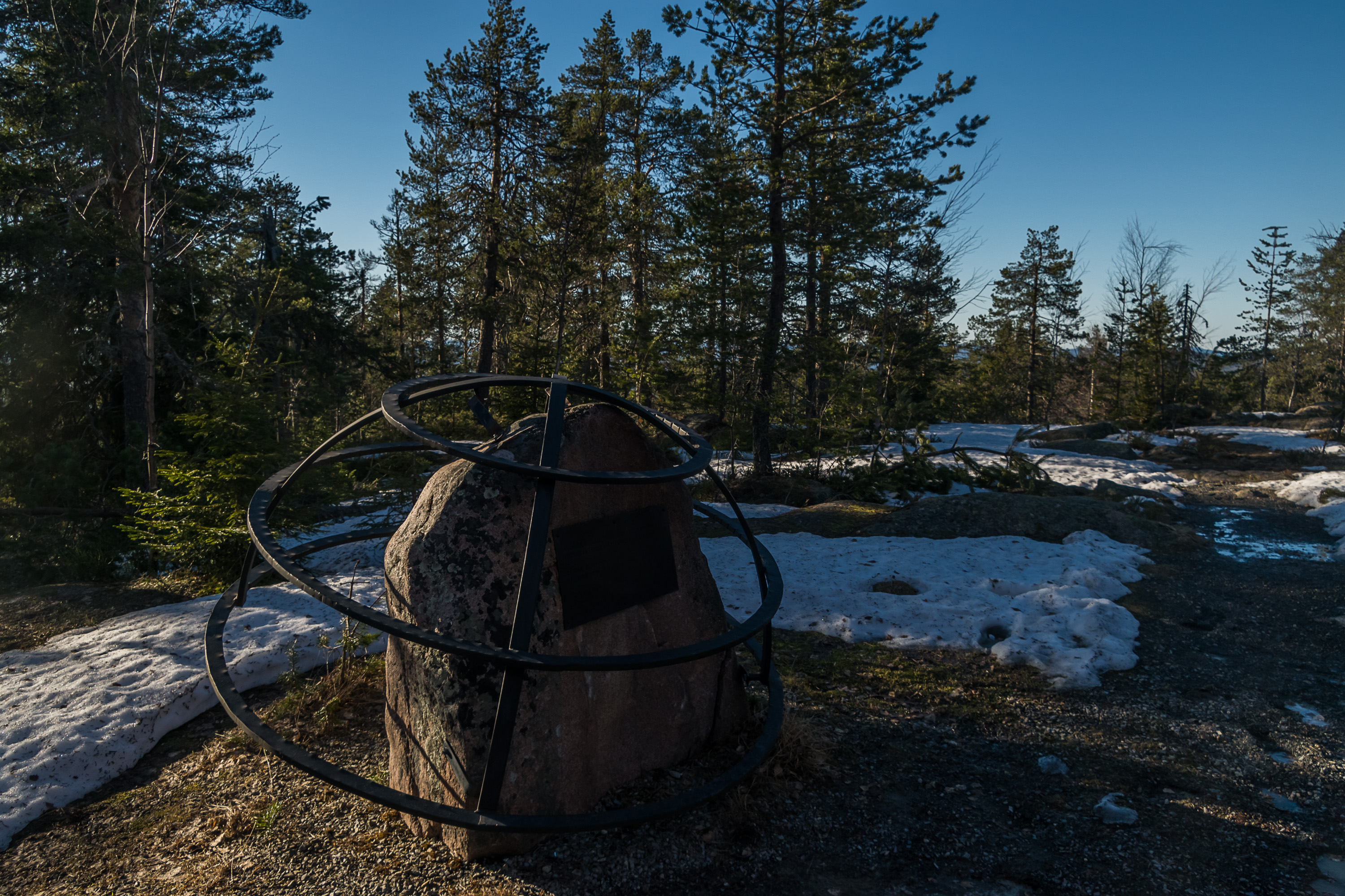
7. Struve Arc monument.
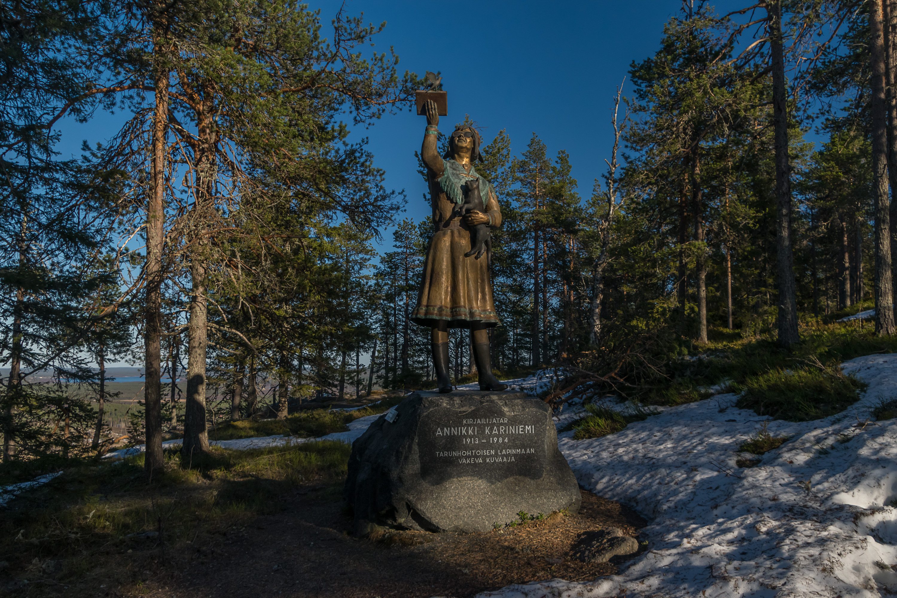
8. There is also a monument to Annikki Kariniemi, the first female writer from Lapland. She's wearing a Sami dress here; her family had Sami roots but generally identified as Finnish, since being a Sami unfortunately was not considered a very good thing in those days.