The southeasternmost region of Finland is called Kymenlaakso, which means Kymi Valley in Finnish. It is not the largest region of Finland, nor the most important one; and it does not correspond to any historical province, as its territory used to be split between Uusimaa, Karelia, and Tavastia. Its population is 180,000 which, honestly, isn't that much.
Nonetheless, Kymenlaakso in my opinion has a distinct and charming personality. Over the last year I've seen a fair bit of Finland; so far I haven't really seen any towns or places I really disliked, but I must admit some places do really seem a bit bland (Mikkeli and Joensuu come to mind, for example). Kymenlaakso, on the other hand, is really a place you just want to come back to again and again. And best of all, it is very close to the Russian border, so you can come and visit and see quite a bit over just a weekend.
Kymenlaakso consists of three cities (Kotka, Hamina, and Kouvola), and several rural municipalities. Its geography is typical of Southern Finland: jagged rocky coast with numerous skerry guards, and bright pine forests inland. Kymenlaakso lies just outside the great Finnish lakeland, and it has no major lakes and just one major river, but it's a pretty big one, named Kymi (Kymijoki). Kymi is one of the few rivers penetrating the Salpausselkä Ridge (Finn. Padlock Ridge), a low but solid ridge marking the southernmost border of the Ice Age glacier (in other words, a terminal morraine). Päijänne Lake, the second largest lake system of Finland, drains through Kymi into the Gulf of Finland; however Päijänne itself does not belong to Kymenlaakso.
Kymenlaakso naturally splits into two subregions: Kotka-Hamina is the part of Kymenlaakso along the coast of the Gulf of Finland, and Kouvola is the more inland part. Kotka-Hamina subregion, in particular, promotes itself as "The Coast of Good Winds", under "Southwest 135°" brand; see their tourist website. And while "The Coast of Good Winds" might not be an especially imaginative slogan, it really suits this place, as I learned in my solo weekend road trip in September 2015, which I'm about to tell you about.
I visited the Salpa Line Museum and the city of Hamina in the first day, then slept in a cabin in Pitkäthiekat Camping near Hamina, and then saw Kotka and its Vellamo Marine Museum in the second day. Still, this series of posts will be a little out of the chronological order; first I intend to tell of the bits which do not belong elsewhere.
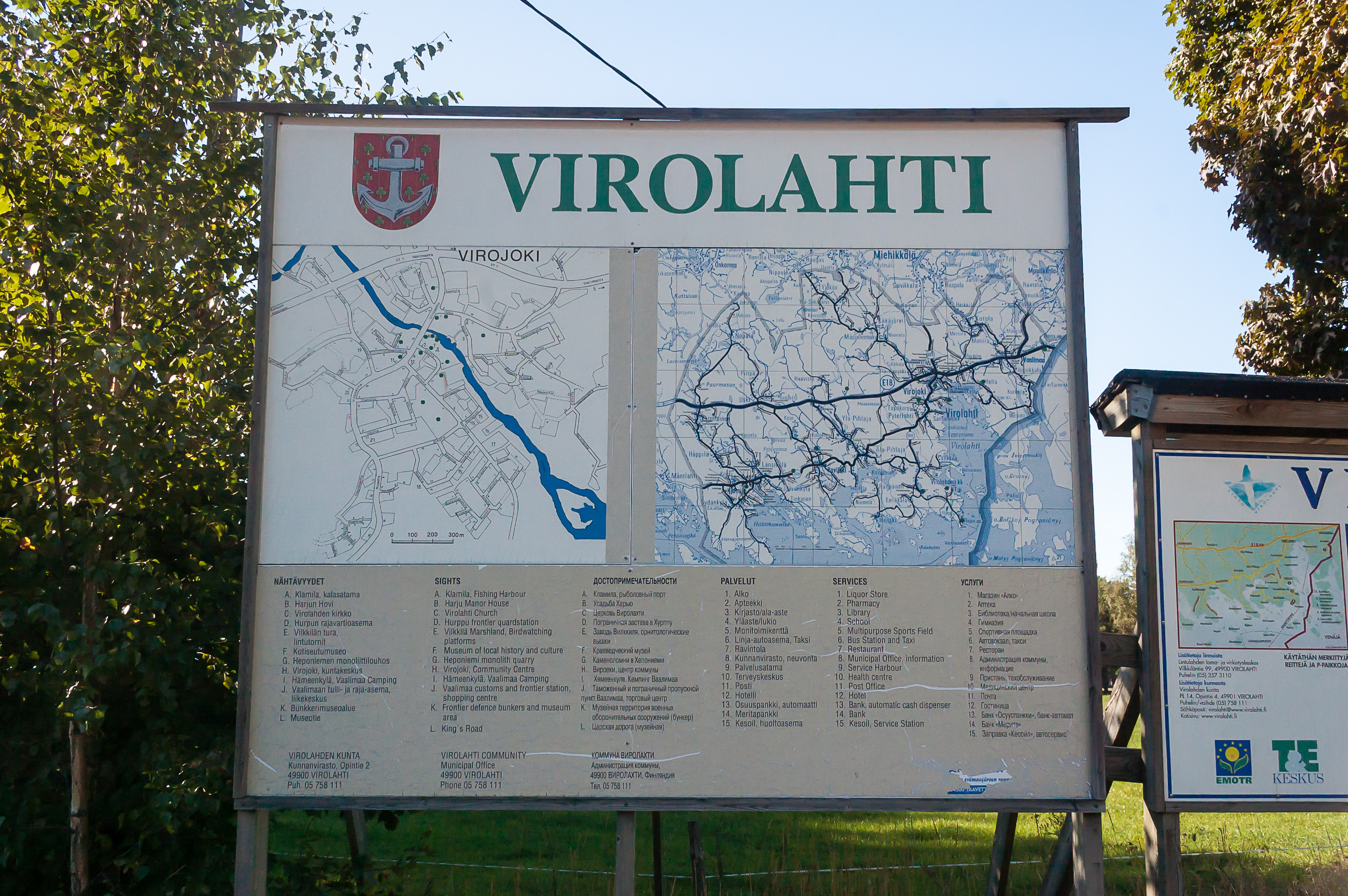
1. If you pay attention when you enter Finland from Russia through the main border crossing point, Torfyanovka-Vaalimaa (on the E18 European Route, St. Petersburg — Helsinki[ — Turku — Stockholm — Oslo]), you may notice two signs, saying Kymenlaakso and Virolahti. And Virolahti Municipality is indeed the very first municipality of Finland you'll see on your way towards Helsinki, if only briefly.
Virolahti is a rural municipality, with population of about 3,500. Its name means "Estonian Bay"; Viro means "Estonia" in Finnish. Virolahti villages sprung up here, along the King's Road, back in the middle ages, and apart from fishing and farming, the major occupation of the locals was trade with Estonia across the Gulf of Finland. There is a word in Swedish without a precisde translation, bondeseglationen; it more or less means sea trade carried on by local peasants, as opposed to merchants; and bondeseglationen was very popular with Virolahti locals. The Gulf of Finland itself is 120 km wide here (it's pretty much its widest part); Estonian cities of Narva and Sillamäe lie across it. Virolahti Bay itself, about 10x3 km in size, is clearly visible in the east of the map on the picture. The eastern coast of this bay is Russian territory already.
Municipalities in Finland can be divided into cities (kaupunki) and rural municipalities (kunta). Rural municipalities typically have the central village (keskustaajama) and the church village (kirkonkylä), which in practice are often the same village. Church villages were historically more important, being the parish centers. In case of Virolahti these are different; the central village is Virojoki, and the church village is literally named Virolahden Kirkonkylä.
Virojoki village can be briefly seen while driving on the main National Road 7 from the Russian border to Helsinki, although this will change in a few years; the last motorway section of Road 7, from Hamina to Russian border (32 km), is due to be finished by 2018. I didn't stop in Virojoki itself and drove straight to Virolahden Kirkonkylä, a few kilometers to the south.
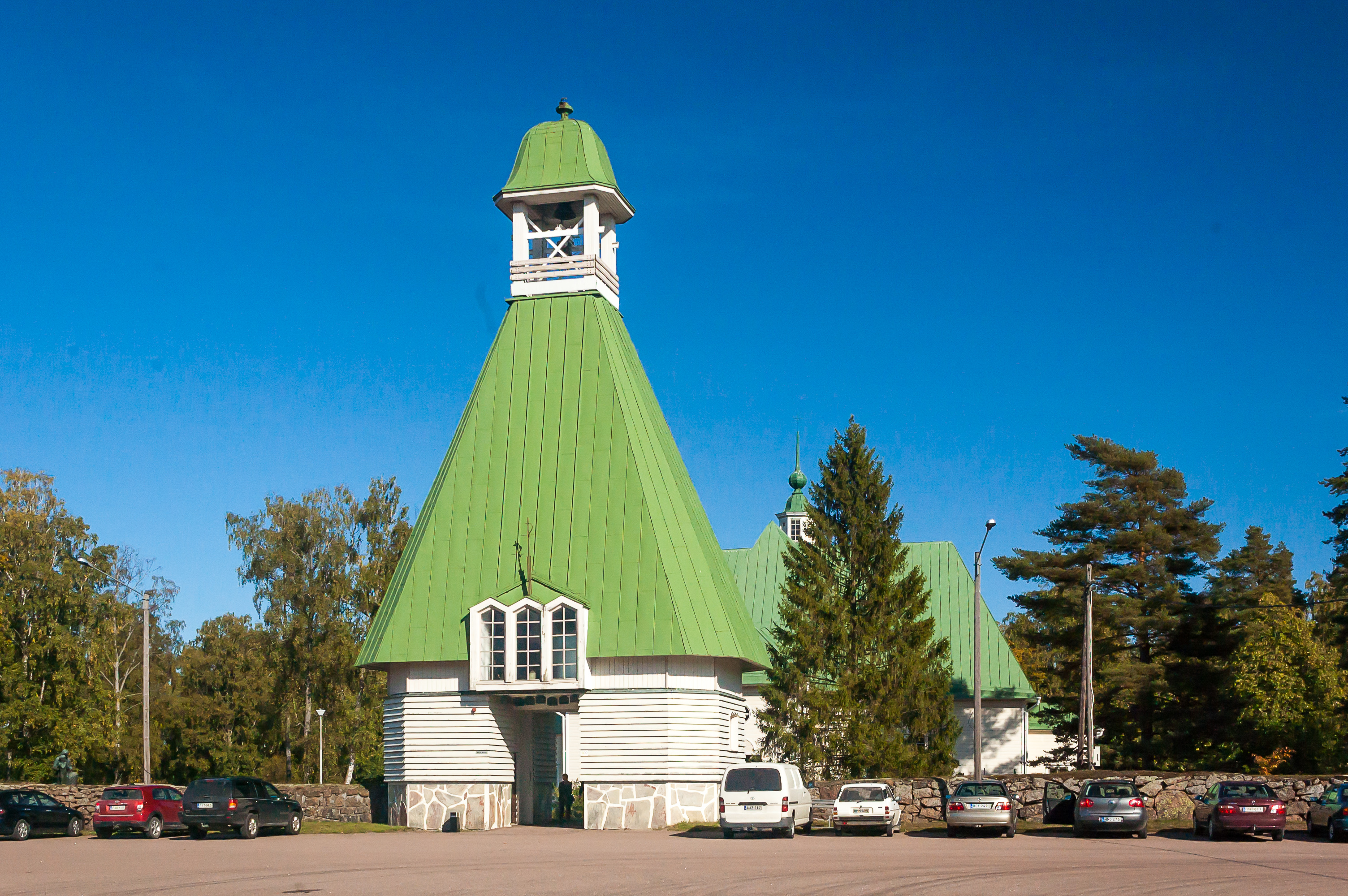
2. So here is the church at Virolahden Kirkonkylä. It is a wooden church with a large wooden belltower, built in 1768. Some service has just ended as I drove near; probably a funeral service, as most people leaving wore black. I didn't enter the church itself, and I didn't explore the village as well, which is a pity. The oldest building of Virolahti is located just beyond this church; it's a small stone sacristy, built in the 16th century.
To the southeast of Virolahden Kirkonkylä there is a village named Hurppu, which is notable as the place of summer residence of Russian Emperor Nicholas II. Russian emperors valued Finland for its calmness (which remains a distinctive trait of Finland to this day). Alexander III in particular loved fishing in Kotka, also in Kymenlaakso, and his fishing lodge remains a significant modern attraction. And his son, Nicholas II, preferred Virolahti, but he used to spend most of his time here aboard his steam yacht named Standart, and virtually no traces of the last Russian tsar remain on Virolahti coast itself. Perhaps the memory of Nicholas II is the reason behind this project of building an extremely luxurious hotel in Hurppu that I found. Its investor is Russian, it seems.
Another place connecting Virolahti to Russian history is its granite quarries in Pyterlahti village, between Virojoki and Virolahden Kirkonkylä. These quarries are where the granite for the columns of the magnificent St. Isaac's Cathedral, Troitsky Bridge (Russ. Trinity Bridge), Alexander I Column, and various other landmarks and buildings of St. Petersburg was mined. This distinctive grainy variety of granite is also known as rapakivi (Finn. crumbly rock). The old quarries can still be seen near Pyterlahti, and mining operations continue in the newer quarries to this day.
3. Modern National Road 7 connects Virolahti and Hamina. The road bypasses most local villages (apart from Virojoki), and despite being an ordinary two-lane road for now, it is straight enough that overtaking etc. is simple enough. This road however was constructed only in the 1960s, and before that the only east-west route in this part was the ancient King's Road.
The King's Road, or Kuninkaantie in Finnish, is one of the old roads of Finland, known since the Middle Ages. It originally connected Turky (Åbo) with Vyborg, passing through a number of towns and villages, eventually including Helsinki, which is younger than this road (Helsinki was established in 1550). The route extended to the west across the Baltic Sea, through Åland Islands into Stockholm and Bergen, and to the east towards Swedish fortresses of Kexholm and Nyenskans, before the latter was destroyed and replaced with St. Petersburg by Peter the Great.
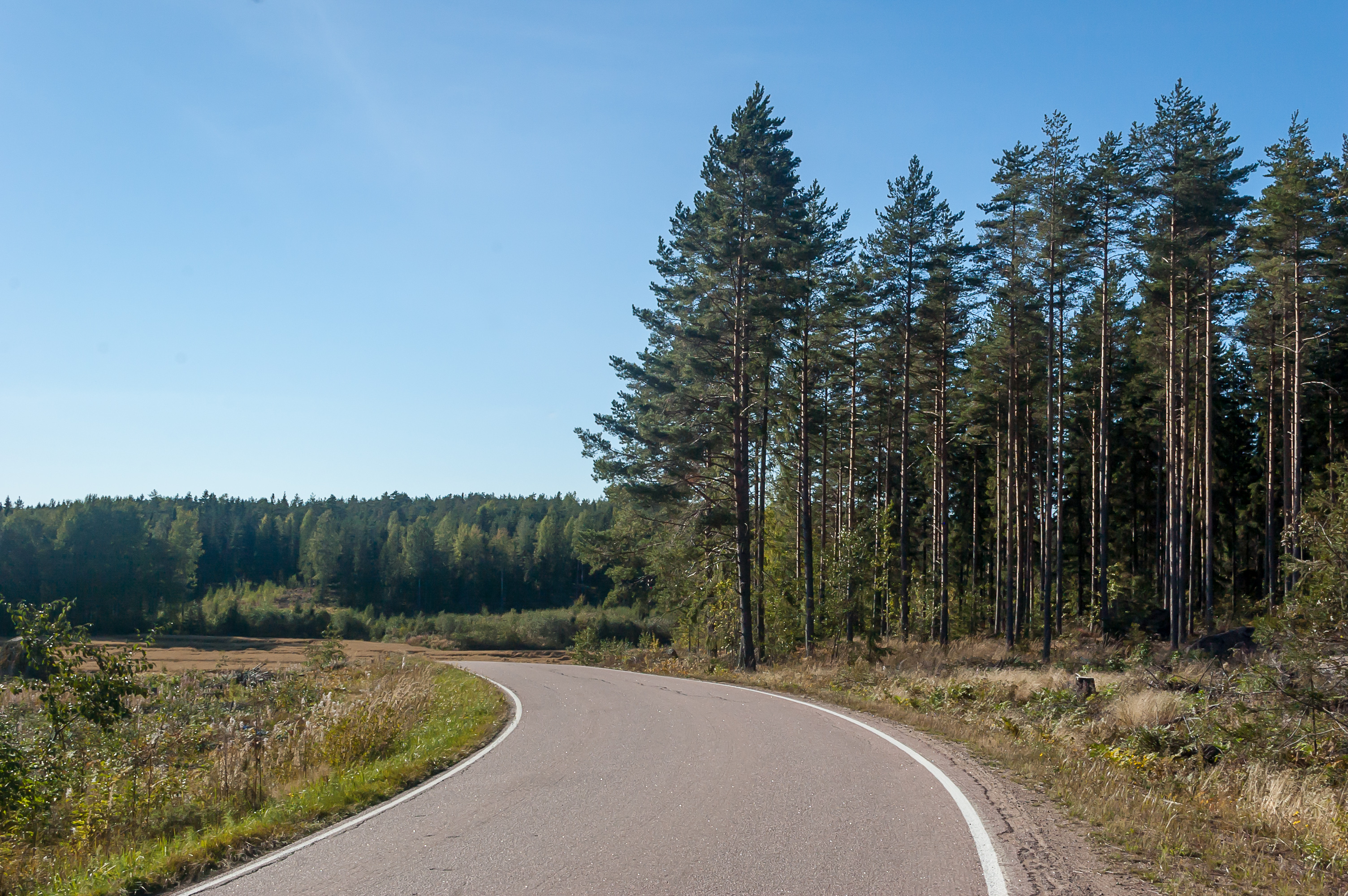
The ancient road very approximately matches modern E18 Route, which in Finland includes Roads 7 and 1, and Helsinki Ring III, but of course road alignment changed many times over the centuries. Almost the entirety of the modern route is a motorway; older Roads 7 and 1 still exist as Roads 170 and 110, parallel to the new ones. But even these roads are relatively modern, built in 1960s when the mass construction of the national road network of Finland took place. Road 170/7 in Hamina and Virolahti was constructed in 1966; before that, the only road was the ancient King's Road, way more narrow and curvy. The King's Road stretch in Virolahti has since been known as Yhdystie 3513 (Finn. Connecting Road). Which is the road you can see in the picture.
Road 3513 is 35 km long, one of the longest of Finnish museum roads (Museotie). Museum roads not always correspond to tourist routes; usually this moniker is assigned to very old roads preserving their historical alignment. It doesn't mean there's necessarily much to see along this road. It's certainly the case for Road 3513; apart from stone kilometer markers, which can be seen on more modern roads too, it looks fairly ordinary. In particular, it is completely paved; don't expect to see ancient flagstones or anything of the sort. The only hint of history is the narrowness and the bendyness of this road; its speed limit is 60 km/h and some bends are uncomfortable even at this speed. As expected, traffic is very low.
Modern King's Road tourist route continues on westwards beyond Road 3513 on more modern roads. Currently it is probably the best known tourist route of Finland. The map of all tourist routes is available here, although I'm not sure whether this is an official source.
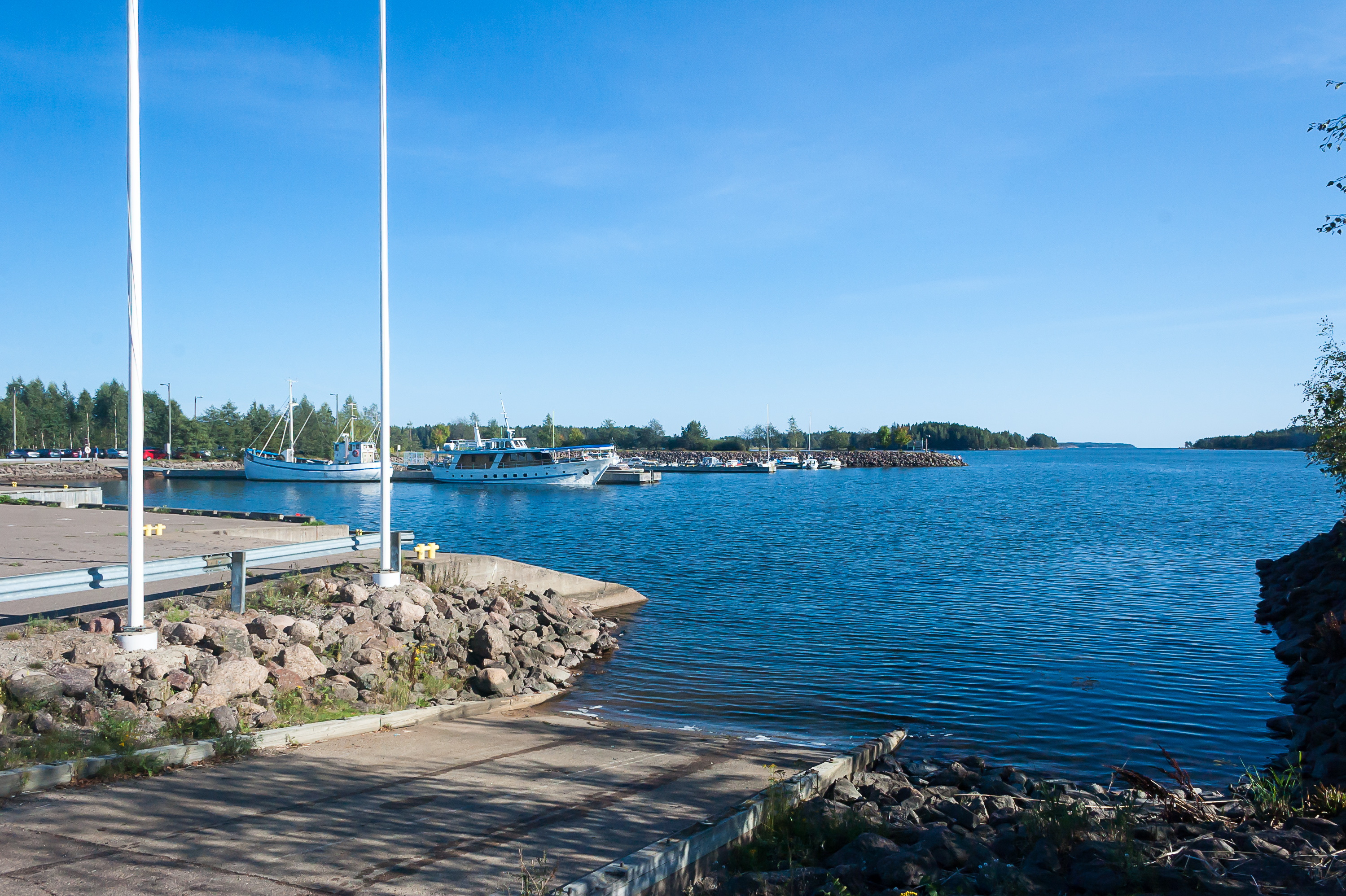
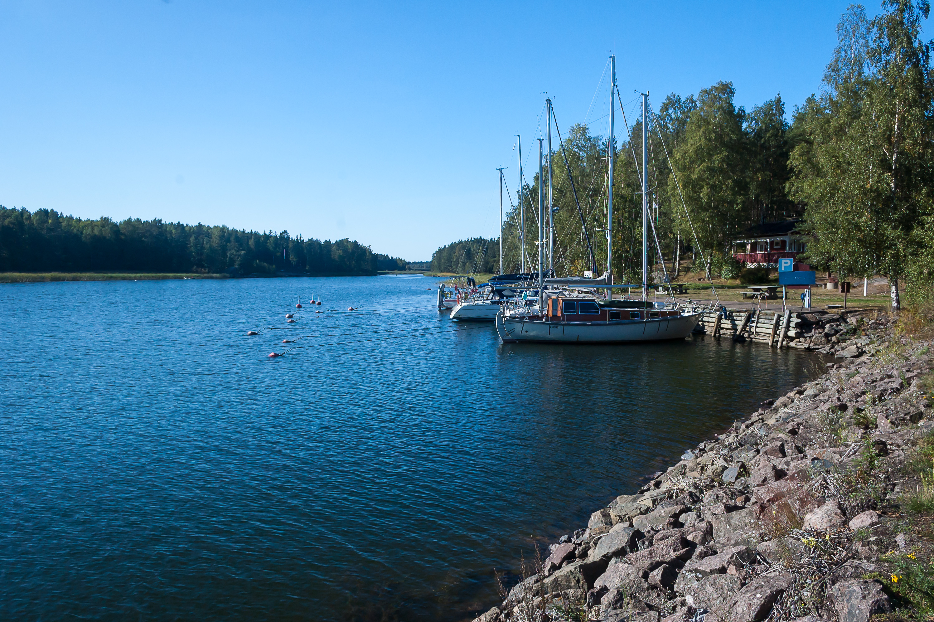
4. The most significant village on the museum road is named Klamila. Located near a small bay, its harbor is quiet but somewhat larger than you would expect. This is the easternmost Finnish port accepting international vessels.
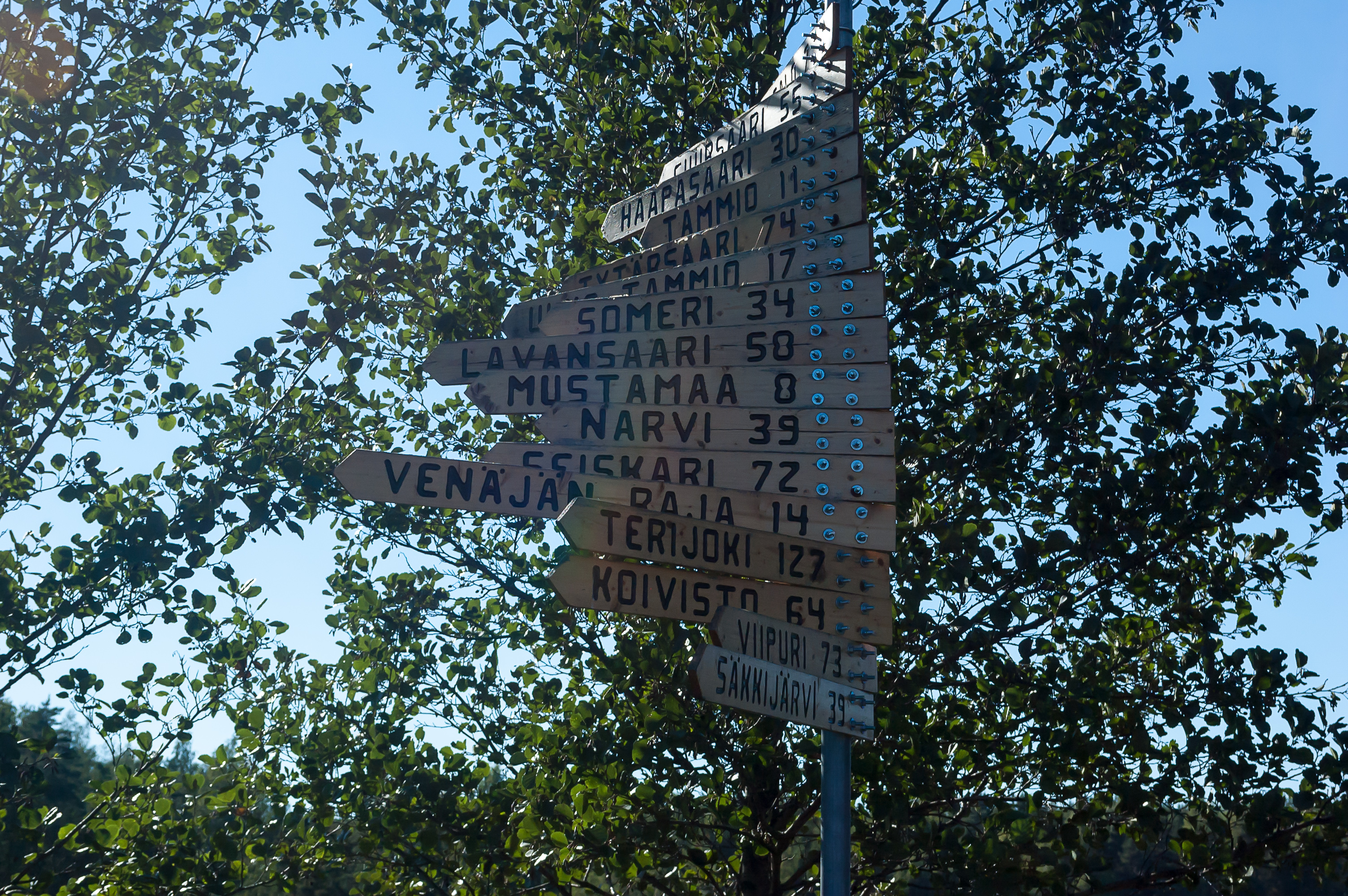
5. These signs in Klamila point not towards Moscow, Tokyo, Paris, London, and other world capitals, as such signs usually do, but rather towards neighboring villages and other places of interest.
Säkkijärvi, Viipuri, Koivisto, and Terijoki refer to towns now belonging to Russia, and named Kondratyevo (after Col. Pyotr Kondratyev, a Russian fighter wing commander, who fought over Karelian Isthmus in Winter War and Continuation War, and was shot down there in 1943) Vyborg, Primorsk (Russ. Seaside Town), and Zelenogorsk (Russ. Green Mountains Town). Venäjän Raja means Russian border.
Other interesting places mentioned are Seiskari, Narvi (not to be confused with Narva the Estonian city), Lavansaari, Tytärsaari, Suursaari and a few others. All of these are relatively isolated islands scattered in the middle of the Gulf of Finland, far out of the view of the coast. They used to hold some Finnish villages, but all of them went to the Soviet Union after the war (even the ones located significantly westwards of the land border), and are now uninhabited except for border stations, lighthouses, and possibly some military installations.
Lavansaari in particular (now known as Moschny (Russ. Powerful) Island) was the location of the outermost Soviet naval base on the Baltic Sea during most of the 1941-1945 war. I remember this well because of Sekretny Farvater (Russ. Secret Channel) novel, which is in my opinion one of the best books about that war. It is set around the (fictionary) modern so-called "Flying Dutchman", a secret Nazi submarine, perfectly ordinary but tasked with missions to set up clandestine trade relations between Nazi Germany and neutral and even Allied nations. In 1944, a Soviet torpedo boat commander, stationed at Lavensaari and regularly sent on minelaying and reconnaissance missions in the skerry guards between Vyborg and Virolahti, accidentally discovers an unusually well-fortified and disguised harbor in the skerries; Dolgy Kamen (Pitkäpaasi) island is mentioned, which places this harbor in an archipelago just to the east of Virolahti. From this harbor, serving as one of the bases for that "Flying Dutchman" submarine, its trail begins to unravel.
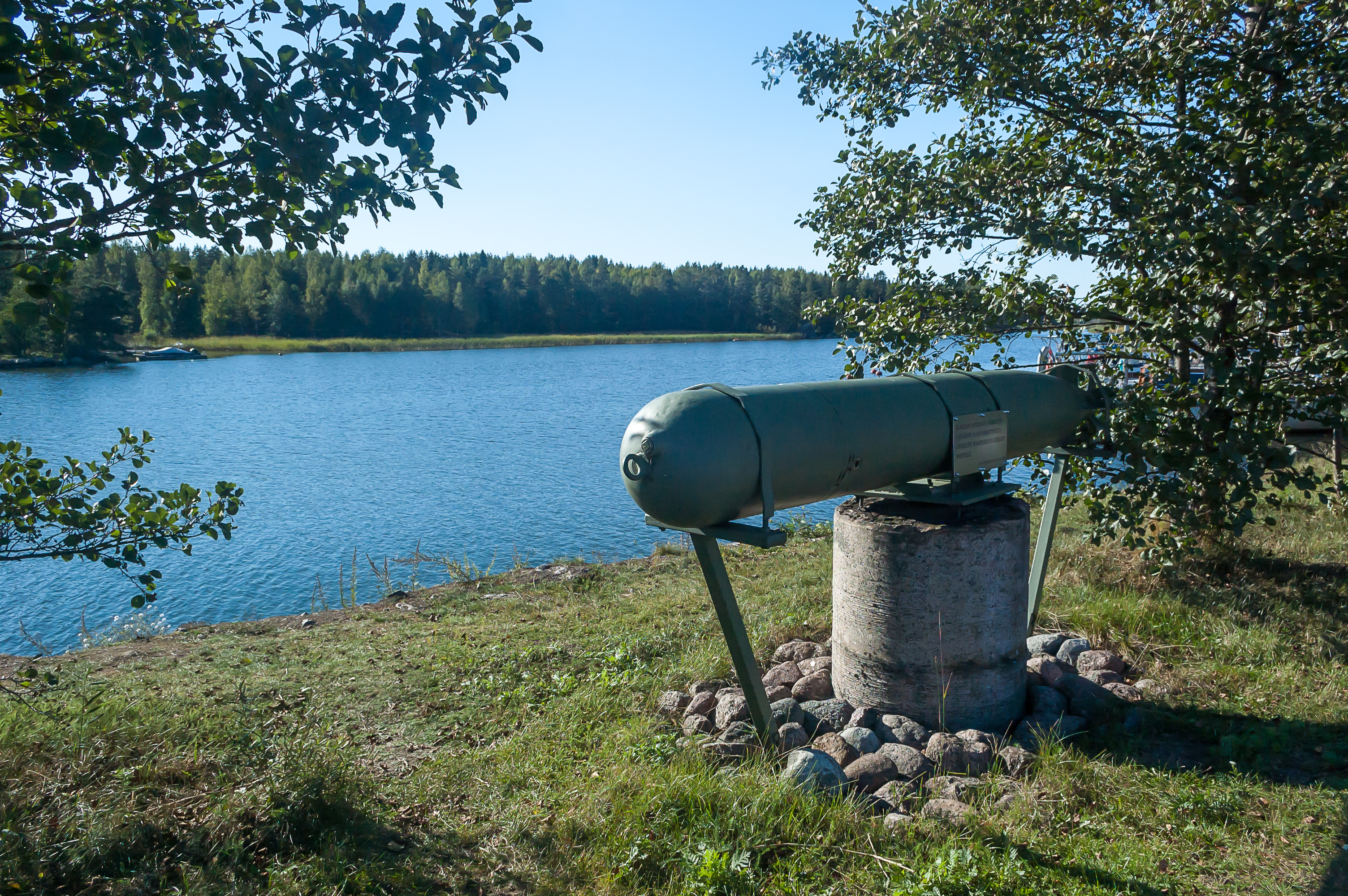
6. Coincidentally, the Finnish torpedo boat flotilla in the war happened to be stationed right here in Klamila. A torpedo reminds here of the fact. Curiously, in that Sekrenty Farvater book, the enemies are uniformly referred to as "fascists", although apart from the "Flying Dutchman" submarine crew, most of them were in fact Finnish, at least in the first half of the book set here in the Gulf of Finland. Apart from the episode with a Finnish fighter shot down over the sea (because the nationality of its pilot becomes a plot point), there are virtually no references to the fact that the Finnish were another distinct side in this war.
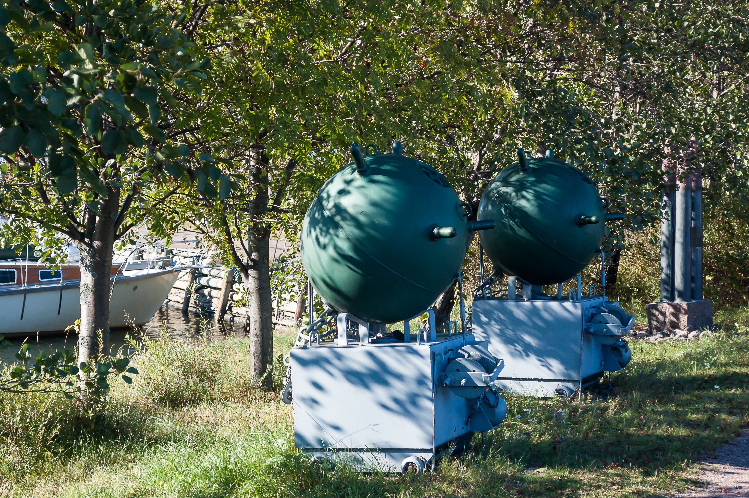
7. Along with a torpedo, there are two mines.
8. A small bay west of Klamila harbor.
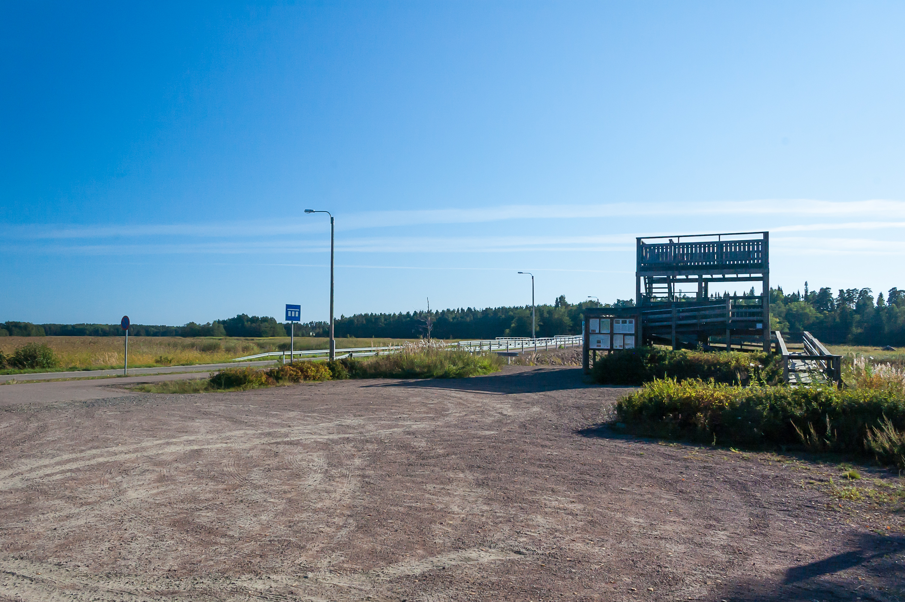
9. Southeast of Hamina, near the end of the museum road section, there is a birdwatching tower. Such birdwatching towers seem to be relatively common in Finland. It seems a little surreal that someone (the government presumably) goes to the length of building a small wooden tower and a fairly big parking lot just so some Finns can go birdwatching.
This tower is located in Hamina Municipality already, but birdwatching is specifically noted as a local attraction in Virolahti. As I understand, migratory birds commonly make a stop in Virolahti area when going from the south to the north, in late May. There are even some Arctic Days held yearly to celebrate the event.
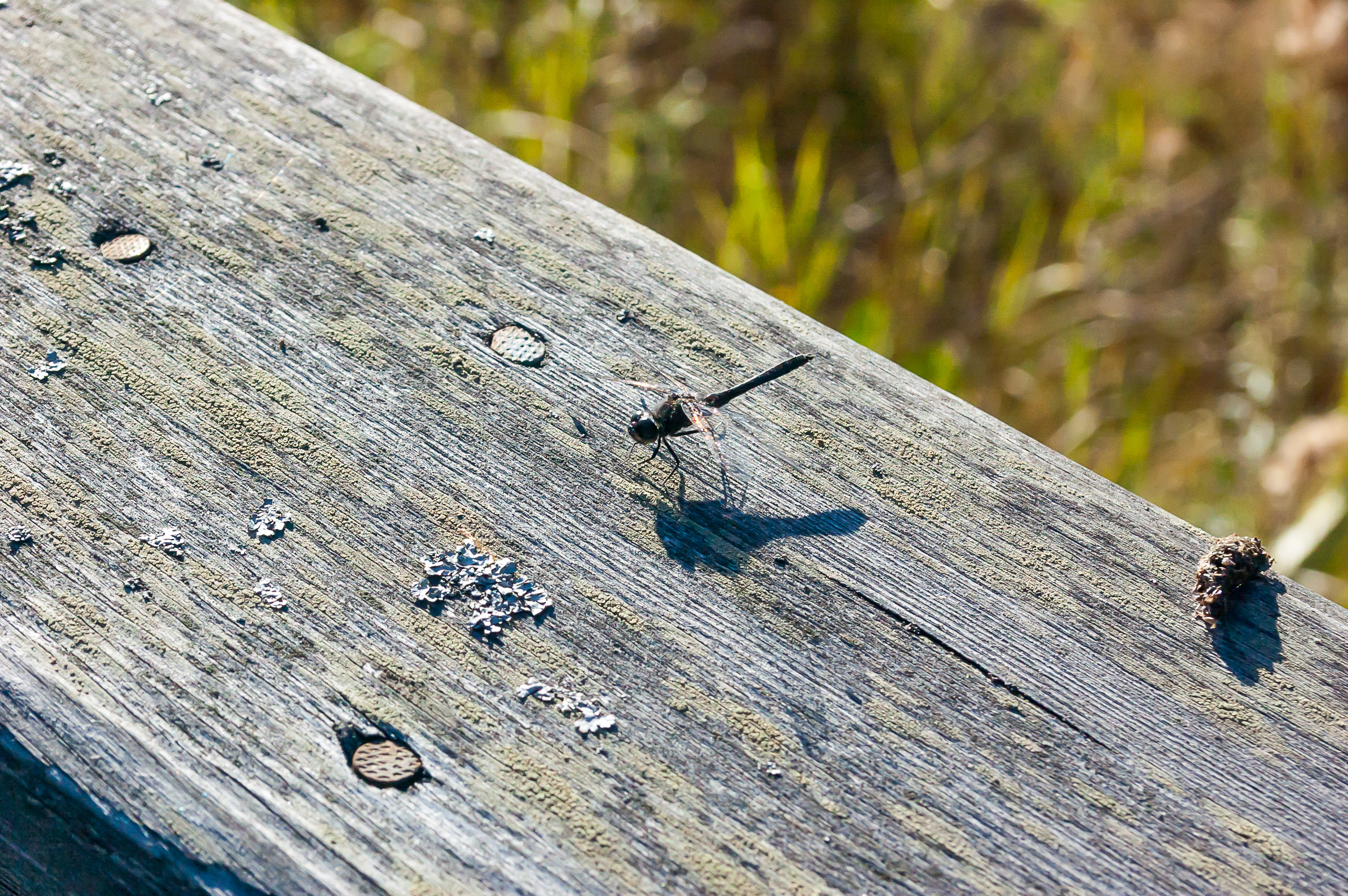
10. Apart from birds information boards near the tower mention some dragonflies, and indeed I saw a few dragonflies sunbathing on the wooden handrails.
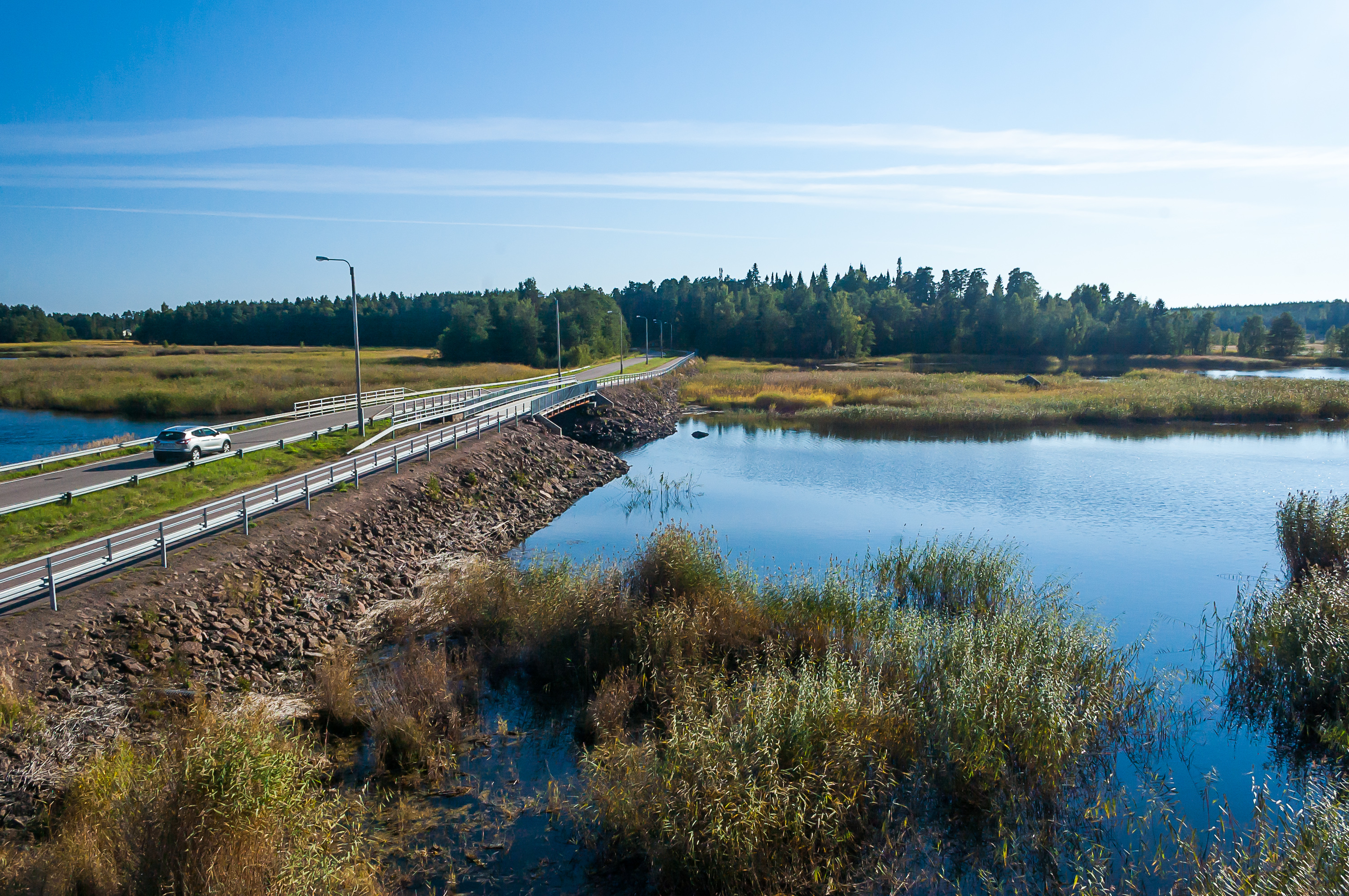
11. The tower is located near a bay separating Hamina from Vilniemi, a village where Pitkäthiekat Camping is located. The narrowest part of the bay is called Lauttasalmi (Finn. Ferry Strait). Presumably there once was a ferry crossing in place of this bridge.

12. The view from the birdwatching tower. I looked around with my binoculars (which I carry around in my car but very rarely remember to actually use) and actually happened to spot a large predatory-looking bird on a rock in the middle of this picture, an eagle maybe; I'm extremely ignorant about ornithology. I failed to capture this bird in any pictures though.
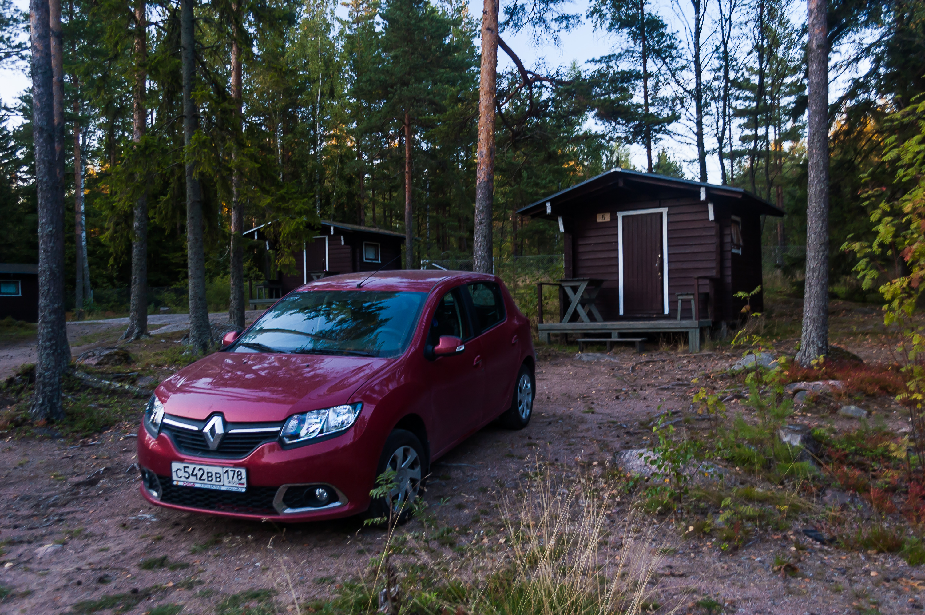
13. I booked a tiny cabin in Pitkäthiekat Camping, costing €40/night. This was not the tiniest cabin I've ever been into; it had four beds, a window, and a microwave oven with a tiny freezer; the tiniest cabin in Rauhalahti Camping in Kuopio, for example, didn't even have that. While the lack of toilet and shower is inconvenient, I still love such tiny cabins.
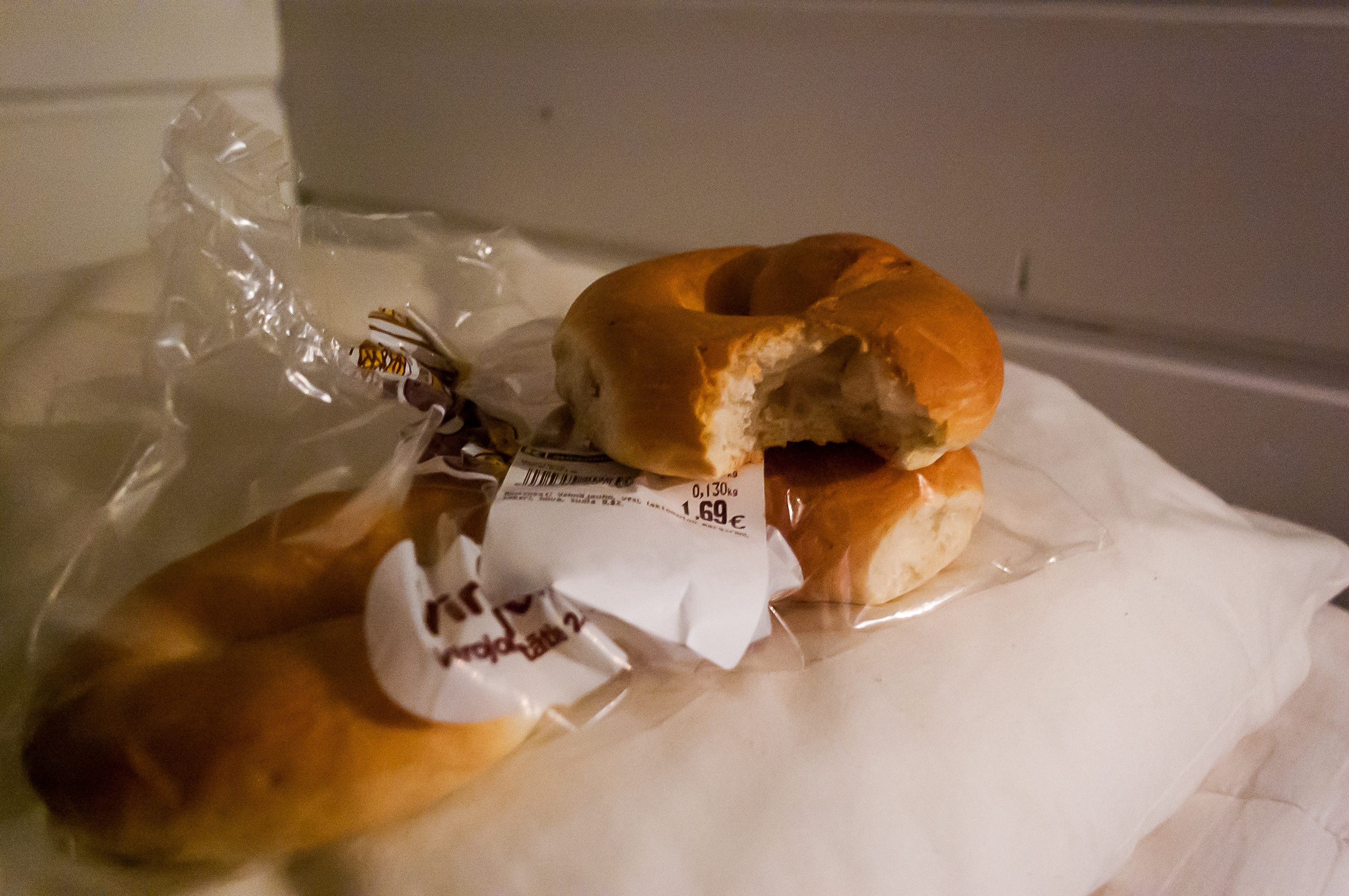
14. Apart from some cider, which I traditionally buy and drink whenever I go to Finland (for some reason they have a much broader assortment of cider than most Russian supermarkets), I spotted some "Virolahti bagels" in a Hamina supermarket, and couldn't resist buying some. Pretty basic bagels.
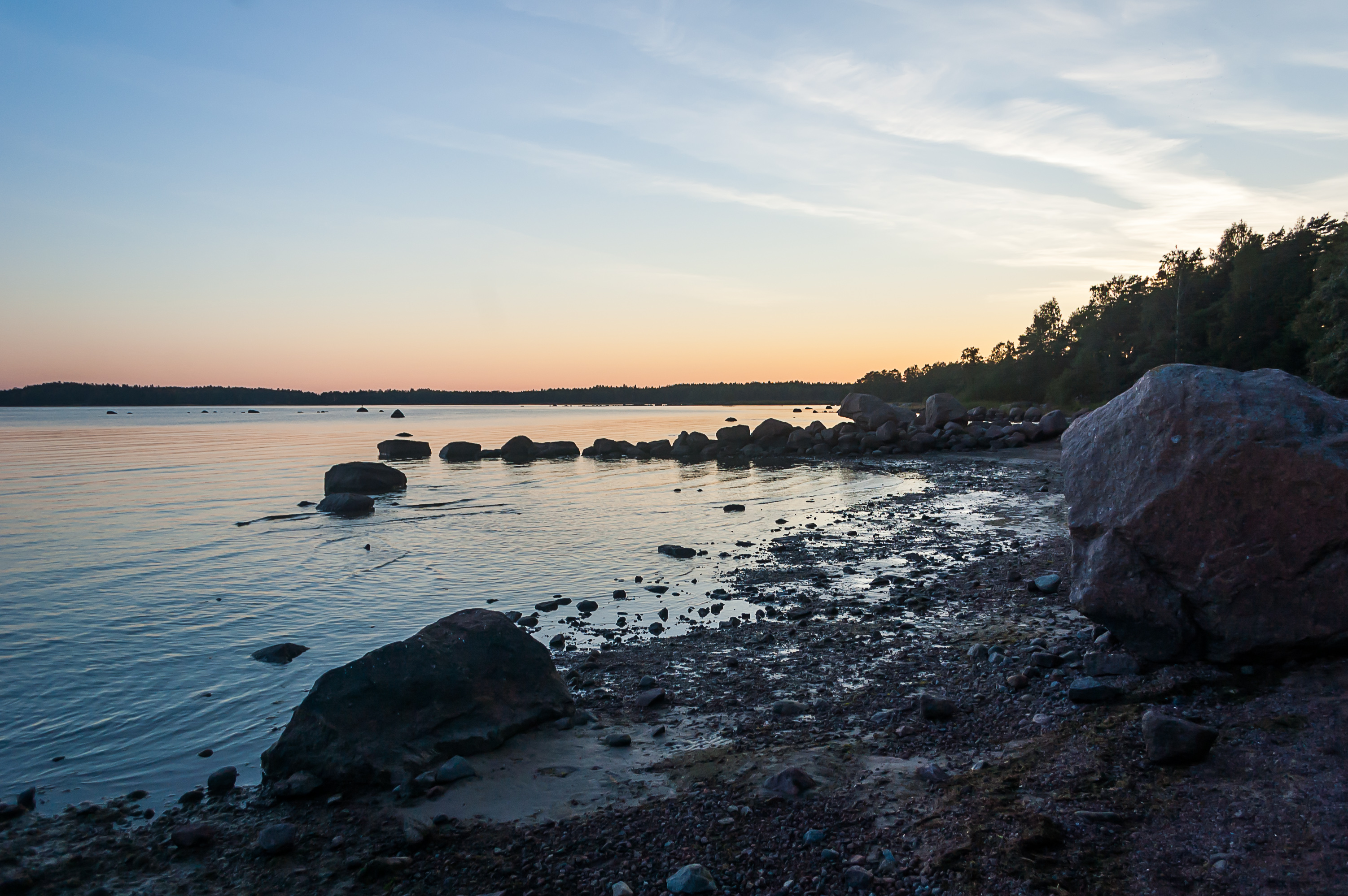
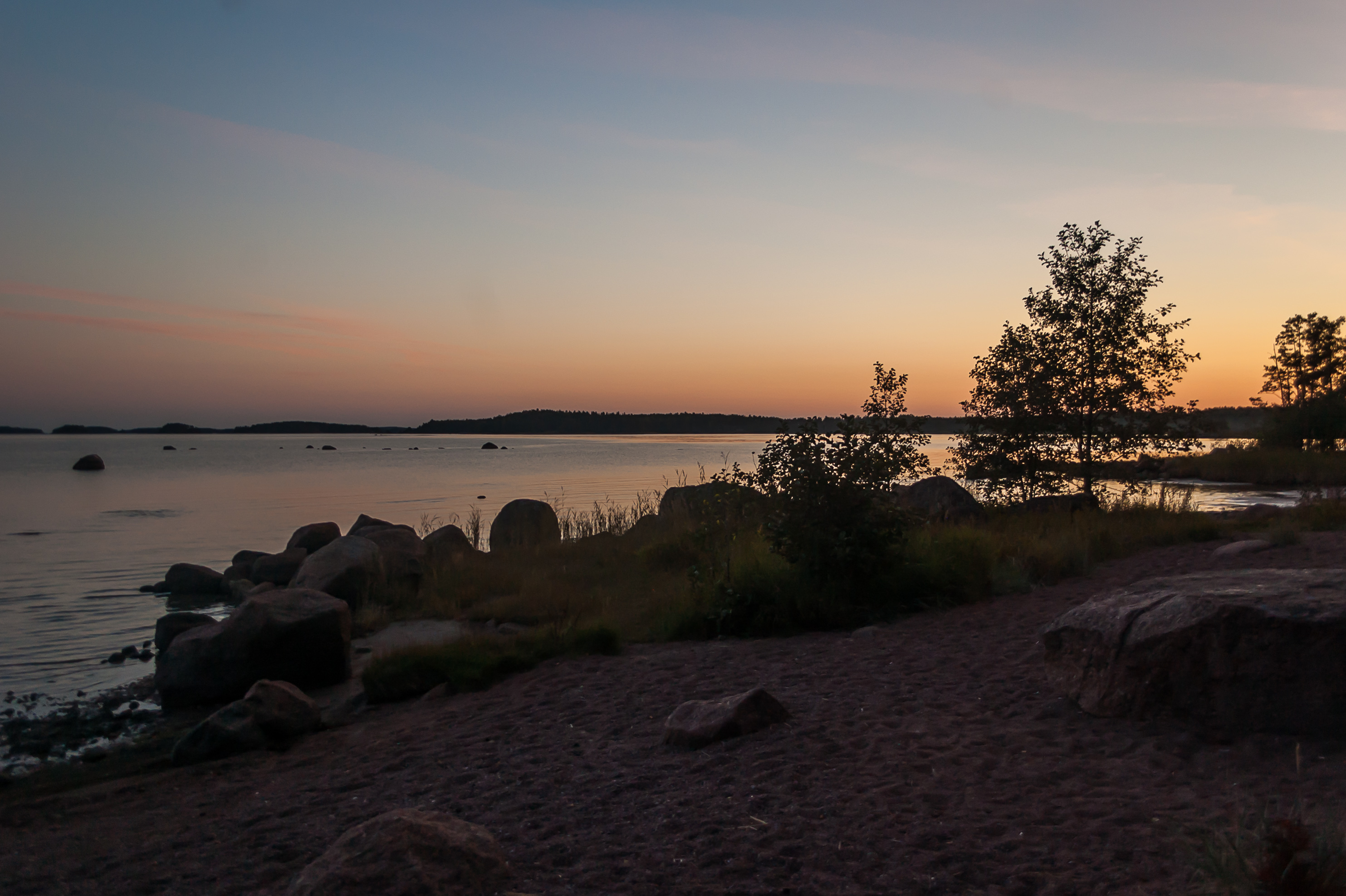
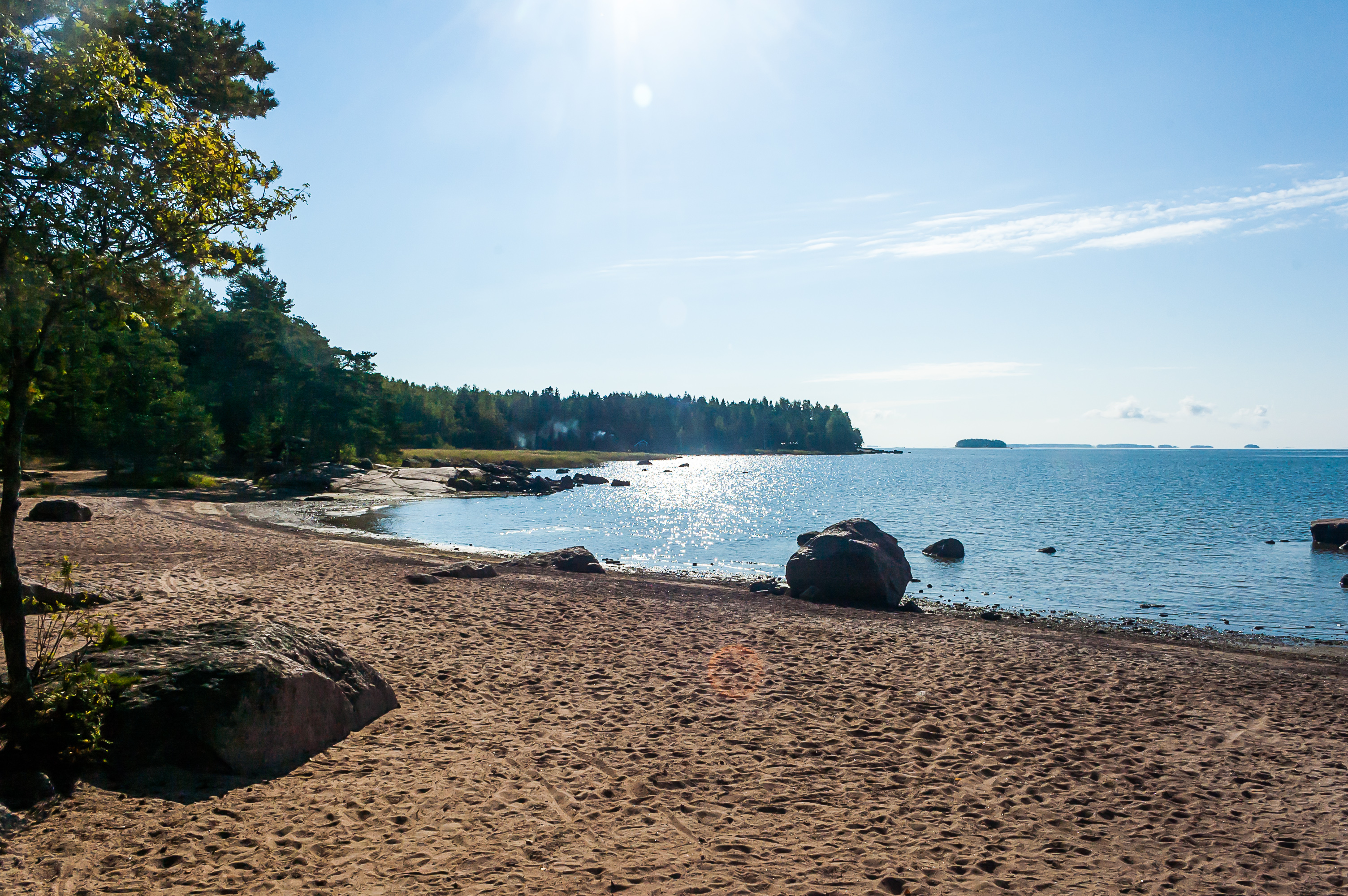
15. Pitkäthiekat means "Long Sands", and the camping indeed stretches along a long sandy beach on the coast of the Gulf of Finland.

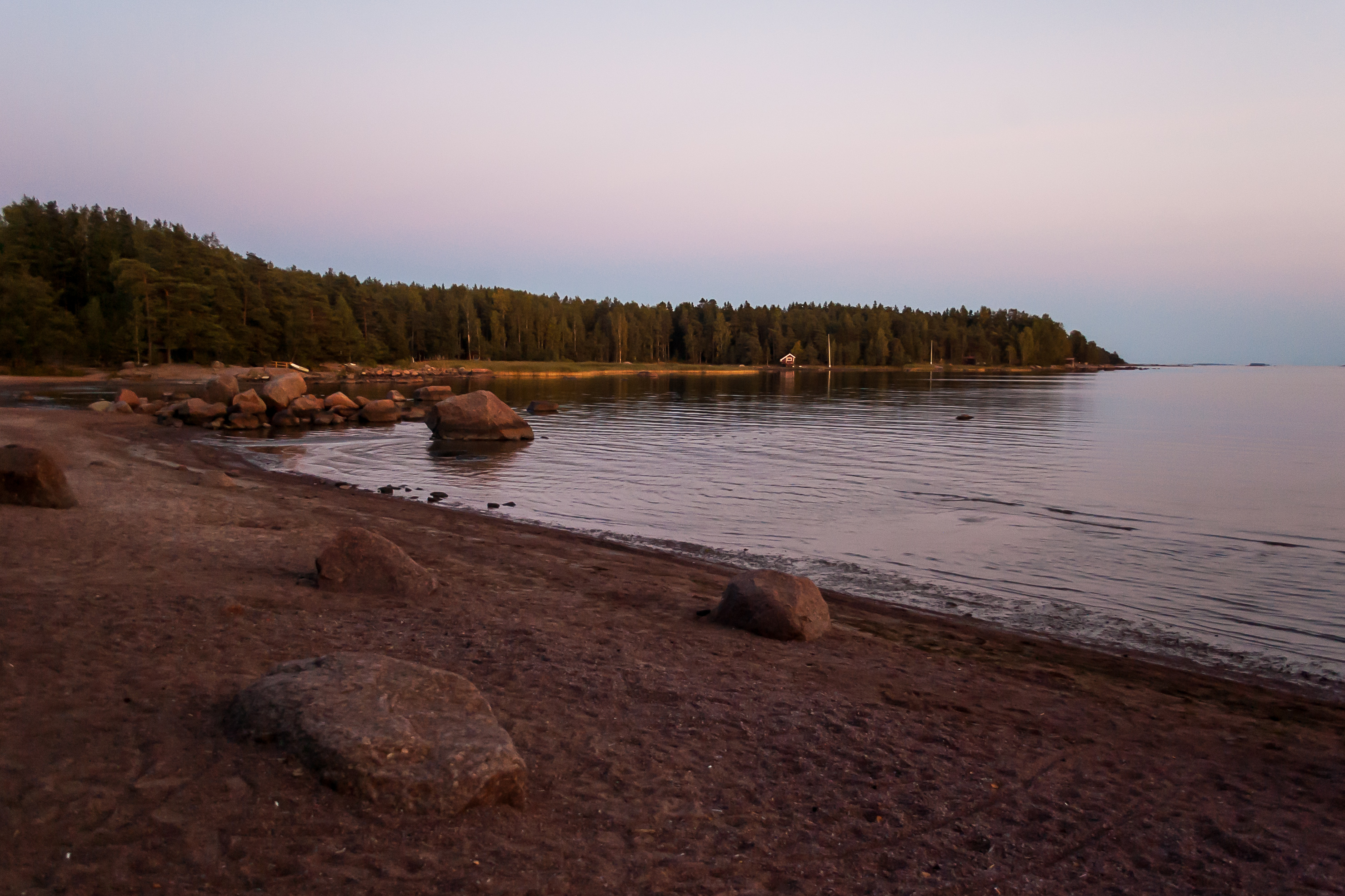
16. Twilight views at Pitkäthiekat Camping.
17.
18.
19.
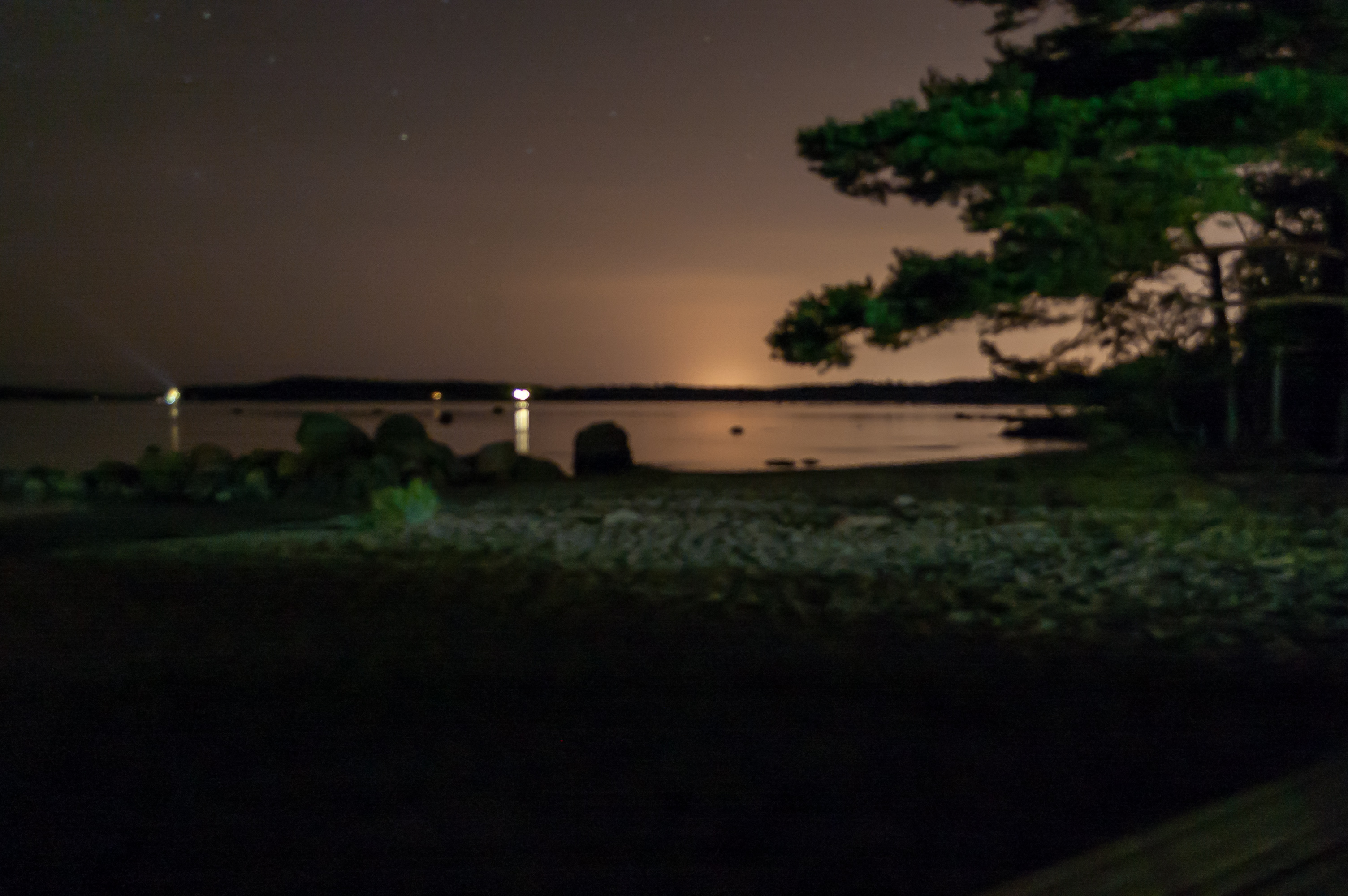
20. My attempt at night photography from a tripod was not particularly successful. Manual focus on the cheap 18-55 Nikon lens doesn't really work.
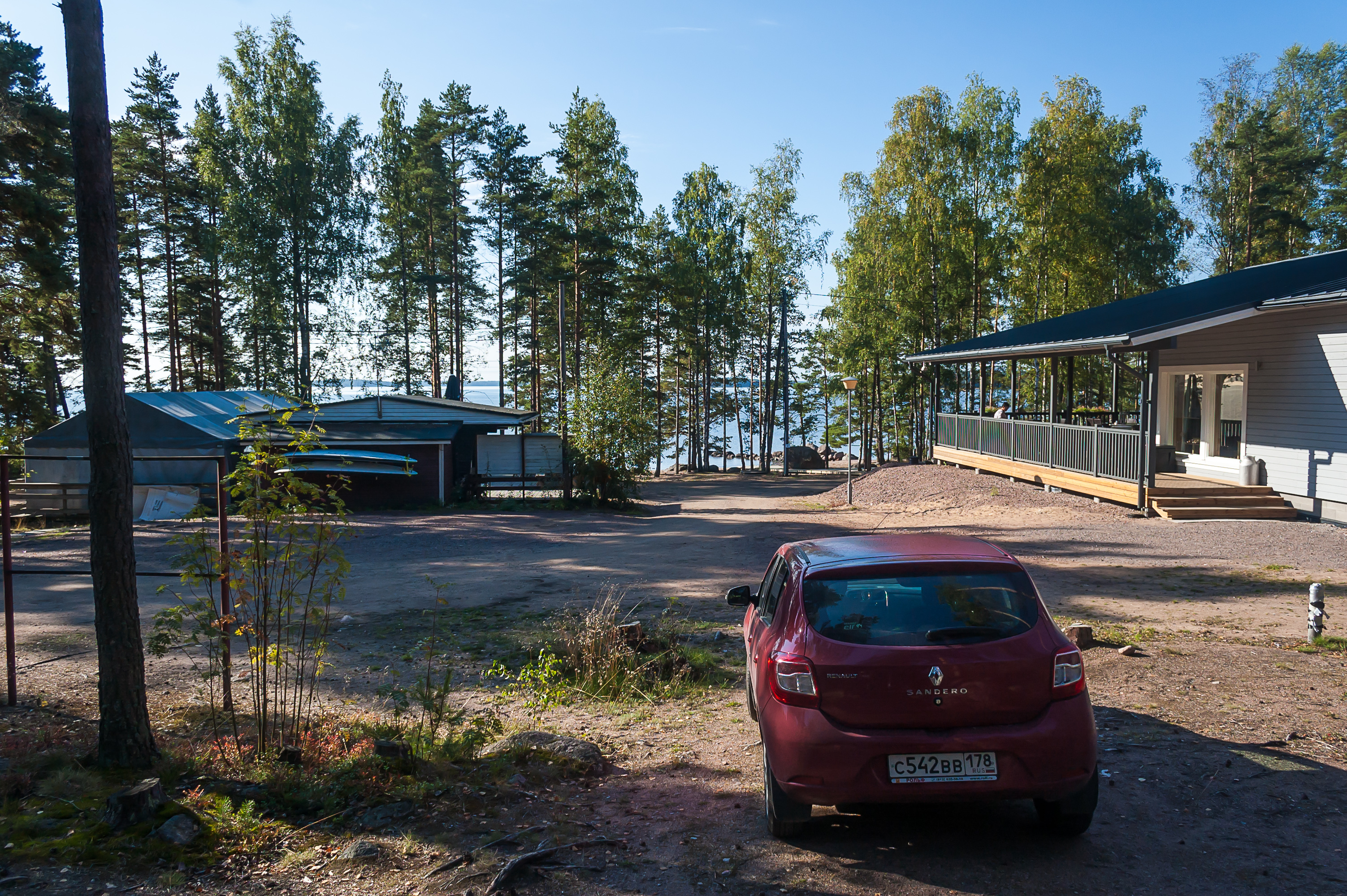
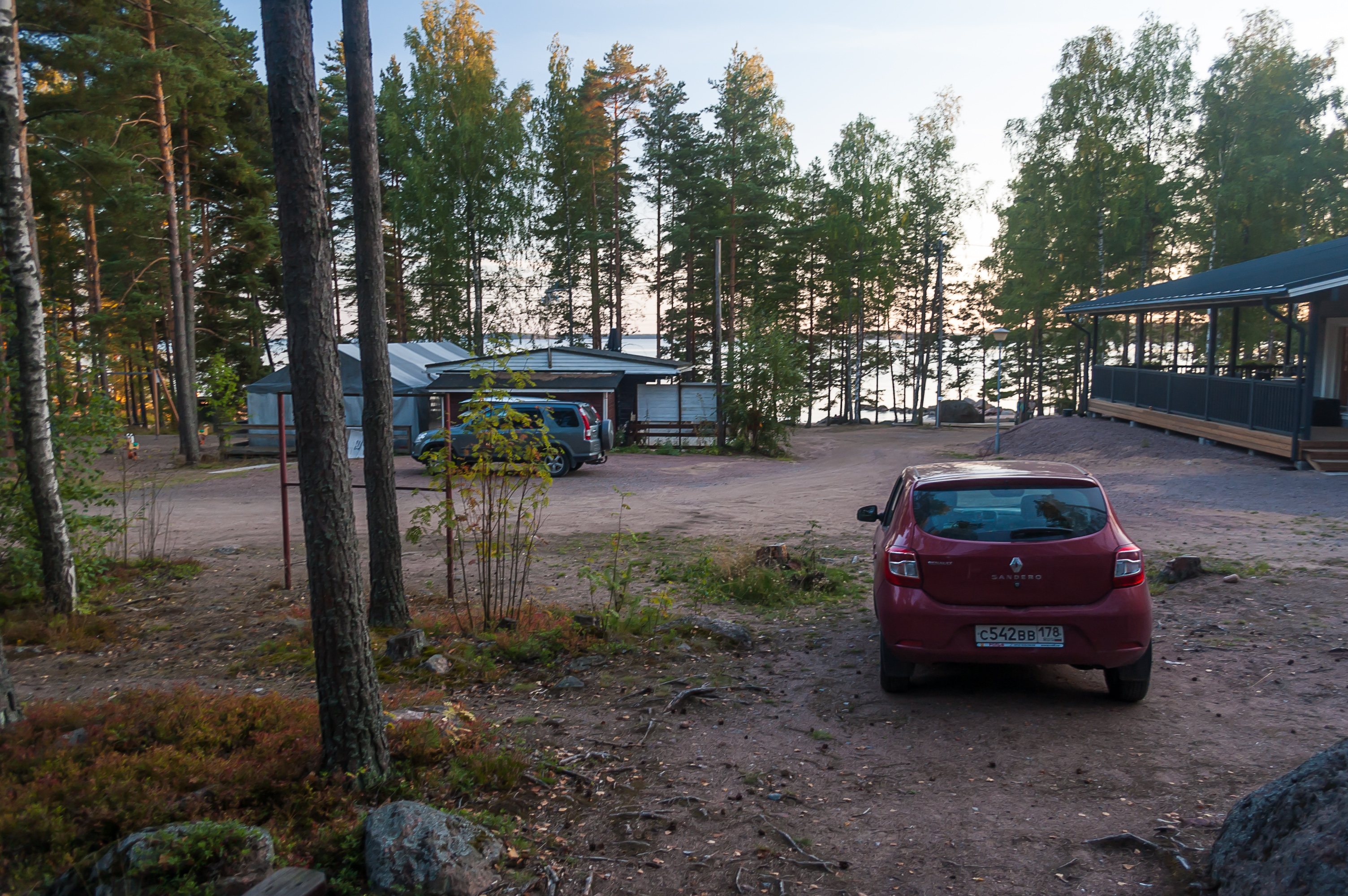
21. Same camping in the morning. Due to the proximity to the border, it seemed about a half of the guests were Russian (judging by car license plates). By midnight though all I could hear were loud sounds of Finnish karaoke from the restaurant (building to the right) which happened to be fairly close to my cabin. Good thing I don't really mind noise when falling asleep.
22.
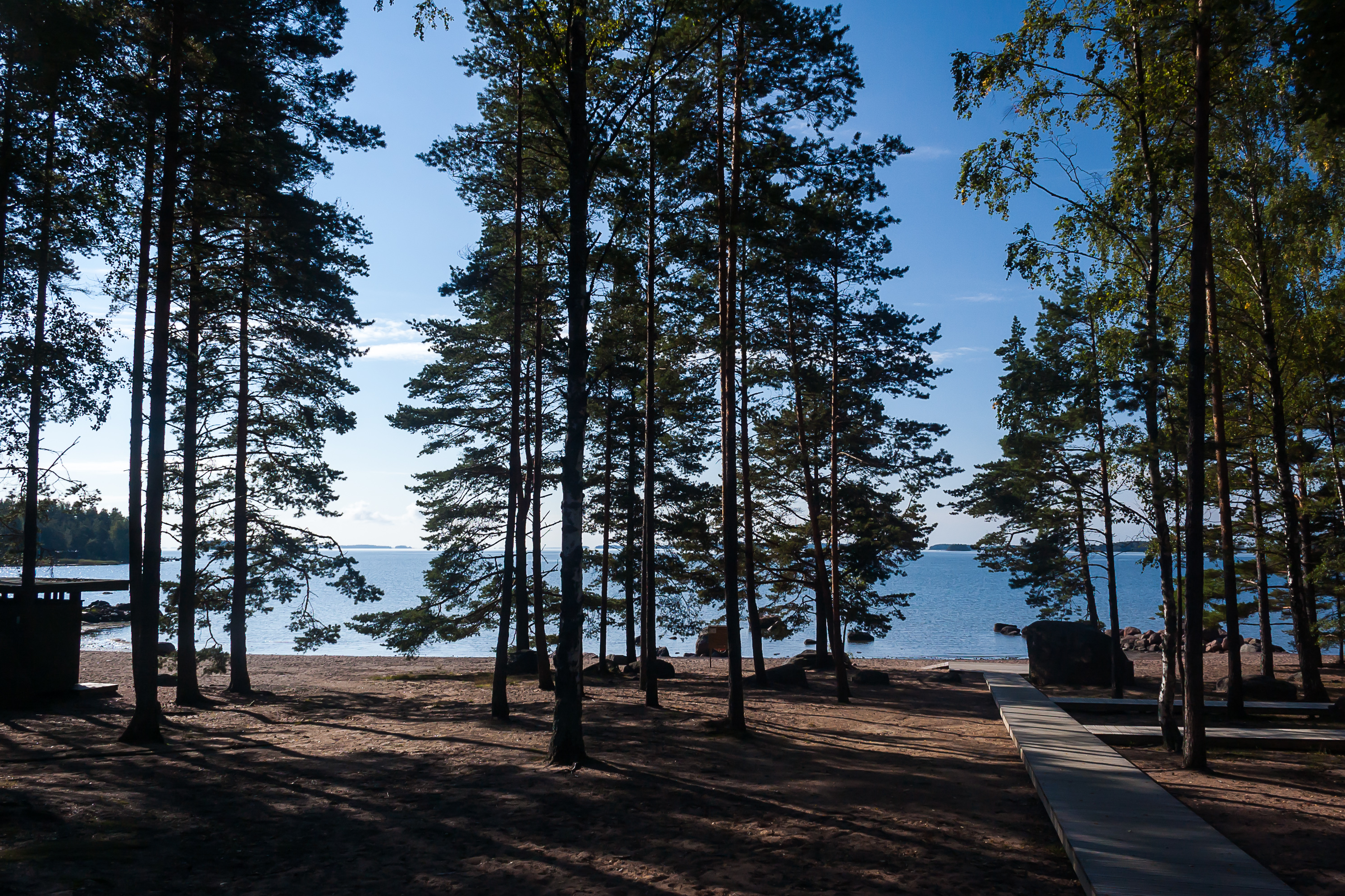
23. One of the archipelagos off Hamina coast is visible.

24.
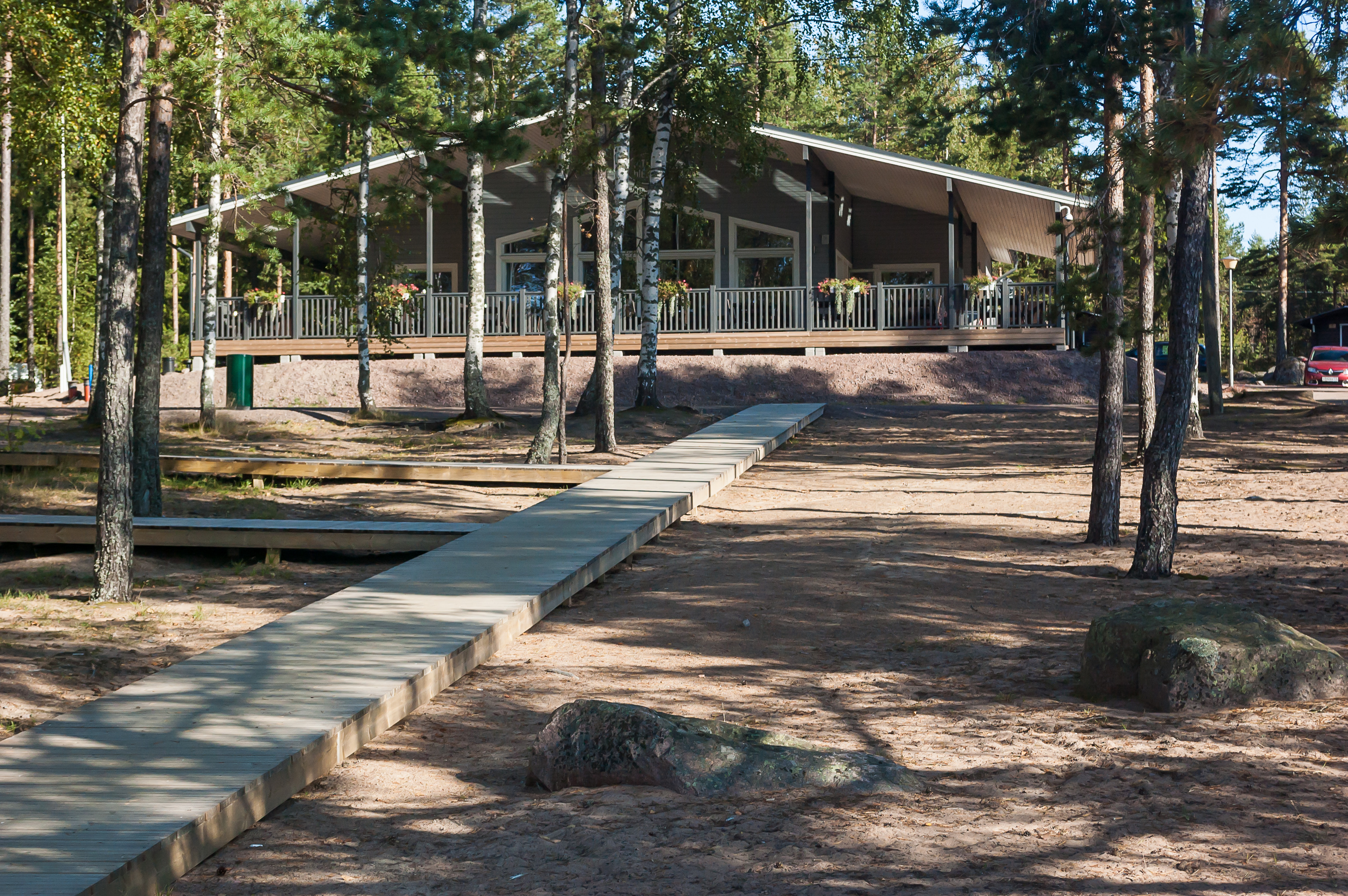
25. The karaoke restaurant in the morning. With that, I departed this camping for Kotka. And now in the next post we'll return one day earlier, to my visit to the Salpa Line Museum in Miehikkälä.