This series has unfortunately been never finished.
Year 2016 has finally been the year I had both the time and the means to make a kind of journey I really always dreamed about. Sure, Sweden and especially Lapland last year were quite nice, but Sweden felt too rushed overall, and Lapland trip, while a completely surreal experience for me, still had a rather limited scope. So I allocated a pretty huge sum of money for the summer of 2016, and booked three vacations in a row at work. And the first one, in July, was going to be the longest. Two weeks, or 16 days, including the preceding weekend.
This time my only companion was my friend Olga. We originally wanted to do a trip to Iceland. We drew up an itinerary and all, but ultimately, decided to go with something else. While in theory we could afford Iceland, the margin for error was going to be rather thin. Plane tickets to Iceland cost a lot, and then of course you have to rent a car there, or you’re not going to see much of Iceland(*).
(*) Actually, there is a way to visit Iceland while driving your own car. There is a ferry line connecting Iceland with Denmark, via Faeroe Islands. The ferry trip is long and costs a fortune too, though, and just driving to Denmark isn’t a very small undertaking in itself. Of course I still want to do this someday too!
Well, our next choice was Northern Norway. We had had only a fleeting experience with Norway before, just enough to know it is utterly amazing and really the most beautiful place on earth. On my Lapland journey I actually drove a bit around a small bit of Northern Norway, but didn’t have the time even for a small bit of hiking. Thus we intended this time to be quite different!
Well, our plan worked out splendidly! It turned out the pace we chose was exactly right, and we drove over 5700 km across Russia, Norway, and Finland without any incident, and we visited nearly all the locations we wanted, with just some two or three exceptions. Even our journey budget ended up being fairly precise!
Our sole means of transportation was the same as in previous year, my ’15 Renault Sandero. I love that car. Well, not literally; I make a point of never becoming attached to any possessions; but it suits me so well. Simple and trusty and reliable, never a single problem in 50,000 km apart from burned-out lightbulbs, and it allowed me to visit so many places — and even the northermost part of Europe now. I really think Renault should pay me something for the marketing!
I ended up taking many thousands of pictures, of course. I’m not even sure how many. The lack of space on my MacBook Pro (well it’s corporate but I can take it anywhere I want) with its 256 GB SSD drive was a very severe concern, and I had to remove duplicates and bad pictures, and process RAW files right on the road. And soon after I got back, my other two vacations followed, so that explains why I began to write things down only four months later.
There are going to be a lot of posts, and I plan to start with a few introductory ones, just telling about the land I saw. Because it’s really an amazing land and the most wonderful place on earth. The rest of the posts will be more chronological.
So. This is Norway:
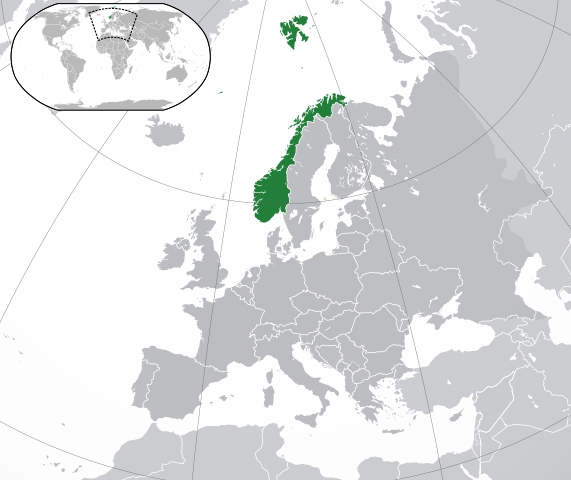
One thing you can immediately notice is that it is the northernmost country of Europe, even excluding Svalbard, those islands very far up north (actually a shared Norwegian-Russian possession). A large fraction of Norway in fact lies beyond the Arctic Circle.
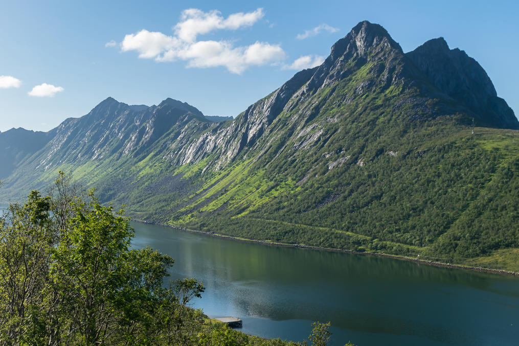
Another thing you can notice is that its coastline is very rough and irregular, which is very obvious even on such a small map. The irregularities are in fact the famous Norwegian fjords. The whole country, excluding only the very south, pretty much consists of fjords, mountains, and mountain plateaus. This is in fact the consequence of its northern location. Most of modern Finland, Sweden, and Norway was completely covered by a huge glacier in the Ice Age. The glacier ended up shaping these countries to what they are today. In Finland, for example, it scraped away the relatively thin sedimentary layer to expose the bedrock and gouge innumerable lakes. But Norway is very much unlike Finland in that it has actual mountains, the Scandinavian Mountains, formed 400 million years ago. The glacier carved enormous precipitous valleys between these mountains, which, once flooded, became fjords. Accidentally, it turns out these fjords are among the most beautiful places in the world.
It’s hard to say how many fjords there are in Norway, as they vary enormously in size, and many major fjords in fact branch into numerous arms, forming a fractal-shaped landscape. The best known fjords are located in Western Norway, but from the map you can see that the very north looks also quite fjord-y as well.
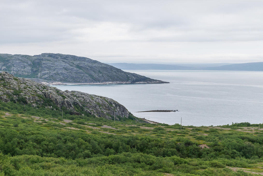
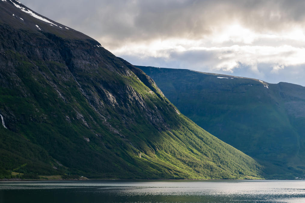
1. It turns out that, for the most part, the northernmost fjords are less precipitous and thus look somewhat less dramatic. The Scandinavian Mountains somewhat flatten off in the very north, giving way to Lapland fell landscape in inland regions.
2. You’d have to drive really far north to experience that “flattening” though. Fjords in the vicinity of Tromsø still look fairly respectable, for example.
3. Northern Norway is pretty much the northernmost place in the world you can visit without being some sort of a hardcore Arctic enthusiast. It is perhaps somewhat surprising then that the climate here is relatively mild. Of course the summer is short and the winters aren’t particularly nice, but it’s not really enormously cold. Finnish Lapland (or Inner Finnmark regions in Northern Norway, which are pretty much the Norwegian Lapland) is much colder, for example. The Gulf Stream flows along the entire coastline of Norway, and moderates climate as far north as the North Cape; its average January temperature is only −3 °C. No worse than in St. Petersburg!
4. Of course, as is everywhere beyond the Arctic Circle, you get the polar night, and the midnight sun. Neither lasts all that long, and neither is as dramatic as it sounds; at midday during polar night you get some fairly light bluish twilight, and at midnight during midnight sun you get just a very extended sunset. In Norway midnight sun actually often gets obscured by the landscape (the fjords and the mountains). We were there during the midnight sun period ourselves, but I couldn’t really even get a picture of the midnight sun. Of course I’m pretty lazy about getting out and taking pictures at night, anyway.
Northern lights are of course the huge attraction of the north, but obviously you cannot see them in midnight sun months, so I won’t show you any pictures of them as well. Overall I’d say if you don’t specifically want to go here in winter (which might be particularly challenging if you intend to drive, which you should), the best month is early September. The weather is still fairly warm, there won’t be a trace of any mosquitoes, and the daylight hours are still fairly long, but you’ll still get proper night, and thus a very good chance of seeing some northern lights.
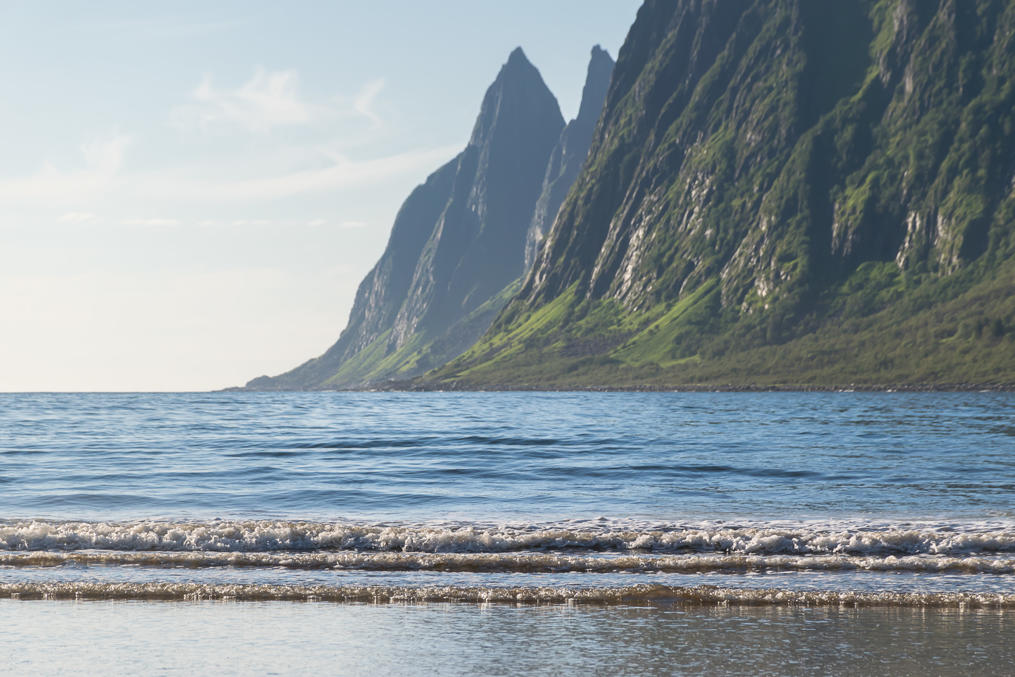
5. Some fjords even have beaches where you can swim at! If you feel adventurous enough, of course.
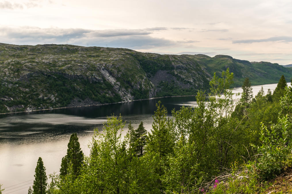
6. Inland locations like Inner Finnmark or Pasvik may look a lot like Finland at places. Nothing wrong with that, but this is probably not the kind of landscapes you came to Norway for. Additionally, mosquitoes in May-July season are extremely nasty there! Conversely, there are almost no mosquitoes near the coast or in the mountains.
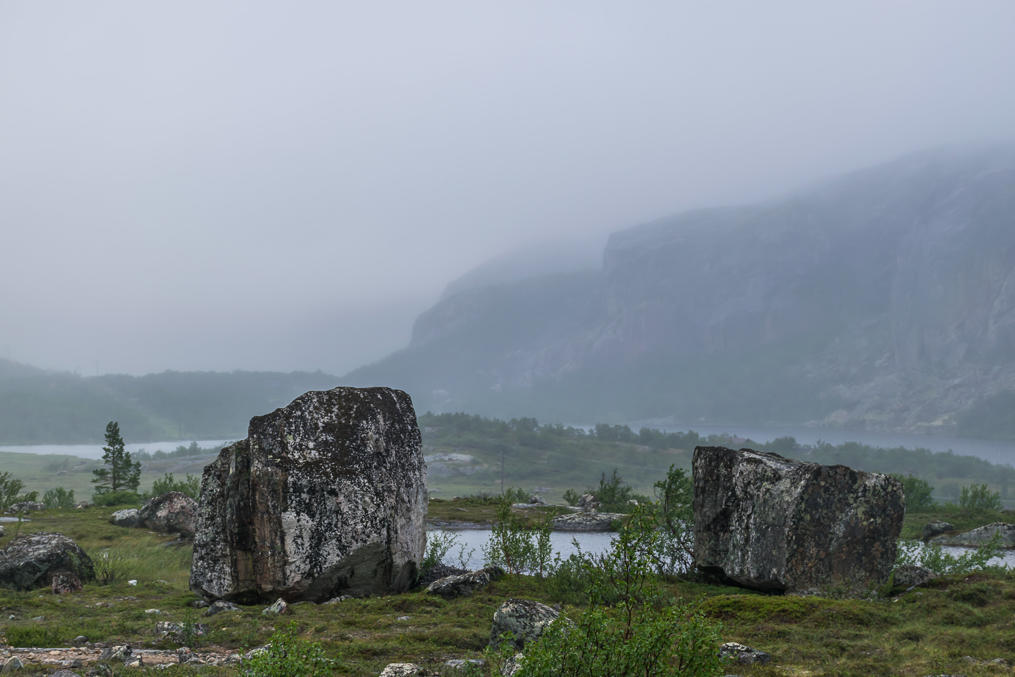
7. Thus in Northern Norway you generally want to see the fjords and the mountains — same as in the rest of the Norway really. And if you want to get that “hey I’m really in the goddamn Arctic” feel, you have two options. First, you can go up! Arctic tundra replaces the usual boreal forest at rather low elevations, sometimes as low as 100 m. Just drive up some minor road, or hike onto some plateau.
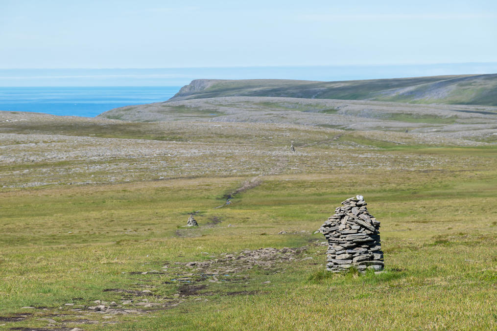
8. The other option is to go really far north. Only a few locations in Northern Norway can really be considered proper Arctic (which can be roughly defined as the region where trees are nearly completely absent, and the tundra starts right at the sea level). These are Varanger Peninsula, northern Porsanger Peninsula, Magerøya Island, and some smaller islands and peninsulae in their vicinity. Magerøya Island is probably the best known, as this is where the North Cape is located. The entire island, which is pretty huge, looks just like that — rocky tundra with some fells and lakes.
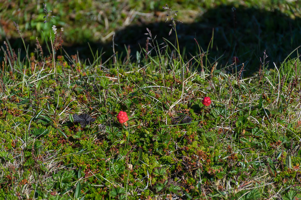
9. By the way, cloudberries are not quite as common in the tundra as you might think. We only saw a few. Maybe we just missed the season, of course.
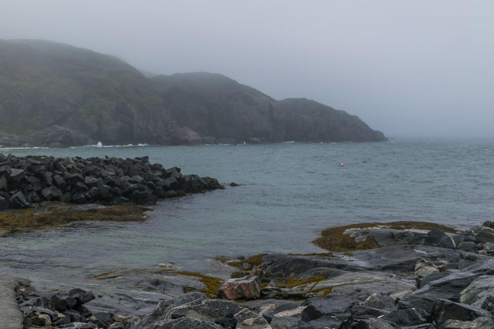
10. The Norwegian Sea stretches along most of the Norwegian coast up until the North Cape, where it changes into the Barentz Sea. The open sea, outside of any fjords, often looks exactly as gloomy and harsh as you’d expect.
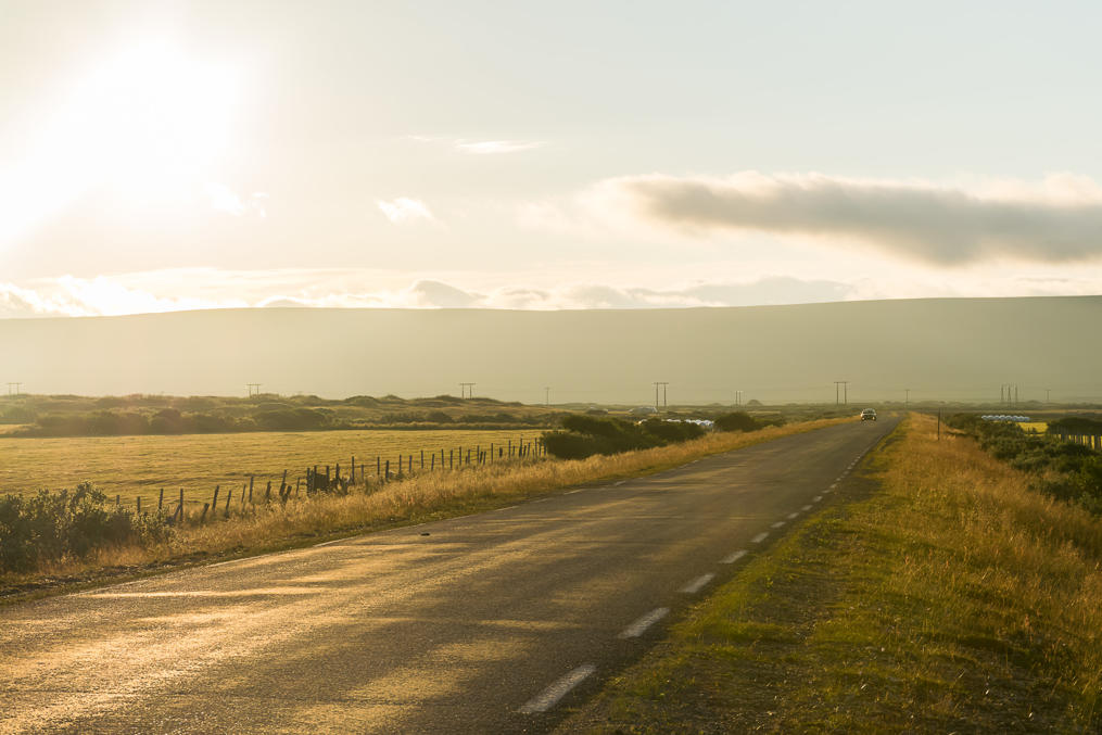
11. The sea depends on the weather, of course, and the weather up here can be extremely volatile.
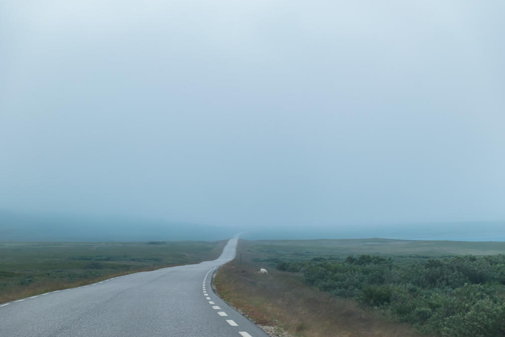
12. This is the very same road just some ten minutes later. The weather is more often gloomy and overcast than not. And while you probably won’t get an actual storm, it would be a very good idea to bring clothes which can shield against the wind well. As is probably expected, it gets very strong in open tundra landscapes.
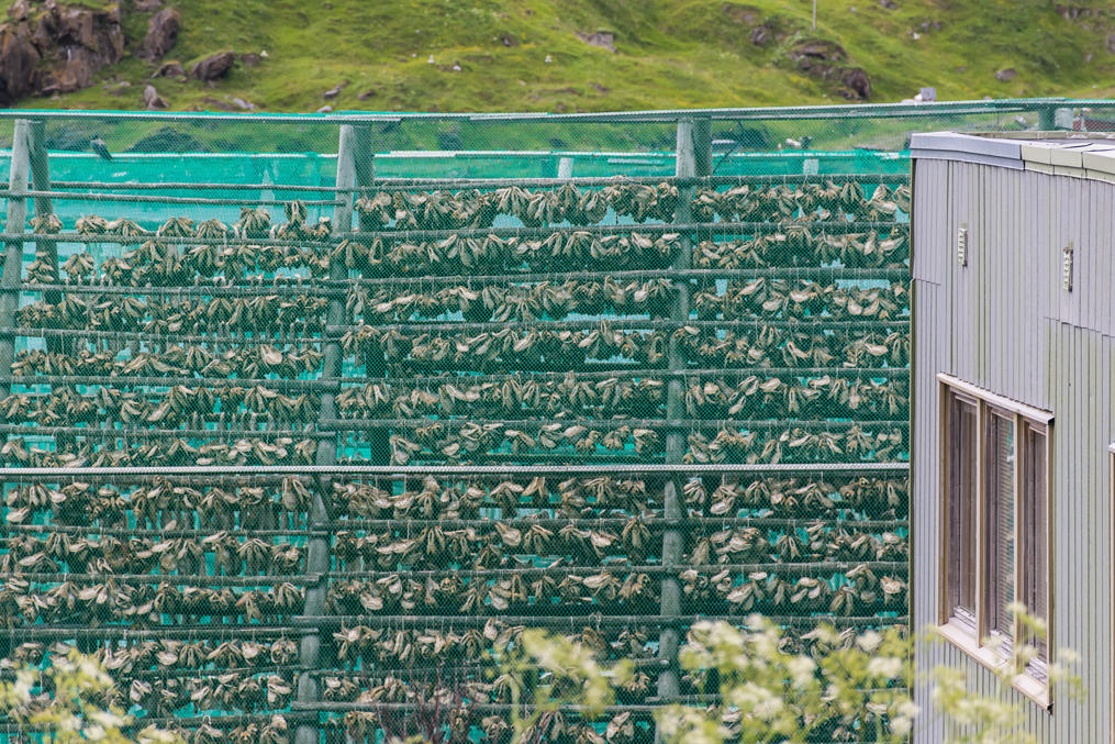
13. The entire Norway has a population of only 5 million, and of course the North is populated particularly thinly. Only a few towns exceed 3,000 in population. One of the obvious local livelihoods is fishing. Racks for cod drying are encountered in every village, although by July they should generally be all empty; the drying-out supposedly takes place from February to May.
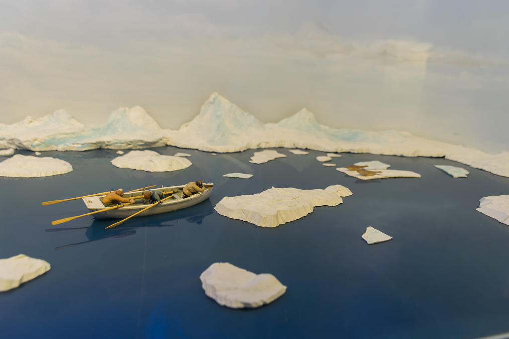
14. Seal hunting are whaling are still actually practiced despite the “family unfriendly” image, although the volumes are not especially high. Various whales in fact commonly inhabit fjords. There are whale-watching tours, and in principle you should in theory be able to spot a whale or two if you just look at a fjord long enough. Personally so far I have never seen a whale.
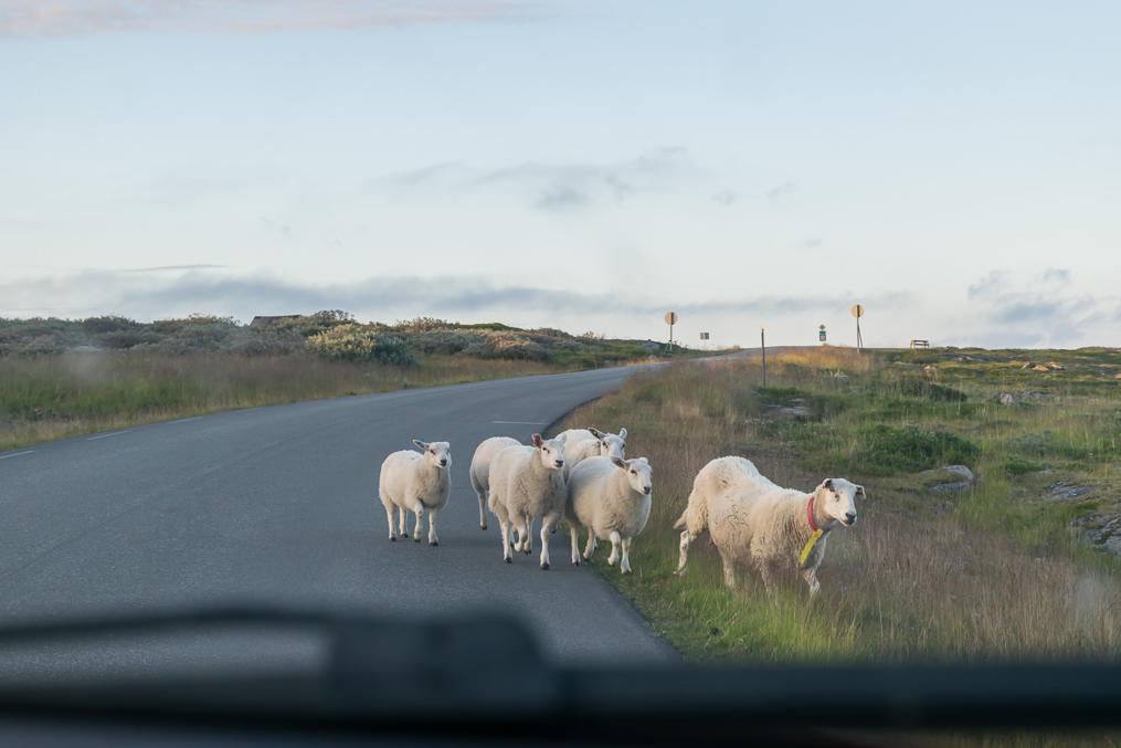
15. Outside of tundra areas, sheep husbandry is rather common. My friends loves to affectionally call them “food”. Crop fields on the other hand are rarely seen, especially big ones; the climate north of about Tromsø is too harsh to sustain crop production, and the terrain is not very favourable as well.
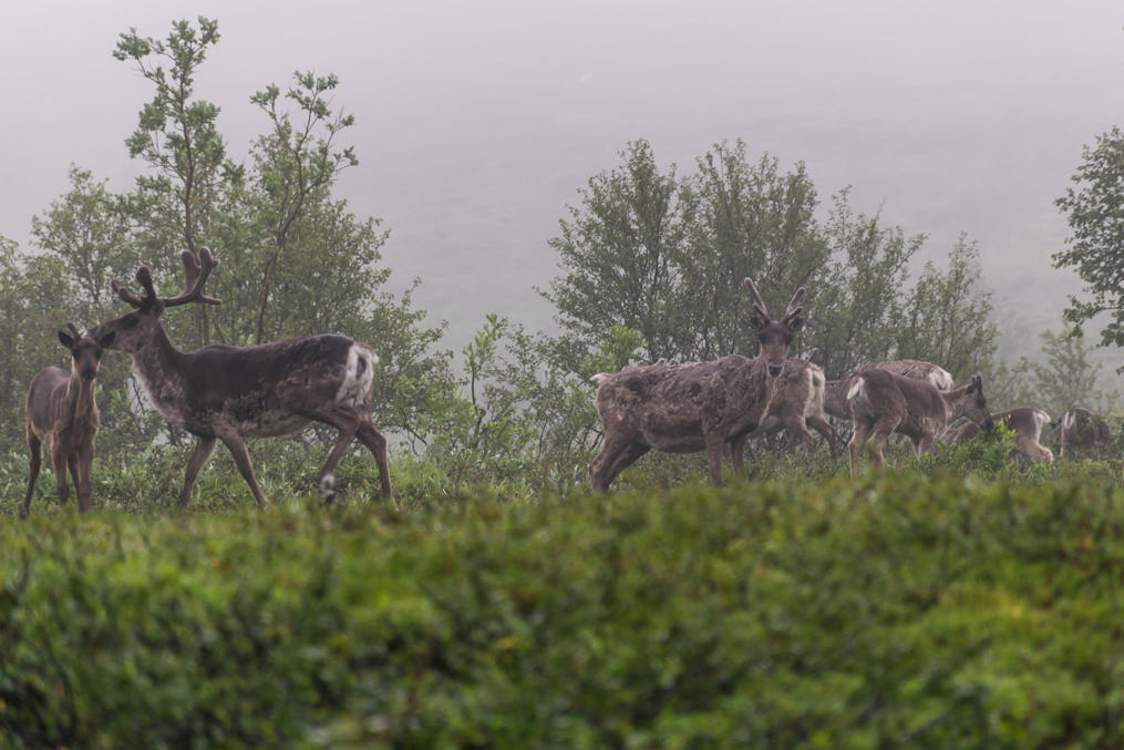
16. You might wonder when will I finally mention reindeer. Well there they are! Reindeer! It’s the single most common sight that you are in the Arctic. You may drive through a nondescript forest not particularly different from Southern Finland or for example Russia, yet still occasionally meet a reindeer or two or even a small herd. Reindeer are semi-domesticated animals; they graze by themselves, pretty much anywhere they like, but they all belong to someone, and eventually they (somehow) get herded together. They are used for meat, skins, milk, and as pack animals, although the latter use is probably rare by now, outside of tourist industry. It’s a pity such beautiful animals get slaughtered, really; I consider them the second cutest animals in the world, after rabbits.
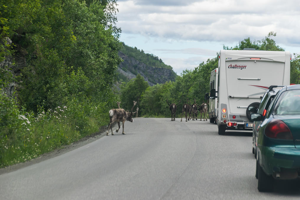
17. Reindeer can be met in the wilderness and on the outskirts of towns and villages, but you’re most likely to encounter them on the roads. They aren’t very large and do not run randomly across the road (like moose), so they do not present a major hazard to driving, provided you actually pay attention to the road (though it gets worse after dark, unless again you’re visiting in midnight sun months like we did). They can however be pretty oblivious of the world around them, not entirely unlike a common cow, and may just block the road if they feel like it. There is not much you can do in this case but to wait until they change their mind; honking doesn’t work. It is often said that the first few times you encounter reindeer while driving it feels marvelous, but then they just get hugely annoying. I totally disagree. I still shout “LOOK! REINDEER!” every time I see one.
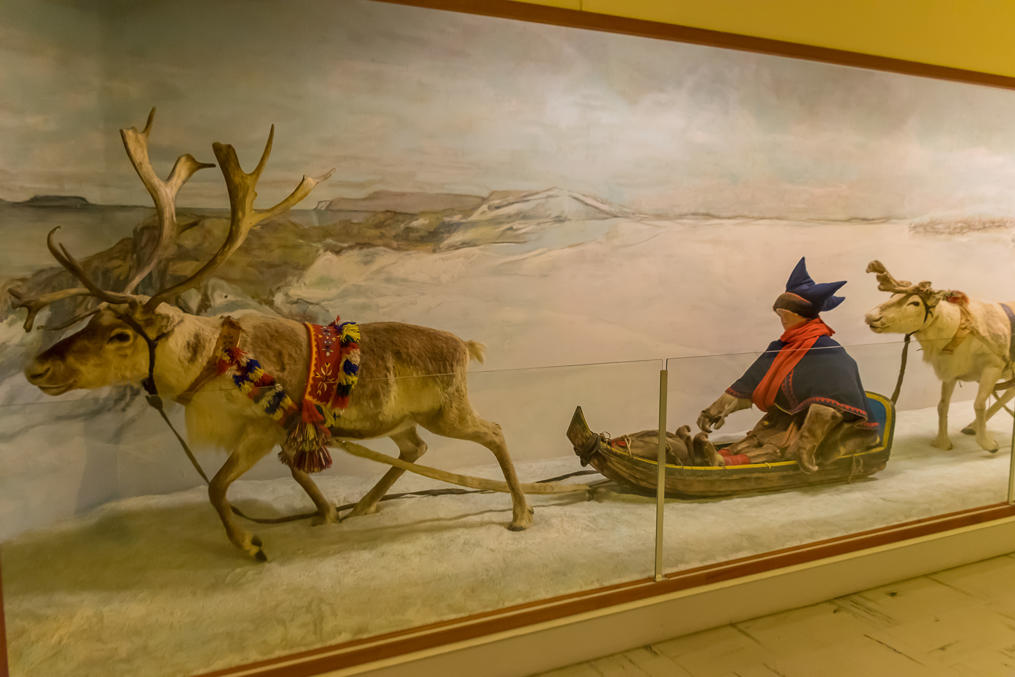
18. Reindeer husbandry has traditionally been practiced by the native people of the North, the Sami. I’m a huge fan of the Sami! (And please excuse me if you’re an actual Sami and you think my descriptions are inaccurate or insensitive in some way.) They aren’t very numerous, with about 100,000 of them at most. They never had their own statehood, and now live in Norway, Sweden, Finland, and Russia alike; mostly in Norway, though. They have their own language, or actually many dialects; the most common one is Northern Sami. It uses Latin letters but looks very unusual, very faintly resembling Finnish (which is in itself very unlike most of European languages). The Sami used to live in teepee-like huts, called goahti, and wore colorful clothes, with lots of blue and red; a particularly notable item of clothing was their four-pronged hat, called Hat of Four Winds. Visually they most closely resemble the Finns, I think, although faintly Asian features are commonly mixed in.
The Sami were significantly oppressed throughout centuries, so that for example their traditional shamanistic religion is pretty much forgotten, and so are traditional Sami names. Many branches of their language are extinct or nearly extinct as well. Only some decades ago they were universally recognized as a distinct people, and granted a degree of autonomy. There is even a Sami parliament in Norway, in the town of Karasjok. Some regions in Finnish Lapland and Northern Norway are officially bilingual, and municipality names etc. are duplicated in Northern Sami. Many remote locations (fells and the like) have only Sami names.
The most distinctly Sami part of Northern Norway is Inner Finnmark, the Finnmarksvidda Plateau, where towns of Kautokeino and Karasjok, populated almost exclusively by the Sami, are located. Unfortunately we didn’t visit Inner Finnmark on our trip (although I had a brief look later in September). Many coastal communities are partially Sami as well. In general, apart from the reindeer-herding part, the Sami now live just the same as everybody else, and even Kautokeino and Karasjok look pretty much nearly exactly the same as any random Norwegian town.
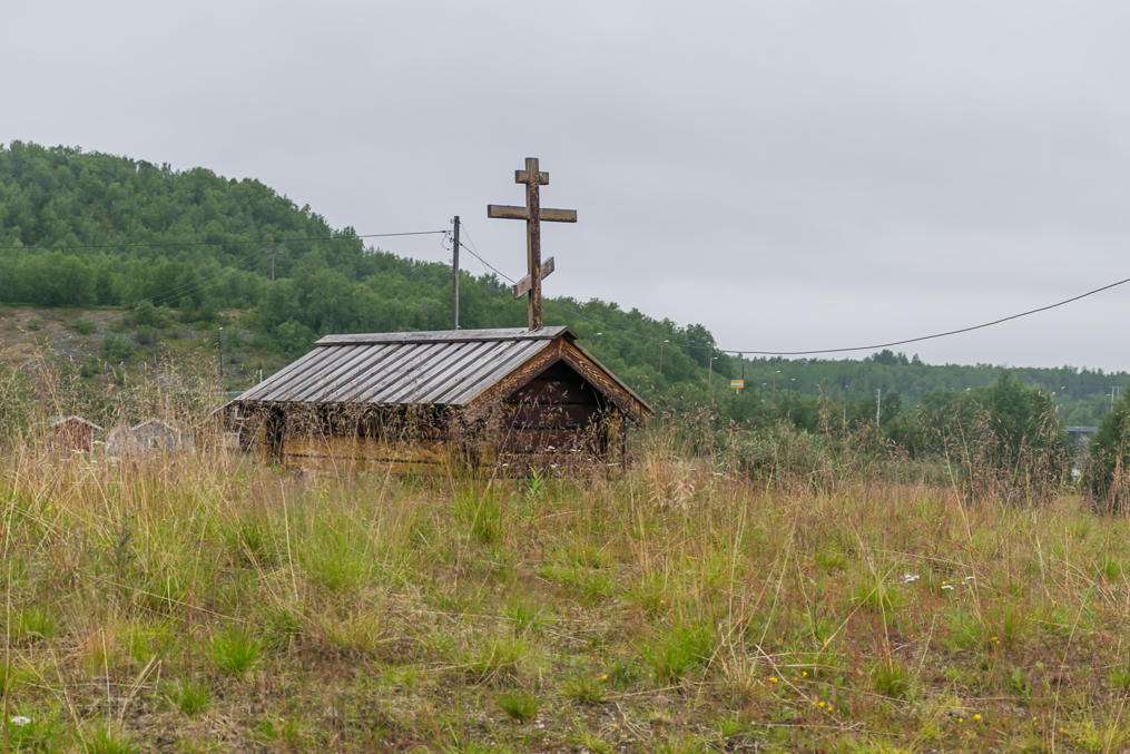
19. Northern Norway has had some significant Russian influence as well. The so-called Pomor trade between coastal villages and Russians from Arkhangelsk region had been an important source of income up until the Russian Revolution of 1917. A Russian monastery in Pechenga, just to the east of Norwegian-Russian border, spread Orthodox faith centuries ago. The Skolt Sami in particular still retain that faith.
It also was the Soviet Union that liberated the Northern Norway in the end of the World War II, and, just as importantly, had the decency to withdraw after that. Norway in general never had any wars or significant disputes with Russia, although nowadays it is a member of NATO, unlike Finland and Sweden.
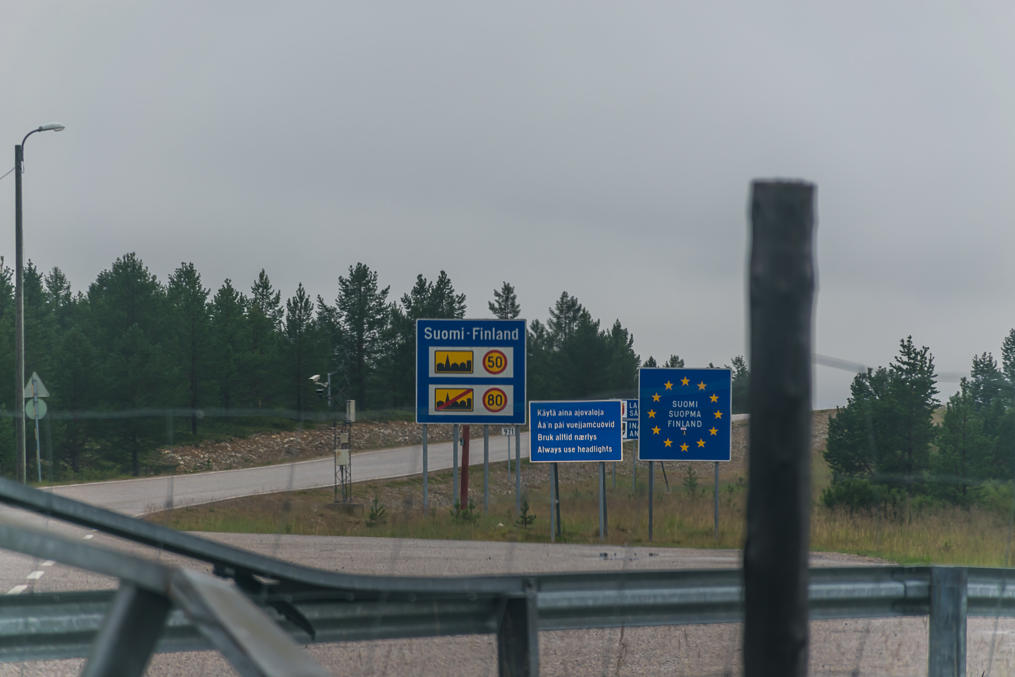
20. There’s only one border crossing to Russia now, but six border crossings to Finland. The distance from most settlements to the Finnish border might be hundreds of kilometers, but those who happen to live close enough commonly visit supermarkets on the Finnish side of the border for grocery shopping, as everything is significantly cheaper in Finland than in Norway. These supermarkets exist in most if not all Finnish border villages. Both Finland and Norway are parts of the Schengen Agreement (even though Norway is not an EU member), so the border can be crossed freely by anyone. Random spot customs checks may still occur at borders though.
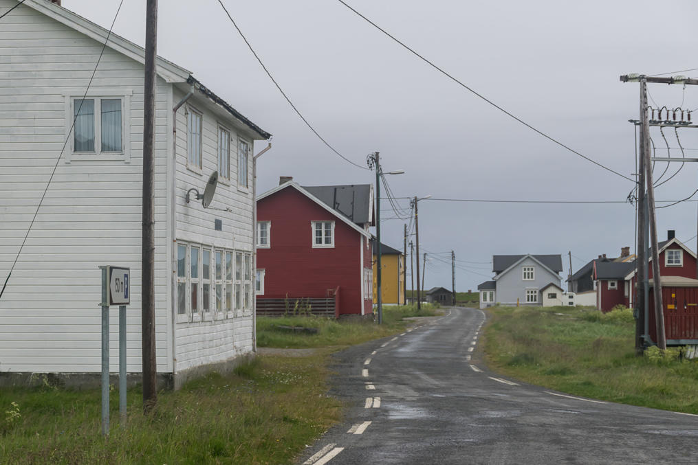
21. Norway, as a country, consists of 20 counties, most of them with sufficiently Norse-sounding names like Rogaland. Three of these counties belong to Northern Norway: Nordland, Troms, and Finnmark, in order from the southernmost to the northernmost one (and from most populated to least populated one too). We only visited Troms and Finnmark on our trip. Nordland is the least Arctic-y of these counties anyway, although it has Lofoten Islands, which are a huge attraction in themselves. Some or most of this post might not apply to Nordland; I wouldn’t know really.
All the true-Arctic locations are in Finnmark, and most of the Sami villages are in Finnmark too (in fact the word “Finnmark” refers not to Finland, but to an old name for the Sami). What it lacks is major mountains and man-made attractions. Indeed, Finnmark, along with Finnish Lapland, was nearly completely destroyed by Germans in the end of the World War II. There weren’t that many casualties, but nearly all towns and villages were completely burned down. As a result, most of Finnmark and Finnish Lapland had to be rebuilt from scratch after the war, and looks relatively uniform and bland. Surviving places, such as the remote village of Hamningberg, are few and far between.
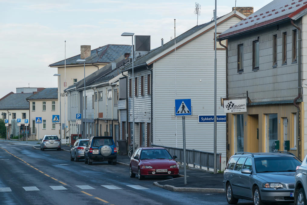
22. The town of Vadsø is the center of Finnmark County, and is a fine example of what the center of a typical Northern Norway town looks like.
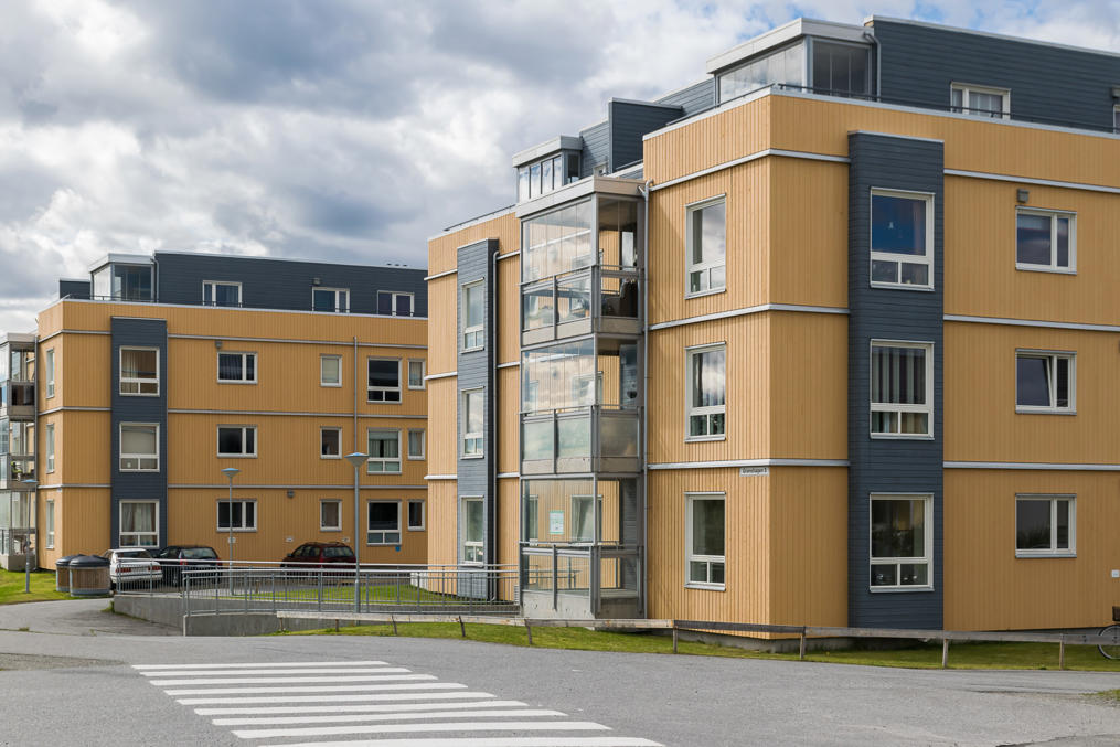
23. The biggest town in Finnmark is actually not Vadsø but Alta, population 20,000 versus Vadsø’s 6,000. It looks ever more bland. Not to say it’s a bad place to live in, of course; it looks very cozy, like any other Nordic town.
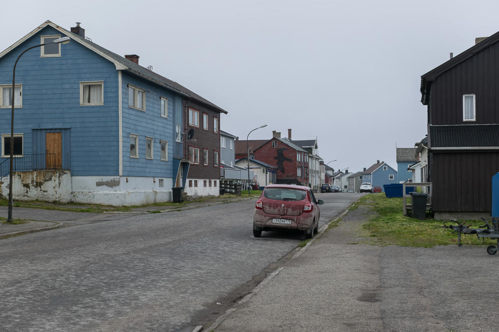
24. Some of the more remote settlements, away from trunk roads and tourist sights, look quite a bit more austere and rough, like the tiny fishing town of Vardø, on a small island off the coast of Varanger — the easternmost point of entire Norway, in fact. I’d still absolutely live there of course.
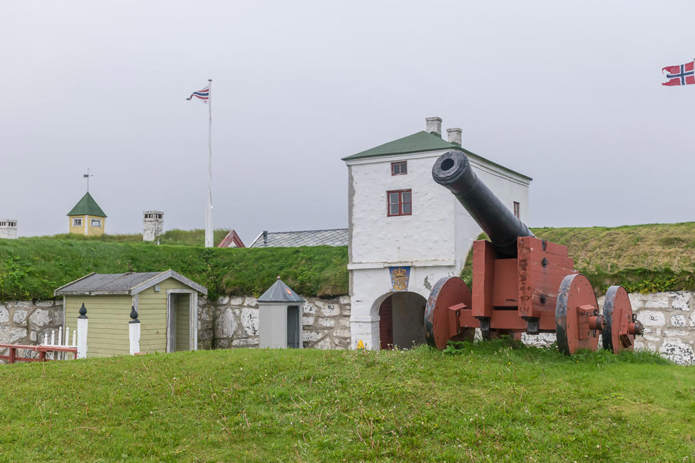
25. Vardø is actually the oldest town in the north by far, and it has the northernmost fortress in the world, named Vardøhus. It’s pretty tiny, and this is perhaps why it survived the WWII, unlike, again, the rest of the town.
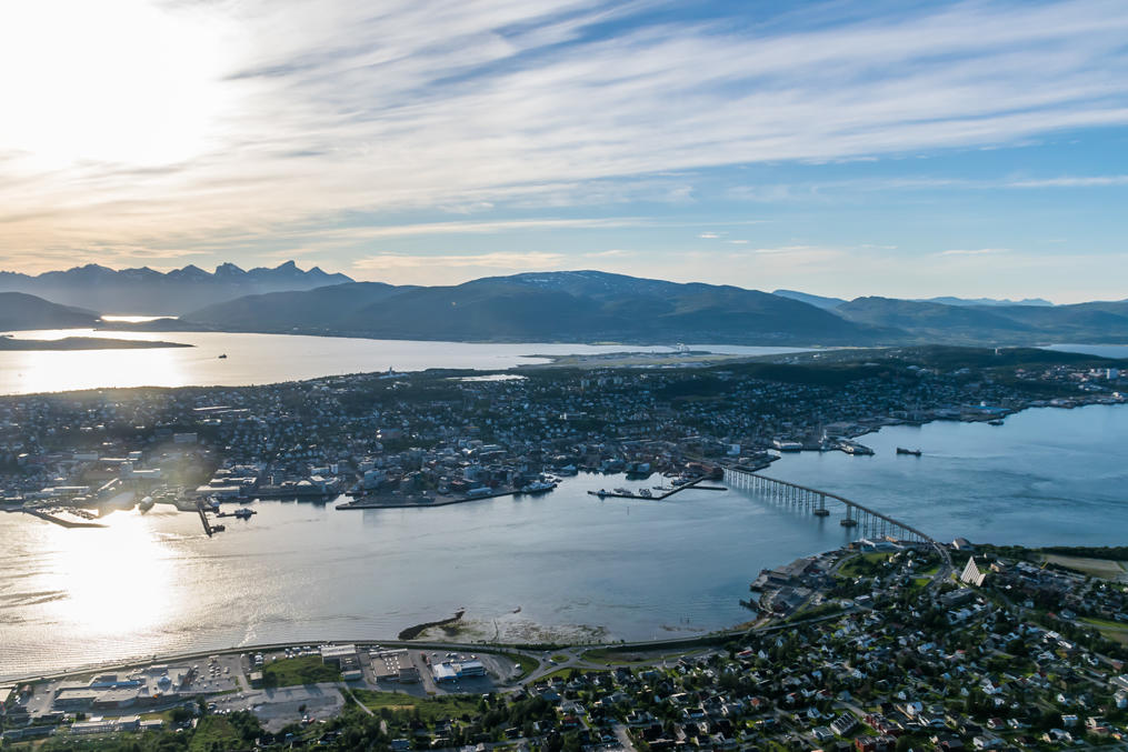
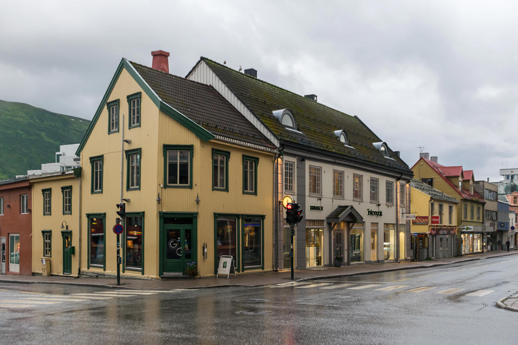
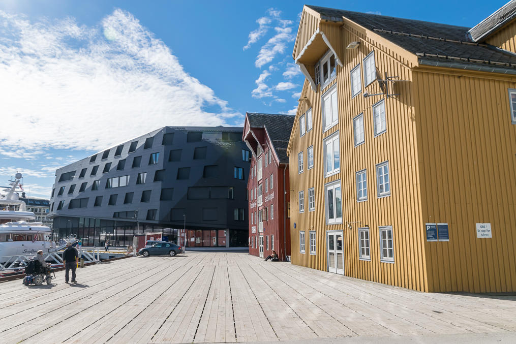
26. It’s pretty clear which city is the actual capital of the Northern Norway nowadays, and that is Tromsø, which I have already mentioned several times before. Tromsø is the center of Troms County (who would’ve guessed), and as such, it is surrounded by fairly respectable mountains. From Storsteinen Mountain it’s easy to have a look over the entire city (population 60,000), which neatly fills a middle-sized island hidden between fjords and straits.
27. The city was nicknamed “the Paris of the North” as early as in the 19th century (although my friend had actually seen Paris before and kept claiming Tromsø was still nowhere like it). WWII fighting thankfully didn’t reach it, and the city retains its old charm.
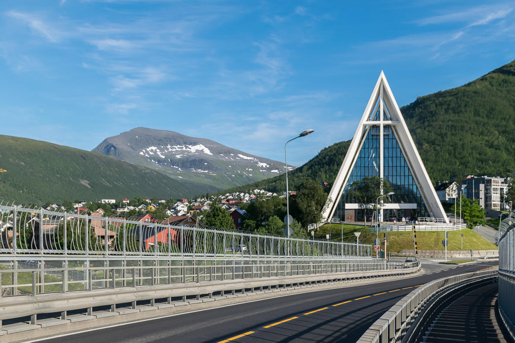
28. The most iconic building of Tromsø is the Arctic Cathedral, actually located not in Tromsø itself, but on the mainland near the bridge to Tromsø, at the end of Tromsdalen Valley.
29. Tromsø is home to the northernmost university in the world as well, appropriately named Arctic University. And to the northernmost brewery in the world, which makes beers with names like “Polar Bear”, “Northern Lights”, or “Arctic Beer”. It looks like naming stuff is very easy if you live beyond the Arctic Circle!
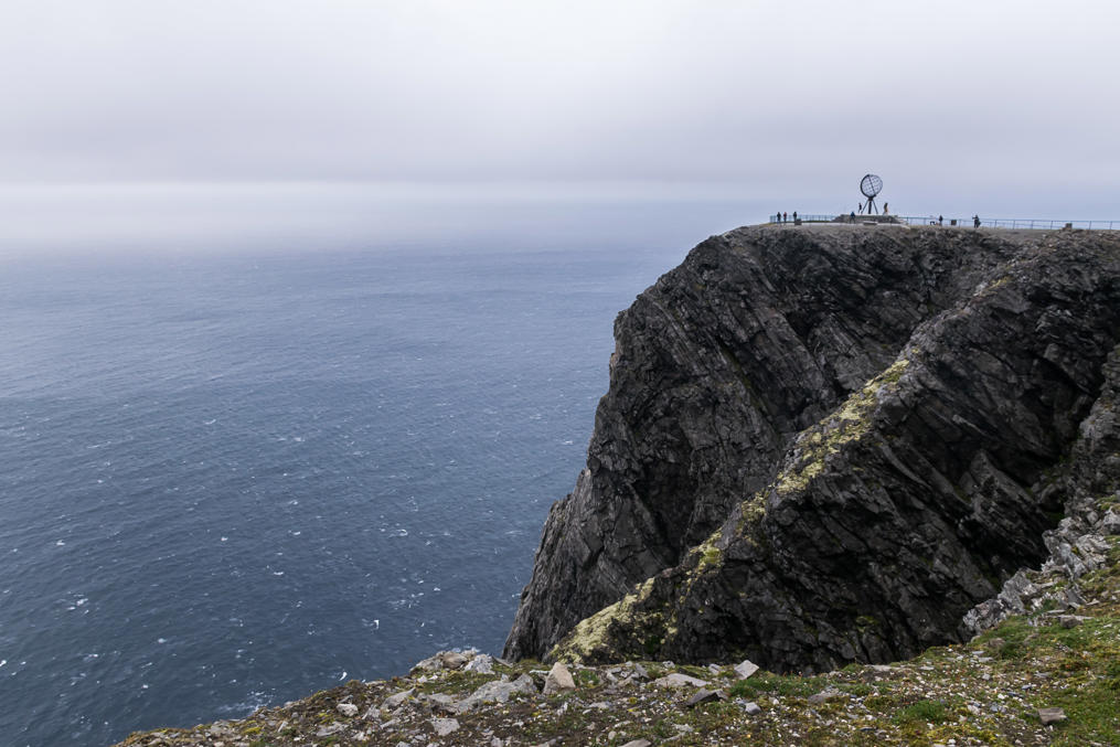
30. The biggest attraction of the Northern Norway is probably the North Cape (Nordkapp), the northernmost point of Europe, on Magerøya Island in Finnmark County. It’s somewhat of a tourist trap (it has a significant entry fee), but I still do absolutely recommend to visit it. Its location is quite dramatic, on a 300 meter tall cliff overlooking the endless Barentz Sea, and on the way there (there’s a decent road) you’ll get to enjoy lots of stunningly beautiful tundra and fjord landscapes.
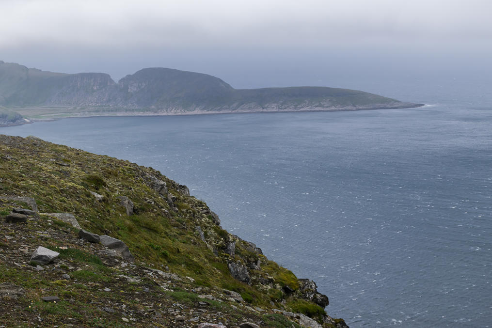
31. The question of what exactly consitutes the northernmost point of Europe isn’t that simple. Svalbard is Europe too, after all, and if you agree to exclude islands then, well, the North Cape is on an island too. The northernmost point of more-or-less-continuous Europe is also not the North Cape, but actually the nearby Knivskjellodden Cape, which is about a kilometer and a half farther north. It can be clearly seen from the North Cape, and a hiking trail goes there, although it’s not the easiest one (we still did it).
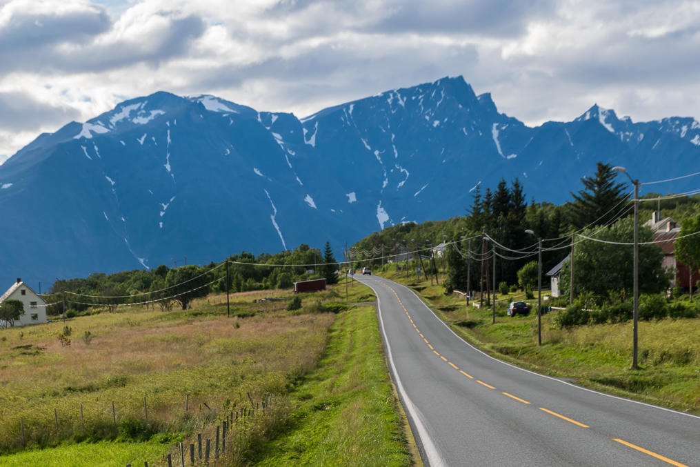
32. Hiking in fact seems pretty much what Norway is meant for. Hiking to Knivskjellodden and in other tundra areas is great if you enjoy huge open spaces (I do), but hiking in various mountains is a lot of fun too, and you do not have be into mountaineering — there are lots of trails perfectly accessible for casual hiking — for example, in the Lyngen Alps, the tallest mountains north of Tromsø, reaching over 1800 meters of elevation. (Okay, if you want to climb its 1800 meters tall mountain, you probably actually do need to know some mountaineering.)
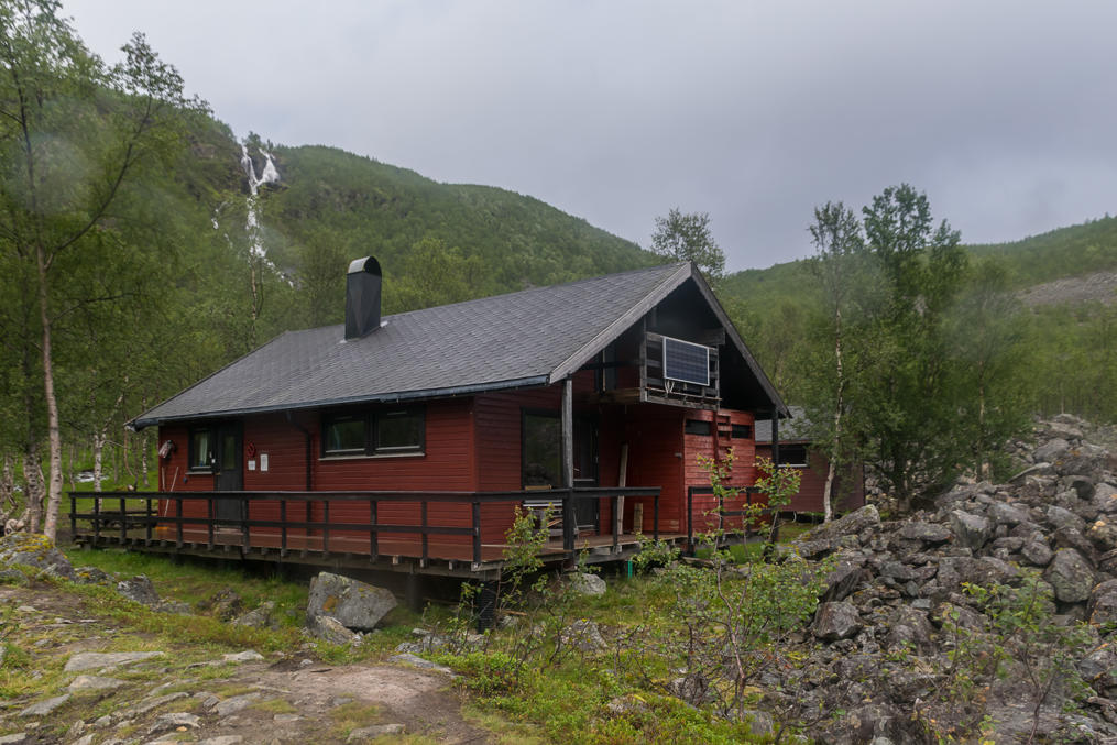
33. You can even go hiking for multiple days without packing sleeping gear (and that stuff weighs a lot!), if you plan carefully. There are reservable tourist huts available in most popular hiking destinations.
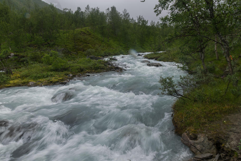
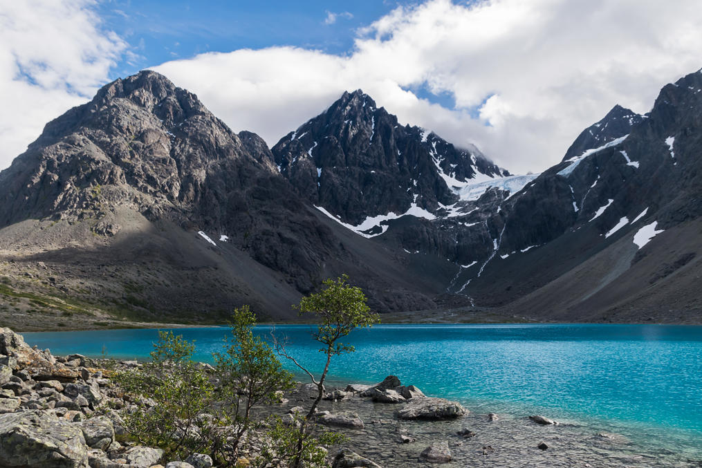
34. There are glaciers in the mountains. That’s why there are many milky white or bluish rivers here — these are glacial rivers carrying a lot of deposit from the glacier above.
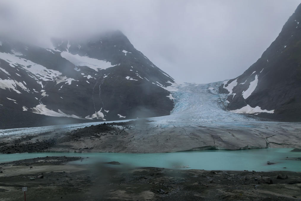
35. It’s not often that you get a chance to see a glacier up close, huh? Of course getting to one requires some hiking; you cannot just drive up there. If you want to proceed onto the glacier itself, there are guided tours; walking on glacier ice alone is very dangerous.
36.
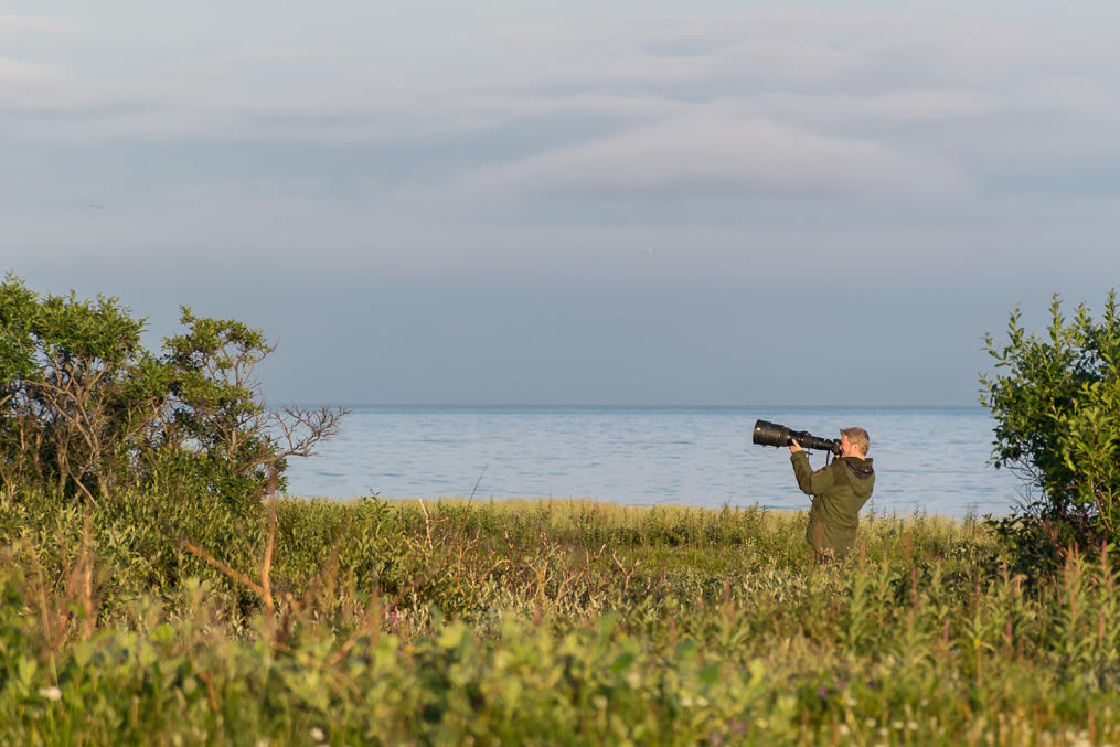
37. There are ample opportunities for wildlife watching if you’re into that. Birdwatching especially; Finnmark islands supposedly contain huge colonies of sea birds. I’ve already mentioned whale watching trips, and along these lines, seal watching also exists. Polar bears thankfully do not live in Northern Norway (although they do in Svalbard), so you cannot go polar bear watching. The local fauna in general should be exceptionally safe.
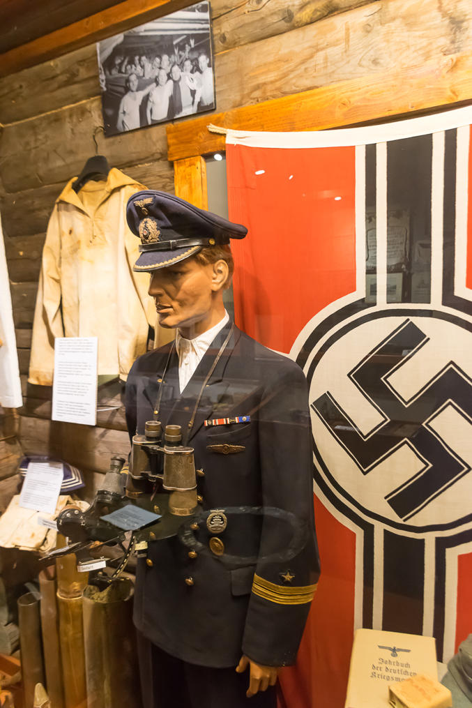
38. Northern Norway is also, perhaps somewhat unexpectedly, an interesting place to visit if you’re into the history of WWII. Northern Norway, occupied by Nazi Germany in WWII, was important most of all as a base for interception of lend-lease convoys, bringing American and British aid to the Soviet Barentz Sea port of Murmansk. There often are some debates in Russia about the significance of this aid; the most common consensus is, we would have probable won even without it, but at a much much worse cost than we did, and the cost we did win at was very terrible to begin with.
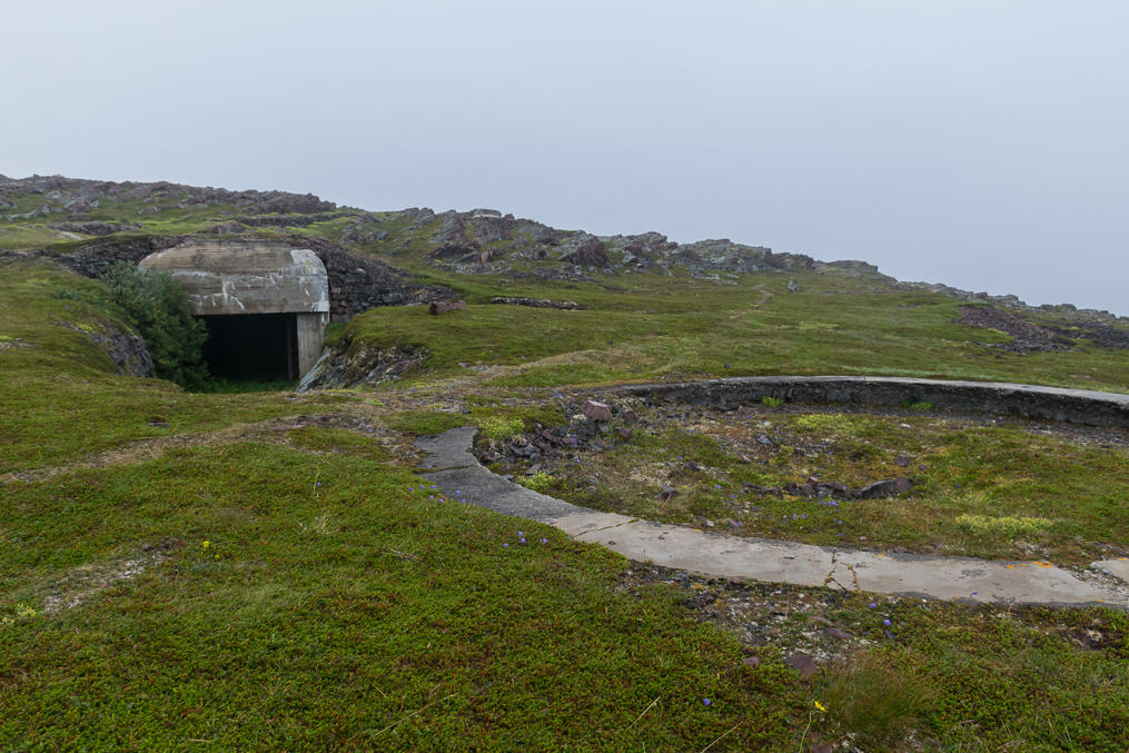
39. Some sea-facing mountains were literally hollowed out and covered with huge artillery cannons. It was supposed to be a part of the Atlantic Wall, Hitler’s huge fortification project, meant to shield his empire from the sea over its entire length, from Spain to Norway. The scale of this construction, carried out mostly by prisoners of war, just boggles the mind (I had no idea about these fortifications before I first saw them). You can still see numerous caves and bunkers to that day, and can’t help but wonder if something undiscovered still remains in one of them. Some secret Nazi laboratory with Hitler clones, or something like that.
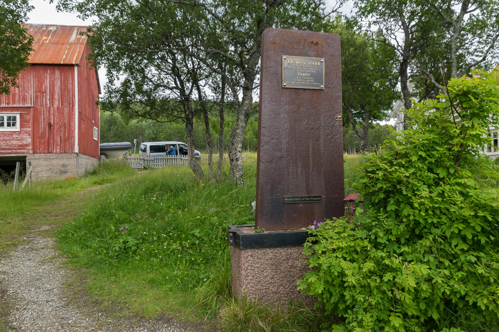
40. The best known episode of war in the Nothern Norway is the raids on, and the sinking of German Battleship Tirpitz. One of the two largest battleships of Nazi Germany, after its sister ship Bismarck was sunk by the British in 1940 in the Battle of the Atlantic, it was assigned to Norway for the rest of the war, where it did pretty much nothing (apart from one raid on Svalbard, which was a massive overkill), but its mere presence affected the lend-lease convoys a lot — if Tirpitz ever intercepted one, the fight would have been very short. The British made multiple daring attacks on the Tirpitz, with bombers and midget submarines, and while they severely damaged it several times, it took many attempts before it was finally sunk by bombers near Håkoya Island, close to Tromsø. The monument at Håkoya is rather small, but there is a whole museum about Tirpitz in Kåfjord, Alta, where its previous base had been.
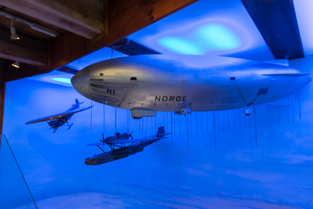
41. On a lighter (hopefully) note, Northern Norway was commonly used as a base for polar exploration due to, well, being relatively close to the North Pole. Judging by the monuments and the museums, Fridtjof Nansen and Roald Amundsen must be pretty popular here, although their best known expeditions weren’t actually related to the Northern Norway.
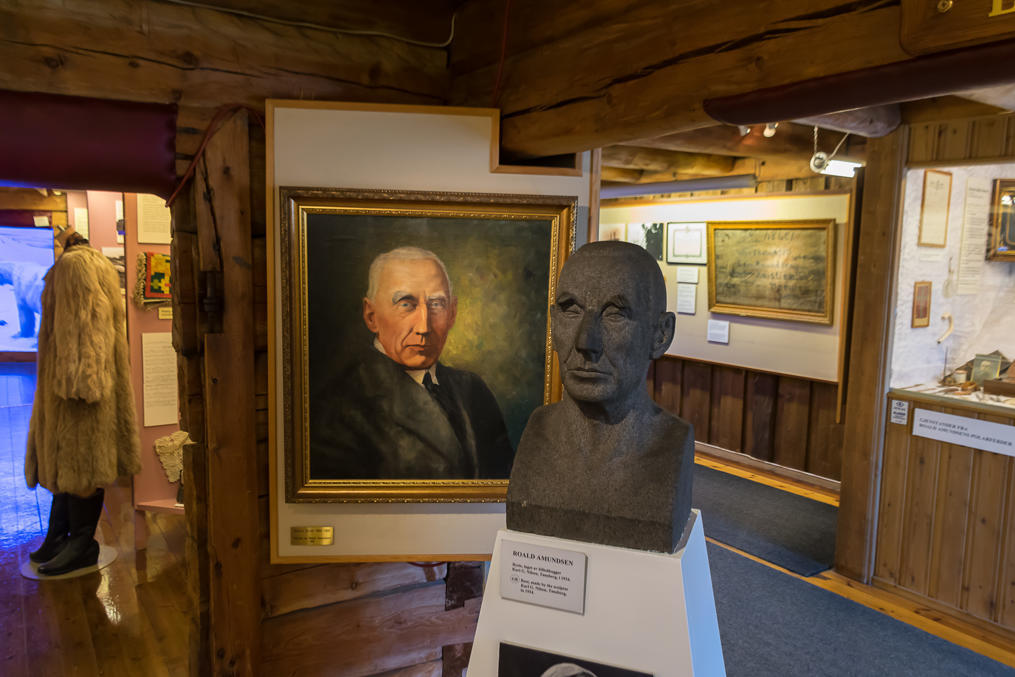
42. The last flight of Amundsen (the first man at the South Pole) took place in 1928, when he took off from Tromsø on a hydroplane, on a rescue mission to find his former companion, Umberto Nobile, whose airship Italia has crashed in the Arctic. Nobile’s expedition was eventually found, while Amundsen disappeared without trace.
43. Okay, so, suppose you want to go there and see all these wonderful things, how would you go about it? Well, it my opinion the only practical mode of travel is car. Yes, it’s a long drive, and you probably might want to go there by plane and then rent a car in airport.
Many of the smaller towns in Northern Norway have airports, due to the fact that road distances are considerable. They are however only connected to Tromsø, or Bodø (in Nordland). Therefore unless you really want to visit only one specific location, it would probably be easier to just fly to Tromsø, get a car, and drive on from there. Even with Tromsø as a final destination, you’ll probably have to make at least one transfer in Oslo; it doesn’t have many connections to any major airports.
Alternately, you might want to consider renting a car in Finnish Lapland, most likely Rovaniemi. Rovaniemi is easily reachable via Helsinki by plane or train, and car rental prices in Finland will likely be significantly lower. I won’t quote any specific numbers, just go to Sixt or any other major rental company website. You’re looking at a >500 km drive from Rovaniemi to Norway, but driving through Lapland is generally easy and pleasant.
If you actually decide to drive your own car from the direction of Sweden, continental Europe, or even Southern or Western Norway, your best bet is European Route E4 via Sweden, and then possibly via Finnish roads. The backbone road of Norway itself, European Route E6, is certainly way more scenic but very slow, with many narrow and/or winding sections. In one place (where entire mainland Norway narrows to an isthmus 6 km wide) there is a mandatory ferry crossing.
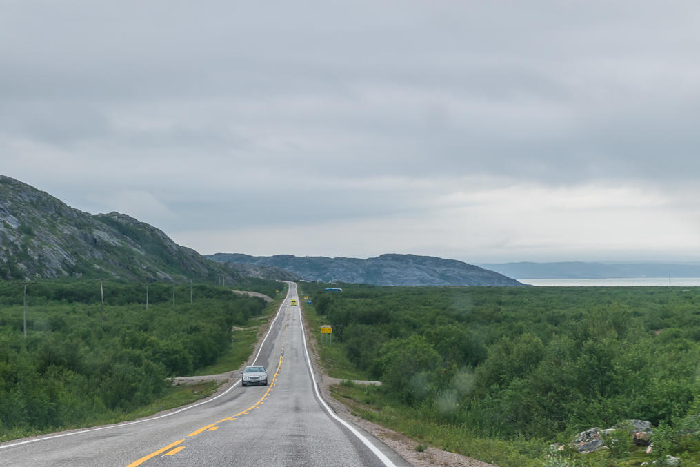
The E6 continues from the Swedish border, through Oslo and Trondheim and Narvik, to the Northern Norway, ending in Kirkenes, very close to the Russian border. Its better parts (like the one pictured above) are actually quite nice, and the traffic is light. Nearly all other roads in the Northern Norway branch from the E6; there are only a few sections with alternate routes, notably Finnmark County Road 98 on Lakselv-Tana Bru leg (more coastal and scenic than the E6 that goes through Finnmarksvidda Plateau), and ferry connections through Lyngenfjorden and Ullsfjorden forming Troms County Road 91 that allows to cut down travel time and distance in Lyngen area very considerably.
As for “driving from Russia or Southern Finland” case, that’s the one I have personal experience with, and I’ll tell about those roads in more detail in the coming posts. Suffice to say, the roads in Finland are very good and in Russia good enough too, but expect two or three full days on the road, if you’re going from St. Petersburg or Helsinki.
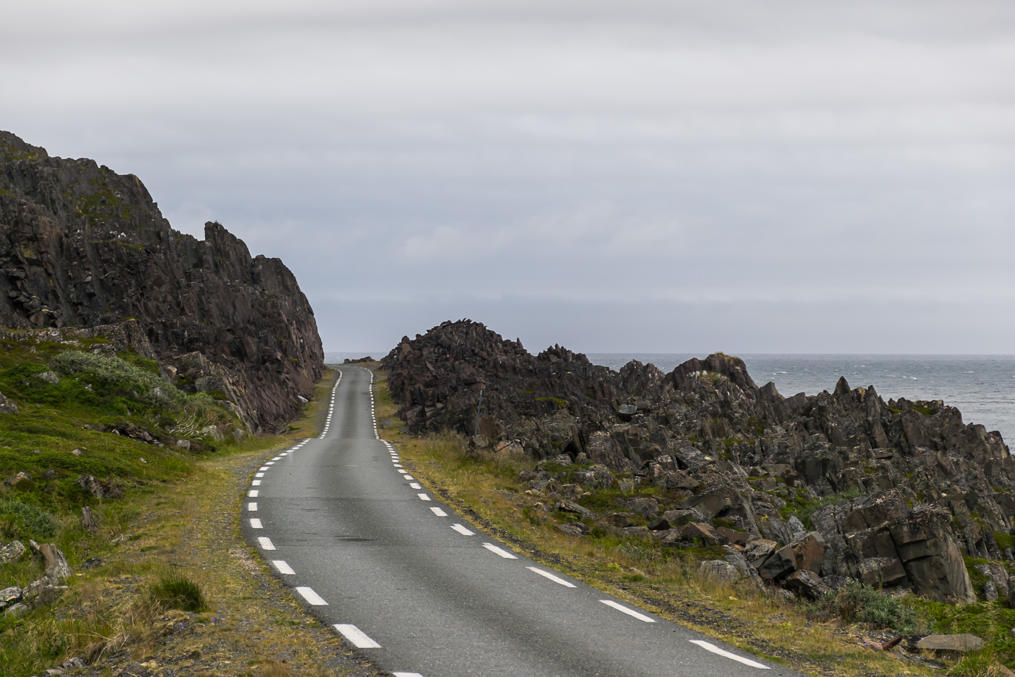
44. The quality of secondary roads may vary. Some roads may be curvy and narrow, sometimes too narrow for two cars to pass, requiring one of them to wait in a passing place or to move over to gravel shoulder. Hamningberg Road, pictured above, is an extreme example of such a road, with only one lane. While trucks are rare, there are usually lots of slow motorhomes, which can get very annoying at times. Overtaking anyone on a narrow road (with no centerline) without warning is a very bad idea. On straight stretches of such a road, trucks and motorhomes will often shift to the right as much as possible, and signal with their right blinker “it’s okay to overtake”. Of course this still requires some width; on a road as narrow as Hamningberg Road overtaking is only really possible if the vehicle ahead stops and pulls over entirely.
Most if not all “official” roads are paved; while the paving may be worn out on smaller roads, I have never seen any actual potholes. There are occasional gravel and dirt roads going to the mountains, usually marked on a topographic map. Attempting these roads on a regular car is also a bad idea. There are exceptions though, such as Beskades Road.
Many minor roads close down for winter entirely (a boom will be lowered). Even sections of trunk roads going over mountain passes or plateaus have to employ convoy driving; basically, the road is normally closed, but a snowplow goes through according to a timetable, and the other traffic may follow it. Most notably, Route E69 (the road to the North Cape) uses convoy driving on its tundra sections. Sometimes there are electronic signs informing about the conditions on the mountain pass ahead. In general, winter driving in Northern Norway is a topic on its own, and I cannot really tell much about it, having never attempted it myself so far.
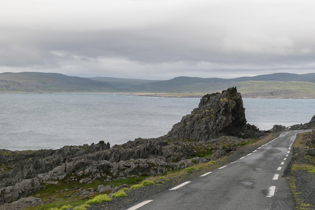
45. Of course many of the minor roads are actually the prettiest ones! Hamningberg Road (and the preceding Route E75 over Varanger Peninsula), Havøysund Road, and Senja Coastal Road are actually designated as National Tourist Routes, and are maintained well, with cool rest areas. There are however many lesser known scenic routes as well, such as the aforementioned Beskades Road (an old gravel road through a vast mountain plateau, covered with tundra, at 500-600 m elevation).
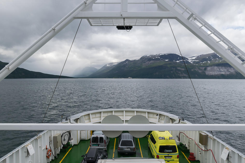
46. There are many island communities in Northern Norway, and most of them are connected to the mainland only by ferries. Additionally, there are some ferries over fjords, which just allow to cut down on travel time. Unlike Finland or Sweden, Norwegian ferries are not free, and the price in fact can be quite significant. I don’t think there is any central website with all ferry timetables, so you generally have to Google them individually. At least you don’t have to make any bookings; just drive onto the ferry, and a fare collector will come up to you and sell you a ticket. As ferry distances aren’t usually particularly short, the ferries should generally have a common cabin, bathrooms, and likely a cafeteria.
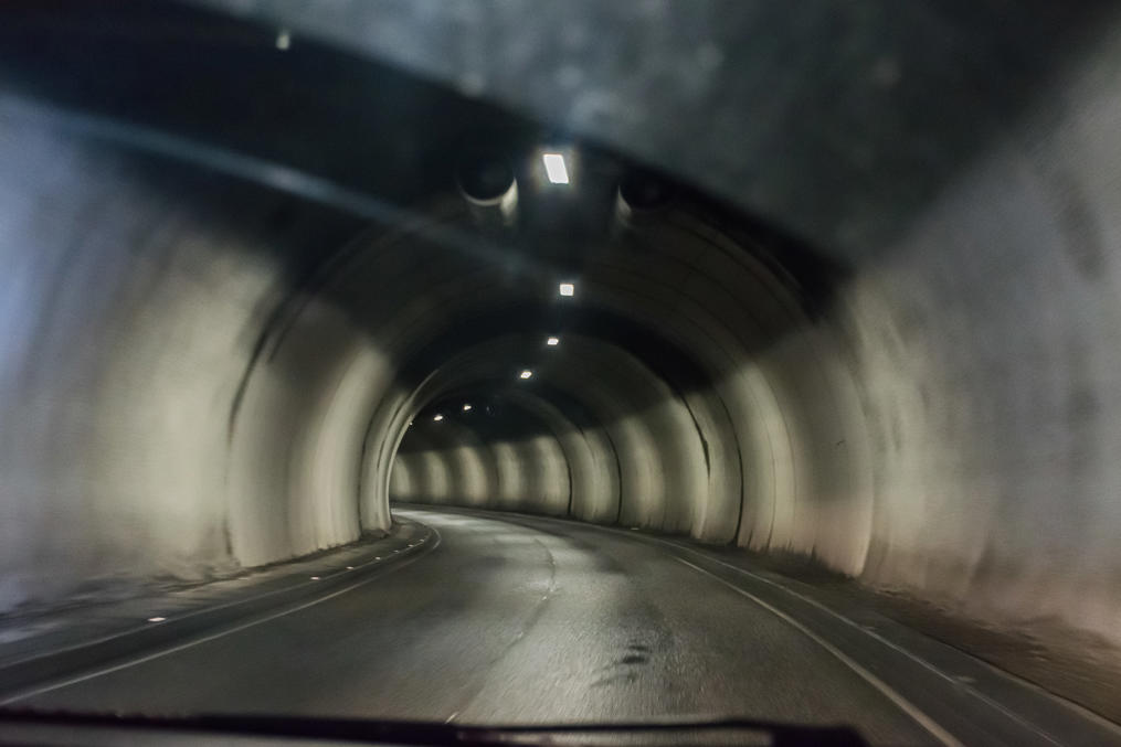
47. Some islands however (like Magerøya or Vardø) are connected to the mainlaind by underwater tunnels, sometimes many kilometers long. Tunnels may also be constructed under mountains, or along mountain slope for avalanche protection. Tunnels are often dark, narrow, steep, or wet, so you should drive very carefully in them.
There are many toll roads and tunnels in Norway; Norway in general isn’t shy when it comes to making money off car users (which is actually surprising, considering the size of the country; I can understand when Denmark does this, but much of Norway is nearly inaccessible without a car). In Northern Norway however toll roads are extremely rare (there simply isn’t enough traffic volume to bother). The only toll road in all of Troms and Finnmark currently is Rya Tunnel in the vicinity of Tromsø (100 NOK cost, about €11.5), not an essential road connection by any means. You may find travel guides claiming that Magerøya Tunnel is tolled; this isn’t true anymore, the toll period on that tunnel has expired. Toll payment is entirely electronic; you have to register on AutoPASS website either in advance or shortly after your trip, and pay an invoice when it arrives via email (which may take several months).
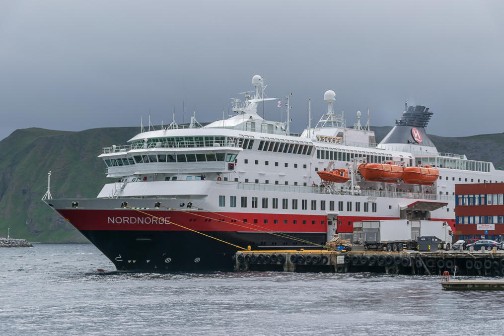
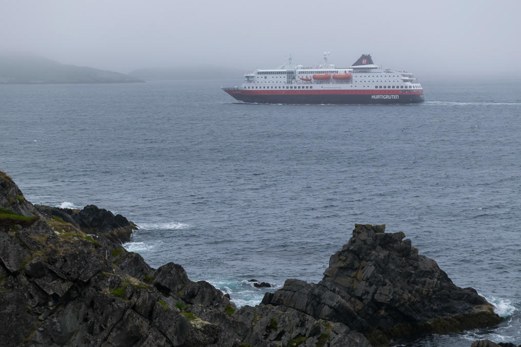
48. Apart from the smaller ferries, there is one giant ferry which connects all of the important Norwegian ports, from Bergen to Kirkenes: the Hurtigruten, “Coastal Route”. It is a very old route, and its actual use as a mode of transport has declined since there are now roads to all of its ports, and airports in many of them too. It’s more of a cruise ship now, but you still can use it to e.g. avoid long travel around all the fjords. See for yourself (Norway Port to Port option); a complete journey from Bergen to Kirkenes costs a fortune, but e. g. Honningsvåg to Kjøllefjord might end up fairly reasonable. I haven’t used Hurtigruten myself, though.
49. Hurtigruten ships, in their distinctive black, red, and white livery, are a common sight in these towns, and you’re likely to see them several times. Honningsvåg (the town closest to the North Cape) in particular becomes many times noisier when all the cruise passengers disembark at once.
Oh yeah, about the buses. I don't actually know anything about the buses, but I suppose there are some long-distance coaches. I doubt they are particularly frequent or convenient. In general, if own/rental car is not an option, I guess you could try hitchhiking. Coaches just seem like a masochistic choice.

50. One final tip. NORWAY IS EXPENSIVE! Really really expensive! I mean Finland or Sweden might be pretty expensive too, and Denmark is worse, but Norway is really the priciest of them all. Norwegians themselves generally have proportionally higher salaries so that’s not as big an issue for them, but as a traveller, you are bound to suffer.
Actually it was not quite as terrible as we expected. Grocery, gas, and accomodation prices are comparable to Finland, generally only slightly more expensive. What is really bad is restaurant prices. Never ever eat out in Norway unless that’s a life or death question, or you’re some kind of super rich Arab oil sheikh! Even a puny hotdog at a gas station may cost as much as a complete meal in Finland. Various tourist activities (whale-watching and the like) might also be more expensive then you expect. We self-catered, staying mostly in hostels and AirBnBs, and only visited some museums (these are usually okay), and in the end ended up almost within our projected budget. (Of course we had some extra in case of some emergency, but thankfully everything went according to our plan.)
