A few days ago we had a look at a small piece of the Finnish-Russian border. Let's now explore the Finnish-Swedish and Finnish-Norwegian ones! I have a lot more material here, so this will be a long(ish) post.
The entire length of the borders of Finland with Sweden and Norway lies in Lapland (Lappi), the biggest region of the country by far, the northern 1/3 of its entire area basically. Despite the very low population density in Lapland, it has quite a few roads. There is a total of six roads from Finland into Sweden, and six more from Finland into Norway.
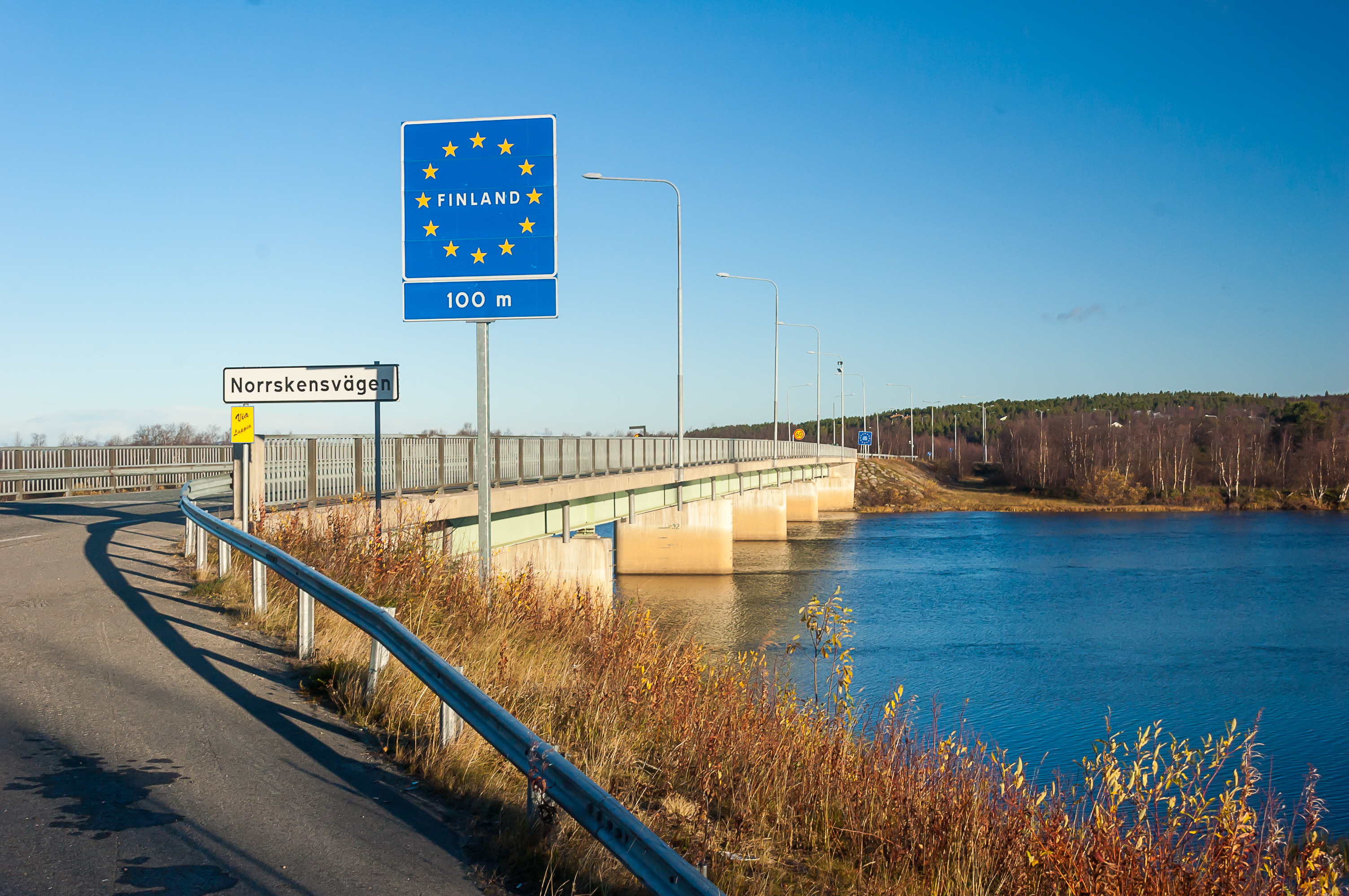
Finland, Sweden and Norway all belong to the Schengen Area, which means it is allowed to move between them freely, even in the wilderness. This however doesn't mean you are free to move any goods between countries. All border crossing have customs, usually open on workdays, where you can declare your goods (although a tourist would hardly ever need to). As far as I remember, these days all of these 12 border crossings have shared customs buildings used by both countries at once. Sometimes (quite rarely) they can do random spot checks, and stop and demand your ID and/or to look at what you have in your car. It's worth noting that Norway is not an EU country, and as such the limits on moving goods between Finland and Norway are much stricter than between Finland and Sweden. For example, you're allowed to bring no more than 1L of hard liquor, 1.5L of wine, 2L of beer and 200 cigarettes into Norway.
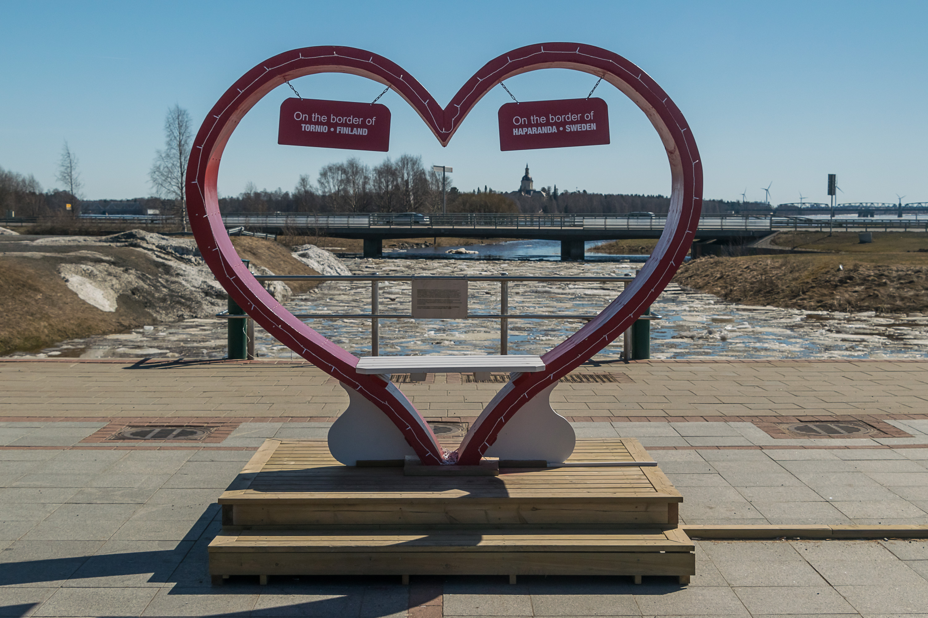
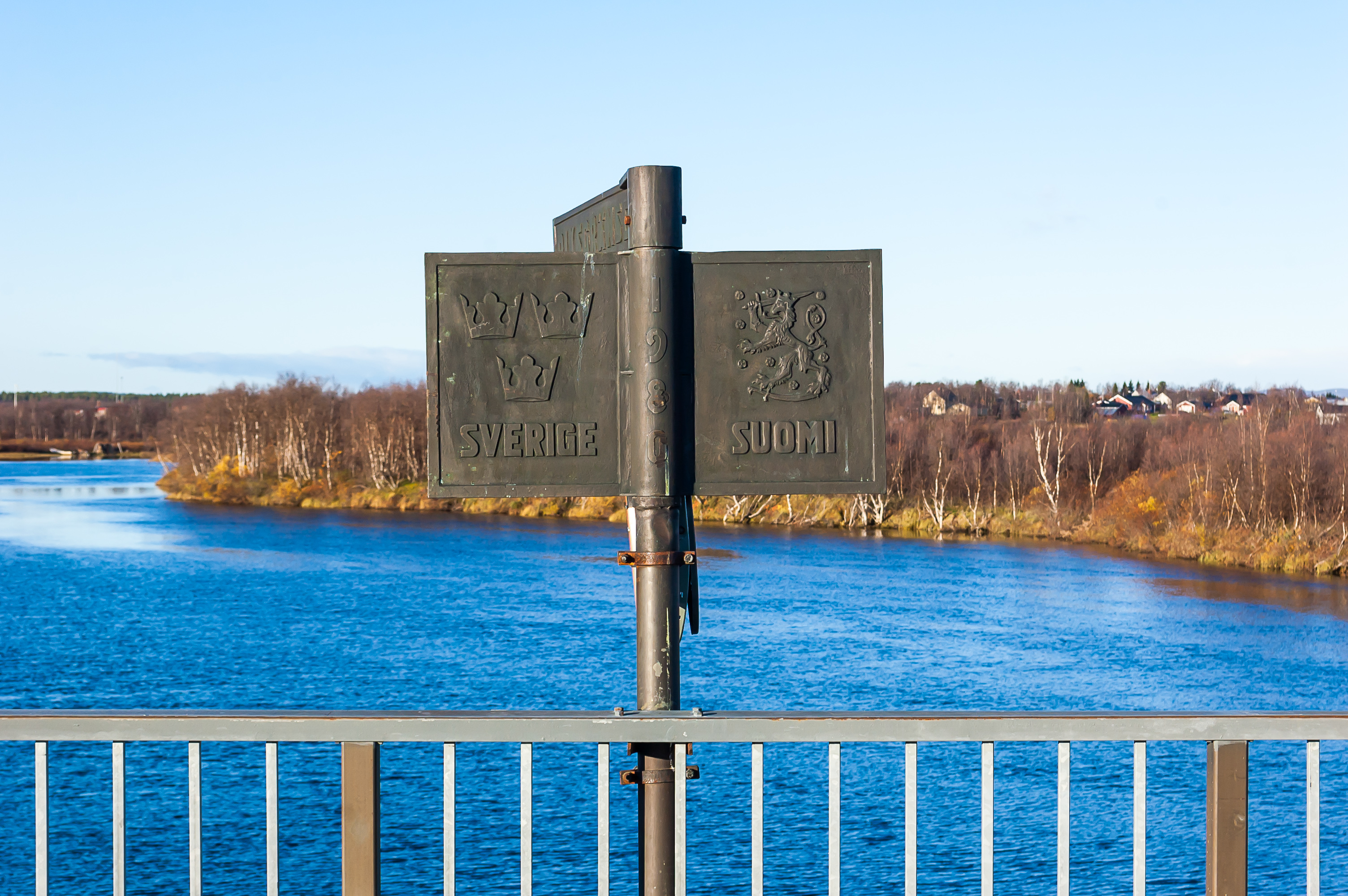
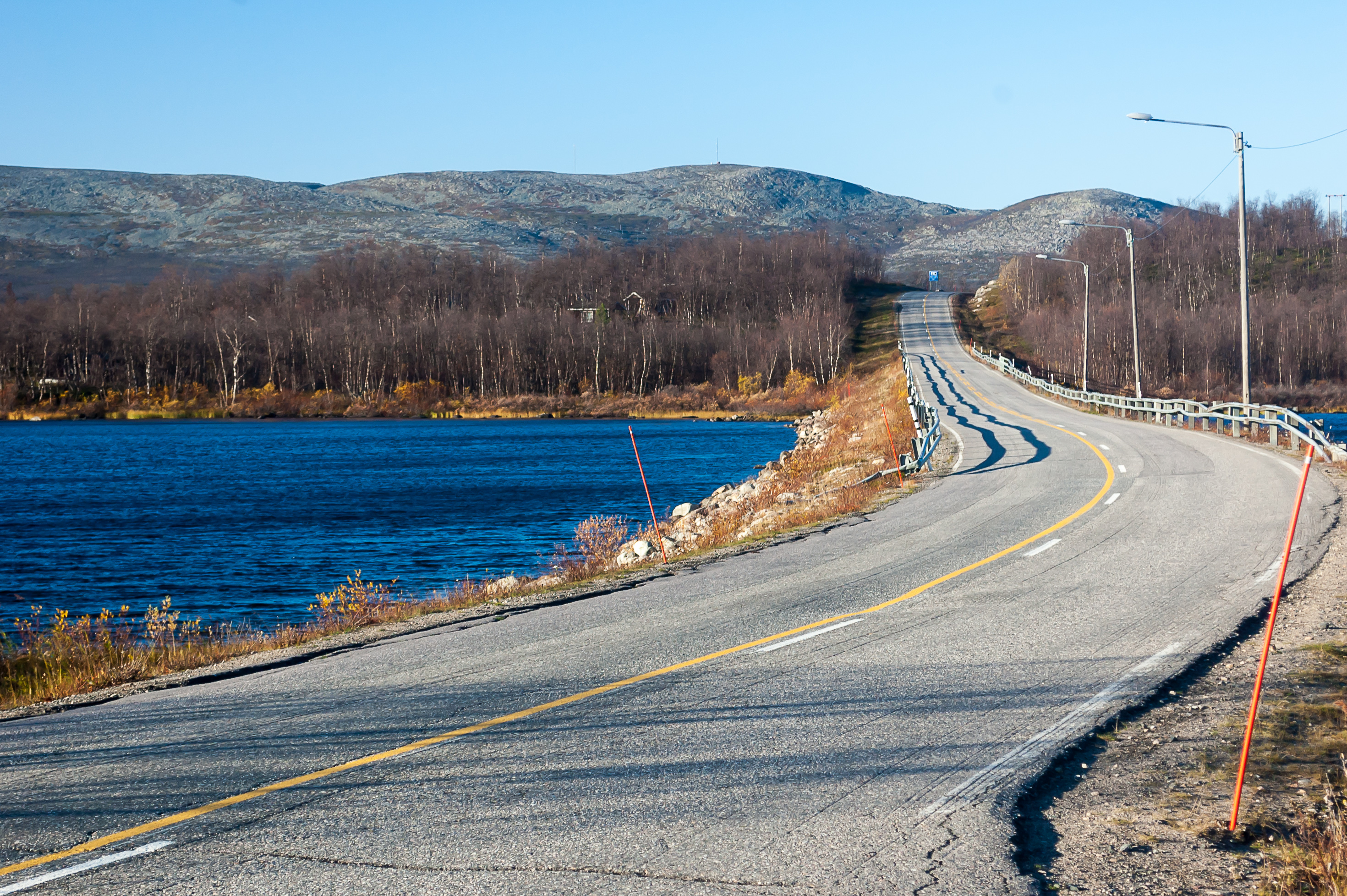
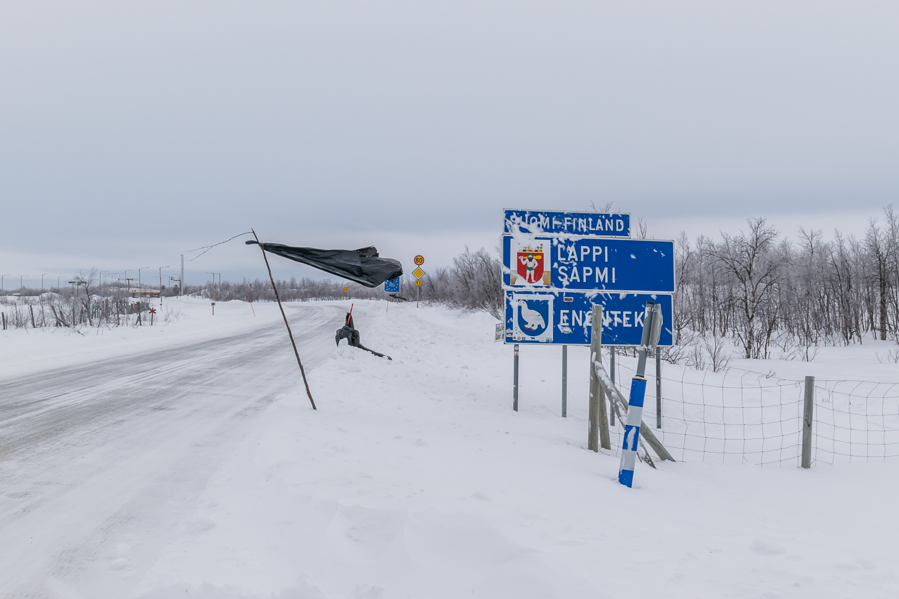
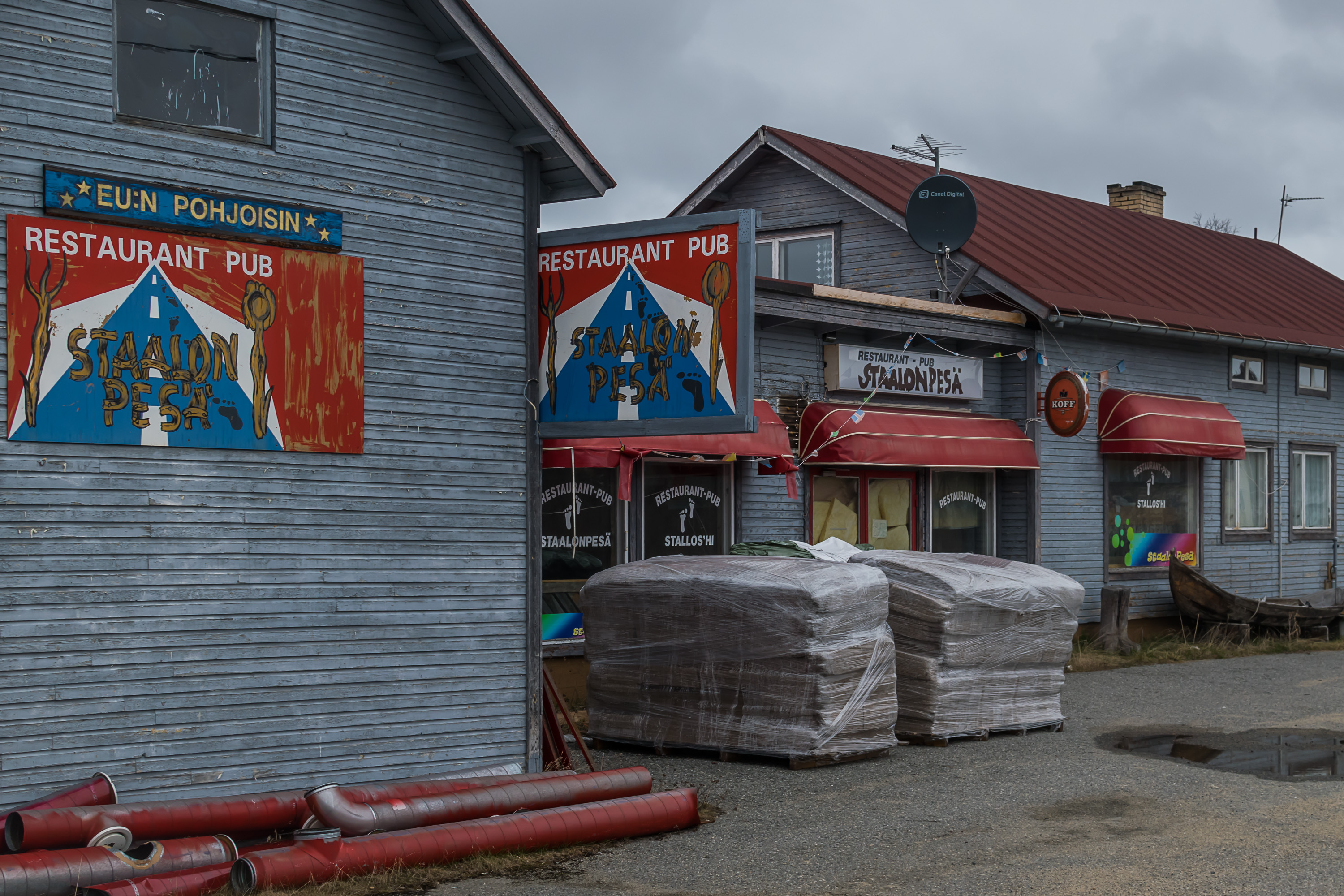
1. Tornio-Haparanda; Road 29 (E4). Let's start from the Baltic Sea. The Finnish-Swedish border begins almost at its northernmost point at the Bay of Bothnia (Perämeri), at the mouth of the Torne River, and follows it upstream. Torne is called Tornionjoki in Finnish and Torneälven in Swedish, and the city at its mouth, Tornio (from Swedish Torneå, which again means simply "Torne River"), is the oldest city of Lapland, although when I visited it I found it a bit disappointing. Nonetheless it's the only border crossing of these 12 with a border city of any size. The Tornio region is also known as Sea Lapland (Meri-Lappi). Despite technically being Lapland, the landscape here is rather flat and relatively boring, reminding more of North Ostrobothnia, and this is the only part of Lapland with no reindeers. The city is known for its huge metallurgical plant and for the (rather meh) Lapin Kulta (Lapland Gold) beer, which has been brewed here for many years but eventually they moved it somewhere to the south.
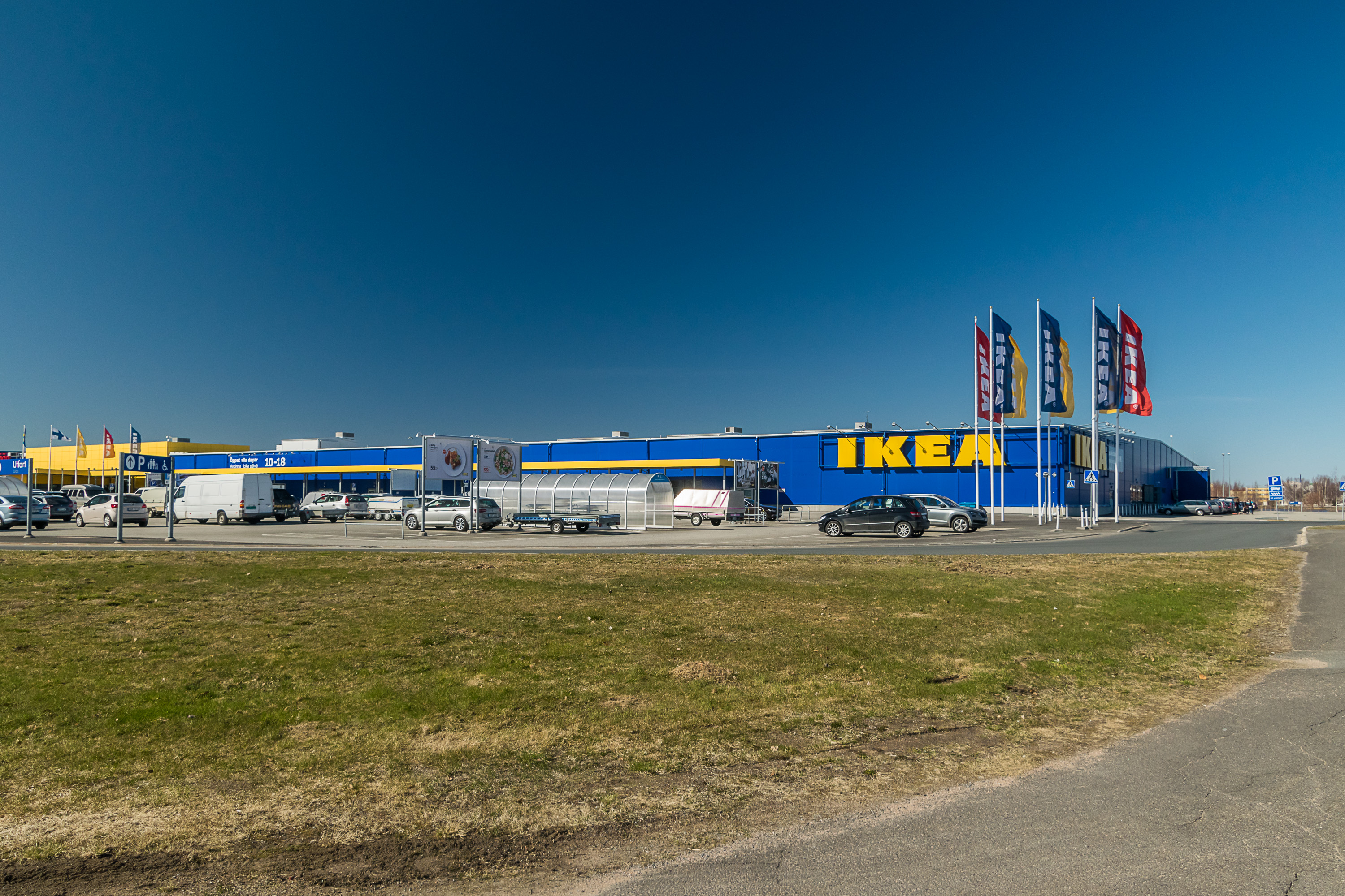
The Swedish town of Haparanda across the border is arguably more interesting, despite being several times smaller (Tornio has population of 22,500, while Haparanda is only 5,000). Haparanda rose rather spontaneously soon after Tornio actually became a border city; in Swedish era the (regional) border between Sweden proper and Finland was considered to lie along the next big river to the east, Kemi (Kemijoki), and Tornio's location was not as notable until 1809. Now there is an Ikea store greeting you literally 200 meters from the border, which looks a big amusing really. I read that the late Ingvar Kamprad personally greenlit an Ikea in Haparanda, despite the population density here being too low for an Ikea store by their own standards. And the Ikea became quite popular. After all, people in the north are used to long road trips. It is the closest store to the cities of Oulu (in Finland) and Luleå (in Sweden), both of which are major regional centers, and I read people come here from as far as Murmansk in Russia — a 800 km trip.
Road E4, the most important road of Sweden, continues on from Haparanda roughly along the sea coast, gradually turning to the south. It follows the coast up until Stockholm, and then turns to the southwest, towards the city of Helsingborg with ferries to Denmark.
There is in fact not one but two actual roads between Tornio and Haparanda; you can see the older one in the picture in the background, behind the monument that is meant to represent Finnish-Swedish cooperation (and which stands exactly on the border). There is also a railroad bridge, the only Finland's rail link to other Nordics, which would merit a separate post. And also there is a relatively famous golf field right on the border.
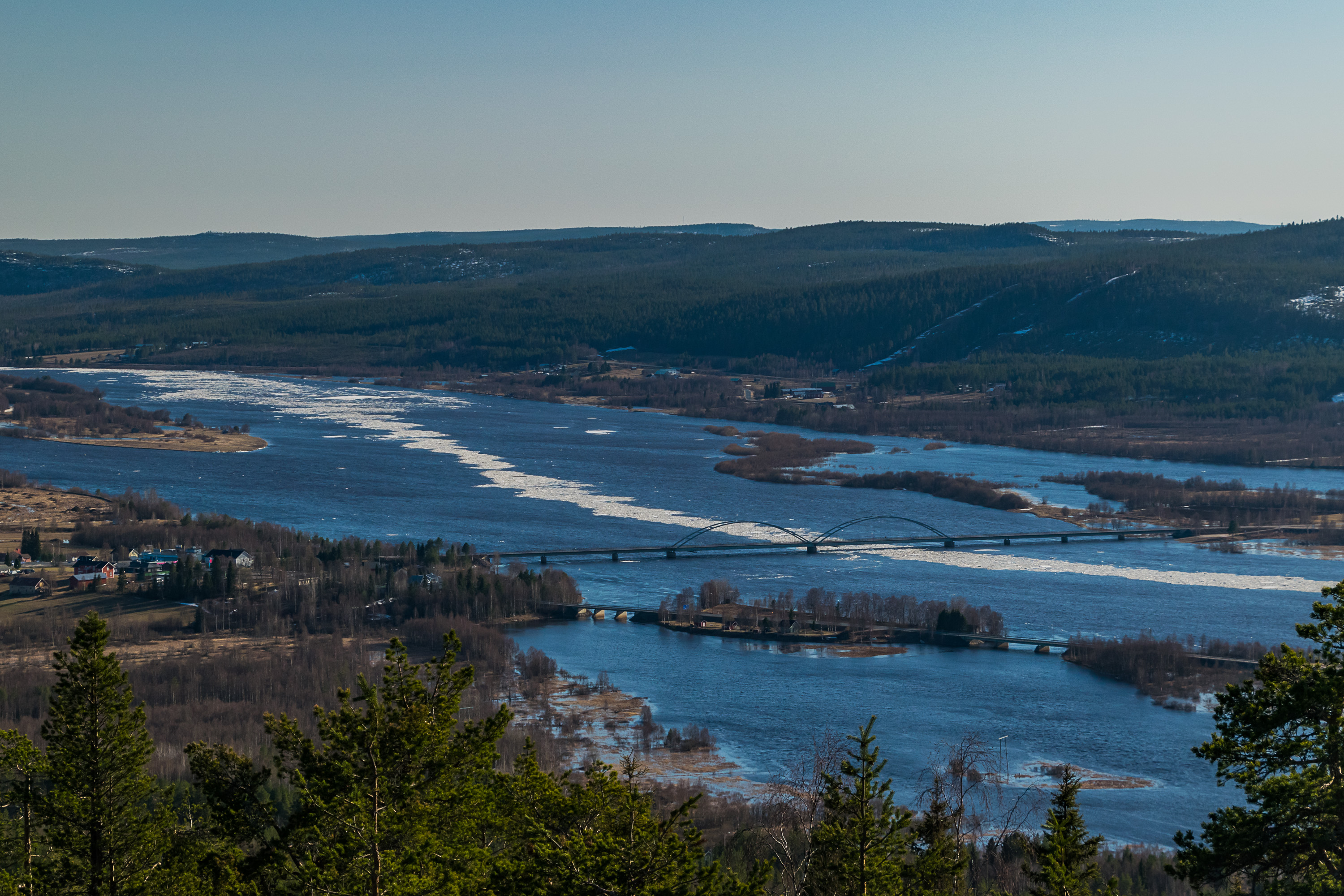
2. Aavasaksa-Övertorneå; Road 98. Finnish National Road 21 begins in Tornio and goes to the north, closely following the river and the Finnish-Swedish border, along its entire length. The road is also known by its more poetic names Northern Lights Road and Four Winds Road. The next town along this road after Tornio (in 60 km) is Ylitornio (Finn. Upper Tornio). A few kilometers farther there is a village named Aavasaksa, linked to Sweden with a bridge over Torne River. The twin town on the Swedish side of the border is named Övertorneå (Swed. also Upper Tornio). The towns are small and there isn't much to tell about the towns themselves.
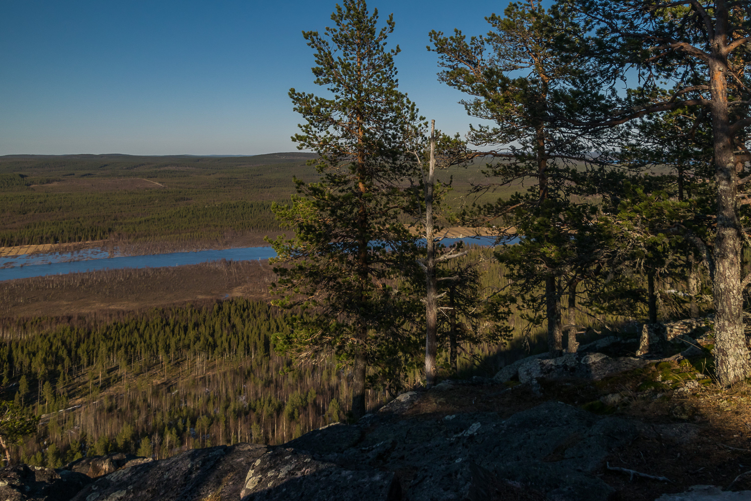
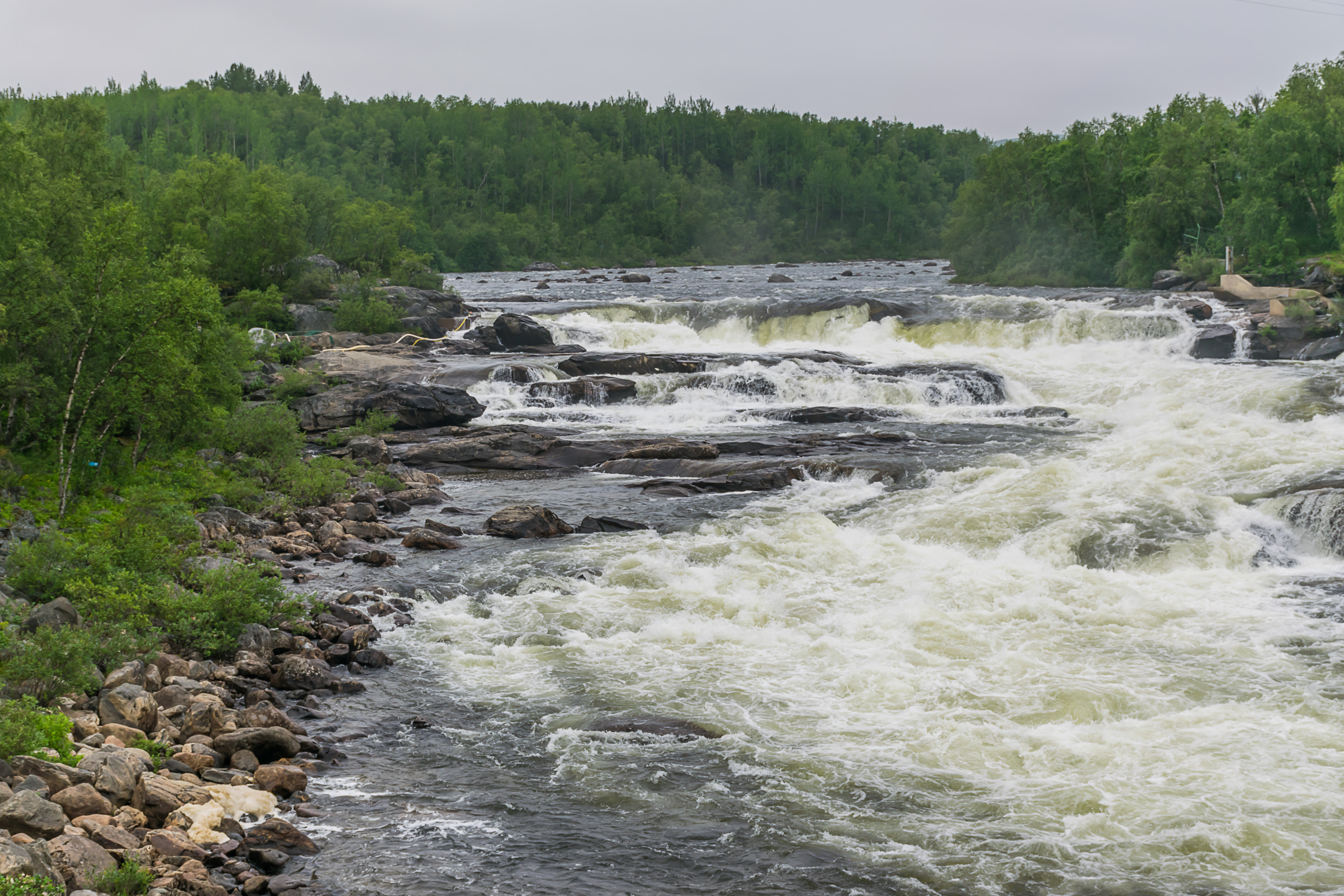
The picture above is taked from the top of the Aavasaksanvaara Hill, also known as simply Aavasaksa too. The hill is not particularly high (242 m) but is fairly steep and prominent, overlooking the Torne valley. Aavasaksa pretty much marks the spot where Sea Lapland turns into Forest Lapland, with its countless forested hills and bogs between them.
One curious and non-obvious fact about Torne River is that it is completely free-flowing, that is, has no hydro power stations or any other dams across it. The river's entire length from Swedish mountains to the Bay of Bothnia has been preserved in its pristine state for the later generations, and it is currently the longest free-flowing river in Europe. There are some hydro power stations on its minor tribunaties though (like the Tengeliö River near Aavasaksa). Despite having no dams, Torne River with its numerous rapids is however unfit for shipping anyway.
There is a much lesser known fact about Torne River as well (I only read it by accident in an old Finnish encyclopedia (Oma Maa, "Own Country") from 1958, and found very few references to it on the web even in Finnish). At some point in the 1950s a plan was seriously considered not just to build mere dams on Torne but for its flow to be turned around entirely! Exactly like the USSR wanted to do with the great Siberian rivers, although for different reasons. The idea was for Finland, Sweden and Norway together to turn the flow of Torne and Kalix rivers to the Arctic Ocean (Kalix is the next major river flowing into the Bay of Bothnia to the west after Torne, entirely in Sweden), and to build a truly monstrous dam at the mouth of the new super-river, 345 m high (for comparison, the Three Gorges Dam in China, which is biggest hydro power station in the world, is 181 m high). Luckily the Finns (and Swedes and Norwegians) pretty soon realized the insanity of this idea, and it was abandoned.
The white strip along the river in the picture is of course ice, if you had any doubts. The picture is taken in early May, and the broken-up melting ice was floating down the river in great quantities at the time.
Aavasaksa hill has been famous for quite some time. In the 19th century Russian Emperor Alexander II was planning to visit Lapland, and a small ornate mountain lodge was built for him on the top of Aavasaksa. In the end the tsar never came though. Alexander III also intended to visit Aavasaksa (most 19th century Russian tsars were quite fond of Finland really), but that never happened as well. The unused lodge has been preserved since nonetheless.
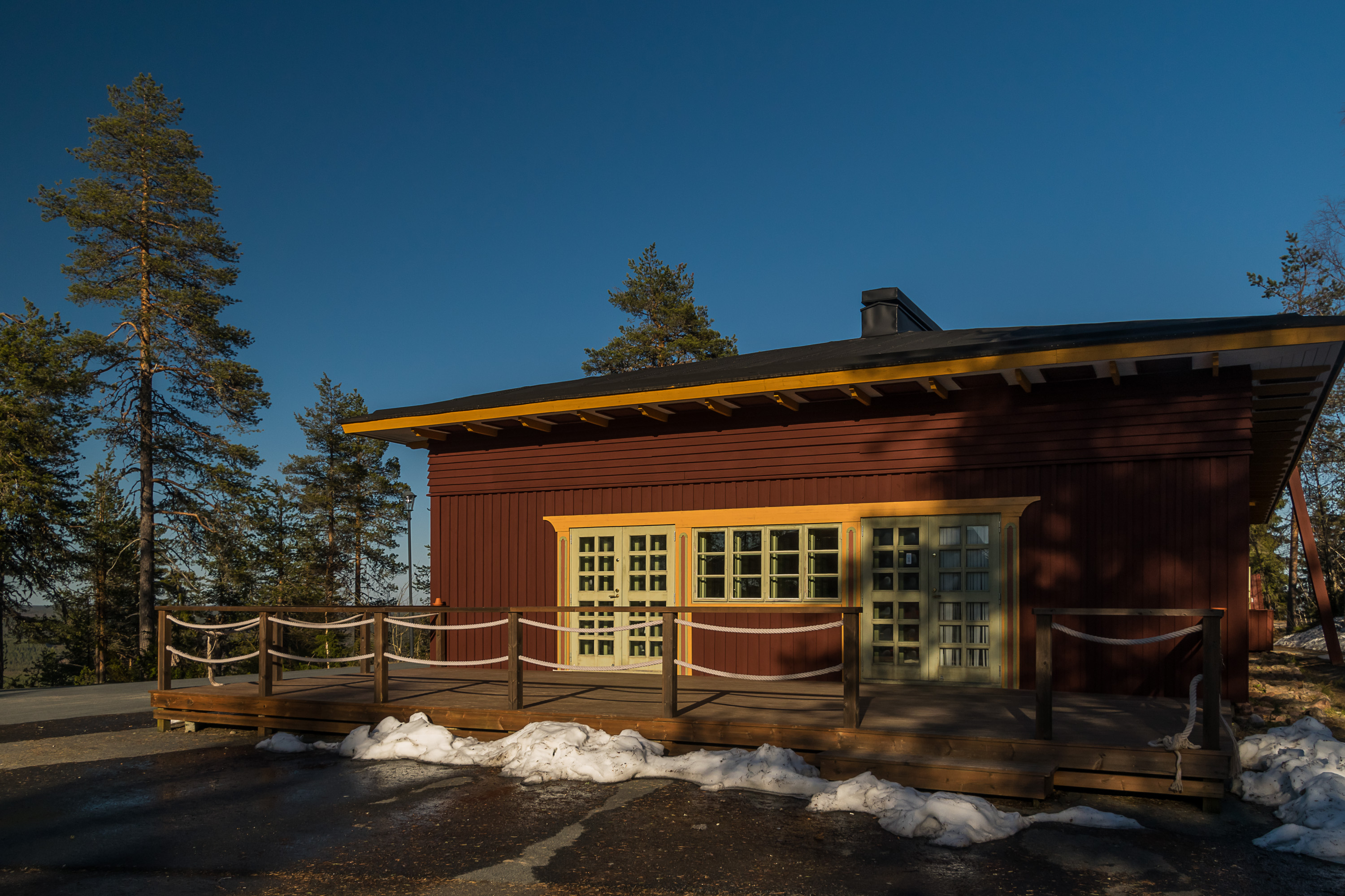
Apart from the lodge, there is a camping, some minor hiking trails, a high observation tower (the picture of the river was taken from this tower), a monument to a Struve Arc point (Struve Arc is a chain of triangulation points constructed all the way from Barents to Black Sea by 1855, which was used to measure Earth exact shape and size with great precision), a monument to a female Sami writer, but of course the best part is just the lookout points from which you can enjoy the hilly Lapland landscape.
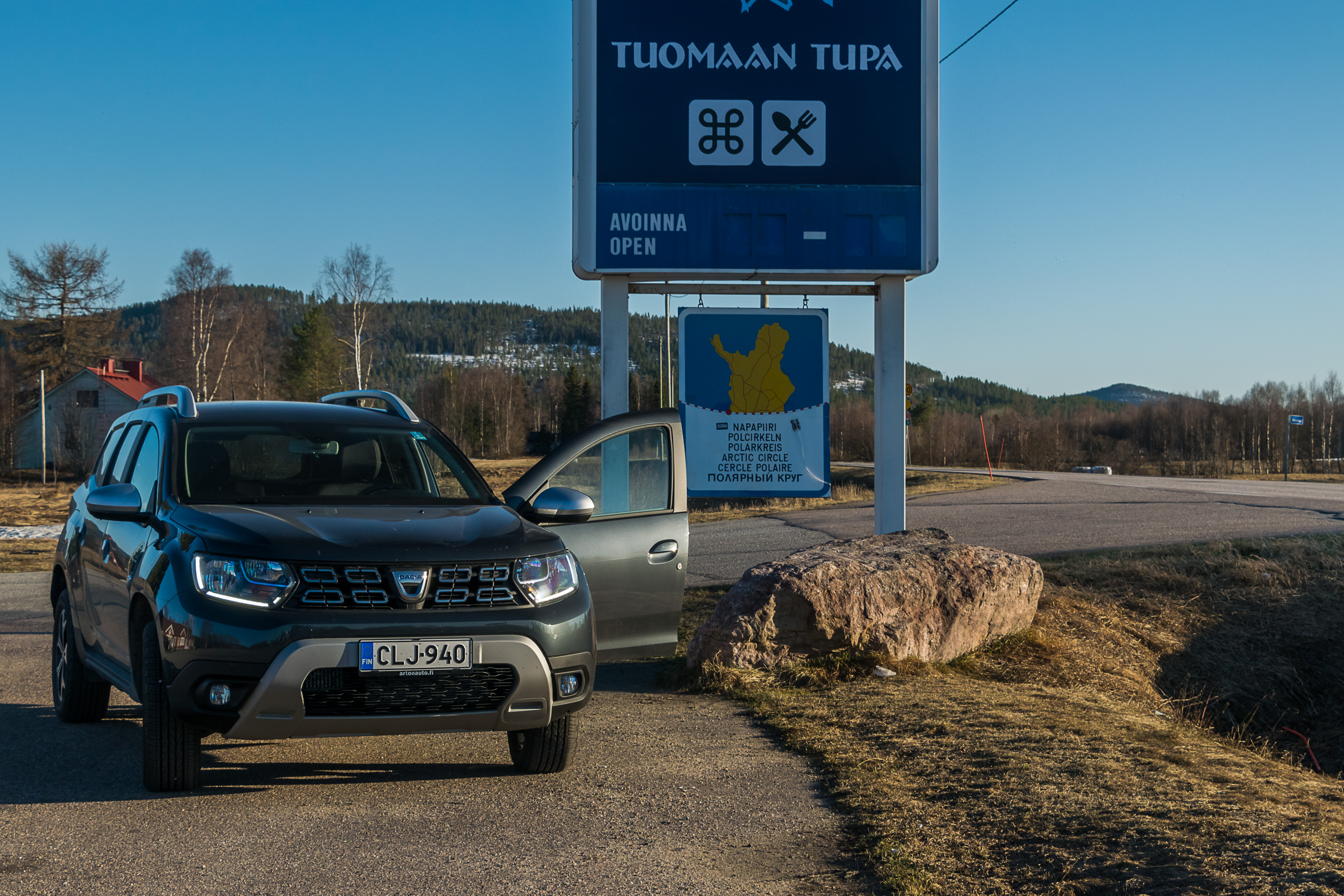
3. Pello; Road 937. Pello is a nondescript little town not especially different from Ylitornio (same will go for the next two towns really), in 55 km further north of it. There are no significant settlements on the Swedish side of the Pello bridge. Halflway between Ylitornio/Aavasaksa and Pello, in a village named Juoksenki, the Northern Lights Road crosses the Arctic Circle. There is a similar-looking sign on all Arctic Circle crossings in Finland, at least on roads of any size. There is also a great souvenir shop here which I really recommend (I'm saying as someone who's been in quite a few souvenir shops in the north of the Nordics).
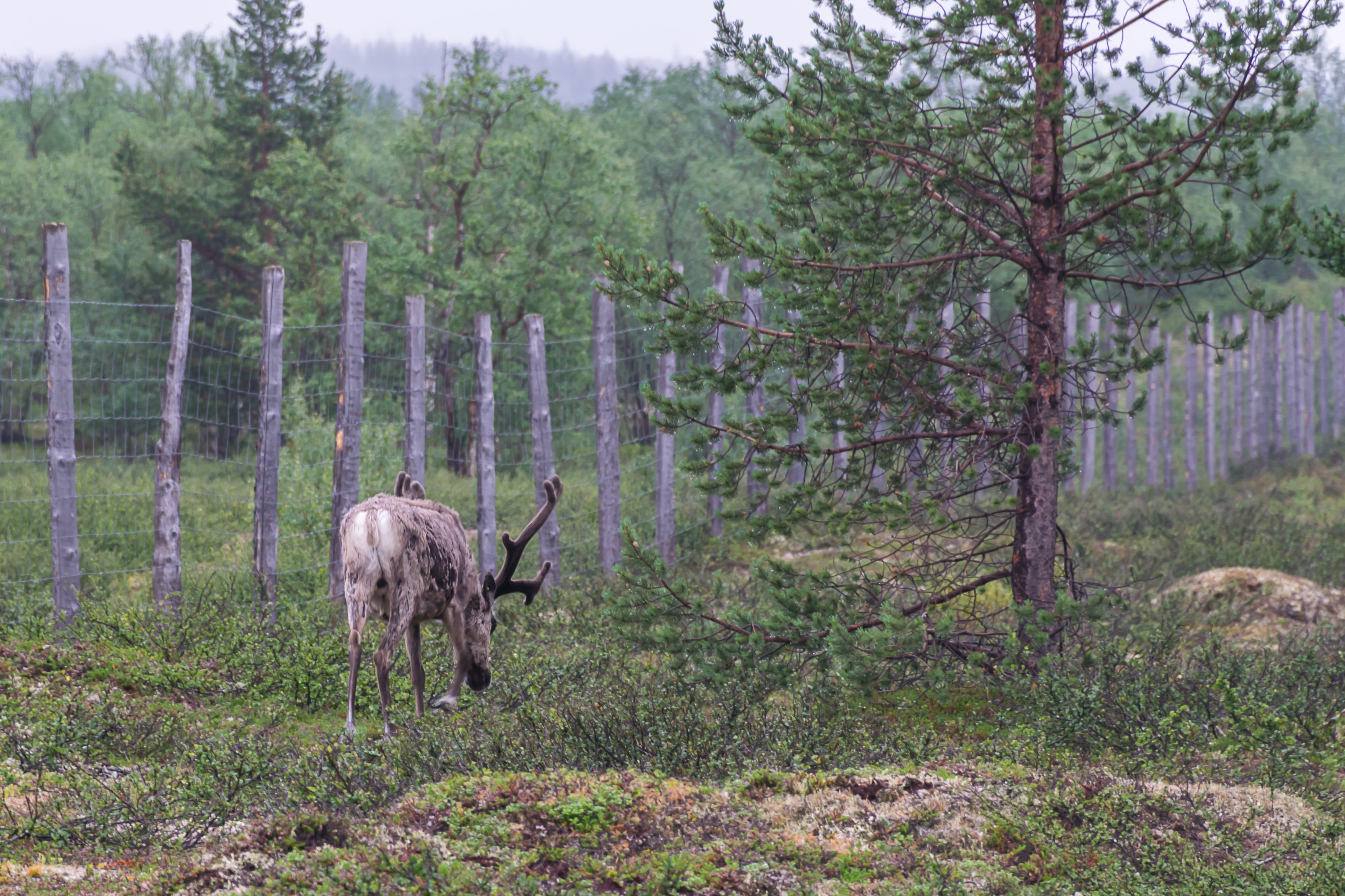
Another border, which is perhaps less precisely defined in practice but passes through Pello as well, is the border of the reindeer husbandry area. This area occupies a big chunk of Northern Finland, bigger than Lapland proper. From here on you need to look out for reindeers on the road; the amazingly beautiful and endearing creatures enjoy wandering on roads in herds, although they're mostly predictable and in practice do not present a big danger. A few years ago a phone app to warn other drivers about reindeer was developed in Finland; you just hit a button when you see reindeers, and other drivers with this app get warnings when they drive through this area.
4. Kolari-Kaunisjoensuu; Road 943. The name Kolari sounds weird in Finnish; this word literally means "car crash". In fact this was the last name of the first settler in these lands; where he got this last name from, in turn, is unclear. Kolari itself (70 km past Pello down the Northern Lights Road) is not a very exciting place, but for many it serves as a gateway to Ylläs. Äkäslompolo and Ylläsjärvi villages, on the opposite sides of Ylläs Fell, one of the best known fells of Finnish Lapland, are both just about 40 km away from Kolari. There are numerous ski slopes on Ylläs, and in winter Äkäslompolo and Ylläsjärvi turn into big ski resorts. They're much less busy in summer, but summer (or even better autumn; it's more beautiful and there are no mosquitoes!) is a great time for day hikes to Ylläs and six other fells near it, or for multi day treks farther to the north, over the entire Pallas-Yllästunturi massif in the namesake national park. Äkäslompolo was the primary destination for my first ever trip to Lapland in 2015. One of the oldest hiking trails in Finland, the Hetta-Pallas trail (55 km), goes through this massif.
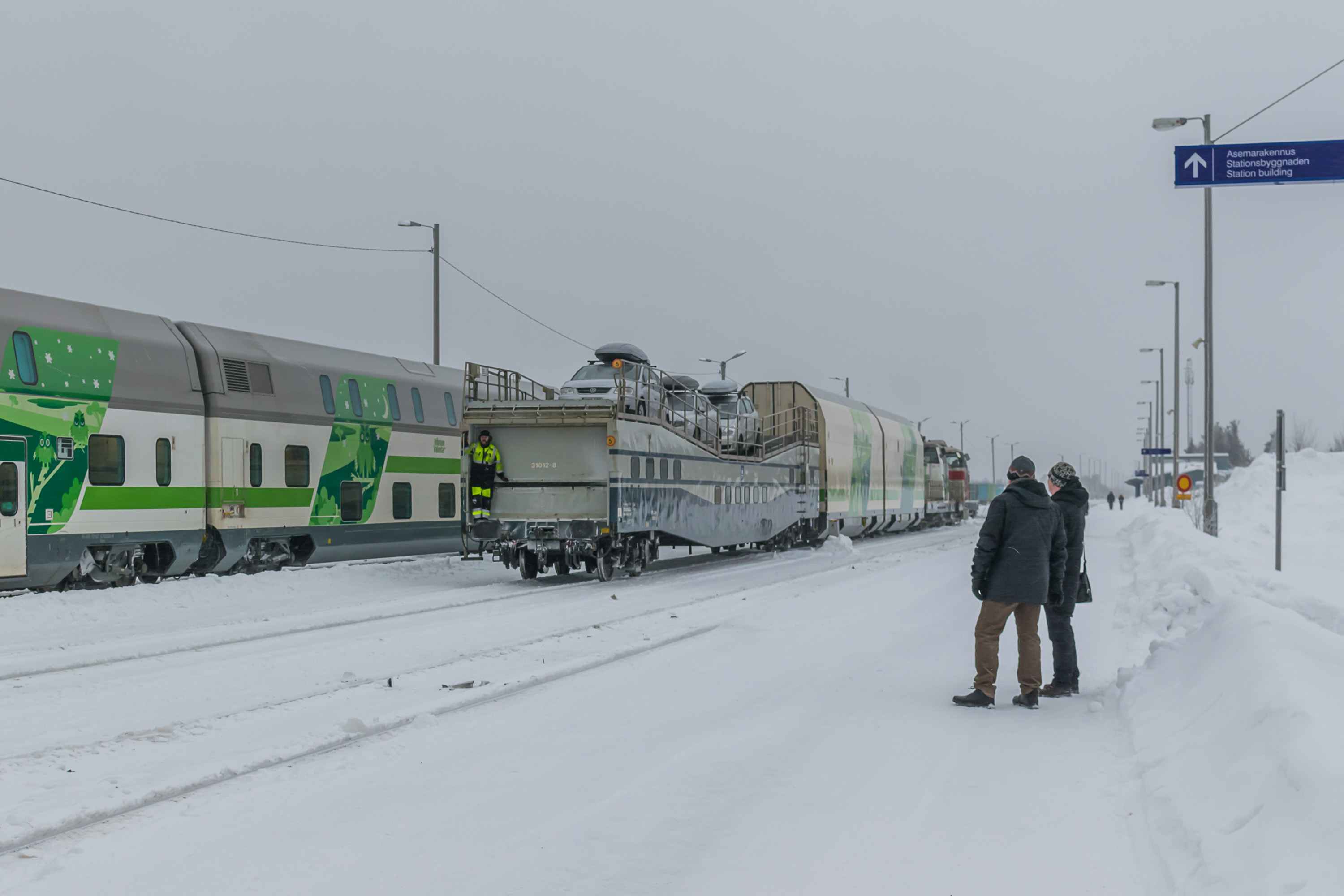
Kolari also has the northernmost railway station in Finland, and this is the real reason why Kolari in particular often happens to be the gateway to Ylläs. You can come here from Helsinki by a night train, and not just come here but bring you car along on a special car carrier traincar. This isn't cheap, but considering that you skip a night in a hotel in this way, and how much effort and time you save on driving, and how much gas costs in Finland, the train option beings to appear attractive. (But for me at the moment it doesn't make much sense anymore, since I live in Vaasa and it is closer to Lapland already and I would first have to go back 240 km south to Tampere to be able to board such a train.)
The place on the Swedish side of the border near Kolari is called Kaunisjoensuu. It appears to be just a single farm, but it's worth noting that despite being in Sweden, it has a Finnish name (Finn. beautiful river mouth). As we mentioned before, Torne River didn't become a border until 1809, and Finnish-speaking population has lived and still lives on both sides of its valley, and further west all over most of the entire Norrbotten region of Sweden. These Swedish Finns are called Tornedalians (from Tornedalen, Swed. Torne valley) and speak a peculiar dialect of Finnish named Meänkieli (Finn., dialectal, literally "Our language"), sometimes considered a separate language from Finnish by now, but in practice it is much closer to it than e. g. Karelian and should be intelligible for most Finns. There are 30,000-70,000 Meänkieli speakers. It has been officially recognized as a minority language in Sweden only in 2000.
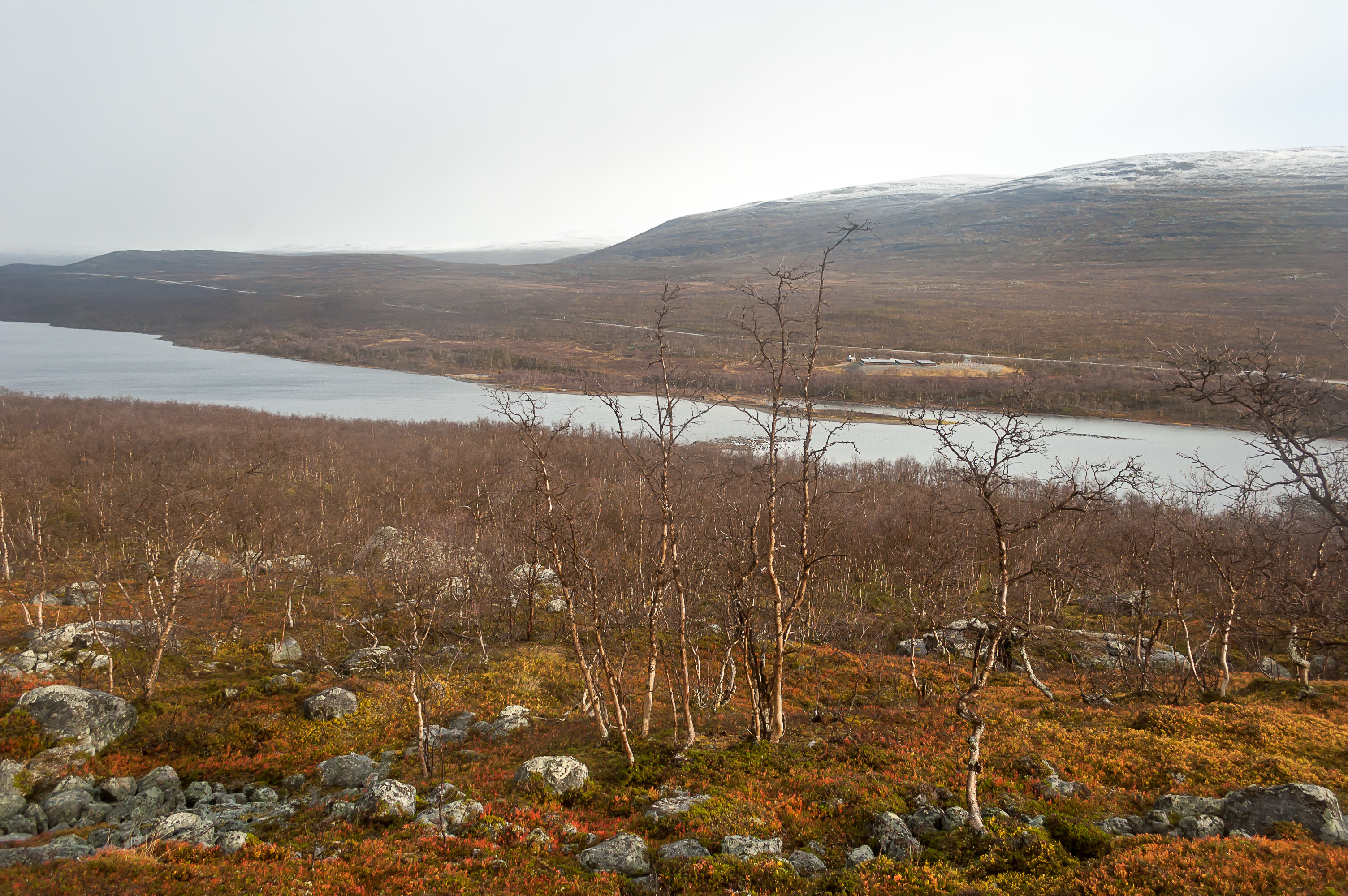
The closest actual town on the Swedish side of Torne River across Kolari is Pajala, which is also a Finnish name (Finn. smithy/workshop-place). There is a fork in Torne River near Pajala, and Torne proper turns towards the Swedish mountains in the northwest, and the border continues to the north along the other fork, Muonio River.
5. Muonio; Road 954; 80 km past Kolari. Not much to say about Muonio, apart from that Pallas, another famous Lapland fell, is located nearby, and that signs between Muonio and Kolari warn about particularly high danger of a reindeer collision. There isn't really anything on the Swedish side here either.
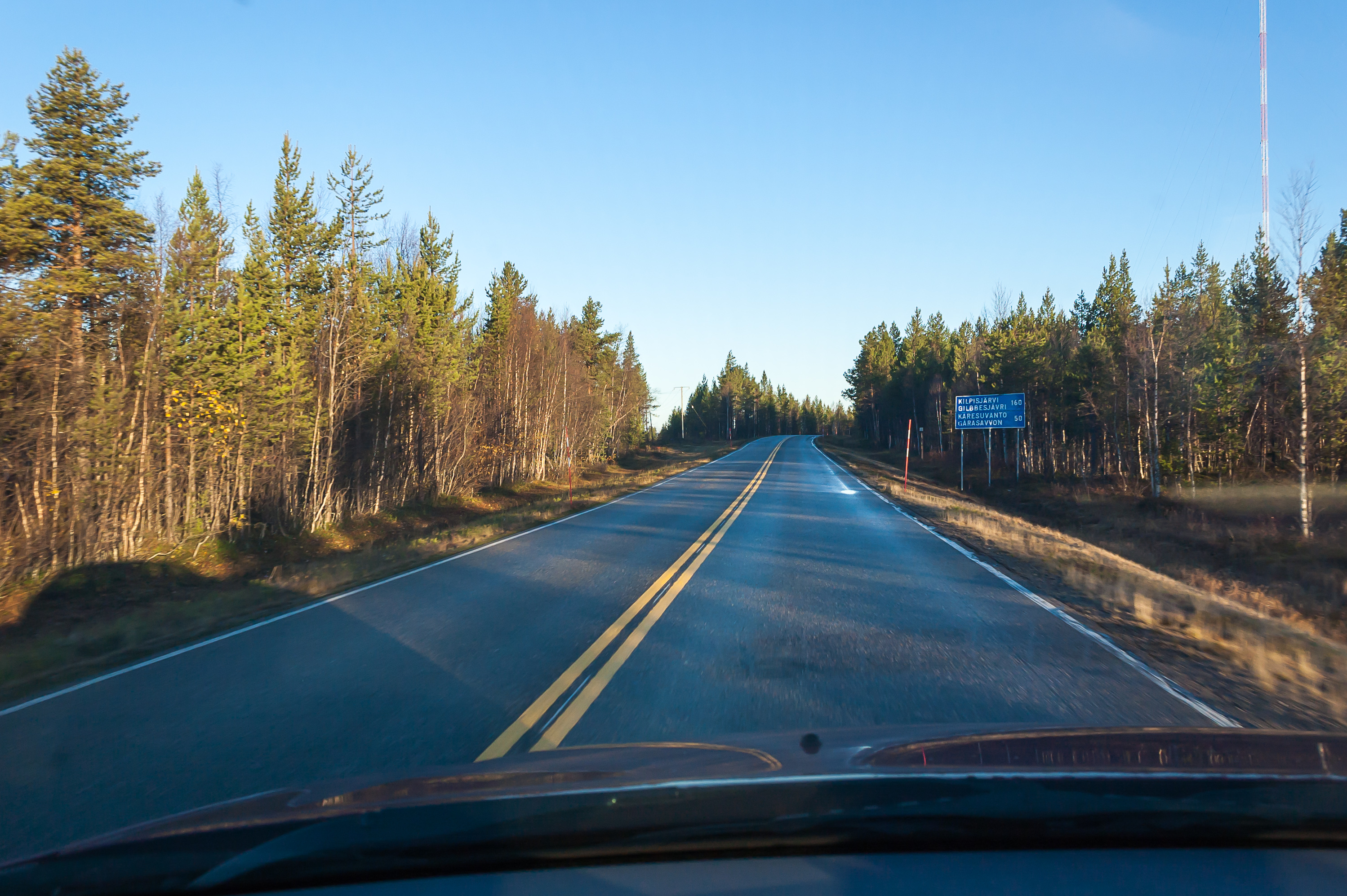
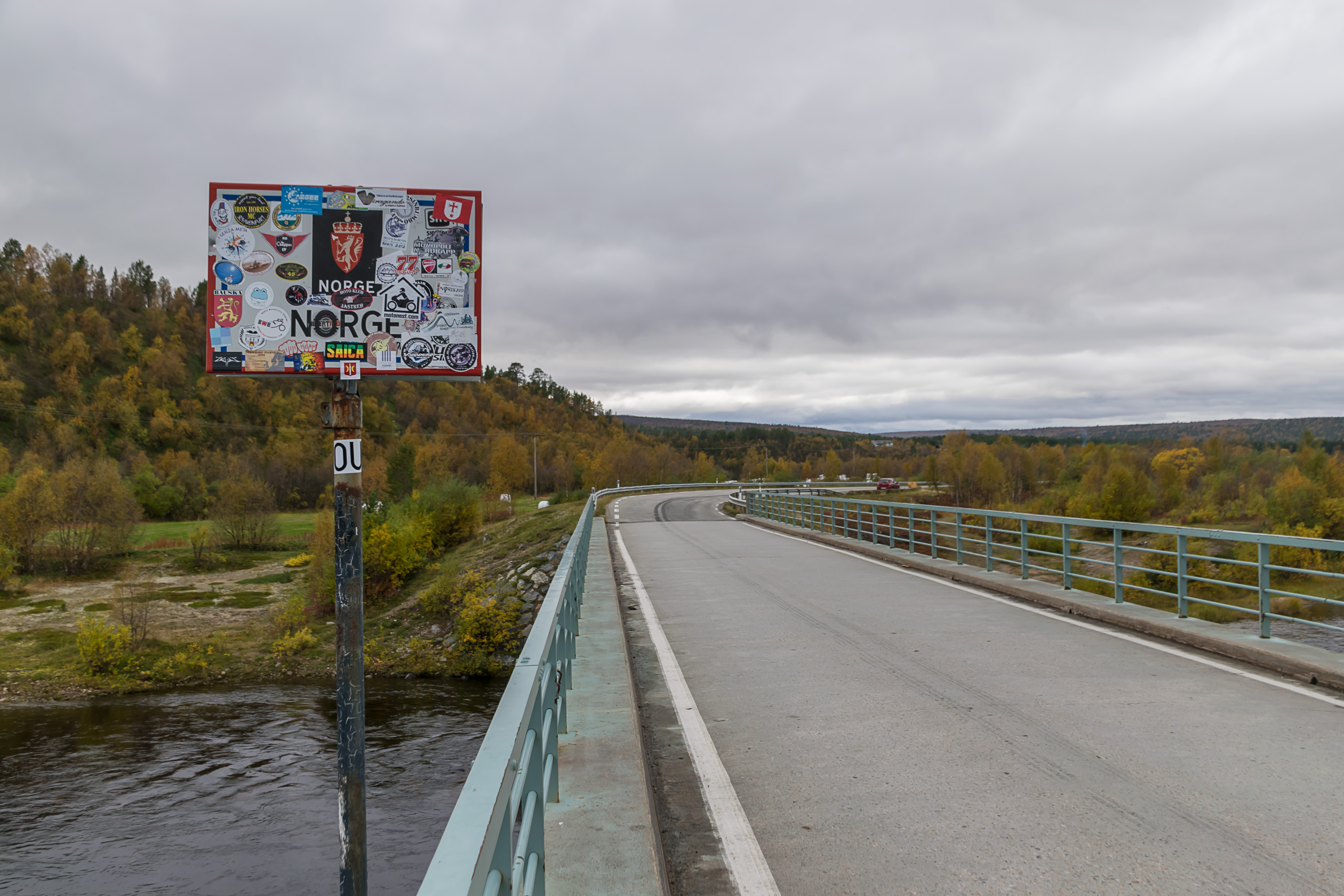
6. Kaaresuvanto-Karesuando; Road 959 (E45); 90 km past Muonio. The last bridge into Sweden. The twin border village is named alike on Finnish and Swedish side. The name appears to be of Finnish origin, but in fact the original version is Swedish Karesuando, from the last name of a Swedish settler.
The lands of the Sami people begin approximately at Kaaresuvanto. Finnish and Sami villages don't really look particularly distinct in Finland, more so since there aren't really pure Sami villages; even in Sami areas the population is a mix of Sami and Finns, with the latter often still being a majority. But road signs here very conspiciously begin to be duplicated in the fascinating Northen Sami language; for example, Kaaresuvanto in Sami is Gárasavvon.
Karesuando is the northernmost village of any size in Sweden. The road along Torne-Muonio rivercourse on the Swedish side (Road 99) ends in Karesuando, unlike its Finnish counterpart (Road 21/Northern Lights Road) that cotinues on to Norway. There are only a few very small villages and individual farms north of Karesuando. Maunu (population: five people) is the northernmost place reachable by road (which correspondingly is the northernmost road in Sweden, in practice just a short road spur from Karesuando). Farther along Muonio and then Könkämäeno, as Muonio is named upstream, there are also a few isolated farms than can be only reached by crossing the river (by boat or on ice) from the Finnish side.
After Karesuando the Northern Lighs Road begins to slowly go uphill, and the landscape turns from the endless boreal forests into fell birch and tundra. This is Käsivärsi, literally "the arm", the conspicious northernwestern spur of Finnish territory. Käsivärsi is the only place where Finland just barely reaches the Scandinavian Mountains chain, and correspondingly is the highest area of Finland, including Halti (1324 m), the highest point of the country. This is the same mountain that Norway intended to give Finland a few years ago but in the end decided against it (1324 m height is just the side summit, and the main one close by, at 1361 m, is on the Norwegian side). Anyway this is a rather remote wilderness; the hike from the nearest road to Halti is 55 km long (in Finland; route through Norway is shorter, but allegedly more difficult).
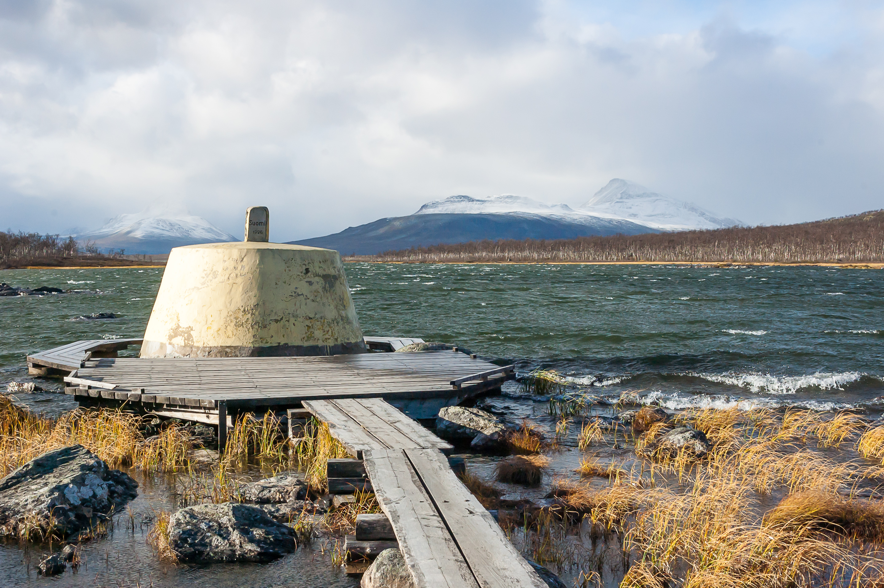
6.5. Treriksröset; Nordkalottleden/Kalottireitti hiking route (Arctic Route). Speaking about Finnish-Swedish and Finnish-Norwegian borders, it probably makes sense also to mention Treriksröset, the point where the borders of these three countries meet. It is located in the Käsivärsi wilderness, slightly off the coast of a small Goldajávri Lake, 12 km from the border village of Kilpisjärvi. Not the easiest hike, but it goes through wonderfully scenic places (through Malla Strict Nature Reserve and past Kitsiputous Waterfall, the highest free-falling waterfall in the country), and in principle it is possible to go there and back in one day. Although it is possible to stay overnight as well, in an open wilderness hut or a reservable hut neaby at the Kuohkimajärvi Lake. Treriksröset is the Swedish name; the Norwegian one sounds very similar but the Finnish is the unwieldy Kolmen valtakunnan rajapyykki, which literally means "Border stone of three states".
Goldajávri Lake is unusual in itself. The Finnish-Norwegian border begins here almost entirely along the watershed, and the lake actually drains in two directions at once; both to the south, via Könkämäeno-Muonio-Torne watercourses into the Baltic Sea, and to the north, via the much shorter Skibotnelva River, into the Lyngenfjorden into the ocean.
7. Kilpisjärvi; Road 21 (E8). In Kilpisjärvi (Finn. shield lake; also Gilbbesjávri in Northern Sami) the Northern Lighs Road crosses into Norway. On the Norwegian side it very soon begins to descend again rather quickly.
Just a few tens of kilometers past the road goes down to the town of Skibotn (Norw. ship bottom) on the coast of the Lyngenfjorden, across the beautiful Lyngen Alps, the highest mountains of North Norway. From there on it's not a very long drive to Tromsø, the most important city of the region, but that would be another story.
8. Kivilompolo; Road 93 (E45). Finnish-Norwegian border mostly passes through the wilderness. In a place named Kivilompolo in particular (Finn. stone pond) there are no villages at all on either side of the border.
The closest town is Norway is Kautokeino (Guovdageaidnu, N. Sami middle of the road), one of the two most important Sami towns in North Norway, and from there the road goes on to Alta, parallel to the old Beskades Road.
9. Karigasniemi-Karasjok; Road 92. A narrow road to the village of Karigasniemi (Gáregasnjárga) is the usual route for the Finns wishing to see the famed North Cape at the end of the world in North Norway. This road crosses the Inarijoki (Anárjohka) river, and very close by in Norway is the other major Sami town, Karasjok (Kárášjohka), which has for example the Sami Parliament of Norway, where the Sami decide how to herd reindeers properly and stuff.
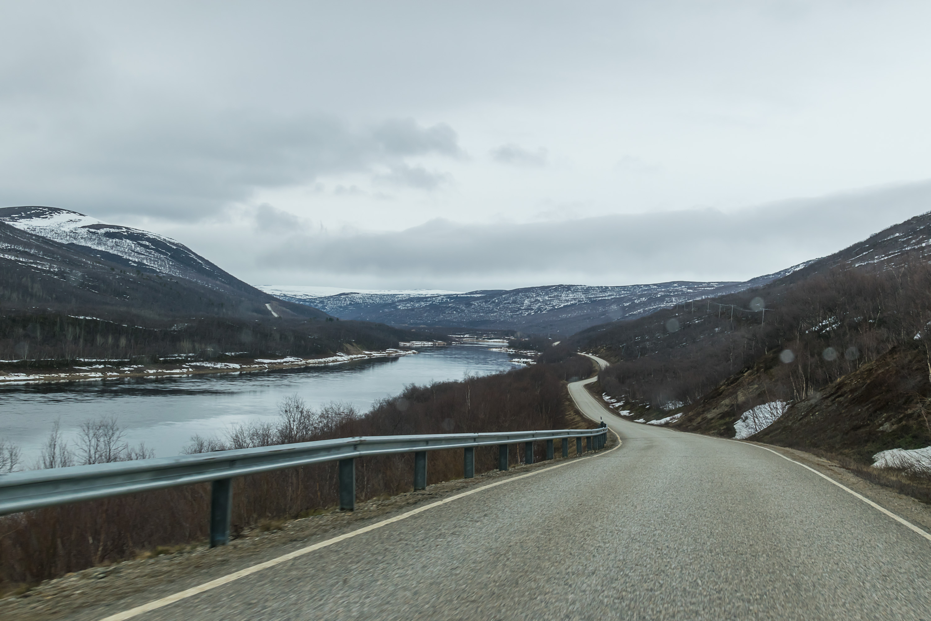
From there on the border follows the river again. The river is Anárjohka in the beginning, but very close to Karigasniemi it flows into the Tana River (Tenojoki in Finnish, Tanaelva in Norwegian, Deatnu in Northern Sami), a big river famous for its salmon, and from the on the border follows Tana. Like Torne, Tana has been preserved and there are no dams blocking it. Between Karigasniemi, Utsjoki and Nuorgam Road 970 follows Tana on the Finnish side, one of the most scenic Finnish roads I would say.
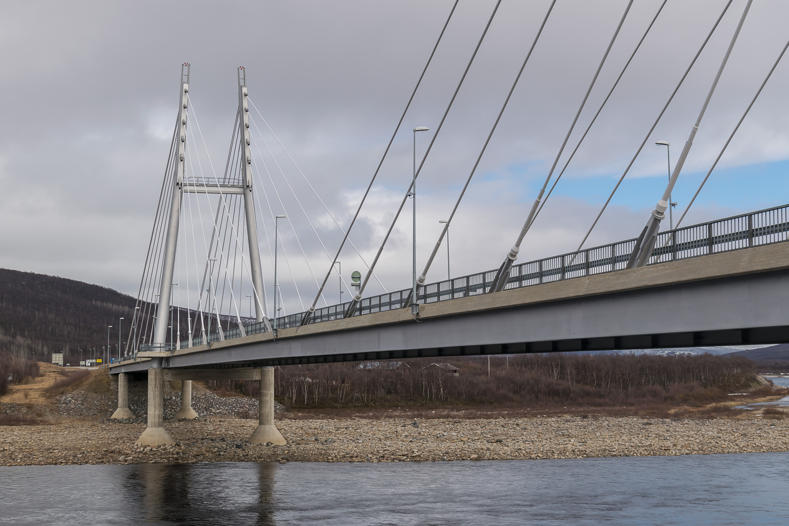
10. Utsjoki; Road 4 (E75). Thus along the river you can reach the village of Utsjoki (Ohcejohka), the center of the northernmost municipality in the country. The longest and the most important road of Finland, National Road 4 (Valtatie 4, also knows as just Nelostie, Fourth Road), Helsinki-Utsjoki via Heinola, Lahti, Jyväskylä, Oulu, Kemi, Rovaniemi, Ivalo, 1295 km long. The road ends with a bridge into Norway, which has been named simply the Sami Bridge. The closest important village on the Norwegian side is Tana-Bru, which means "Tana Bridge"; Tana in its lower reaches flows into the Arctic Ocean through Norway, and there is just one single bridge crossing it there, which game the name to the village.
11. Nuorgam-Polmak; Road 970. If you do not cross the Sami Bridge but follow Tana River a bit farther through Finland, you'll reach the village of Nuorgam (Njuorggán) which is officially the northernmost point of Finland and the entire EU. For some reason I missed the memorial plaque when I was there, but here's the northernmost pub in the EU. There's also the northernmost grocery store in the EU, the northernmost gas station in the EU, and god knows what else northernmost. The small village on the Norwegian side is called Polmak (Buolbmát), and the closest major village is the aforementioned Tana-Bru.

12. Näätämö-Neiden; Road 92. And the last road from Finland into Norway goes through the village of Näätämö (Njauddâm in Skolt Sami). This is not just a Sami but a Skolt Sami area. The Skolt Sami are a very small people, who originally lived in Pechenga/Petsamo area on the Kola Peninsula, and were turned into Orthodox faith by Tryphon of Pechenga as far back as the 15th century. After the war most Skolts preferred to move deeper into Finland rather than stay on the now Soviet territory, but most of them still have names like "Sergei Fofonoff" or "Veikko Feodoroff". Skolt Sami looks even more unusual than the regular Northern Sami in writing.
But this Skolt business doesn't prevent Näätämö Village from being the center of the border trade. Same can actually be said about the aforementioned Kilpisjärvi and Nuorgam. Finland is an expensive country, but still far cheaper than the truly incredibly expensive Norway. Norwegian salaries are also higher than Finnish ones of course, and Norwegians are not exactly starving, but still they do not mind at all going to Finland (or Sweden) for a bit of grocery shopping whenever feasible. Although there are no major cities to any of the Finnish-Norwegian border crossing points, people in the north are used to long distances, and can come from farther away. The Finns, on the other hand, are operating not just grocery stores and gas stations but also Alko (liquor store) points in Kilpisjärvi, Nuorgam and Näätämö. Reportedly, in Kilpisjärvi Alko for example 99% of customers are Norwegians.
On the Norwegian side, not far from Näätämö by the Skoltefossen Waterfall (Norw. Skolt Waterfall, as expected) there is a twin village named Neiden, also inhabited mostly by the Skolt Sami. This is the only Skolt Sami village in Norway; they're even less numerous there than in Finland or Russia. Farther one there would be Varangerfjorden and Kirkenes, the last Norwegian town before the Russian border.
Lately there have been talks about the construction of a railroad from Finland into North Norway, into Kirkenes. It would pass somewhere not far from Näätämö, according to the most accepted plan. The local reindeer herders are fiercely against this idea. The railroad would of course be also very expensive to build, and its value might be more strategic than economic; it could be unlikely to ever become profitable by itself.
From Näätämö the border turns southwards. Soon afterwards at the Muotkavaara hill the Finnish-Norwegian border ends, and the Finnish-Russian one begins, with the restricted border area and nowhere as friendly in general. The Russian border crosses the old road to Pechenga/Petsamo, which was cut in two after the war (for some reason there has never been opened an official border crossing point on this road), and farther on there are the regular border crossings: Raja-Jooseppi, Salla, Kuusamo, Vartius, Niirala, Imatra, Nuijamaa and Vaalimaa, counting from north to south. But I'm not familiar with most of them, and most of them are not in Lapland already, and thus we will not discuss them here :)