The biggest city north of the Arctic Circle in the world! That's Murmansk (Мурманск), thecenter of Murmansk Oblast region in Russia, located on the coast of the Kola Bay, a long narrow fjord of the Barents Sea of the Arctic Ocean. Like Petrozavodsk, Murmansk is the only major city in the region. Its modern population is about 300,000.
A small town at the bottom of the Kola Bay, named also Kola (Кола), existed for centuries (and still exists today as a suburb of Murmansk), but by the end of the 19th century the need for a major seaport on the Barentz Sea became quite urgent. The new city, originally named Romanov-na-Murmane (Романов-на-Мурмане, Romanov upon Murman) was founded in 1916 (when the railroad connecting it to the rest of the country was finished), the last city ever founded in Tzarist Russia era. Shortly after the February Revolution of 1917 it was renamed to Murmansk. The northern coast of the Kola Peninsula has always been known as Murman Coast; "Murmans" was an old Russian word for Norwegians (likely from Norwegian nordmann, "northern man"). The tiny town quickly grew in Soviet years, becoming the base for many Soviet explorations of the Arctic.
Murmansk was extremely important to the Soviet Union in the World War II, as a warm-water port which the Germans could not blockade. Much of the lend-lease aid from Britain and the US came through Murmansk, shuttled south on the railroad then. Despite bloody battles Nazi Germany, attacking from Northern Norway and Finnish Lapland, never managed to capture the port of Murmansk or sever the rail line. The city itself was nearly completely destroyed in the war, and had to be rebuilt afterwards. This was accomplished as soon as 1952.
Murmansk continued to be the Soviet "capital of the Arctic" of sorts, but underwent a great depopulation after the fall of the Soviet Union. As many as a third of its population left. Although Murmansk climate is not as harsh as one could expect, it's still colder than most of Russia, and polar night doesn't make it a very attractive place to live in as well (unless of course you really like the Arctic). So people who lost their jobs mostly just moved elsewhere.
Nonetheless modern Murmansk looks quite good, much better than Petrozavodsk (the city we visited before Murmansk) anyway despite similar size. Despite the depopulation it doesn't really appear to have any abandoned buildings (perhaps we just didn't see them but still). The city is rather boring, truth be told (its surroundings are probably way more interesting, but we were just passing through and didn't see them), but it appears to be kept in a nice shape.
Perhaps one reason for that is the closeness of Russian naval bases. Russian Northern Fleet is the most important one by far, as it is the one with most (if not all) nuclear subs. Most towns near Murmansk are naval bases: Severomorsk, Polyarnyi, Snezhnogorsk, Skalistyi, Ostrovnoi, Vidyaevo, and other smaller ones. In fact Murmansk is almost the only Russian populated locality on the Barents Sea that can be actually visited without a special permit! Severomorsk and the others are "closed cities". Although Murmansk is located deep in the Kola Bay and you cannot actually see the open sea from it; the only place where you can is the semi-abandoned fishing village of Teriberka (Териберка), lately known as the place where Leviathan movie was shot. That's a pity of course. Barentz Sea is incredibly beautiful but you really need to go to Norway to appreciate that (or to places like Sredny and Rybachy Peninsula, reachable only with a 4WD vehicle).
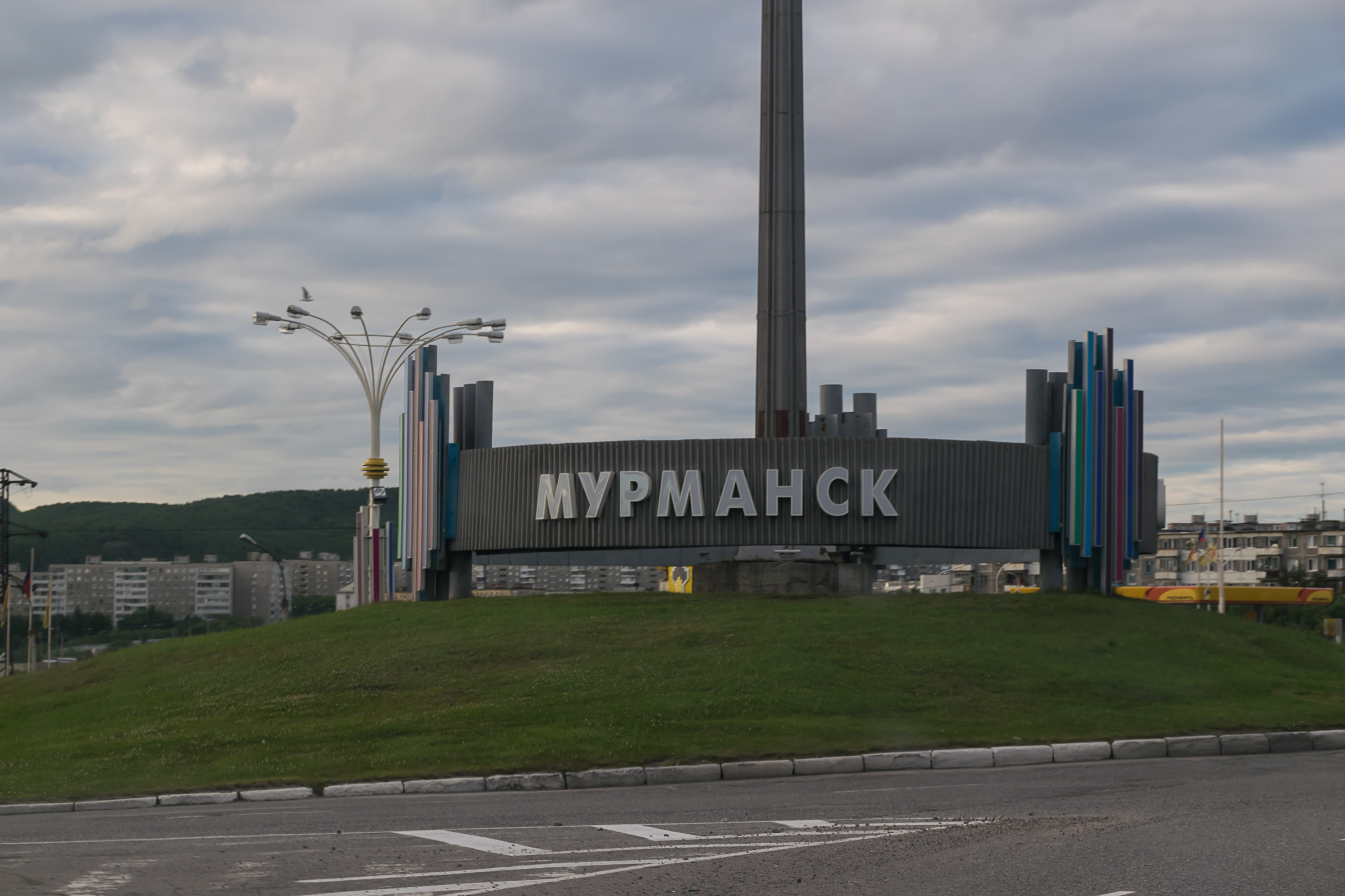
1. So. Welcome to Murmansk, I suppose!
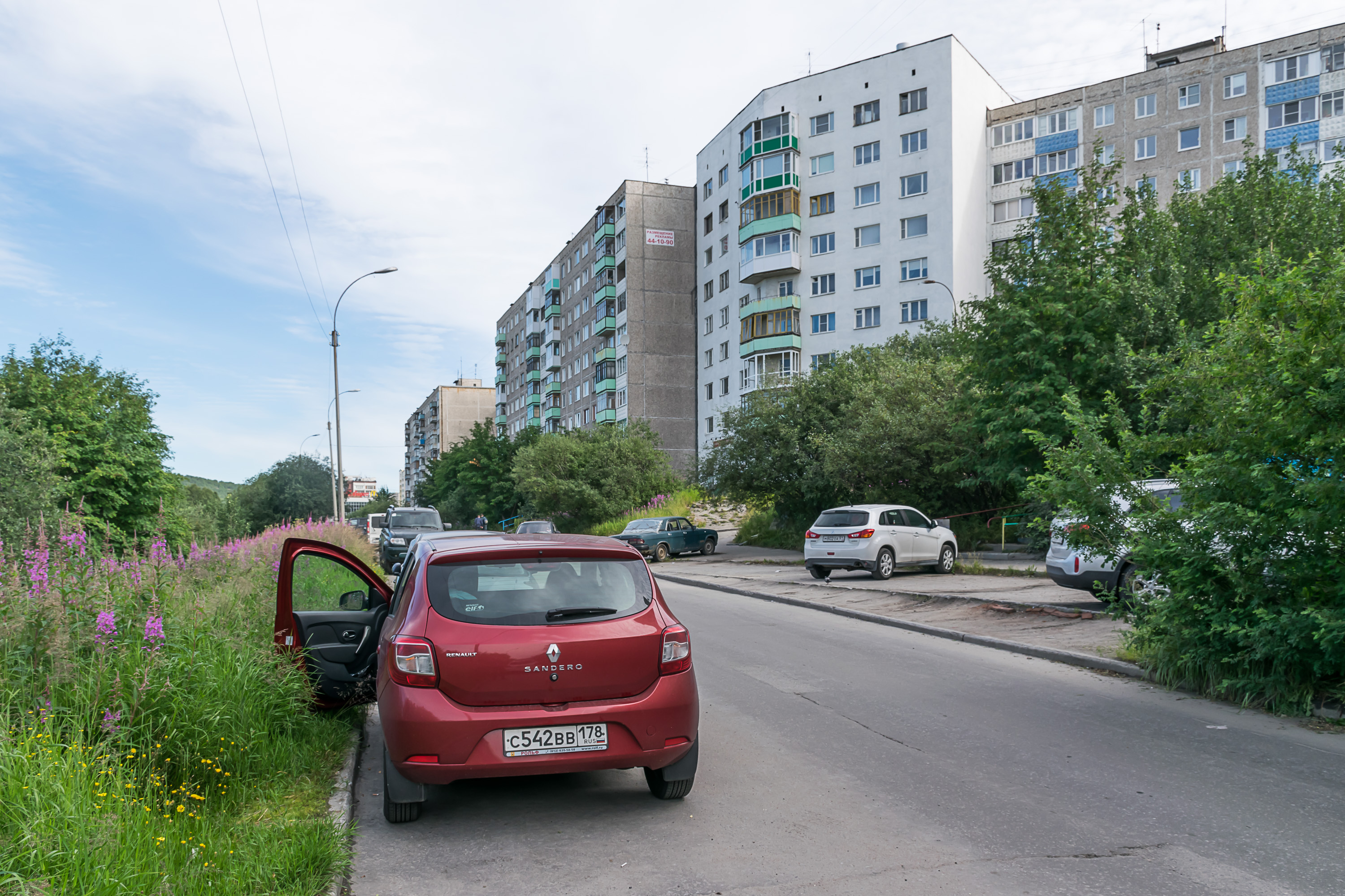
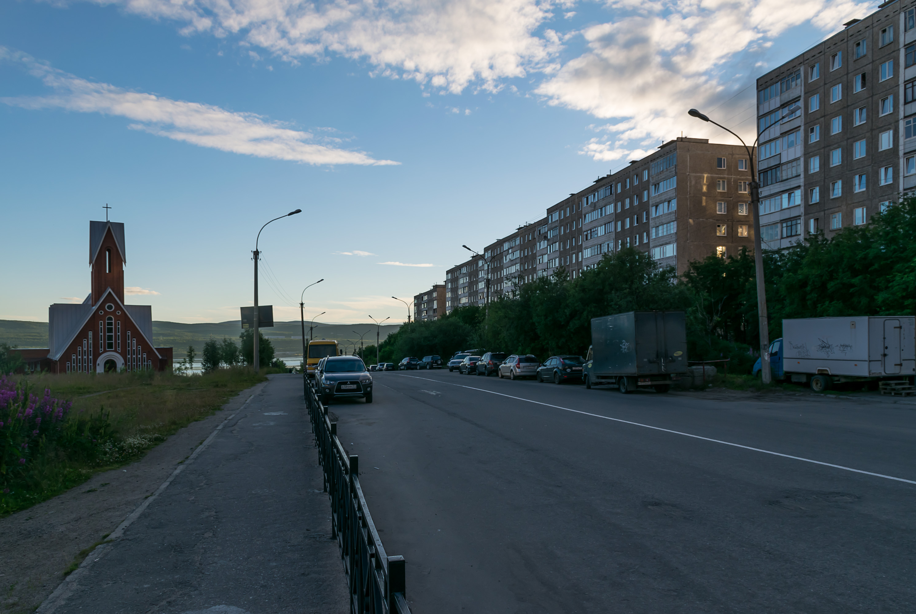
2. Geographically, Murmansk stretches along the eastern coast of the Kola Bay. Its southern part, separated by a hill from the center, is named Severnoye Nagornoye (Северное Нагорное, Russ. Northern Hilltop Place; I don't think there's a South Hilltop Place), consisting completely of commieblock buildings. This is where our hotel (actually just a bunch of apartments on the ground floor of another commieblock, connected together) was located as well. It was nice enough, although I was promised "free welcoming drink" due to my frequest traveller status on Booking.com, and when I reminded the receptionist of that he was like "umm... okay... some tea?" Tea was not exactly the drink I had in mind. Anyway although it was the evening already we went out, ate at a McDonalds in a nearby mall, and then had a short walk around Severnoye Nagornoye.
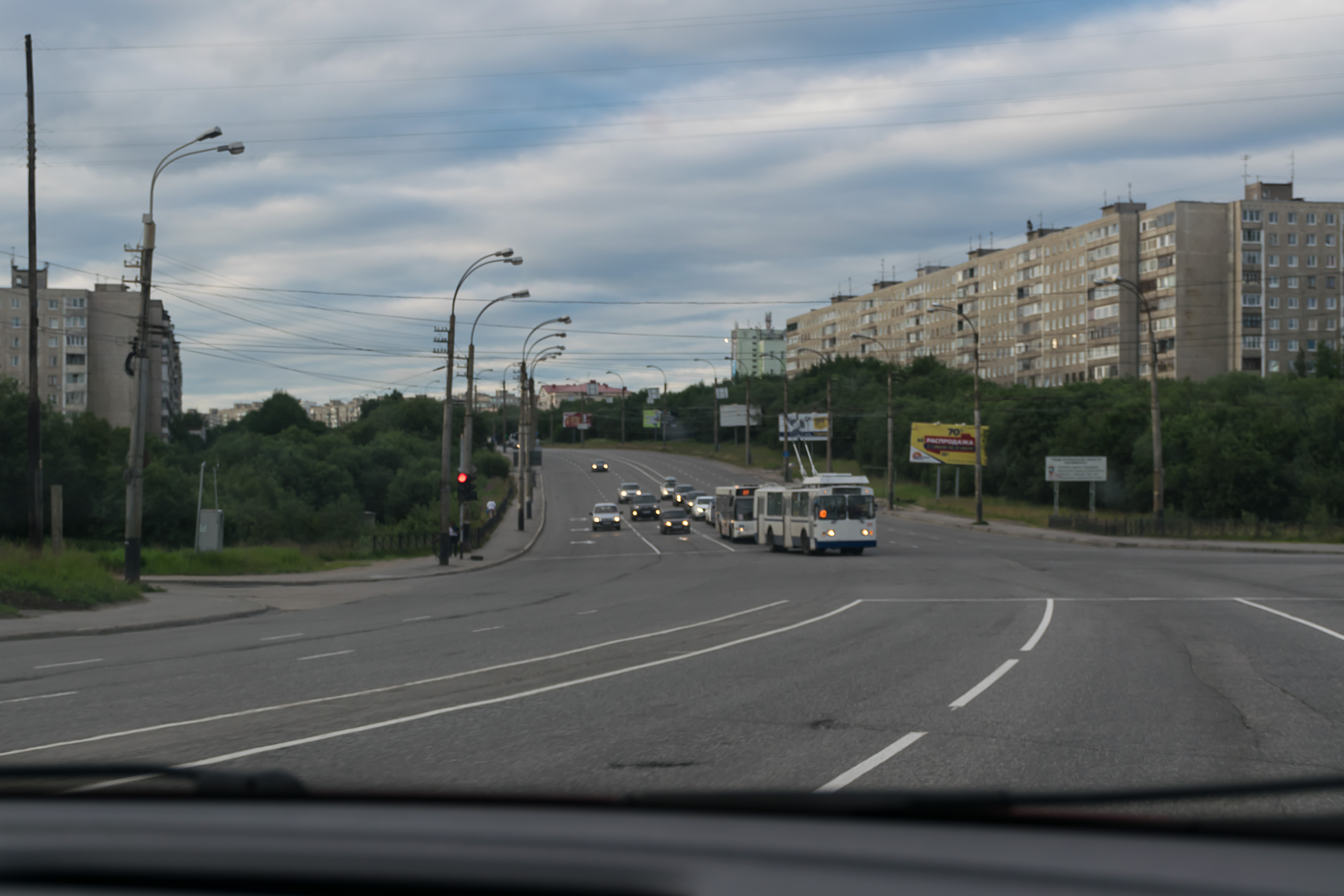
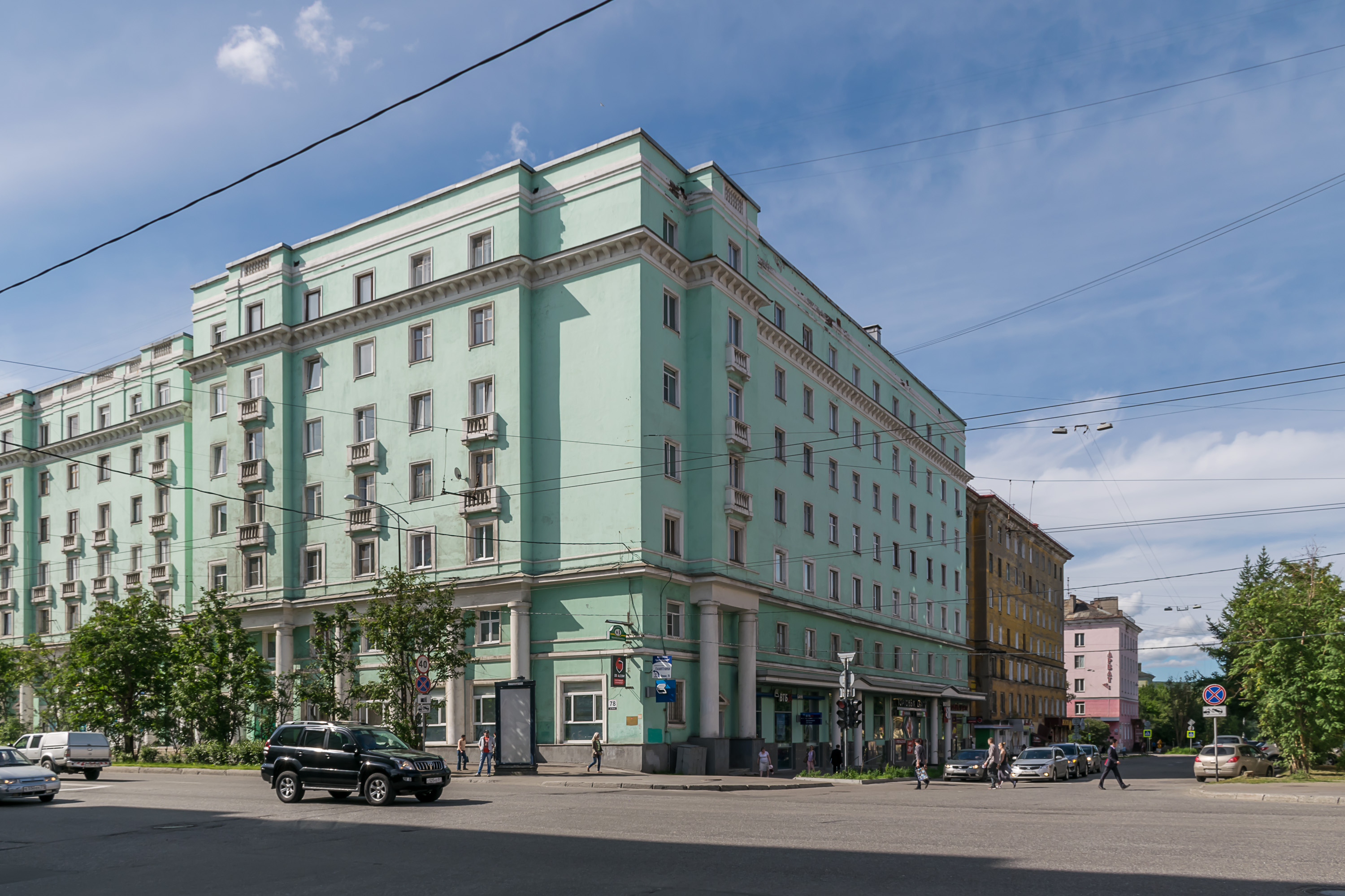
3. As I said, Murmansk immediately appears to be kept in a much better shape than Petrozavodsk, despite its similar population and a much more Arctic location. The very first thing we noticed is that Murmansk has some pretty nice roads, such as this Kolski Avenue (Кольский проспект, Russ. Kola Avenue) connecting Severnoye Nagornoye with the city center.
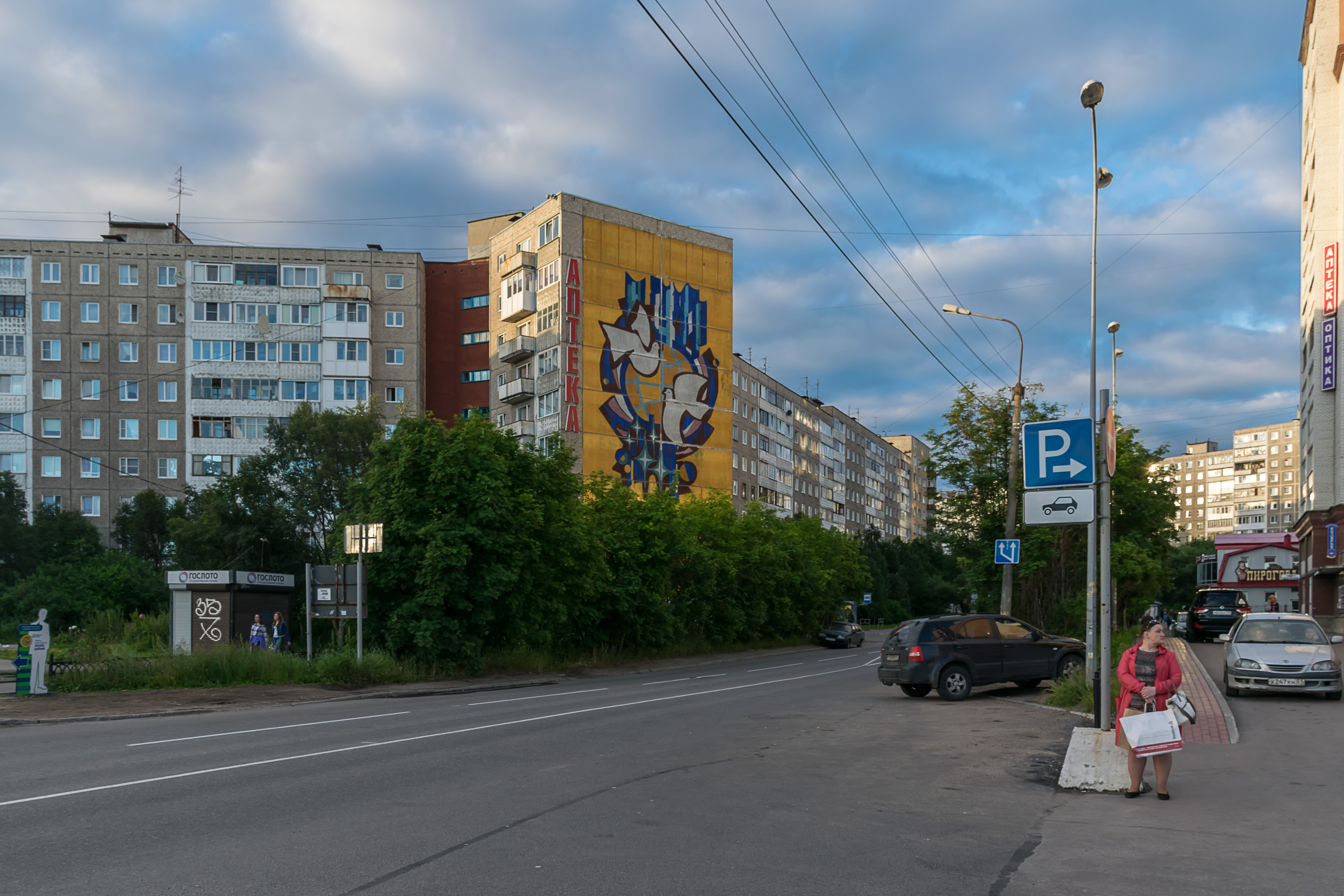
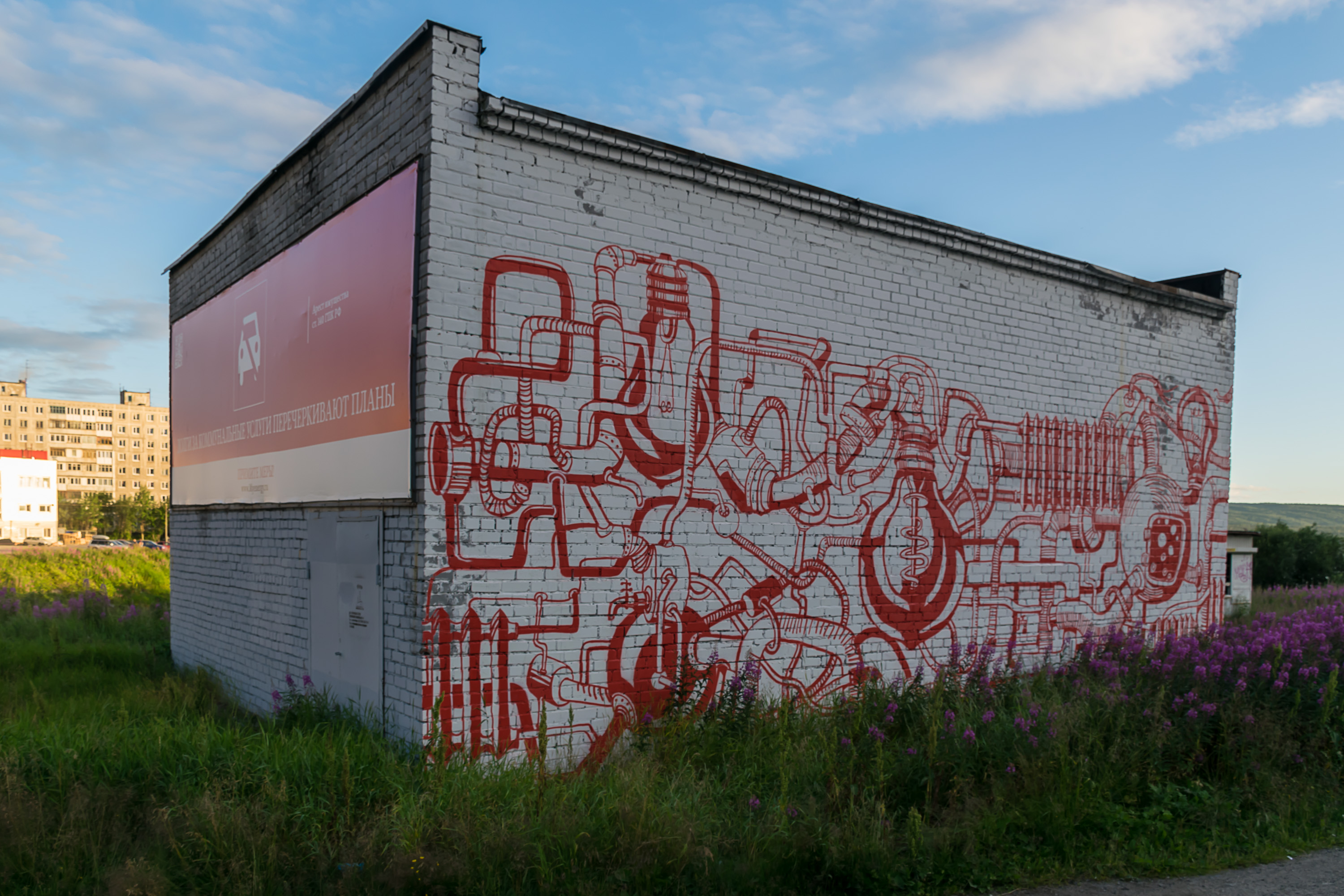
4. Typical Severnoye Nagornoye street. Pretty nice mural.
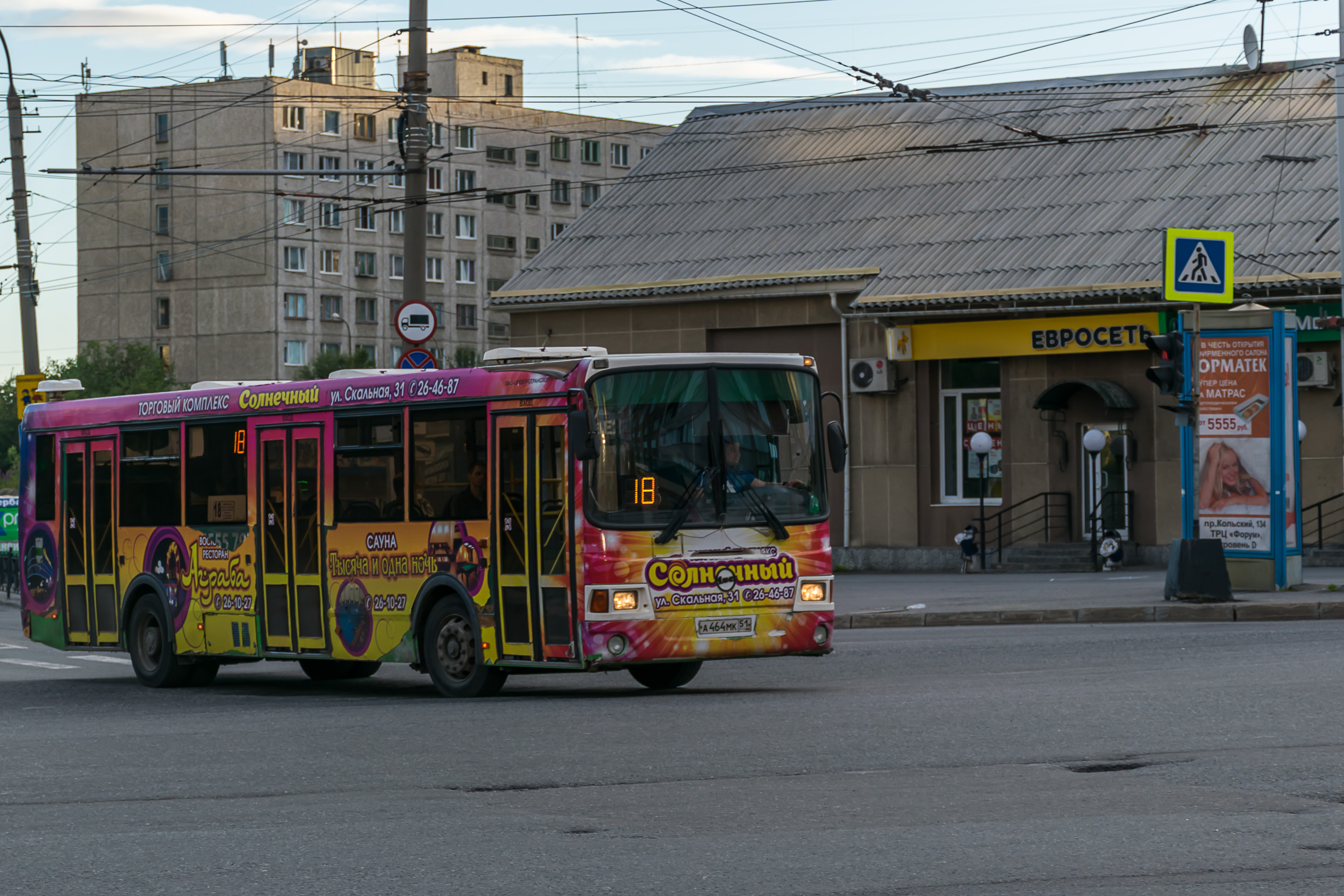
5. Like Petrozavodsk, Murmansk has a bus and a trolleybus network. Both buses and trolleybuses are covered with advertisements up to their roof, but otherwise look nice enough.

6. The northernmost trolleybus network in the world. Murmansk has got quite a few "northernmost in the world" things covered.
7. We decided to walk down to the Kola Bay. Murmansk has no public waterfront (if you don't count the passenger harbor); the coast of Kola Bay is nearly completely occupied by industrial areas and the cargo seaport, just like in Kandalaksha. Still you can walk down to the coast in a few places if you really want to.
8.

9. Kola Bay, as seen towards its bottom. You can see both the old bridge in the background and part of the much longer new one. The town visible to the left is Kola, and the one to the right far away is Murmashi (Мурмаши).
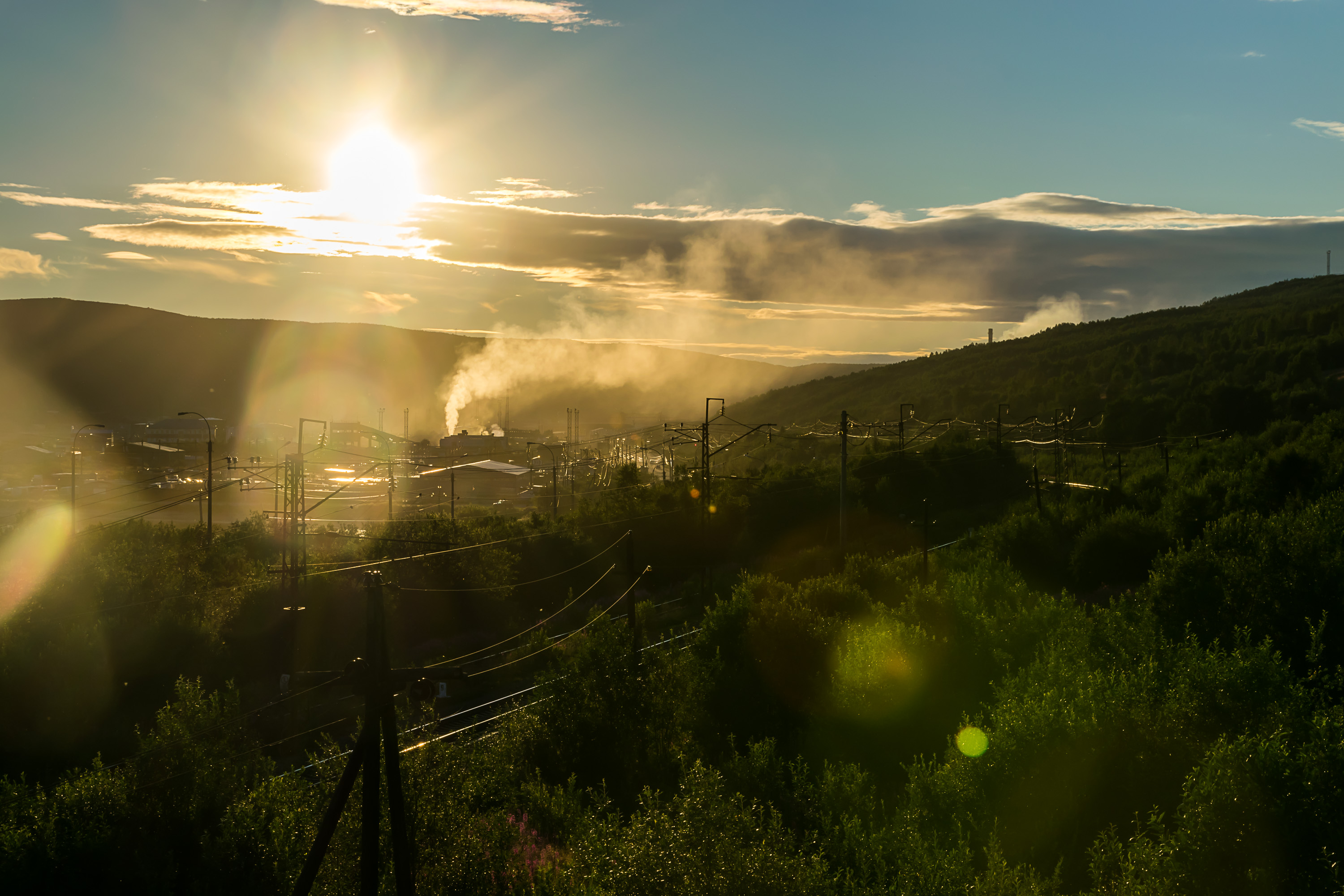
10. Midnight sun! Well it wasn't technically midnight as I recall, only around 23:00. Nonetheless this was the first midnight sun that either of us ever saw.

11.
12. View towards the seaport.

13. And eventually we did find a small beach on the Kola Bay. A quite dirty one, mind you, in a poorly accessible place. You can see the apartment blocks of Severnoye Nagornoye in the background. And some local drunk couple to the left. At least I can say that the water here is much saltier than in St. Petersburg or Kandalaksha.

14. Having been mostly satisfied with that (we didn't really expect anything more really) we went back to our hotel to sleep, which was much appreciated after the over 900 km drive from Petrozavodsk. In the following morning after eating our breakfast in the hotel's kitchen we boarded our car again, and drove through the city to its most famous sight, Alyosha Monument. It is a huge soldier statue on top of a hill overlooking the entire town. It's officially named Monument to the Defenders of the Arctic, but the soldier is much more commonly known as Alyosha (Алеша, Russ. diminutive form of a random male name).

15. As do most of the iconic Russian WWII monuments, it has an eternal flame burning at its foot.
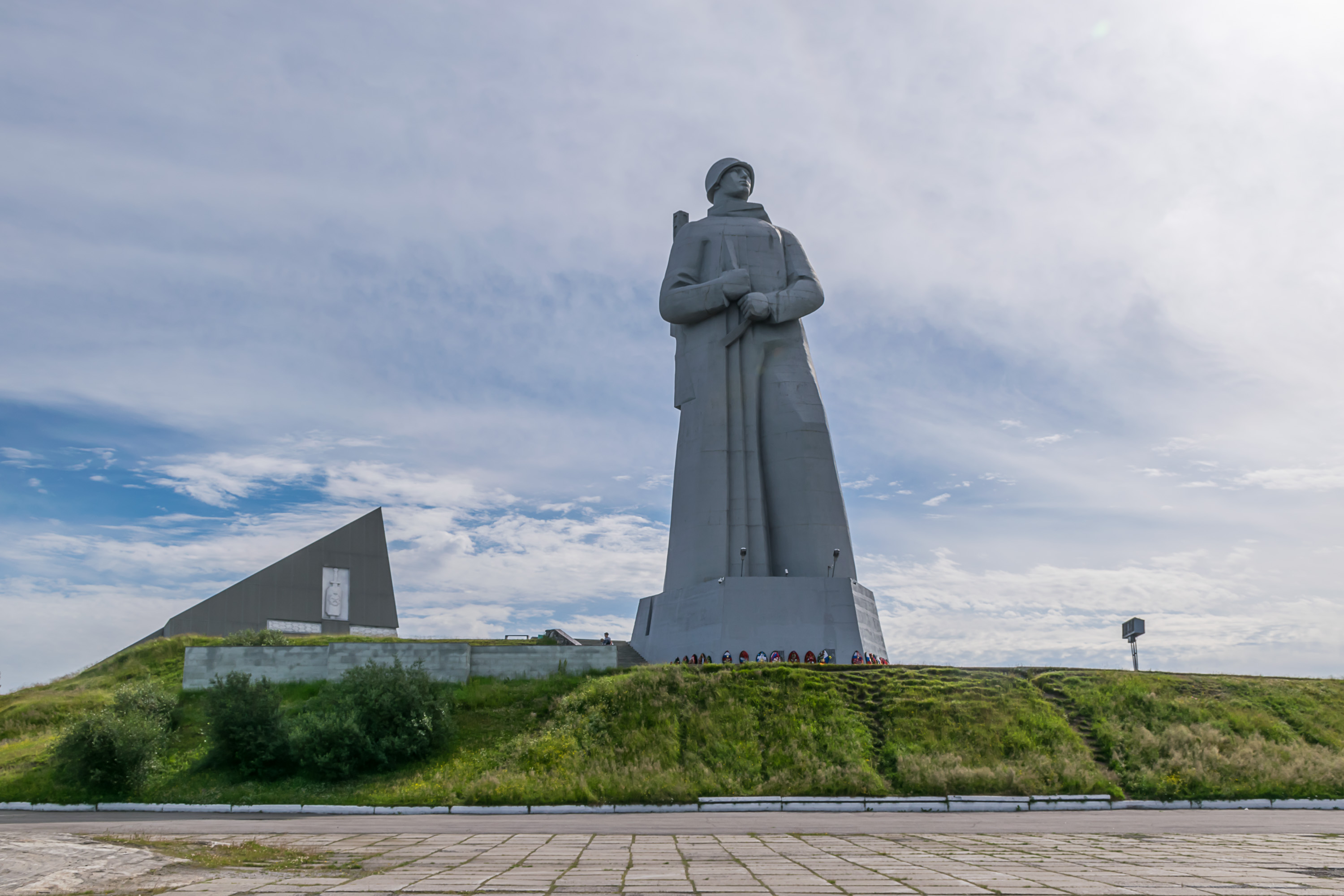
16. Alyosha himself.

17. The northern part of Murmansk, as seen from the foot of the Alyosha statue. Pretty similar to Severnoye Nagornoye in the south.
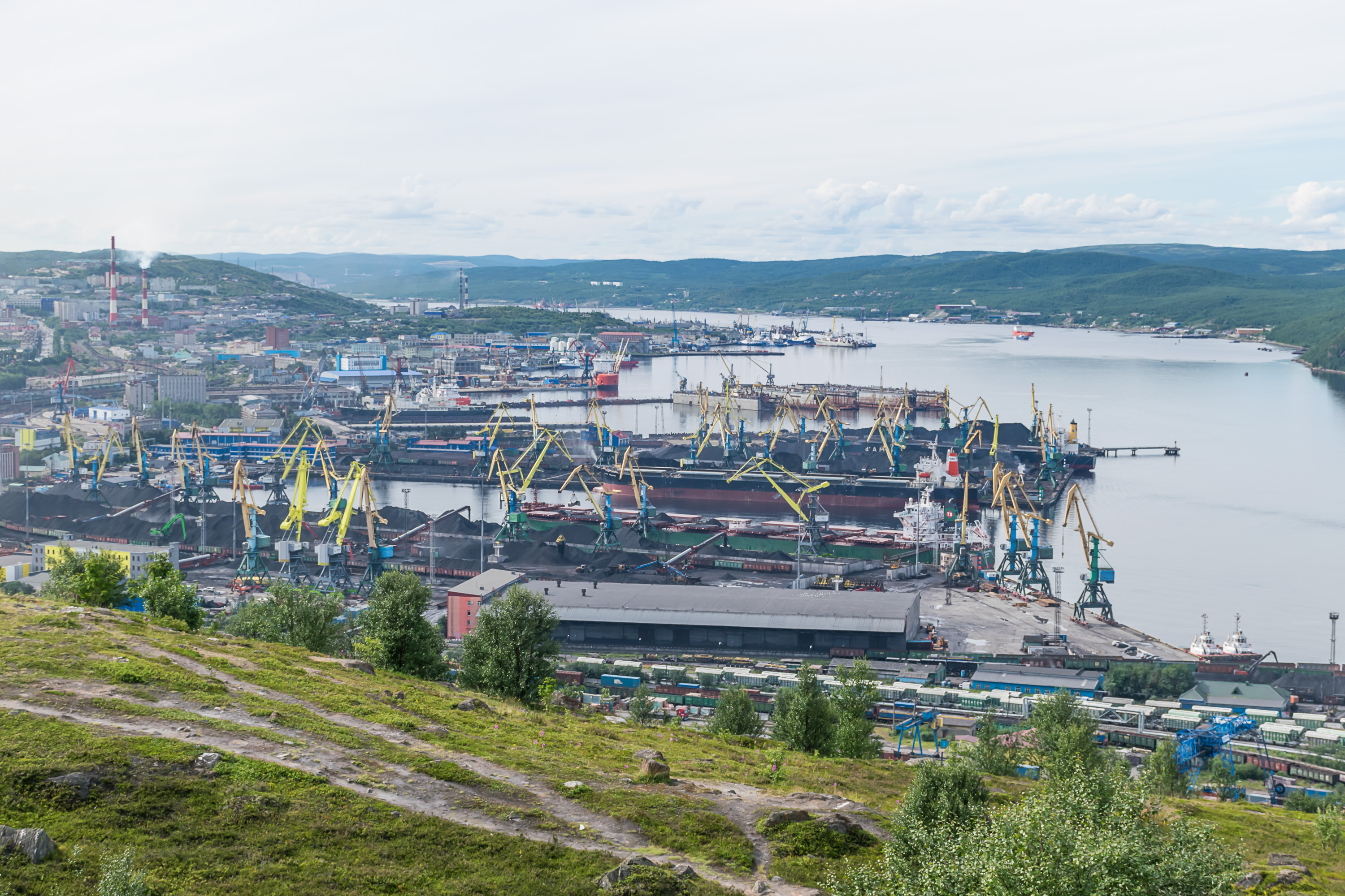
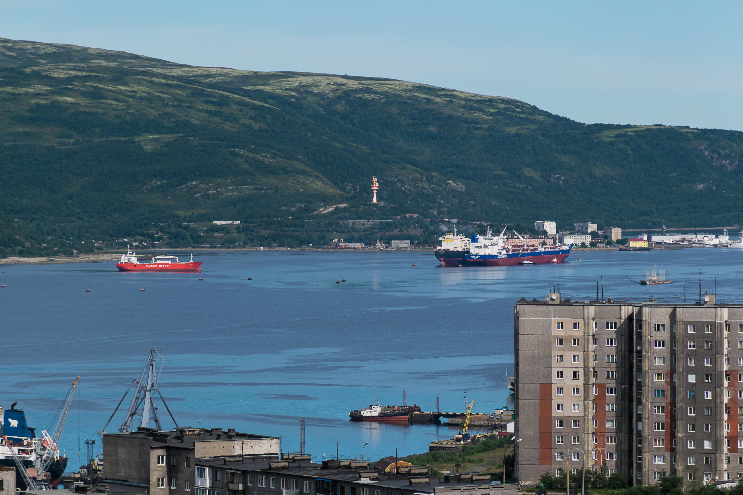
18. Murmansk seaport is much more interesting to look at. It's a pretty big seaport to be sure! As a cargo seaport, it is currently the 6th seaport in Russia by cargo volume. At 33.4 million tons (as of 2016), it is the biggest one in the Arctic Ocean by far. It's also bigger than any seaport in Nordic countries save Gothenburg.
One interesting place in Murmansk that we totally missed is its passenger harbor. I don't know whether any cruise ships ever come here (likely not) but it actually has some scheduled traffic! Namely, a passenger ship Klavdiya Yelanskaya (Клавдия Еланская, after a theater actress from early Soviet era), the only link to the mainland for villages of the Ter Coast, the outermost part of the Kola Peninsula. Ter Coast was originally a land of the Ter Sami, one of the smallest of Sami peoples. Their language is now extinct or nearly extinct, and their former biggest village, Jokanga (Йоканьга, originally Jovkuisiidda) has been turned into a naval base for nuclear subs, and currently exists as a bleak closed town dubbed Ostrovnoi (Островной, Russ. Island Town), population less than 2,000. Ostrovnoi is the main destination for Klavdiya Yelanskaya, although it can't be visited without a permit anyway. It has no airfield, thus the passenger ship service cannot be cancelled. Klavdiya Yelanskaya makes one trip there per week; the trip lasts 14 hours, and the tickets are quite cheap, probably subsidized by the goverment. In summer season, once per month, it also calls at a few other villages along the Ter Coast.
The biggest sight of the Murmansk passenger harbor is however Lenin, a nuclear-powered icebreaker. Built in 1957, it was both the first nuclear-powered surface ship and the first nuclear-powered civilian ship in the world, a big point of pride for the Soviet Union at the time. It was decommissioned in 1989, and is a museum ship now. We did want to visit it, but it is kind of difficult; you have to pre-book a tour for that. So we didn't bother. You can see Lenin in the picture, although it's kind of hard to find if you don't know what to look for. It's a ship with a bluish-black hull and yellowish superstructure, left of the center of the picture. There is a small red patch next to it (actually a hull of some other ship behind Lenin).
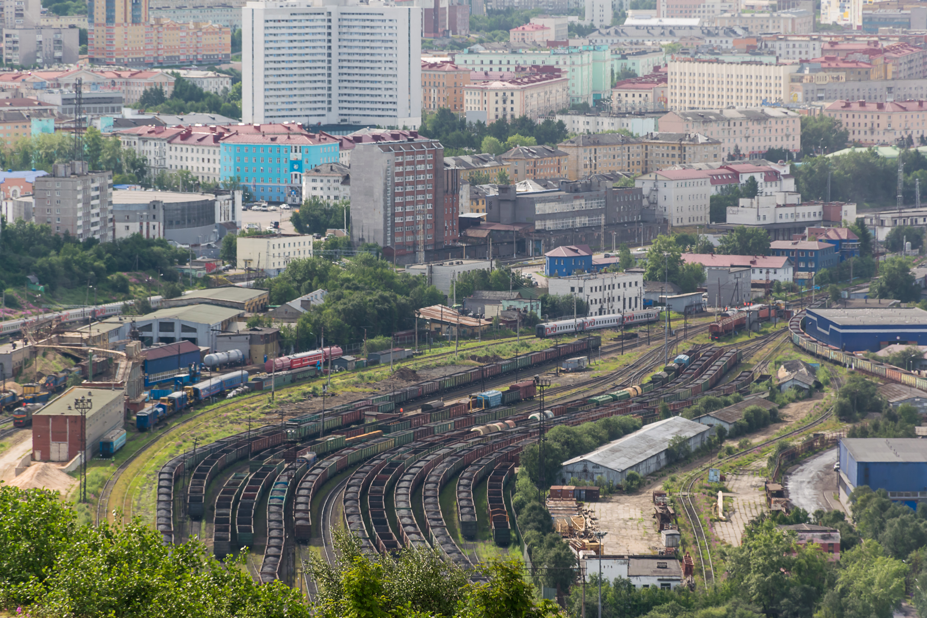
19. Freight railway station near the seaport. That's a lot of coal!
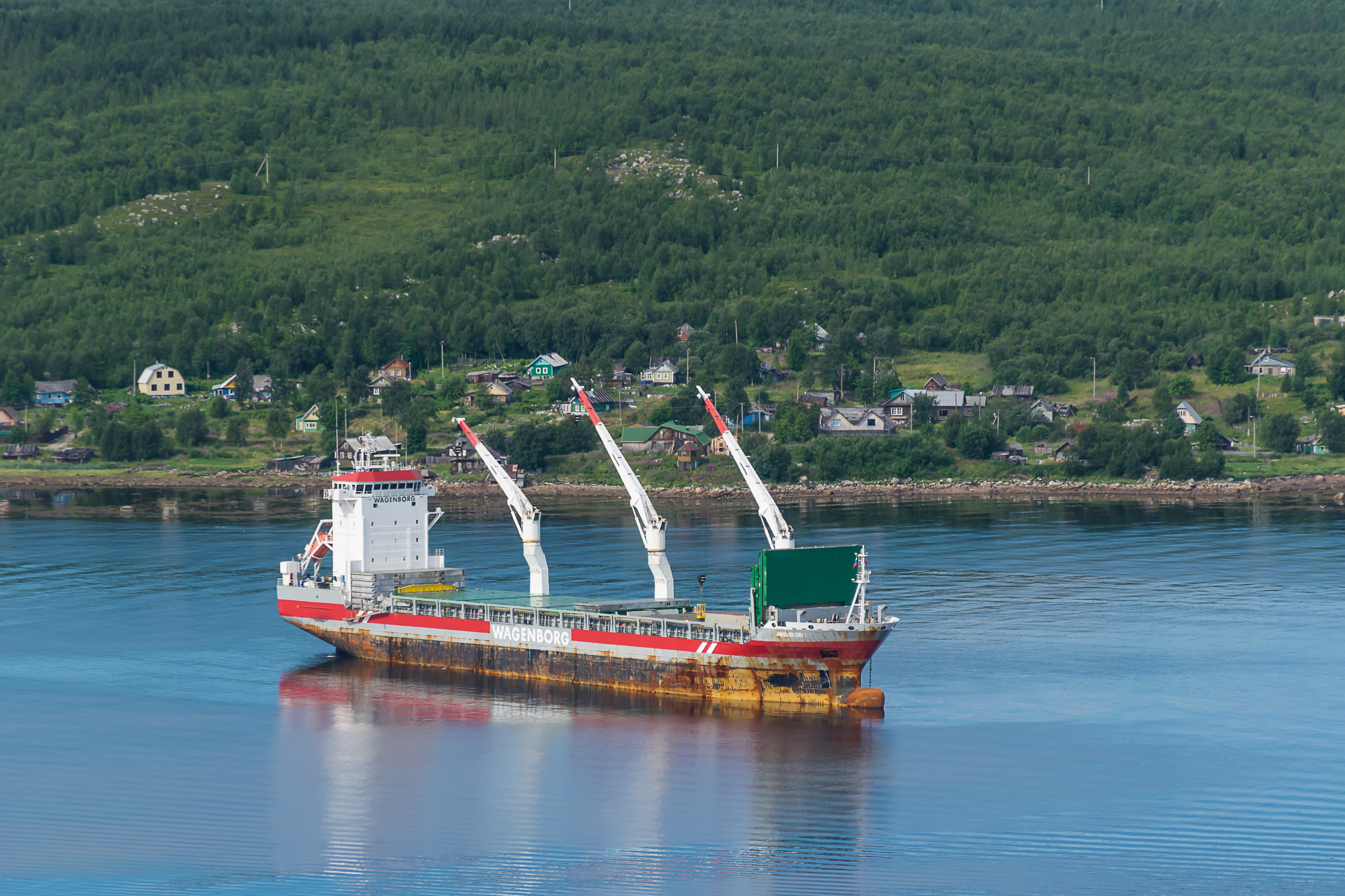
20. A ship in the Kola Bay.
21. More Kola Bay. The tundra-capped fells on the western coast of the bay look beautiful.
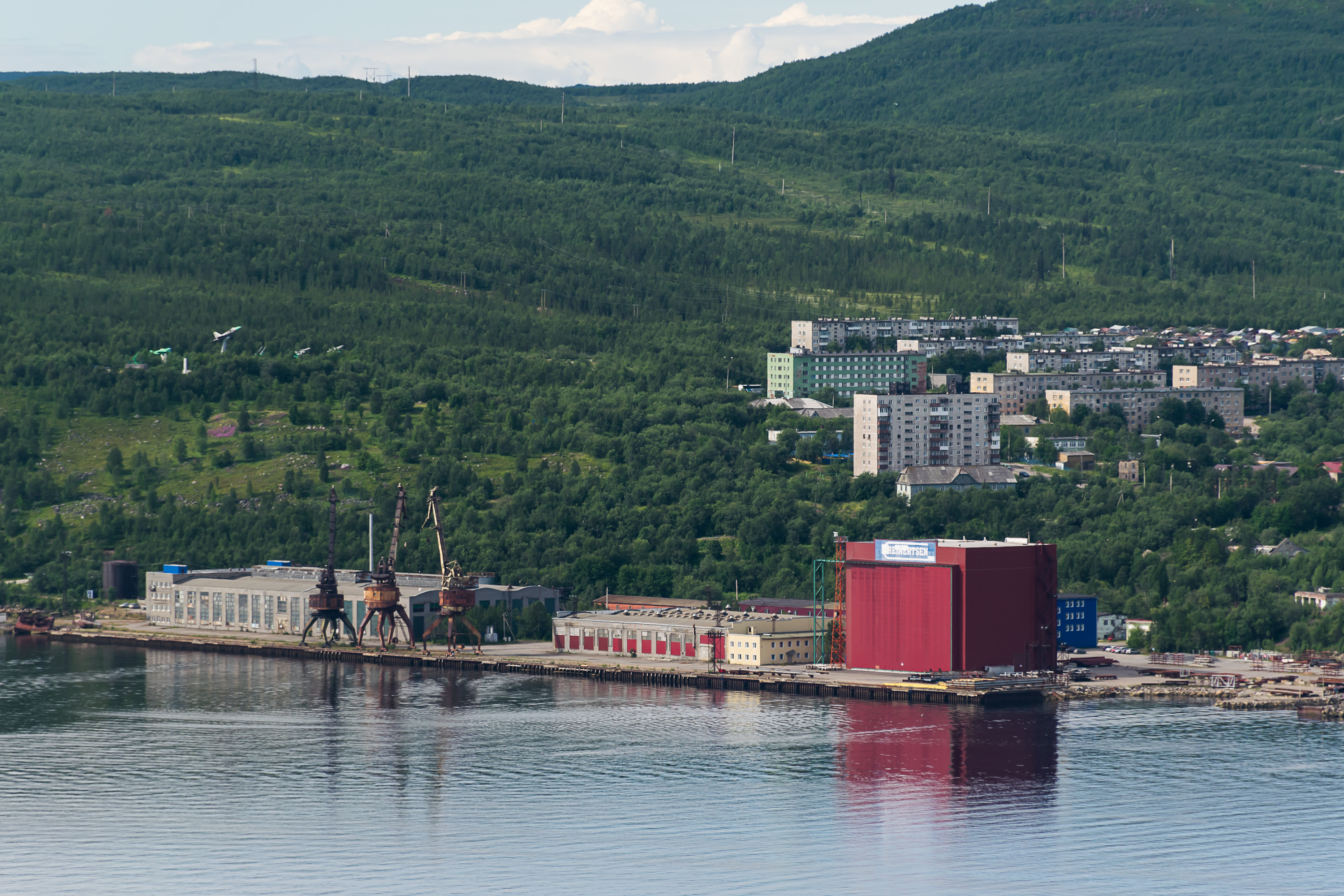
22. A few isolated neighborhoods of Murmansk are located on the west coast, across the bay. Abram-Mys (Абрам-Мыс, Russ. Abraham Cape) is one of them. Its old shipyard has been converted into an oil extraction equipment plant for Reinertsen, a Norwegian-based company.
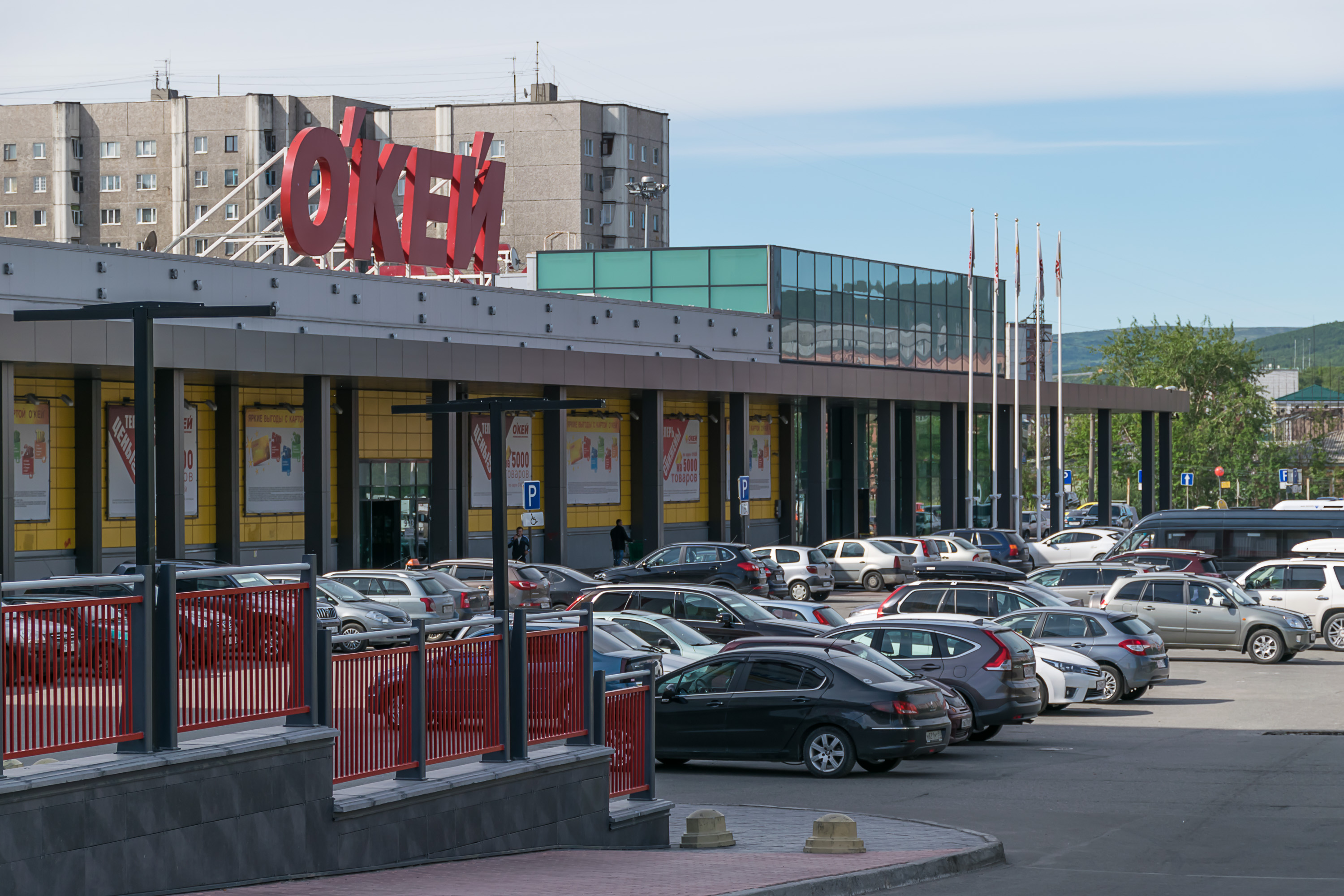
23. Having enjoyed the view we drove to the center of Murmansk and left our car at a parking lot of an Okey supermarket. It's one of my favorite chains in St. Petersburg, but Murmansk only has a single Okey supermarket.
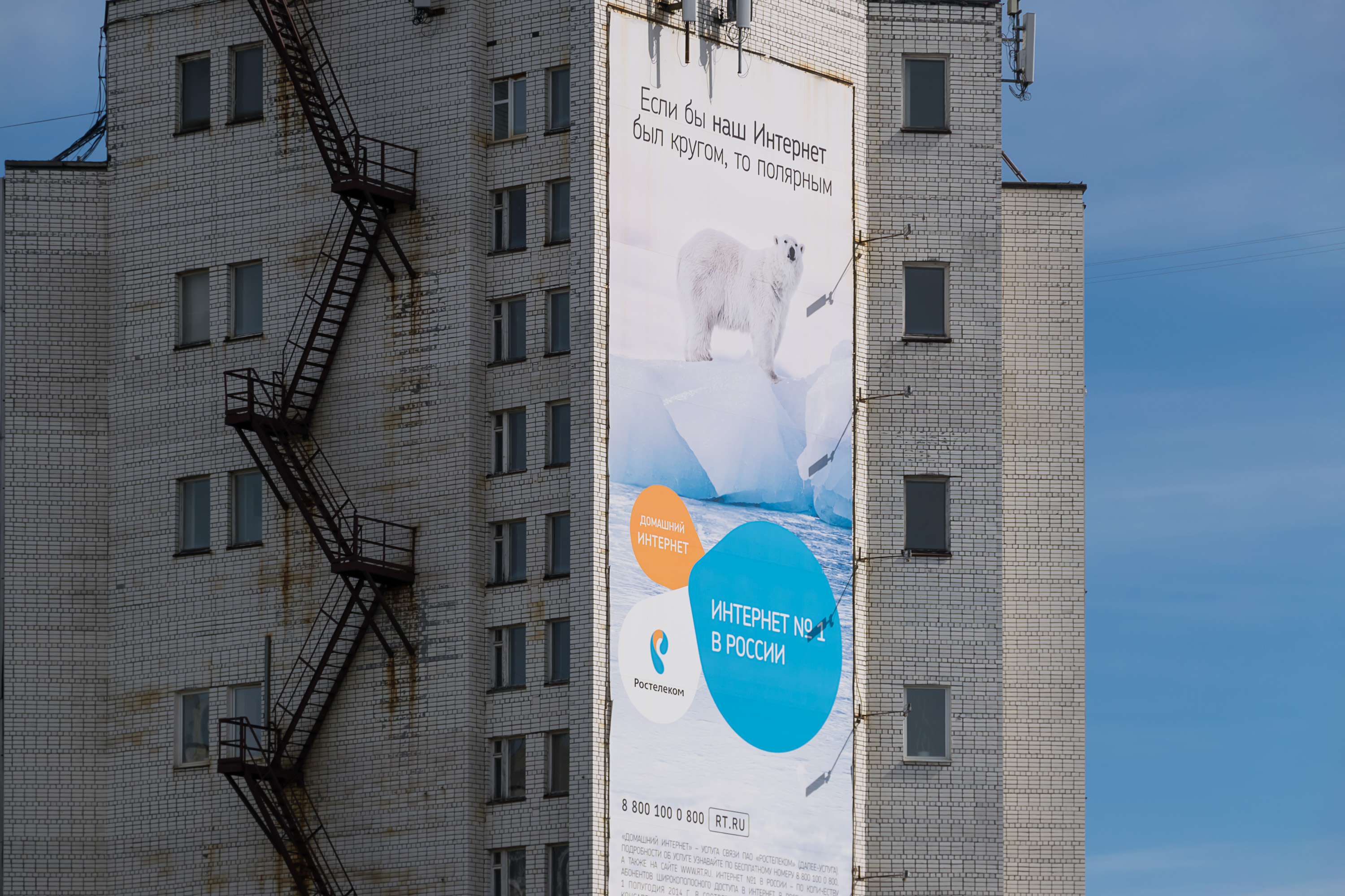
24. Funny billboard on an apartment building wall. "If our Internet was a circle, it'd be the Arctic one!" It's for Rostelekom which is the Russian state-owned telecommunication company.
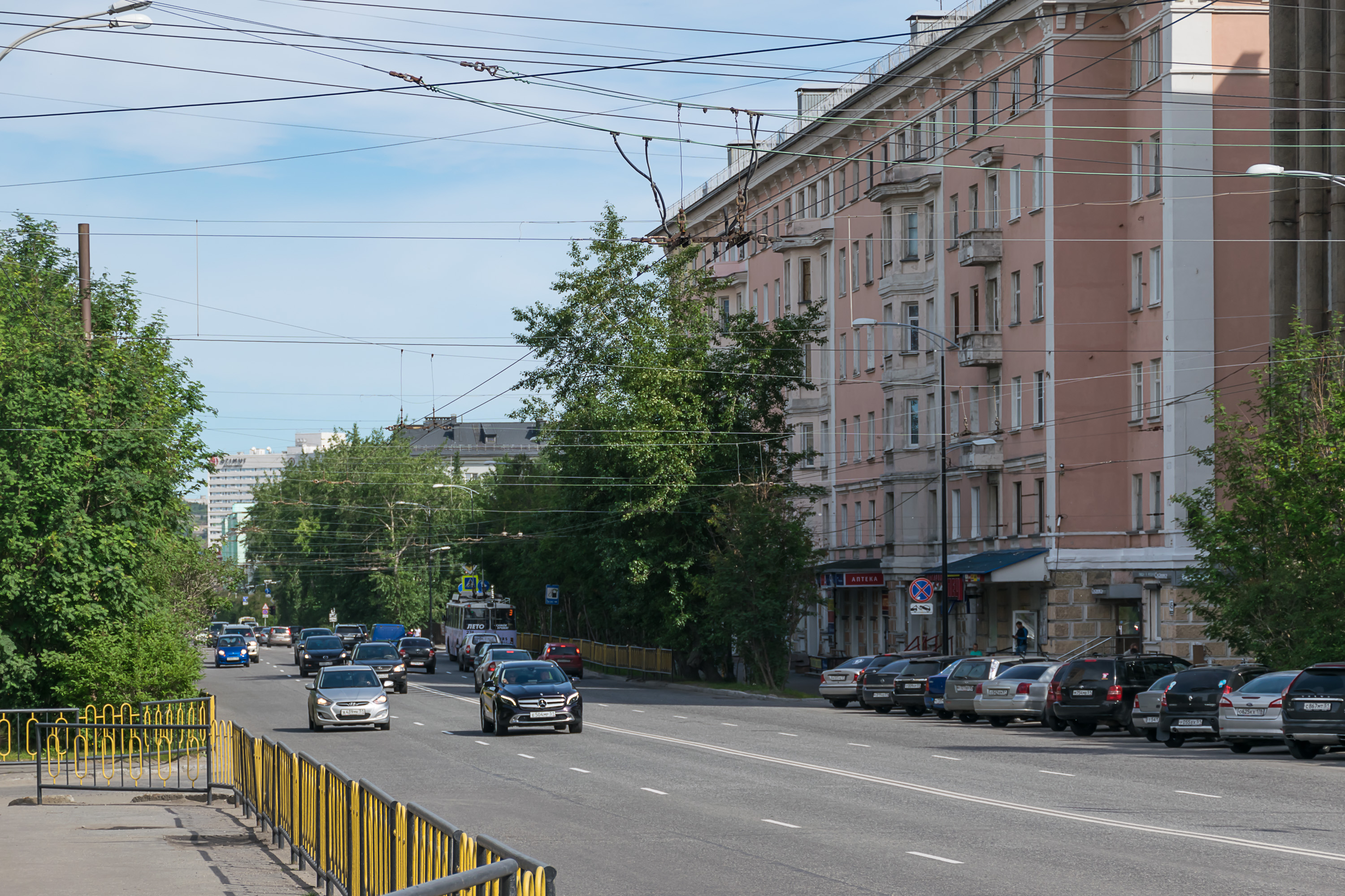
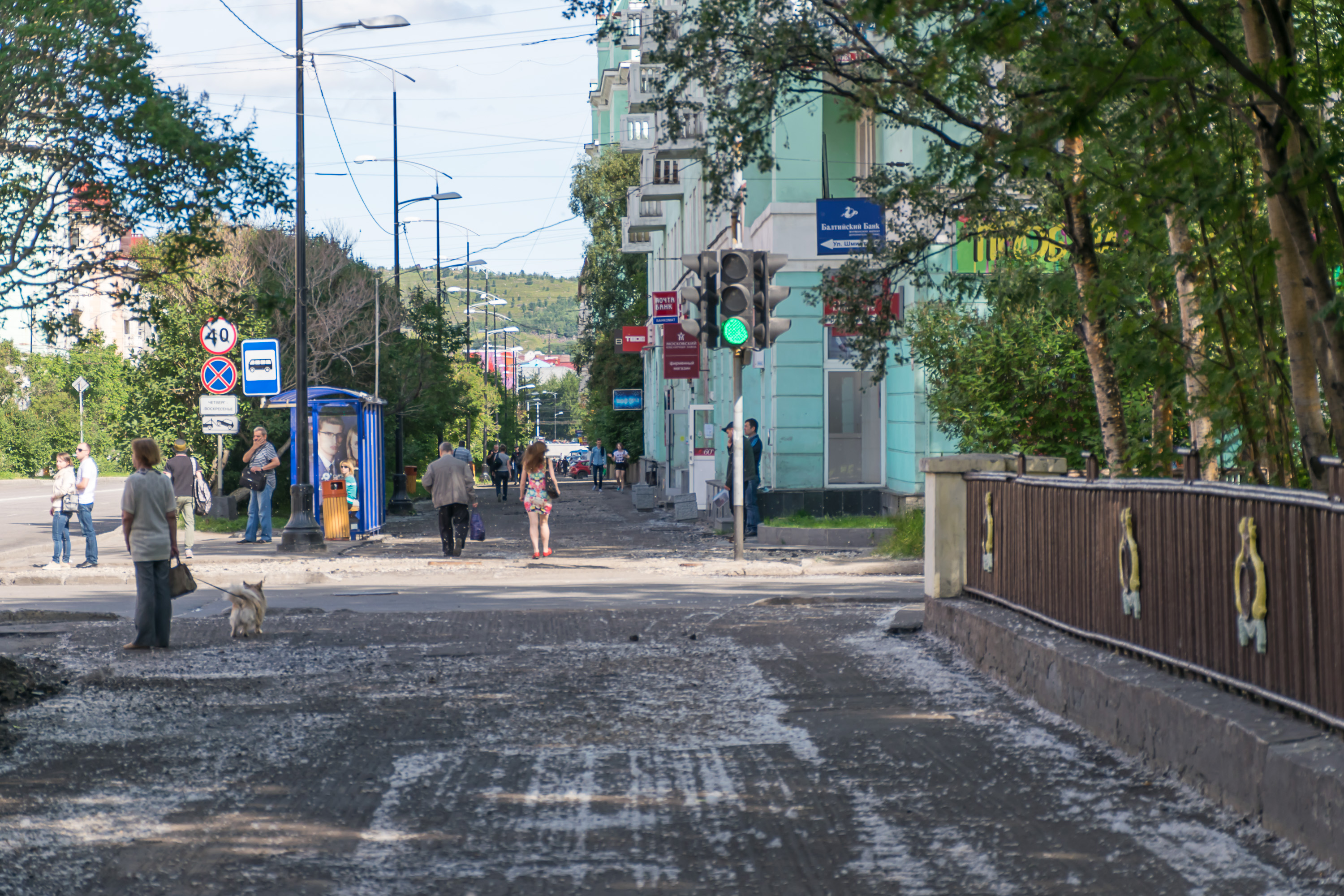
25. Murmansk center mostly looks like this.
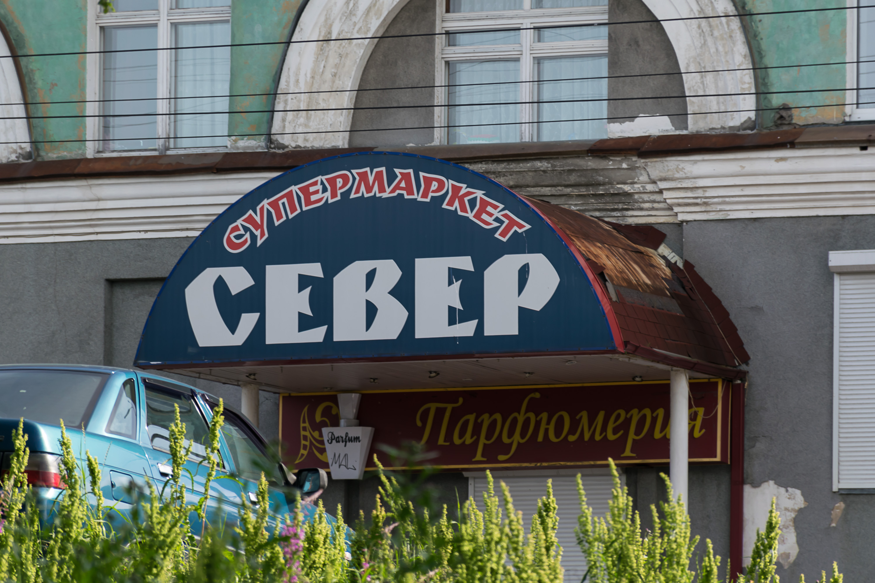
26. I've noticed that branding for various businesses is super easy in Arctic localities. "North", "Polar Bear", "Northern Lights", and so on. This goes for all countries, not just for Russia. Here we have a grocery store named North.
Curiously, the font of the sign is somehow indeed subconsciously associated with something northern in my mind, but I couldn't understand why. Neither did my friends or parents, although they all agreed about this association. Maybe there was some old Soviet cartoon, or some chocolate brand, or something else from our childhood... Yet I completely failed to remember what exactly this was, and an hour of googling didn't help.
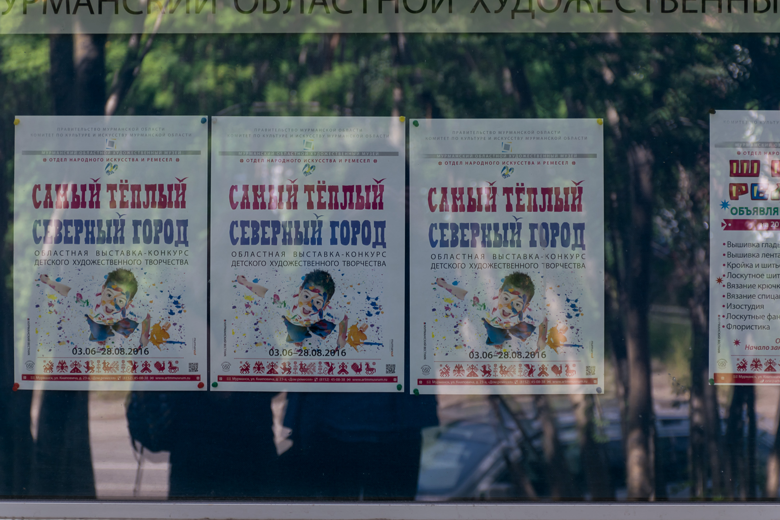
27. Posters from some children art exhibition, titled "The Warmest Northern City". Well, as compared with cities on the Arctic coast in the rest of Russia, Murmansk is indeed the warmest. It still gets some remaining heat from the Gulf Stream, unlike the frozen god-forgotten towns of Tiksi and Dudinka and others in the north of Siberia. The average temperature is +13 °C in July, and -9 °C in January. Perhaps more surprisingly, it virtually never ever gets colder than -30 °C. The midnight sun lasts from 22.05 to 22.07, and the polar night from 2.12 to 11.01. At least in summer it looks and feels exactly like any other Russian town; the only thing that reminds you that you're in the Arctic is midnight sun.
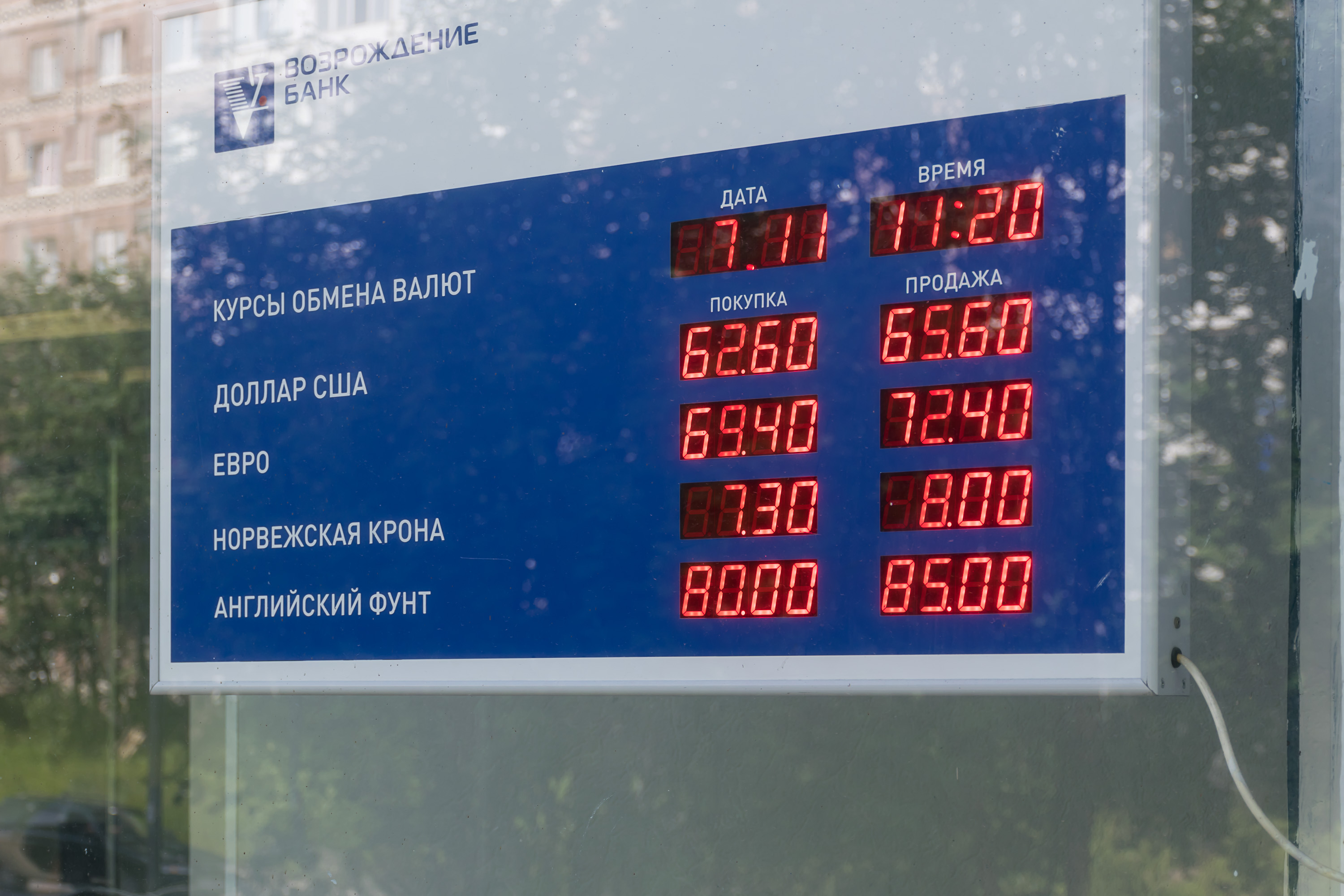
28. We tried to exchange some rubles for Norwegian krones, just in case we'll need some cash. Not every bank in Murmansk has krones, but some do (second line from the bottom is ruble/krone exchange rate). Norwegian, Swedish, and Danish krones are all worth about ten times less that a euro. That's a very rough approximation but it helps, as 1 € is a much more familiar amount to me that 1 krone. So we got some krones in this bank but, as it turned out later, never actually needed them anywhere (basically everyone accepts cards, just like in Finland), and had to frantically try to spend them wherever on our last day in Norway in Tromsø.
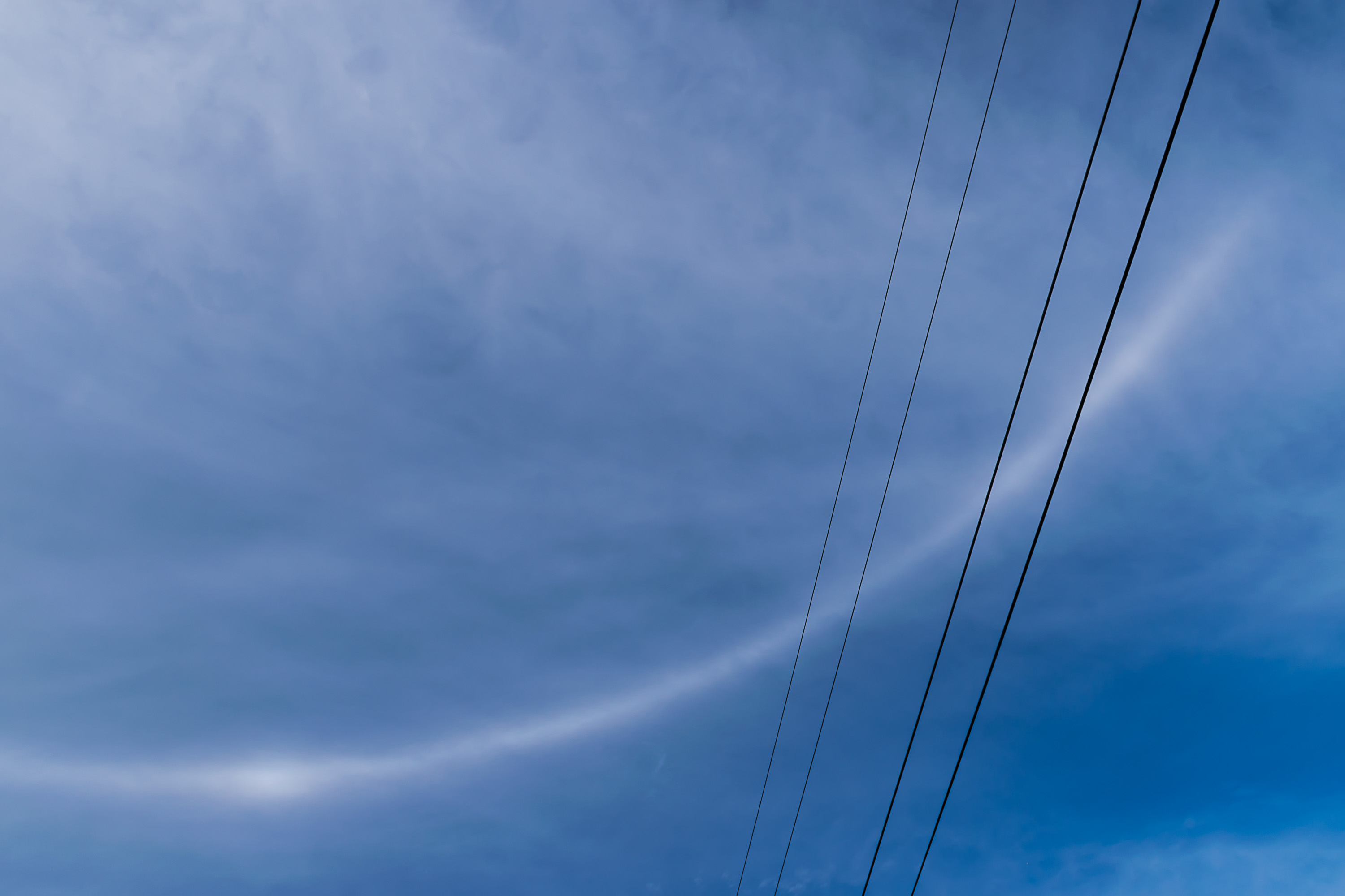
29. Some woman noticed that I was carrying a camera, and pointed up, to this odd circular thing in the sky. She had no idea what it was, and neither was I. It looks like a usual halo, as far as I can say now; I just don't really remember ever seeing halos before. On the other hand I rarely feel the need to stare at the sun, so that might explain this.
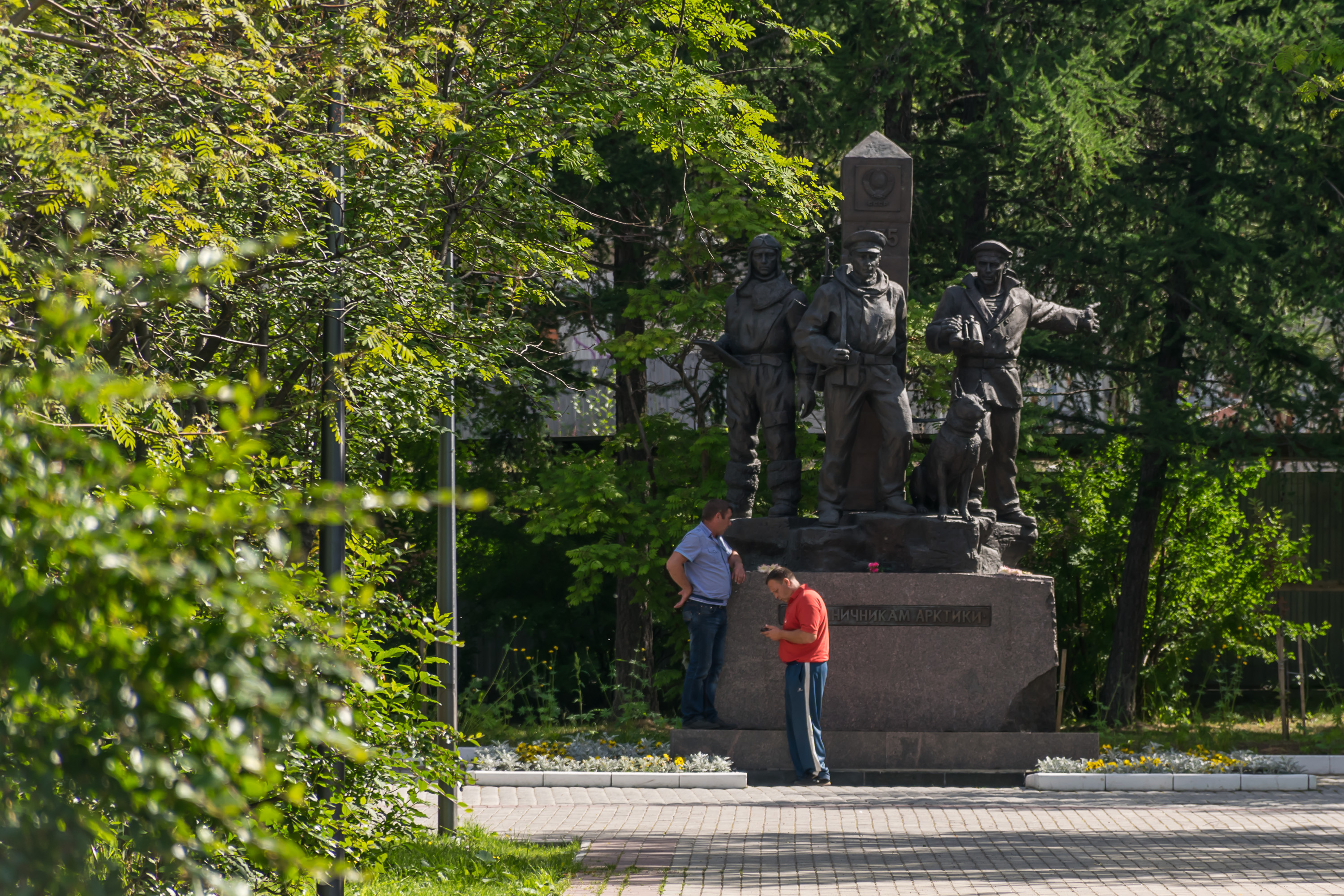
30. Monument to the border guards in the Arctic.

31. A theater being repaired.

32.
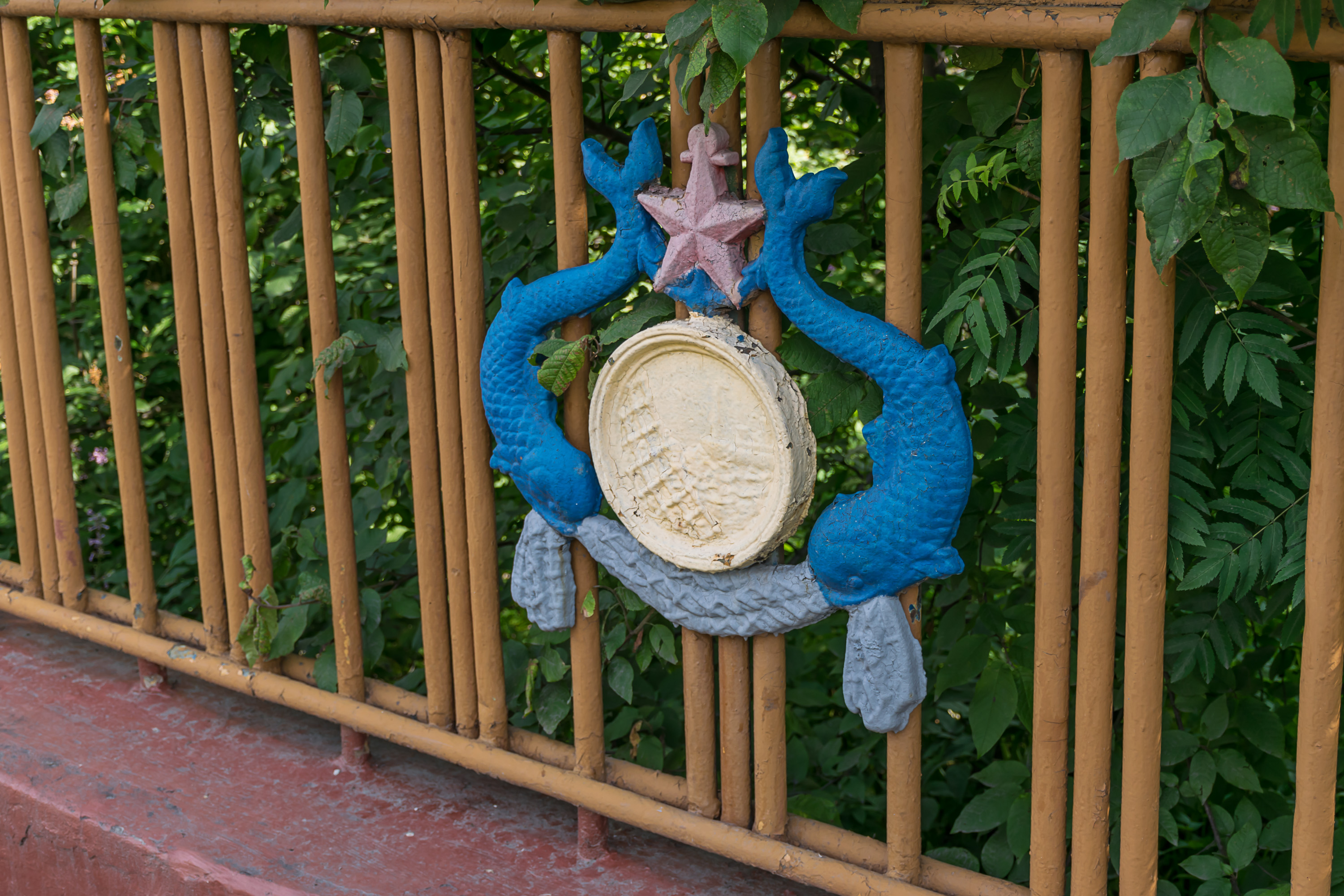
33. An old fishing-themed fence decoration near a local university.
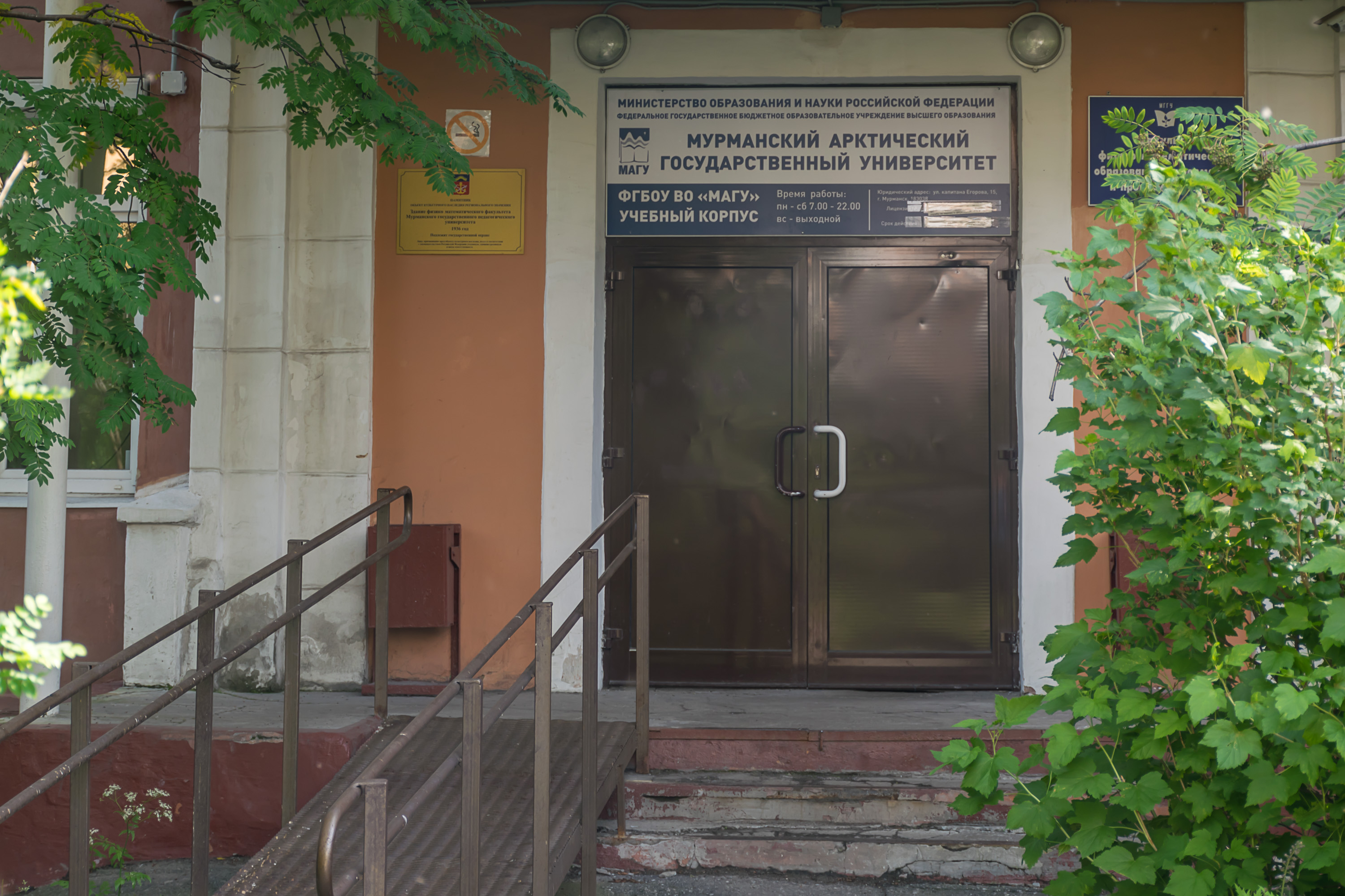
34. One of the university buildings. That's not a real university (unlike a Petrozavodsk one), that's a former teachers college which is now calling itself Murmansk Arctic State University to feel more important. (Seriously, why did you feel the need to put "Arctic" in the name? Everybody kind of already knows Murmansk is in the Arctic.)
35. Some streets were full of poplar fluff at this time of year. That's something I hadn't seen for a long time. My hometown, Yekaterinburg, has a lot of poplars on its streets, and they similarly release a lot of fluff in June and July (this is how their seeds spread or something). Many people are severely allergic to this stuff. St. Petersburg, however, has much fewer poplars (at least of the fluffy kind), and hence fluff-littered streets are uncommon there.
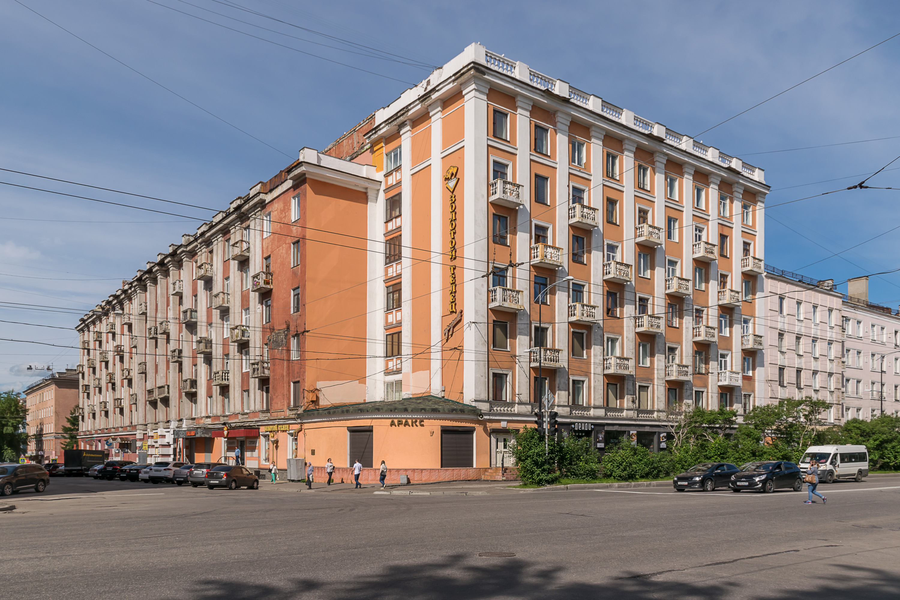
36. Stalinist era buildings in Murmansk generally look very nice and well-preserved, but rather forgettable.
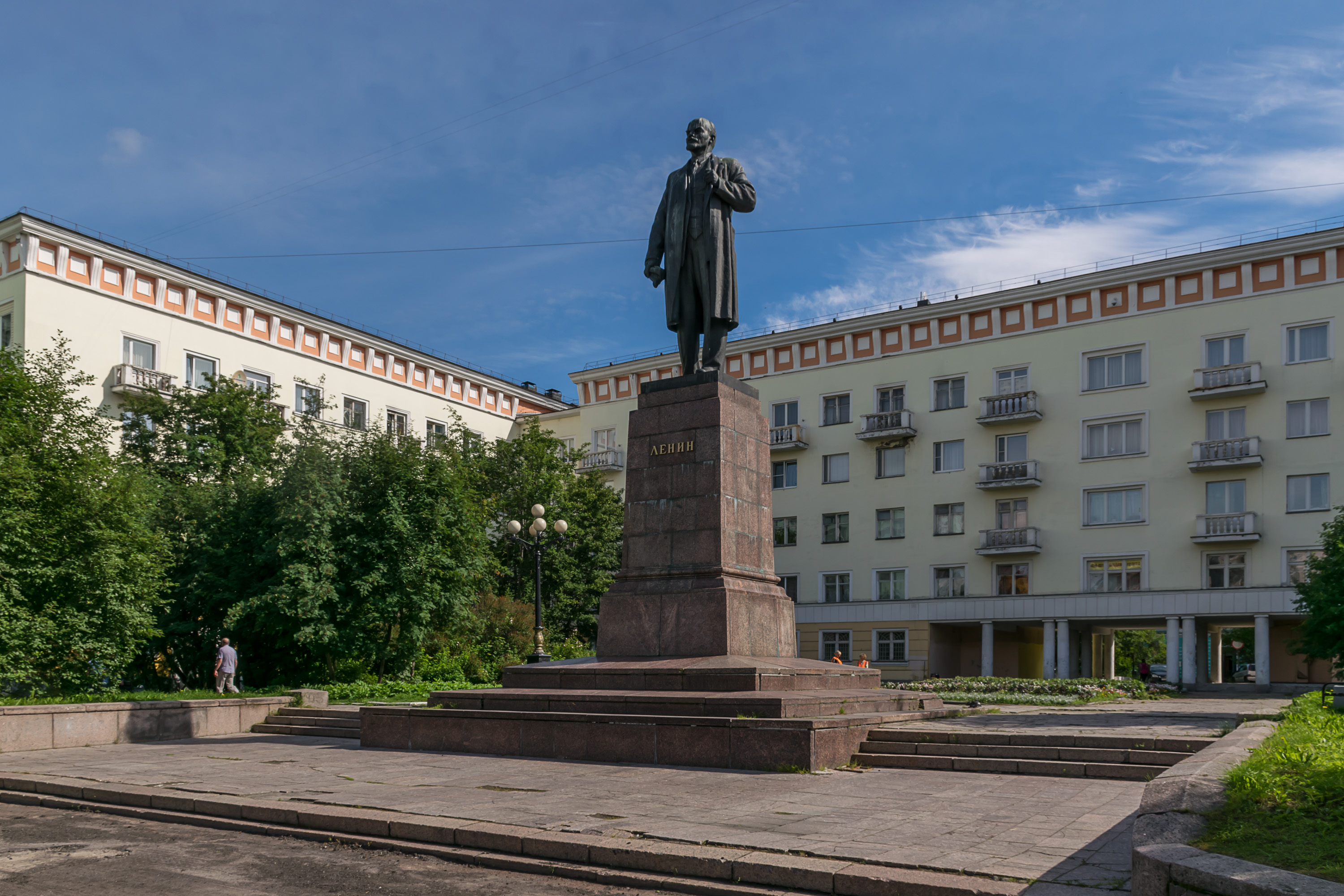
37. Of course there's an obligatory Lenin statue.
38.
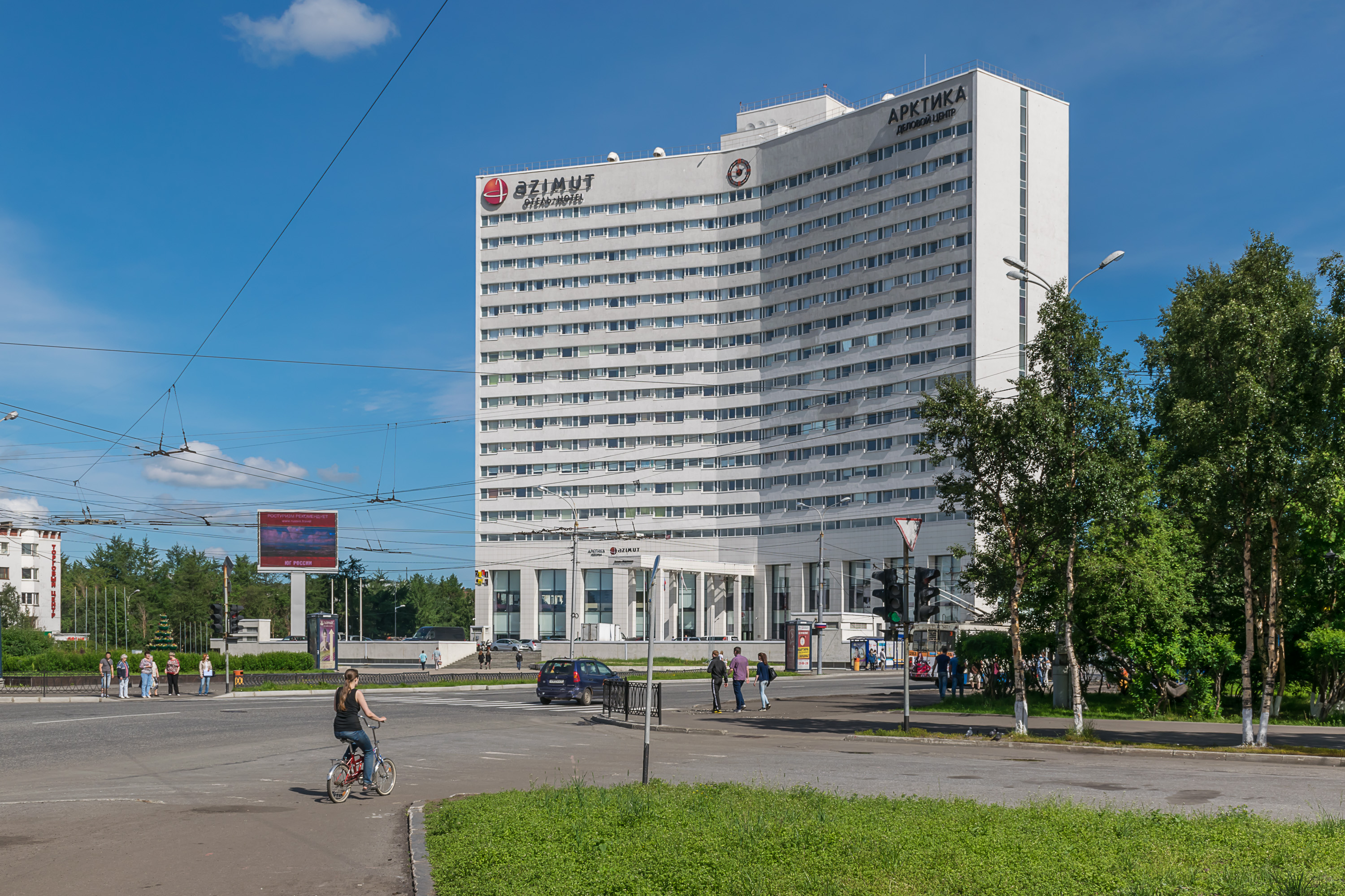
39. A hotel.
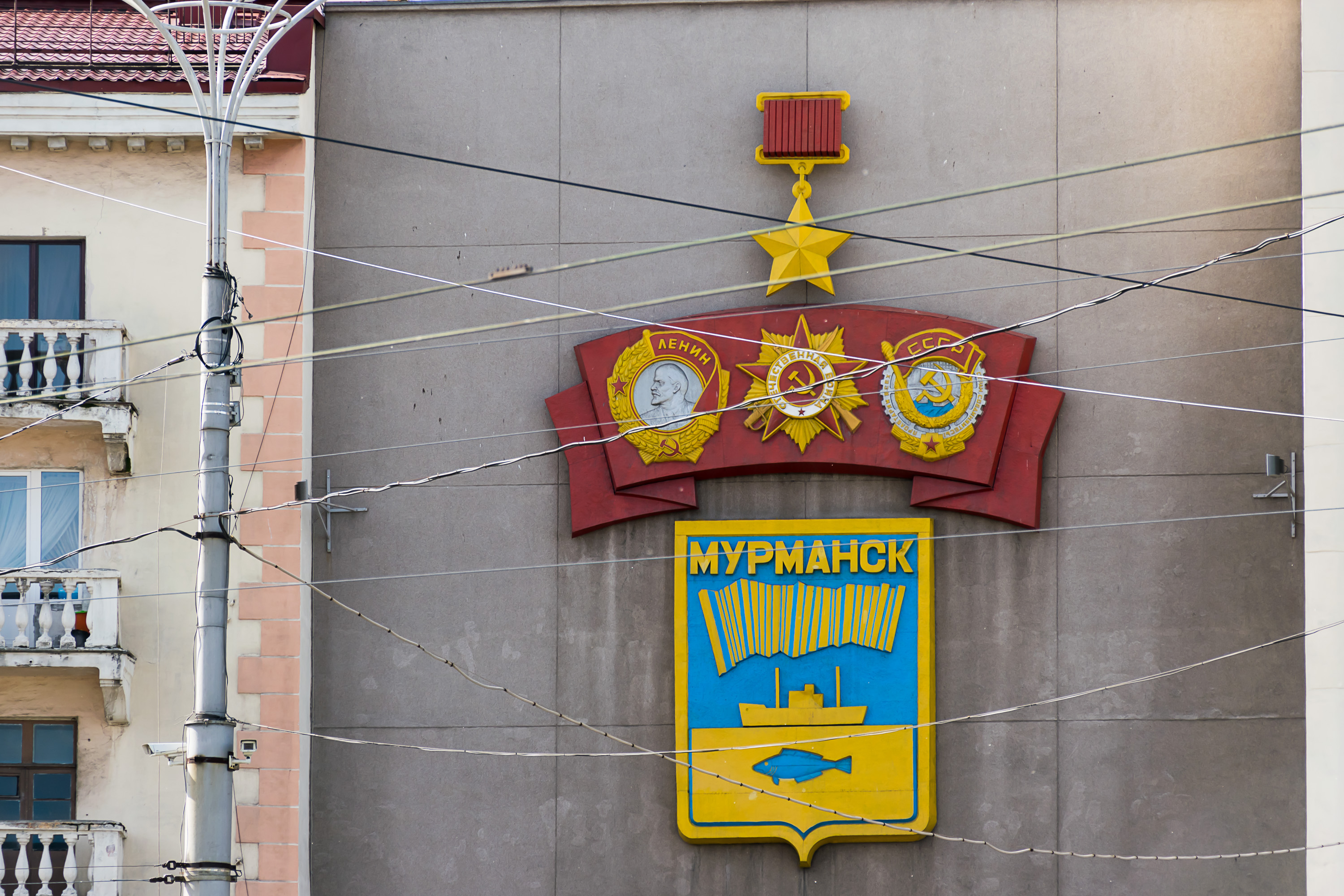
40. A fish, a ship, and northern lights — quite a fitting coat of arms for Murmansk.
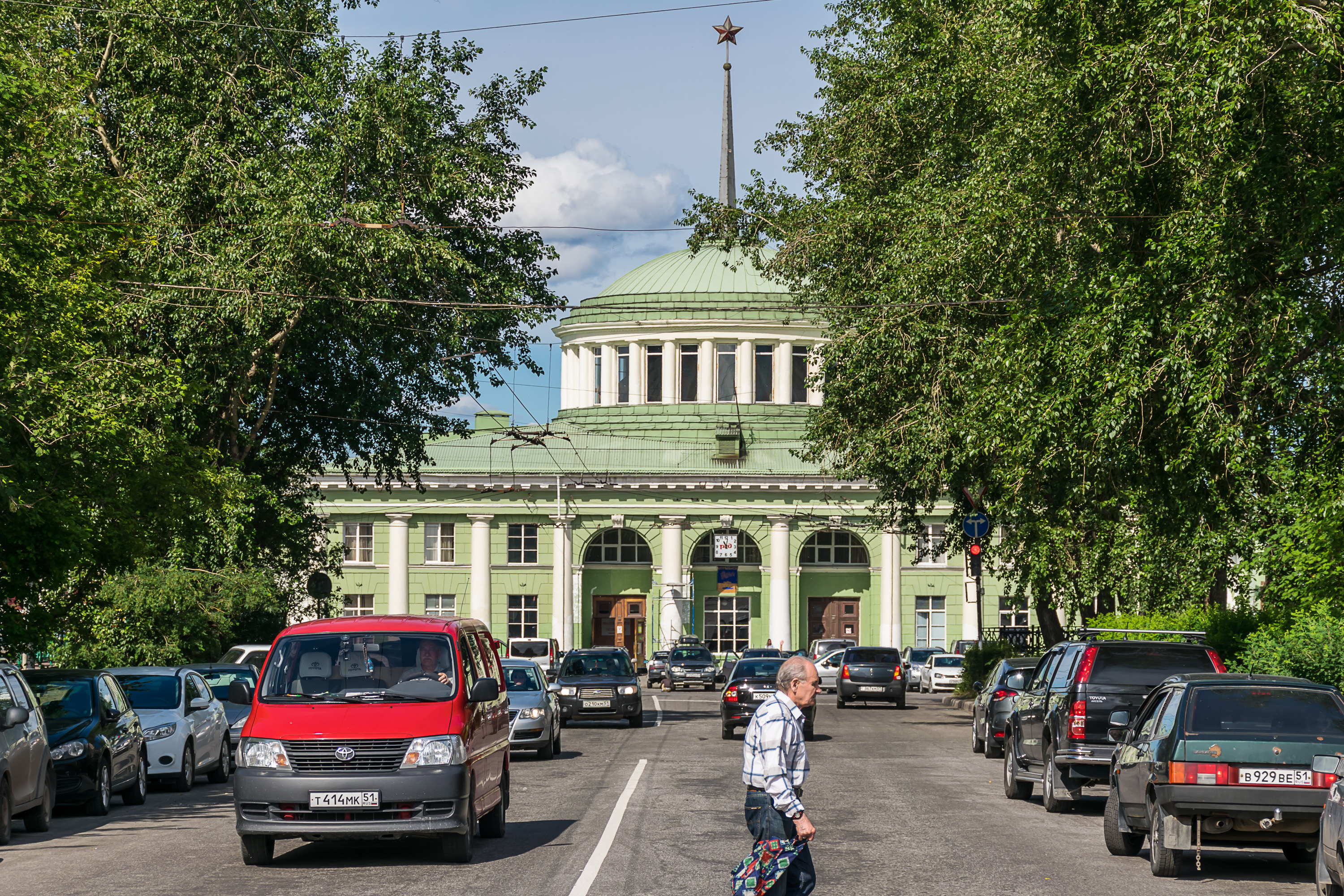
41. Railway station. Murmansk is the northernmost point of Russian passenger rail network; in fact, it's the northernmost passenger railway station in the entire world. Long-distance trains connect it with Moscow, St. Petersburg, Vologda, and Minsk (Belarus). There are seasonal trains to Anapa and Novorossiysk (Black Sea resorts), and an odd suburban train to Apatity twice a week. The trains going to the west, towards Norwegian border, to Nikel and Zapolyarnyi, have been cancelled since 2014.
Murmansk airport (adding this for completeness, again) seems to be rather more lively than the Petrozavodsk one, with multiple daily departures to Moscow and St. Petersburg (no less than ten in total), and also regular flights to Arkhangelsk.
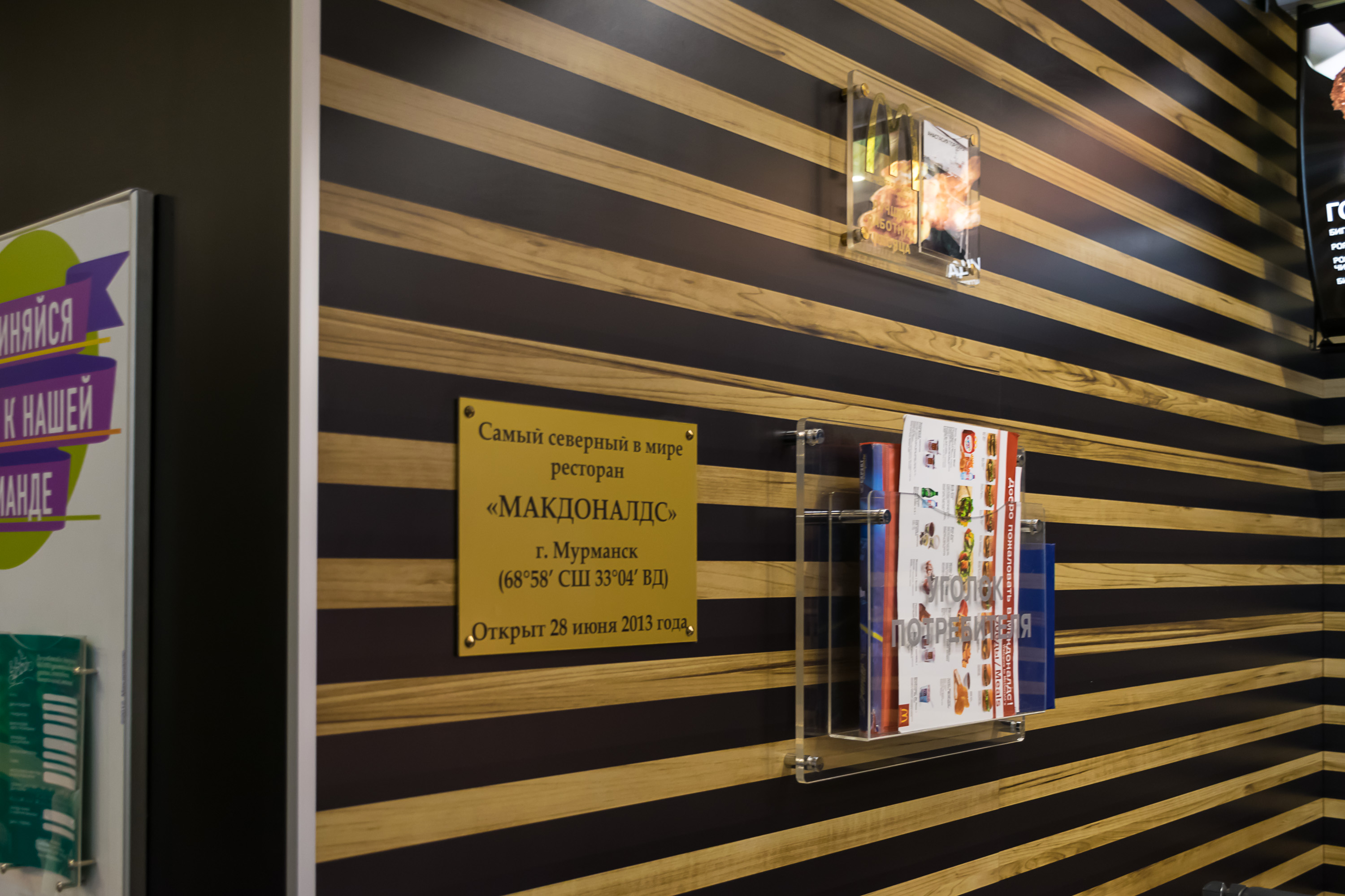
42. Looking for a public toilet, we dropped into some McDonald's, and by complete accident discovered that this was, in fact, the northernmost McDonald's in the world. I felt obliged to buy a cheeseburger here. There are no McDonald'ses in Norway north of Trondheim (at least as of 2016), and Finland and Sweden don't have any towns north of Murmansk latitude at all, so Murmansk is the undisputed champion here.

43. Murmansk has some pretty depressing-looking buildings too, but we haven't really seen many of them.
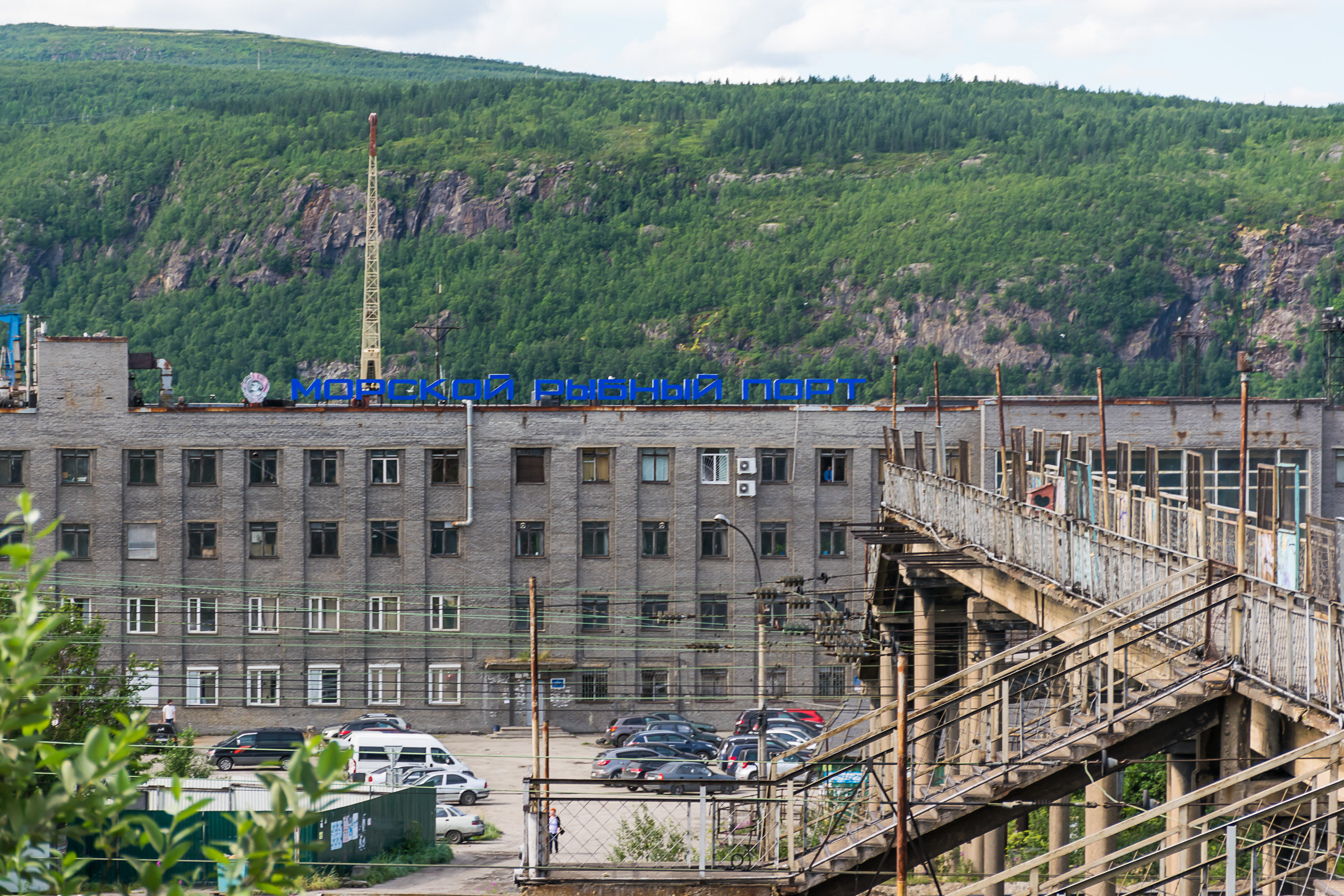
44. Fish port building.
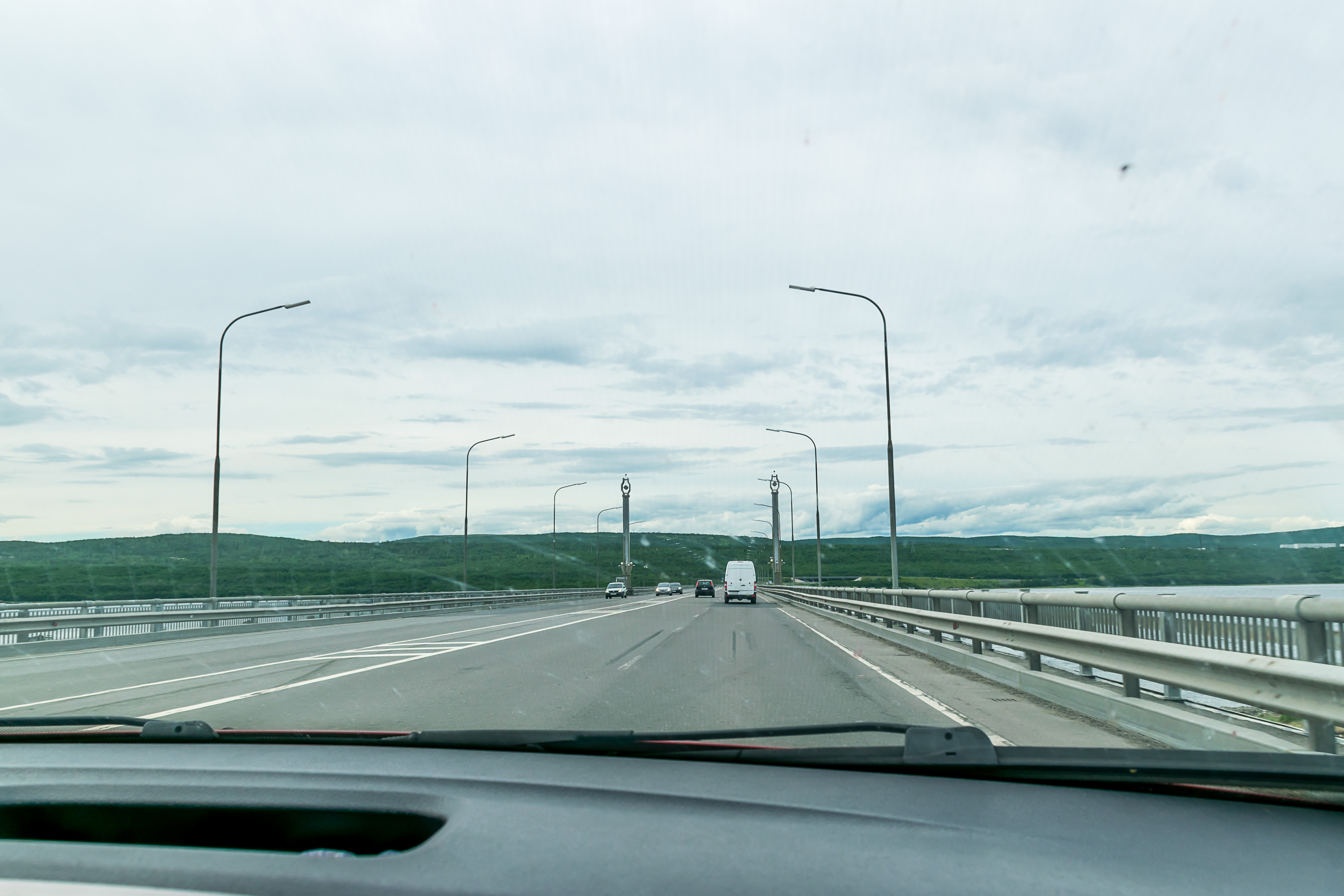
45. We returned back to the Okey supermarket, did our last grocery shopping before the Norwegian border (as everything is of course a lot more expensive in Norway; incidentally we were disappointed by the lack of local products (e. g. crabs) in the supermarket), crossed the Kola Bay on this bridge, and set off past Pechenga and Zapolyarny into Norway.
Overall I feel our impressions of Murmansk were rather brief, and we felt like we saw a lot more of Petrozavodsk than Murmansk. On the other hand Murmansk really just feels a bit too bland. Apart from the Lenin icebreaker and Alyosha monument, I really don't know what else is there to see in Murmansk.
One more thing I'd like to note is that there seems to be zero recognition of the Sami people in Murmansk. No Sami flags, no Sami cultural centers, no anything. The Sami were the original inhabitants of the Kola Peninsula, just like in Finnish and Swedish Lapland, Northern Norway, and parts of Scandinavian Mountains. However only about 1,500 people in Russia currently identify as Sami, much fewer than in either Finland, Sweden, or Norway. The biggest group by far is Kildin Sami.
Sami people in general were severely discriminated (until embarassingly recent years) everywhere they lived, but, as usual, the ones from Russia got the really short end of the stick. First of all, unlike the Nordic countries, there are a lot of other native northern peoples in Russia, and some of them (particularly the Komi and the Nenets) have always been much more numerous than the Sami. Sami culture was kind of dwarfed and trampled by theirs wherever they got in contact. And then of course there was the Soviet era, with forced displacements and collectivization (reindeer herding kolhkozes! yeah, that was a thing). 118 Sami were persecuted during Stalin purges, and 50 of them were shot; the Sami (along with a few Russian etnographers working among them) were accused of conspiring to proclaim their independence and to join the capitalist Finland. The ridiculousness of these claims is highlighted in a novella on the subject by Mikhail Kuraevnamed Sami Conspiracy (Саамский заговор). I love the scene where an old Sami man is being questioned by a NKVD officer (translation mine):
The only thing that the old man understood of what the military boss had said brought him to tears from laughter. Someone had told the boss that he, Kurekhin Salma Nestorovich, a Sami from Voronye village, had wanted to set fire to tundra, to burn all reindeer moss, and starve all the reindeer to death. He roared with laughter, shaking his head, and peering through his tears of laughter he saw the angry but confused face of the boss, who seemed to understand that he had said something funny by mistake.
"Noo!.. Tundra wet!", said Kurekvin, the detained person, having laughed to his satisfaction and wiped his face with the sleeve of his coat. "Do water burn? Water not burn! Noo!.. Yimmel Aiah(*) can no burn tundra".
"Yimmel Aiah?", asked 2nd Lt. Mikhailov, eager to know who could set fire to tundra, and made a note on a piece of paper with his pencil. "Where does he live?"
The old man knew that Yimmel Aiah lives in the Seventh, the Honey Heaven, knew that one could only get there through other heavens, first the Blueberry one, then the Eyelash, after that the Heather, then Hare, Cloudberry, and Amethyst, and then one'll get to the Honey one. He knew that Yimmel Aiah rules over all other gods: Air, Fire, Earth, Water, Home, and Beast ones. He commands everyone and answers to no one, he's proud, he knows all the mysteries, but even Yimmel Aiah cannot set fire to tundra. If any small child in any village knows this, doesn't such a big boss, who had decorated himself with a red star?
(*) Yimmel Aiah (Йиммель-Айя) probably refers to Radien-attje, an actual Sami god. I wonder whether the Cloudberry Heaven stuff is accurate.
So today the Russian Sami mostly live in a few villages, the most significant one being Lovozero, and the life there isn't very nice. The Kildin Sami language is so far a living one (unlike for example Ter Sami), but only a few hundred speakers remain. And all in all it's a pity that one can drive all the way through Murmansk Oblast and never see any evidence that the Sami even exist, much less that this was their land. And not even a single reindeer, too!
But we're going to see a bit more about the Sami (though not by much) in Norway. The Russian part of our journey ends here. It was a bit rushed, of course, and you can notice I had to write "we didn't actually go there" a lot, because its only point in the end was getting to Norway. But at least now we have an idea what the Russian Arctic looks like. To be continued!
Edit (2020): Unfortunately this series, which was meant to have about 10 more posts, was left unfinished — so, in the end, it only covered some Russia, not actual Nord-Norge.