If there is one city I love the most in the world, that would be Helsinki, the capital of Finland. (Edit 2023: okay, my views have changed entirely here, Helsinki is simply way too huge and definitely not my favorite place in Finland or otherwise) Stockholm might be a close tie, and it’s, objectively speaking, prettier and has more sights, but still, I love Finland more, and thus I love Helsinki more. It looks perfect to me in nearly every way imaginable, specifically perfect as a place to live in. And when I’m talking about Helsinki, I usually mean Greater Helsinki, the whole metropolitan area. Helsinki proper has a population of 630,000, but with its suburbs it’s closer to 1.4 million. The closest suburbs are Espoo and Vantaa, which pretty much completely blend into Helsinki from the west and from the north respectively.
I’m actually not all that familiar with Helsinki; my go-to places for weekend trips are smaller towns and natural sights within reasonable driving distance from the Russian border, and on my vacations, I try to go much farther north. Still, back in March I had a marvelous trip, when I just walked all the way from the center of Helsinki to Espoo (Espoon Keskus area) alone on foot, and got to see a pretty significant slice of Helsinki and Espoo on my way. Last weekend, in late November, I decided to do pretty much the same, only with Vantaa this time. Just walking around, not trying to see any particular sights, just enjoying Finnish streets and suburbs.
For the first time in nearly two years, I decided to choose a different mode of travel than my car. I’m not a fan of winter driving. Road conditions probably weren’t that terrible, but it just takes up a lot of time, and daylight hours up here in November are pretty short. So it’s either waste these precious hours on driving (at least 4.5 hours from St. Petersburg to Helsinki one way), or drive before/after dark, which is twice as exhausting. In the end I decided to buy tickets for the Allegro train.

1. Here it is, to the left. The Allegro is a high-speed train on St. Petersburg-Helsinki route, jointly operated by Russian (RZD) and Finnish (VR) Railways. It’s a very nice and comfortable train, taking just 3.5 hours from Finlyandsky Railway Station in St. Petersburg (Rus. Finnish, appropriately enough) to Helsinki Central Station. It has free Wi-Fi, wall power sockets, and you don’t even need to stand up for border formalities; Russian and Finnish border and customs officers just go through the cars themselves. There are four trains every day. The only downside is, well, it’s pretty damn expensive! The usual price is about €80 one way, although it might be somewhat less if you buy tickets in advance (I didn’t). For comparison, gas price for a St. Petersburg-Helsinki trip (420 km) on a compact car shouldn’t be more than €20, assuming you only refuel in Russia (and any reasonable car will have a large enough gas tank that you can make a Russian gas station to border to Helsinki to border to Russian gas station trip without refueling).
But anyway I did it. Bought the tickets on the Internet the previous day. Oddly enough, Russian Railways website doesn’t generally allow you to buy a ticket from Helsinki to St. Petersburg, only the other way round. It just says “no tickets available”. Although now I examine it closely and there is some small grey text telling you that you need to uncheck “show trains with tickets only” checkbox, and then still proceed and try to buy a ticket as usual, even though it will show the price as “0 RUB”, presumably up until the actual payment. This bug has been present ever since they introduced these trains in 2011. Finnish Railways website works fine with both directions.
The train left at 6:40 in the morning, and most of the way I was mostly preoccupied with hangover with last-Friday-of-the-month drinking at work the day before. St. Petersburg had been snowless (we had had some huge snowstorms in the first half of November, even though there is rarely any permanent snow cover until late December; but all the snow had melted again since then), and so was Helsinki, but most of the way between them the train passed through endless heavy snowfall.
Finally, it’s some quarter past nine Finnish time, and I’m leaving the train, armed with a camera and a small backpack, and ready to explore! The Finnish two-storeyed train to the right was, incidentally, about to depart for Oulu, the largest city in Northern Finland.
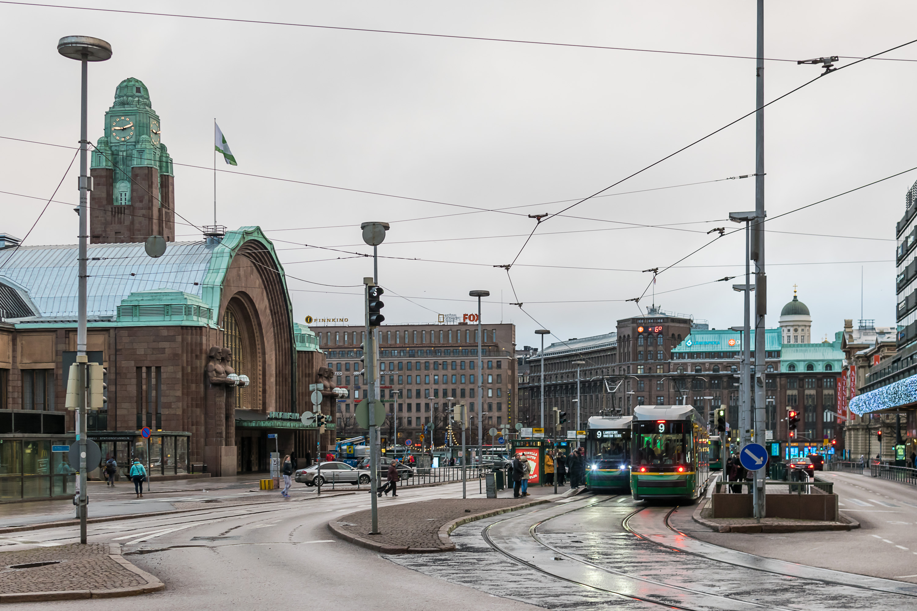
2. Rautatientori (Finn. Railroad Square) and the iconic Helsinki Central Station building, greeting me on this gloomy and wet November morning. A young man came up to me and said “Anteeksi” and proceeded in Finnish, and when I said “Sorry, I don’t speak Finnish”, he switched to perfectly fine English, and begged me for some change in English. Well, I didn’t have any cash in euros on me, even if I felt generous. The funniest thing was that he had exactly the same forked-in-two style beard as Marco Hietala from Nightwish band. It’s actually not an uncommon style in Finland.

3. Mannerheimintie (Finn. Mannerheim Road, after the famous commander-in-chief of Finland in WWII). Probably the biggest street of central Helsinki, it feels overwhelming to me, just like Nevsky Prospekt in St. Petersburg. Even if it didn’t look all that busy on that gloomy Saturday morning.

4. I walked south from the railway station, and Mannerheimintie Road eventually blended into some quieter streets. This is the “Topelius and the Children” monument to Zacharias Topelius, a famous 19th century Finnish writer. His fairy tales were particularly well known, hence the monument. Topelius was the first person to suggest that Finnish flag should be white and blue, although not in the current Nordic cross shape. (Remember that in the 19th century Finland was just a province of the Russian Empire, although practically speaking it enjoyed huge autonomy, up until the end of the century when some unhappy times began.)
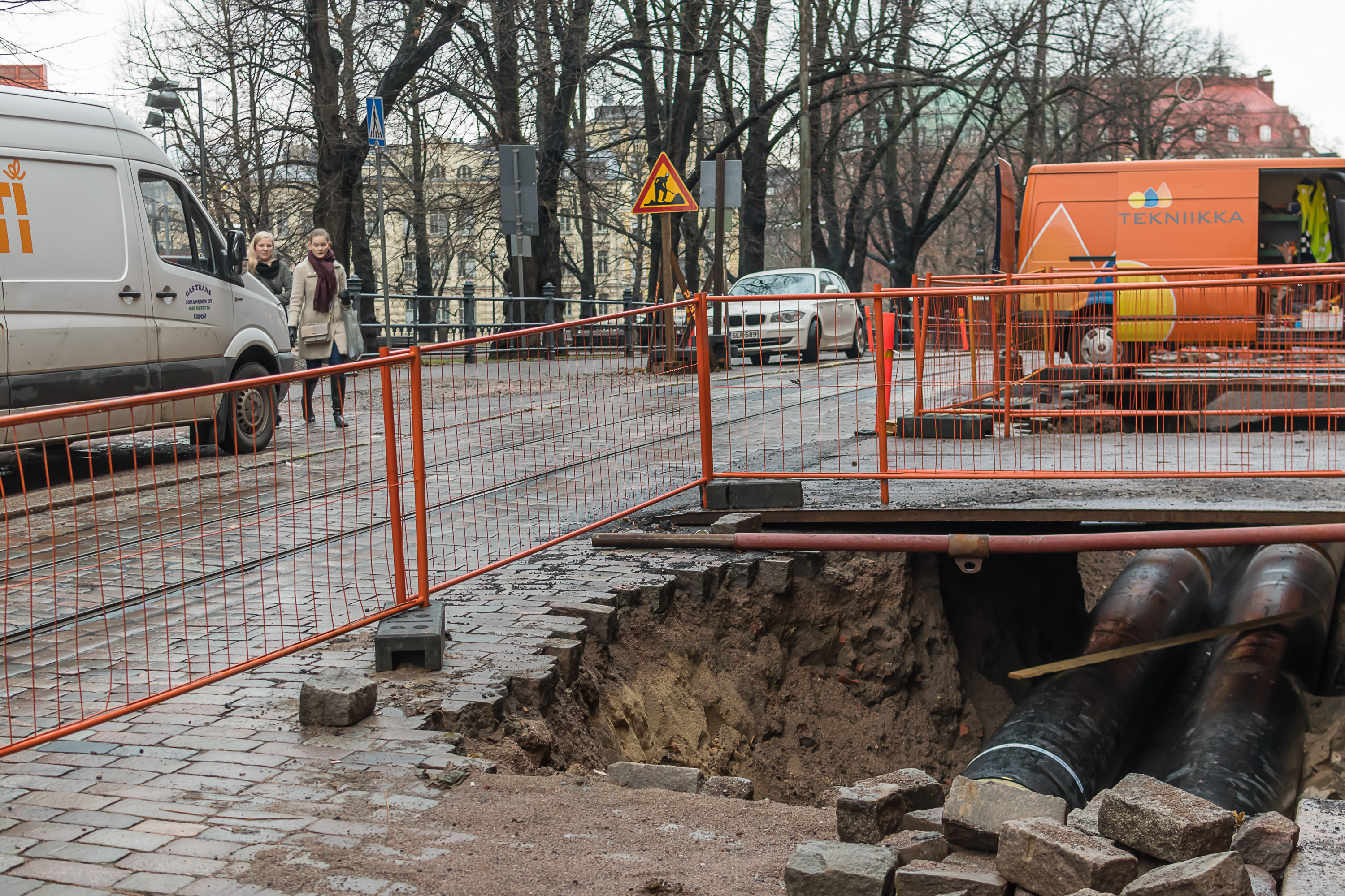
5. Some pipe repairs.
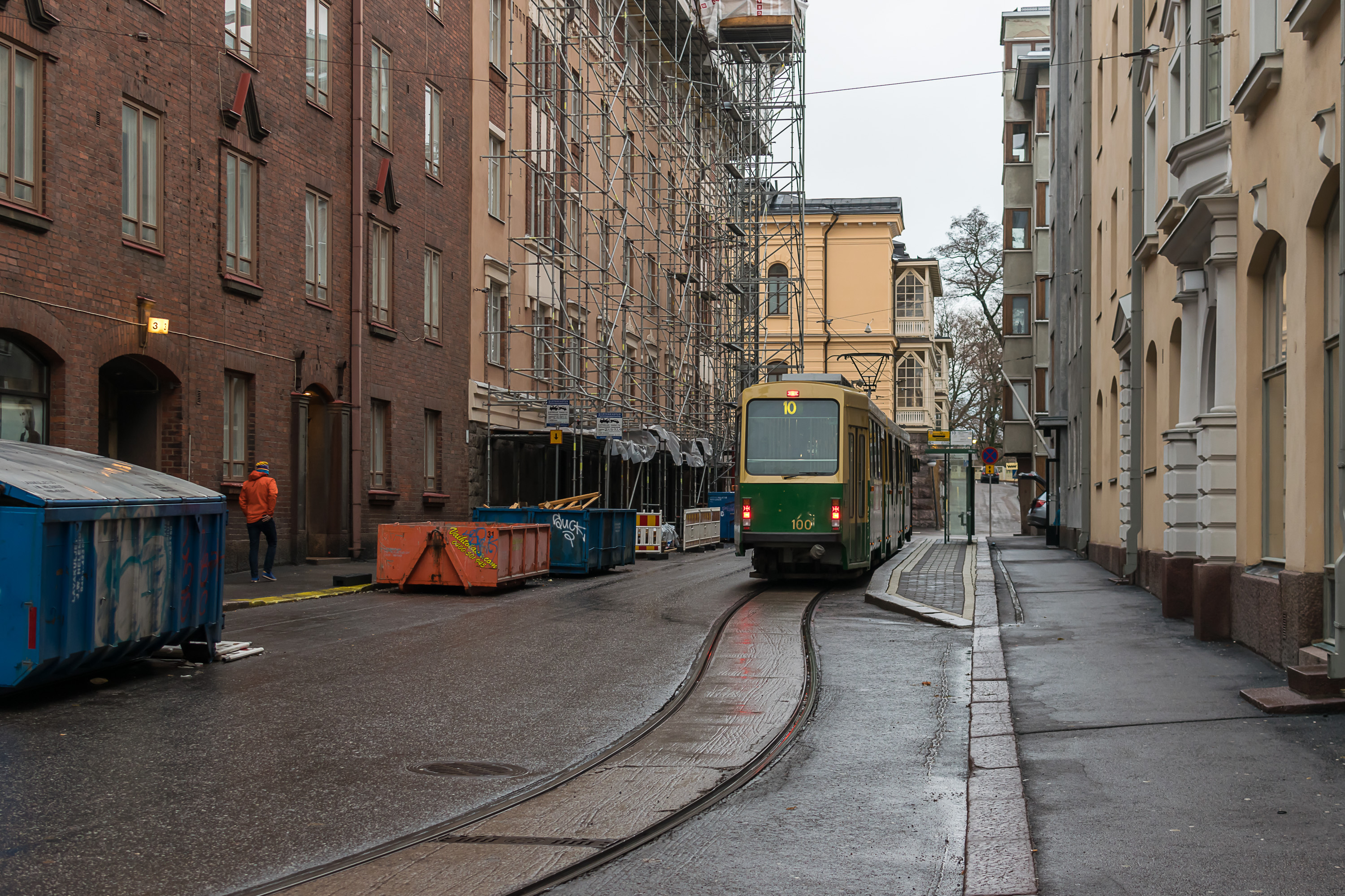
6. Tarkk’ampujankatu Street, with a tram terminus stop. I wonder why the rails curve apparently slightly more than they really need to. The name of this short street is spelled in an unusual way, with an apostrophe; it should have been written as Tarkka-ampujankatu in modern Finnish. That name means Sniper Street, as some old barracks and a shooting range used to be nearby.
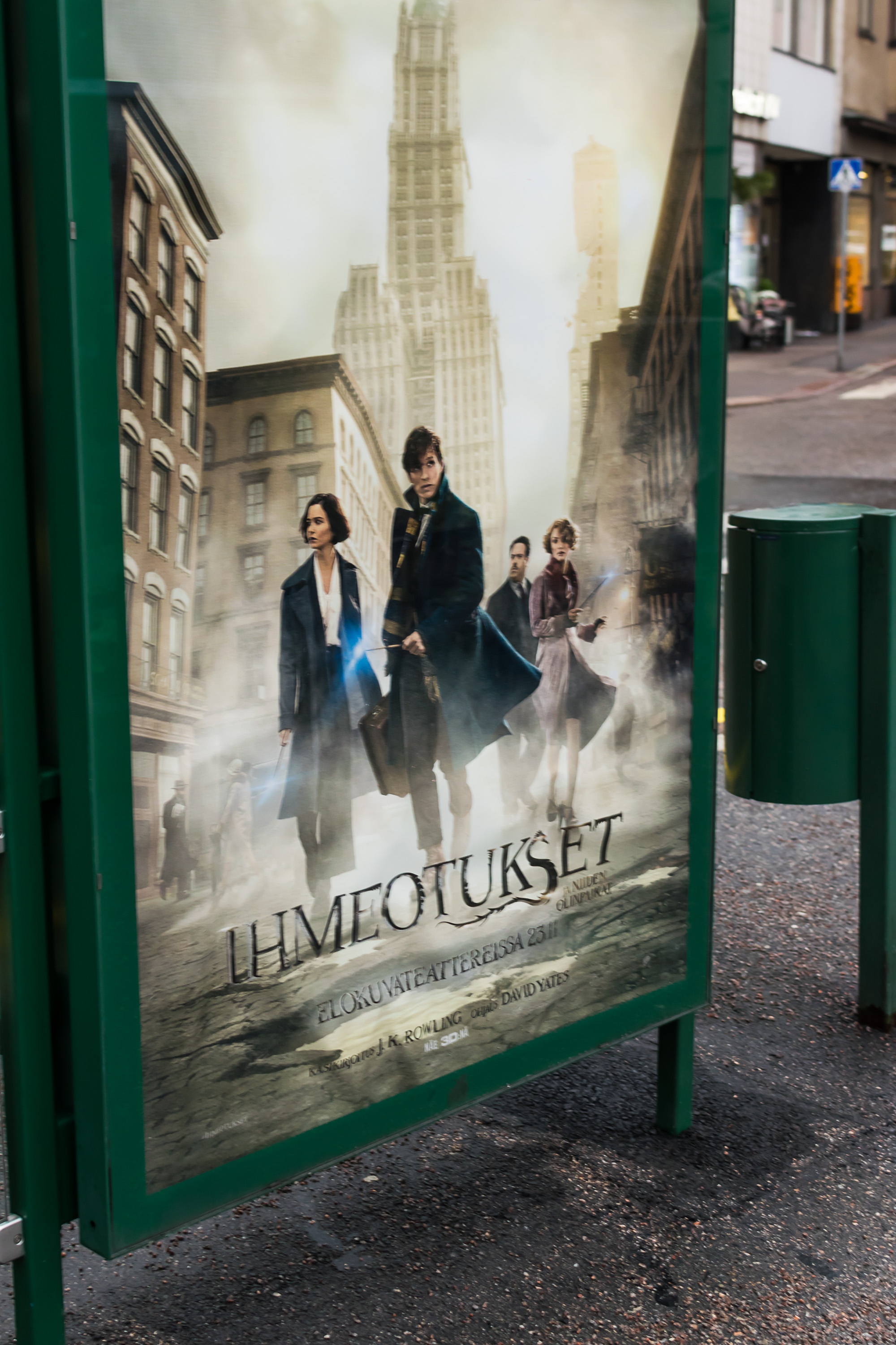
7. Did you like Fantasic Beasts and Where to Find Them? I certainly did! Jacob and Queenie was the best love story ever!
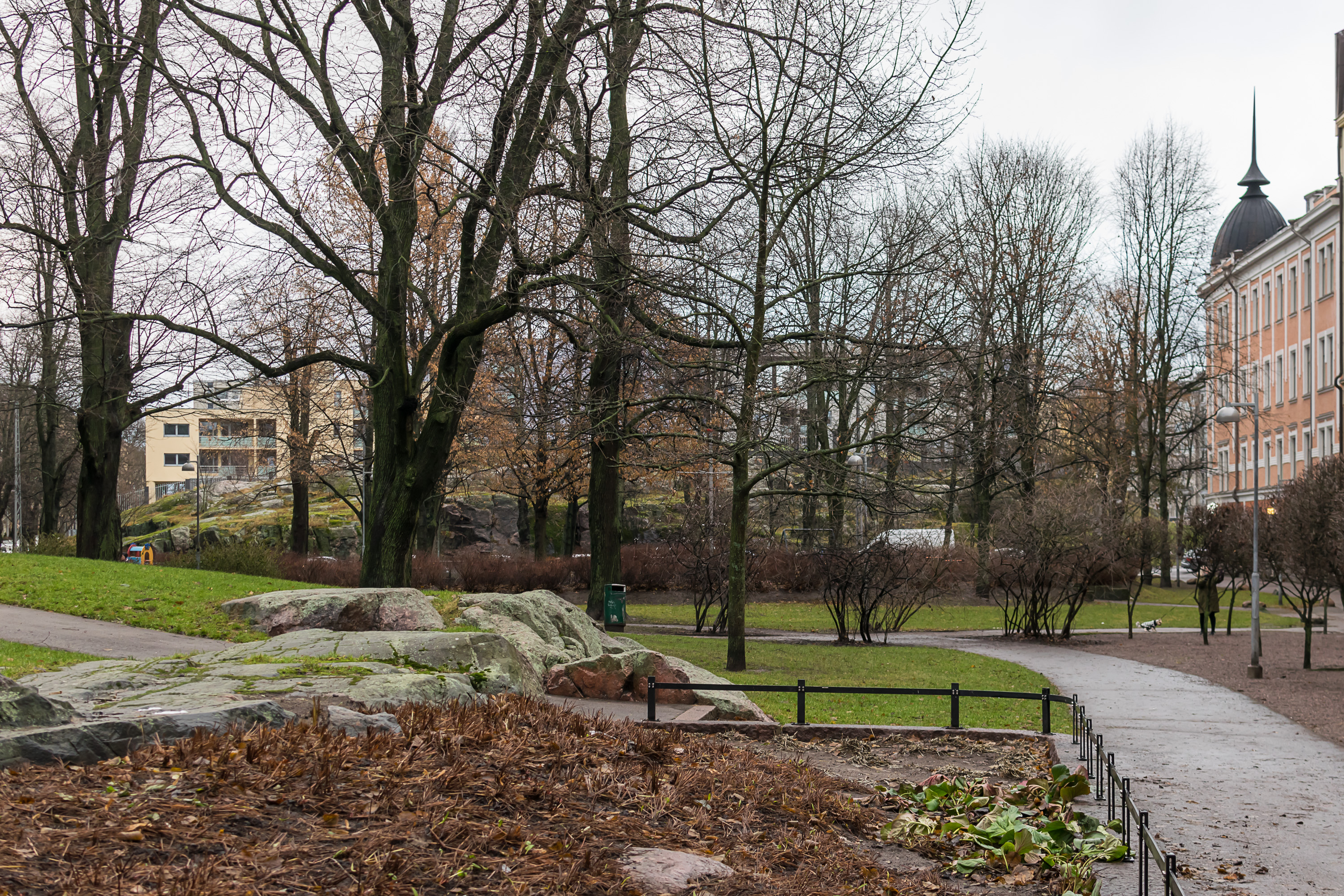
8. Vuorimiehenpuistikko, a small park with prominent rocky outcroppings. The name translates as something like Miner Garden, only “vuorimies” (Finn. Mountain Man) is apparently a more narrow concept than just a miner. Some particular kind of miners who used to enjoy special privileges with regards to taxes and the like, but had to mine and smelt iron for the Swedish Crown in return. Or maybe I don’t quite understand Google’s Wikipedia translations.
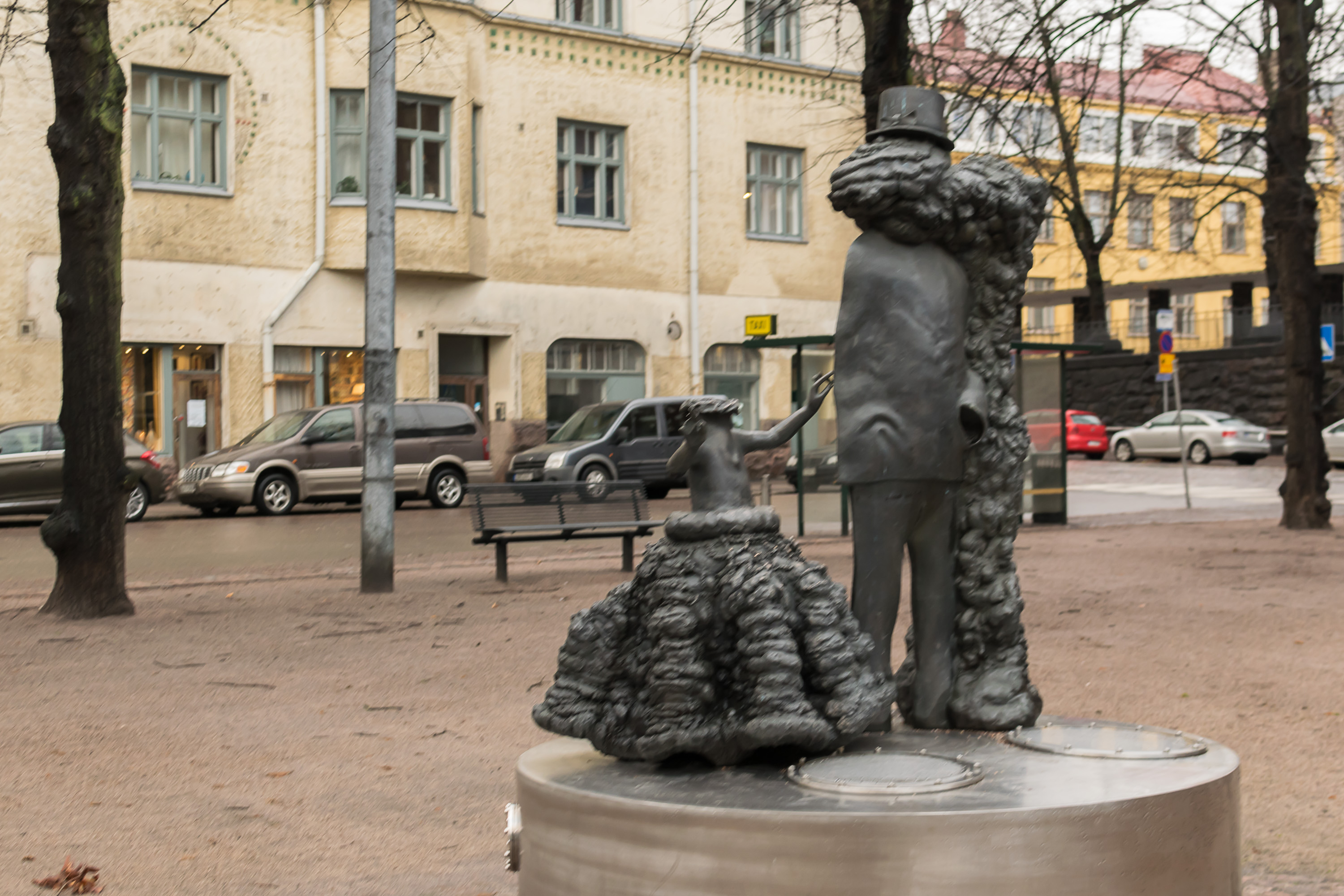
9. In another small park, named Kapteeninpuistikko (Finn. Captain’s Garden), there is a very odd sculpture, apparently of a headless girl, and a man which has something very wrong with him, armless and with some cancerous growth next to him and replacing his head. It’s called “Captain’s Dream”. It’s a work of art by Pekka Kauhanen, a famous modern Finnish sculptor.
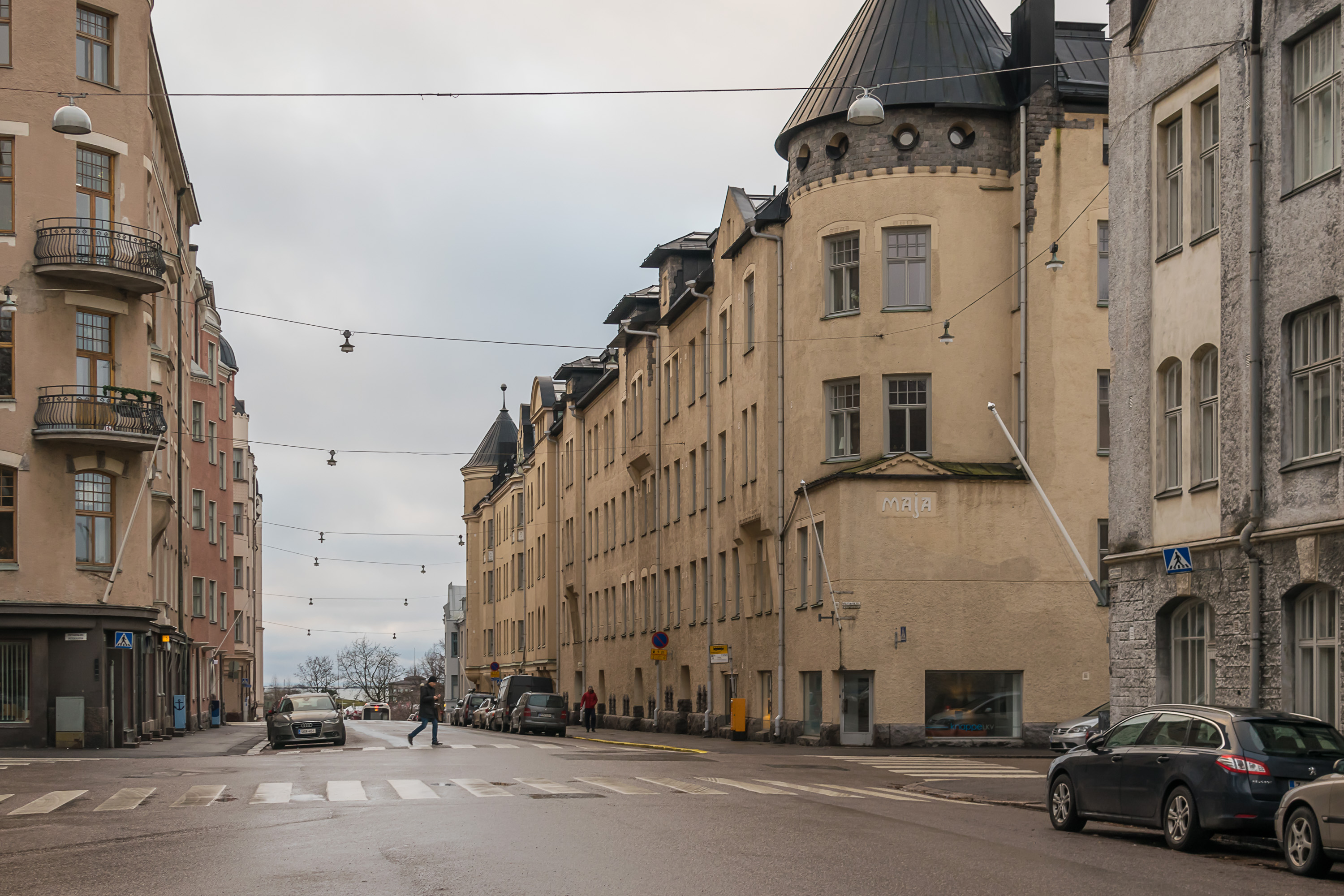
10. The end of Kapteeninkatu (Finn. Captain Street), with a small bit of the sea already visible behind the trees. Much of central Helsinki really looks nearly indistinguishable from St. Petersburg, being designed pretty much by the same architects and all. Apart from road signs and an orange mailbox, this would have looked exactly like some street from Petrogradsky or Aptekarsky Island of St. Petersburg, where I currently live. As for Helsinki, this part of the city is called Ullanlinna (Finn. Ulla’s Castle), after some shore fortifications which were built in the era of Swedish Queen Ulrika, and complemented the Suomenlinna island fortress. No traces of these fortifications currently remain.

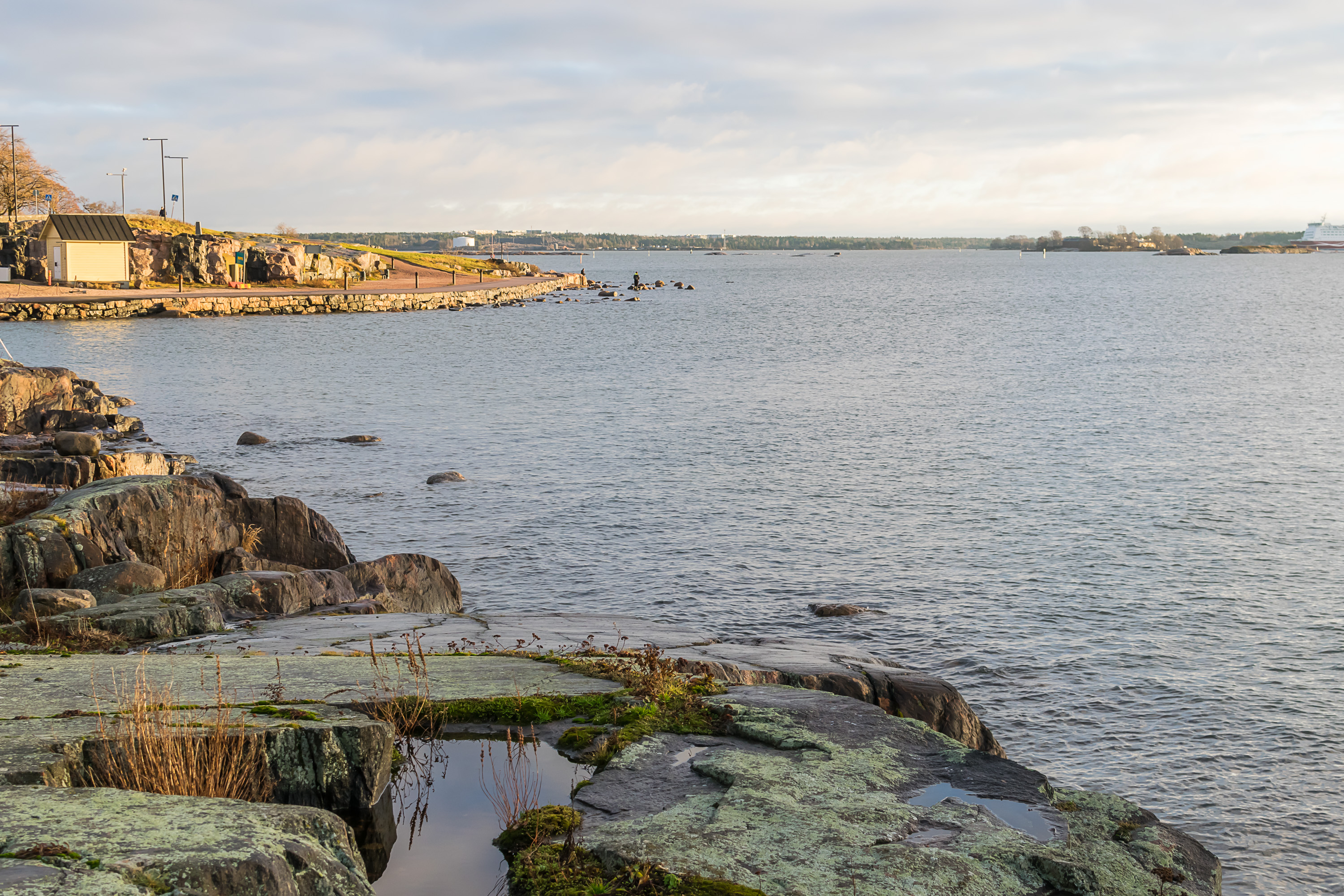
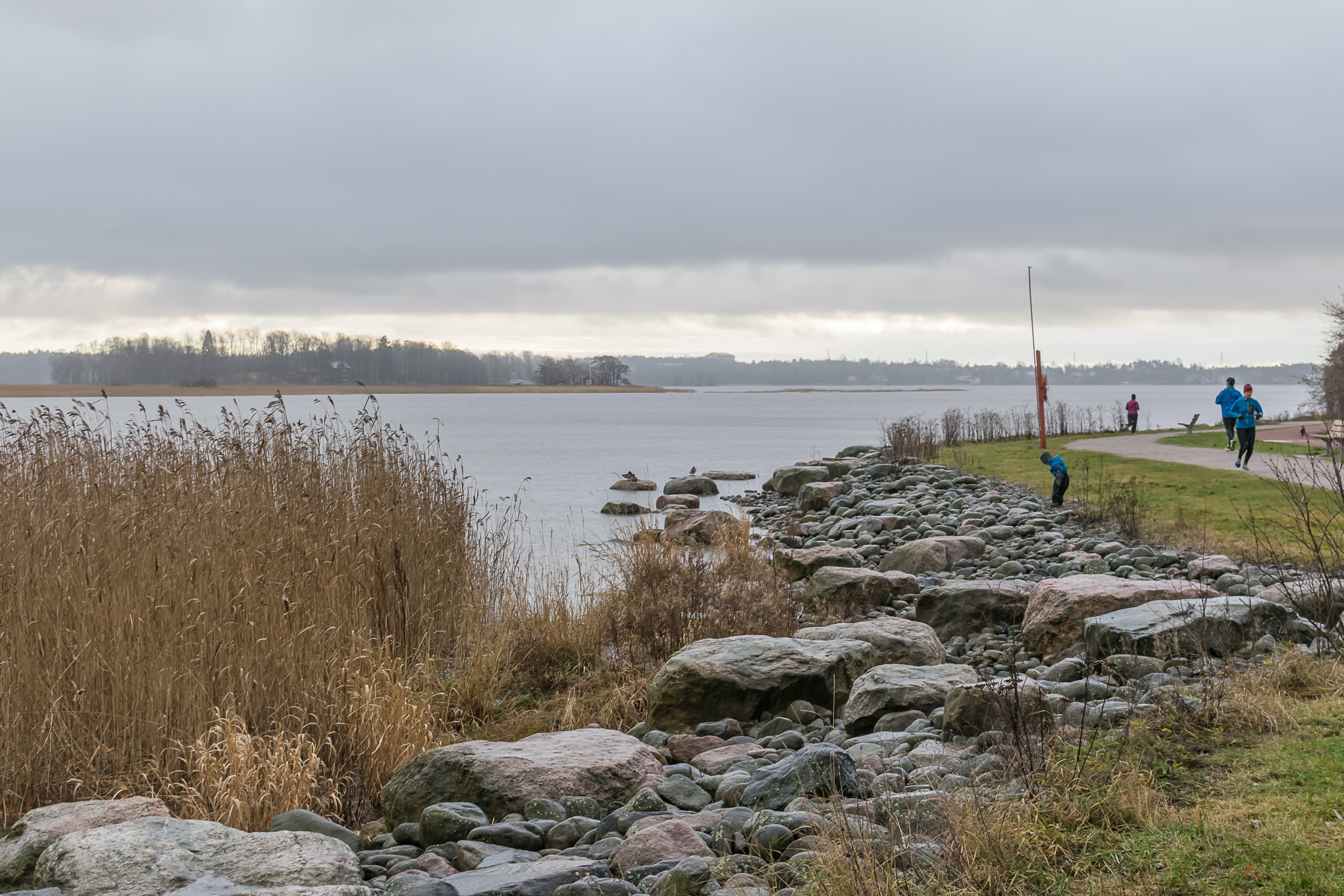
11. Central Helsinki is located on a peninsula, and its southernmost waterfront is called, appropriately enough, Merisatamanranta (Finn. Sea Harbor Coast). There is a marina (to be expected), a nice wide embankment with lots of jogging Finns, and a wide park.

12. This part of embankment is called Kompassitori (Finn. Compass Square). A tiny ferry links it to small Uunisaari isles (Finn. Oven Island), just a hundred meters or so off the coast. I think you’re supposed to lift the red-tipped arm on a white pole to the right, and the ferry will come pick you. It only operates in summer though; from November 15, a pontoon foot bridge is installed instead. No idea why they can’t keep the bridge throughout the year. Maybe it would block the waterway too much, or maybe the ferry’s just kept for sentimental value.
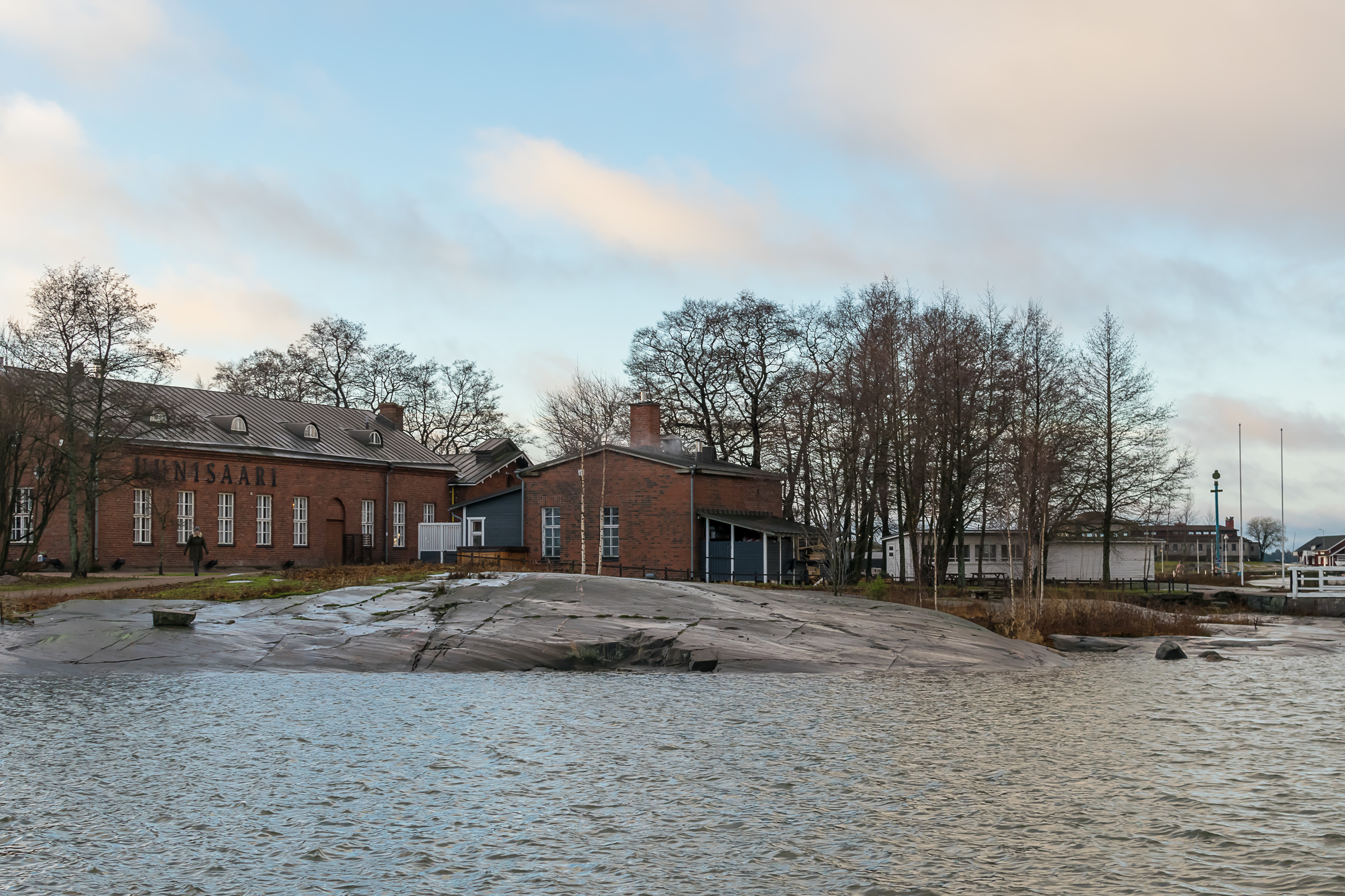
13. So of course I crossed the bridge and had a brief peek of Uunisaari. The island used to hold some smallish factories which manufactured varnish and oil. The red-brick factory buildings are now occupied by a posh-looking restaurant, presumably the reason why there is a ferry line. Being a Finnish restaurant, it even has its own sauna.
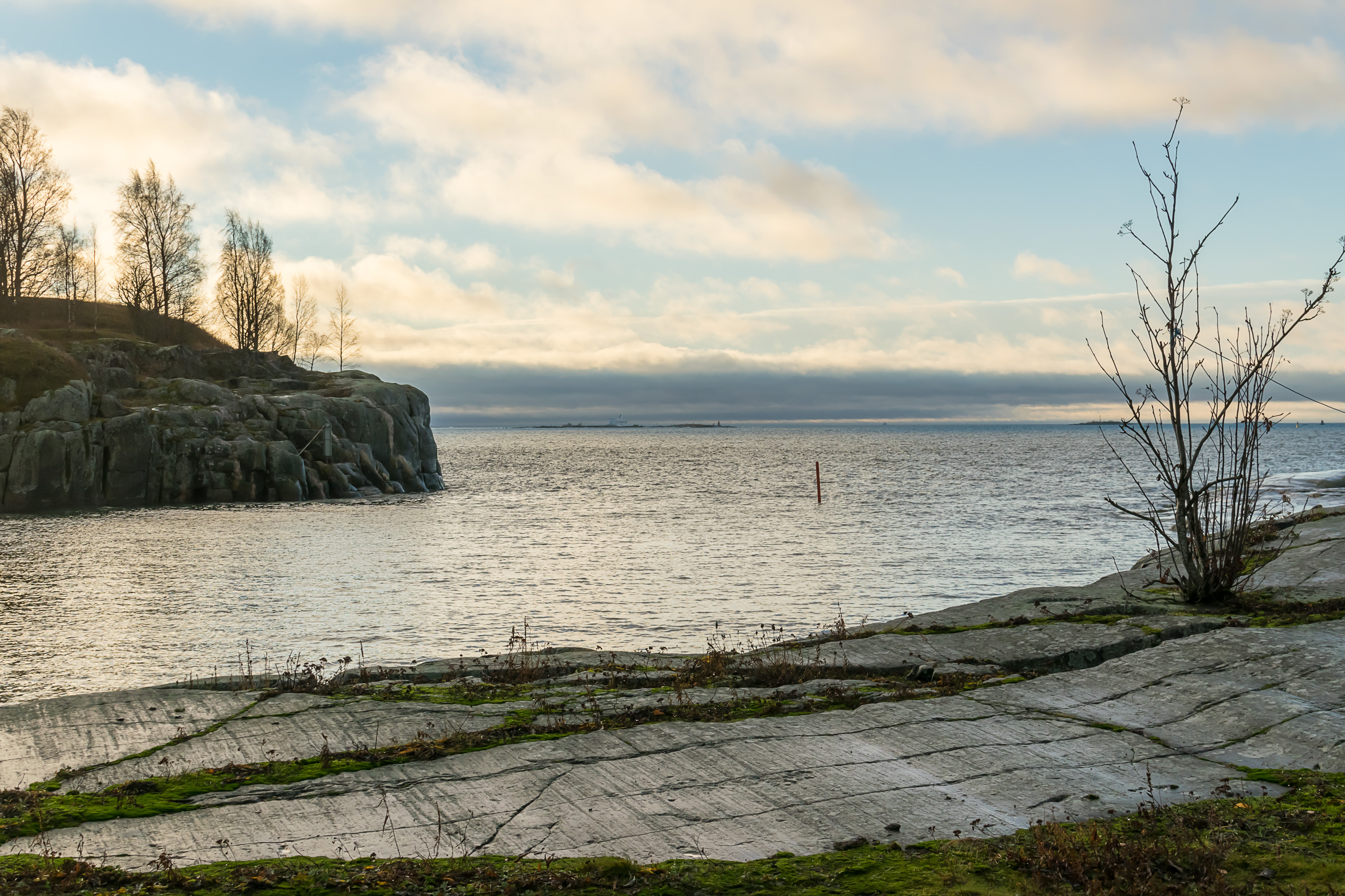
14. Of course the isles are free to roam and you do not need to visit the restaurant at all. There is a beach, some picnic tables, and lots and lots of views of the sea. The bit of ground to the left belongs to Harakka island (Finn. Magpie), significantly larger than Uunisaari. It was used by Finnish Armed Forces until 1989, and still holds the barracks buildings, but now it serves as a nature center, being an unusually huge bird nesting place. It has a museum and a short nature trail, and is connected to the mainland with a cheap ferry.

15. Lots of other minor islands can be seen in the Gulf of Finland in the distance.
16. You can spot the bow of the Mariella ferry (operated by Viking Line) to the right. Huge cruiseferries link Helsinki with Tallinn and Stockholm, and arrive pretty much to the center of the city. I saw two ferries this morning but didn’t get many close angles.
17. Meanwhile, sun has risen and peeks briefly between the horizon and the cloud cover. The day was otherwise almost entirely overcast, and I was glad I caught the “golden hour” in a beautiful location.

18. Back on the mainland, walking between Kaivopuisto Park and the sea. The silhouette in the middle belongs to another ferry, Silja Symphony (operated by Tallink-Silja), arriving from Stockholm.
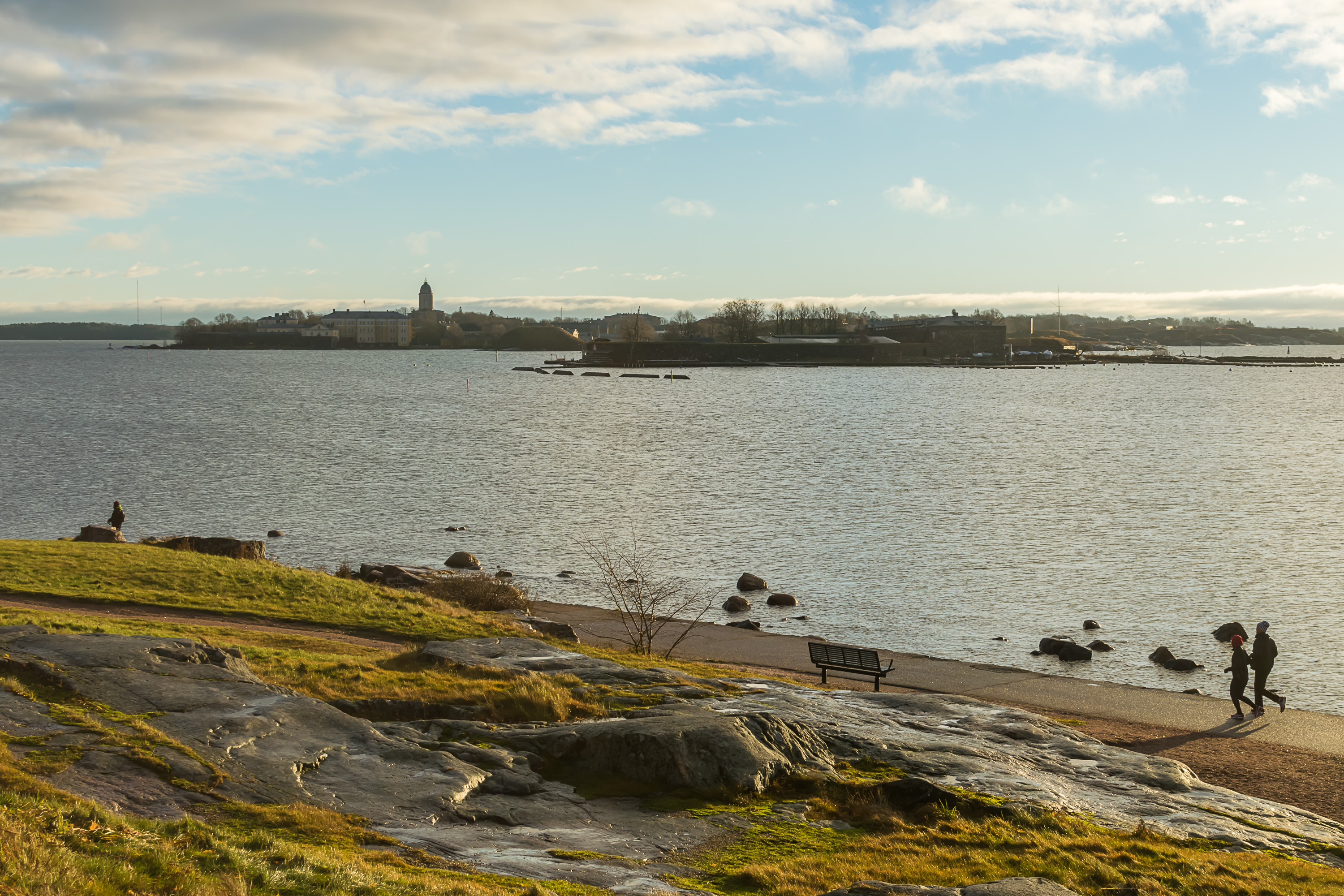
19. And these islands are of course nothing else but Suomenlinna sea fortress (Finn. Finnish Castle, literally), probably the best known Helsinki sight. Suomenlinna is normally linked to the mainland with a ferry line, but there is a relatively little known underwater tunnel, which starts in Kaivopuisto Park and more or less follows line of sight in this picture. The tunnel is quite narrow, and is not open for public; it is meant for cables, pipes, and other communications, and also for emergency vehicles.
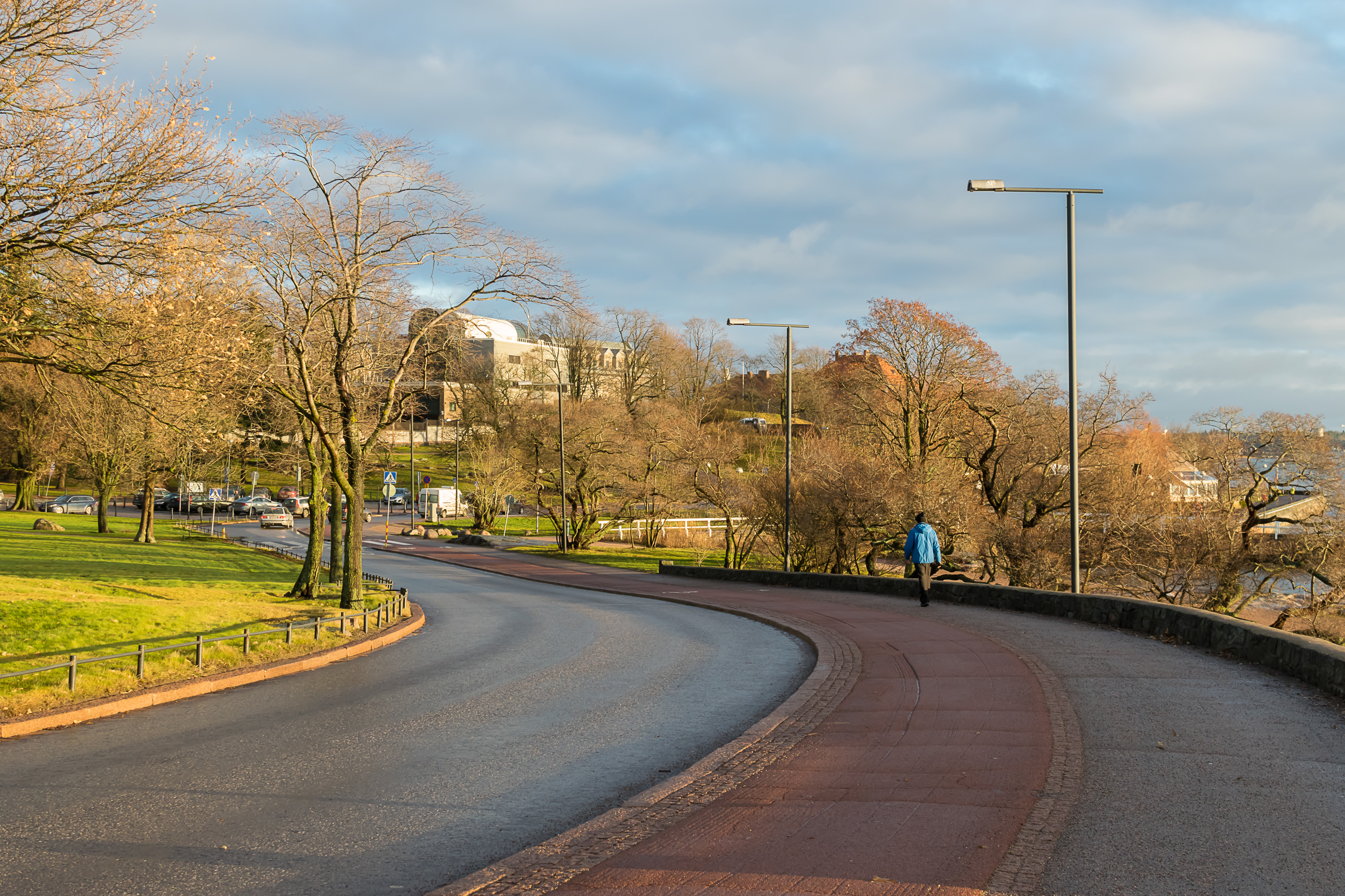
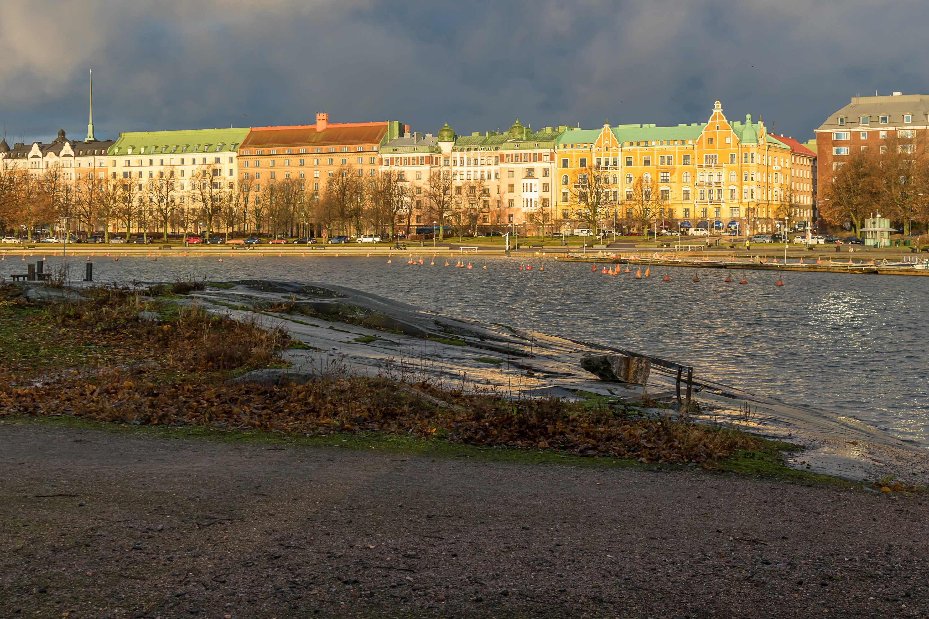
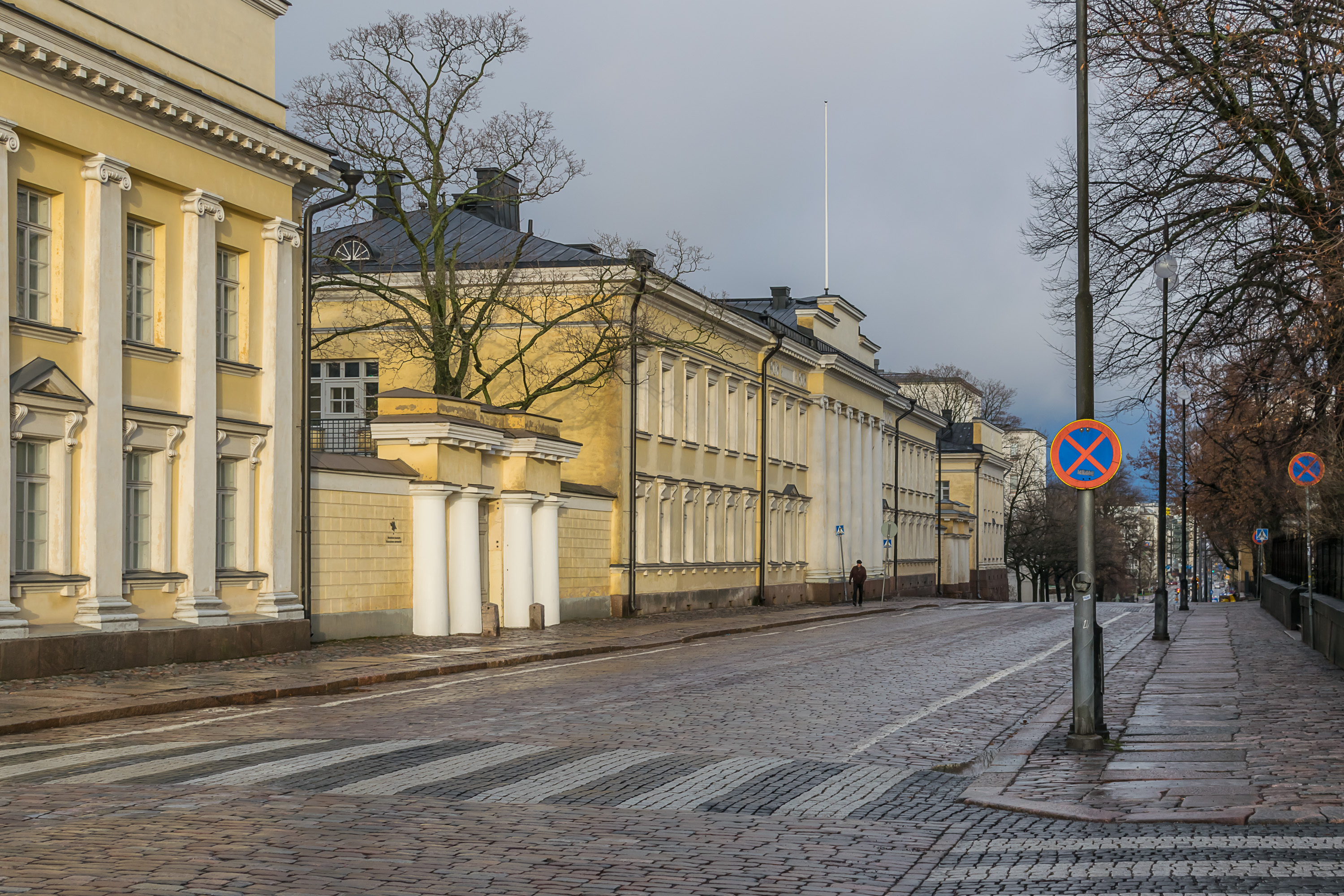
20. Kaivopuisto Park is to the left. The street along the park is named Ehrenströmmintie (Finn. Ehrenström Road), after Johan Albrecht Ehrenström, the man who designed Helsinki city plan after Helsinki (which had been a pretty small town before) became the capital of the Grand Duchy of Finland following its annexation by the Russian Empire in the early 19th century.
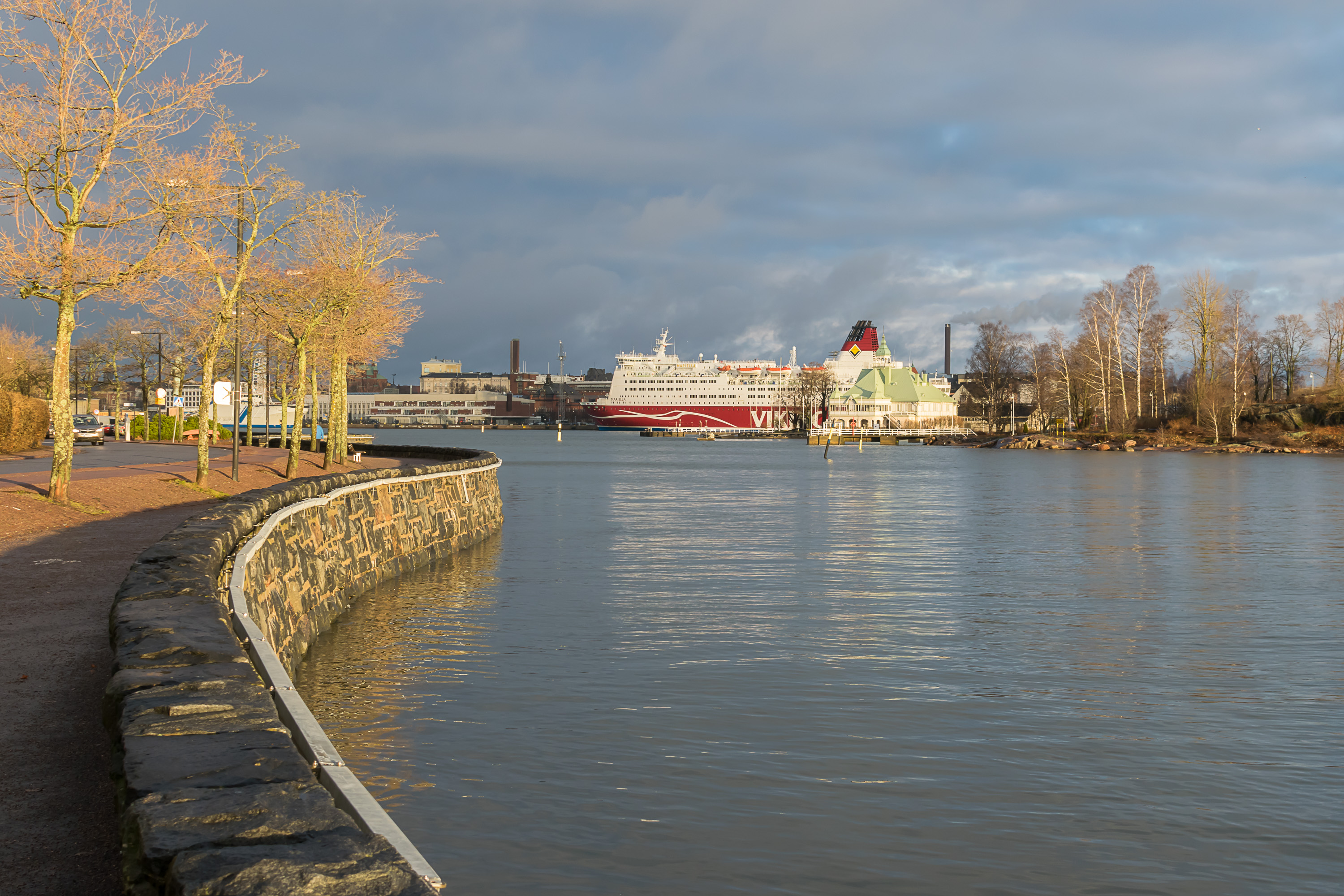
21. Mariella has already moored at the Viking Line terminal on Katajanokka (Finn. Juniper Cape). The pretty building in front of Mariella is Nyländska Jaktklubben, an old yacht club. It is located on Valkosaari (Finn. White Island), yet another Helsinki islet.
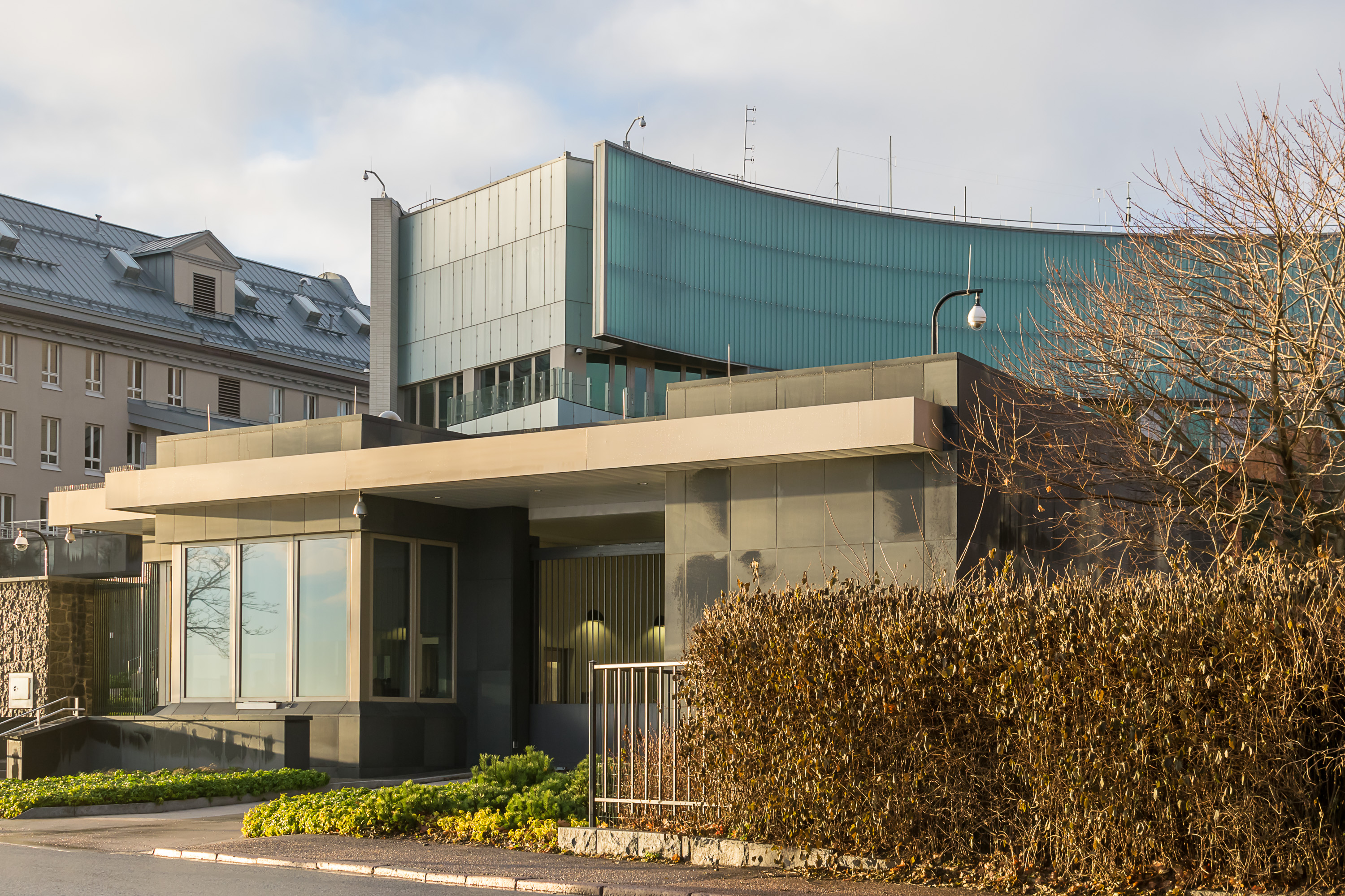
22. The US embassy kind of looks like a small fortress. You’d think the Americans would feel safer in what is pretty much the most peaceful country in the world.

23. There were lots of jogging Finns (in fact I kept seeing lots of jogging Finns throughout that day), and I originally assumed the running girl statue is also about jogging. It is actually meant to symbolize Finnish-Russian cooperation. A dead gull was floating in the tiny decorative harbor.
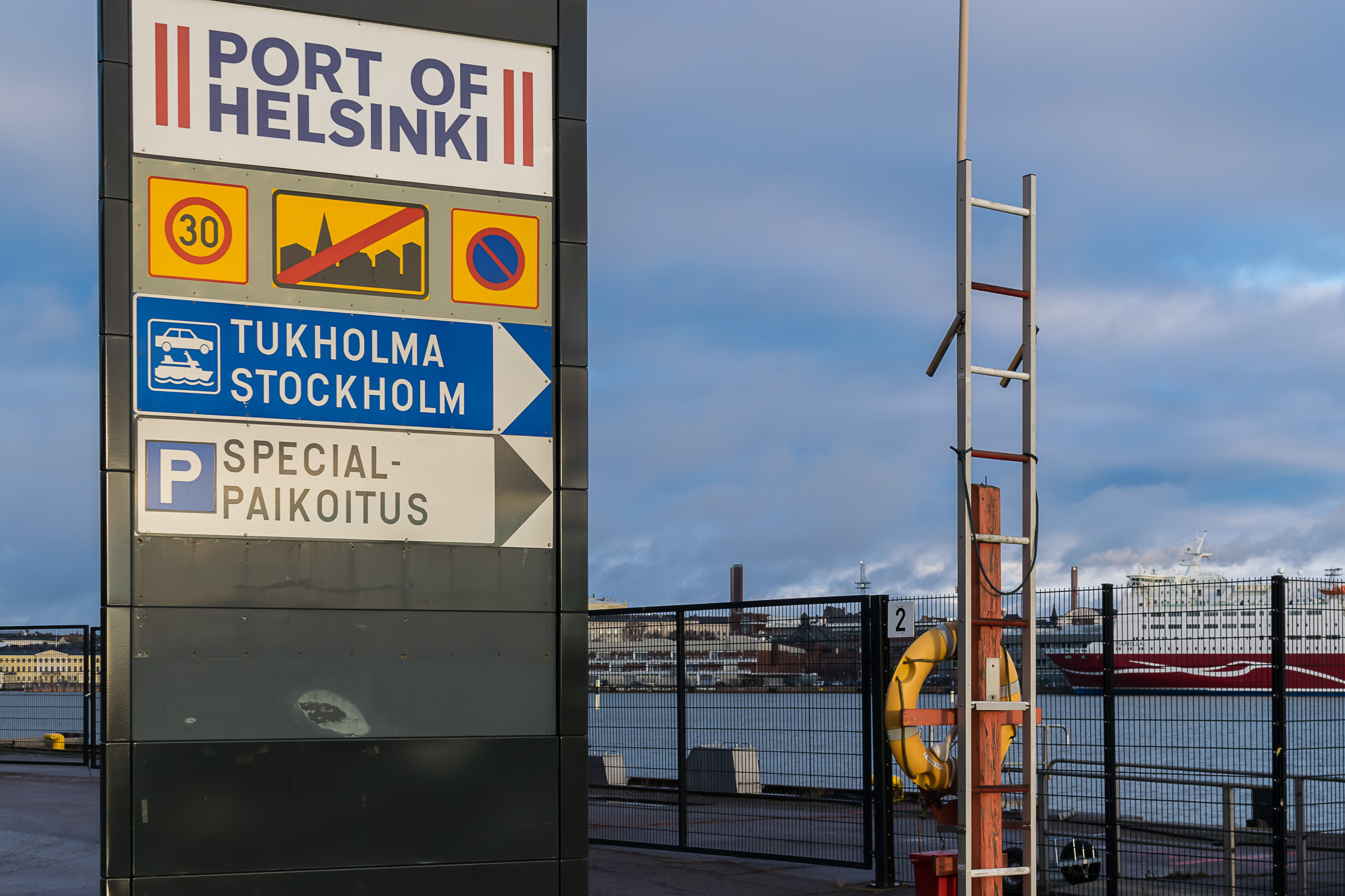
24. Walking past one of the ferry terminals, this one belonging to Tallink-Silja.
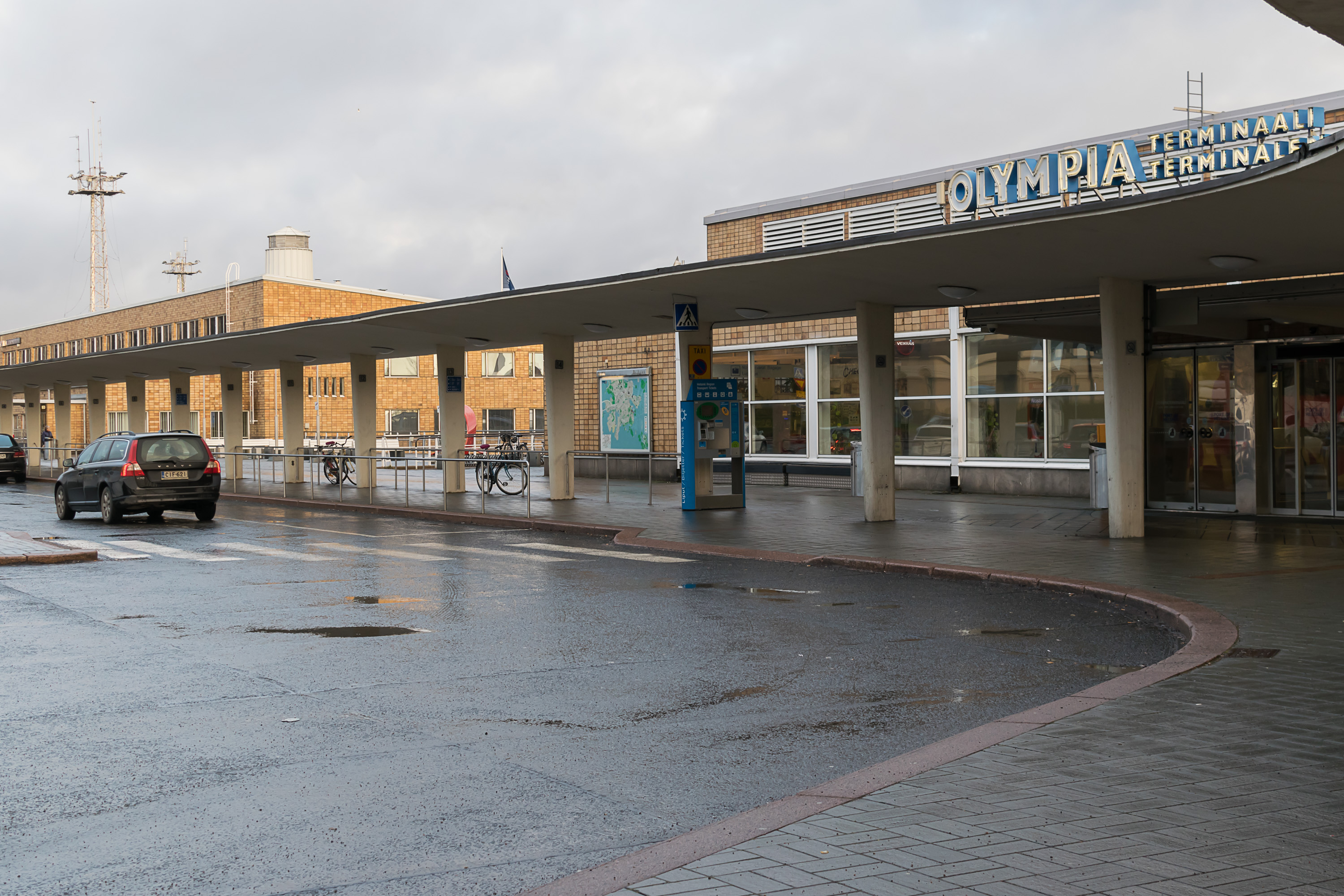
25. The terminal is named Olympia, as it was constructed for the 1952 Olympic Games, held in Helsinki.
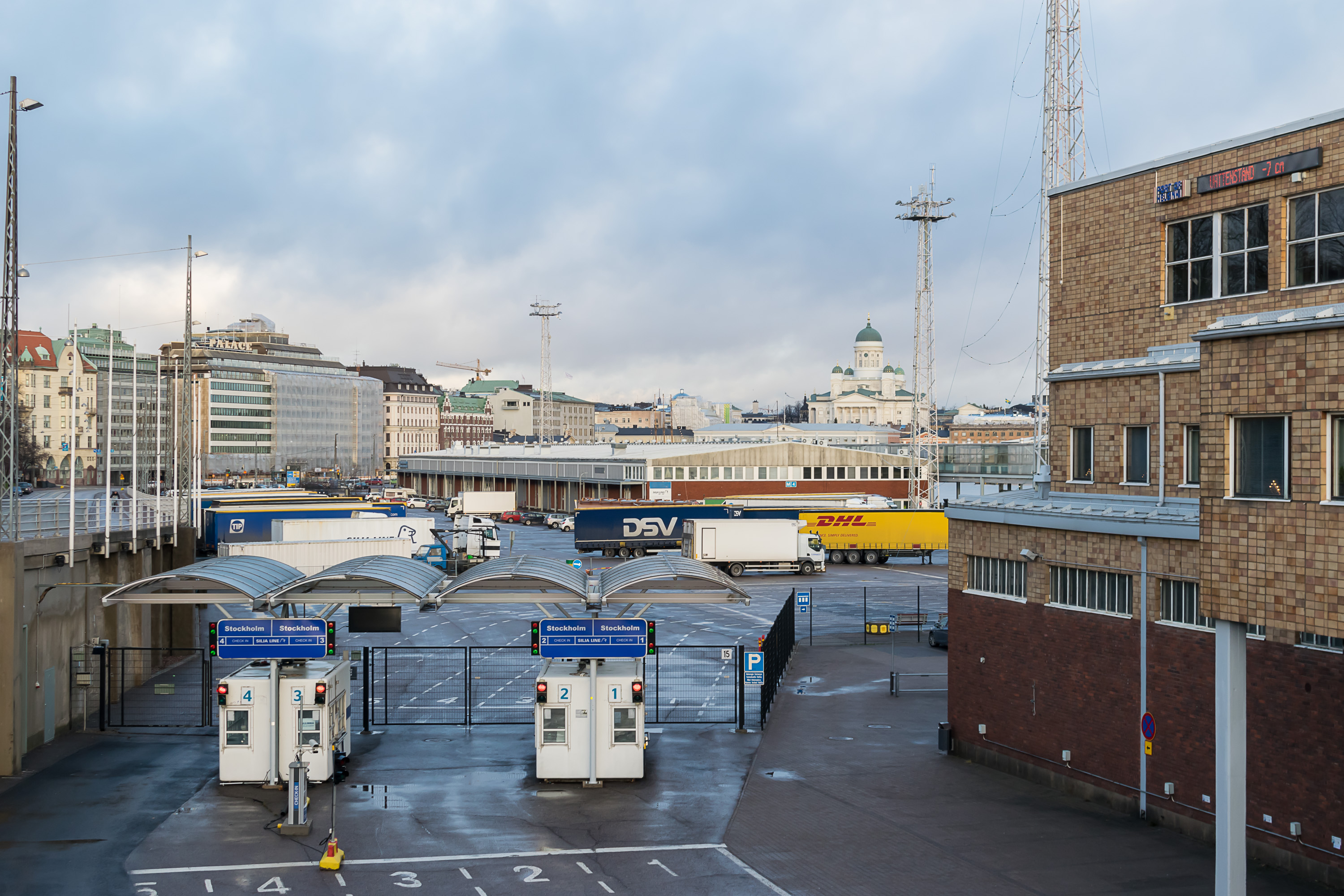
26. The terminal, squeezed between the sea and the rocky mainland, bears some similarity to Stockholm Stadsgården Terminal. I travelled from Turku to Stockholm to Stadsgården Terminal three times, but so far I have never sailed anywhere from Helsinki.
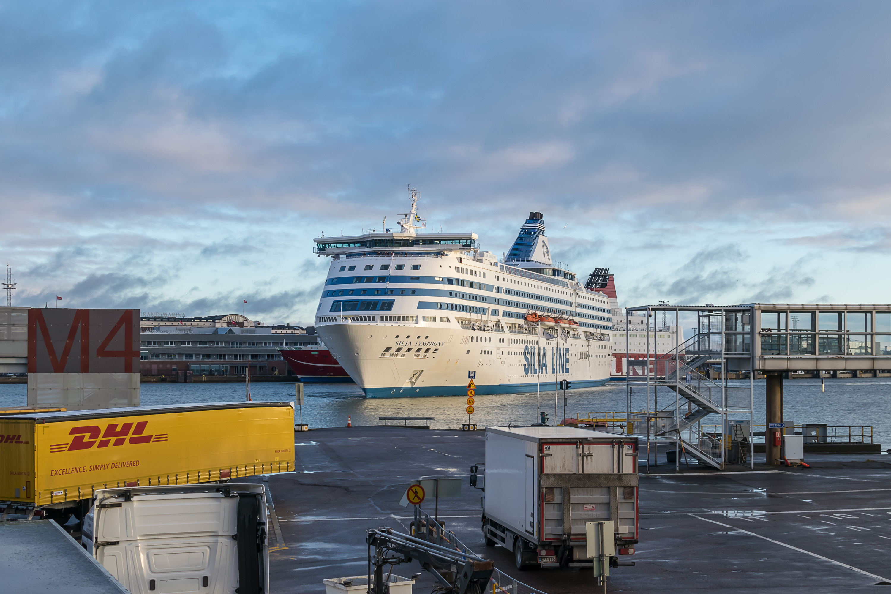
27. Silja Symphony is incidentally just about to moor. Too bad it was obscured by the terminal constructions throughout most of the mooring.
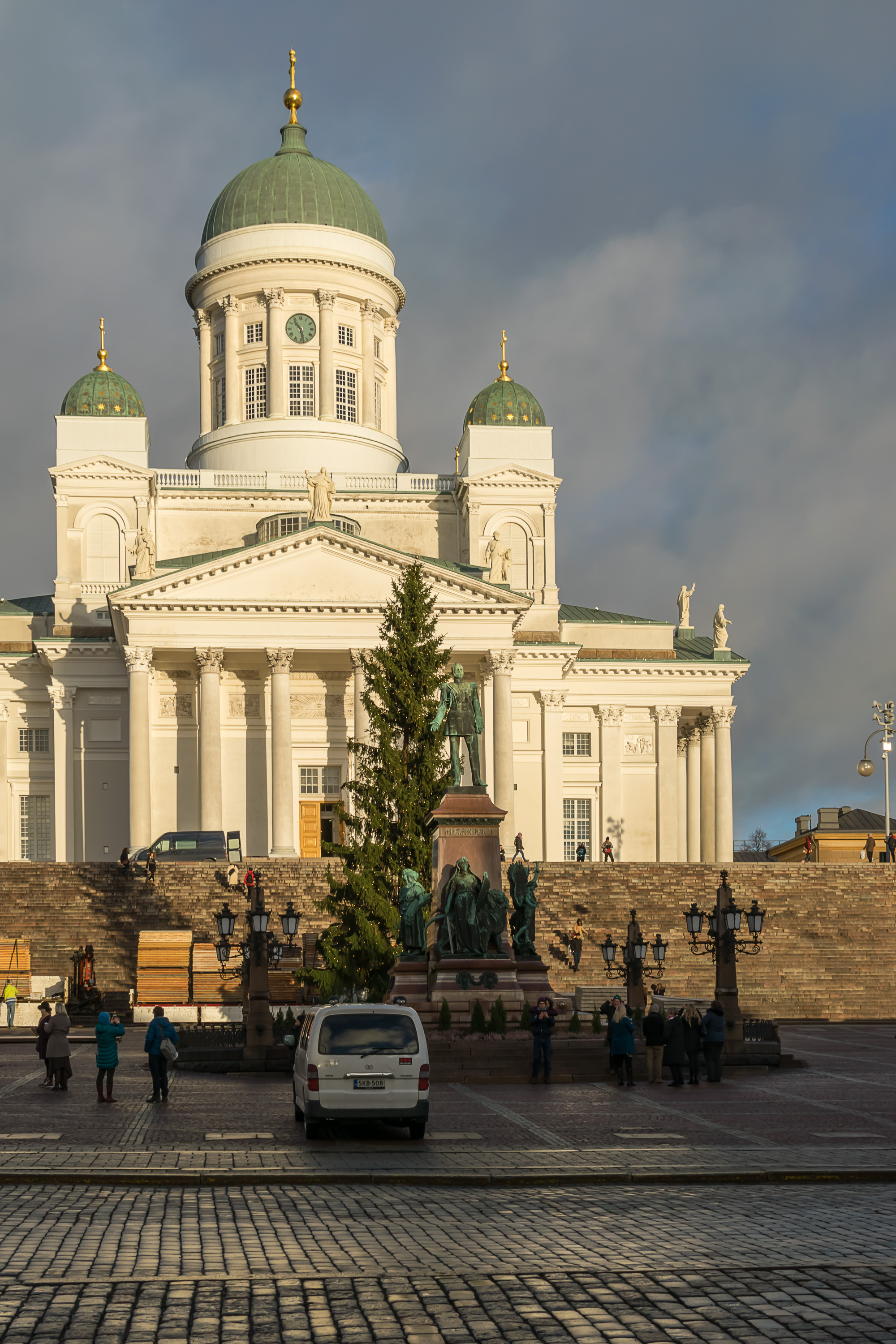
28. At Kauppatori Square I left the waterfront for quite a while. I didn’t take many pictures of the very center of Helsinki. A Christmas tree was already present on Senaatintori (Finn. Senate Square, the central square of Helsinki). I had read in the news that the tree was donated by an ordinary person from Itä-Hakkila neighborhood in Vantaa suburb, who had always felt that the fir tree in his backyard had grown too big anyway. Citizens donating the Christmas tree to the city is such a cute custom.
29. Unioninkatu Street (Finn. Union Street) behind the Senaatintori, another view that could be easily mistaken for St. Petersburg. The name refers to the union of the Grand Duchy of Finland and the Russian Empire.

30. Kaisaniemi Park to the north of the city center (Finn. Kaisa Cape, after a woman who owned a restaurant here long ago) has some funny garbage bins, with solar panels embedded in the top (not really seen here). As far as I could Google, these garbage bins have solar-powered trash compactors inside, which allows them to be emptied much less often (up to seven times less, supposedly) than usual garbage bins. This in turn allows to save on labor costs; keep in mind that labor is generally the most expensive thing in the Nordic countries. With each bin costing several thousand euros, the economy still seems counterintuitive, but apparently these US-made BigBellies have been rather popular around the world lately.
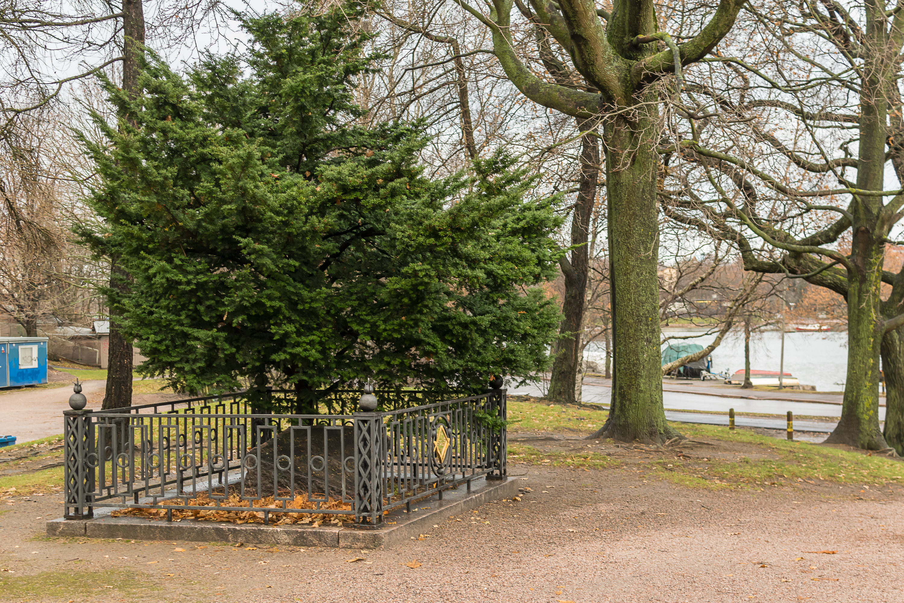
31. There is an odd lone gravestone under a tree in Kaisaniemi Park, known as Freemason’s Grave (Vapaamuurarin hauta), due to masonic symbols drawn on it. The person buried here is a Swedish colonel (and a knight) named Fredrik Granatenhjelm, who died in 1784 and specifically requested from King Gustaf III to be buried in this spot, outside church grounds, which had been rather exceptional at the time. It is not really known for sure whether he had actually been a Freemason himself. Nonetheless this grave is the oldest known public memorial in Helsinki. Again, remember that before the 19th century it had been a fairly minor town, only really significant as the site of Suomenlinna/Sveaborg fortress.
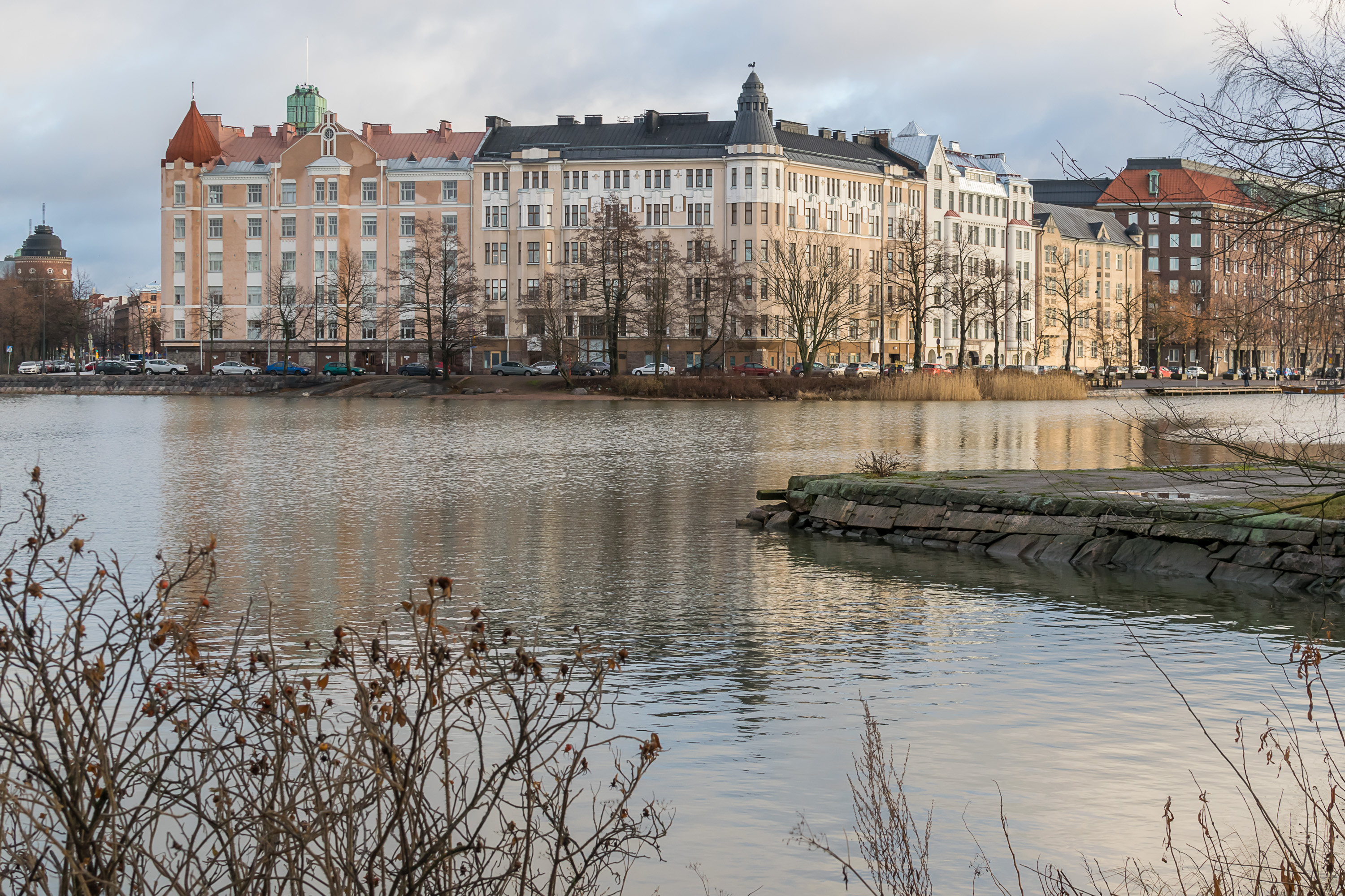
32. By that time the sky became mostly overcast again, and it remained this way until the sunset hours. A deep bay cuts though most of the peninsula containing central Helsinki. The part of the city behind the bay is named Hakaniemi.
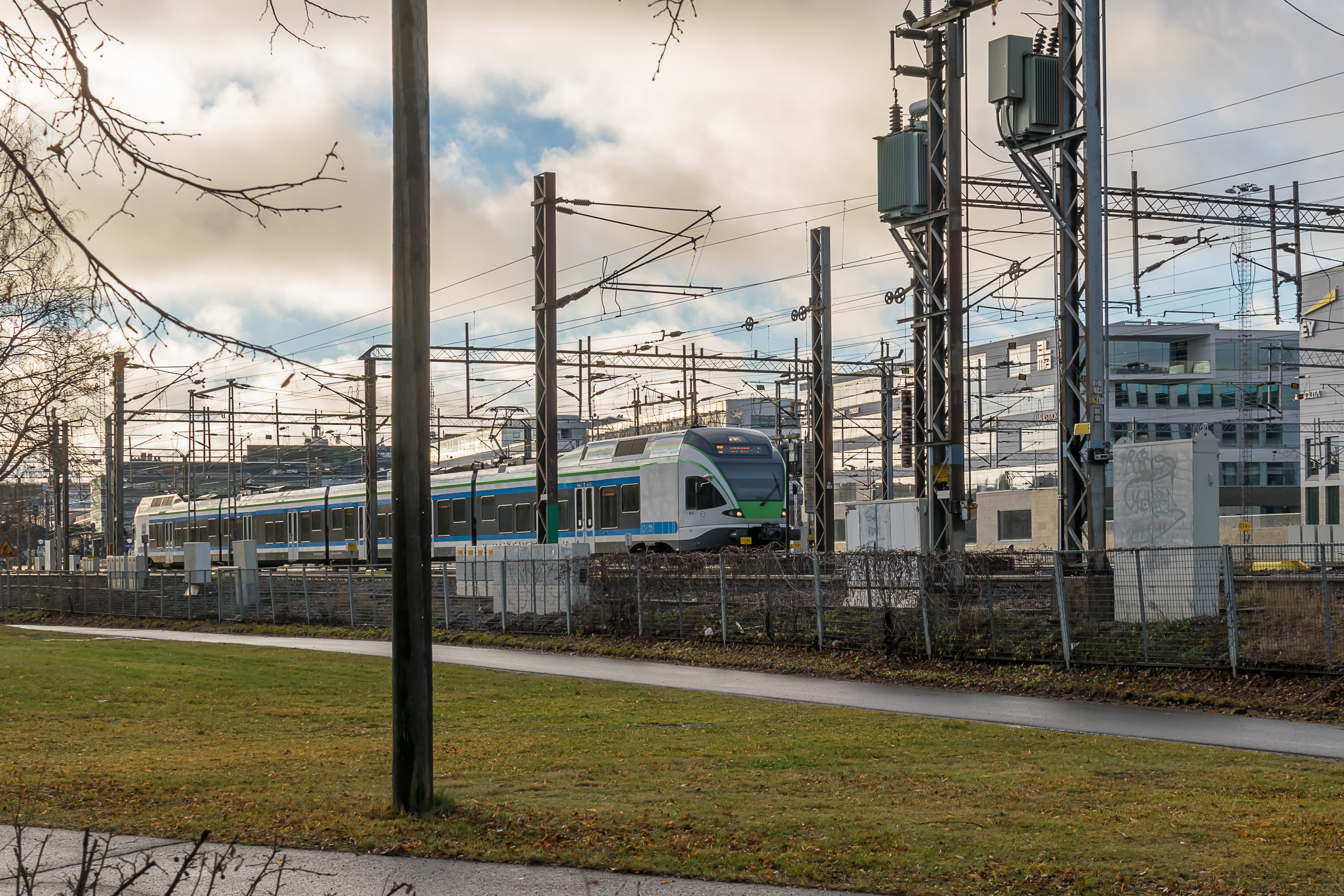
33. The pathway from Kaisaniemi Park farther north is squeezed between the water and the railroad. Suburbans trains come and leave from Helsinki Central Station pretty much every minute or two.

34. The bay, which as far as I known doesn’t have any single name, continues under the railroad as a narrow channel, and ends as Töölönlahti Bay on the other side. Ducks are very common in all inner water bodies of Helsinki, but near the mouth of this channel you can also see actual swans. These are pretty huge birds, seen up close. The swan is the national bird of Finland, by the way; the whooper swan, to be precise. I’m not sure whether these are whooper swans or mute swans.
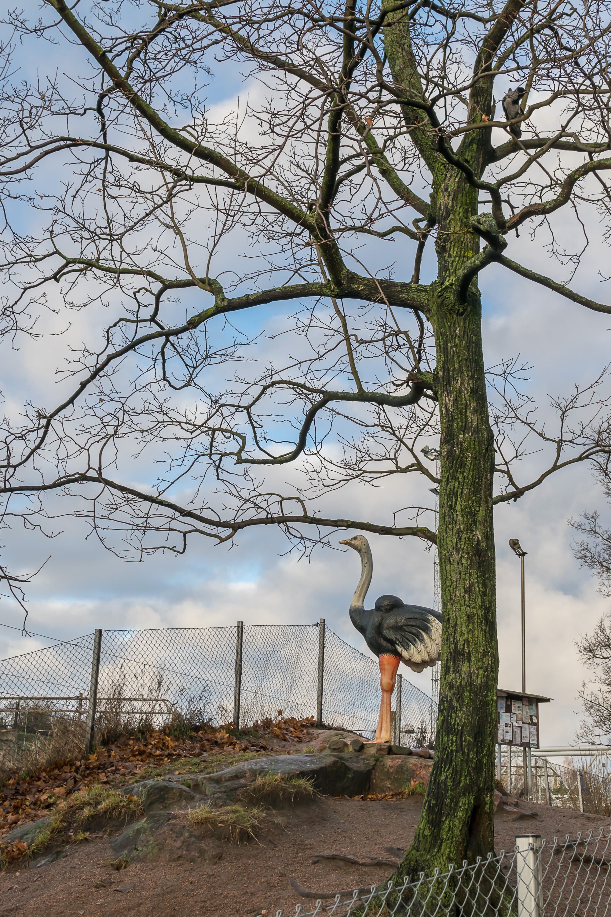
35. The small park on the other side of the bay is named Tokoinranta. There is a dog park on a rocky hill in Tokoinranta, which for some odd reason has a rather large ostrich statue.
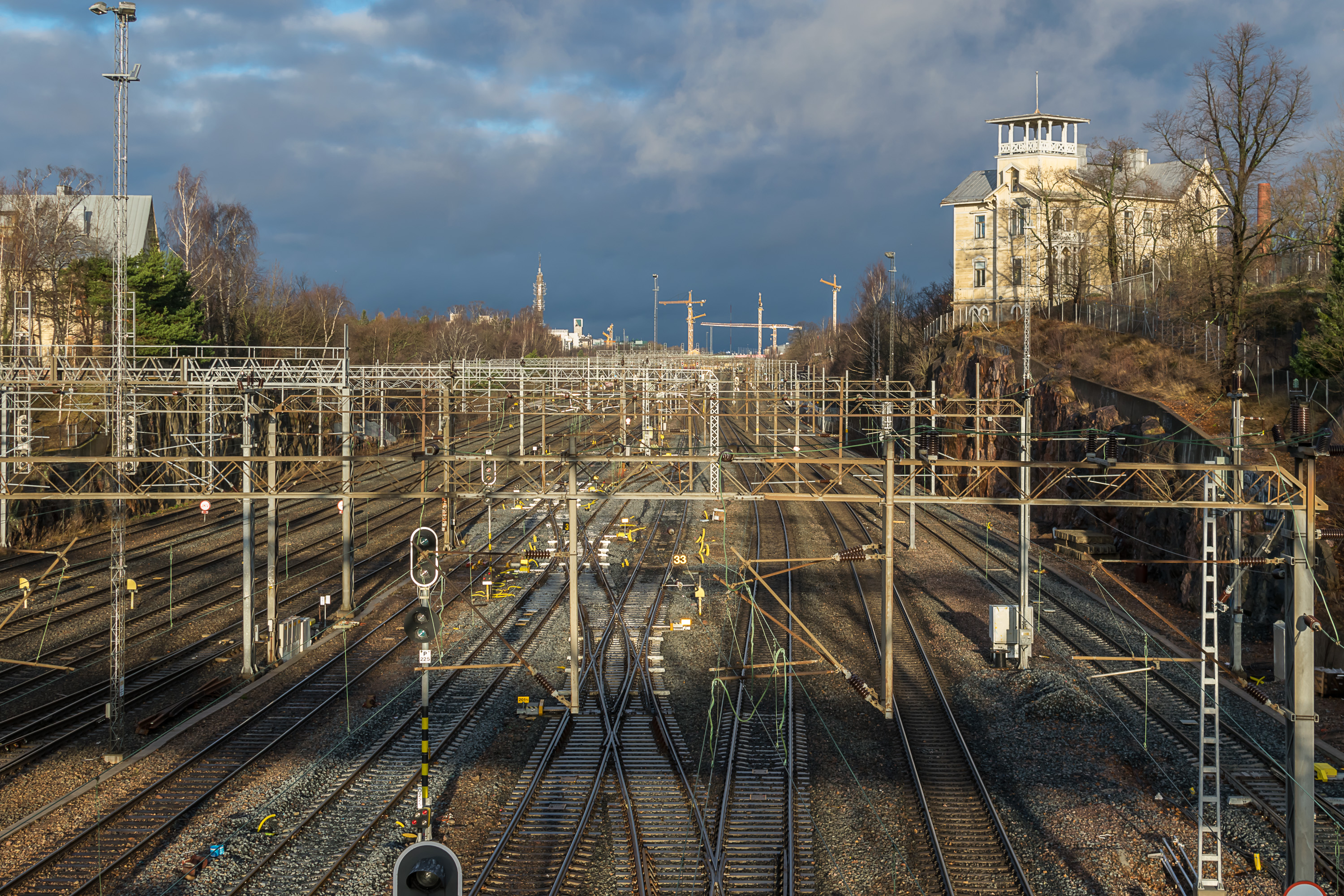
36. A foot bridge connects Tokoinranta with Linnunlaulu (Finn. Bird Song) area on the other side of the railroad. It’s a perfect place to see the huge number of railroad tracks going to the Central Station.
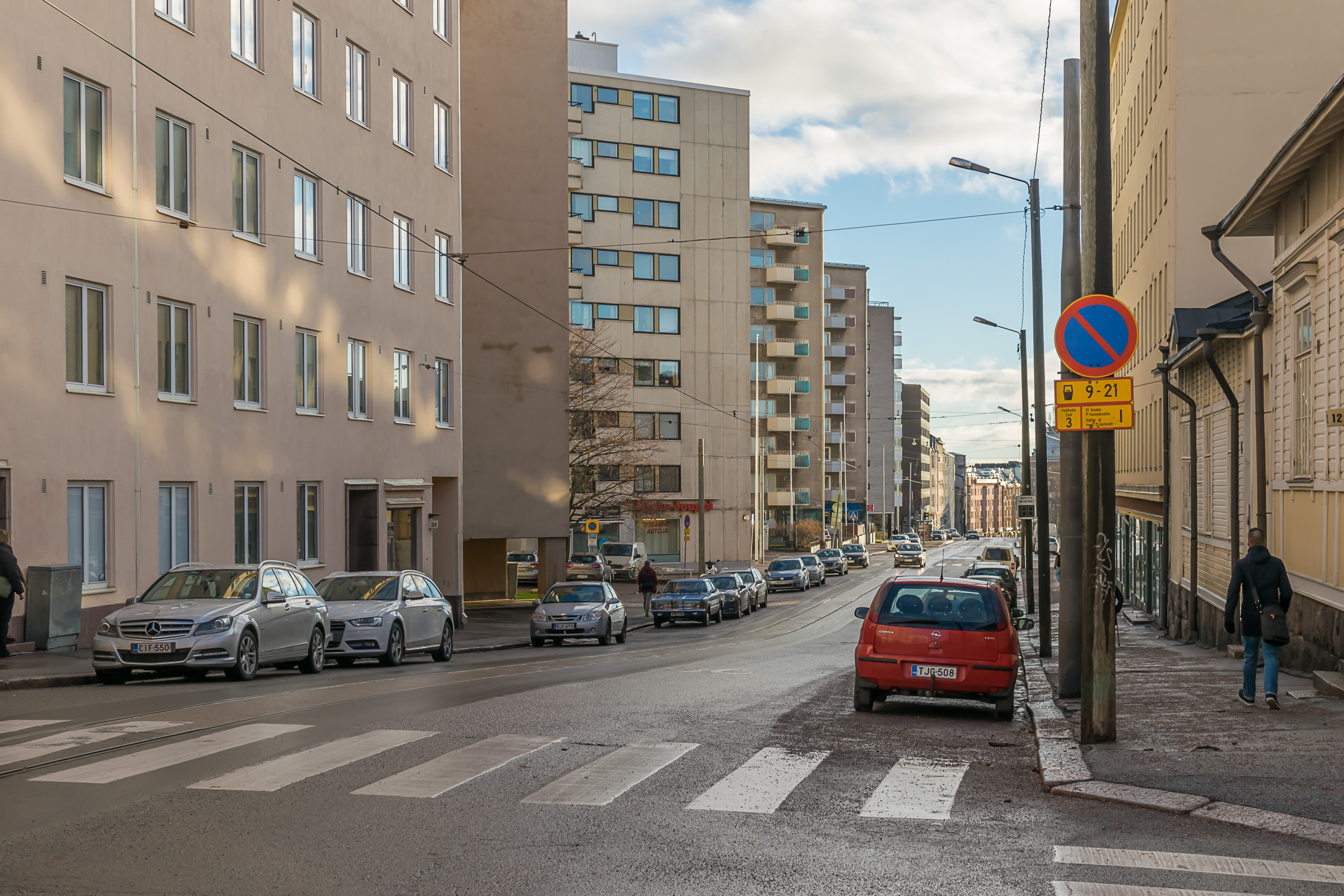
37. Walking to the northeast away from the railroad. This part of the city is named Kallio, meaning simply “Rock”. The usual residential blocks begin to prevail here, although there still are some old buildings here and there. The street is named Toinen linja, “Second Line”. Apparently there are a few streets designated as sequential “lines” in Helsinki, the same as in St. Petersburg.
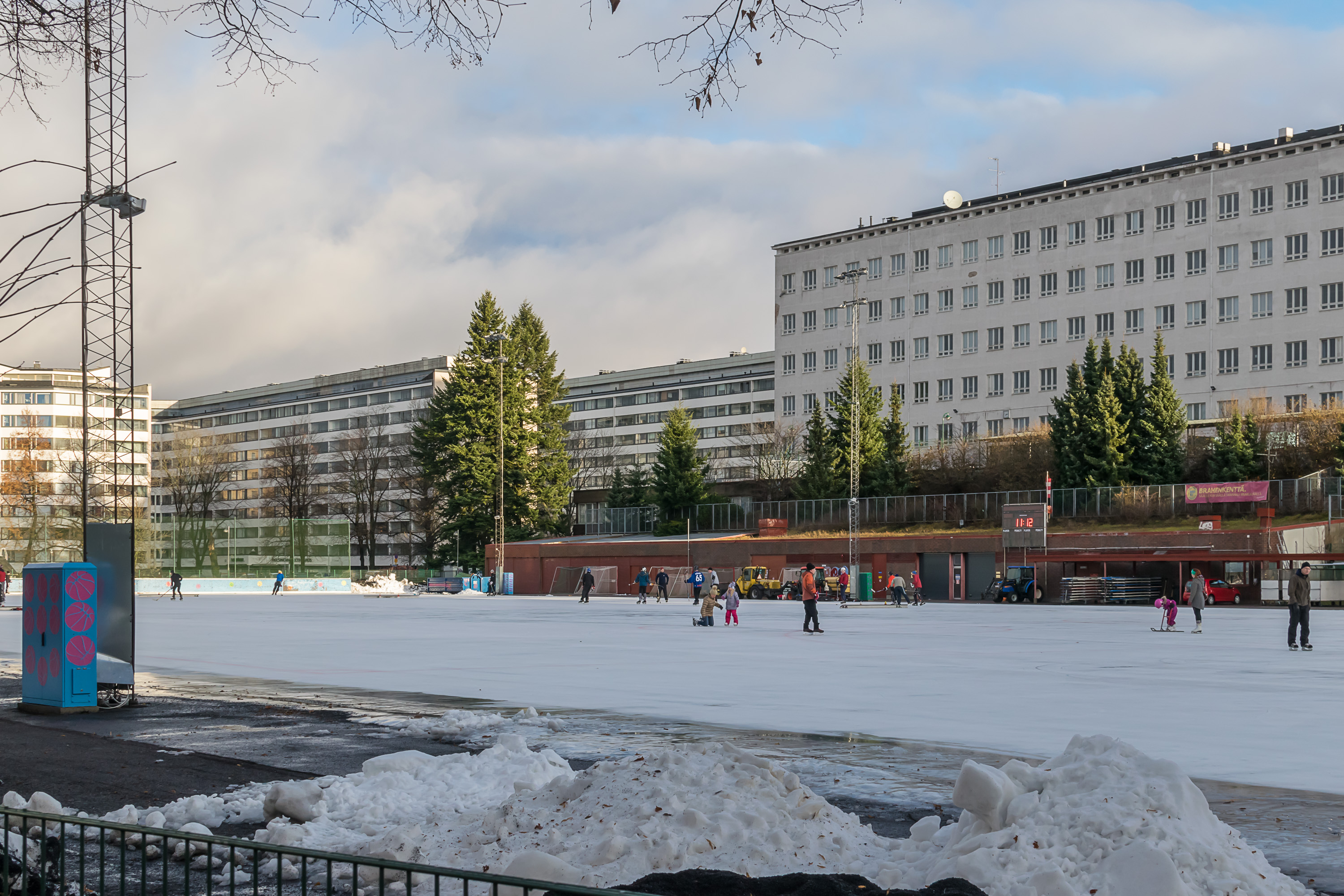
38. A pretty huge skating rink on Helsinginkatu (Finn. Helsinki Street, although it doesn’t look all that important to get such a name).
39. I walked by Sörnäinen Metro Station and through Kalasatama (Finn. Fish Harbor) area. Not much interesting to see here. Sörnäinen area looked a bit shady, although not to the degree of Slussen Metro Station in Stockholm. I’ve seen a bit of Kalasatama before; this was where we picked a Sixt rental car two years before, to travel on a ferry to Sweden and Norway.
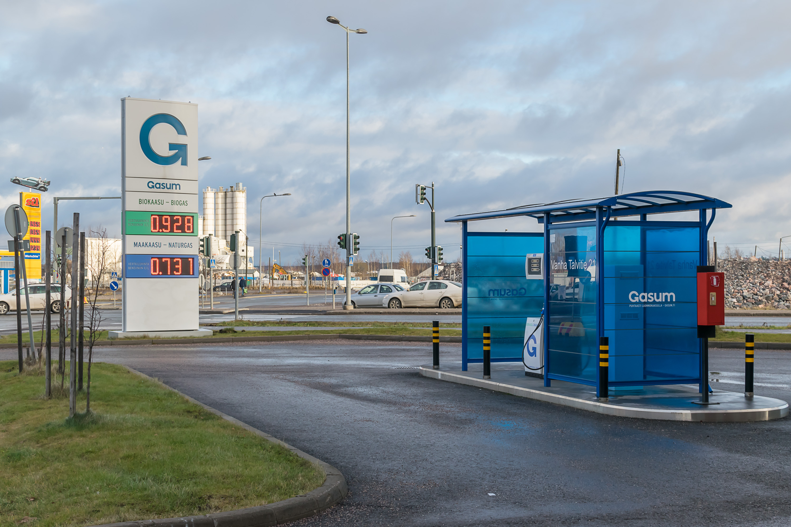
Electric car charging stations are not an unusual sight these days, but this is the first time I see a natural gas filling station in Finland. These are occasionally seen in Russia, where converting cars for natural gas fuel is relatively common (as natural gas is cheaper than gasoline), but I had no idea natural gas was used in Finland too.

40. Verkkosaari area also belongs to Kalasatama. While Kalasatama means “Fish Harbor”, Verkkosaari means “Fishing Net Island”, although it’s not an actual island. A large part of entire Kalasatama area is undergoing a massive renovation effort, but it looks like Verkkosaari will still hold some minor industry, warehouses, and junkyards. The place looks rather depressing. I walked through Verkkosaari so I could get to the sea coast again.
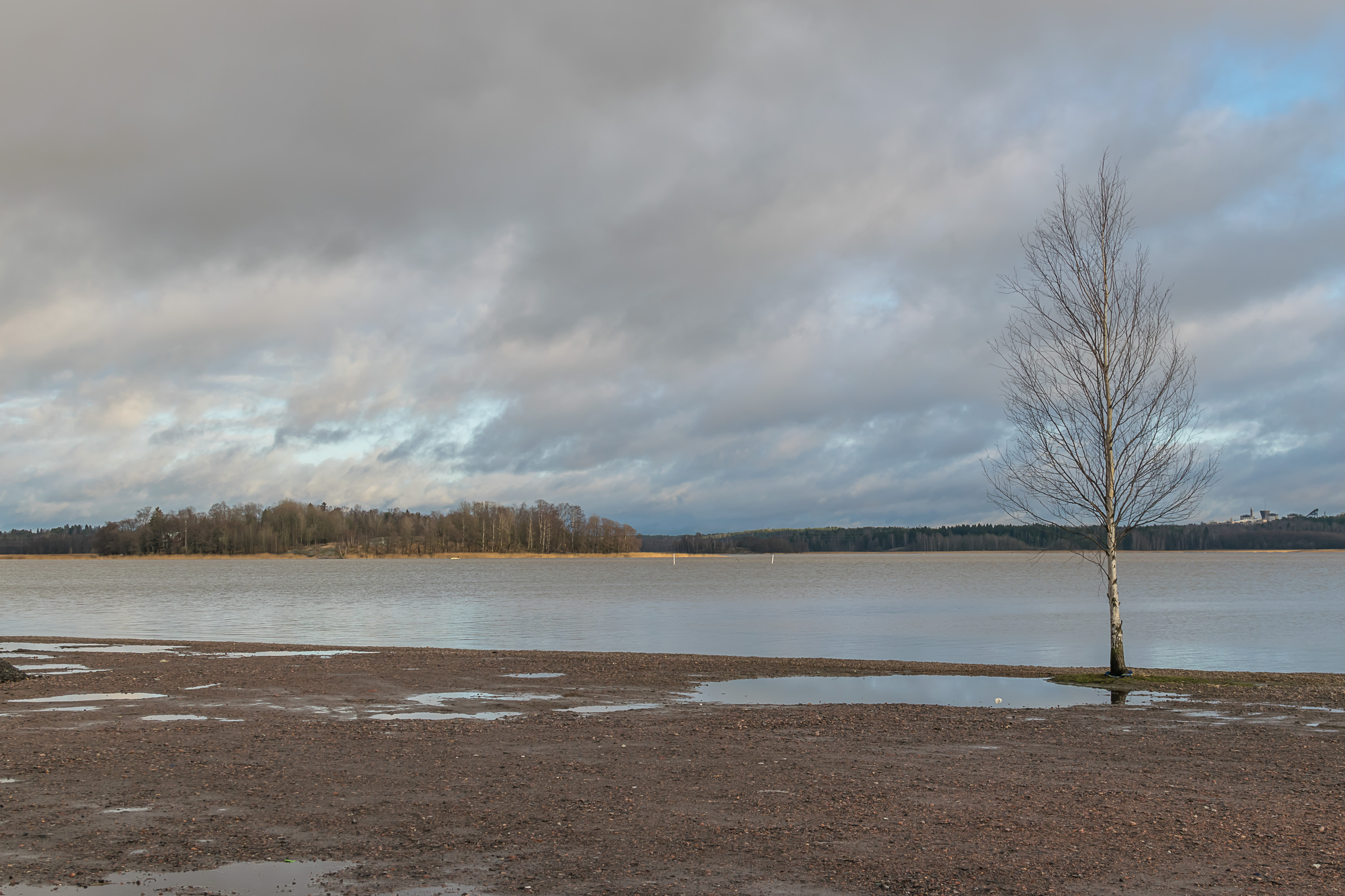
41. And indeed here it is. The inner part of a large gulf between central and eastern Helsinki (Herttoniemi, Itäkeskus, etc.) is called Vanhakaupunginlahti (Finn. Old City Bay); we’ll soon see why. It is shielded from the open sea by large Kulosaari and Mustikkamaa islands, and looks more like a lake.
42. North of Verkkosaari, the coast is mostly covered by a rather unimpressive-looking wet thicket with several brooks. It is called Hermannin rantapuisto (Finn. Hermanni Coast Park, after Hermanni neighborhood, located more inland).
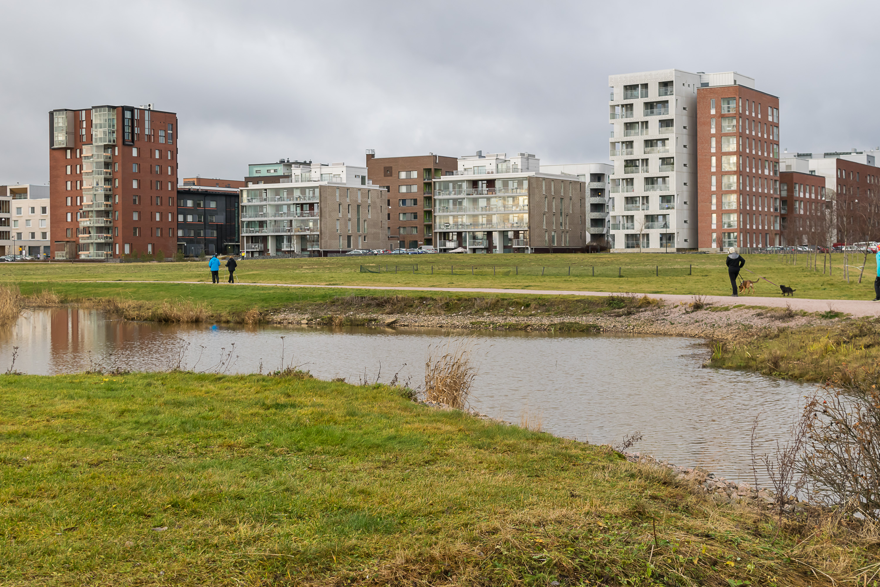
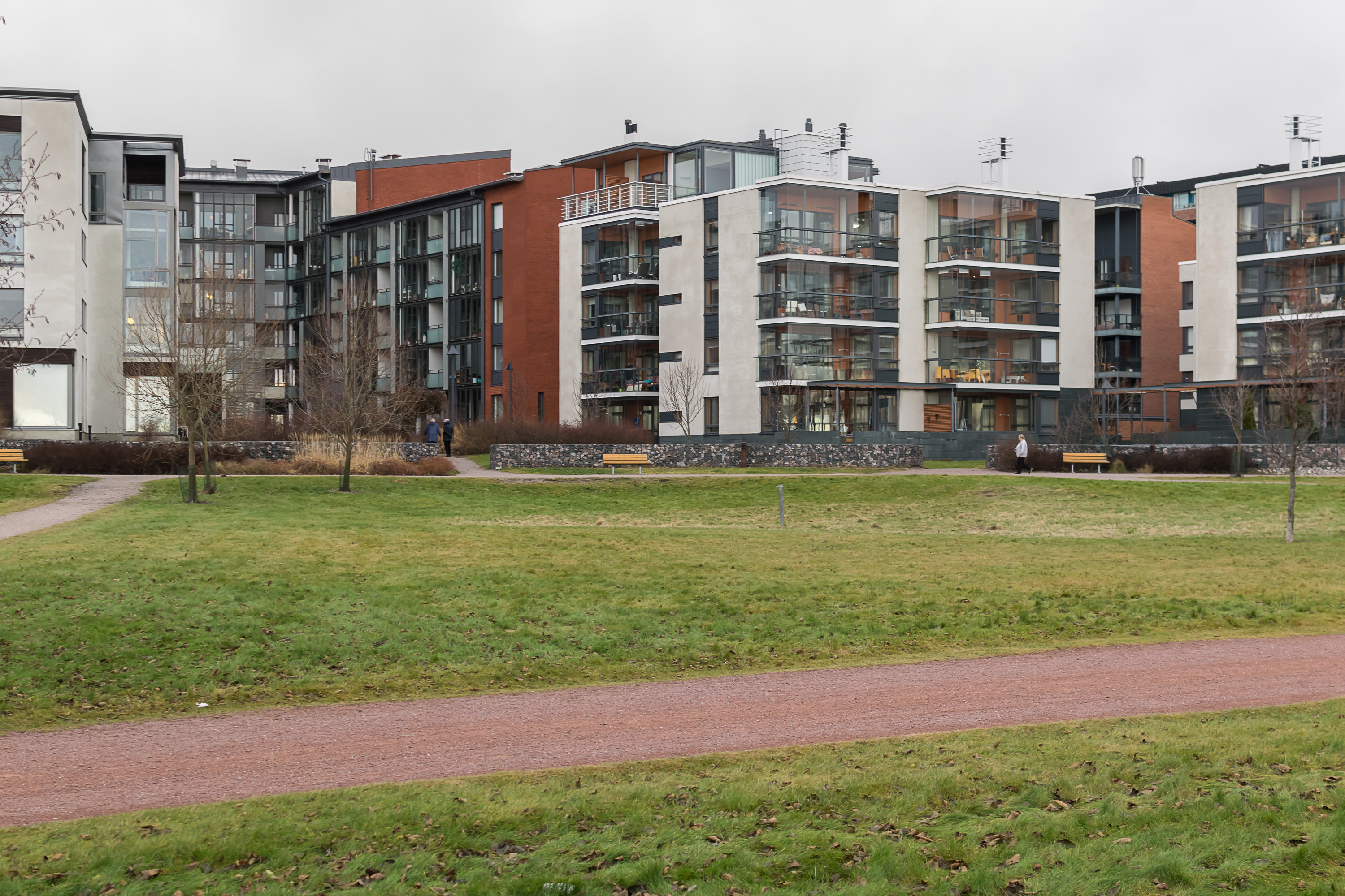
43. Some prettier places begin again when you reach Arabianranta neighborhood (Finn. Arabia Shore). Built fairly recently, it is a great example of modern Finnish residential architecture. It shares the name with the famous Arabia porcelain factory, which had also been located here. Although Arabia still exists as one of the best known worldwide Finnish brands, the old factory itself has closed down, and its building now houses Aalto University School of Arts, Design and Architecture. The name “Arabia” actually does not originate with the factory (as is usually assumed), but predates it instead; the local streets in older Toukola neighborhood behind Arabianranta had Middle Eastern and Asian-themed names since quite long ago.
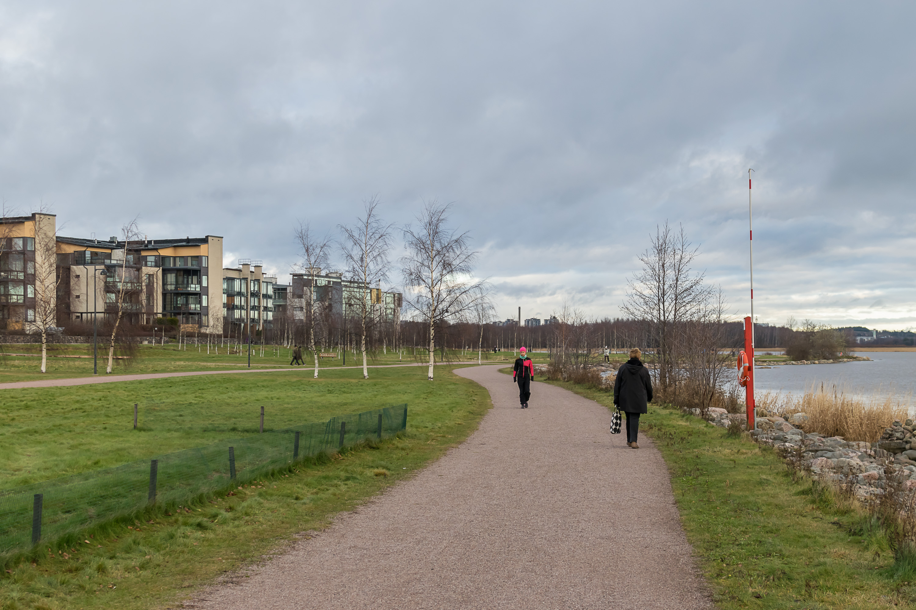
44. The area between Arabianranta and the gulf is occupied by Arabian rantapuisto, a young-looking park with smallish trees.
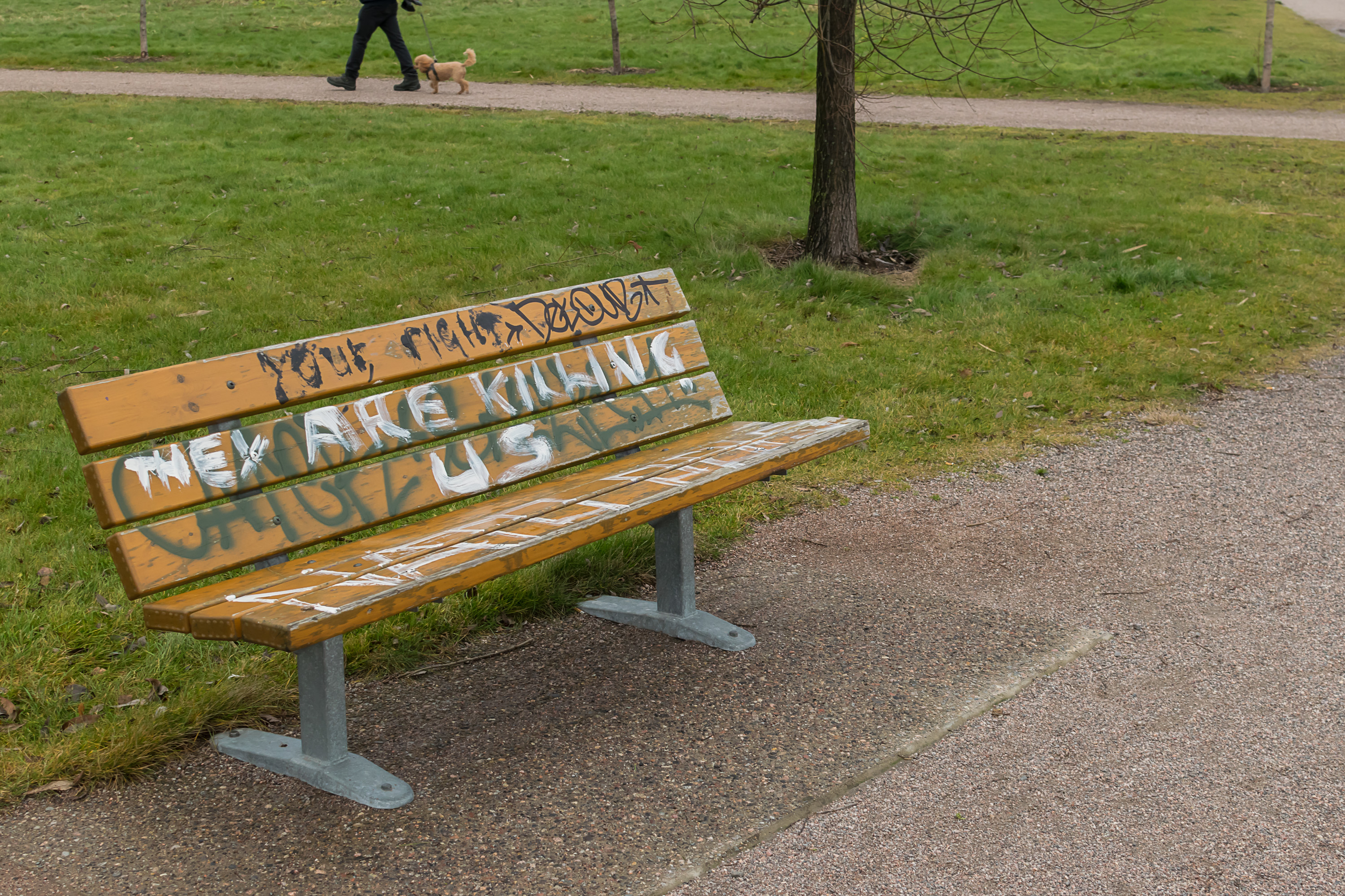
45. Well whoever “they” are...

46. Oh, those huge glass pane windows!
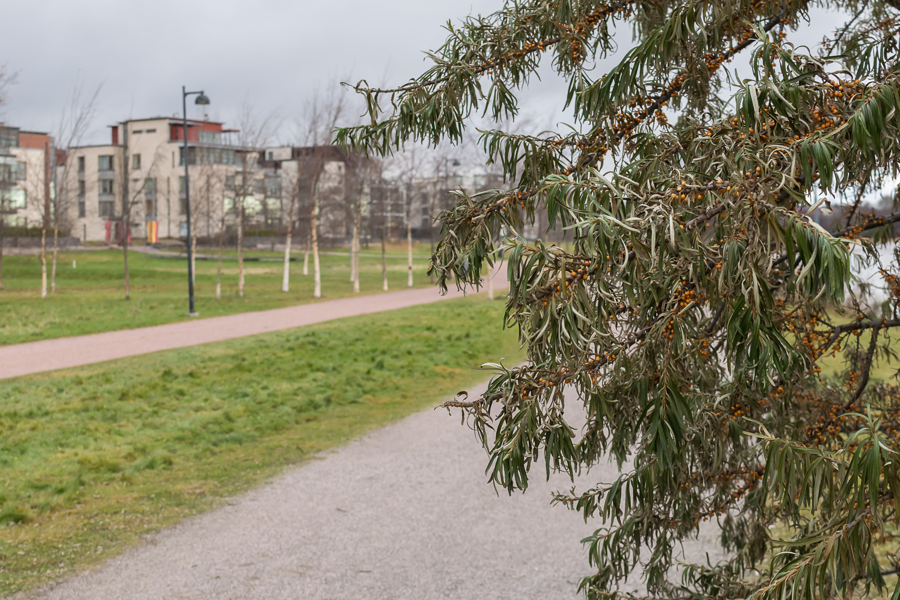
47. Lone sea buckthorn tree on the shore, covered with dried-out berries.
48.
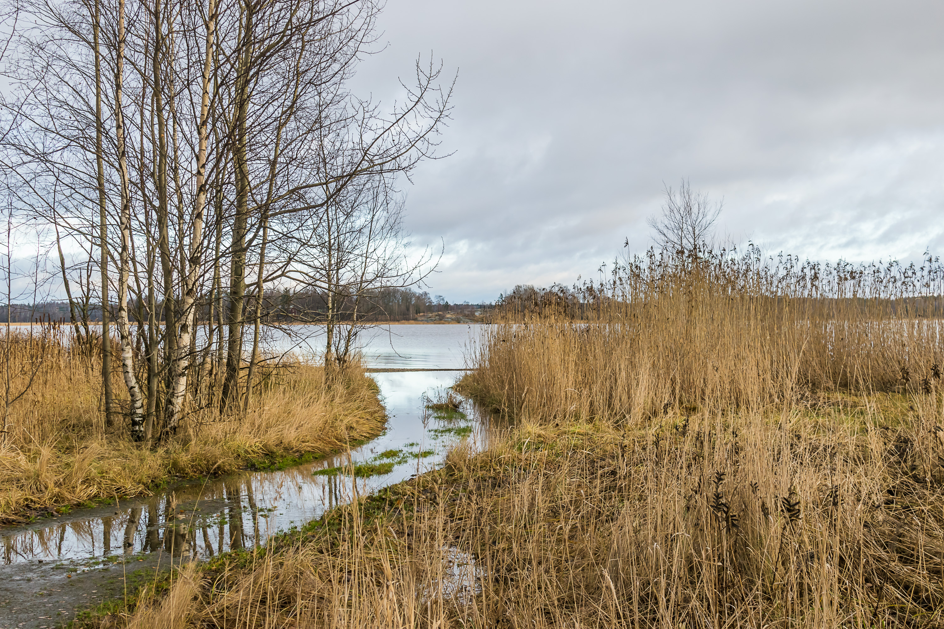
49. On the other side of Vanhakaupunginlahti Bay is the island Lammassaari (Finn. Sheep Island) and an overgrown part of the bay. It is a protected nature area, but I haven’t been there yet so I don’t know what it looks like up close.

50. Meanwhile the bay comes to a close. At the end of the bay is the mouth of the Vantaa River (Vantaanjoki). The powerful rapids in the mouth of Vantaa is the original location of the city of Helsinki. Hence the name for this part of the city, Vanhakaupunki, literally “Old City”. Don’t expect anything resembling medieval cities of Stockholm or Tallinn though, no remnants of old Helsinki actually exist. Still, Vanhakaupunki and the shores of Vantaa River are quite nice places, but that’s a subject for another post.