The final city I visited over my September Kymenlaakso weekend was Kotka. With its population of 55,000 Kotka is the second largest city of Kymenlaakso, after Kouvola. A lively seaside town, it is not quite as old as Hamina, but still can boast some history too.
Kotka is located in the estuary of Kymi (Kymijoki) river, the one Kymenlaakso Region gets its name from. Kymi splits into two branches near the modern Valkmusa National Park; the western branch flows into the Gulf of Finland at Pyhtää, a mostly unremarkable small old town, and the eastern branch splits some more, forming several islands in its mouth, and these islands are where modern Kotka is located.
The history of Kotka doesn’t really start until the late 18th century; before that, Pyhtää and Hamina (originally Vehkalahti) were the local centers of civilization. The territory of Kymi estuary was simply called Kymi as well; Kymi Municipality was merged with Kotka in 1977. In 1788 however King Gustav III of Sweden started a new Russo-Swedish War, ostensibly to return territories annexed by Russia before (Old Finland, with Vyborg, Kexholm, Hamina, Lappeenranta, and Savonlinna). The idea was to catch Russia off-guard, as it was already busy fighting a war with Turkey. It was a classic case of “short victorious war” actually intended to solve domestic problems. As usual, the plan failed. It was pretty idiotic from the get go; they seriously expected to capture St. Petersburg and depose Empress Catherine II! No wonder the delusional Gustav ended up assassinated a few years later. Well anyway, two major sea battles of this war were fought in Ruotsinsalmi (Finn. Swedish Channel; also Swed. Svensksund), a strait between the mainland and an archipelago near Kymi mouth. The first Battle of Svensksund was a decisive Russian victory; however, the second one was won by the Swedes, and in effect prevented Russia from claiming a victory in the entire war, which it had been close to, making its commanders feel way too self-assured. That Second Battle of Svensksund remains to this day the largest naval battle ever fought in the Baltic Sea, and the largest ever Swedish naval victory.
Thanks to the Second Battle of Svensksund, the war ended in 1790 in a draw; this time, the border was not changed. Immediately afterwards though Russia decided to build a major fortress at Svensksund/Ruotsinsalmi, to prevent the Swedes from having any more funny ideas. Ruotsinsalmi Sea Fortress, as it came to be known, was pretty huge, actually consisting of several distinct fortresses. The main one was Fort Katarina, on the large Kotkansaari (Finn. Eagle Island) island. Two smaller fortresses were build on outward islands; Fort Elisabeth on Varissaari (Finn. Crow Island), and Fort Slava (Russ. Fort Glory) on Kukouri. One more fortress, Kyminlinna (Finn. Kymi Fortress) was built farther inland, blocking the King’s Road. The construction of the fortresses was overseen by Count Alexander Suvorov, one of the most famous Russian military commanders ever.
Ruotsinsalmi Fortress didn’t saw much fighting, not against Sweden at least. It didn’t play any significant role in the final Russo-Swedish war of 1809-1809; some of the fortifications hadn’t even been completed by then. After that war and the annexation of entire Finland, Ruotsinsalmi ended up deep in Russian Finland territory, and was deemed unlikely to ever play a major military function again. The garrison, which had numbered in thousands before, was reduced to a few hundreds.
The fortress ended up being destroyed in 1855, in the Crimean War, not by the Swedes but by the British and the French. The major battles of this war took place elsewhere (as its name suggests), but Britain and France quite successfully blockaded Russia in the Baltic Sea, and bombarded its fortresses. They couldn’t really do anything against impregnable Kronstadt and perhaps less impregnable but still heavily fortified Sveaborg (Suomenlinna, off the shore of Helsinki). Ruotsinsalmi with its small garrison and obsolete design however was an easy prey for them, and ended up pretty much reduced to rubble. Only Kyminlinna was more or less intact due to its distance from the sea, but on its own it was even more useless.
For some years after the war, Kotkansaari didn’t really hold anything but the ruins. But that was the second half of the 19th century, the era of industrial revolution. And Kymi river was an ideal place for building sawmills and other factories; although Kymi is not navigable due to numerous rapids, it could be used for timber floating from huge inland Päijänne and Saimaa lake systems. Sawmills, followed by other industries, helped the city to be reborn again, and in 1879 the city of Kotka was formally established.
Kotka means “eagle” in Finnish, which is an odd name for a city; there is nothing particularly eagle-y about Kotka. When I complained to my friend about this odd city name, she pointed out that in fact there’s a Russian city named “eagle” (Орел, Oryol) too. So I guess I’m not in a position to complain. Anyway, the name probably comes from Kotkansaari island, which was probably named many centuries ago and it is quite possible that it had in fact been known for its eagles. The coat of arms of Kotka displays a soaring eagle, holding an anchor and a caduceus (staff of Mercury the Roman god, a traditional symbol of trade).
The city of Kotka grew steadily, quickly spreading inland from the Kotkansaari island, and subsuming some villages. It seems it didn’t see any life-changing events in the 20th century. A railroad linking Kotka with Kouvola was built in 1890, and the modern National Road 7 passes close. In fact you can see some relatively densely built-up area when passing Kotka on the way to Helsinki on Road 7; this however is not Kotka proper, but rather its suburb of Karhula (after karhu, Finn. bear; and its planning with a motorway bisecting the town is now considered a major mistake). You have to take an exit and drive some more on the final section of the National Road 15 to get to the center of Kotka on Kotkansaari.
Kotka seaport is the most important enterprise of the city. It had been the largest cargo seaport of Finland even before its merger with Hamina seaport. The port includes several harbors around the city. The major employers of Kotka are the hospital of Kymenlaakso, Stora Enso (paper mills), Ahlstrom (fiber-based materials, basically also wood processing), Steveco (logistics; as far as I understand the seaport just provides the facilities and the actual ship loading etc. is performed by other companies like Steveco), and others. It’s a fairly industrialized city.
Visually, most of Kotka looks somewhat like a typical mid-sized Finnish city, but its location on an island (which is mostly built-up) gives it a unique atmosphere as well. It has a huge guest harbor; there is a marvelous park close to the sea; and the remains of Ruotsinsalmi fortress remind of its past. There is regular passenger service to a few outside islands, including Varissaari (location of Fort Elizabeth remains) and Kaunissaari (Finn. Beautiful Island; just a random sunny island in the Gulf of Finland). Kotka’s two major museums are also sea-themed: Vellamo tells about the past and the present of seafaring in Finland, and Maretarium is a huge collection of aquariums with fishes of the Baltic Sea and the Finnish lakes.
After an overnight stay in Pitkäthiekat Camping near Hamina, I drove to Kotka. I tried to follow Kuninkaantie (King’s Road) route again, but there weren’t any more museum road sections. I decided to start with the Vellamo museum, and drove to its parking lot first.
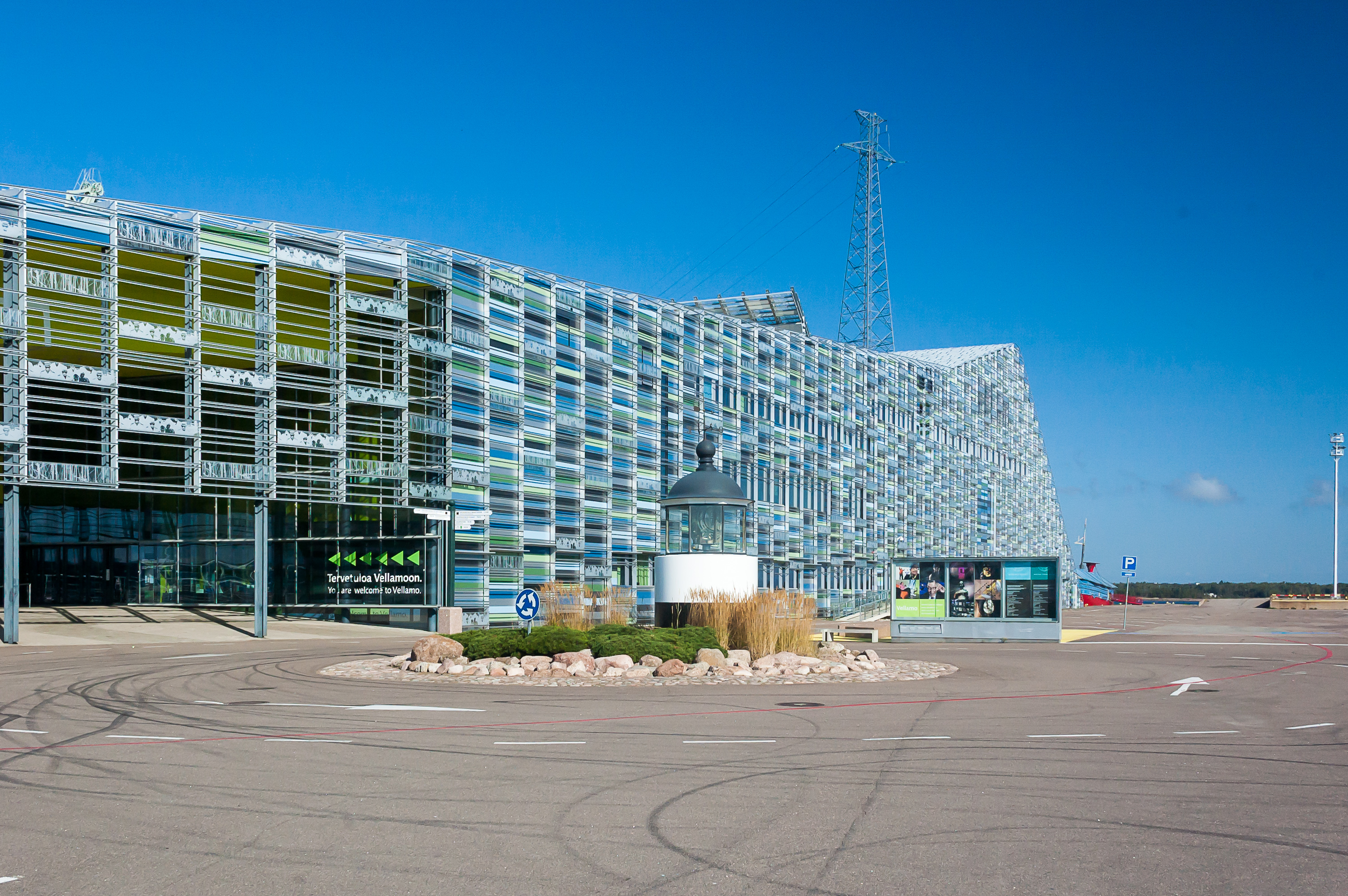
1. Vellamo Museum is named after the mermaid-like goddess of water in the traditional Finnish mythology, mentioned in the Kalevala epic. The museum is located in a new building in Kantasatama (Finn. Main Harbor) area. The harbor itself seems to be mostly unused now, and there is an absolutely enormous parking lot in front of the museum, probably in place of some old port facilites; a lighthouse-like tiny tower marks the entrance to the museum. The building itself is ostensibly intended to evoke an image of waves. Can’t say it looked like a wave to me, but it’s certainly a nice specimen of modern (2008) architecture. Before 2008 the museum was located in Helsinki; it is actually the biggest maritime museum in the country.
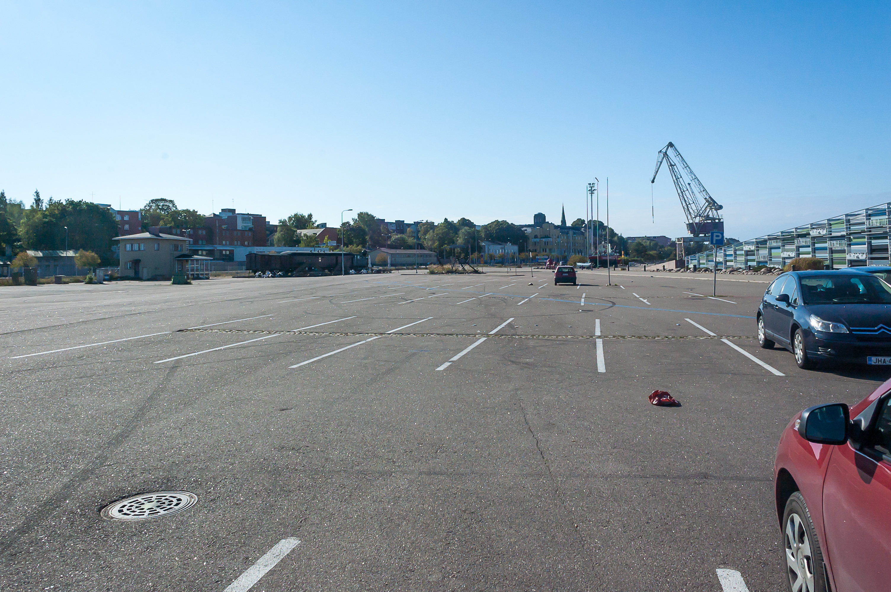
2. The parking lot.

3. I won’t tell here about the museum exposition in detail. The museum is certainly very large and absolutely worth visiting. The range of topics covered is very wide but the coverage itself is relatively shallow; I tend to enjoy more the opposite kind of museums — with an in-depth coverage of one specific topic. I found the parts about the Baltic ferries the most interesting, but there were other highlights. (By the way there used to be a Kotka-Sillamäe (Estonia) ferry for a short while; it was cancelled due to low passenger volumes.) It should also be noted that the museum only covers civilian shipping; naval history is barely even mentioned. By the way the cashier in the museum was Russian (or at least spoke perfect Russian), and she could give a few tips on what to look at first. The ticket costs €10.
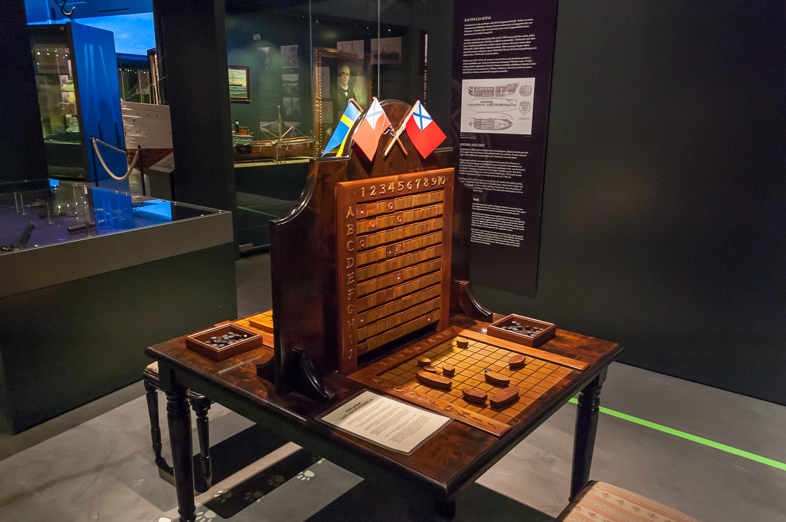
4. A battleships game board in the museum (with a Russian Empire and a Swedish flag, no less). The museum has quite a few games and attractions for kids, although it seemed to me that quite a few of them were out of order.
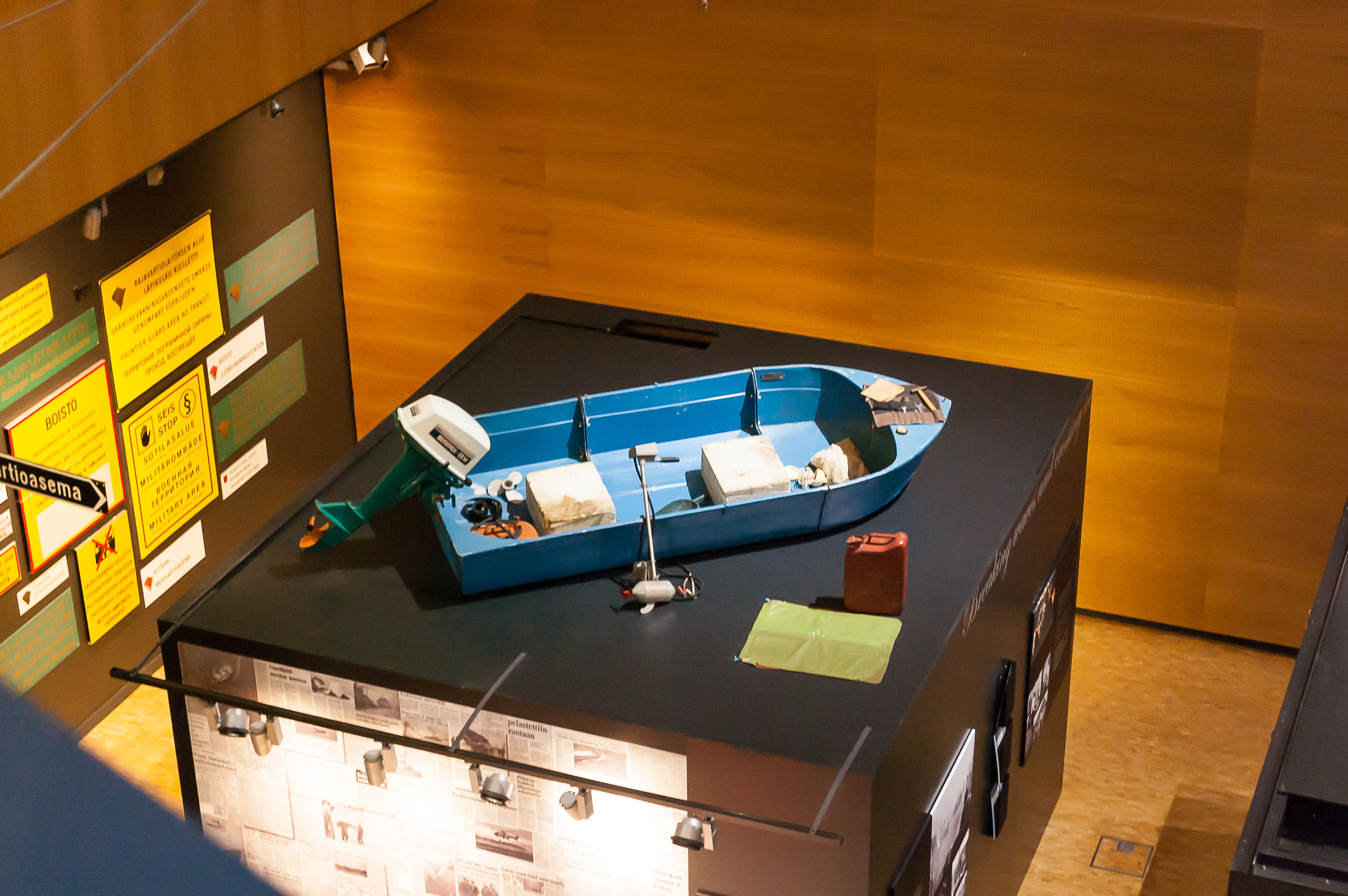
5. Vellamo Museum is in fact not one but three museum under a single roof. The seafaring museum is of course the biggest and the most interesting one. The second one is Coast Guard museum, also telling about the Border Guards. The exhibit I liked most was this boat; two political refugees from Soviet Estonia allegedly crossed the Gulf of Finland on this very boat, only to disappear somewhere in Finland, and were never found again.
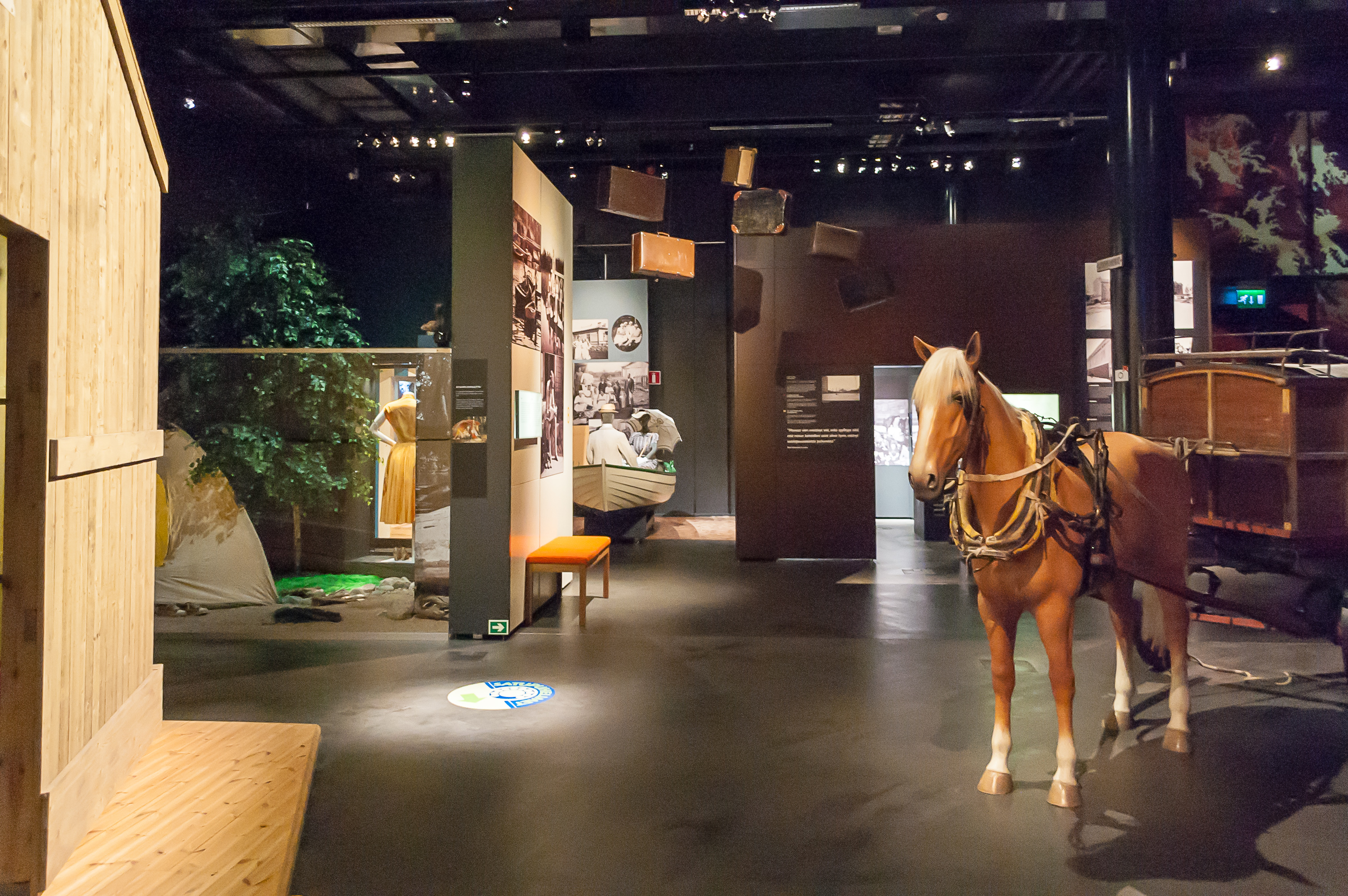
6. The third part of the museum is devoted to Kymenlaakso Region. One of the two floors of this part was closed when I was visiting. The exhibition makes a decent job showing the everyday life of ordinary Finns, but it does not seem particulary specific to Kymenlaakso.
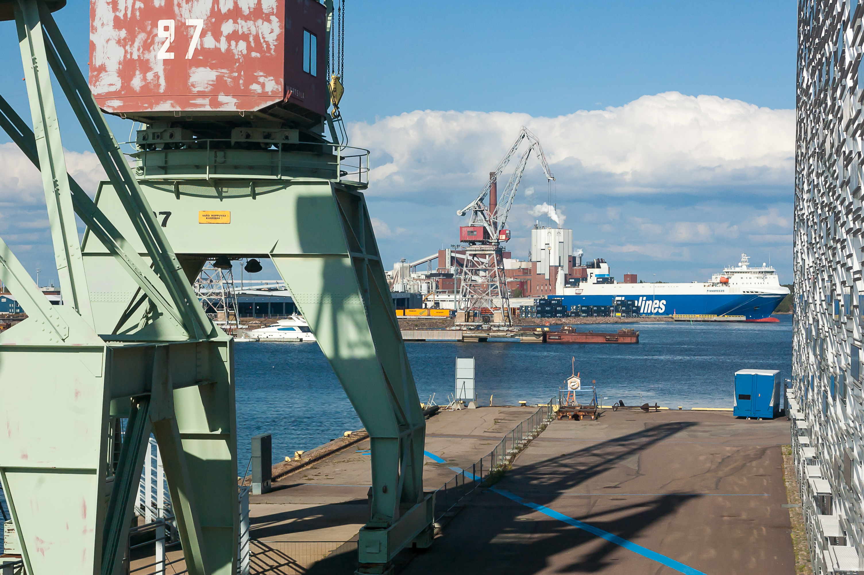
7. Behind the Vellamo museum there are several old cranes, and a few museum ships moored. On the far side of the bay is an active harbor of Kotka seaport, named Hietanen.
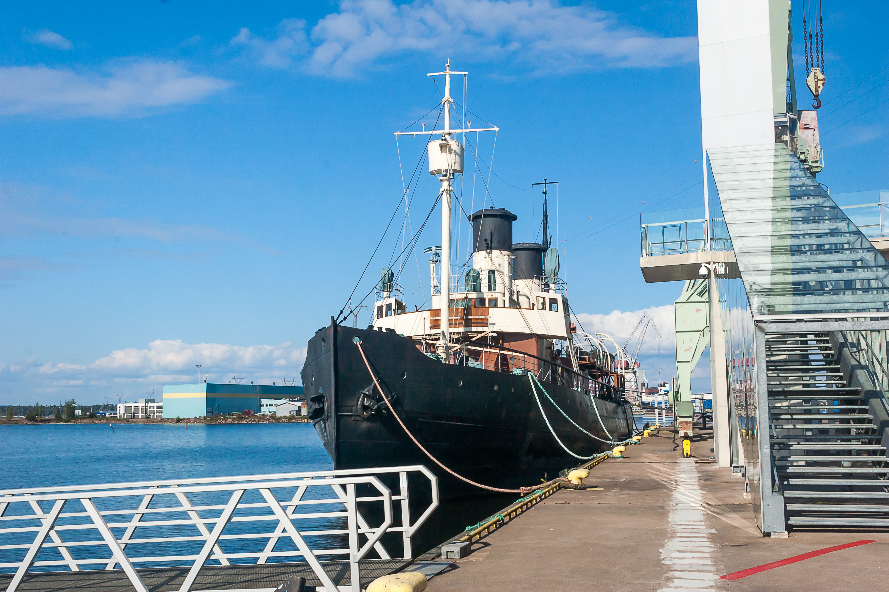
8. The most notable museum ship of Vellamo is an icebreaker named Tarmo (Finn. Vigour; 1907, Newcastle-upon-Tyne, UK), the oldest surviving Baltic icebreaker. It was the third icebreaker owned by Finland, and the last steam-powered icebreaker to remain in service, decommissioned in 1970. Tarmo had relatively interesting history during the Finnish Civil War and the Winter War. I’m not sure if the ship can be actually entered; I sure hope so, but it didn’t appear to be the case when I was there.
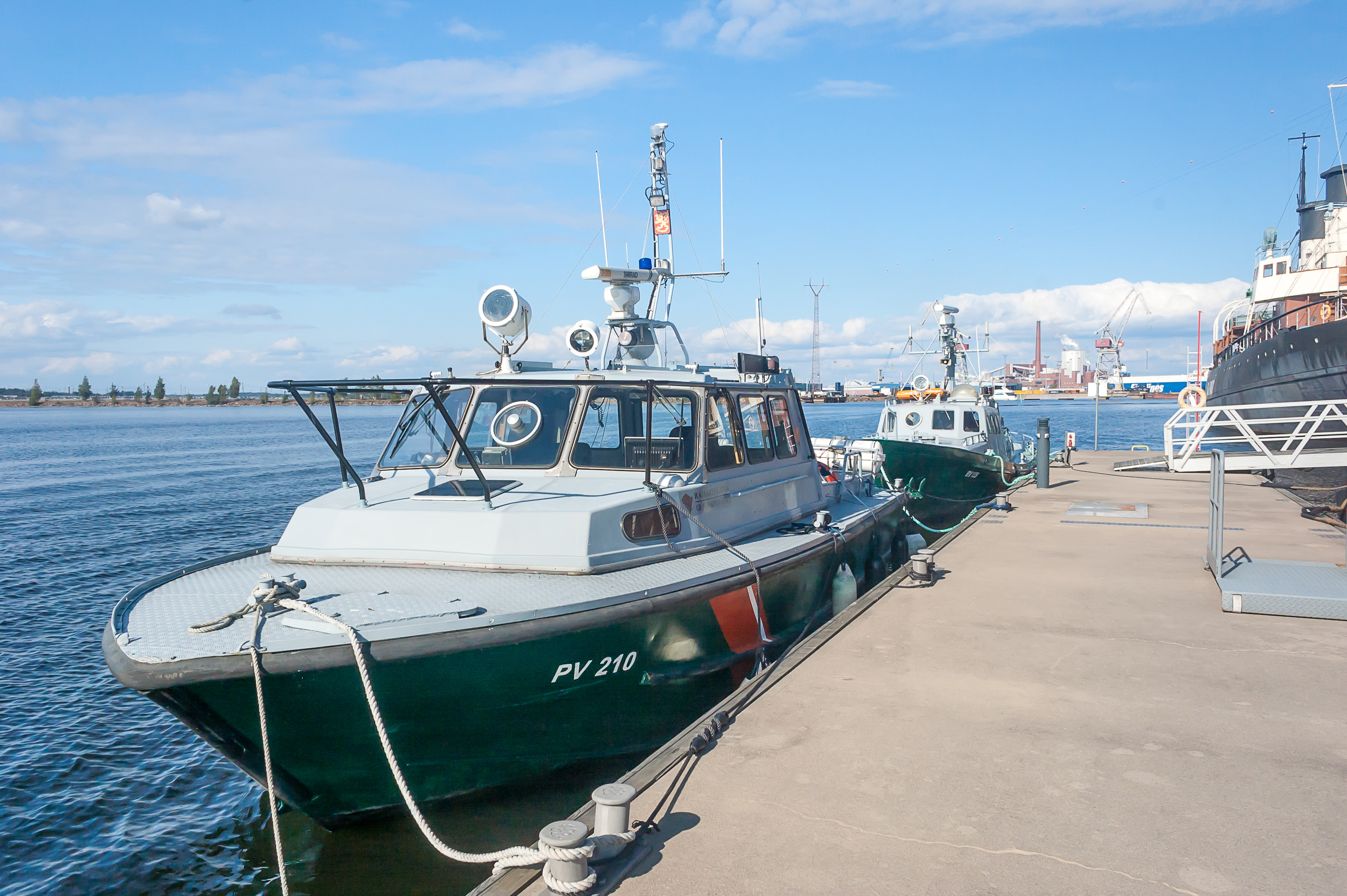
9. The rest of the ships are not particularly interesting, like these border guard boats.
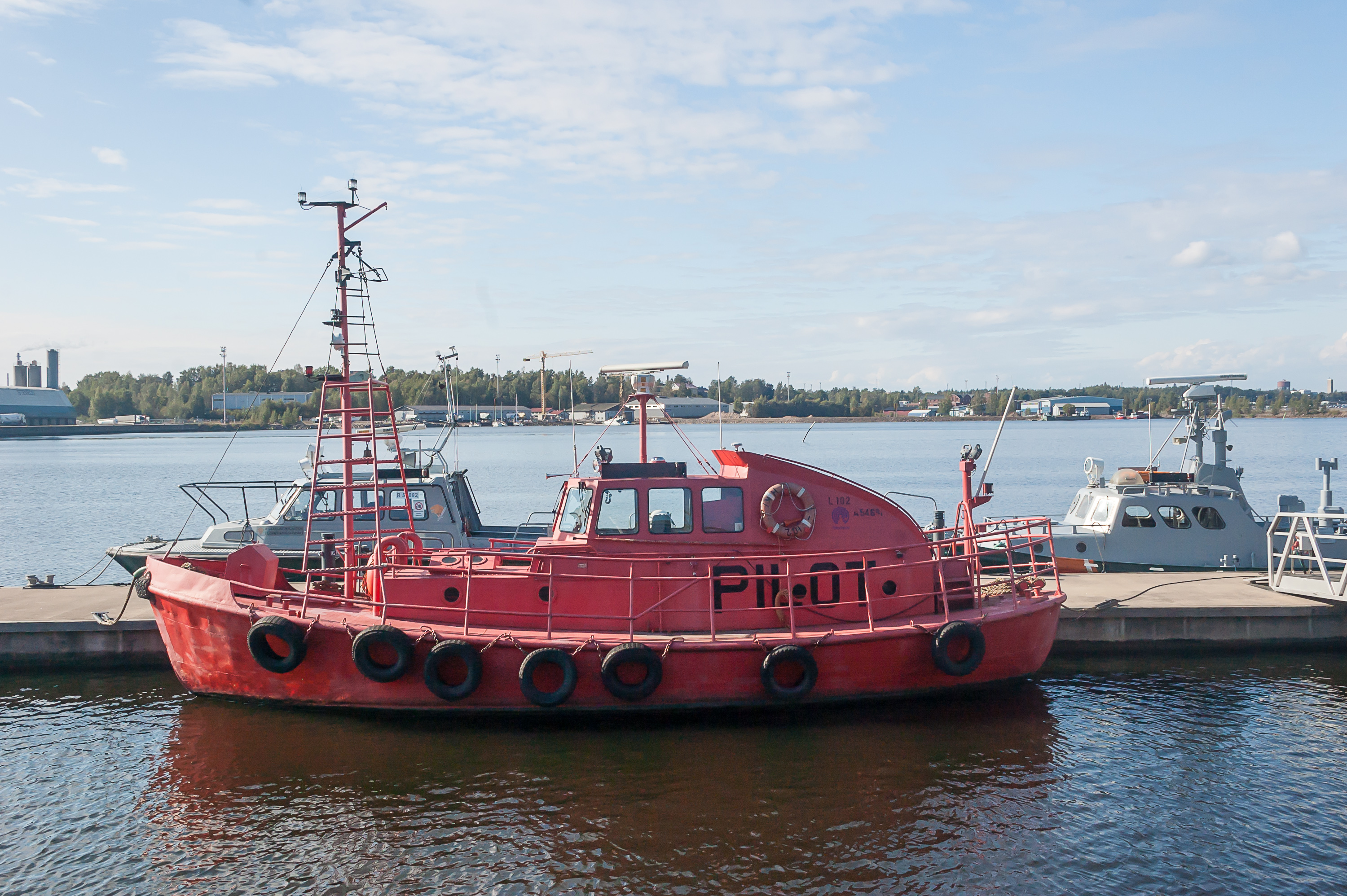
10. Or this pilot boat.
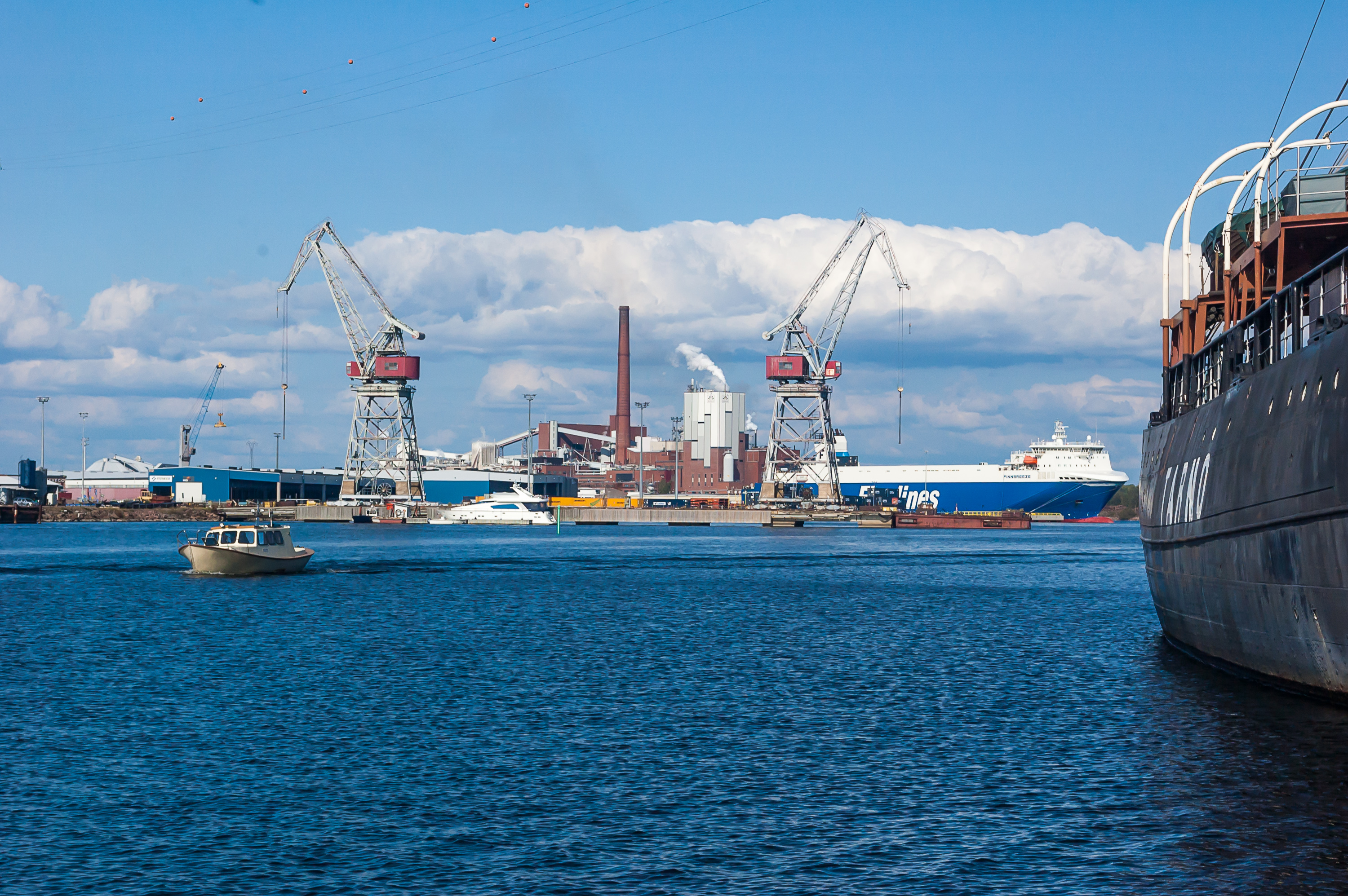
11. Hietanen harbor, visible across the bay, specializes in ro-ro traffic (roll on/roll off; when an entire semi rolls onto the ship, and then rolls off in the destination seaport). Finnlines in particular is a Finnish shipping company specializing in ro-ro services, although they also operate a few ro-pax (ro-ro + passenger) ferries, most notably on Helsinki — Travemünde (Germany) line. Most of their ships have names beginning with Finn- which actually sounds pretty funny. This one, Finnbreeze, is built in 2011 in Nanking, China. Finnlines is currently owned by Italy-based Grimaldi Group.

12. After munching on some snacks in the car, I set off again to explore the city. I left my car at Vellamo Museum parking again, not bothering to move it elsewhere.
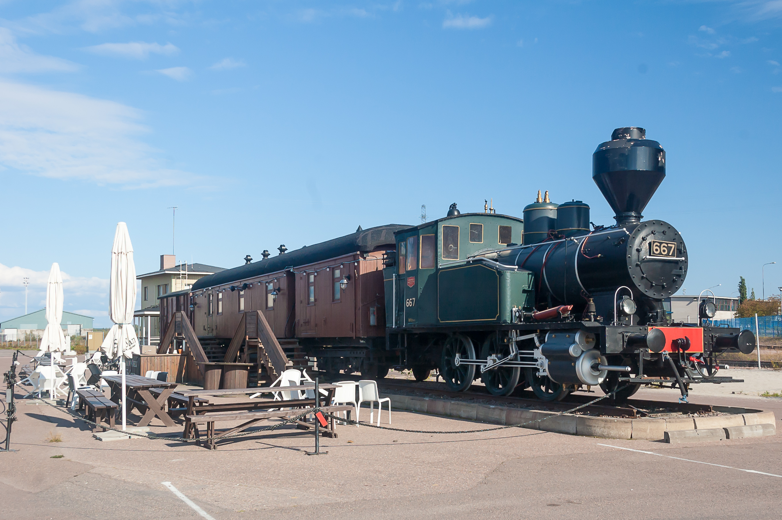
13. Next to the Kantasatama railroad is a small old train, apparently converted into a restaurant. The steam engine is a Vr1, built in Hannover in 1923; the model dates from 1913. It is a shunter locomotive, with a top speed of only 25 km/h. Quite a lot of Vr1’s have been preserved; as far as I was able to find out, this Vr1 no. 667 is not particularly notable.
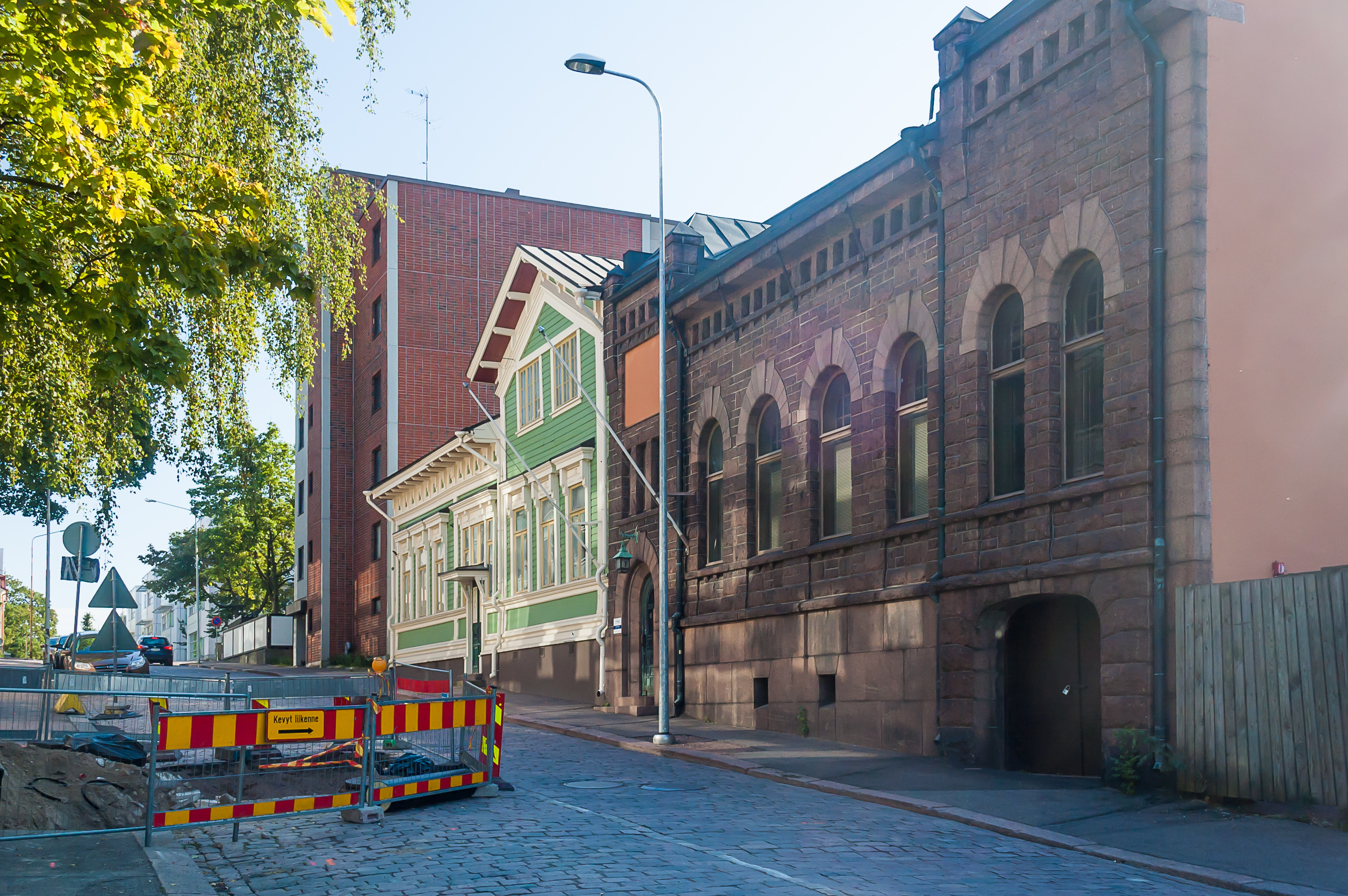
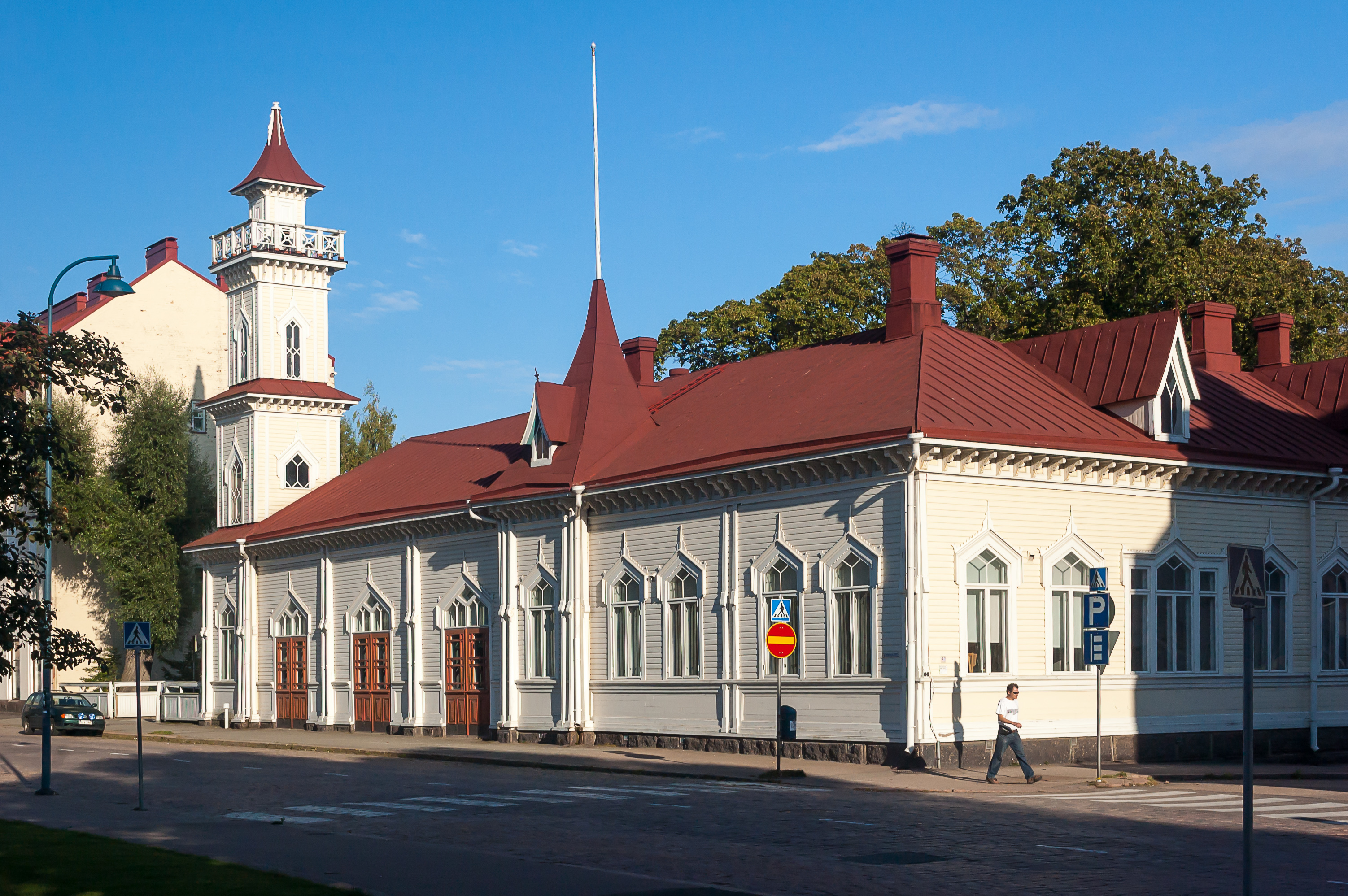
14. Laivurinkatu Street (Finn. Captain Street), starting at Kantasatama. Judging by the cobblestones and the old-looking building to the right, we are actually quite close to the city center.
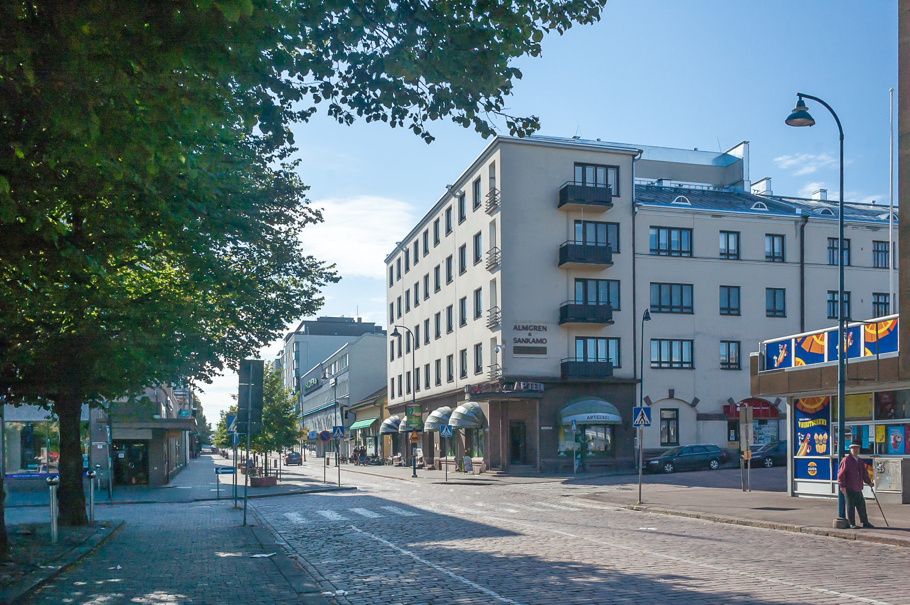
15. Typical Finnish cityscape.
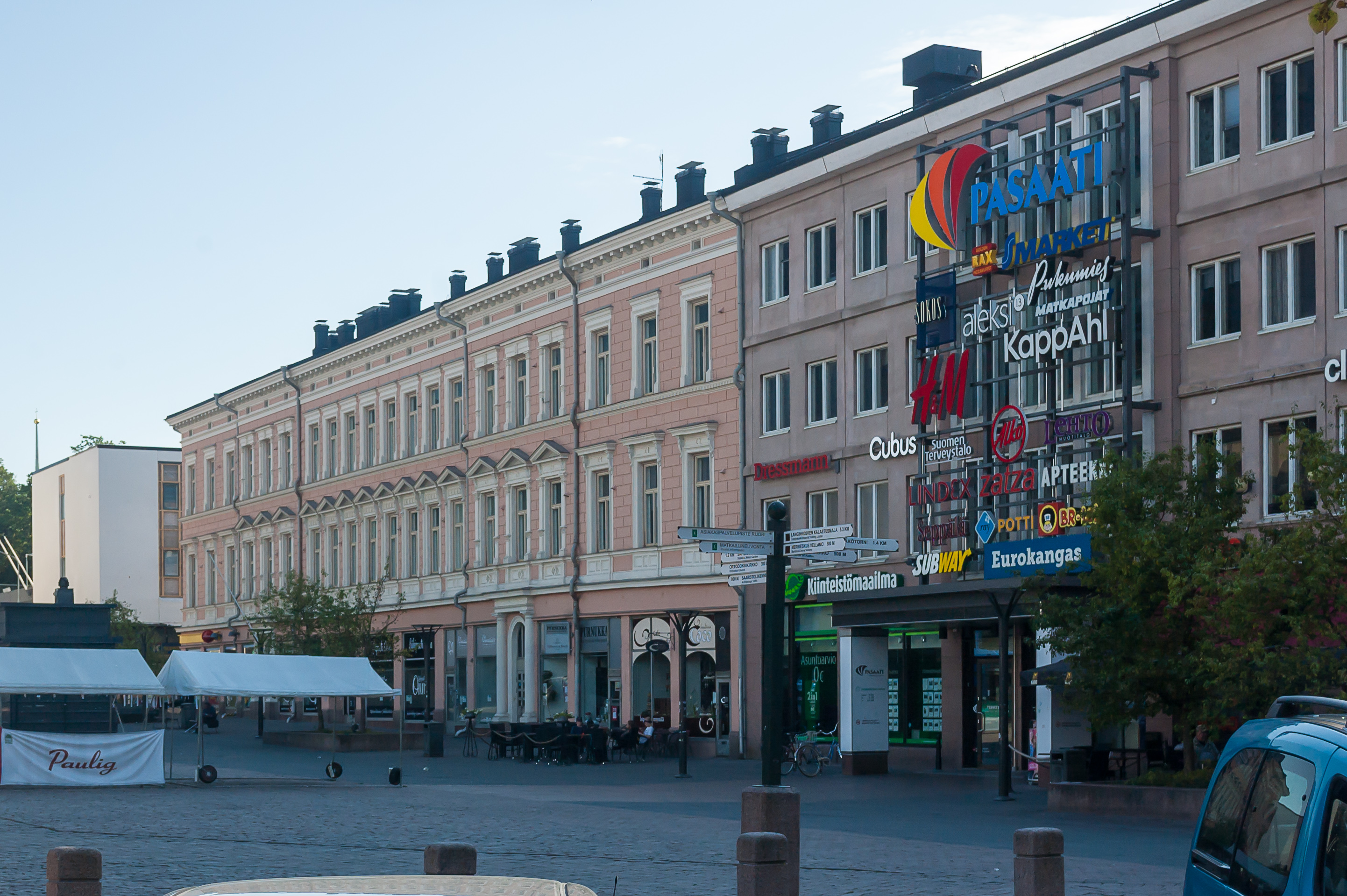
16. Pasaati (Finn. Trade wind) mall on the market square, with an ordinary selection of stores.
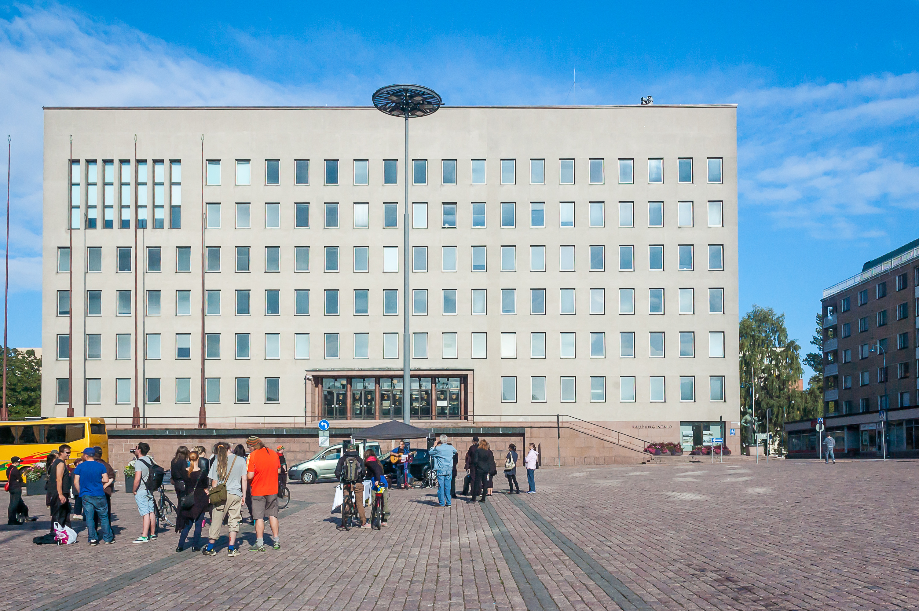
17. A musician was giving a small performance in front of the modern city hall.
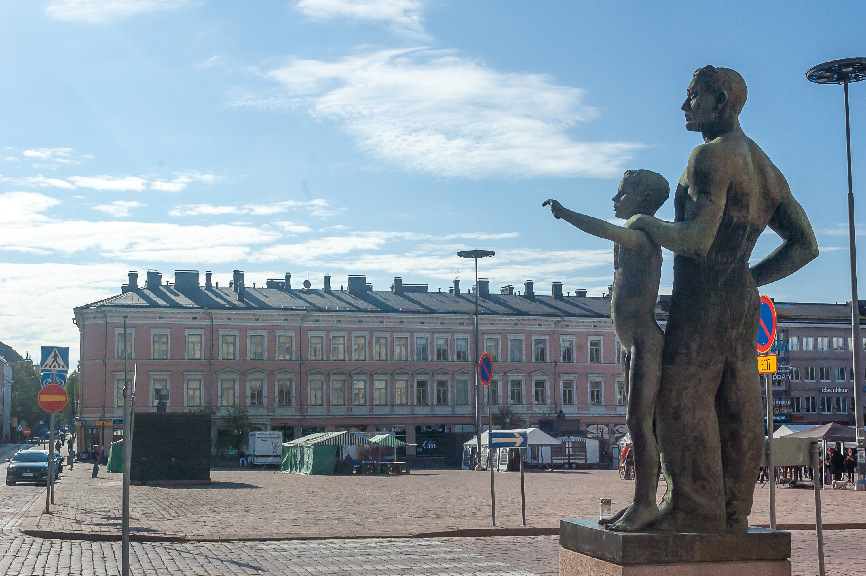
18. A statue near the city hall.
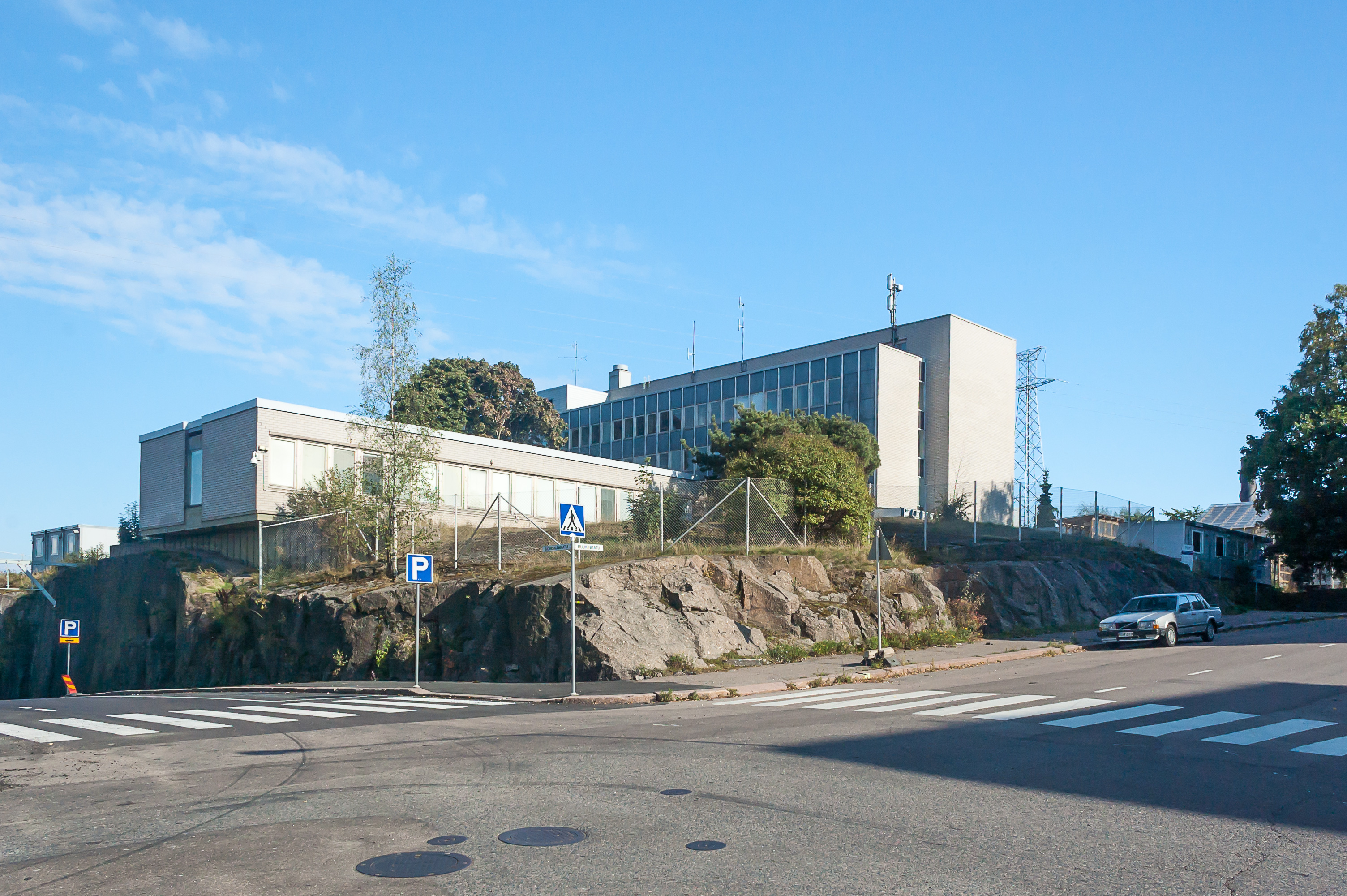
19. The local police station, in just a few blocks from the market square, is built on one huge rock. The city pretty much ends here; the eastern part of the island is occupied by an industrial area.
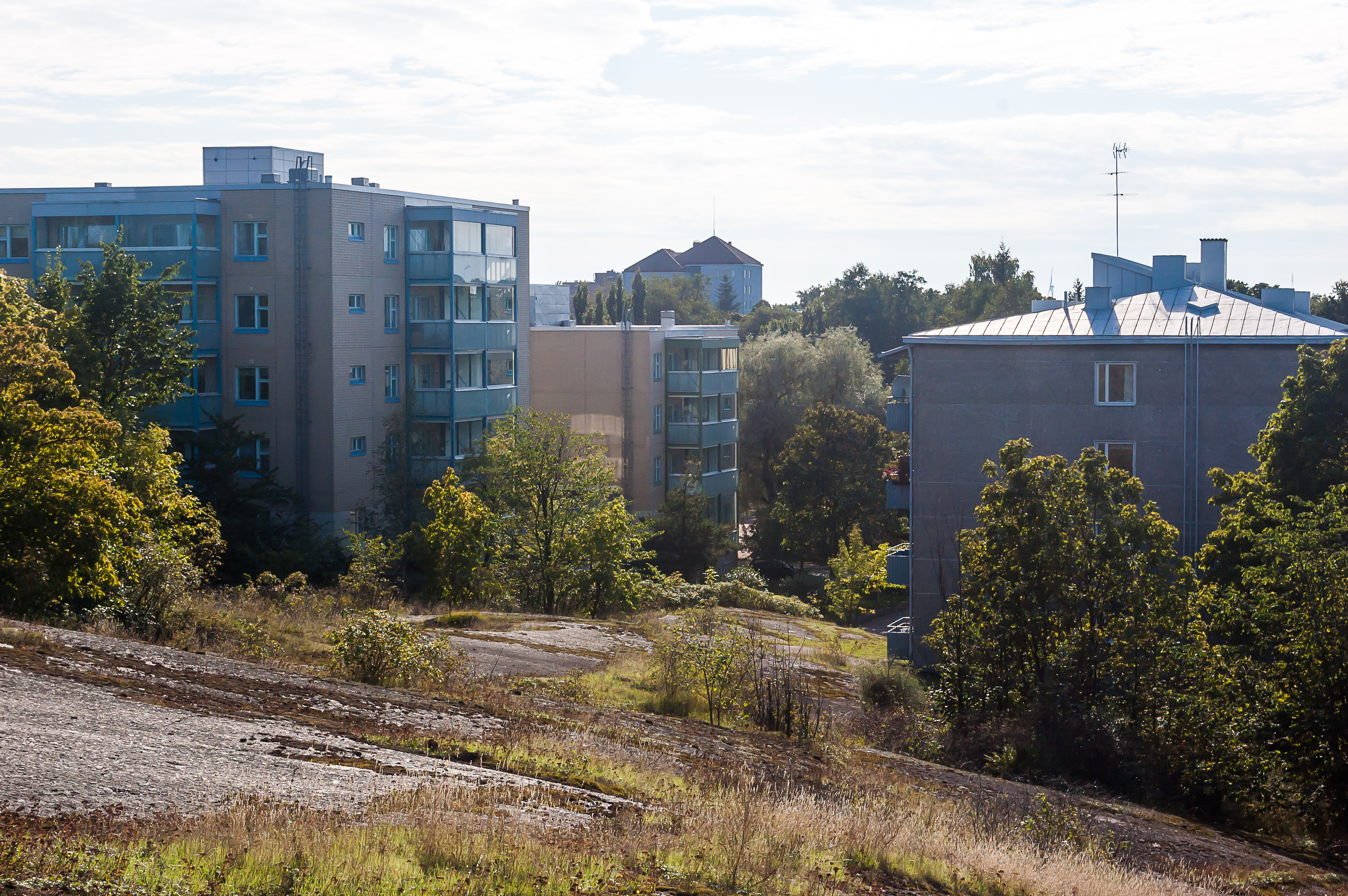
20. Apartment buildings, as seen from the top of an another huge rock.
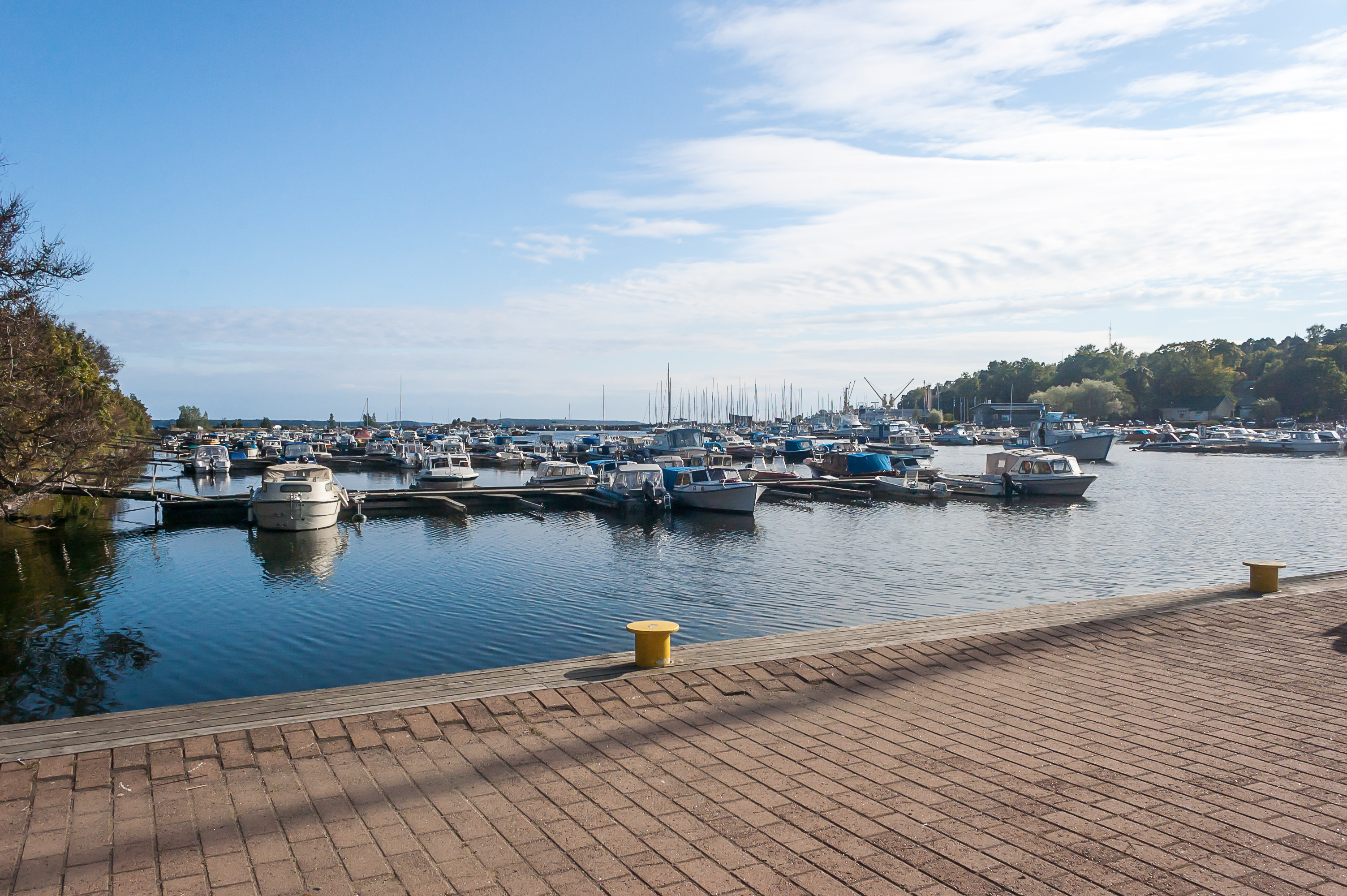
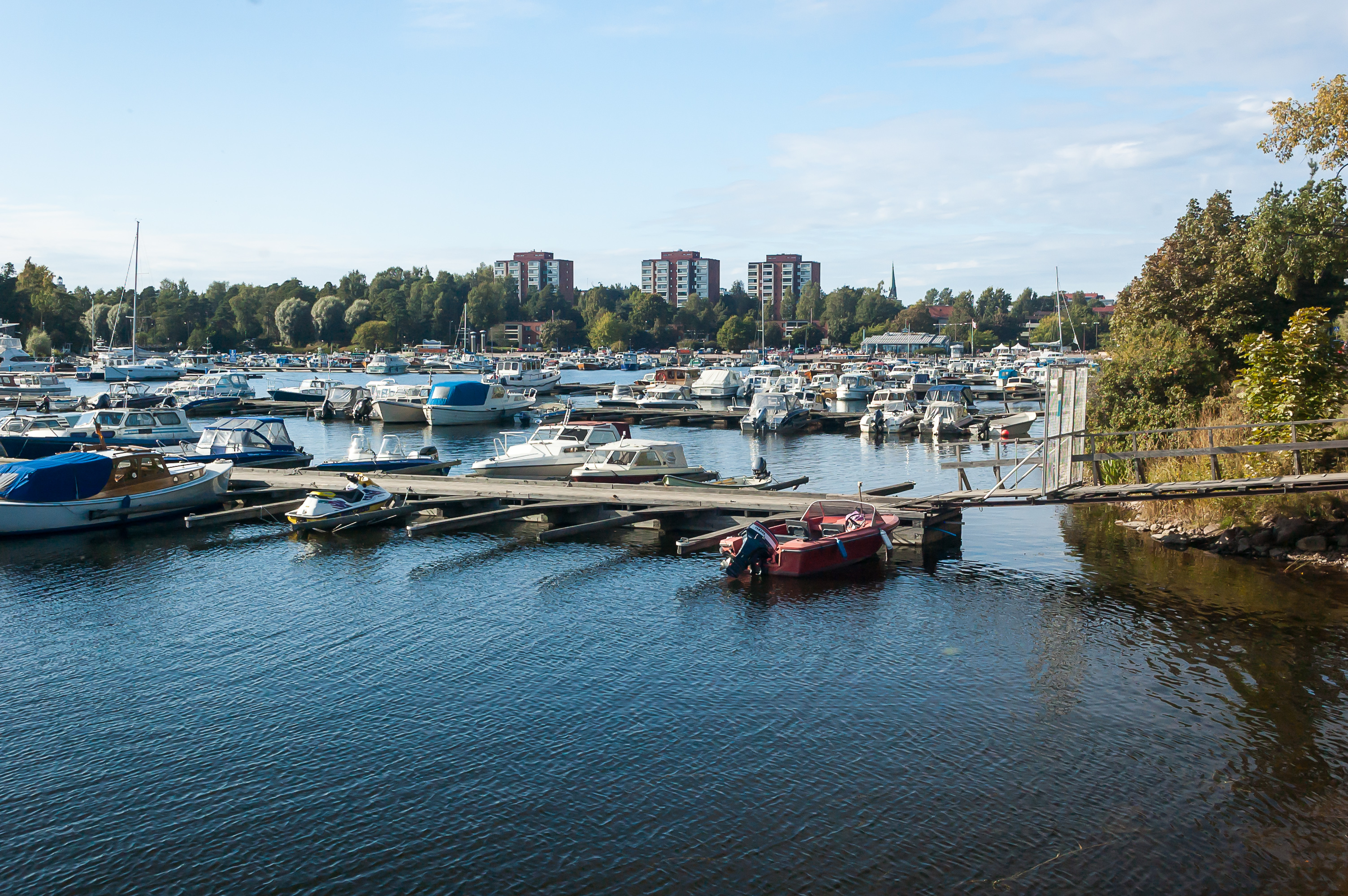
21. Kotkan sea can be seen most prominently in Sapokka Harbour. Sapokka is derived from Russian сапог (sah-pOg), meaning “boot” — it’s obvious from the shape of the harbor. Sapokka is home to a huge yacht harbor, and to Maretarium Museum, showing fishes from all over Finland. I put off Maretarium for another visit.
22.
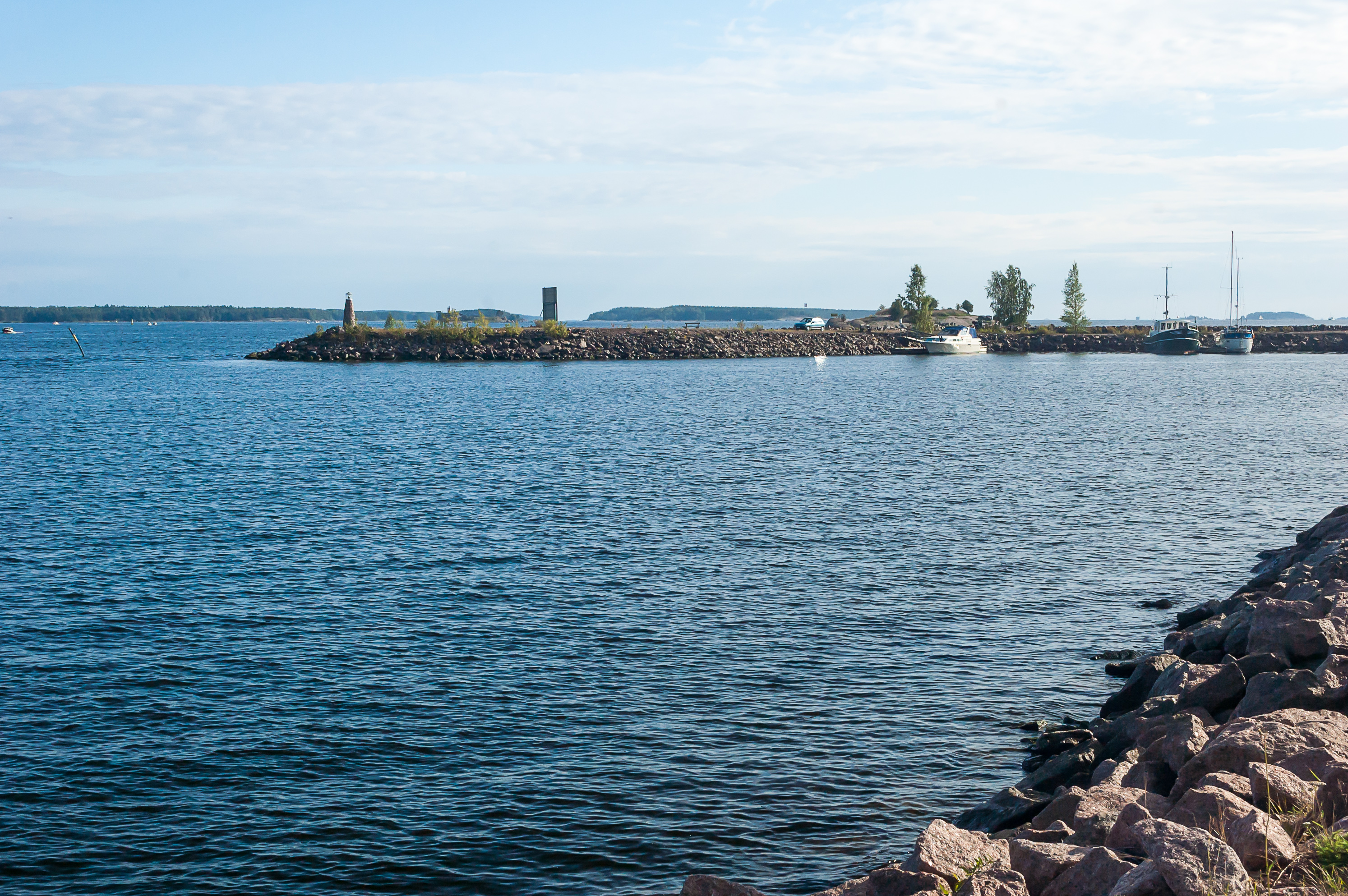
23. Seawalls and outside islands can be seen beyond the harbor.

24. A tiny lighthouse, but I think this one is actually functional.

25. A squirrel climbed down one of the trees near the piers.
26. I noticed that quite a few cars parked at Sapokka had obviously been left there a while ago, with unwashed traces of rains visible on the windshields and the roofs. Looks like their owners went off sailing.
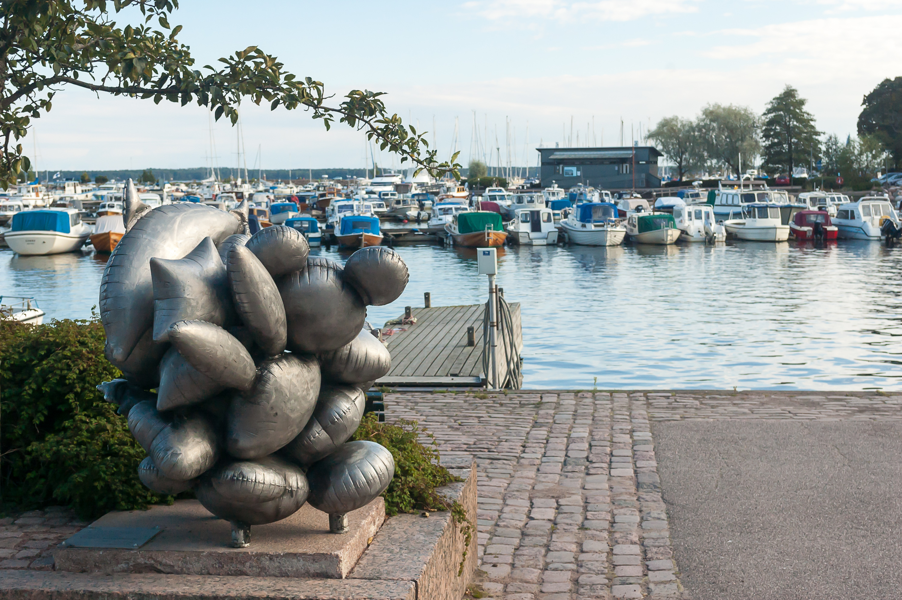
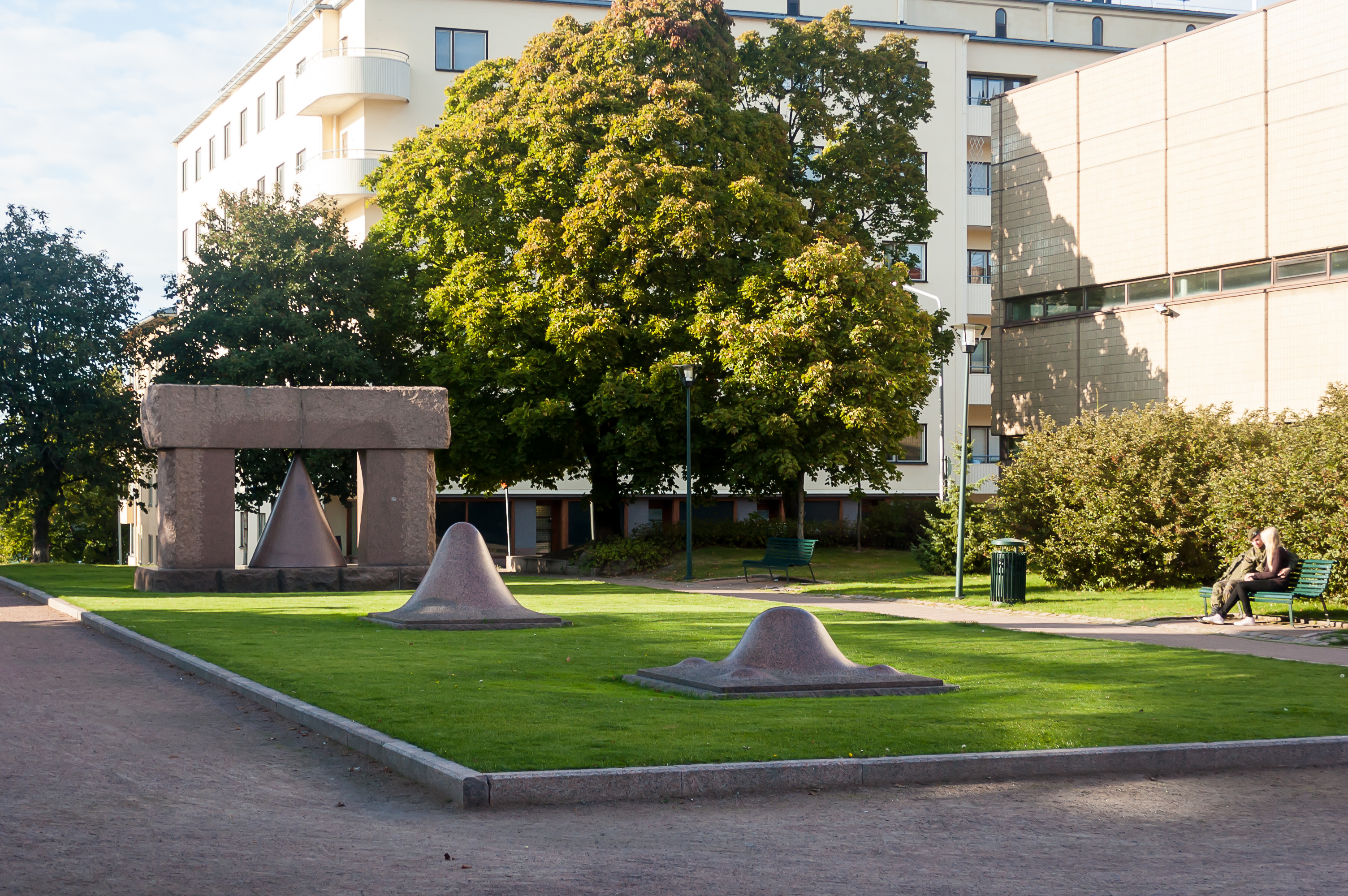
27. A sculpture. As someone once pointed out in a blog, there are three kinds of statues in Finland: abstract mess, bronze men turned green with age, and granite creatures. Kotka is unusually rich in statues of the first kind, even for Finland.
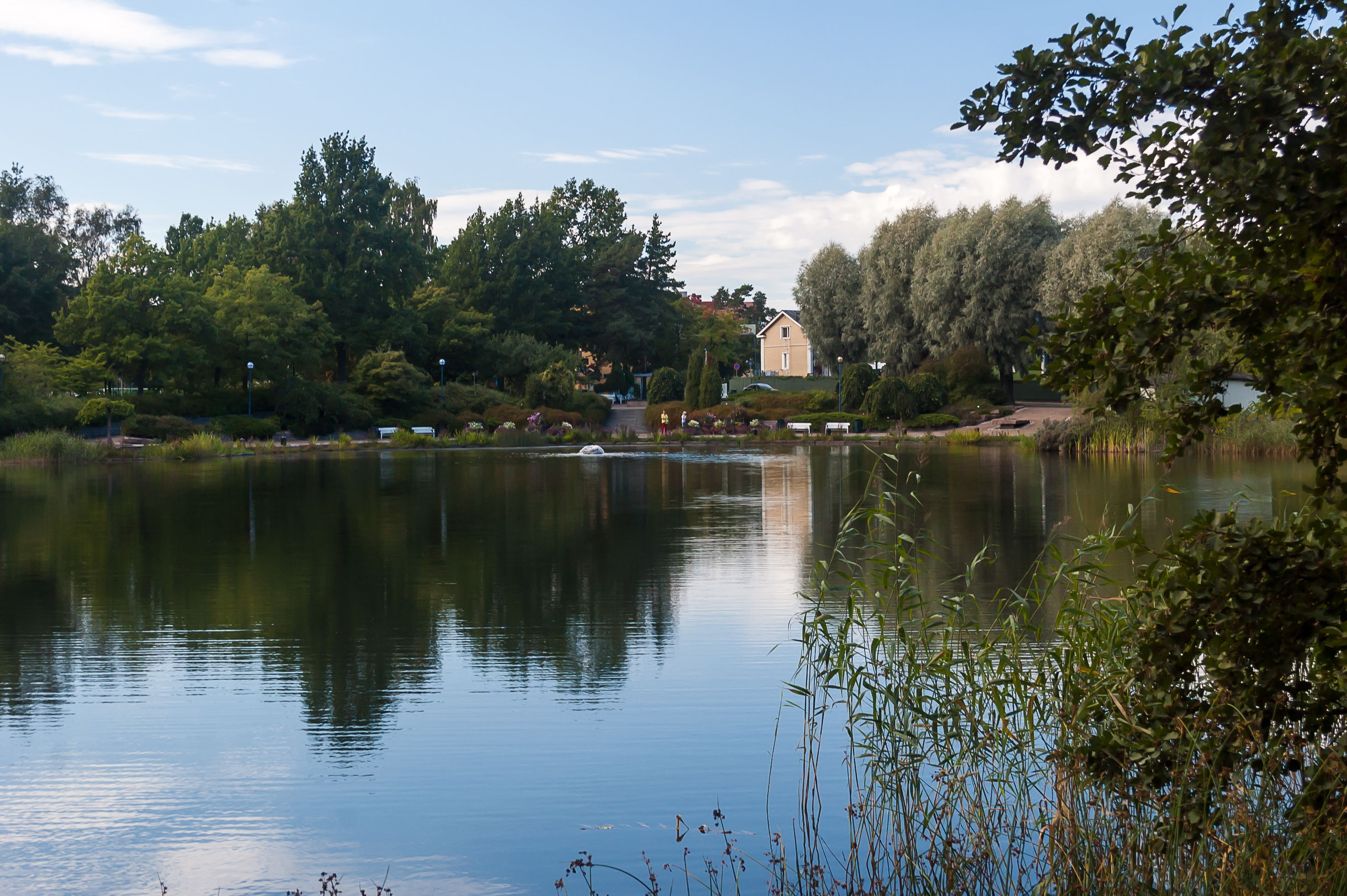
28. Right next to the harbor is an extremely lush park, the kind I was quite suprised to encounter in a Finnish port city. The park is named Sapokan Vesipuisto (Finn. Sapokka Water Park).
29.
30.
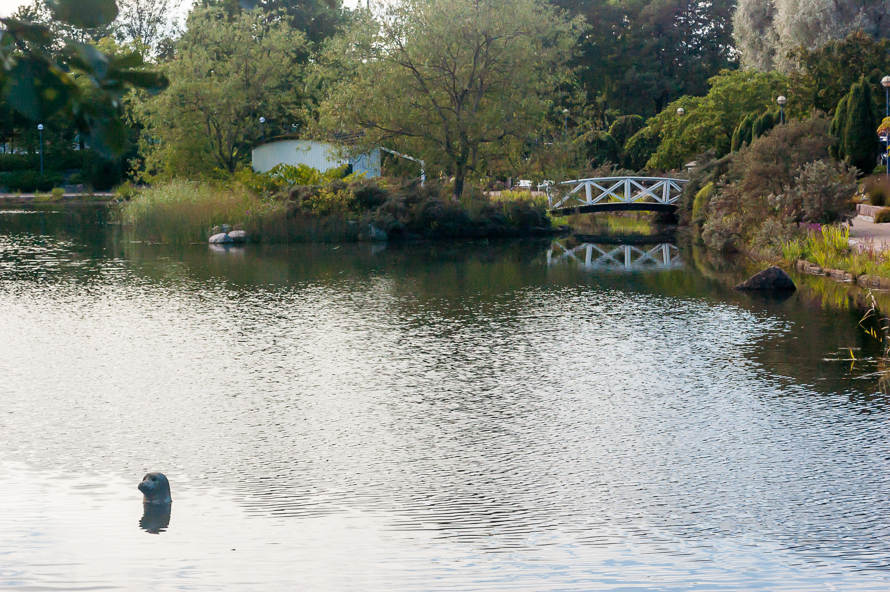
31. The inside part of Sapokka Bay has a small seal statue, just like a pond in Hamina city park.
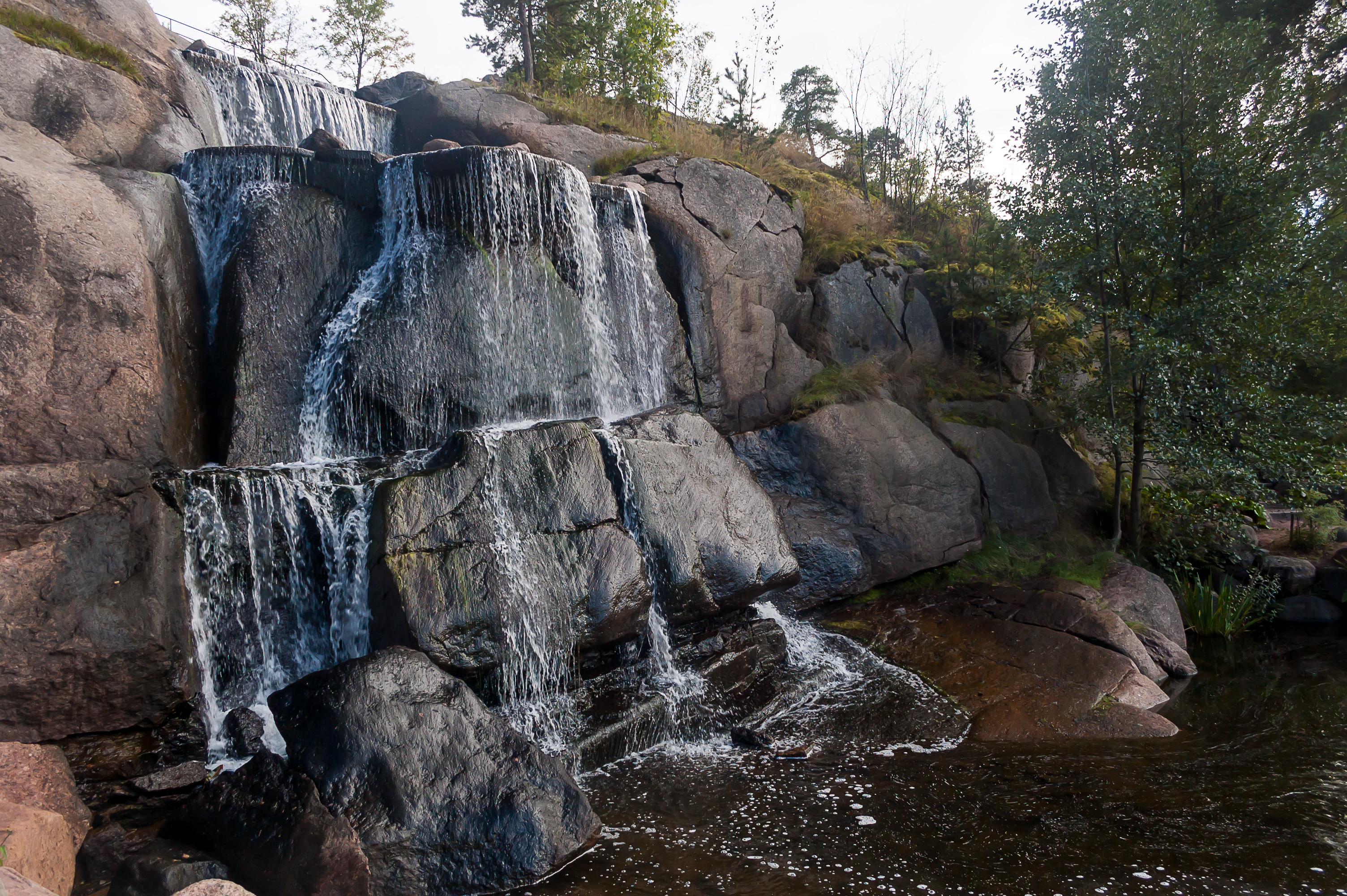
32. An artificial waterfall.
33.
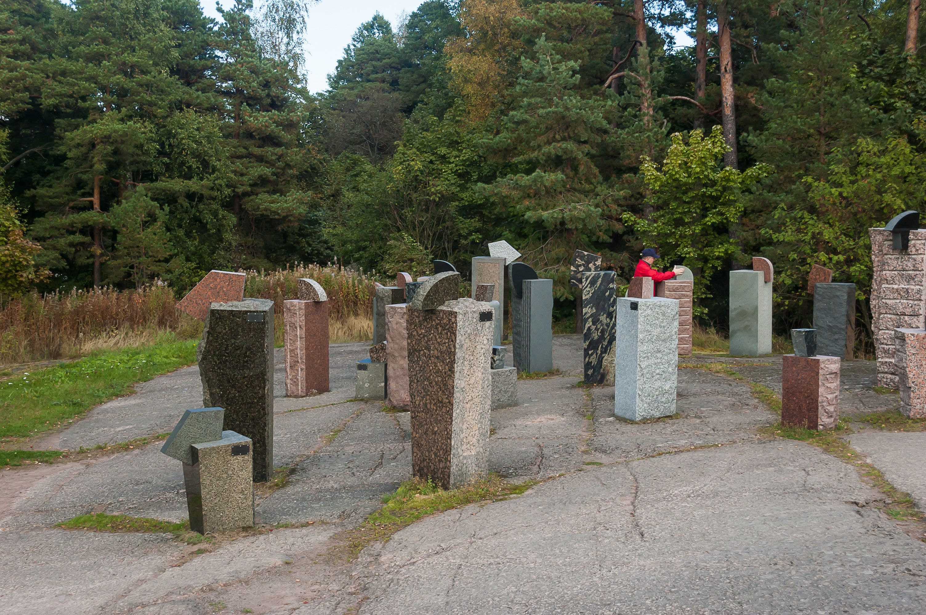
34. An interesting attraction of this park is a set of samples of various kinds of construction rock from all over Finland; mostly granite of course. There is an information board with a map and all.

35. South of Sapokka Bay is a small residential area, and behind it facing the sea is another park. Fort Katarina ruins can be found in the southernmost part of this park, but I didn’t know that at the time. Instead I saw a sign for some sort of observation tower, and found it with a bit of difficulty. The tower is actually built in the ruin of a lighthouse of Ruotsinsalmi Sea Fortress. The lighthouse tower itself didn’t survive, and a small modern metal tower has been built instead of it.
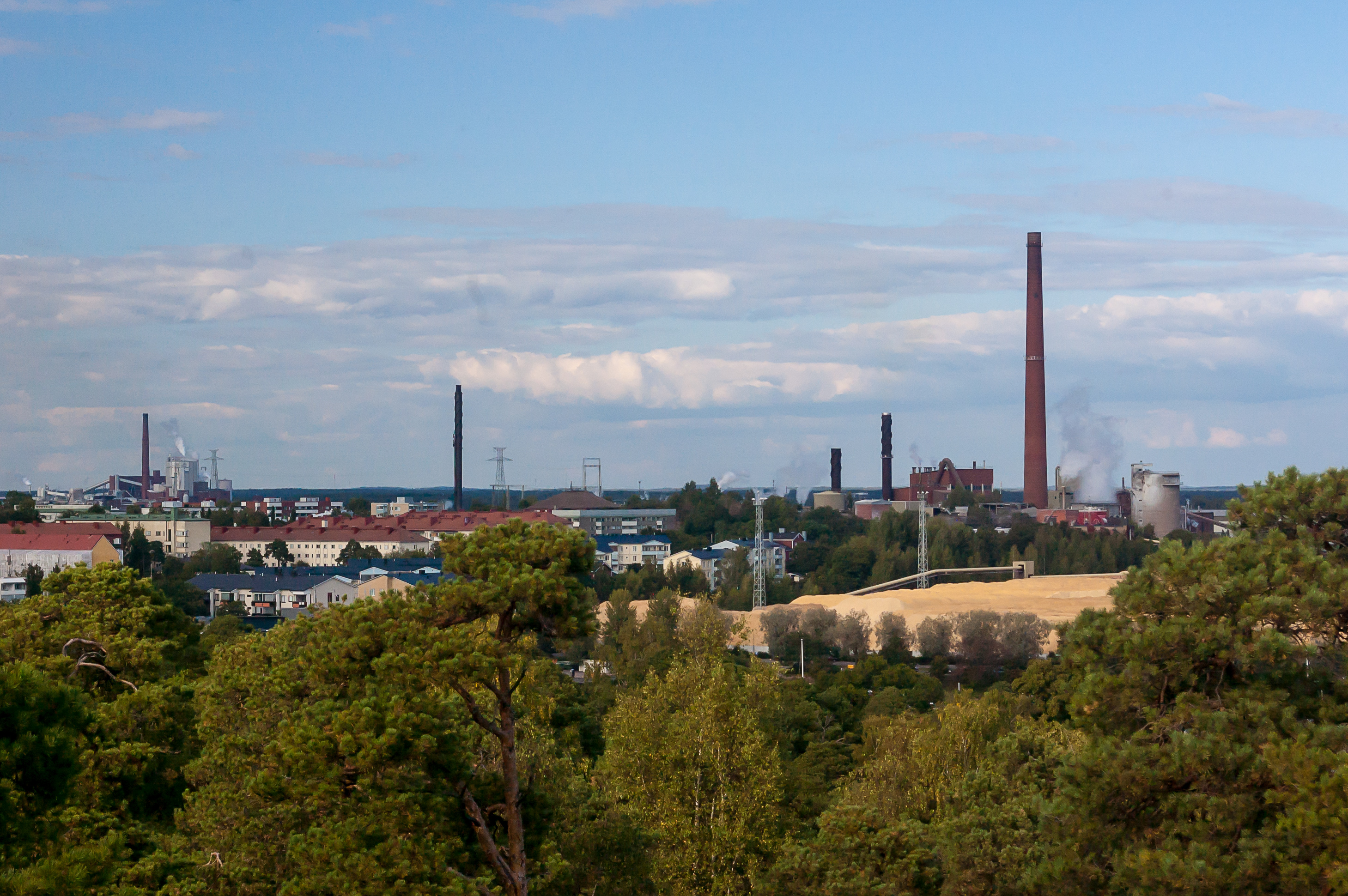
36. Some views from the tower. To the northeast is the industrial part of Kotkansaari. I’m not sure exactly what these factories are, but the yellow mass to the right certainly looks like an enormous hill of sawdust.
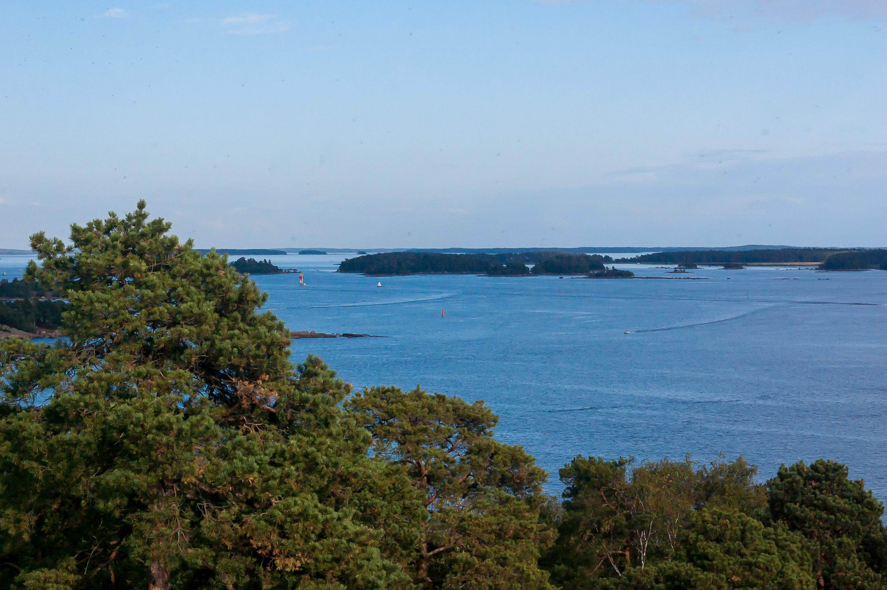
37. Islands of a large archipelago to the east of Kotka.

38. To the southwest a part of another cargo harbor of Kotka seaport is visible. This one is named Mussalo. The island in the foreground is most likely Havouri, and a much larger one in the background is Viikarinsaari (Finn. Boy Island).

39. And in front of the huge Kuutsalo island is the small Kukouri with the ruins of Fort Slava. There really is not much remaining of the fort.

40. In the western part of the Kotkansaari island there is only a tiny fortification, the Redutti (Finn. Redoubt). It has been completely restored and now holds a garden of medicine herbs.
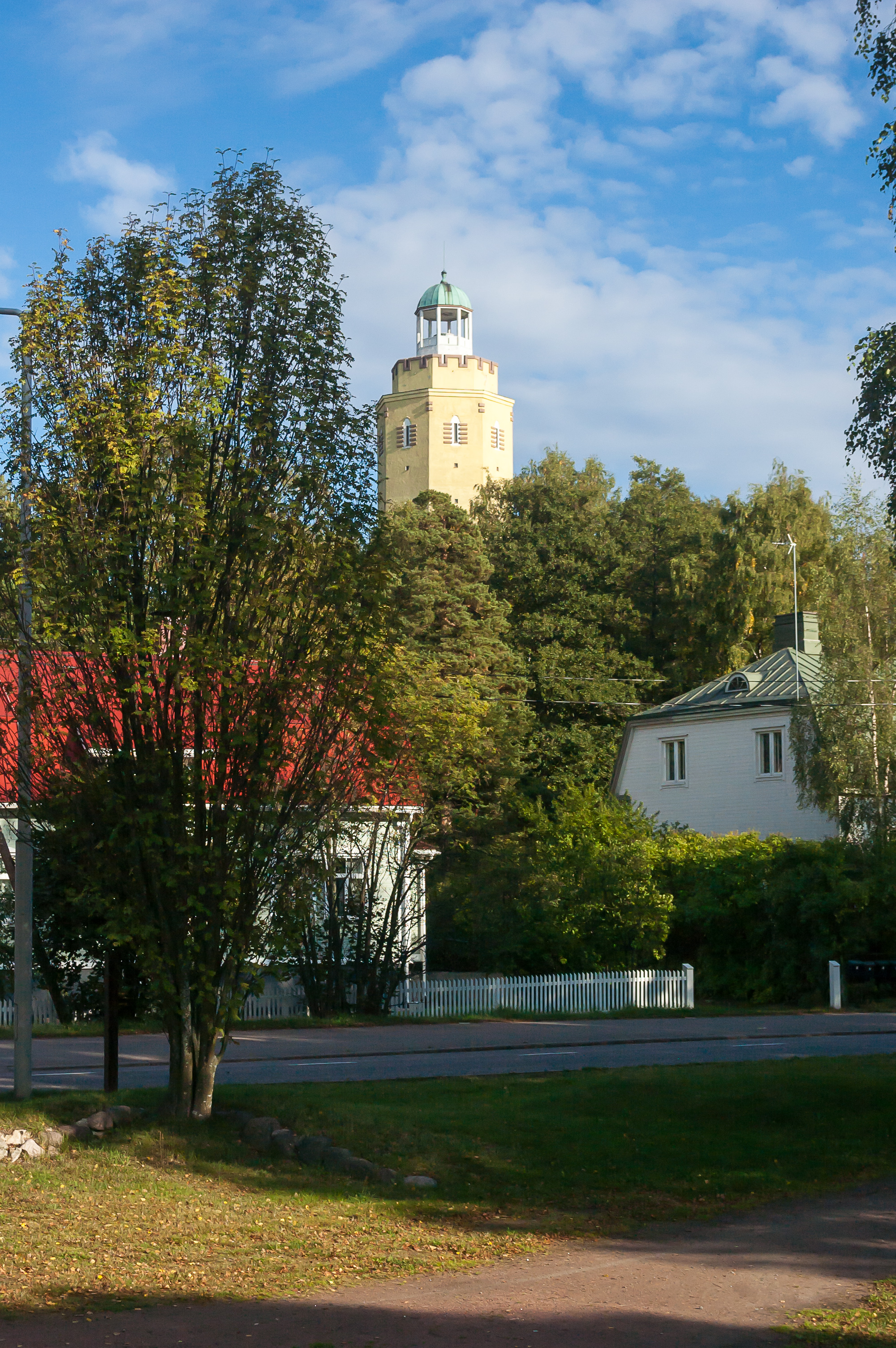
41. The highest point of Kotkansaari is Haukkavuori Näkötorni (Finn. Falcon Mountain Observation Tower), in 72 meters above sea level. From the top of the tower, the city of Kouvola can in theory be seen to the north, and the island of Hogland (Suursaari) to the south. The tower was originally build in 1914-1920 as a water tower, and was converted into an observation tower in the 1960s. I expected it would be closed due to season and/or late hours as well, so I didn’t try to go to the tower.
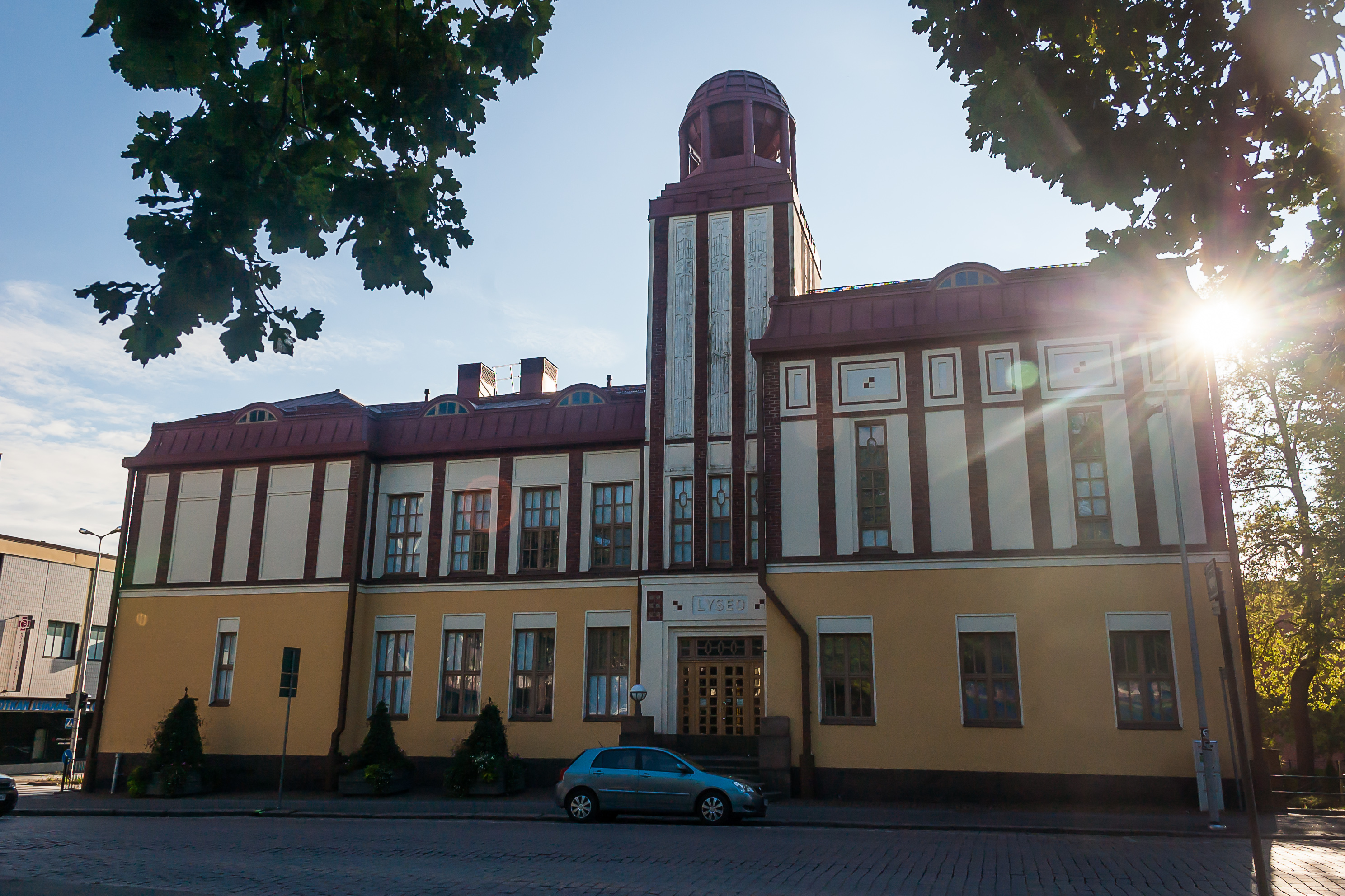
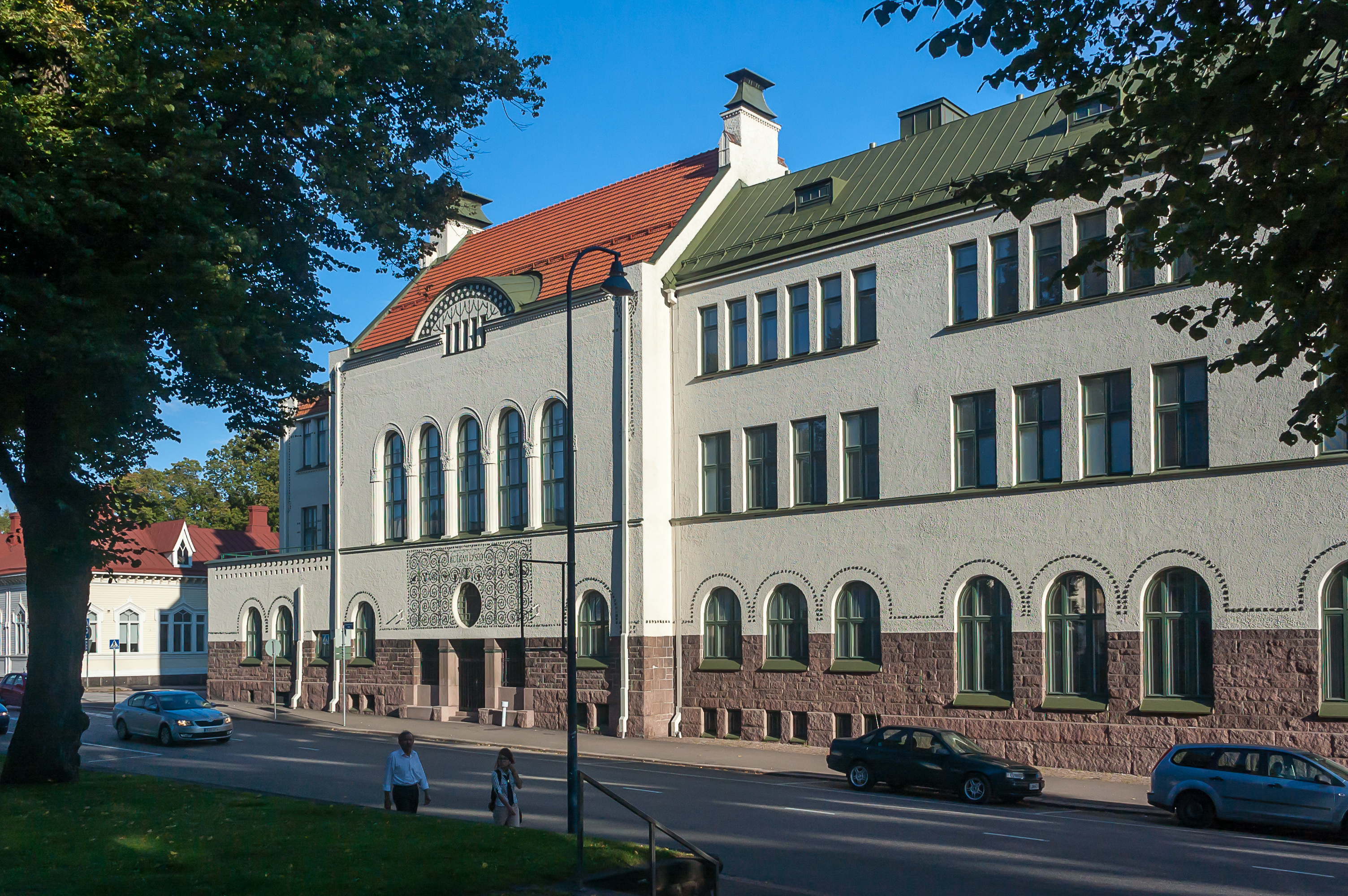
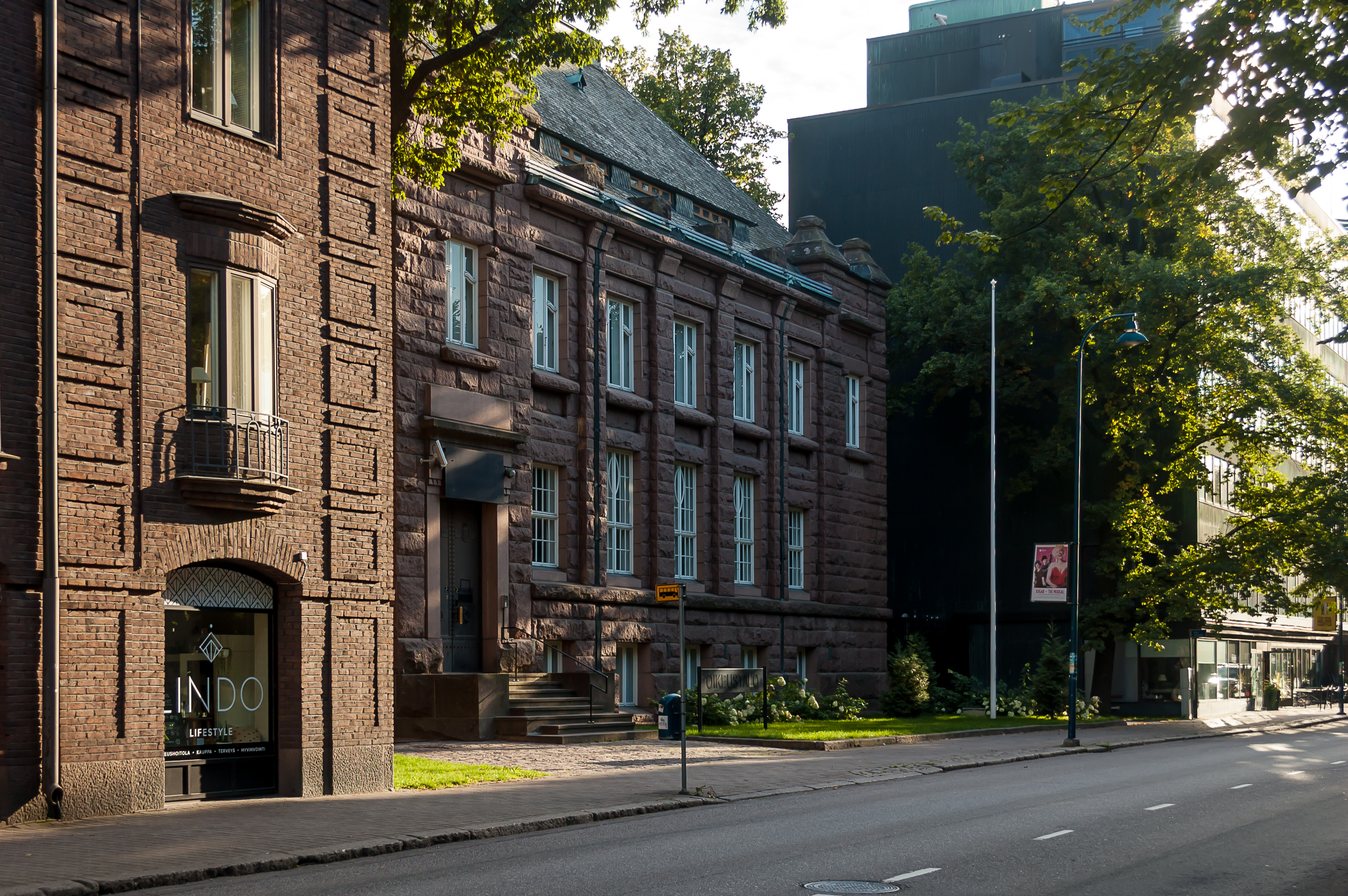
42. I finished my walk by exploring some more of the Kotkan center. This is the Kotkan lyceo (Finn. Lyceum), an old school founded in 1896.
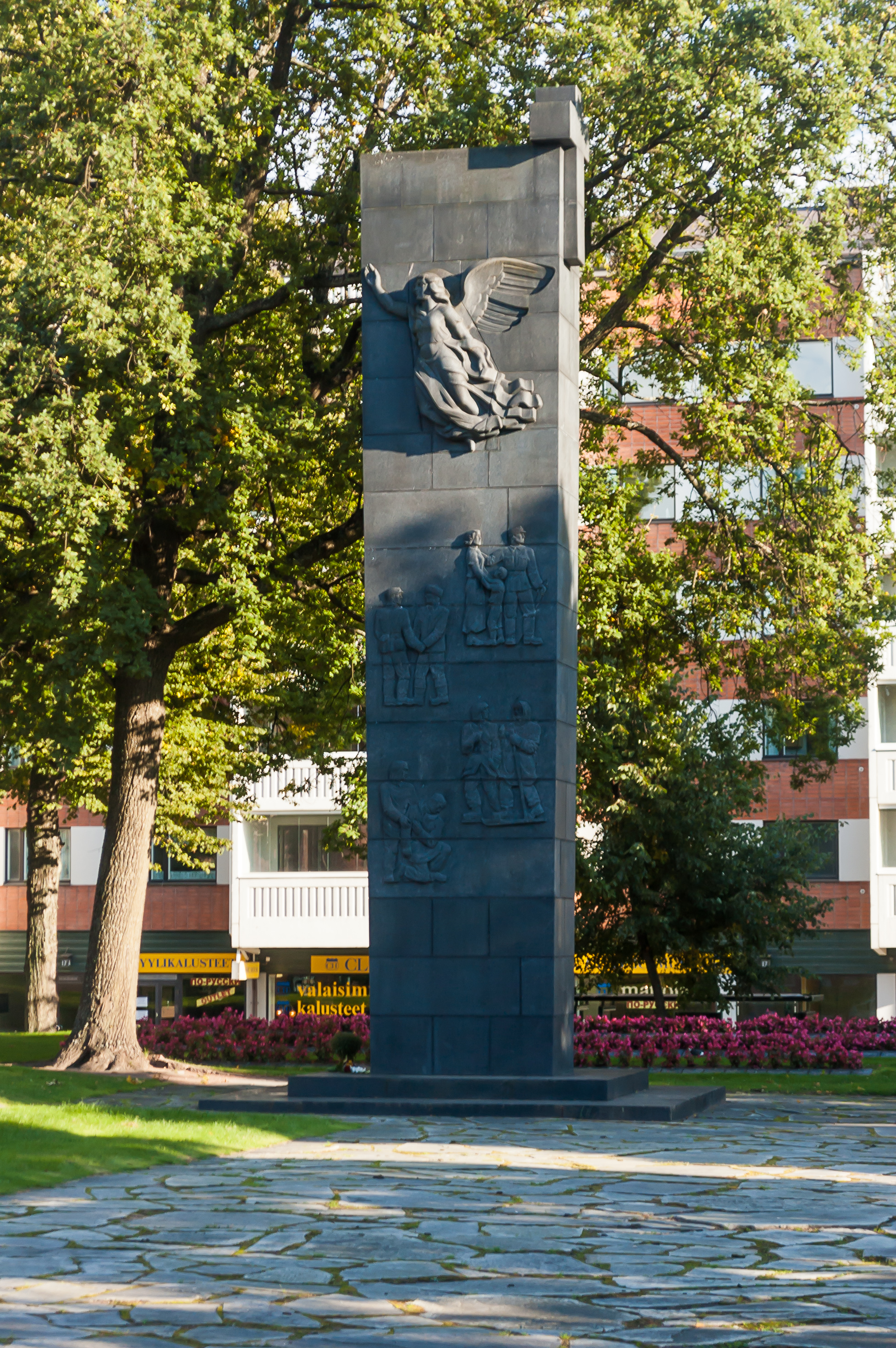
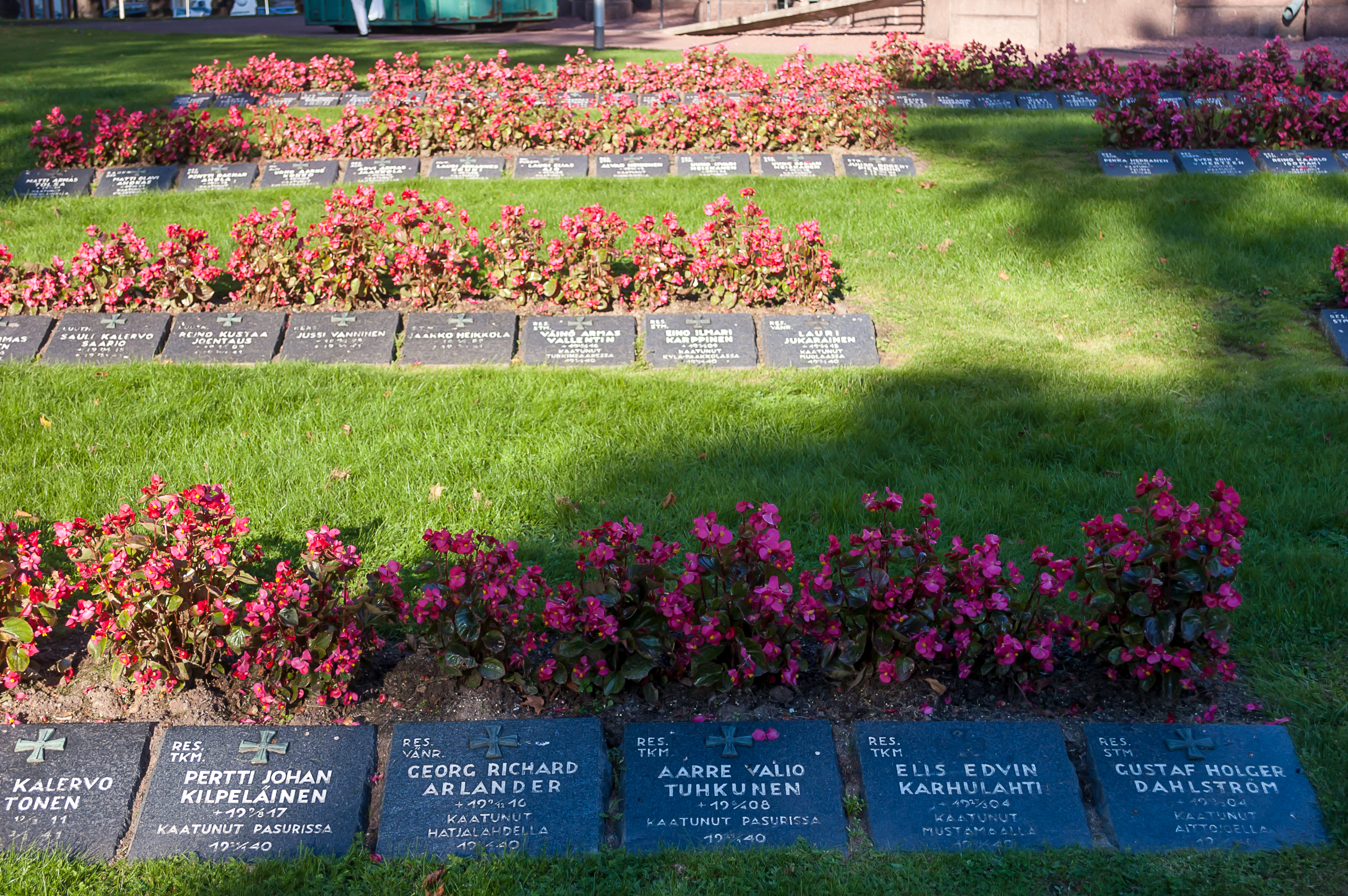
43. A traditional war memorial.
44.
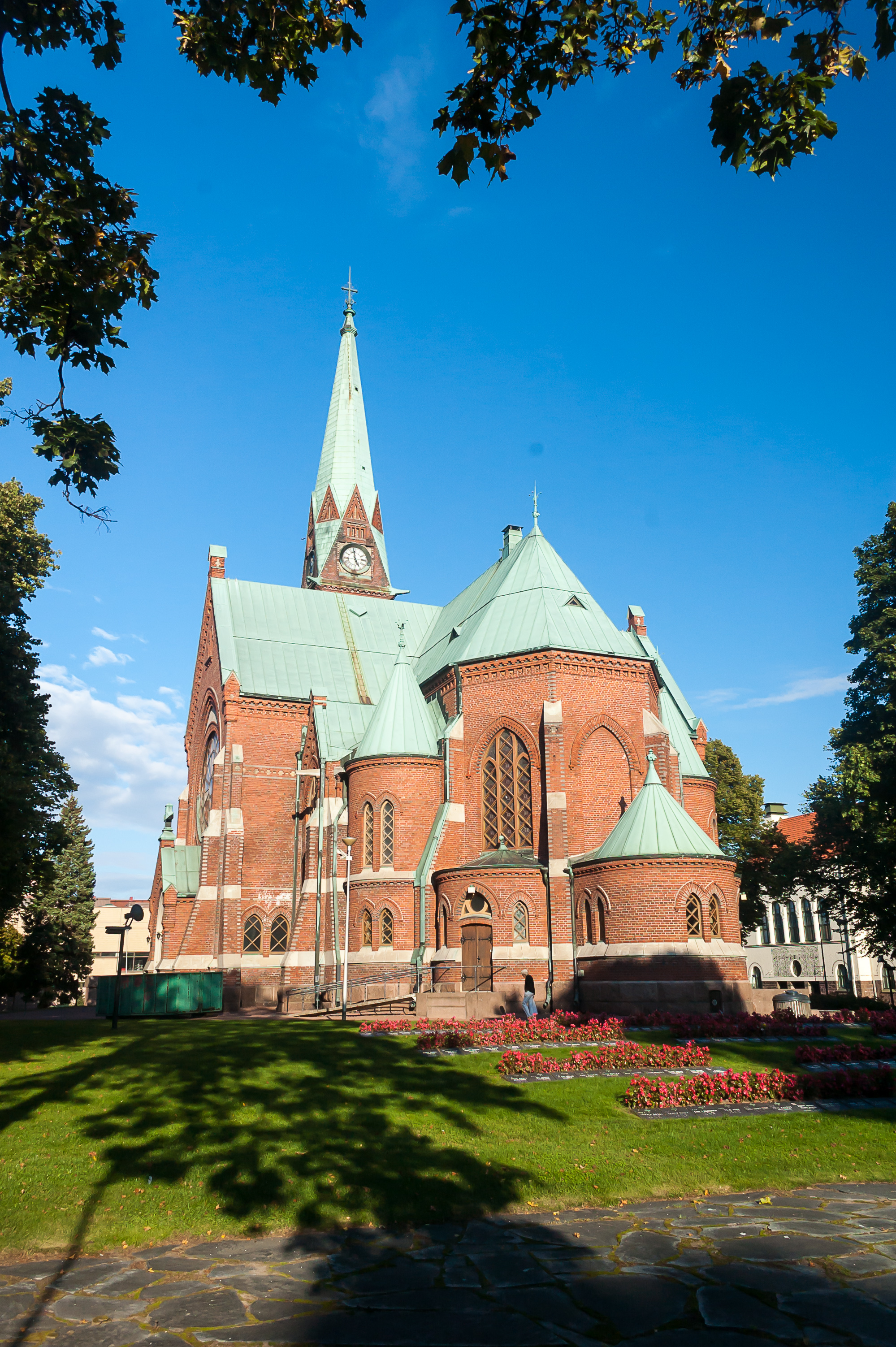
45. Kotka Church, built in 1898 by Josef Stenbäck in his traditional style. Probably not the best angle for it.
46.
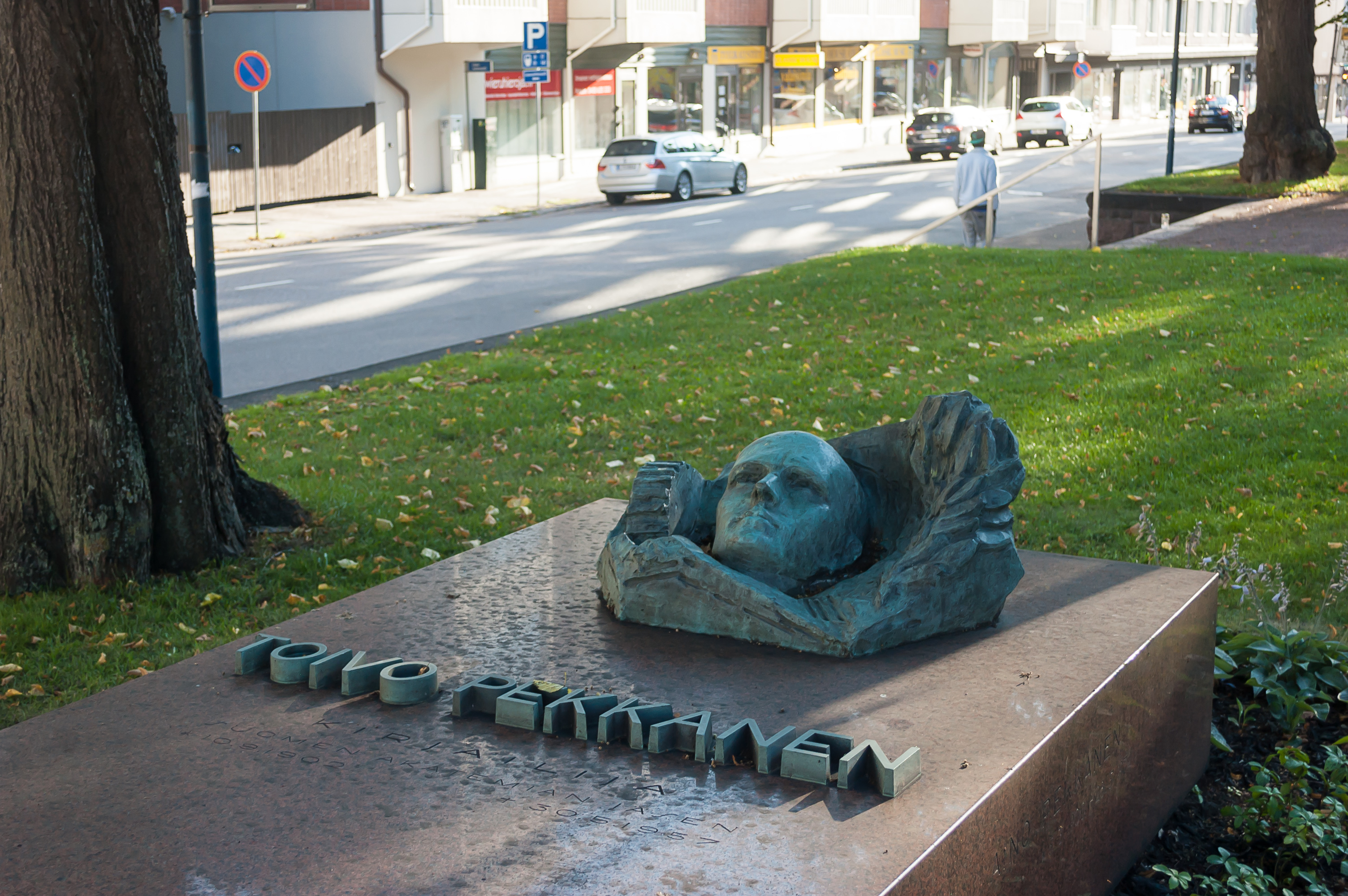
47. The grave of Toivo Pekkanen, probably the most famous writer from Kotka (1902-1957). He wrote of workers’ lives, and his most famous work is named Shadow of the Plant (Tehtaan varjossa). There is a school and a park in Kotka named after him as well.
48.
49. More Kotka sculpture.
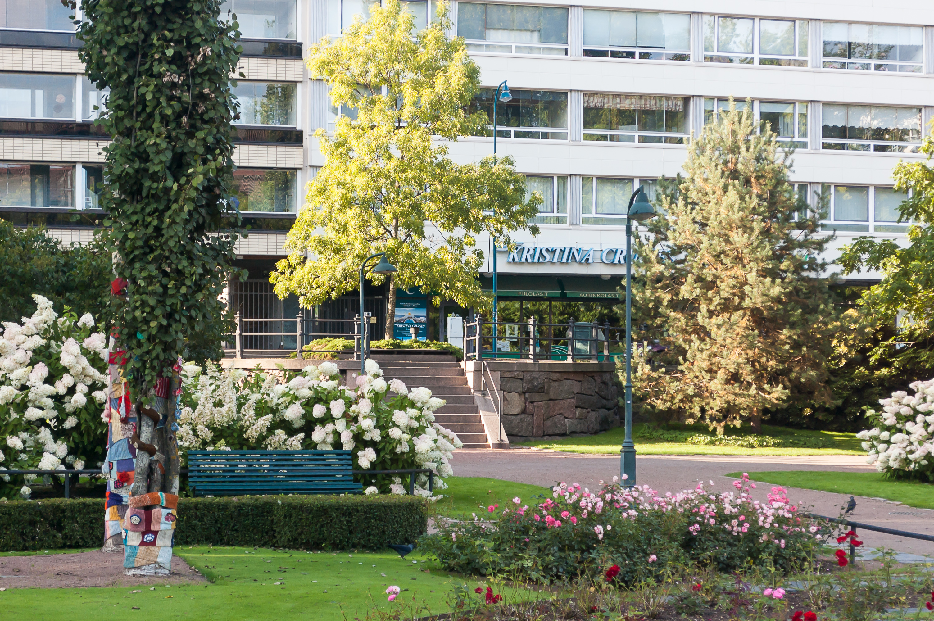
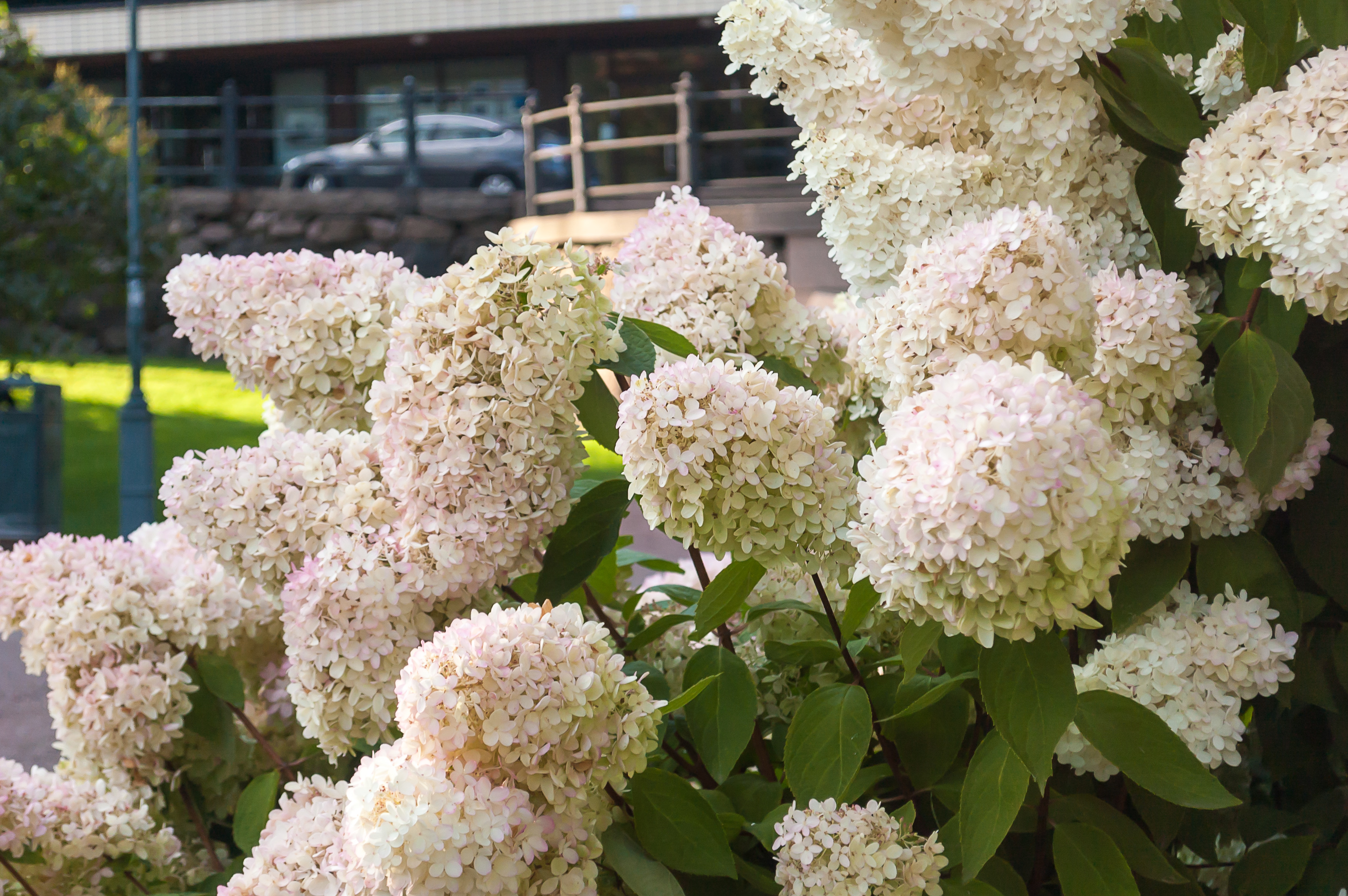
50. Sibelius Park, with lots of flowers blooming despite the autumn month. Kristina Cruises office is visible in the background. A local cruise company, founded in 1985, it used to have its own small fleet, but they sold their last ship, Kristina Katarina, in 2014 and now operate more like an ordinary travel agency.
51.
52.
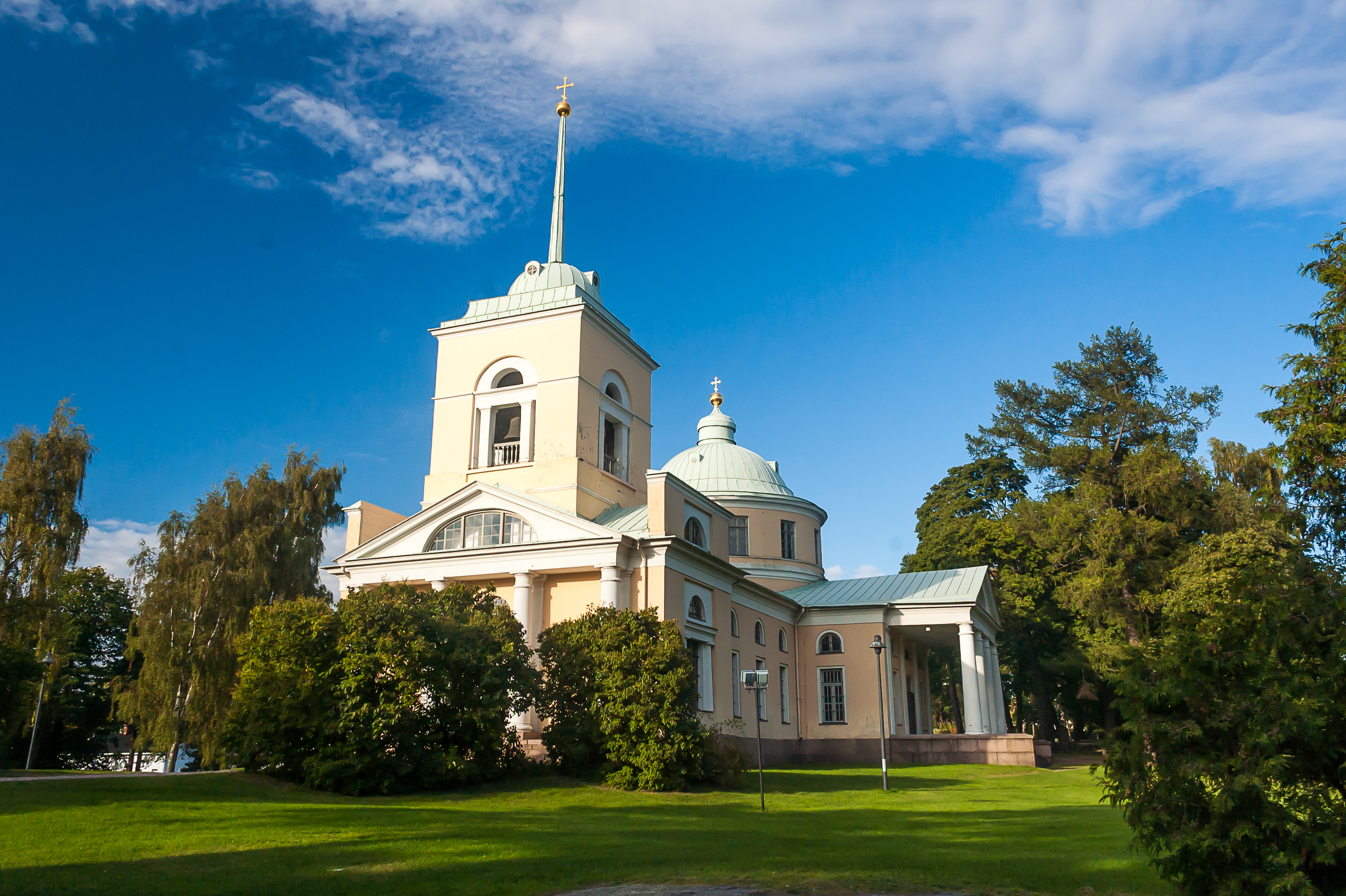
53. Yet another park, Isopuisto (Finn. Large Park), holds the oldest surviving building of Kotka, and in fact the only surviving building of Ruotsinsalmi fortress (if you don’t count fotress ruins). It is an Orthodox church of St. Nicholas.
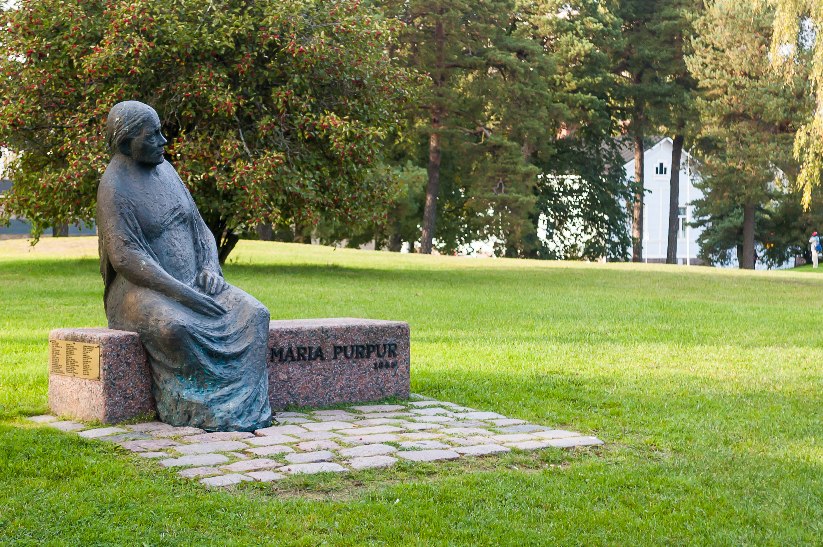
54. According to the legend, the reason why this church survived the British raid was this old woman, Maria Purpur, a Russian colonel’s widow. Allegedly, she locked herself down in the church and said that she won’t come out and that they could raze the church with her inside if they like. The British, being gentlemen and all, hesitated a bit, shrugged, and went away. I have no idea if that legend is true, but it is the reason why Kotka has a statue of a Russian babushka, just like Hamina.
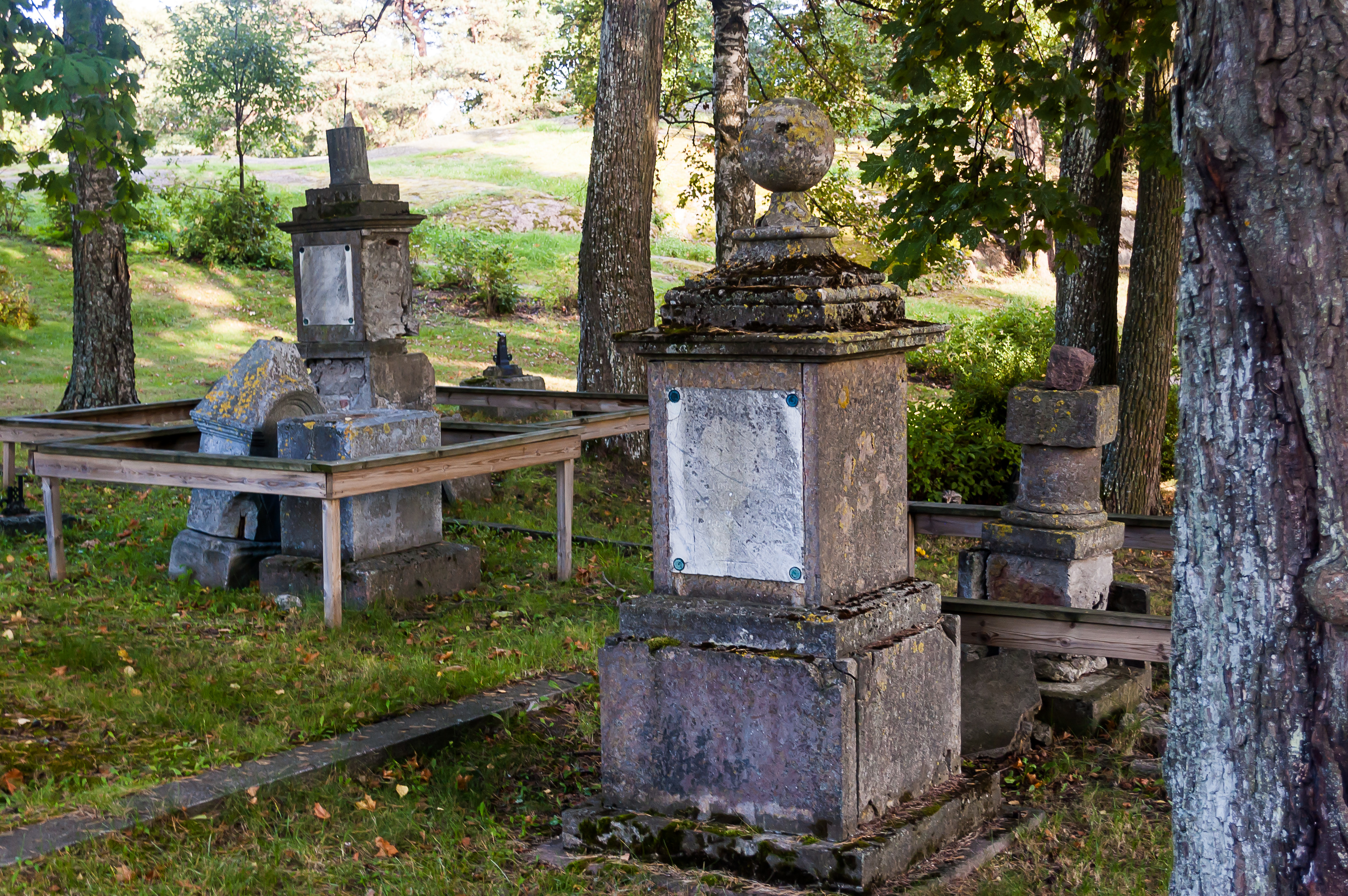
55. There is a tiny Russian graveyard next to the church. The names are mostly unreadable.

56. The wreck of one of the Russian frigates sunk in the Battle of Svensksund, named St. Nicholas (presumably no relation to the church), was discovered in 1948. It was preserved relatively well, and its cannons and various other artifacts were raised from the Ruotsinsalmi sea floor, and took place in the museums. The process took many years, and eventually the remains of the crew were raised as well and buried on the same old Russian graveyard with full honors.
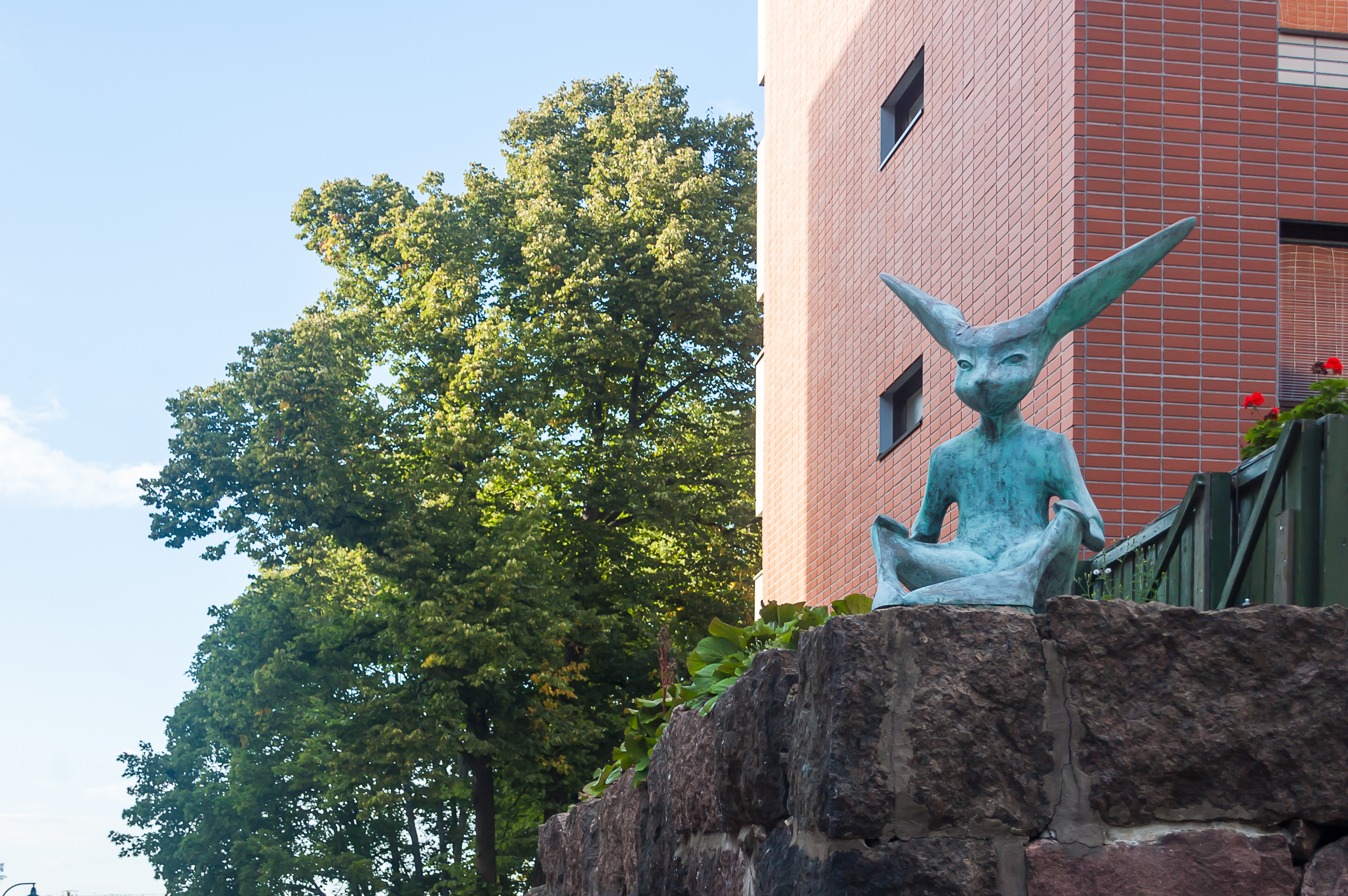
57. Going back to the car, past a statue named “The Idol”, although it looked more like a fennec fox to me. The car was waiting for me at the Vellamo Museum parking lot as I left it, and I drove towards the Russian border, getting home some four hours later or so, close to midnight.
Overall, I loved Kotka just the same as I loved Hamina. I visited the city again a few months later, in winter, and went to the Maretarium Museum then; and probably I’ll get there again some time in summer, to try to see more of the Ruotsinsalmi Fotress remains, and to take a boat to Varissaari and/or Kaunissaari. The eagle-y city is overall the best city of Kymenlaakso, I’d say — not that there are many of them.