title: "Lappi '15. IV. Up the Kesänki Fell" title_image: "/blog/2016/02/images/21967399985_2c8b797647_o.jpg" geo: - title: Kesänki fell lat: 67.618869 lng: 24.274844 zoom: 7 icon: mountain title_image: /blog/2016/02/images/21967396565_0a03a15e44_o.jpg description: > A fell in Ylläs massif in Pallas-Yllästunturi National Park, north of Ylläs proper. 535 m above sea level, about 300 m above the surrounding landscape. Great views over Ylläs and Kesänkijärvi lake below, climb a along store run. Circular 8 km hiking trail starting from Kellokas Visitor Center maps: [index, mountains]
On my second day in Fell Lapland, I decided to try something a bit more exciting than exploring the village and the easiest trails. I wanted to climb one of the fells, and spend a lot of time in the morning deliberating on the choice of that fell. With this and working on photos and letters, I set out only at 2 PM, having failed to really decide on anything. I drove to Kellokas nature center, intending to buy a map and start my walk there. The distance from my cabin to Kellokas was only about two kilometers, but I decided to drive rather than walk anyway, to conserve energy for later.
I was taken aback by how many cars there were at Kellokas parking lot. It felt a lot more crowded than, say, Jounin Kauppas supermarket parking lot. It looked like I wasn't the only one who wanted to go hiking. Nonetheless I only met a few people during that day.
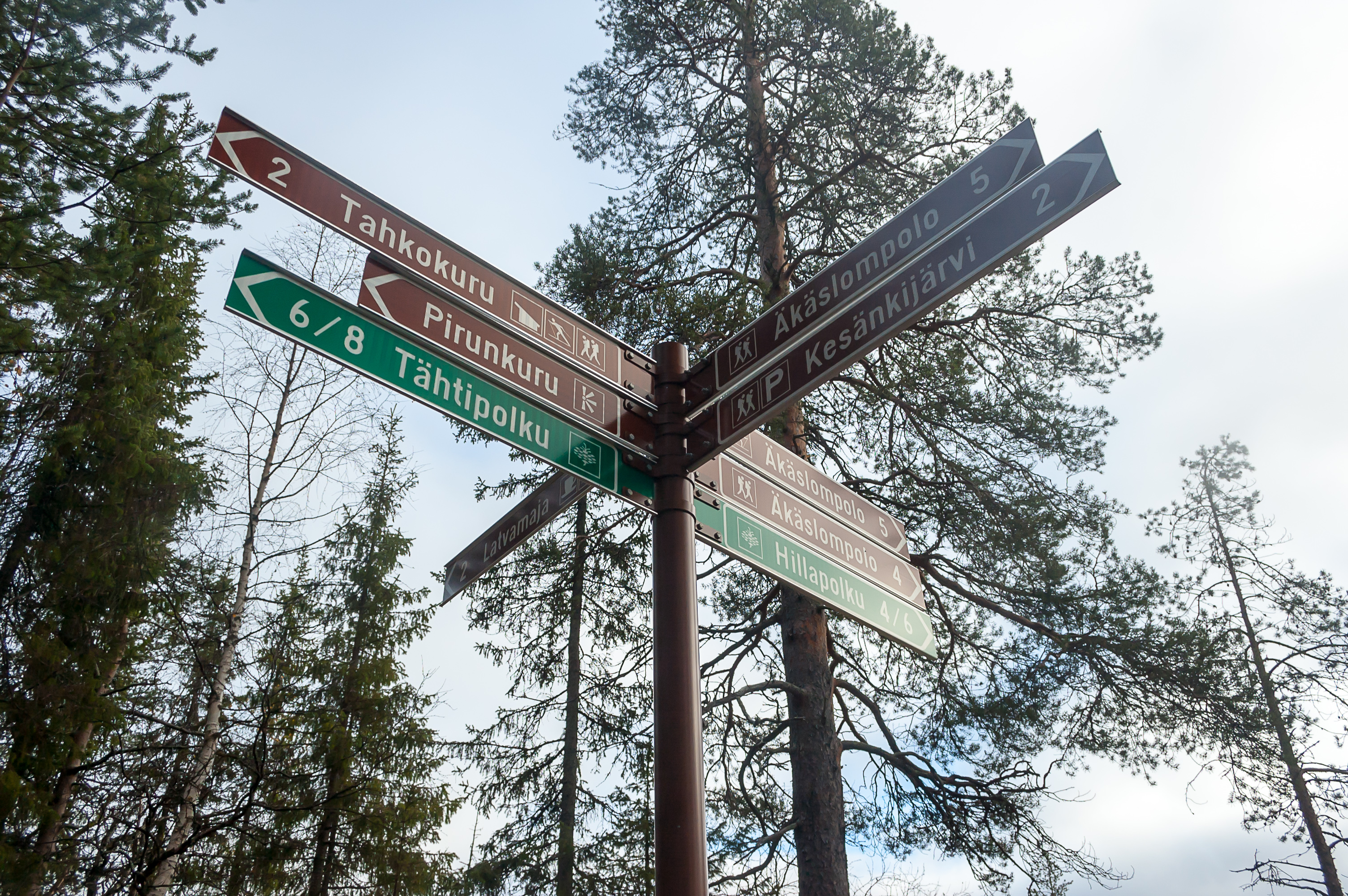
I can't really explain what is the exact purpose of Kellokas nature center, as I don't really know myself. It has a map and souvenir shop, a cafeteria, a library, probably other things. I quickly found the map I wanted, which was the same one I saw on an information board at Ylläs skiing slopes the previous day, only pocket-sized. €6 felt like rather a lot for such a small map. It was really extremely useful though, and I guess the national park must make at least a bit of money somehow. It's not like they can charge simply for entering; that would be a violation of the ancient Everyman's Right.
I looked through the rest of the shop's inventory, but didn't find anything particularly notable. There were lots of other maps, including some of rather remote areas like Kilpisjärvi or Utsjoki. The souvenirs were more or less what you would expect, including cloudberry sauce and jam. I was more interested in cloudberry liqueur, but as with any hard alcohol in Finland, that could only be found in a specialized Alko store.
After examining the map, I decided I wanted to walk a trail named Tähtipolku (Finn. Star Trail), which climbed Kesänki Fell (it's KEH-san-kee by the way) through Pirunkuru Ravine. At this, I set out from Kellokas.
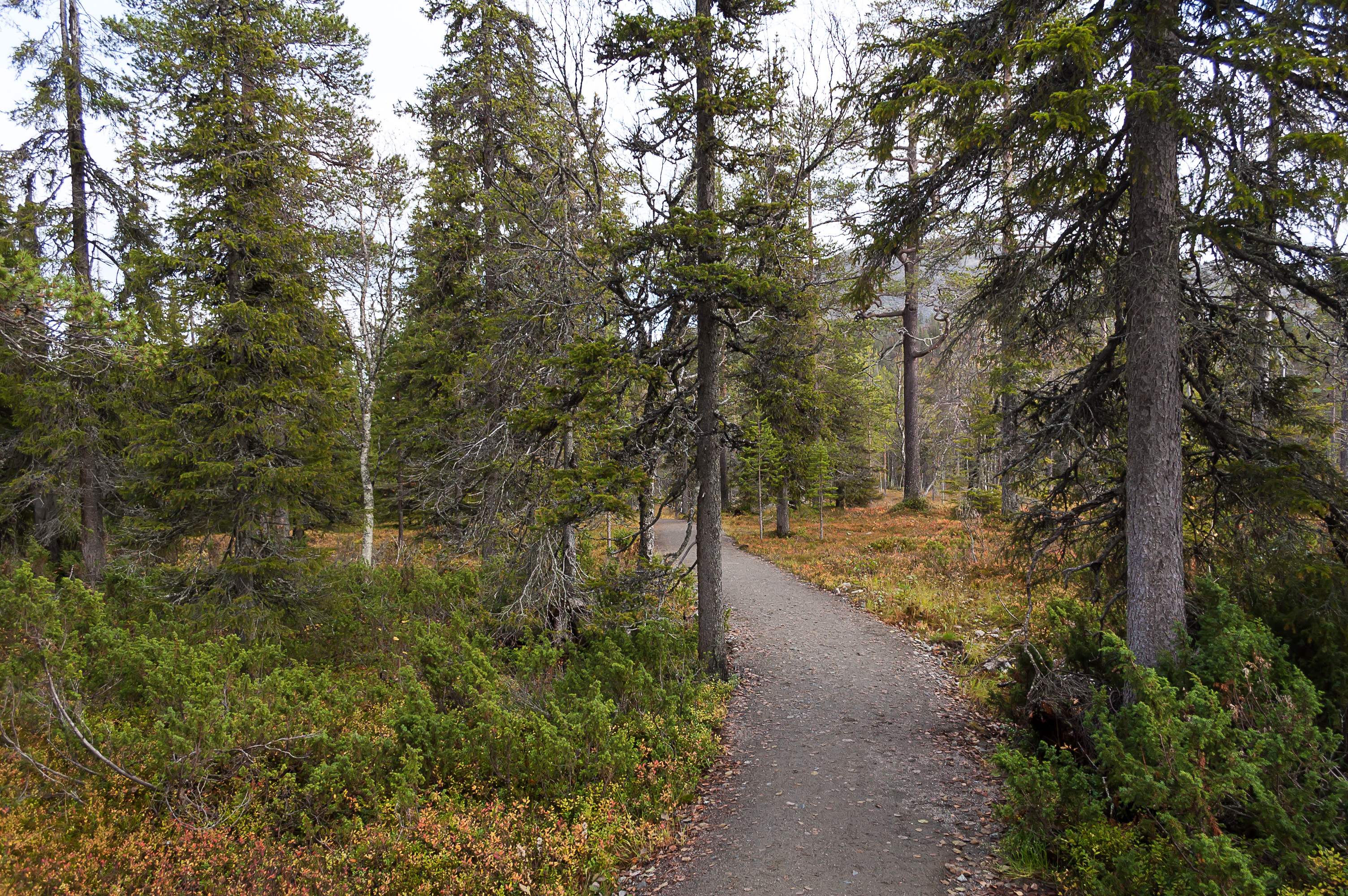
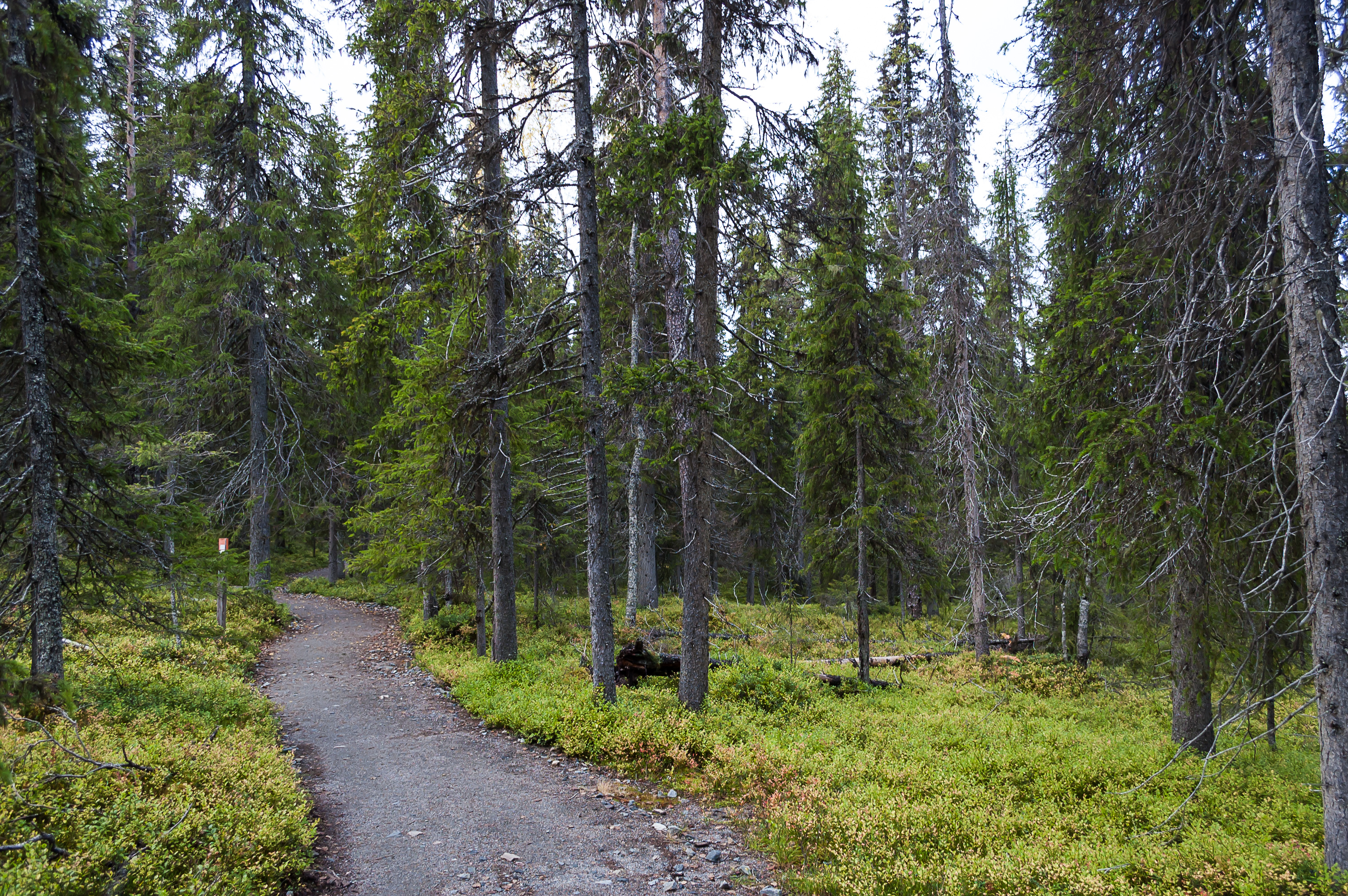
1. Officially, Tähtipolku trail doesn't really start at Kellokas, so I had to walk parts of Varkaankuru and Hillapolku (Finn. Cloudberry Trail) first. So this is me walking to Varkaankuru again.
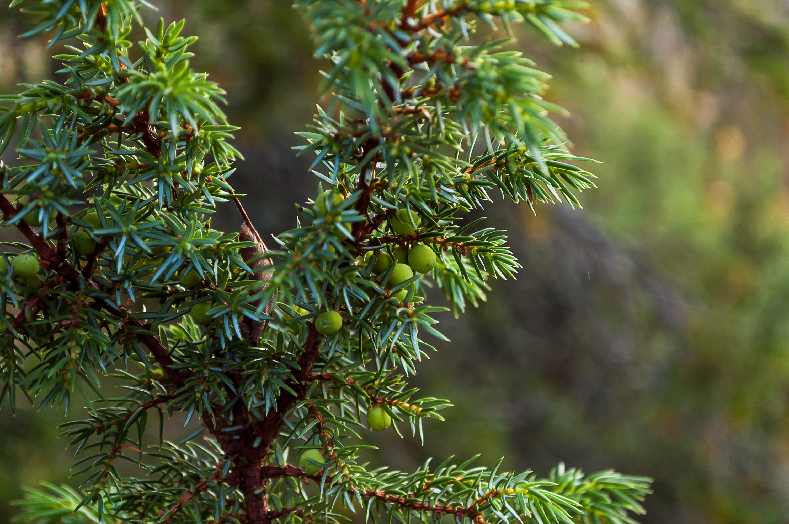
2. Some more juniper. Its berries are actually tiny cones. Crazy, right?
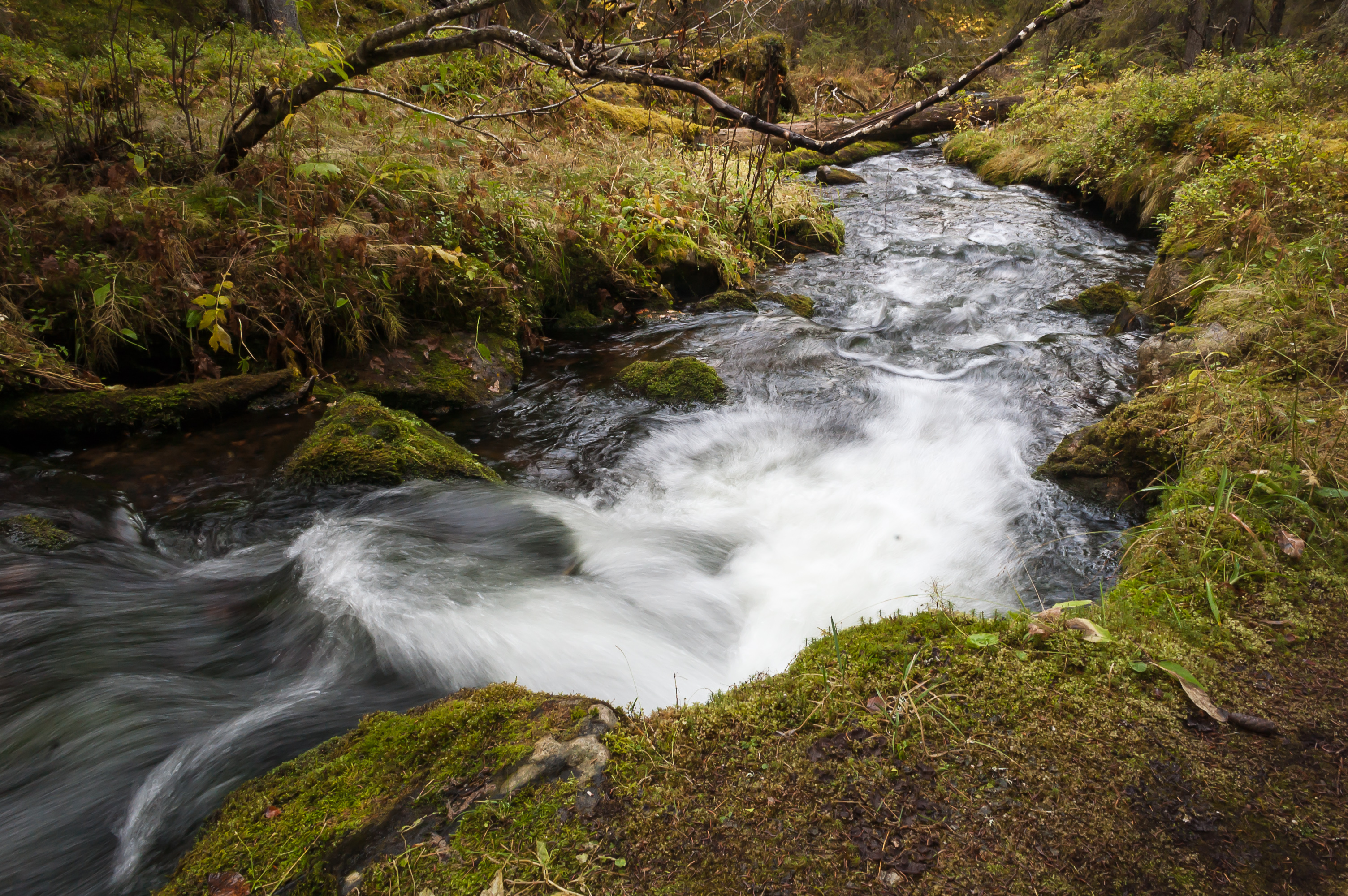
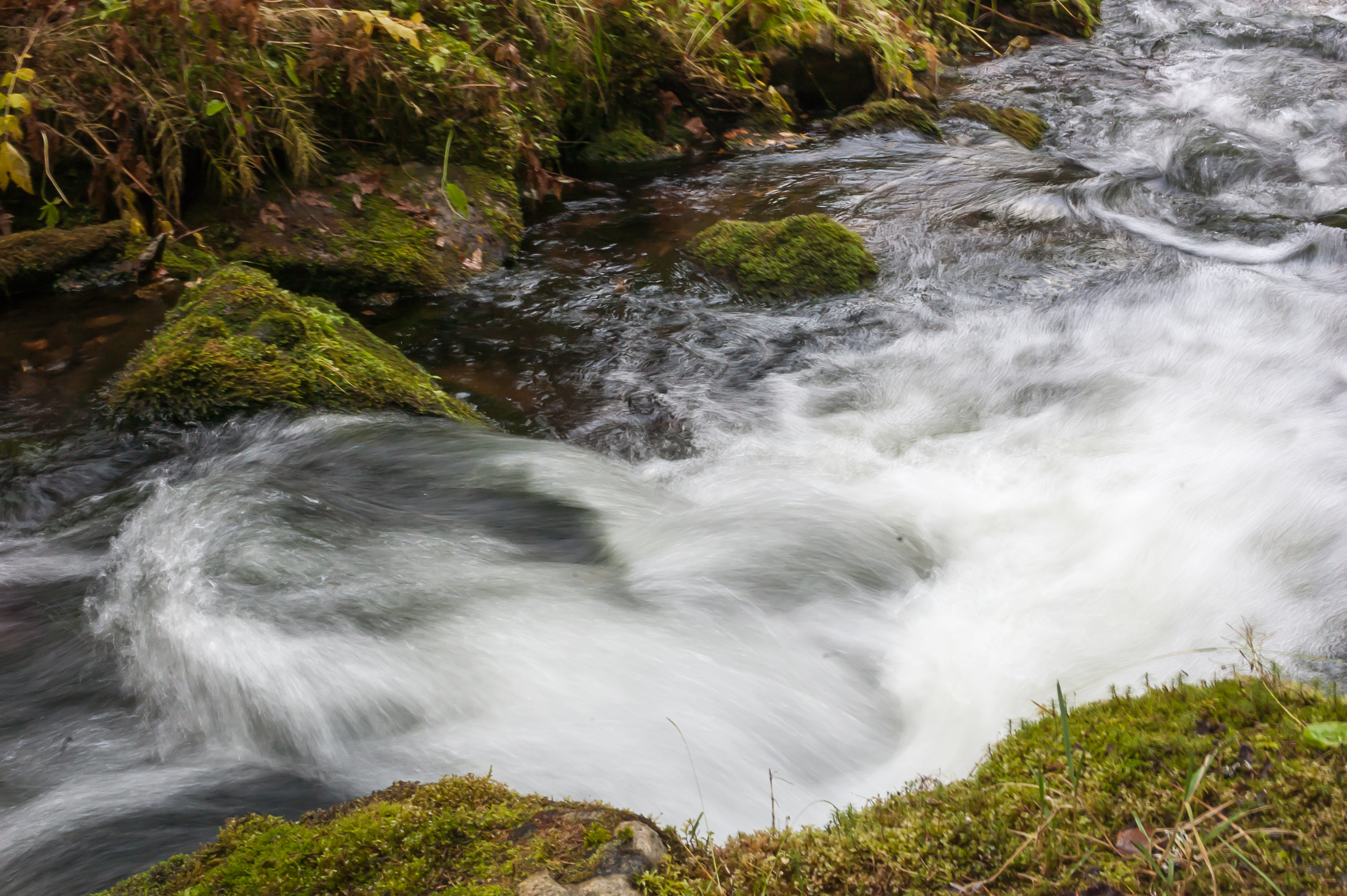
3. Walking by Varkaanoja Brook again. The foam on its rapids is snow white.
4.
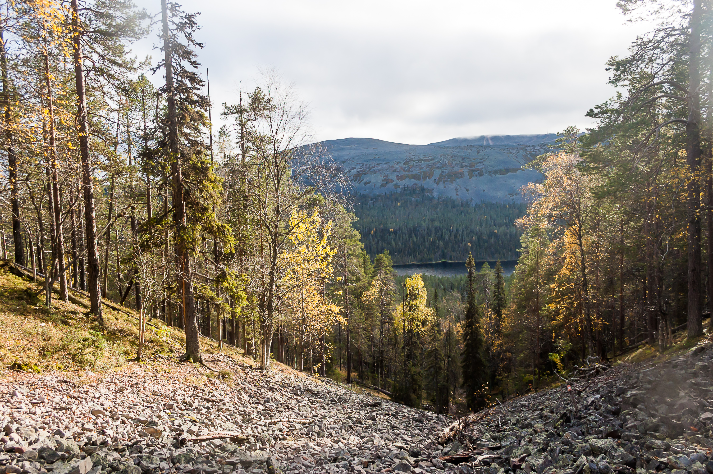
5. From Varkaankuru I turned onto Hillapolku trail, which goes in circle around Kesänkijärvi Lake.
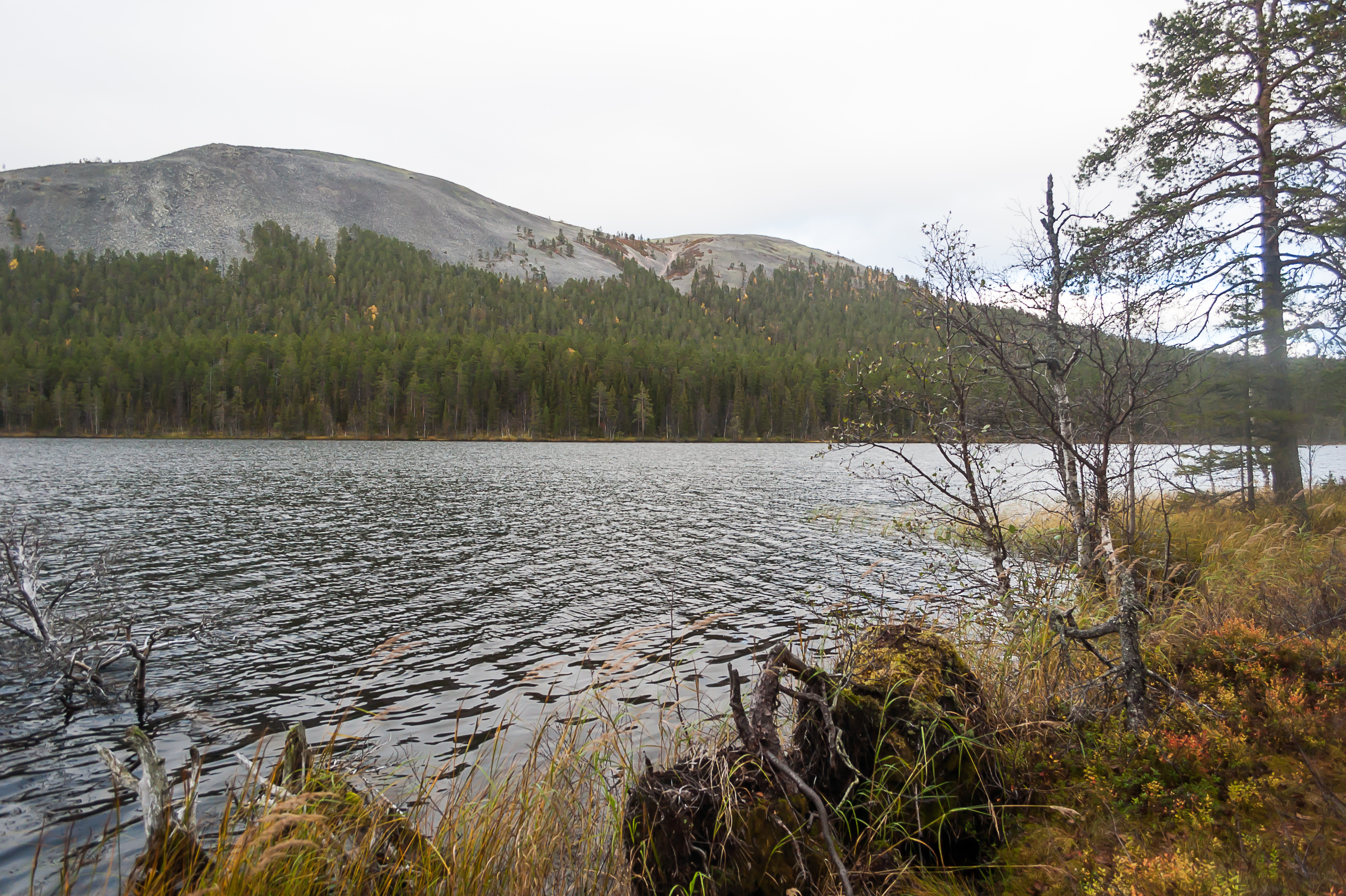
6. Here is that lake, peeking through the trees. And the fell behind the lake is Kesänki itself.
7. Kesänkijärvi shores are mostly waterlogged. I walked to the shore on some tiny trail which soon disappeared in a marsh. I got some water in my boots but still managed to get to the edge of the water.
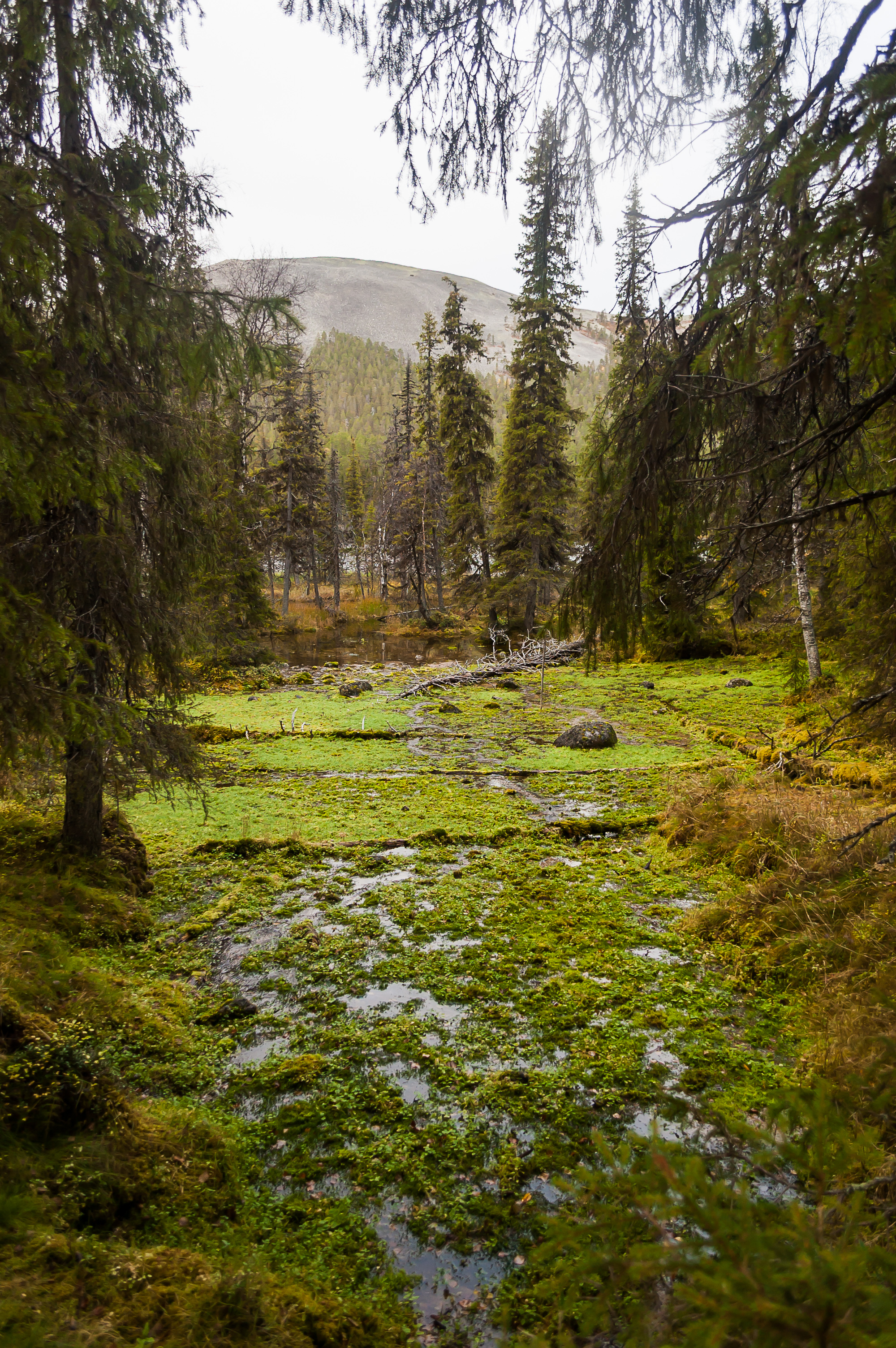
8. Even more waterlogged area by the main Hillapolku trail.
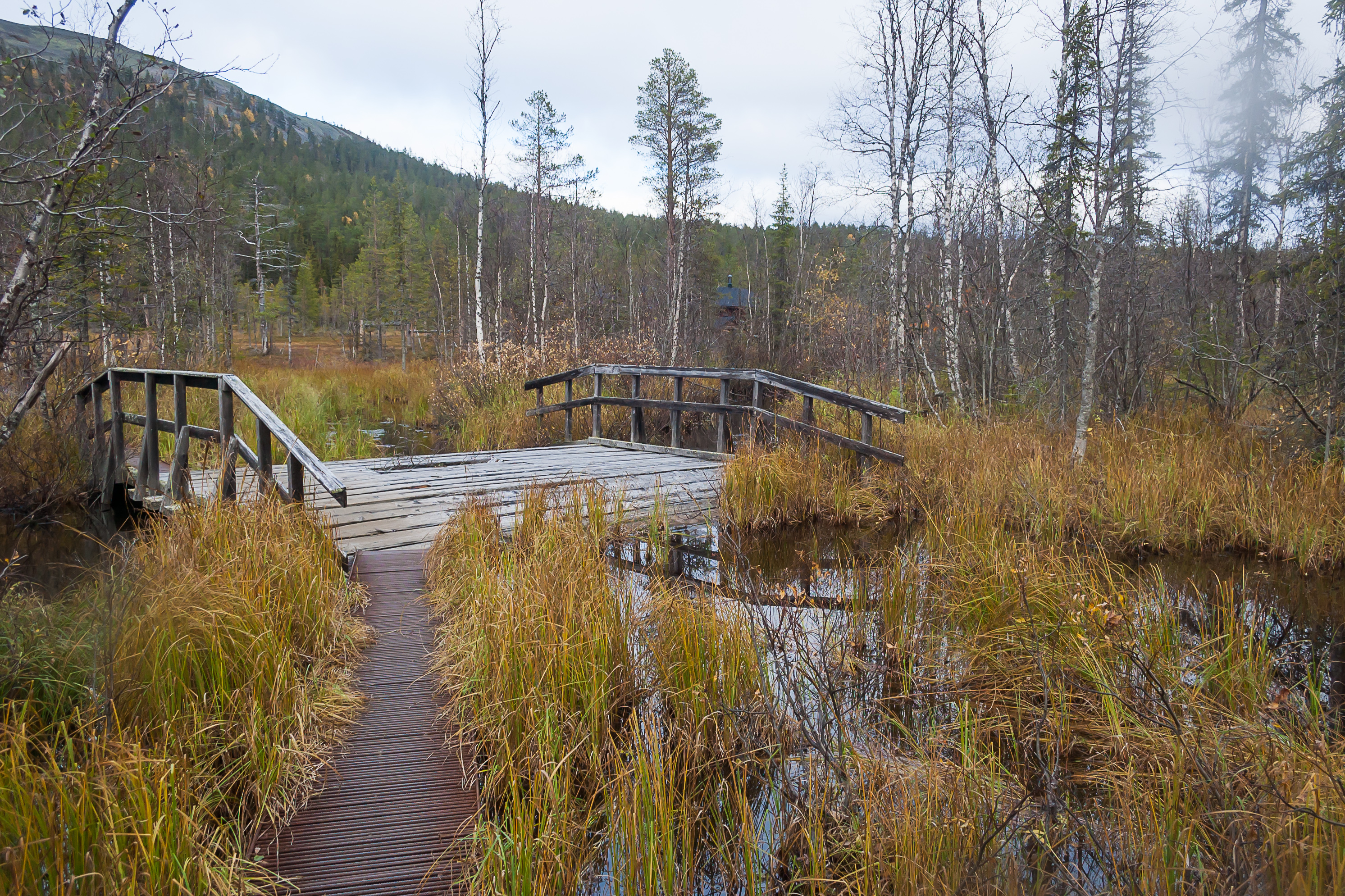
9. Part of the trail has to continue on a plankway, and a larger bridge crosses Kesänkijoki River, which flows in and out of the lake, and then into Äkäslompolo Lake in the namesake vilage.
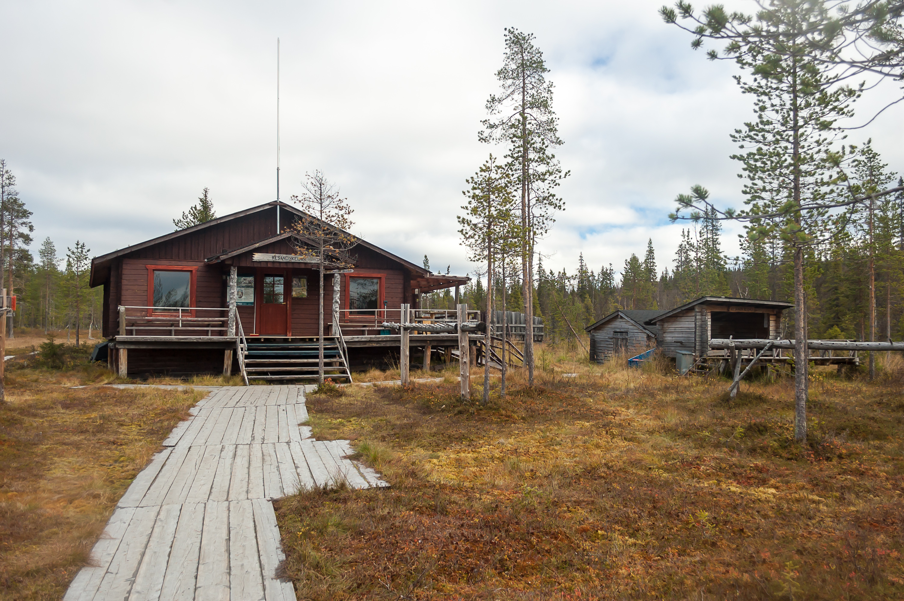
10. You'd think it would be nearly impossible to build anything in such a wet and roadless place, but here is Kesängin Keidas (Finn. Kesänki Oasis), a cafeteria. It is meant for skiers, and it looked like it was closed in that time of year. I guess it's only really possible to supply such a cafeteria when the marshes freeze over and it becomes reachable with a snowmobile or something.
11. It's also possible to walk to a tiny pier at the lake here, so I guess I could have avoided getting water in my boots.

12. Three swans swam out on the lake.
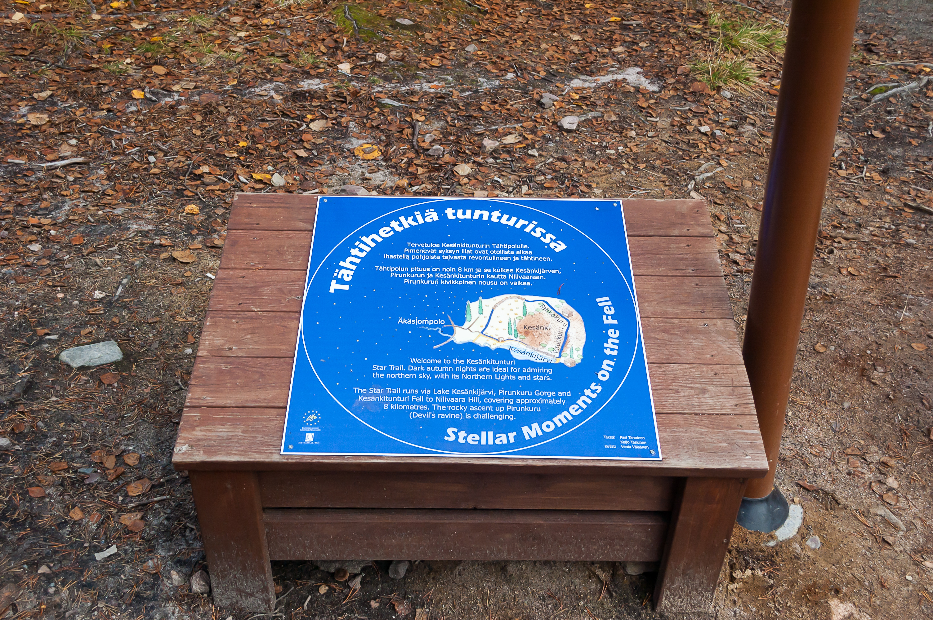
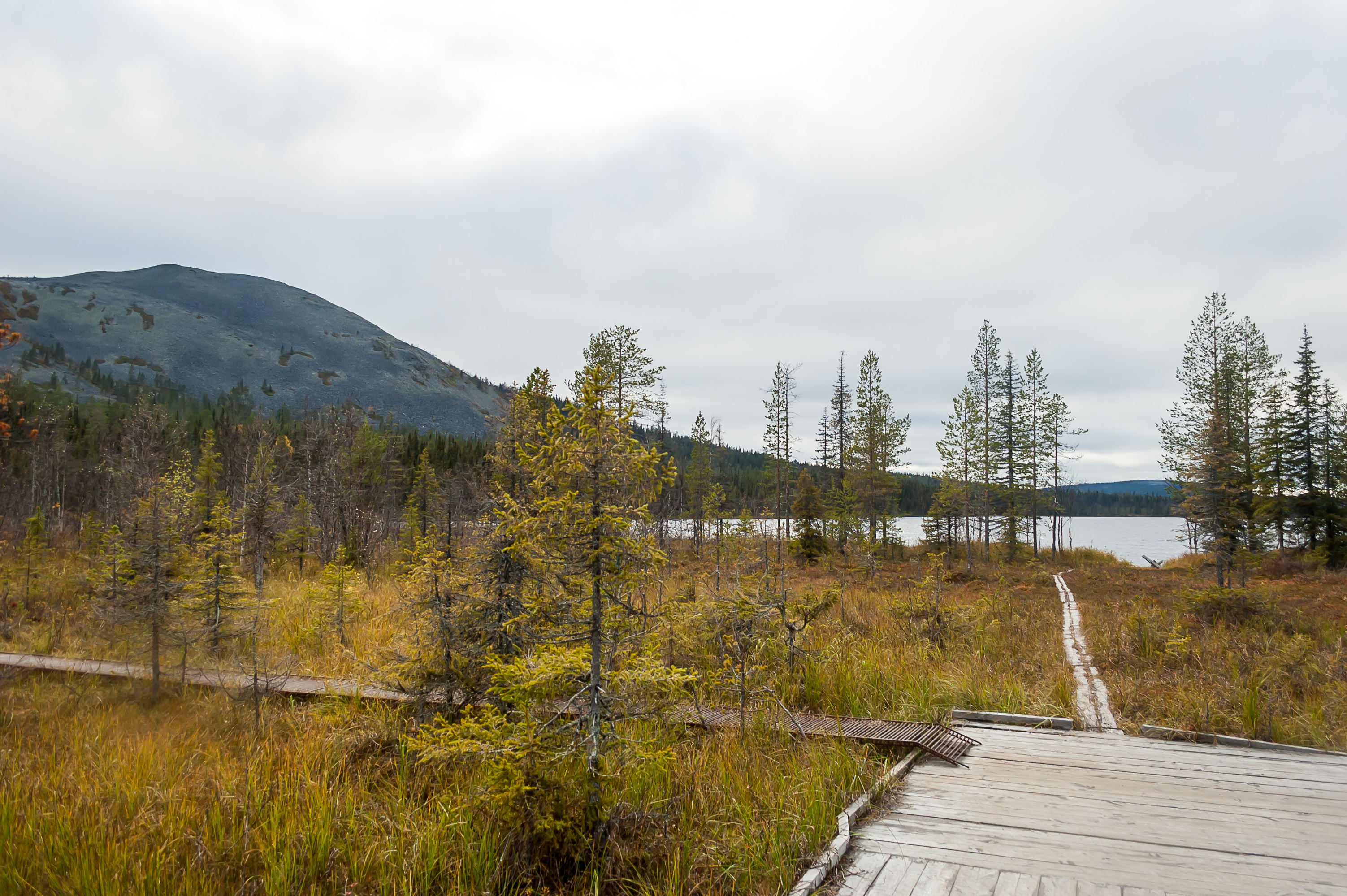
13. After the cafeteria, Hillapolku trail continues along the lake shore, and Tähtipolku starts here and begins to climb the Kesänki Fell. I'm not sure why they chose to name it "Star Trail", but there were small astronomy-themed information boards along this trail. They were translated into English, but there wasn't anything interesting in them; all the information was on a children book level.
14.
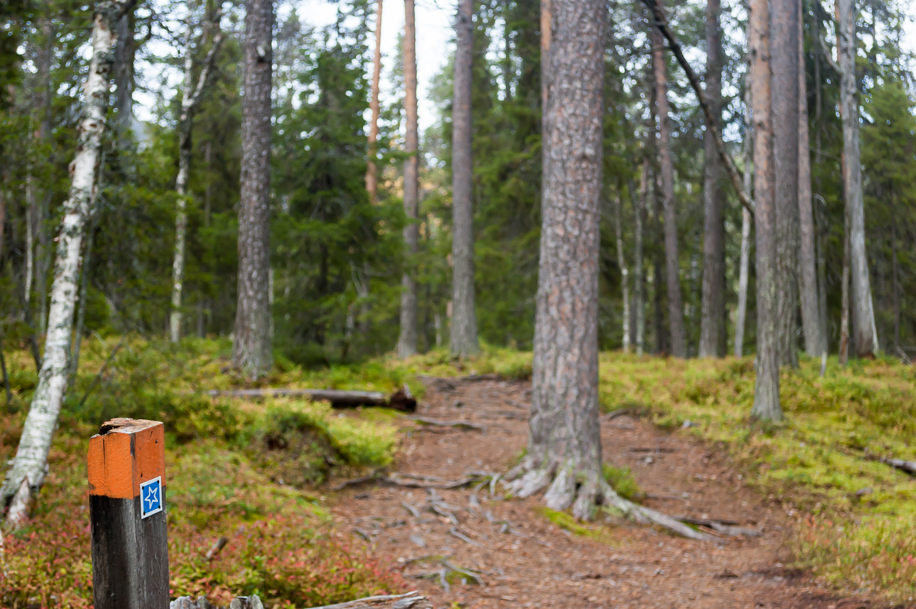
15. The part of the climb through the forest was easy enough. Like the other trails, Tähtipolku is marked with orange-topped poles. For named trails these poles also have the corresponding sign on them, which in this case was, appropriately, a blue star.
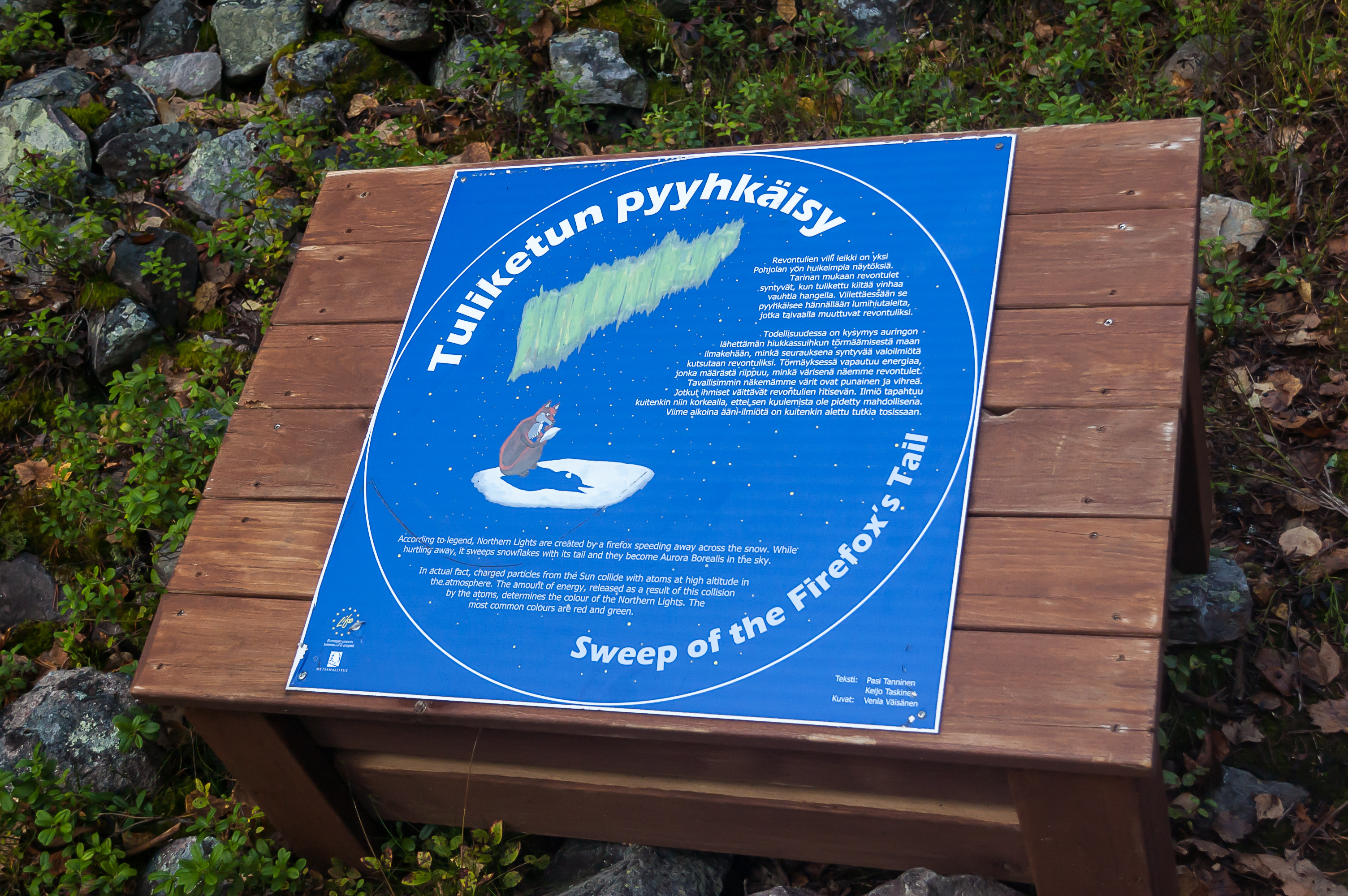
16. This is the part which explains why northern lights are called revontuli (fox fire) in Finnish. I guess watching northern lights from the top of the fell must be pretty spectacular.
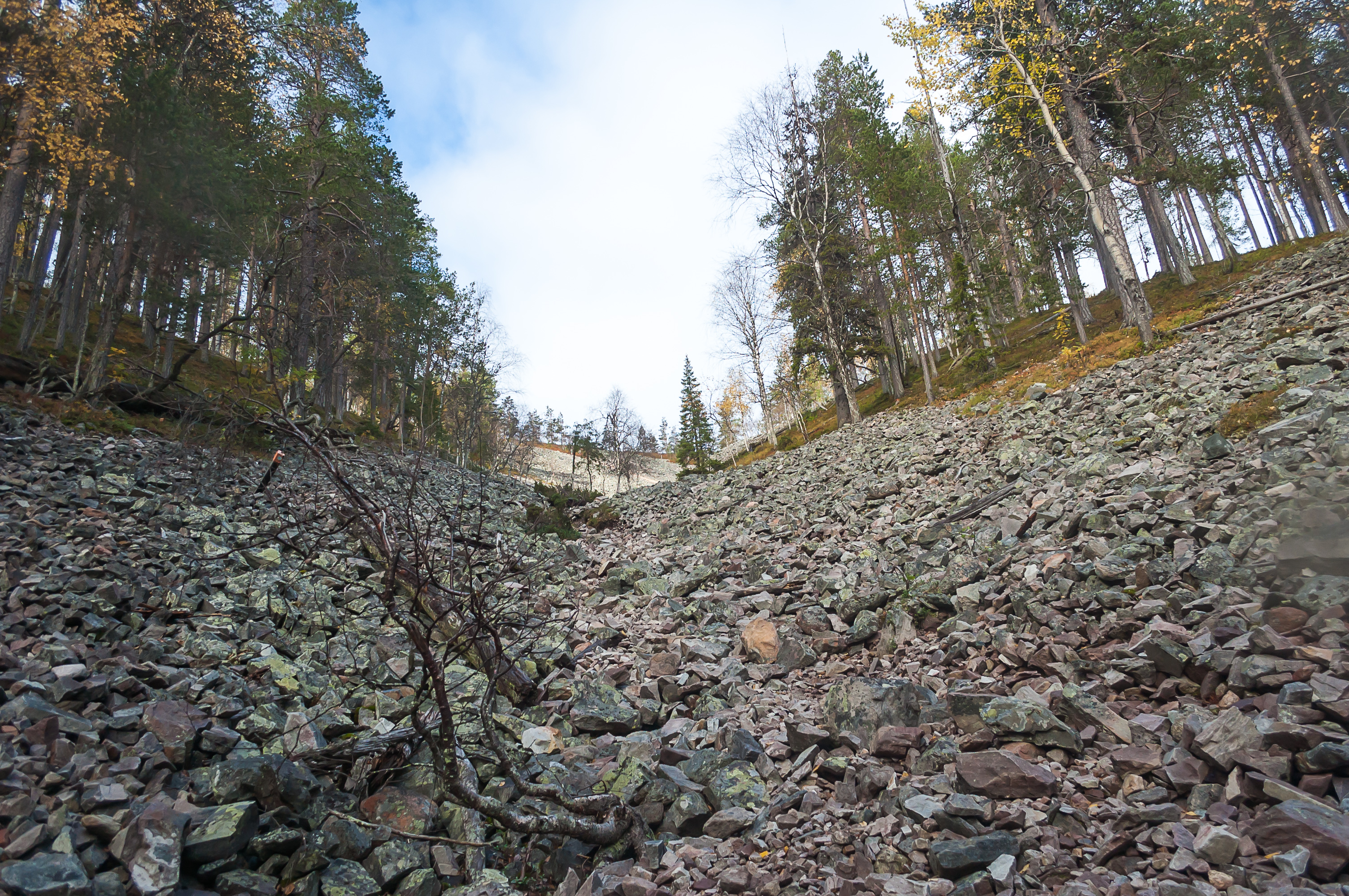
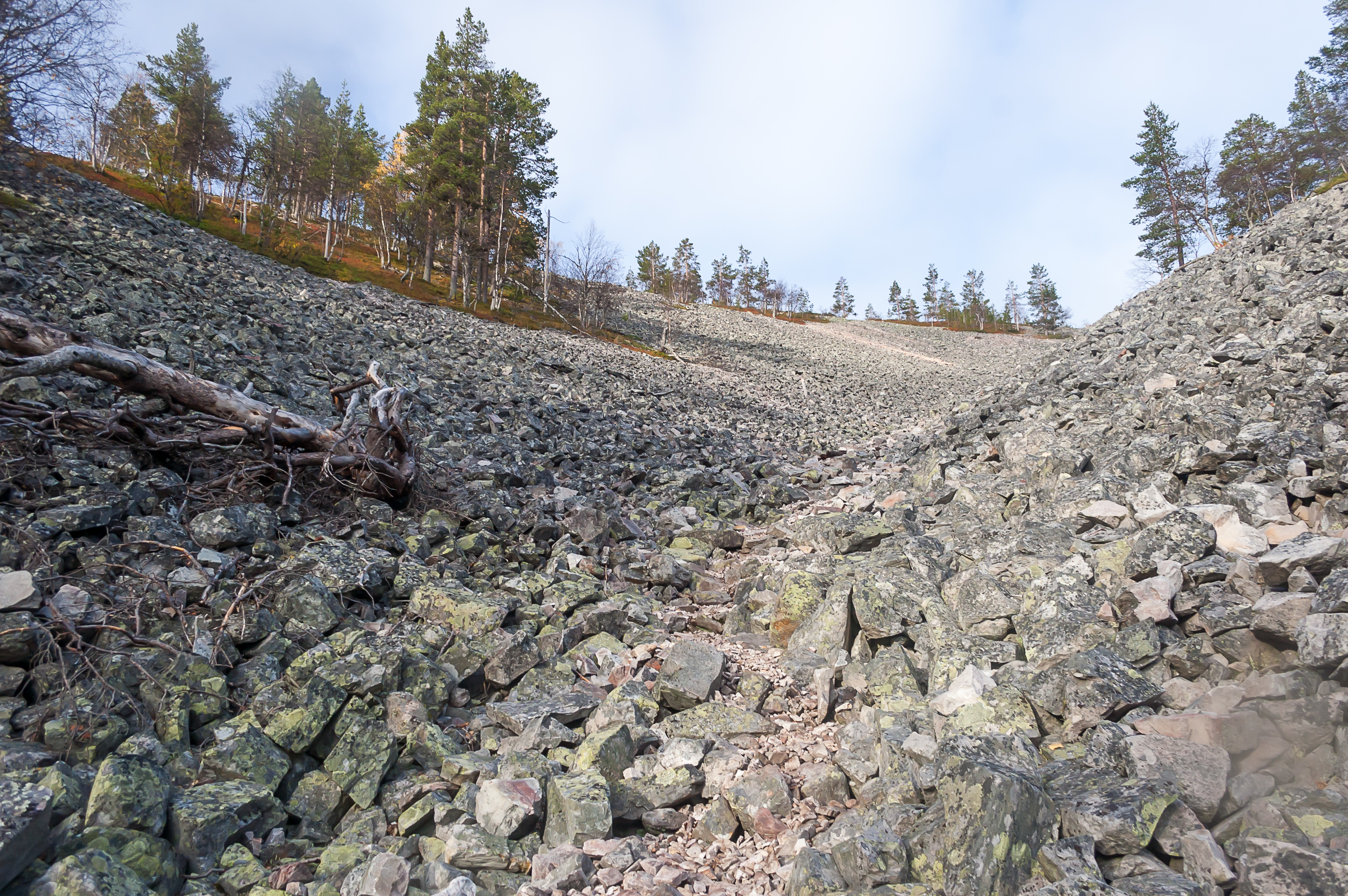
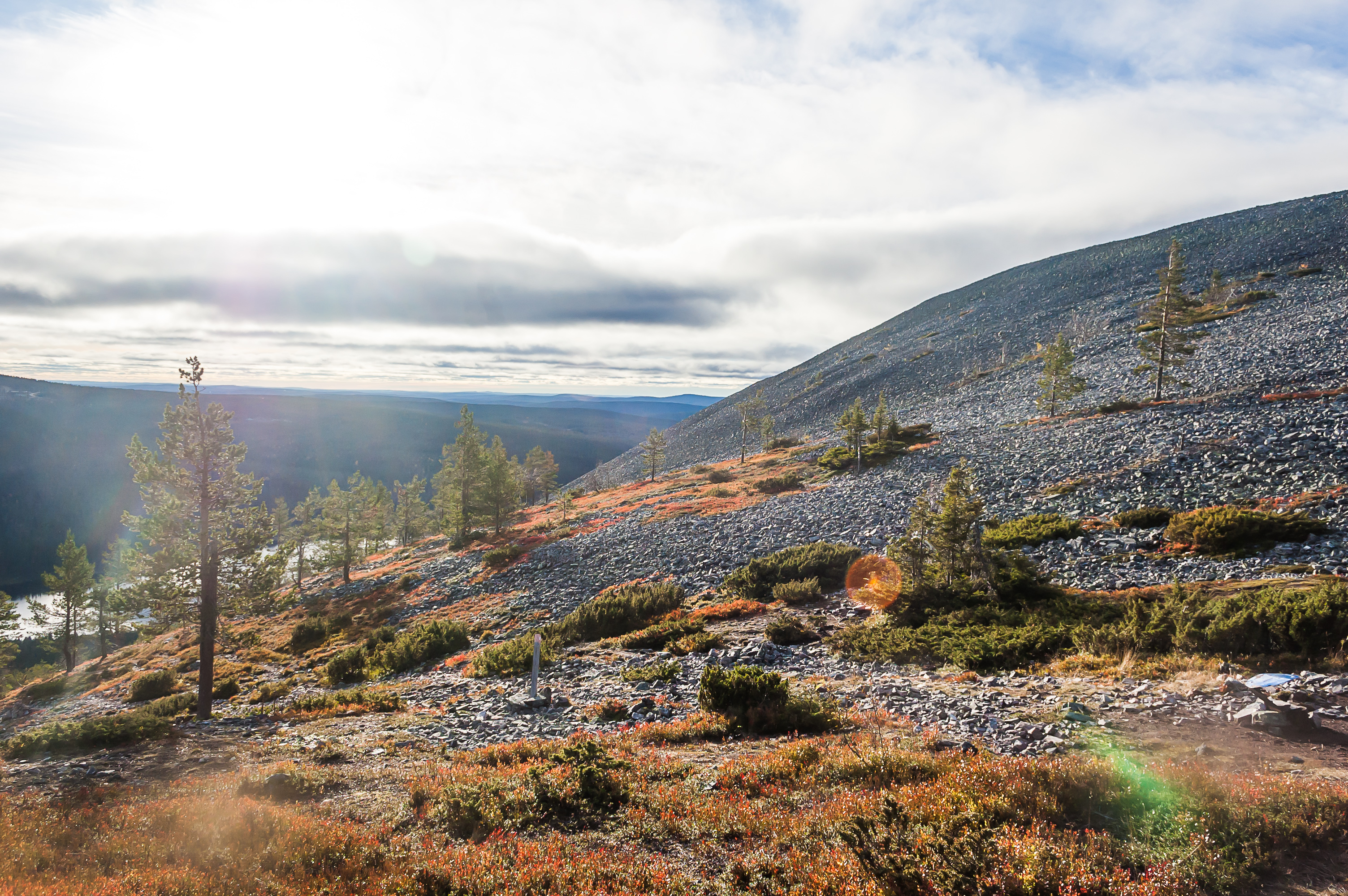
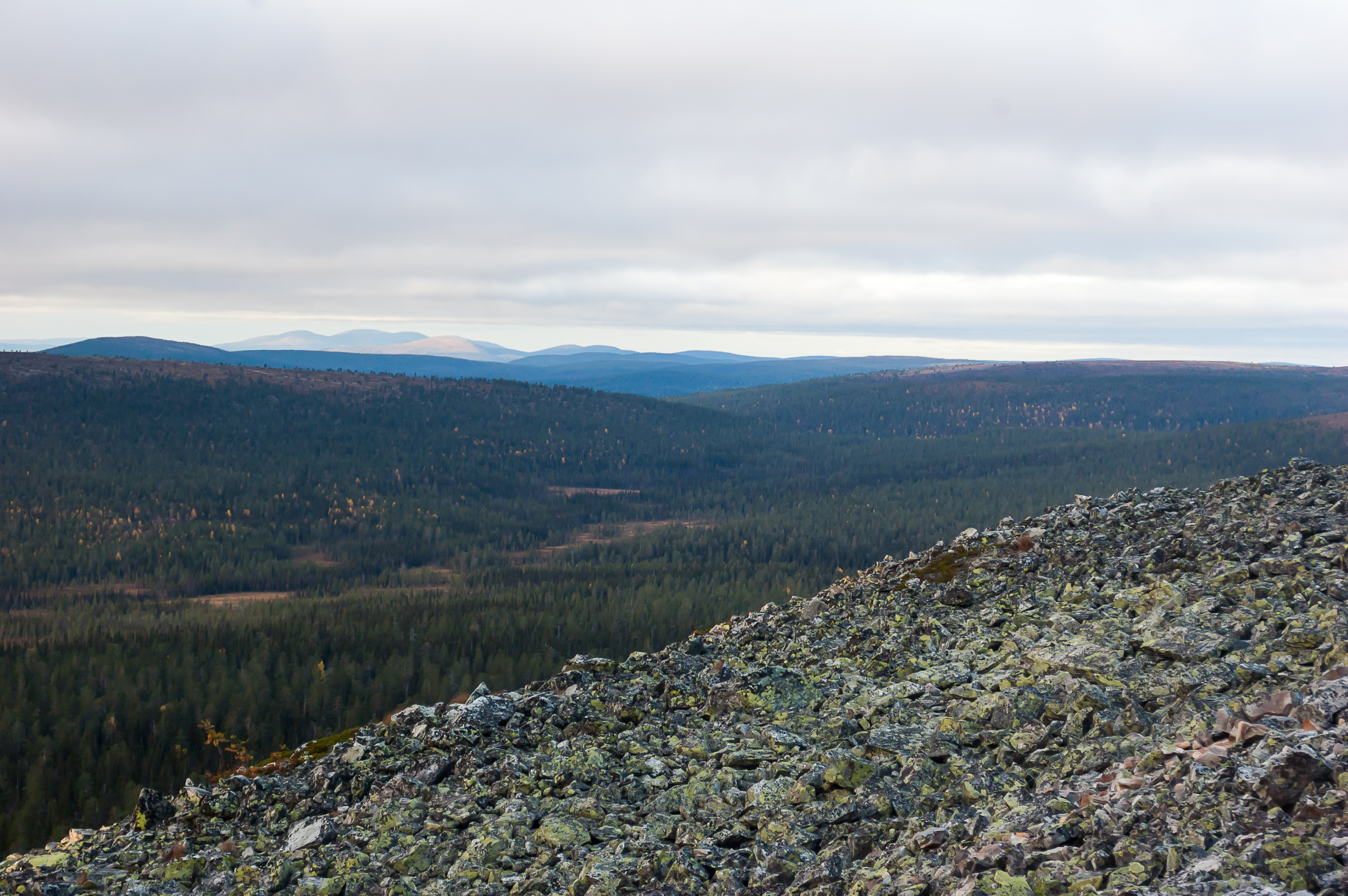
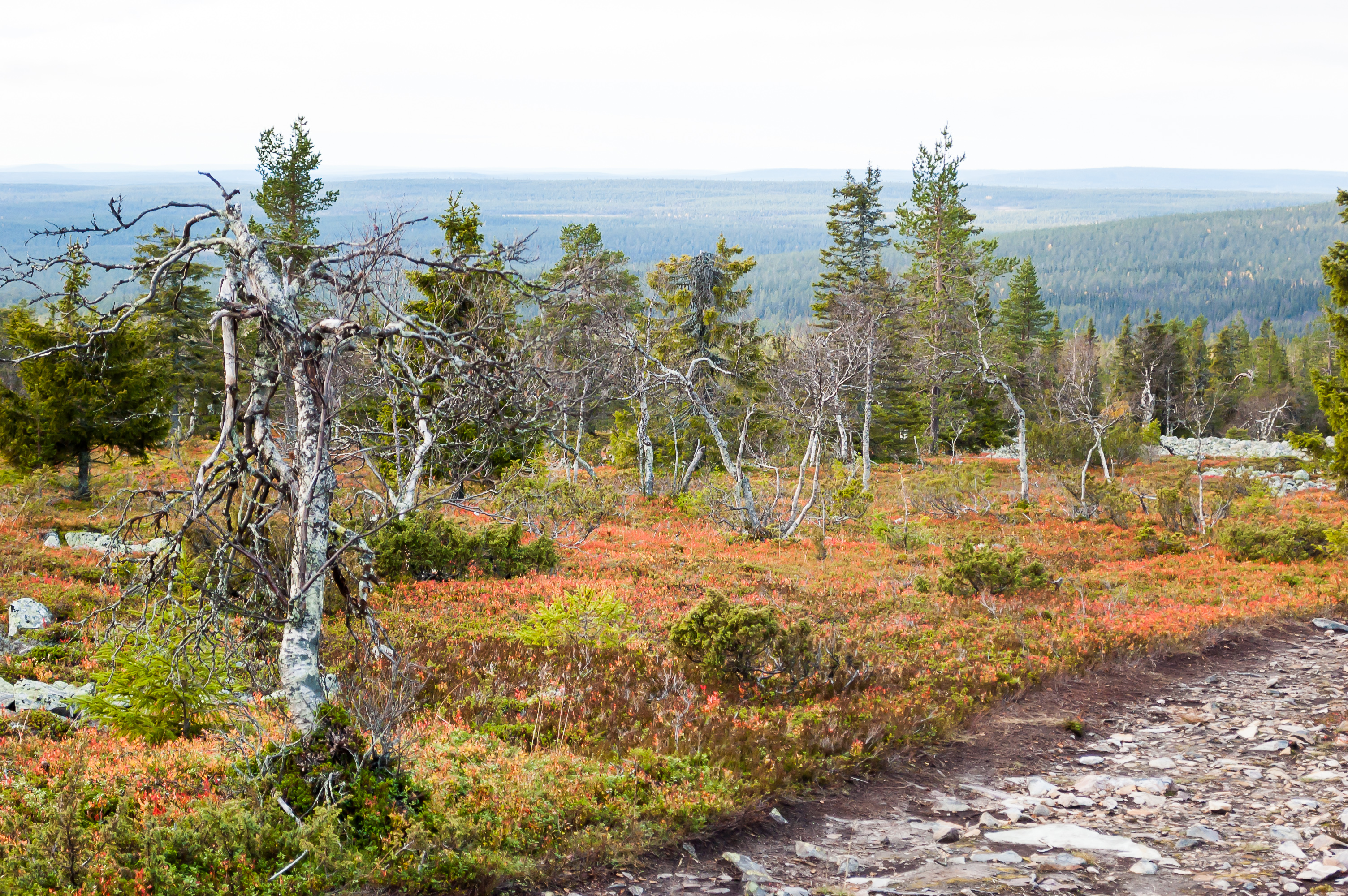
17. This part of the climb is appropriately named Pirunkuru, Devil's Ravine. It is steep and fairly challenging, requiring you to walk uphill on these jagged stones, while trying not to break your leg.
The summits of most of the fells at Ylläs are completely covered with similar stones, and I guess this stone run at Pirunkuru is just a spillover. Supposedly these stones were formed in the Ice Age by multiple cycles of water freezing and thawing in cracks of the exposed rock surface.
18. Kelostapuli Fell begins to show behind my back.
19. This isn't the first time I saw a similar stone run. In fact this entire climb brought strong memories of Zuratkul Mountain in the South Urals back in 2010. I still lived in Yekaterinburg back then and didn't own a car, so it took a train, a bus, and a taxi to reach Zuratkul Lake and its nearby mountain chain. The mountain was of a similar height and the climb offered similar views, although the landscape at the top was quite different. Overall Zuratkul was probably the prettiest place in Russia I've ever been to.
The perceived similarity made me think about mining. Ural Mountains are famous for having been mined for all kinds of ores and some gemstones before. Does Lapland have any significant mines? I know that there was a Lapland gold rush in some part of it, not entirely dissimilar to the American one, and of course there were nickel mines in Petsamo, immensely important to Hitler; but that part of Finland was re-annexed by the Soviet Union after war. But was there anything else? I googled a lot after returning to St. Petersburg and found out that some major mines are just about to start being constructed in Lapland. Apparently that's a controversial matter too — on one hand, the mines would bring lots of tax revenue and jobs (unemployment is, unsurprisingly, a major problem in Lapland); on the other hand, chances of wrecking many local ecosystems, nearly undisturbed since time immemorial, are very high.
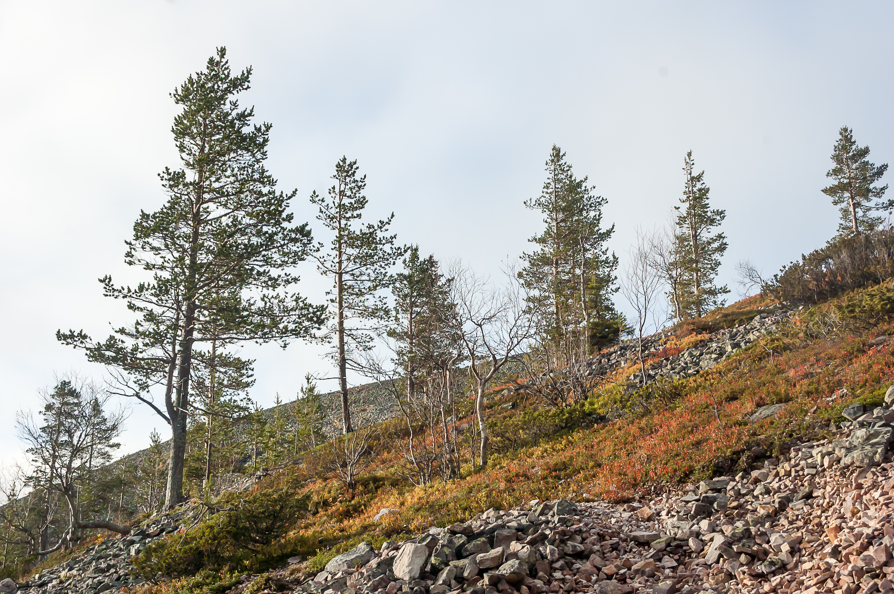
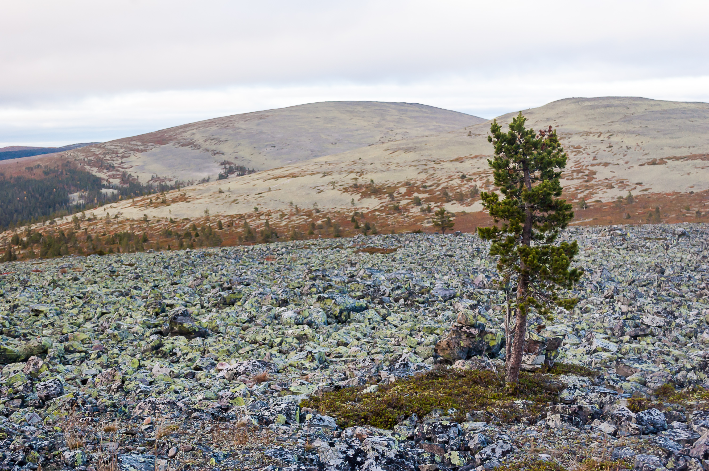
20. I'm about to rise above the treeline, although it's not very clearly defined here.
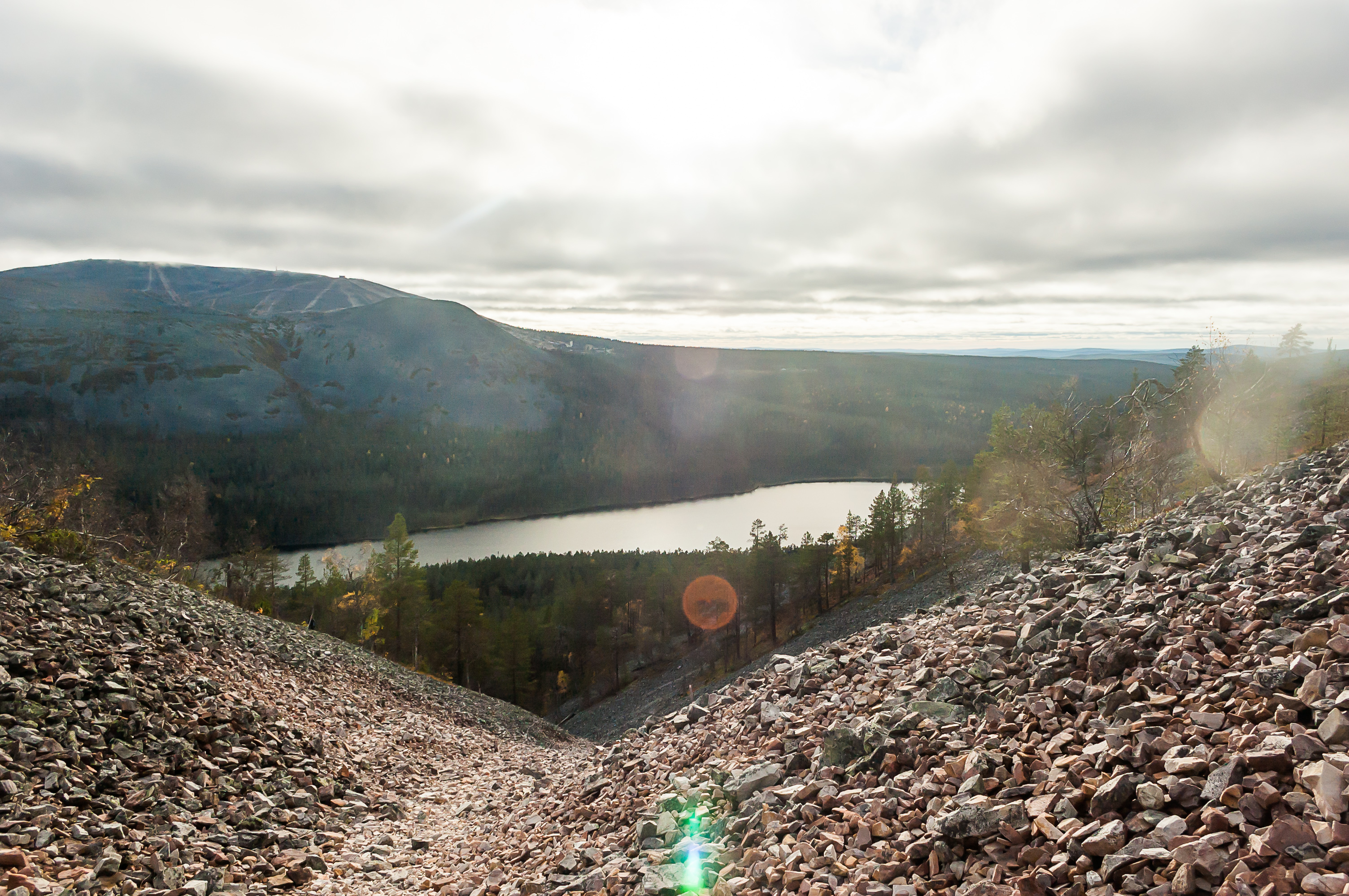
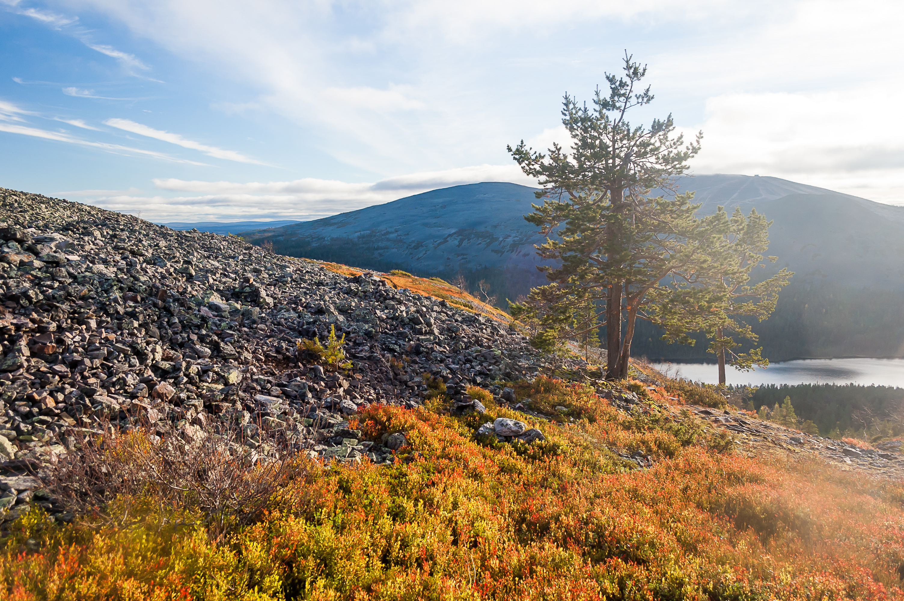
21. I had to stop and rest a bit fairly often, but at least I could enjoy the views. Kesänkijärvi Lake is now clearly visible below, and Ylläs Fell peeks from behind Kelostapuli.
22. By the time the steep part of the climb finished, sun peeked out from the clouds. As you might have noticed, the weather during my Lapland trip was not generally very exciting. It wasn't cold but the sky was mostly overcast, with an occasinal drizzle. That's my favorite kind of weather actually, but it doesn't work well for photos. So I was lucky to get some rays of light at an appropriate moment.
23. My favorite picture from the entire first half of my vacation (before the big trip farther up north).

24. I met an old Finnish man, also climbing Kesänki, and he said to me "Terve!". Of course the best answer I could manage was "Sorry?" in a silly voice. "Hello?.." said he uncertainly. "Oh, hello!". Damn. How could I have forgotten that "Terve" means just "Hello"? The man must now think that I was retarded.

25. A woman waited for him on top. Here they are, sitting on a rock below. I sat down in the distance too and munched on a bag of crisps I brought with me.
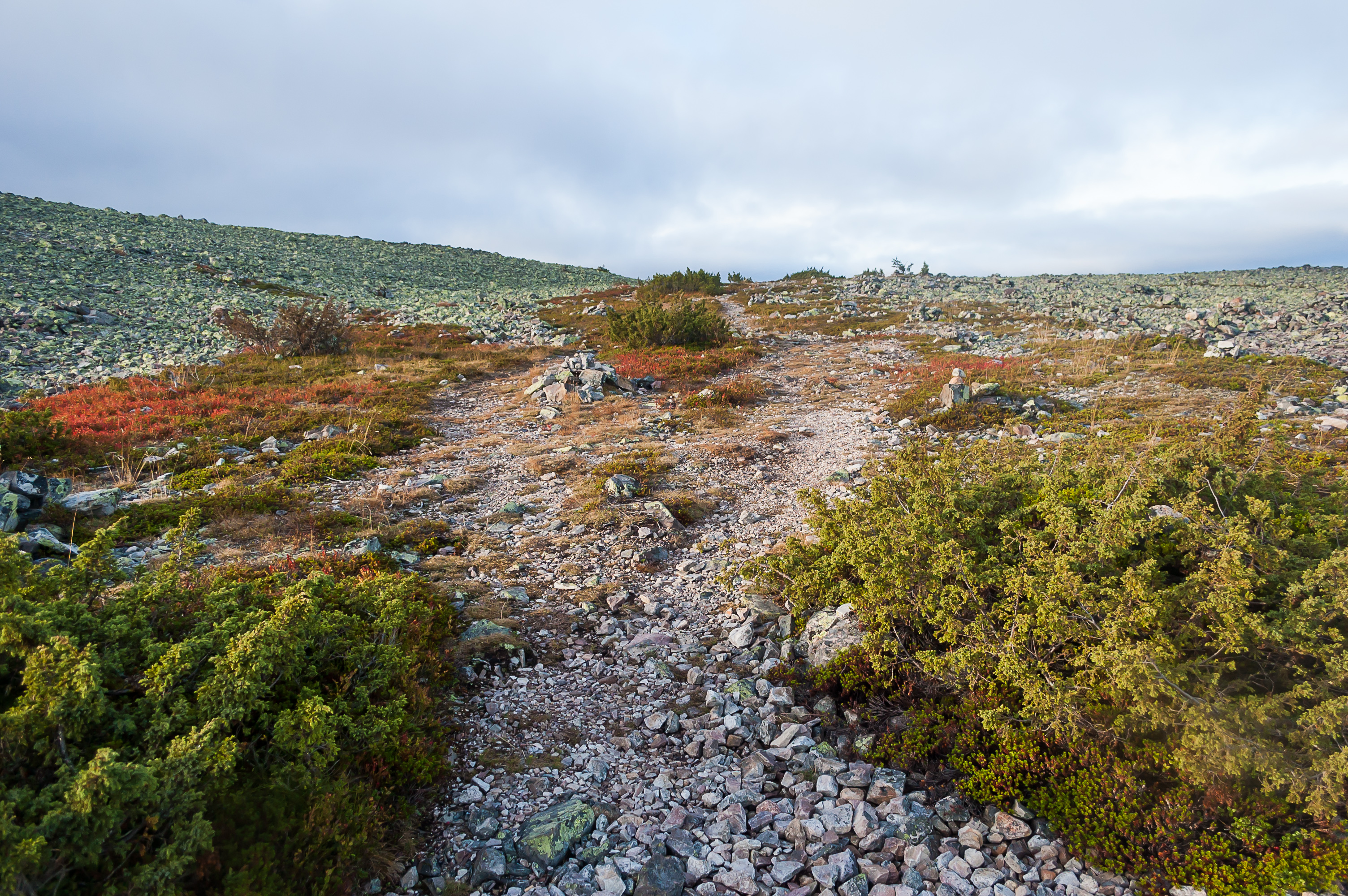
26. Kesänki Fell has at least three summits, and Tähtipolku trail passes between two of them. I decided to go off trail a bit and climb one of the summits. It was in just a few hundred meters, and the remaining climb was extremely shallow.
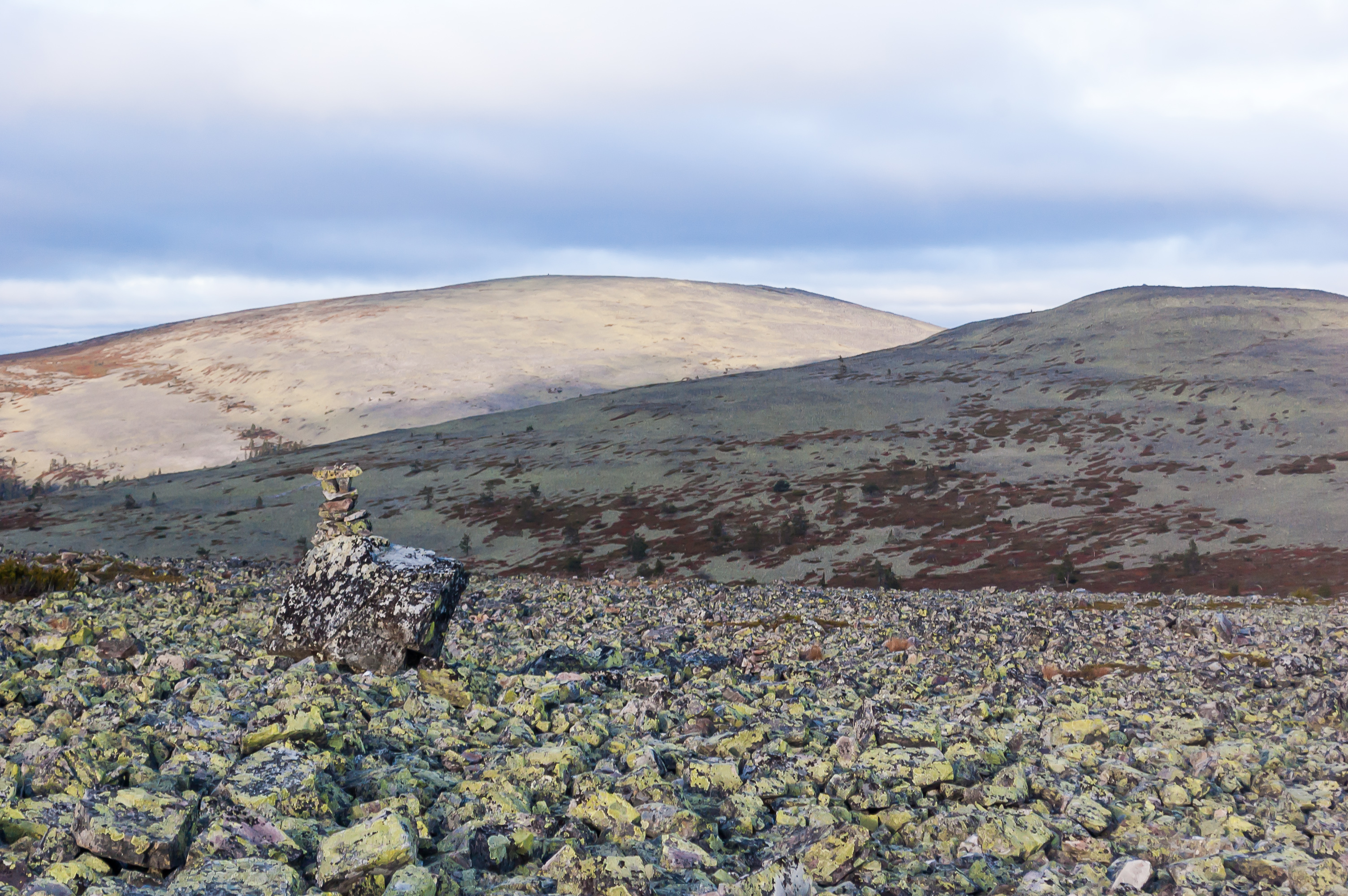
27. Two other summits are visible in the distance. The highest one is actually the farthest. With so many stones, it's only obvious someone decided to make a cairn.
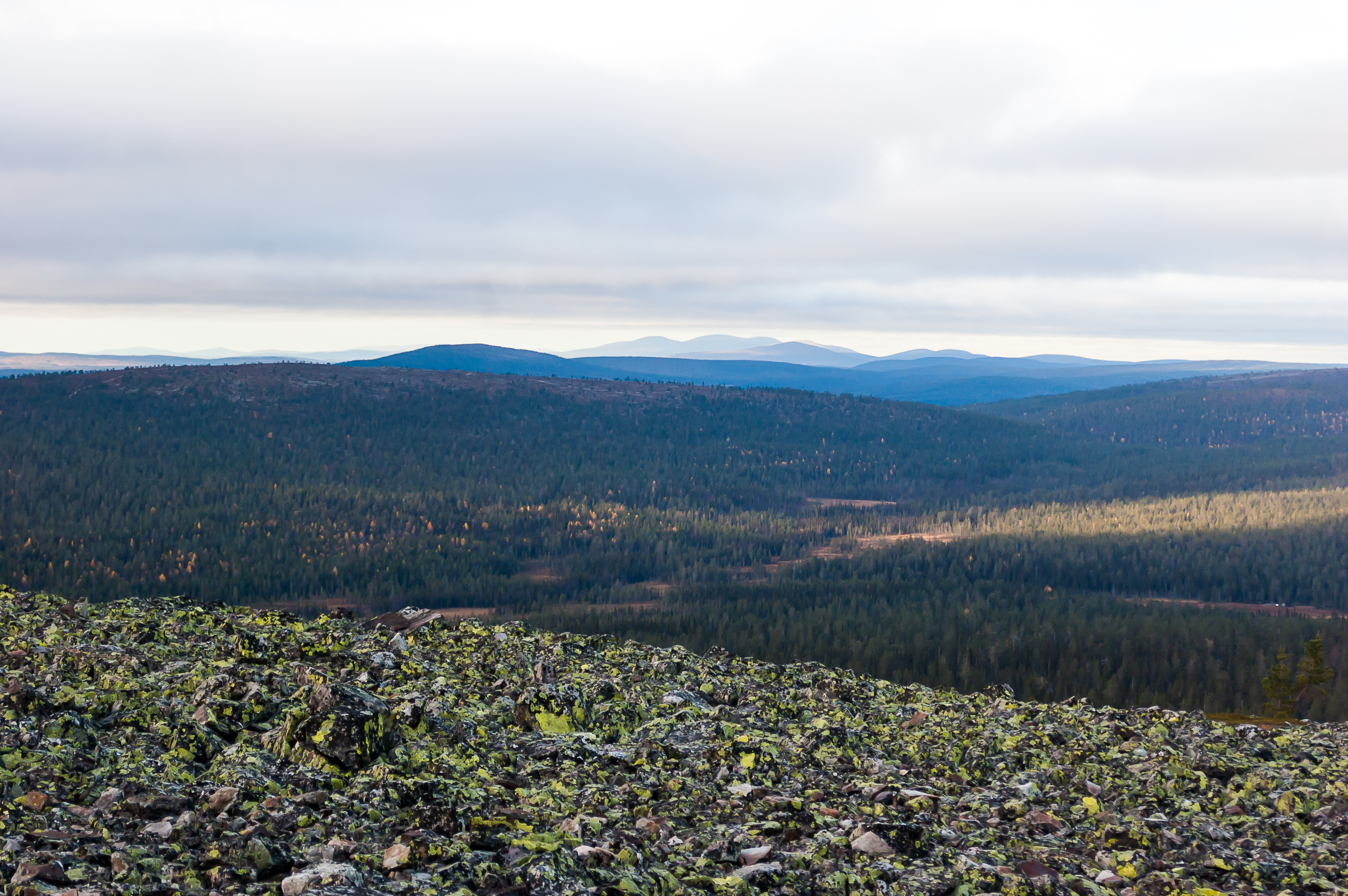
28. These fells far to the north could be Pallas and its neighbors. Although it's more likely these are just the farthest Ylläs-related fells, such as Pyhätunturi.
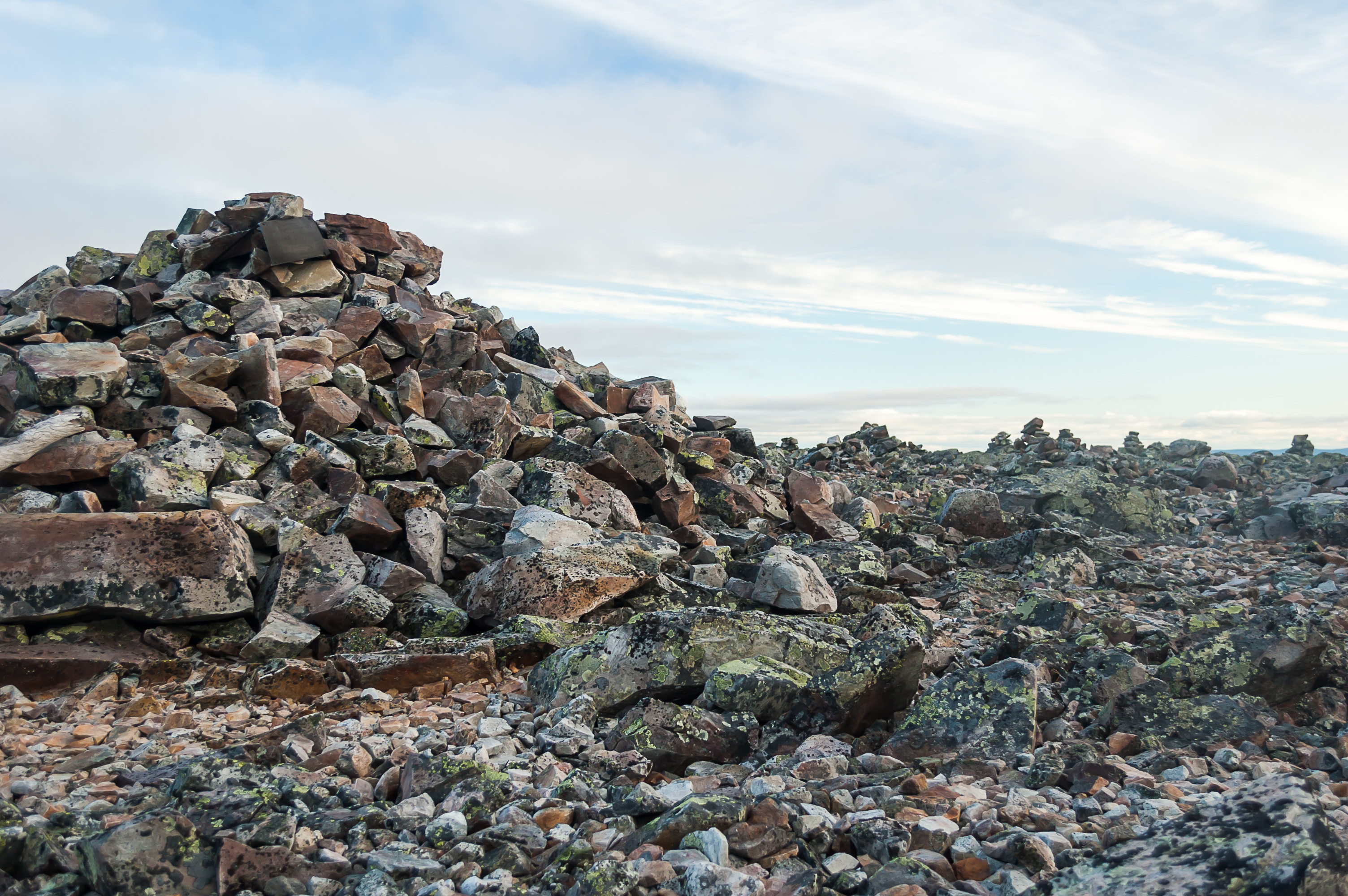
29. At the very summit there is a much larger cairn, as high as a man, among smaller ones. I wondered who and when started to make this cairn. I added ten stones into the pile myself, and took another one with me. I like to bring home random stones from various trips, although I'm not very consistent about this.
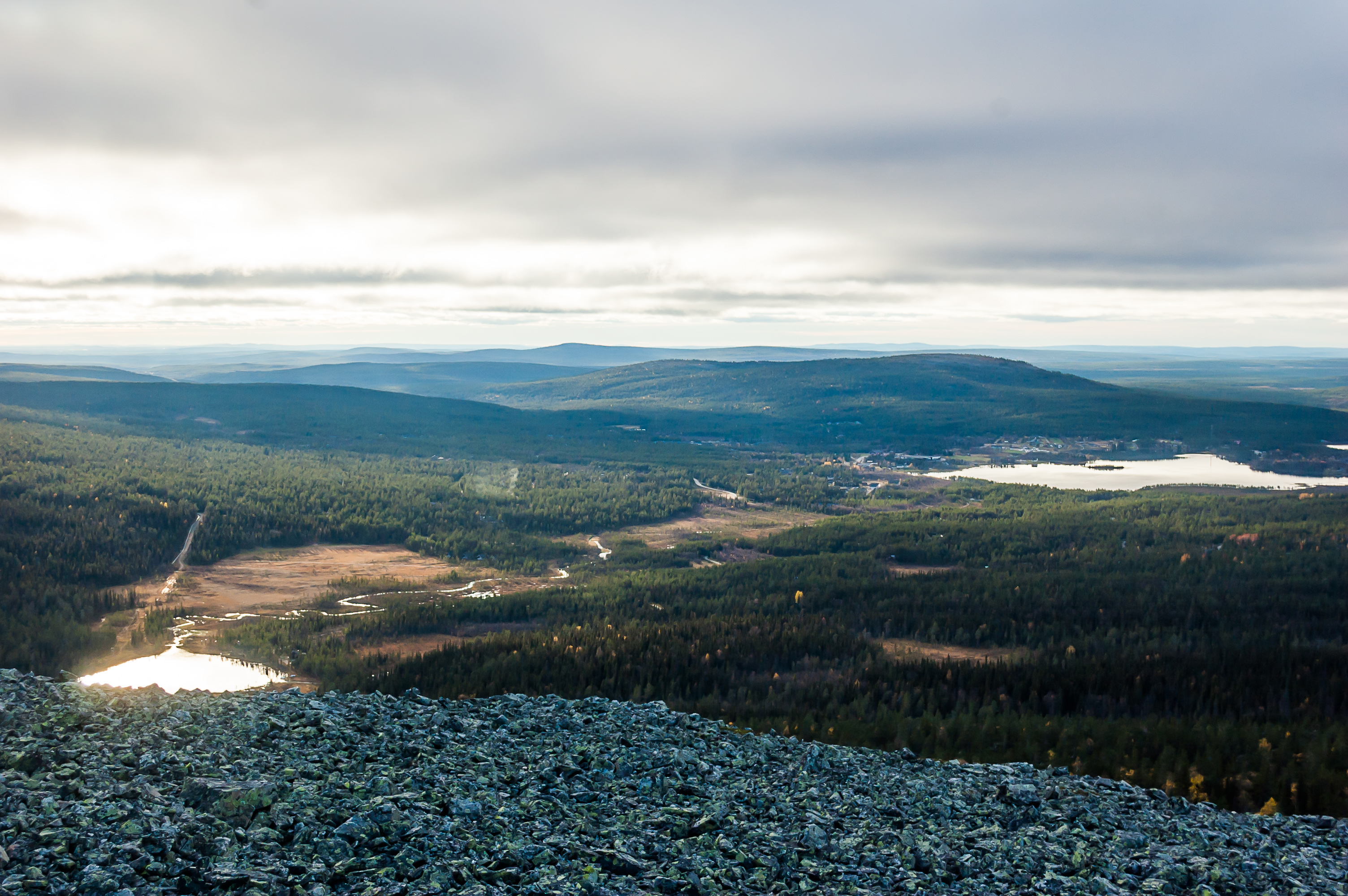
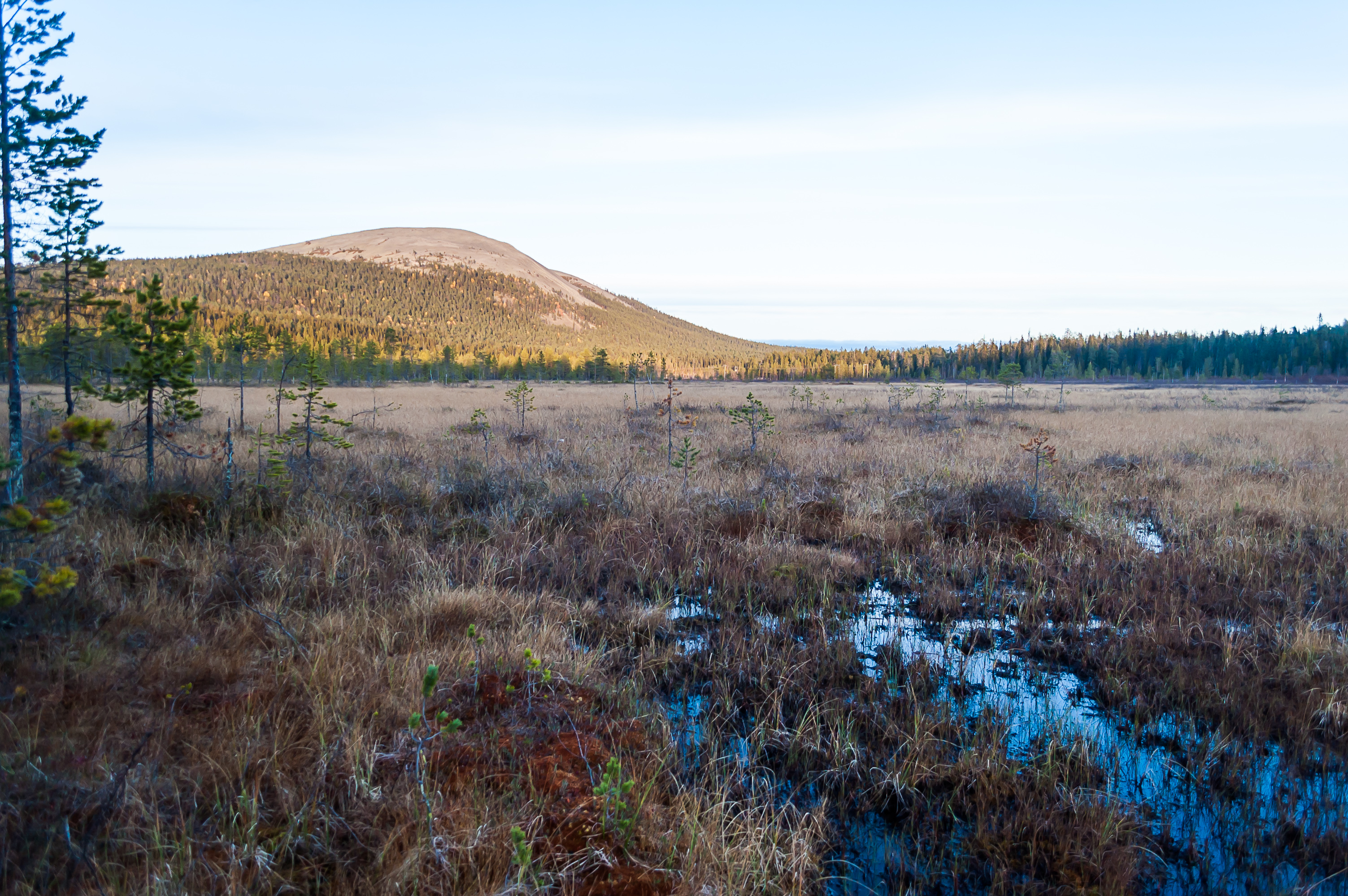
30. The view from the southwestern slope of the summit. Part of Kesänkijärvi Lake is visible at the bottom. The narrow stripe of Kesänkijoki River flows from it across the picture into Äkäslompolo Lake to the right. On the shores of the lake are Äkäslompolo village buildings; behind them is shallow Kuer Fell.
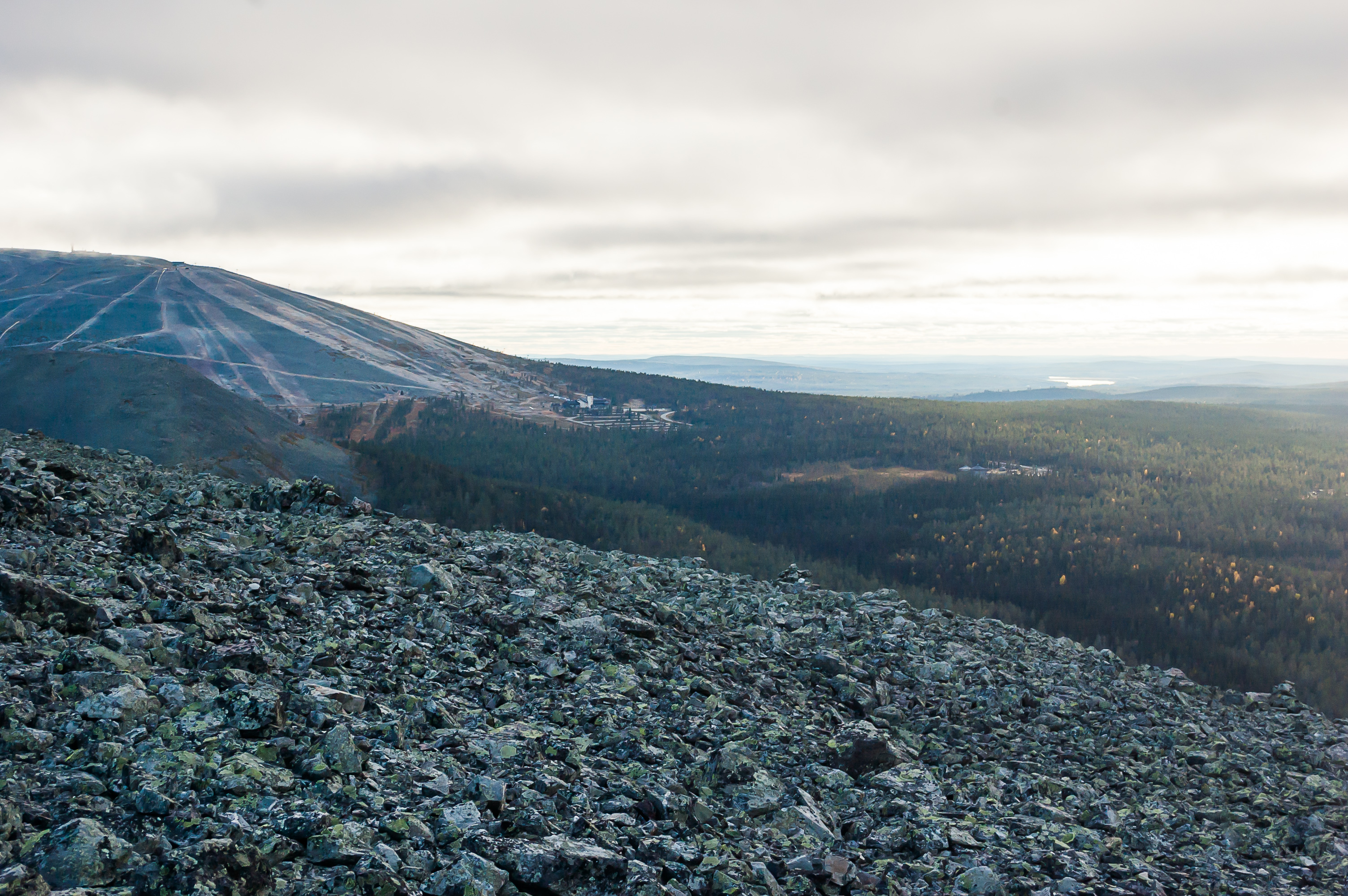
31. Further to the left is Ylläs Fell with its skiing slopes. Skiing center is visible at the bottom of the slopes.
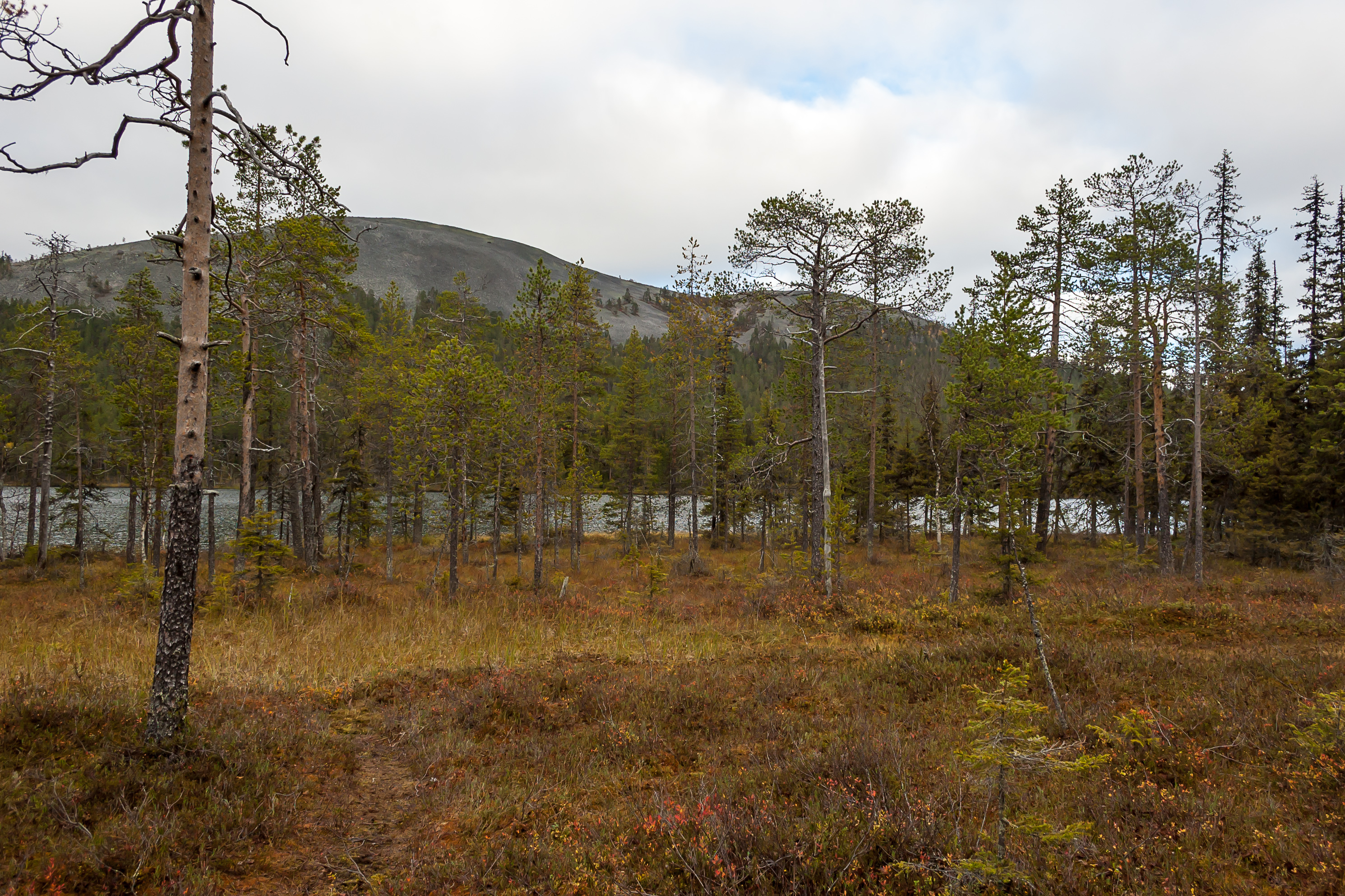
32. The elevation of this summit of Kesänki is about 520 m above sea level. Kesänkijärvi Lake is located at 218 m above sea level. So it appears I climbed about 300 meters.
33. The summit is almost devoid of vegetation, but occasional patches of moss and berries are still found between rocks, and there are very rare tiny trees.

34. Returning from the summit, I located Tähtipolku trail again, and began to descend on the other side of the fell.
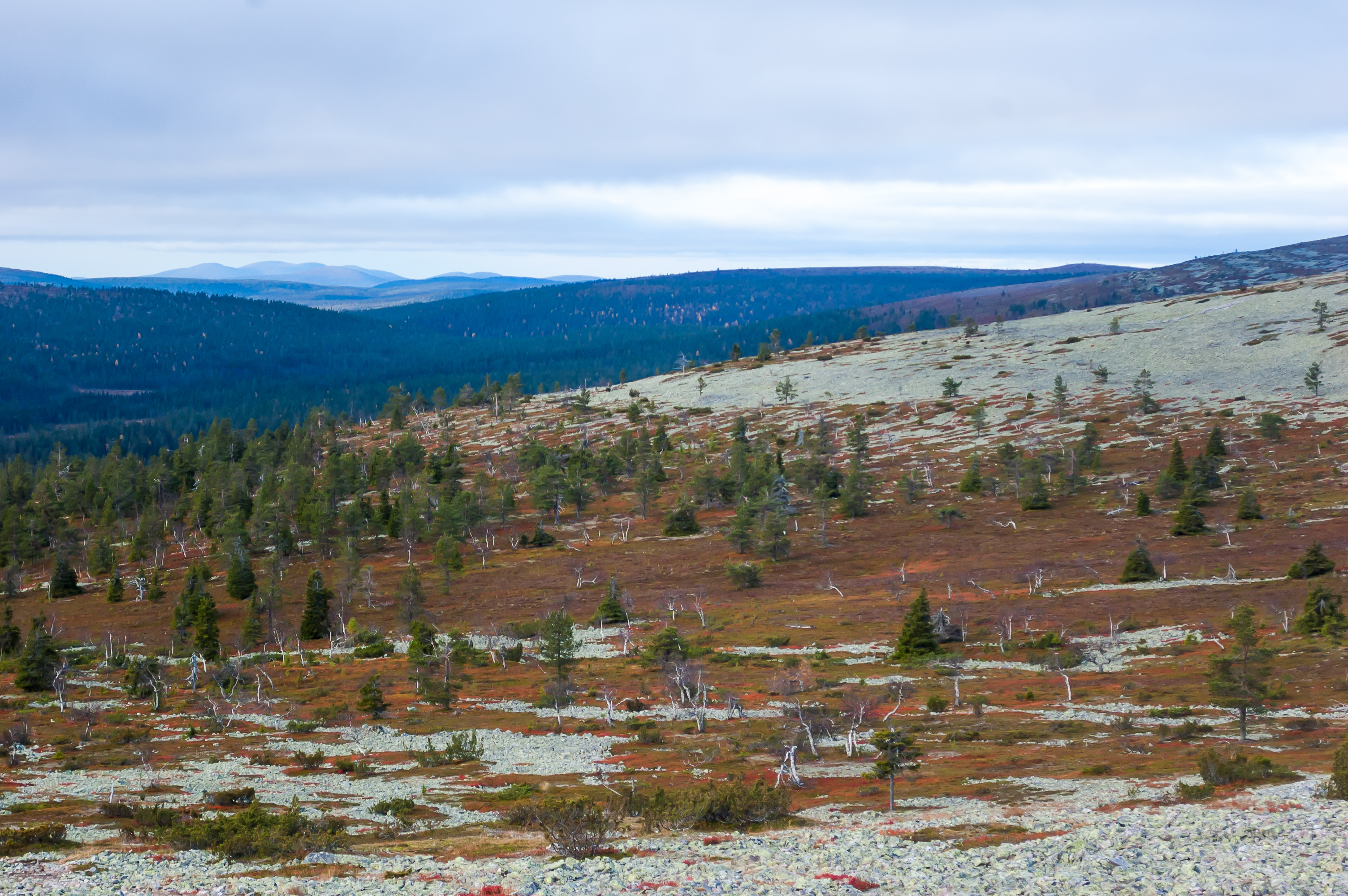
35. The descent is named Tahkokuru (Finn. Grindstone Ravine?). Completely unlike the Pirunkuru side, it was very shallow and easy to walk and didn't look even remotely like a ravine.
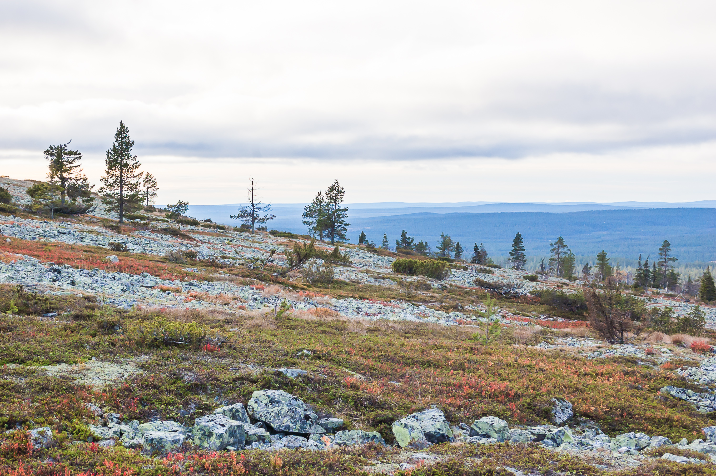
36. Tundra-like mosses and dwarf trees eventually replace bare stone runs again.
37. I love these twisted dwarf birches. They are more sturdy than coniferous trees and disappear at a higher elevetion. You'd think that those needles would be more enduring but no.
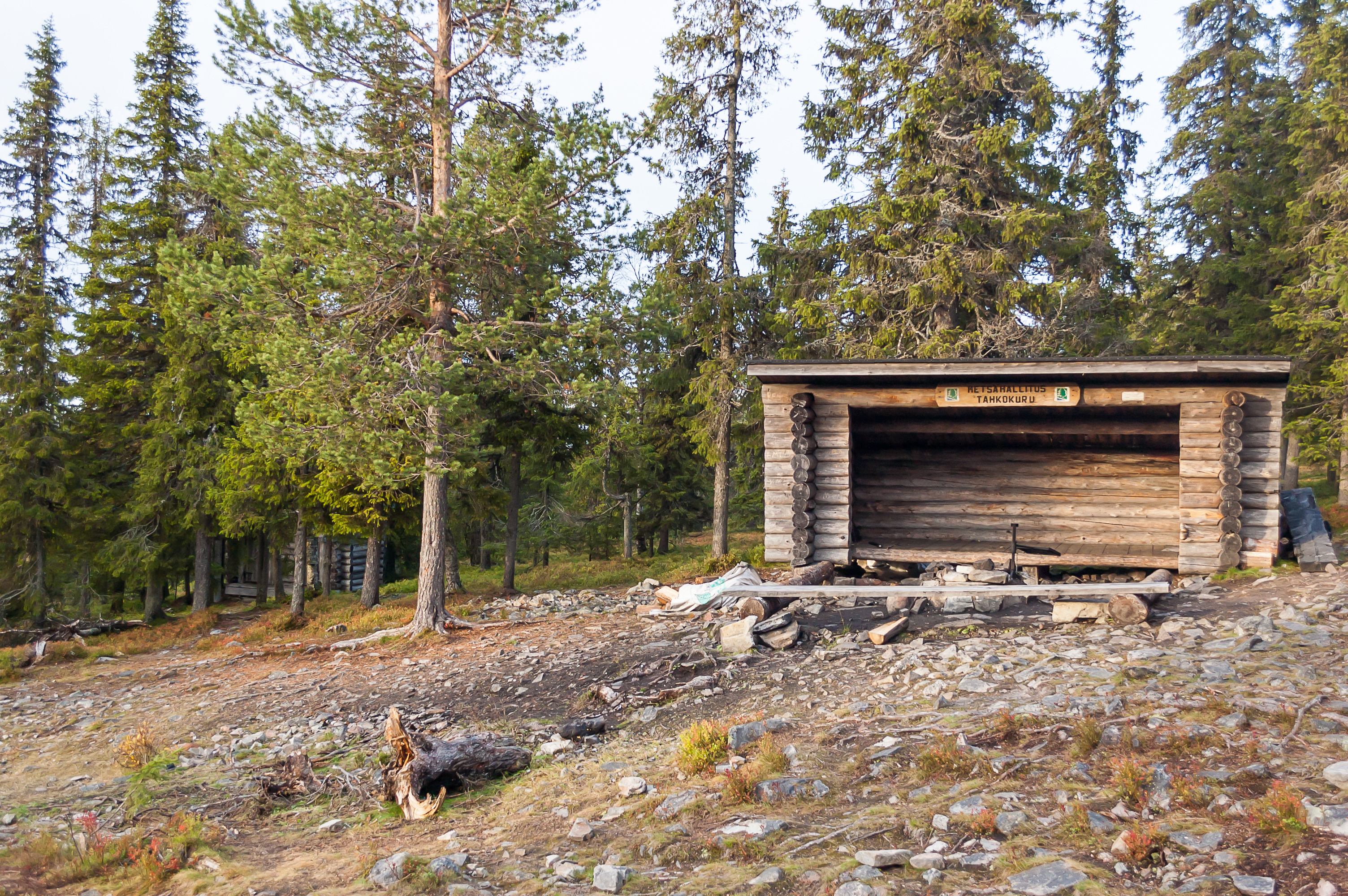
38. At the exact spot where tundra and regular Lapland forest meet there is a laavu shelter. I talked about laavus at length in the previous part. This laavu was unoccupied so I could have a closer look.
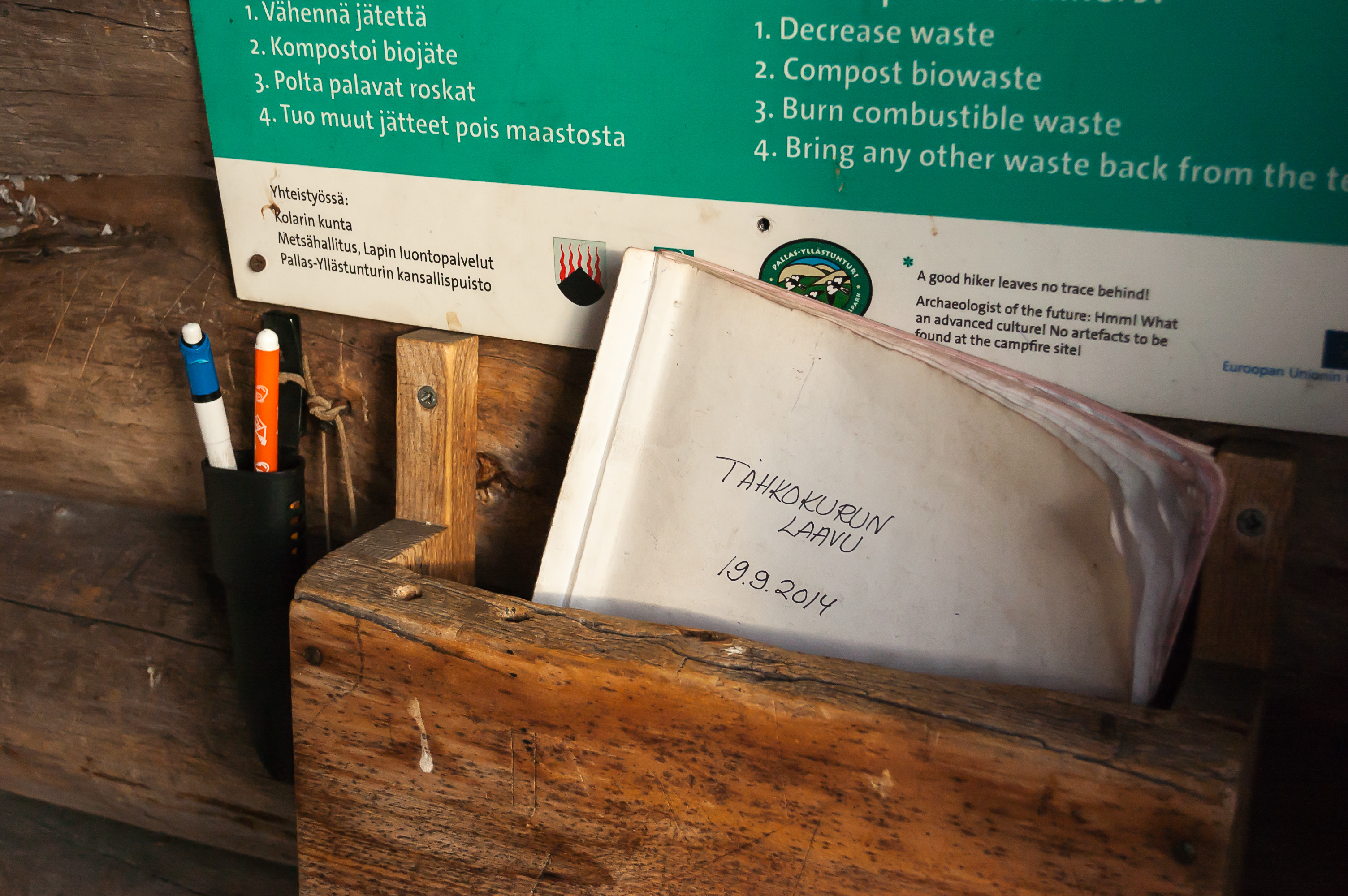
39. There was a log book inside the laavu. All or nearly all entries were in Finnish.
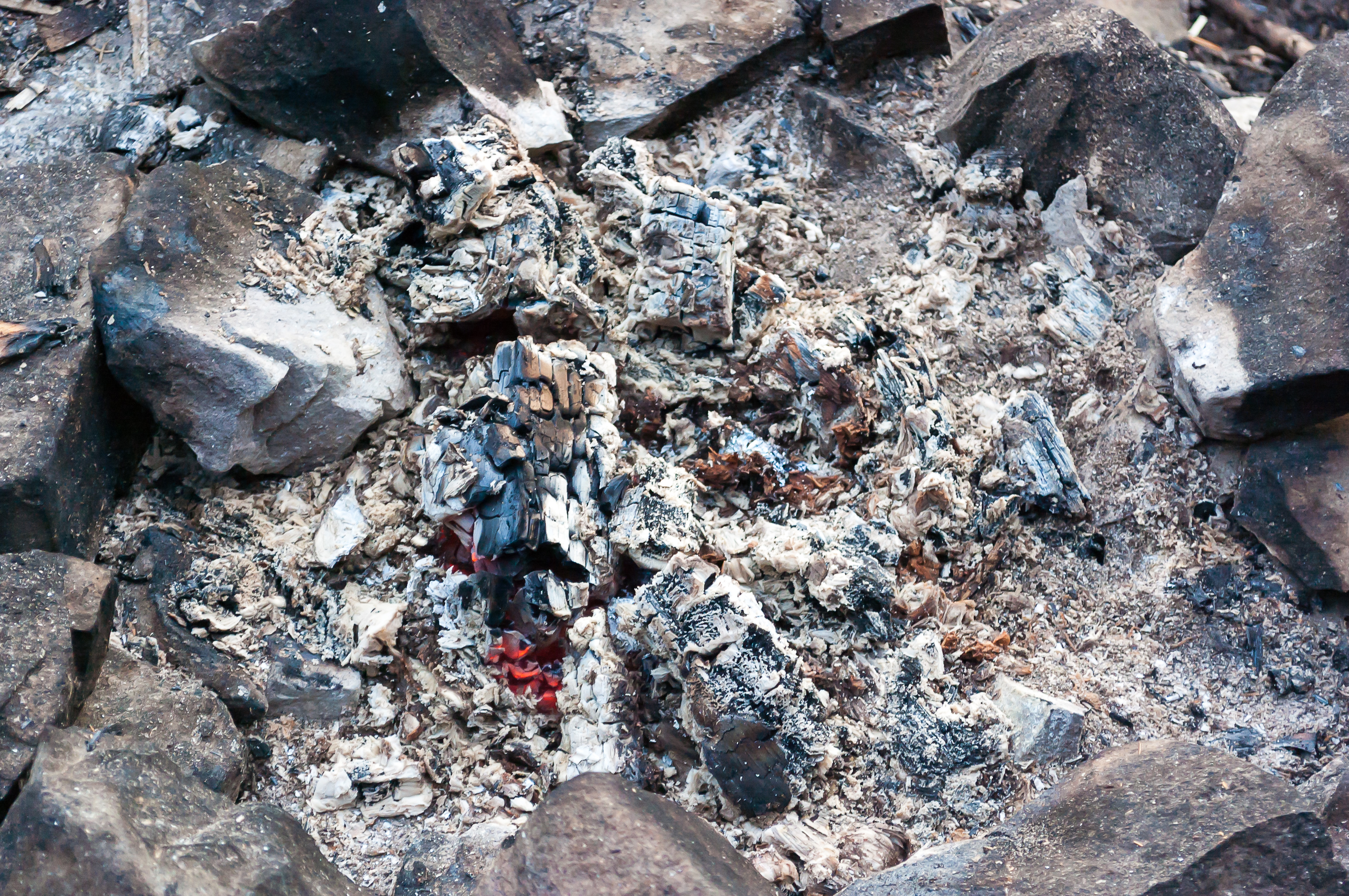
40. Coals in the fireplace still smouldered. Someone has been here shortly before me.
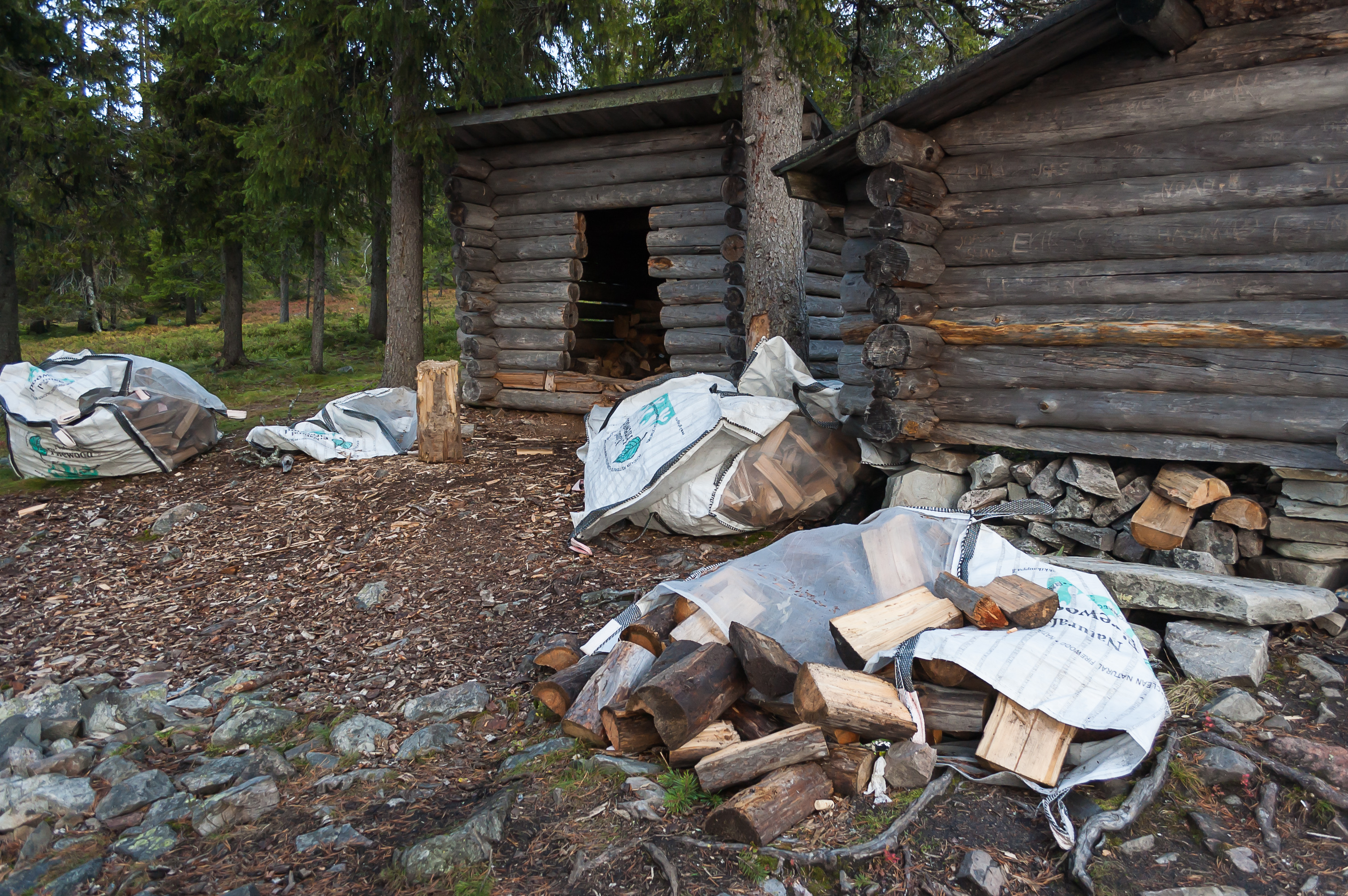
41. There were several huge bags of firewood strewn about sloppily.
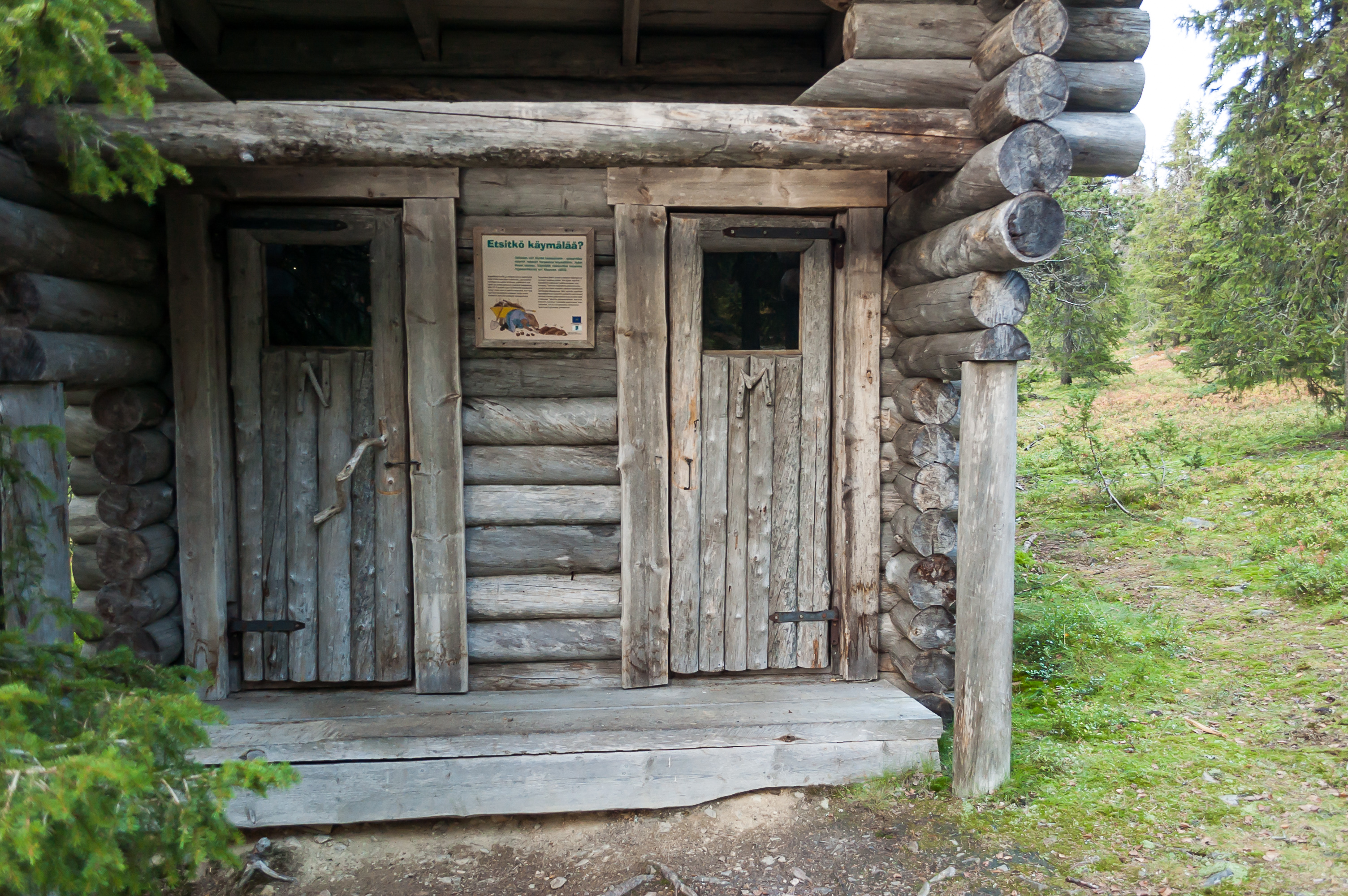
42. And an outhouse. M is for men, obviously (mies), and N is for women (nainen), not for "neuter". Most toilets in Finland just use pictures to avoid confusion.
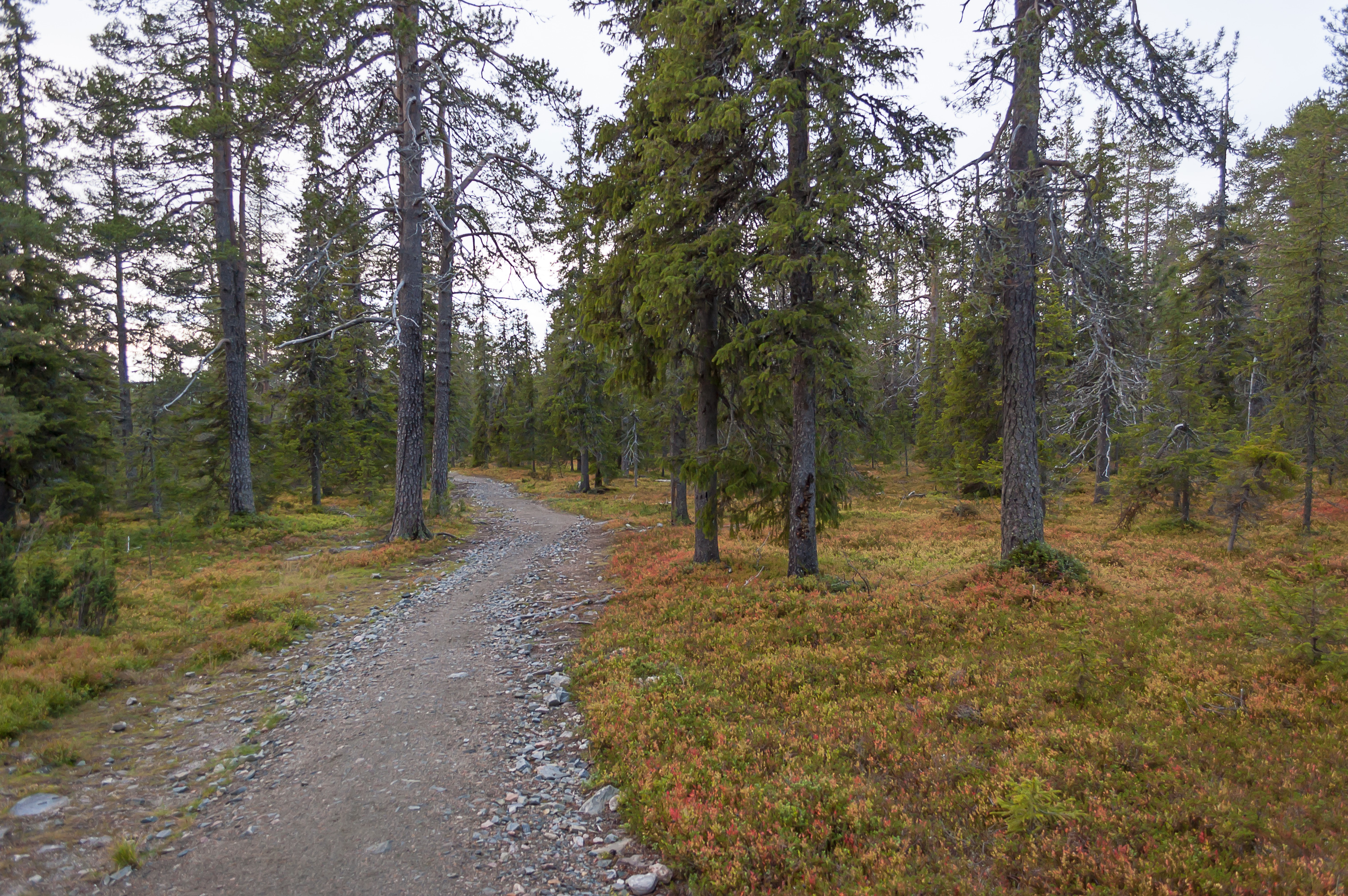
43. Walking on. This kind of forest became very familiar for me by that time.
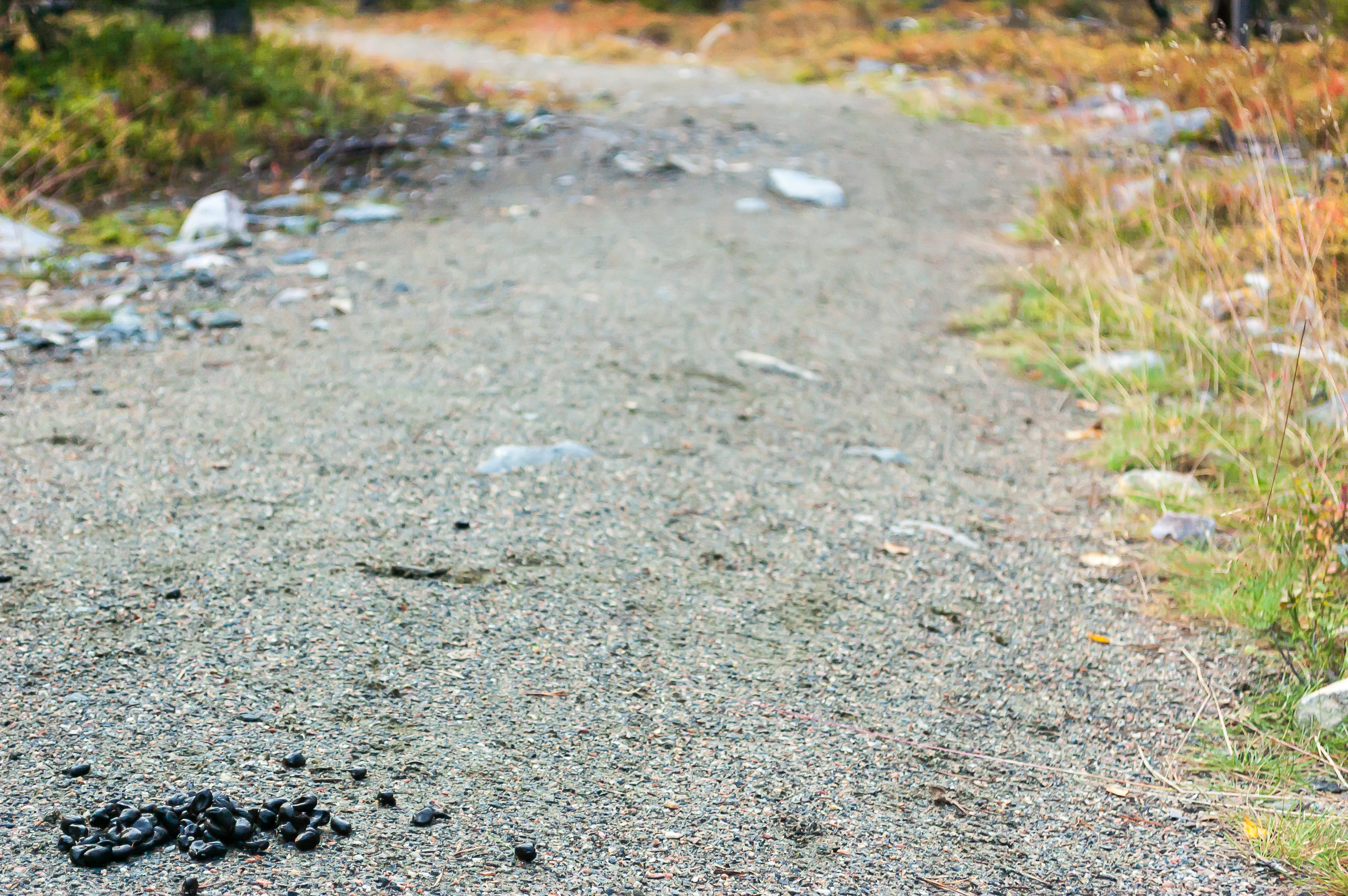
44. I saw a pile of reindeer droppings and of course I couldn't help taking a picture. They are less cute than rabbit droppings which I as a happy rabbit owner know everything about.
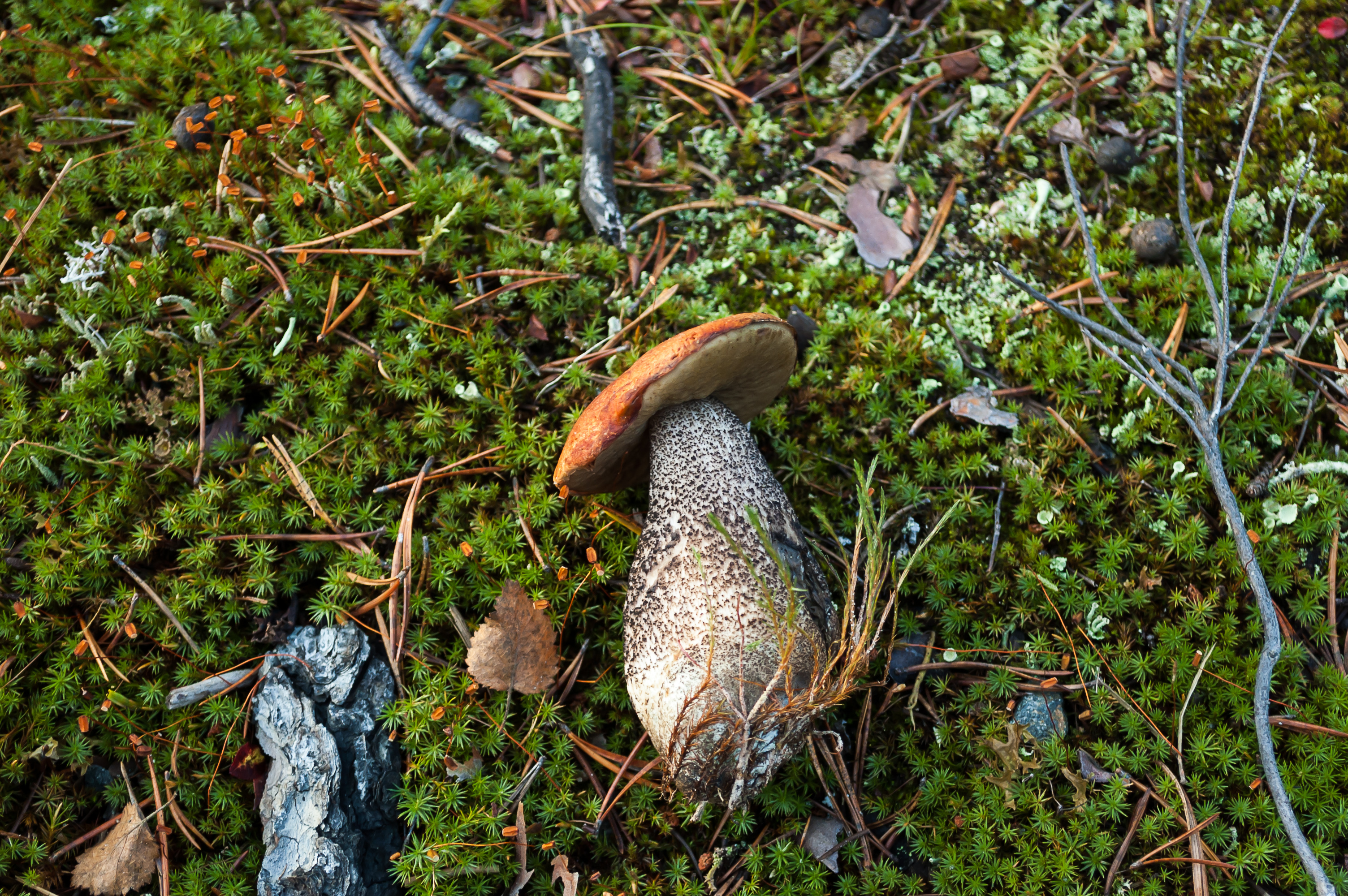
45. Beautiful red-capped scaber stalk mushroom, sadly already picked and thrown away by someone. (Is this really the proper English name for this mushroom? Sounds so awkward. Its Russian name simply means "one under aspen".)
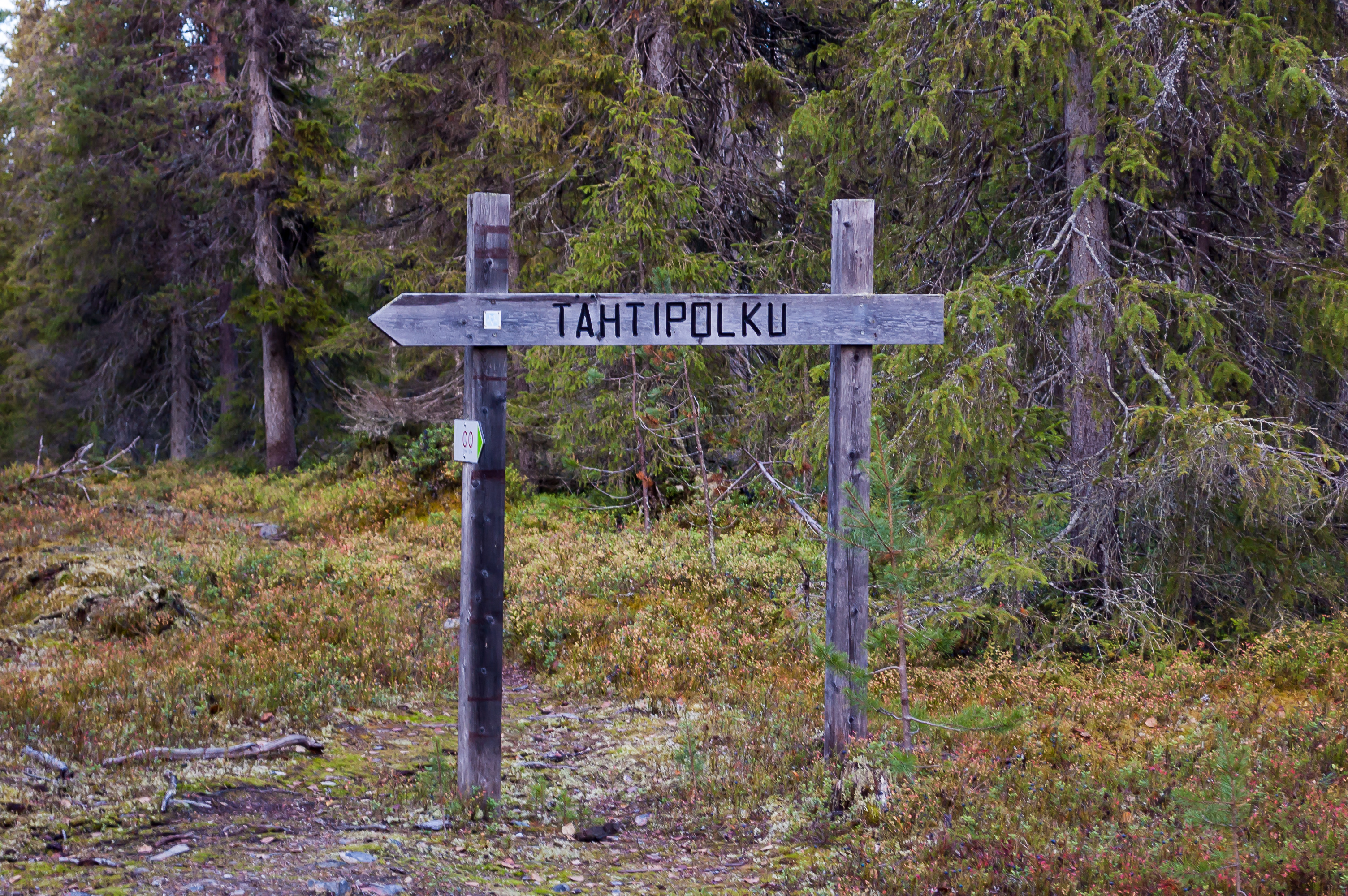
46. At this sign, I left Tahtipolku trail again, crossing a small dirt road (The trail loops around Kesänki fell, and starts and finishes at a small parking lot.) There are so many wooden signs in this style across entire country. The people who make these signs must be the richest men in Finland.
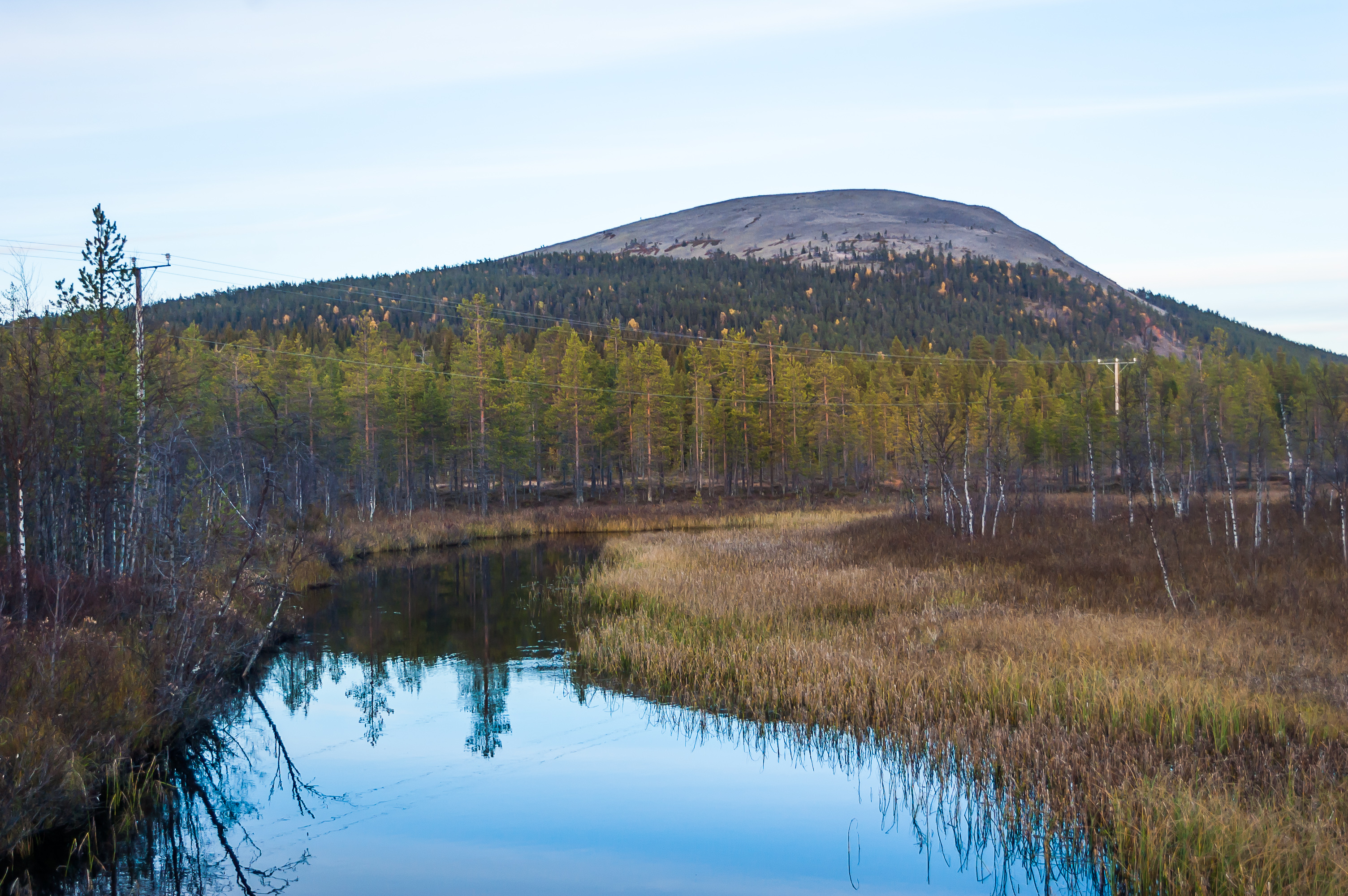
47. I intended to return to Kellokas via another trail. This one crossed Kesänkijoki River downstream from the lake. The fell in the background is Kesänki itself, which I had just ascended and descended.
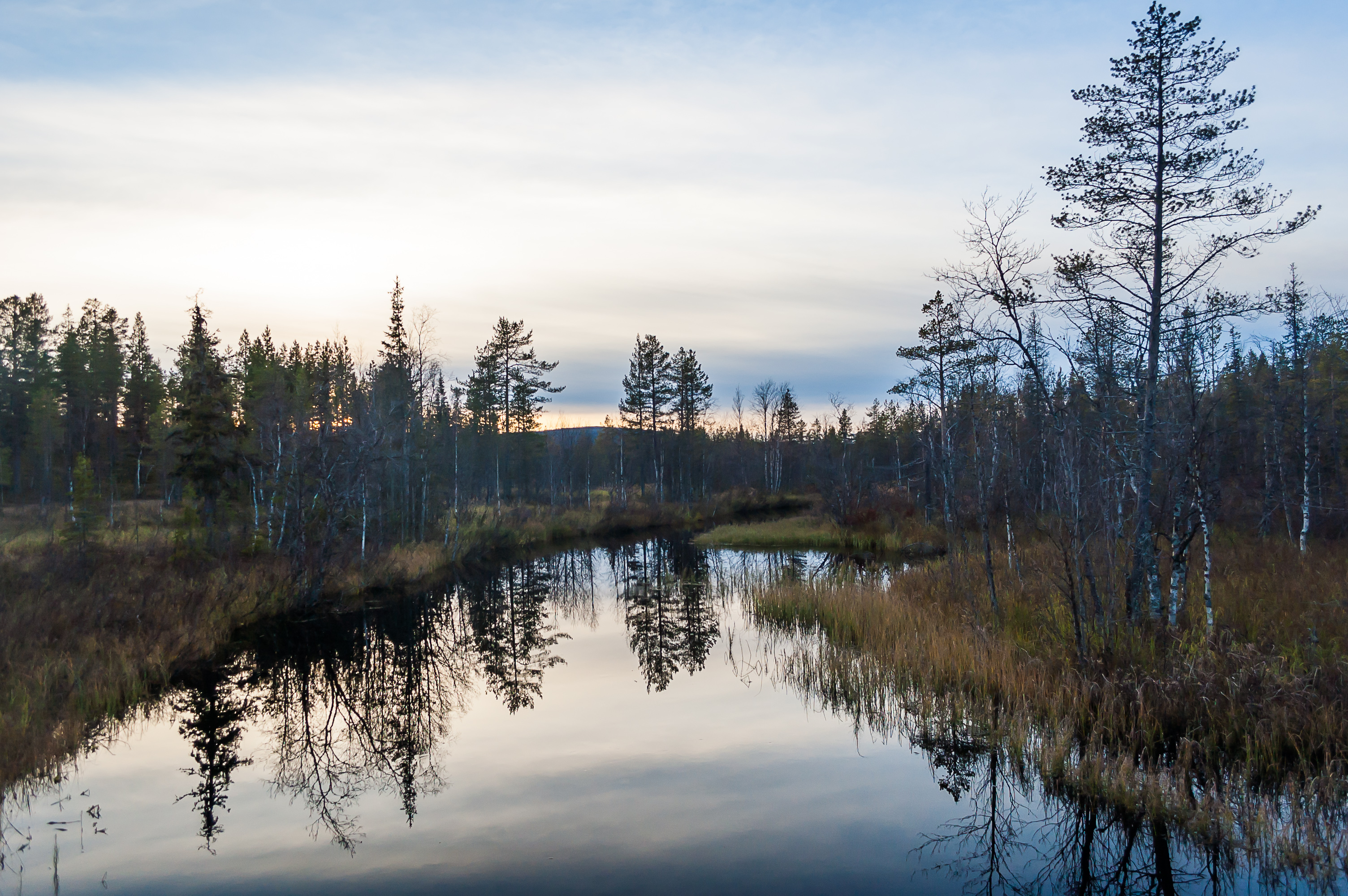
48. Kesänkijoki River.
49. Passing by a few houses on the outskirts of Äkäslompolo, the trail crosses small Hormistonjänkkä Marsh on plankways.

50. The final stretch of the trail near Kellokas was extremely wet and unpleasant, with numerous small streams crossing it, and some huge puddles. At least by the time I reached Kellokas I was rewarded with another meeting with reindeer. This very likely was the same herd I saw the day before.
Soon I reached my car and drove back to my cabin. The rest of the day was uneventful. I began binge watching Rick and Morty and it was hilarious although I still rate Archer better. I was very tired but I enjoyed that day immensely, having really seen a tiny bit of the beauty of Lapland. To be continued.