So we set out from Vasa Museum on Djurgården, took a ferry to Skeppsholmen, walked through Gamla Stan (Old Town) and Riddarholmen to Kungsholmen, and then took a metro train back to where we left our car in the morning.
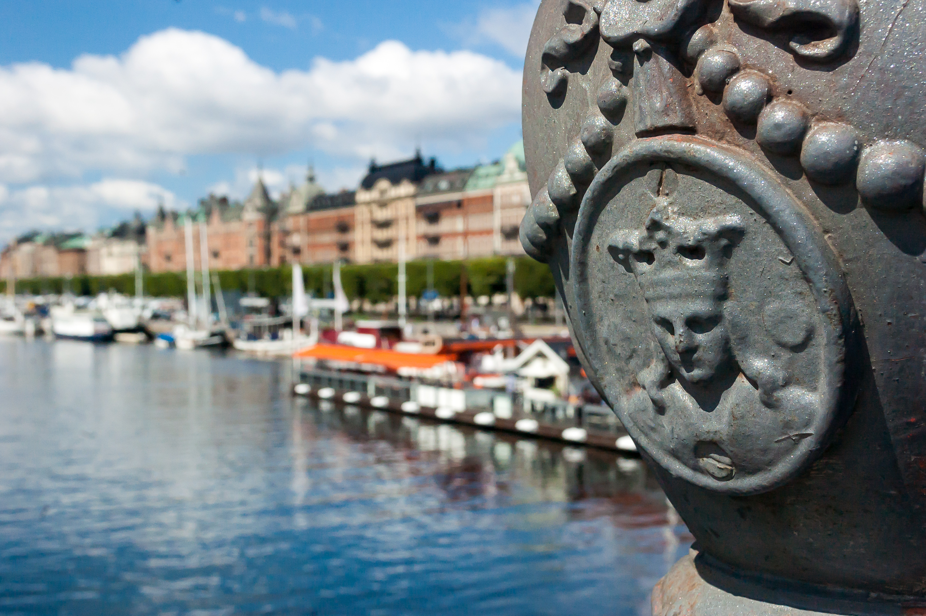
1. Djurgårdsbron (Swed. Djurgården Bridge) again.
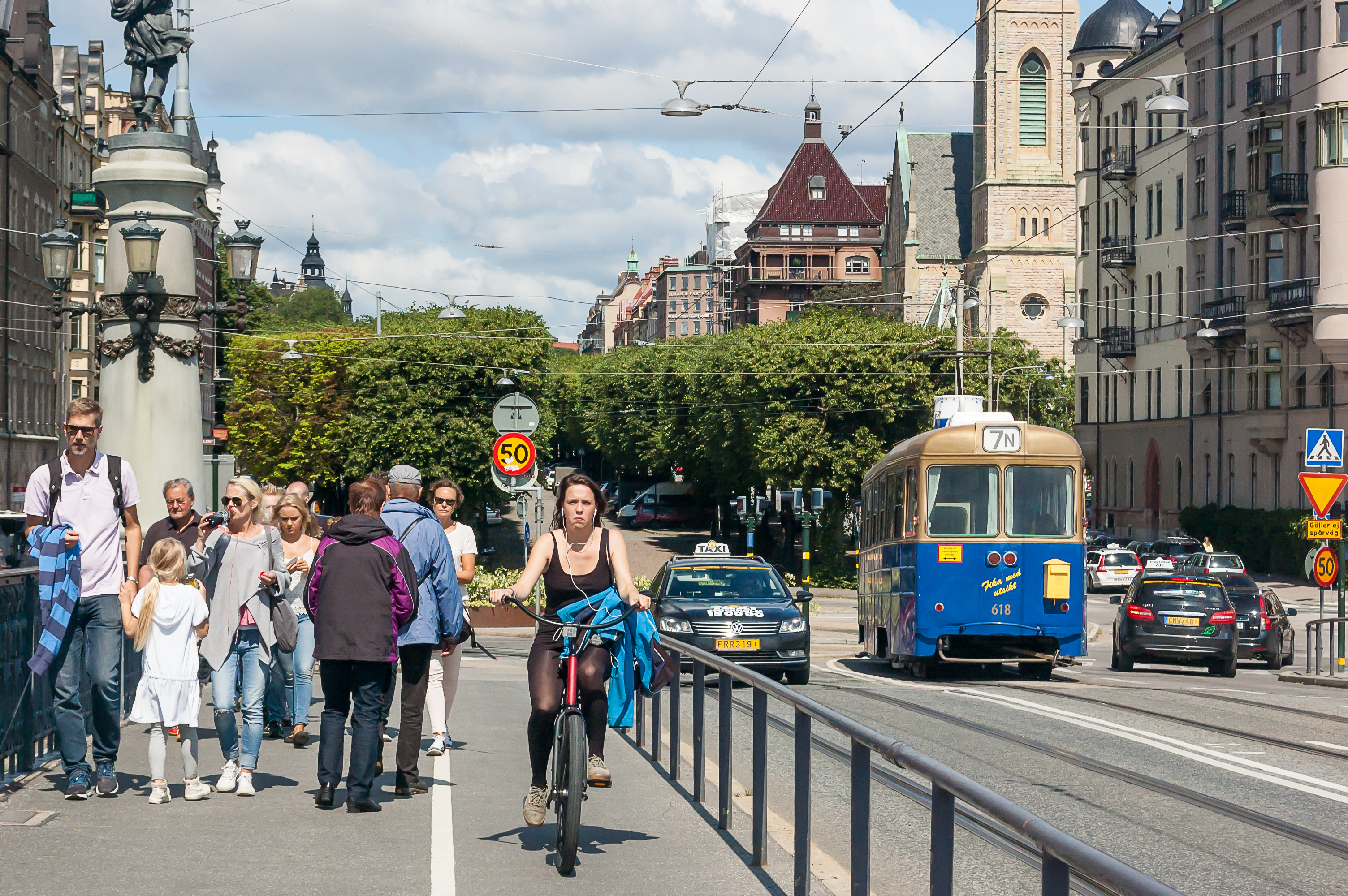
2. You can see a heritage tram leaving Djurgården via Djurgårdsbron here. A number of tram cars from various ages are used on this route; this one is from 1952, and is used as a "cafe tram".
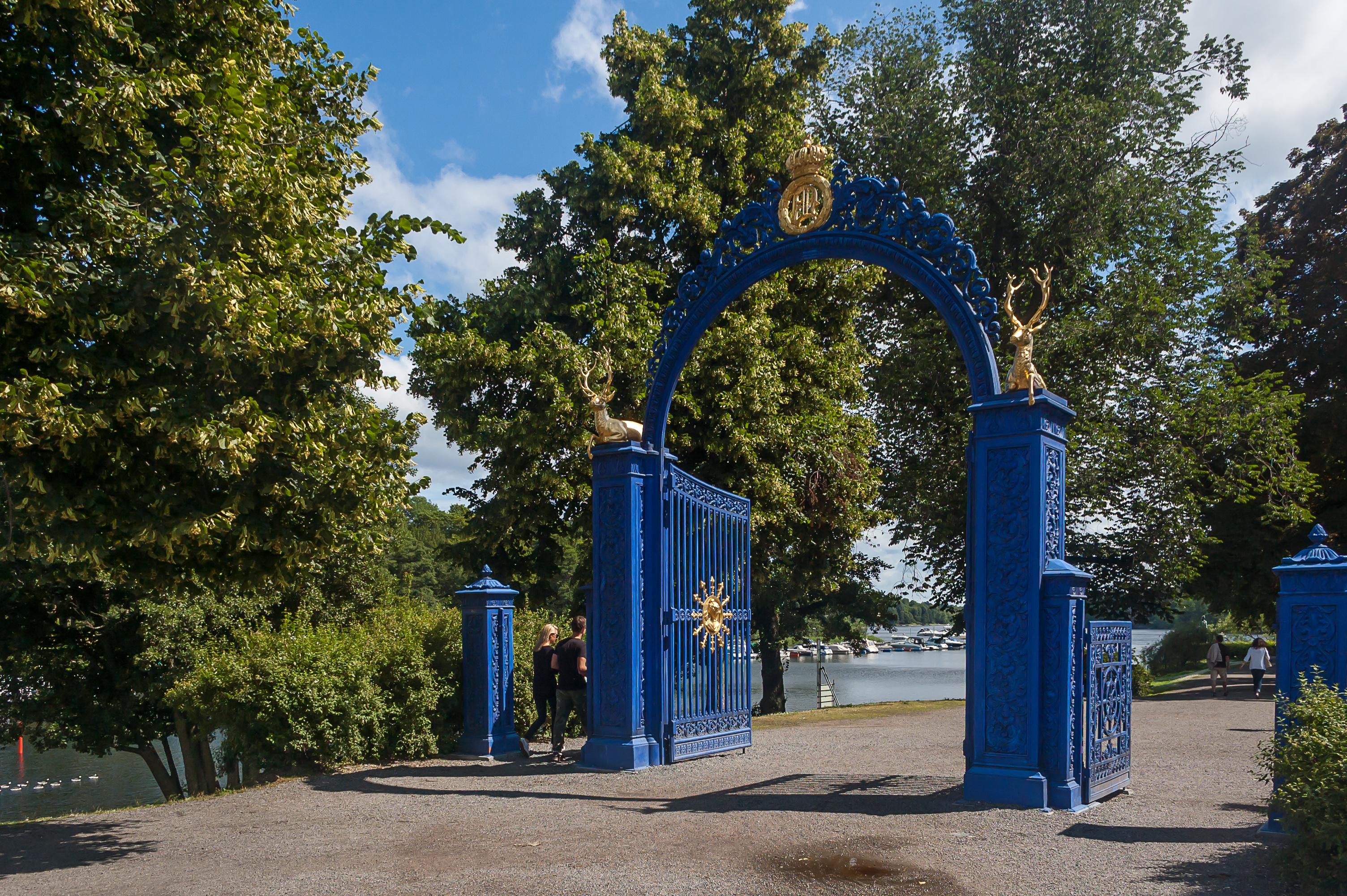
3. Blå Porten (Swed. Blue Gate), an entrance gate to the Djurgården park from 1840, just next to the bridge.
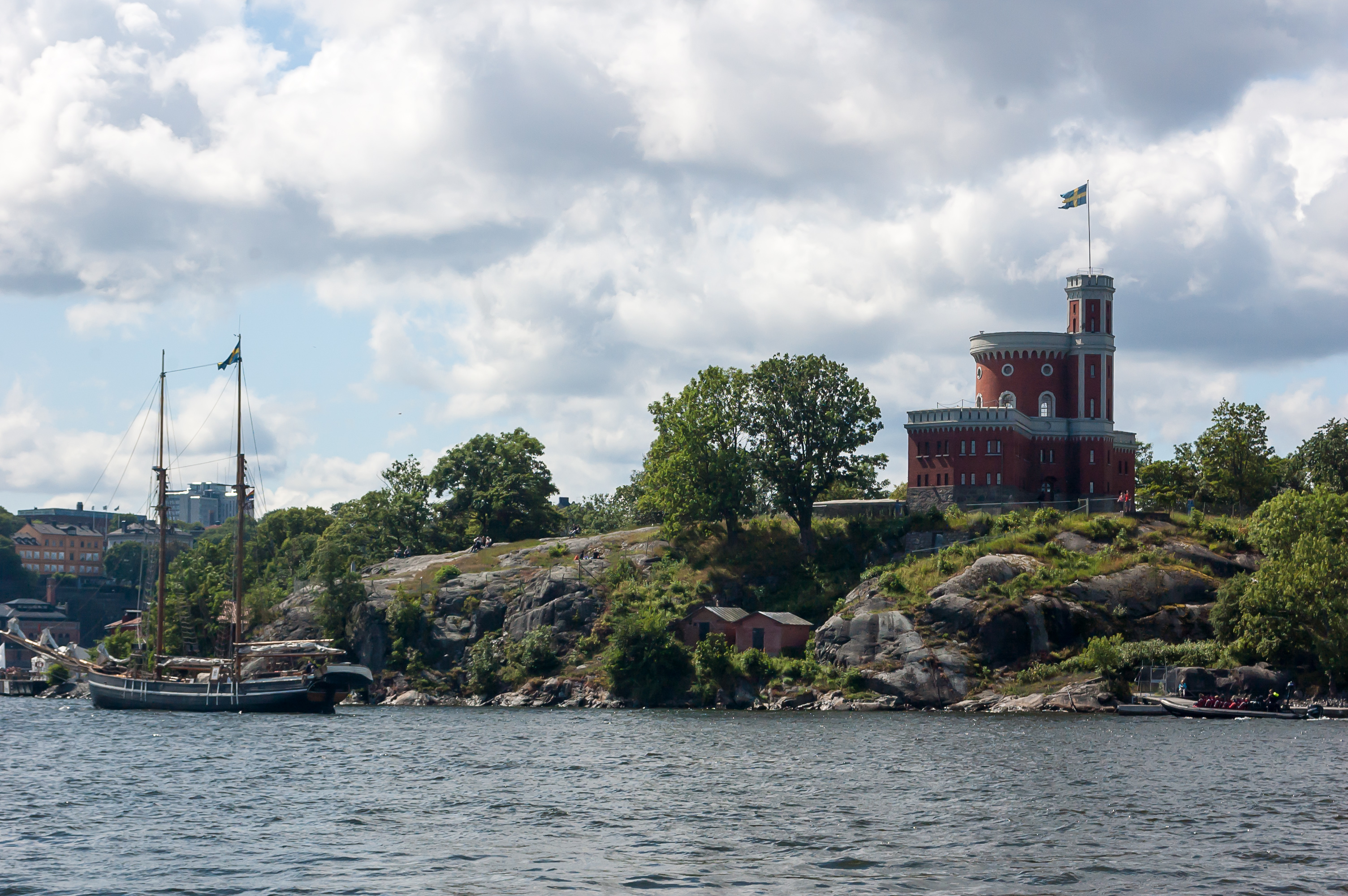
4. The flag on the Kastellet citadel is raised now.

5. Djurgården is rather out of the way if you walk there on foot, and it's not very close to any metro stations either. However there are two ferry lines connecting it to the Old Town. The longer one runs to Slussen, and the shorter one to Skeppsholmen. The ferries, known as Djurgårdsfärjan, are considered a part of overall Stockholm public transport system, and use the same tickets. The stop on Djurgården is next to the Gröna Lund amusement park.
A few words on the Stockholm public transport. Stockholm public transport system consists of metro (T-bana), commuter trains and light rail lines going to suburbs, buses, a single tram line I already mentioned, and Djurgårdsfärjan ferries. All these kinds of transport are managed by SL (Storstockholms Lokaltrafik, Swed. Greater Stockholm Local Transit) authority, and use the same tickets. The Stockholm suburban area is divided into three zones, and the tickets which allow crossing between zones are more expensive. You probably don't need to worry about zones if you're just staying in Stockholm proper; the entire metro system and the city buses are all in the inner Zone A.
Tickets can be bought at any metro station, at any (probably) train station, at Djurgårdsfärjan harbors, but, notably not on board of any buses. You can't pay with cash either, so you just need to buy tickets in advance. A single-use ticket for a single zone is sold in ticket machines, and costs 36 SEK. (1 SEK, that is, one Swedish Krona, is worth about €0.10-0.11, or 7-8 rubles.) That's quite expensive of course; at least that includes any interchanges within 75 minutes. As is usual for European public transport, it gets much cheaper if you buy multiple trips at once. If you use a prepaid card, one trip within a single zone costs 25 SEK. A card which allows you to travel freely for 7 days costs 300 SEK.
Anyway, the ferry trip from Djurgården to Skeppsholmen is very short, lasting just a minute or two. I don't know why they even bother with seats. For some reason I forgot to take a picture of the ferry from the outside, so here is one from Wikipedia.
There are also some larger ferries linking Stockholm to various islands of the Stockholm archipelago. They are operated by Waxholmbolaget, same company as Djurgården ferries, and they use their own tickets.

6. Approaching Skeppsholmen. Skeppsholmen (Swed. Ship Island) is a small island, about 0.5 km across, located to the east from the Old Town, and connected to the mainland with the Skeppsholmsbron bridge. Originally a naval base, it is now mostly a home to museums like Djurgården.
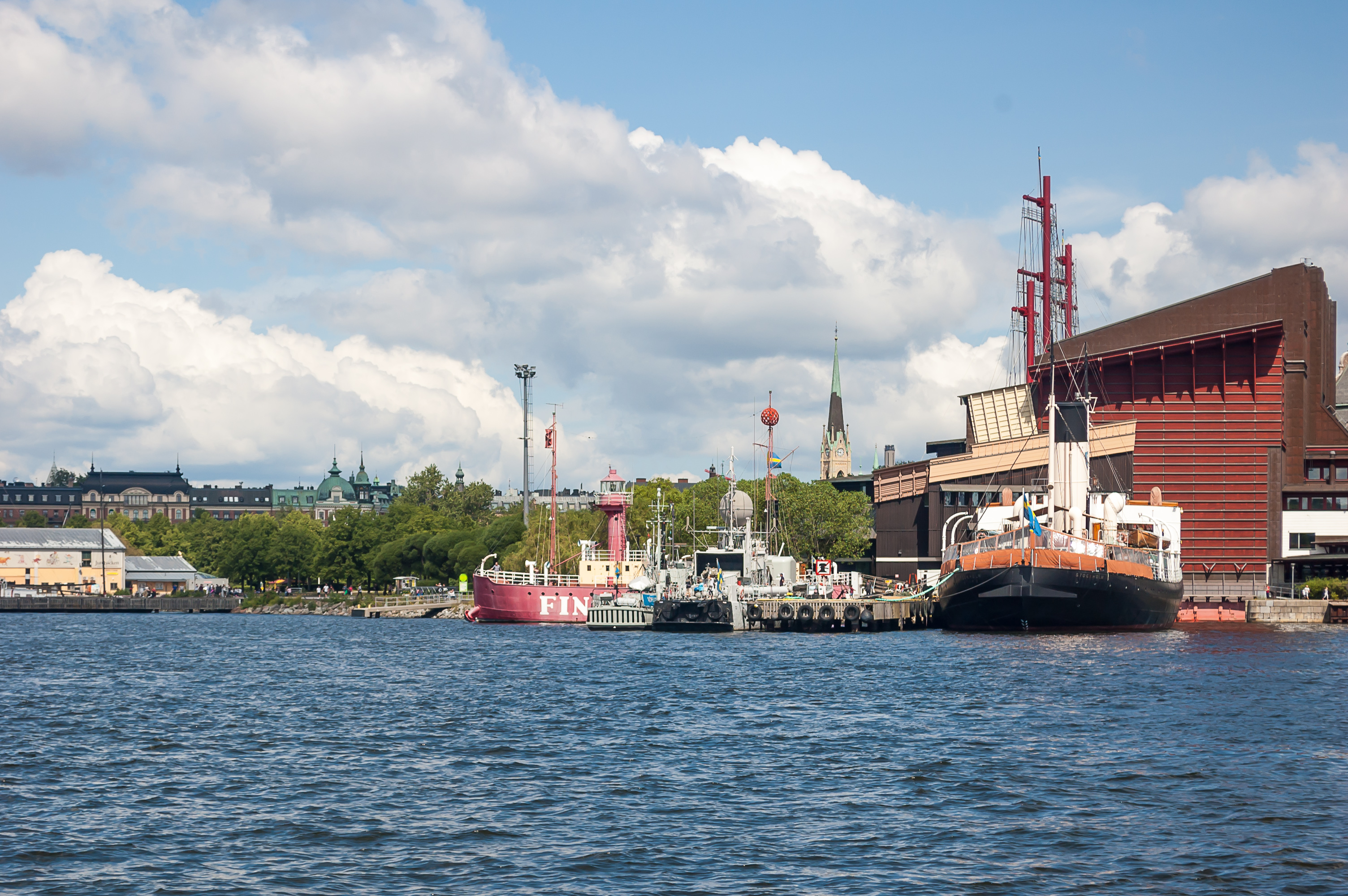
7. A small part of Djurgården, as seen from Skeppsholmen. An oddly-shaped building to the far right is the Vasa Museum. Two other museum ships, an icebreaker and a lightship, are moored nearby.
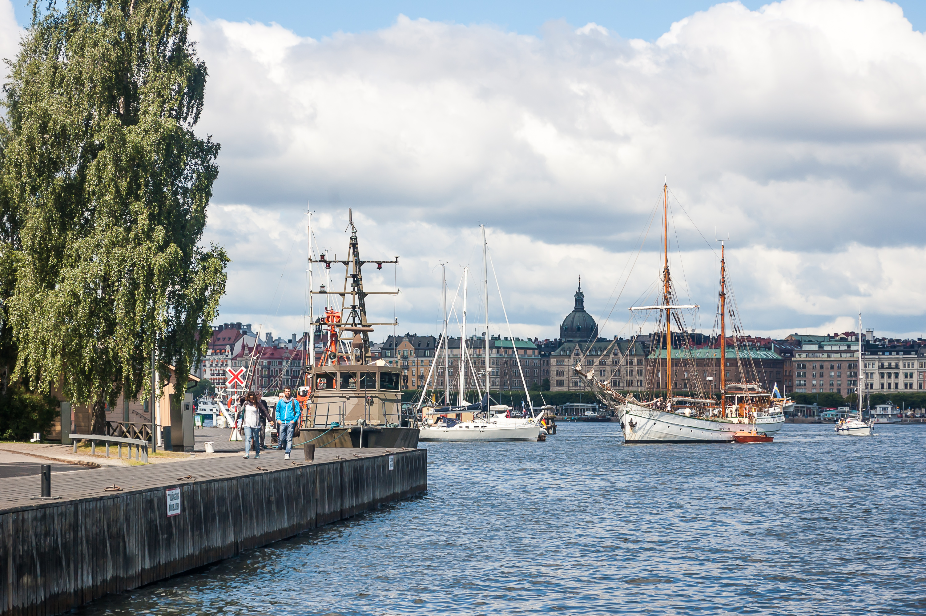
8. Ships in the Stockholm harbor.
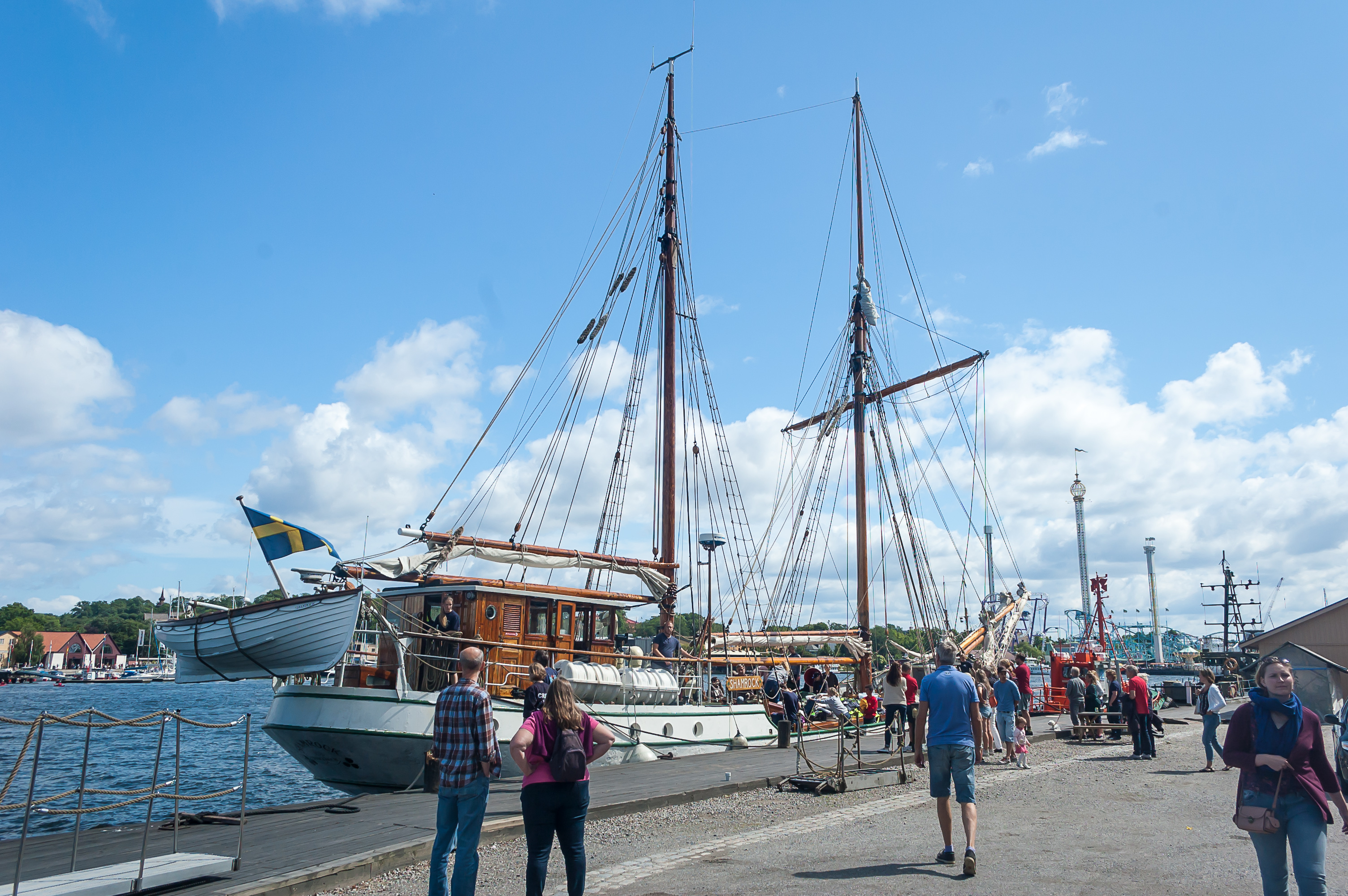
9. Skeppsholmen, like the Aura quay in Turku, is a home to a great number of small ships, some of them quite old. This is the schooner Shamrock, built in the Netherlands in 1915, which serves as a training ship.
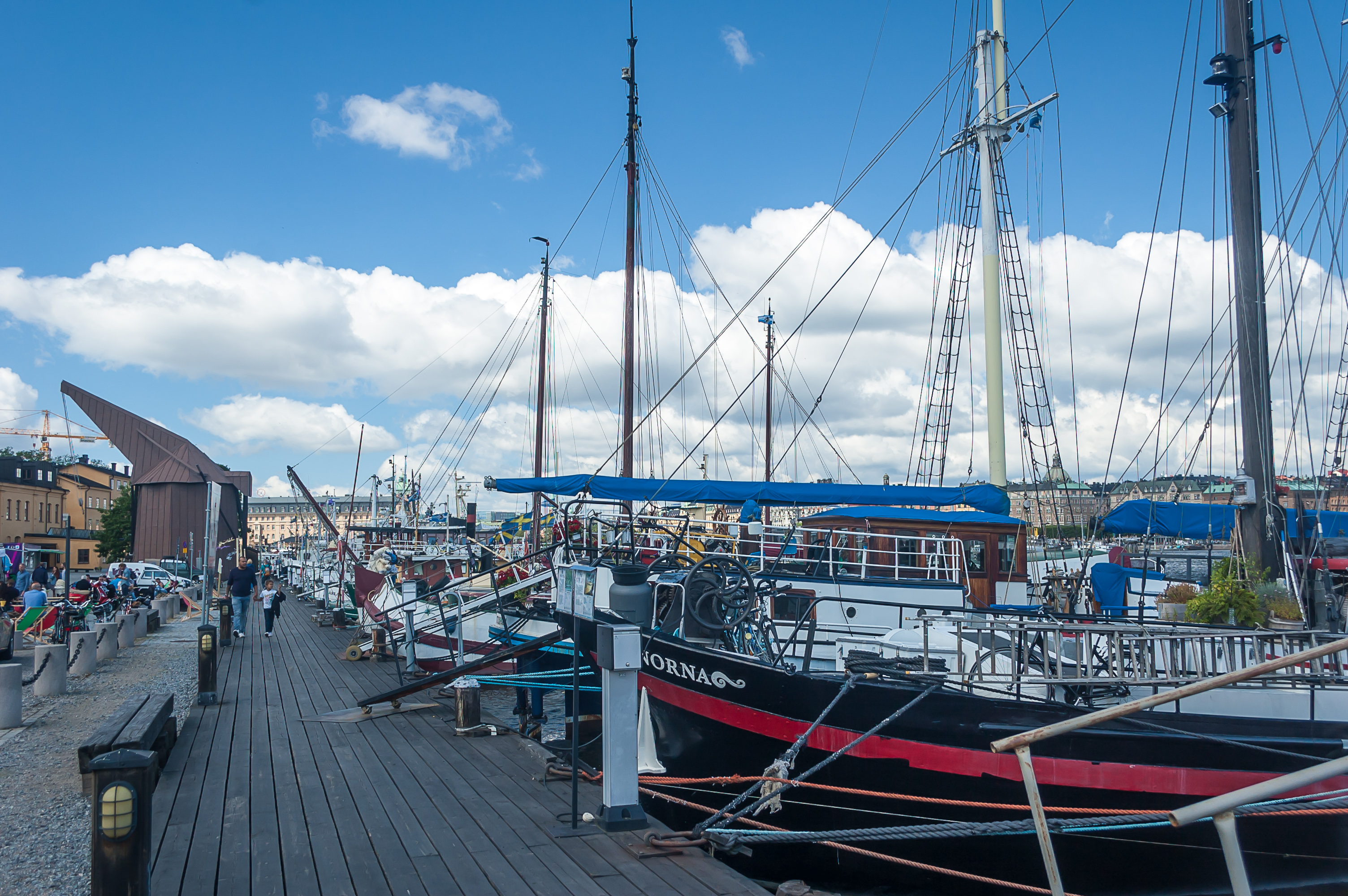
10. Skeppsholmen quay.
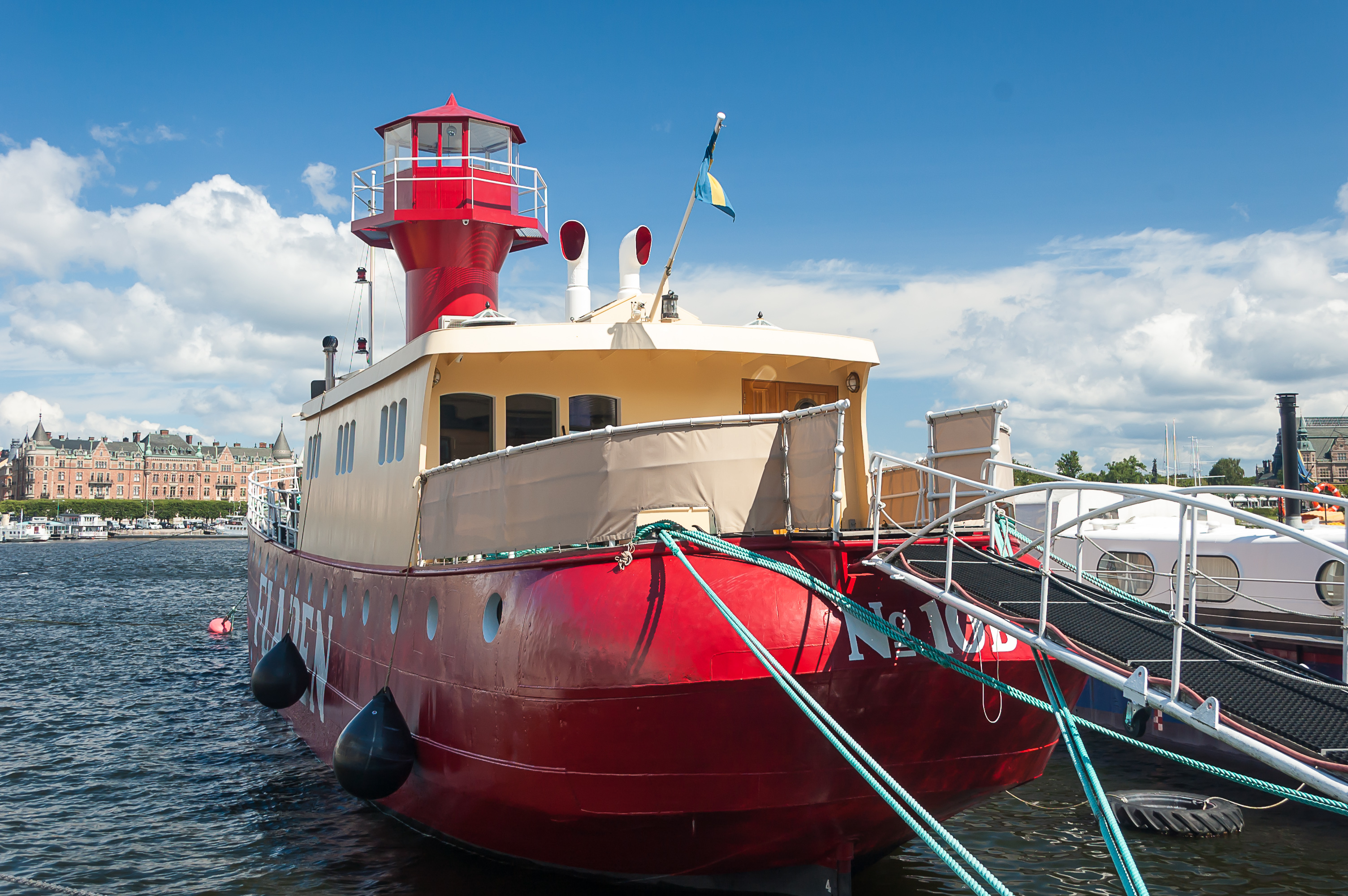
11. The lightship Fladen, built in 1892 in Malmö. Not to be confused with another lightship named Fladen, which is located in Gothenburg.

12. More old ships, not Vasa-old of course.
13. Skeppsholmsbron (Swed. Skeppsholmen Bridge), a rather long bridge, connects Skeppsholmen to the mainland. The bridge was built in 1861, becoming the first wrought iron bridge in Stockholm.
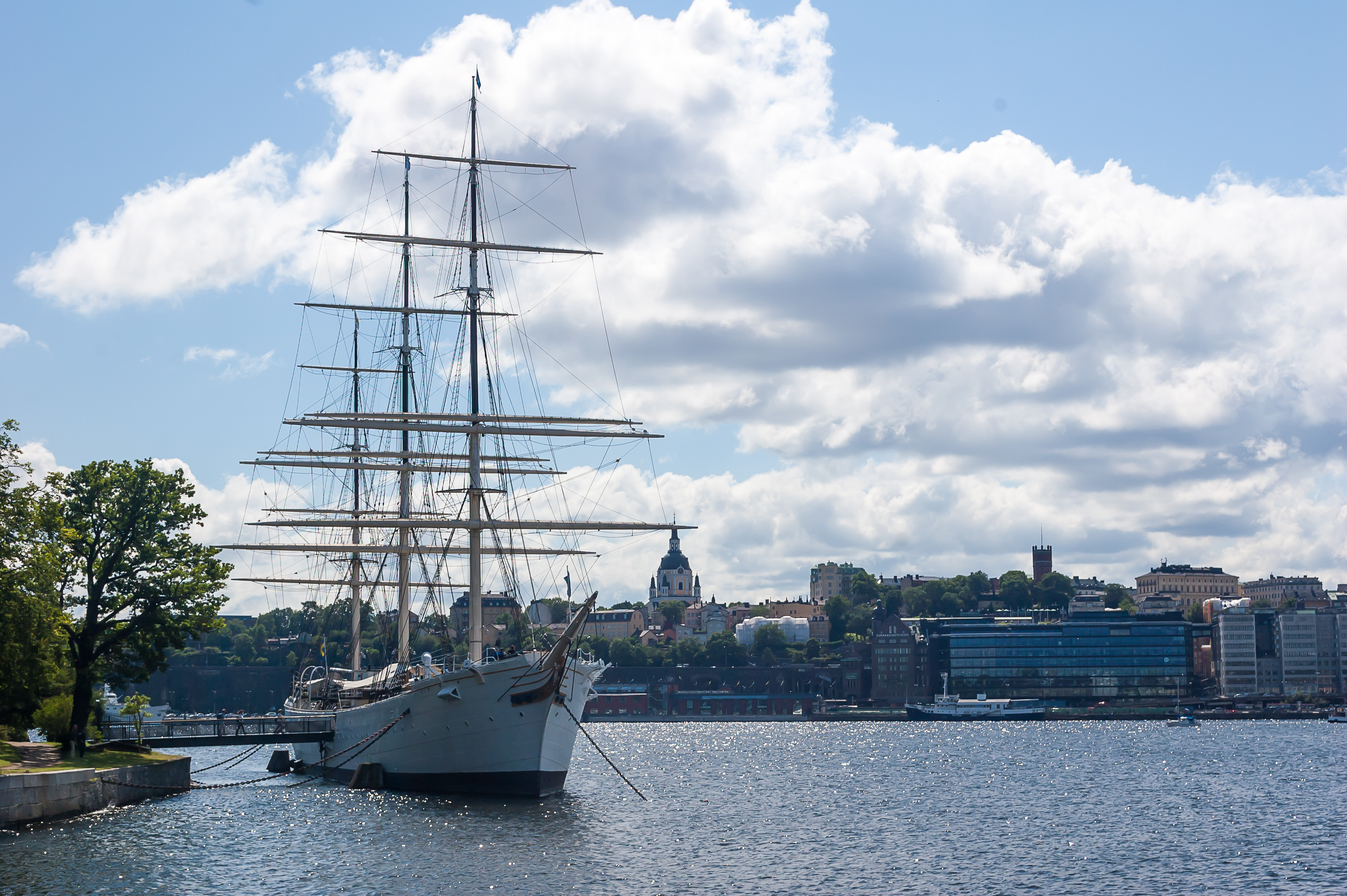
14. af Chapman, a full-rigged sailing ship built in 1888 in Whitehaven, England, was bought by the Swedish Navy in 1923 for use as a training ship, and renamed after Vice Admiral af Chapman, a famous Swedish shipbuilder of the 18th century. af Chapman is moored permanently here and used as a youth hostel.
15. Eric Ericsonhallen, a former church converted into a concert hall.
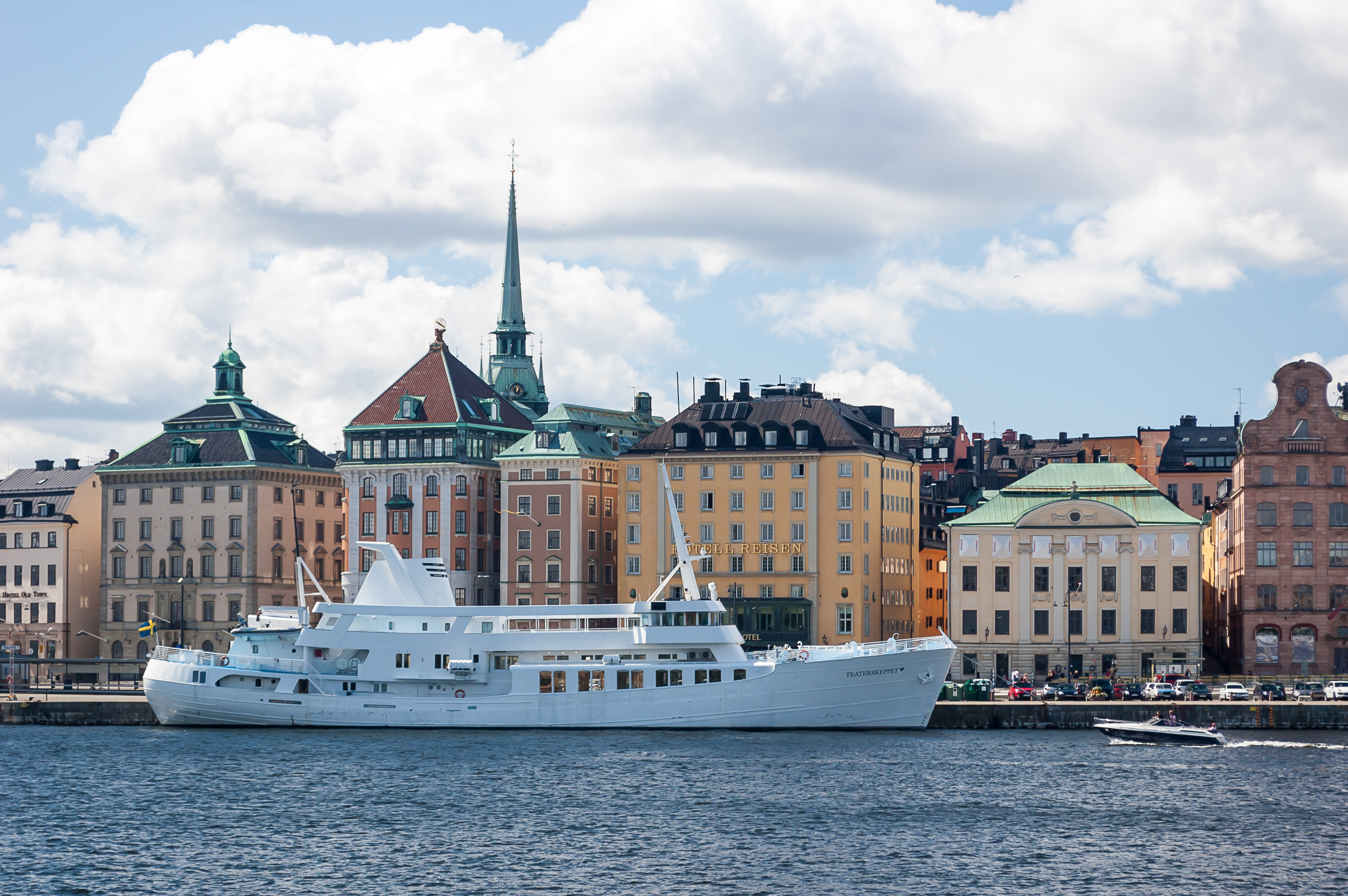
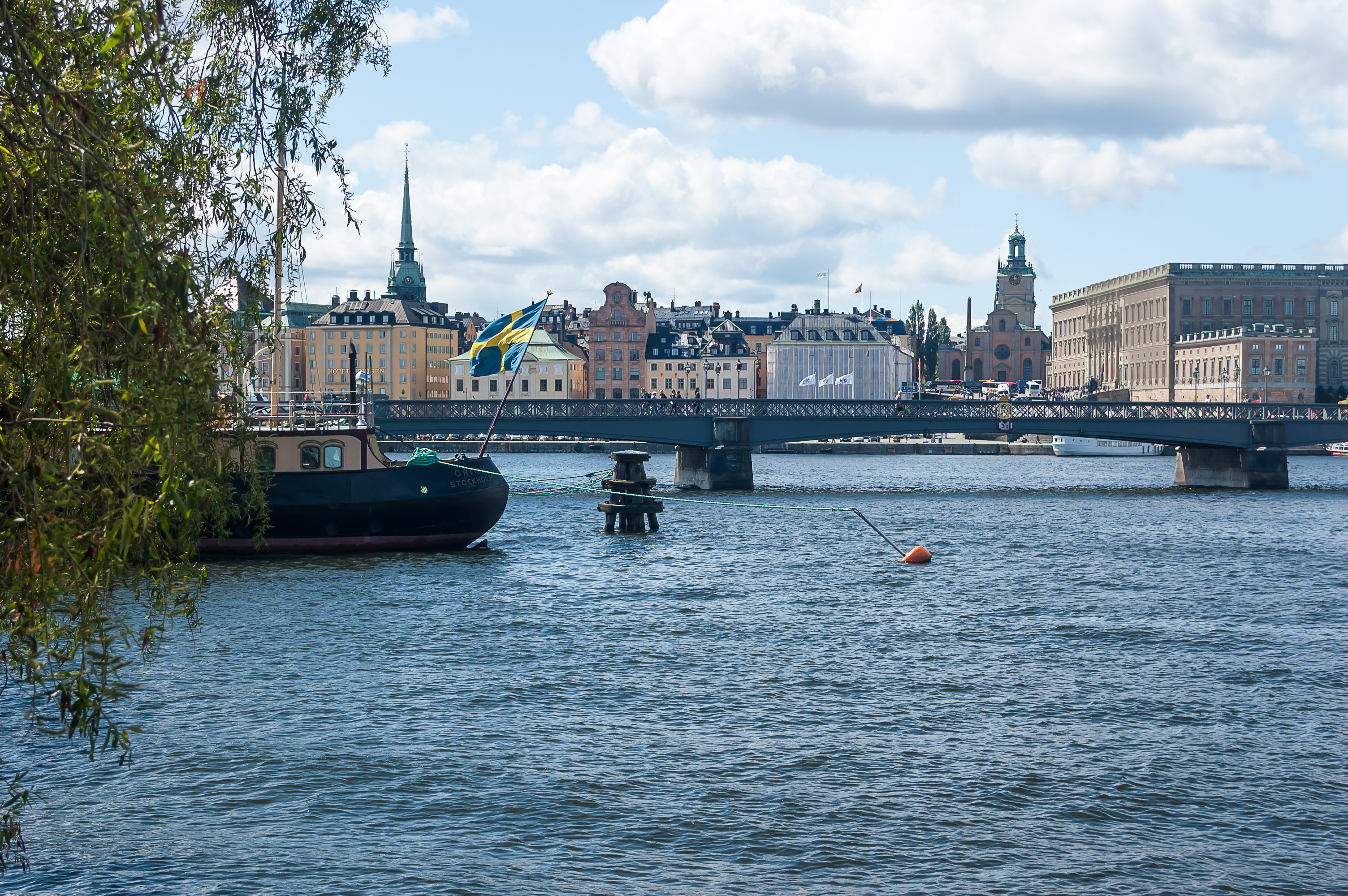
16. Teaterskeppet (Swed. Theater Ship) at the Old Town waterfront, across the channel. Built in 1959 in Portugal as Vågbingur, a fishing ship for the Faeroe Islands, it now mostly hosts conferences and parties.
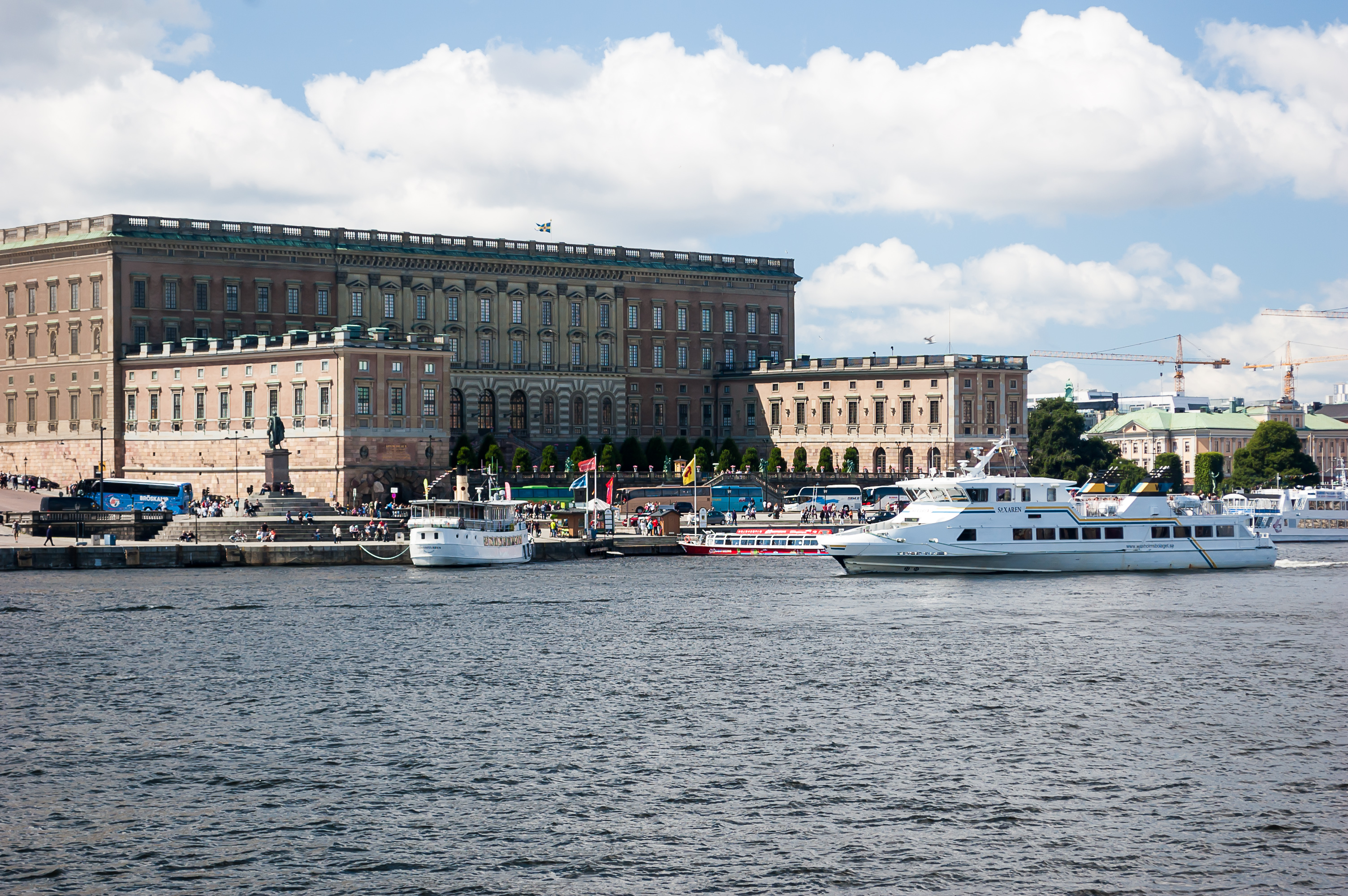
17. Stockholm Royal Palace (Kungliga slottet) in all its glory. It is the official residence of the Swedish Royal family in the Old Town, built in 1754, although since 1981 the Royal family actually lives in Drottningholm Palace on an island in the suburbs. The palace is occasionally called Tre Kronor (Swed. Three Crowns), but that is incorrect; Tre Kronor was the name of the old castle in this place, which burnt down way back in 1697.
His Majesty the King of Sweden Carl XVI Gustaf has been the reigning monarch since 1973. He belongs to the House of Bernadotte, founded by Jean-Baptiste Bernadotte, a Marshal of France, who was elected (on Napoleon's wishes) the King of Sweden in 1810. The role of the monarch was very limited even in that era; the first Instrument of Government, a document essentially making Sweden a constitutional monarchy, was adopted by Riksdag of the Estates (a proto-parliament) in 1719. As for Carl XVI Gustaf, in my opinion he kinda looks like a kind and somewhat apologetic grandfather. Amusingly, there was a significant scandal in 2010, when this nice grandpa was revealed to have participarted in sex parties in the 1990s. Even more amusingly, the Swedes themselves were apparently totally cool with that revelation.
Oh, and Princess Estelle, Duchess of Östergötland, born in 2012, is officially the most adorable child ever.
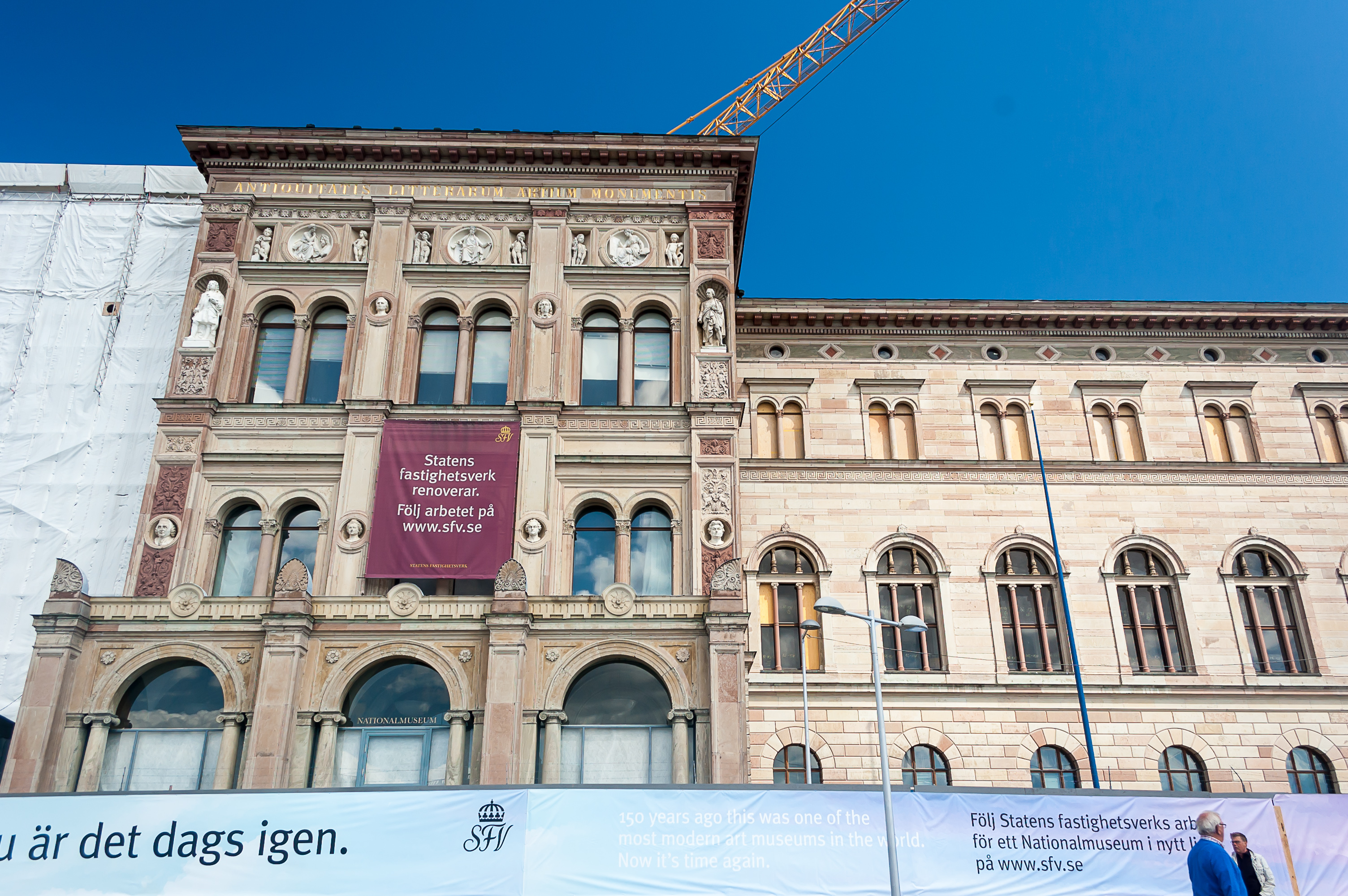
18. Nationalmuseum, the National Museum of Fine Arts, is closed for renovation until 2017.
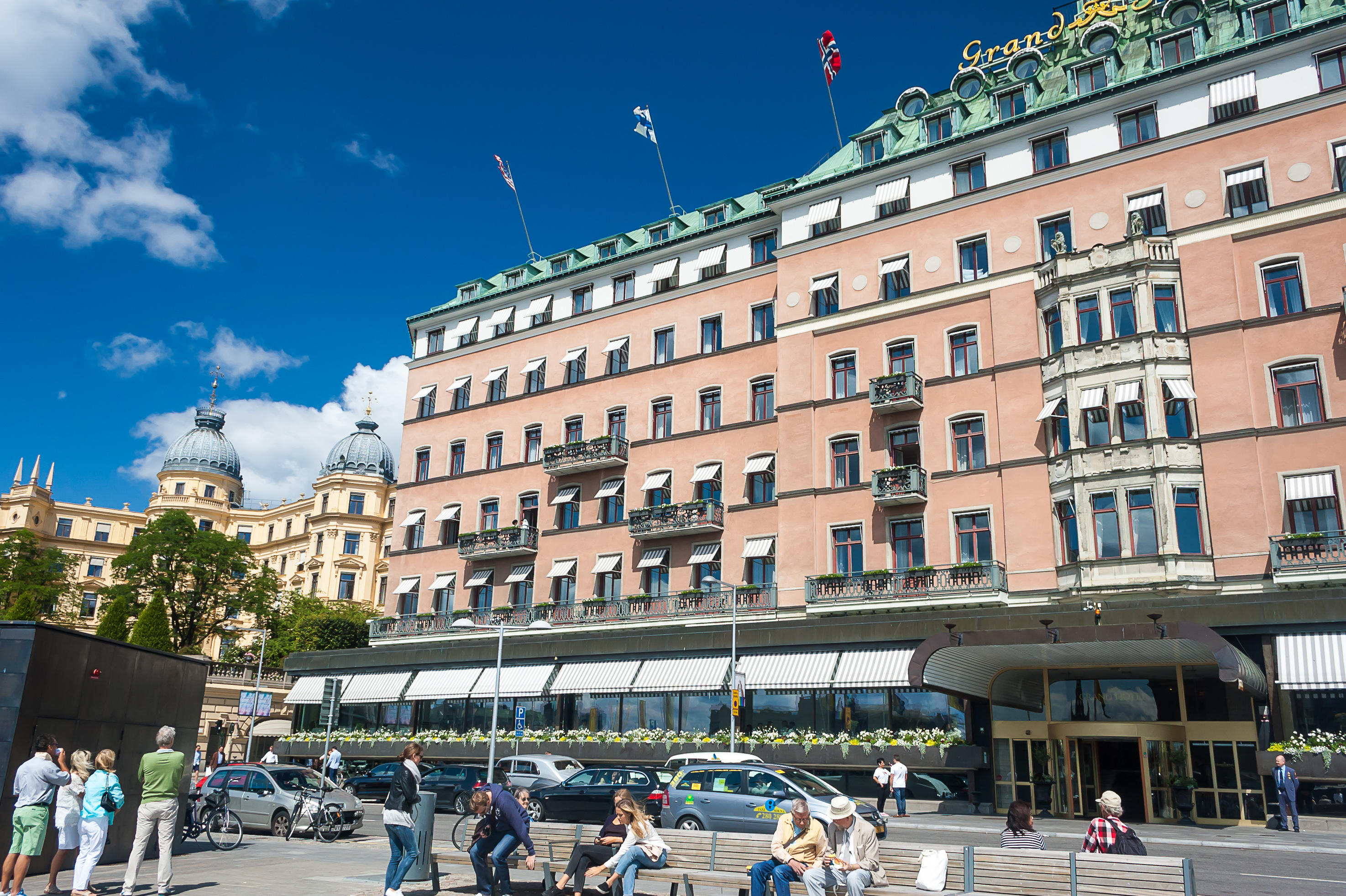
19. Grand Hôtel Stockholm, a five-star hotel just opposite the Royal Palace. Grand Hôtel and the Nationalmuseum are both located on the former island of Blasieholmen, the one that once housed a shipyard where Vasa was built.

20. Fersen Palace (Fersenska palatset, after Counts von Fersen, its original owners), a nice building next to the Grand Hôtel. Its oldest parts date back to 1634. It is currently occupied (along with a building next to it) by headquarters of Handelsbanken, one of the major banks of Nordic countries.
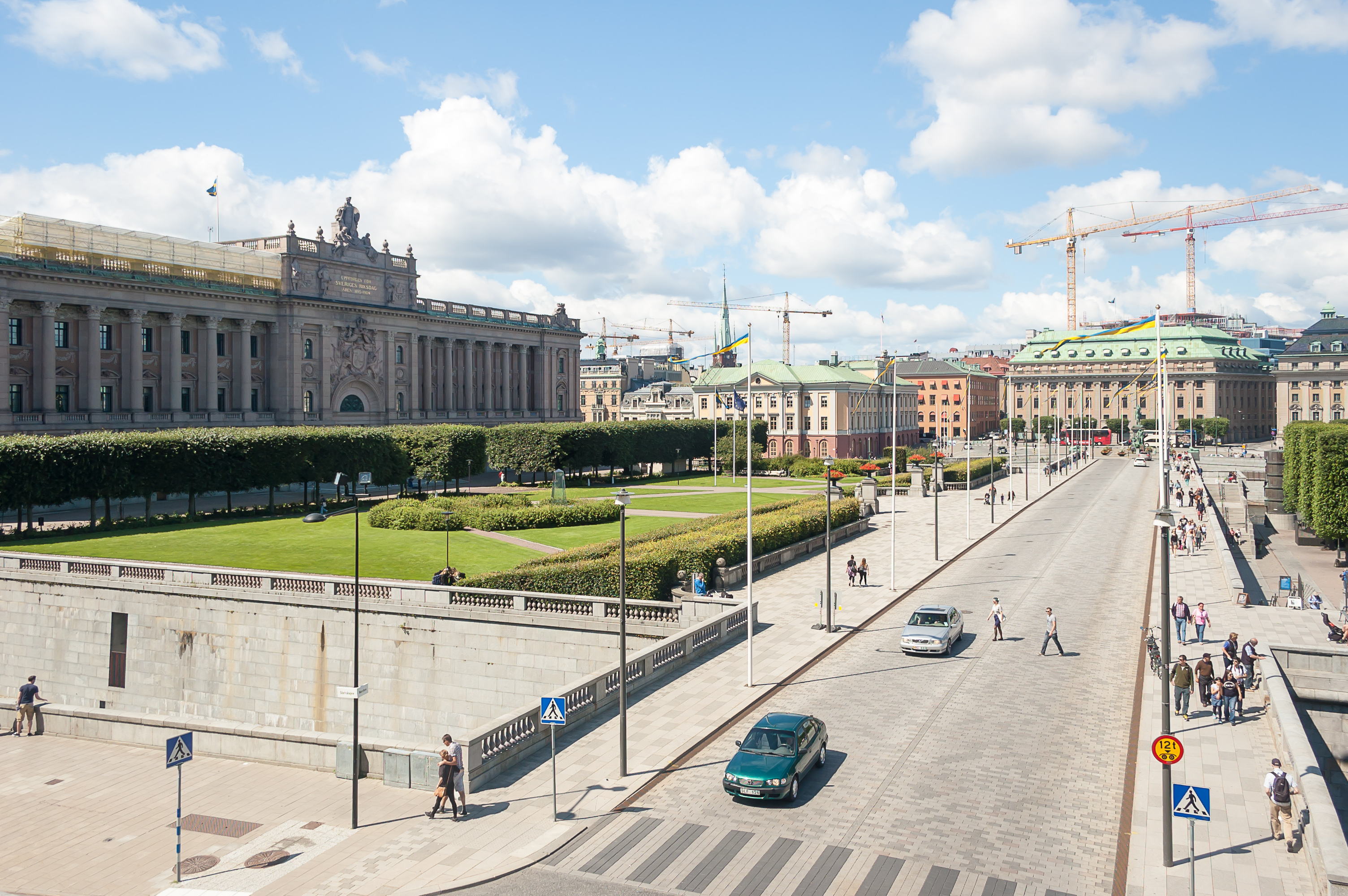
21. Norrbro (Swed. North Bridge), the front access road to the Stockholm Palace. The Riksdag building is to the left.
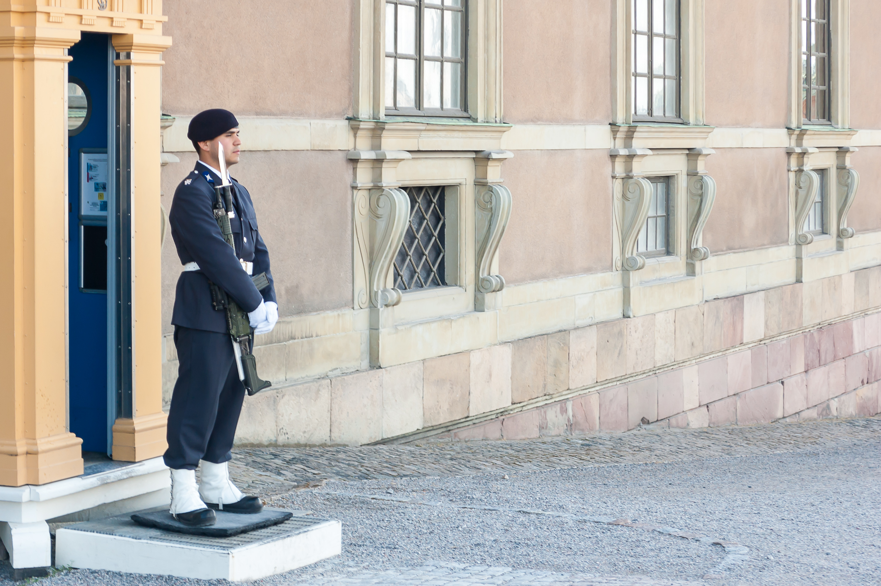
22. Swedish Royal Guard. Sadly we didn't see the changing of the guard. Also, most of the pictures of them I can find show a more fanciful uniform, with an ornate spiked helmet. So maybe this isn't actually a proper Royal Guard.

23. Stockholm Old Town, Västerlånggatan street (Swed. Western Long Street), the most touristy one. I didn't take many pictures of the Old Town, as I already did that a year before. I'm not a huge fan of Stockholm Old Town actually. There are so many tourists it doesn't really feel like a real living place, unlike for example Tallinn Old Town. But maybe that's just me.
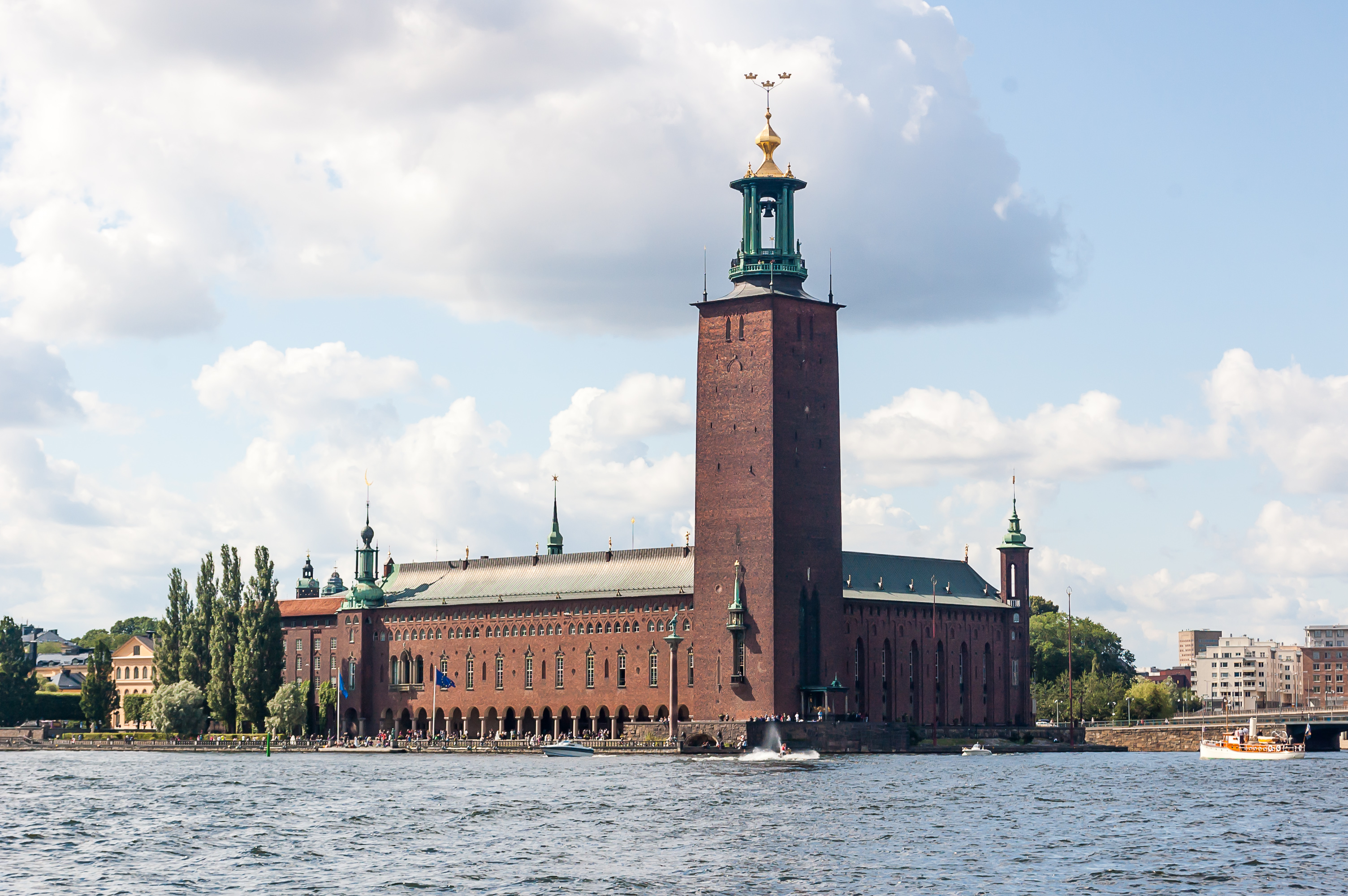
24. Stockholm City Hall (Stadshuset) on the island of Kungsholmen (Swed. King's Island), with its large square tower, topped by three golden crowns, is my favorite building of Stockholm (along with Riddarholmen Church). The picture is taken from Riddarholmen (Swed. Knight Island), a 300 meter wide island connected to the Old Town with a small bridge. Riddarholmen is home to just twenty or so buildings, the most promiment one being the abovementioned Riddarholmen Church (Riddarholmskyrkan).
25. Riddarholmen waterfront faces Riddarfjärden (Swed. Knight Bay), which is considered the easternmost part of lake Mälaren. The waterways of central Stockholm are called Stockholms ström (Swed. Stockholm Stream), and further to the east is the bay of Saltsjön (Swed. Salt Sea), filled with islands of Stockholm archipelago, and considered a part of Baltic Sea proper.
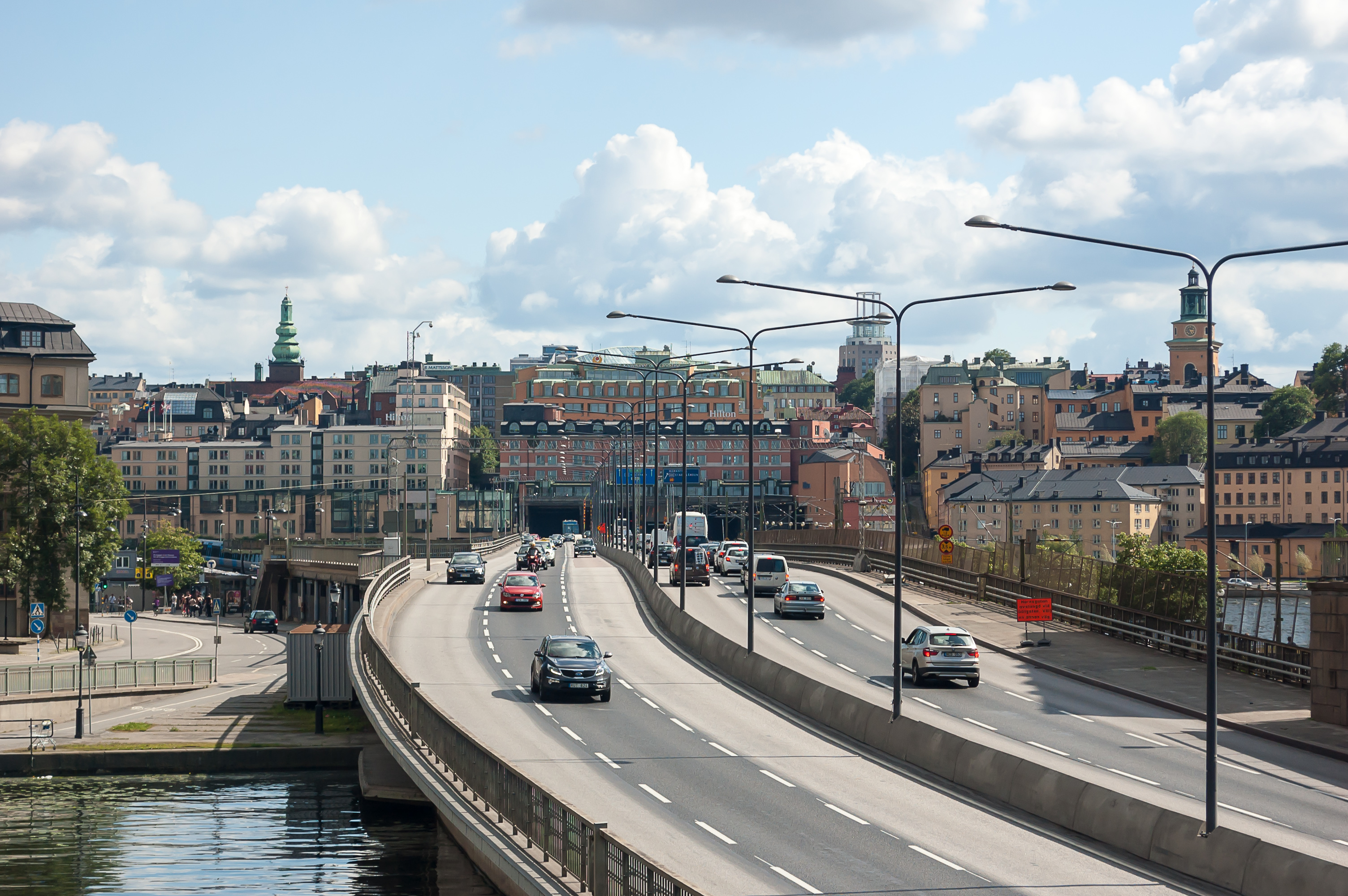
26. Centralbron (Swed. Central Bridge), fitting neatly between Old Town and Riddarholmen, is the largest road link between northern and southern parts of Stockholm. It was completed in 1967, and much criticized since then, being an ugly motorway-like road very close to the Old Town buildings, but no adequate replacement exists. Centralbron doesn't actually have any exits to Old Town; the latter can only be reached with smaller older bridges.
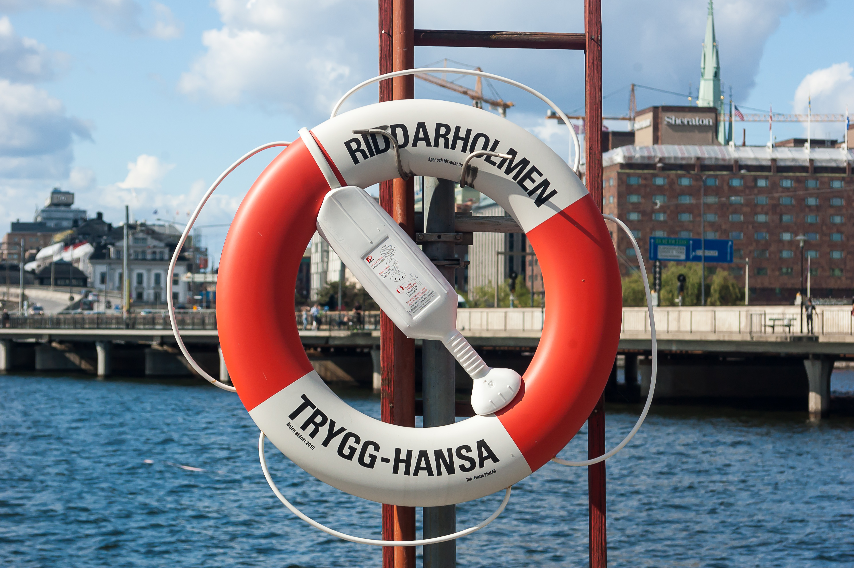
27. A lifesaver at Riddarholmen. All lifesavers I saw in Stockholm public areas are branded Trygg-Hansa. This is not their manufacturer, but rather a major Swedish insurance company, which sponsored the installation of 80,000 lifesavers throughout entire Sweden. Trygg-Hansa claims they save 11 lives every year.
28. Norra järnvägsbron (North Railway Bridge), along with Södra järnvägsbron, runs just along Centralbron, carrying commuter rail traffic. The only existing north-south rail link east of lake Mälaren (which is about 100 km long), it is a badly overloaded bottleneck. A new line is now under construction, in the form of a 6 km long tunnel under the entire central Stockholm. It is known as Citybanan (bana means road or more often a railway in Swedish, but I can't read this word without thinking of bananas), and will open in 2017.

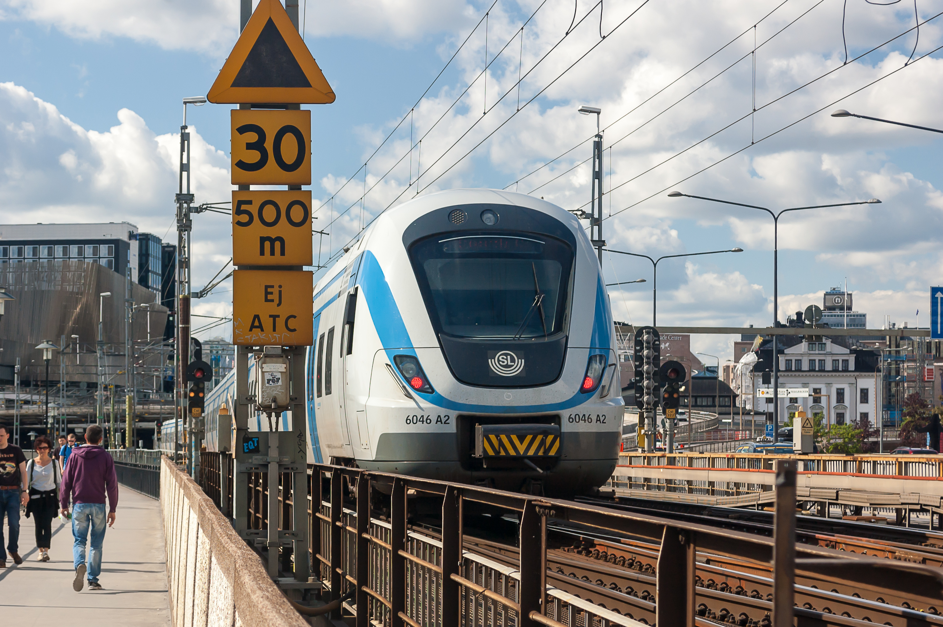
29. For now you just can watch all kinds of passenger trains crossing Norra/Södra järnvägsbron about once every two minutes.
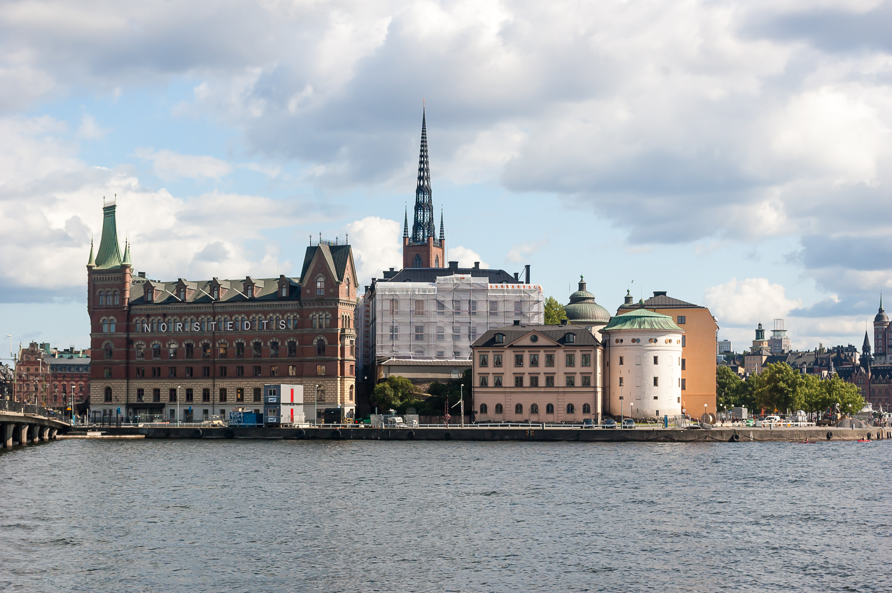
30. Riddarholmen, as seen from Kungsholmen. The spire of Riddarholmskyrkan church is in the middle.
The round building to the right is the oldest building of Stockholm, Birger Jarl's Tower (Birger jarls torn), built in 1525 by the order of King Gustav Vasa. It is the only remaining part of Stockholm city walls, along with one of the towers of Wrangel Palace in the center of Riddarholmen (visible just beyond Birger Jarl's Tower). It now houses the office of the Chancellor of Justice, who basically represents Swedish state as a legal entity.
As for the bulding with NORSTEDTS inscription, this is in fact the Norstedts Building, constructed in 1889 for Norstedts, an old Swedish publishing house, and still occupied by them.
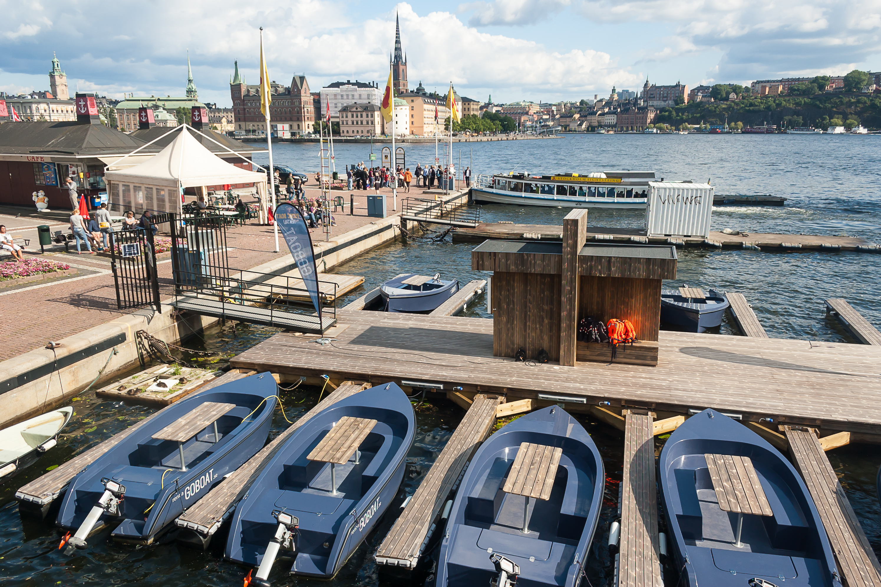
31. You can rent a motorboat right next to the City Hall. It costs a lot though, and presumably you're expected to know how to operate a motorboat.
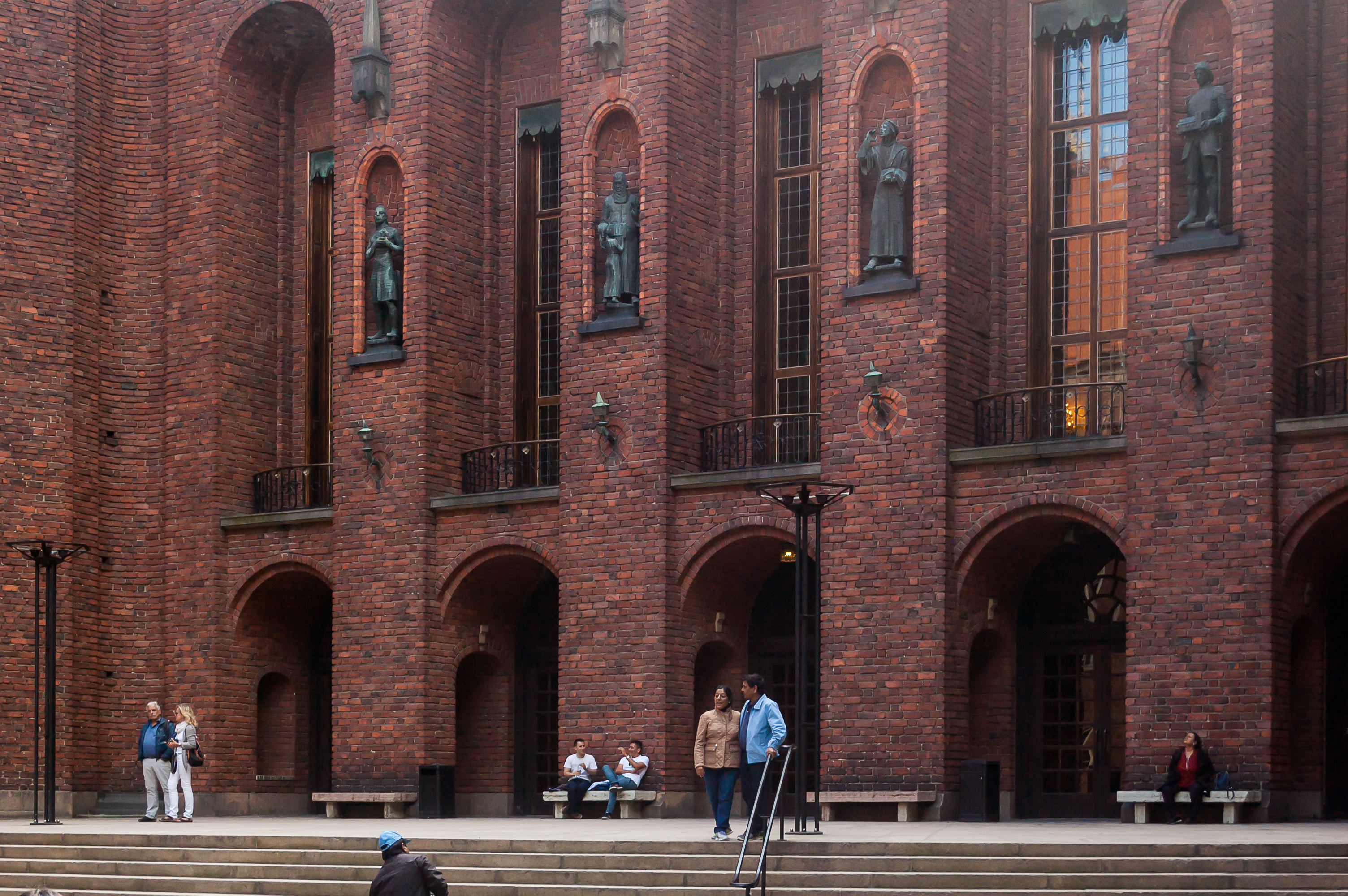
32. City Hall courtyard. The building dates from 1923, and, from what I can google, is even prettier from the inside.
33.
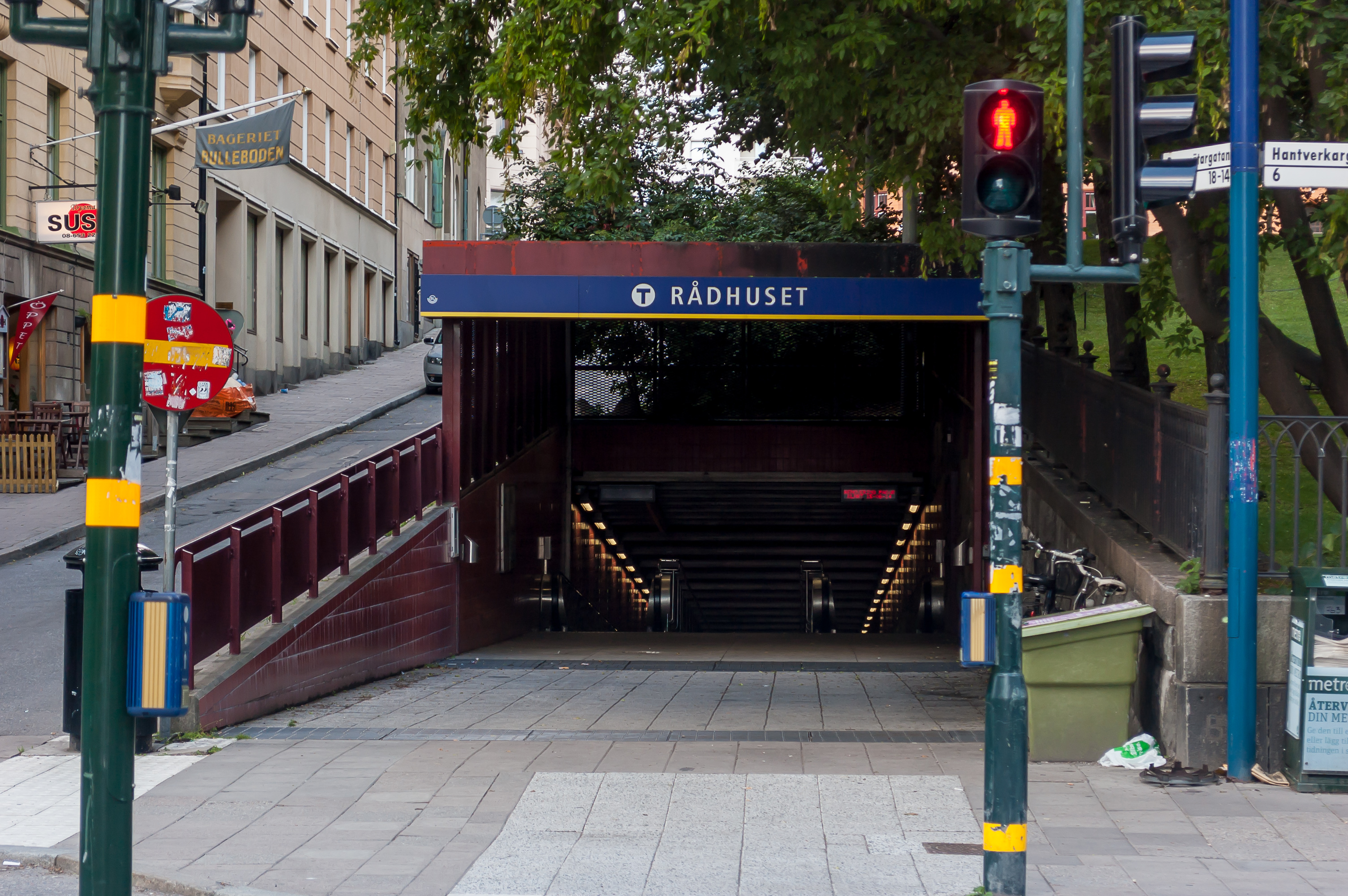
34. The entrance to Rådhuset metro station. Rådhus apparently also means city hall. I'm not sure about the differences between Rådhus and Stadshus. Anyway, the Rådhus building, which I didn't see, actually houses the Stockholm Court House.
Stockholm metro is called Tunnelbana, or just T-bana, hence the T sign, a common shorthand for Stockholm metro.
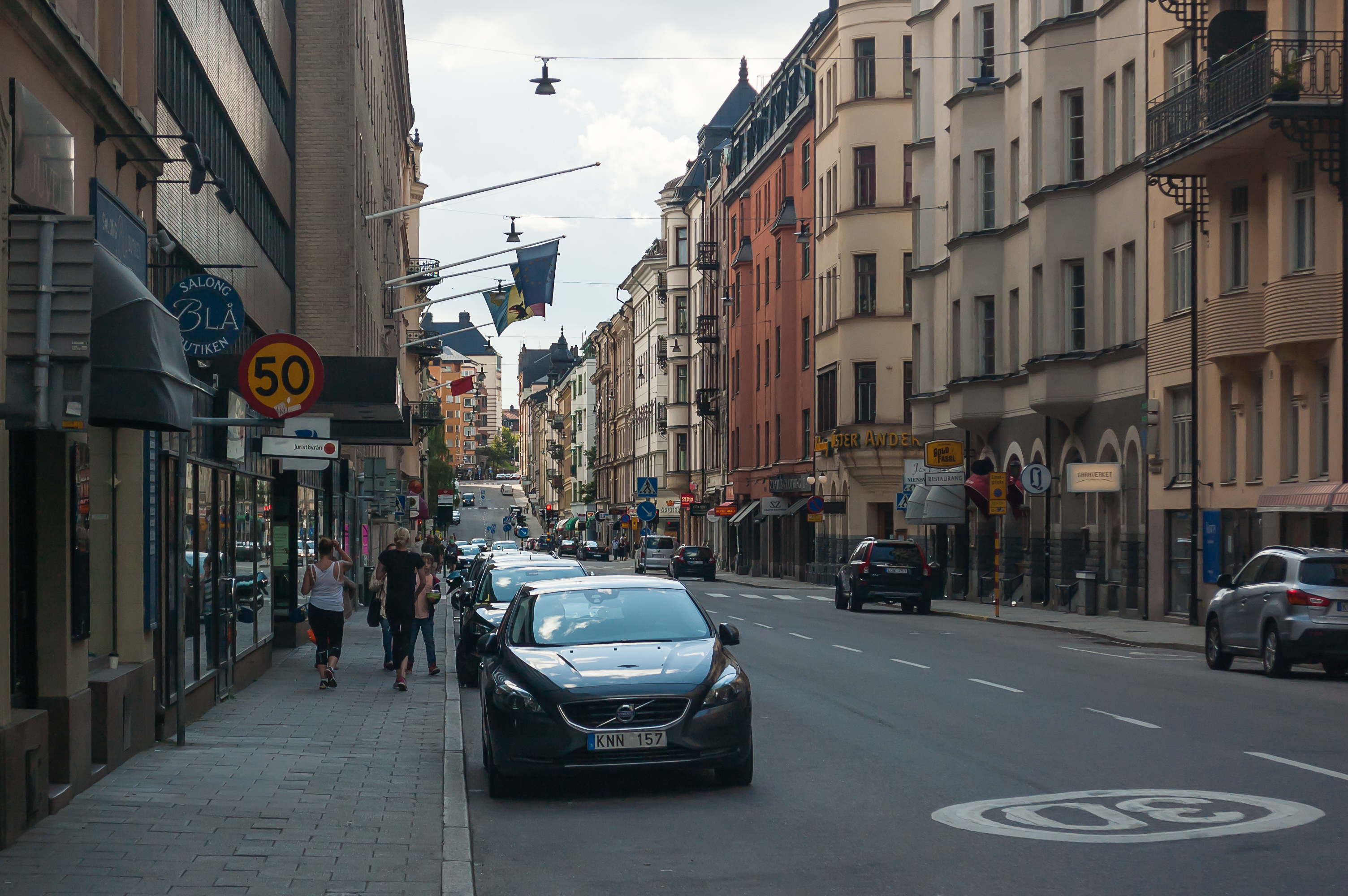
35. We walked to the next T-bana station through Kungsholmen streets. Perhaps we were just tired, but this part of the city seemed nice and very pretty but a bit too uniform and lacking in sights, which central Stockholm is just packed with. The buildings style looks not unlike Helsinki or late Tzarist-era parts of St. Petersburg.

36. We're finally entering T-bana at the Fridhemsplan station, named after a nearby square.
Stockholm metro is often called the most beautiful in the world, and there might be some truth to that. (Moscow metro is certainly no less beautiful, but the style is completely different.) It has exactly 100 stations, which is a lot for a city of that size; they stretch into the inner suburbs, where they are mostly above ground. There are three lines: the red, the blue, and the green one. All of the lines have forks in them, and all three intersect at T-Centralen station, built under the central Stockholm railway station.
Stockholm metro is absolutely worth a closer look. Sadly we were very tired by that point and just travelled to the Karlaplan station, close to our parking lot, transferring from the blue to the red line.
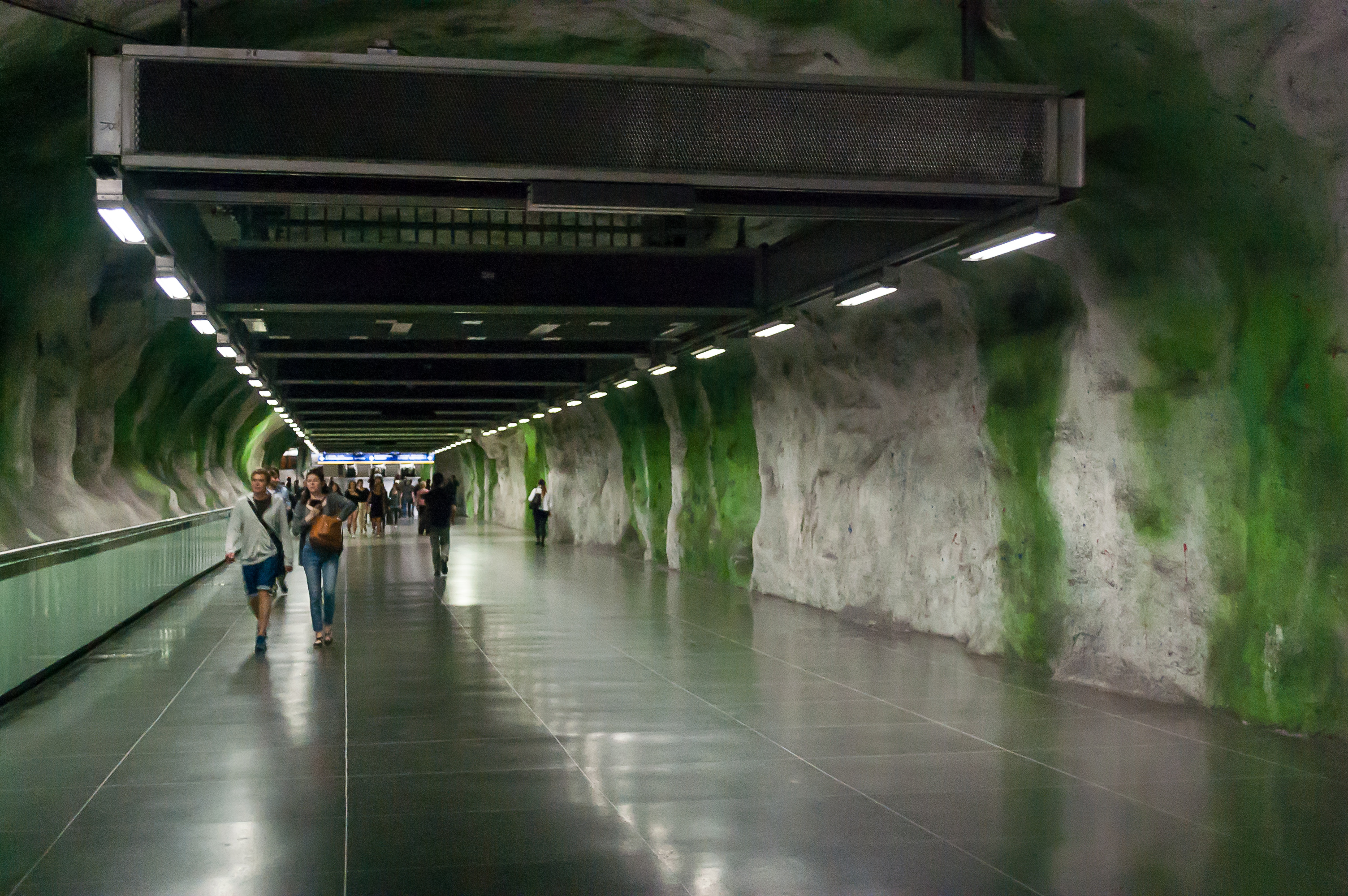
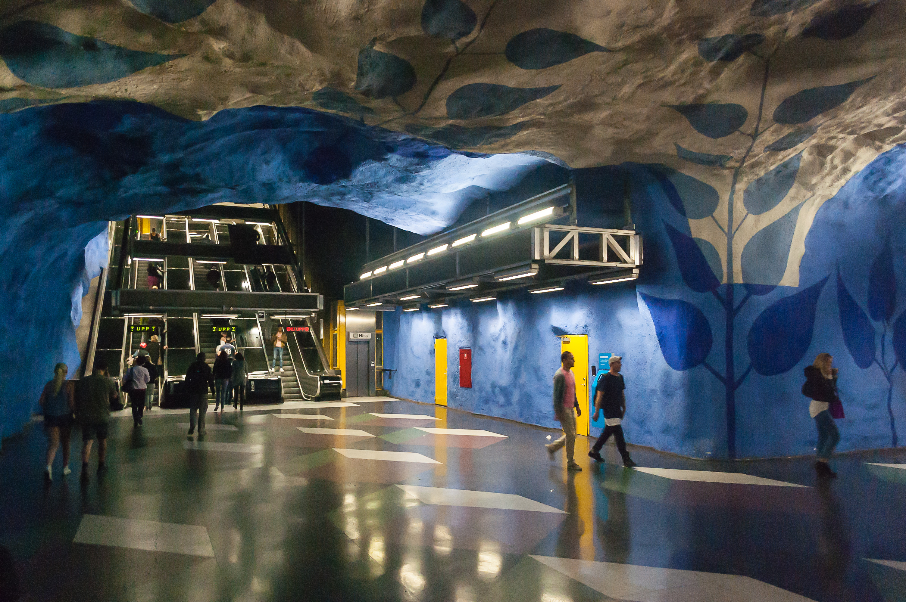
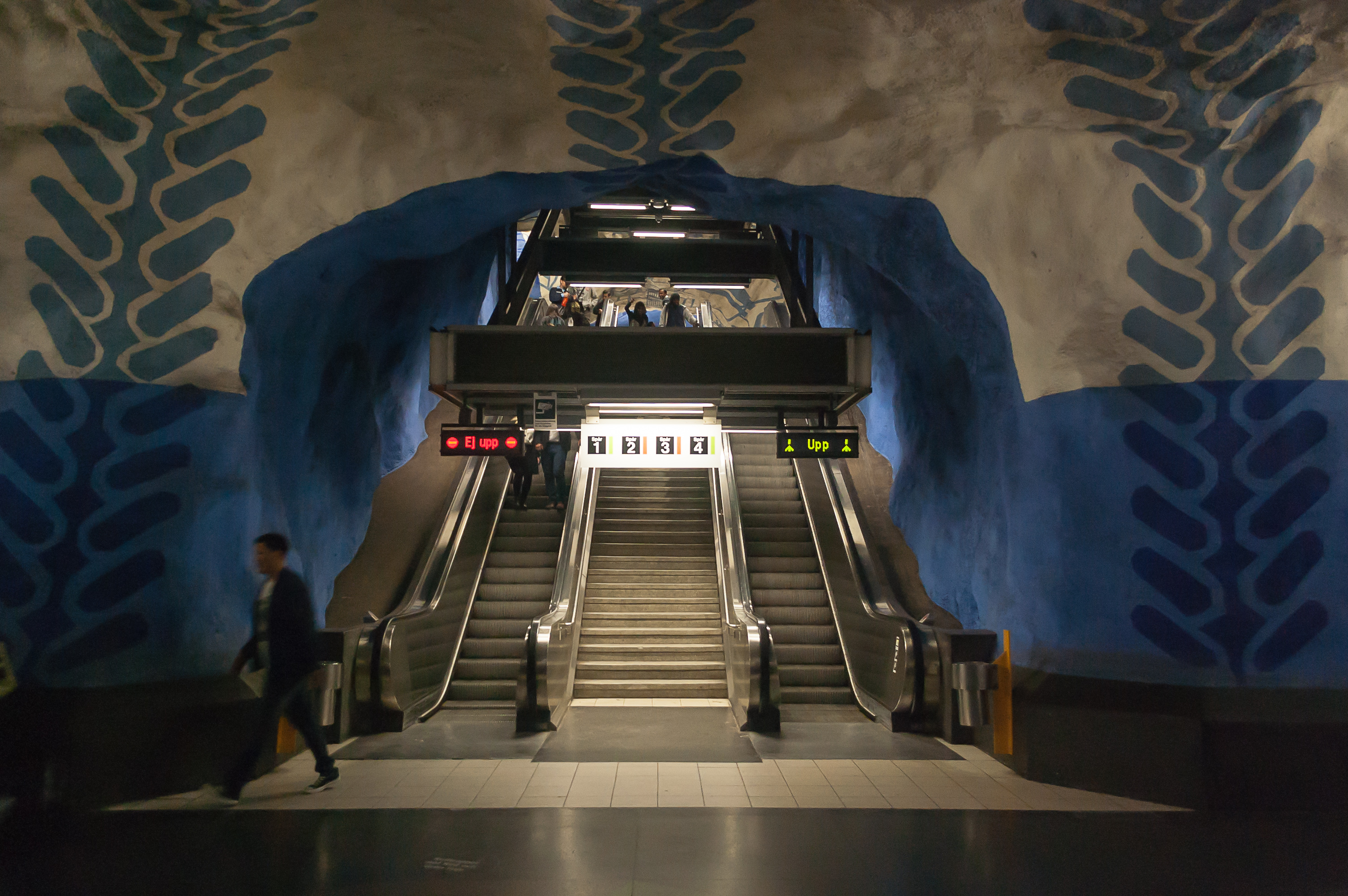
37. Stockholm metro is famous for having many stations having apparently exposed rock in their interiors. I strongly suspect this is just spray-on concrete, but that still looks very cool.
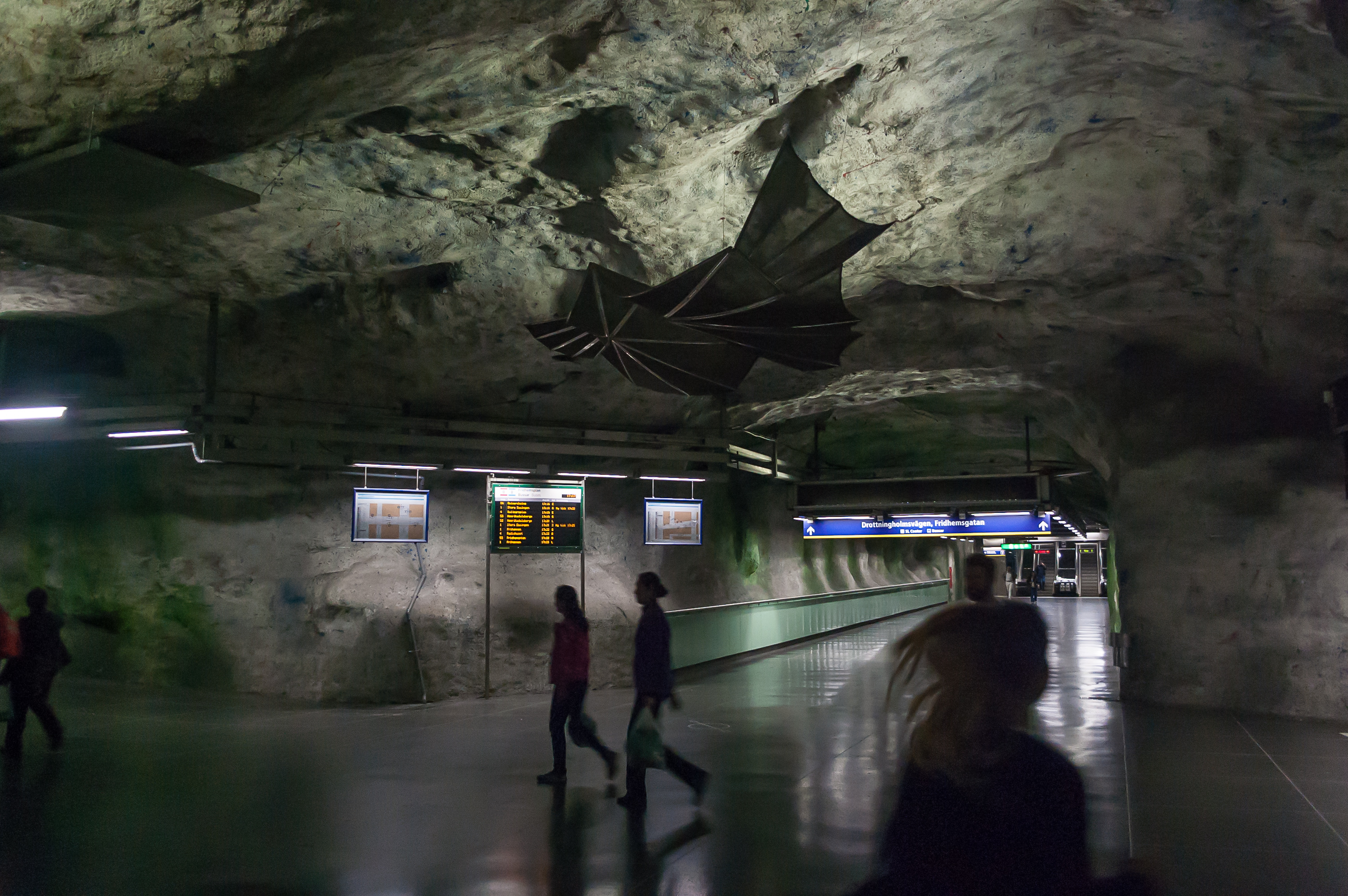
38. This blue line station was built in 1975. (The station also has an interchange to the green line.) Most of it is lit very dimly for some reason.
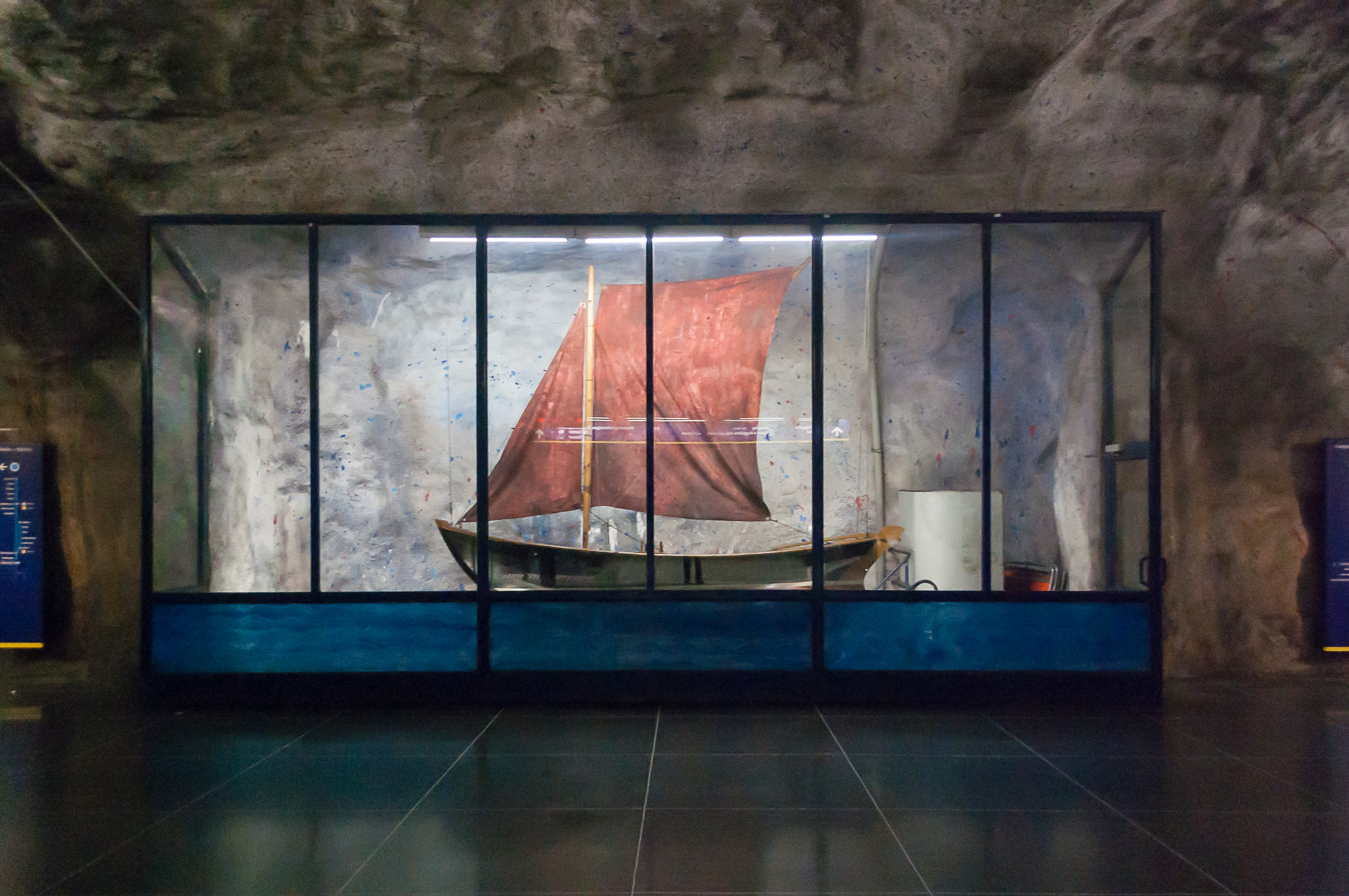
39. The station is also decorated with a model of Blekinge Eka, a traditional fishing boat still popular in the Blekinge Archipelago in southeastern Sweden.
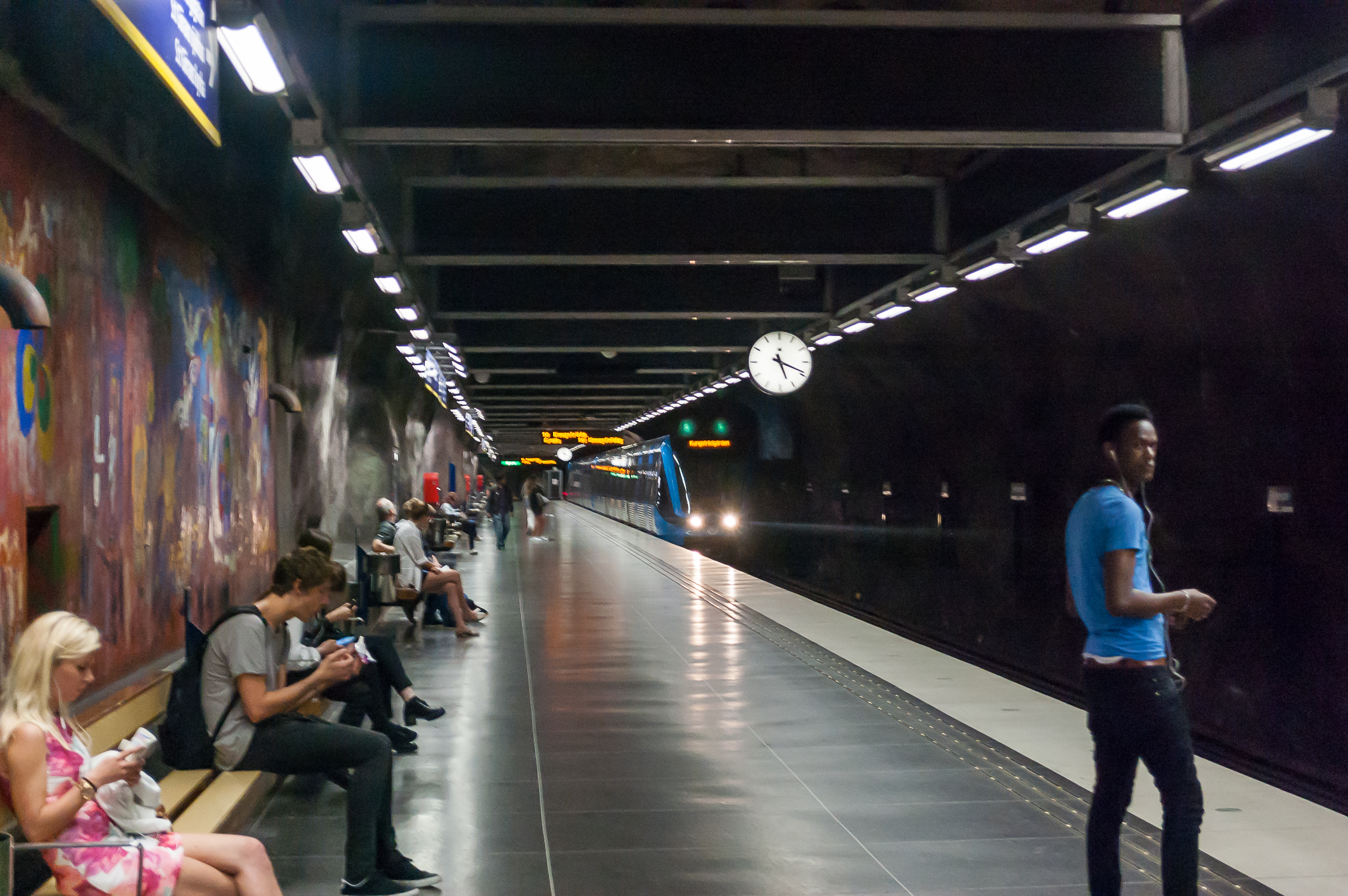
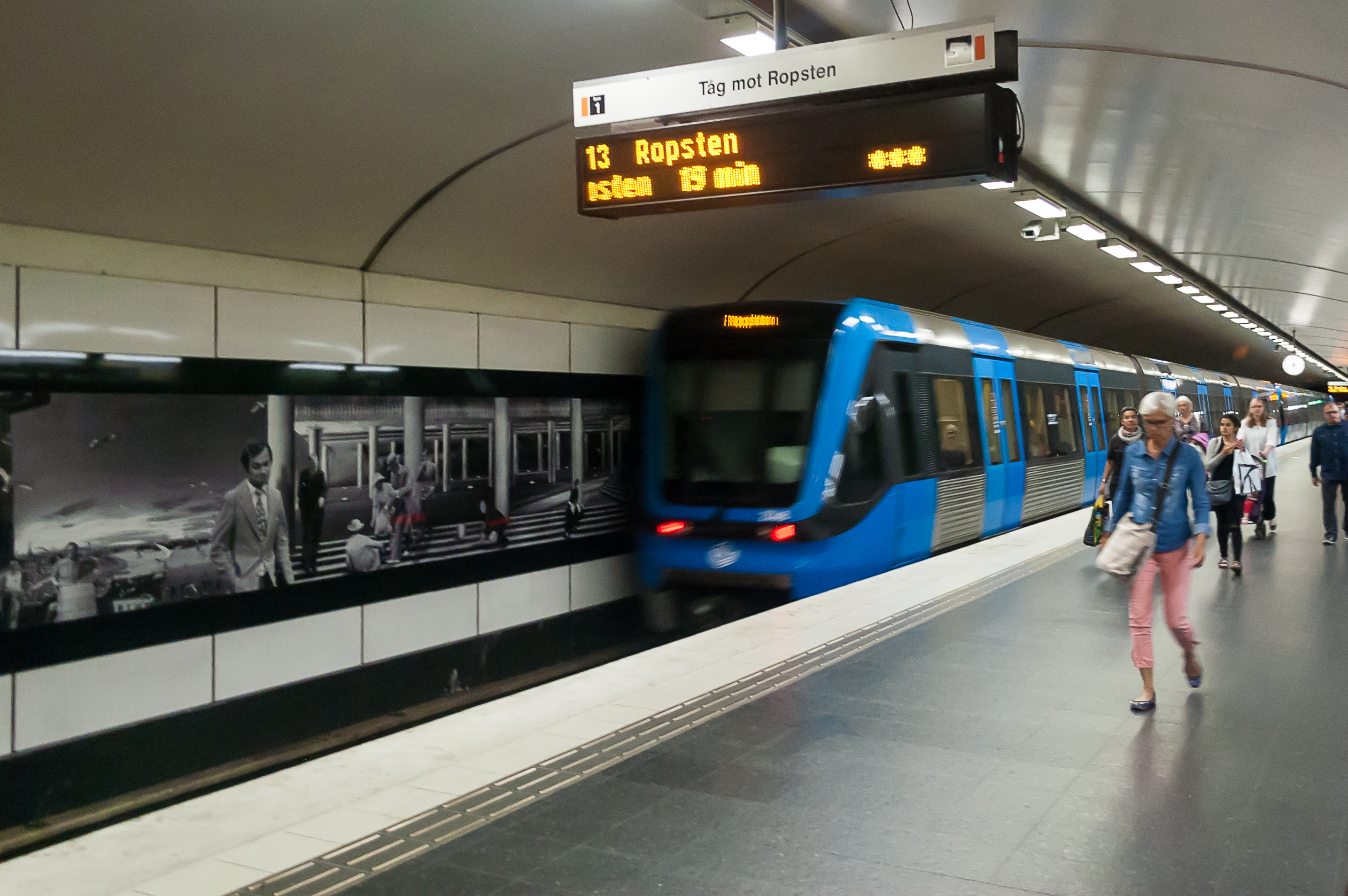
40. A train arriving. The trains in Stockholm metro are the only visible remnant of the left-hand driving era in Sweden.
41. Blue line T-Centralen station. It is lit much brighter than Fridhemsplan.
42. T-Centralen is pretty much an underground maze. Just follow the directions and don't try to think.
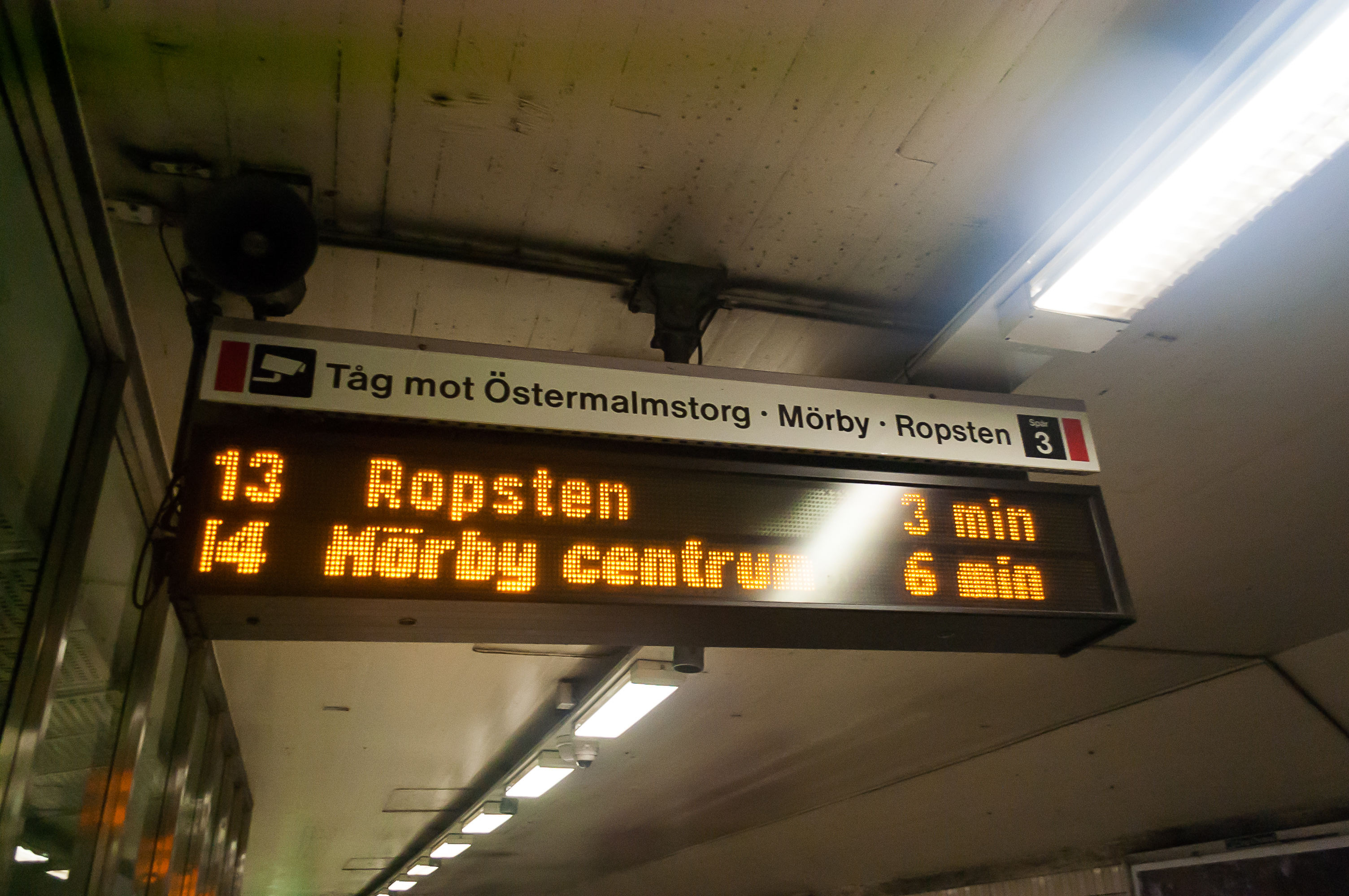
43. Northeastern end of the red line has a fork, and trains alternate between its directions. We need a train going to Ropsten, whatever a Ropsten is.
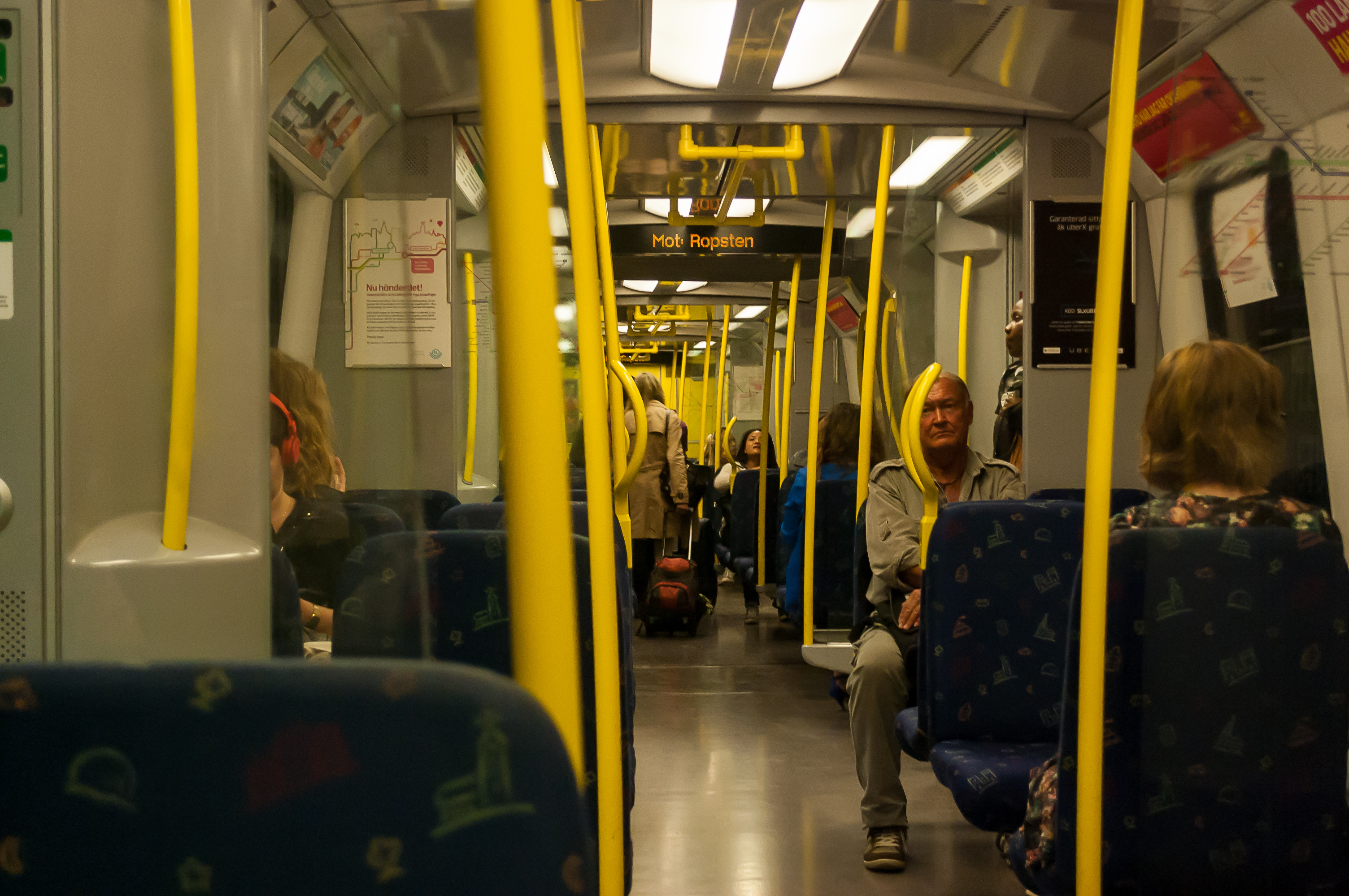
44. Inside a train. Nothing particularly notable.
45. Karlaplan metro station, also named after a square above. Less unusual-looking than previous stations, but features a panorama of weird photos.
46. More of Karlaplan station.

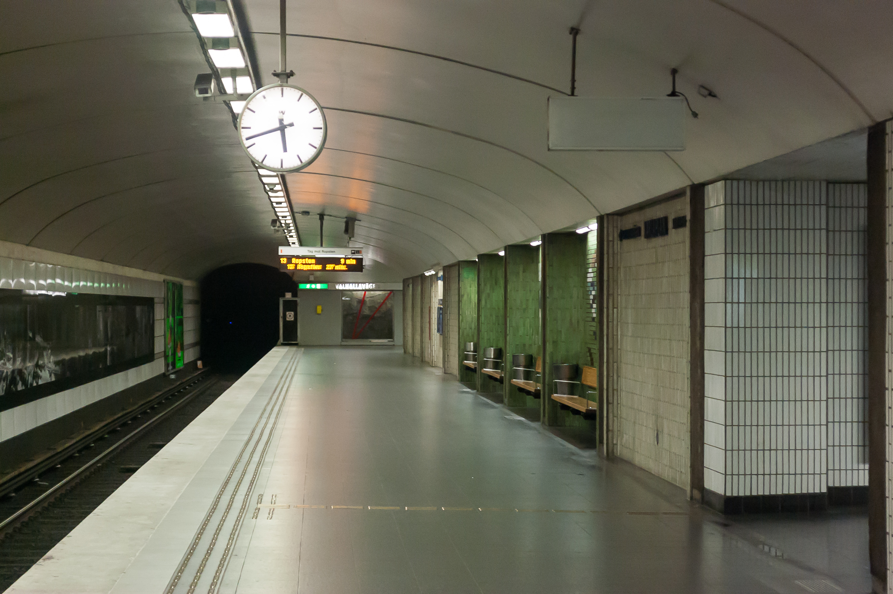
47. Valhallavägen! Now that's a badass street name!
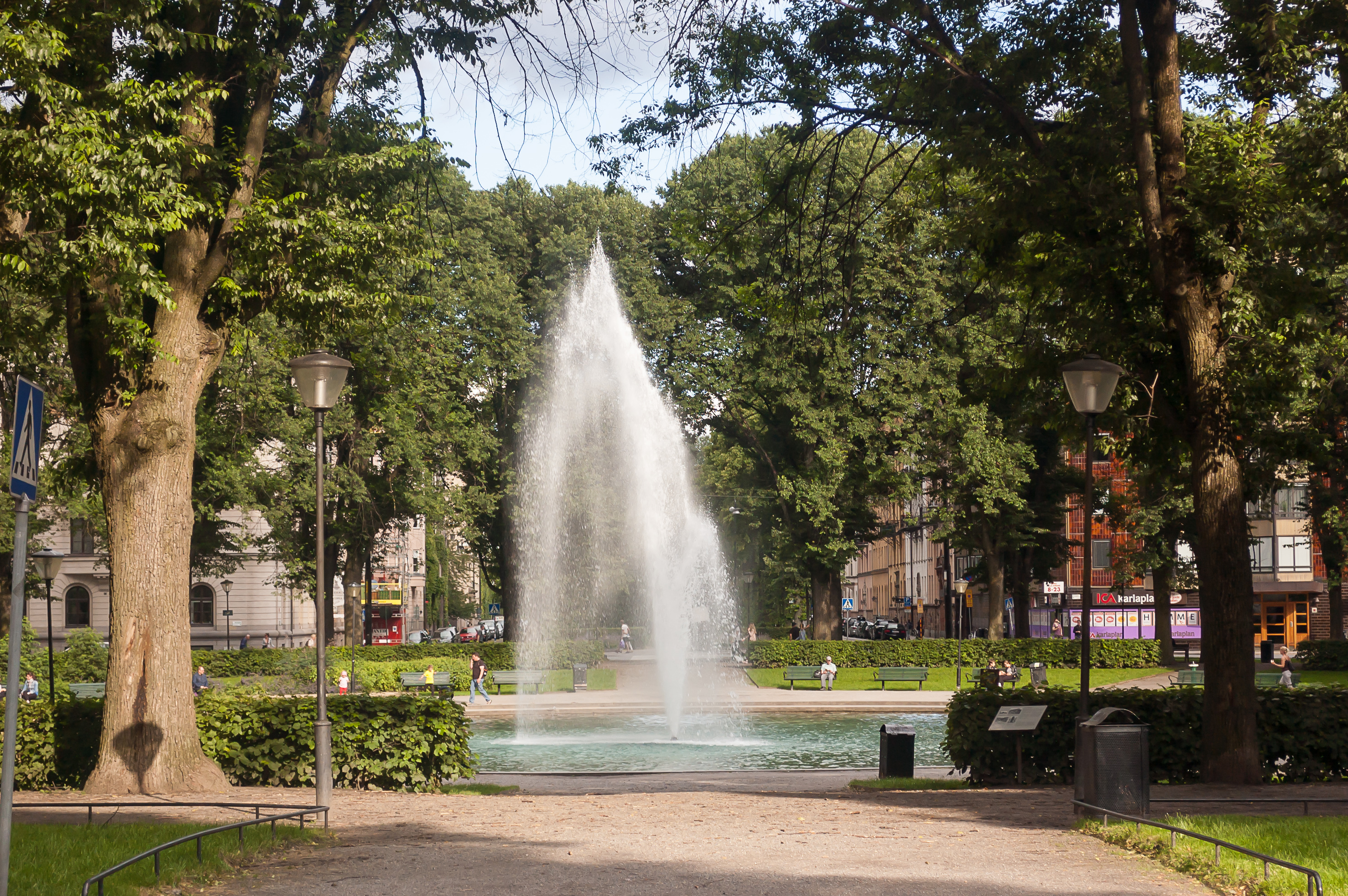
48. Karlaplan square in Östermalm (Swed. Eastern Hill) is round and pretty huge, with a small park with a fountain in the center, and a total of eight streets radiating from it. Despite that, Karlaplan seems to be a fairly quiet place.
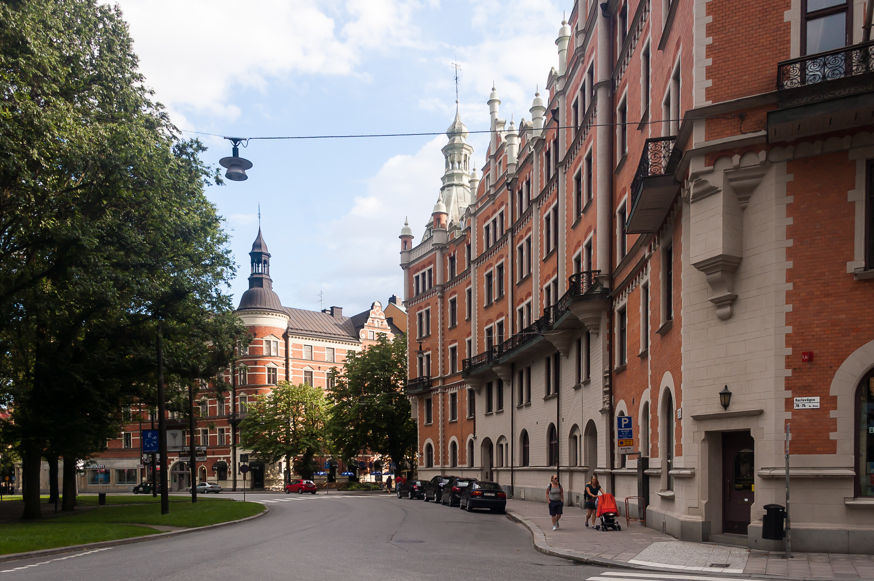
49. And one of the streets starting at Karlaplan is Narvavägen, where we finally reached our car.
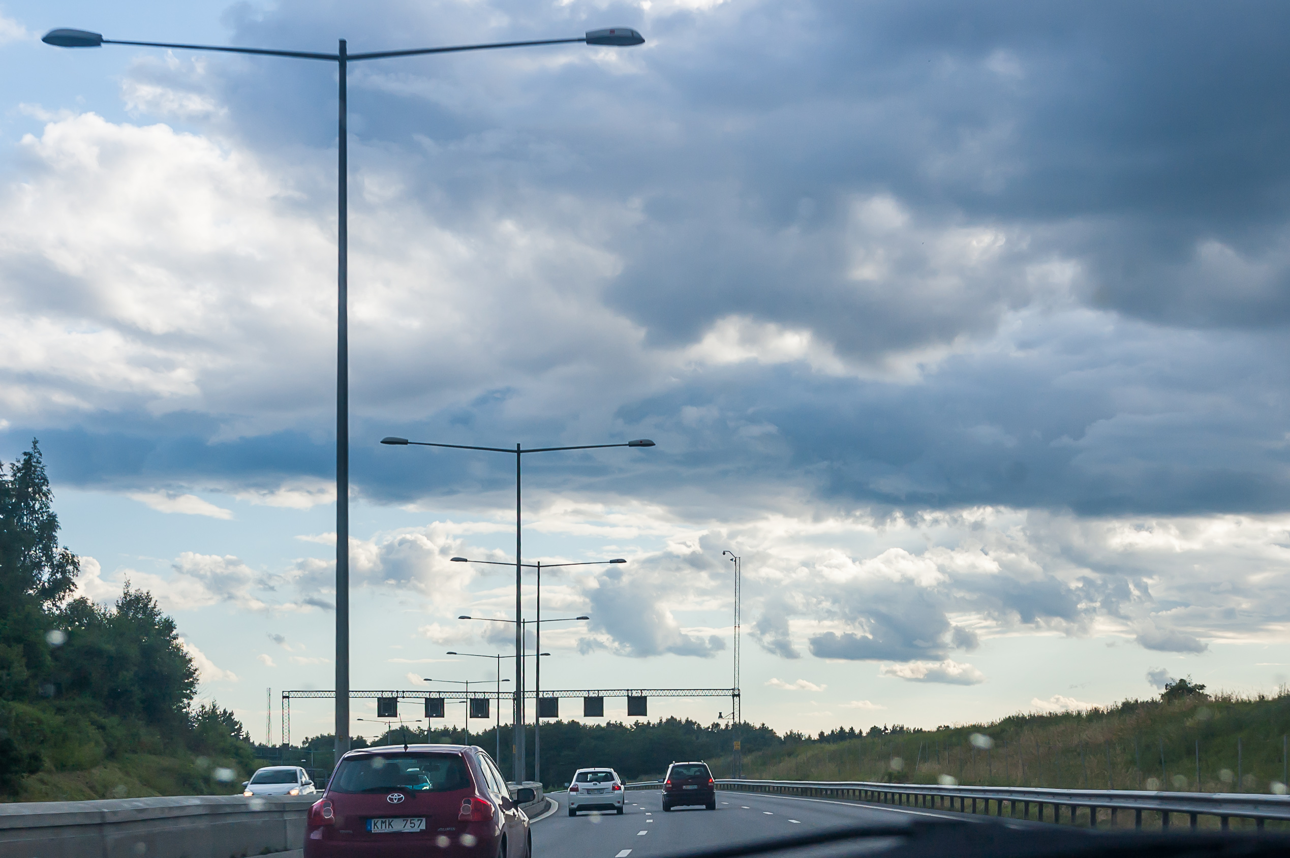
50. At about 17 o'clock in the evening we left Stockholm, driving southwest on the E4 motorway, expecting to cover about 300 km in that day. In the next part we'll cover our first road trip in Sweden, so, to be continued.